I will keep the live winter storm blog updated with fresh information. Model data comes in four times a day.
Hit refresh on this page for the most up to date information. I will time-stamp each post.
Questions? See the daily threads over on the Beau Dodson Weather Facebook page – link click here
or email me at beaudodson@usawx.com
–> For those viewing this on the Weather Talk website. You can also view it directly at this link. CLICK HERE
SCROLL DOWN FOR THE LATEST POST
D0n’t forget my friend JP has a travel alert app, as well.
https://jpstraffic.com/welcome

.

Winter Weather Radars (the local city radars have a winterize button. Click that to see lighter returns and precipitation type)
Interactive-city-view radars. Clickable watches and warnings.
https://wtalk.co/B3XHASFZ
Old legacy radar site (some of you like it better)
https://weatherobservatory.com/weather-radar.htm
If the radar is not updating then try another one. If a radar does not appear to be refreshing then hit Ctrl F5. You may also try restarting your browser.
Backup radar site in case the above one is not working.
https://weathertalk.com/morani
Regional Radar
https://imagery.weathertalk.com/prx/RadarLoop.mp4
** NEW ** Zoom radar with chaser tracking abilities!
ZoomRadar
.
Refresh this page for the latest update.
Friday, January 10, 2025
7 PM
Our winter storm is winding down.
Watch for black ice tonight and tomorrow morning.
Temperatures tomorrow and Sunday should pop into the 30s. Hopefully, some melting.
Arctic front arrives Sunday night with more cold air early next week.
I can’t rule out snow showers or freezing drizzle Sunday night. I will monitor it.
Small chance of flurries Monday into Tuesday night.
A warm up late next week. The 40s may return!
I am watching a system around January 18th to 20th. A bit early to know if it will bring snow or rain.
.
11:00 AM
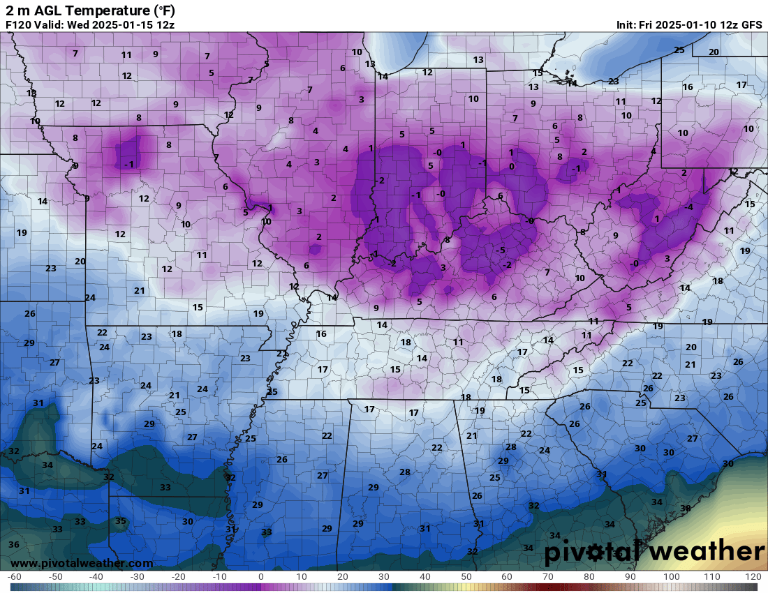
Another artic front arrives Sunday and Monday. It will be cold Monday into Wednesday.
Check out Wednesday morning’s lows
Double click images to enlarge them
10:45 AM Video Update
6:50 AM
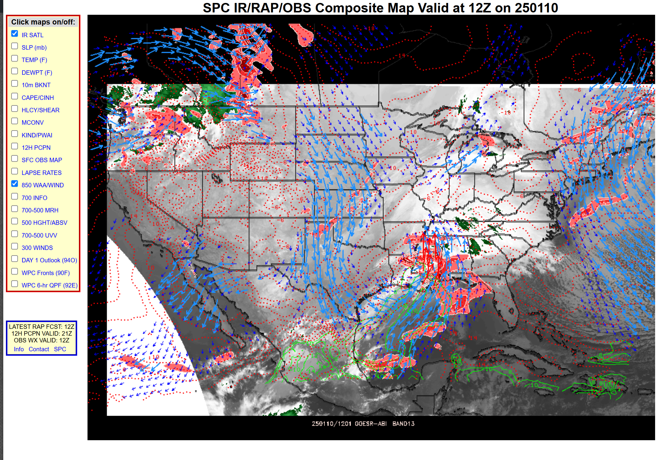
You can see the area of low pressure along the Gulf of Mexico.
This is why it is snowing.

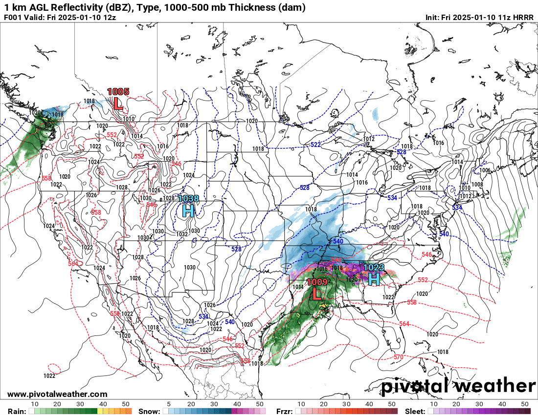
You can see the moisture spreading northward on this map. The arrows coming from the Gulf of Mexico. Feeding our snow event.
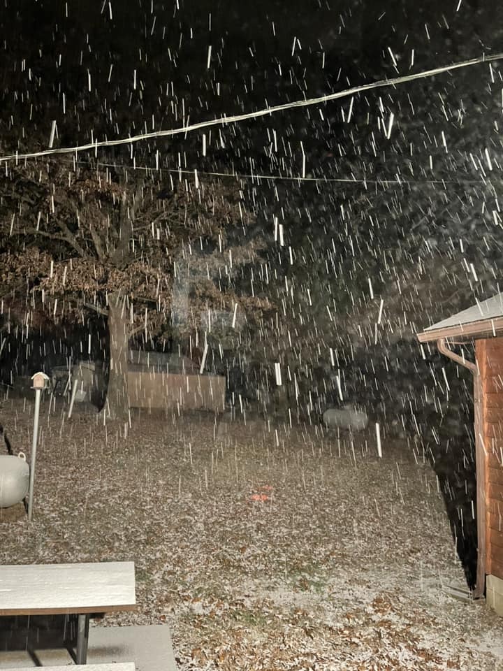
6:45 AM
Fulton, KY
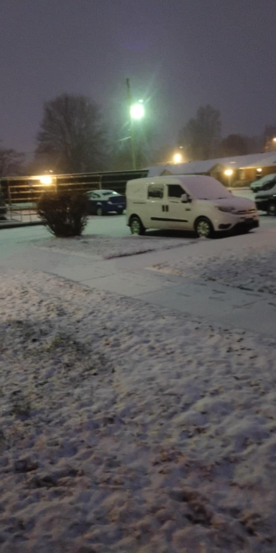
6:05 AM
Peggy Shaffer James sent in this photo from Salem, KY. 6 AM.
.
5:55 AM
Quick video update
5:25 AM
Good morning. My forecast is on track. Some of you are waking up to snow and some of you are not. That was the forecast. Some would wake up to snow spreading in on radar.
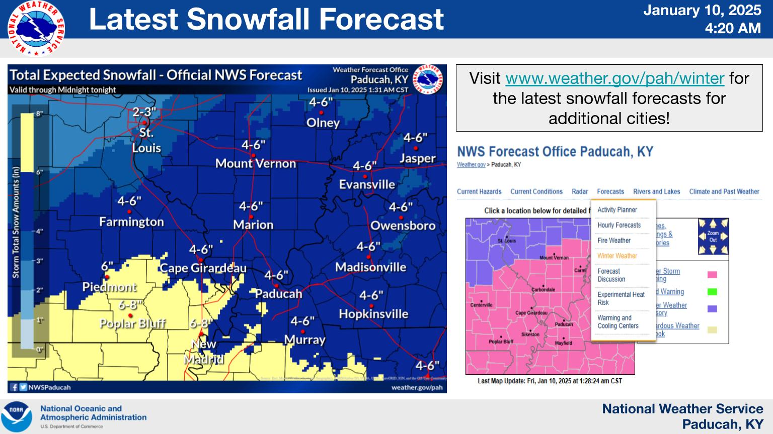
A widespread 2 to 4 inches of snow today. There could be pockets of 4″ to 6″. That would mainly be across the Missouri Bootheel east northeast along the Kentucky/Tennessee border and then south from there.
Whether areas to the north end up in banding with higher totals will just have to be monitored. I did not make any changes to my forecast.
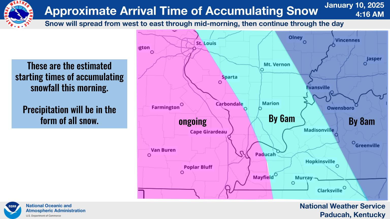
Here are some NWS graphics, as well.
All of my counties are under a winter storm warning.
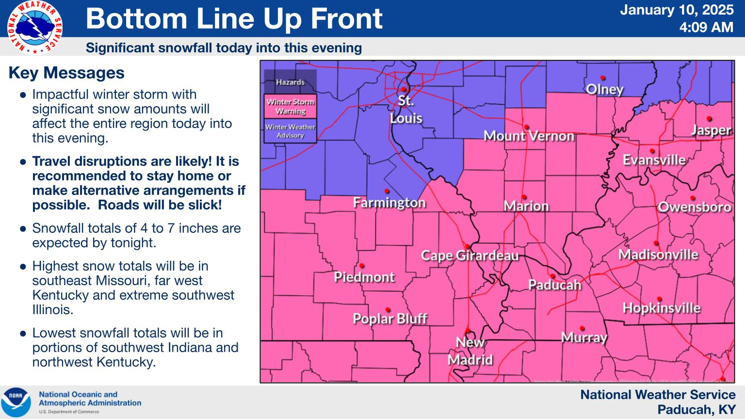
Approximate timing. Give or take.
Here is what the NWS is forecasting for snow totals.
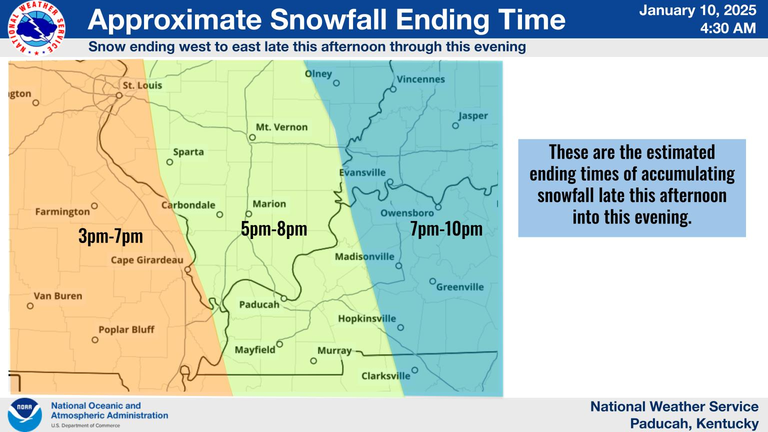
Approximate end time.
.
5:20 AM
Widespread snow moving in. Some of this is virga and is not reaching the ground. It will eventually reach the ground.
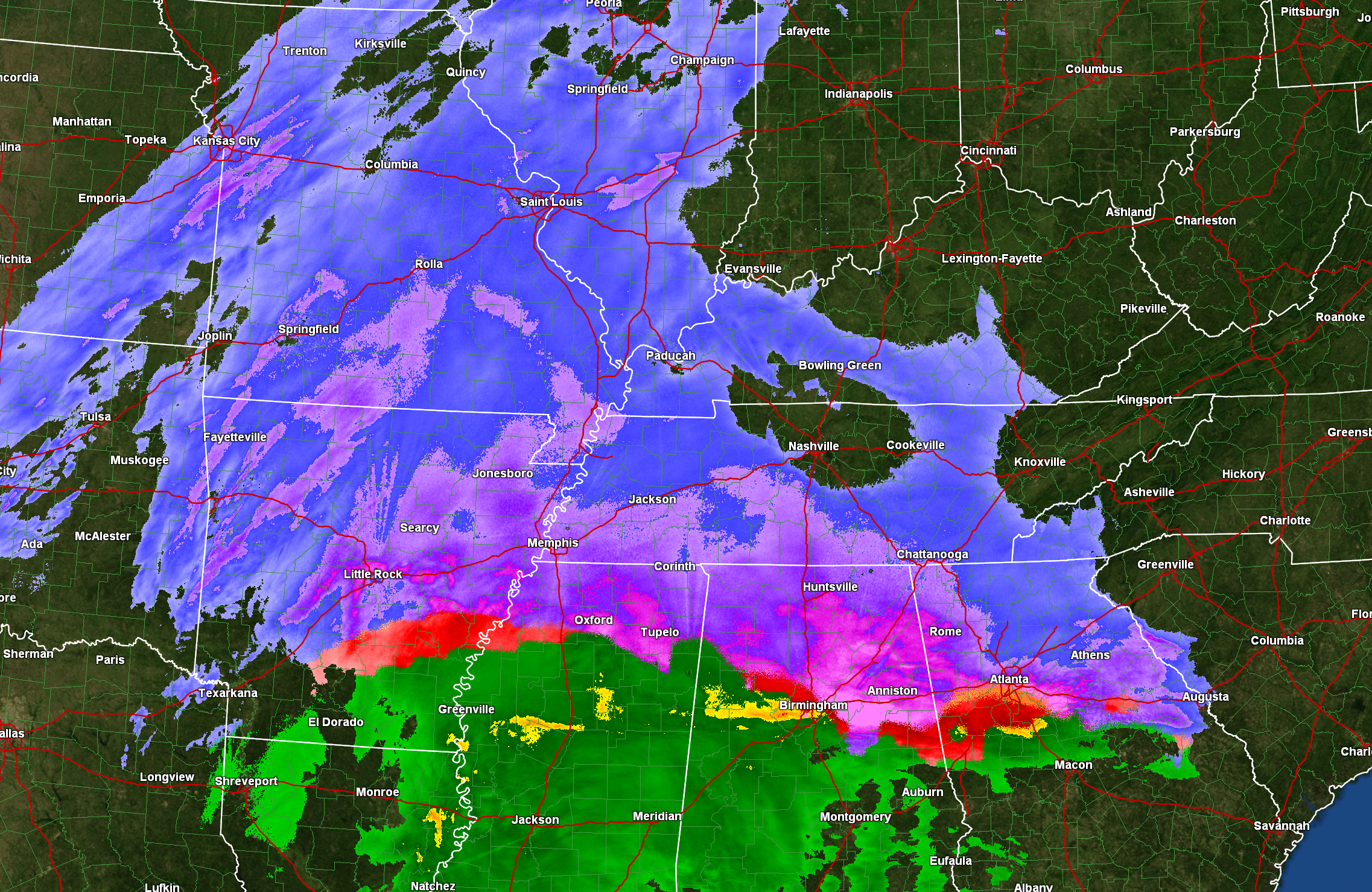
Everything is on track. The winter storm is spreading across the region.
New Facebook thread CLICK HERE
.
Want to read your warning text?
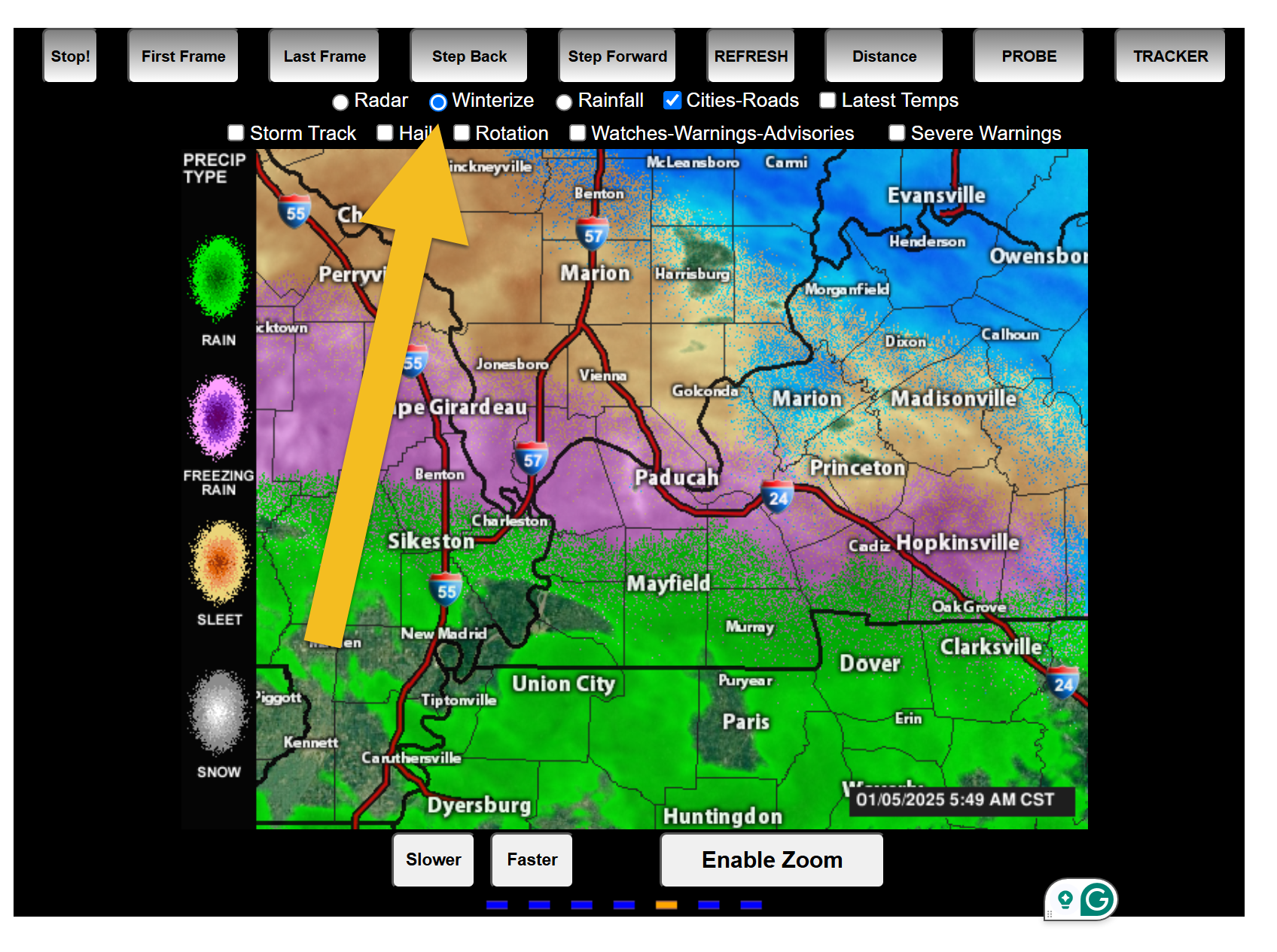
Load are city-view radars and turn on the watch warning tab. Also, don’t forget there is a winterize button to see precipitation type.
Don’t forget the winter weather radars (the local city view radars) have a winterize button on them. Click that to see precipitation type.
Interactive-city-view radars. Clickable watches and warnings.
https://wtalk.co/B3XHASFZ
Old legacy radar site (some of you like it better)
https://weatherobservatory.com/weather-radar.htm
.
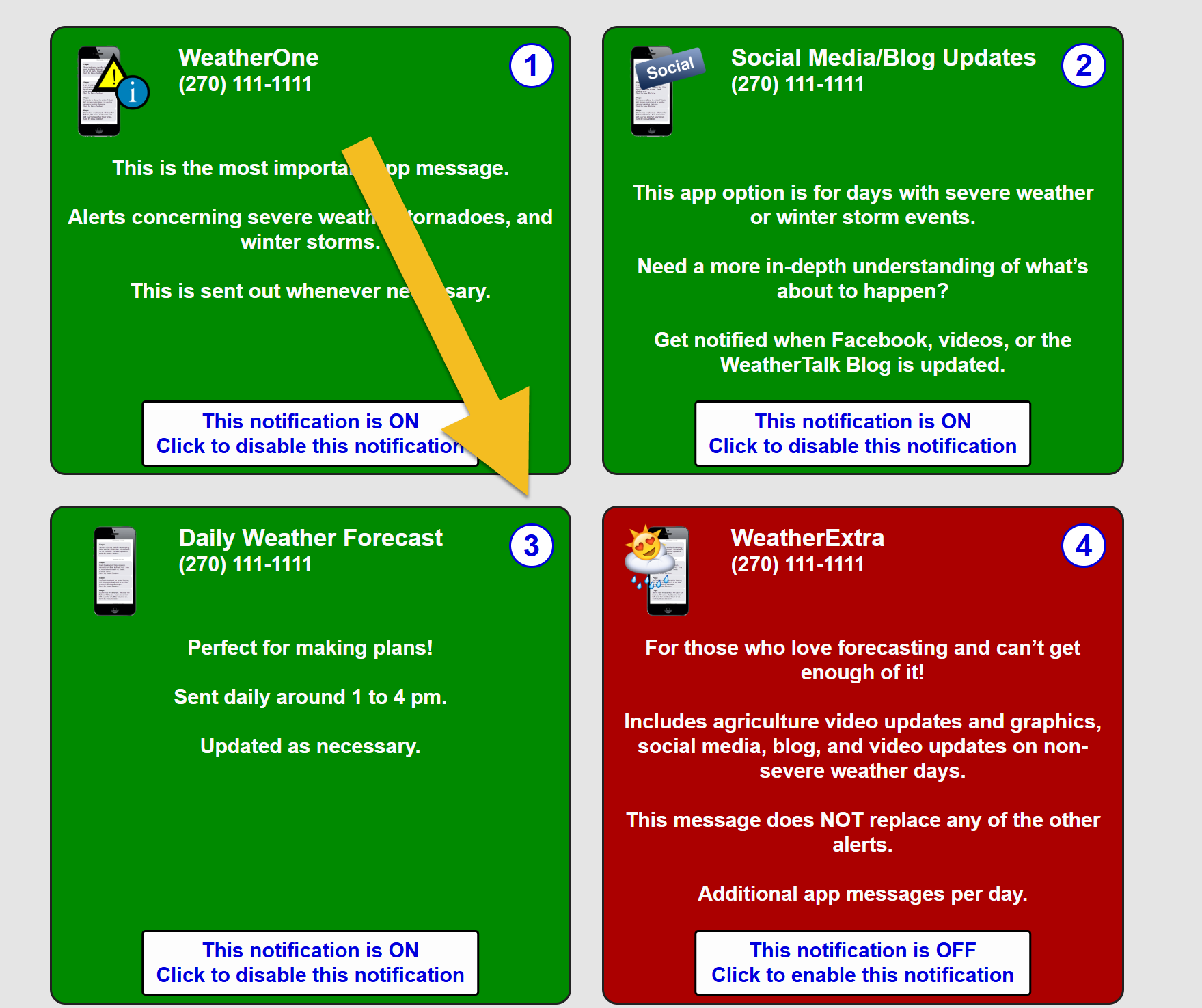
Want to receive the daily forecast on your app?
You can receive those on the app by turning that option on.
Long into www.weathertalk.com
Go to notification settings
Turn on option three. The daily weather forecast.