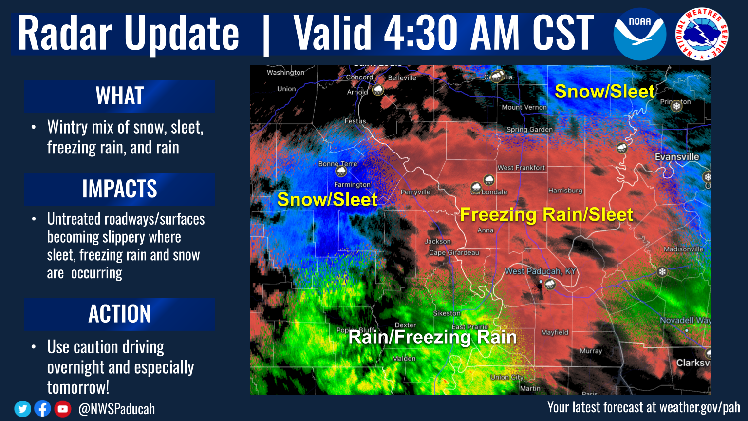
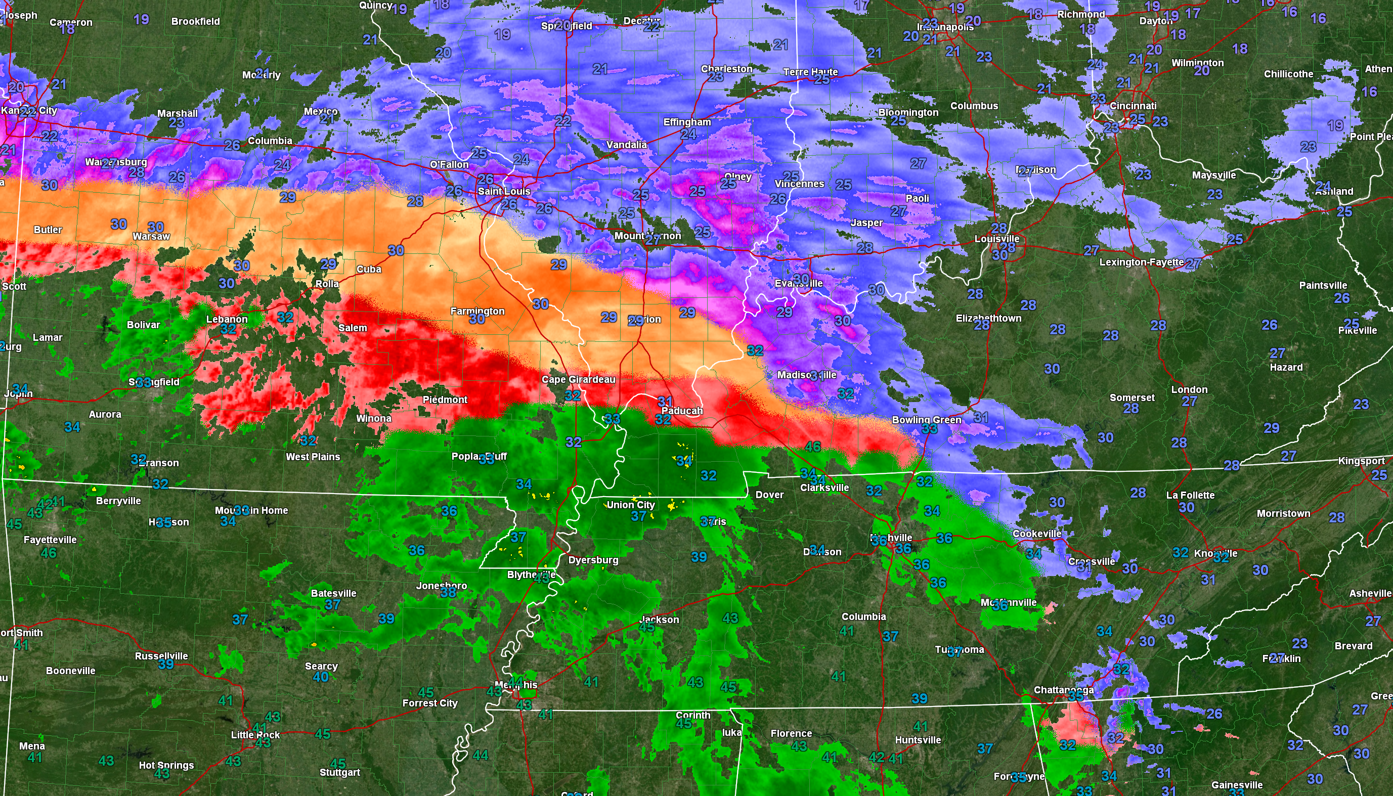
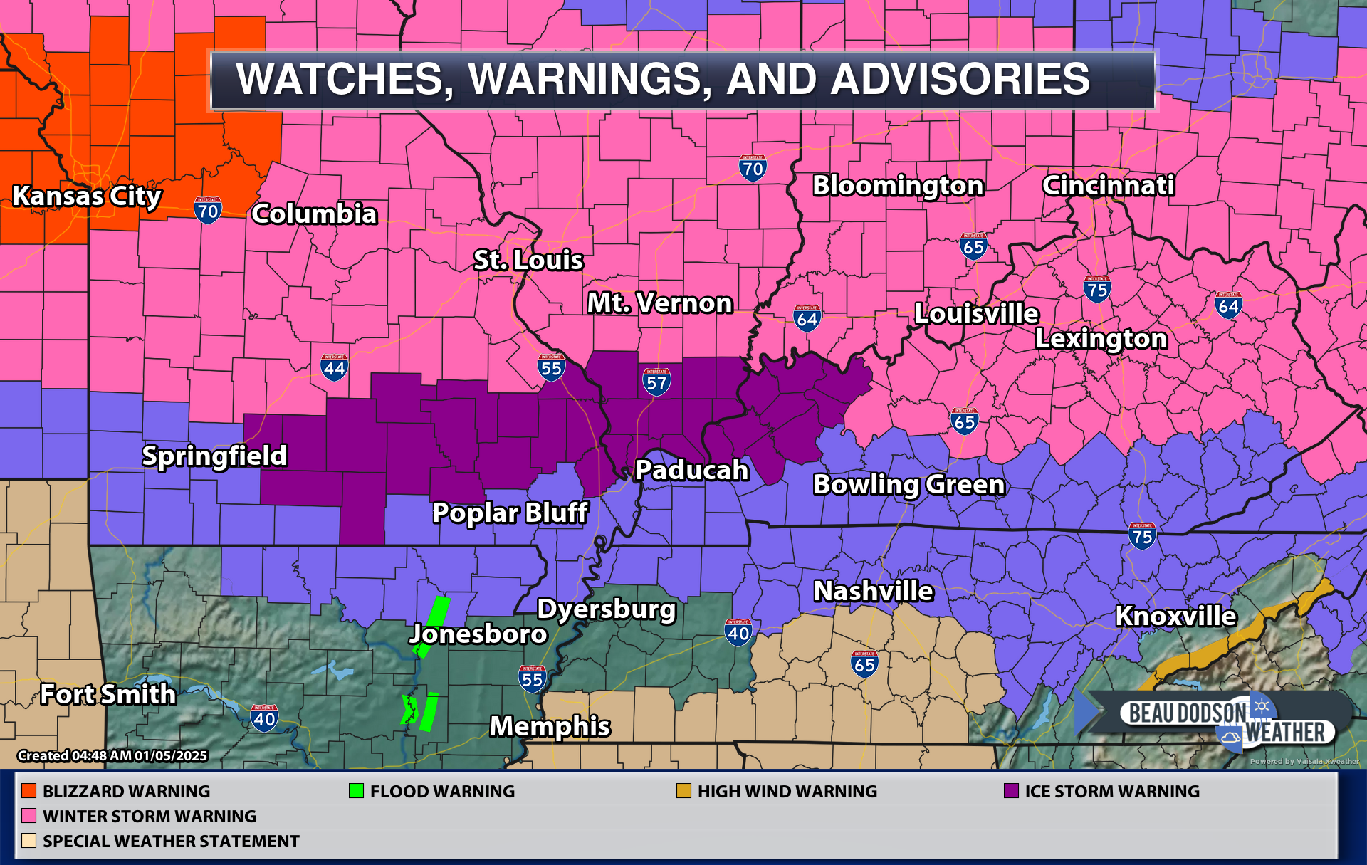
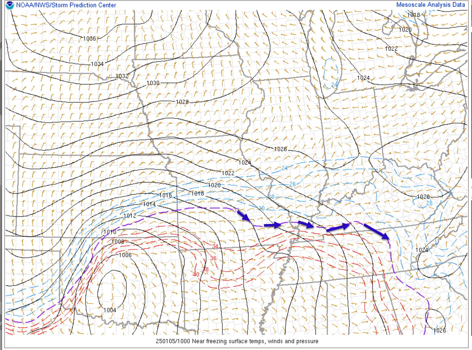
I will keep the live winter storm blog updated with fresh information. Model data comes in four times a day.
Hit refresh on this page for the most up to date information. I will time-stamp each post.
Questions? See the daily threads over on the Beau Dodson Weather Facebook page – link click here
or email me at beaudodson@usawx.com
–> For those viewing this on the Weather Talk website. You can also view it directly at this link. CLICK HERE
SCROLL DOWN FOR THE LATEST POST
D0n’t forget JPhas a travel alert app, as well.
https://jpstraffic.com/welcome

Radars and Lightning Data
Interactive-city-view radars. Clickable watches and warnings.
https://wtalk.co/B3XHASFZ
Old legacy radar site (some of you like it better)
https://weatherobservatory.com/weather-radar.htm
If the radar is not updating then try another one. If a radar does not appear to be refreshing then hit Ctrl F5. You may also try restarting your browser.
Backup radar site in case the above one is not working.
https://weathertalk.com/morani
Regional Radar
https://imagery.weathertalk.com/prx/RadarLoop.mp4
** NEW ** Zoom radar with chaser tracking abilities!
ZoomRadar
Lightning Data (zoom in and out of your local area)
https://wtalk.co/WJ3SN5UZ
.
Monday, January 6, 2025
–> I will get the normal blog up and running again today.
I spent all my time on the winter live blog. I will have it ready by mid-morning.
Cold today into the weekend.
Some areas will have travel issues all week in the hardest hit areas.
Many schools are closed today.
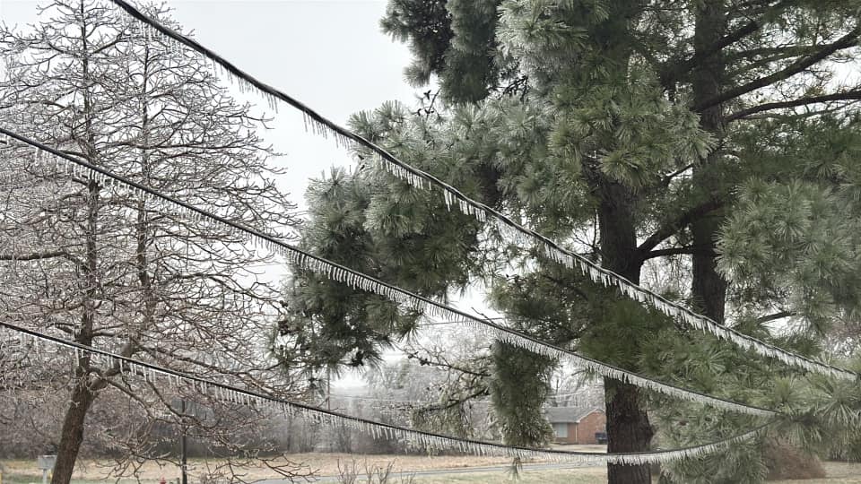
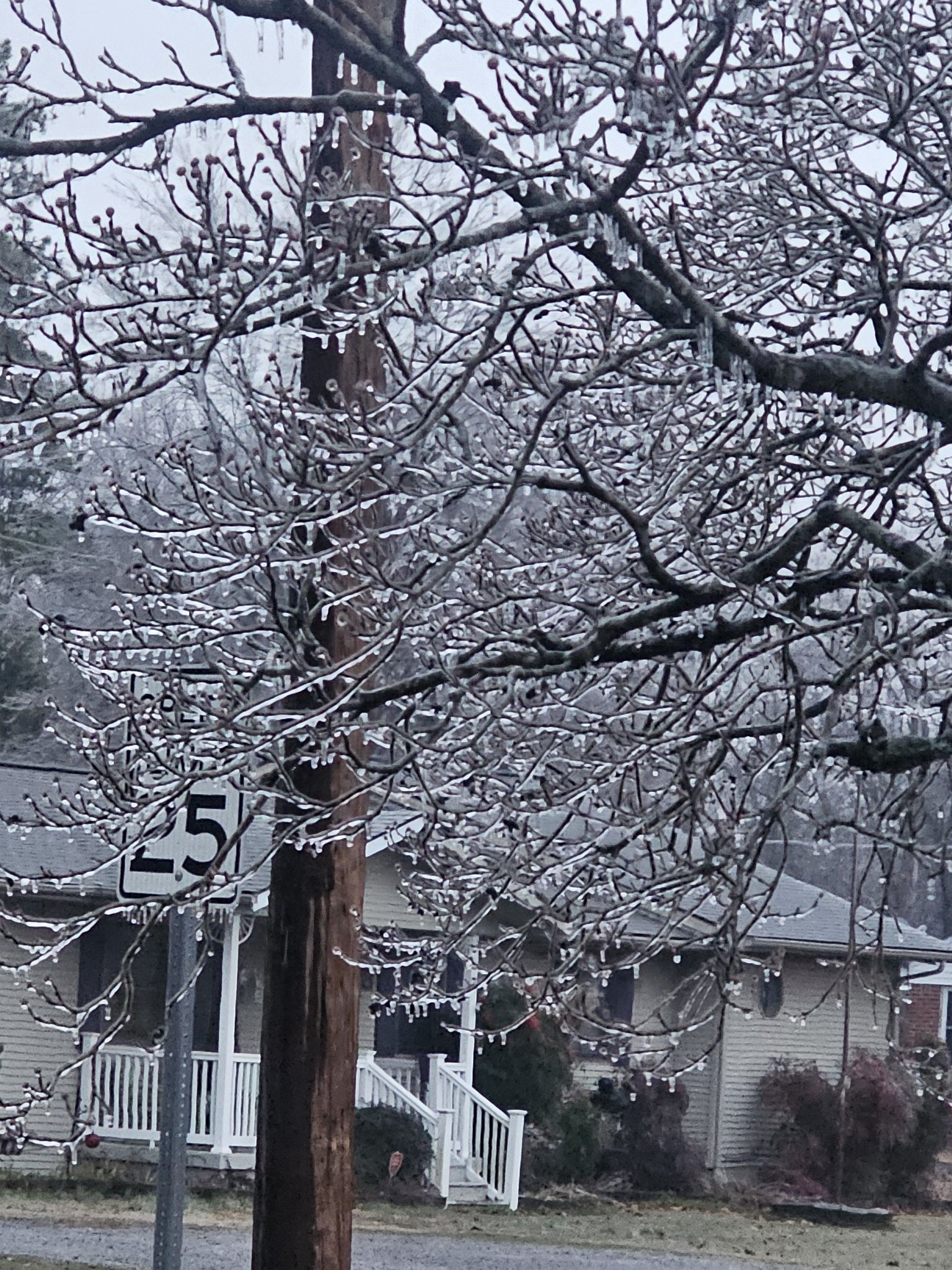
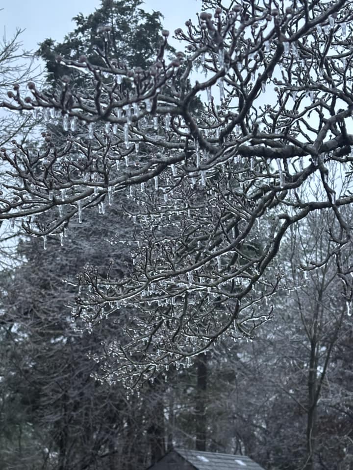
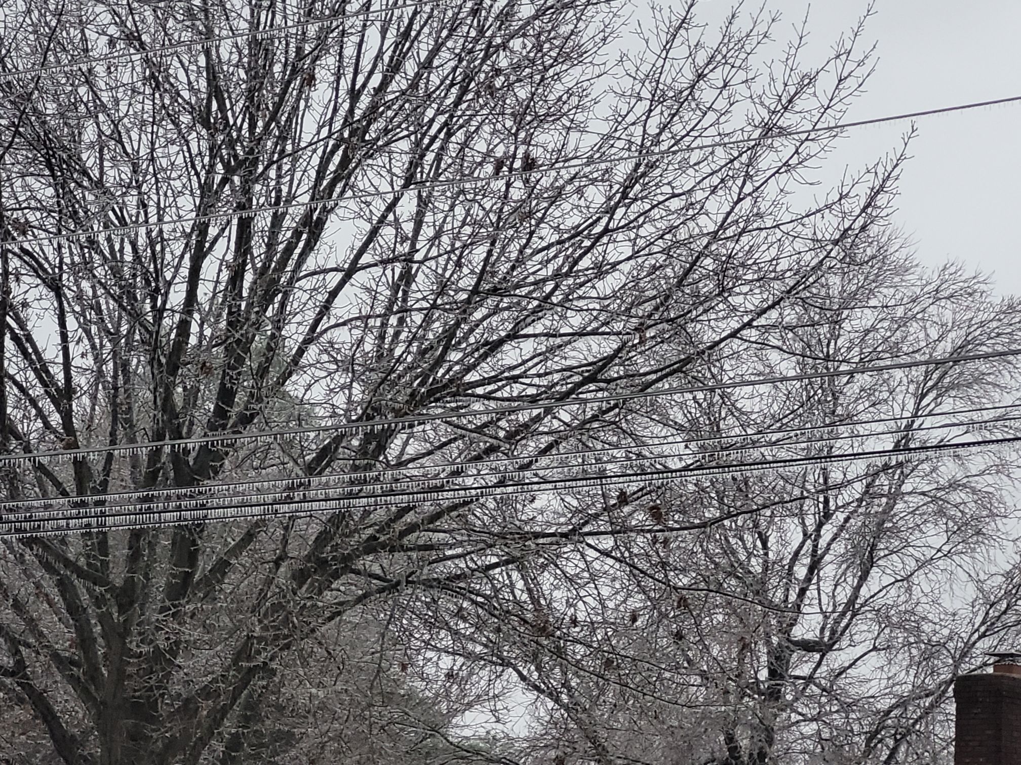
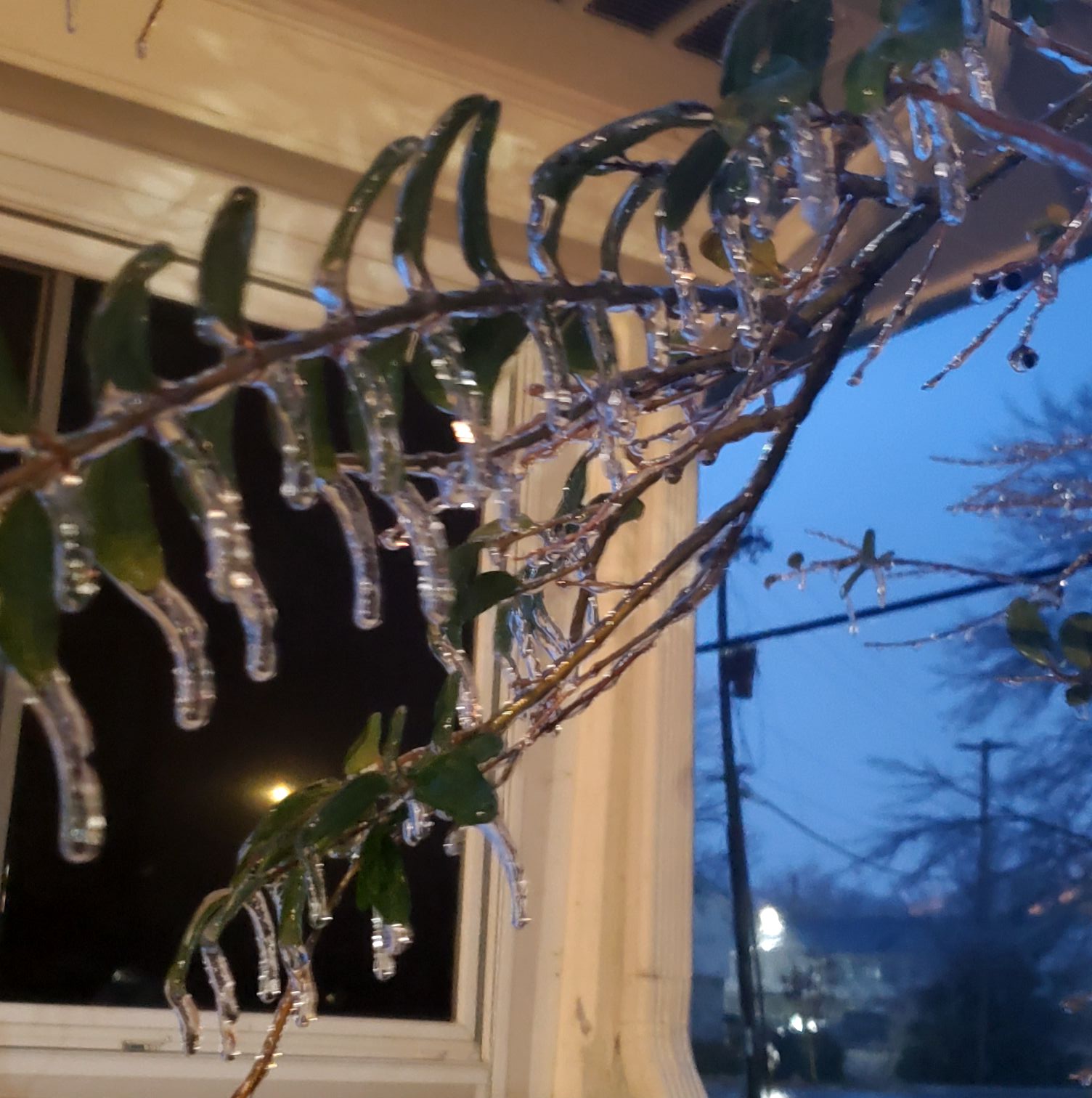
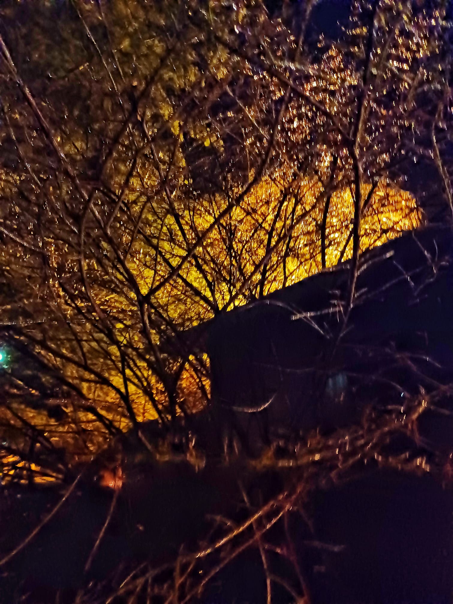
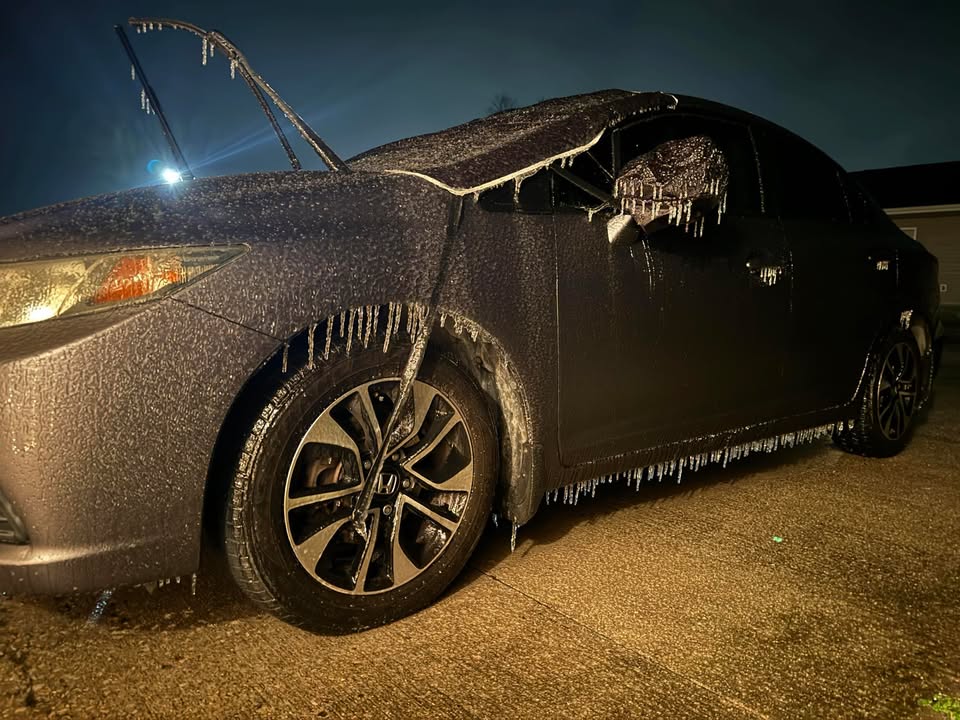
Gusty winds will continue to bring down power lines and tree limbs today in the ice storm zone.
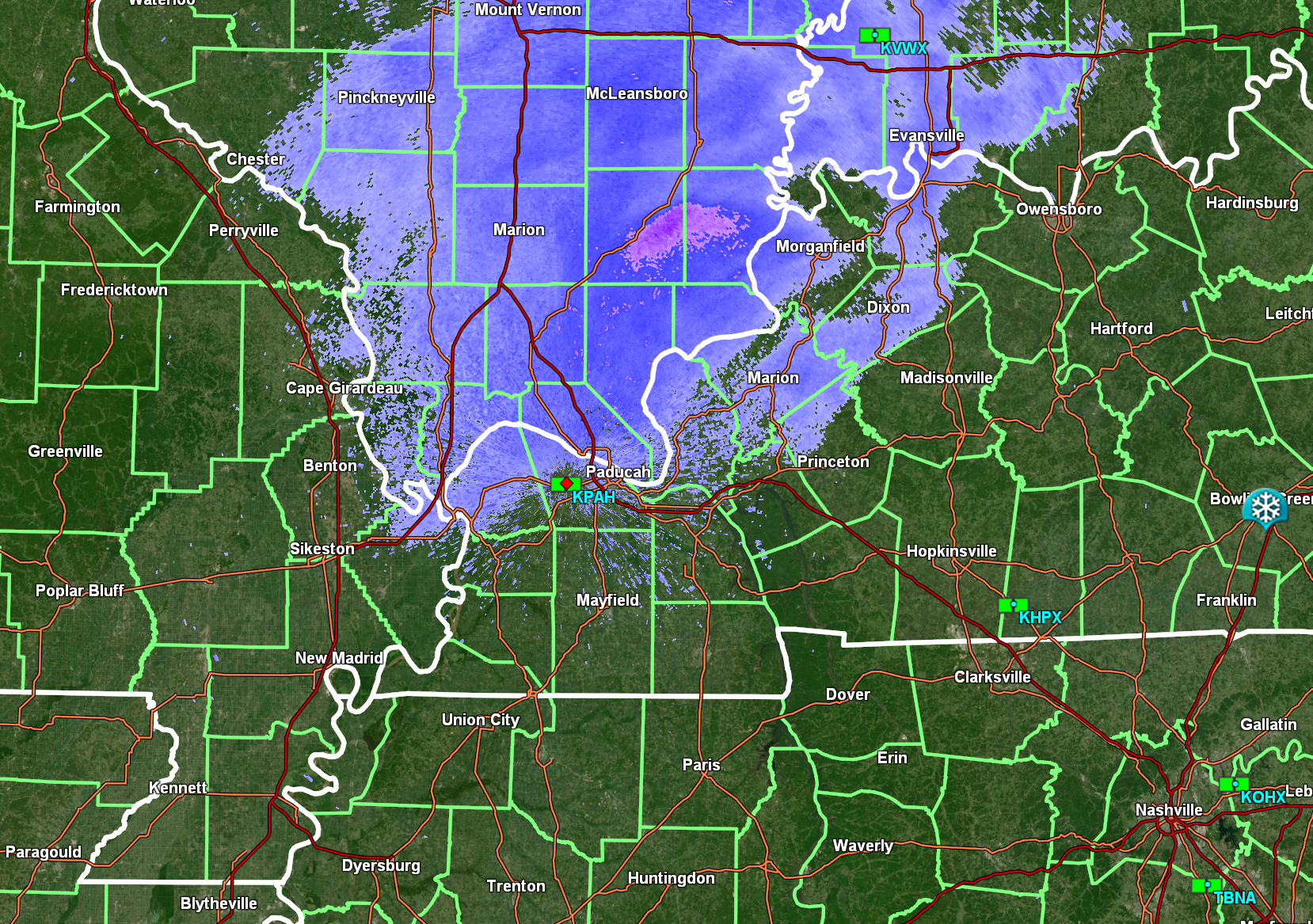
Snow showers are moving through the region. Especially parts of southern IL and western KY.
See the radar links at the top of the page
Sunday, January 5, 2025
6;30 PM
At some point, I will be taking a nap! Been a very long day.
Nothing to update you on right now. See videos below for the last video update.
Widespread school closures tomorrow.
Black ice tonight is a real concern with temps falling into the 20s.
Watch your step outside tomorrow. Could be ice on surfaces. Don’t fall.
Once precipitation tapers this evening more will form later tonight. Freezing drizzle and snow showers. A glaze of new ice possible in areas without ice.
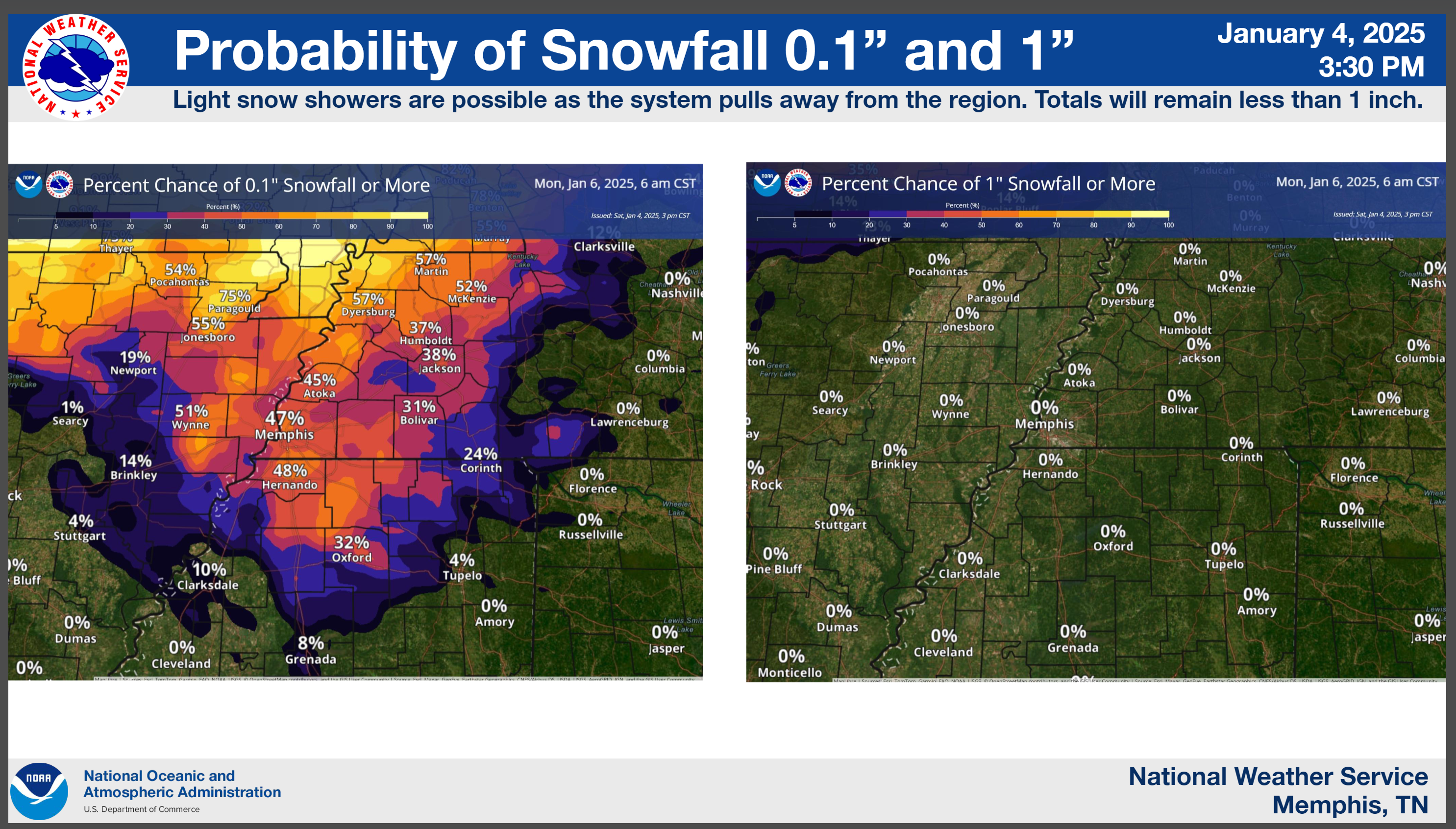
Light snow accumulations possible in some areas, as well.
Main concern is the freezing drizzle.
.
5 PM
Sheltering In Place Statement
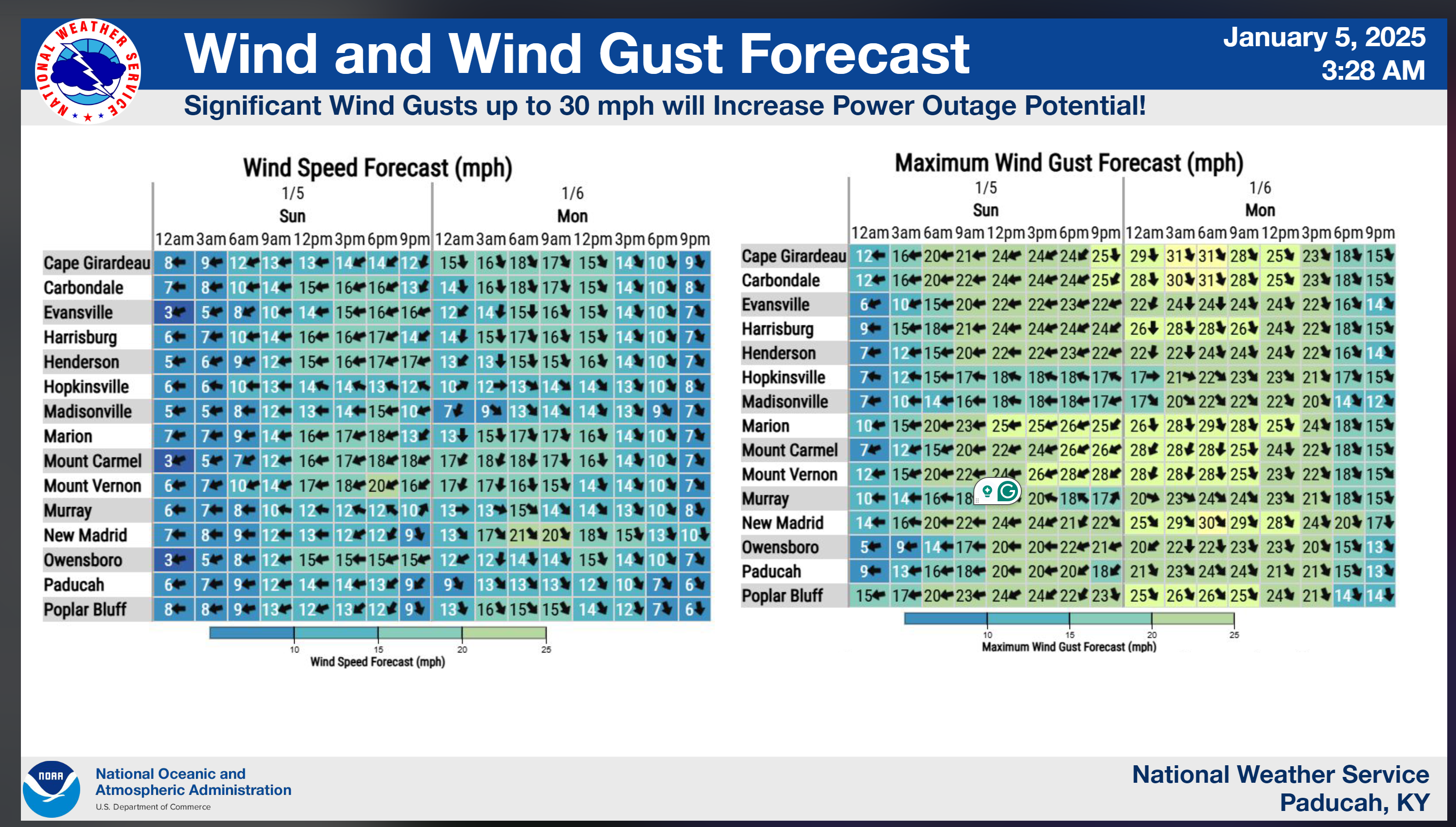
Winds are going to increase into the 15 to 30 mph range over the coming hours. Occasionally, with higher gusts.
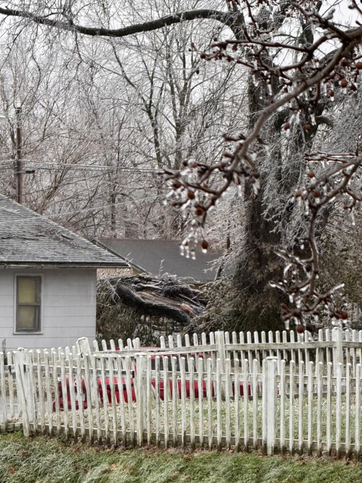
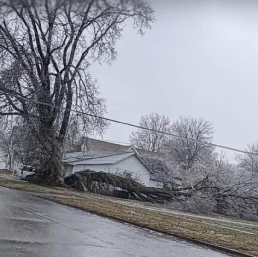
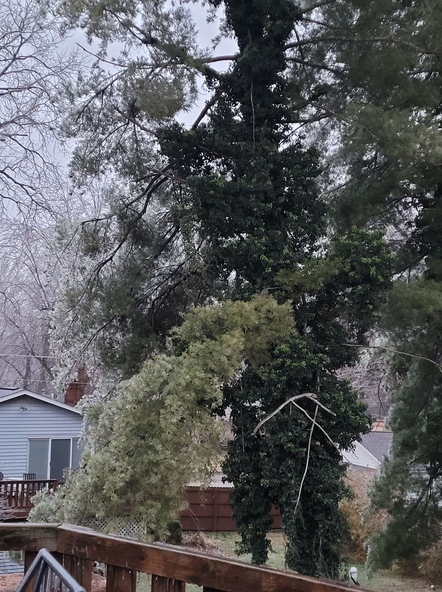
I am receiving reports from the ice storm zone of larger limbs and trees falling.
If your home is surrounded by large trees, then you may want to move to the basement or closet tonight. If you are worried about trees falling on your home, then this is the best advice. That, or if it is safe to leave, go to a friends house. Obviously, use care if roads are icy.
I have already received photos of large trees on homes in some counties.
During the 2009 ice storm we had to treat it like a tornado warning. We slept in the basement as trees fell around us.
Strong and gusty winds tonight into tomorrow morning will cause additional tree and power line damage.
Please use care and stay safe.
.
4:10 PM
New Facebook thread. Click here
.
3:30 AM
.
2:05 PM
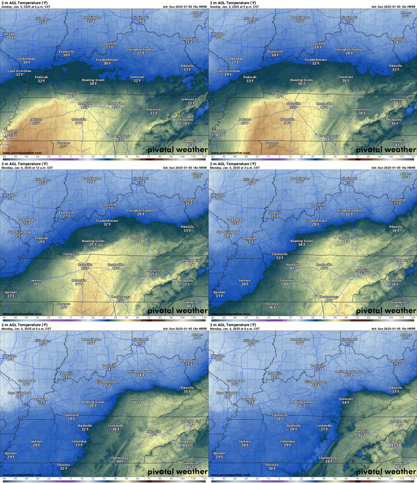
Watch the 20s arrive tonight.
Double click the animation to enlarge it
2 PM
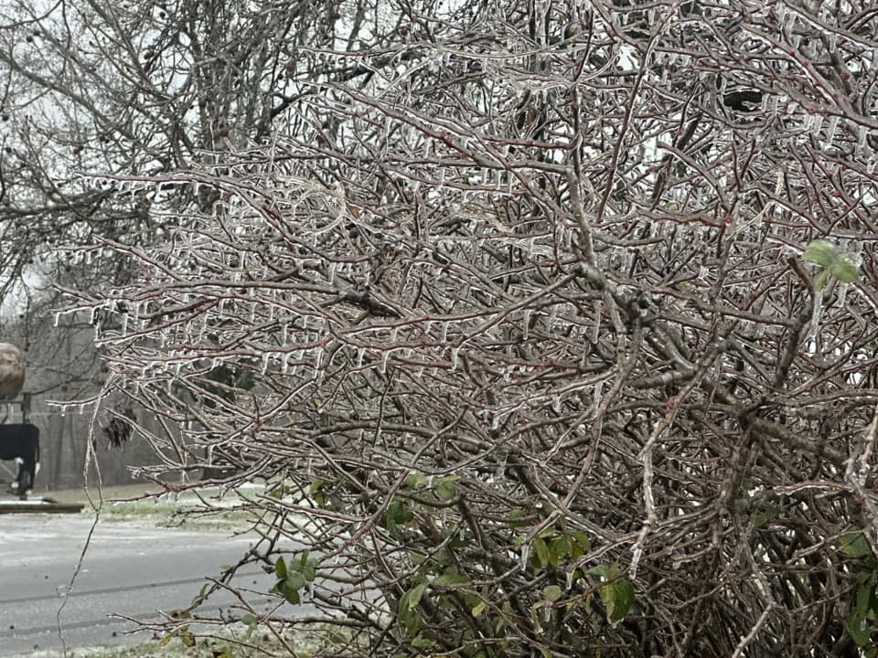
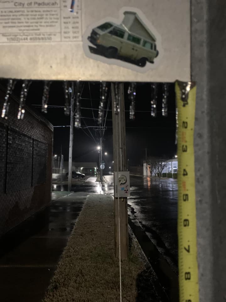
Hailey Bargeron photo. Princeton, KY
12:55 PM
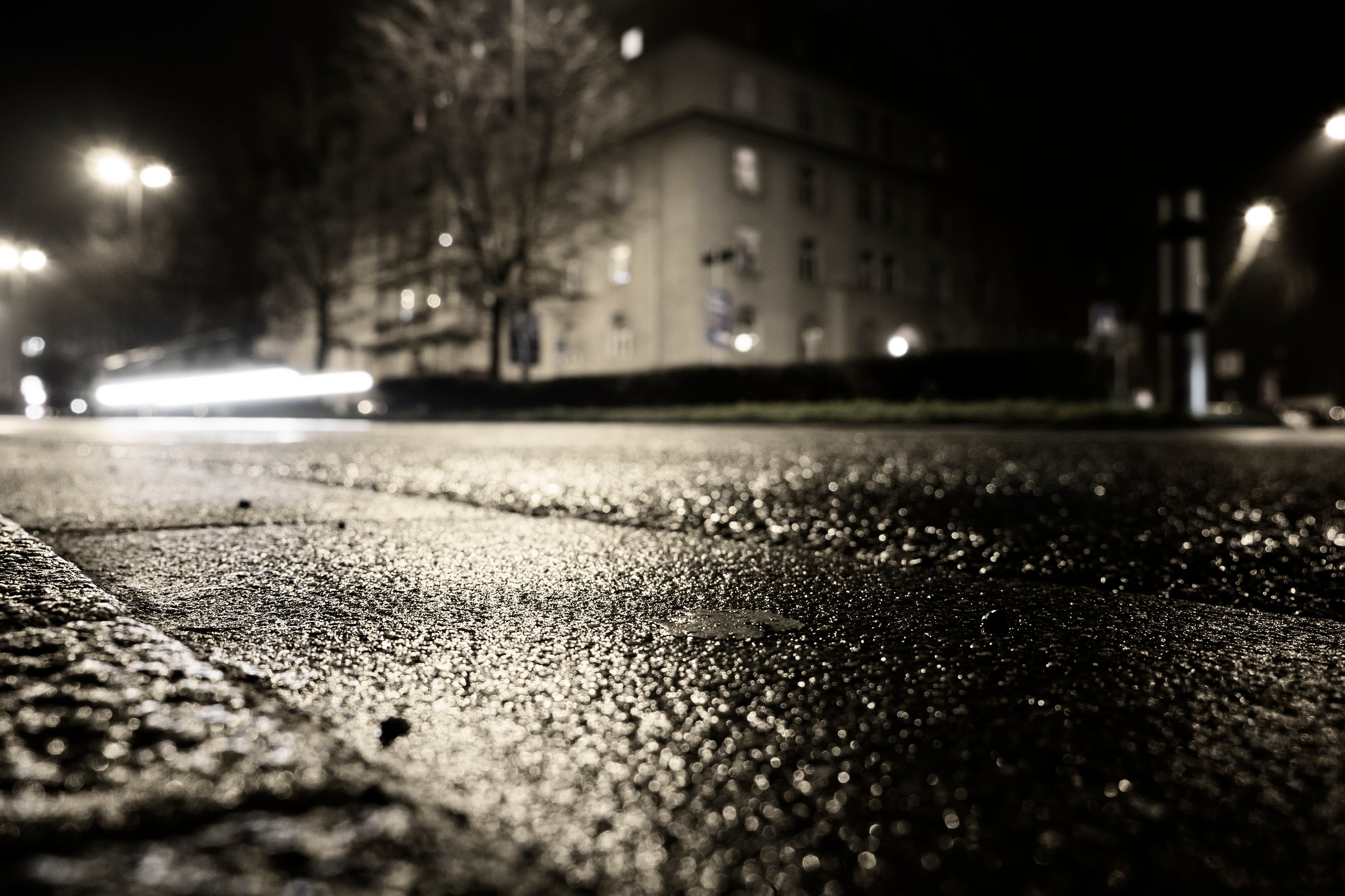
We are concerned tonight about black ice.
Areas that have been rain today will change to freezing rain/freezing drizzle tonight.
Temperatures will fall into the 20s. This will cause icy surfaces to develop. Untreated roadways will become icy.
Use care tonight. Watch your first step outside on decks, porches, stairs, and sidewalks. It could be ice.
There will be a lot of school closures tomorrow.
.
12:3o PM
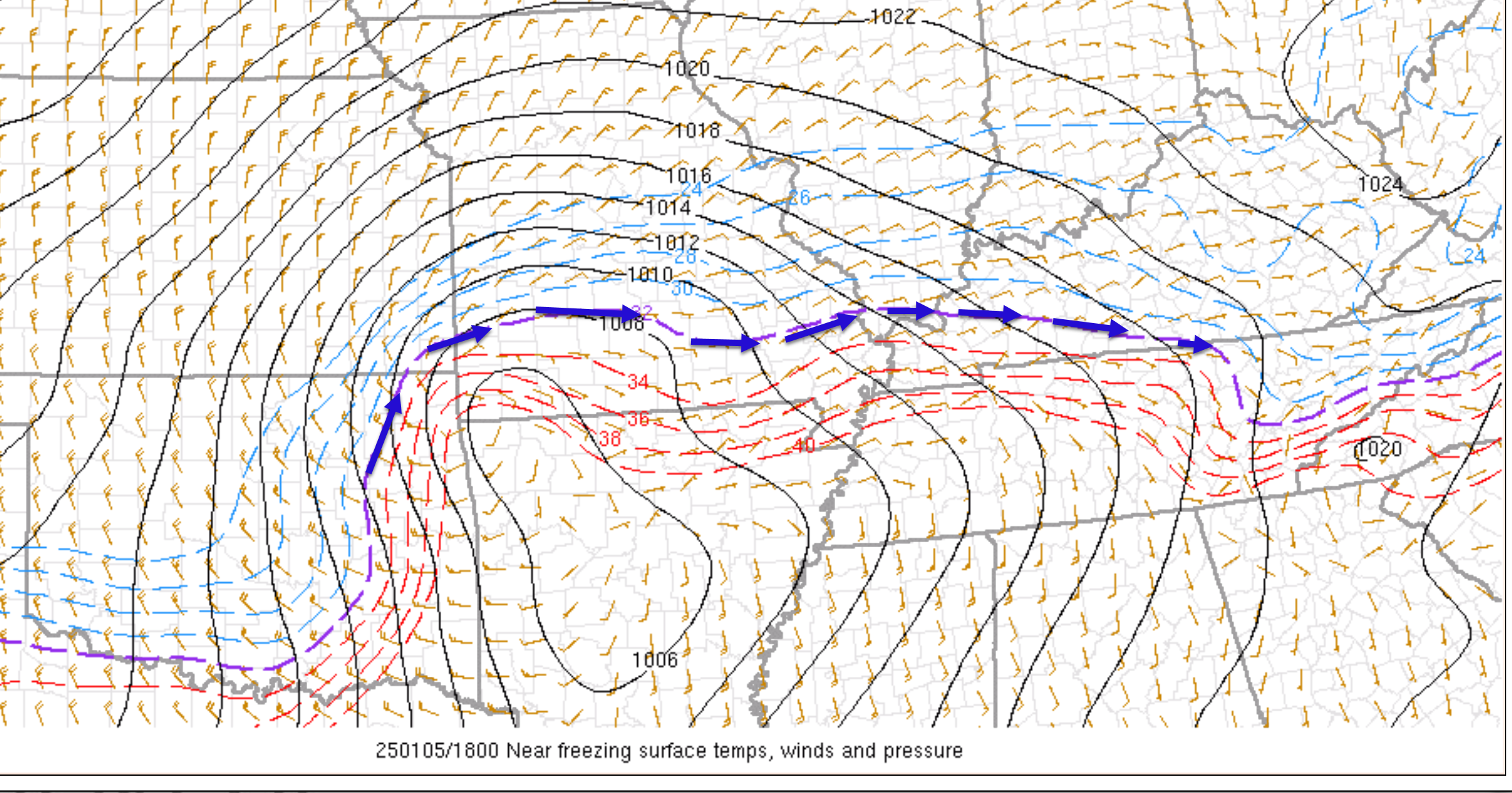
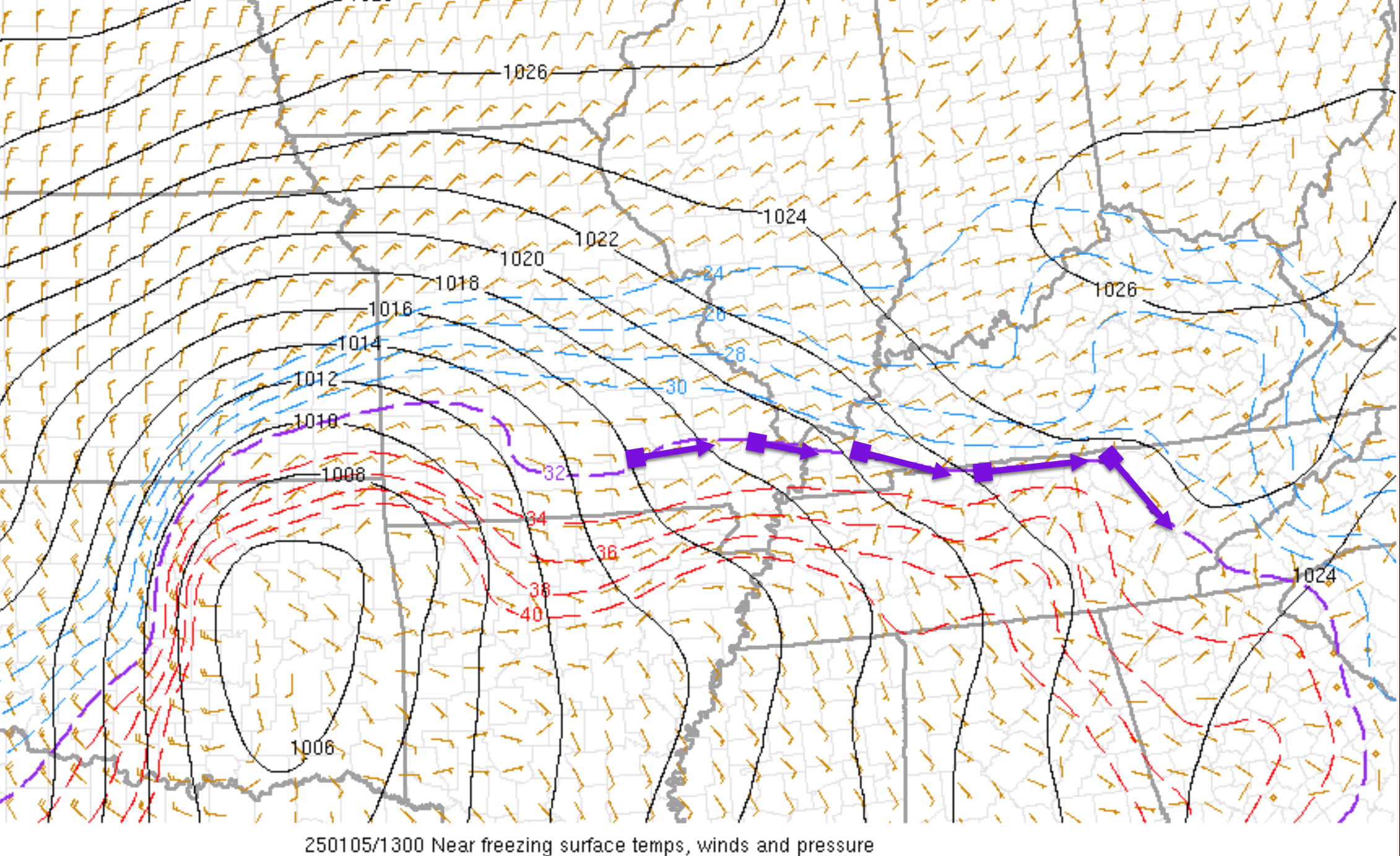
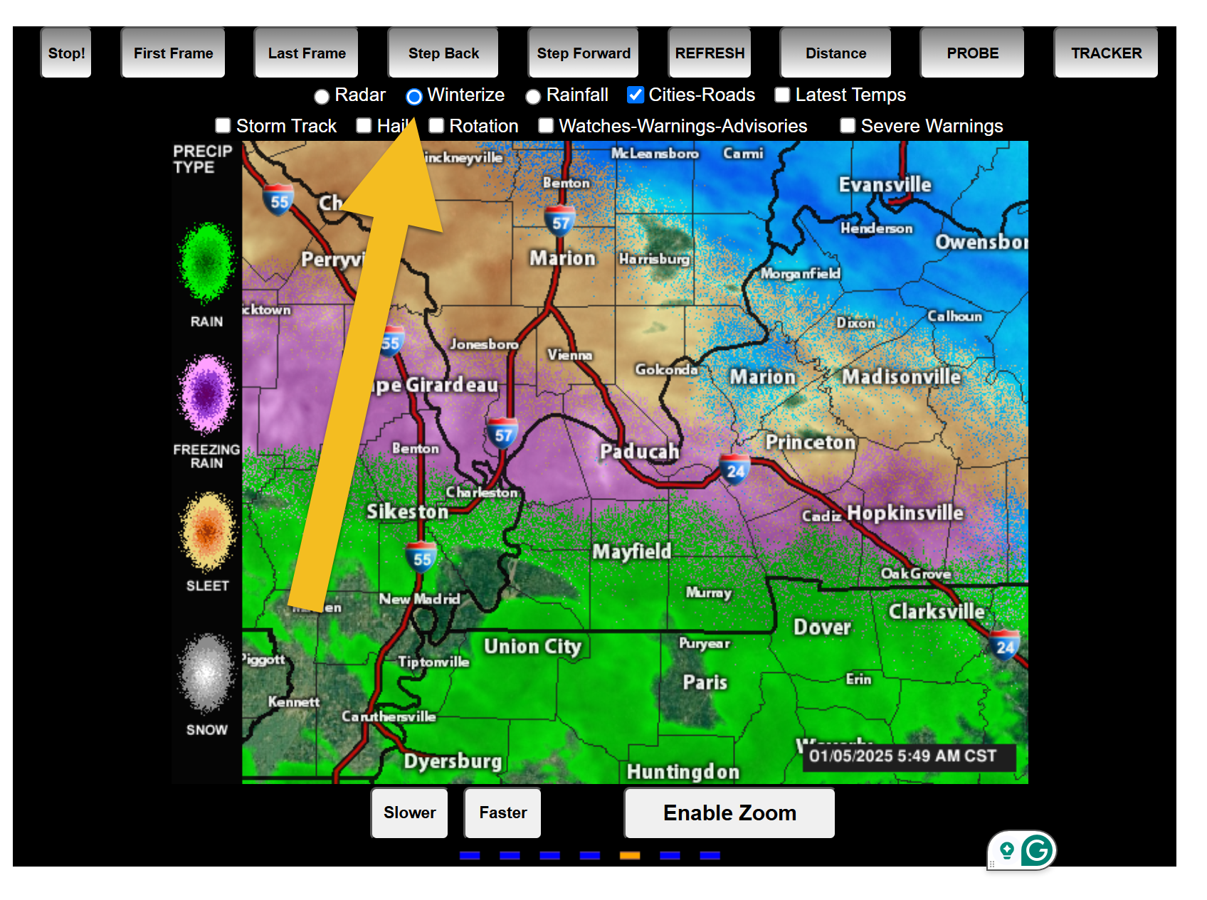
Freezing line is slowly moving north northeast. The purple line is the 32 degree line.
It is wavering over far SE MO and extreme south IL. Then southeast from there.
12 PM
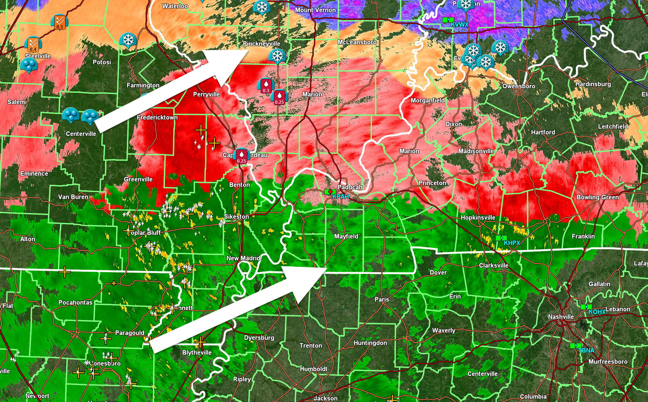
Heavy thunderstorms are moving in. Heavy rain. Heavy freezing rain, sleet, and snow with lightning.
Lightning Data (zoom in and out of your local area)
https://wtalk.co/WJ3SN5UZ
Interactive-city-view radars. Clickable watches and warnings.
https://wtalk.co/B3XHASFZ
Old legacy radar site (some of you like it better)
https://weatherobservatory.com/weather-radar.htm
This is moving northeast
.
11:30 AM Video Update
11:28 AM
Radar shows numerous lightning strikes incoming from MO AR.
Lightning Data (zoom in and out of your local area)
https://wtalk.co/WJ3SN5UZ
11:00 AM
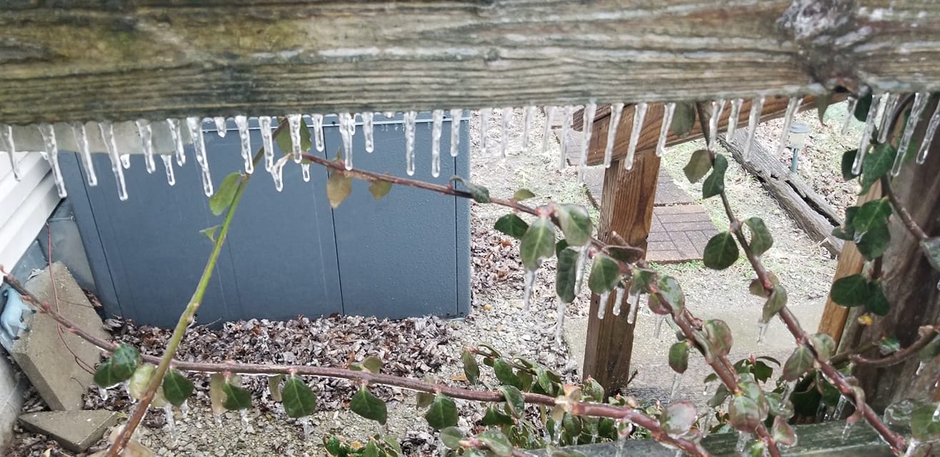
Natalie Mc photo. 3 miles east of Dycusburg KY
10:30 AM
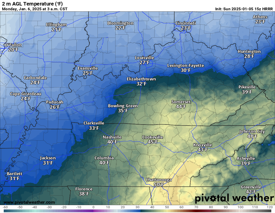
This is the 3 AM tonight temperature forecast with widespread freezing drizzle.
.
10:15 AM
New Facebook thread CLICK HERE
.
10:05 AM
KYTC District 1 Winter Weather Update
for Jan. 5, 2025 at 9:45 a.m.
Crews winding down treating efforts until next round of precipitation overnight into Monday morning
PADUCAH, Ky. (Jan. 5, 2025) – Due to decreasing icy precipitation and rising temperatures, Kentucky Transportation Cabinet (KYTC) District 1 Snowfighters are winding down patrolling and treating efforts this morning. Crews are on standby and will report again if this winter storm produces accumulating snow during the overnight hours into Monday morning.
Crews were out early Sunday morning in Ballard, Crittenden, Livingston, Lyon, Marshall, McCracken, and Trigg counties, spraying salt brine on interstates and major highways and spot-treating bridges and overpasses ahead of the arrival of freezing rain and sleet. Crews in District 1’s five southernmost counties saw minor to no travel impacts during this round of winter weather.
Motorists are advised to use extra caution today as slick spots may hang around, particularly on bridges and overpasses, until temperatures rise above freezing.
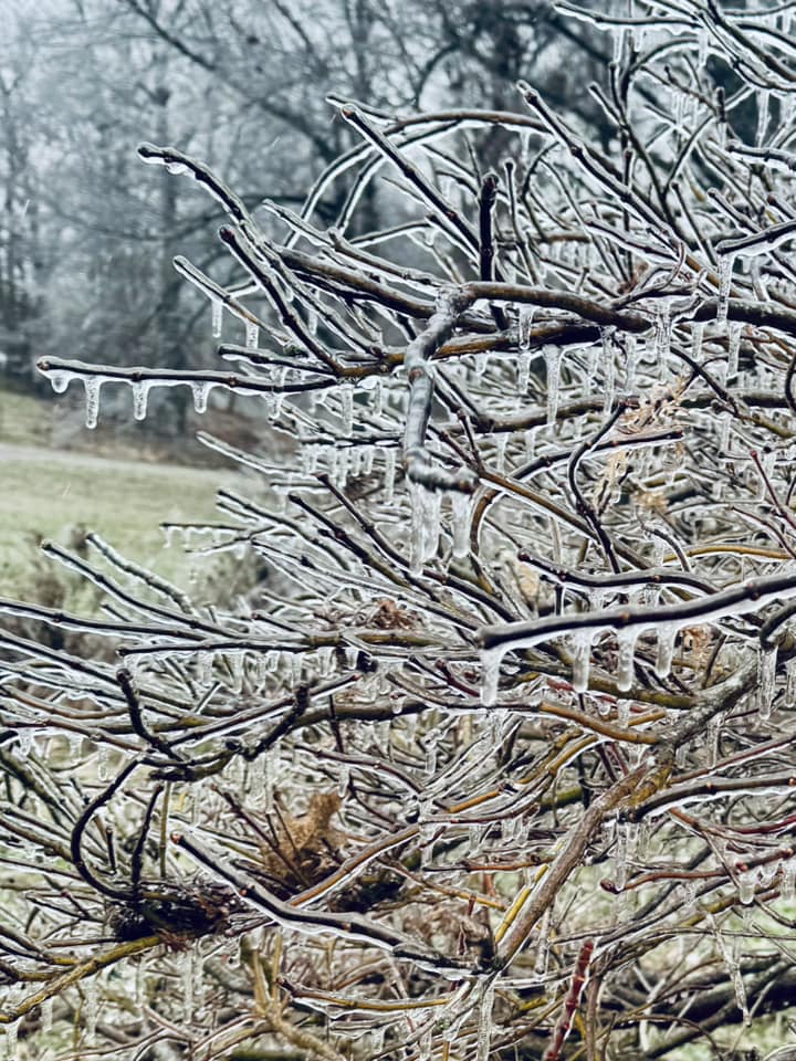
At 9 a.m. Sunday, the Livingston County Highway Maintenance Crew reported limbs and small trees down due to the weight of ice accumulation. Paducah Power also experienced two main outages and other smaller scattered outages with over 1,700 accounts impacted due to ice weighing down tree limbs.
A Winter Weather Advisory is still in effect for much of the region until 6 a.m. Monday. The National Weather Service (NWS) anticipates Western Kentucky could see snow accumulation up to 1 inch overnight and leaving the area by 9 a.m. Monday.
The KYTC District 1 Snow and Ice Team will monitor weather conditions hour by hour and will adjust response strategies for area highway crews as needed.
The U.S. 45 Ohio River “Brookport” Bridge in Paducah is closed to all traffic until further notice. Motorists should detour via the Interstate 24 Ohio River Bridge.
Motorists who plan to travel should be fully prepared for extreme cold temperatures continuing throughout the rest of the week.
10:00 AM
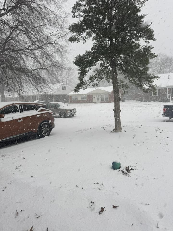
Jennifer Davis from Owensboro, KY. Snow and sleet.
10 AM
Wind forecast. Click to enlarge.
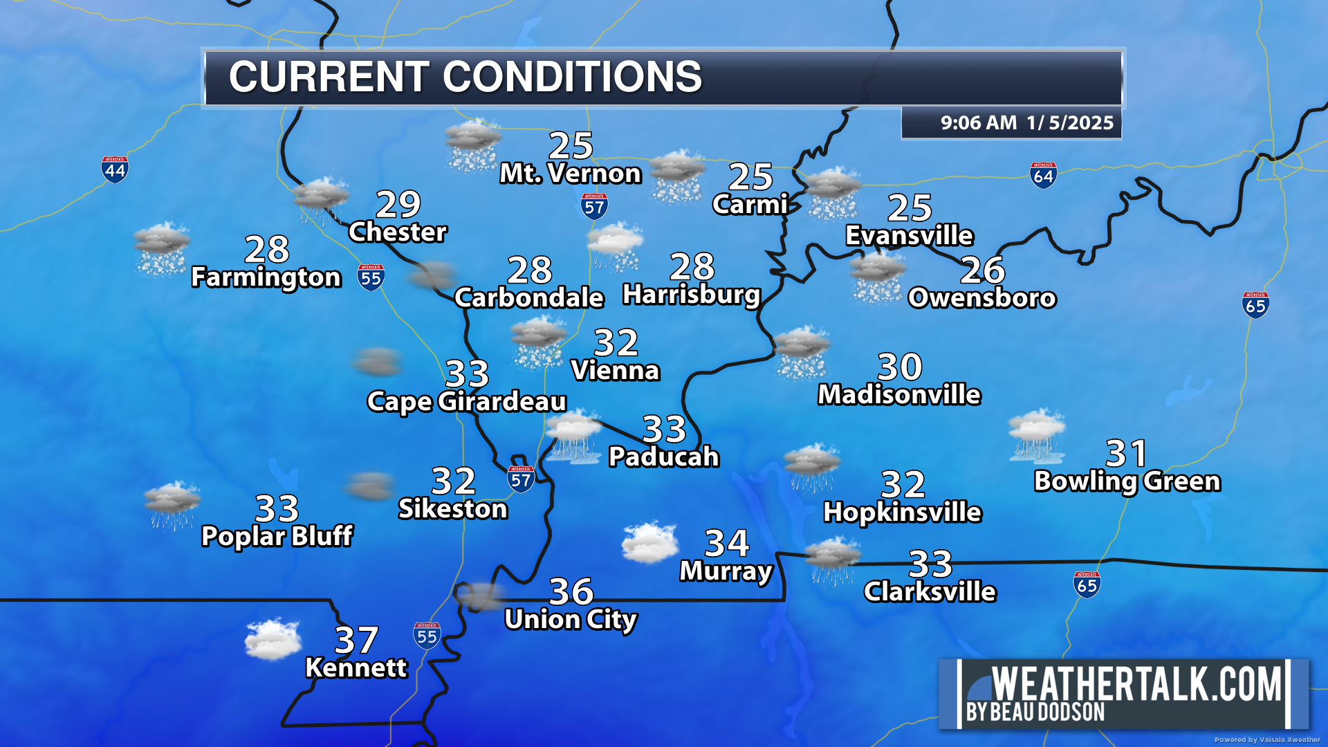
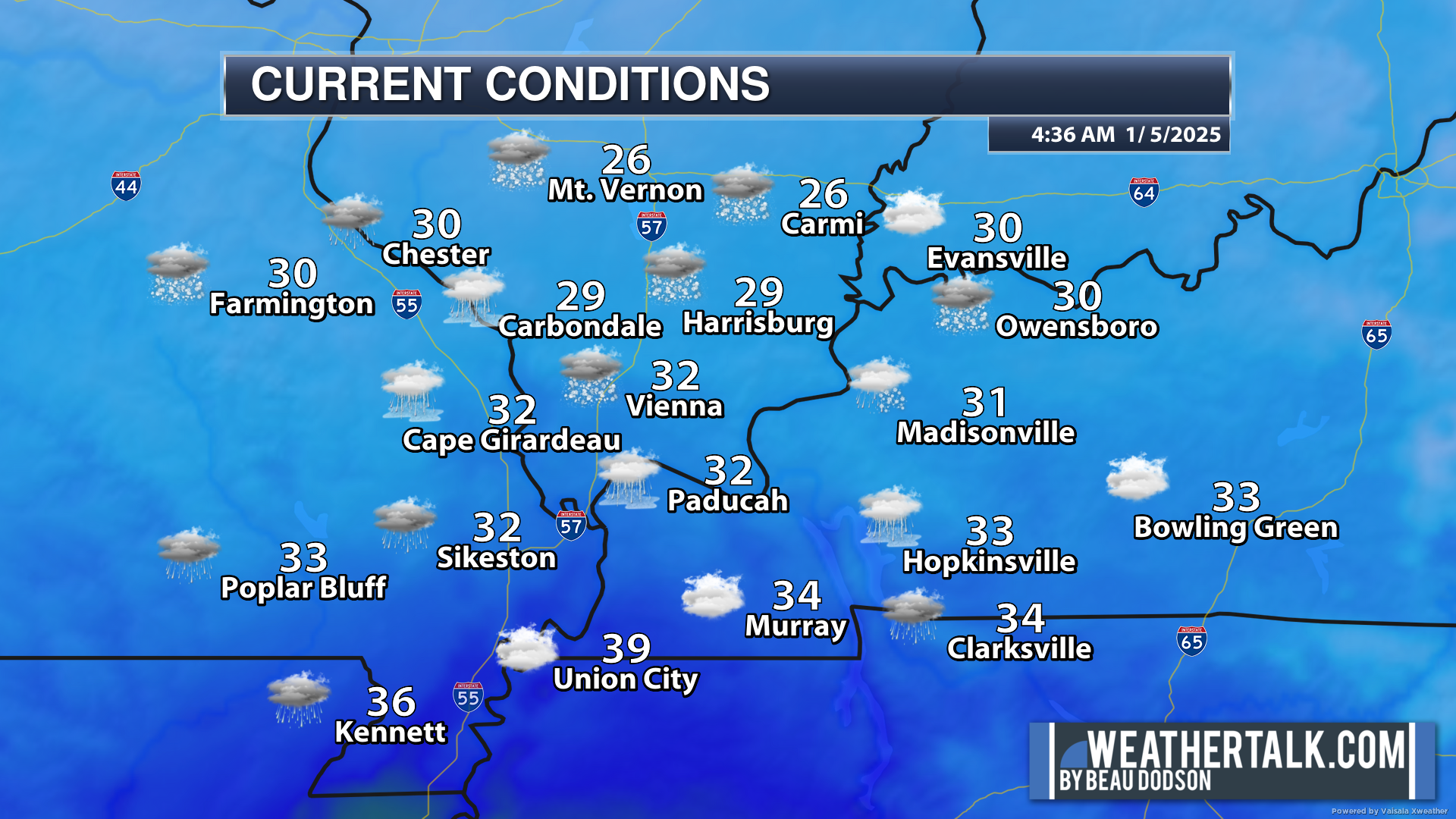
9:30 AM temperatures
9:30 AM
Ashley Nikole photo from East Central Johnson County/West Central Pope County line
9 AM Video Update
.
9 AM
The freezing line is the purple line.
There are concerns tonight for widespread freezing drizzle with temps in the 20s. Some snow showers, as well.
This model shows that
9 AM Video Update
9:00 AM
Terry Koneman photos. Ice storm in Pope County, IL.
.
8:40 AM
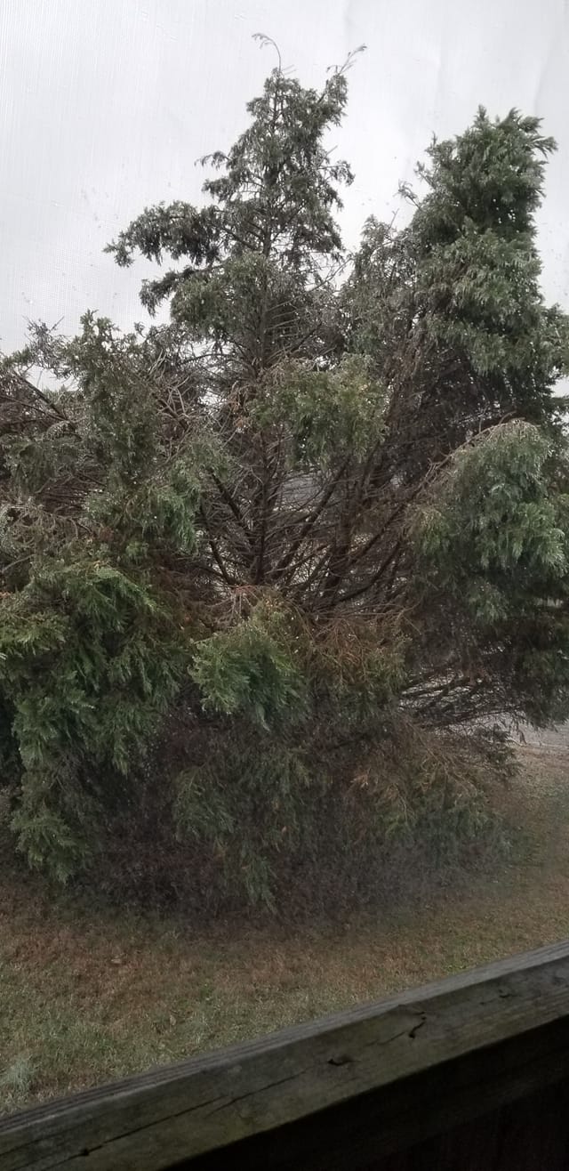
Jessica Bowman photo from northern Massac County
8:37 AM
Kim Weber in Caldwell County, KY
8:25 AM
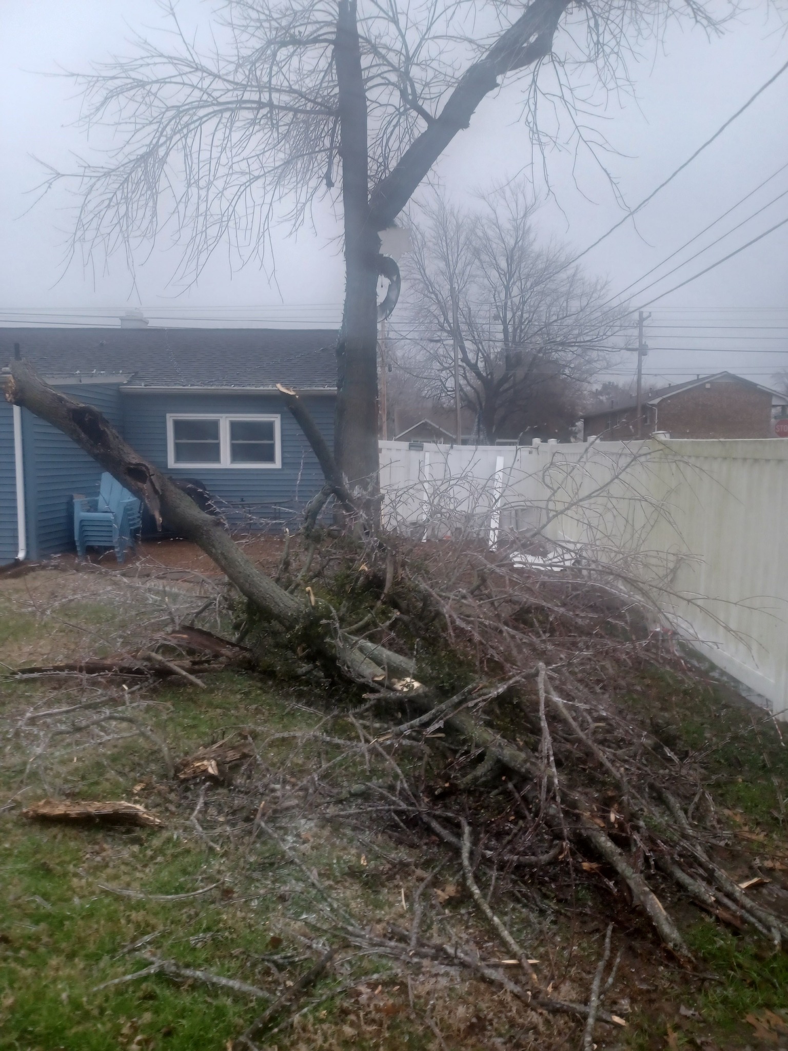
Tim Watkins. Paducah, KY with tree damage.
.
Mickey Lambert. Omaha, IL snow.
Dawn Roberts took this photo in Cape Girardeau, MO
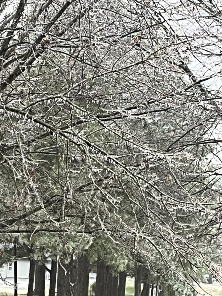
Peggy James, Salem, KY
.
8:05 AM Video Update
.
7:38 AM
Shalon Day photo. Paducah/Lone Oak
Andrea Jones photo. Lone Oak, KY
7:34 AM
Jackson, MO. Freezing rain is accumulating rapidly. Jessica McQuillen photos.
.
7:32 AM
Cynthia Anderson photo from Metropolis, IL
.
7:22 AM
Double click image to enlarge it
.
7:19 AM
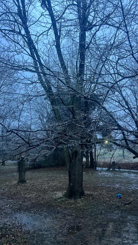
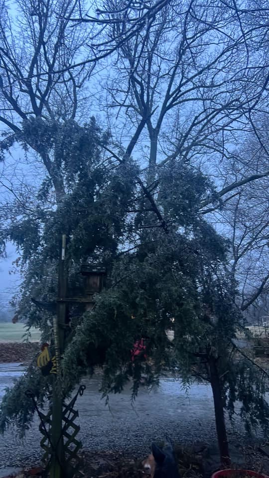
Sharpe, KY
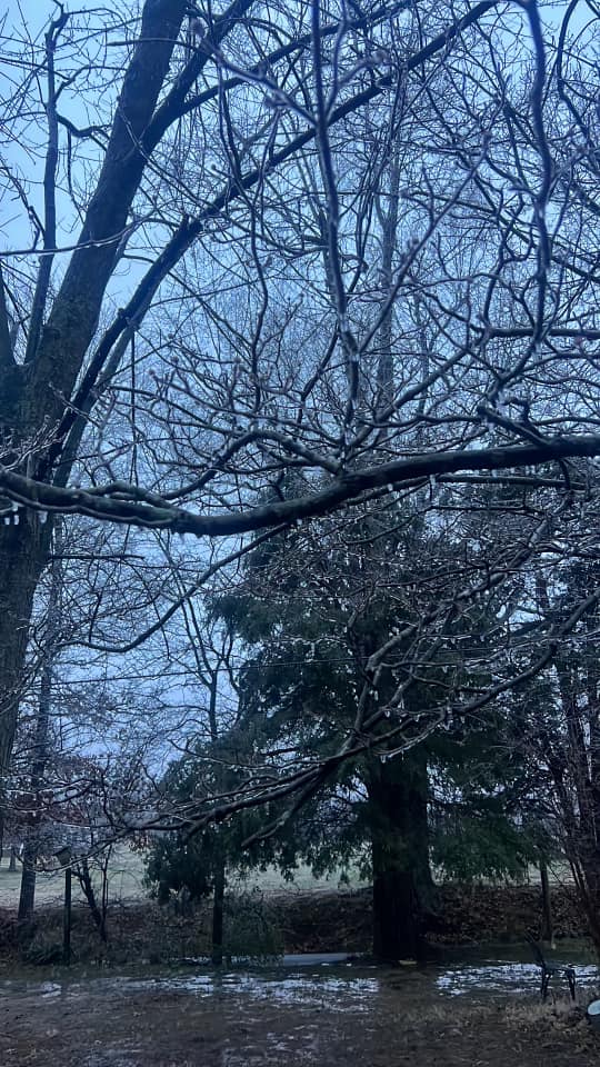
Cayden Culp photos.
.
7:15 AM
Danielle Day photo from Paducah, KY
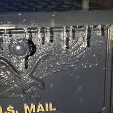
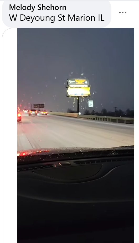
Marion, Illinois. Sleet and an icy mess. Kids are going to be out of school a while in some area.
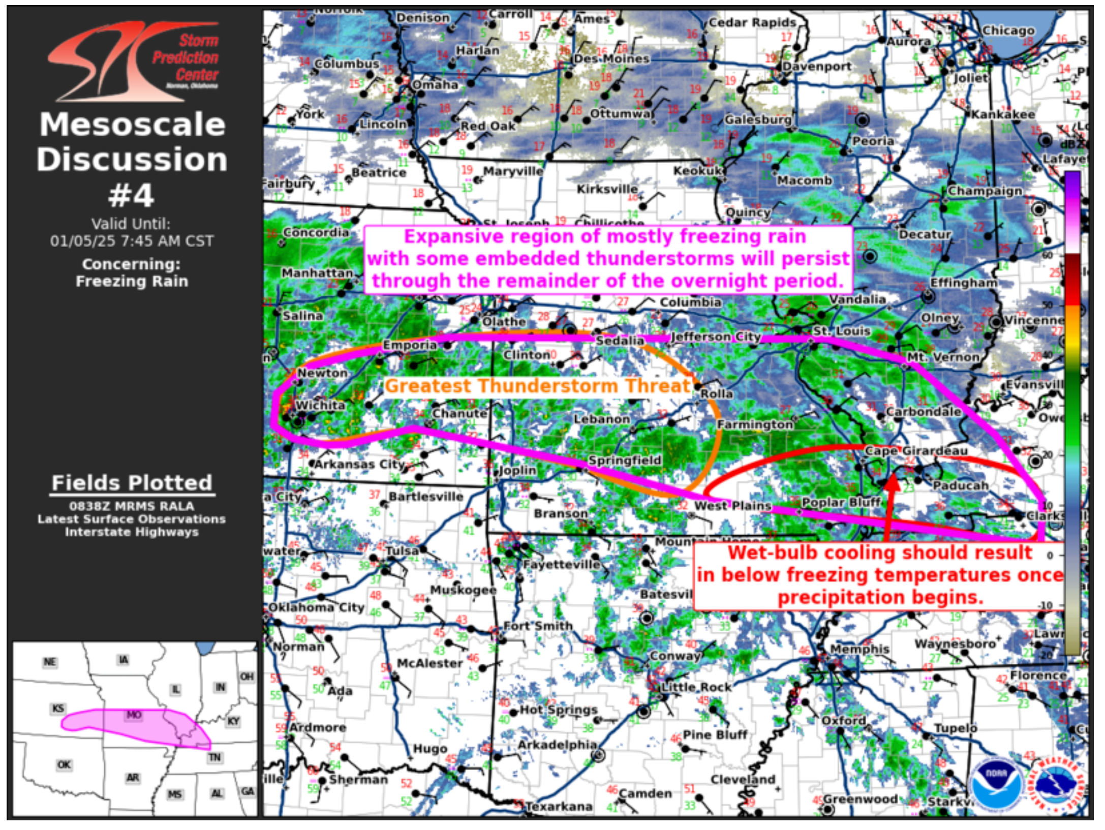
7:00 AM Report From the SPC
Technical discussion
Mesoscale Discussion 0004
   NWS Storm Prediction Center Norman OK
   0240 AM CST Sun Jan 05 2025

   Areas affected...east-central Kansas...much of central
   Missouri...southern Illinois...and far western Kentucky.

   Concerning...Freezing rain

   Valid 050840Z - 051345Z

   SUMMARY...An expansive region of mostly freezing rain with some
   embedded thunderstorms will persist through the remainder of the
   overnight period.

   DISCUSSION...Freezing rain and isolated sleet is being observed
   early this morning across a broad region from south-central Kansas
   to western Illinois and far western Kentucky. A broad region of
   isentropic ascent will support continued precipitation development
   along the frontal zone through the early morning hours. In addition,
   low-level cold air will continue to advect into the region with an
   area of arctic high pressure extending from the northern Plains to
   the Lower Ohio Valley.

   Temperatures are currently above freezing across southeast Missouri
   and into western Kentucky. However, wet-bulb cooling should result
   in below freezing temperatures shortly after precipitation begins.

   Widespread lightning has been observed with the freezing rain
   activity across central/eastern Kansas over the last 1 to 2 hours.
   Forecast soundings show elevated instability which should continue
   to support the threat for thunderstorms through the early morning
   hours across eastern Kansas and into Missouri. These heavier
   precipitation cores may not be that efficient at ice accretion where
   temperatures are in the upper 20s to low 30s. However, where
   temperatures are in the mid 20s or colder, these heavier
   precipitation rates could result in substantial freezing rain
   accretion in a very short period.

   ..Bentley.. 01/05/2025
.
6:48 AM
Photo from Paducah, KY.
Keary Cindi Keeling photograph.
6:40 AM
Alisha Farlee photo. Jackson, MO.
.
6:30 AM
I am watching a possible snowstorm Friday into Saturday of this week. Long way off, but watching it closely.
.
6:30 AM
Foster Stacy sent in this photo from downtown Paducah.
.
6:21 AM
NWS St Louis Weather Briefing for my northern counties
.
6:08 AM
Don’t forget the winter weather radars (the local city view radars) have a winterize button on them. Click that to see precipitation type.
Interactive-city-view radars. Clickable watches and warnings.
https://wtalk.co/B3XHASFZ
Old legacy radar site (some of you like it better)
https://weatherobservatory.com/weather-radar.htm
.
6:05 AM
Video update
6:00 AM
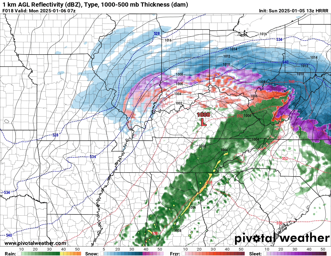
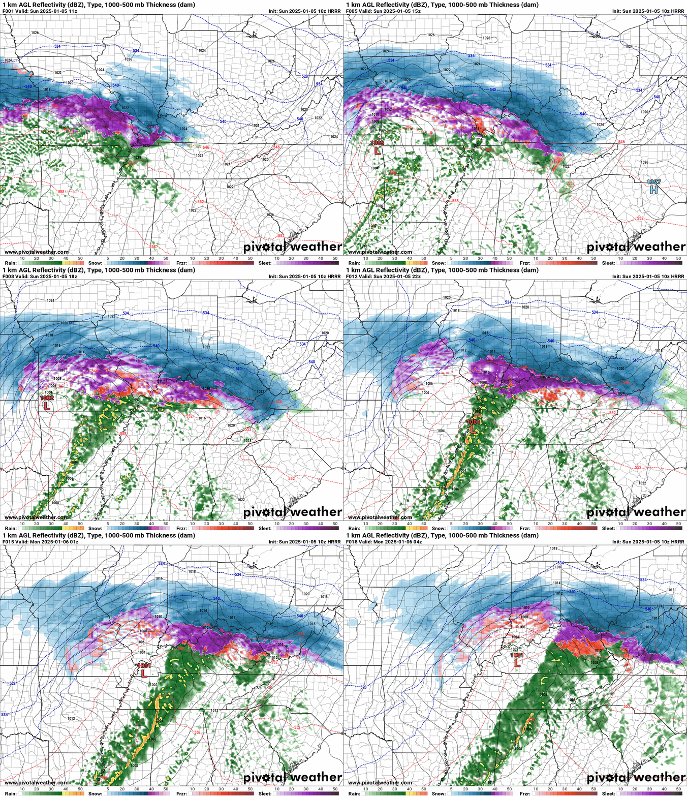
Future-cast Hrrr radar.
Fine line between major ice vs just plain rain.
Blue is snow. Purple and red are sleet and ice.
Time is in Zulu 12z=6 AM. 18z=12 pm. 00z=6 pm.
The overnight forecast is on track.
Temperatures are perhaps a couple of degrees warmer than forecast in a few counties.
The wintry mix has already changed to rain over portions of SE MO and western KY. NW TN, as well.
There was a brief period of sleet in some of those areas. No impacts.
Don’t forget, that impacts in some counties were not forecast until tonight when temperatures fall into the 20s. Freezing drizzle and light snow will be possible in the area.
That could lead to black ice developing.
Other areas will be covered already in snow, sleet, and ice.
A wide range of conditions across the region this morning.
5:00 AM
Another radar shot.
Double click images to enlarge them. You can see temps on heer, as well.
They will slowly rise today .
Watches and warnings remain the same.
The freezing line is the purple line. Everyone south of that line is likely done with ice, for now.
Some more freezing drizzle and light snow will be possible tonight into Monday morning.
5 AM Temperatures
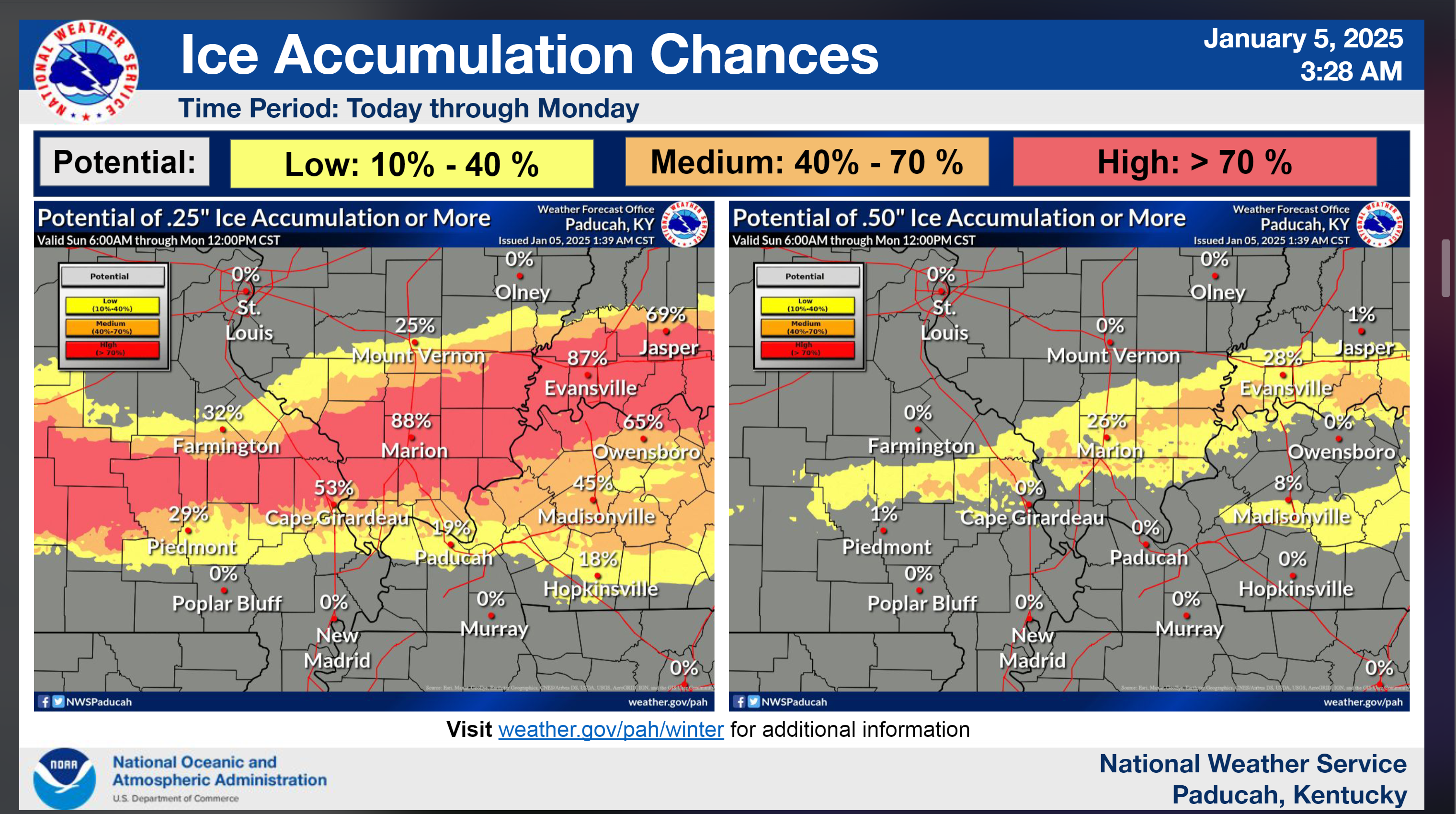
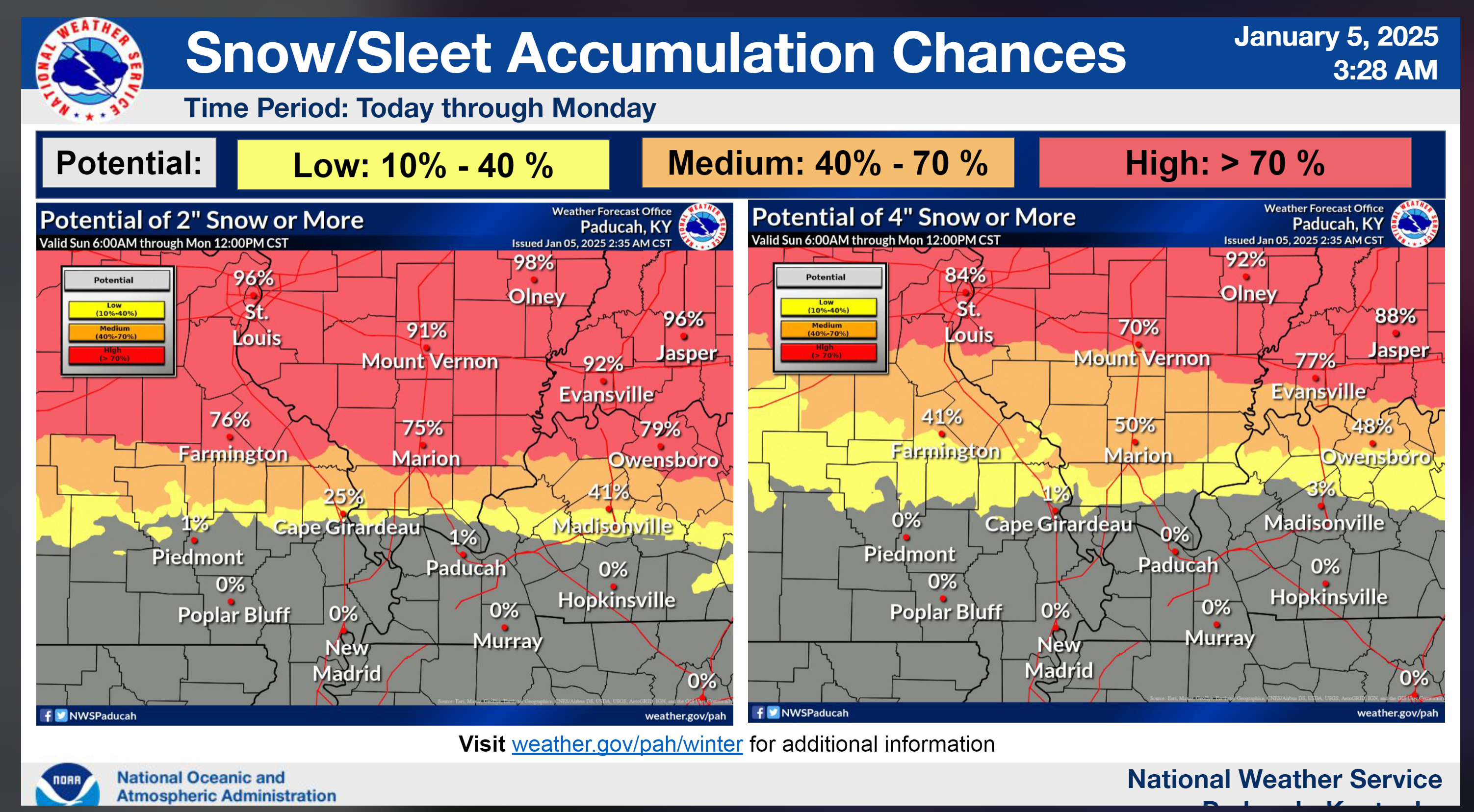
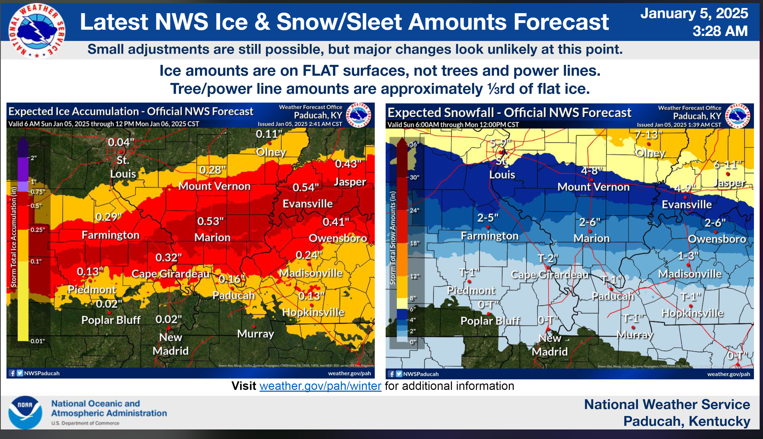
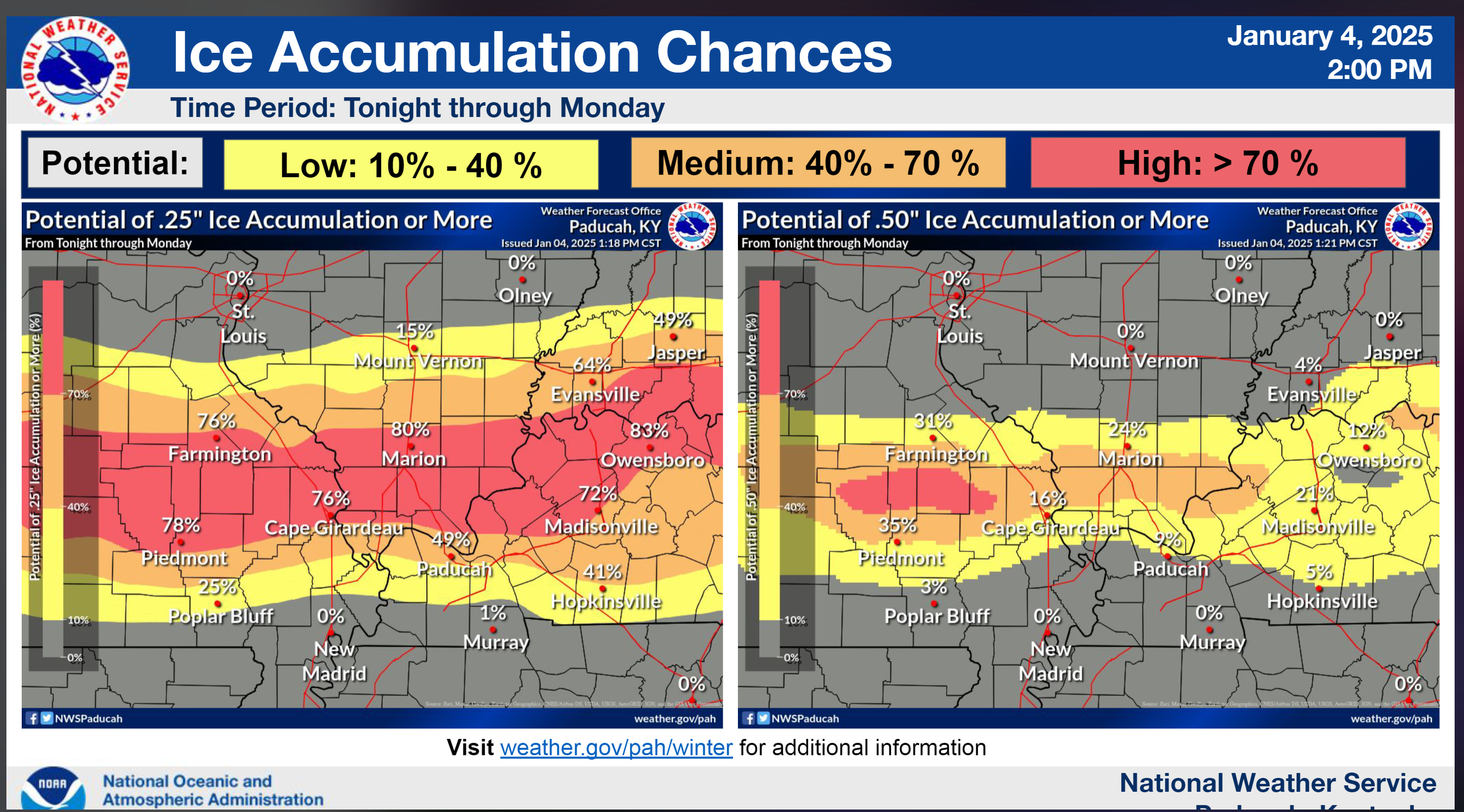
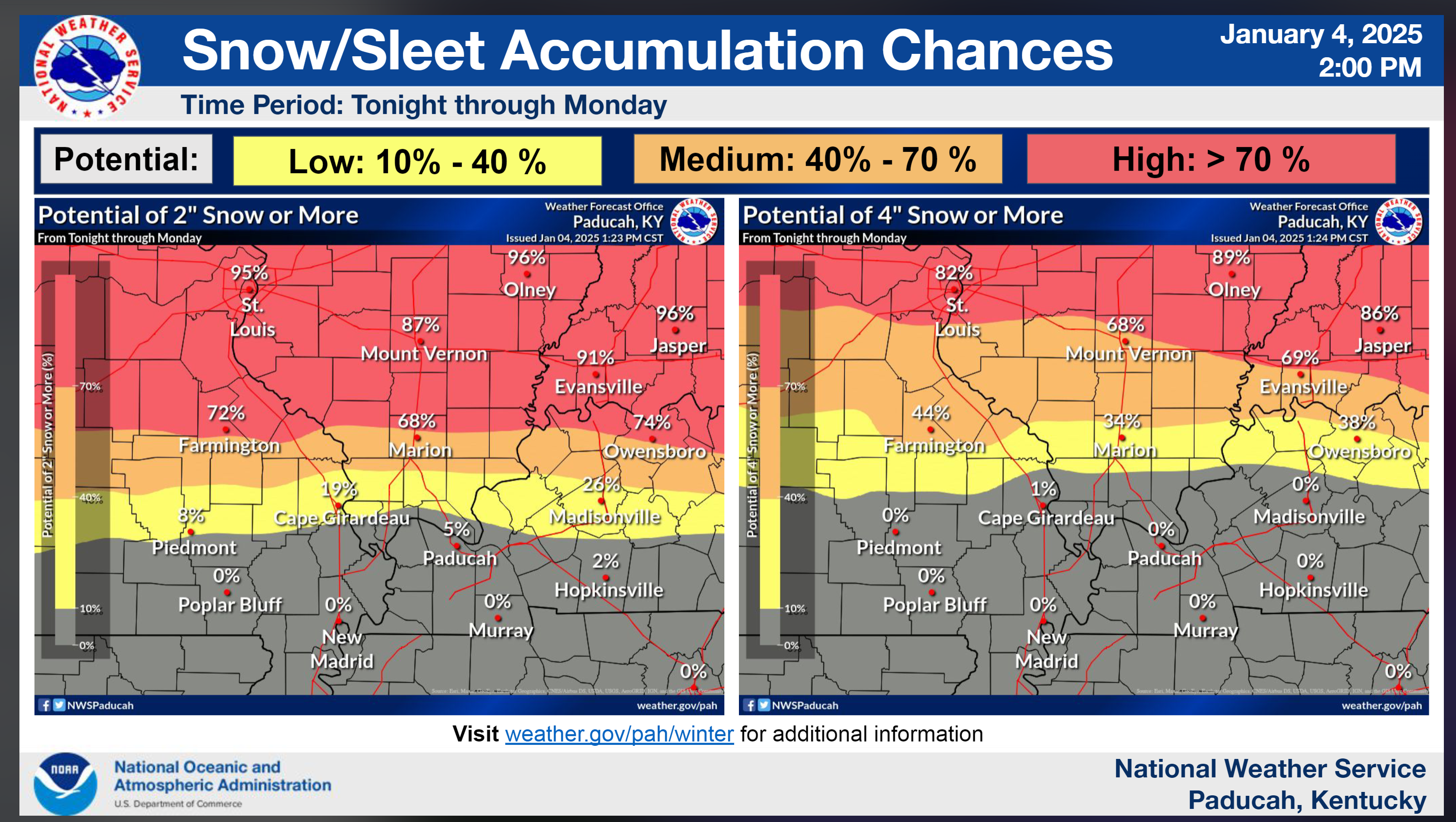
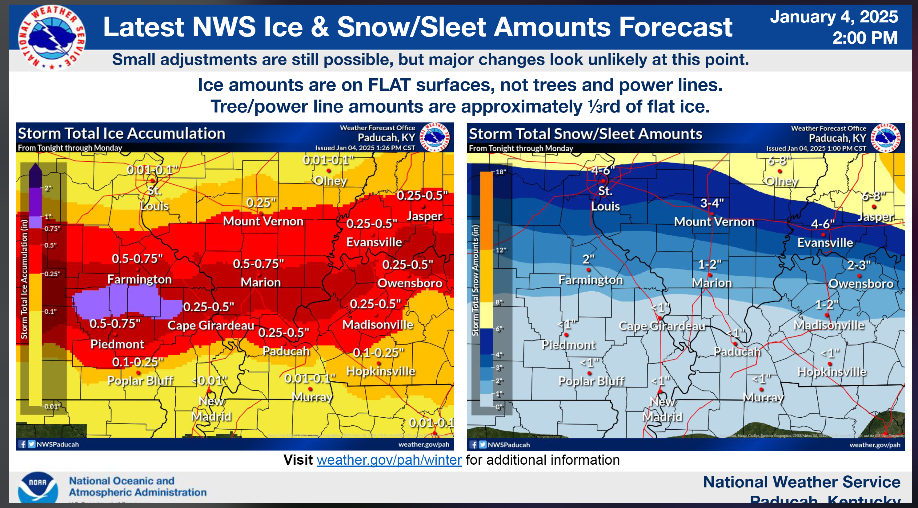
Updated snow and ice totals forecast
A slight tick north for the higher totals.
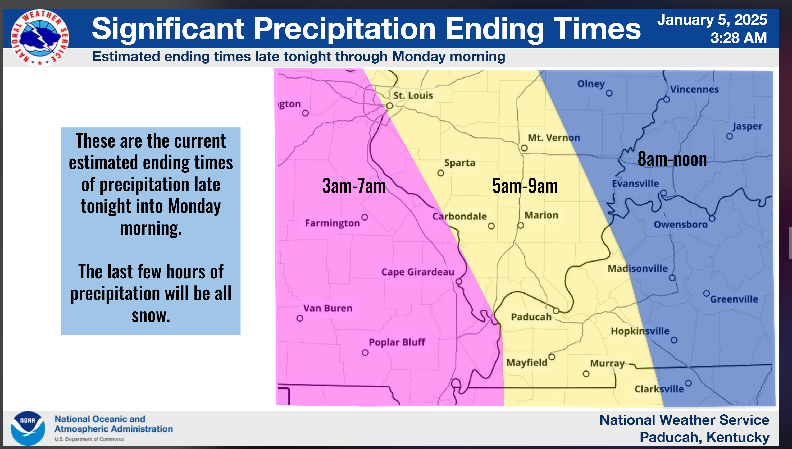
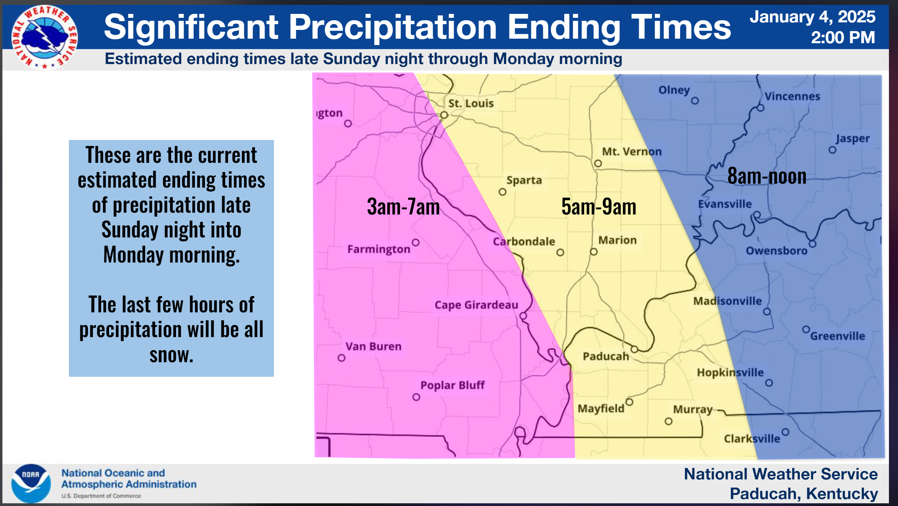
Precipitation end time (for the bulk of it)
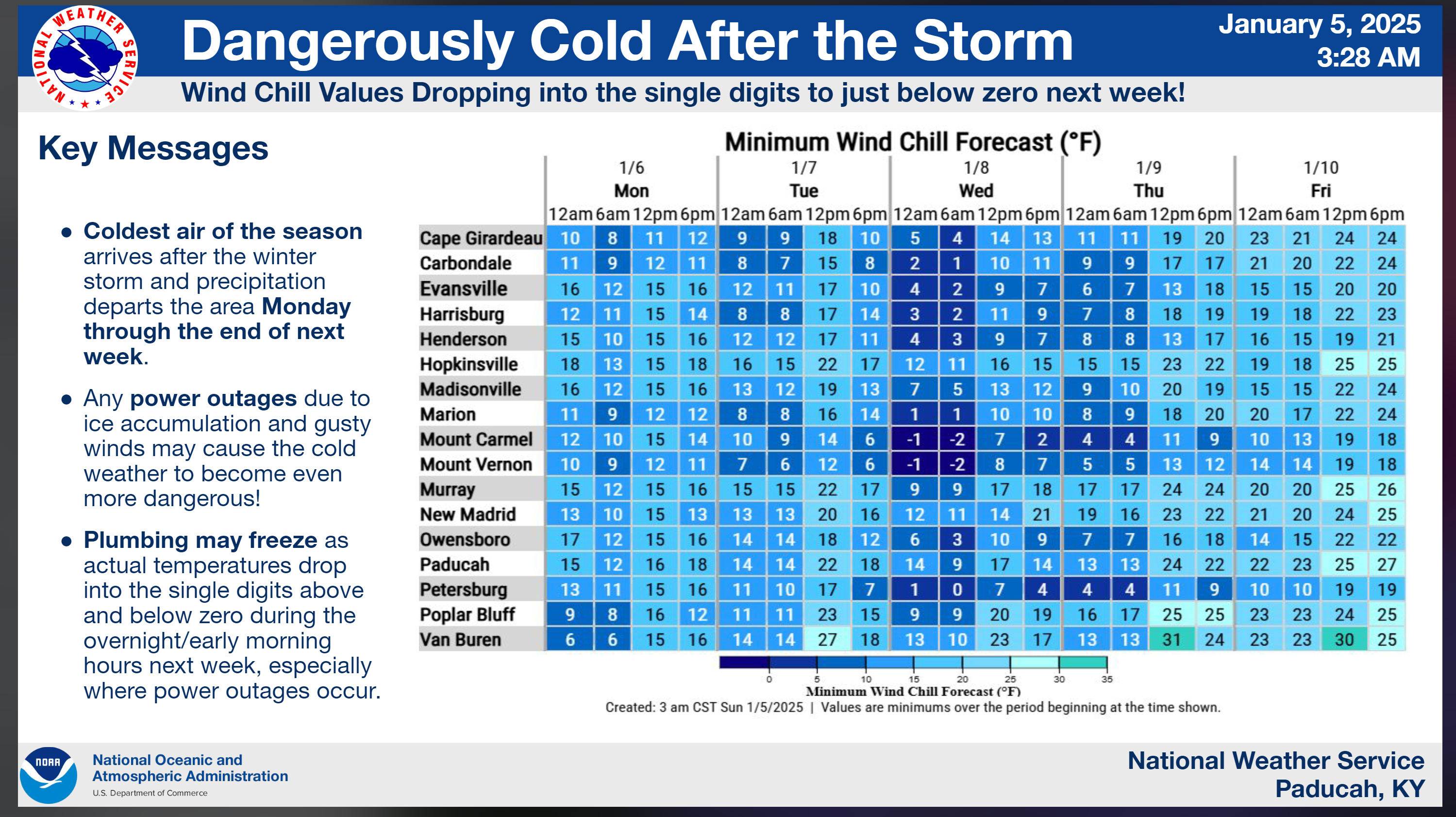
Bitterly cold air to follow
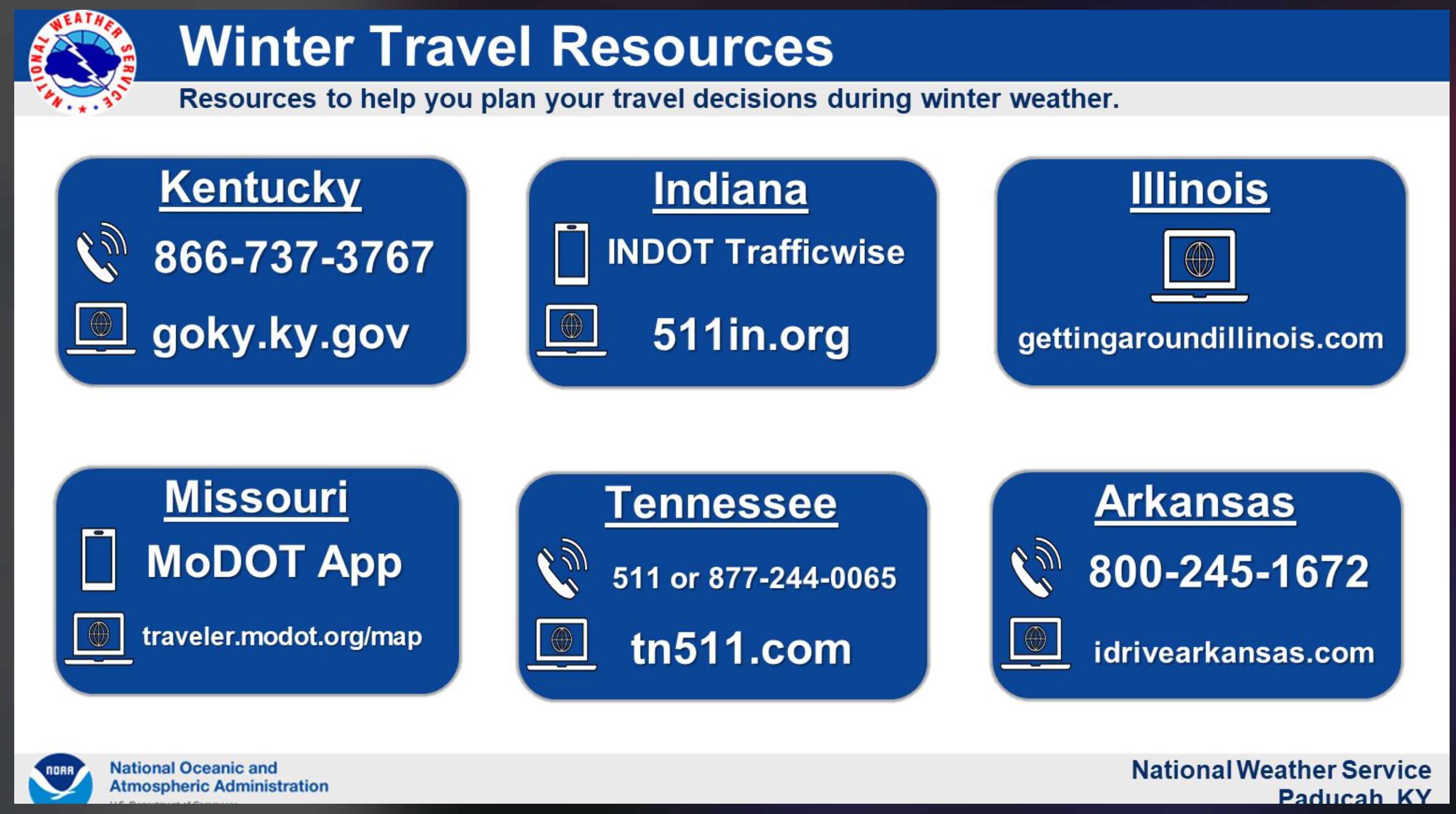
Some more information on travel
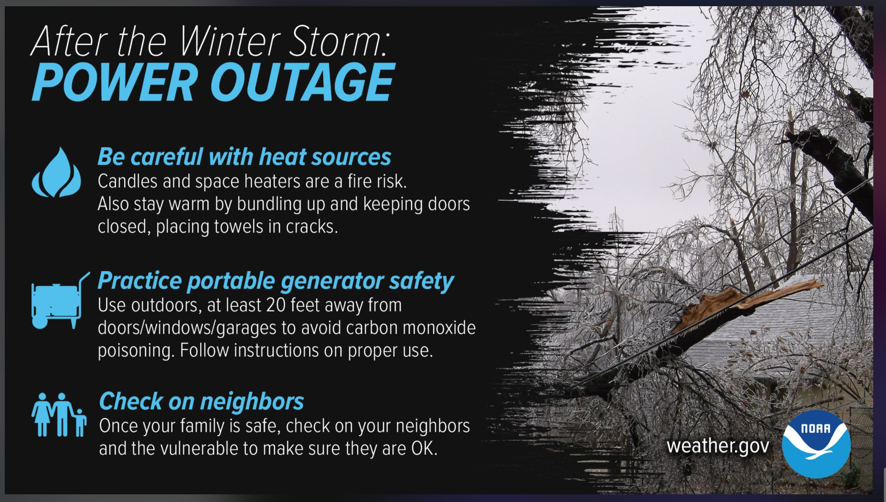
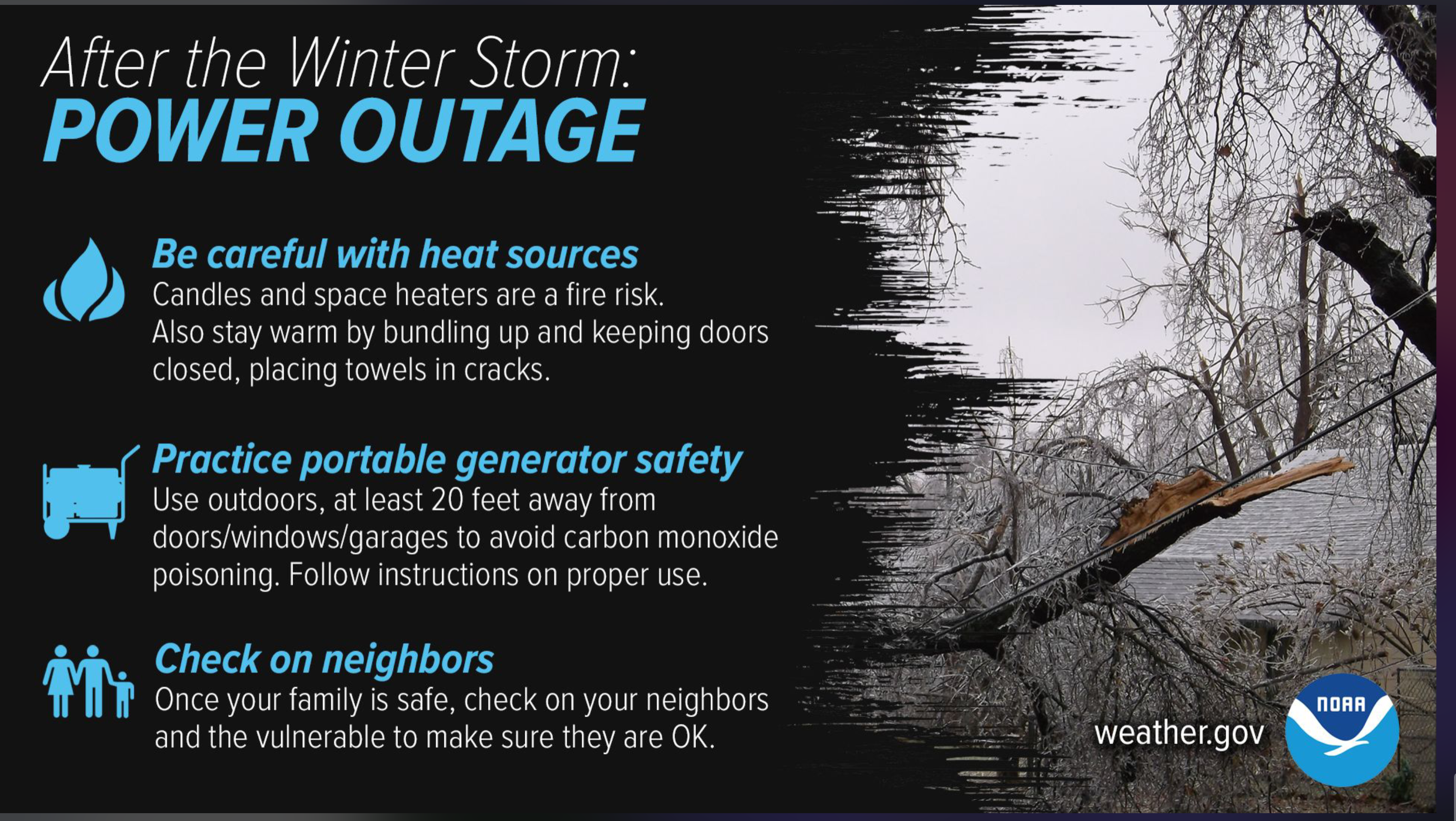
Power outage safety tips
Saturday, January 4, 2025
7:30 PM
I will update again in the morning. Everything is a go with the forecast. We will see how it goes.
.
6:20 PM
Light snow and sleet are developing over southeast MO. This will spread northeast over the coming hours.
Steadier and widespread precipitation will develop late tonight into tomorrow morning.
See the radar links at the top of the page.
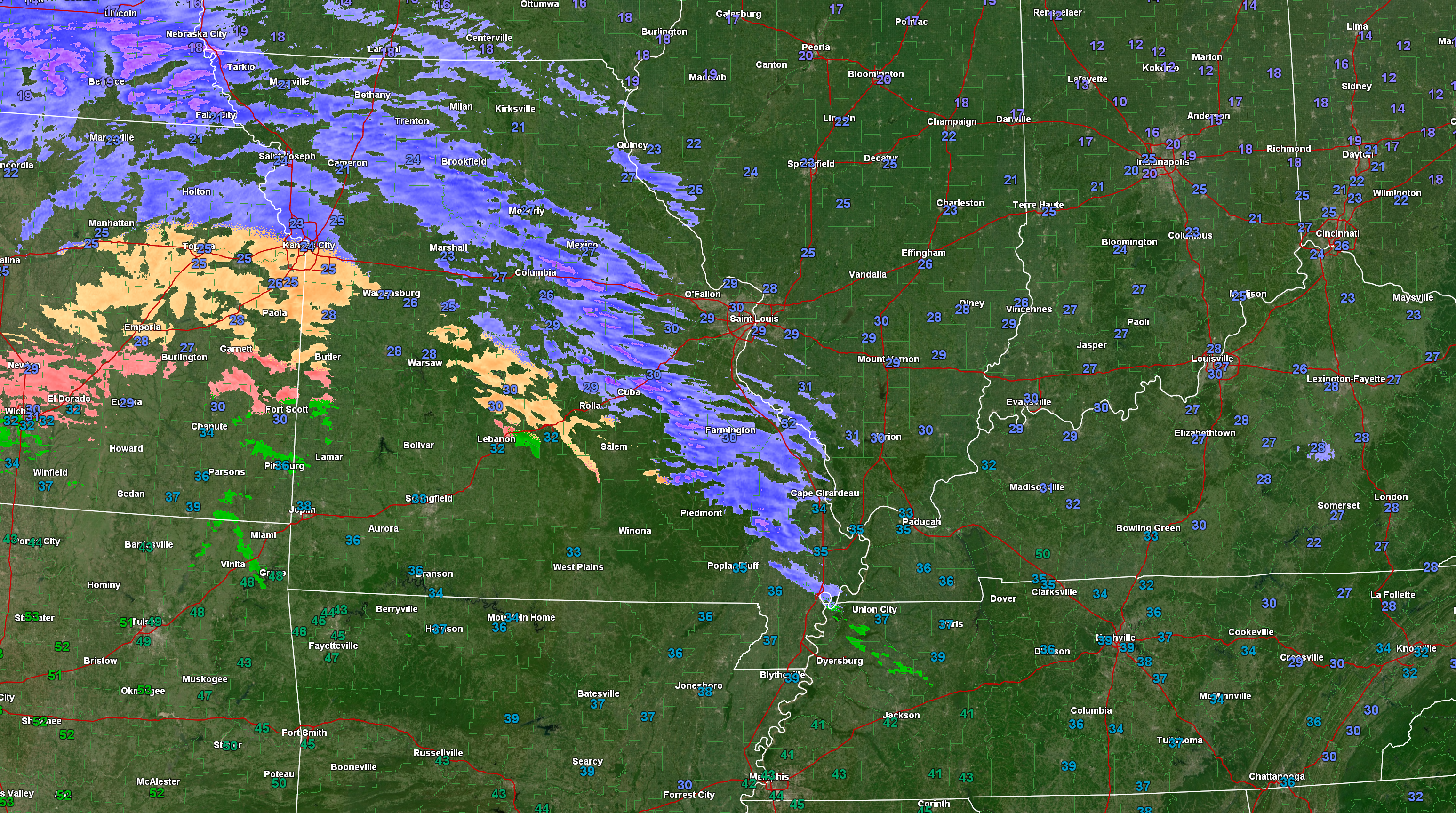
Radar snapshot at 6:20 PM. Blue is snow. Orange is sleet. Red is freezing rain.
4:41 PM
Fresh evening graphics
Double click on an image to make it larger
For the Missouri Bootheel and NW TN. Impacts are possible Sunday night and Monday. Low risk tonight for freezing rain.
Double click images to enlarge them.
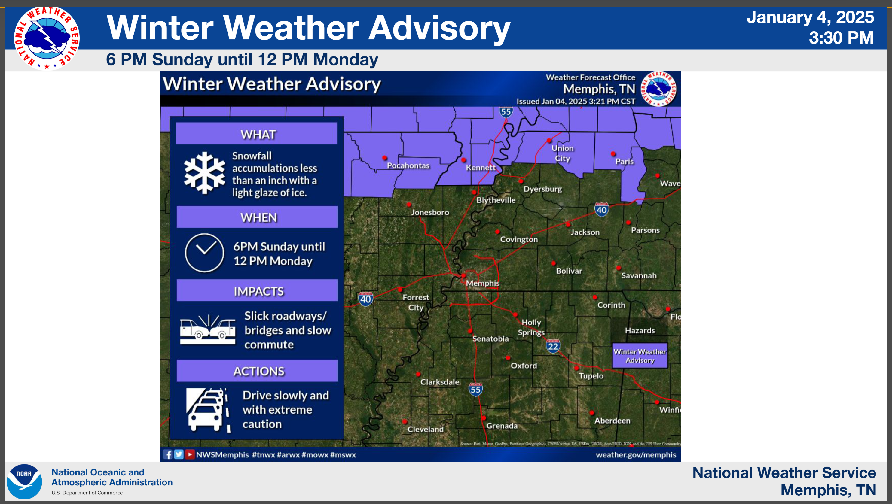
Winter Weather Advisory Sunday night and Monday
3:32 PM
Evening Update For My Southern Counties
MO: Butler, New Madrid, Dunklin, and Pemiscot Counties
KY: Hickman, Fulton, Graves, Calloway, Trigg, Christian, and Todd
TN: Lake, Obion, Weakley, and Henry
Temperatures tonight could go below freezing for a period of time. Precipitation will overspread the region later tonight into tomorrow morning.
That precipitation may begin as a wintry mix of plain old rain, freezing rain, and sleet. There could be some brief impacts on surfaces.
The Missouri Bootheel may end up with lows just above freezing. Thus, if that happens there are no concerns for that area.
Temperatures will rise above freezing tomorrow morning. That will mean plain old rain. Not freezing.
Temperatures in the MO Bootheel, NW TN, and along the KY/TN border could even rise into the 50s tomorrow. Thunderstorms are possible.
A flash freeze is likely Sunday night into Monday. Temperatures will rapidly fall into the 20s. This will cause the rain to change to freezing rain, freezing drizzle, sleet, and snow. Some light icing will be possible Sunday night into Monday.
Remember, it only takes a little bit of freezing rain or freezing drizzle to cause travel issues. It will also make decks, porches, and stairs icy. Use care when you step out.
I am watching another winter storm late next week.
The live winter storm blog is up and running
Beau Dodson Winter Weather Radars and Lightning Data
Don’t forget the local city-view radars have a winterize button. That allows you to see lighter precipitation and precipitation type.
New radar site
https://beaudodsonweather.com/weather-radars/
Old legacy radar site (some of you like it better)
https://weatherobservatory.com/weather-radar.htm
Backup radar site
https://weathertalk.com/morani
Regional Radar
https://imagery.weathertalk.com/prx/RadarLoop.mp4
*NEW* Zoom interactive radar (with storm chaser streams)
https://wtalk.co/AVWG7GM7
Real time lightning tracker system two.
https://map.blitzortung.org/#5.02/37.95/-86.99
3:15 PM
I just sent out the county by county forecast. Took a while!
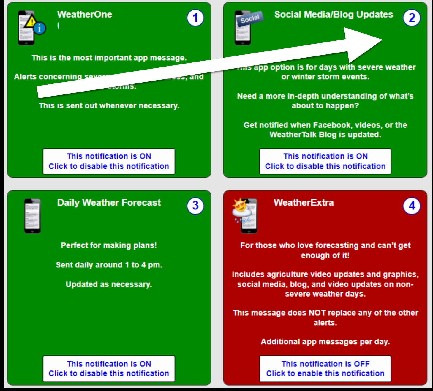
You can receive those on the app by turning that option on.
Long into www.weathertalk.com
Go to notification settings
Turn on option three. The daily forecast.
This shows option two. Turn that on, as well. You can receive the social media alerts.
1:37 PM
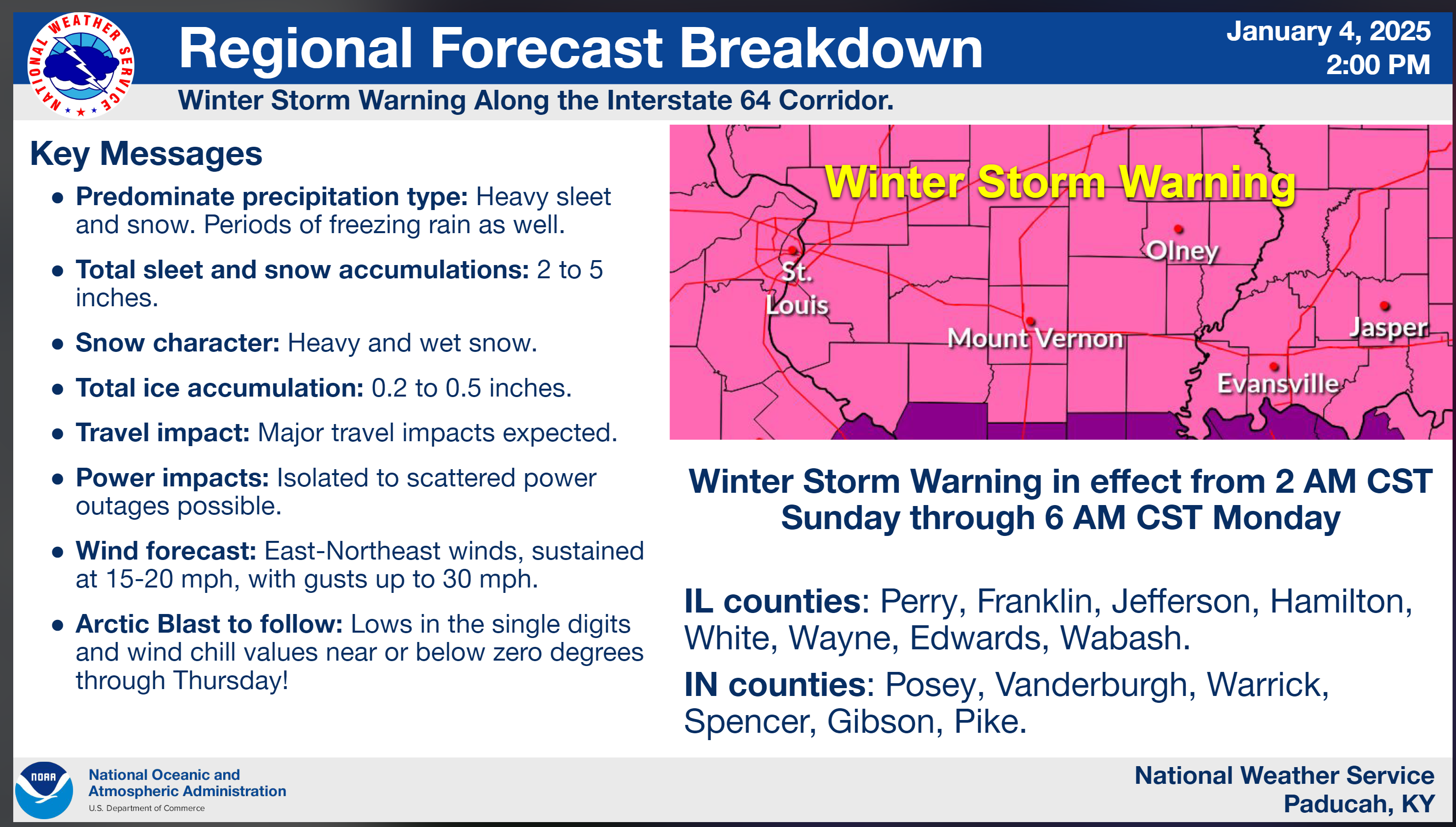
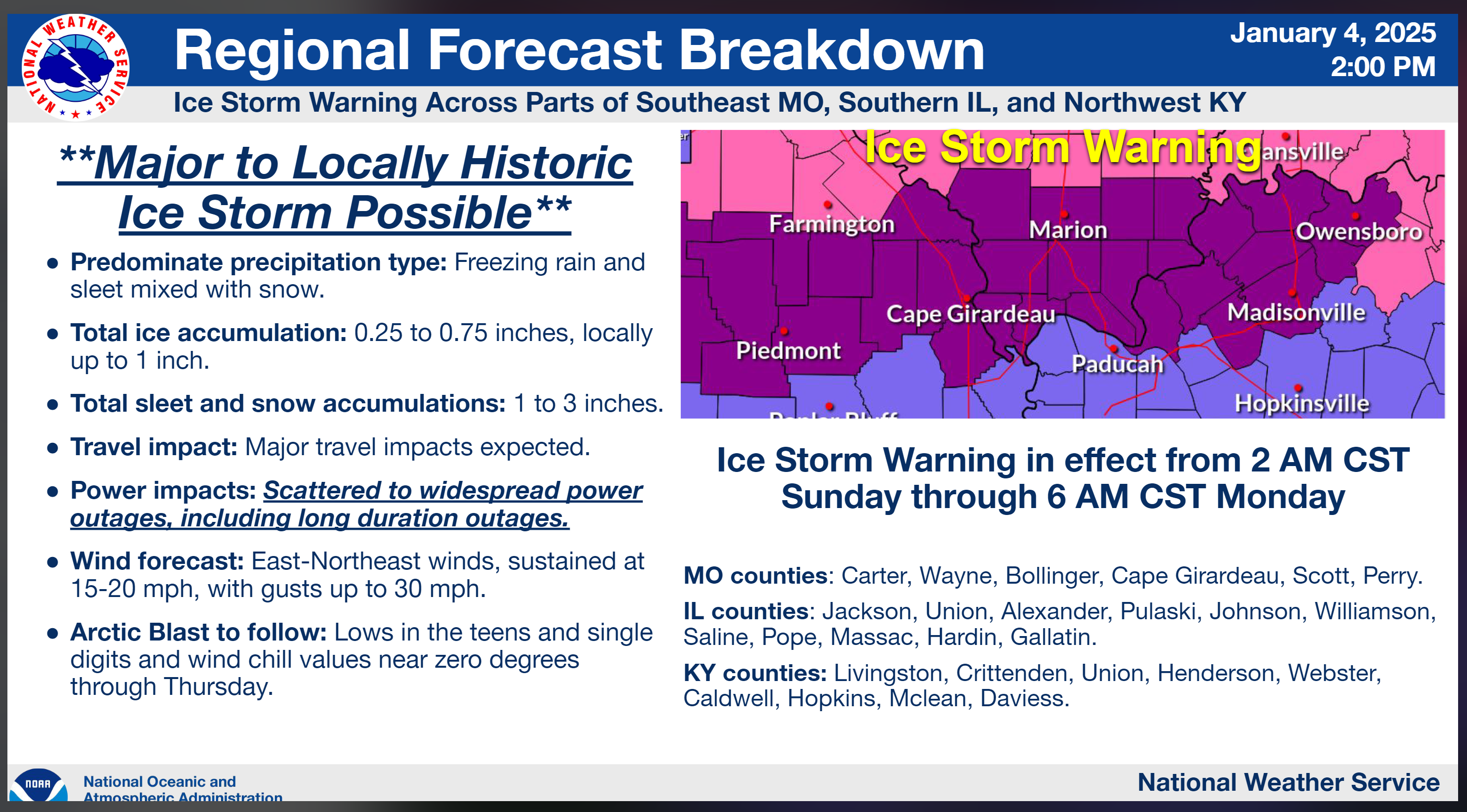
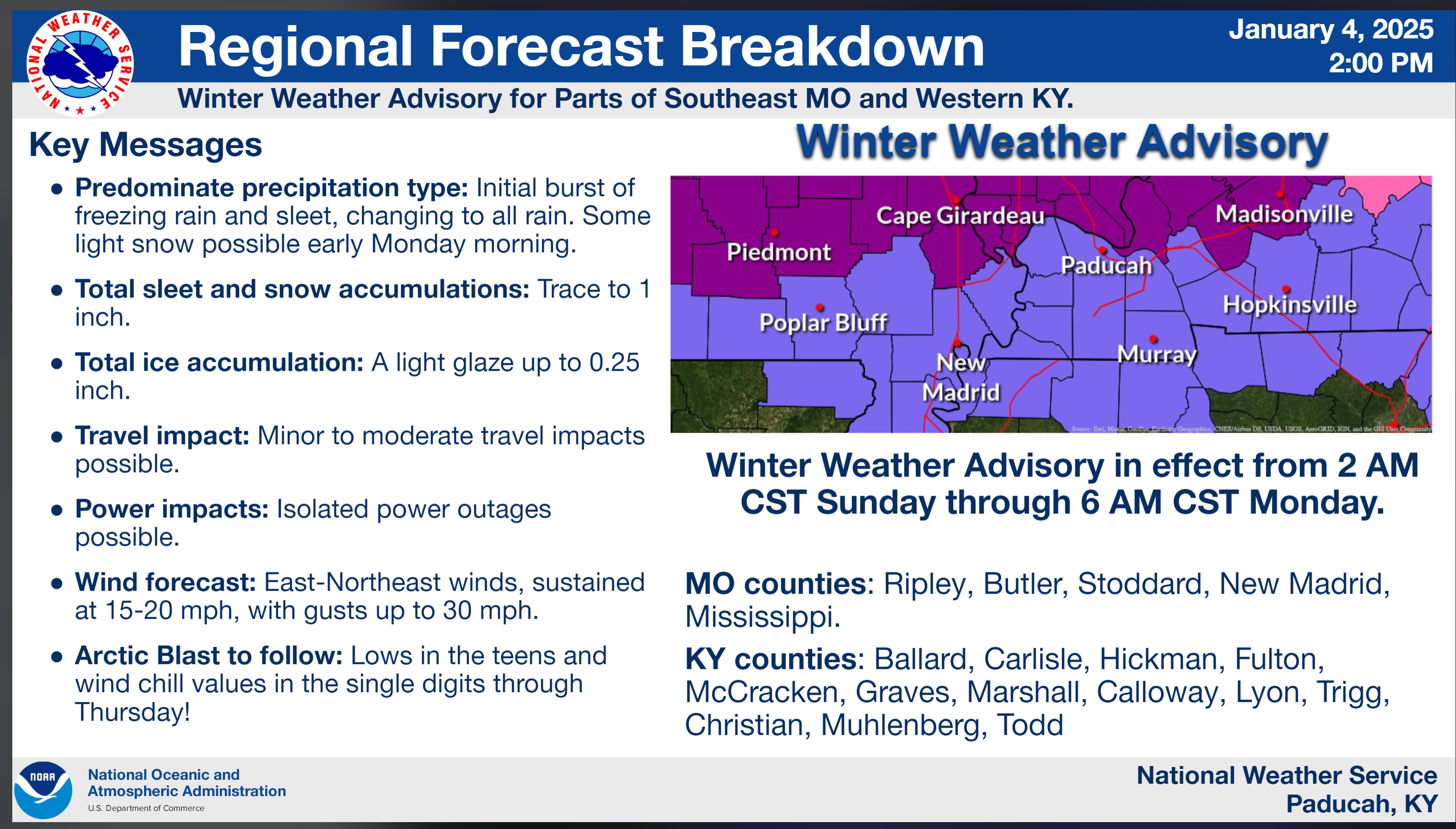
The only change the NWS made in the warning products was to extend the winter weather advisory into Monday.
All other warning products remain the same.
Fulton-Hickman-Carlisle-Ballard-McCracken-Graves-Marshall-
Calloway-Lyon-Trigg-Christian-Muhlenberg-Todd-Ripley-Butler-
Stoddard-Mississippi-New Madrid-
Including the cities of New Madrid, Benton, Hopkinsville,
Bloomfield, Mayfield, Hickman, Charleston, Wickliffe, Bardwell,
Eddyville, Greenville, Cadiz, Paducah, Murray, Clinton, Poplar
Bluff, Elkton, and Doniphan
131 PM CST Sat Jan 4 2025

...WINTER WEATHER ADVISORY NOW IN EFFECT FROM 2 AM SUNDAY TO 6 AM
CST MONDAY...

* WHAT...Mixed precipitation expected. Total snow and sleet
  accumulations up to one half inch and ice accumulations up to one
  quarter of an inch through Sunday morning. The heavier totals in
  the advisory area are expected to be along a line from Poplar
  Bluff, Missouri through Paducah to Greenville, Kentucky. Following
  an afternoon transition to rain, precipitation changes over to
  freezing drizzle Sunday night, with one last changeover to snow
  late in the night.

* WHERE...Portions of western Kentucky and southeast Missouri.

* WHEN...From 2 AM Sunday to 6 AM CST Monday.

* IMPACTS...Roads, and especially bridges and overpasses, will
  likely become slick and hazardous. Power outages and tree damage
  are likely due to the ice. Travel could be nearly impossible.
  Freezing drizzle Sunday night will be most hazardous on otherwise
  cleared surfaces and may present as black ice.

* ADDITIONAL DETAILS...An arctic blast will arrive Monday and last
  through most of the week. Wind chill values will drop into the
  single digits or below zero at times, which can be even more
  dangerous with any long duration power outages.

PRECAUTIONARY/PREPAREDNESS ACTIONS...

Slow down and use caution while traveling. The latest road
conditions can be obtained by visiting www.weather.gov/pah/roads

Be prepared for slippery roads. Slow down and use caution while
driving. If you are going outside, watch your first few steps taken
on stairs, sidewalks, and driveways. These surfaces could be icy and
slippery, increasing your risk of a fall and injury.
1:14 PM
I am waiting on the latest winter storm and ice storm warning products from the NWS.
Those will come out over the next two hours. We will see if they adjust everything.
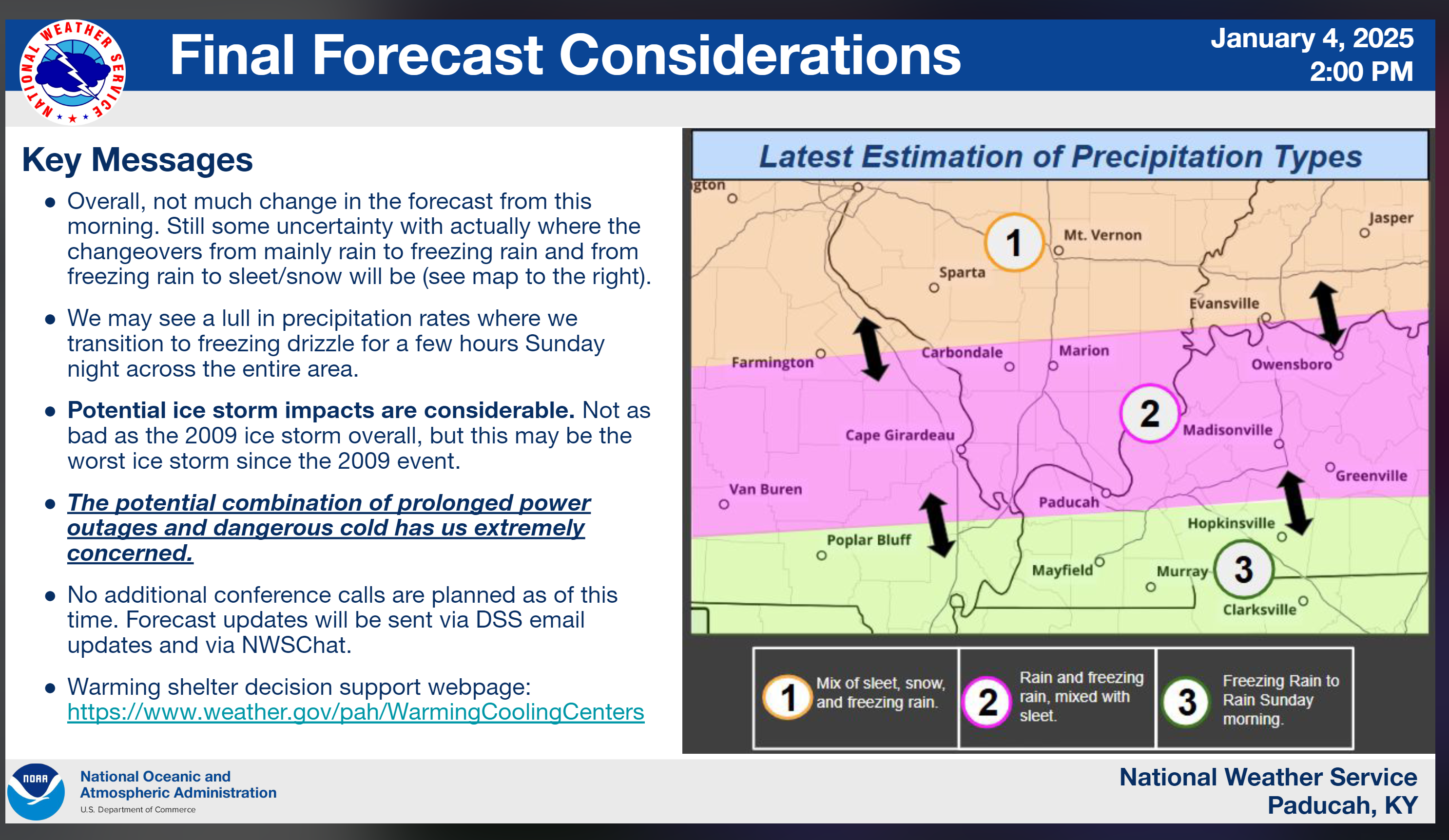
From what I can tell, everything looks about the same. There is still a 25 to 35 mile wide area that remains questionable for frozen vs pure rain.
That would be near the ice storm warning (southern part of it) into the winter weather advisory zone.
One or two degrees will make a big difference in impacts.
I will know more shortly.
Watch for fresh graphics and updates this afternoon into the evening.
.
11:45 AM
I am watching another winter storm later this weekend.
A bit early to know how it will play out, but it looks like a lot of snow for some areas.


