.
SCROLL DOWN THE PAGE FOR UPDATES
.
Click on the words below to subscribe
Storm Tracking Links
Interactive local city-view radars. Clickable watches and warnings.
https://wtalk.co/B3XHASFZ
Backup radar site in case the above one is not working.
https://weathertalk.com/morani
Regional Radar
https://imagery.weathertalk.com/prx/RadarLoop.mp4
*NEW* Zoom interactive radar (with storm chaser streams)
https://wtalk.co/AVWG7GM7
Real time lightning tracker system two.
https://map.blitzortung.org/#5.02/37.95/-86.99
Lightning Data (zoom in and out of your local area)
https://wtalk.co/WJ3SN5UZ
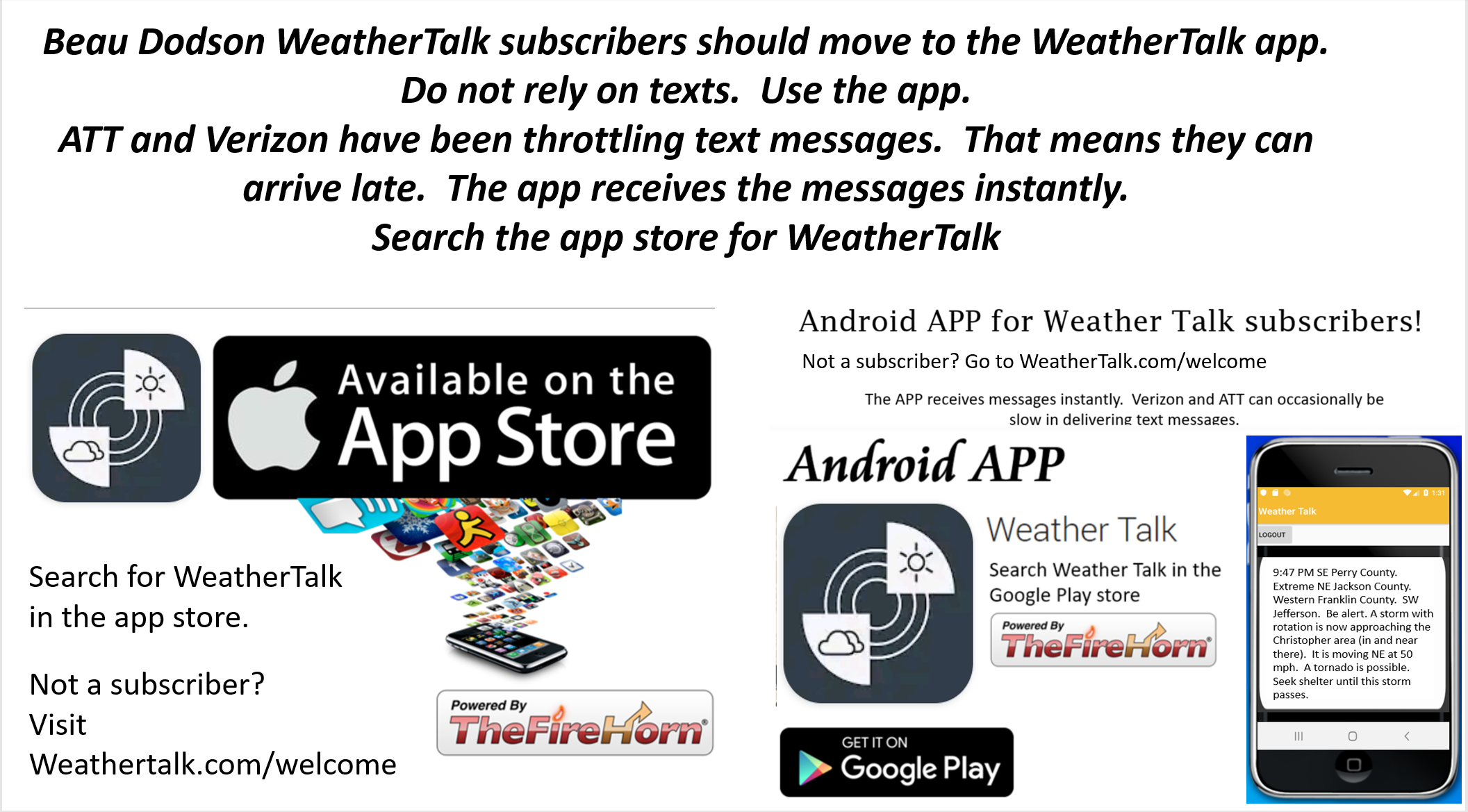
The app is for www.weathertalk.com subscribers. Subscriber first and then download the app.
Apple users click here. Android users click here.
What you need to know
Key Points
- Thunderstorms are likely today through Wednesday evening..
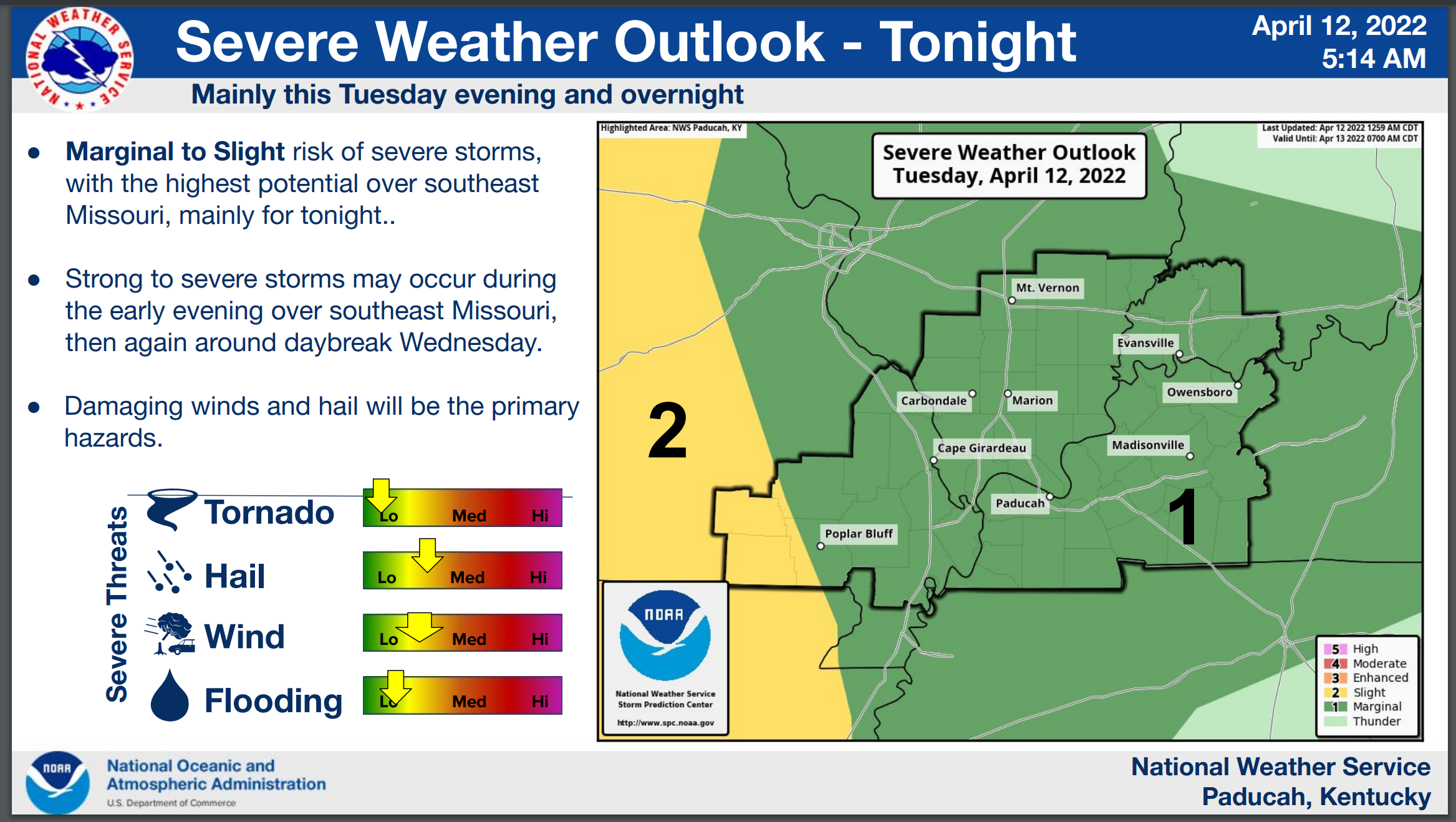
- A few storms are possible Tuesday (during the day). The overall severe risk is low during this time-frame. Tuesday night: Scattered thunderstorms will push into the region from Arkansas and Tennessee. Some of these storms could be severe with damaging wind and hail.
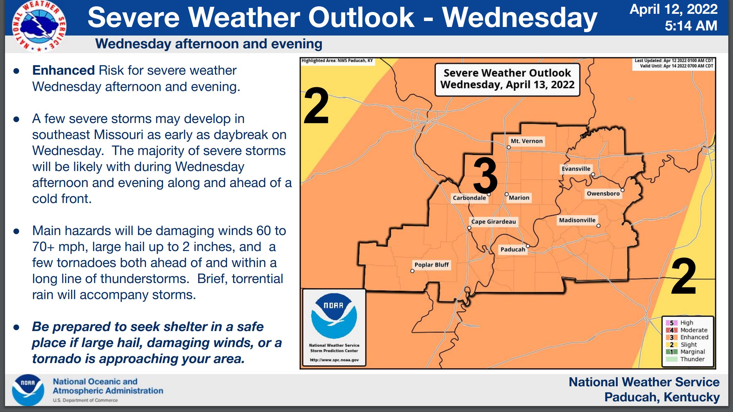
- Wednesday/Wednesday night: Severe thunderstorms appear likely, but there remain questions on whether morning thunderstorms will stabilize the atmosphere and prevent a greater outbreak event later in the day.
- Locally heavy rain is likely with these events. Some locations could top four inches of rain. This is most likely where thunderstorms train over the same areas.
- Have your Beau Dodson Weather app on. Check it. Make sure you have not logged out of the app.
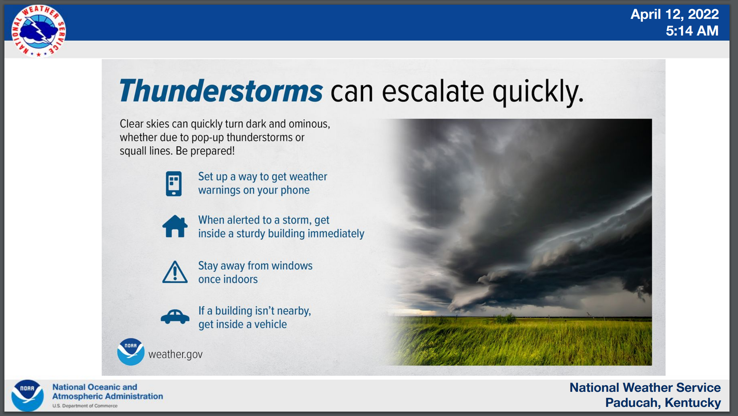
- Have THREE to FIVE ways of receiving your severe weather warnings.
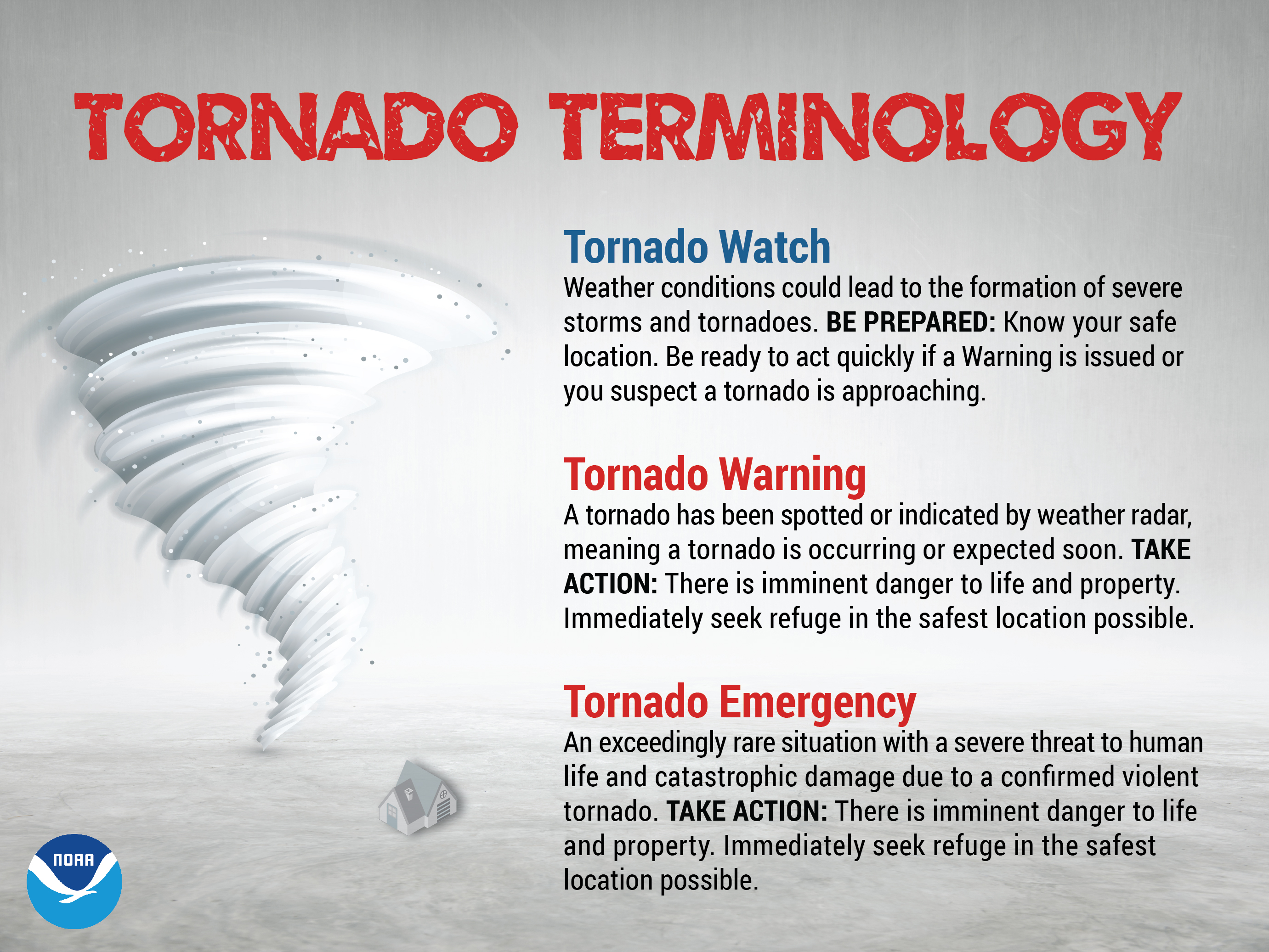
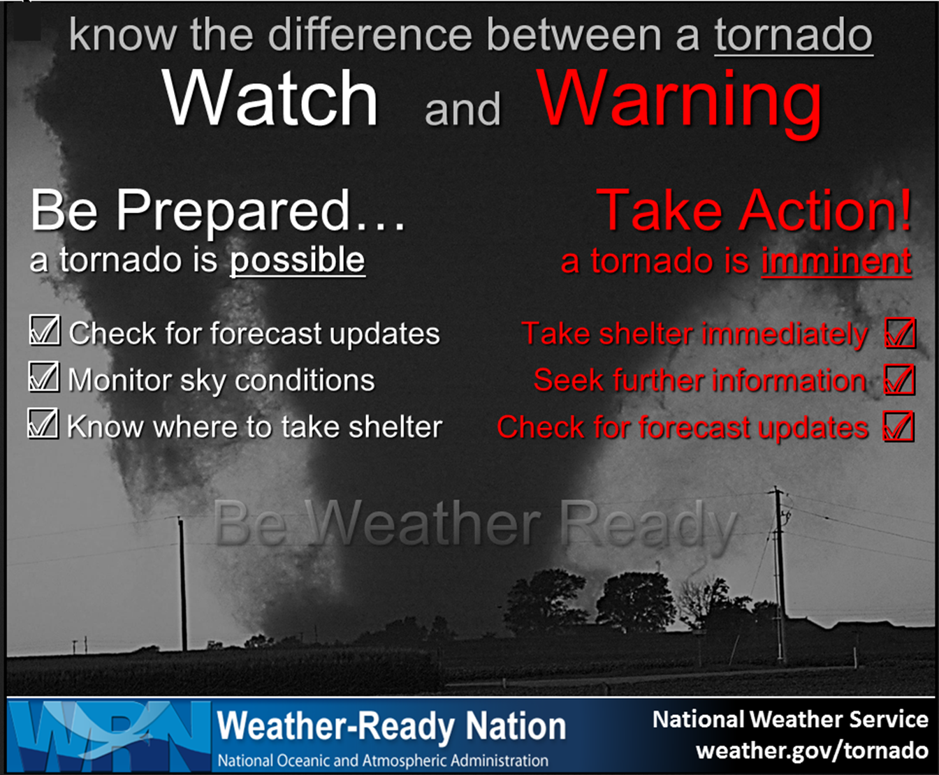
- Remember, a watch means to monitor updates. A warning means to seek shelter. A warning is a higher threat and means to seek shelter immediately. Severe weather may occur in or near your location.
.

Here is Facebooks’ Severe Weather Q&A threads.
Link https://www.facebook.com/beaudodsonweather
.
The latest blog updates will be posted here at the top of Beau’s severe weather blog.
.
Wednesday, April 13, 2022
.
April 13, 2022
6:09 PM
McLean and Muhlenberg Counties
Storms continue to race northeast through the county. They will soon exit off to the east.
The most intense storms were located over the eastern portion of the counties.
The severe threat will end in about ten minutes.
Just some rain after this line passes your area. No more severe concerns the rest of tonight.
.
.
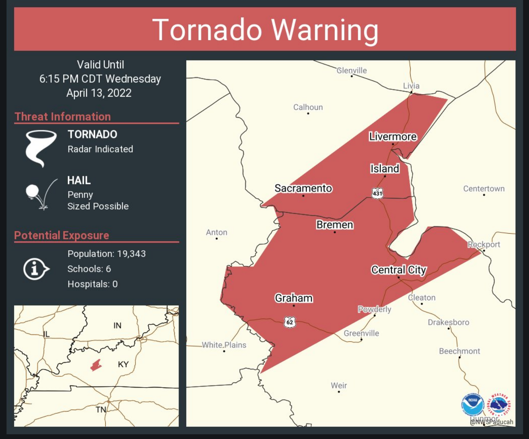
549 PM CDT WED APR 13 2022

...A TORNADO WARNING REMAINS IN EFFECT UNTIL 615 PM CDT FOR
MUHLENBERG COUNTY...

AT 548 PM CDT, A SEVERE SQUALL LINE CAPABLE OF PRODUCING BOTH
TORNADOES AND EXTENSIVE STRAIGHT LINE WIND DAMAGE WAS LOCATED OVER
WEIR, OR 13 MILES SOUTH OF CENTRAL CITY, MOVING NORTHEAST AT 50 MPH.

HAZARD...TORNADO.

SOURCE...RADAR INDICATED ROTATION.

IMPACT...FLYING DEBRIS WILL BE DANGEROUS TO THOSE CAUGHT WITHOUT
         SHELTER. MOBILE HOMES WILL BE DAMAGED OR DESTROYED. DAMAGE
         TO ROOFS, WINDOWS, AND VEHICLES WILL OCCUR.  TREE DAMAGE IS
         LIKELY.

LOCATIONS IMPACTED INCLUDE...
  POWDERLY, GREENVILLE AND DUNMOR.

THIS INCLUDES WESTERN KENTUCKY PARKWAY BETWEEN MILE MARKERS 58 AND
64.
.
TORNADO WARNING
NATIONAL WEATHER SERVICE PADUCAH KY
543 PM CDT WED APR 13 2022

THE NATIONAL WEATHER SERVICE IN PADUCAH HAS ISSUED A

* TORNADO WARNING FOR...
  NORTHWESTERN MUHLENBERG COUNTY IN SOUTH CENTRAL KENTUCKY...
  SOUTHEASTERN MCLEAN COUNTY IN NORTHWESTERN KENTUCKY...

* UNTIL 615 PM CDT.

* AT 542 PM CDT, A SEVERE THUNDERSTORM CAPABLE OF PRODUCING A TORNADO
  WAS LOCATED NEAR MADISONVILLE, MOVING NORTHEAST AT 65 MPH.

  HAZARD...TORNADO.

  SOURCE...RADAR INDICATED ROTATION.

  IMPACT...FLYING DEBRIS WILL BE DANGEROUS TO THOSE CAUGHT WITHOUT
           SHELTER. MOBILE HOMES WILL BE DAMAGED OR DESTROYED.
           DAMAGE TO ROOFS, WINDOWS, AND VEHICLES WILL OCCUR.  TREE
           DAMAGE IS LIKELY.

* THIS DANGEROUS STORM WILL BE NEAR...
  CENTRAL CITY AROUND 555 PM CDT.
  LIVERMORE AROUND 600 PM CDT.

THIS INCLUDES WESTERN KENTUCKY PARKWAY BETWEEN MILE MARKERS 44 AND
64.
.
Daviess County.
Storms are moving in from the southwest.
These storms have a history of high wind. There could be some pockets of 60 mph wind gusts.
Stay weather aware as these storms pass through your area.
.
TORNADO WARNING
NATIONAL WEATHER SERVICE PADUCAH KY
533 PM CDT WED APR 13 2022

THE NATIONAL WEATHER SERVICE IN PADUCAH HAS ISSUED A

* TORNADO WARNING FOR...
  MUHLENBERG COUNTY IN SOUTH CENTRAL KENTUCKY...
  NORTHEASTERN CHRISTIAN COUNTY IN SOUTH CENTRAL KENTUCKY...
  NORTHEASTERN TODD COUNTY IN SOUTH CENTRAL KENTUCKY...

* UNTIL 615 PM CDT.

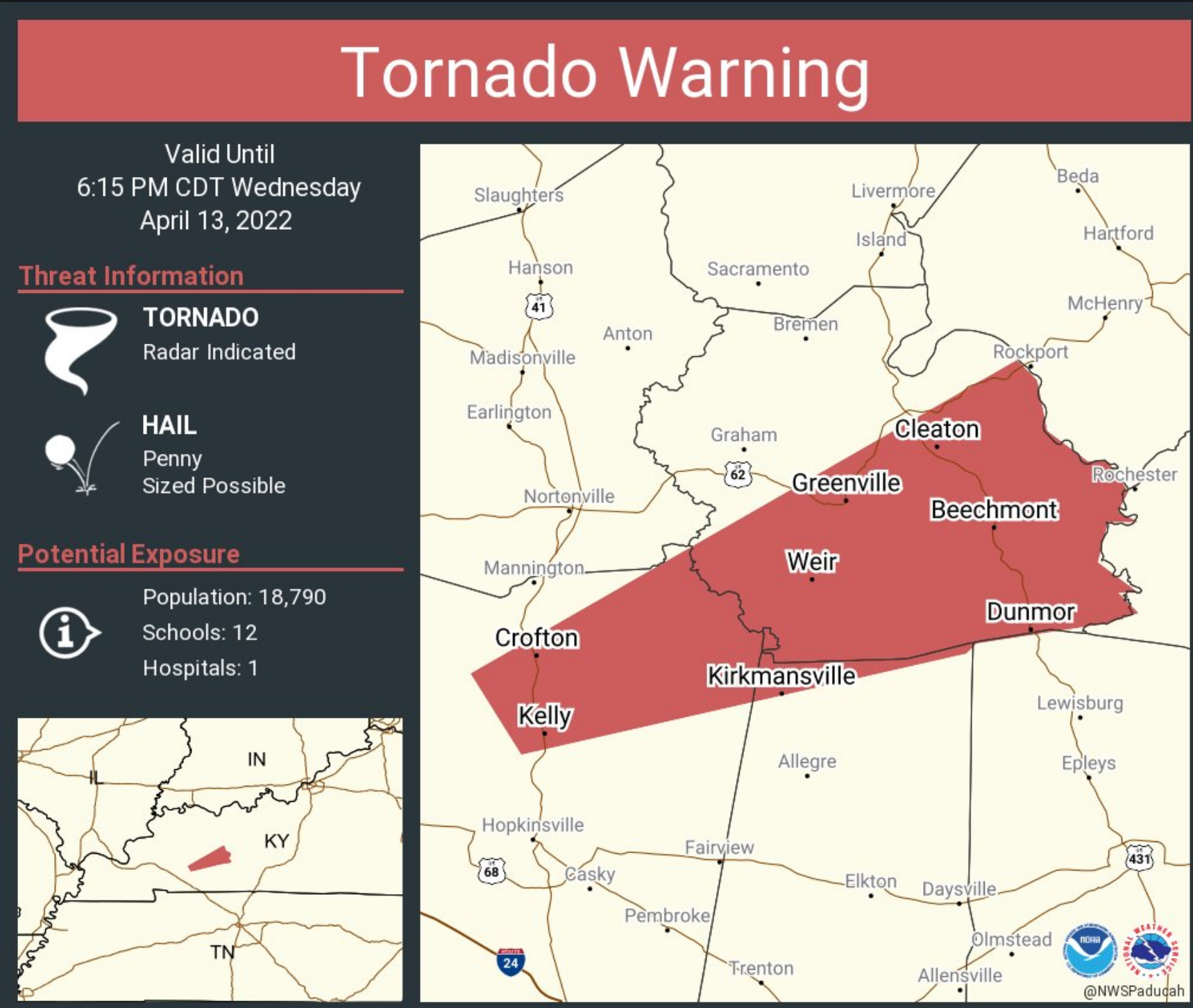
* AT 533 PM CDT, SEVERE THUNDERSTORMS CAPABLE OF PRODUCING BOTH
  TORNADOES AND EXTENSIVE STRAIGHT LINE WIND DAMAGE WERE LOCATED OVER
  CROFTON, OR 12 MILES NORTH OF HOPKINSVILLE, MOVING NORTHEAST AT 50
  MPH.

  HAZARD...TORNADO.

  SOURCE...RADAR INDICATED ROTATION.

  IMPACT...FLYING DEBRIS WILL BE DANGEROUS TO THOSE CAUGHT WITHOUT
           SHELTER. MOBILE HOMES WILL BE DAMAGED OR DESTROYED.
           DAMAGE TO ROOFS, WINDOWS, AND VEHICLES WILL OCCUR.  TREE
           DAMAGE IS LIKELY.

* THESE DANGEROUS STORMS WILL BE NEAR...
  WEIR AROUND 550 PM CDT.

OTHER LOCATIONS IN THE PATH OF THIS TORNADIC THUNDERSTORM INCLUDE
GREENVILLE, POWDERLY AND DUNMOR.

THIS INCLUDES THE FOLLOWING HIGHWAYS...
 WESTERN KENTUCKY PARKWAY BETWEEN MILE MARKERS 58 AND 65.
 PENNYRILE PARKWAY BETWEEN MILE MARKERS 17 AND 24.
.
April 13, 2022
5:32 PM
Tornado warning expired for Caldwell and Trigg Counties.
Continues for the areas below.
A TORNADO WARNING REMAINS IN EFFECT UNTIL 600 PM CDT FOR NORTH
CENTRAL CHRISTIAN AND SOUTHEASTERN HOPKINS COUNTIES…
AT 530 PM CDT, A SEVERE THUNDERSTORM CAPABLE OF PRODUCING A TORNADO
WAS LOCATED OVER NORTONVILLE, OR 10 MILES SOUTH OF MADISONVILLE,
MOVING NORTHEAST AT 60 MPH.
HAZARD…TORNADO.
SOURCE…RADAR INDICATED ROTATION.
IMPACT…FLYING DEBRIS WILL BE DANGEROUS TO THOSE CAUGHT WITHOUT
SHELTER. MOBILE HOMES WILL BE DAMAGED OR DESTROYED. DAMAGE
TO ROOFS, WINDOWS, AND VEHICLES WILL OCCUR. TREE DAMAGE IS
LIKELY.
THIS TORNADIC THUNDERSTORM WILL REMAIN OVER MAINLY RURAL AREAS OF
NORTH CENTRAL CHRISTIAN AND SOUTHEASTERN HOPKINS COUNTIES, INCLUDING
THE FOLLOWING LOCATIONS… ST. CHARLES AND WHITE PLAINS.
THIS INCLUDES THE FOLLOWING HIGHWAYS…
INTERSTATE 69 IN KENTUCKY BETWEEN MILE MARKERS 95 AND 113.
WESTERN KENTUCKY PARKWAY BETWEEN MILE MARKERS 39 AND 43.
PENNYRILE PARKWAY BETWEEN MILE MARKERS 24 AND 34.
.
Southern IL severe threat is over
Southeast MO severe threat is over
Far western KY – severe threat is over (west of the main line)
NW TN – severe threat is over except for Henry County
.
.
Flash Flood Warning for Caldwell, Christian, Hopkins, Lyon, Muhlenberg, Todd, Trigg [KY] till 8:00 PM CDT
.
BULLETIN - EAS ACTIVATION REQUESTED
TORNADO WARNING
NATIONAL WEATHER SERVICE PADUCAH KY
509 PM CDT WED APR 13 2022

THE NATIONAL WEATHER SERVICE IN PADUCAH HAS ISSUED A

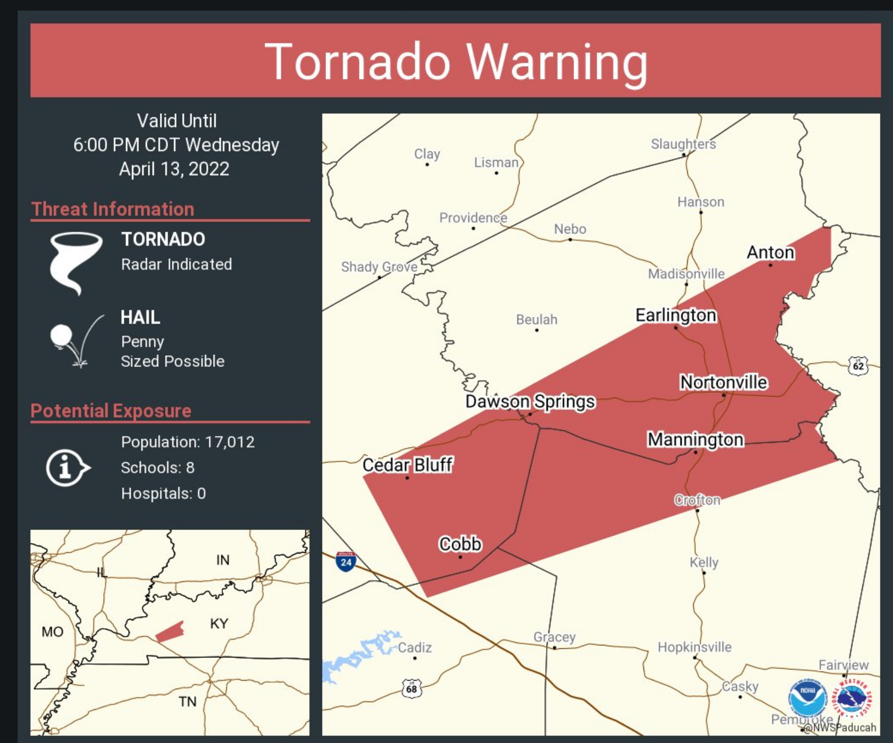
* TORNADO WARNING FOR...
  NORTHWESTERN CHRISTIAN COUNTY IN SOUTH CENTRAL KENTUCKY...
  SOUTHEASTERN CALDWELL COUNTY IN WESTERN KENTUCKY...
  NORTHERN TRIGG COUNTY IN WESTERN KENTUCKY...
  SOUTHEASTERN HOPKINS COUNTY IN NORTHWESTERN KENTUCKY...

* UNTIL 600 PM CDT.

* AT 508 PM CDT, A SEVERE THUNDERSTORM CAPABLE OF PRODUCING A TORNADO
  WAS LOCATED NEAR COBB, OR 7 MILES SOUTH OF PRINCETON, MOVING
  NORTHEAST AT 55 MPH.

  HAZARD...TORNADO.

  SOURCE...RADAR INDICATED ROTATION.

  IMPACT...FLYING DEBRIS WILL BE DANGEROUS TO THOSE CAUGHT WITHOUT
           SHELTER. MOBILE HOMES WILL BE DAMAGED OR DESTROYED.
           DAMAGE TO ROOFS, WINDOWS, AND VEHICLES WILL OCCUR.  TREE
           DAMAGE IS LIKELY.

* THIS DANGEROUS STORM WILL BE NEAR...
  DAWSON SPRINGS AROUND 525 PM CDT.

OTHER LOCATIONS IN THE PATH OF THIS TORNADIC THUNDERSTORM INCLUDE
CROFTON, NORTONVILLE, EARLINGTON AND MORTONS GAP.

THIS INCLUDES THE FOLLOWING HIGHWAYS...
 INTERSTATE 69 IN KENTUCKY BETWEEN MILE MARKERS 87 AND 113.
 WESTERN KENTUCKY PARKWAY BETWEEN MILE MARKERS 39 AND 43.
 PENNYRILE PARKWAY BETWEEN MILE MARKERS 24 AND 34.
.
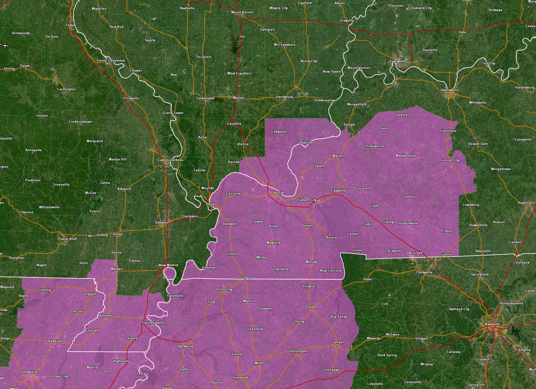
SEVERE THUNDERSTORM WARNING
NATIONAL WEATHER SERVICE PADUCAH KY
504 PM CDT WED APR 13 2022

THE NATIONAL WEATHER SERVICE IN PADUCAH HAS ISSUED A

* SEVERE THUNDERSTORM WARNING FOR...
  MUHLENBERG COUNTY IN SOUTH CENTRAL KENTUCKY...
  EAST CENTRAL CRITTENDEN COUNTY IN WESTERN KENTUCKY...
  CHRISTIAN COUNTY IN SOUTH CENTRAL KENTUCKY...
  CALDWELL COUNTY IN WESTERN KENTUCKY...
  MCLEAN COUNTY IN NORTHWESTERN KENTUCKY...
  TRIGG COUNTY IN WESTERN KENTUCKY...
  HOPKINS COUNTY IN NORTHWESTERN KENTUCKY...
  TODD COUNTY IN SOUTH CENTRAL KENTUCKY...
  WEBSTER COUNTY IN NORTHWESTERN KENTUCKY...
  EASTERN LYON COUNTY IN WESTERN KENTUCKY...

* UNTIL 600 PM CDT.

* AT 503 PM CDT, SEVERE THUNDERSTORMS WERE LOCATED ALONG A LINE
  EXTENDING FROM FARMERSVILLE TO 7 MILES NORTHWEST OF CADIZ TO NEAR
  CANTON, MOVING NORTHEAST AT 65 MPH.

  HAZARD...70 MPH WIND GUSTS AND NICKEL SIZE HAIL.

  SOURCE...RADAR INDICATED.

  IMPACT...EXPECT CONSIDERABLE TREE DAMAGE. DAMAGE IS LIKELY TO
           MOBILE HOMES, ROOFS, AND OUTBUILDINGS.

* SEVERE THUNDERSTORMS WILL BE NEAR...
  COBB, OLNEY AND CRESWELL AROUND 510 PM CDT.
  PROVIDENCE AROUND 520 PM CDT.

OTHER LOCATIONS IN THE PATH OF THESE SEVERE THUNDERSTORMS INCLUDE
HOPKINSVILLE, MADISONVILLE, EARLINGTON, CROFTON, NORTONVILLE, MORTONS
GAP, GRAHAM, WEIR, CENTRAL CITY, CALHOUN, POWDERLY, GREENVILLE,
LIVERMORE AND DUNMOR.

THIS INCLUDES THE FOLLOWING HIGHWAYS...
 INTERSTATE 24 IN KENTUCKY BETWEEN MILE MARKERS 46 AND 92.
 INTERSTATE 69 IN KENTUCKY BETWEEN MILE MARKERS 73 AND 138.
 WESTERN KENTUCKY PARKWAY BETWEEN MILE MARKERS 39 AND 65.
 PENNYRILE PARKWAY BETWEEN MILE MARKERS 1 AND 34.
.
.
5 PM
The severe weather threat has ended for Graves, Marshall, and Calloway Counties.
We still have some thunderstorms in the area. Just some heavy rain and lightning. That is the only concern now.
.
4:58 PM
Rotating increasing just west of Rockcastle in Trigg County.
.
4:57 PM
Lyon, Caldwell, Hopkins, Muhlenberg, Trigg, Christian, and Todd Counties
A line of storms continues to race northeast at 70 mph.
Some of these storms are producing 80 mph wind gusts. Short-lived tornadoes are also possible.
Seek shelter if you are in the path of these storms.
.
4:47 PM
THE NATIONAL WEATHER SERVICE IN PADUCAH HAS ISSUED A

* TORNADO WARNING FOR...
  TRIGG COUNTY IN WESTERN KENTUCKY...

* UNTIL 515 PM CDT.

* AT 444 PM CDT, SEVERE THUNDERSTORMS CAPABLE OF PRODUCING BOTH
  TORNADOES AND EXTENSIVE STRAIGHT LINE WIND DAMAGE WERE LOCATED
  ALONG A LINE EXTENDING FROM 8 MILES SOUTHEAST OF BENTON TO 7 MILES
  SOUTHEAST OF MURRAY, MOVING EAST AT 65 MPH.

  HAZARD...TORNADO.

  SOURCE...RADAR INDICATED ROTATION.

  IMPACT...FLYING DEBRIS WILL BE DANGEROUS TO THOSE CAUGHT WITHOUT
           SHELTER. MOBILE HOMES WILL BE DAMAGED OR DESTROYED.
           DAMAGE TO ROOFS, WINDOWS, AND VEHICLES WILL OCCUR.  TREE
           DAMAGE IS LIKELY.

* THESE DANGEROUS STORMS WILL BE NEAR...
  LAND BETWEEN THE LAKES AREA AROUND 450 PM CDT.
  CANTON AROUND 455 PM CDT.

OTHER LOCATIONS IN THE PATH OF THESE TORNADIC STORMS INCLUDE CADIZ.

THIS INCLUDES INTERSTATE 24 IN KENTUCKY BETWEEN MILE MARKERS 58 AND
70.
.
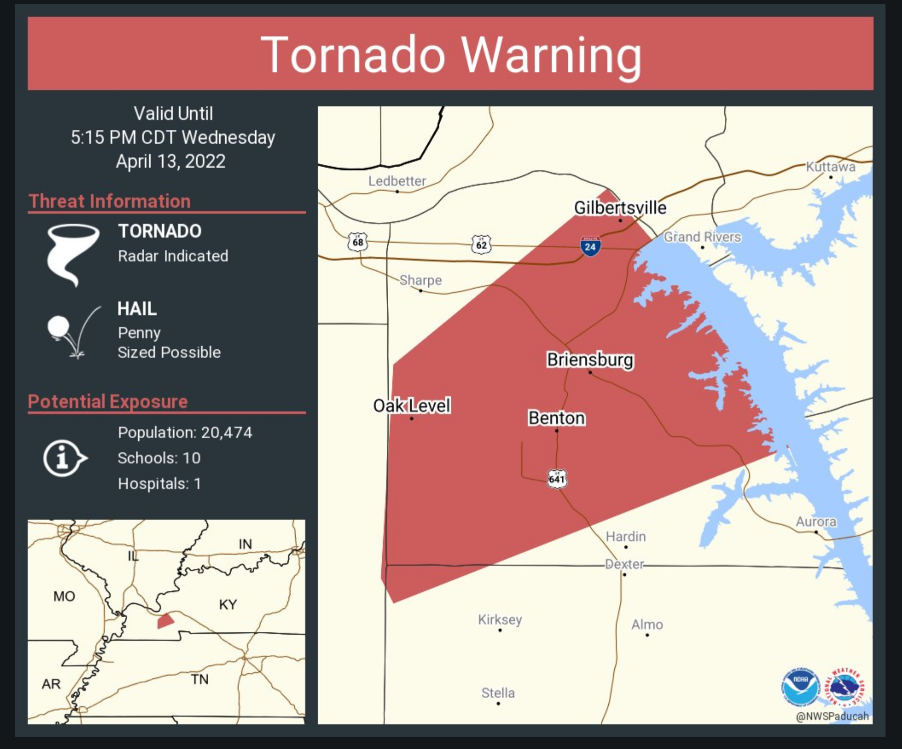
THE NATIONAL WEATHER SERVICE IN PADUCAH HAS ISSUED A

* TORNADO WARNING FOR...
  SOUTHERN CALDWELL COUNTY IN WESTERN KENTUCKY...
  LYON COUNTY IN WESTERN KENTUCKY...

* UNTIL 515 PM CDT.

* AT 445 PM CDT, A SEVERE THUNDERSTORM CAPABLE OF PRODUCING A TORNADO
  WAS LOCATED 7 MILES NORTHEAST OF BENTON, MOVING NORTHEAST AT 60
  MPH.

  HAZARD...TORNADO.

  SOURCE...RADAR INDICATED ROTATION.

  IMPACT...FLYING DEBRIS WILL BE DANGEROUS TO THOSE CAUGHT WITHOUT
           SHELTER. MOBILE HOMES WILL BE DAMAGED OR DESTROYED.
           DAMAGE TO ROOFS, WINDOWS, AND VEHICLES WILL OCCUR.  TREE
           DAMAGE IS LIKELY.

* THIS DANGEROUS STORM WILL BE NEAR...
  EDDYVILLE AROUND 500 PM CDT.

OTHER LOCATIONS IN THE PATH OF THIS TORNADIC THUNDERSTORM INCLUDE
PRINCETON.

THIS INCLUDES THE FOLLOWING HIGHWAYS...
 INTERSTATE 24 IN KENTUCKY BETWEEN MILE MARKERS 40 AND 57.
 INTERSTATE 69 IN KENTUCKY BETWEEN MILE MARKERS 68 AND 83.
.
4:42 PM
Southern Livingston, Marshall, and Lyon Counties
A tornado is possible, at this time, near or north of Benton, Kentucky.
This storm is moving northeast at 70 mph.
Seek shelter now.
.
Updated tornado warning
.
BULLETIN - EAS ACTIVATION REQUESTED
TORNADO WARNING
NATIONAL WEATHER SERVICE PADUCAH KY
428 PM CDT WED APR 13 2022

THE NATIONAL WEATHER SERVICE IN PADUCAH HAS ISSUED A

* TORNADO WARNING FOR...
  CALLOWAY COUNTY IN WESTERN KENTUCKY...
  SOUTHEASTERN MARSHALL COUNTY IN WESTERN KENTUCKY...

* UNTIL 500 PM CDT.

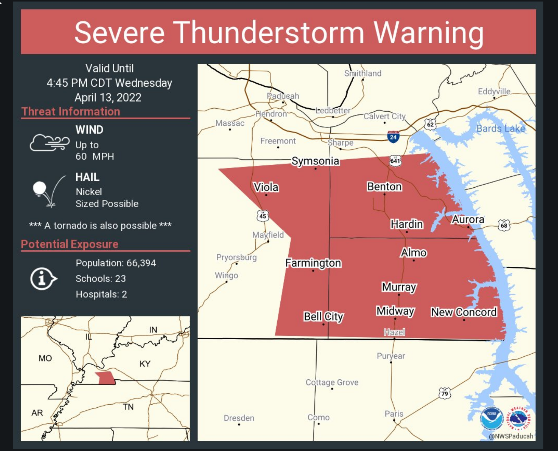
* AT 428 PM CDT, SEVERE THUNDERSTORMS CAPABLE OF PRODUCING BOTH
  TORNADOES AND EXTENSIVE STRAIGHT LINE WIND DAMAGE WERE LOCATED
  ALONG A LINE EXTENDING FROM 8 MILES SOUTHWEST OF BENTON TO 7 MILES
  SOUTHEAST OF LYNNVILLE, MOVING EAST AT 75 MPH.

  HAZARD...TORNADO.

  SOURCE...RADAR INDICATED ROTATION.

  IMPACT...FLYING DEBRIS WILL BE DANGEROUS TO THOSE CAUGHT WITHOUT
           SHELTER. MOBILE HOMES WILL BE DAMAGED OR DESTROYED.
           DAMAGE TO ROOFS, WINDOWS, AND VEHICLES WILL OCCUR.  TREE
           DAMAGE IS LIKELY.

* THESE TORNADIC STORMS WILL REMAIN OVER MAINLY RURAL AREAS OF
  CALLOWAY AND SOUTHEASTERN MARSHALL COUNTIES, INCLUDING THE
  FOLLOWING LOCATIONS... AURORA, NEW CONCORD, HARDIN, KIRKSEY, HARRIS
  GROVE, HAZEL AND CROSSLAND.

PRECAUTIONARY/PREPAREDNESS ACTIONS...

TAKE COVER NOW! MOVE TO A BASEMENT OR AN INTERIOR ROOM ON THE LOWEST
FLOOR OF A STURDY BUILDING. AVOID WINDOWS. IF YOU ARE OUTDOORS, IN A
MOBILE HOME, OR IN A VEHICLE, MOVE TO THE CLOSEST SUBSTANTIAL SHELTER
AND PROTECT YOURSELF FROM FLYING DEBRIS.

&&
.
4:30 PM
TORNADO WARNING
NATIONAL WEATHER SERVICE PADUCAH KY
428 PM CDT WED APR 13 2022

THE NATIONAL WEATHER SERVICE IN PADUCAH HAS ISSUED A

* TORNADO WARNING FOR...
  CALLOWAY COUNTY IN WESTERN KENTUCKY...
  SOUTHEASTERN MARSHALL COUNTY IN WESTERN KENTUCKY...

* UNTIL 500 PM CDT.

* AT 428 PM CDT, SEVERE THUNDERSTORMS CAPABLE OF PRODUCING BOTH
  TORNADOES AND EXTENSIVE STRAIGHT LINE WIND DAMAGE WERE LOCATED
  ALONG A LINE EXTENDING FROM 8 MILES SOUTHWEST OF BENTON TO 7 MILES
  SOUTHEAST OF LYNNVILLE, MOVING EAST AT 75 MPH.

  HAZARD...TORNADO.

  SOURCE...RADAR INDICATED ROTATION.

  IMPACT...FLYING DEBRIS WILL BE DANGEROUS TO THOSE CAUGHT WITHOUT
           SHELTER. MOBILE HOMES WILL BE DAMAGED OR DESTROYED.
           DAMAGE TO ROOFS, WINDOWS, AND VEHICLES WILL OCCUR.  TREE
           DAMAGE IS LIKELY.

* THESE TORNADIC STORMS WILL REMAIN OVER MAINLY RURAL AREAS OF
  CALLOWAY AND SOUTHEASTERN MARSHALL COUNTIES, INCLUDING THE
  FOLLOWING LOCATIONS... AURORA, NEW CONCORD, HARDIN, KIRKSEY, HARRIS
  GROVE, HAZEL AND CROSSLAND.
.
4:29 PM
TORNADO WARNING
NATIONAL WEATHER SERVICE PADUCAH KY
427 PM CDT WED APR 13 2022

THE NATIONAL WEATHER SERVICE IN PADUCAH HAS ISSUED A

* TORNADO WARNING FOR...
  NORTHWESTERN CALLOWAY COUNTY IN WESTERN KENTUCKY...
  MARSHALL COUNTY IN WESTERN KENTUCKY...
  NORTHEASTERN GRAVES COUNTY IN WESTERN KENTUCKY...

* UNTIL 515 PM CDT.

* AT 427 PM CDT, A SEVERE THUNDERSTORM CAPABLE OF PRODUCING A TORNADO
  WAS LOCATED NEAR MAYFIELD, MOVING NORTHEAST AT 50 MPH.

  HAZARD...TORNADO.

  SOURCE...RADAR INDICATED ROTATION.

  IMPACT...FLYING DEBRIS WILL BE DANGEROUS TO THOSE CAUGHT WITHOUT
           SHELTER. MOBILE HOMES WILL BE DAMAGED OR DESTROYED.
           DAMAGE TO ROOFS, WINDOWS, AND VEHICLES WILL OCCUR.  TREE
           DAMAGE IS LIKELY.

* THIS DANGEROUS STORM WILL BE NEAR...
  BENTON AROUND 440 PM CDT.

OTHER LOCATIONS IN THE PATH OF THIS TORNADIC THUNDERSTORM INCLUDE
CALVERT CITY.

THIS INCLUDES THE FOLLOWING HIGHWAYS...
 INTERSTATE 24 IN KENTUCKY BETWEEN MILE MARKERS 22 AND 29.
 INTERSTATE 69 IN KENTUCKY BETWEEN MILE MARKERS 24 AND 51.
4:28 PM
Graves and Marshall Counties
Circulation has tightened up a bit north of Mayfield, KY. This storm is moving northeast at 70 MPH.
Those northeast of there should seek shelter now.
A tornado is possible.
.
4:25 P
.
4:19 PM
April 13, 2022
4:19 PM
Graves County
415 PM CDT WED APR 13 2022
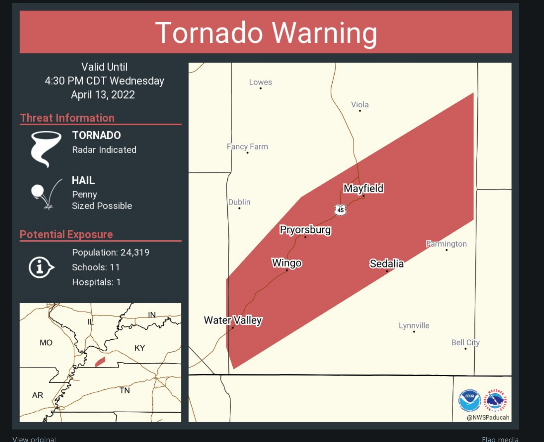
A TORNADO WARNING REMAINS IN EFFECT UNTIL 430 PM CDT FOR CENTRAL
GRAVES COUNTY
AT 414 PM CDT, A SEVERE THUNDERSTORM CAPABLE OF PRODUCING A TORNADO
WAS LOCATED NEAR SEDALIA, OR 9 MILES SOUTHWEST OF MAYFIELD, MOVING
NORTHEAST AT 80 MPH.
HAZARD…TORNADO.
SOURCE…RADAR INDICATED ROTATION.
IMPACT…FLYING DEBRIS WILL BE DANGEROUS TO THOSE CAUGHT WITHOUT
SHELTER. MOBILE HOMES WILL BE DAMAGED OR DESTROYED. DAMAGE
TO ROOFS, WINDOWS, AND VEHICLES WILL OCCUR. TREE DAMAGE IS
LIKELY.
THIS DANGEROUS STORM WILL BE NEAR…
MAYFIELD AROUND 420 PM CDT.
THIS INCLUDES INTERSTATE 69 IN KENTUCKY BETWEEN MILE MARKERS 9 AND
33.
.
4:17 PM
April 13, 2022
4:17 PM
Carlisle, Fulton, Hickman, and Graves Counties
Storms are rapidly moving northeast at 70 mph.
There have been some very small areas of rotation embedded within the line of storms. We call these QLCS tornadoes. They can be short-lived and rather small in size.
The tornado warning has been issued because of these small circulations.
The primary area of concern is now in Graves County.
Stay sheltered until the storm passes.
Radar
https://weatherobservatory.com/radar_paducah.htm
.
4:10 PM
.
4:05 PM
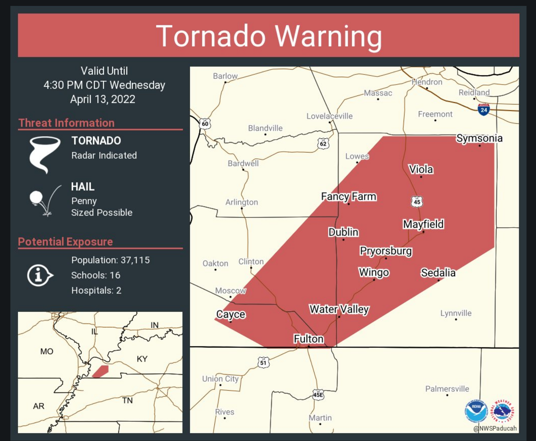
TORNADO WARNING
NATIONAL WEATHER SERVICE PADUCAH KY
404 PM CDT WED APR 13 2022

THE NATIONAL WEATHER SERVICE IN PADUCAH HAS ISSUED A

* TORNADO WARNING FOR...
  SOUTHEASTERN FULTON COUNTY IN WESTERN KENTUCKY...
  EASTERN HICKMAN COUNTY IN WESTERN KENTUCKY...
  SOUTHEASTERN CARLISLE COUNTY IN WESTERN KENTUCKY...
  GRAVES COUNTY IN WESTERN KENTUCKY...

* UNTIL 430 PM CDT.

* AT 404 PM CDT, A SEVERE THUNDERSTORM CAPABLE OF PRODUCING A TORNADO
  WAS LOCATED NEAR FULTON, MOVING NORTHEAST AT 70 MPH.

  HAZARD...TORNADO.

  SOURCE...RADAR INDICATED ROTATION.

  IMPACT...FLYING DEBRIS WILL BE DANGEROUS TO THOSE CAUGHT WITHOUT
           SHELTER. MOBILE HOMES WILL BE DAMAGED OR DESTROYED.
           DAMAGE TO ROOFS, WINDOWS, AND VEHICLES WILL OCCUR.  TREE
           DAMAGE IS LIKELY.

* THIS DANGEROUS STORM WILL BE NEAR...
  SEDALIA AROUND 415 PM CDT.
  MAYFIELD AROUND 420 PM CDT.

THIS INCLUDES INTERSTATE 69 IN KENTUCKY BETWEEN MILE MARKERS 1 AND
33.
.
4:03 PM
.
4 PM
Tornado warnings have expired in western KY. There are still some severe thunderstorm warnings in west KY. Additional tornado warnings are possible. Stay alert.
These are QLCS tornado warnings. That means they are short-lived spin-ups that can rapidly form and dissipate.
The severe thunderstorms can produce winds in excess of 60 mph. Hail is also possible.
Stay weather aware. If you feel threatened by a storm, then seek shelter.
.
3:58 PM
.
3:55 PM
The tornado warnings have expired for the Bootheel and northwest Tennessee.
Severe thunderstorms continue, however, and could still produce damaging wind and a few reports of hail.
It is possible that additional short-lived spin-ups could develop. Stay weather aware as storms move through the area.
Radars
https://weatherobservatory.com/radar_paducah.htm
.
3:53 PM
BULLETIN - IMMEDIATE BROADCAST REQUESTED
SEVERE THUNDERSTORM WARNING
NATIONAL WEATHER SERVICE PADUCAH KY
349 PM CDT WED APR 13 2022

THE NATIONAL WEATHER SERVICE IN PADUCAH HAS ISSUED A

* SEVERE THUNDERSTORM WARNING FOR...
  FULTON COUNTY IN WESTERN KENTUCKY...
  CALLOWAY COUNTY IN WESTERN KENTUCKY...
  MARSHALL COUNTY IN WESTERN KENTUCKY...
  HICKMAN COUNTY IN WESTERN KENTUCKY...
  CARLISLE COUNTY IN WESTERN KENTUCKY...
  GRAVES COUNTY IN WESTERN KENTUCKY...
  SOUTHEASTERN MISSISSIPPI COUNTY IN SOUTHEASTERN MISSOURI...

* UNTIL 445 PM CDT.

* AT 349 PM CDT, SEVERE THUNDERSTORMS WERE LOCATED ALONG A LINE
  EXTENDING FROM NEAR TOWOSAHGY STATE HISTORIC SITE TO NEAR HICKMAN
  TO NEAR NEWBERN, MOVING EAST AT 60 MPH.

  HAZARD...60 MPH WIND GUSTS AND NICKEL SIZE HAIL.

  SOURCE...RADAR INDICATED.

  IMPACT...EXPECT DAMAGE TO ROOFS, SIDING, AND TREES.

* SEVERE THUNDERSTORMS WILL BE NEAR...
  CAYCE AROUND 355 PM CDT.
  CLINTON AROUND 400 PM CDT.
  FULTON, BARDWELL AND FULGHAM AROUND 405 PM CDT.

OTHER LOCATIONS IN THE PATH OF THESE SEVERE THUNDERSTORMS INCLUDE
MAYFIELD, SEDALIA, LYNNVILLE AND MURRAY.

THIS INCLUDES INTERSTATE 69 IN KENTUCKY BETWEEN MILE MARKERS 1 AND
48.
.
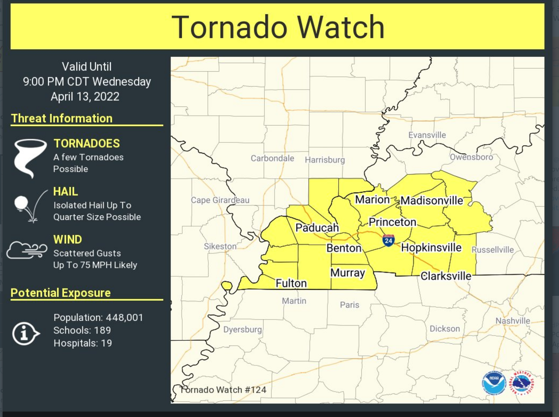
Tornado watch
.
3:44 PM
Weakley, Henry, Calloway, and Trigg Counties
Thunderstorms are moving through northwest Tennessee. Some of these storms have increased in intensity.
They are moving northeast at 60 mph.
Some of the storms could produce damaging wind, hail, and short-lived tornadoes.
There is a tornado watch in effect for the area. That means conditions are favorable for tornadoes.
If a tornado warning is issued then seek shelter.
Turn on local media for wall to wall coverage.
Radars
https://weatherobservatory.com/radar_paducah.htm
,
3:41 PM
.
3:40 PM
TORNADO WARNING
NATIONAL WEATHER SERVICE PADUCAH KY
338 PM CDT WED APR 13 2022

THE NATIONAL WEATHER SERVICE IN PADUCAH HAS ISSUED A

* TORNADO WARNING FOR...
  CENTRAL FULTON COUNTY IN WESTERN KENTUCKY...
  HICKMAN COUNTY IN WESTERN KENTUCKY...
  SOUTHWESTERN CARLISLE COUNTY IN WESTERN KENTUCKY...
  SOUTHEASTERN MISSISSIPPI COUNTY IN SOUTHEASTERN MISSOURI...

* UNTIL 415 PM CDT.

* AT 337 PM CDT, A SEVERE THUNDERSTORM CAPABLE OF PRODUCING A TORNADO
  WAS LOCATED 7 MILES WEST OF CLAYTON, OR 9 MILES NORTH OF REELFOOT
  LAKE STATE PARK, MOVING NORTHEAST AT 70 MPH.

  HAZARD...TORNADO.

  SOURCE...RADAR INDICATED ROTATION.

  IMPACT...FLYING DEBRIS WILL BE DANGEROUS TO THOSE CAUGHT WITHOUT
           SHELTER. MOBILE HOMES WILL BE DAMAGED OR DESTROYED.
           DAMAGE TO ROOFS, WINDOWS, AND VEHICLES WILL OCCUR.  TREE
           DAMAGE IS LIKELY.

* THIS DANGEROUS STORM WILL BE NEAR...
  HICKMAN, BIG OAK TREE STATE PARK AND DORENA AROUND 345 PM CDT.
  TOWOSAHGY STATE HISTORIC SITE AROUND 350 PM CDT.
  CLINTON AROUND 355 PM CDT.
.
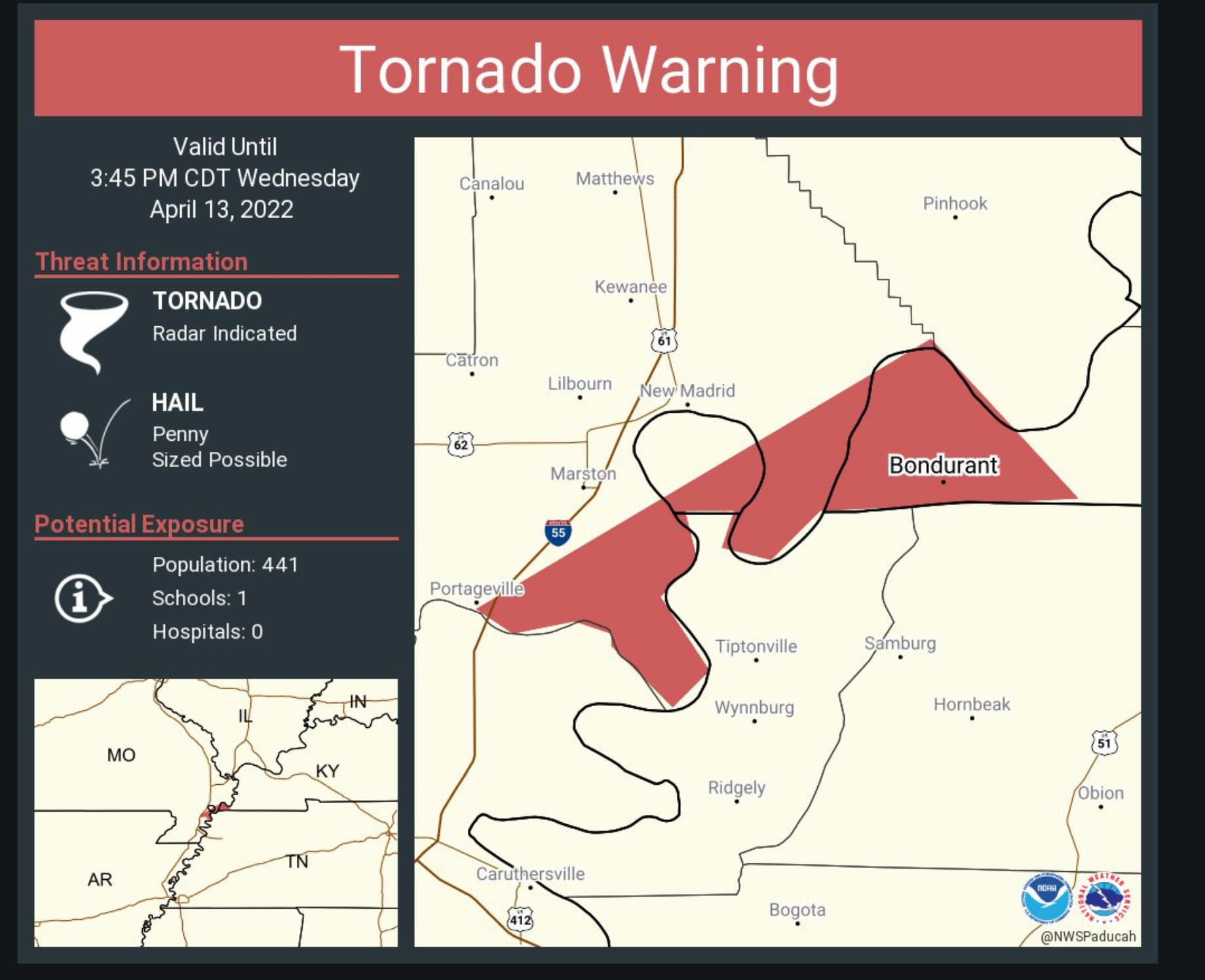
3;37 PM
NATIONAL WEATHER SERVICE PADUCAH KY
335 PM CDT WED APR 13 2022

KYC075-MOC143-132045-
/O.CON.KPAH.TO.W.0015.000000T0000Z-220413T2045Z/
FULTON KY-NEW MADRID MO-
335 PM CDT WED APR 13 2022

...A TORNADO WARNING REMAINS IN EFFECT UNTIL 345 PM CDT FOR WESTERN
FULTON AND SOUTHEASTERN NEW MADRID COUNTIES...

AT 335 PM CDT, A SEVERE THUNDERSTORM CAPABLE OF PRODUCING A TORNADO
WAS LOCATED NEAR TIPTONVILLE, OR NEAR REELFOOT LAKE STATE PARK,
MOVING NORTHEAST AT 70 MPH.

HAZARD...TORNADO.

SOURCE...RADAR INDICATED ROTATION.

IMPACT...FLYING DEBRIS WILL BE DANGEROUS TO THOSE CAUGHT WITHOUT
         SHELTER. MOBILE HOMES WILL BE DAMAGED OR DESTROYED. DAMAGE
         TO ROOFS, WINDOWS, AND VEHICLES WILL OCCUR.  TREE DAMAGE IS
         LIKELY.

LOCATIONS IMPACTED INCLUDE...
BOUNDURANT.

THIS INCLUDES INTERSTATE 55 NEAR MILE MARKER 33.

PRECAUTIONARY/PREPAREDNESS ACTIONS...

TAKE COVER NOW! MOVE TO A BASEMENT OR AN INTERIOR ROOM ON THE LOWEST
FLOOR OF A STURDY BUILDING. AVOID WINDOWS. IF YOU ARE OUTDOORS, IN A
MOBILE HOME, OR IN A VEHICLE, MOVE TO THE CLOSEST SUBSTANTIAL SHELTER
AND PROTECT YOURSELF FROM FLYING DEBRIS.
.
3:35 PM
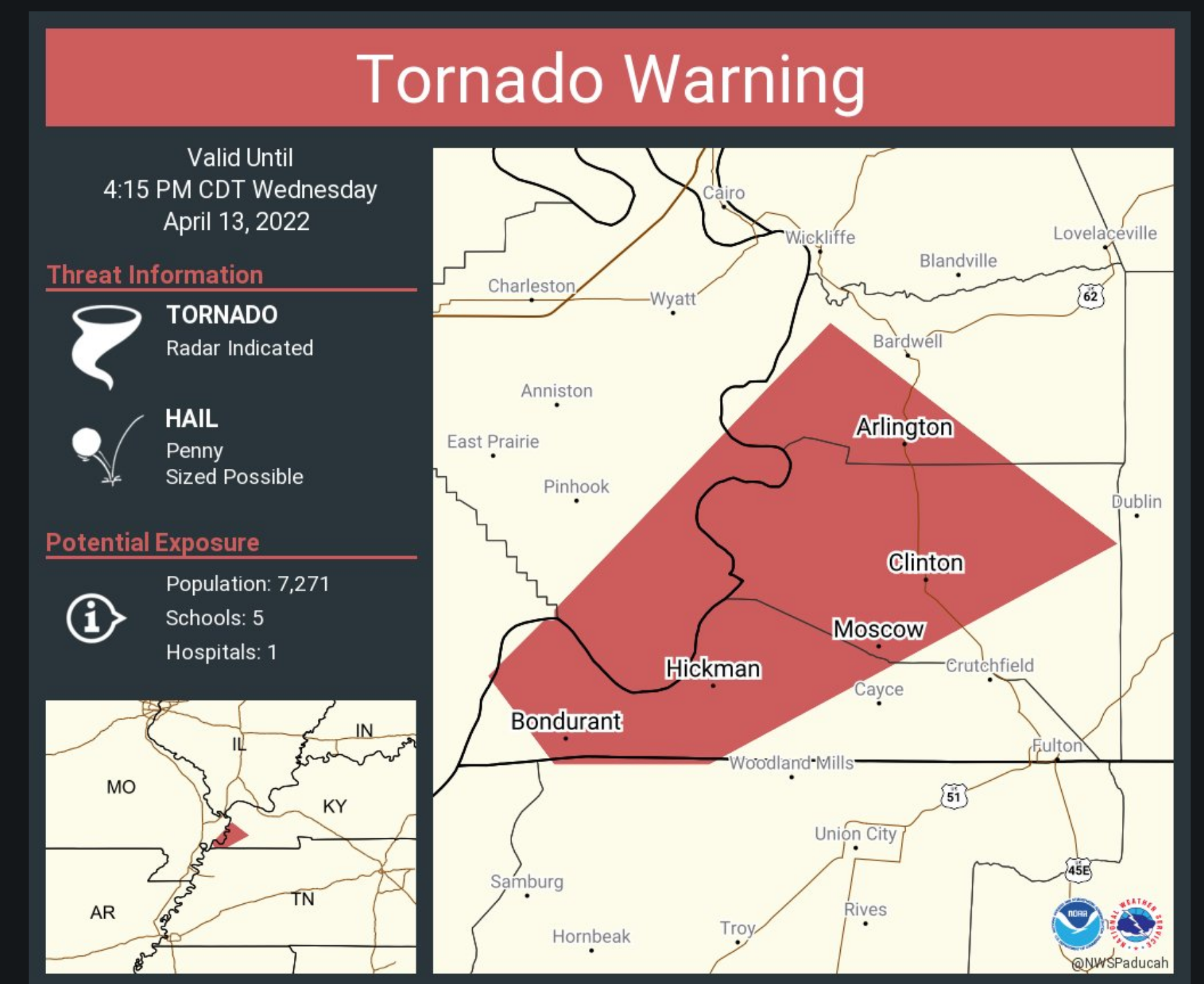
TORNADO WARNING
NATIONAL WEATHER SERVICE MEMPHIS TN
335 PM CDT WED APR 13 2022
THE NATIONAL WEATHER SERVICE IN MEMPHIS HAS ISSUED A
* TORNADO WARNING FOR…
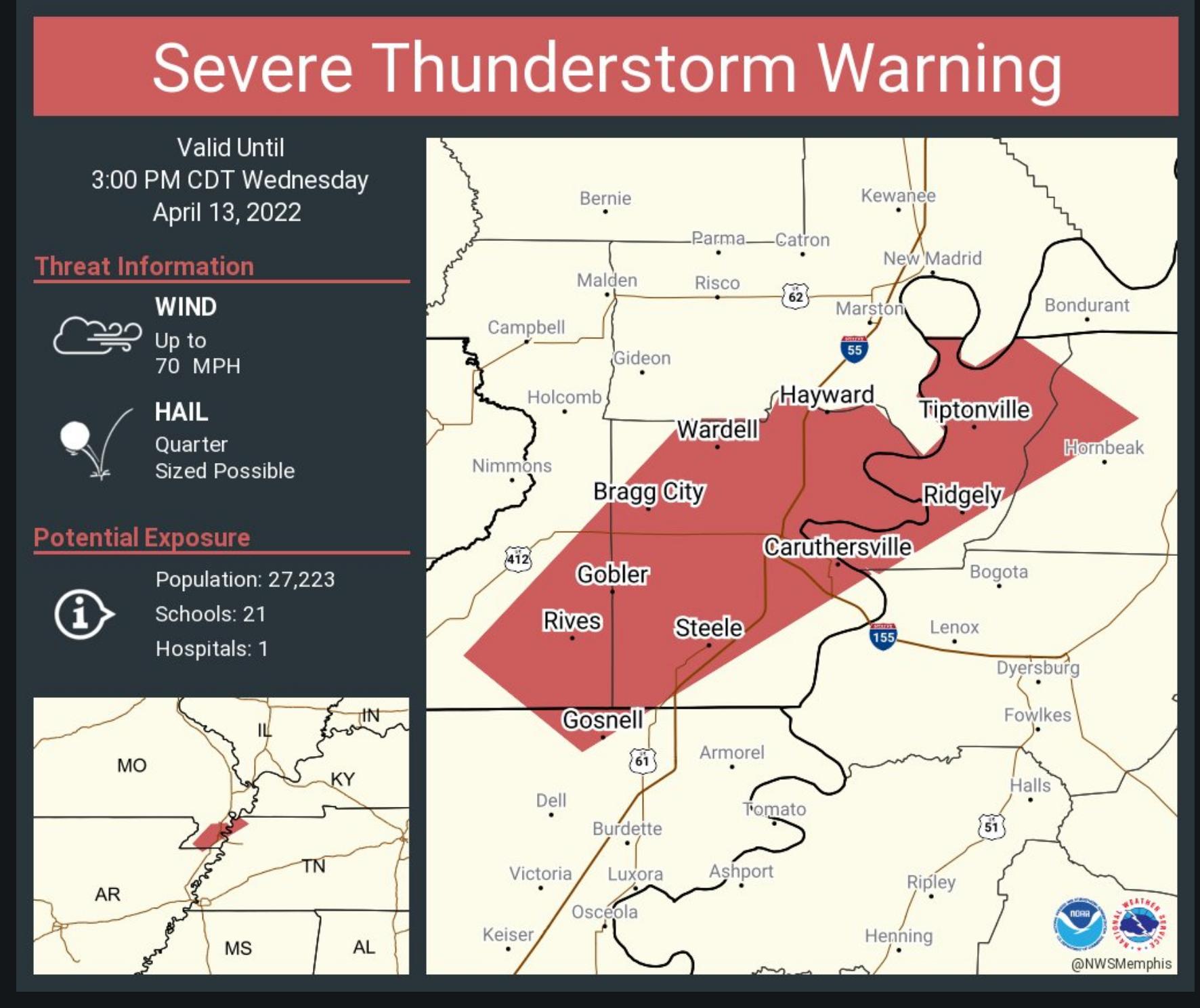
CENTRAL PEMISCOT COUNTY IN SOUTHEASTERN MISSOURI…
NORTHERN WEAKLEY COUNTY IN WESTERN TENNESSEE…
NORTHERN DYER COUNTY IN WESTERN TENNESSEE…
OBION COUNTY IN WESTERN TENNESSEE…
LAKE COUNTY IN WESTERN TENNESSEE…
* UNTIL 415 PM CDT.
* AT 326 PM CDT, A SEVERE THUNDERSTORM PRODUCING A TORNADO WAS
LOCATED NEAR COTTONWOOD GROVE, OR NEAR CARUTHERSVILLE, MOVING
NORTHEAST AT 65 MPH.
HAZARD…TORNADO.
SOURCE…RADAR INDICATED ROTATION.
IMPACT…FLYING DEBRIS WILL BE DANGEROUS TO THOSE CAUGHT WITHOUT
SHELTER. MOBILE HOMES WILL BE DAMAGED OR DESTROYED.
DAMAGE TO ROOFS, WINDOWS, AND VEHICLES WILL OCCUR. TREE
DAMAGE IS LIKELY.
* LOCATIONS IMPACTED INCLUDE…
MARTIN, UNION CITY, CARUTHERSVILLE, PORTAGEVILLE, HAYTI, FULTON,
REELFOOT LAKE STATE PARK, TIPTONVILLE, SOUTH FULTON, RIDGELY, TROY,
OBION, HAYTI HEIGHTS, WARDELL, LATHAM, CLAYTON, BOLTON, CLOVERDALE,
MISTON AND COTTONWOOD GROVE.
.
3:27 PM
NATIONAL WEATHER SERVICE PADUCAH KY
326 PM CDT WED APR 13 2022

THE NATIONAL WEATHER SERVICE IN PADUCAH HAS ISSUED A

* TORNADO WARNING FOR...
  WESTERN FULTON COUNTY IN WESTERN KENTUCKY...
  SOUTHEASTERN NEW MADRID COUNTY IN SOUTHEASTERN MISSOURI...

* UNTIL 345 PM CDT.

* AT 325 PM CDT, A SEVERE THUNDERSTORM CAPABLE OF PRODUCING A TORNADO
  WAS LOCATED 7 MILES SOUTHEAST OF PORTAGEVILLE, MOVING NORTHEAST AT
  70 MPH.

  HAZARD...TORNADO.

  SOURCE...RADAR INDICATED ROTATION.

  IMPACT...FLYING DEBRIS WILL BE DANGEROUS TO THOSE CAUGHT WITHOUT
           SHELTER. MOBILE HOMES WILL BE DAMAGED OR DESTROYED.
           DAMAGE TO ROOFS, WINDOWS, AND VEHICLES WILL OCCUR.  TREE
           DAMAGE IS LIKELY.

* THIS TORNADIC THUNDERSTORM WILL REMAIN OVER MAINLY RURAL AREAS OF
  WESTERN FULTON AND SOUTHEASTERN NEW MADRID COUNTIES, INCLUDING THE
  FOLLOWING LOCATIONS... BOUNDURANT.
.
3:30 PM
.
3:15 PM
.
3:12 PM
April 13, 2022
TORNADO WARNING
NATIONAL WEATHER SERVICE PADUCAH KY
308 PM CDT WED APR 13 2022
THE NATIONAL WEATHER SERVICE IN PADUCAH HAS ISSUED A
* TORNADO WARNING FOR…
NEW MADRID COUNTY IN SOUTHEASTERN MISSOURI…
SOUTHEASTERN STODDARD COUNTY IN SOUTHEASTERN MISSOURI…
* UNTIL 400 PM CDT.
* AT 308 PM CDT, A SEVERE THUNDERSTORM CAPABLE OF PRODUCING A TORNADO
WAS LOCATED OVER CLARKTON, OR NEAR CAMPBELL, MOVING NORTHEAST AT 65
MPH.
HAZARD…TORNADO.
SOURCE…RADAR INDICATED ROTATION.
IMPACT…FLYING DEBRIS WILL BE DANGEROUS TO THOSE CAUGHT WITHOUT
SHELTER. MOBILE HOMES WILL BE DAMAGED OR DESTROYED.
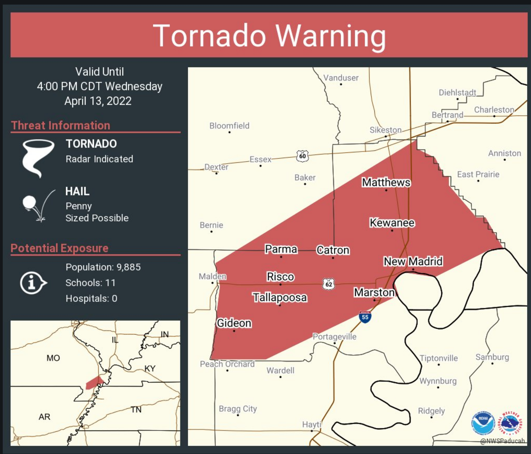
DAMAGE TO ROOFS, WINDOWS, AND VEHICLES WILL OCCUR. TREE
DAMAGE IS LIKELY.
* THIS DANGEROUS STORM WILL BE NEAR…
PARMA AND RISCO AROUND 320 PM CDT.
OTHER LOCATIONS IN THE PATH OF THIS TORNADIC THUNDERSTORM INCLUDE NEW
MADRID, LILBOURN, HOWARDVILLE, HUNTER-DAWSON STATE HISTORIC SITE,
MATTHEWS, CANALOU AND FARRENBURG.
THIS INCLUDES INTERSTATE 55 BETWEEN MILE MARKERS 40 AND 65.
PRECAUTIONARY/PREPAREDNESS ACTIONS…
.
3 PM
.
2:54 PM
253 PM CDT WED APR 13 2022

...A TORNADO WARNING REMAINS IN EFFECT UNTIL 315 PM CDT FOR
NORTHWESTERN MISSISSIPPI...SOUTHWESTERN PEMISCOT AND SOUTHEASTERN
DUNKLIN COUNTIES...

AT 252 PM CDT, A SEVERE THUNDERSTORM PRODUCING A TORNADO WAS LOCATED
OVER ARBYRD, OR NEAR LEACHVILLE, MOVING NORTHEAST AT 65 MPH.

HAZARD...TORNADO.

SOURCE...RADAR INDICATED ROTATION.

IMPACT...FLYING DEBRIS WILL BE DANGEROUS TO THOSE CAUGHT WITHOUT
         SHELTER. MOBILE HOMES WILL BE DAMAGED OR DESTROYED. DAMAGE
         TO ROOFS, WINDOWS, AND VEHICLES WILL OCCUR.  TREE DAMAGE IS
         LIKELY.

LOCATIONS IMPACTED INCLUDE...
KENNETT, GOSNELL, STEELE, LEACHVILLE, SENATH, CARDWELL, HORNERSVILLE,
ARBYRD, HOLLAND, HAPPY CORNERS, CALUMET, BUCKEYE, ARKMO, WEST
KENNETT, WOODLAND CORNER, PAWHEEN, NOLAND, POPLAR CORNER, GARSON AND
BOYNTON.
.
April 13, 2022
2:50 PM
Rotation is moving into the Bootheel.
Latest
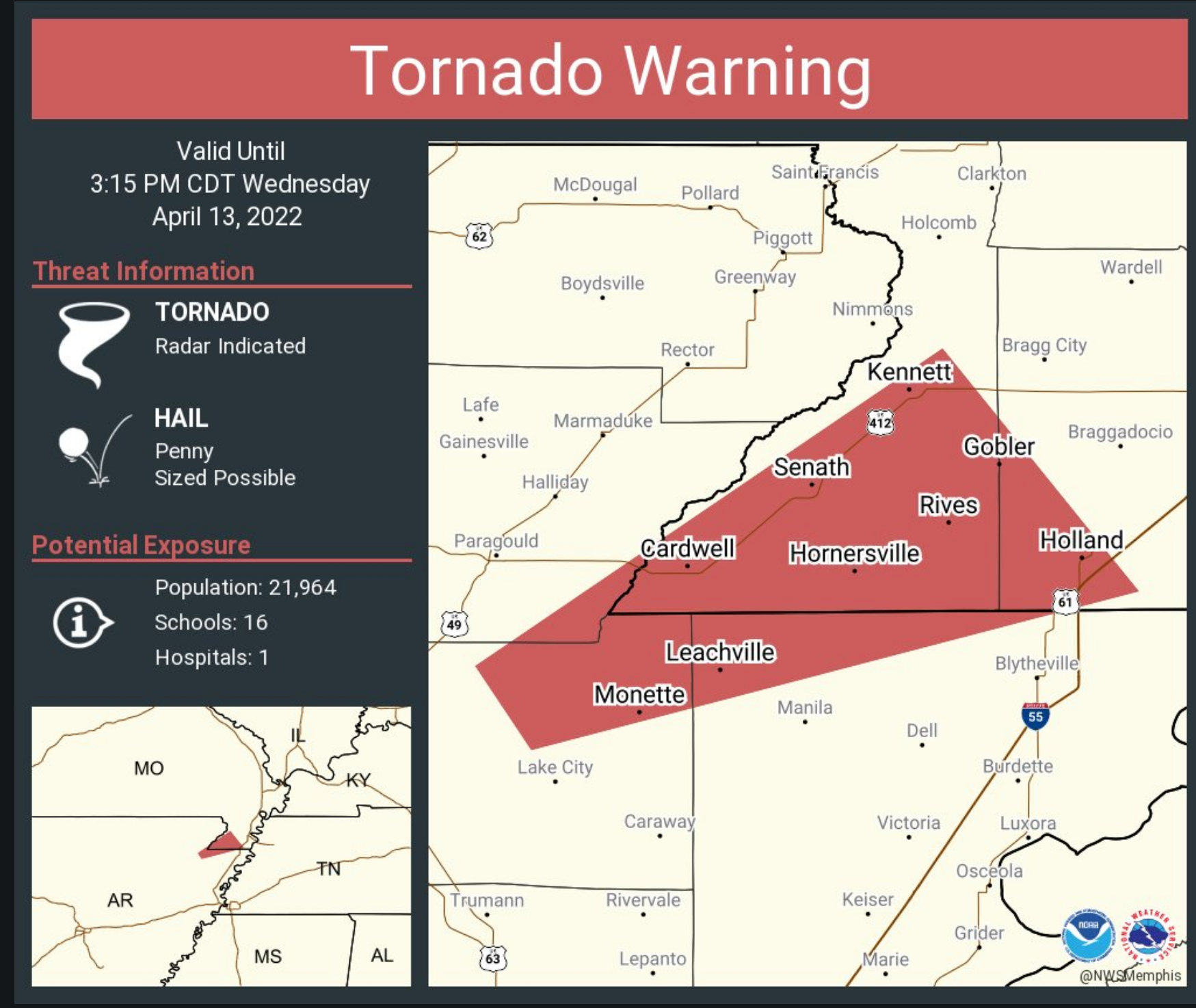
AT 248 PM CDT, A SEVERE THUNDERSTORM PRODUCING A TORNADO WAS LOCATED
NEAR CARDWELL, OR NEAR LEACHVILLE, MOVING NORTHEAST AT 65 MPH.
HAZARD…TORNADO.
SOURCE…RADAR INDICATED ROTATION.
IMPACT…FLYING DEBRIS WILL BE DANGEROUS TO THOSE CAUGHT WITHOUT
SHELTER. MOBILE HOMES WILL BE DAMAGED OR DESTROYED. DAMAGE
TO ROOFS, WINDOWS, AND VEHICLES WILL OCCUR. TREE DAMAGE IS
LIKELY.
LOCATIONS IMPACTED INCLUDE…
KENNETT, GOSNELL, STEELE, LEACHVILLE, SENATH, MONETTE, CARDWELL,
HORNERSVILLE, ARBYRD, HOLLAND, DELFORE, CALUMET, BUCKEYE, ARKMO, WEST
KENNETT, NOLAND, HAPPY CORNERS, WOODLAND CORNER, PAWHEEN AND POPLAR
CORNER.
.
2:47 PM
.
2:44 PM
Tornado Warning
National Weather Service Memphis TN
242 PM CDT Wed Apr 13 2022
The National Weather Service in Memphis has issued a
* Tornado Warning for…
Southeastern Greene County in eastern Arkansas…
Northeastern Craighead County in eastern Arkansas…
Northwestern Mississippi County in eastern Arkansas…
Southwestern Pemiscot County in southeastern Missouri…
Southern Dunklin County in southeastern Missouri…
* Until 315 PM CDT.
* At 242 PM CDT, a severe thunderstorm producing a tornado was
located near Monette, moving northeast at 65 mph.
HAZARD…Tornado.
SOURCE…Radar indicated rotation.
IMPACT…Flying debris will be dangerous to those caught without
shelter. Mobile homes will be damaged or destroyed.
Damage to roofs, windows, and vehicles will occur. Tree
damage is likely.
* Locations impacted include…
Kennett, Gosnell, Steele, Leachville, Senath, Monette, Cardwell,
Hornersville, Arbyrd, Holland, Delfore, Calumet, Buckeye, Lester,
Arkmo, West Kennett, Noland, Happy Corners, Macey and Schug.
2:40 PM
Dunklin and Pemiscot Counties.
Wind gusts over 60+ mph have been reported with the storms approaching from northeast AR. They will move into the Bootheel over the next few minutes.
These are separate storms from what are already in the Bootheel of MO.
Storms may produce wind damage and hail.
Radar
https://weatherobservatory.com/radar_pbluff.htm
.
2:25 PM
New Madrid, Dunklin, Pemiscot, Lake, Obion, and Fulton Counties.
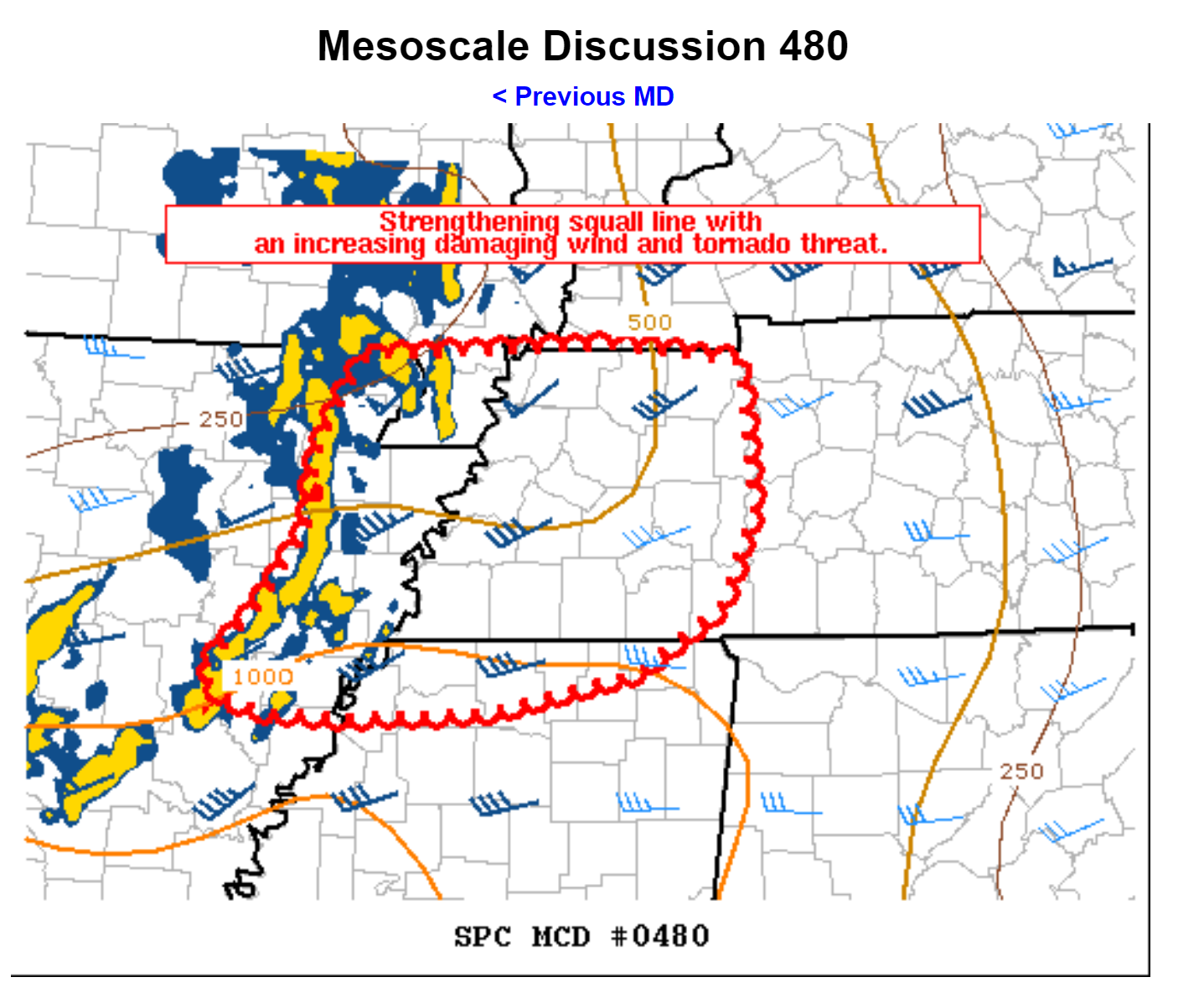
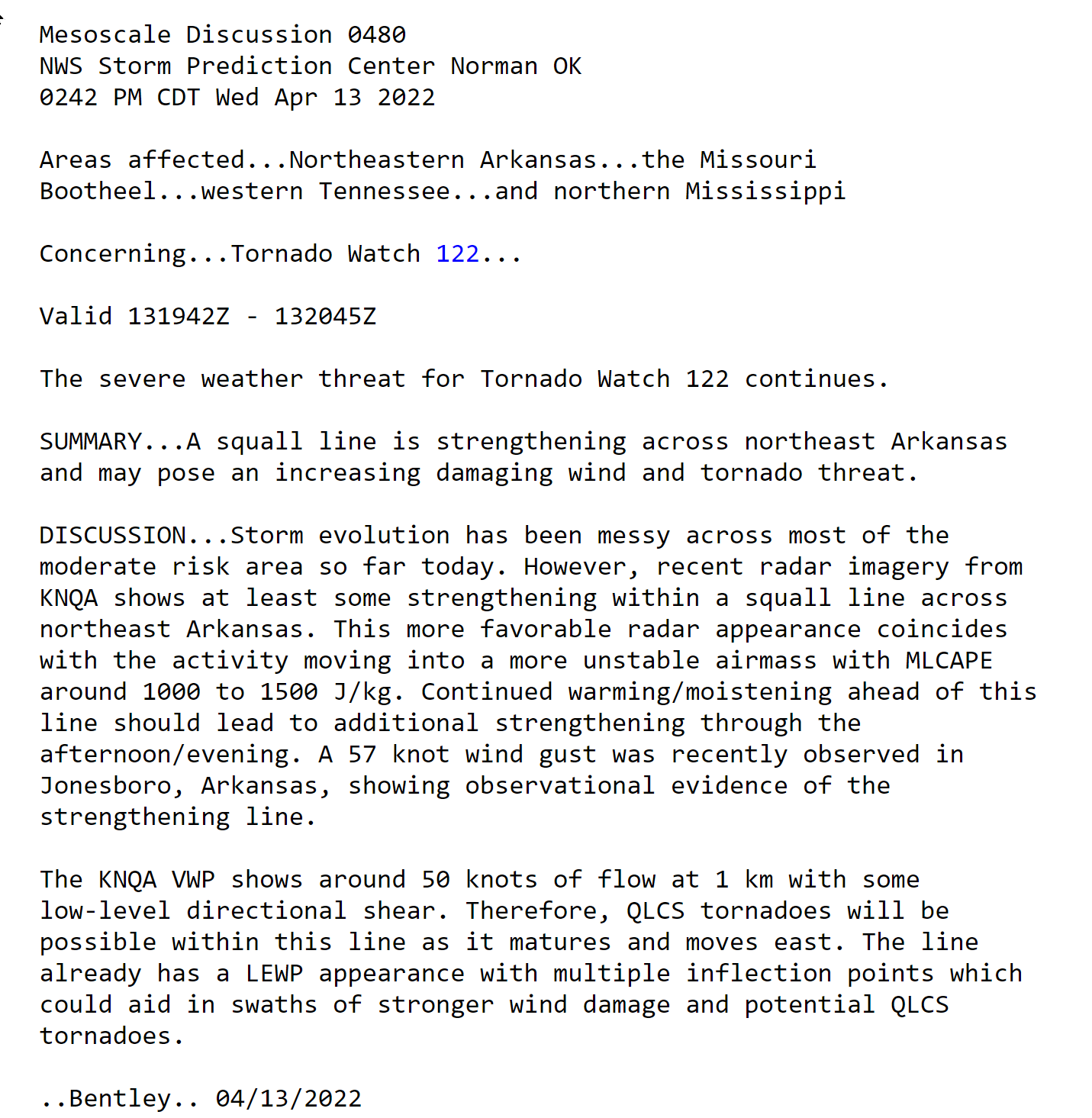
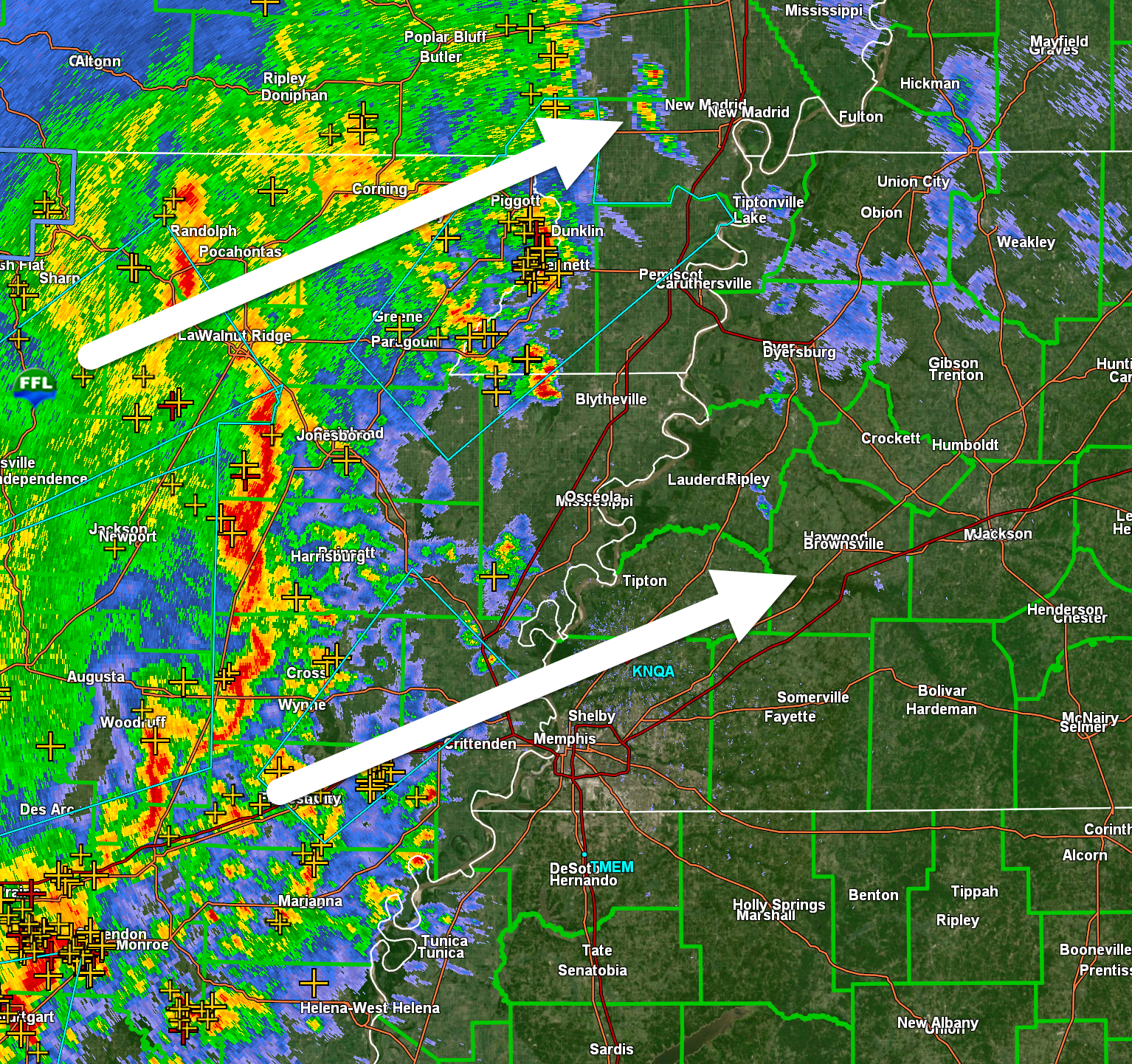
I am tracking a line of intense storms coming out of northeast Arkansas. This line of storms has been strengthening over the past 20 minutes.
The line is moving northeast at 50 mph.
It will enter the Bootheel over the next 30 minutes and then continue moving northeast.
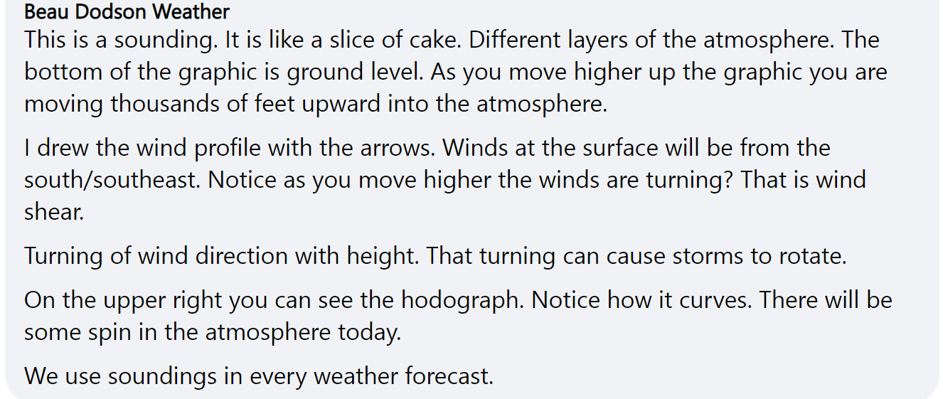
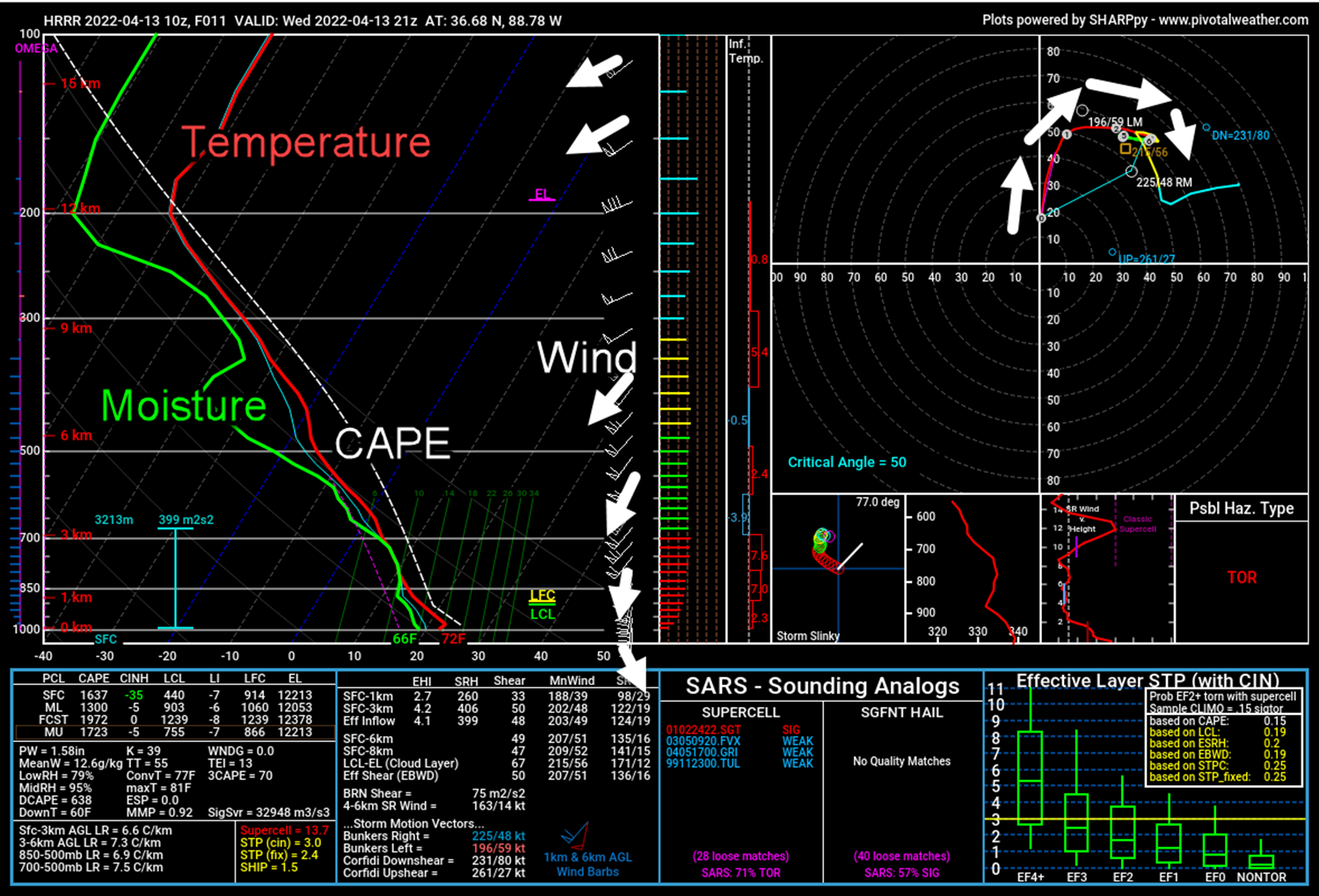
The line, if it continues to intensify, could produce 60 mph wind gusts and quarter size hail. There is spin in the atmosphere today. Thus, we will need to monitor conditions in case a short-lived tornado develops.
Radar
https://weatherobservatory.com/radar_pbluff.htm
.
2:16 PM
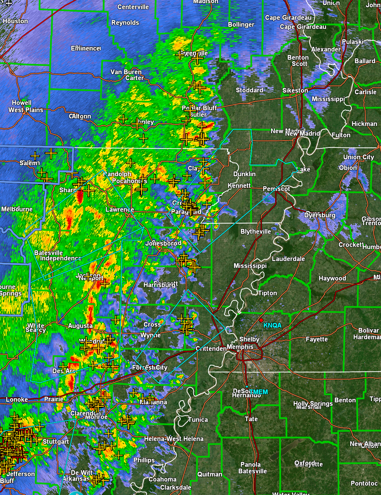
This line in Arkansas is starting to strengthen. Let’s watch it as it moves northeast.
.
2:15 PM
.
2 PM
The line is very messy. That is good. It has not gotten its act together into a solid squall line. Right now it is a bunch of thunderstorms bunched up together.
The risk of severe weather when it is like this is small.
The big question is what does it do over the next few hours and that is what we are watching.
I am glad to see it like this. Let’s hope it stays this way.
.
1:51 PM
.
1:41 PM
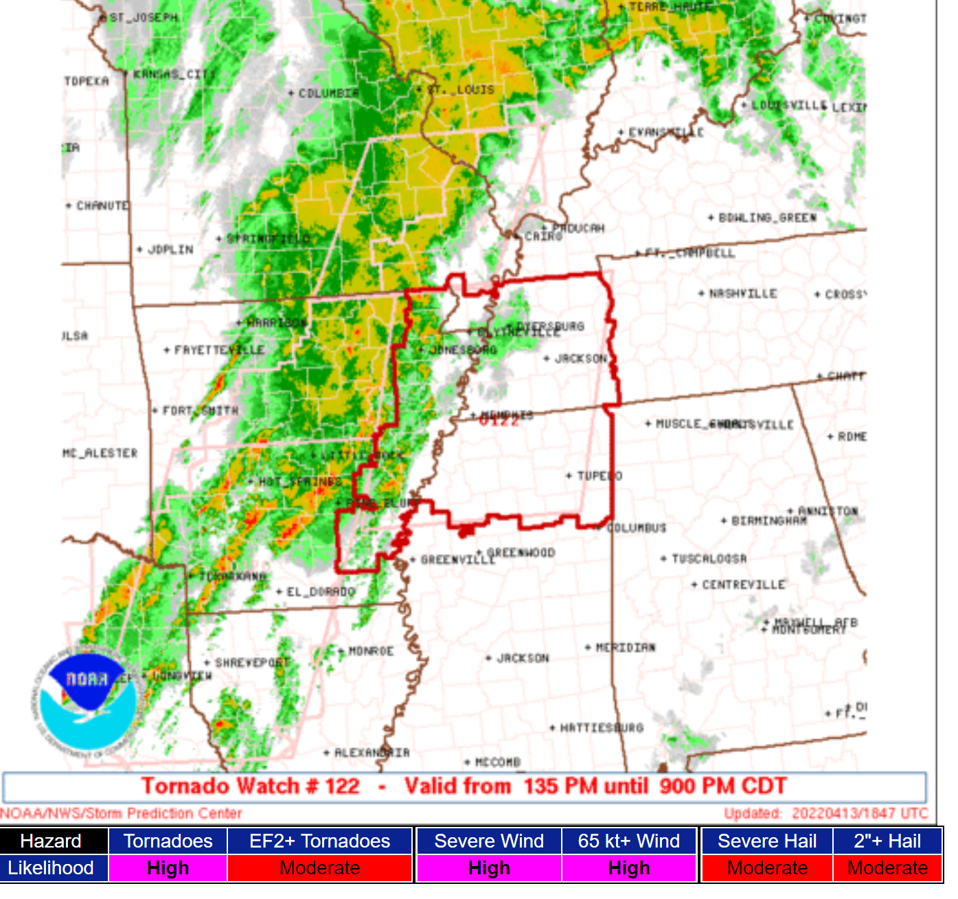
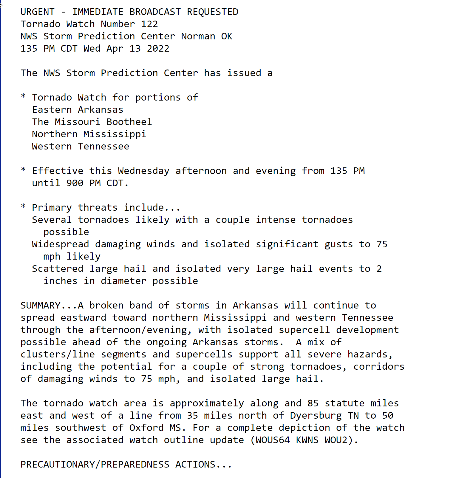
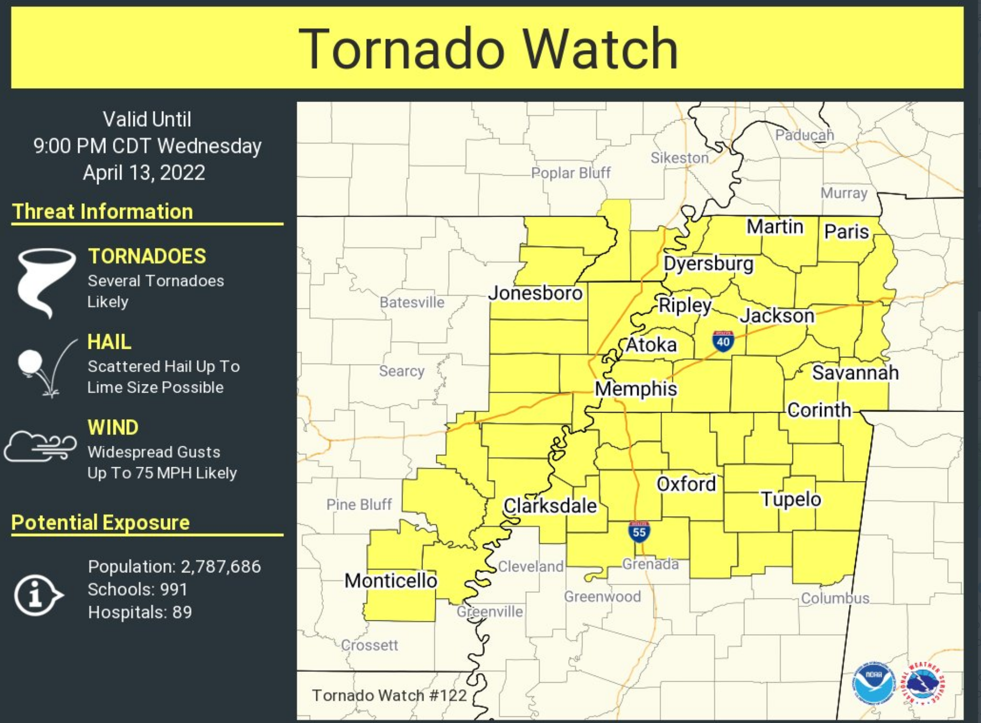
A new tornado watch has been issued for the Bootheel and northwest Tennessee.
This means to remain alert this afternoon and evening. A WARNING means to seek shelter.
This is a watch.
.
1:15 PM
We are now at the point of waiting.
Storms are moving through MO/AR.
The atmosphere is becoming unstable over a good chunk of the area. Esp SW IL, western KY, the Bootheel, and western TN.
Waiting to see when the new tornado watch will be issued for the more of the area (maybe not all – we will see).
Feeling a little bit better about northern portions of southern IL and perhaps portions of southeast IL. If we can get the rain into those areas then it would help.
Let’s see how it goes.
At this point, it is just being patient and seeing how this unfolds. There are always questions left on the table. Today is no different.
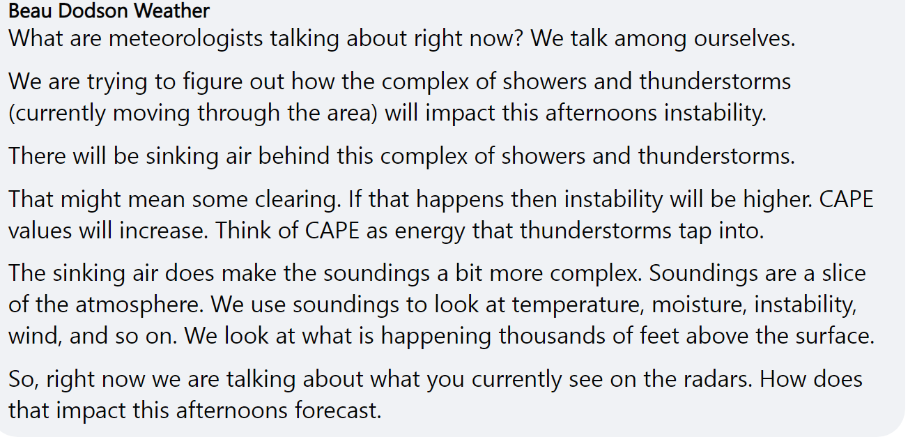
All of us meteorologists are discussing the same thing.
.
1 PM
.
12:45 PM
.
12:40 PM
Double click all images to enlarge them
.
12:20 PM
.
12:10 PM
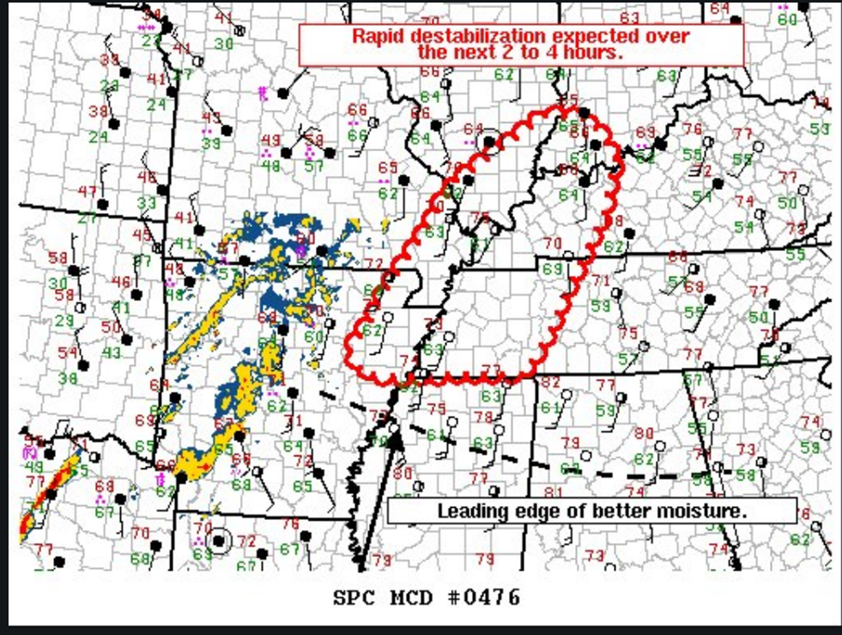
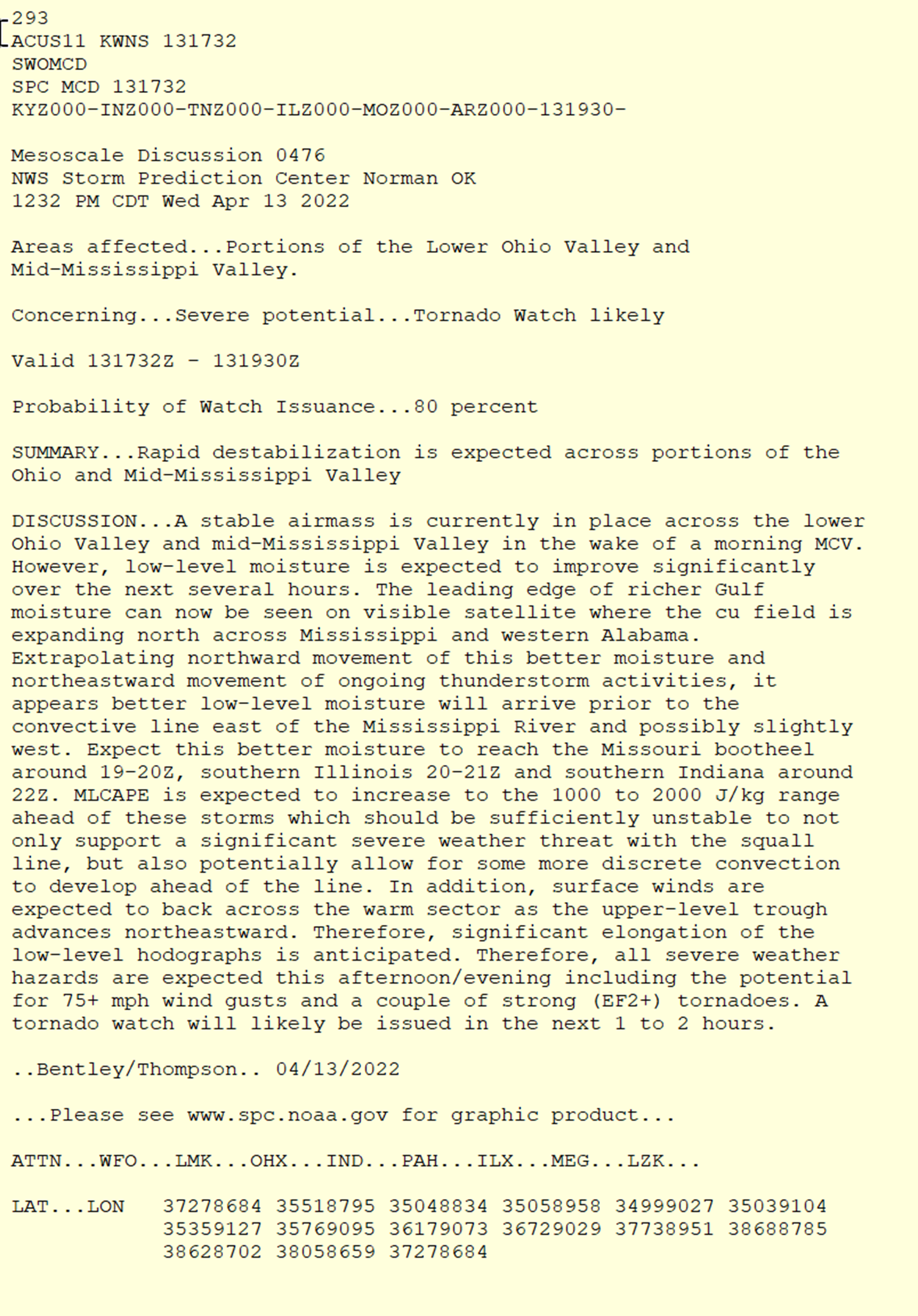
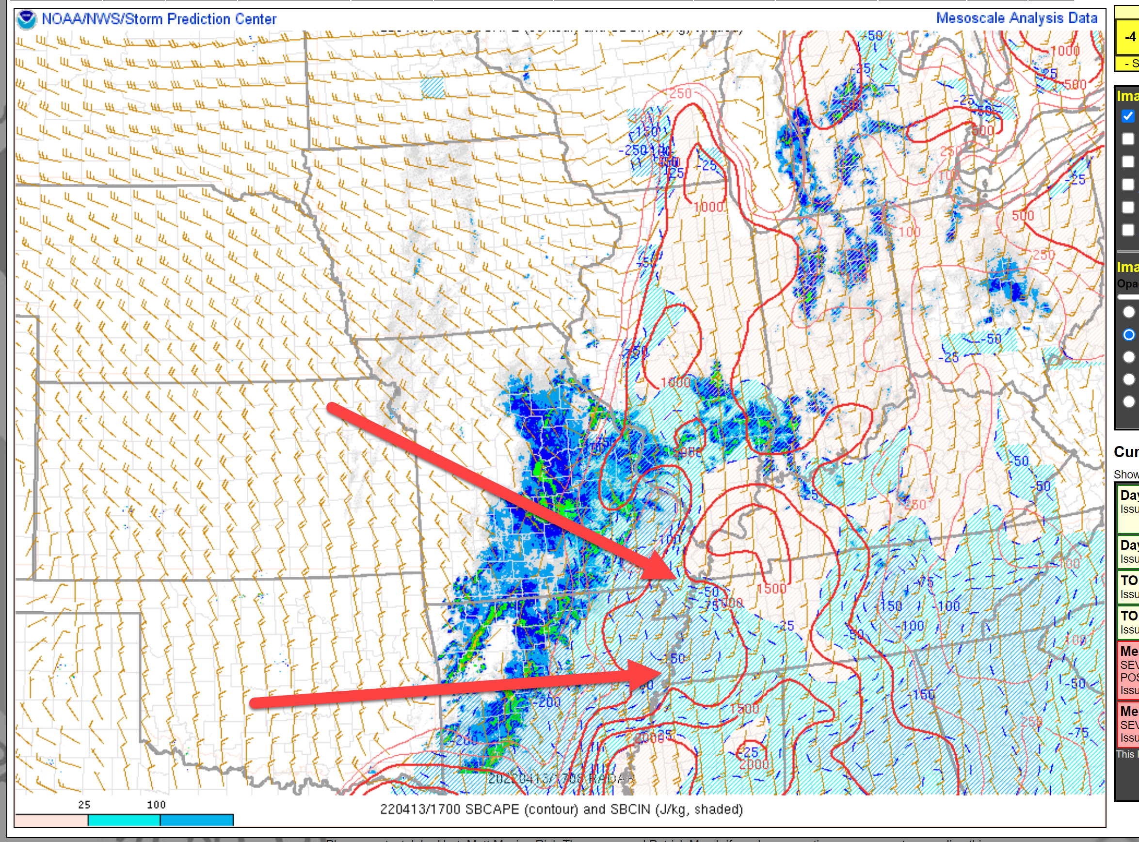
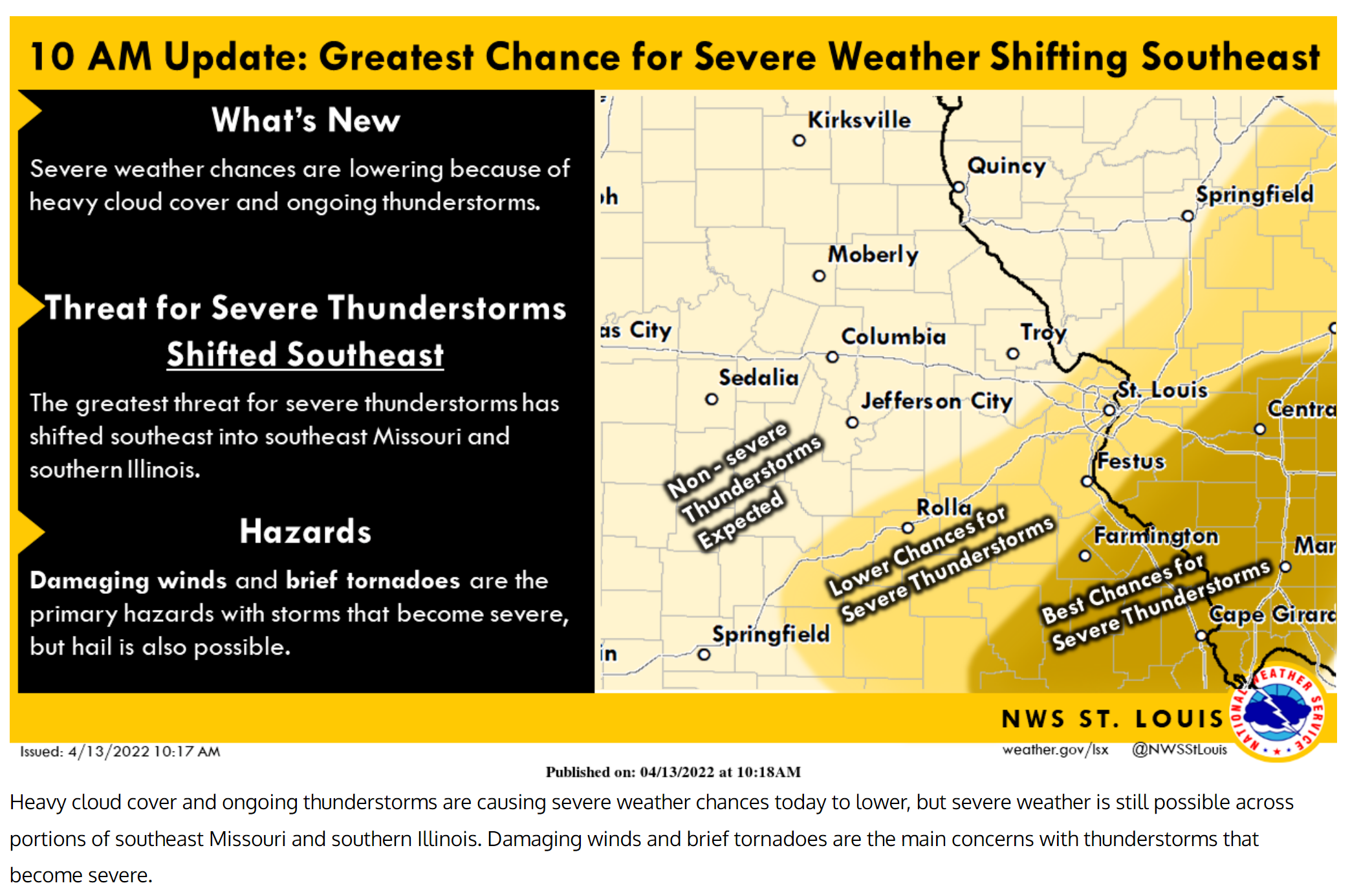
There remain questions, even at this late hour, as to the extent of severe weather reports this afternoon.
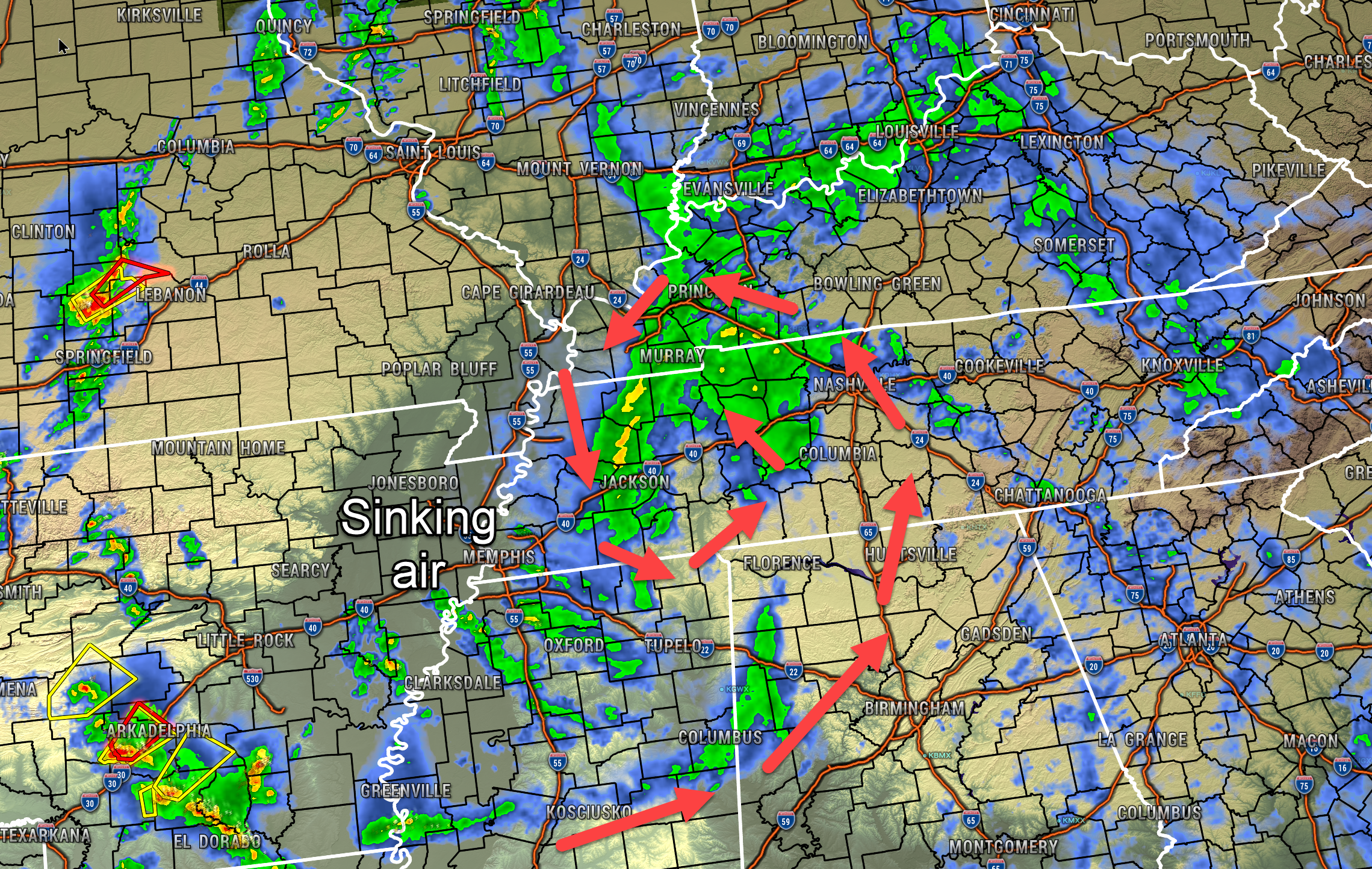
A morning complex of storms moved through portions of TN and KY. This caused sinking air behind it.
That also caused clearing sky conditions.
CAPE numbers are rising in areas with sunshine.
The line of storms in MO and AR continues to move east/northeast.
The line has weakened some over MO. The line has strengthened in AR.
I continue to monitor trends.
I expect several reports of damaging wind and hail. I can’t rule out some tornadoes, as well.
Let’s all just stay weather aware over the coming hours. We always hope for a weaker system than data shows.
I have witnessed moderate and high risk events “bust” or not verify. Meaning, they did not achieve their maximum potential.
That is always a possibility.
But, we plan for the worst.
.
12 PM
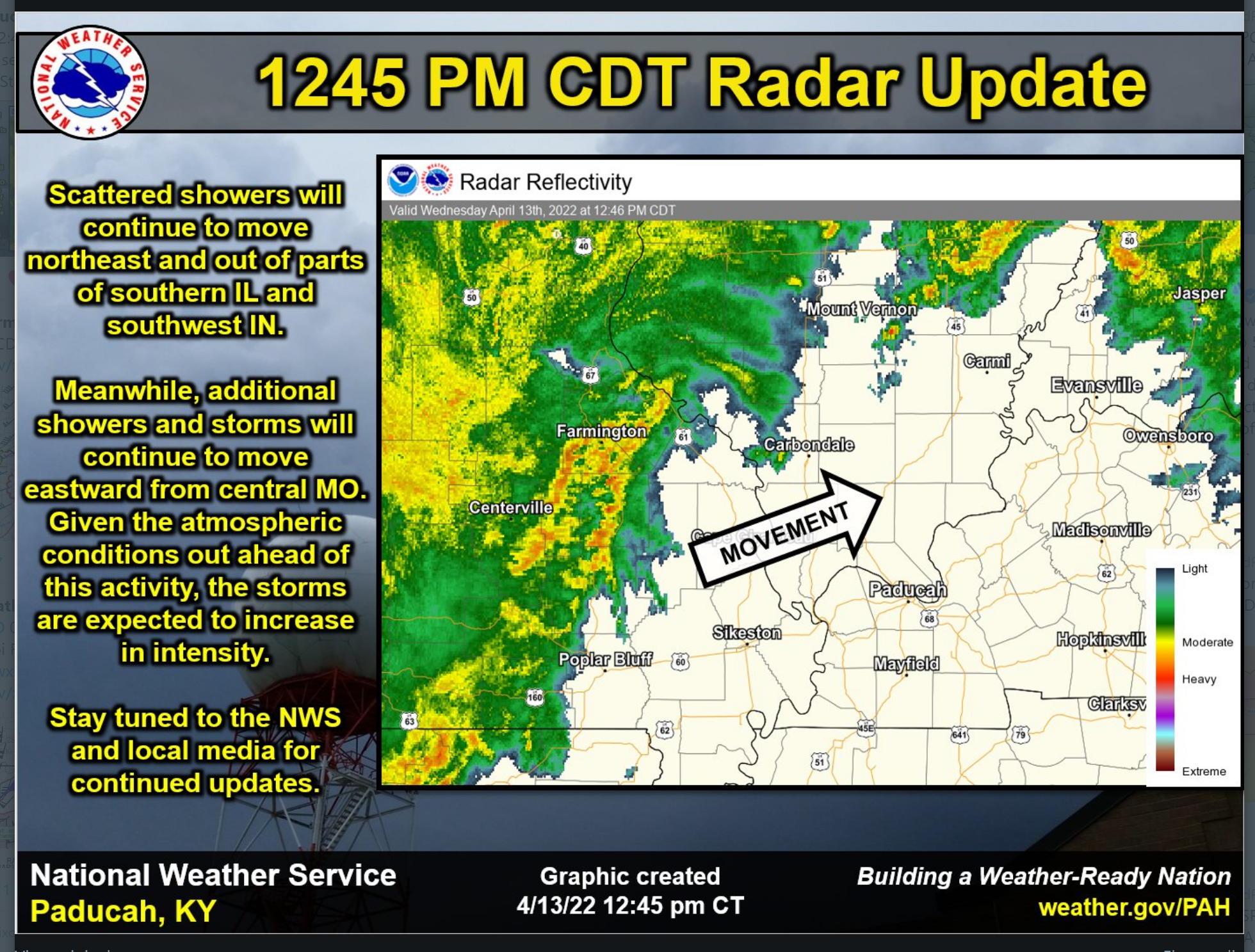
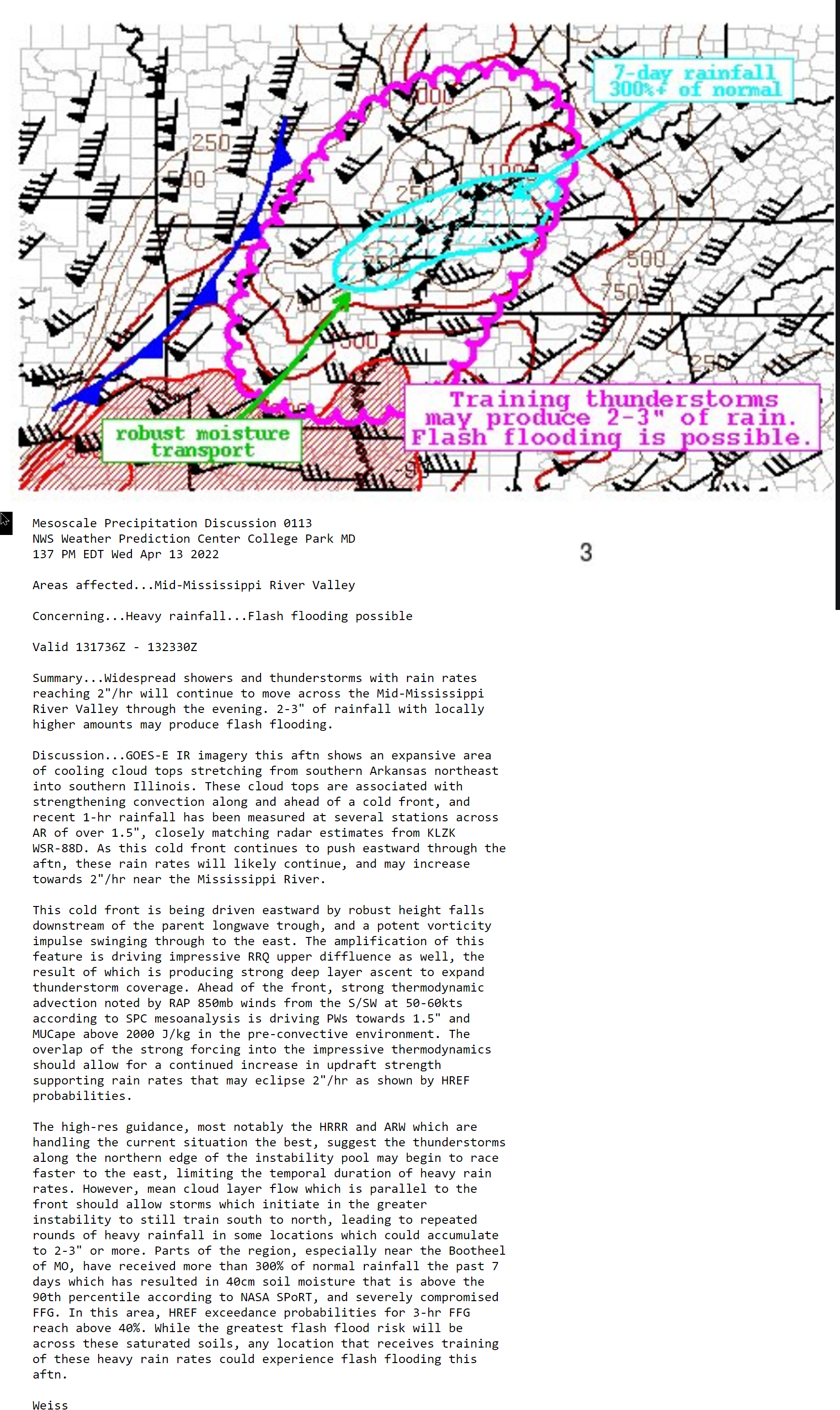
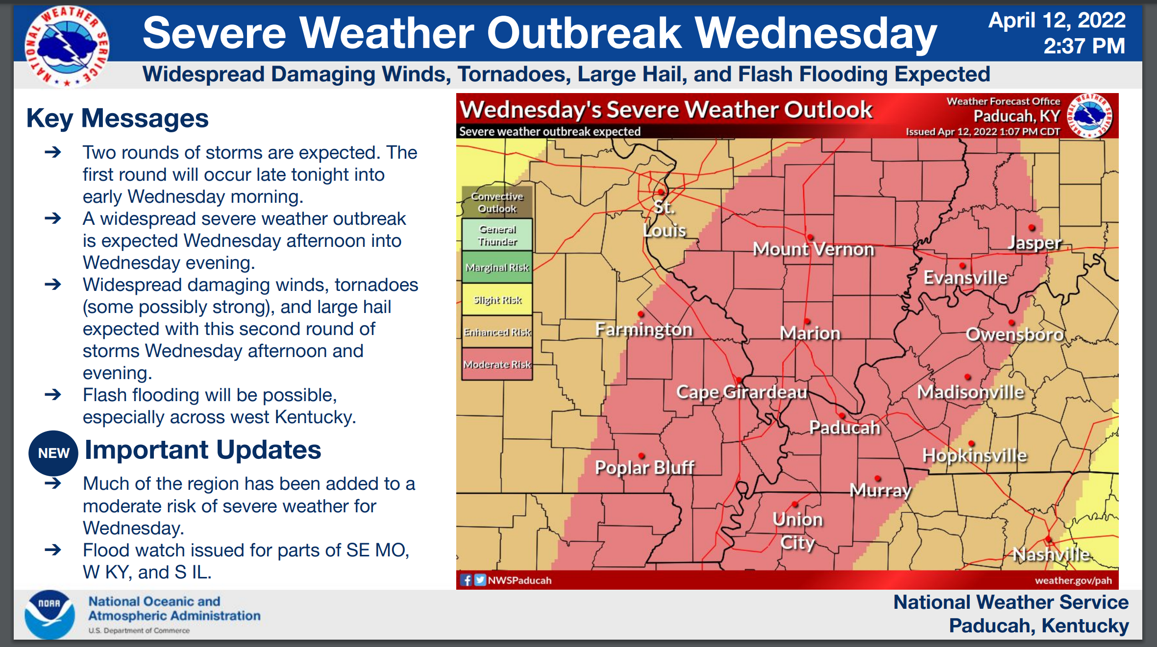
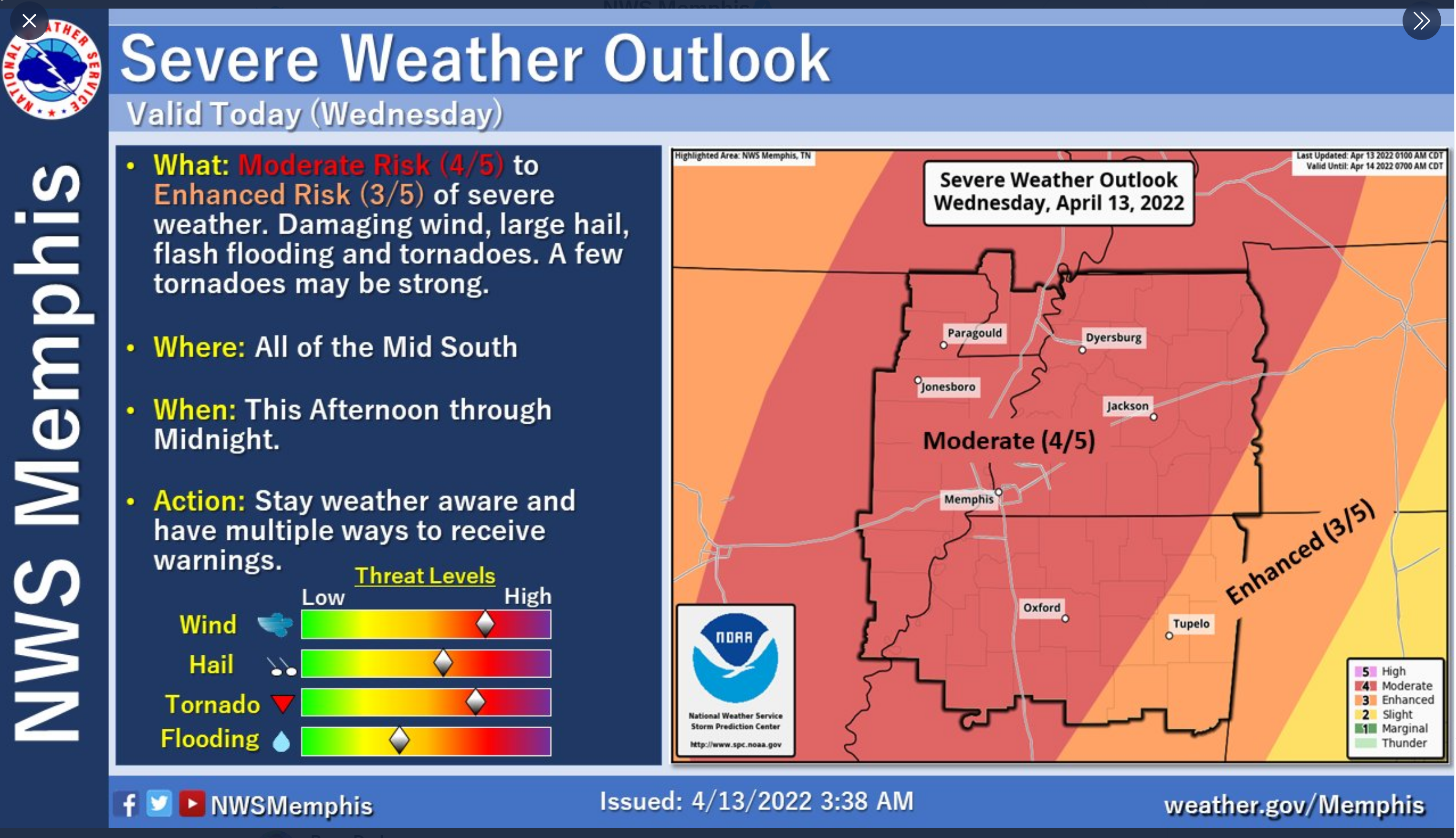
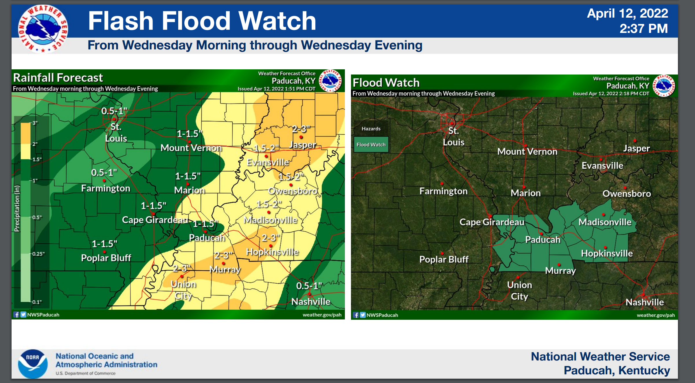
A couple of NWS graphics.
,
12 PM
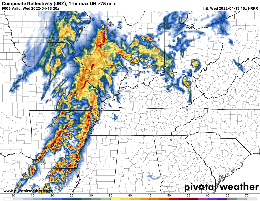
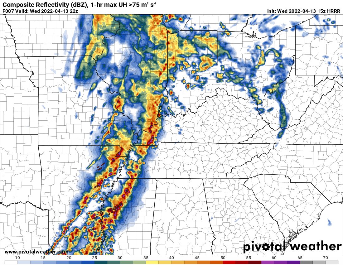
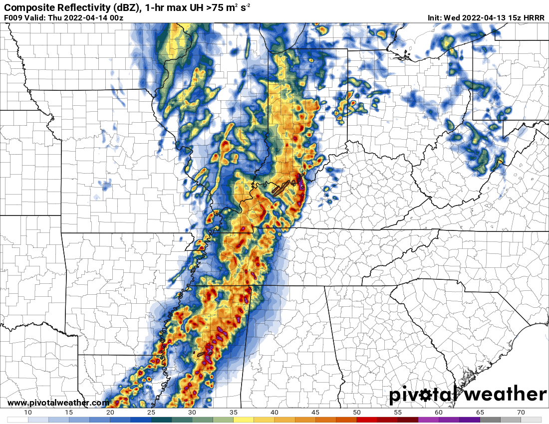
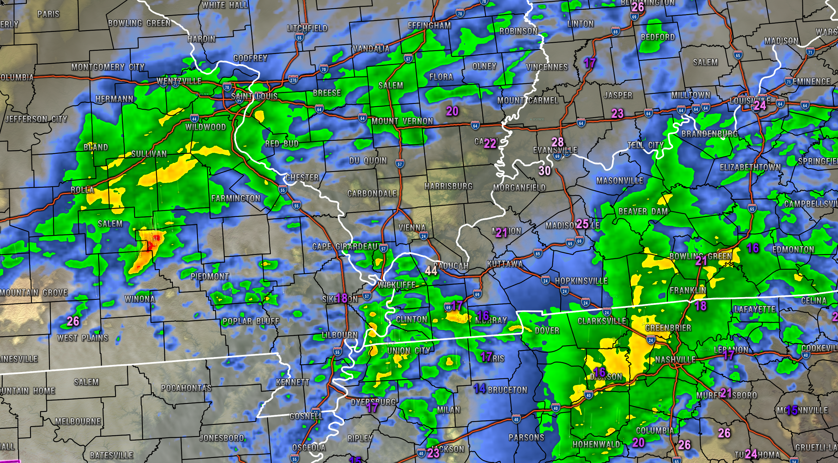
What radar might look like this afternoon.
3 PM
5 PM
7 PM
11:24 AM
Double click on all images to enlarge them.
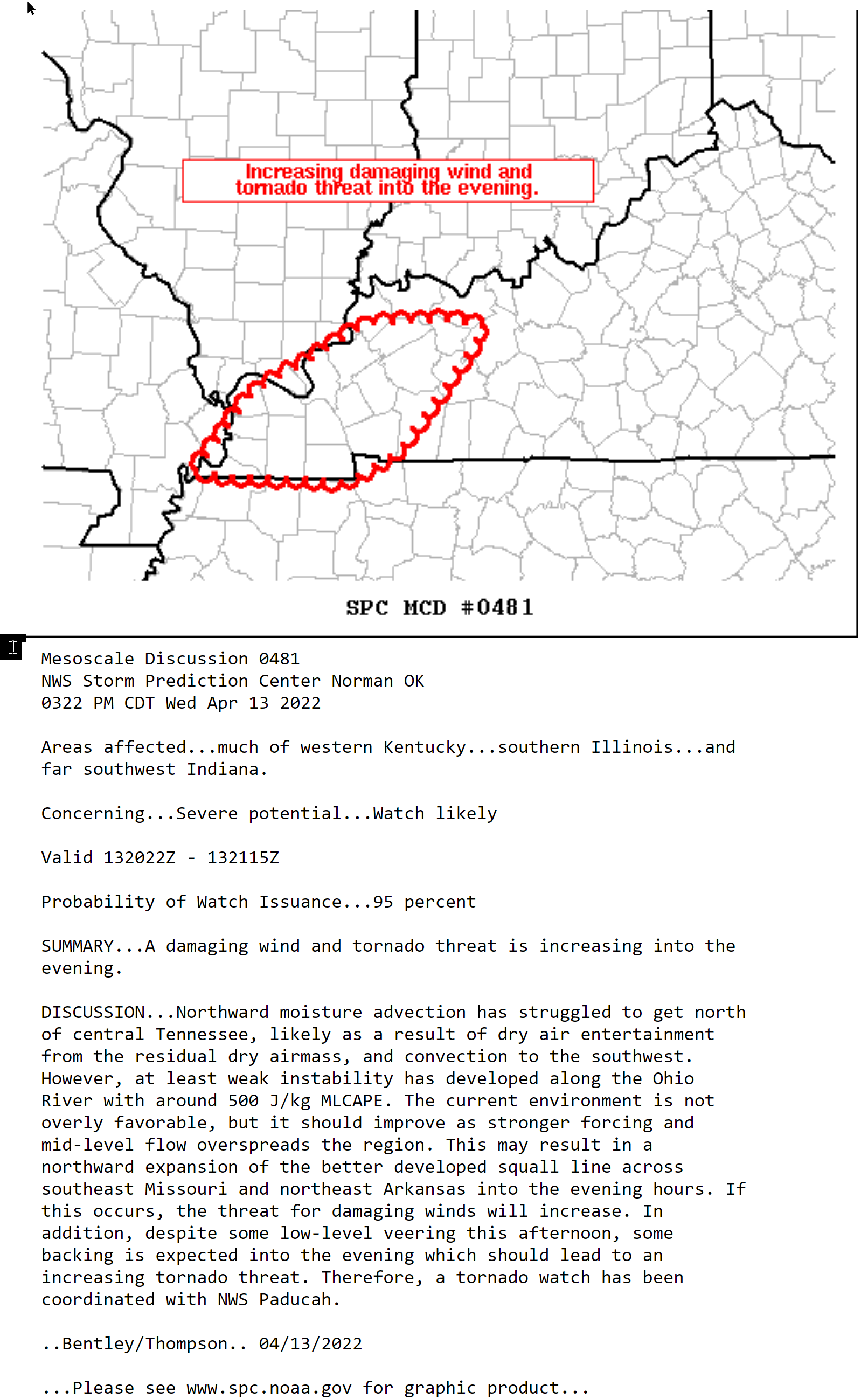
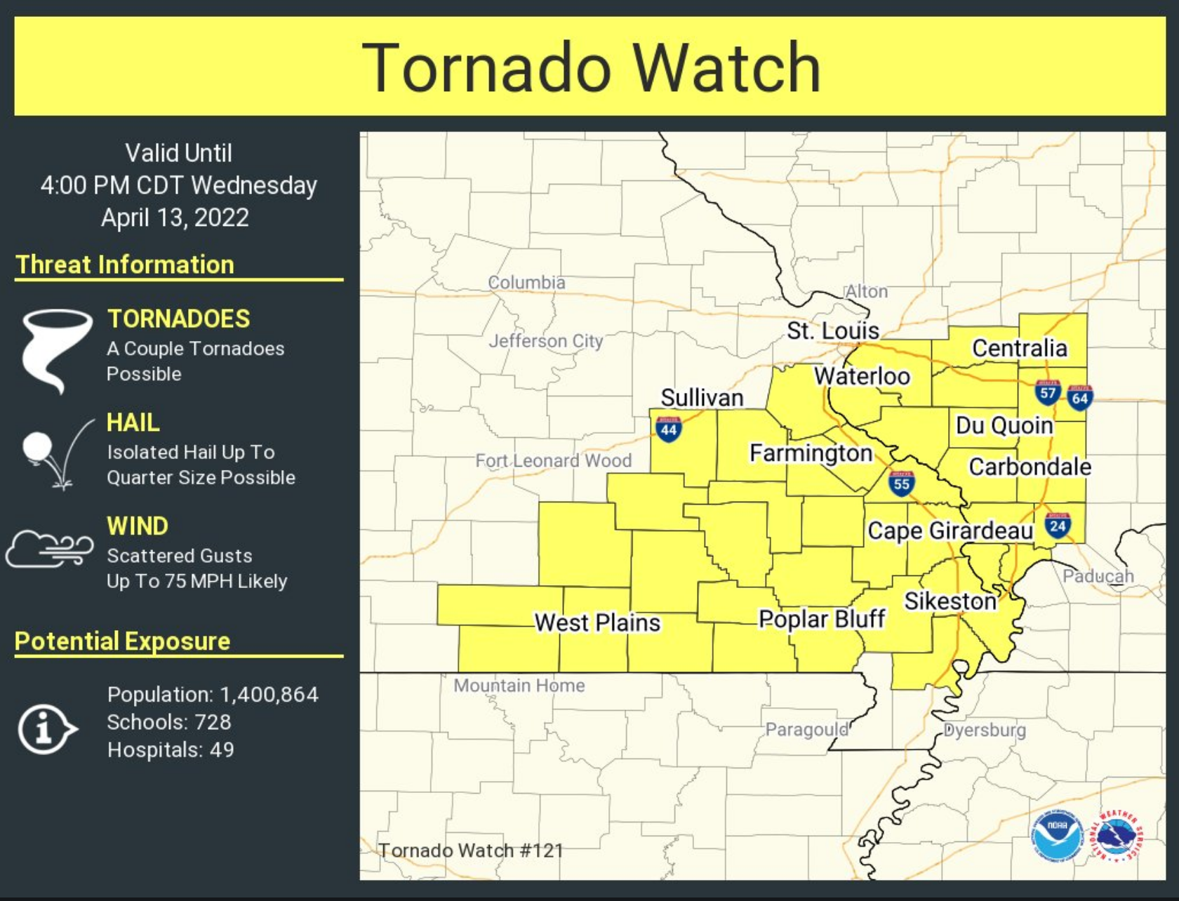
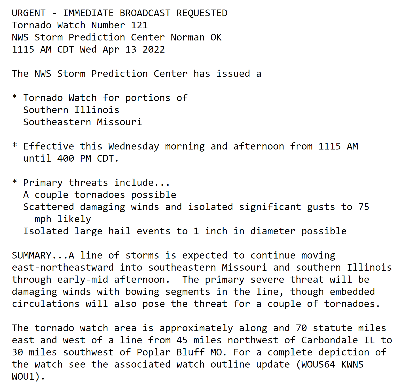
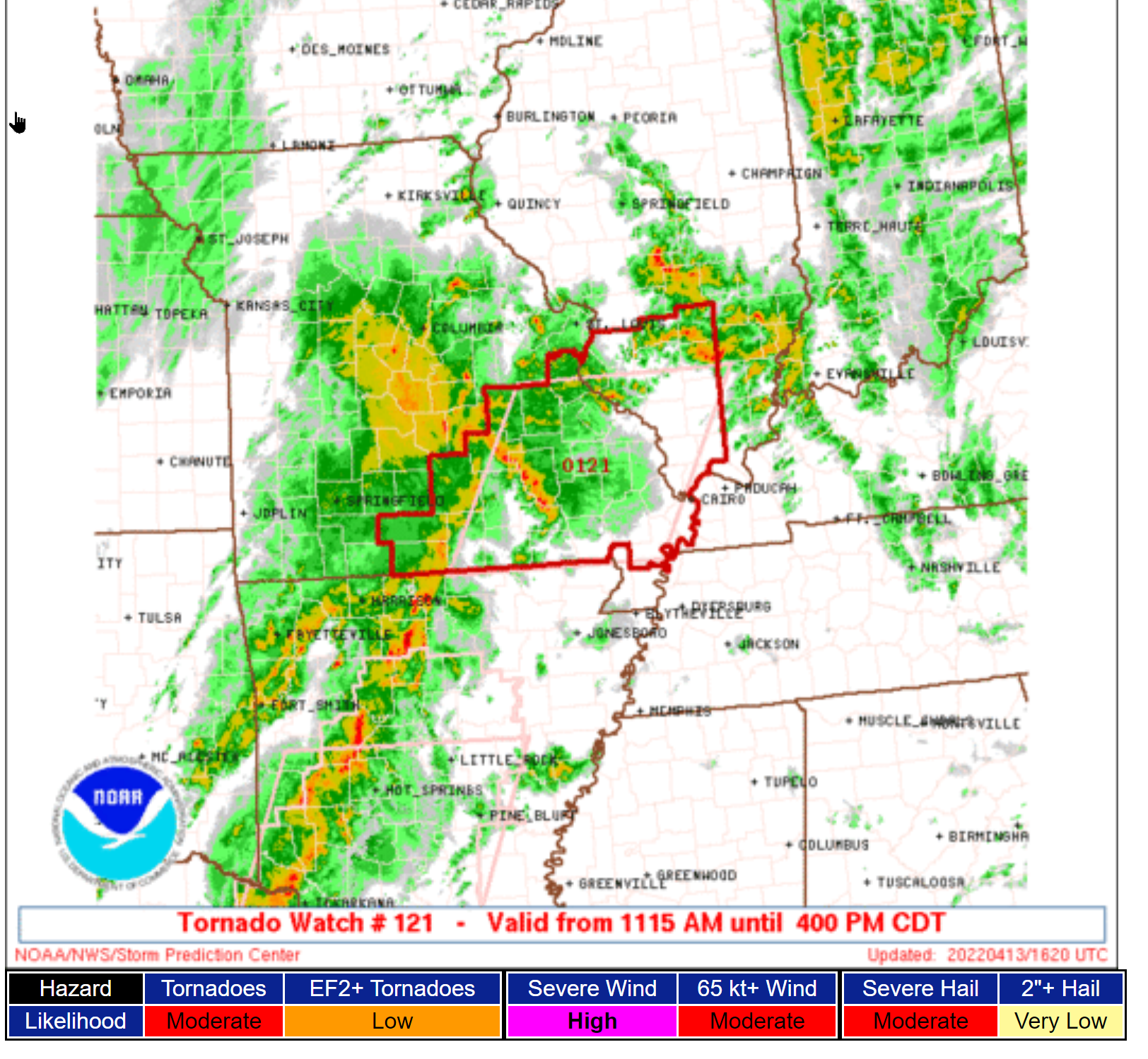
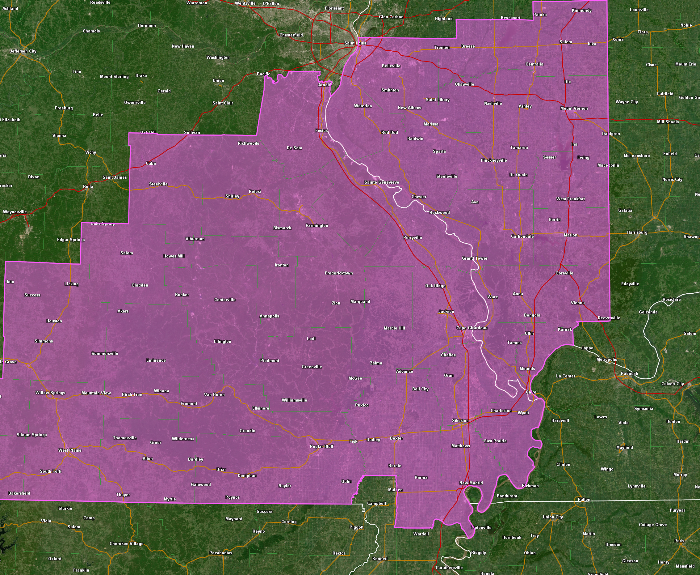
More information on the tornado watch
.
11:19 AM
Tornado watch has been issued. For details shortly.
.
11 AM
11 AM update
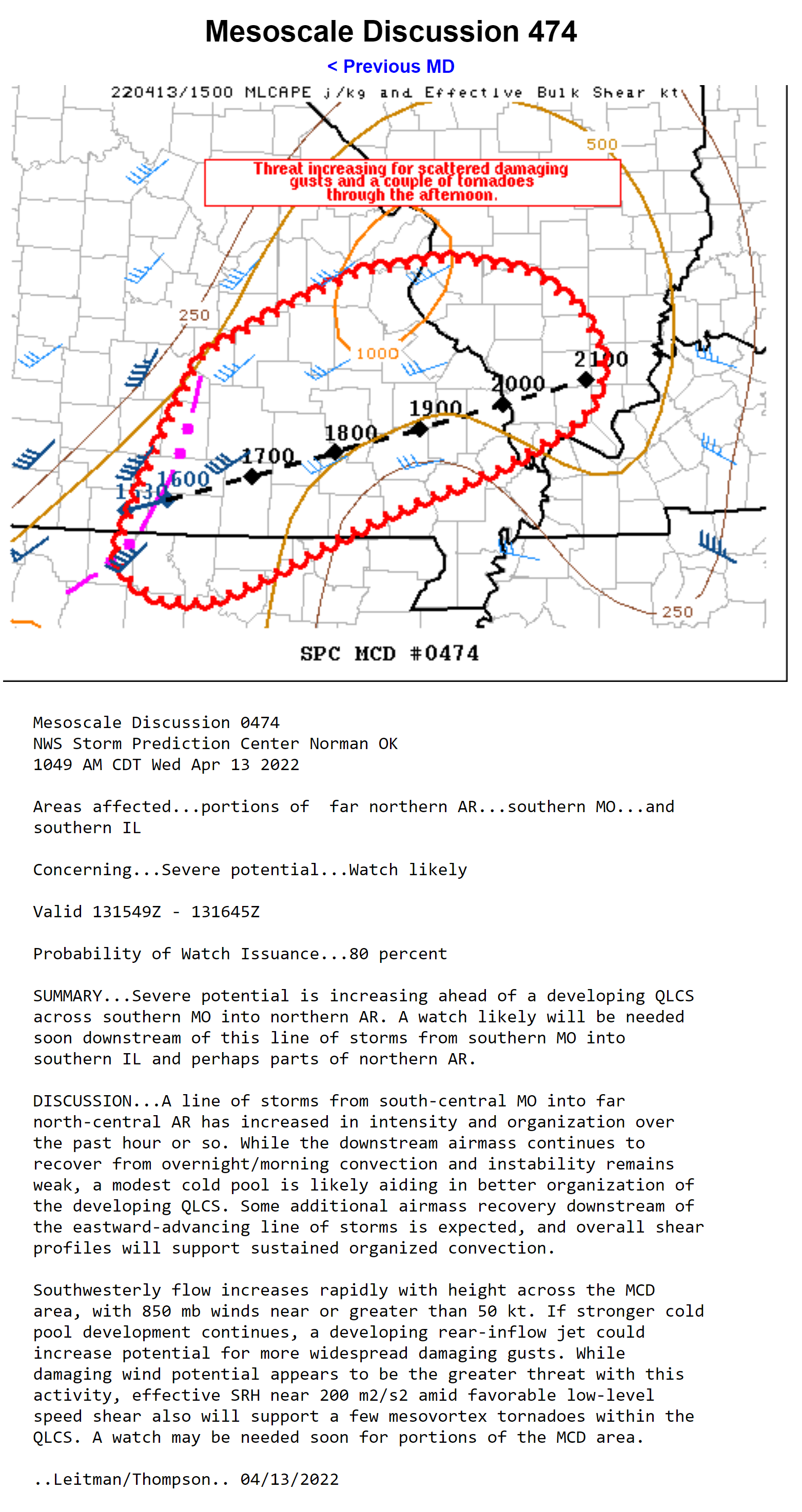
Severe weather is likely this afternoon and evening. There will be watches and warnings issued.
I expect a tornado watch will be issued for the area that will last into the evening hours. A watch means to monitor updates. A WARNING means to seek shelter.
Everything appears to be coming together for an outbreak of severe thunderstorms. That includes damaging wind, hail, and even some tornadoes.
Let’s be weather aware over the coming hours. Storms in southwest Missouri are moving at 90 mph. Fast.
Storms will move fast in our region, as well. That does not give you much time to seek shelter if a warning is issued. Be aware well before storms move into your area.
I will send out app messages. I advise you to turn on local television stations once the warnings begin. They will have wall to wall severe weather coverage.
Have several sources of information. Television, radio, weather radio, multiple apps, WEA on your phone, and outdoor sirens. Do not rely on just me. Have multiple ways of receiving information.
Notice the app has a SEE ALL button. That button shows you all the messages that I send out.
.
10:48 AM
10:30 AM
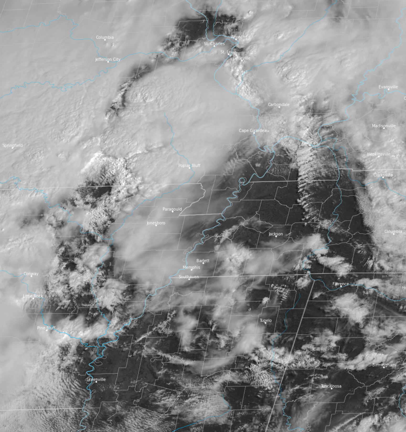
Satellite shows a lot of clearing over portions of the region. The sun is heating things up a bit.
We will have to see if this means higher CAPE values over the next few hours.
Stay aware as we move into the afternoon.
.
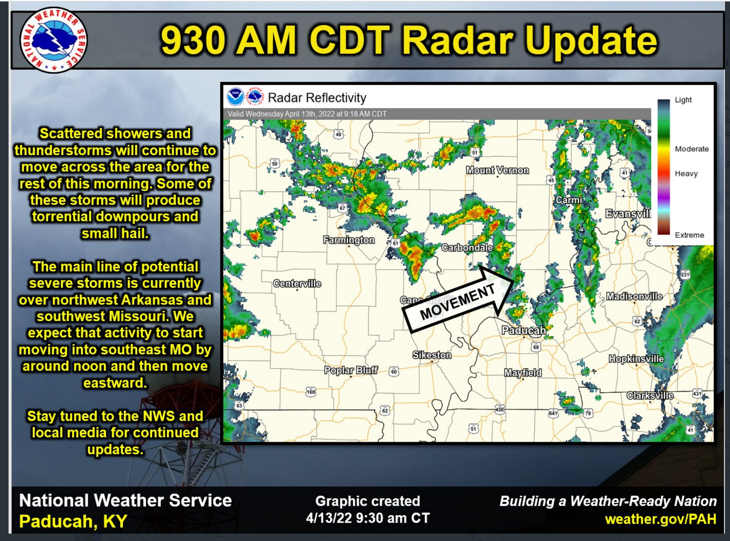
9:30 AM
8:36 AM
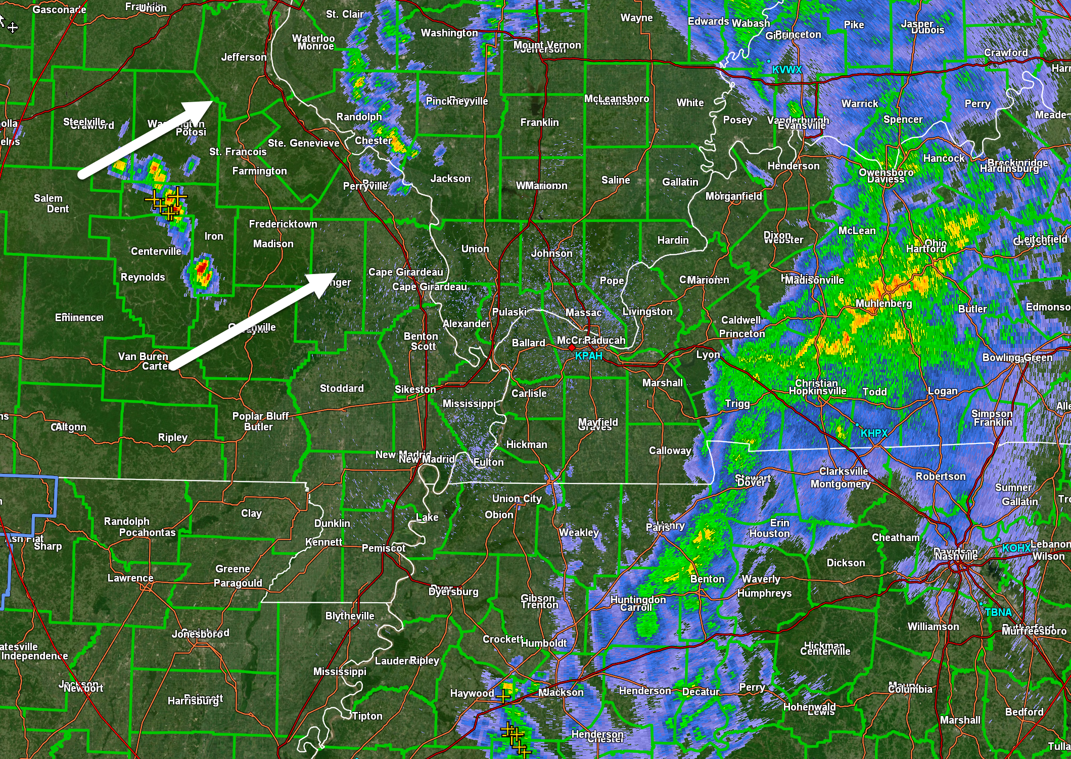
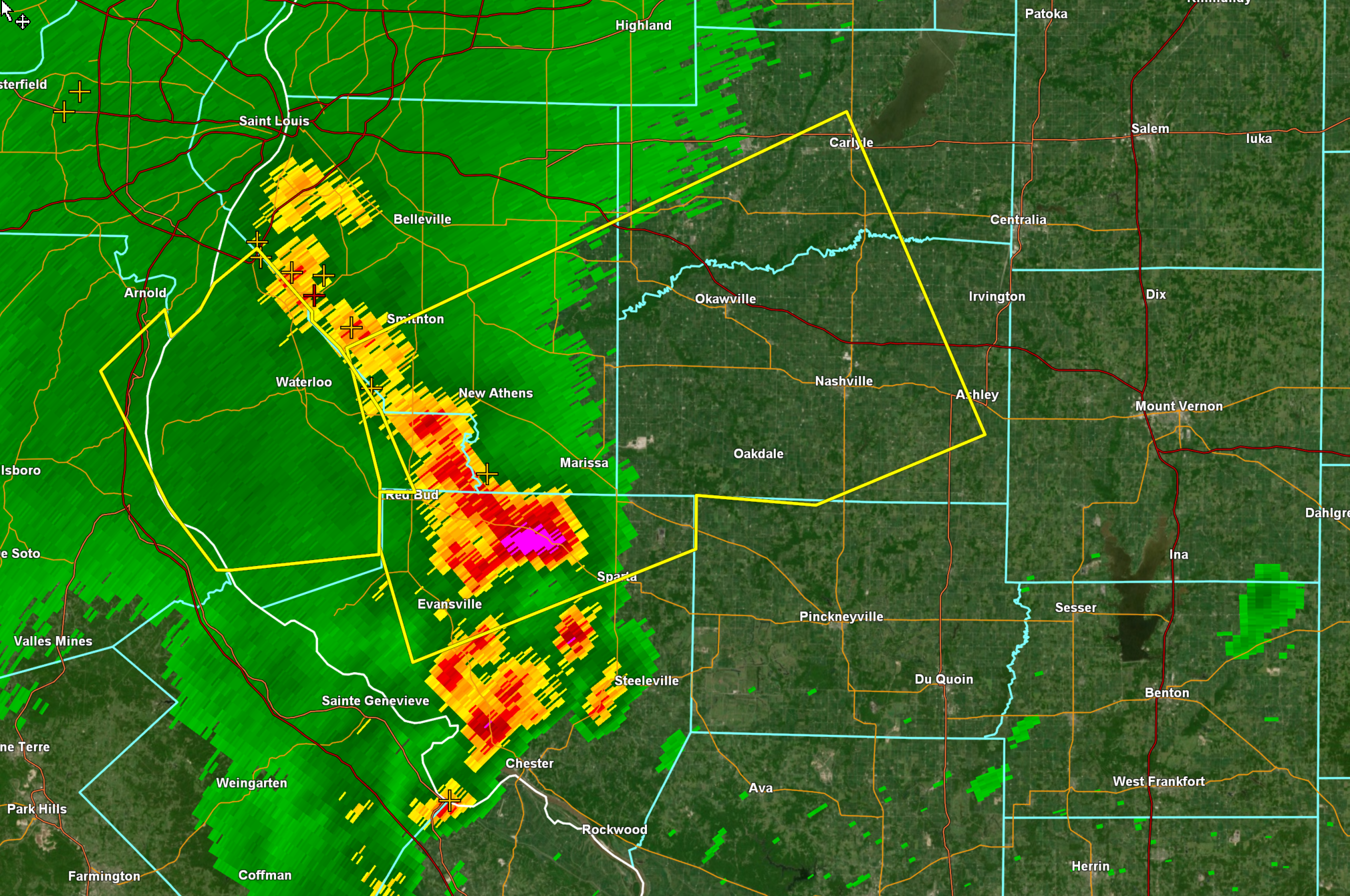
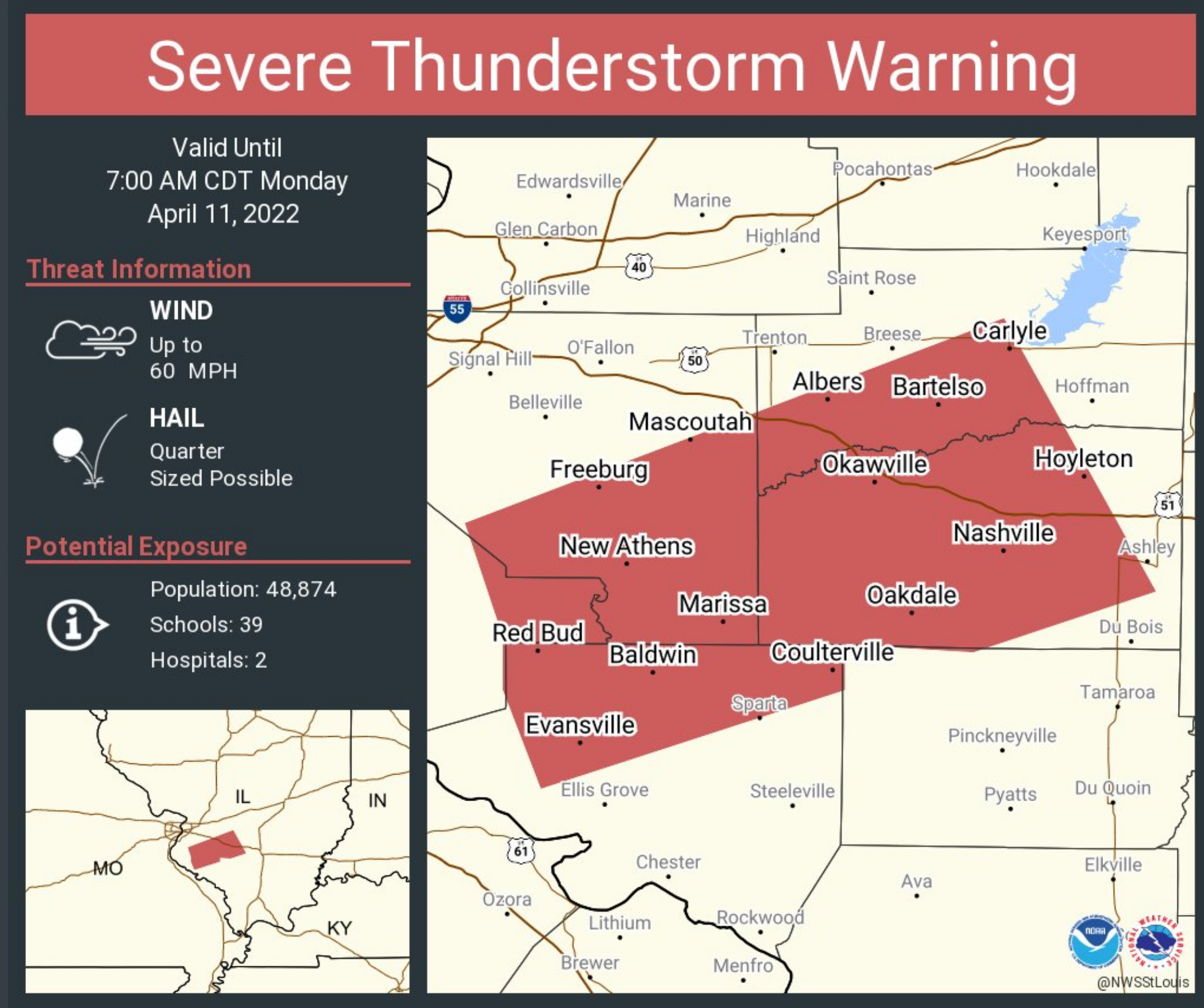
Some strong thunderstorms have formed over Union and Jackson Counties in southern Illinois. They are rapidly moving northeast at 50 mph.
The most intense storms could produce isolated quarter size hail and strong wind gusts.
The most intense storm was in Union County, IL. Near Cobden. This storm is likely producing hail.
Radar
https://weatherobservatory.com/radar_paducah.htm
.
7:54 AM update
7:45 AM Update
Multi-media update. Memphis, Tennessee, National Weather Service has posted this video.
.
7 AM Update
.
.
6:30 AM Update
Severe thunderstorms are certain today. The primary concern will be this afternoon into tonight.
The timing has slowed by an hour or two.
I want you to keep in mind that we could have storms develop at any given point today. The risk, however, is higher as we move later into the afternoon and evening hours.
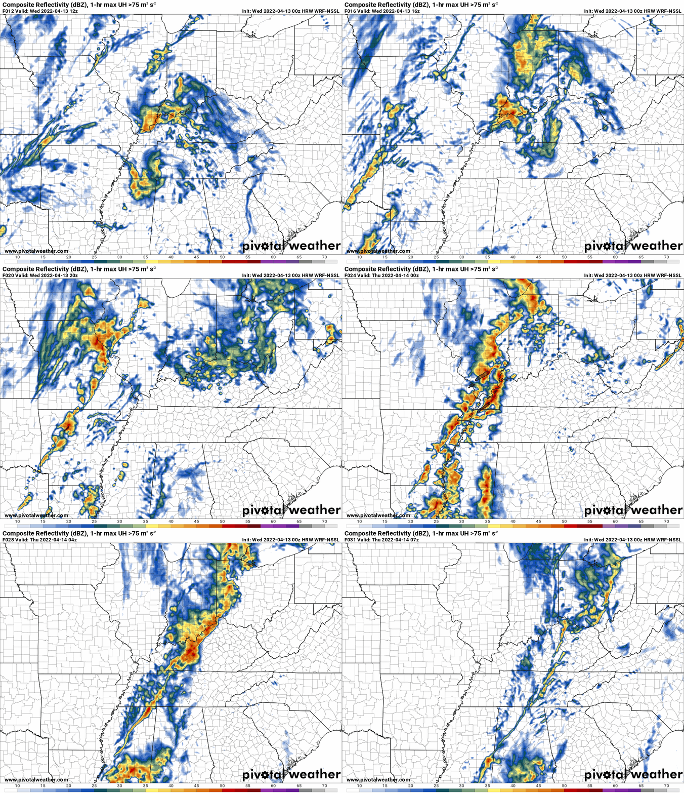
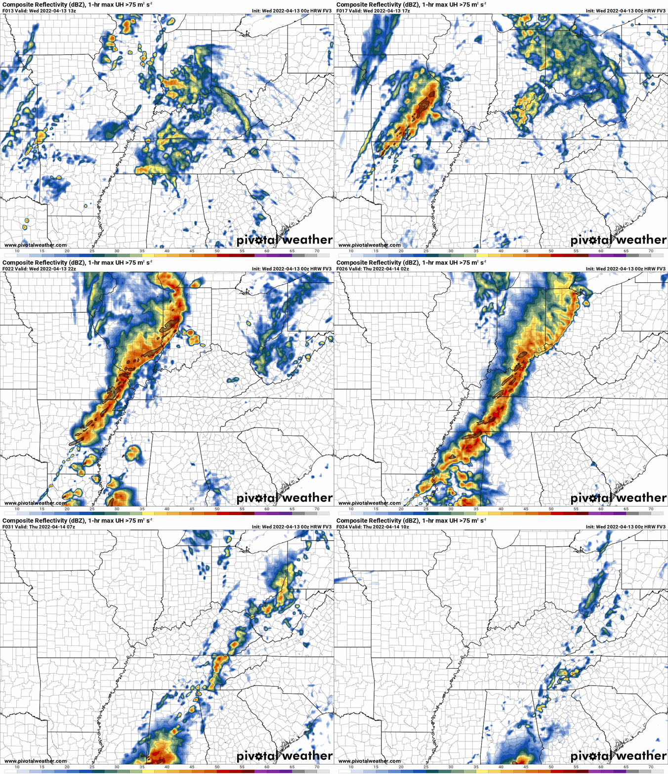
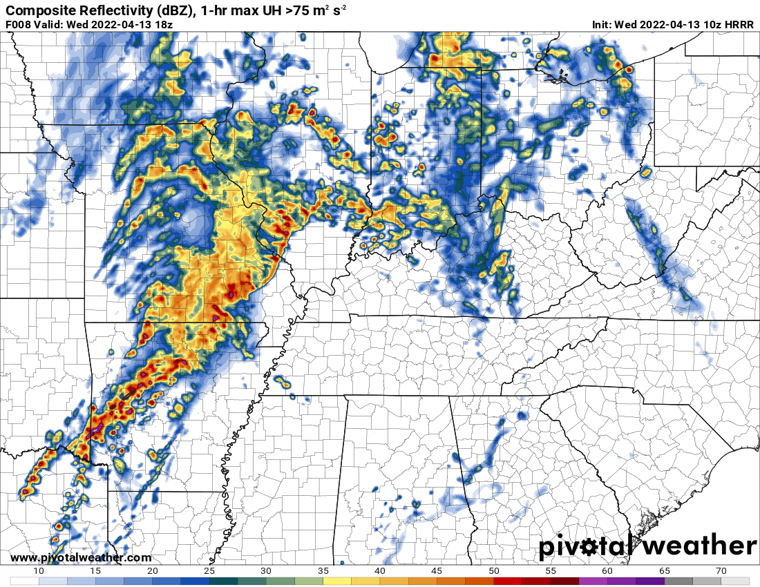
A line of thunderstorms will develop across Missouri and Arkansas. It will then sweep eastward. See the future-cast radars.
Here are some of the high resolution future-cast radars.
Time is in Zulu
Occasionally, these maps are in Zulu time. 12z=7 AM. 18z=1 PM. 00z=7 PM. 06z=1 AM
NSSL model
FV3 model
Occasionally, these maps are in Zulu time. 12z=7 AM. 18z=1 PM. 00z=7 PM. 06z=1 AM
Hrrr model
Occasionally, these maps are in Zulu time. 12z=7 AM. 18z=1 PM. 00z=7 PM. 06z=1 AM
.
The line will produce wind gusts above 70 mph, quarter size hail or larger, and some QLCS tornadoes.
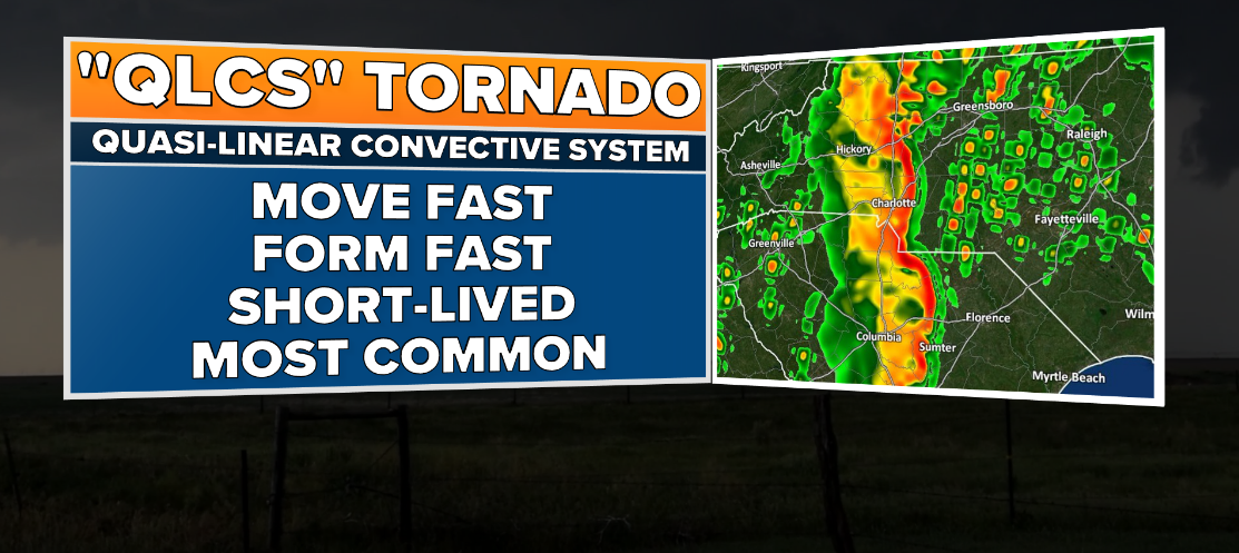
A QLCS is an abbreviation for a Quasi-Linear Convective System. This can be defined as a strong line of thunderstorms that is not perfectly straight.
QLCS tornadoes tend to be short-lived. Embedded in the rain. Difficult to issue warnings on (they develop and dissipate rapidly).
Damaging wind and short-lived tornadoes would be a concern in the squall line. Remember, most of our tornadoes are QLCS.
In addition to the above, some supercell thunderstorms could form ahead of the primary line of storms.
Supercell storms tend to produce higher end severe weather events. They can produce long tracked tornadoes. Some could be strong.
Whether supercell thunderstorms develop or not remains a question. Let’s keep it in mind.
Supercell tornadoes tend to last longer. They also tend to be higher EF-scale in their ratings.
.
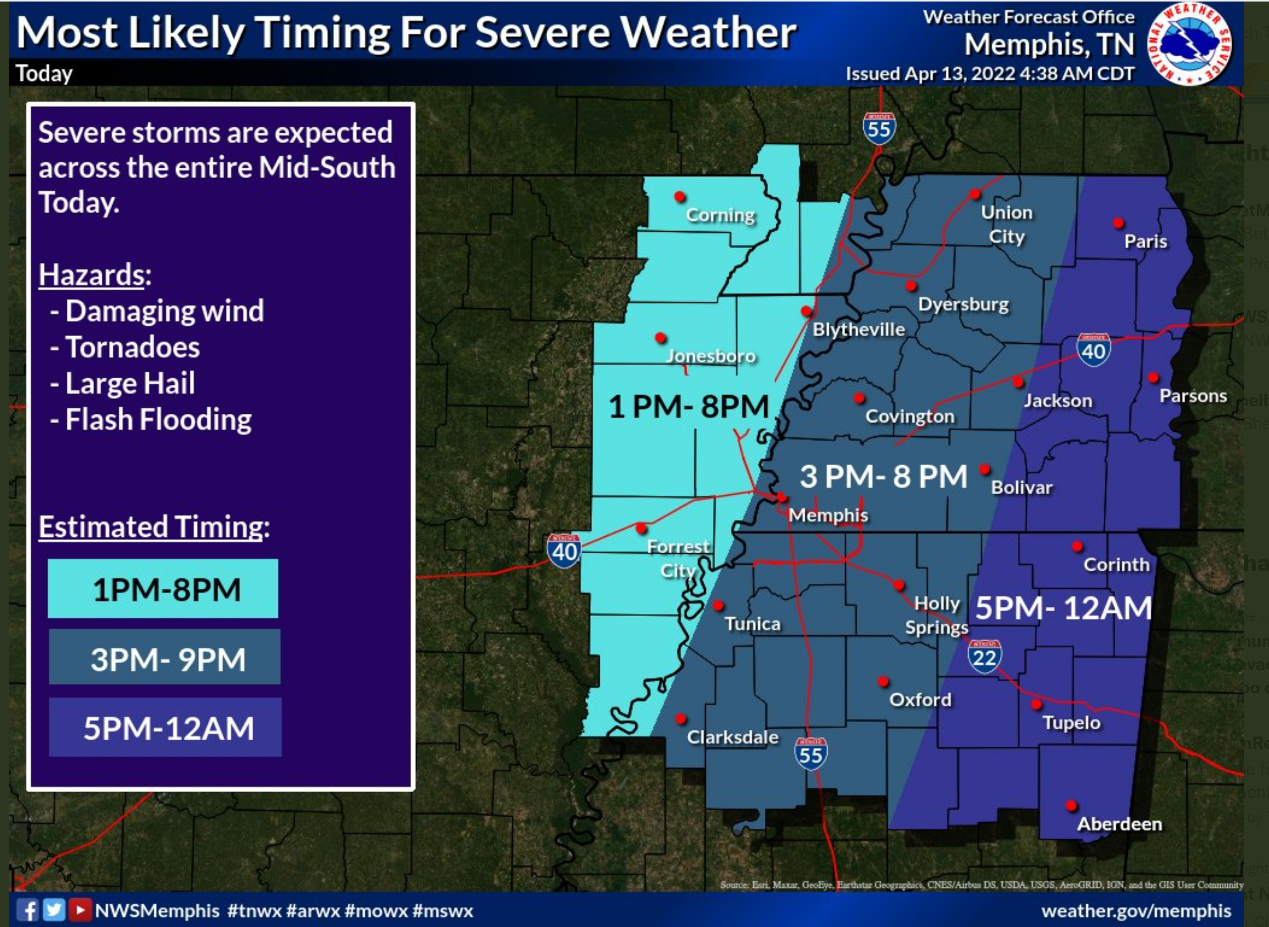
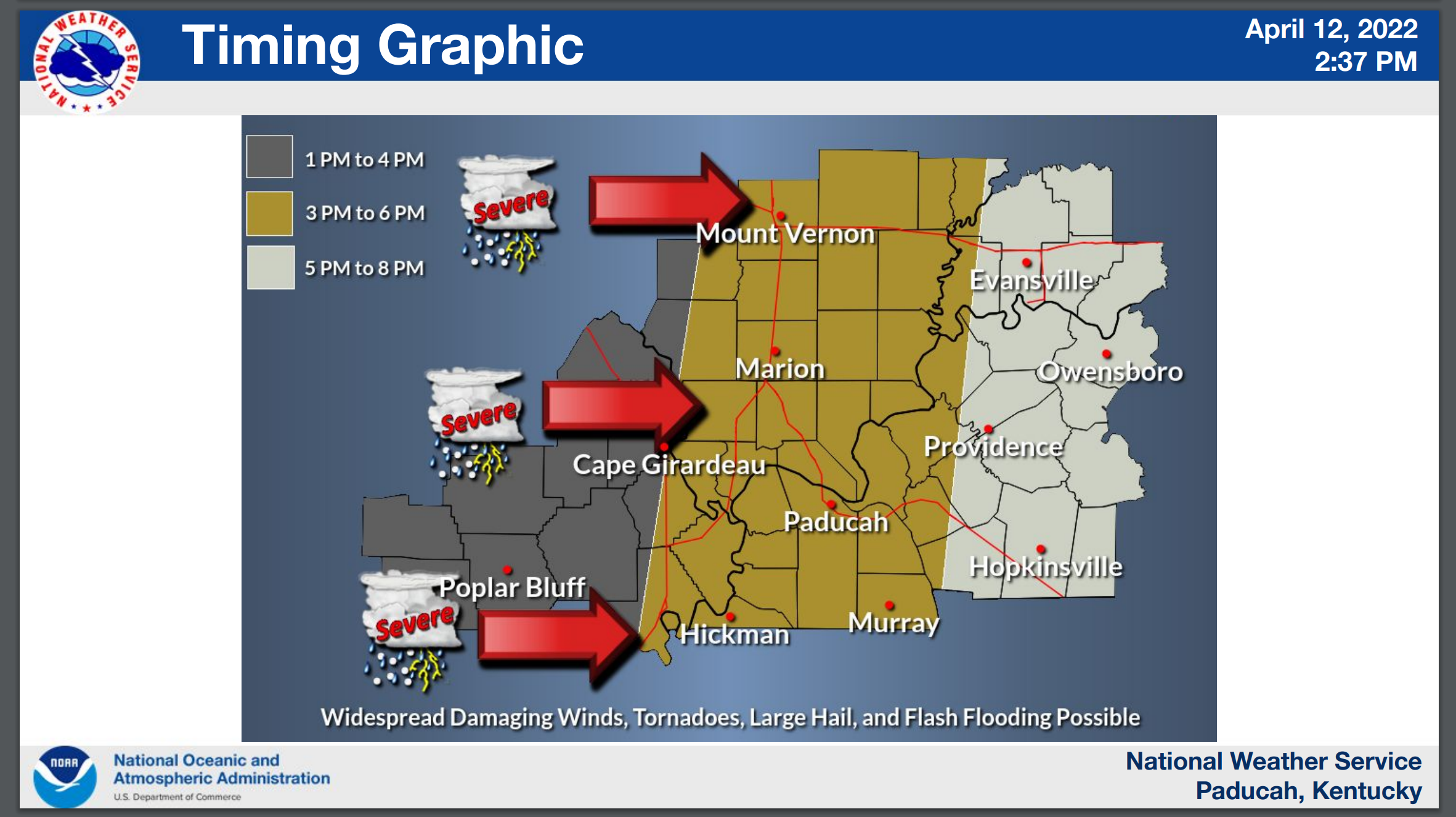
Timing graphics from our local NWS offices.
.
.
.
A flood was has been issued for portions of the area, as well.
Have multiple ways of receiving your severe weather information. Do not rely on one source. Have many.
Charge your devices in case of power outages.

.
5 AM
Working on the morning update.
At first glance, there are no significant adjustments to the going forecast.
The greatest threat time will be this afternoon into the evening hours.
Damaging wind, hail, and tornadoes will be possible. Expect tornado watches to be issued for most of the area later today.
Remember, a watch means to monitor updates. A WARNING means to seek shelter.
.
Tuesday, April 12, 2022
2:45 PM
Memphis, Tennessee, NWS video update
.
NWS conference call concerning the severe weather event.
.
1 PM update
Latest data shows no changes to the going forecast.
One round of storms later tonight into Wednesday morning.
That round could produce some torrential downpours, quarter size hail, and strong wind gusts.
The primary concern continues to be tomorrow afternoon into Wednesday evening.
A line of thunderstorms will sweep west to east across the region. Some supercell thunderstorms could form ahead of the line.
Supercell thunderstorms tend to be lone storms. They are usually ahead of the squall line. Sometimes they can be embedded in a line, as well.
Supercell thunderstorms tend to produce the higher end severe weather. That includes 70 mph winds, golf ball size hail, and stronger tornadoes.
There remain questions about how the morning thunderstorm activity will influence the storms during the afternoon.
All of the data shows tomorrow being a high-end severe weather event.
We should be weather aware. Be prepared. We go through this a few times every year.
Have your safety plan. Have multiple ways of receiving your severe weather information.
.
9 AM
Here is the Hrrr high-resolution model. Future-cast radar. What radar might look like tomorrow.
1 PM
4 PM
7 PM
.
8 AM
NWS Memphis, Tennessee, has posted a video update.
.
6:30 AM Update
Let’s break it down into time periods.
This morning: Scattered thunderstorms will produce locally heavy rain and lightning. I don’t expect severe weather this morning.
This afternoon: Isolated storms are possible. If a storm forms, then it could become severe. The overall risk this afternoon is low. There will be a CAP on the atmosphere. A lid. That is warm air aloft. That prevents thunderstorms from forming.
Tonight: Scattered thunderstorms will develop as a system approaches our region from the south/southwest.
Thunderstorms that form tonight could produce large hail and damaging wind. There are questions about the extent of the risk tonight. The best advice is to leave your severe weather devices on. If a warning is issued then you will receive the information.
Locally heavy rain will be possible. Some locations have already received 2 to 4″ of rain. Those areas could have some water issues if thunderstorms train over the same locations.
Wednesday and Wednesday night: This is the time-frame of greatest concern. There is a substantial risk of damaging wind, large hail, and tornadoes.
There remain some questions about Wednesday’s event.
One of the questions is whether morning shower and thunderstorm activity will stabilize the atmosphere enough to prevent an afternoon outbreak.
At this time, it appears that there will be showers and thunderstorms on radar Wednesday morning. Perhaps lingering or even redeveloping during the late morning hours.
These clouds and precipitation will make for a difficult afternoon forecast.
If the atmosphere does re-charge then we are going to have a chance of 70+ mph wind gusts, golf ball size hail or larger, and tornadoes. Some of those tornadoes could be long-tracked and strong.
We may not have a solid handle on Wednesday’s threat until tomorrow morning.
Either way, now is the time to prepare for the possibility of severe weather.
It is important to remember that most locations won’t be impacted by an actual severe thunderstorm. The area that receives the damaging wind, large hail, and tornadoes is typically very small. Thus, the odds are always on your side when it comes to severe weather.
A few locations will be impacted.
Unfortunately, the science does not allow us to tell you what towns will be hit by a severe thunderstorm until they develop and we can issue actual warnings.
What you can do to prepare for severe weather
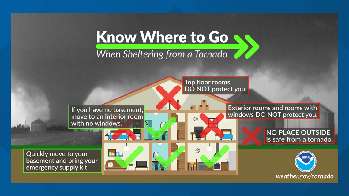
Here is some safety advice from the NWS concerning sheltering from storms. https://www.weather.gov/ama/severesafetytips
1. Have a family safety plan. Discuss it with your family. Make sure your kids know what to do in the event of severe weather.
2. Have your devices fully charged.
3. Change the batteries in your NOAA weather radio.
4. Have THREE TO FIVE ways of receiving your severe weather information. All sources can and have failed in the past. The Beau Dodson Weather app is one of those ways, NOAA weather radio, WEA on your phones (google it), local television and radar media, additional weather apps, and outdoor sirens. Do not rely on just the outdoor warning sirens.
5. Leave your shoes and wallet/keys by the bed. If a warning is issued overnight then you will be prepared.
6. We recommend people wear helmets during tornado warnings. In the event of an actual tornado then you will be thankful to have a helmet.
7. Have a thick blanket in your tornado safe-space.
8. Prescription medicine.
Create an emergency supply kit. If the storm is likely to cause a lot of damage, it’s important to be prepared for a variety of problems. Things that you should put in a basic supply kit include:
- Flashlights and extra batteries.
- Emergency radio.
- First aid kit
- Whistle, to alert people to your location.
- Personal sanitation products, such as garbage bags, toilet paper, paper towels, wet wipes, and tampons/pads.
- Plastic tarps
- Extra warm clothes.
- Dusk masks.
- Utility shut off tools.
Here are some of the high resolution future-cast radars.
Time is in Zulu
Occasionally, these maps are in Zulu time. 12z=7 AM. 18z=1 PM. 00z=7 PM. 06z=1 AM
NSSL model
FV3 model
Hrrr model
.
Know your safety plan. Make sure your kids know the severe weather safety plan.
Have helmets in your safe space. Any kind of helmet is better than no helmet.

Noah Stewart shelters in the closet just 15 minutes before an April 2011 tornado demolished his house. Wearing the helmet may have saved his life, one doctor says.
Have three to five ways of receiving your severe weather information.
Monday, April 11, 2022
7:45 PM
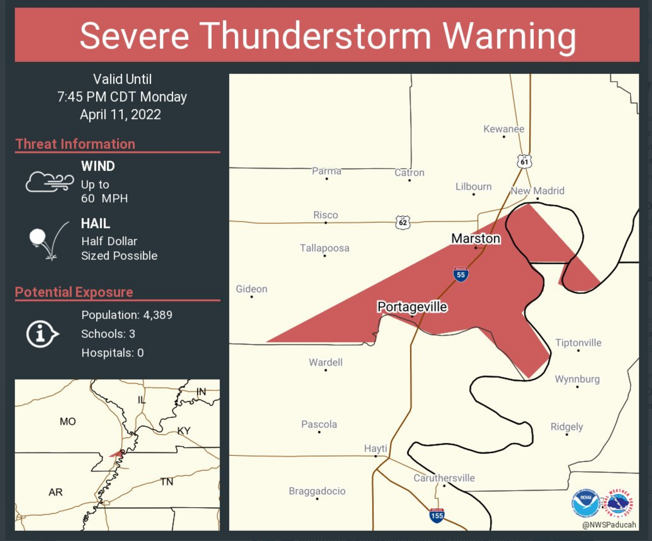
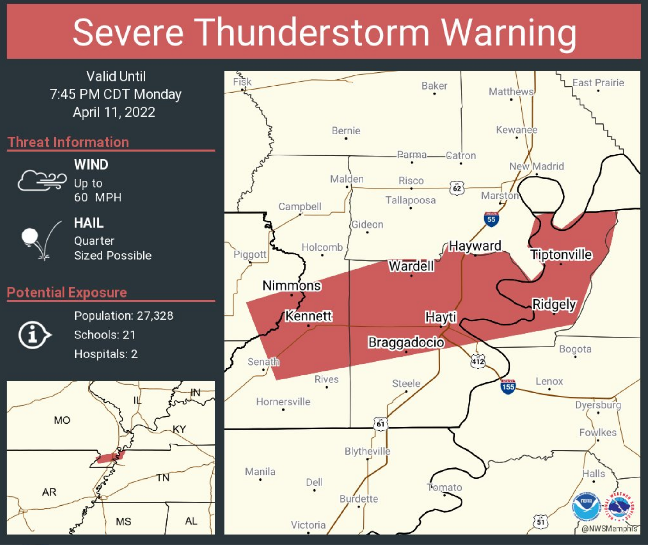
Severe thunderstorm warnings have expired.
Golf ball size hail fell across portions of the Missouri Bootheel.
The storm has since weakened..
.
7:42 PM
.
.
.
.
.
.
.
7:10 PM
.
4:49 PM
Video update from the Memphis, Tennessee, NWS Office
.
.
1:25 PM
.
12:55 PM
.
.
12:30 PM Update
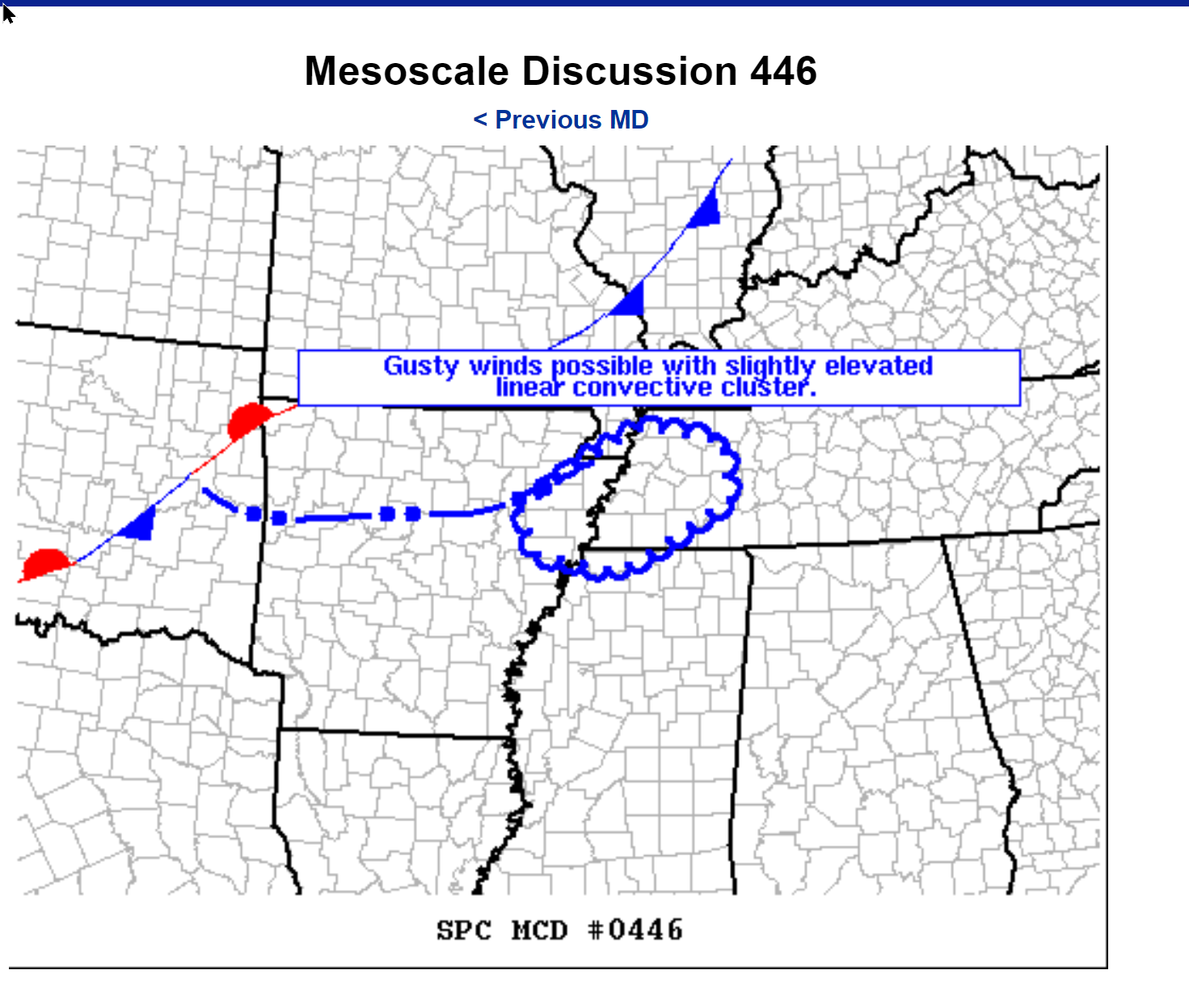
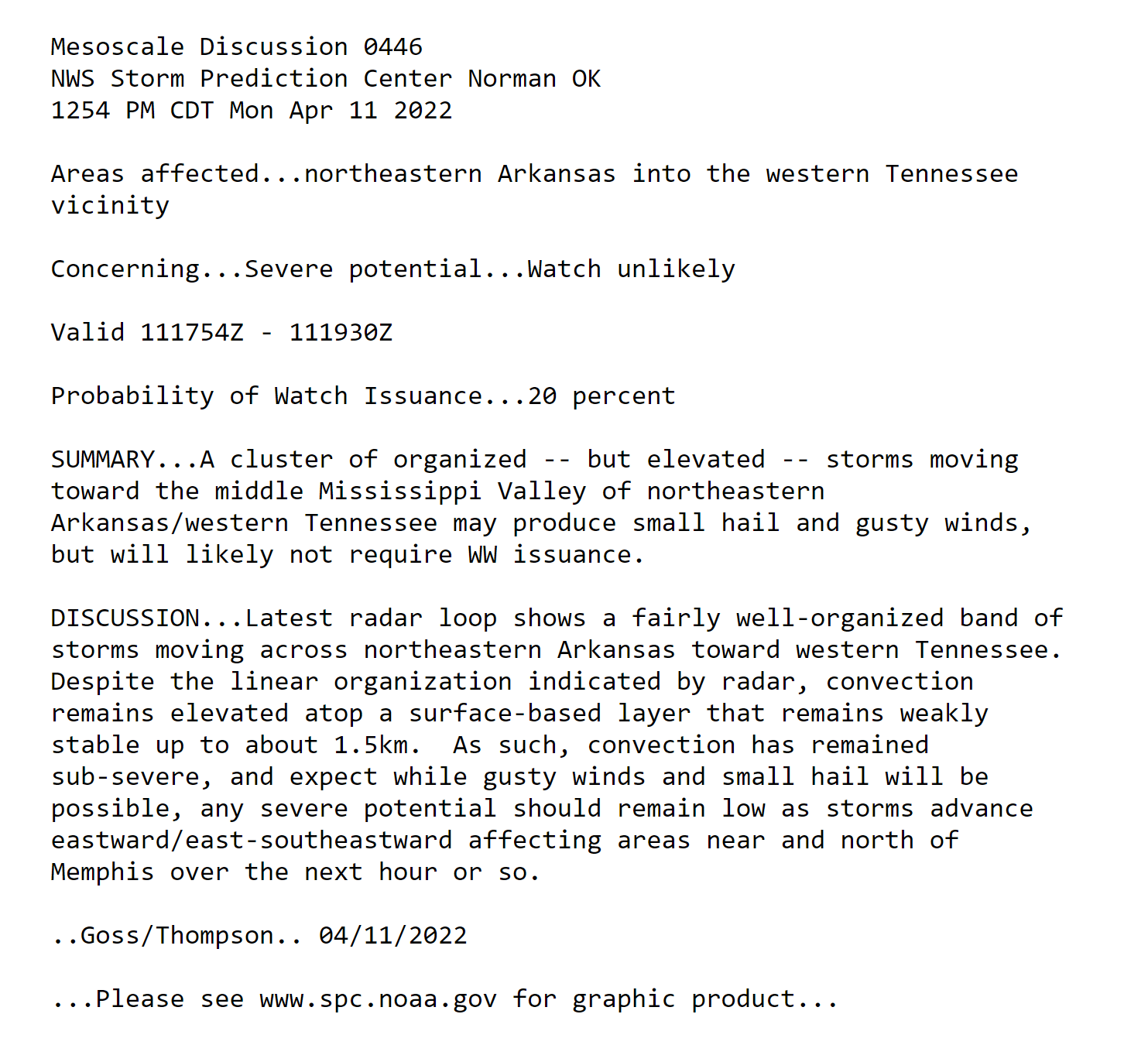
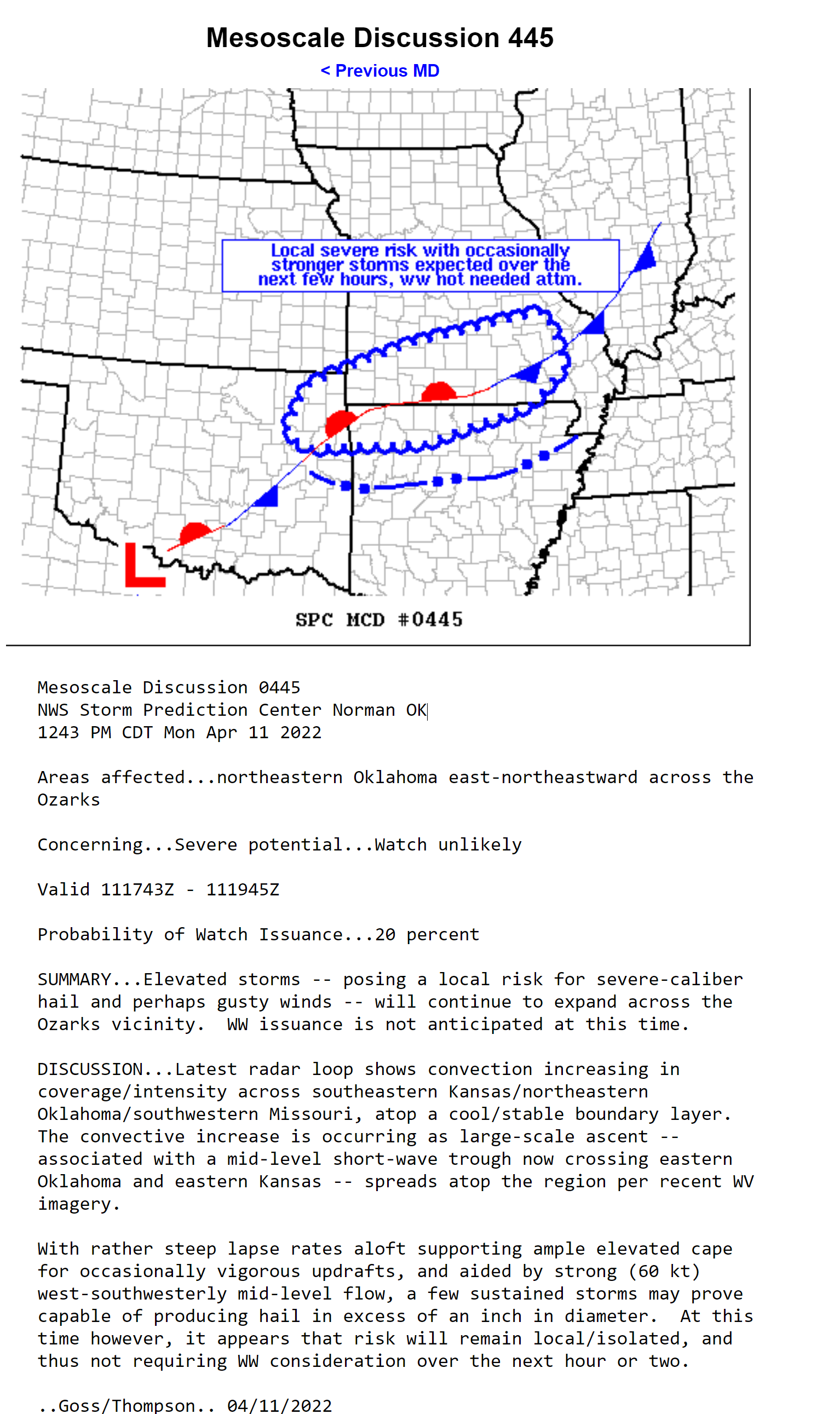
I am watching this afternoon and evening for a few severe thunderstorms. The primary concern is going to be damaging wind and hail. A low tornado risk (not zero).
Let’s look at the Hrrr model guidance. Future-cast radar.
What radar might look like at
5 PM
7 PM
9 PM
Know your safety plan. Make sure your kids know the severe weather safety plan.
Have helmets in your safe space. Any kind of helmet is better than no helmet.

Noah Stewart shelters in the closet just 15 minutes before an April 2011 tornado demolished his house. Wearing the helmet may have saved his life, one doctor says.
.
Scroll further down to see the latest future-cast radars.
A cold front will push into our region today. The front will move back north as a warm front tonight.
This front will be the focus of showers and thunderstorms today and tonight.
Some of these storms are going to produce heavy downpours.
There is a risk of severe weather today, as well. The risk is highest this afternoon into tonight.
The primary concern will be damaging wind and hail. The tornado risk is low, but not zero. The tornado risk is a bit higher near the Missouri Bootheel.
Either way, expect some severe thunderstorm warnings later today.
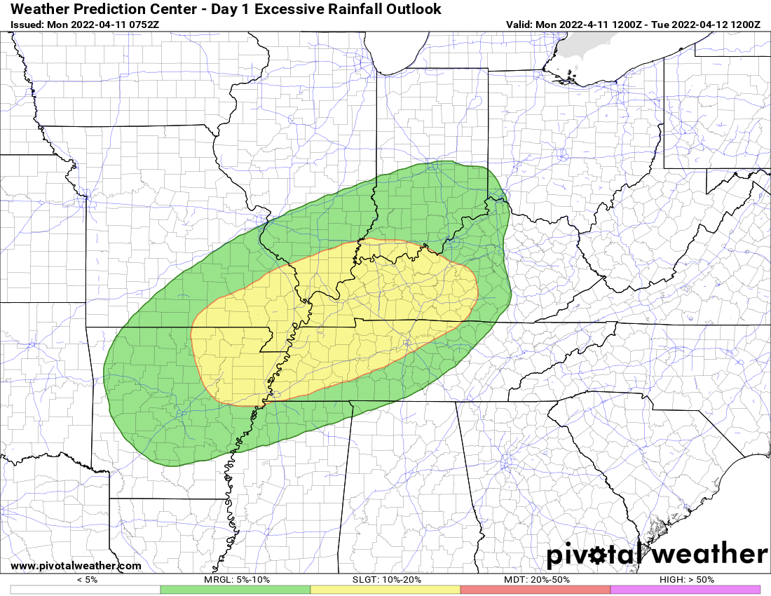
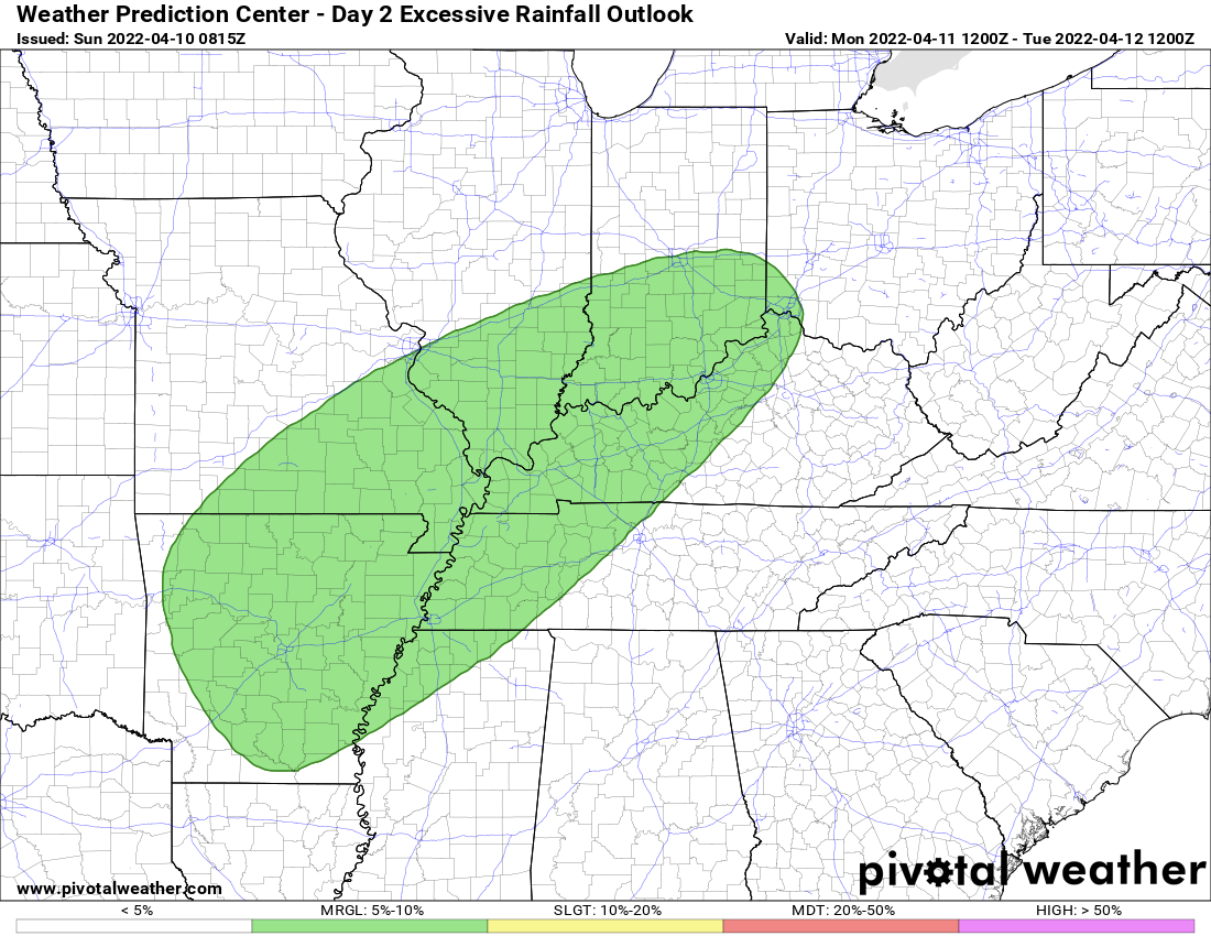
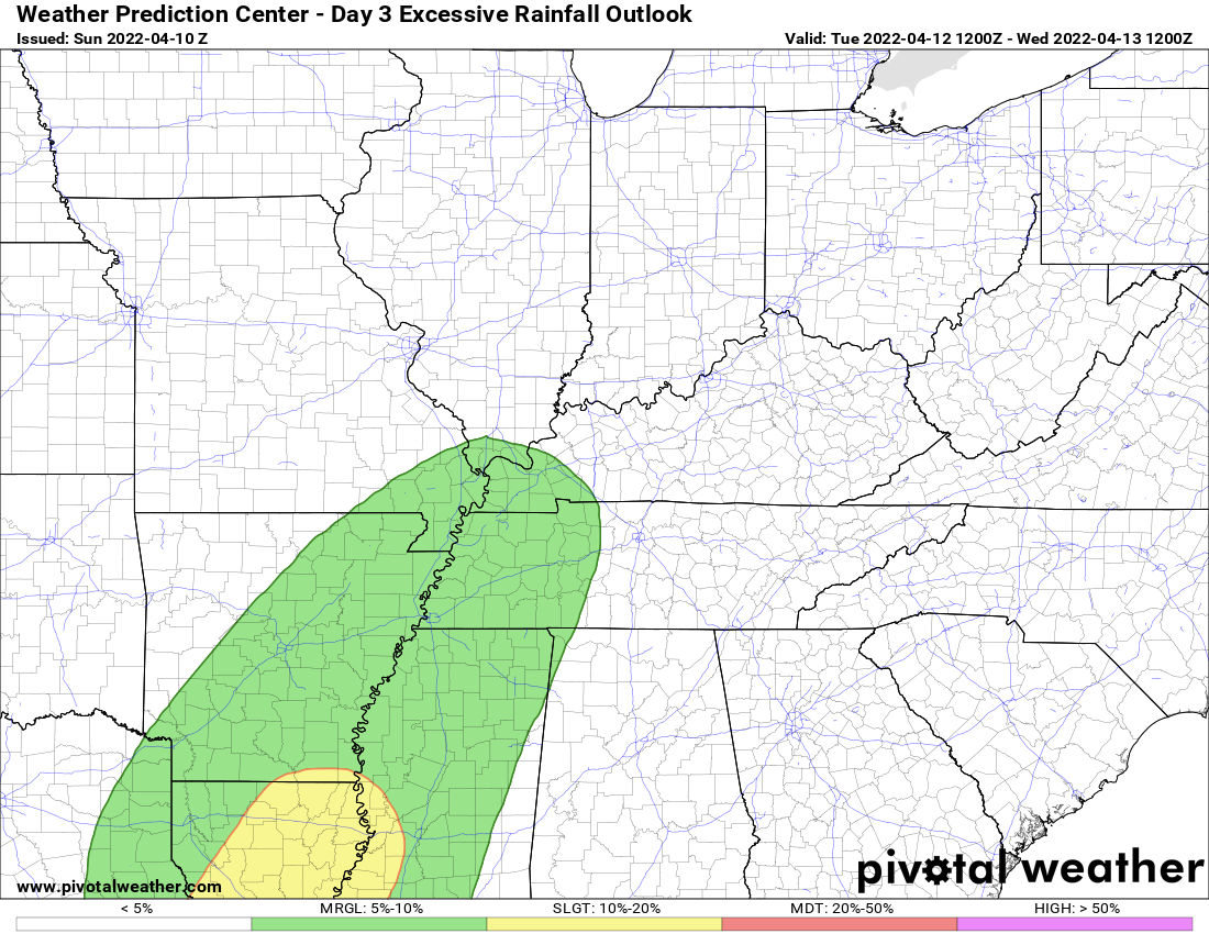
We are also in a marginal and slight risk of flash flooding. There could be some issues in low lying area, commonly flooded areas, and some roadways.
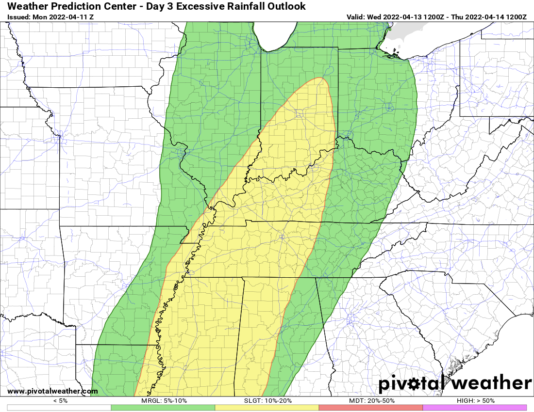
WPC/NOAA excessive rainfall outlook.
Warm air aloft will likely help CAP the atmosphere Tuesday. What is a CAP? A CAP acts like a lid on the atmosphere. It prevents thunderstorms from developing. This CAP will likely help keep storms from forming during the day on Tuesday.
Perhaps an isolated storm. For the most part, however, it will be dry.
Shower and thunderstorm chances will increase Tuesday evening and night.
One disturbance will push into the region Tuesday night from Arkansas and Louisiana. This system will produce numerous showers and thunderstorms.
Some of those thunderstorms could be severe Tuesday night/Wednesday morning.
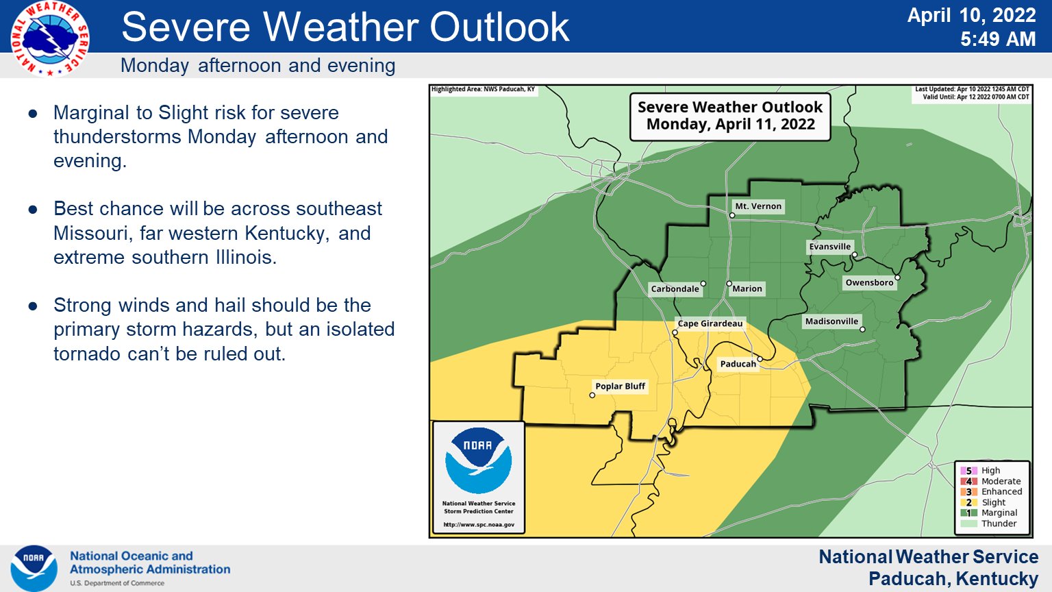
Here are the Storm Prediction Center’s severe weather outlooks for today and tomorrow.
Light green is where thunderstorms may occur but should be below severe levels.
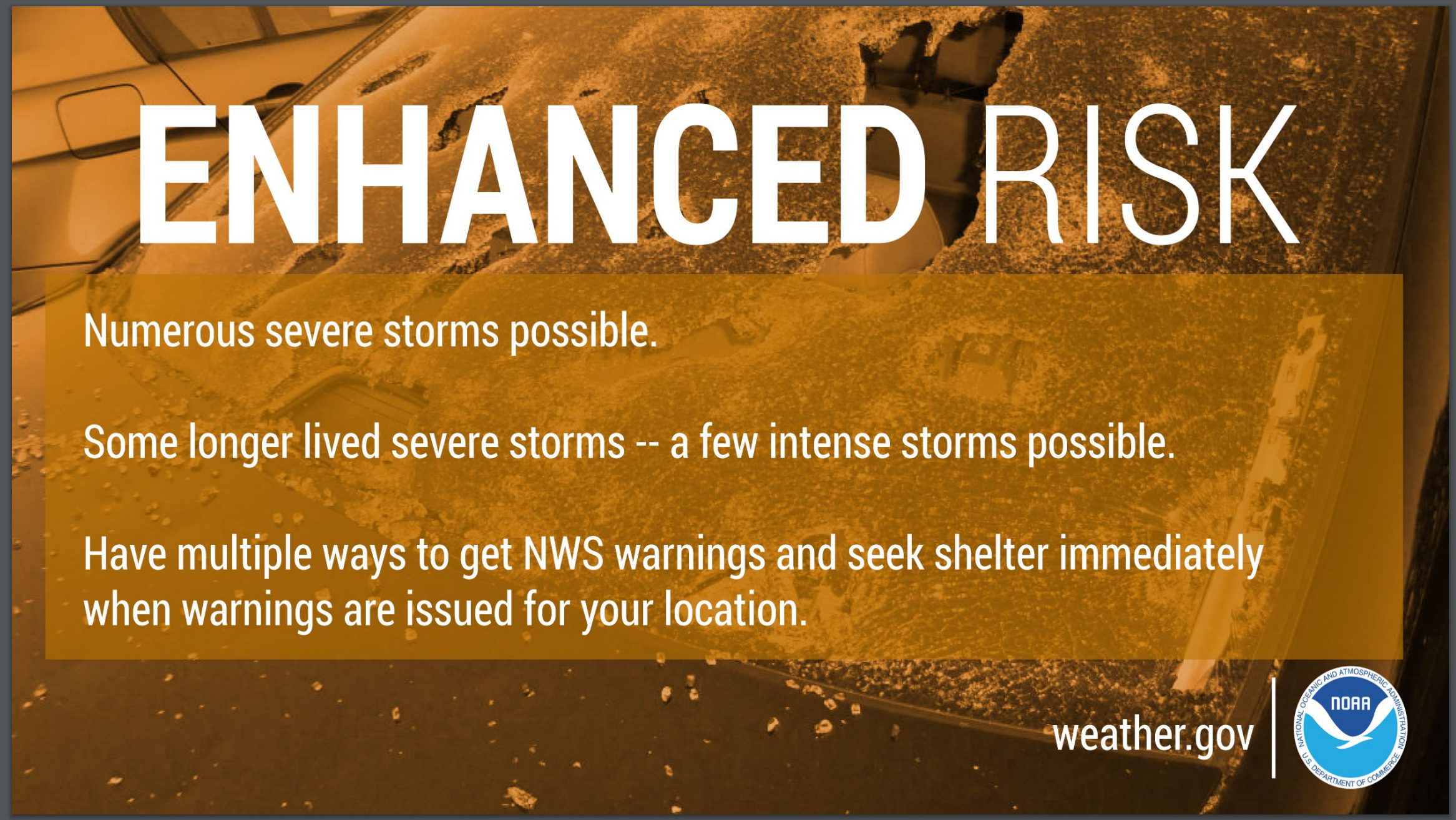
Dark green is a level one risk. Yellow is a level two risk. Orange is a level three (enhanced) risk. Red is a level four (moderate) risk. Pink is a level five (high) risk.
One is the lowest risk. Five is the highest risk.
A severe storm is one that produces 60 mph wind or higher, quarter size hail, and/or a tornado.
Today’s severe weather outlook.

Tomorrow’s severe weather outlook.

.
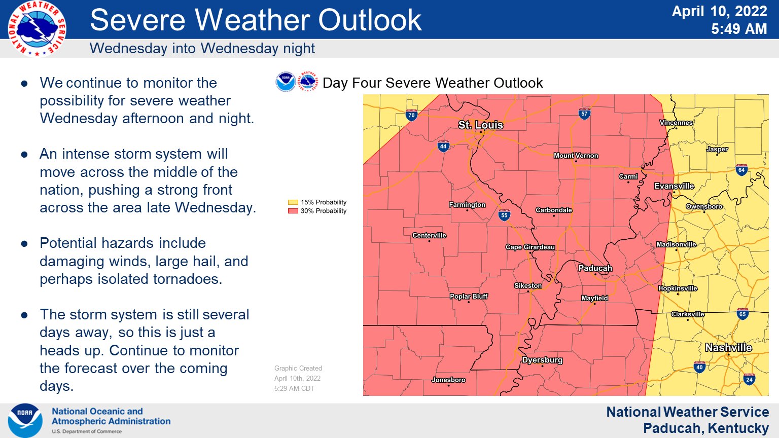
Severe Weather Likely Wednesday/Wednesday night
The Tuesday night/Wednesday morning system will then quickly pull off to the northeast Wednesday morning.
If it does push out of the region quickly, then that would allow some time for the atmosphere to recover during the late morning and afternoon hours. The atmosphere would, in other words, become unstable.
If this destabilization does occur, then expect numerous severe thunderstorms to develop Wednesday afternoon and evening. Some of these storms could produce winds above 70 mph, golf-ball size hail, and tornadoes.
We will have to monitor the risk of supercells Wednesday afternoon and evening. Again, this is highly dependent on the morning activity exiting the region fast enough for the atmosphere to recover.
There remain some questions about Wednesday’s threat. The primary question being the morning clouds and precipitation and how fast it exits.
The Storm Prediction Center has outlined our region in a level three out of five risk of severe weather Wednesday. This may be upgraded IF the atmosphere can destabilize after the morning precipitation.
In addition to the above, locally heavy rain could cause pockets of flooding. The WPC/NOAA has placed our region in a marginal and slight risk of flash flooding Wednesday/Wednesday night.
A mixture of QLCS tornadoes and supercells will be possible Wednesday/Wednesday night.
Supercells tend to produce a higher degree of severe weather. That includes damaging wind, hail, and tornadoes.
I am forecasting a squall line along the cold front. A squall line is a line of thunderstorms. This is likely to be QLCS. A wavy line of storms.
A QLCS is an abbreviation for a Quasi-Linear Convective System. This can be defined as a strong line of thunderstorms that is not perfectly straight.
QLCS tornadoes tend to be short-lived. Embedded in the rain. Difficult to issue warnings on (they develop and dissipate rapidly).
Damaging wind and short-lived tornadoes would be a concern in the squall line. Remember, most of our tornadoes are QLCS.
Monitor updates.
Now is the time to prepare for severe weather.
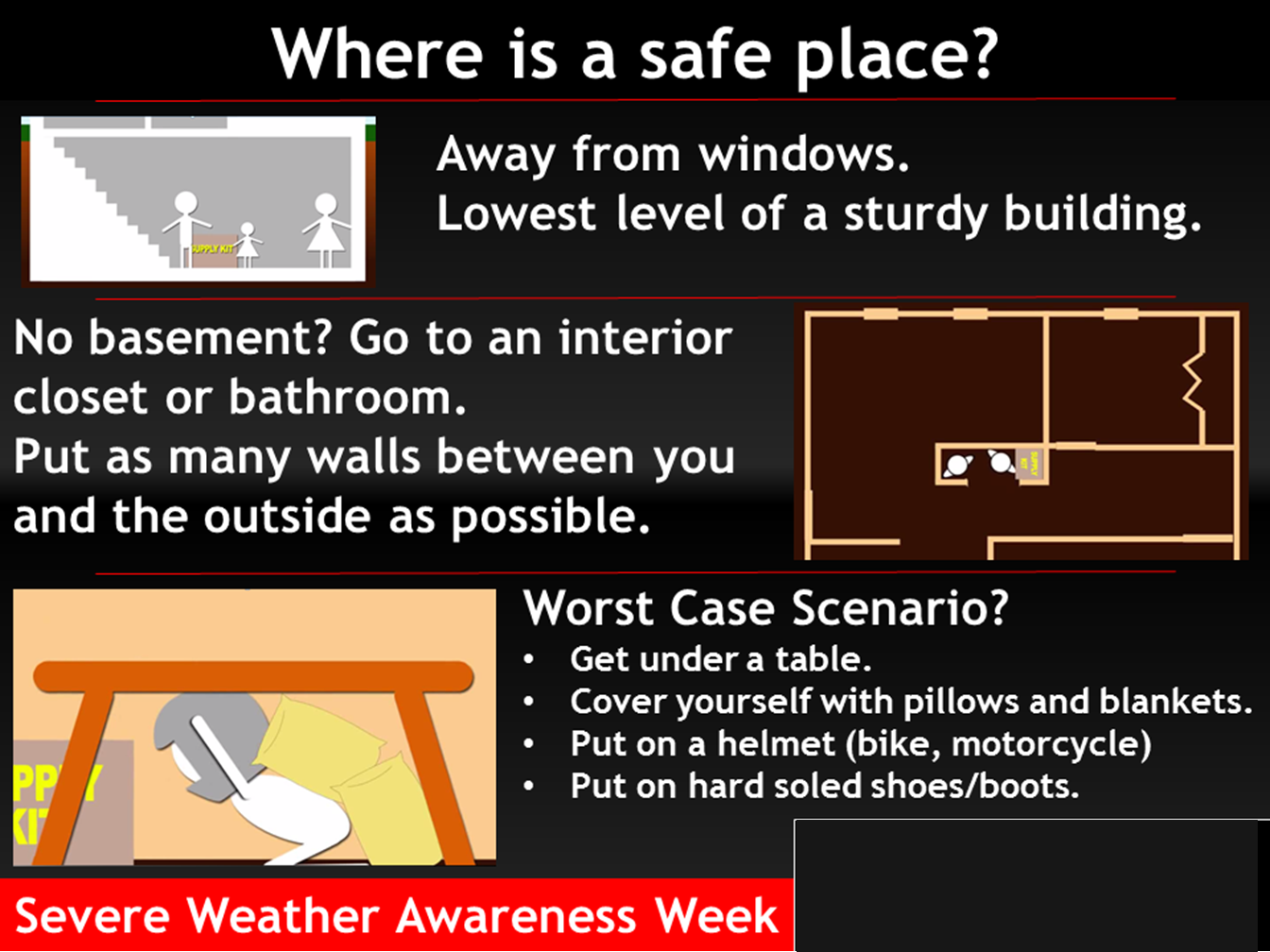
Where is a safe place to hide when tornadoes threaten your location.
Have three to five ways of receiving your severe weather information.
What am I looking at?
You are looking at different models. Meteorologists use many different models to forecast the weather. All models are wrong. Some are more wrong than others. Meteorologists have to make a forecast based on the guidance/models.
I show you these so you can see what the different models are showing as far as precipitation. If most of the models agree, then the confidence in the final weather forecast increases.
You can see my final forecast at the top of the page.
Occasionally, these maps are in Zulu time. 12z=7 AM. 18z=1 PM. 00z=7 PM. 06z=1 AM
.
This animation is the Storm Prediction Center WRF model.
This animation shows you what radar might look like as the next system pulls through the region. It is a future-cast radar.
Time-stamp upper left. Click the animation to enlarge it.
.
This animation is the HRW FV3 high resolution model.
This animation shows you what radar might look like as the next system pulls through the region. It is a future-cast radar.
Time-stamp upper left. Click the animation to enlarge it.
Occasionally, these maps are in Zulu time. 12z=7 AM. 18z=1 PM. 00z=7 PM. 06z=1 AM
.
This animation is the Hrrr short-range model.
This animation shows you what radar might look like as the next system pulls through the region. It is a future-cast radar.
Time-stamp upper left. Click the animation to enlarge it.
Double click the animation to enlarge it.
Occasionally, these maps are in Zulu time. 12z=7 AM. 18z=1 PM. 00z=7 PM. 06z=1 AM
.
.This animation is the higher-resolution 3K NAM American Model.
Double click the animation to enlarge it.
Occasionally, these maps are in Zulu time. 12z=7 AM. 18z=1 PM. 00z=7 PM. 06z=1 AM
.
Severe thunderstorm warning for portions of Randolph County.
6:10 AM.
.
Sunday, April 10, 2022
The next update will be Monday morning.
2 PM
Some graphics from the NWS
.
12 PM update
We are going to have some active weather over the coming days. Monitor updates each day. Be prepared for some severe weather.
Several waves of thunderstorms will impact the region between tonight and Wednesday night.
Locally heavy rain will be possible over the coming days. There is quite a bit of moisture for storms to work with. If thunderstorms train over the same areas then there could be some water issues in a few spots.
Widespread flash flooding is currently not anticipated, but I am forecasting some sporadic issues. Some flash flood warnings or flood advisories will be possible.
Avoid flooded roadways if they develop. Help our local emergency responders by staying out of the water. You put yourself and them at risk.
The greatest risk of severe weather will likely be Wednesday. That is the day that the cold front pushes across the region.
Let’s break it down.
Monday:
Thunderstorms are possible at any given point of the time and night.
A couple of storms could produce hail and high winds Monday. The overall risk is on the lower end, but it is not a zero risk. The tornado risk is low for most of the area.
The exception to that might be the Missouri Bootheel. The risk of a tornado is a bit higher there.
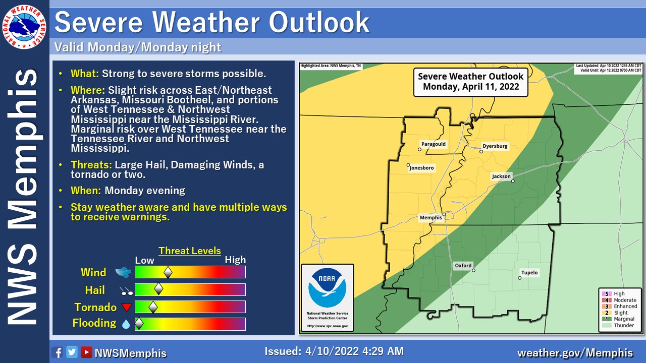
The best advice is to monitor updates Monday. The Storm Prediction Center does have us in a level one and two risk (Monday). It is a five level risk scale. One being the lowest. Five being the highest.
The WPC/NOAA has placed us in a level one (lowest) flash flooding risk, as well.
The Hrrr and NAM 3K model guidance future-cast radar shows activity during the morning, afternoon, and night.
7 AM
Here is what the NAM 3K model showers for the same time-period.
.
1 PM
Here is what the NAM 3K model shows for the same time-period
.
7 PM
Here is what the NAM 3K shows for the same time-period
.
1 AM Tuesday
.
Tuesday
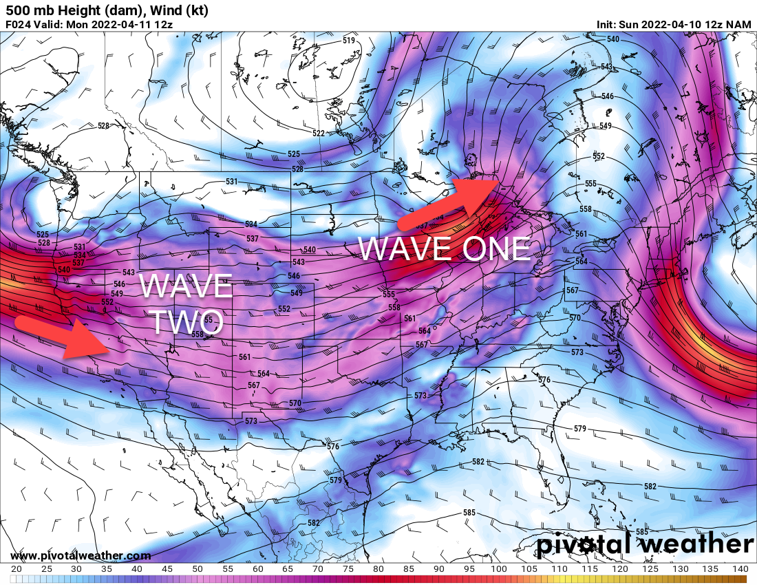
The first shortwave will be pulling away from the region Tuesday. The risk of severe weather will shift westward in advance of the next system pulling out of the southwest United States.
We do have a chance of showers and thunderstorms Tuesday. The Storm Prediction Center currently has us in a level one risk of severe weather. The lowest risk.
The atmosphere will be quite unstable Tuesday, but we will have a warm layer of air aloft. This warm layer of air is called a CAP. CAP can prevent storms from forming.
Without a lot of lift in the atmosphere, it may be difficult for thunderstorms to form Tuesday (during the day).
Storms will form to our west throughout Tuesday and Tuesday evening.
The cold front will slowly push towards our region Tuesday night. The chance of a few thunderstorms will increase Tuesday night.
I will monitor Tuesday night for severe weather. The concern would be higher over southeast Missouri Tuesday night vs the rest of the area.
With that said, since the atmosphere will be unstable, let’s keep an eye on Tuesday/Tuesday night.
The WPC/NOAA has portions of the region in a level risk of flash flooding.
.
Wednesday:
I am most concerned about Wednesday’s severe weather threat.
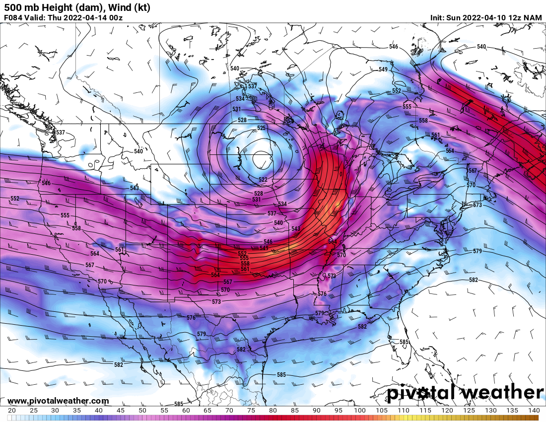
You can see the trough pushing out of the central United States and advancing northeast.
This is the 500 mb map. 15,000 feet aloft. You can see the jet stream wind. The red colors are higher numbers.
There are some questions about Wednesday’s threat.
The GFS model is faster with bringing the cold front into the region and moving it eastward. The EC model is slower.
The EC model is currently the favored model. It has been most consistent from run to run. It runs four times a day.
We will need to monitor how much shower and thunderstorm activity remains in the region Wednesday morning. Clouds, as well.
Ongoing precipitation and clouds could keep instability lower. Lower instability would reduce the severe weather risk Wednesday afternoon and night.
If morning showers and thunderstorms don’t impact the afternoon activity then all modes of severe weather will be possible. That includes some supercells.
Supercells tend to produce a higher degree of severe weather. That includes damaging wind, hail, and tornadoes.
I am forecasting a squall line along the cold front. A squall line is a line of thunderstorms. This is likely to be QLCS. A wavy line of storms.
A QLCS is an abbreviation for a Quasi-Linear Convective System. This can be defined as a strong line of thunderstorms that is not perfectly straight.
QLCS tornadoes tend to be short-lived. Embedded in the rain. Difficult to issue warnings on (they develop and dissipate rapidly).
Damaging wind and short-lived tornadoes would be a concern in the squall line. Remember, most of our tornadoes are QLCS.
Supercell tornadoes tend to last longer. They also tend to be higher EF-scale in their ratings.
Since there remain questions about the extent of Wednesday’s severe weather threat, the best advice is to monitor updates over the next 48 to 72 hours.
The threat of severe weather will end by Thursday.
I am watching next Sunday for thunderstorms in or near the region. We may remain on the cold side of that system. If so, there won’t be a severe weather threat.
Monitor updates. Monitor your Beau Dodson Weather App. Monitor local media. Have THREE TO FIVE ways of receiving severe weather information. Do not rely on just one source. Every source can fail at one point or another. Thus, having multiple sources of severe weather information is the best advice.
.
Light green is where thunderstorms may occur but should be below severe levels.
Dark green is a level one risk. Yellow is a level two risk. Orange is a level three (enhanced) risk. Red is a level four (moderate) risk. Pink is a level five (high) risk.
One is the lowest risk. Five is the highest risk.
A severe storm is one that produces 60 mph wind or higher, quarter size hail, and/or a tornado.
Today’s severe weather outlook.

Tomorrow’s severe weather outlook.

.
.
Monitor updates. Monitor your Beau Dodson Weather App. Monitor local media. Have THREE TO FIVE ways of receiving severe weather information. Do not rely on just one source. Every source can fail at one point or another. Thus, having multiple sources of severe weather information is the best advice.
Know your families safety plan in the event severe weather develops.
Have multiple ways of receiving severe weather information. Not just my weather app. Have other ways, as well. All technology can fail. Thus, having more than one source will help keep you safe.
Remember, a WATCH means to monitor updates. You don’t have to change your behavior for a watch. Be prepared.
A WARNING is more serious. A WARNING means severe weather is imminent in or near your location. A WARNING means to seek shelter.
.
Where is a safe place to hide when tornadoes threaten your location.
.
![]()
Today’s severe weather outlook from the Storm Prediction Center (below).
Light green is where thunderstorms may occur but should be below severe levels.
Dark green is a level one risk. Yellow is a level two risk. Orange is a level three (enhanced) risk. Red is a level four (moderate) risk. Pink is a level five (high) risk.
One is the lowest risk. Five is the highest risk.
A severe storm is one that produces 58 mph wind or higher, quarter size hail, and/or a tornado.
The tan states are simply a region that SPC outlined on this particular map. Just ignore that.

The black outline is our local area.

.
Tomorrow’s severe weather outlook.

.
SUBSCRIBERS: Download the WeatherTalk app to keep abreast of my latest information.
The app is for subscribers. Subscribe at www.weathertalk.com/welcome then go to your app store and search for WeatherTalk
Subscribers, PLEASE USE THE APP. ATT and Verizon are not reliable during severe weather. They are delaying text messages.
The app is under WeatherTalk in the app store.
Apple users click here
Android users click here
![]()
![]()
.

Radar Link: Interactive local city-view radars & regional radars.
You will find clickable warning and advisory buttons on the local city-view radars.
If the radar is not updating then try another one. If a radar does not appear to be refreshing then hit Ctrl F5. You may also try restarting your browser.
Not working? Email me at beaudodson@usawx.com
Backup radar site in case the above one is not working.
https://weathertalk.com/morani
New ZOOM radar (with storm chasers)
https://wtalk.co/AVWG7GM7
Regional Radar
https://imagery.weathertalk.com/prx/RadarLoop.mp4
Lightning Data (zoom in and out of your local area)
https://wtalk.co/WJ3SN5UZ
Satellite Data
Computers and tablets. These two satellite links may not work well on cell phones.
Visible Satellite. This one is to be used during daylight only. Be sure and hit refresh once you are on the satellite page. Otherwise, the data will be old.
https://col.st/a5A0e
IR Satellite. This one shows cloud temperatures. Bright colors represent cold cloud tops. That could mean thunderstorms. Be sure and hit refresh once you are on the satellite page. Otherwise, the data will be old.
https://col.st/R2fw1
Water Vapor Satellite. This one shows mid-level moisture in the atmosphere. Be sure and hit refresh once you are on the satellite page. Otherwise, the data will be old.
https://col.st/xFVwx
.

Live lightning data: Click here.
Not receiving app/text messages?
Log in and out of your app.
USE THE APP. ATT and Verizon are slowing or stopping the text messages. Move to the app (not texts).
Make sure you have the correct app/text options turned on. Find those under the personal notification settings tab at www.weathertalk.com. Red is off. Green is on.
Subscribers, PLEASE USE THE APP. ATT and Verizon are not reliable during severe weather. They are delaying text messages.
The app is under WeatherTalk in the app store.
Apple users click here
Android users click here
.


