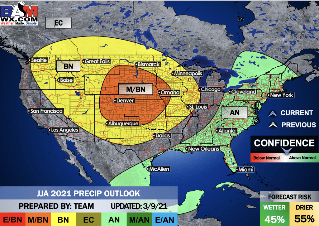
The long-range team has been updated.
Click on the images to enlarge them.
.
.
.
.
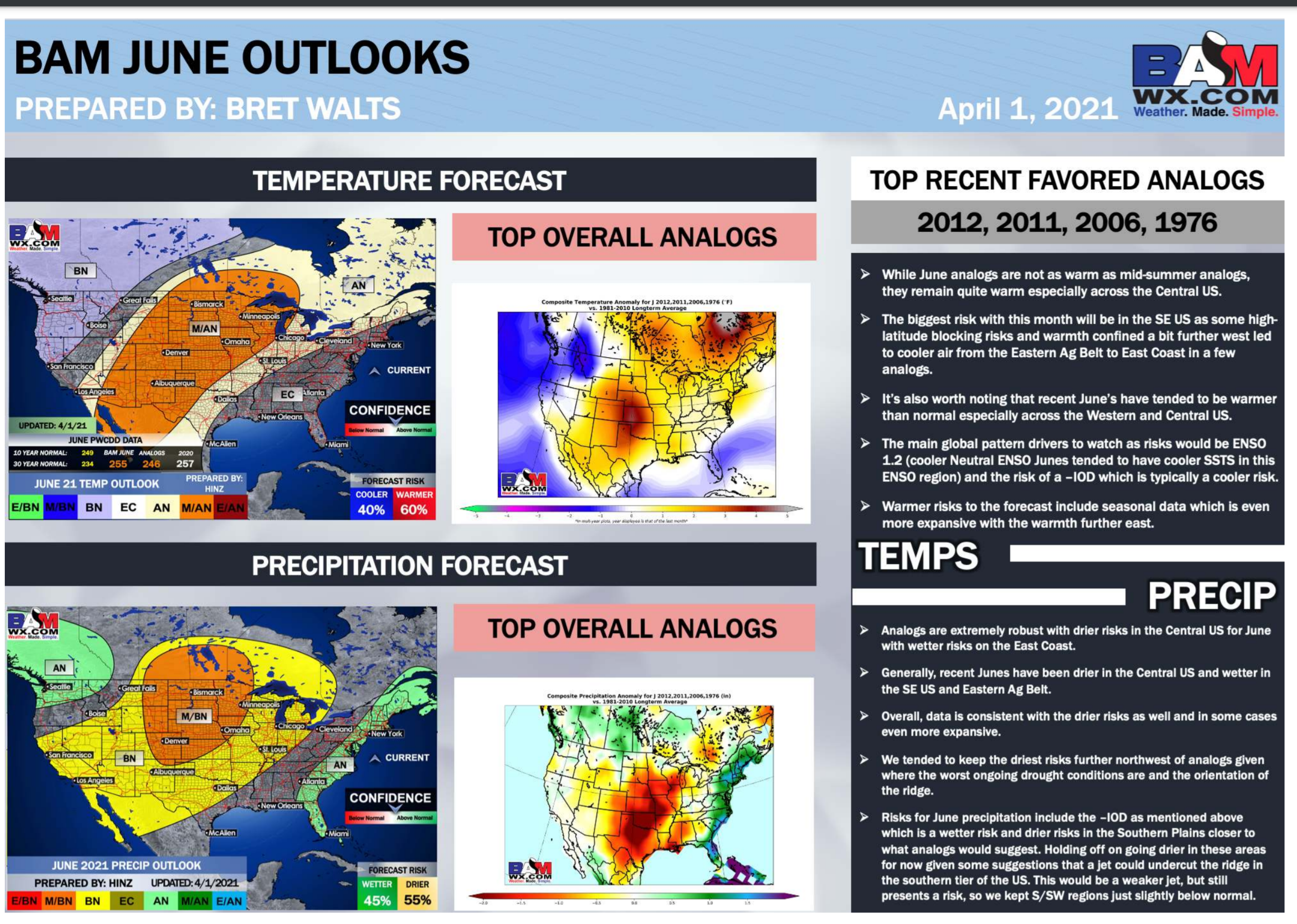
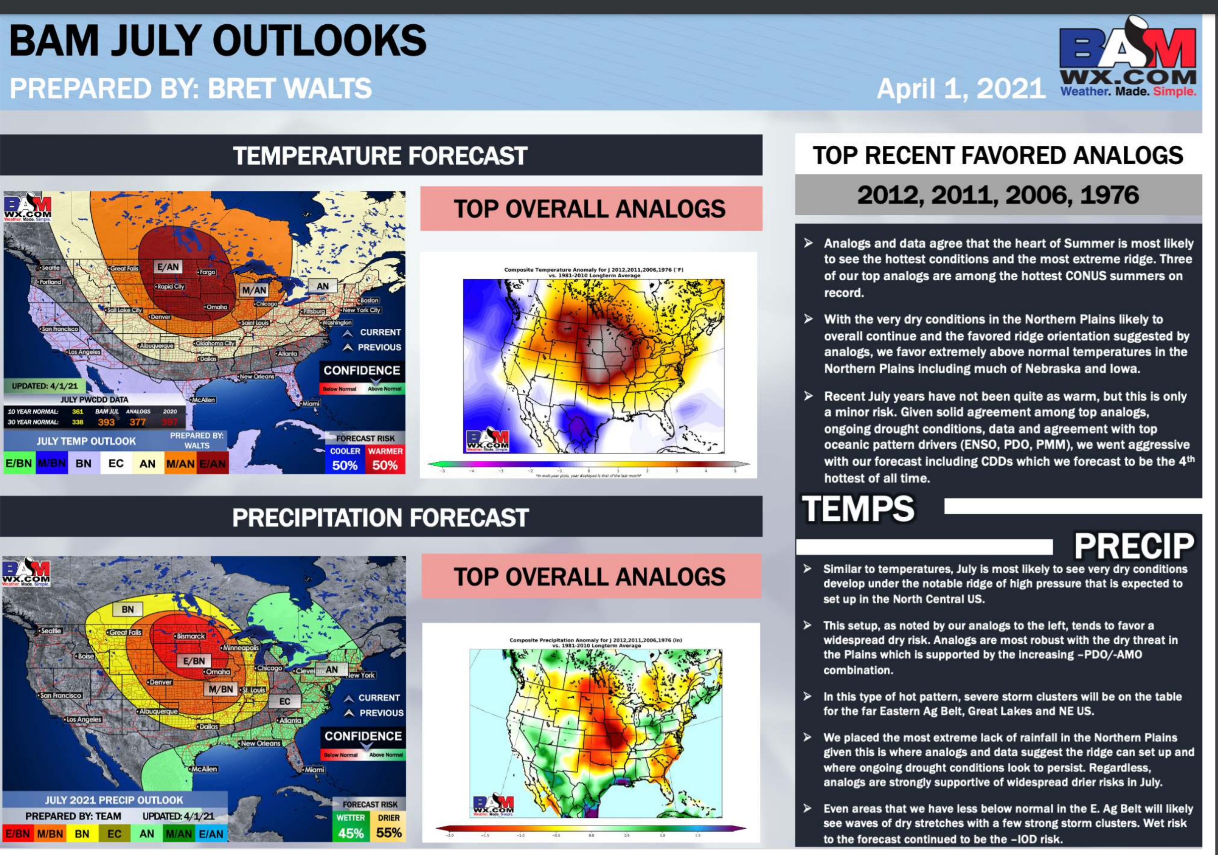
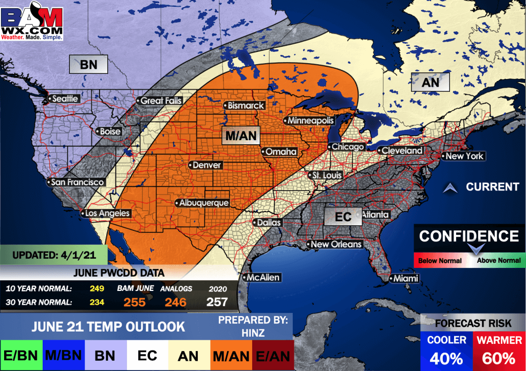
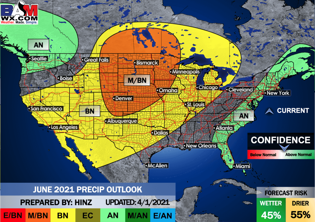
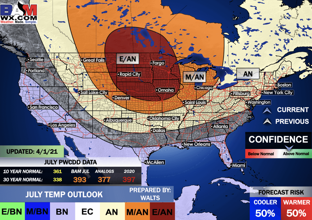
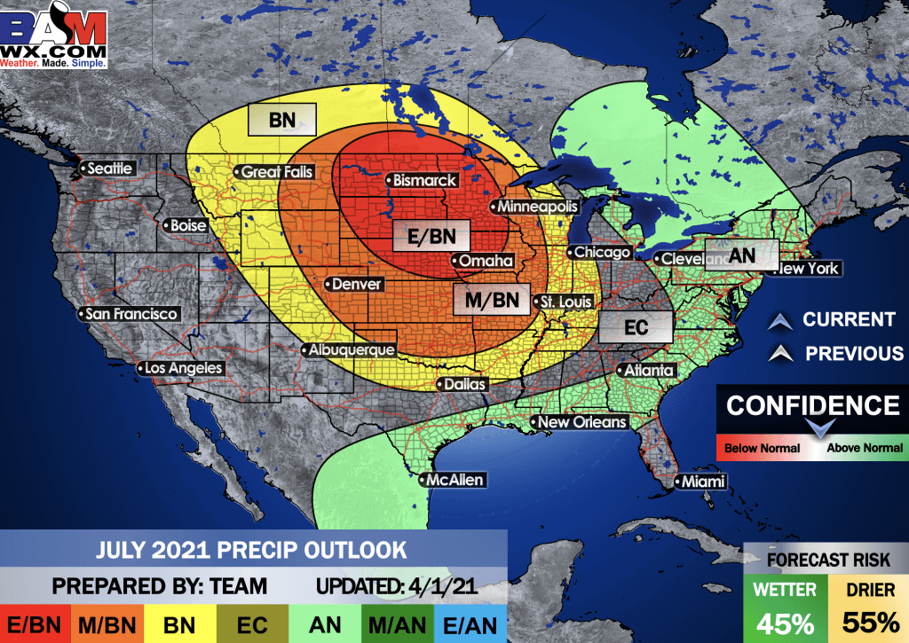
There are a lot of summer forecasts that are similar. Hot and dry for a decent portion of the United States.
Where will that heat be centered? That may be the bigger question.
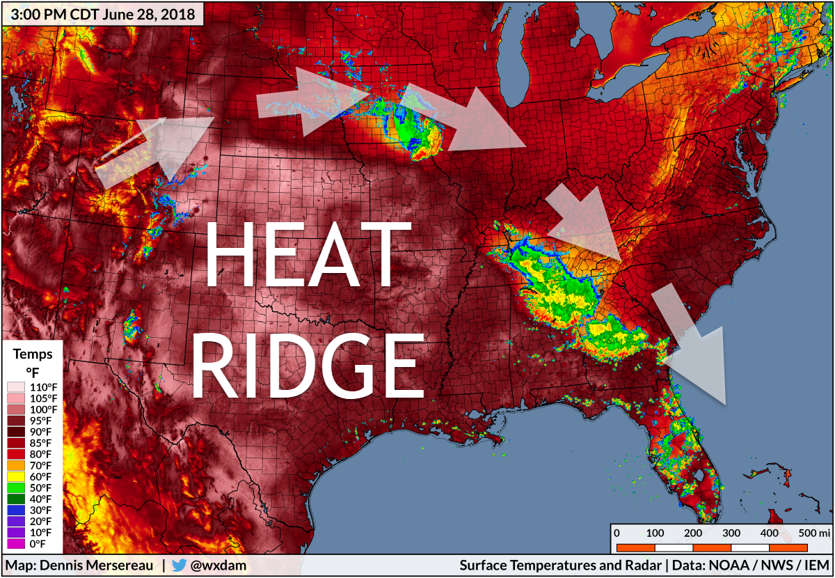
Thunderstorm complexes, called mesoscale complex systems, can ride along the edge of the heat ridge.
Here is an interesting article on convective systems and heat waves. Click here for that.
Flash flooding and severe weather can occur along the edge of the heat ridge.
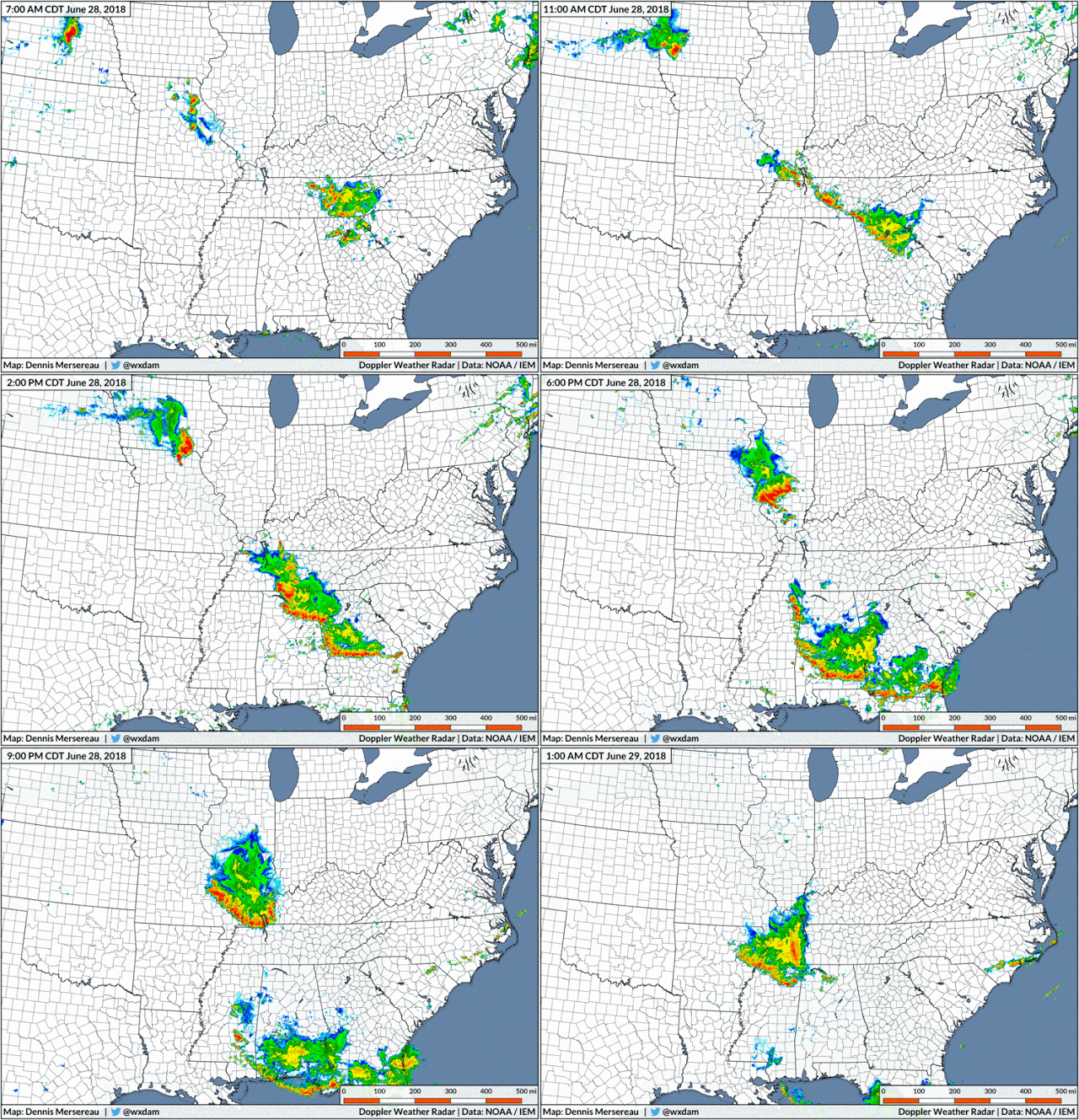
This image is from 2018 and is simply an example.
Again, WHERE that heat ridge sets up is key to where severe storms and heavy rain will occur. Around the edge of it.
Radar from that event. We had widespread wind damage from this June, 28, 2018 thunderstorm complex (Derecho).
.
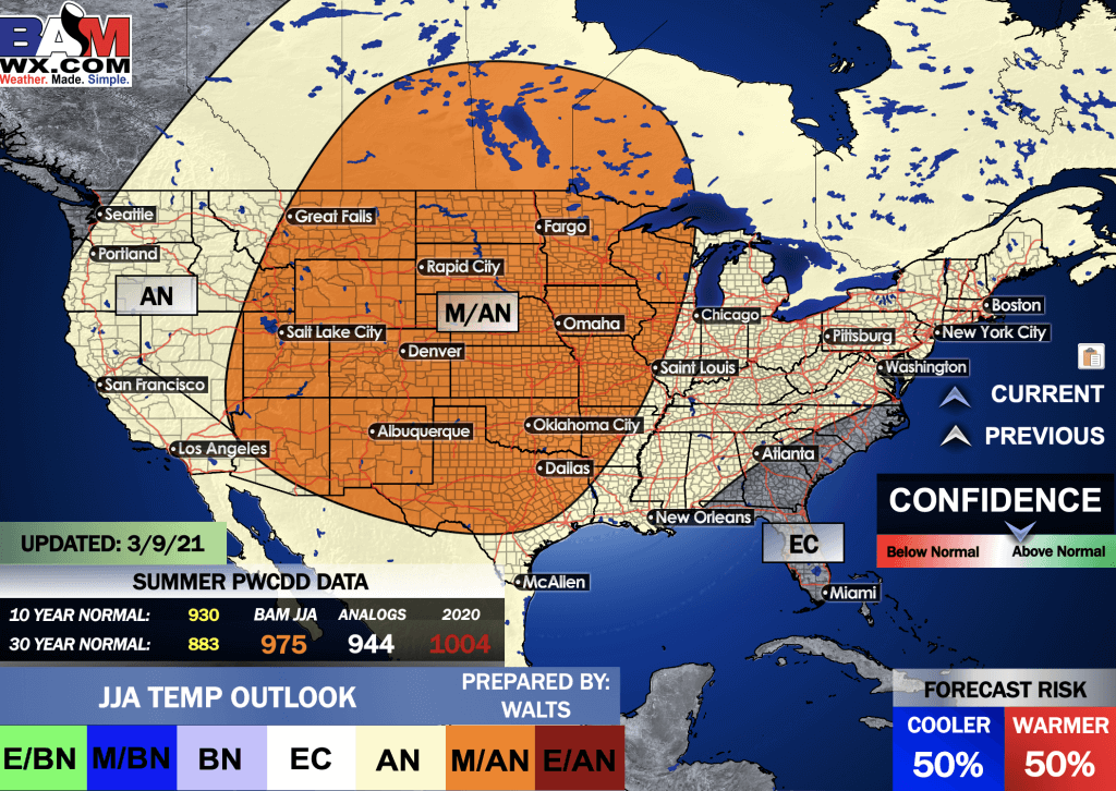
June through August overall forecast.
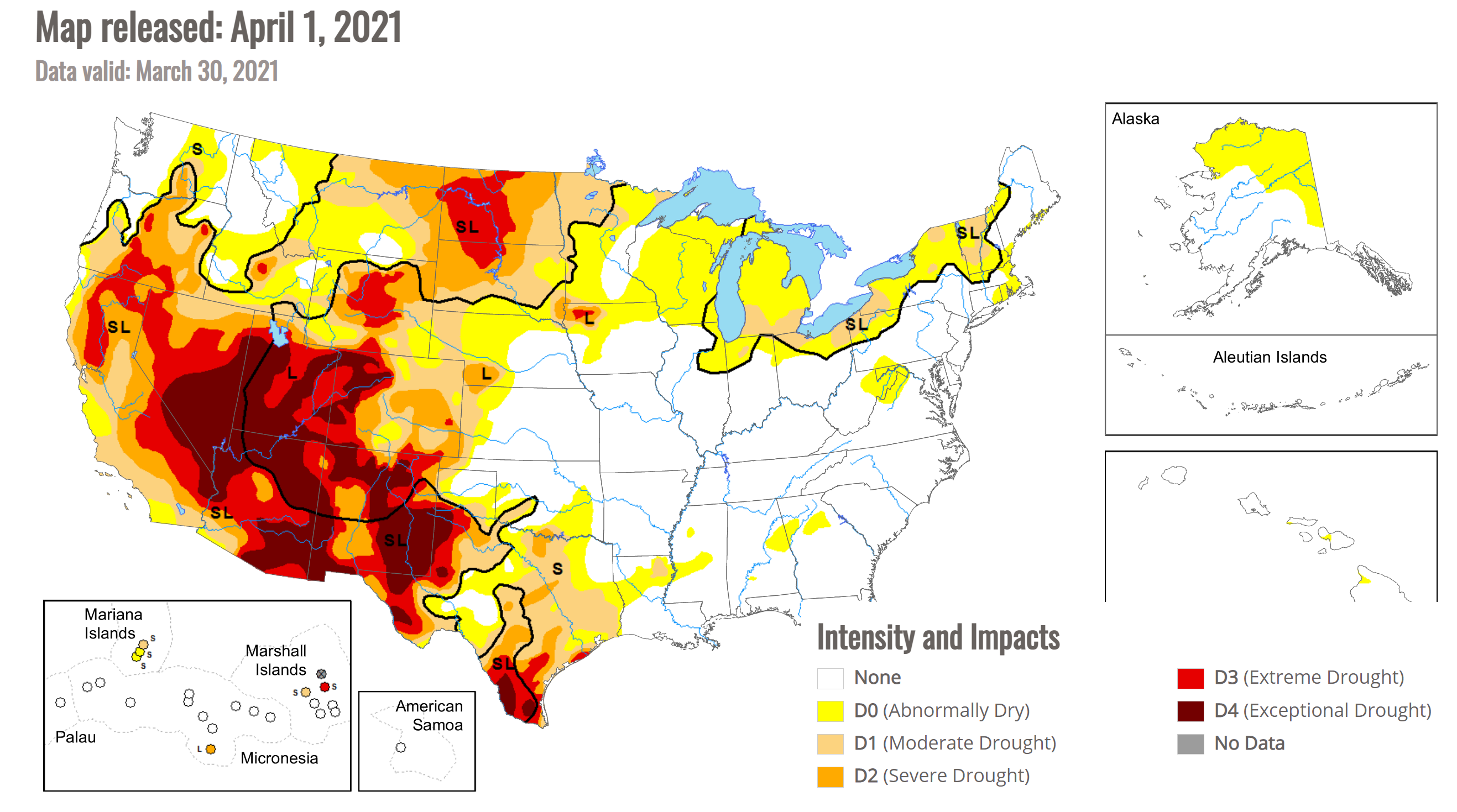
We are already dealing with drought. Here is the latest drought monitor.
And here is the preliminary June through August general forecast from the long range team.


