

.
I have some question-and-answer threads over on the Facebook page. Link to those threads CLICK HERE
Or email me at beaudodsonweather@gmail.com
I am going to start going live during events.
I have a live stream running now (I am learning how to use the software).
Check it out here https://www.youtube.com/user/beaudodson
Click the subscribe button (it is a free subscribe button), and it will alert you when I go live. I will also send out alerts to the app when I go live for an event.

.

🌪️ Seven-Day Tornado Outlook ⛈️
June 3rd ough June 10th
Current risk: LOW RISK.
Current confidence level: Medium confidence in the forecast.
Comment: The risk of tornadoes is low. I am monitoring Friday for a few severe thunderstorms. The primary concern will be damaging wind gusts. The tornado risk will remain low.
.

Seven-Day Hazardous Weather Outlook
1. Is lightning in the forecast? YES. Lightning is possible late tonight through Sunday.
2. Are severe thunderstorms in the forecast? MONITOR. Significant severe weather appears unlikely. I can’t rule out some low-end risks this week. The signal isn’t strong for severe storms, but there may be a few days with a low-end marginal risk. Damaging wind would be the primary concern.
I am watching Friday with a bit more interest. The parameters may be slightly stronger on Friday, potentially leading to a few severe thunderstorms. Once again, damaging wind would be the primary concern.
3. Is flash flooding in the forecast? ISOLATED. Locally heavy thunderstorms are expected Wednesday into the weekend. Several rounds of showers and thunderstorms. This could result in brief flooding issues. Ditches overflowing, commonly flooded roadways, and so on.
4. Will non-thunderstorm winds top 40 mph? NO.
5. Will temperatures rise above 90 degrees? UNLIKELY. A few reporting stations could reach 90 or above today and tomorrow, but most areas will remain in the eighties.
6. Will the heat index rise above 100 degrees? NO.
.
A quick forecast glance. Your 48-hour forecast Graphics


.


.


Forecast discussion.
- Above-average temperatures today and tomorrow. Then, normal to below average temperatures are expected into the weekend.
- Gusty winds are expected today on area lakes and rivers.
- Haze again today from Canadian wildfires.
- Unsettled weather Wednesday into the weekend.
- On and off shower and thunderstorm chances. Locally heavy downpours.
.

Good morning, everyone.
We are still experiencing haze in the region due to the massive Canadian wildfires.
You can see it here on the overnight satellite view.
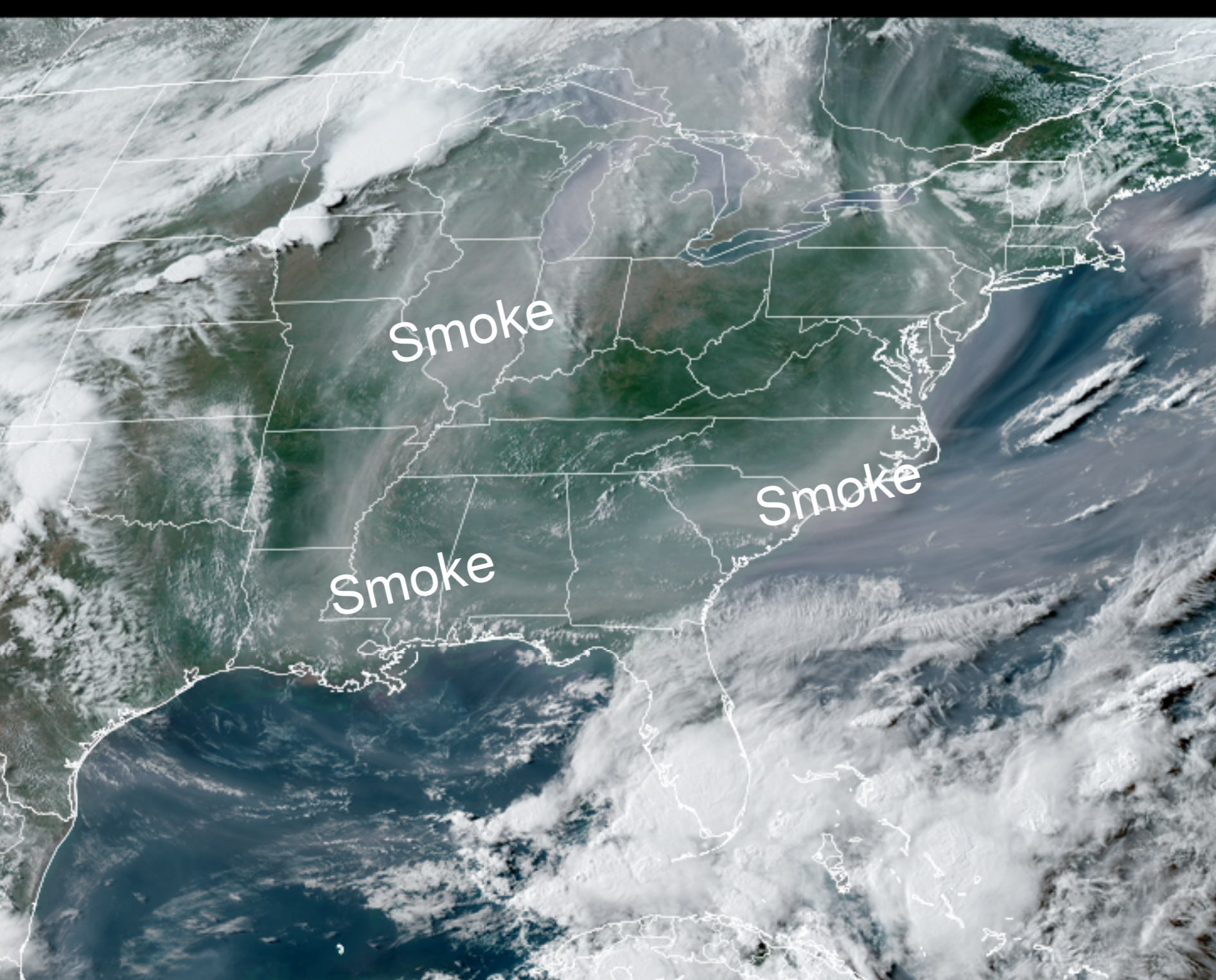
.
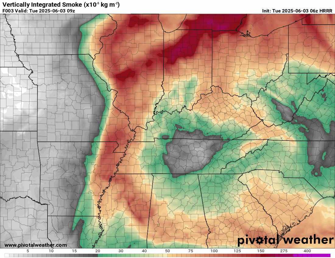
Here is the latest smoke outlook for today and tomorrow. With time, the smoke will push eastward.
.
I don’t have any weather concerns today. Warm. A little humid, but nothing extreme.
Southerly winds will be gusty today. Ranging from 10 to 25 mph. If you are boating, then this could cause some issues. There is a lake wind advisory in effect through the afternoon hours.
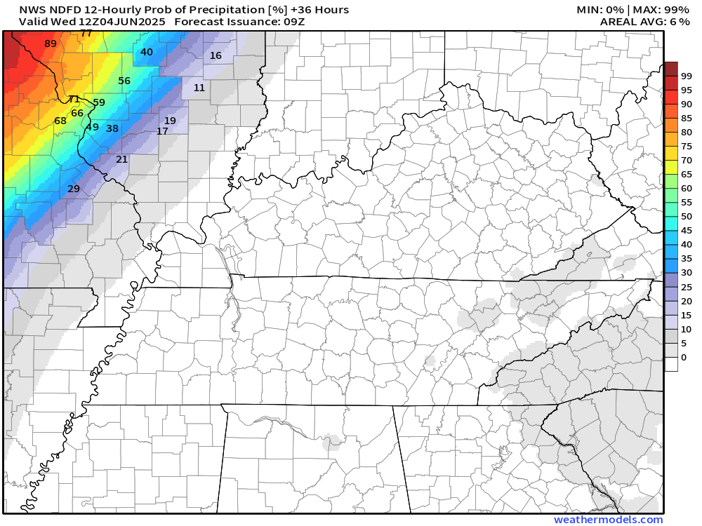
I can’t rule out a few showers and thunderstorms late tonight over southeast Missouri and southwest Illinois.
Let’s look at those rain probabilities. This is from 7 PM Tuesday to 7 AM Wednesday, mainly after midnight. Most of the region will remain dry through Wednesday morning.
.
Increasingly unsettled weather begins tomorrow.
A cold front will stall over our region. Becoming a stationary front.
That front will then become the focus of scattered showers and thunderstorms. It won’t rain all the time, of course. However, there will be intermittent chances from Wednesday into the weekend.
The weekend forecast will be highly dependent on how quickly the front pushes southward or dissipates. If it speeds up a bit, then perhaps we can lower rain chances Saturday and Sunday. For now, however, we have a chance of precipitation Friday through Sunday.
There remain questions on rain chances Saturday and Sunday. The EC model is faster. It pushes the front southward and lowers rain chances on Saturday and Sunday. The GFS data is slower. It keeps rain chances going into the weekend.
Have a plan B, just in case of rain. Then, you will be prepared.
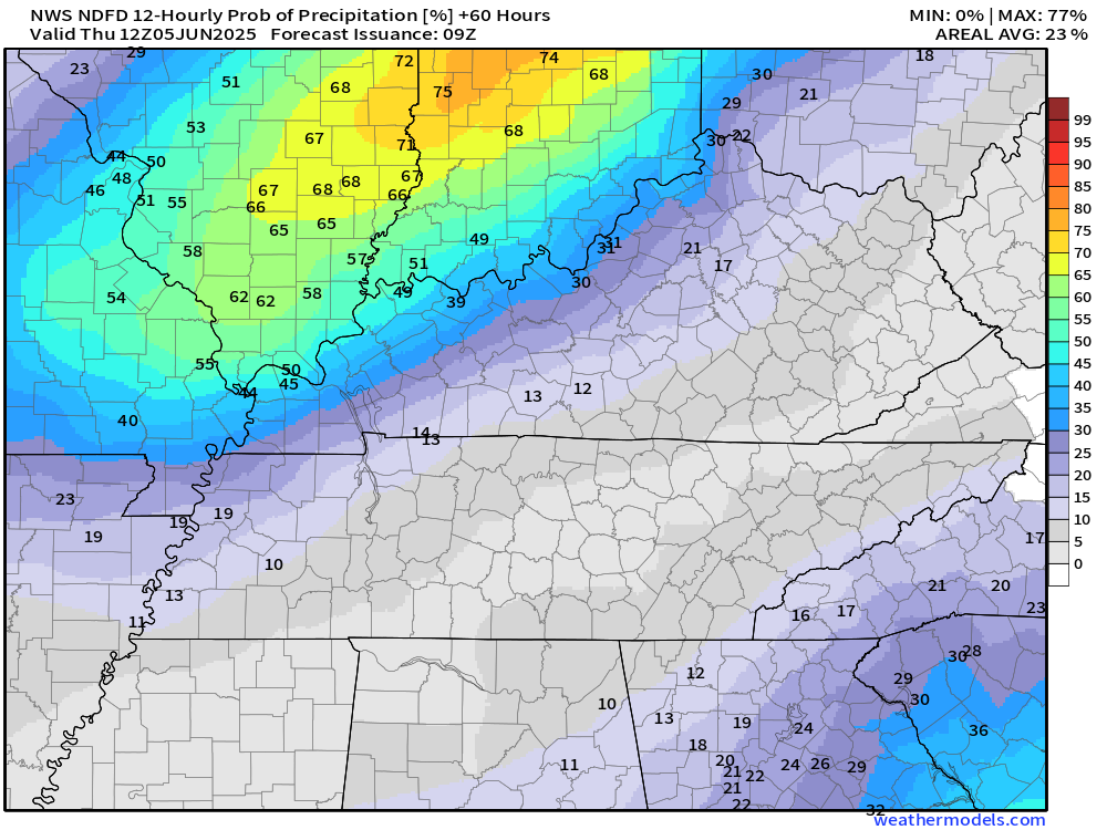
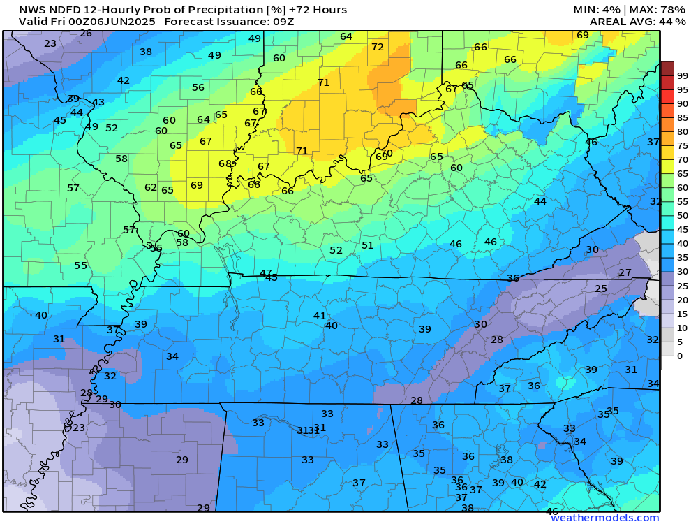
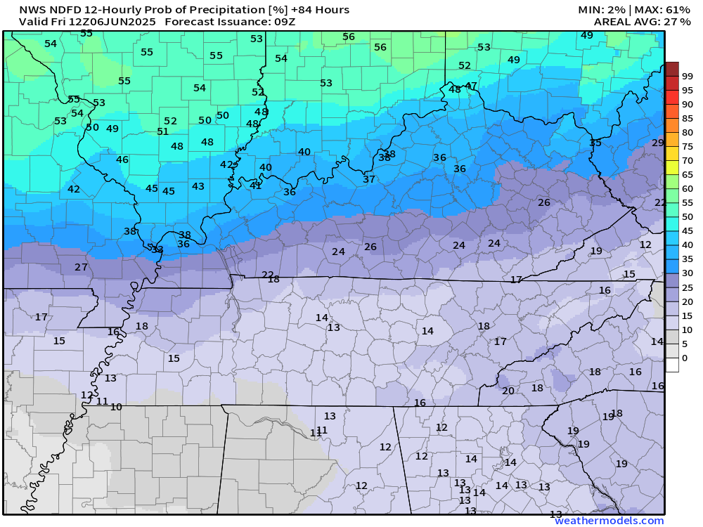
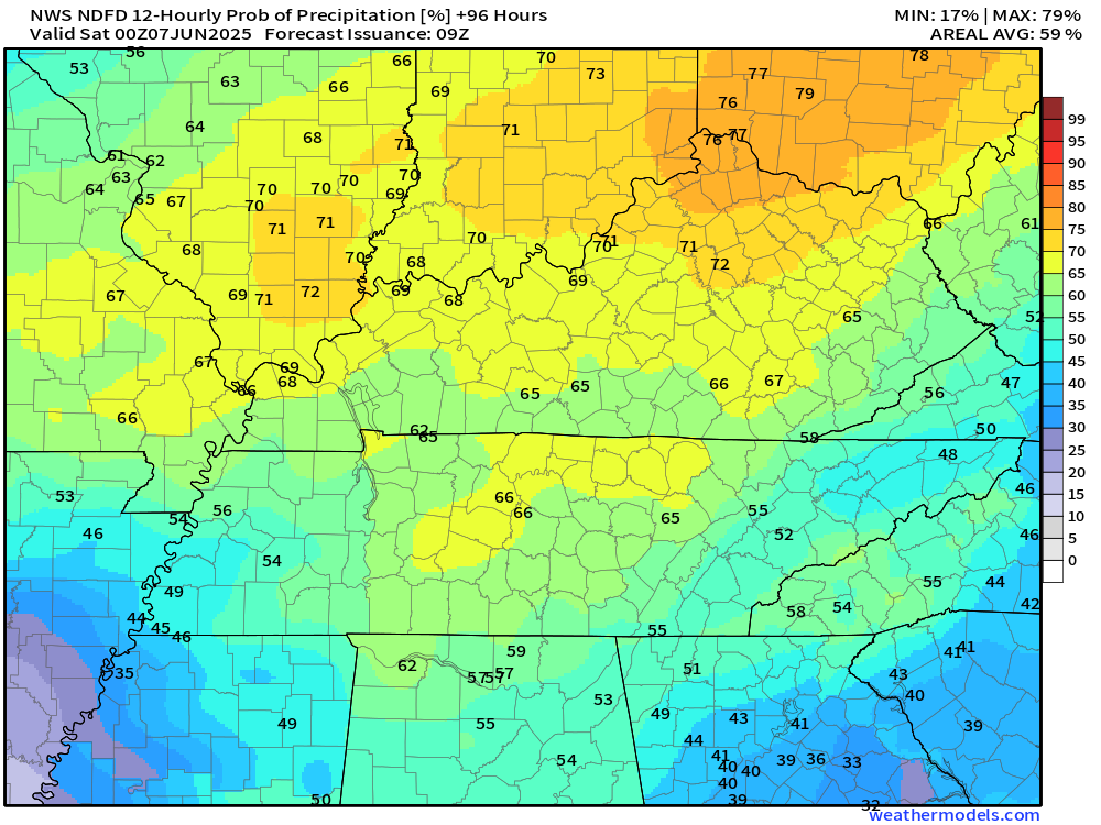
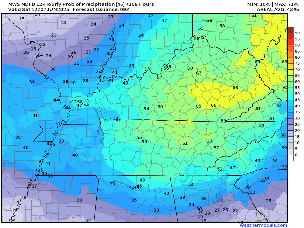
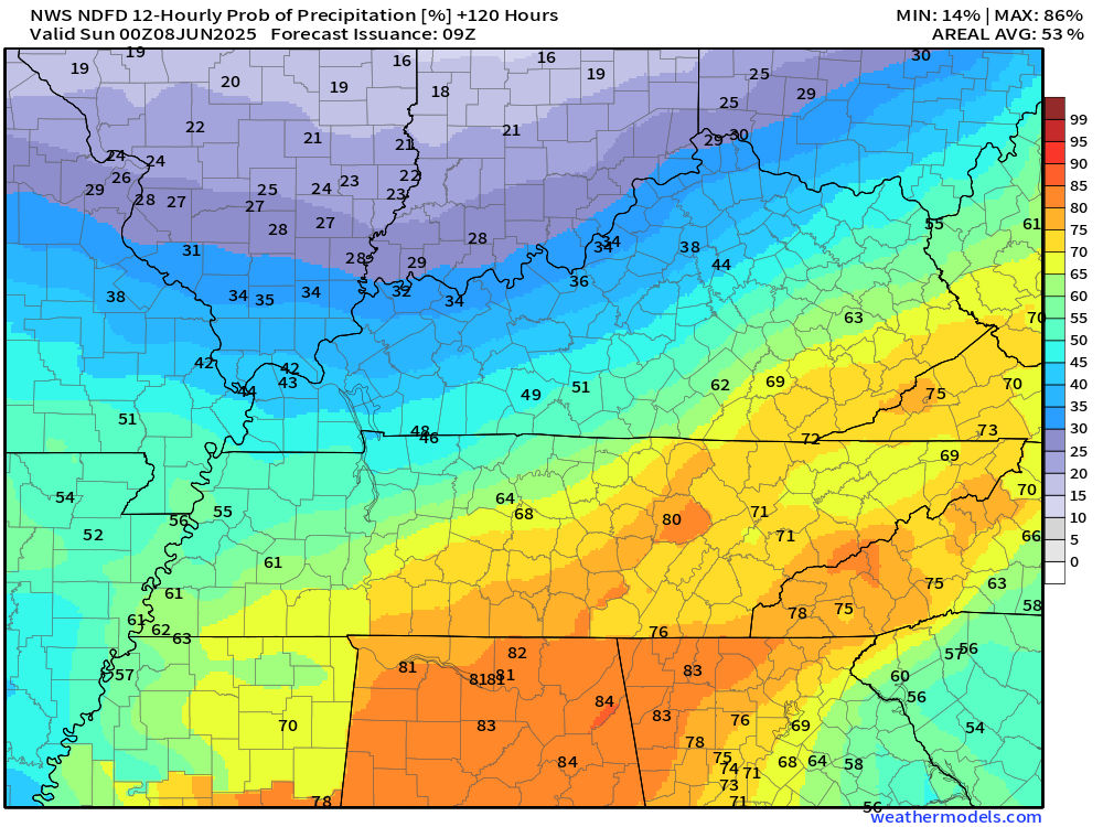
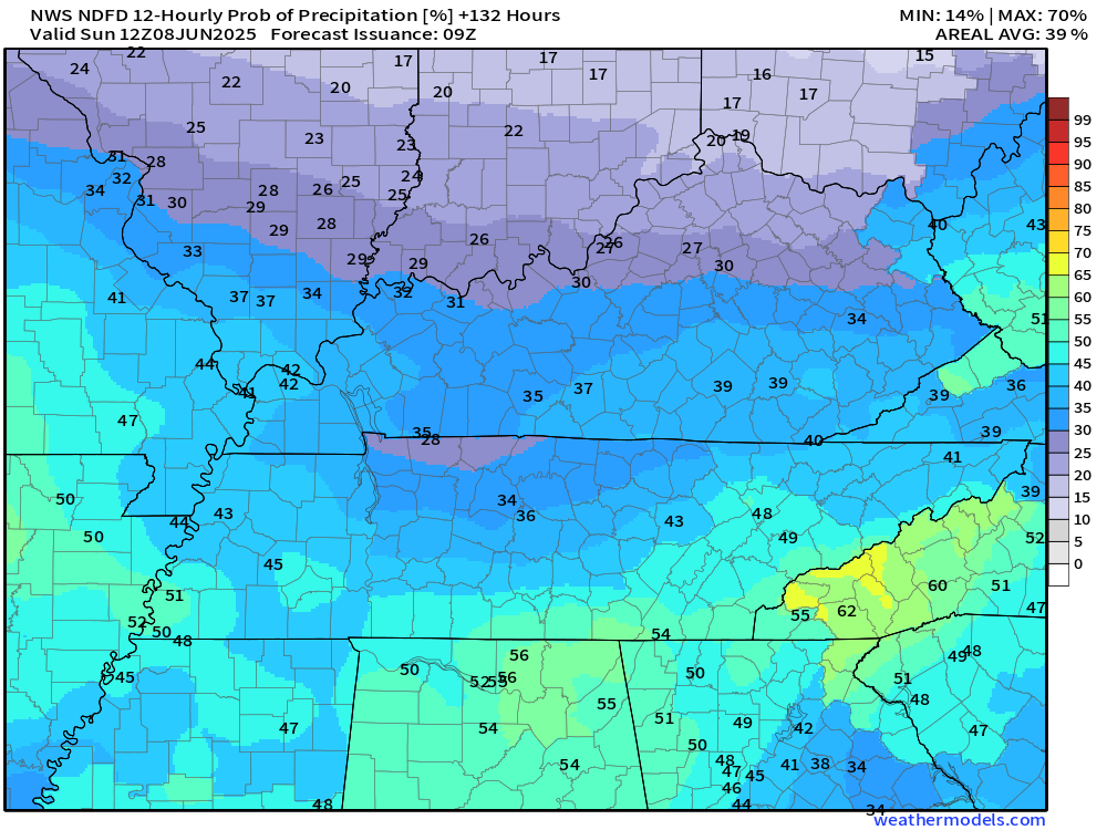
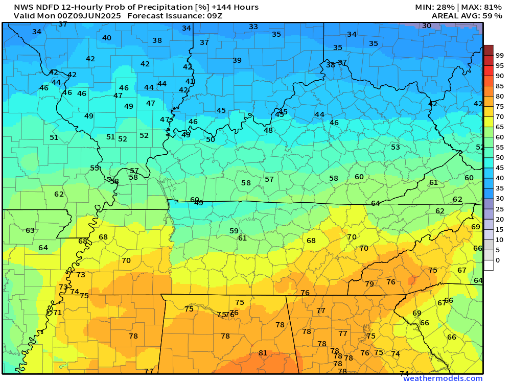
Let’s look at the latest rain probability graphics. This will give you a decent idea of what we are looking at for each twelve-hour period (7 AM to 7 PM and 7 PM to 7 AM).
These graphics display the rain probability (% chances)
Wednesday (rain chances will be higher over Missouri and Illinois vs Kentucky/Tennessee)
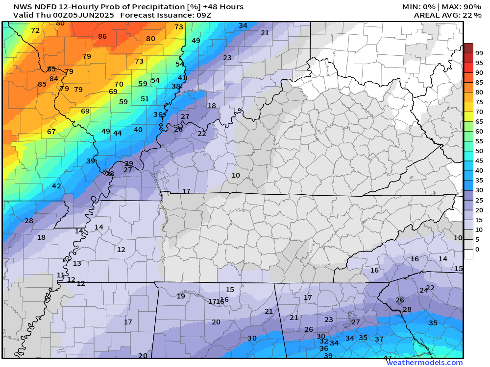
Wednesday night
Thursday
Thursday night
Friday
Friday night
Saturday
Saturday night
Sunday
.
Notice how chances peak during the day and wane a bit at night. That is because of the heat of the day. Heat makes the atmosphere increasingly unstable. Thus, peak chances will be during the afternoon and evening hours.
The overall severe weather risk is low over the coming days. I can’t rule out some isolated issues. Perhaps a low-end severe weather risk.
Let’s look at what the Storm Prediction Center is forecasting for the risk of severe thunderstorms.
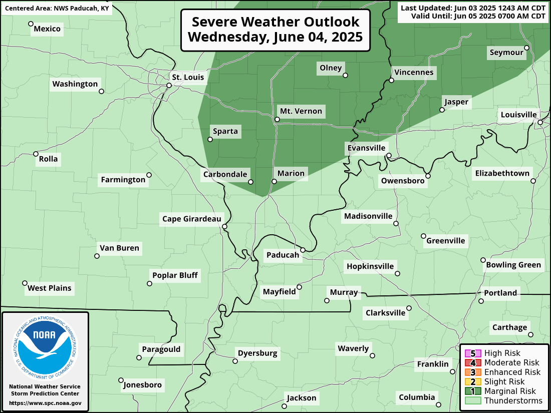
This is the outlook for Wednesday. They have a level one risk over portions of southern Illinois. The light green is where sub-severe storms are possible (below severe limits). The dark green is the level one risk (the lowest risk they have).
.
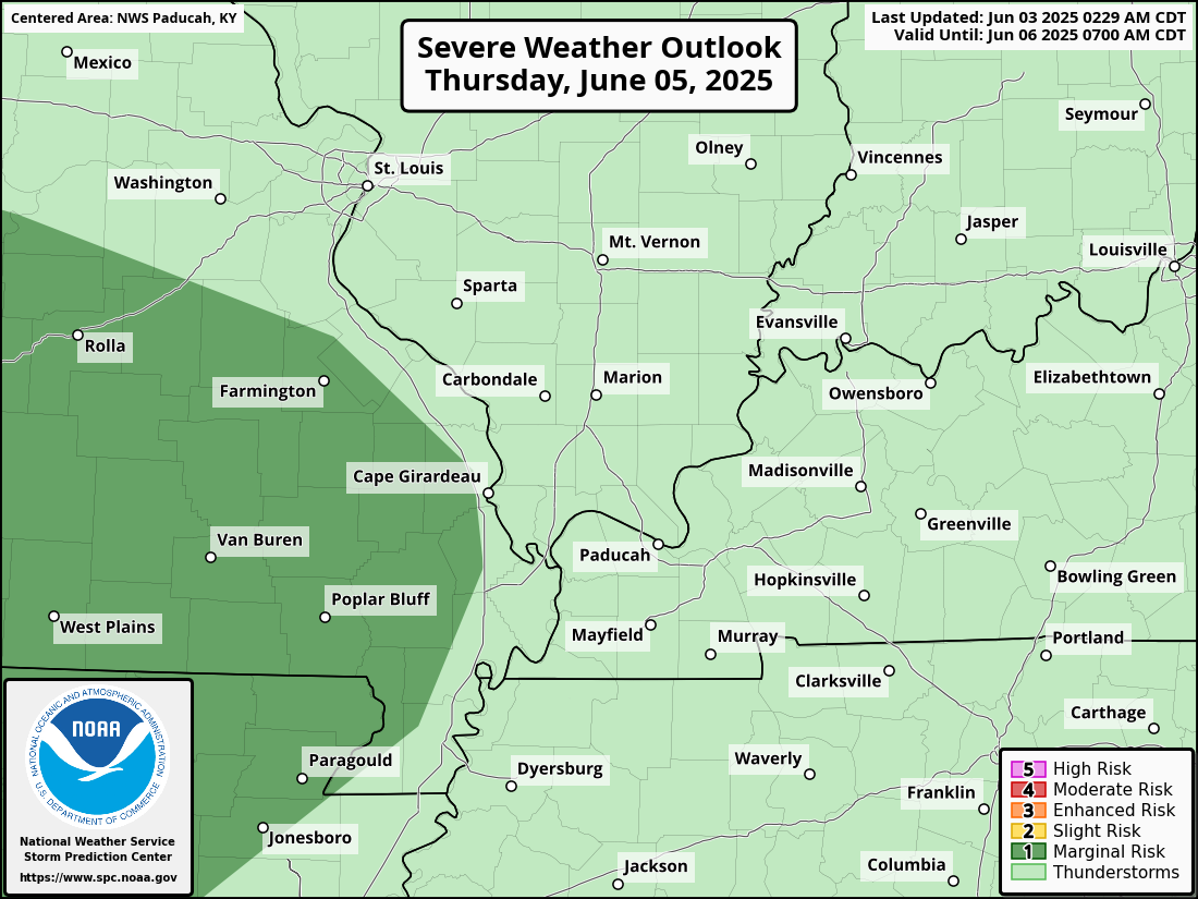
Then, on Thursday, they have a level one risk over portions of southeast Missouri
.
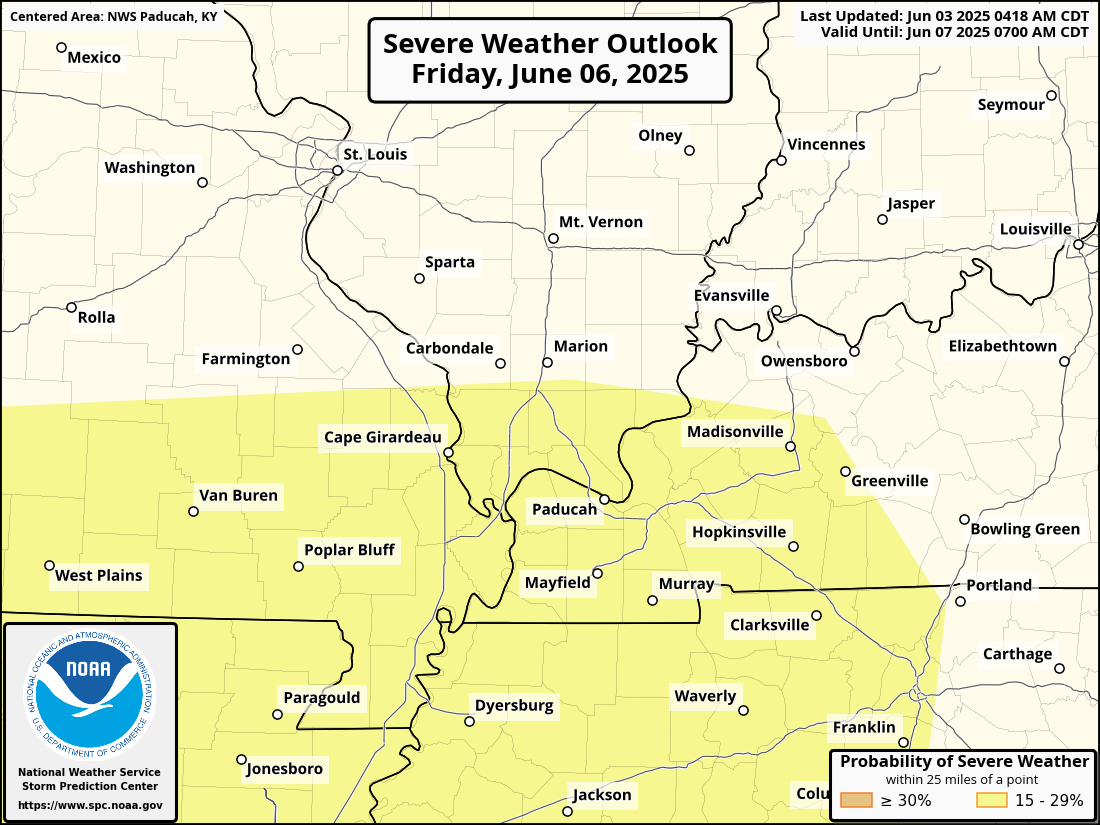
Then, on Friday, they have a level two (slight) risk over portions of the region. The yellow zone is a level 2 (slight risk).
This will evolve with time. I will be monitoring it. They don’t issue a level one risk beyond day three. You can assume that there would be a level one risk around the yellow zone, as well.
.
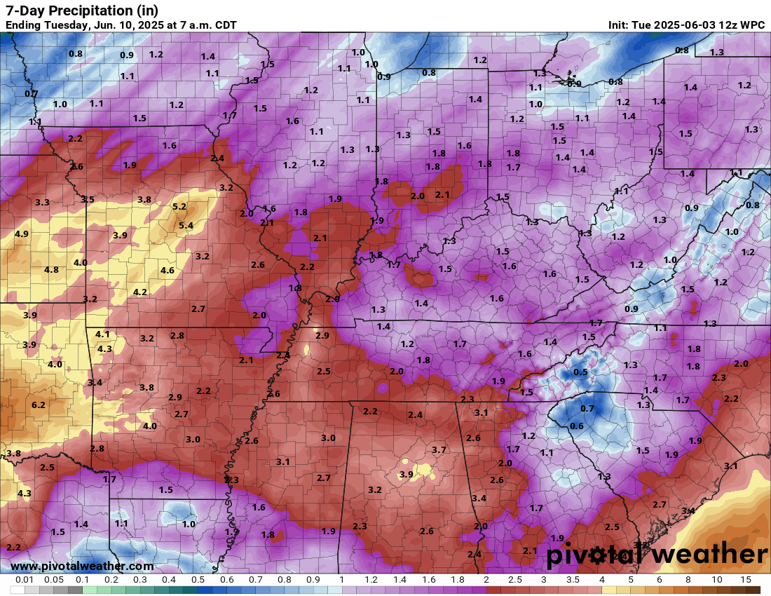
Rainfall totals will vary wildly.
During the summer months, one county could have two to three inches of rain. A neighboring county could remain dry. If you have lived in this area for any length of time, then you will know this.
If thunderstorms train over the same area, then this will enhance rainfall totals.
Generally, rainfall totals Wednesday through Sunday will range from 1.00″ to 2.00″. Then there will be pockets of two to three inches or more of rain. Not the best news for farmers.
Here is the official WPC/NOAA rainfall outlook. Double click to enlarge this graphic.
.
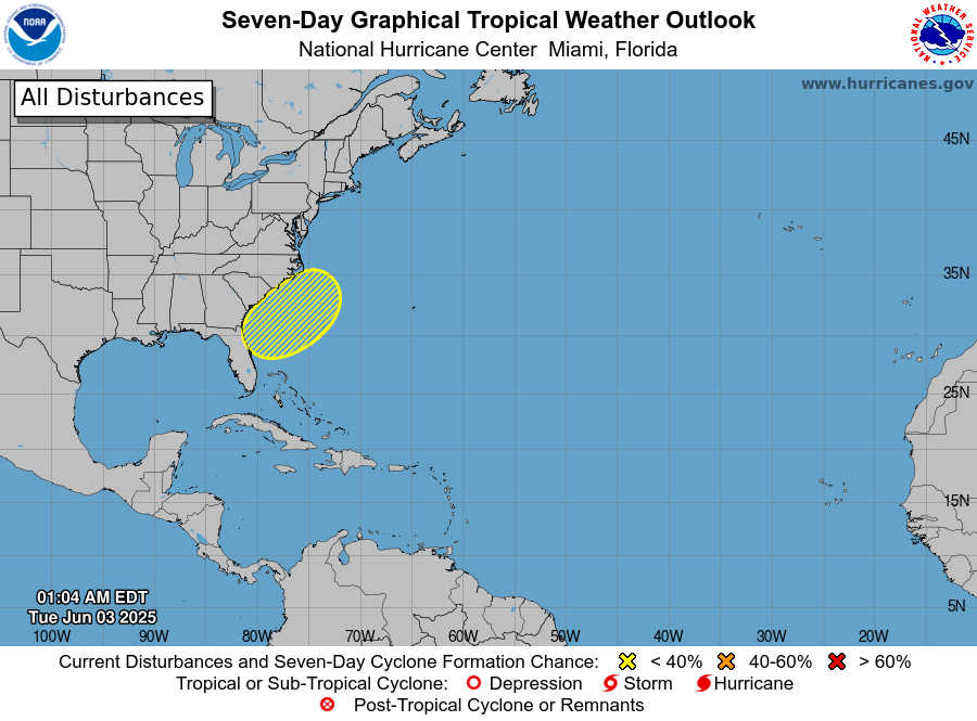
Hurricane season is underway.
No significant tropical concerns at this time. This is the seven-day tropical outlook.
There is a ten percent chance of development off the southeast coast.
.

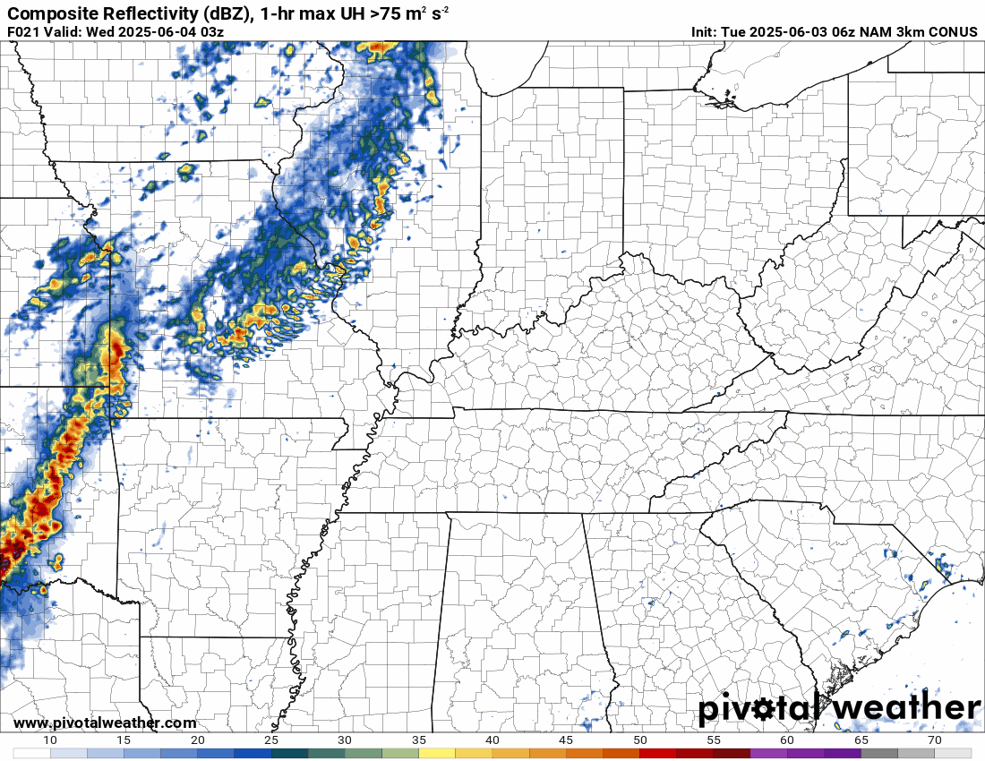
The timestamp (upper left) is in Zulu. 12z=7 am. 18z=1 pm. 00z=7 pm.
Double-click the animation to enlarge it.
NAM 3K model.
.
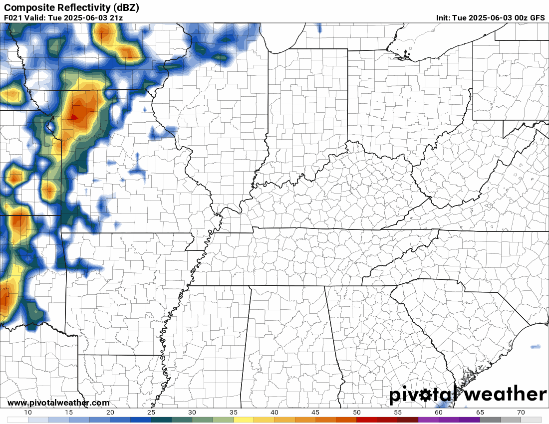
GFS model. The timestamp (upper left) is in Zulu. 12z=7 am. 18z=1 pm. 00z=7 pm.
..
.
Click here if you would like to return to the top of the page.
.Average high temperatures for this time of the year are around 83 degrees.
Average low temperatures for this time of the year are around 62 degrees.
Average precipitation during this time period ranges from 1.00″ to 1.40″
Six to Ten Day Outlook.
Blue is below average. Red is above average. The no color zone represents equal chances.
Average highs for this time of the year are in the lower 60s. Average lows for this time of the year are in the lower 40s.

Green is above average precipitation. Yellow and brown favors below average precipitation. Average precipitation for this time of the year is around one inch per week.

.

Average low temperatures for this time of the year are around 63 degrees.
Average precipitation during this time period ranges from 1.20″ to 1.50″
.
Eight to Fourteen Day Outlook.
Blue is below average. Red is above average. The no color zone represents equal chances.

Green is above average precipitation. Yellow and brown favors below average precipitation. Average precipitation for this time of the year is around one inch per week.

.
.
.
We have a new service to complement your www.weathertalk.com subscription. This does NOTreplace www.weathertalk.com It is simply another tool for you to receive severe weather information.
.


.

Radars and Lightning Data
Interactive-city-view radars. Clickable watches and warnings.
https://wtalk.co/B3XHASFZ
Old legacy radar site (some of you like it better)
https://weatherobservatory.com/weather-radar.htm
If the radar is not updating then try another one. If a radar does not appear to be refreshing then hit Ctrl F5. You may also try restarting your browser.
Backup radar site in case the above one is not working.
https://weathertalk.com/morani
Regional Radar
https://imagery.weathertalk.com/prx/RadarLoop.mp4
** NEW ** Zoom radar with chaser tracking abilities!
ZoomRadar
If the radar is not working, then email me: Email me at beaudodson@usawx.com
.
We do have some sponsors! Check them out.
Roof damage from recent storms? Link – Click here
INTEGRITY ROOFING AND EXTERIORS!
⛈️ Roof or gutter damage from recent storms? Today’s weather is sponsored by Integrity Roofing. Check out their website at this link https://www.ourintegritymatters.com/

![]()
![]()
![]()
Make sure you have three to five ways of receiving your severe weather information.
Weather Talk is one of those ways! Now, I have another product for you and your family.

.
Want to add more products to your Beau Dodson Weather App?
Receive daily videos, weather blog updates on normal weather days and severe weather and winter storm days, your county by county weather forecast, and more!
Here is how to do add those additional products to your app notification settings!
Here is a video on how to update your Beau Dodson Weather payment.
The app is for subscribers. Subscribe at www.weathertalk.com/welcome then go to your app store and search for WeatherTalk
Subscribers, PLEASE USE THE APP. ATT and Verizon are not reliable during severe weather. They are delaying text messages.
The app is under WeatherTalk in the app store.

Apple users click here

Android users click here
.
Radars and Lightning Data
Interactive-city-view radars. Clickable watches and warnings.
https://wtalk.co/B3XHASFZ
Old legacy radar site (some of you like it better)
https://weatherobservatory.com/weather-radar.htm
If the radar is not updating then try another one. If a radar does not appear to be refreshing then hit Ctrl F5. You may also try restarting your browser.
Backup radar site in case the above one is not working.
https://weathertalk.com/morani
Regional Radar
https://imagery.weathertalk.com/prx/RadarLoop.mp4
** NEW ** Zoom radar with chaser tracking abilities!
ZoomRadar
Lightning Data (zoom in and out of your local area)
https://wtalk.co/WJ3SN5UZ
Not working? Email me at beaudodson@usawx.com
National map of weather watches and warnings. Click here.
Storm Prediction Center. Click here.
Weather Prediction Center. Click here.
.

Live lightning data: Click here.
Real time lightning data (another one) https://map.blitzortung.org/#5.02/37.95/-86.99
Our new Zoom radar with storm chases
.
.

Interactive GOES R satellite. Track clouds. Click here.
GOES 16 slider tool. Click here.
College of DuPage satellites. Click here
.

Here are the latest local river stage forecast numbers Click Here.
Here are the latest lake stage forecast numbers for Kentucky Lake and Lake Barkley Click Here.
.
.
Find Beau on Facebook! Click the banner.


 .
.