

.
I have some question-and-answer threads over on the Facebook page. Link to those threads CLICK HERE
Or email me at beaudodsonweather@gmail.com
.
Want to receive the daily forecast/other products on your Beau Dodson Weather app?
Did you know you have four options in your www.weathertalk.com account
You will then receive these via your Beau Dodson Weather app.
Just log into your www.weathertalk.com account
Click the NOTIFICATION SETTINGS TAB
Then, turn them on (green) and off (red)
🌪️ Number 1 is the most important one. Severe alerts, tornado alerts, and so on.
Number 2 is the daily video, blog, livestream alerts, and severe weather Facebook threads on severe days or winter storm days.
Number 3 is the daily forecast. I send that out every day during the afternoon hours. It is the seven-day forecast, hazardous weather outlook, fire outlook, and more.
Number 4 is to receive the daily video, blog, and other content on NON-severe weather days (every day without severe threats in other words)
GREEN IS ON
RED IS OFF

.

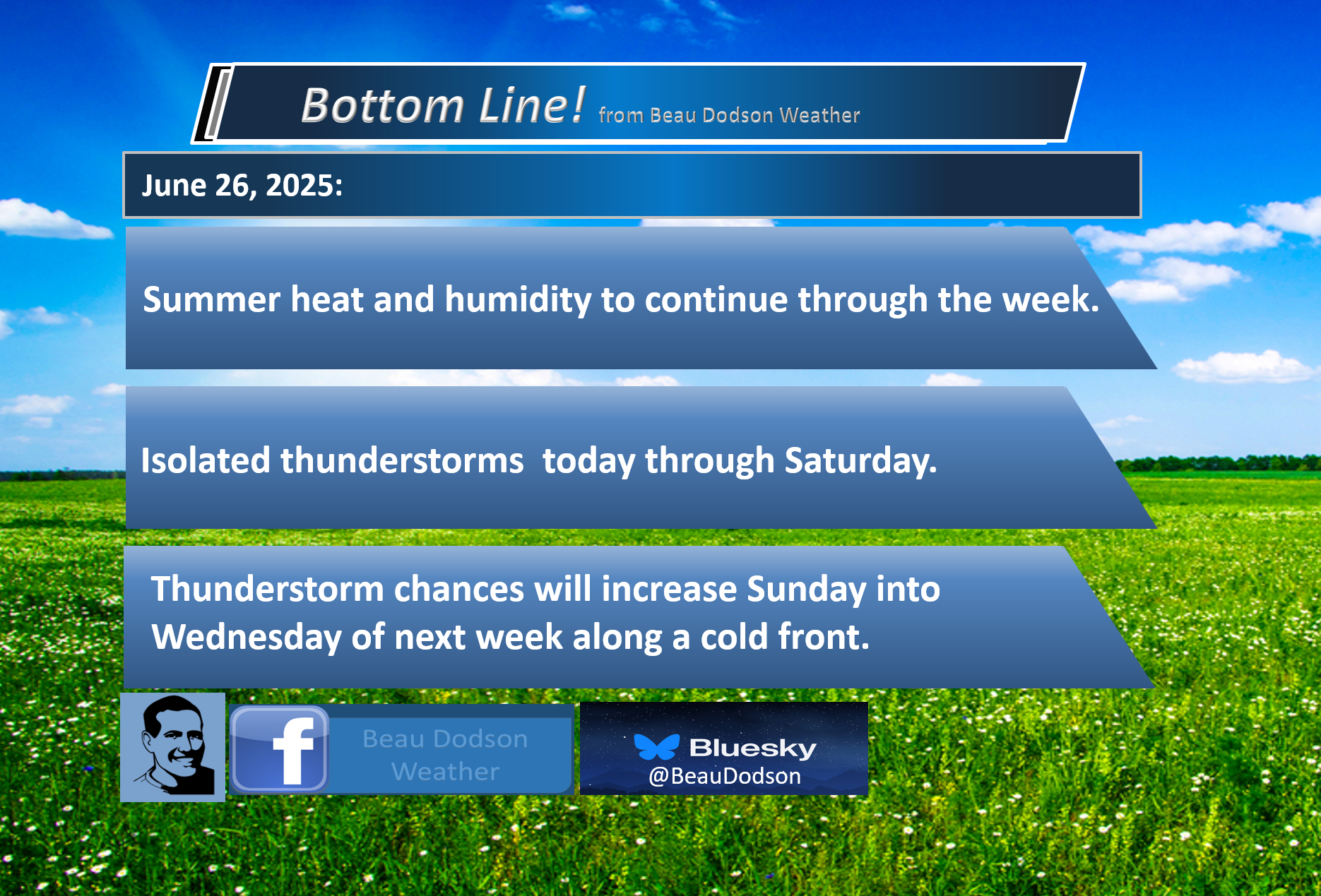
🌪️ Seven-Day Tornado Outlook ⛈️
June 26th through July 2nd
Current risk: None.
Current confidence level: High confidence in the forecast.
Comment: No tornado threats.
.

Seven-Day Hazardous Weather Outlook
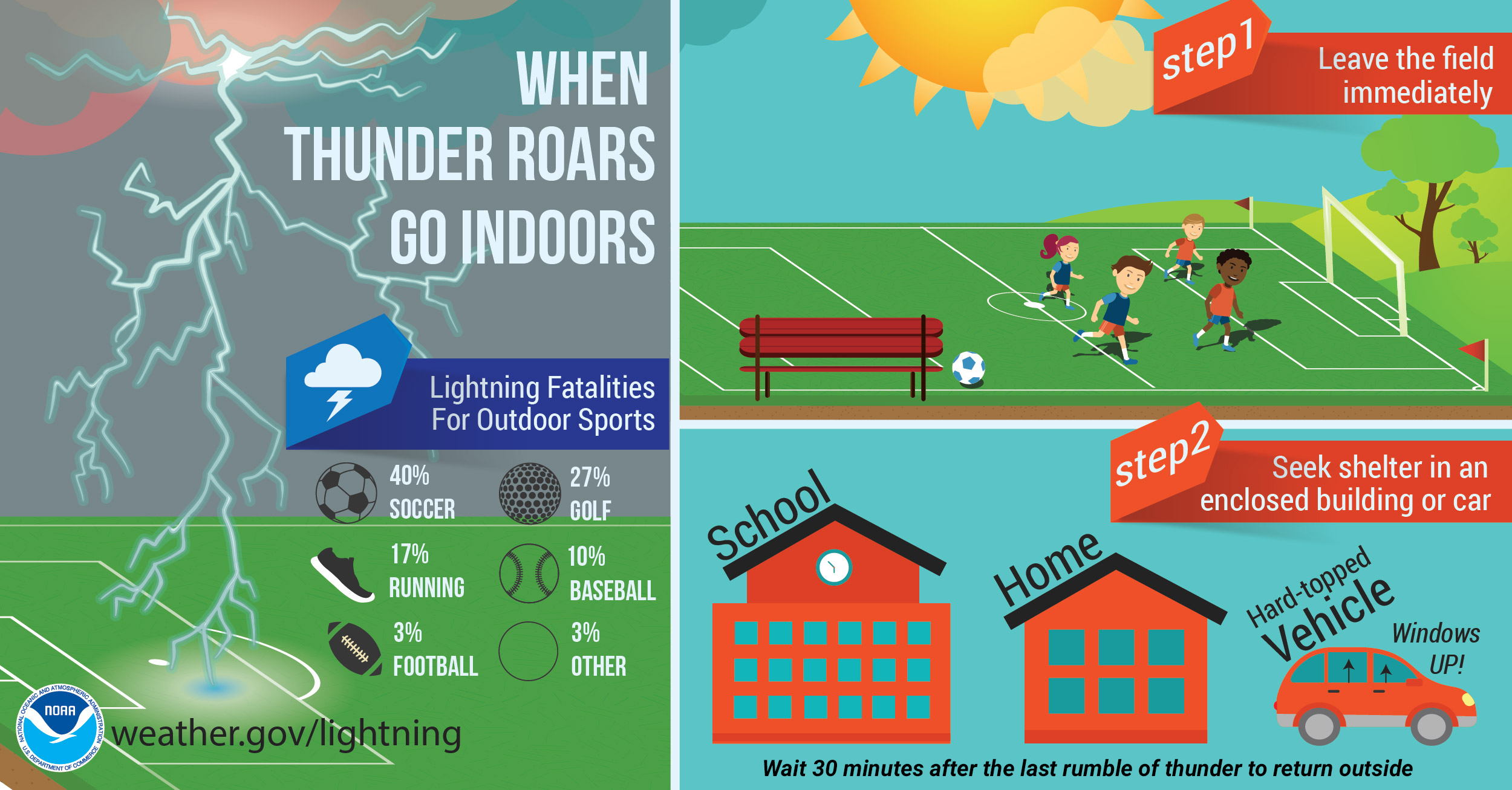
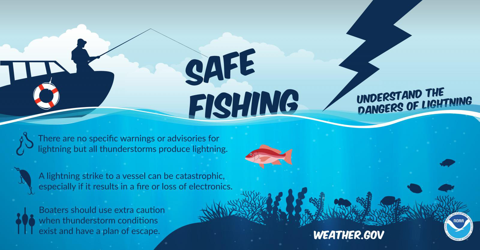
1. Is lightning in the forecast? ISOLATED. There is an isolated risk of lightning today through Saturday. Scattered lightning is possible Sunday through Wednesday.
It is lightning awareness week.
.
2. Are organized severe thunderstorms in the forecast? MONITOR. I will monitor Sunday through Tuesday.
Additionally, summer thunderstorms can produce isolated damaging wind gusts with little to no warning.
3. Is flash flooding in the forecast? MONITOR. I will monitor Sunday through Tuesday. Summer thunderstorms can produce heavy downpours. Keep that in mind.
4. Will non-thunderstorm winds top 40 mph? NO.
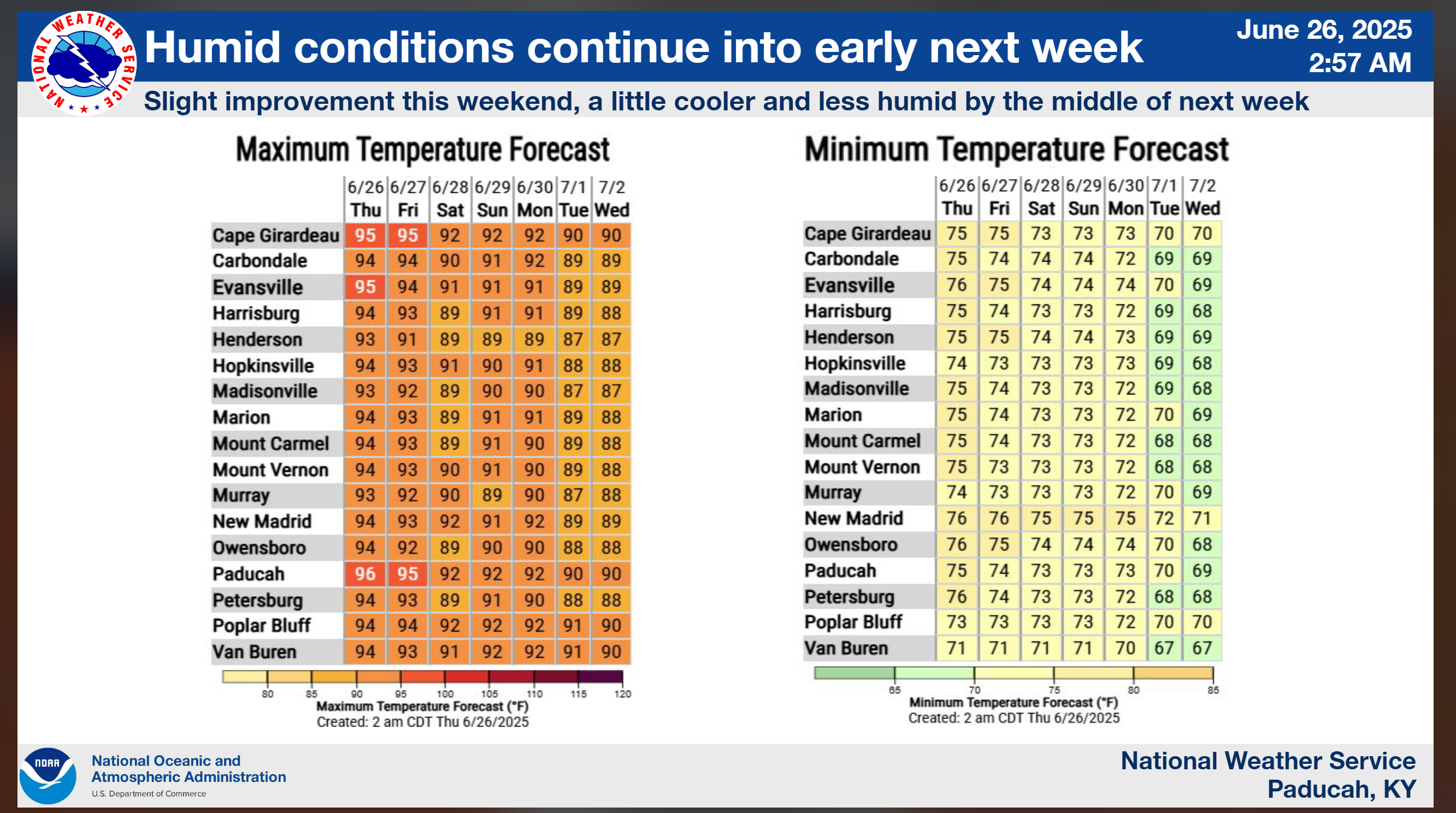
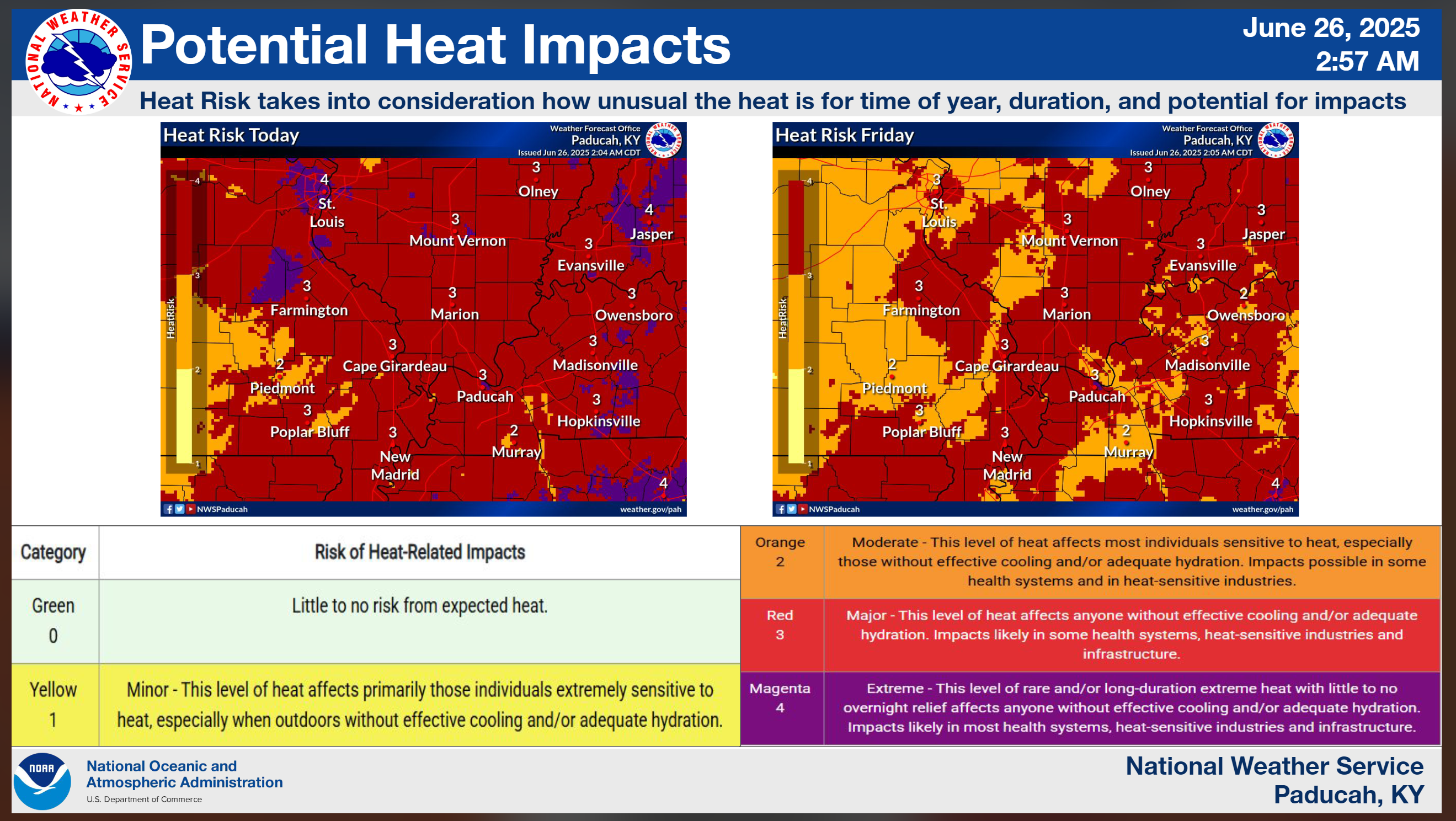
5. Will temperatures rise above 90 degrees? YES. Temperatures will reach 90°F or higher today through at least Saturday. I will monitor Sunday and Monday.
6. Will the heat index rise above 100 degrees? YES. Heat index values will approach and exceed 100 degrees today through Saturday. I will monitor Sunday.
Double click on this graphic to enlarge it.
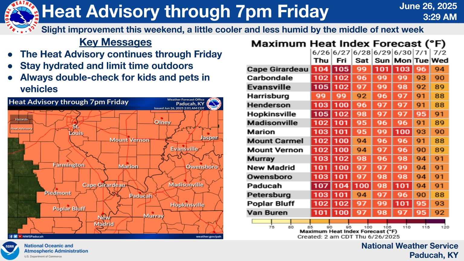
Double click on this graphic to enlarge it. Notice the heat index values.
Double-click this graphic to enlarge it.
.
The heat index factors in both the actual air temperature and the amount of moisture in the air (relative humidity).
.
Perceived Temperature:
High humidity makes it harder for the body to cool itself through sweating, so the perceived temperature is higher than the actual temperature.
.
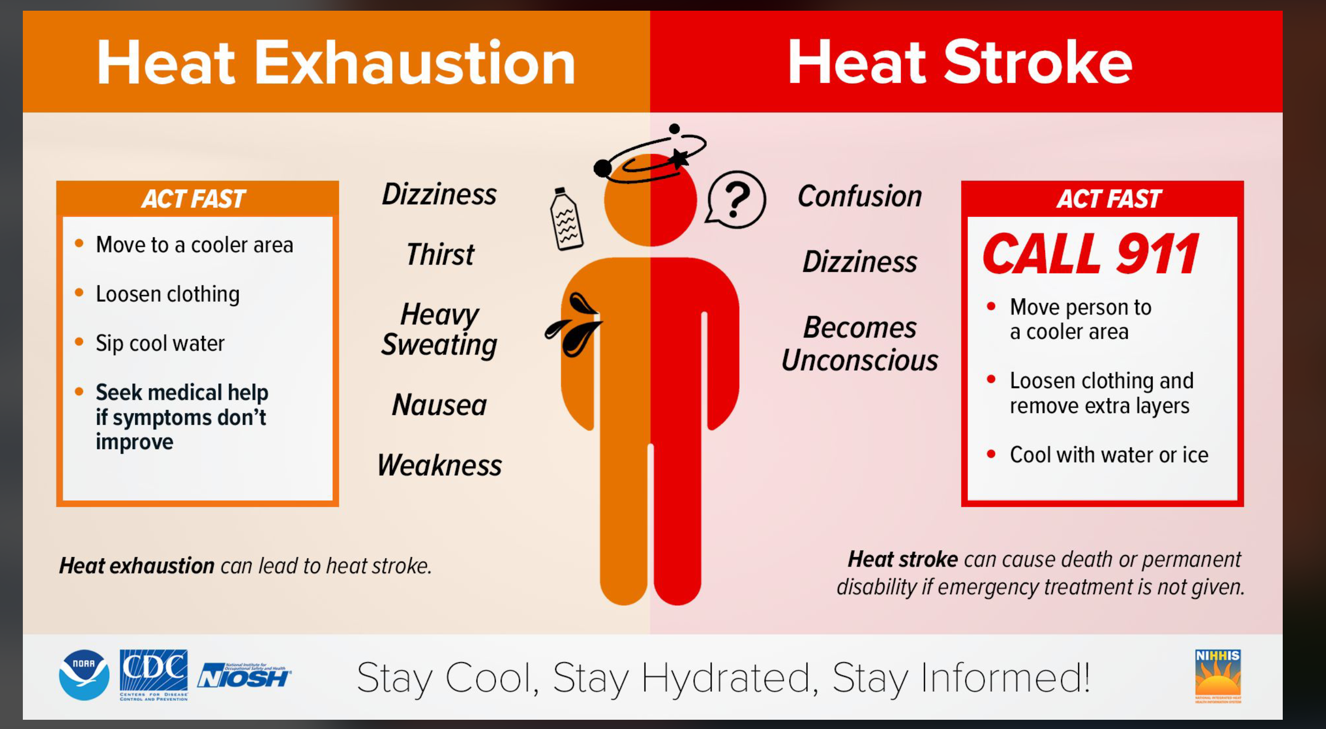
Heat-Related Illnesses:
When the heat index is high, the risk of heat-related illnesses, such as heat cramps, heat exhaustion, and heat stroke, increases, especially with prolonged exposure to the heat or physical activity.
.
Shade vs. Sunlight:
The heat index is typically calculated for shaded areas. Exposure to direct sunlight can further increase the perceived temperature.
.
A quick forecast glance. Your 48-hour forecast Graphics


.

.


Forecast discussion.
- Summer weather. Heat and high humidity. Muggy. Take common-sense precautions.
- Hot and muggy weather is expected to persist through at least Saturday.
- Heat index values are expected to exceed 100 degrees over the coming days.
- Isolated storms today and tomorrow. Slightly higher chances on Saturday. Higher chances Sunday through Tuesday. Perhaps through Wednesday.
- I am watching a cold front late in the weekend or early next week.
.

Not much change. Our string of 90+ degree days will continue through Saturday.
Remember, the heat index is just as important as the temperature. Perhaps more important.
The body responds to the heat index (same as wind chill). Thus, we don’t just tell you the heat index to make it sound hotter. It is essential for those who work outdoors.
Heat index values will range from 100 to 108 degrees. Not the best outdoor weather.
No real change in the weather today through Saturday. Hot and muggy. Daily highs in the 90s. Heat index values of 98 to 108 degrees during peak heating.
Overnight lows will also be warm, mainly in the 70s.
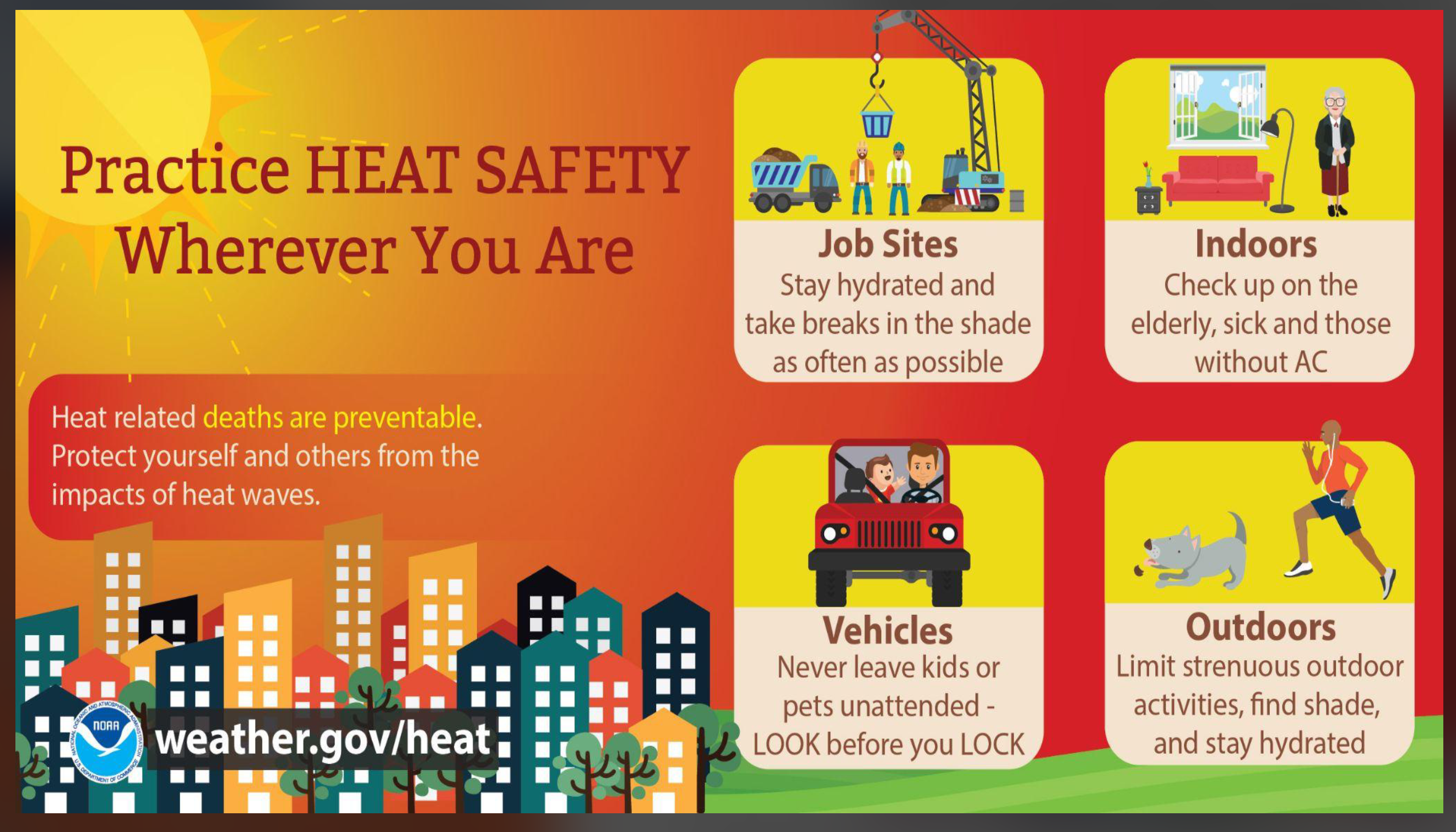
It would be best to work outside early in the morning or late in the evening.
I have a 20% chance of showers and thunderstorms during the afternoon and evening hours today through tomorrow.
Most areas will remain dry. A few places will experience a slow-moving thunderstorm.
Summer thunderstorms can drop heavy rain in a short amount of time. This can briefly flood roadways and ditches.
I am watching Saturday through Wednesday for higher rain chances.
A cold front is expected to move into the region late this weekend and early next week. This will help spark some thunderstorms.
Some of the thunderstorms could produce strong wind gusts.
It appears the front will push through the region on Tuesday. I will need to monitor to see if the front stalls in or near our region. This would mean a continued chance of showers and thunderstorms.
It will be somewhat cooler behind that front. Nothing extreme. It is summer. Cold fronts are not as potent during the summer months.
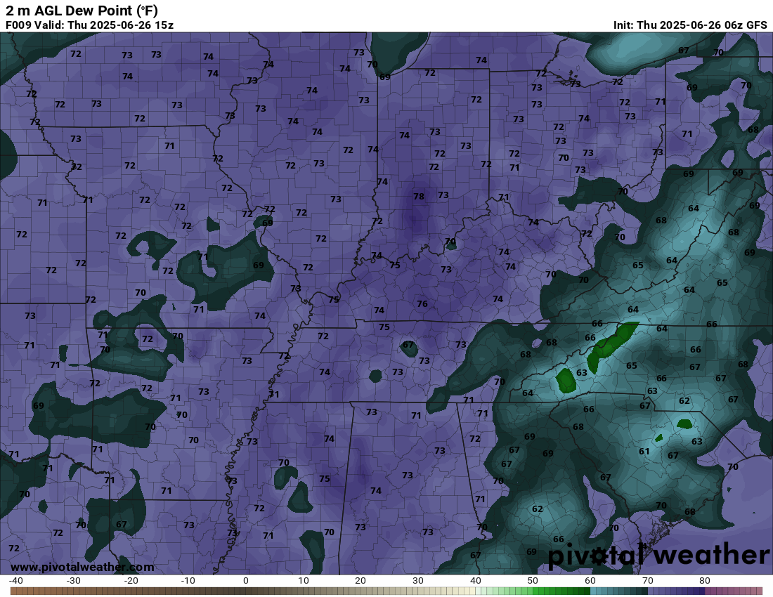
Let me show you some dew point maps. Dew point is a measure of moisture in the atmosphere. Dew point is what makes it feel so muggy outside.
Today’s dew points. Air you wear. Muggy.
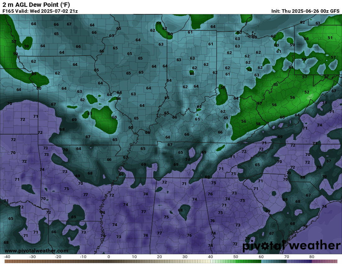
Now, let me show you next Tuesday and Wednesday.
Quite the difference north and south of the cold front! We need to get that cold front through here.
.
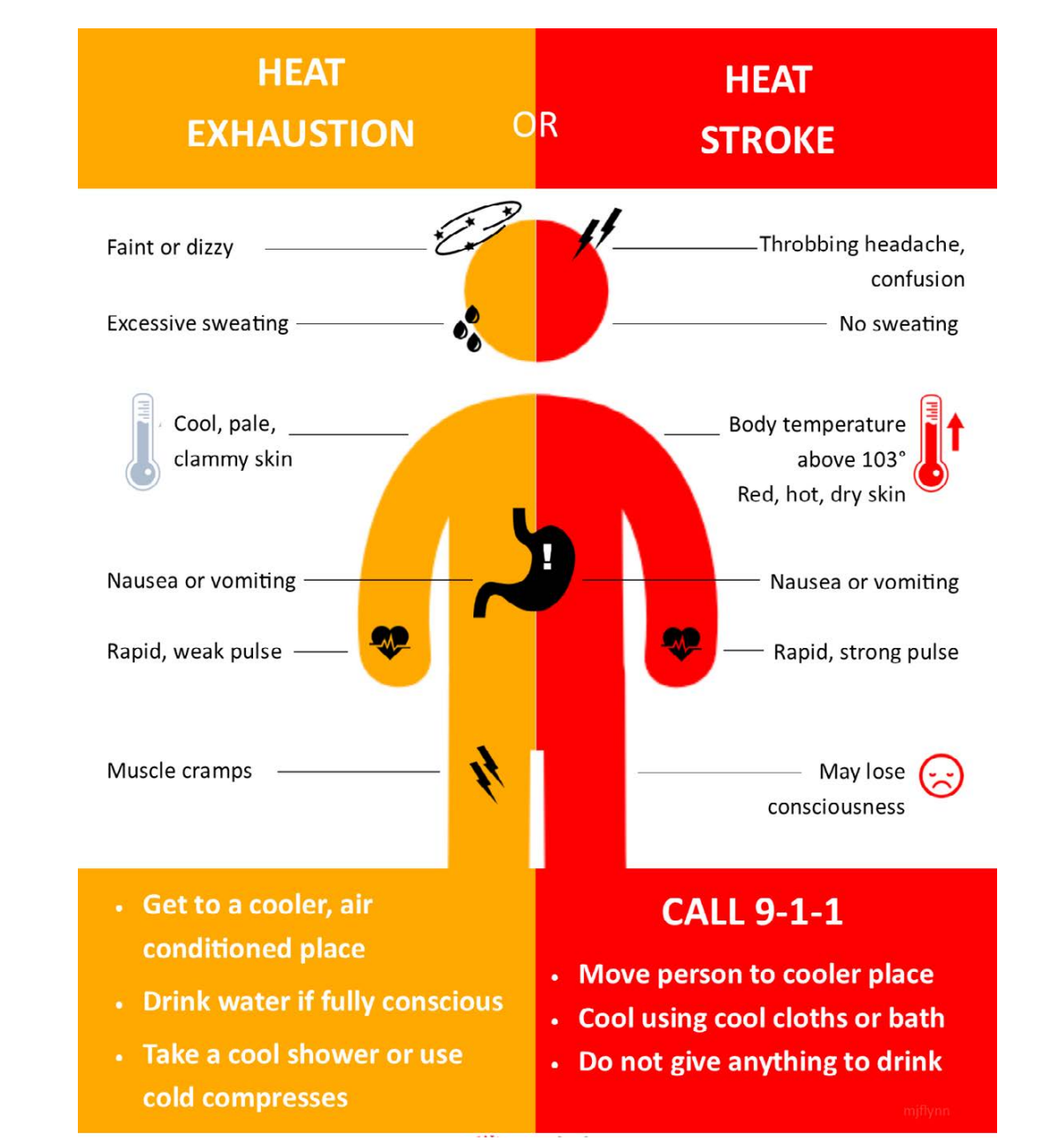
Try to stay cool out there.
Know the signs of heat illness.
.

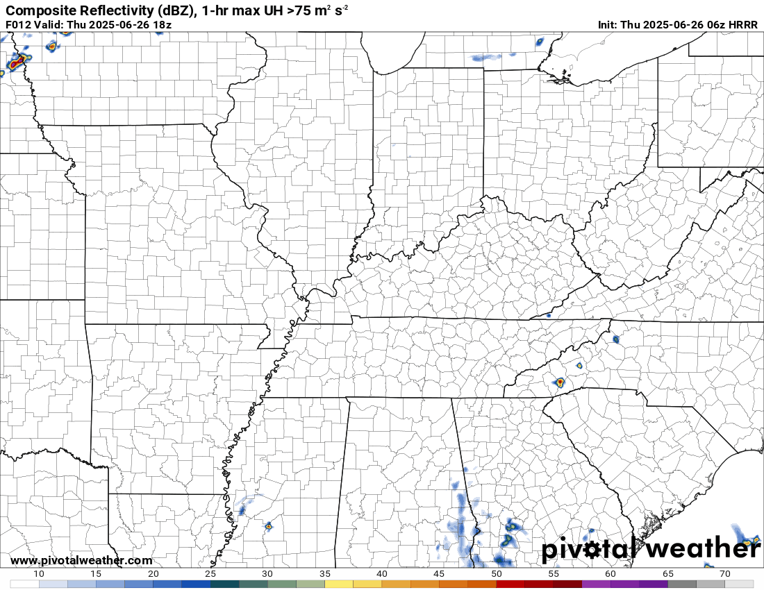
The timestamp (upper left) is in Zulu. 12z=7 am. 18z=1 pm. 00z=7 pm.
Double-click the animation to enlarge it.
Hrrr model
 .
.
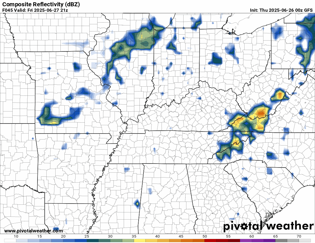
GFS model..
The timestamp (upper left) is in Zulu. 12z=7 am. 18z=1 pm. 00z=7 pm.
..
.
Click here if you would like to return to the top of the page.
.Average high temperatures for this time of the year are around 87 degrees.
Average low temperatures for this time of the year are around 66 degrees.
Average precipitation during this time period ranges from 1.00″ to 1.40″
Six to Ten Day Outlook.
Blue is below average. Red is above average. The no color zone represents equal chances.
Average highs for this time of the year are in the lower 60s. Average lows for this time of the year are in the lower 40s.

Green is above average precipitation. Yellow and brown favors below average precipitation. Average precipitation for this time of the year is around one inch per week.

.

Average low temperatures for this time of the year are around 67 degrees.
Average precipitation during this time period ranges from 1.20″ to 1.50″
.
Eight to Fourteen Day Outlook.
Blue is below average. Red is above average. The no color zone represents equal chances.

Green is above average precipitation. Yellow and brown favors below average precipitation. Average precipitation for this time of the year is around one inch per week.

.
.
.
We have a new service to complement your www.weathertalk.com subscription. This does NOTreplace www.weathertalk.com It is simply another tool for you to receive severe weather information.
.
https://weathercallservices.com/beau-dodson-weather


I am going to start going live during bigger severe weather events.
Check it out here https://www.youtube.com/user/beaudodson
Click the subscribe button (it’s a free subscription button), and it will alert you when I go live. I will also send out alerts to the app when I go live for an event.

.

Radars and Lightning Data
Interactive-city-view radars. Clickable watches and warnings.
https://wtalk.co/B3XHASFZ
Old legacy radar site (some of you like it better)
https://weatherobservatory.com/weather-radar.htm
If the radar is not updating then try another one. If a radar does not appear to be refreshing then hit Ctrl F5. You may also try restarting your browser.
Backup radar site in case the above one is not working.
https://weathertalk.com/morani
Regional Radar
https://imagery.weathertalk.com/prx/RadarLoop.mp4
** NEW ** Zoom radar with chaser tracking abilities!
ZoomRadar
If the radar is not working, then email me: Email me at beaudodson@usawx.com
.
We do have some sponsors! Check them out.
Roof damage from recent storms? Link – Click here
INTEGRITY ROOFING AND EXTERIORS!
⛈️ Roof or gutter damage from recent storms? Today’s weather is sponsored by Integrity Roofing. Check out their website at this link https://www.ourintegritymatters.com/

![]()
![]()
![]()
Make sure you have three to five ways of receiving your severe weather information.
Weather Talk is one of those ways! Now, I have another product for you and your family.

.
Want to add more products to your Beau Dodson Weather App?
Receive daily videos, weather blog updates on normal weather days and severe weather and winter storm days, your county by county weather forecast, and more!
Here is how to do add those additional products to your app notification settings!
Here is a video on how to update your Beau Dodson Weather payment.
The app is for subscribers. Subscribe at www.weathertalk.com/welcome then go to your app store and search for WeatherTalk
Subscribers, PLEASE USE THE APP. ATT and Verizon are not reliable during severe weather. They are delaying text messages.
The app is under WeatherTalk in the app store.

Apple users click here

Android users click here
.
Radars and Lightning Data
Interactive-city-view radars. Clickable watches and warnings.
https://wtalk.co/B3XHASFZ
Old legacy radar site (some of you like it better)
https://weatherobservatory.com/weather-radar.htm
If the radar is not updating then try another one. If a radar does not appear to be refreshing then hit Ctrl F5. You may also try restarting your browser.
Backup radar site in case the above one is not working.
https://weathertalk.com/morani
Regional Radar
https://imagery.weathertalk.com/prx/RadarLoop.mp4
** NEW ** Zoom radar with chaser tracking abilities!
ZoomRadar
Lightning Data (zoom in and out of your local area)
https://wtalk.co/WJ3SN5UZ
Not working? Email me at beaudodson@usawx.com
National map of weather watches and warnings. Click here.
Storm Prediction Center. Click here.
Weather Prediction Center. Click here.
.

Live lightning data: Click here.
Real time lightning data (another one) https://map.blitzortung.org/#5.02/37.95/-86.99
Our new Zoom radar with storm chases
.
.

Interactive GOES R satellite. Track clouds. Click here.
GOES 16 slider tool. Click here.
College of DuPage satellites. Click here
.

Here are the latest local river stage forecast numbers Click Here.
Here are the latest lake stage forecast numbers for Kentucky Lake and Lake Barkley Click Here.
.
.
Find Beau on Facebook! Click the banner.


 .
.