SCOLL DOWN FOR THE LATEST SEVERE WEATHER INFORMATION
Click on the words below to subscribe
We stopped supporting texts and made an app. The app receives longer messages, the videos, the blog, and more! The app receives them faster. If you are still using texts, then move over to the app, please.
Apple users click here. Android users click here.
Beau’s Severe Weather Forecast
What you need to know.
Key Points
- A couple of rounds of thunderstorms will be possible today and tonight. Ending Sunday morning.
- Some of the thunderstorms could produce 60 mph wind, nickel size hail, torrential downpours, and frequent lightning.
- A few severe thunderstorm warnings will be possible today and tonight.
- The tornado risk is low, but not zero. Monitor your Beau Dodson Weather app. I will push out information if necessary.
- Have your Beau Dodson Weather app on. Check it. Make sure you have not logged out of the app.
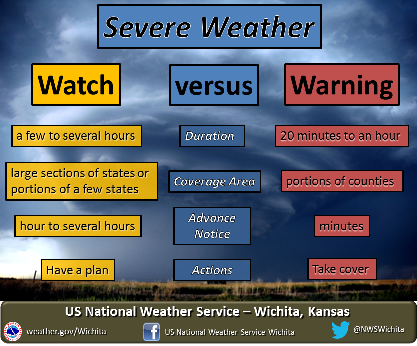
- Remember, a watch means to monitor updates. A warning means to seek shelter. A warning is a higher threat.
.

The latest update will be posted here. Check back from time to time.
10 PM
THE SEVERE THREAT HAS ENDED.
ENJOY THE COOLER WEATHER!
- Beau
9:24 PM
Tornado warning has expired.
Strong storms continue to move through the Bootheel and could produce high wind gusts.
.
9:06 PM
Tornado Warning for…
Southwestern Pemiscot County in southeastern Missouri
Southeastern Dunklin County in southeastern Missouri
* Until 930 PM CDT.
* At 906 PM CDT, doppler radar indicated a severe thunderstorm
producing a tornado was located near Gosnell, moving southeast at
35 mph.
Seek shelter until this storm exits your area.
9:03 PM
BULLETIN – IMMEDIATE BROADCAST REQUESTED
Severe Thunderstorm Warning
National Weather Service Memphis TN
857 PM CDT Sat Jul 31 2021
The National Weather Service in Memphis has issued a
* Severe Thunderstorm Warning for…
Northeastern Mississippi County in eastern Arkansas…
Southwestern Pemiscot County in southeastern Missouri…
Southeastern Dunklin County in southeastern Missouri…
Central Lauderdale County in western Tennessee…
* Until 945 PM CDT.
* At 857 PM CDT, a severe thunderstorm was located over Hornersville,
or near Senath, moving southeast at 50 mph.
HAZARD…60 mph wind gusts.
SOURCE…Radar indicated.
IMPACT…Expect damage to roofs, siding, and trees.
* Locations impacted include…
Blytheville, Kennett, Ripley, Osceola, Gosnell, Manila, Steele,
Senath, Luxora, Fort Pillow State Park, Hornersville, Arbyrd,
Cooter, Dell, Burdette, Fulton, Ashport, Ft Pillow, Holland and
Victoria.
PRECAUTIONARY/PREPAREDNESS ACTIONS…
For your protection move to an interior room on the lowest floor of a
building.
Torrential rainfall is occurring with this storm, and may lead to
flash flooding. Do not drive your vehicle through flooded roadways.
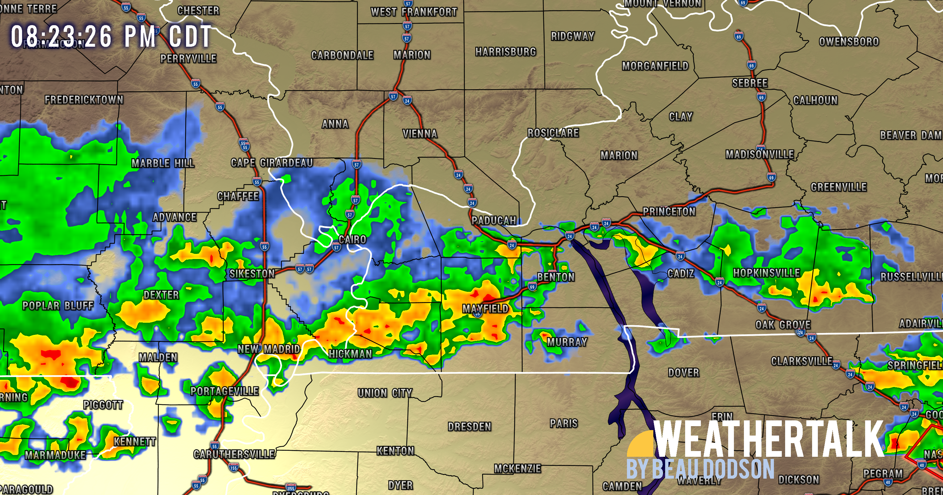
8:43 PM
A SIGNIFICANT WEATHER ADVISORY HAS BEEN ISSUED UNTIL 915 PM CDT
FOR...

EAST CENTRAL PEMISCOT COUNTY IN SOUTHEASTERN MISSOURI...
SOUTHERN LAKE COUNTY IN WESTERN TENNESSEE...
SOUTHWESTERN OBION COUNTY IN WESTERN TENNESSEE...
NORTHEASTERN DYER COUNTY IN WESTERN TENNESSEE...

AT 840 PM CDT...A STRONG THUNDERSTORM PRODUCING WIND GUSTS UP TO 50
MPH WAS LOCATED NEAR PORTAGEVILLE, MOVING SOUTHEAST AT 35 MPH.

PEOPLE IN EAST CENTRAL PEMISCOT...SOUTHERN LAKE...SOUTHWESTERN OBION
AND NORTHEASTERN DYER COUNTIES SHOULD MONITOR THIS STORM CLOSELY.
.
8:42 PM
SPECIAL WEATHER STATEMENT
NATIONAL WEATHER SERVICE PADUCAH KY

KYZ001-006-008-009-012-010215-
MARSHALL KY-CALLOWAY KY-GRAVES KY-FULTON KY-TRIGG KY-

...SPECIAL WEATHER STATEMENT...

AT 826 PM CDT, DOPPLER RADAR WAS TRACKING STRONG THUNDERSTORMS ALONG
A LINE EXTENDING FROM 7 MILES SOUTHEAST OF CALVERT CITY TO 7 MILES
NORTHWEST OF MURRAY TO 7 MILES SOUTHWEST OF SEDALIA TO REELFOOT LAKE
STATE PARK. MOVEMENT WAS SOUTHEAST AT 40 MPH.

WINDS IN EXCESS OF 30 MPH WILL BE POSSIBLE WITH THESE STORMS.
FREQUENT AND DANGEROUS LIGHTNING WILL ALSO BE A CONCERN IN THE
STRONGEST STORMS, ESPECIALLY FOR THOSE OUTDOORS OR ON KENTUCKY OR
BARKLEY LAKES.

LOCATIONS IMPACTED INCLUDE...
MURRAY, FULTON, LAND BETWEEN THE LAKES AREA, CAYCE, LYNNVILLE,
SEDALIA, WINGO, HARDIN, HAZEL, WATER VALLEY, NEW CONCORD, LINTON,
KIRKSEY, AURORA, DUKEDOM, HARRIS GROVE AND CROSSLAND.

PRECAUTIONARY/PREPAREDNESS ACTIONS...

TORRENTIAL RAINFALL IS ALSO OCCURRING WITH THESE STORMS, AND MAY LEAD
TO LOCALIZED FLOODING. DO NOT DRIVE YOUR VEHICLE THROUGH FLOODED
ROADWAYS.

FREQUENT CLOUD TO GROUND LIGHTNING IS OCCURRING WITH THESE STORMS.
LIGHTNING CAN STRIKE 10 MILES AWAY FROM A THUNDERSTORM. SEEK A SAFE
SHELTER INSIDE A BUILDING OR VEHICLE.
8:27 PM
Storms continue to shift south and east. As these storms move south and east the concerns end to the north.
.
7:27 PM
SPECIAL WEATHER STATEMENT
NATIONAL WEATHER SERVICE PADUCAH KY
721 PM CDT SAT JUL 31 2021

ILZ092>094-KYZ003>007-MOZ111-112-010100-
MASSAC IL-ALEXANDER IL-PULASKI IL-CARLISLE KY-MCCRACKEN KY-
BALLARD KY-GRAVES KY-LIVINGSTON KY-SCOTT MO-MISSISSIPPI MO-
721 PM CDT SAT JUL 31 2021

...SIGNIFICANT WEATHER ADVISORY FOR CENTRAL PULASKI...SOUTHEASTERN
MASSAC...EASTERN ALEXANDER...SOUTHWESTERN LIVINGSTON...CARLISLE...
MCCRACKEN...BALLARD...NORTHWESTERN GRAVES...NORTHEASTERN MISSISSIPPI
AND EAST CENTRAL SCOTT COUNTIES UNTIL 800 PM CDT...

AT 720 PM CDT, DOPPLER RADAR WAS TRACKING STRONG THUNDERSTORMS ALONG
A LINE EXTENDING FROM 8 MILES NORTHWEST OF TAMMS TO 7 MILES SOUTHWEST
OF KARNAK TO MOUND CITY TO NEAR BERTRAND. MOVEMENT WAS EAST AT 50
MPH.

WINDS IN EXCESS OF 40 MPH WILL BE POSSIBLE WITH THESE STORMS.

LOCATIONS IMPACTED INCLUDE...
PADUCAH, METROPOLIS, CHARLESTON, CAIRO, LA CENTER, BARDWELL,
WICKLIFFE, REIDLAND, LONE OAK, BROOKPORT, MOUNDS, BARLOW, MOUND CITY,
WYATT, BARKLEY REGIONAL AIRPORT, LOVELACEVILLE, WEST PADUCAH,
LEDBETTER, ULLIN AND KEVIL.

PRECAUTIONARY/PREPAREDNESS ACTIONS...

TORRENTIAL RAINFALL IS ALSO OCCURRING WITH THESE STORMS, AND MAY LEAD
TO LOCALIZED FLOODING. DO NOT DRIVE YOUR VEHICLE THROUGH FLOODED
ROADWAYS.

FREQUENT CLOUD TO GROUND LIGHTNING IS OCCURRING WITH THESE STORMS.
LIGHTNING CAN STRIKE 10 MILES AWAY FROM A THUNDERSTORM. SEEK A SAFE
SHELTER INSIDE A BUILDING OR VEHICLE.

THESE STORMS MAY INTENSIFY, SO BE CERTAIN TO MONITOR LOCAL RADIO
STATIONS AND AVAILABLE TELEVISION STATIONS FOR ADDITIONAL INFORMATION
AND POSSIBLE WARNINGS FROM THE NATIONAL WEATHER SERVICE.

TO REPORT SEVERE WEATHER, CONTACT YOUR NEAREST LAW ENFORCEMENT
AGENCY. THEY WILL RELAY YOUR REPORT TO THE NATIONAL WEATHER SERVICE
OFFICE IN PADUCAH.
.
7:26 PM
FREQUENT DANGEROUS LIGHTNING...

BE ADVISED THAT SCATTERED TO NUMEROUS THUNDERSTORMS ACROSS
SOUTHEAST MISSOURI, FAR SOUTHERN ILLINOIS, AND WESTERN KENTUCKY,
WILL POSE A SIGNIFICANT LIGHTNING HAZARD THIS EVENING.

AT 710 PM...CARTER COUNTY EMERGENCY MANAGEMENT REPORTED A COUPLE
OF PEOPLE WERE STRUCK BY LIGHTNING WHILE RECREATING ON THE WATER.
IF YOU ARE OUTSIDE CAMPING OR BOATING ANYWHERE IN THE AREA THIS
EVENING, BE ADVISED OF THIS DANGEROUS HAZARD FROM THUNDERSTORMS
AND GET OFF THE WATER AND SEEK SAFE SHELTER.

HEAVY RAINS ALSO MAY POSE A FLOODING RISK, SO BE ALERT FOR RISING
WATERS AND SEEK HIGH GROUND IF NECESSARY.
.
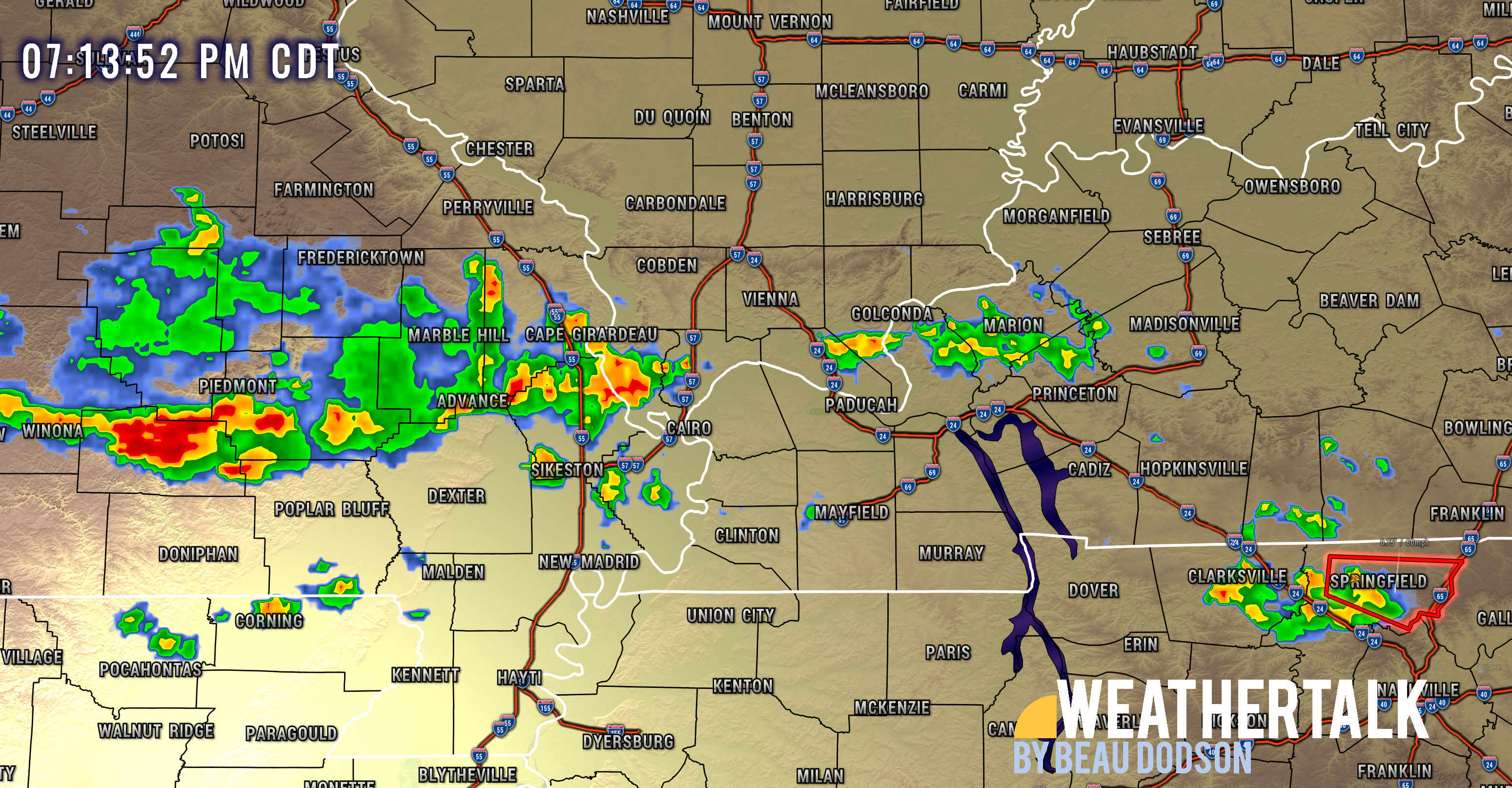
7:20 PM
Storms continue to develop from NW to SE. The main concern is south of the white line.
Heavy rain is the first concern. Isolated high winds and then lightning, of course.
5:30 PM
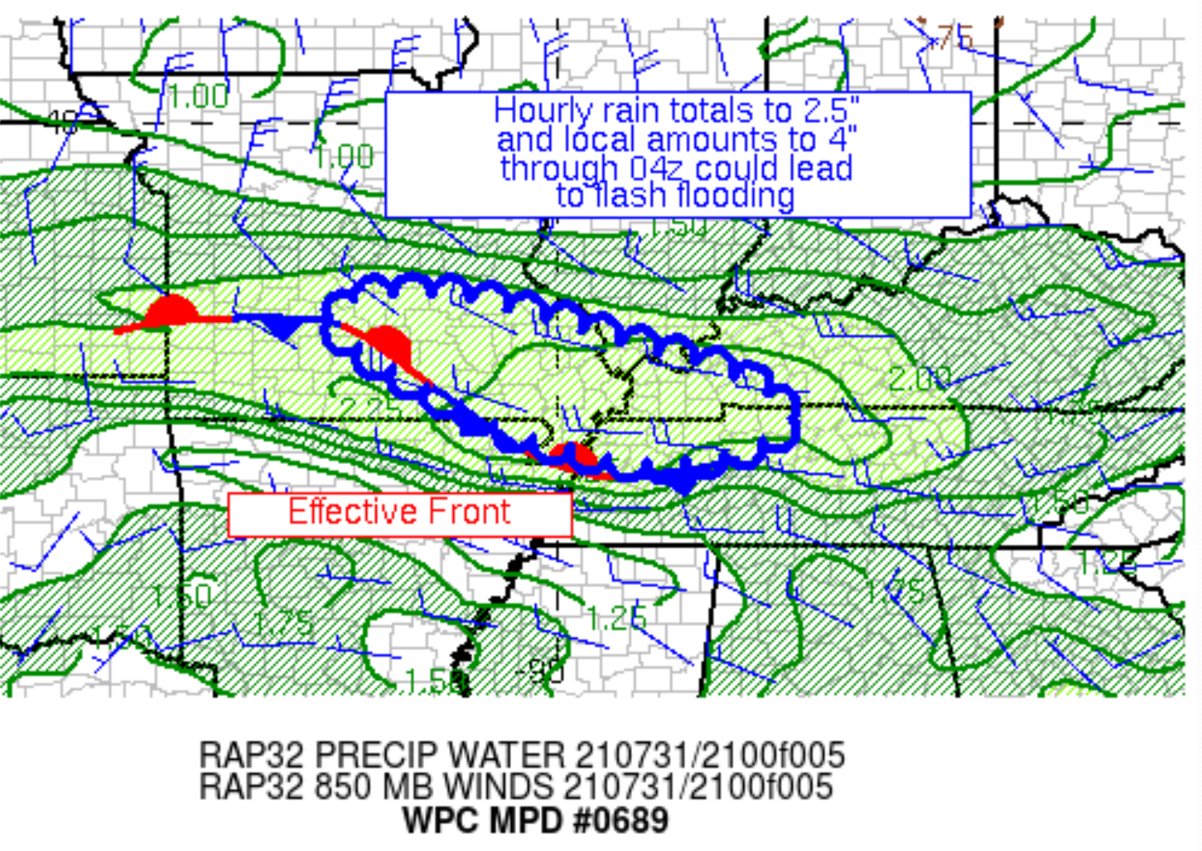
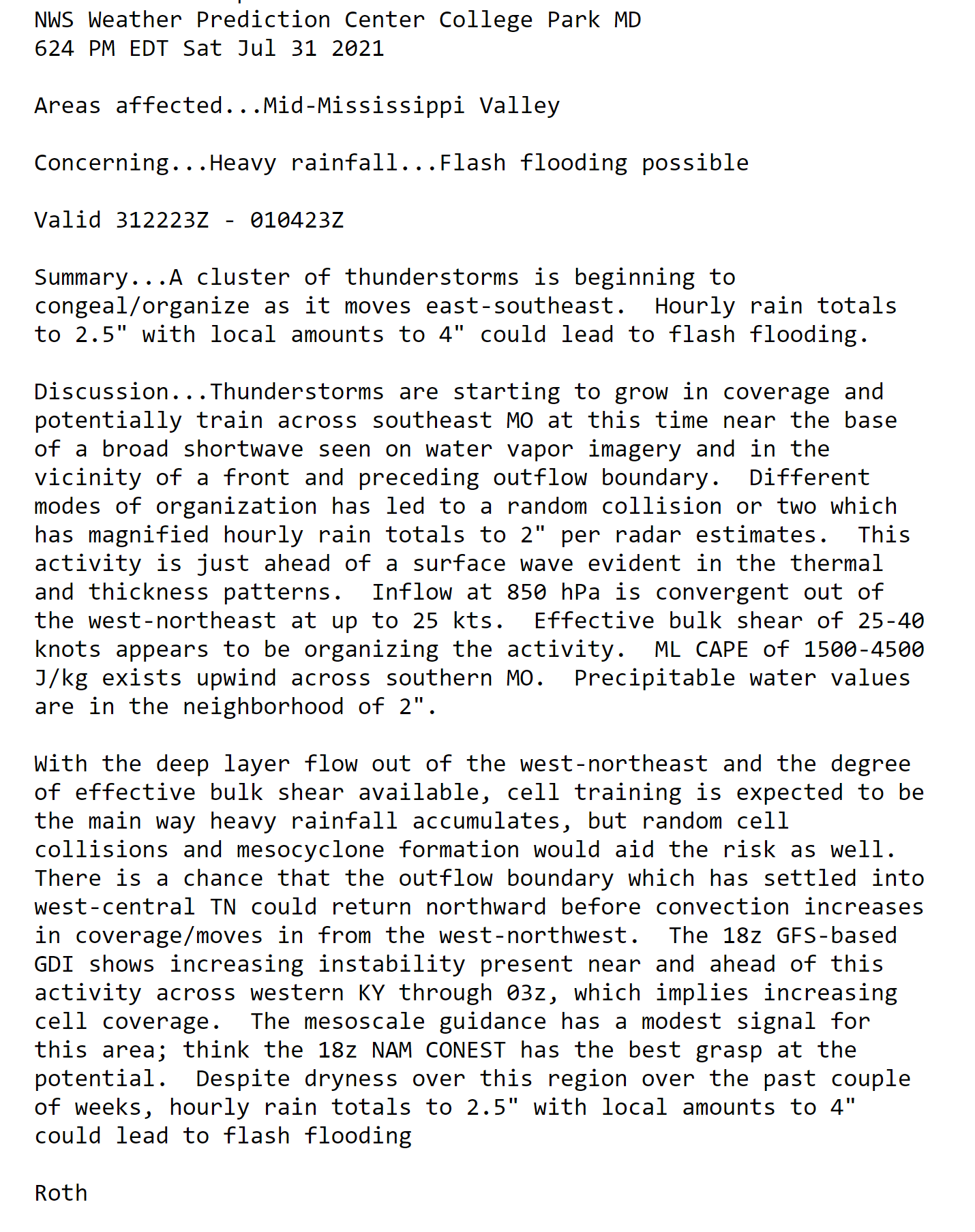
Flash flood update
..
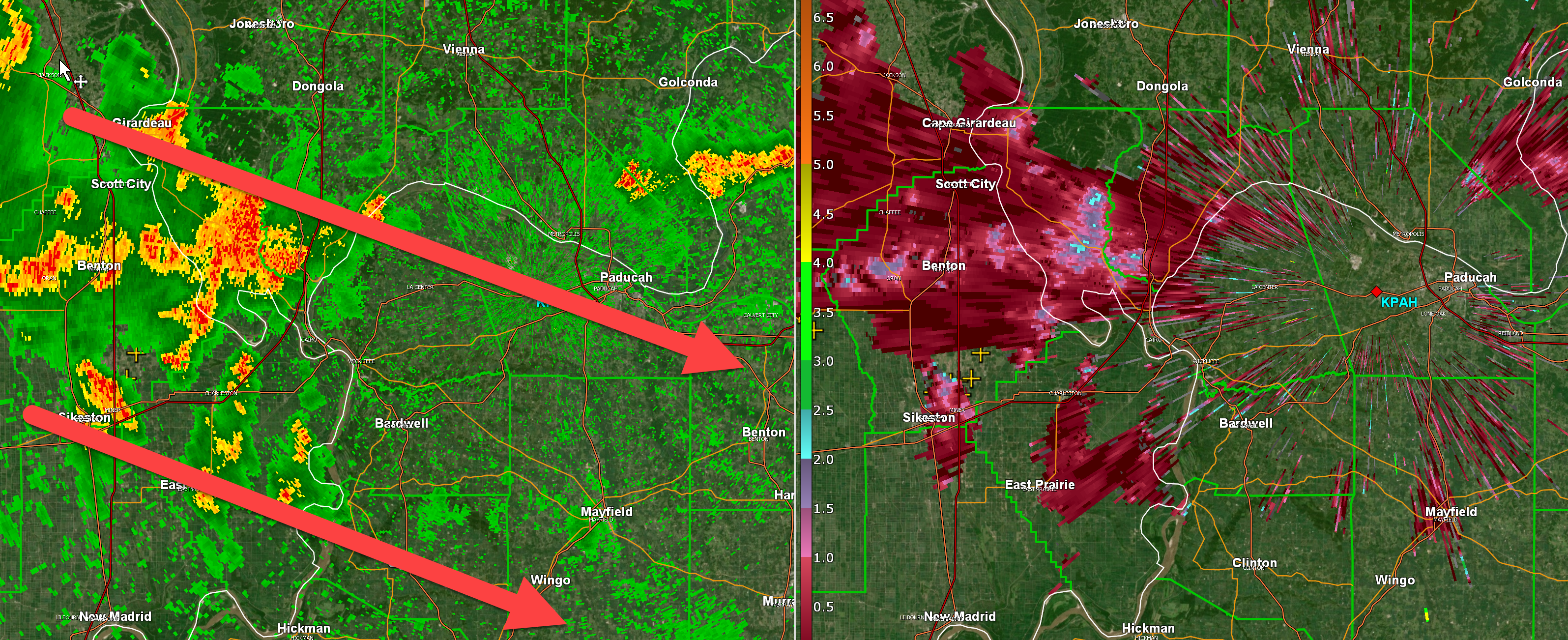
5:18 PM
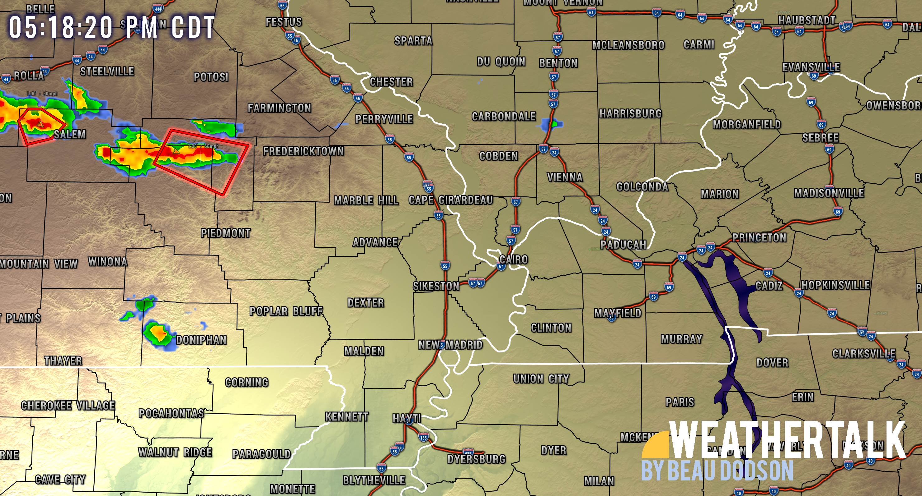
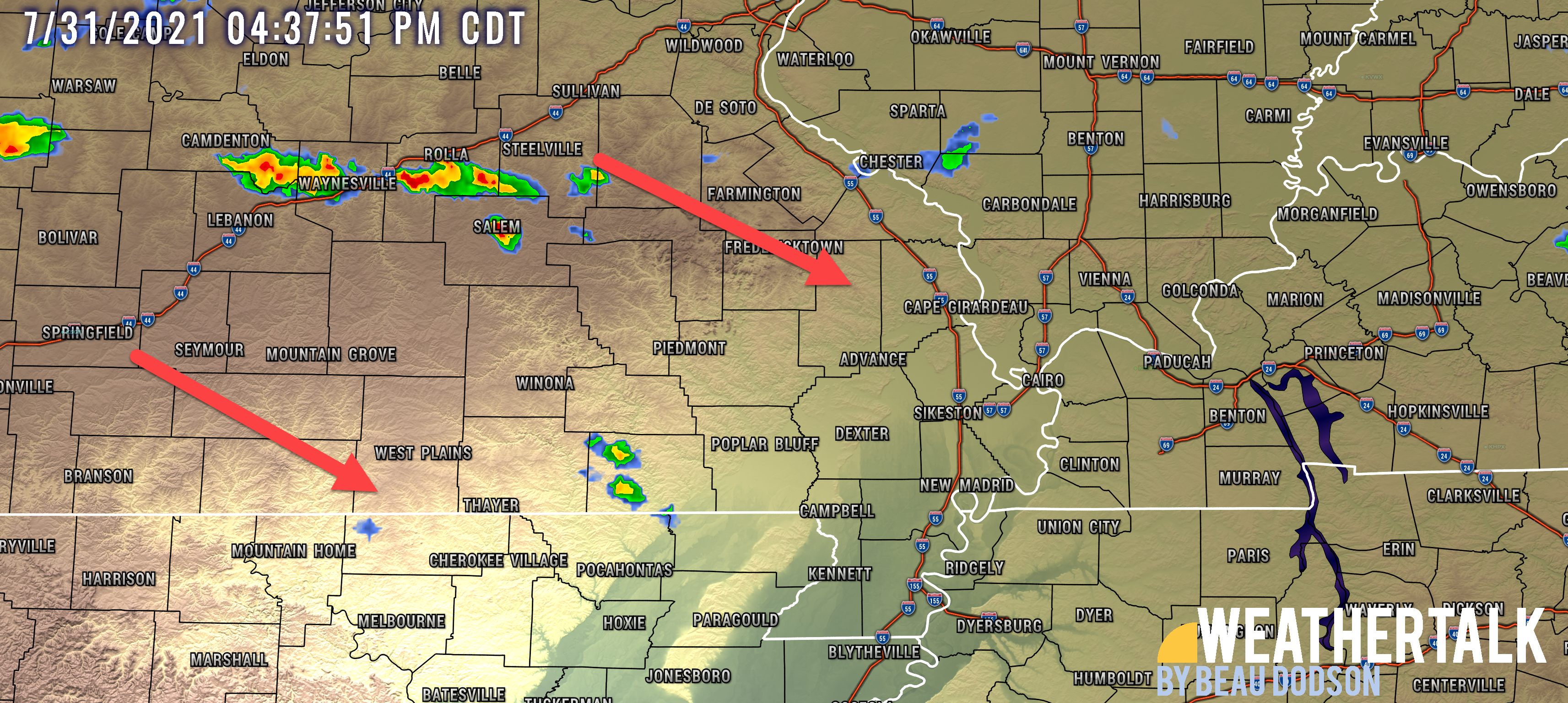
Severe thunderstorms are forming in Missouri. I continue to monitor their track.
They are moving southeast at 25 mph.
.
5:15 PM
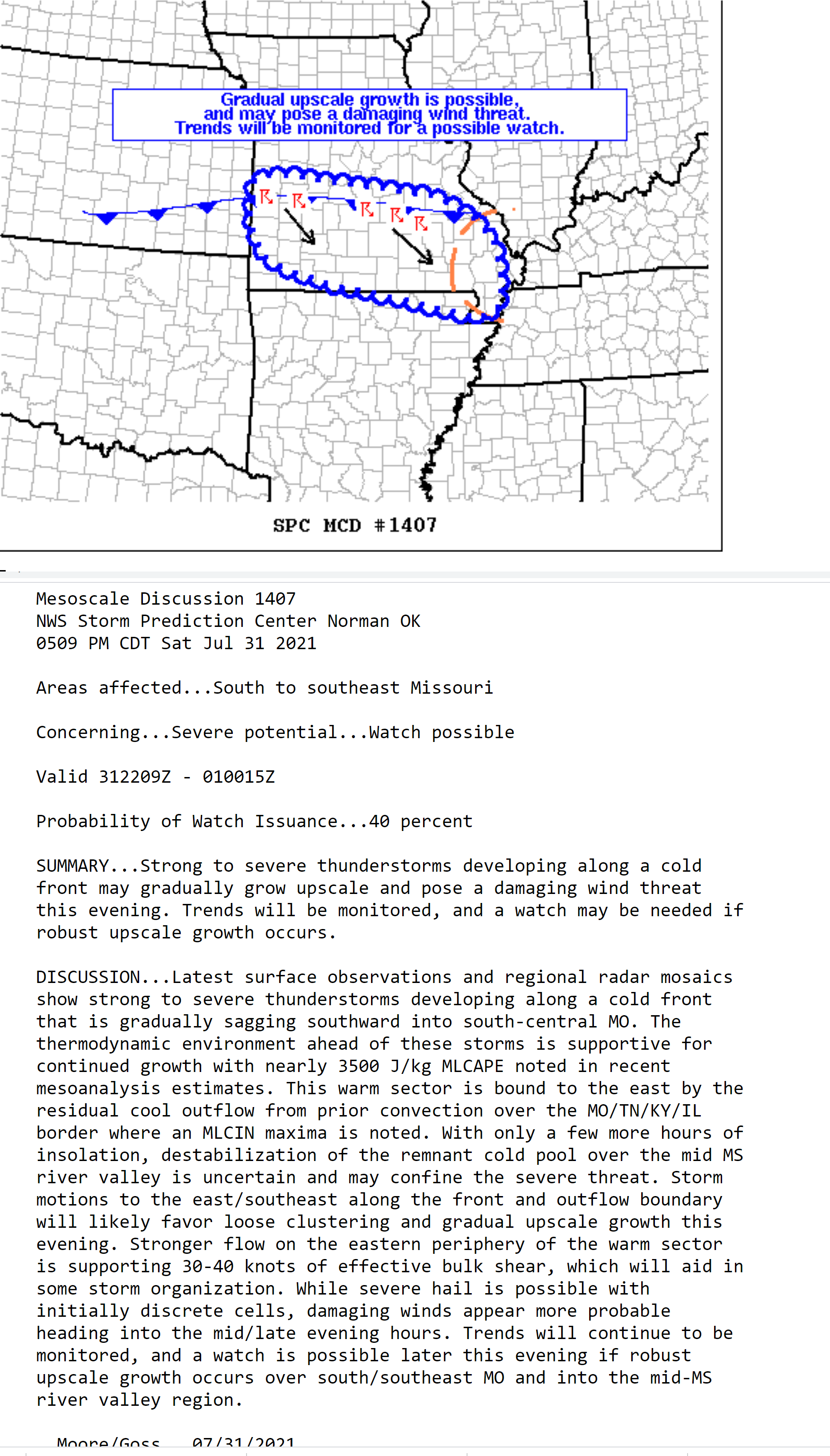
A severe thunderstorm watch may be issued shortly for this area.
There is a 40% chance of a severe thunderstorm watch.
4:45 PM
Storms are beginning to redevelop in Missouri. Let’s watch them as they track SE into our area.
Some storms could be severe.
4:30 PM
I am watching the radars to see where storms re-fire over the coming hours.
Some storms could be severe.
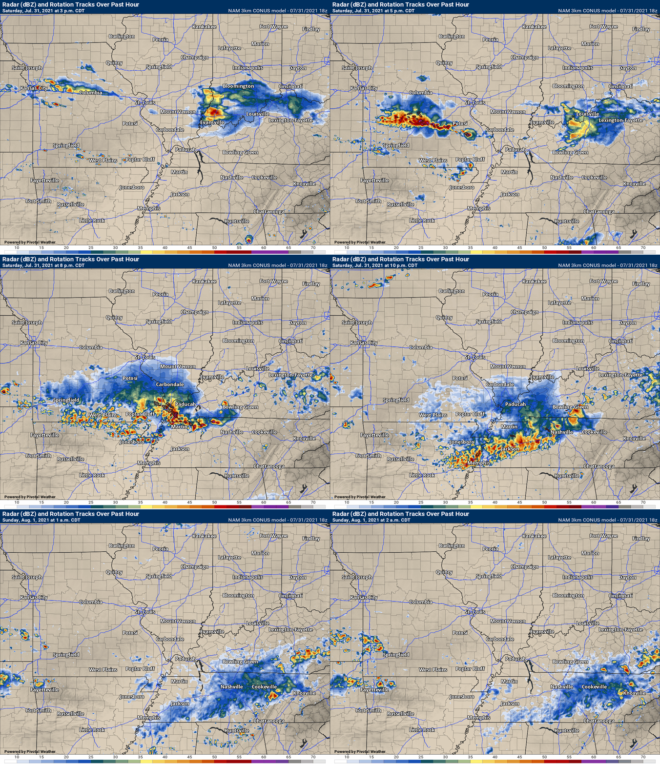
And the NAM model shows similar
.
2:55 PM
Butler County
A quick update on the Butler County storms.
Storms continue, mainly in the /southsouthwest portion of the county. This storm likely has downburst winds over 60 mph. Wind damage is likely.
There is also some rotation with the storm. Be weather aware as this storm pushes southeast at 25 mph. Seek shelter if necessary.
.
1:25 PM
Stoddard, New Madrid, Pemiscot, and Dunklin Counties.
Lake County, Tennessee.
I will monitor other counties to the east.
Thunderstorms are moving through the Missouri Bootheel.
The line is moving south/southeast. From time to time, these storms pulse up enough to produce nickel size hail and perhaps isolated wind damage. For now, that is the exception.
The storms may hold together all the way through the Bootheel. If so, there will occasionally be high winds with them. Lightning and heavy rain, of course.
.
1 PM
Storms moving into Butler County could become severe with quarter size hail and high winds.
Storm Tracking Links
Interactive local city-view radars. Clickable watches and warnings.
https://wtalk.co/B3XHASFZ
Backup radar site in case the above one is not working.
https://weathertalk.com/morani
Regional Radar
https://imagery.weathertalk.com/prx/RadarLoop.mp4
*NEW* Zoom interactive radar (with storm chaser streams)
https://wtalk.co/AVWG7GM7
Real time lightning tracker system two.
https://map.blitzortung.org/#5.02/37.95/-86.99
Lightning Data (zoom in and out of your local area)
https://wtalk.co/WJ3SN5UZ
.
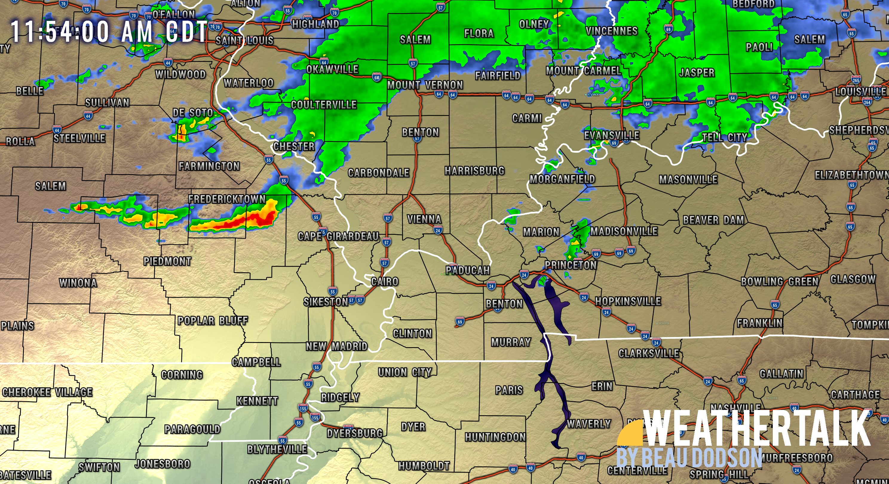
11:55 AM
11:30 AM
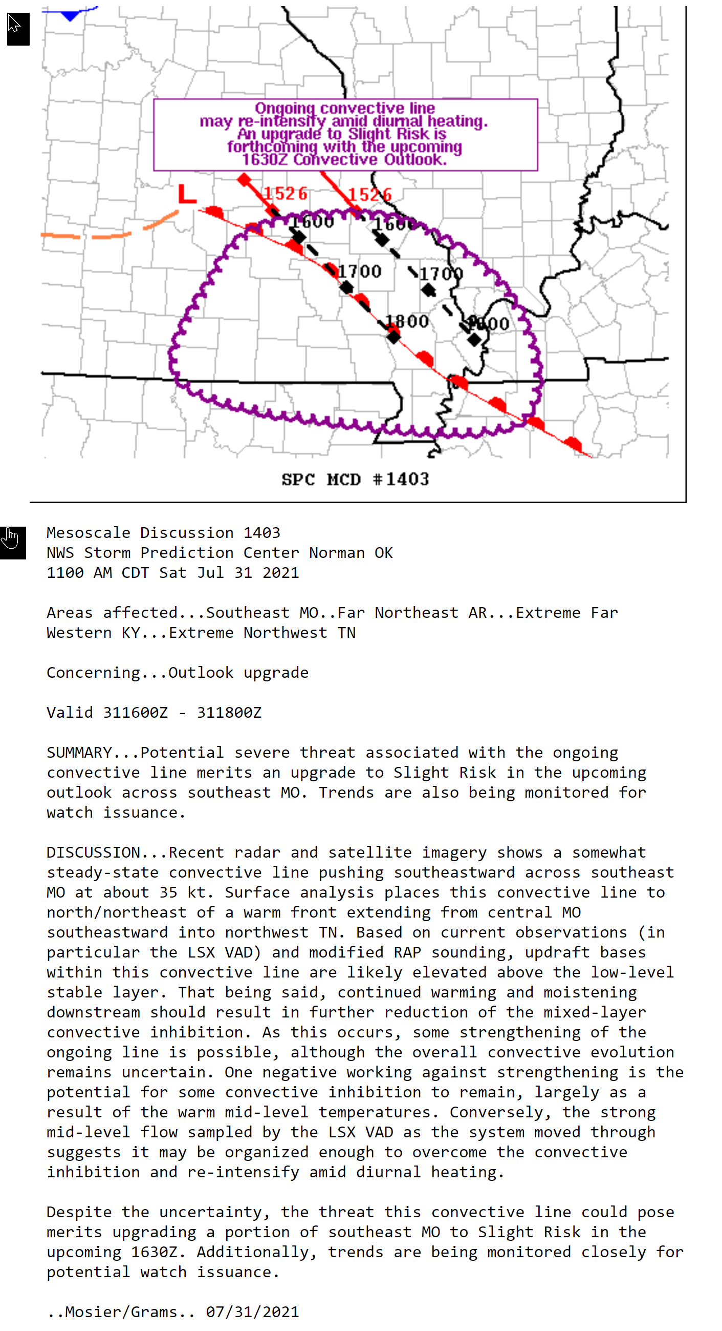
This area is being watched. A severe thunderstorm watch may need to be issued.
.
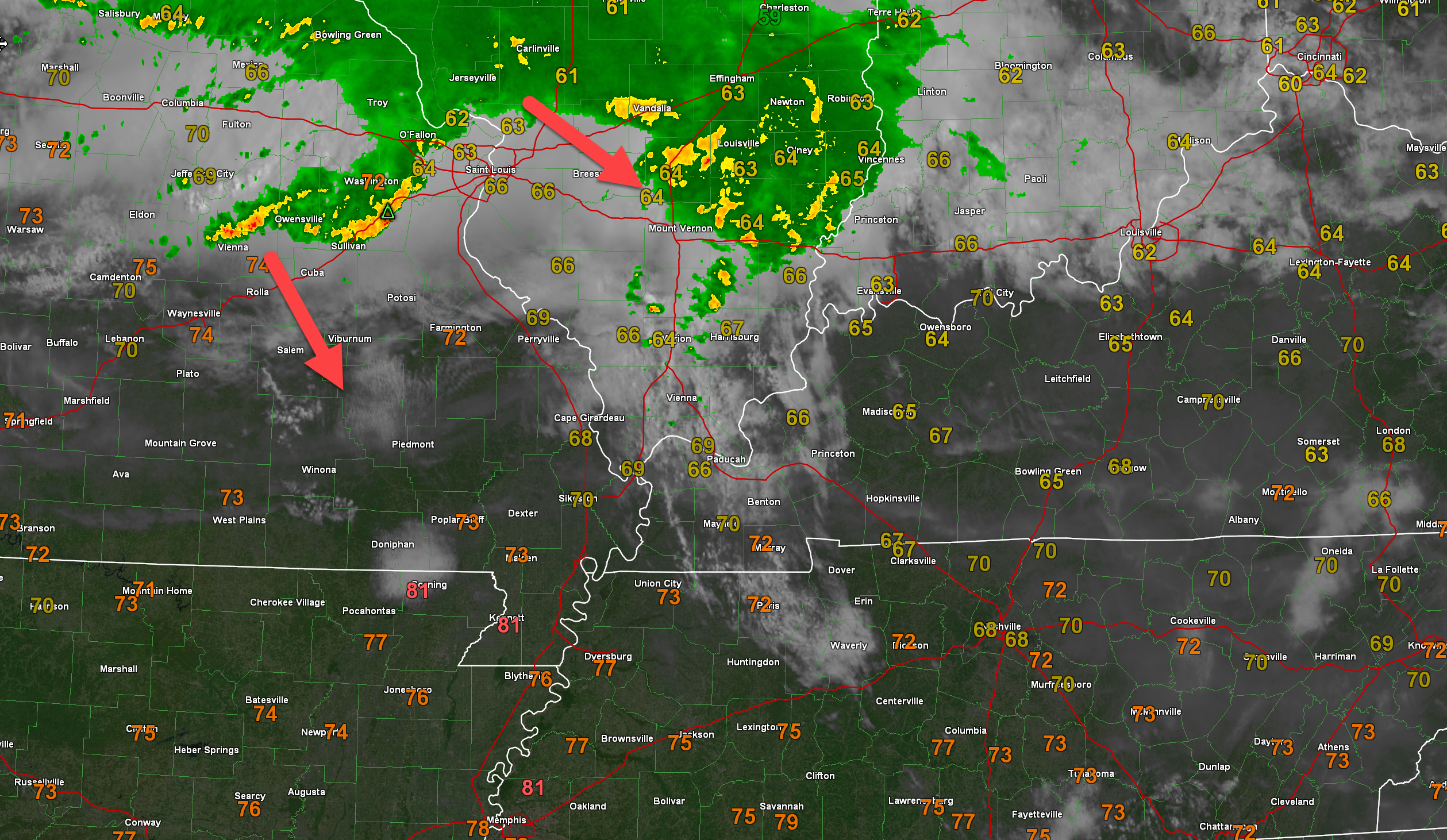
9:49 AM
These storms are moving southeast at 30 mph. I will monitor them. They could strengthen.
.
8:50 AM
8:48 AM update/discussion
See the local/live radars to track the storms moving into southern Illinois.
Interactive local city-view radars. Clickable watches and warnings.
https://wtalk.co/B3XHASFZ
Regional Radar
https://imagery.weathertalk.com/prx/RadarLoop.mp4
.
8:45 AM update/discussion
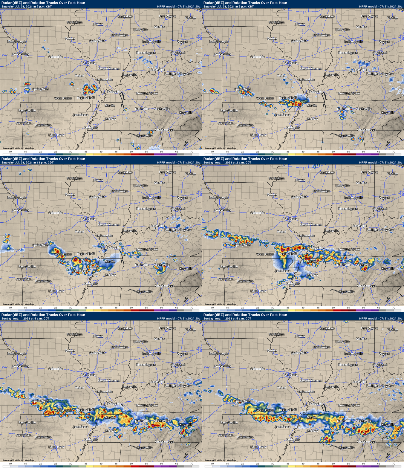
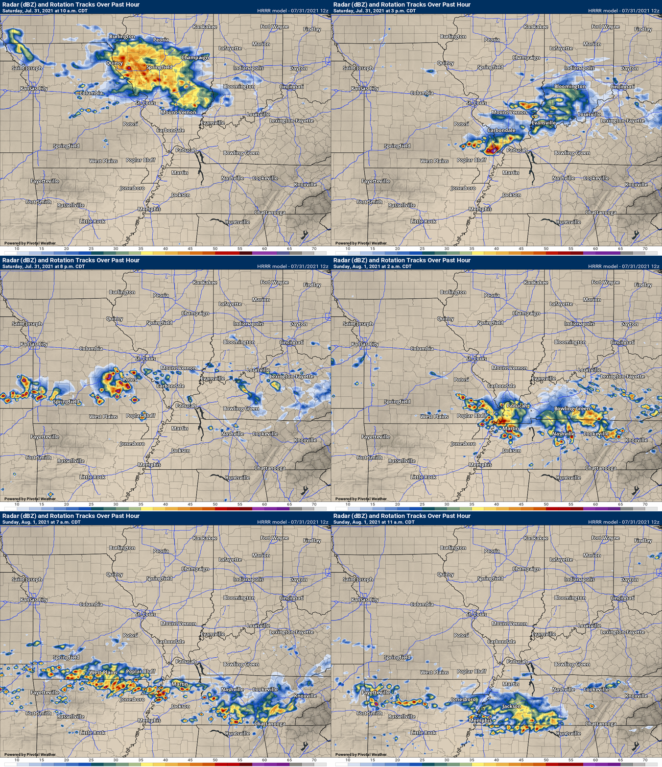
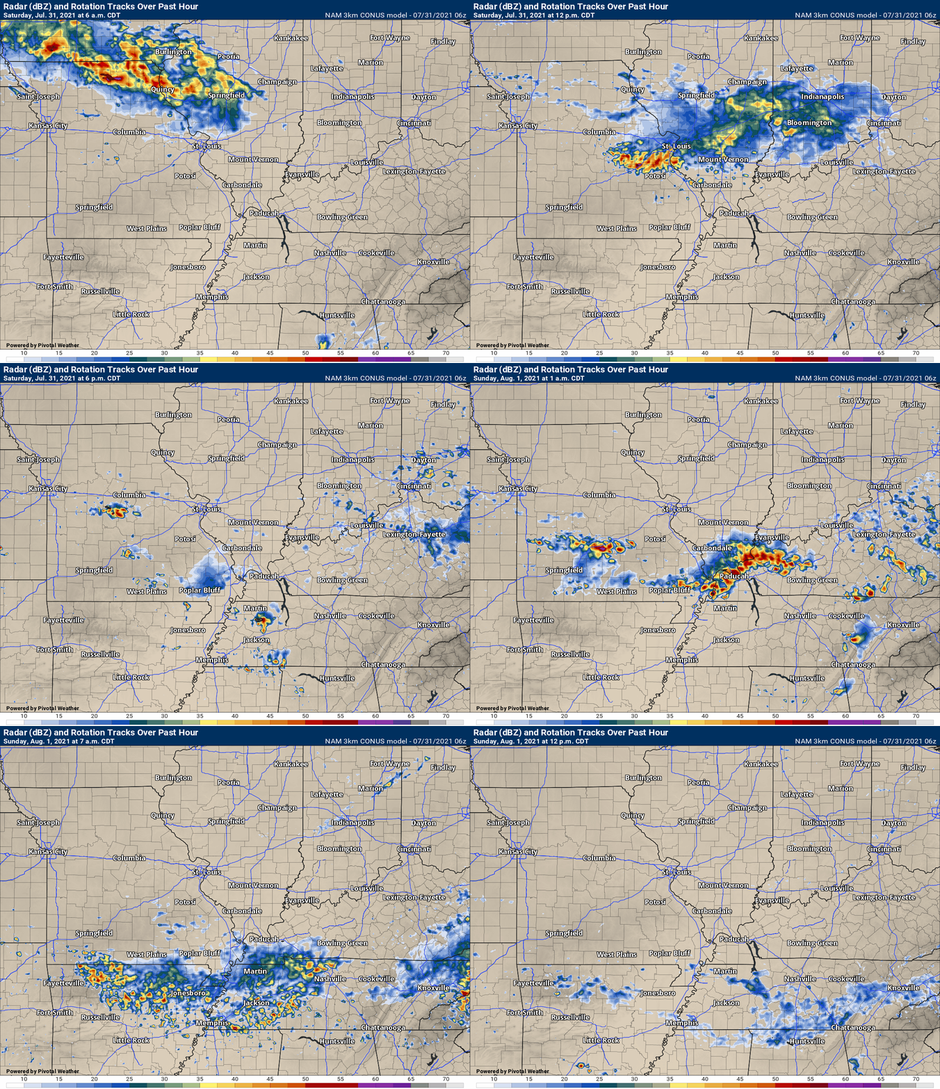
I posted future-cast radars below, as well. Those give you an idea of what the models are expecting. It won’t be exact, but it will at least give you an idea of how the models see the different rounds of thunderstorms developing.
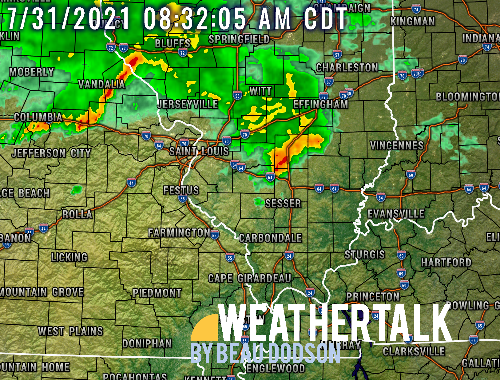
One round of thunderstorms is already pushing into southeast Missouri and southern Illinois.
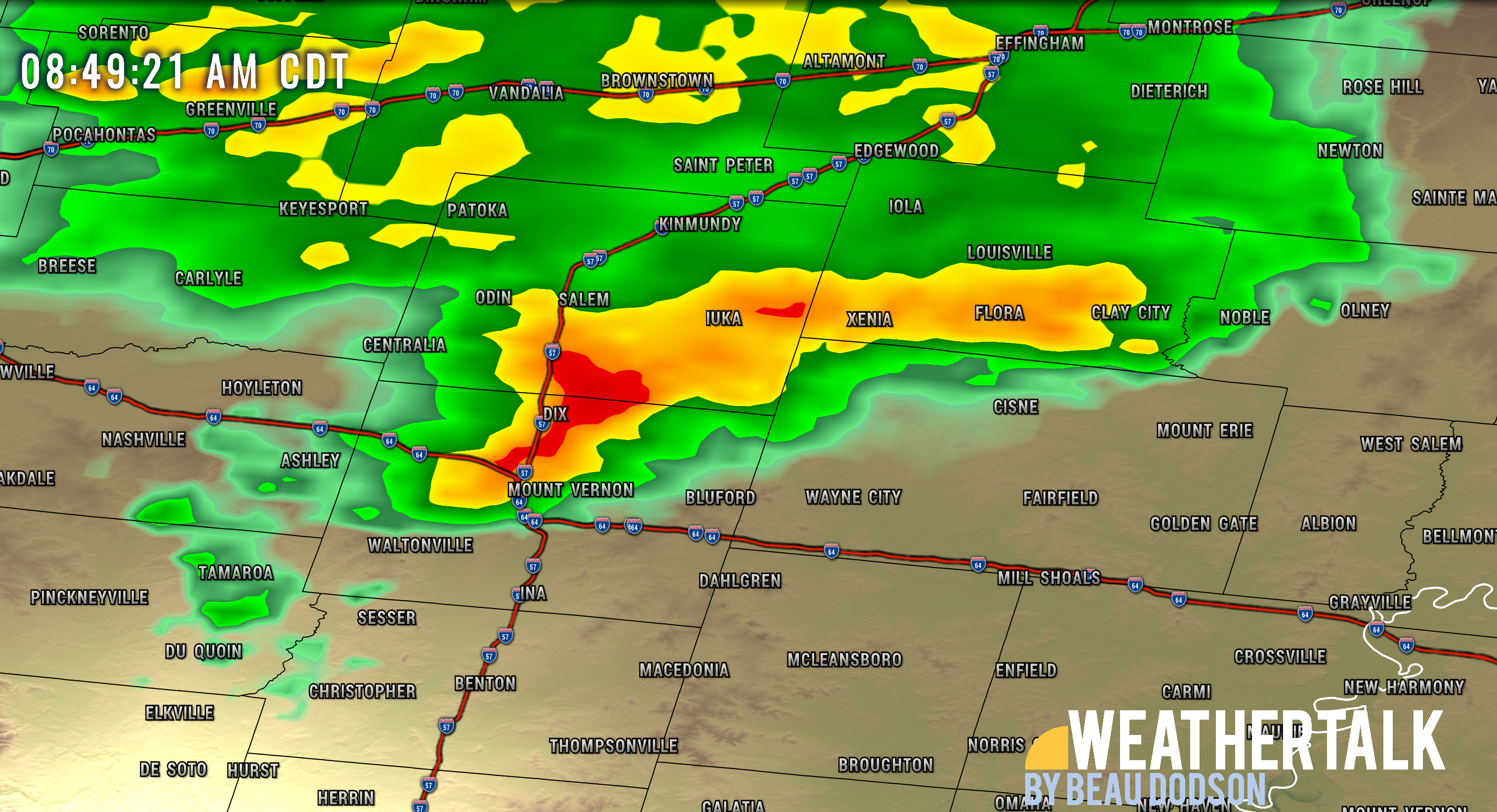
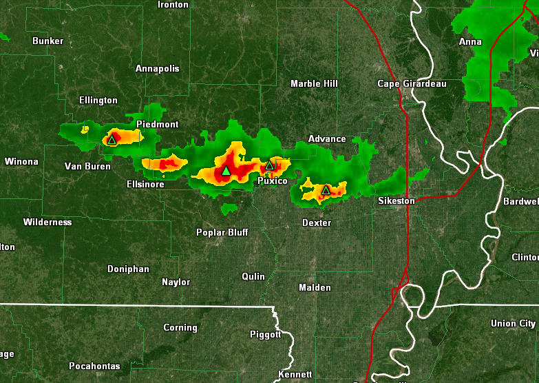
As of this writing, at 8:45 AM, a heavy thunderstorm was moving into Jefferson County, Illinois. It was producing gusty wind, heavy rain, and lightning.
It is moving southeast.
Other storms are lined up across northeast and east-central Missouri. These storms will push southward with time.
Static radar image from 8:45 AM.
See the live radars for the latest imagery.
.
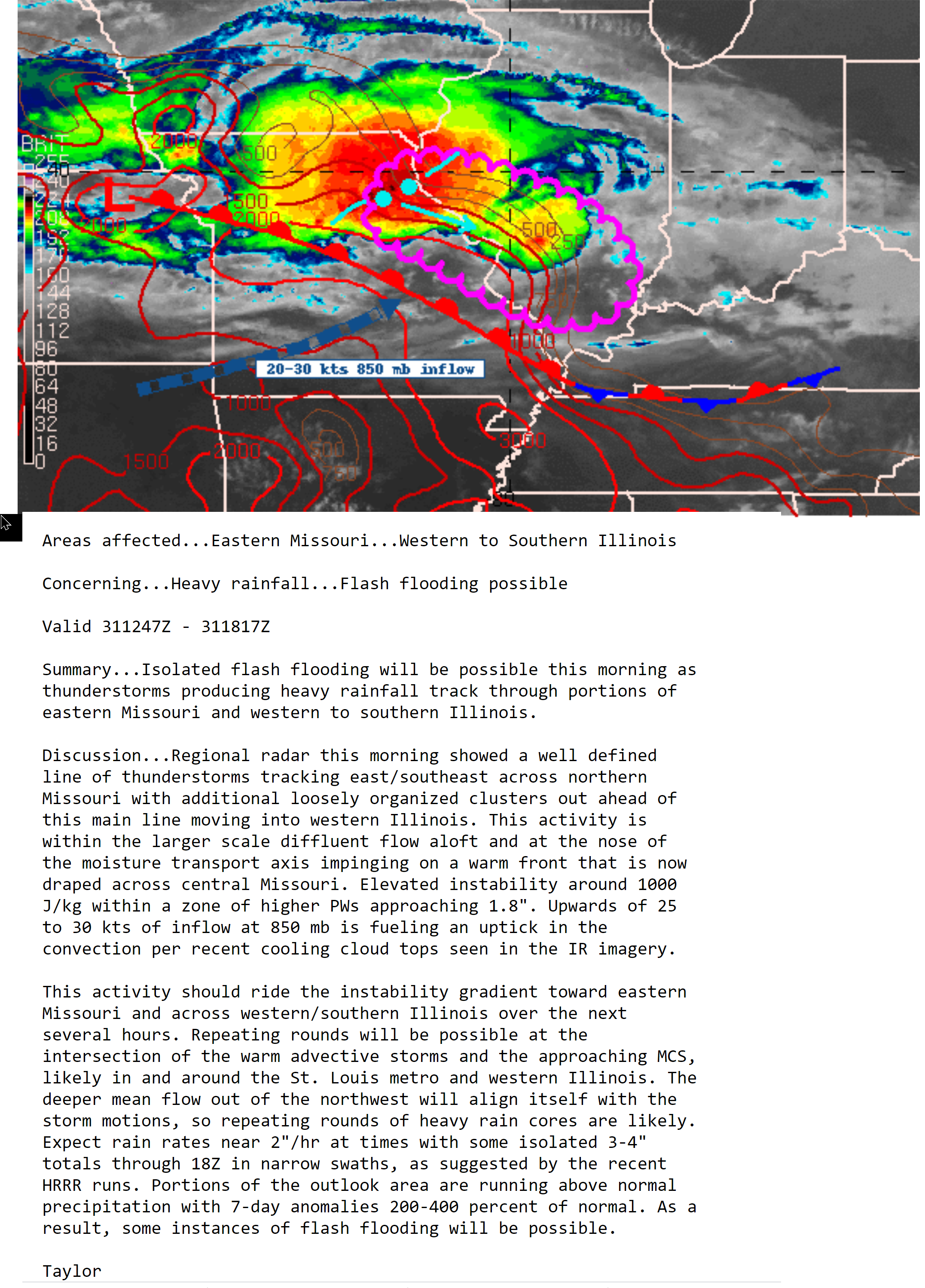
The WPC has issued a flash flood statement. The pink zig-zag zone is where they are concerned about heavy rain over the next few hours. This is round one of this storm system.
Double click on this image to enlarge it.
.
The atmosphere is fairly unstable with weak wind shear. There are some ingredients for isolated wind damage today. If a thunderstorm were to tap into a boundary then some rotation could also occur. Boundaries are left over from previous thunderstorms.
Storms will mostly be moving south and southeast.
The Storm Prediction Center has outlined our region for a level one out of five risk of severe weather. One if the lowest risk.
Basically, it means what I said above. A few storms could produce damaging wind gusts.
There will likely end up being two distinct rounds of thunderstorms. This first round that is on radar now and then new development this evening into tonight.
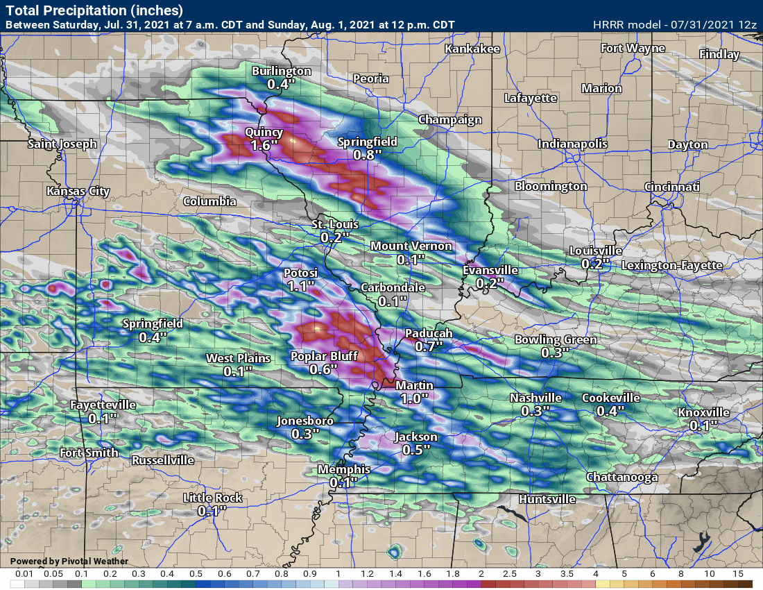
Tonight’s round may produce some flash flooding. Storms may train over the same areas. If this happens then torrential rain totals can occur in a short period of time. One to three inches in thirty-minutes. This can lead to roads flooding.
The Hrrr model likes southwest Illinois, southeast Missouri and far western Kentucky for the heaviest rain totals.
If flash flooding develops, then avoid flooded roadways.
Storms will end Sunday morning and afternoon. That will occur as the cold front pushes away from the region.
Monitor your Beau Dodson Weather Talk app today.
Storm Tracking Links
Interactive local city-view radars. Clickable watches and warnings.
https://wtalk.co/B3XHASFZ
Backup radar site in case the above one is not working.
https://weathertalk.com/morani
Regional Radar
https://imagery.weathertalk.com/prx/RadarLoop.mp4
*NEW* Zoom interactive radar (with storm chaser streams)
https://wtalk.co/AVWG7GM7
Real time lightning tracker system two.
https://map.blitzortung.org/#5.02/37.95/-86.99
Lightning Data (zoom in and out of your local area)
https://wtalk.co/WJ3SN5UZ
.

Click here if you would like to return to the top of the page.
Again, as a reminder, these are models. They are never 100% accurate. Take the general idea from them.
What should I take from these?
- The general idea and not specifics. Models usually do well with the generalities.
- The time-stamp is located in the upper left corner.
- The EC European weather model is in Zulu time.
.
What am I looking at?
You are looking at different models. Meteorologists use many different models to forecast the weather. All models are wrong. Some are more wrong than others. Meteorologists have to make a forecast based on the guidance/models.
I show you these so you can see what the different models are showing as far as precipitation. If most of the models agree, then the confidence in the final weather forecast increases.
You can see my final forecast at the top of the page.
.
This animation is the Storm Prediction Center WRF model.
This animation shows you what radar might look like as the next system pulls through the region. It is a future-cast radar.
Time-stamp upper left. Click the animation to enlarge it.
.
This animation is the Hrrr short-range model.
This animation shows you what radar might look like as the next system pulls through the region. It is a future-cast radar.
Time-stamp upper left. Click the animation to enlarge it.
.
.This animation is the higher-resolution 3K NAM American Model.
![]()
Today’s severe weather outlook from the Storm Prediction Center (below).
Light green is where thunderstorms may occur but should be below severe levels.
Dark green is a level one risk. Yellow is a level two risk. Orange is a level three (enhanced) risk. Red is a level four (moderate) risk. Pink is a level five (high) risk.
One is the lowest risk. Five is the highest risk.
A severe storm is one that produces 58 mph wind or higher, quarter size hail, and/or a tornado.
The tan states are simply a region that SPC outlined on this particular map. Just ignore that.

The black outline is our local area.

.
Tomorrow’s severe weather outlook.

![]()
![]()
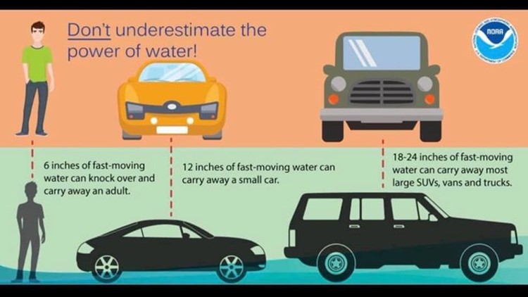
Some safety graphics.
.![]()
.
.

Radar Link: Interactive local city-view radars & regional radars.
You will find clickable warning and advisory buttons on the local city-view radars.
If the radar is not updating then try another one. If a radar does not appear to be refreshing then hit Ctrl F5. You may also try restarting your browser.
Not working? Email me at beaudodson@usawx.com
Backup radar site in case the above one is not working.
https://weathertalk.com/morani
New ZOOM radar (with storm chasers)
https://wtalk.co/AVWG7GM7
Regional Radar
https://imagery.weathertalk.com/prx/RadarLoop.mp4
Lightning Data (zoom in and out of your local area)
https://wtalk.co/WJ3SN5UZ
Satellite Data
Computers and tablets. These two satellite links may not work well on cell phones.
Visible Satellite. This one is to be used during daylight only. Be sure and hit refresh once you are on the satellite page. Otherwise, the data will be old.
https://col.st/a5A0e
IR Satellite. This one shows cloud temperatures. Bright colors represent cold cloud tops. That could mean thunderstorms. Be sure and hit refresh once you are on the satellite page. Otherwise, the data will be old.
https://col.st/R2fw1
Water Vapor Satellite. This one shows mid-level moisture in the atmosphere. Be sure and hit refresh once you are on the satellite page. Otherwise, the data will be old.
https://col.st/xFVwx
.

Live lightning data: Click here.
Not receiving app/text messages?
Log in and out of your app.
USE THE APP. ATT and Verizon are slowing or stopping the text messages. Move to the app (not texts).
Make sure you have the correct app/text options turned on. Find those under the personal notification settings tab at www.weathertalk.com. Red is off. Green is on.
Subscribers, PLEASE USE THE APP. ATT and Verizon are not reliable during severe weather. They are delaying text messages.
The app is under WeatherTalk in the app store.
Apple users click here
Android users click here
.


