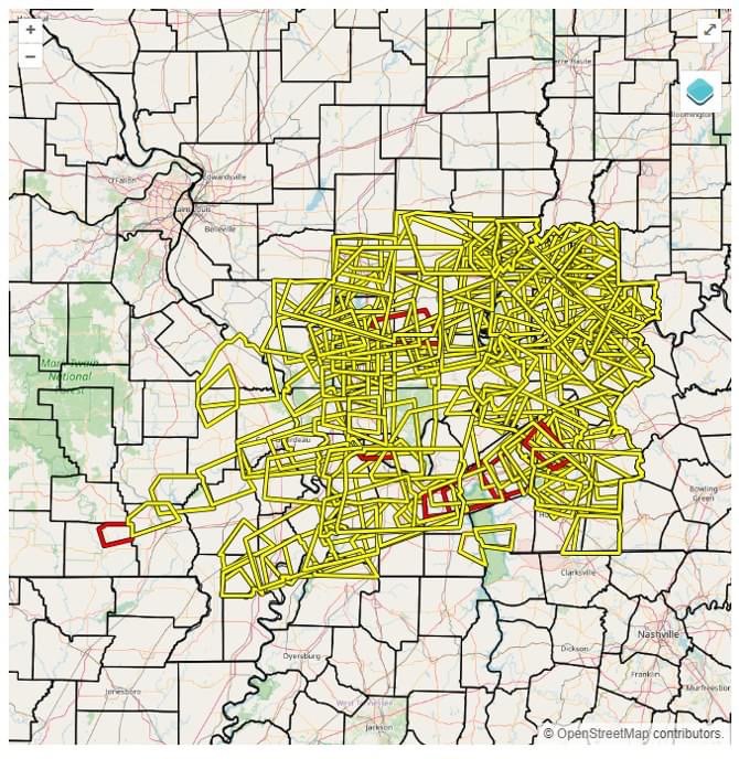
It has been a very long four days.
If you add in northwest Tennessee and northern portions of southeast Missouri, then nearly 200 warnings were issued. In four days! That is just an incredible number for any time of the year, let alone summer.
Your weatherman is worn out!
Rainfall totals ranged from very little to nearly NINE inches! I had been predicting pockets of three to six inches. I was too low!
Thus, a short update today.
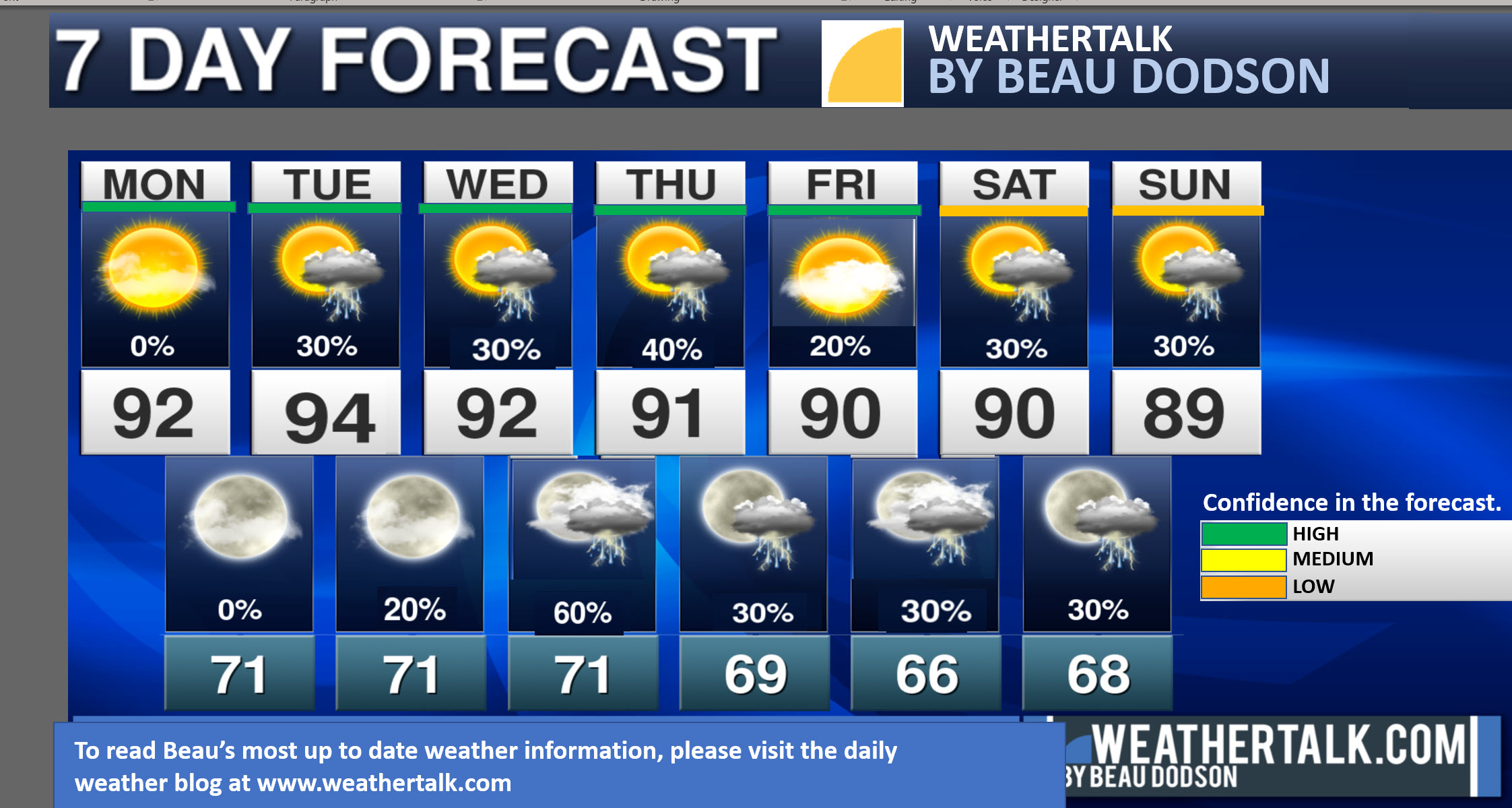
Scattered storms are possible Fourth of July. For now, I am not expecting severe weather. Which is the good news.
Our next good chance of thunderstorms will arrive Wednesday afternoon and night.
Scattered thunderstorms will be possible Thursday into the weekend.
We will need to watch for severe weather risks Wednesday afternoon and night. Perhaps beyond that, as well.
The Storm Prediction Center has us outlined for severe storms Wednesday afternoon and night. Moving in from the northwest. Monitor updates.
Rain probabilities may need adjusting Thursday into the weekend. I need to monitor data and gain some confidence on timing.
For now, I broad-brushed the chances in the 20 to 30% range. I would not be surprised if there were some thunderstorm complexes mixed in. That would increase rain chances/coverage/amounts.


