

.
I have some question-and-answer threads over on the Facebook page. Link to those threads CLICK HERE
Or email me at beaudodsonweather@gmail.com
..

🌪️ Seven-Day Tornado Outlook ⛈️
July 23rd through July 29th
Current risk: None.
Current confidence level: High confidence in the forecast.
Comment: No tornado threats.
.

Seven-Day Hazardous Weather Outlook
1. Is lightning in the forecast? ISOLATED. Isolated lightning is possible this week. Peak chances will be Friday into Sunday as a boundary pushes into the region. I will monitor next Tuesday and Wednesday.
2. Are organized severe thunderstorms in the forecast? NOT AT THIS TIME. Thunderstorms, during the summer months, can produce isolated gusty winds. Organized severe weather is not anticipated. I will monitor Friday into Sunday as a boundary approaches the region. I will monitor next Tuesday and Wednesday.
3. Is flash flooding in the forecast? ISOLATED. Slow-moving summer storms can produce torrential downpours that can briefly flood ditches and roadways.
4. Will non-thunderstorm winds top 40 mph? NO.
5. Will temperatures rise above 90 degrees? YES. Temperatures will be in the nineties into next week.
6. Will temperatures rise above 100 degrees? NO.
7. Will the heat index (feels like) rise above 100 degrees? YES. Heat index values of 100 to 110 degrees are expected to be in the forecast for the entire week. Locally higher. Areas with clouds and rain will be a bit lower. I will also be monitoring next week’s forecast. Additional high heat index readings are possible.
8. Will the heat index rise above 115 degrees? LOW RISK. A few locations could reach heat index temperatures of 115 degrees or higher today through Friday.
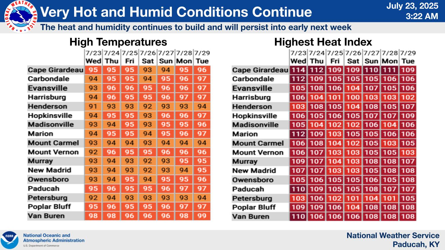
Here is a graphic that shows you high temperatures and heat index values. Find the city nearest to you.
Double-click on this image to enlarge.
.
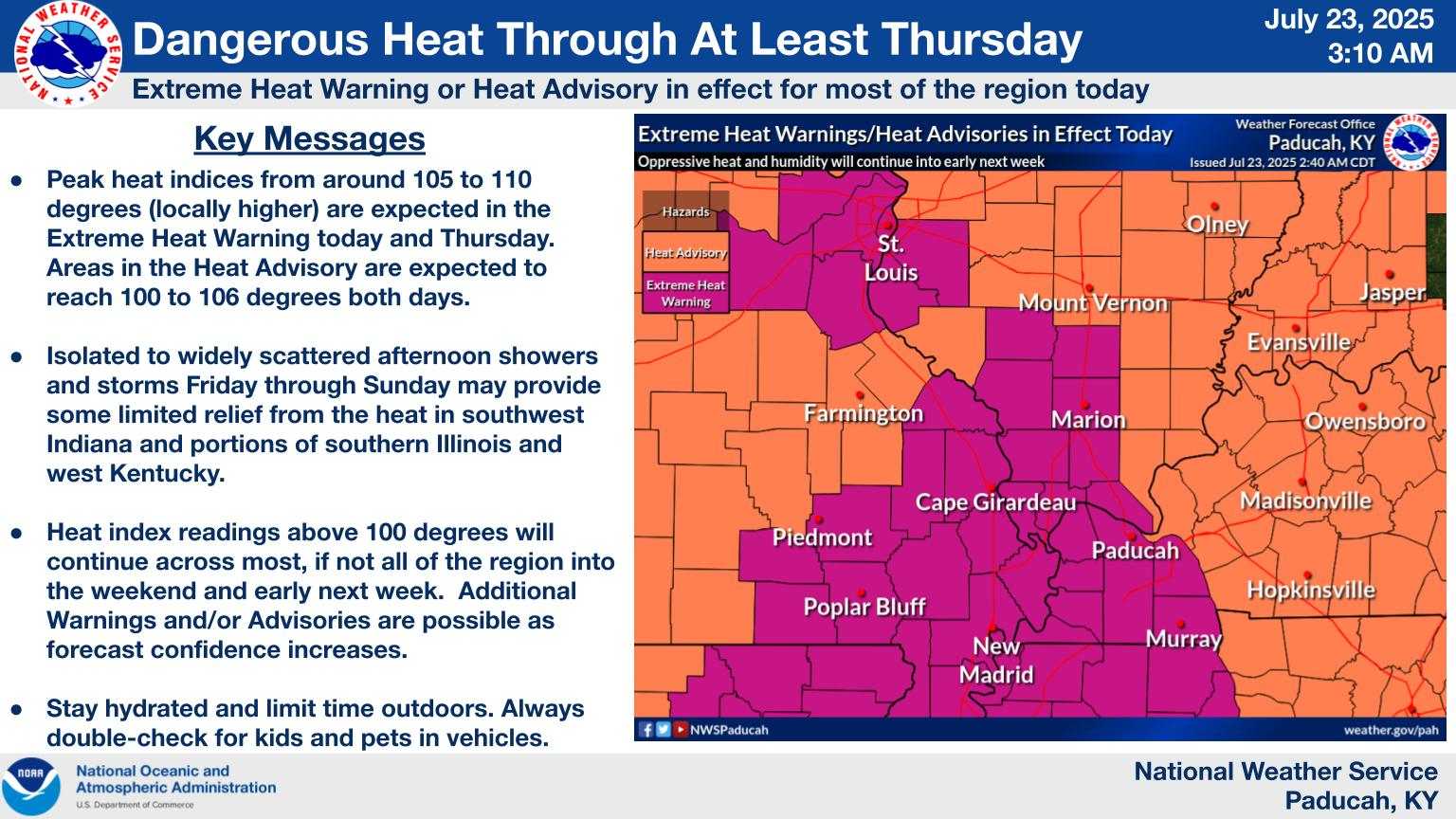
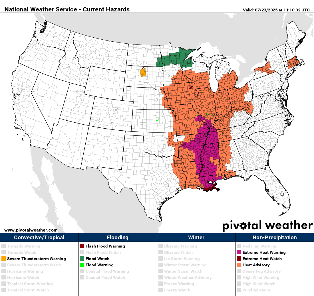
Warnings and advisories. They may extend this into the weekend. That will depend on clouds and precipitation.
Double-click on this image to enlarge.
.
A quick forecast glance. Your 48-hour forecast Graphics


.

.

.

Forecast discussion.
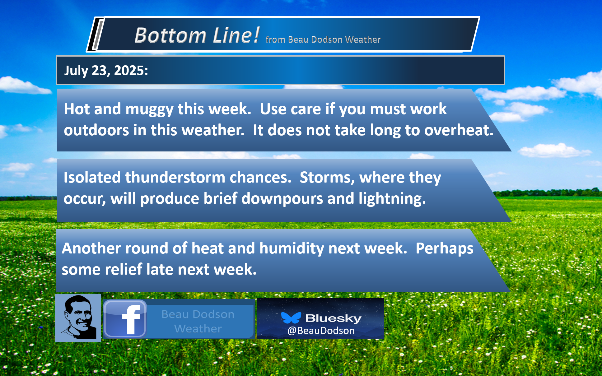
- Hot and muggy weather is expected to continue into the weekend. The heat will likely continue into next week.
- Isolated thunderstorms will bring relief to a few counties. Many areas will remain dry.
- July thunderstorms can produce strong and gusty winds. Frequent cloud-to-ground lightning, as well.
- Thunderstorm chances will increase slightly Friday into Sunday along a stalled frontal boundary.
- I am watching a frontal boundary towards the middle/end of next week. That could bring some relief from the heat.
.

.
Good morning, everyone.
It’s essentially Groundhog Day in the weather department (a great movie, if you haven’t watched it).
More of the same. Hot. Muggy. Humid. Isolated thunderstorms.

.
No significant changes have been made to the forecast.
The big weather story will continue to be the heat. Highs will be in the nineties this week. Heat index values will range from 100 to 110 degrees. Locally, 110 to 115 degrees.
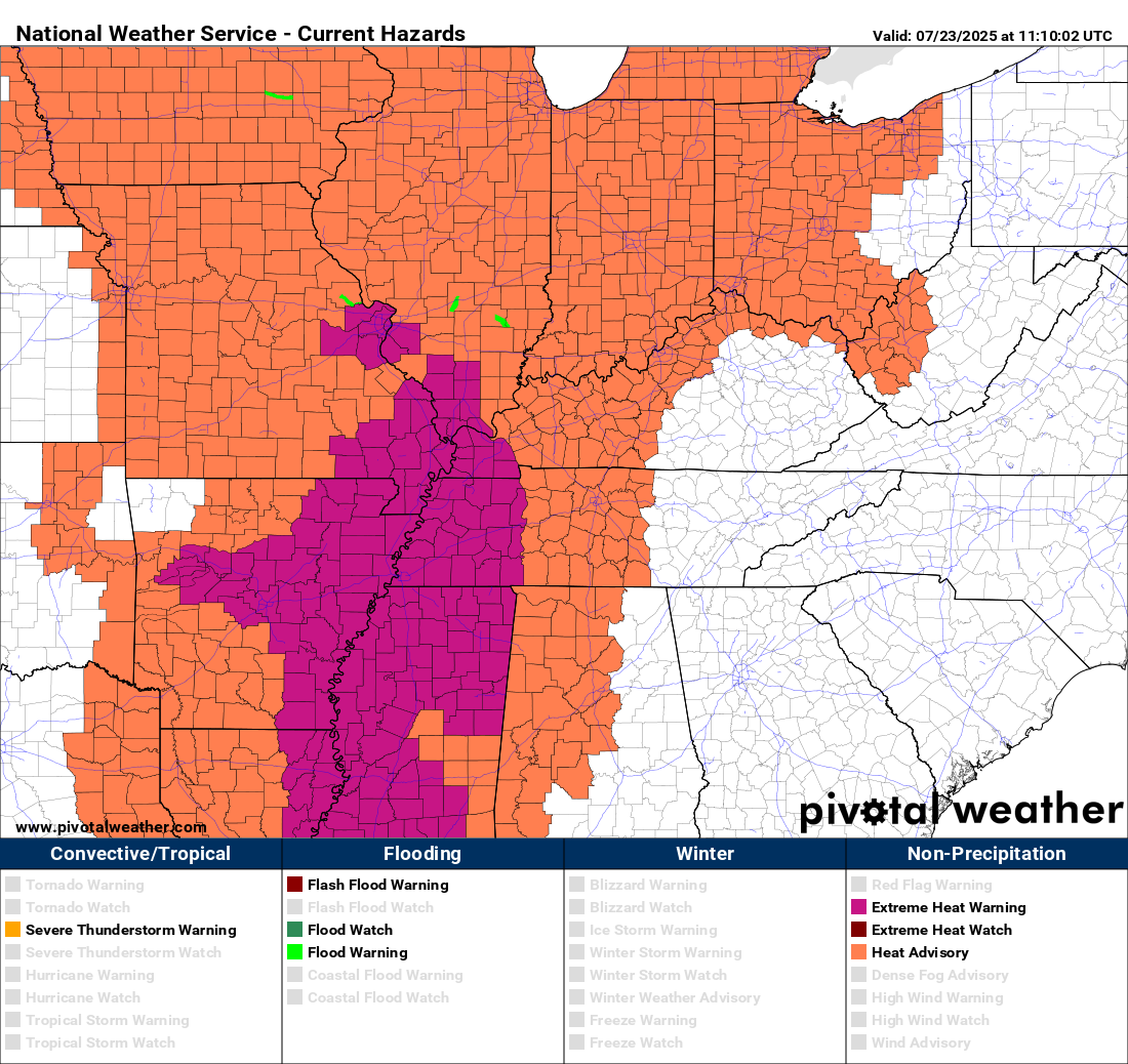
You can see the heat on this advisory/warning map. A large area of NWS heat products.
.
The only relief will be isolated areas of clouds and thunderstorms. That will shave a few degrees off the thermometer. Otherwise, it will be hot.
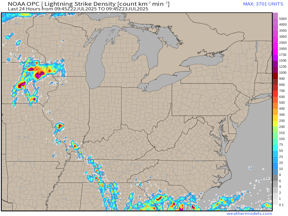
Check out the lightning strikes from the past 24 hours. You can see where storms developed. They extend northwest to southeast along a stalled weak boundary. That is why the lightning is lined up. That boundary hasn’t moved in the past two days.
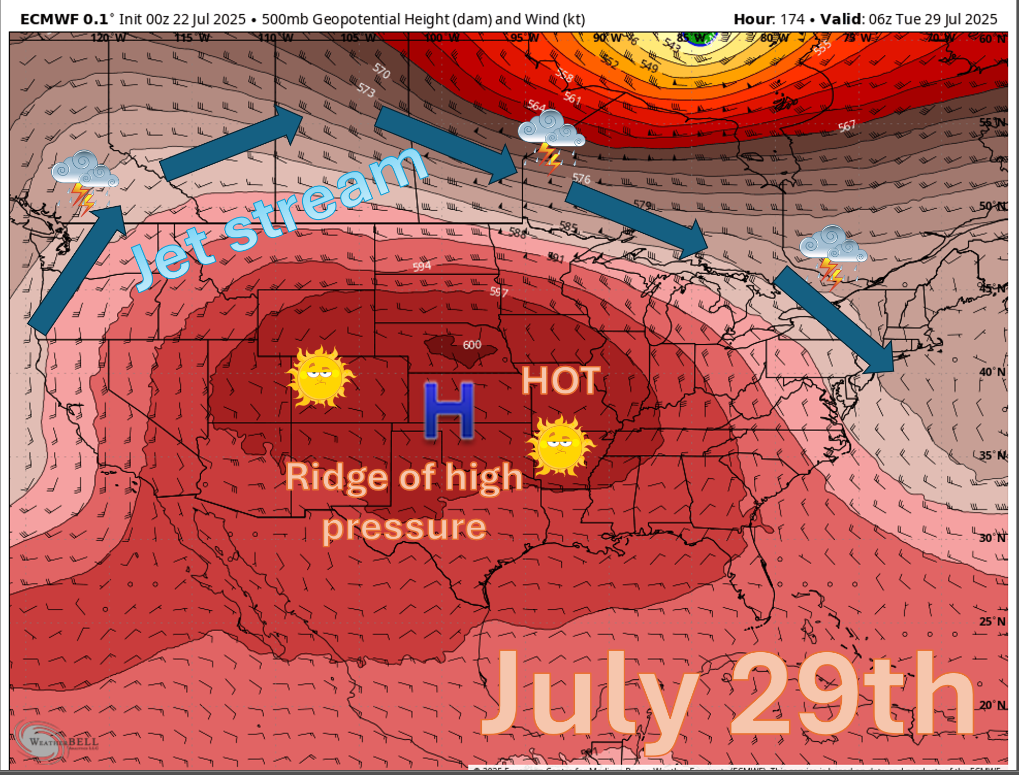
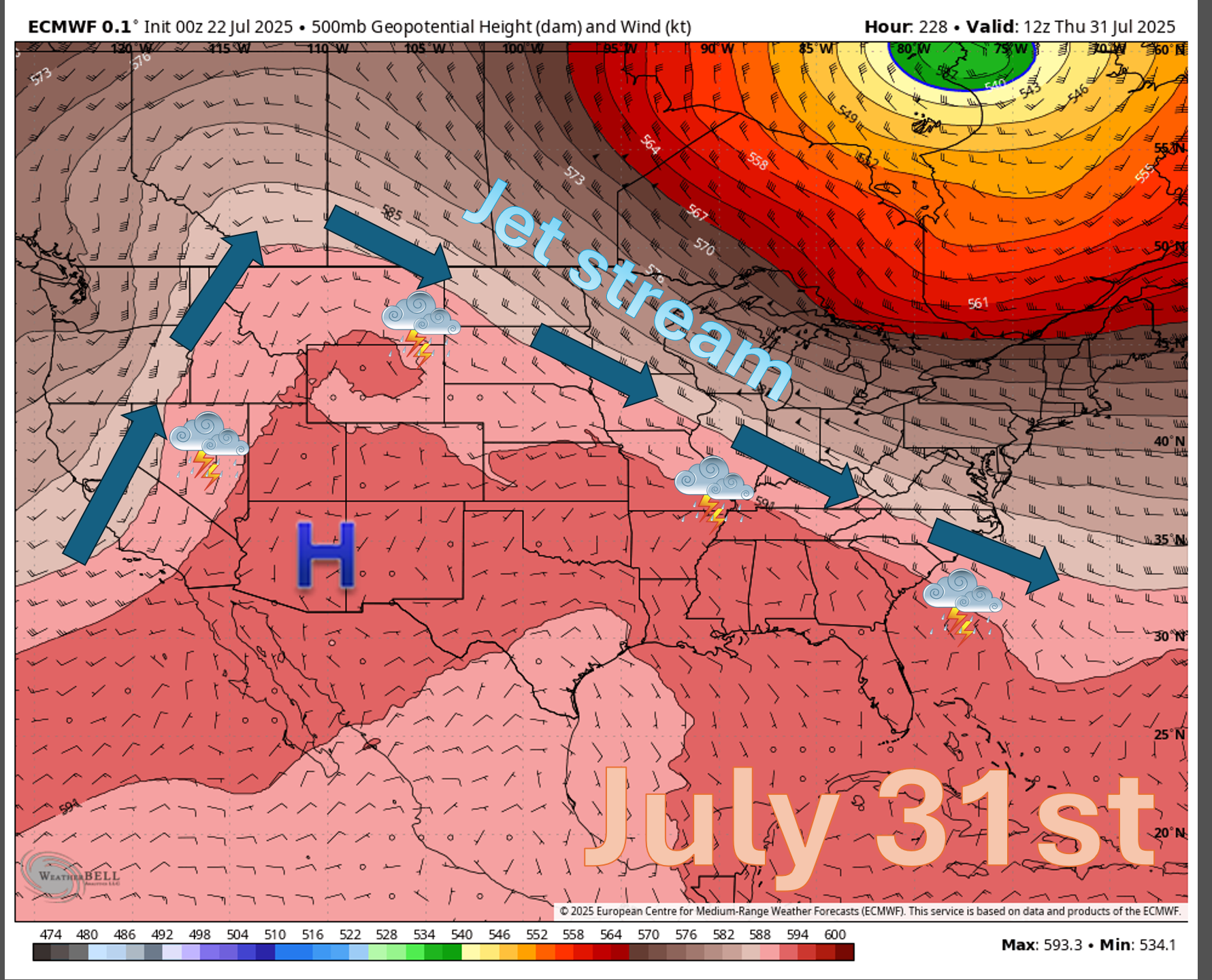
The ridge of high pressure is causing a large portion of the USA to bake in summer heat.
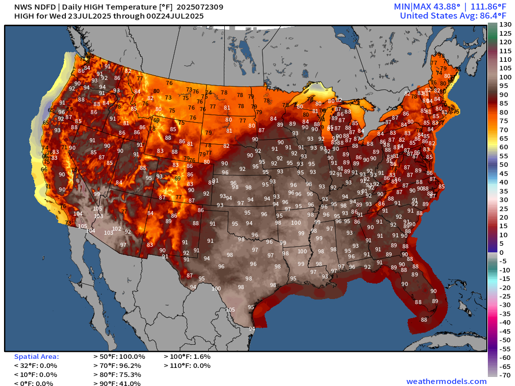
This is today’s high temperature forecast. Toasty.
Double click this image to enlarge it.
.
Not the best forecast for those of you who are tired of the heat and humidity.
The reason for the heat is a ridge of high pressure. Some people refer to this as a heat dome. Either way, it spells hot weather for our region.
It keeps the bulk of the thunderstorms to our north (along the edge of the heat). It pushes the jet stream northward, away from our region.
This is what the heat ridge looks like today and will look like into early next week.
To bring about a change in the forecast, we need the high-pressure center to shift westward and weaken. That may happen next week.
.
You can see that shift on this weather map. Some data breaks it down as early as next Wednesday. I will be monitoring trends in the guidance.
.
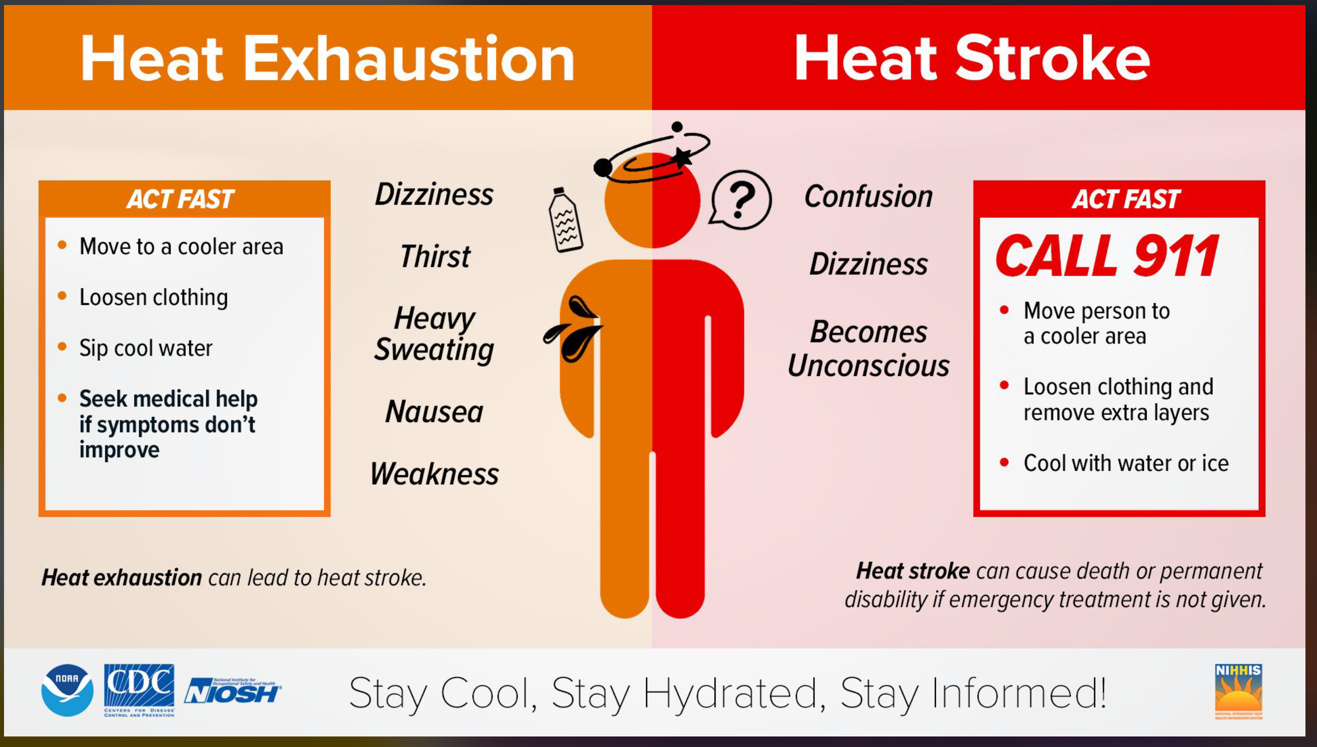
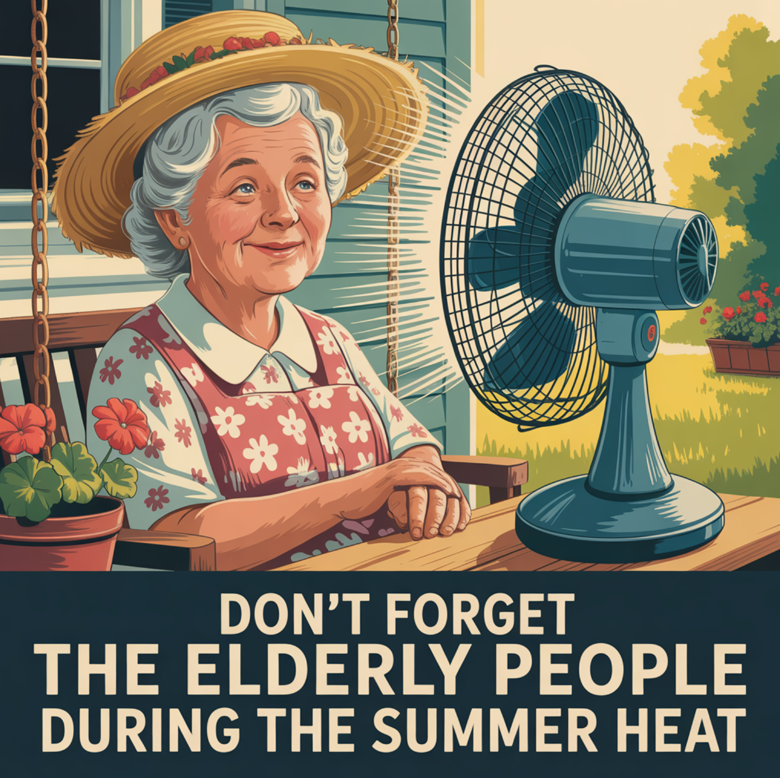
Don’t forget to check on the elderly during this heat wave.
Use care in the heat. Remember the signs of heat illness.
.
Don’t forget to check on the elderly during this extended period of heat.
.
Change your pets’ water bowls frequently, as well.

.
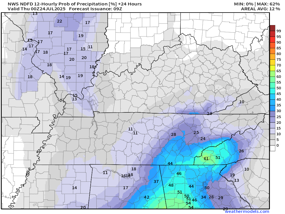
I am watching a weak frontal boundary this weekend. Rain probabilities will be a bit higher on Saturday and Sunday. For now, however, I kept them around 20 to 30%. Those numbers could increase as confidence in the final forecast grows.
It will remain hot and muggy into the weekend and likely into next week. Typical summer weather.
I am watching a cold front towards the middle of next week. This front could bring relief from the heat.
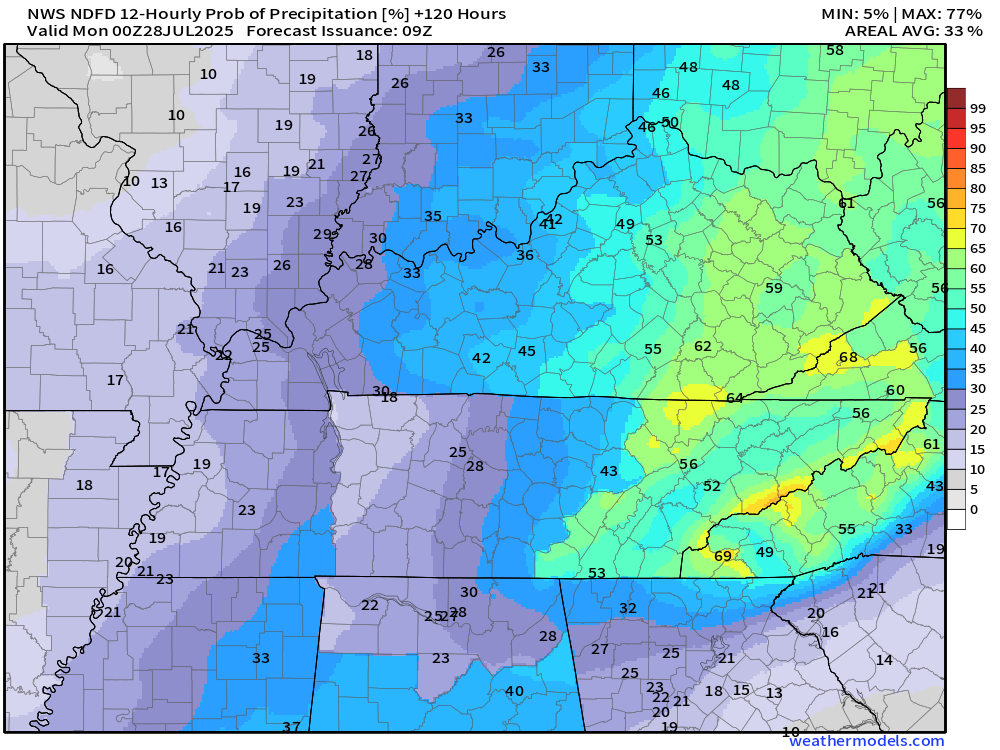
Let me show you the current NWS rain probability maps.
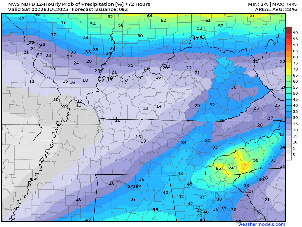
Remember, a 20% chance of thunderstorms during the summer months usually means someone will have a gullywasher, but many areas will remain dry. It does not mean that it won’t rain on your picnic.
Take the general idea from these numbers.
These numbers may vary a bit in the daily video. I gave the average chance area-wide on the video update.
Wednesday 7 AM to 7 PM rain probabilities (%)
.
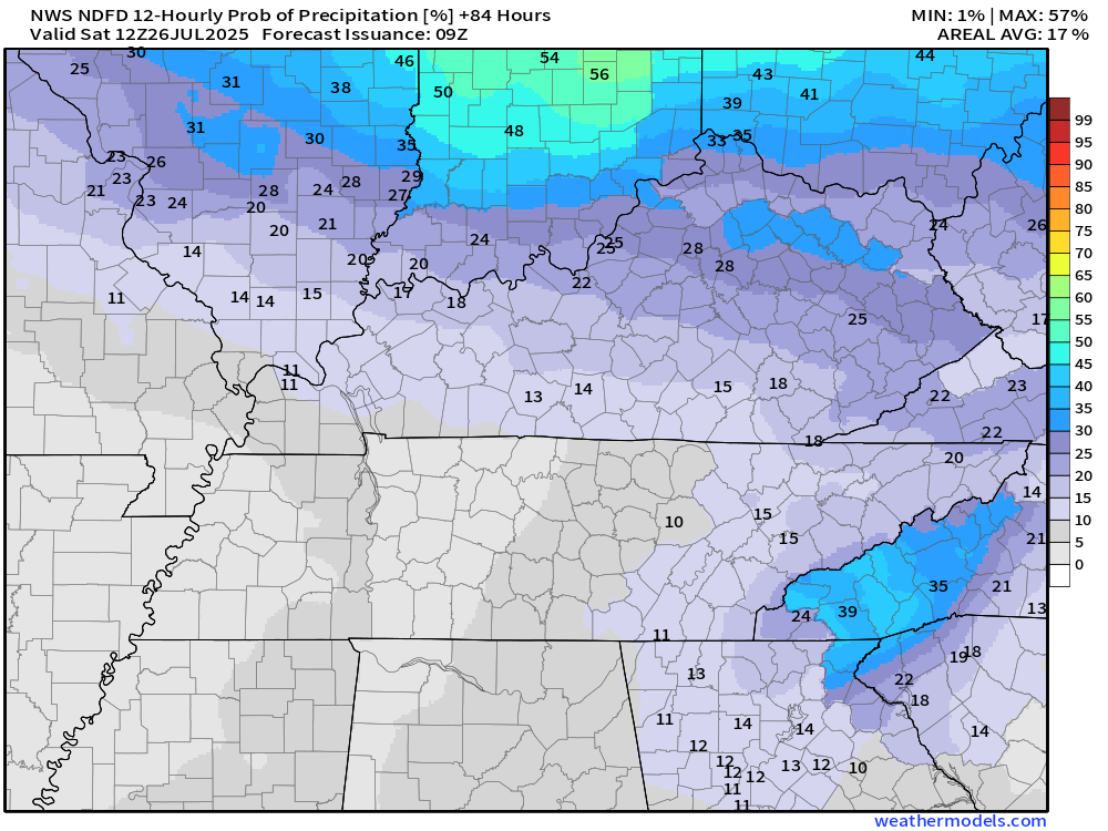
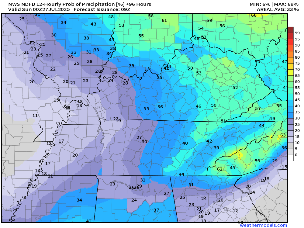
I will be monitoring Friday through Sunday. Thunderstorm chances may increase slightly. For now, I kept them around thirty-perfect.
Friday 7 AM to Friday 7 PM rain probabilities (%)
Friday night 7 PM to 7 AM rain probabilities (%)
Saturday 7 AM to Saturday 7 PM rain probabilities (%)
Saturday 7 PM to Sunday 7 AM rain probabilities
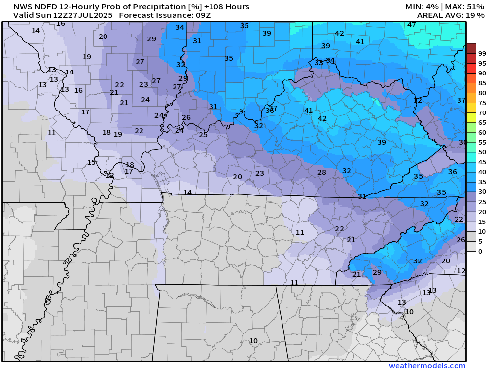
Sunday 7 AM to Sunday 7 PM rain probabilities (%)
.

.
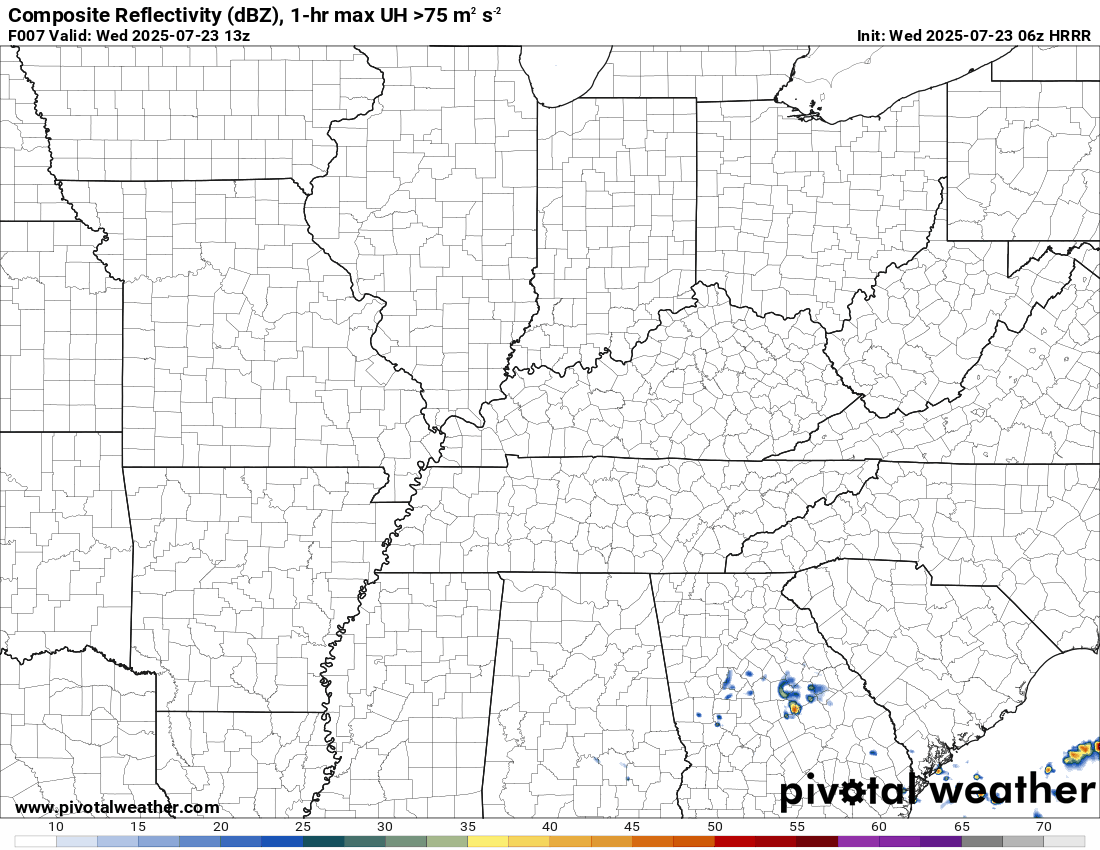
The timestamp (upper left) is in Zulu. 12z=7 am. 18z=1 pm. 00z=7 pm.
Double-click the animation to enlarge it.
Hrrr model
.
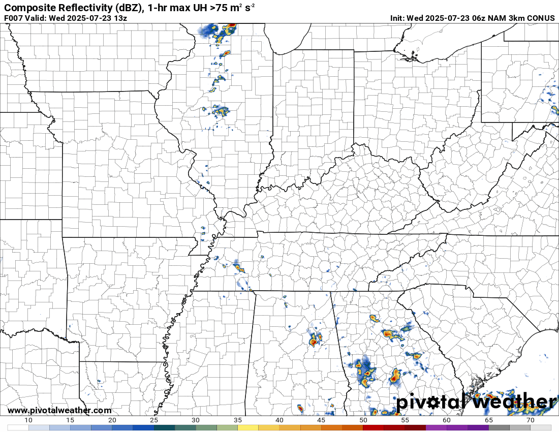
The timestamp (upper left) is in Zulu. 12z=7 am. 18z=1 pm. 00z=7 pm.
Double-click the animation to enlarge it.
NAM 3K model
.
..
.
Click here if you would like to return to the top of the page.
.Average high temperatures for this time of the year are around 89 degrees.
Average low temperatures for this time of the year are around 69 degrees.
Average precipitation during this time period ranges from 1.00″ to 1.25″
Six to Ten Day Outlook.
Blue is below average. Red is above average. The no color zone represents equal chances.
Average highs for this time of the year are in the lower 60s. Average lows for this time of the year are in the lower 40s.

Green is above average precipitation. Yellow and brown favors below average precipitation. Average precipitation for this time of the year is around one inch per week.

.

Average low temperatures for this time of the year are around 69 degrees.
Average precipitation during this time period ranges from 1.00″ to 1.25″
.
Eight to Fourteen Day Outlook.
Blue is below average. Red is above average. The no color zone represents equal chances.

Green is above average precipitation. Yellow and brown favors below average precipitation. Average precipitation for this time of the year is around one inch per week.

.
.
.
We have a new service to complement your www.weathertalk.com subscription. This does NOTreplace www.weathertalk.com It is simply another tool for you to receive severe weather information.
.
https://weathercallservices.com/beau-dodson-weather


Want to receive the daily forecast/other products on your Beau Dodson Weather app?
Did you know you have four options in your www.weathertalk.com account
You will then receive these via your Beau Dodson Weather app.
Just log into your www.weathertalk.com account
Click the NOTIFICATION SETTINGS TAB
Then, turn them on (green) and off (red)
🌪️ Number 1 is the most important one. Severe alerts, tornado alerts, and so on.
Number 2 is the daily video, blog, livestream alerts, and severe weather Facebook threads on severe days or winter storm days.
Number 3 is the daily forecast. I send that out every day during the afternoon hours. It is the seven-day forecast, hazardous weather outlook, fire outlook, and more.
Number 4 is to receive the daily video, blog, and other content on NON-severe weather days (every day without severe threats in other words)
GREEN IS ON
RED IS OFF

I am going to start going live during bigger severe weather events.
Check it out here https://www.youtube.com/user/beaudodson
Click the subscribe button (it’s a free subscription button), and it will alert you when I go live. I will also send out alerts to the app when I go live for an event.

.

Radars and Lightning Data
Interactive-city-view radars. Clickable watches and warnings.
https://wtalk.co/B3XHASFZ
Old legacy radar site (some of you like it better)
https://weatherobservatory.com/weather-radar.htm
If the radar is not updating then try another one. If a radar does not appear to be refreshing then hit Ctrl F5. You may also try restarting your browser.
Backup radar site in case the above one is not working.
https://weathertalk.com/morani
Regional Radar
https://imagery.weathertalk.com/prx/RadarLoop.mp4
** NEW ** Zoom radar with chaser tracking abilities!
ZoomRadar
If the radar is not working, then email me: Email me at beaudodson@usawx.com
.
We do have some sponsors! Check them out.
Roof damage from recent storms? Link – Click here
INTEGRITY ROOFING AND EXTERIORS!
⛈️ Roof or gutter damage from recent storms? Today’s weather is sponsored by Integrity Roofing. Check out their website at this link https://www.ourintegritymatters.com/

![]()
![]()
![]()
Make sure you have three to five ways of receiving your severe weather information.
Weather Talk is one of those ways! Now, I have another product for you and your family.

.
Want to add more products to your Beau Dodson Weather App?
Receive daily videos, weather blog updates on normal weather days and severe weather and winter storm days, your county by county weather forecast, and more!
Here is how to do add those additional products to your app notification settings!
Here is a video on how to update your Beau Dodson Weather payment.
The app is for subscribers. Subscribe at www.weathertalk.com/welcome then go to your app store and search for WeatherTalk
Subscribers, PLEASE USE THE APP. ATT and Verizon are not reliable during severe weather. They are delaying text messages.
The app is under WeatherTalk in the app store.

Apple users click here

Android users click here
.
Radars and Lightning Data
Interactive-city-view radars. Clickable watches and warnings.
https://wtalk.co/B3XHASFZ
Old legacy radar site (some of you like it better)
https://weatherobservatory.com/weather-radar.htm
If the radar is not updating then try another one. If a radar does not appear to be refreshing then hit Ctrl F5. You may also try restarting your browser.
Backup radar site in case the above one is not working.
https://weathertalk.com/morani
Regional Radar
https://imagery.weathertalk.com/prx/RadarLoop.mp4
** NEW ** Zoom radar with chaser tracking abilities!
ZoomRadar
Lightning Data (zoom in and out of your local area)
https://wtalk.co/WJ3SN5UZ
Not working? Email me at beaudodson@usawx.com
National map of weather watches and warnings. Click here.
Storm Prediction Center. Click here.
Weather Prediction Center. Click here.
.

Live lightning data: Click here.
Real time lightning data (another one) https://map.blitzortung.org/#5.02/37.95/-86.99
Our new Zoom radar with storm chases
.
.

Interactive GOES R satellite. Track clouds. Click here.
GOES 16 slider tool. Click here.
College of DuPage satellites. Click here
.

Here are the latest local river stage forecast numbers Click Here.
Here are the latest lake stage forecast numbers for Kentucky Lake and Lake Barkley Click Here.
.
.
Find Beau on Facebook! Click the banner.


 .
.