

.
I have some question-and-answer threads over on the Facebook page. Link to those threads CLICK HERE
Or email me at beaudodsonweather@gmail.com
..

🌪️ Seven-Day Tornado Outlook ⛈️
January 8th through January 14th
Current risk: Severe weather is possible from late this afternoon into tonight. A smaller risk on Friday (eastern counties).
The primary concern will be damaging wind gusts and a few tornadoes.
There remain significant questions about the threat level.
See the graphics below. Also, see the daily video for more details.
There are two time frames of concern.
The first time frame will be from late this afternoon through early Friday morning. The concern is somewhat greater in southeast Missouri, southern Illinois, and far western Kentucky. Perhaps northwest Tennessee, as well.
The second time frame of concern will be late Friday afternoon into Friday night. That concern will mainly be across portions of western Kentucky and northwest Tennessee. The trend of the Friday event has been to push it east southeast.
This is a highly conditional risk.
What does conditional mean? This means some ingredients may be missing. The primary lacking ingredient is CAPE.
What is CAPE?
CAPE is instability. Energy. Thunderstorms tap into CAPE for energy. Without CAPE, there won’t be a severe weather threat. However, if we have a bit of CAPE, the risk of severe weather will increase.
This is one of those events that could go either way. The best advice is to monitor your Beau Dodson Weather App and other sources for severe weather information.
Make sure you have several ways of receiving your severe weather alerts.
Don’t forget to sign up for Weather Call, as well.
This does not replace your Beau Dodson Weather App. It is an additional tool to receive warnings.
This is especially useful when you are sleeping. A phone call will wake you up if you are inside the tornado or severe thunderstorm warning box.
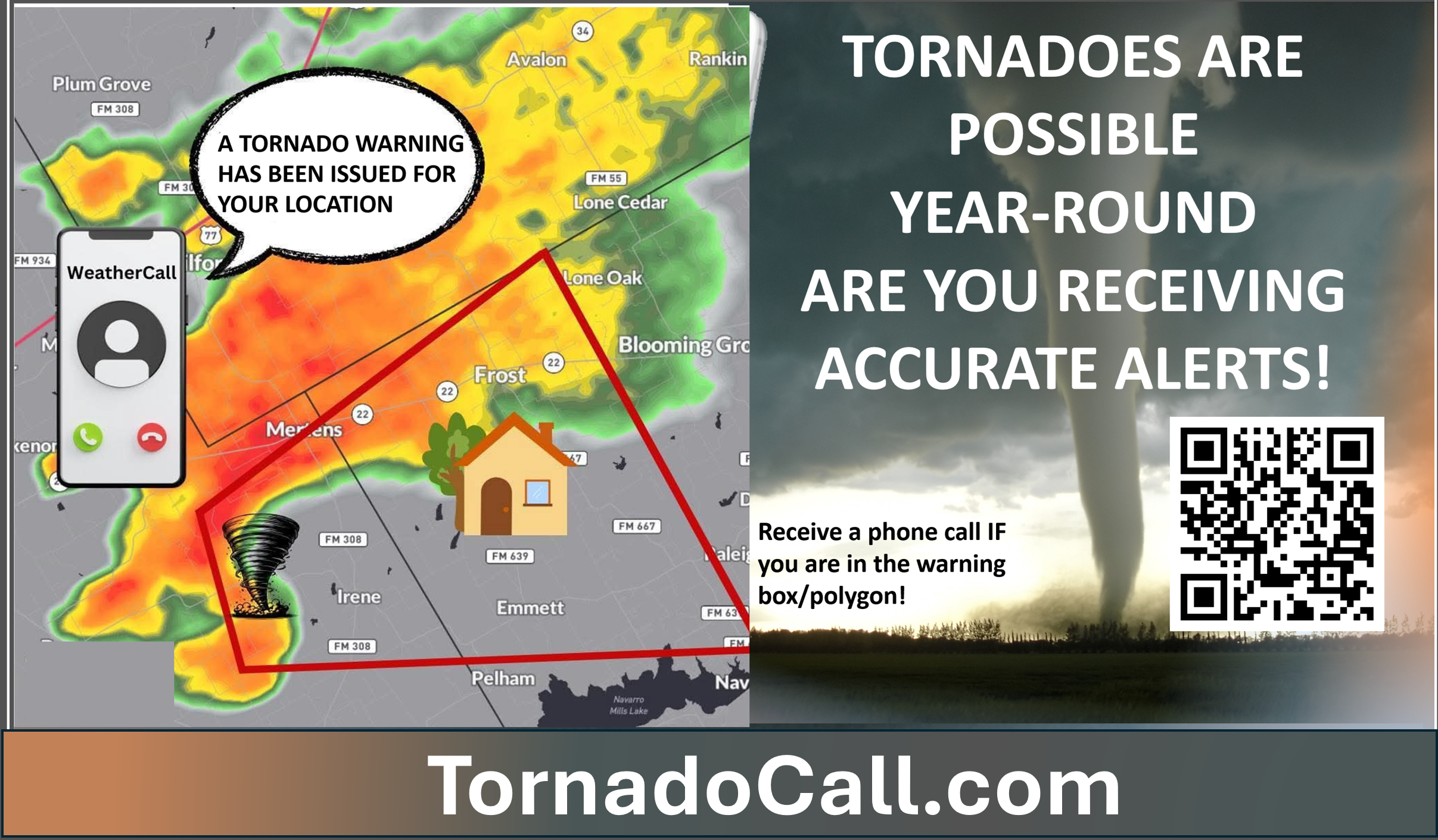
🚨 I encourage everyone to have 3 to 5 ways of receiving severe weather information. All sources can fail, and the more sources you have, the better prepared you will be in the event of severe weather warnings.
WeatherCall will call your cell phone or home number if your home is in a tornado or severe thunderstorm warning. It only calls you if your home is inside the warning box. If you are outside the warning box, it will not disturb you.
More information on the WeatherCall subscription service is here.
Click here www.tornadocall.com
YouTube Video
https://www.youtube.com/watch?v=ve2UY2mAkEI
What the tornado warning sounds like
https://www.youtube.com/watch?v=MXBc03tW_N0
.
Current confidence level: Medium confidence.
Comments: Monitor updates.
.

Seven-Day Hazardous Weather Outlook
1. Is lightning in the forecast? YES. Lightning is possible this afternoon and tonight. Another chance on Friday and Friday night.
2. Are organized/widespread severe thunderstorms in the forecast? POSSIBLE I am monitoring this afternoon and tonight. I am monitoring Friday afternoon and night, as well.
The highest chance of intense storms will be late this afternoon into early Friday morning. The concern would be a few reports of high wind gusts. There will be a lot of spin in the atmosphere. I can’t rule out some tornado warnings. This is especially true if CAPE numbers are a bit higher.
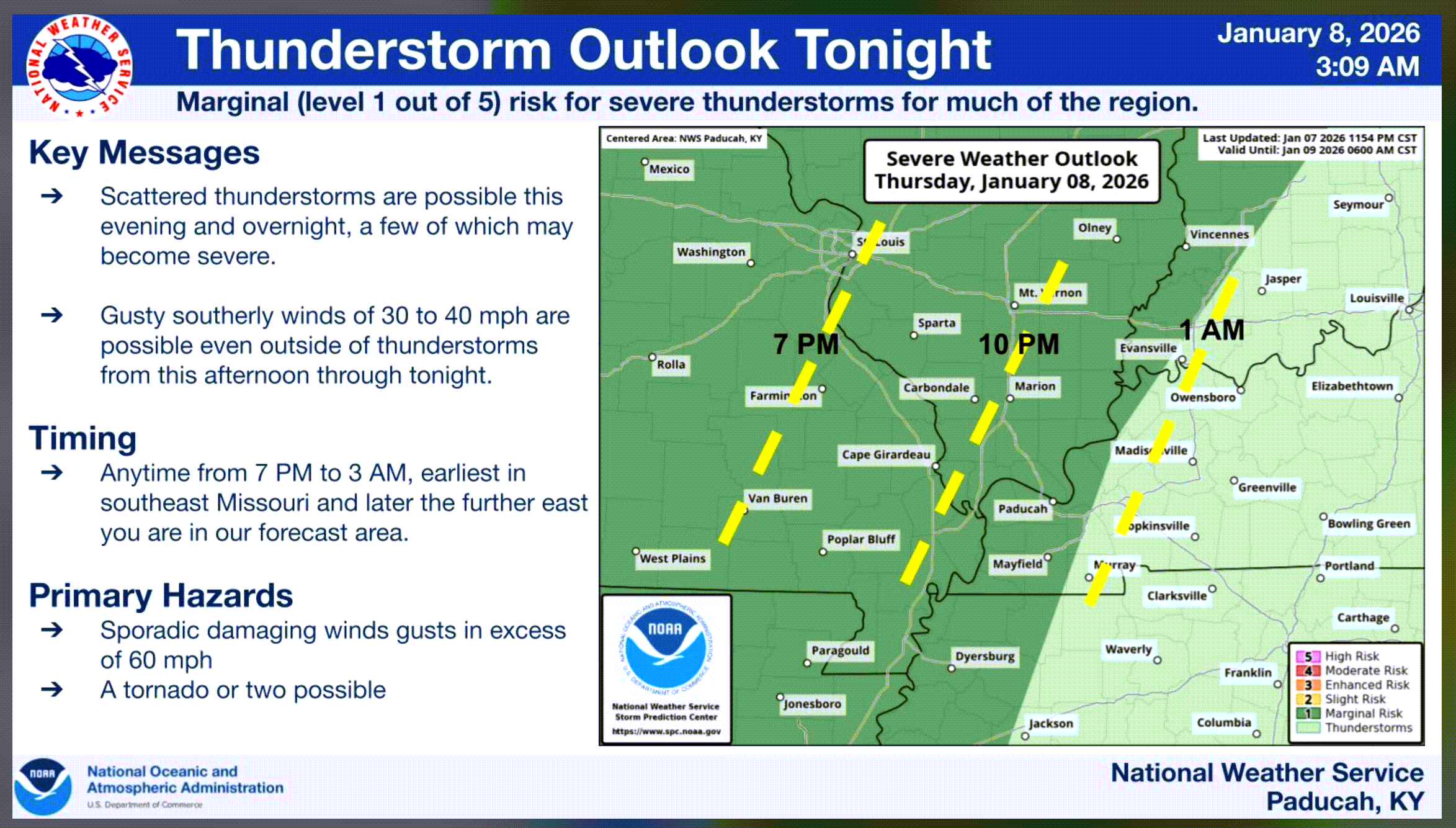
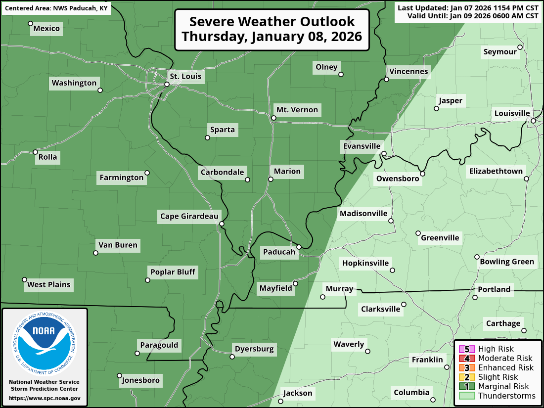
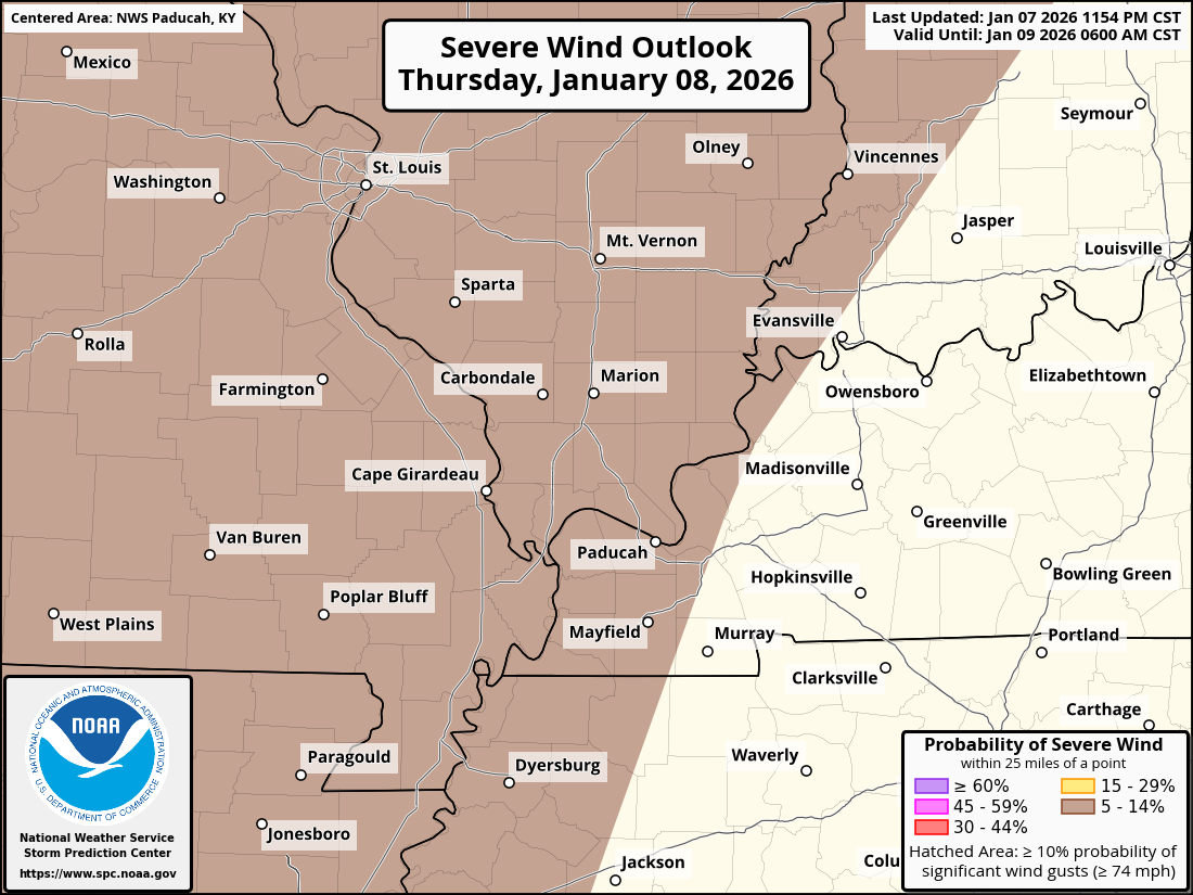
Here is today’s severe weather outlook. The dark green zone indicates level 1 (marginal) risk of severe weather.
The light green indicates where storms are possible, but are unlikely to be severe.
This outlook will be updated several times today. I would not be surprised to see a level two risk initiated across portions of the region.
.
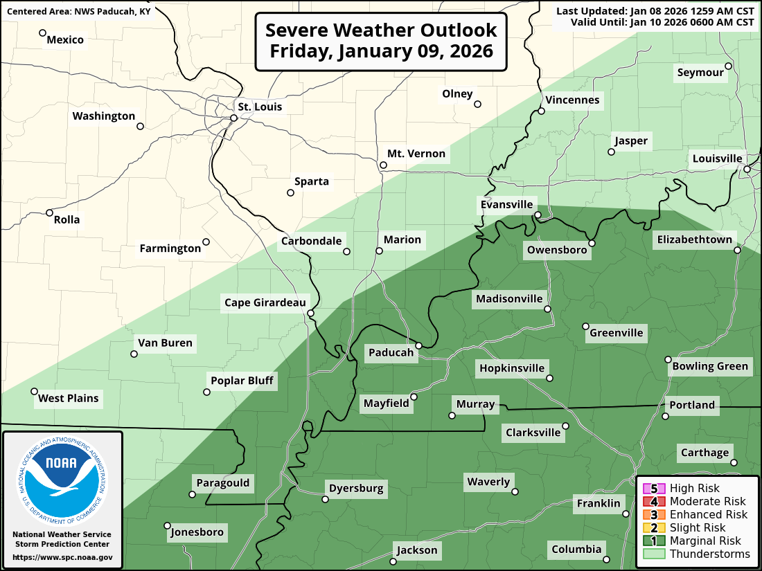
I am watching late Friday afternoon and Friday night, as well. The risk on Friday will mainly extend from the Missouri Bootheel into Kentucky and Tennessee. Perhaps extreme southern Illinois.
Here is the Friday severe weather outlook. The dark green is the level one (marginal) risk. The yellow zone is the level two (slight) risk.
The concern will mainly be from Friday afternoon into Friday night (see the daily video).
This graphic will be updated several times between now and Friday afternoon. Monitor updated forecasts and graphics.
I will also send updates to the Beau Dodson Weather App.
.
4. Will non-thunderstorm winds top 40 mph? NO.
5. Will the temperature fall below 20 degrees? NO.
6. Is the wind chill forecast to drop below ten degrees? NO.
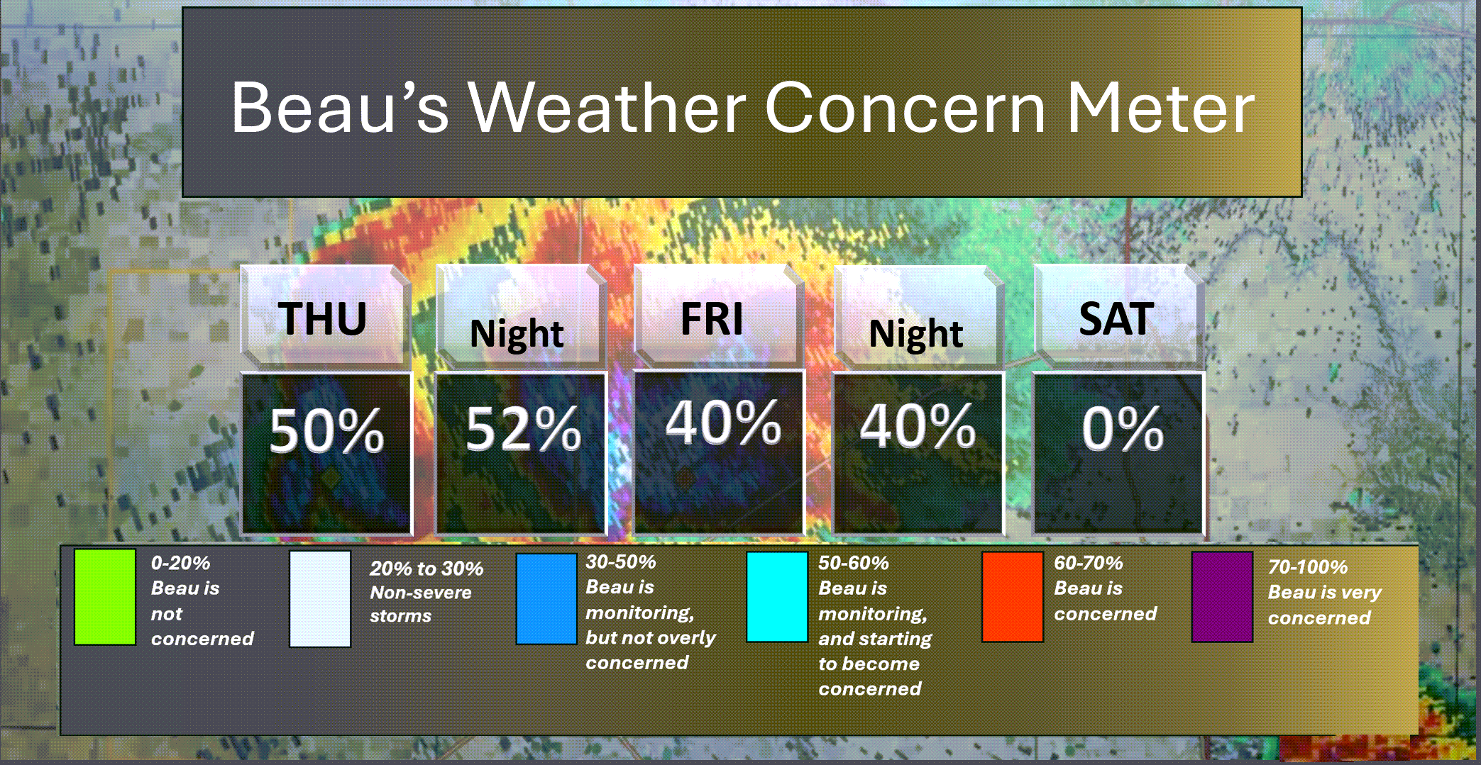
Here is the short-range thunderstorm concern meter.
There are some concerns late this afternoon and tonight. Another risk on Friday afternoon and night.
.
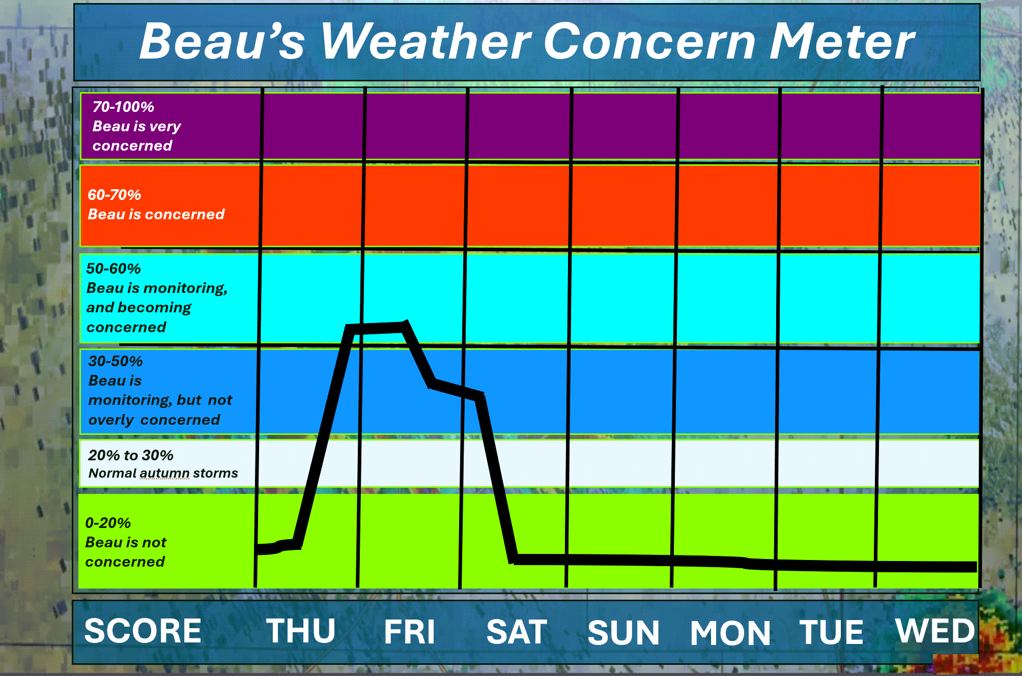
Here is the extended concern meter.
I am monitoring the risk of severe weather late this afternoon into early Friday morning. Then, I am monitoring Friday afternoon and night. See the graphics at the top of this update.
Again, the primary concern would be a few storms producing strong wind gusts. A few tornadoes can’t be ruled out. There is a lot of spin in the atmosphere.
Monitor updates.
.
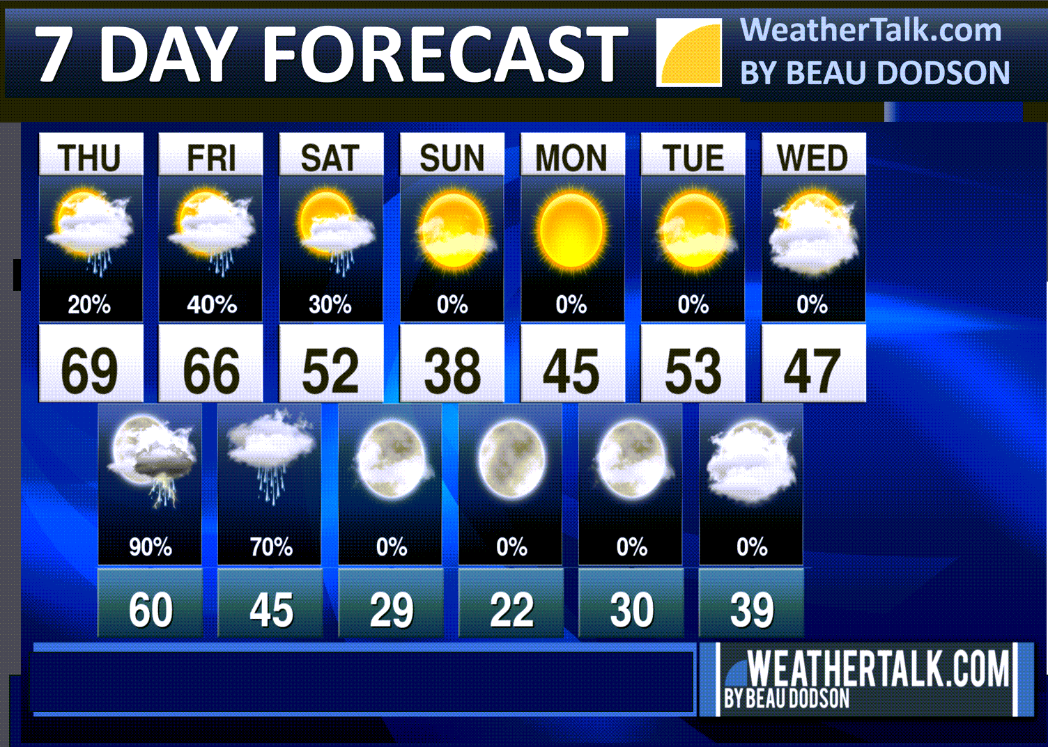
A quick forecast glance. Your 48-hour forecast Graphics


.
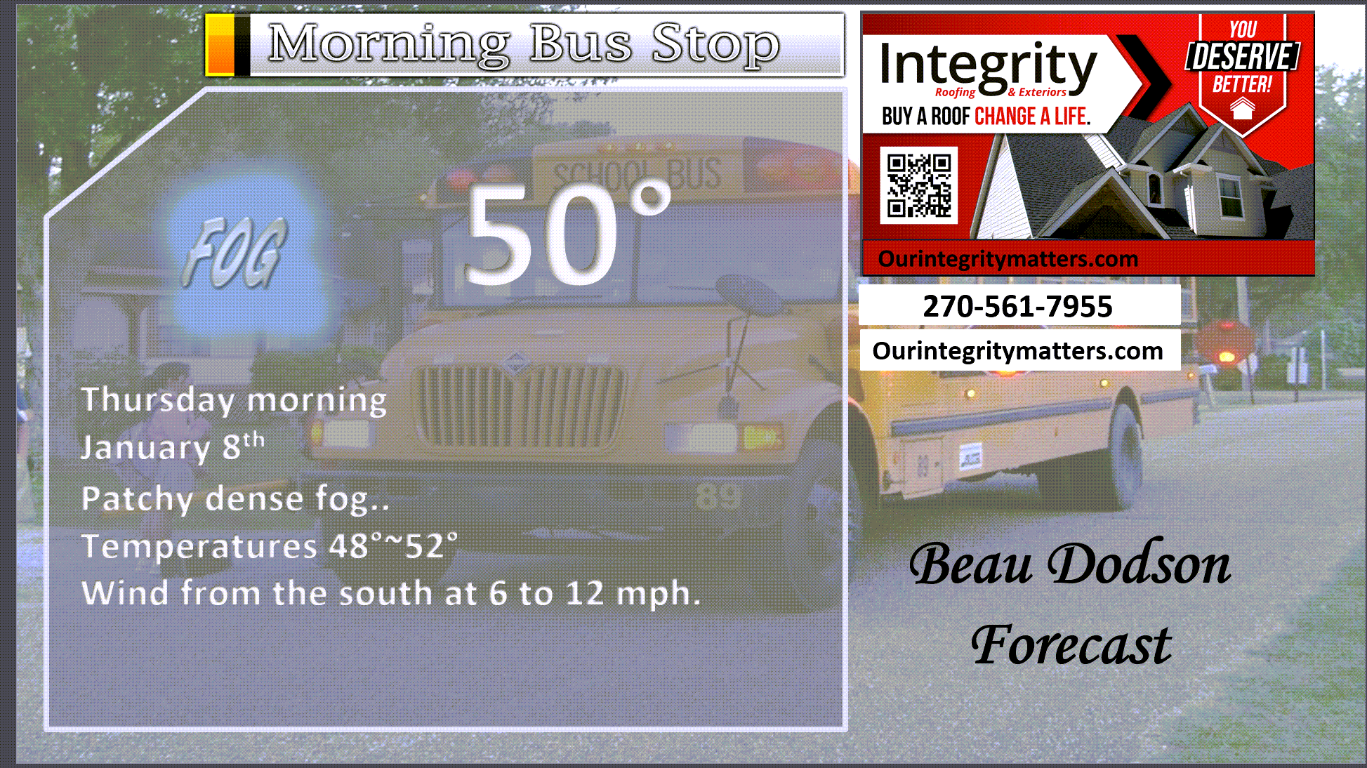
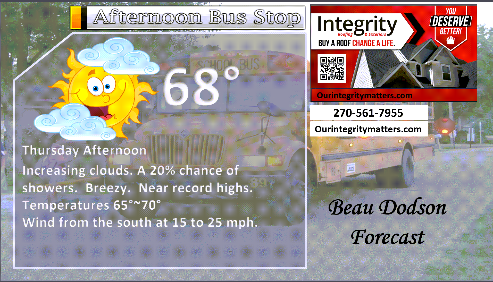
Here is your bus stop forecast
.
This afternoon
.


Forecast discussion
- Patchy dense fog this morning. Use care, as always.
- A warm day ahead of us. Near record highs. Breezy.
- Near record high minimum temperatures tonight, as well. Mild.
- Showers and thunderstorms return to the forecast late this afternoon and tonight.
- A few severe thunderstorms are possible late this afternoon and tonight. The concern will be damaging wind gusts and a few tornadoes. There remain questions about the extent of the threat.
- Another system will bring additional rain chances Friday afternoon into Saturday morning (esp over the Bootheel, far southern Illinois, western Kentucky, and northwest Tennessee.
- Cooler temperatures will arrive on Saturday, Sunday, and Monday.
.
 .
.
.
What is the primary weather concern?
Some patchy dense fog this morning. Use care.
The primary weather concern will be showers and thunderstorms from late this afternoon into late tonight.
A few thunderstorms could become severe, with high winds. There is also a risk of a few tornadoes. There remain questions about how unstable the atmosphere will become later today and tonight.
There will be plenty of spin in the atmosphere. If surface-based thunderstorms form, then severe weather will be a concern.
This is one of those events that could go either way. Small differences in dew points and instability will be important.
Monitor updates.
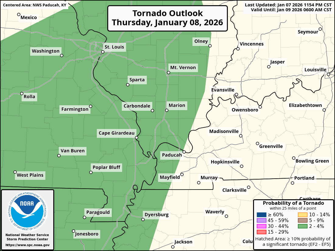
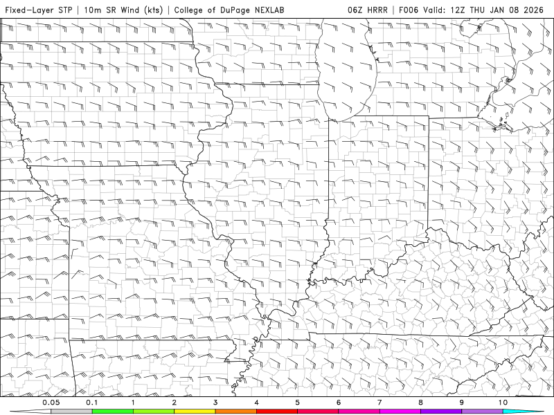
Here is the tornado threat animation.
You can see that it peaks over Missouri and Illinois. Then, it wanes a bit over Kentucky and Tennessee.
.
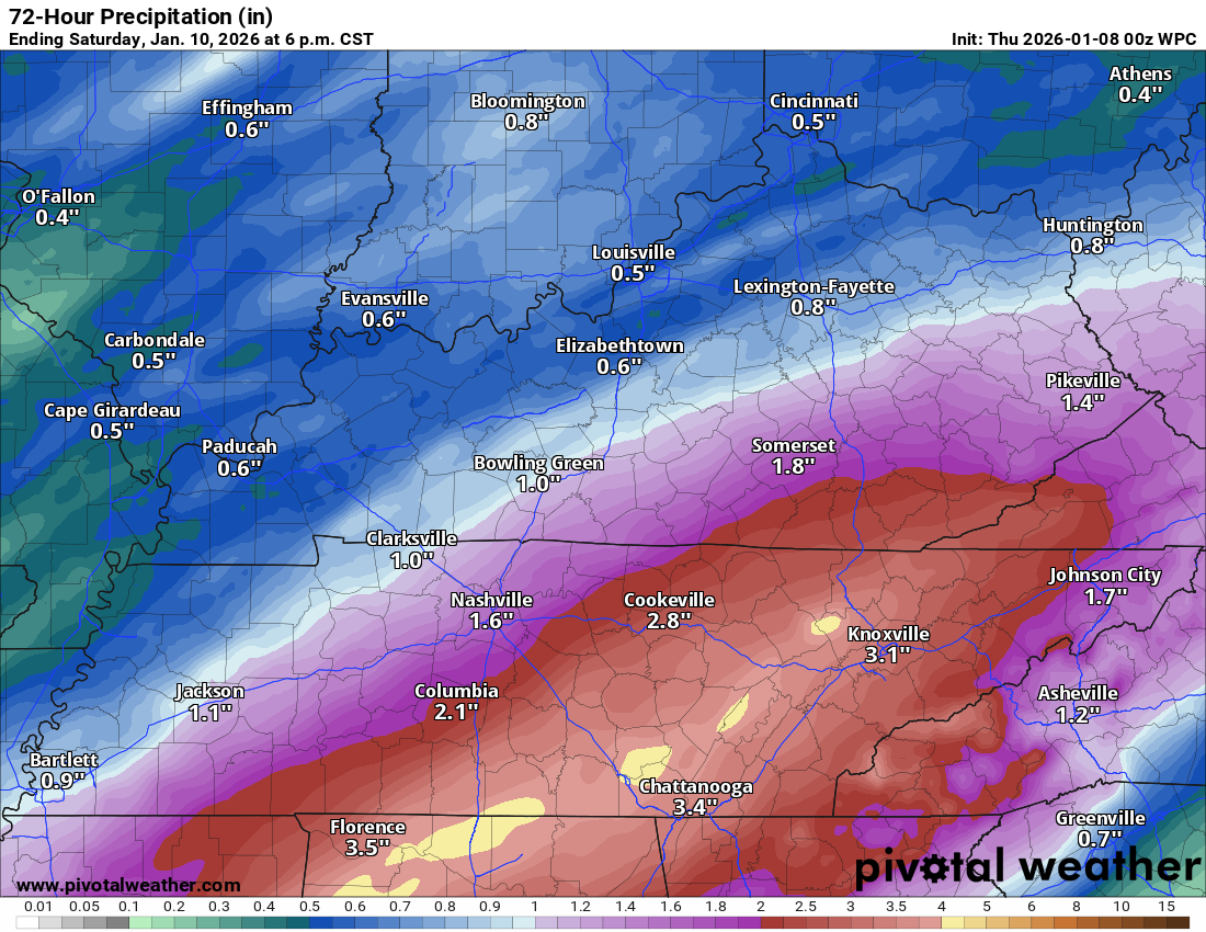
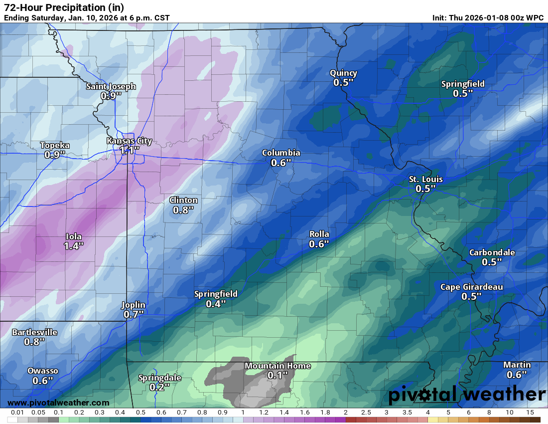
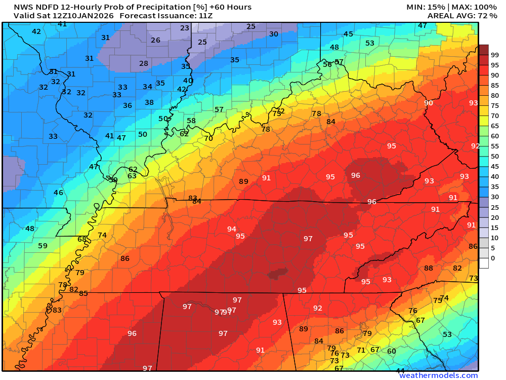
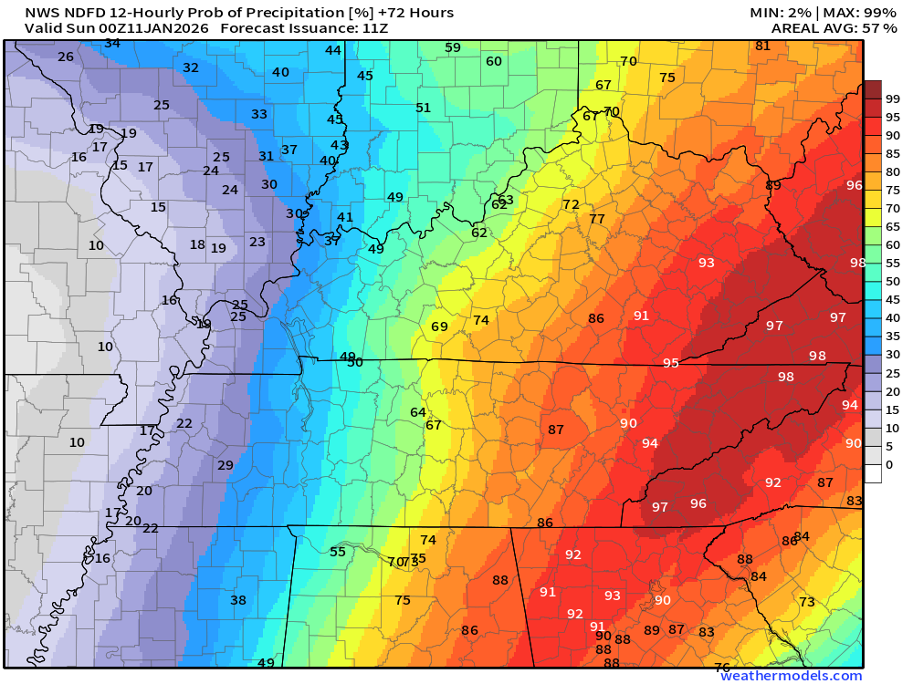
Rain totals will vary across the region. Here is the latest rainfall graphic.
This covers tonight through Saturday.
 .
.
Seven-day outlook graphic.
See the video or graphics below for more details specific to your county. This is a broad-brush overview of the entire region.
There will be a couple of rounds of precipitation.
Please see the rain probability graphics below. Those go into more details on the timing and rain chances.
.
Today and tonight
Patchy dense fog this morning, again. Use care.
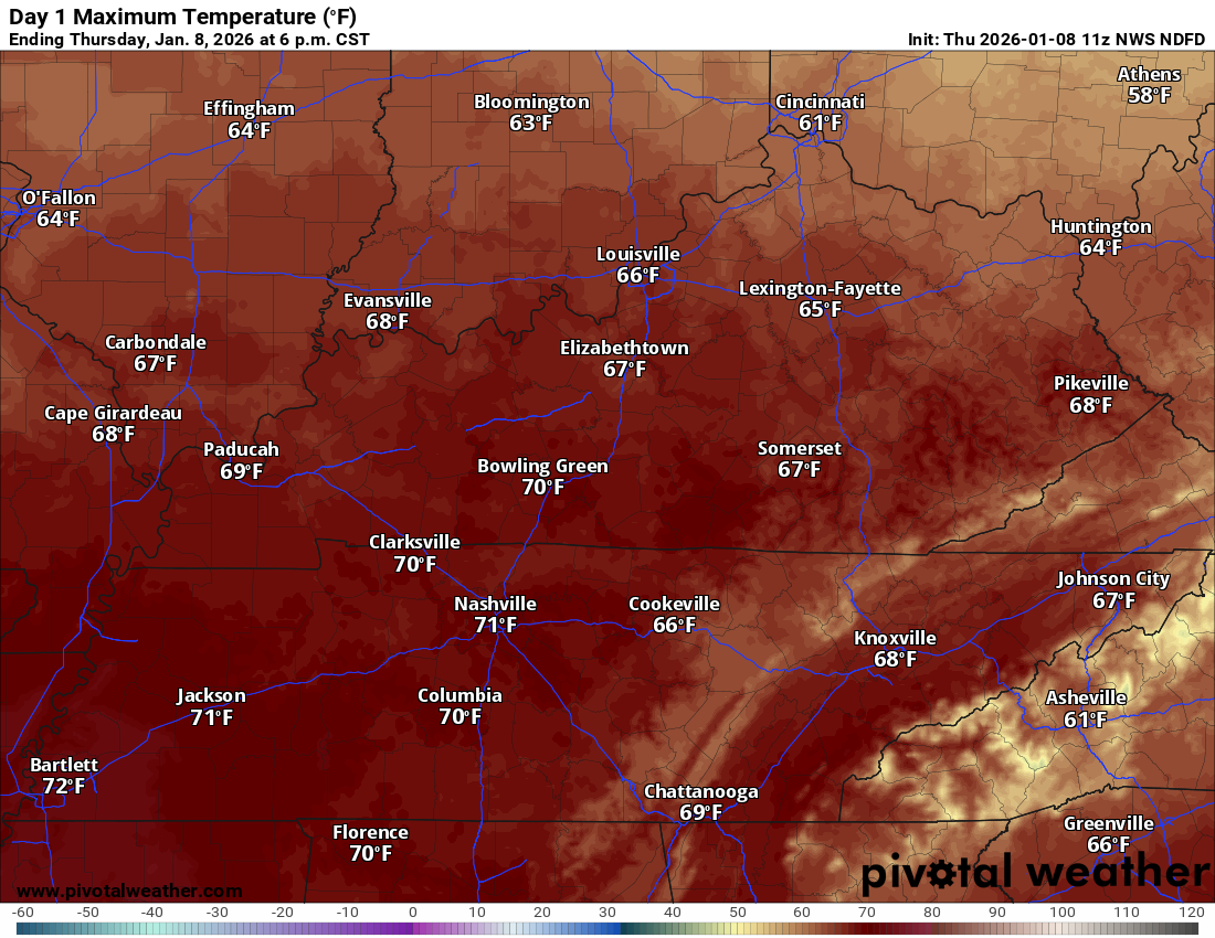
We are anticipating a mild day ahead. As a matter of fact, temperatures will be near record levels. That equals widespread mid to upper sixties. Perhaps even some seventies!
It will be breezy today ahead of a strong cold front.
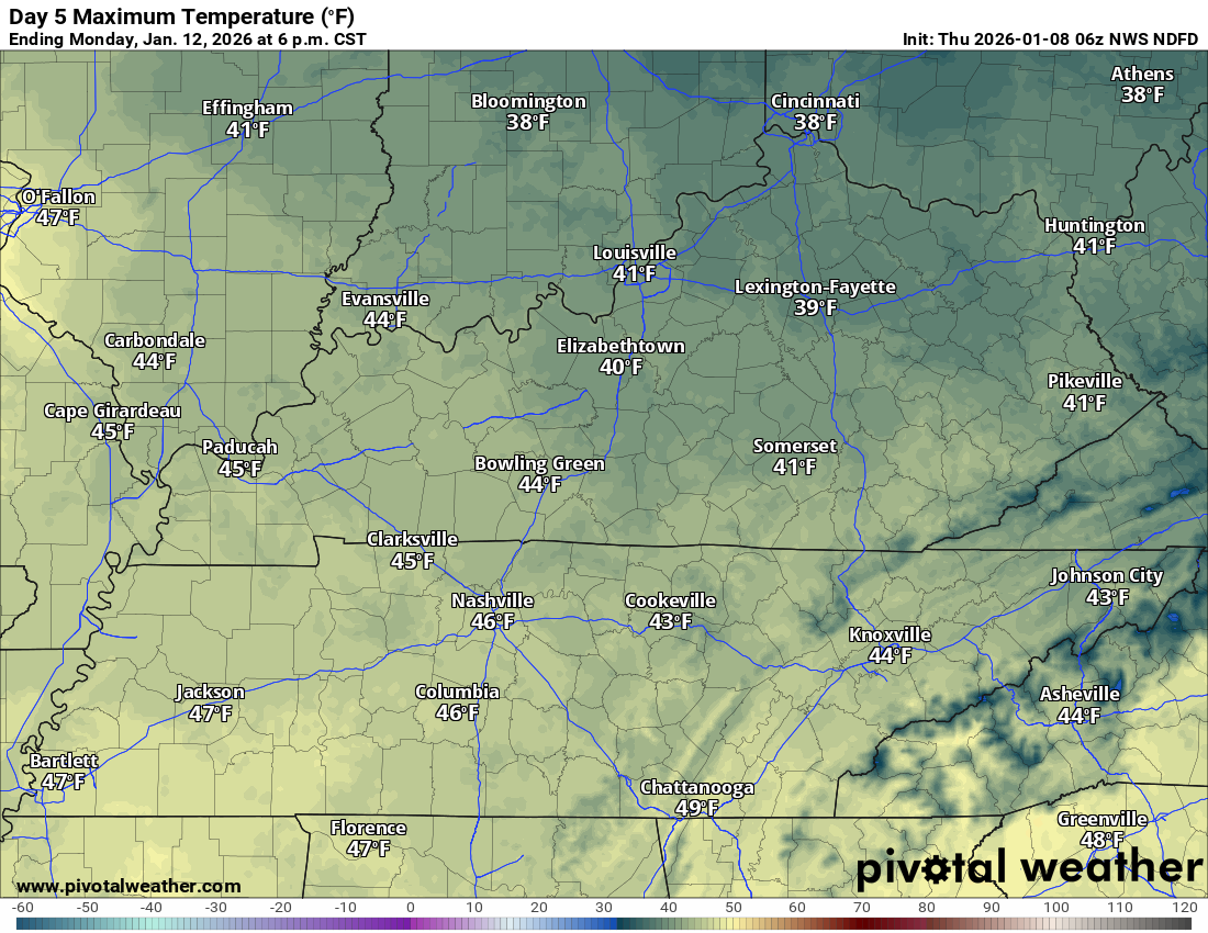
Today’s high temperatures
.
A cold front will nudge into the region later today and tonight.
Scattered showers and thunderstorms will accompany the front.
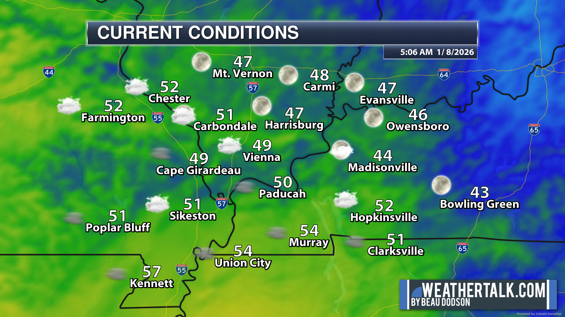
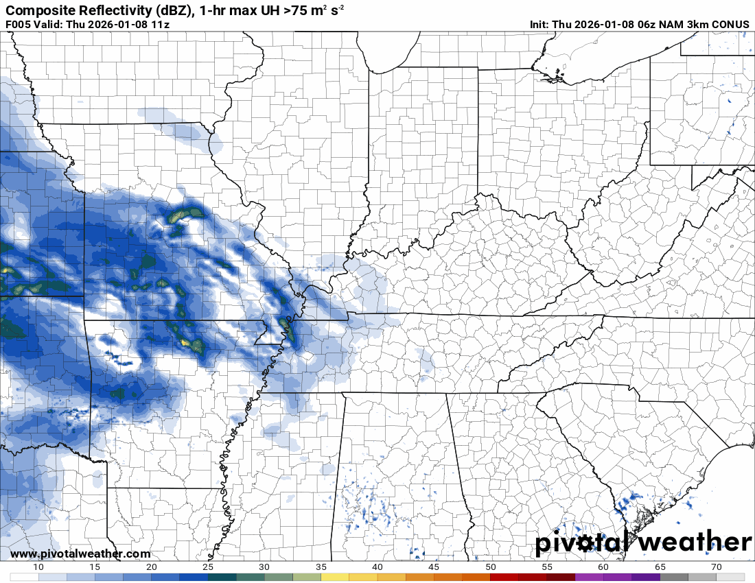
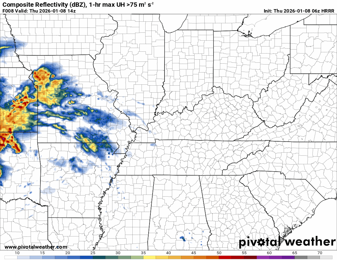
You can see that the system is developing to our west on this radar view (6 AM radar).
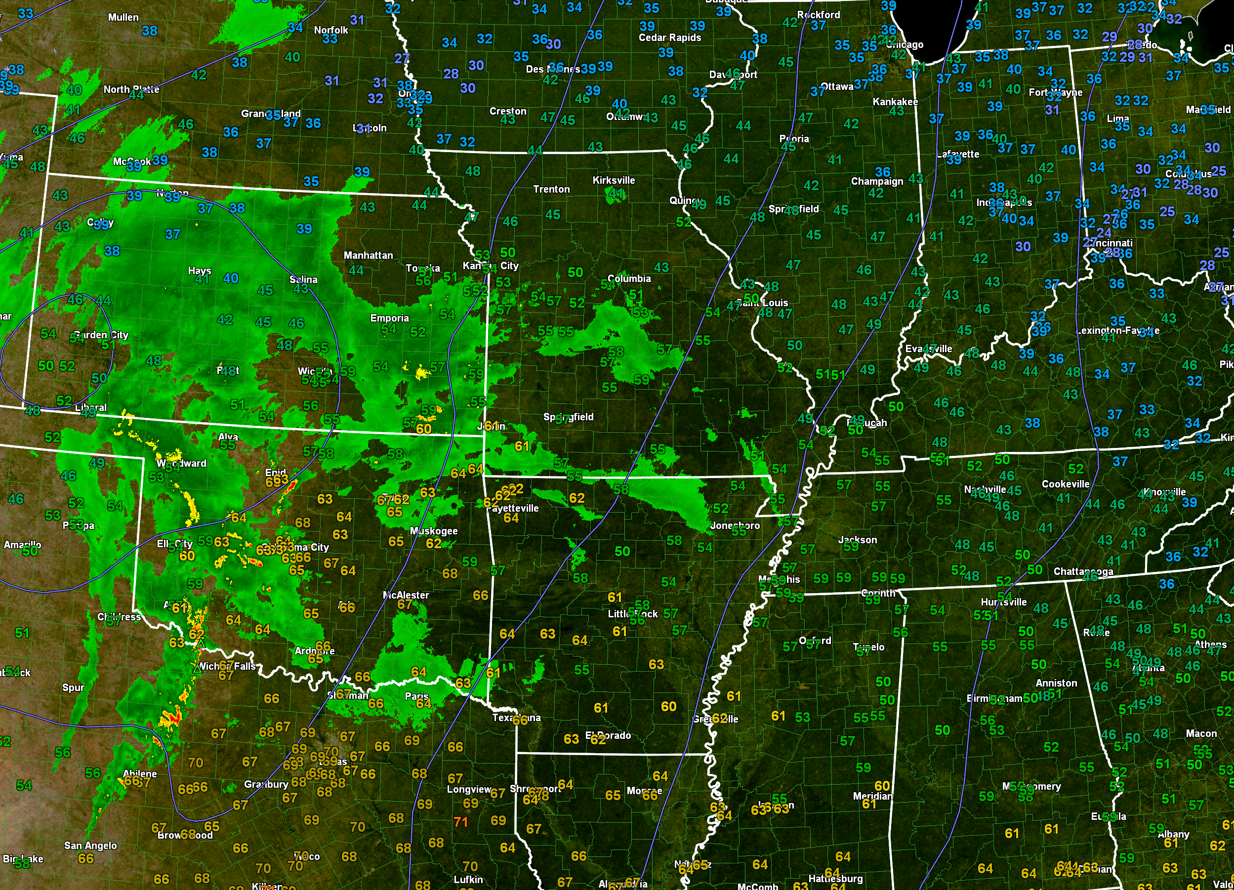
.
There remain questions about instability. How unstable will the atmosphere become later today and tonight?
That is the pressing question for the severe weather outlook.
If instability is a bit higher, there will no doubt be reports of damaging winds and even a few tornadoes.
If instability is lower, then the threat of severe weather will be very small.
The latest guidance shows just enough instability to produce severe weather.
Let’s stay weather aware later today and tonight. A few warnings are possible.
Have several ways of receiving your severe weather information. See the top of the page to subscribe to WeatherCall.
WeatherCall sometimes even calls you before the weather radios go off! I have used it for years.
The primary time-frame of concern will be 5 pm to 12 am. Then, a smaller threat from 12 am to 3 am.
This could be a late-night event for some counties. Monitor your Beau Dodson Weather App.
With time, instability will wane. That will help weaken the showers and thunderstorms as they move farther east.
.
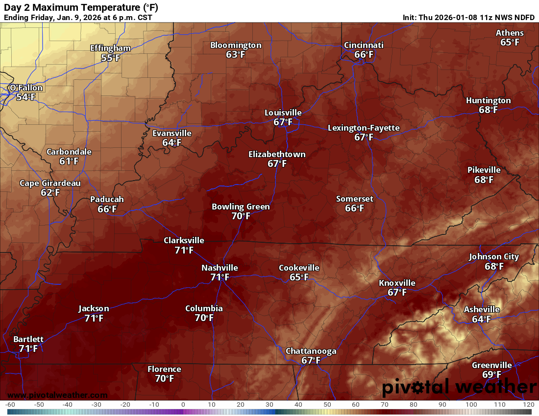
Friday through Sunday
Friday will be mild, as well. A bit cooler over our far northwestern counties. A bit warmer east southeast.
These warm temperatures will precede a strong cold front arriving tomorrow and on Friday.
There will actually be two systems moving through the region.
It will turn cooler behind that cold front. Nothing extreme.
Friday’s highs
.
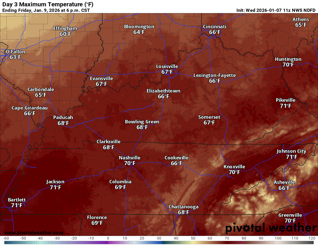
Saturday’s highs
.
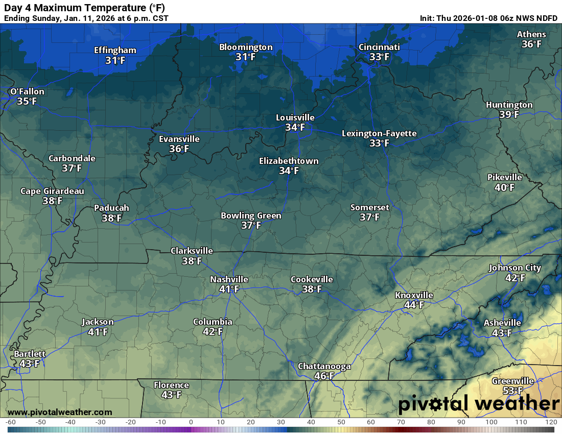
Sunday’s high temperatures
.
Monday’s high temperatures
.
A strong cold front will bring showers and thunderstorms back to the region late Friday afternoon into Friday night. A few showers could linger into early Saturday.
The Storm Prediction Center has outlined portions of the region for severe weather from late Friday afternoon into Friday night.
The trend in the guidance has been to push this system farther south southeast. The primary concern will be a few reports of damaging wind. Perhaps a short-lived tornado.
It is possible that the severe weather misses our region on Friday afternoon/night. It would not take much of a shift to push it out of our region. Monitor updates..
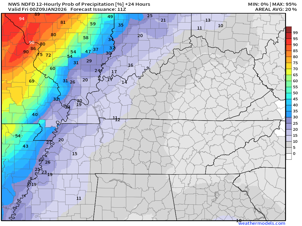
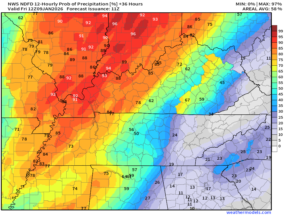
Let’s look at the rain probabilities.
What is the % chance of rain?.
Thursday
Notice how the chances are higher over Missouri and Illinois.
Much of the day will be dry across a chunk of the region.
.
Tonight
Numerous showers and a few thunderstorms.
.
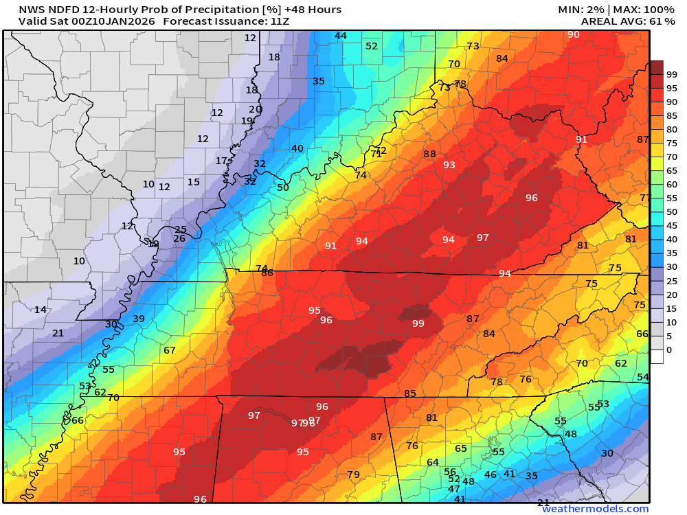
Friday
Notice on Friday how the chances are higher over Kentucky/Tennessee. That is because the second system will track a bit farther south.
.
Friday night
.
A few showers may linger into Saturday morning.
.
There is a small chance of flurries on Saturday night.
Sunday and Monday will be cool. No weather concerns.
.

.
The timestamp (upper left) is in Zulu. 12z=6 am. 18z=12 pm. 00z=6 pm.
Double-click the animation to enlarge it.
Green is rain. Yellow is moderate rain. Orange and red indicate locally heavy rain.
A lot of those blue returns (early on) are not reaching the ground.
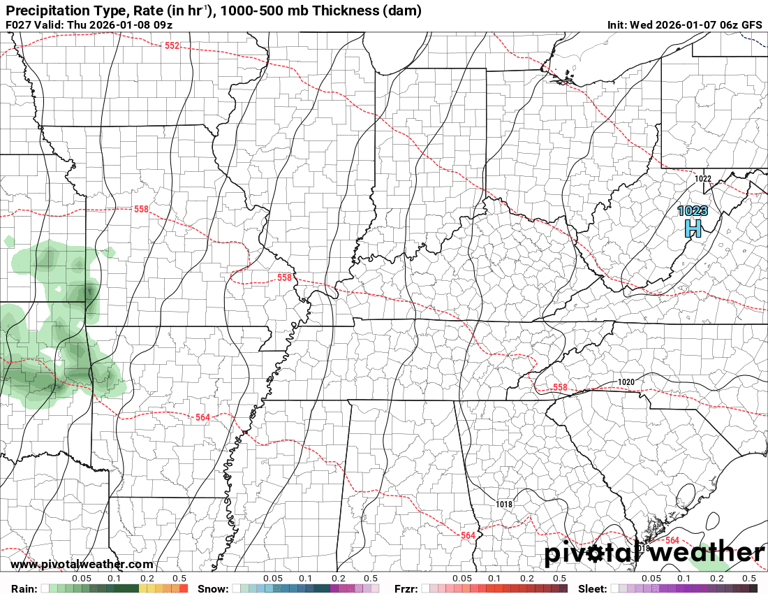
NAM 3K model
.
The timestamp (upper left) is in Zulu. 12z=6 am. 18z=12 pm. 00z=6 pm.
Double-click the animation to enlarge it.
Green is rain. Yellow is moderate rain. Red is locally heavy rain.
Hrrr model
.
.
The timestamp (upper left) is in Zulu. 12z=6 am. 18z=12 pm. 00z=6 pm.
Double-click the animation to enlarge it.
Green is rain. Yellow is moderate rain. Blue is snow.
GFS model
.
..
.
Click here if you would like to return to the top of the page.
.Average high temperatures for this time of the year are around 44 degrees.
Average low temperatures for this time of the year are around 28 degrees.
Average precipitation during this time period ranges from 1.00″ to 1.25″
Six to Ten Day Outlook.
Blue is below average. Red is above average. The no color zone represents equal chances.
Average highs for this time of the year are in the lower 60s. Average lows for this time of the year are in the lower 40s.

Green is above average precipitation. Yellow and brown favors below average precipitation. Average precipitation for this time of the year is around one inch per week.

.

Average low temperatures for this time of the year are around 26 degrees.
Average precipitation during this time period ranges from 1.00″ to 1.25″
.
Eight to Fourteen Day Outlook.
Blue is below average. Red is above average. The no color zone represents equal chances.

Green is above average precipitation. Yellow and brown favors below average precipitation. Average precipitation for this time of the year is around one inch per week.

.
.
.
We have a new service to complement your www.weathertalk.com subscription. This does NOTreplace www.weathertalk.com It is simply another tool for you to receive severe weather information.
.
https://weathercallservices.com/beau-dodson-weather


Want to receive the daily forecast/other products on your Beau Dodson Weather app?
Did you know you have four options in your www.weathertalk.com account
You will then receive these via your Beau Dodson Weather app.
Just log into your www.weathertalk.com account
Click the NOTIFICATION SETTINGS TAB
Then, turn them on (green) and off (red)
🌪️ Number 1 is the most important one. Severe alerts, tornado alerts, and so on.
Number 2 is the daily video, blog, livestream alerts, and severe weather Facebook threads on severe days or winter storm days.
Number 3 is the daily forecast. I send that out every day during the afternoon hours. It is the seven-day forecast, hazardous weather outlook, fire outlook, and more.
Number 4 is to receive the daily video, blog, and other content on NON-severe weather days (every day without severe threats in other words)
GREEN IS ON
RED IS OFF

I am going to start going live during bigger severe weather events.
Check it out here https://www.youtube.com/user/beaudodson
Click the subscribe button (it’s a free subscription button), and it will alert you when I go live. I will also send out alerts to the app when I go live for an event.

.

Radars and Lightning Data
Interactive-city-view radars. Clickable watches and warnings.
https://wtalk.co/B3XHASFZ
Old legacy radar site (some of you like it better)
https://weatherobservatory.com/weather-radar.htm
If the radar is not updating then try another one. If a radar does not appear to be refreshing then hit Ctrl F5. You may also try restarting your browser.
Backup radar site in case the above one is not working.
https://weathertalk.com/morani
Regional Radar
https://imagery.weathertalk.com/prx/RadarLoop.mp4
** NEW ** Zoom radar with chaser tracking abilities!
ZoomRadar
If the radar is not working, then email me: Email me at beaudodson@usawx.com
.
We do have some sponsors! Check them out.
Roof damage from recent storms? Link – Click here
INTEGRITY ROOFING AND EXTERIORS!
⛈️ Roof or gutter damage from recent storms? Today’s weather is sponsored by Integrity Roofing. Check out their website at this link https://www.ourintegritymatters.com/

![]()
![]()
![]()
Make sure you have three to five ways of receiving your severe weather information.
Weather Talk is one of those ways! Now, I have another product for you and your family.

.
Want to add more products to your Beau Dodson Weather App?
Receive daily videos, weather blog updates on normal weather days and severe weather and winter storm days, your county by county weather forecast, and more!
Here is how to do add those additional products to your app notification settings!
Here is a video on how to update your Beau Dodson Weather payment.
The app is for subscribers. Subscribe at www.weathertalk.com/welcome then go to your app store and search for WeatherTalk
Subscribers, PLEASE USE THE APP. ATT and Verizon are not reliable during severe weather. They are delaying text messages.
The app is under WeatherTalk in the app store.

Apple users click here

Android users click here
.
Radars and Lightning Data
Interactive-city-view radars. Clickable watches and warnings.
https://wtalk.co/B3XHASFZ
Old legacy radar site (some of you like it better)
https://weatherobservatory.com/weather-radar.htm
If the radar is not updating then try another one. If a radar does not appear to be refreshing then hit Ctrl F5. You may also try restarting your browser.
Backup radar site in case the above one is not working.
https://weathertalk.com/morani
Regional Radar
https://imagery.weathertalk.com/prx/RadarLoop.mp4
** NEW ** Zoom radar with chaser tracking abilities!
ZoomRadar
Lightning Data (zoom in and out of your local area)
https://wtalk.co/WJ3SN5UZ
Not working? Email me at beaudodson@usawx.com
National map of weather watches and warnings. Click here.
Storm Prediction Center. Click here.
Weather Prediction Center. Click here.
.

Live lightning data: Click here.
Real time lightning data (another one) https://map.blitzortung.org/#5.02/37.95/-86.99
Our new Zoom radar with storm chases
.
.

Interactive GOES R satellite. Track clouds. Click here.
GOES 16 slider tool. Click here.
College of DuPage satellites. Click here
.

Here are the latest local river stage forecast numbers Click Here.
Here are the latest lake stage forecast numbers for Kentucky Lake and Lake Barkley Click Here.
.
.
Find Beau on Facebook! Click the banner.


 .
.