

.
I have some question-and-answer threads over on the Facebook page. Link to those threads CLICK HERE
Or email me at beaudodsonweather@gmail.com
..

🌪️ Seven-Day Tornado Outlook ⛈️
January 13th through January 19th
Current risk: No concerns.
Current confidence level: High confidence.
Comments: Severe weather is not anticipated.
.

Seven-Day Hazardous Weather Outlook
1. Is lightning in the forecast? NO.
2. Are organized/widespread severe thunderstorms in the forecast? NO.
..3. Is significant or widespread flash flooding in the forecast? NO.
4. Will non-thunderstorm winds top 40 mph? LOW RISK. A small chance on Friday.
5. Will the temperature fall below 20 degrees? YES. The highest probability of this will be on Thursday night, Friday night, Saturday night, and Sunday night. Perhaps beyond Sunday night, as well.
6. Is the wind chill forecast to drop below ten degrees? YES. On and off from Friday night into Sunday night.
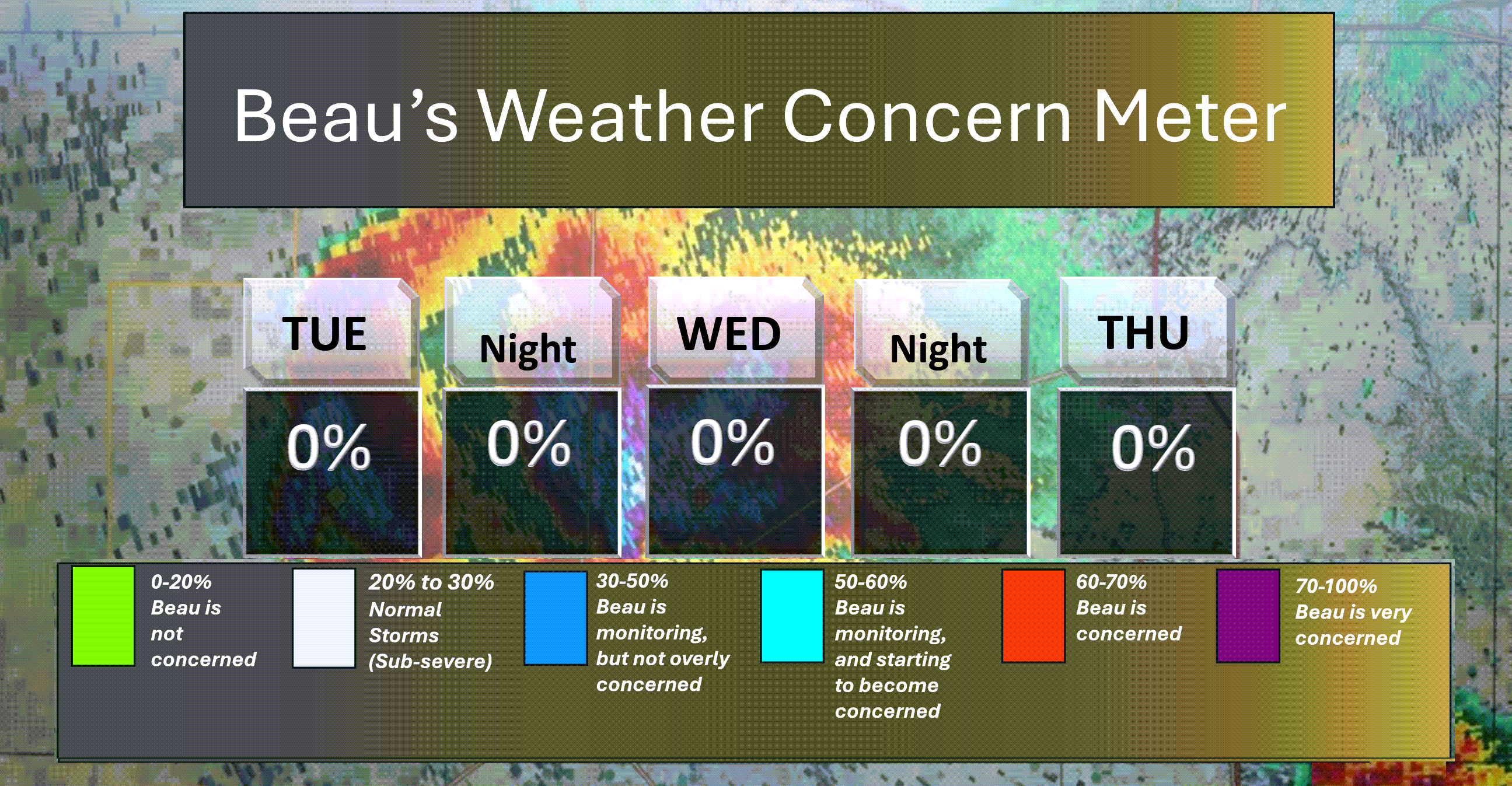
Here is the short-range thunderstorm concern meter.
.
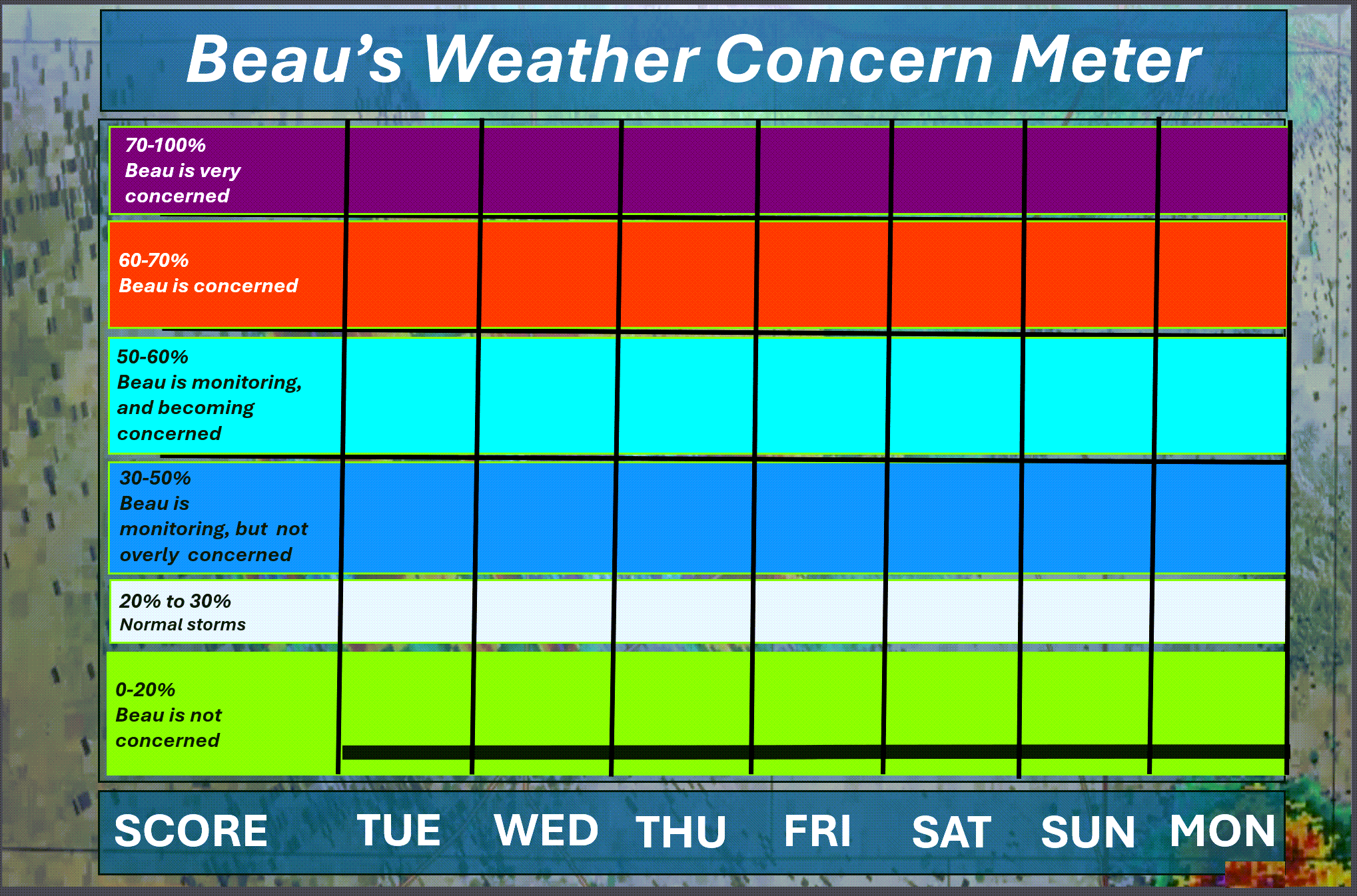
Here is the extended concern meter.
We will remain in the green. No thunderstorm threats.
.
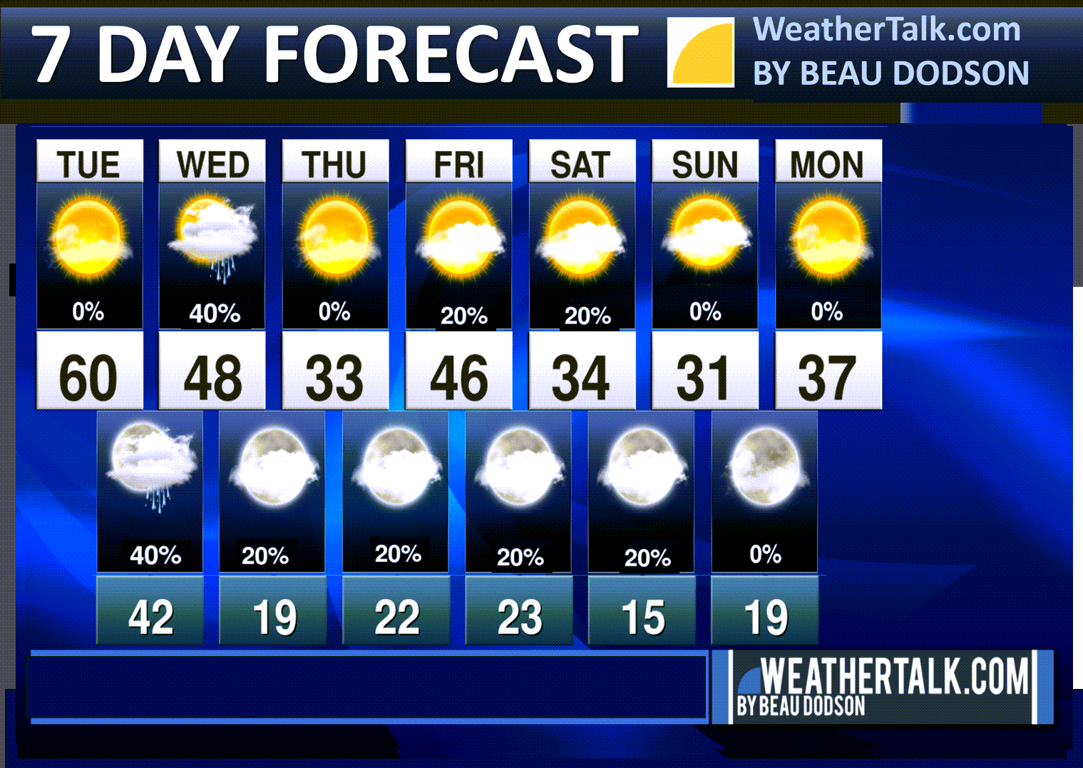
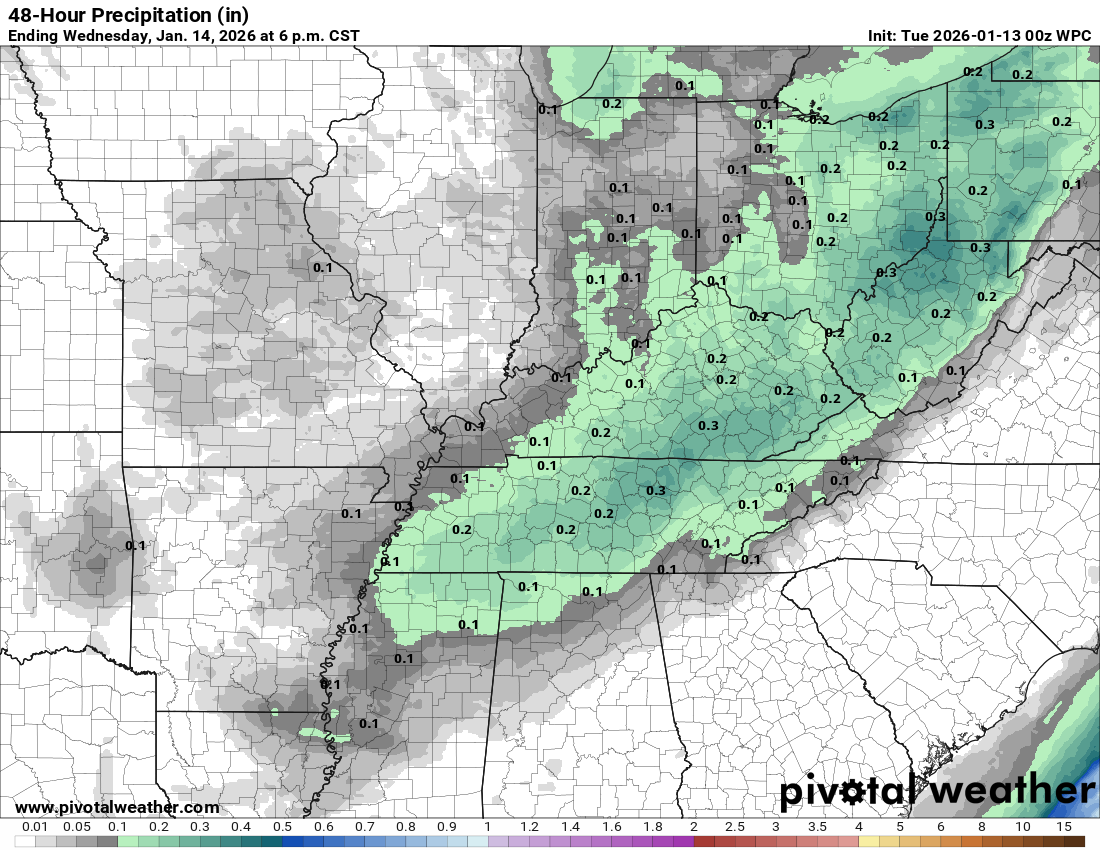
A quick forecast glance. Your 48-hour forecast Graphics


.
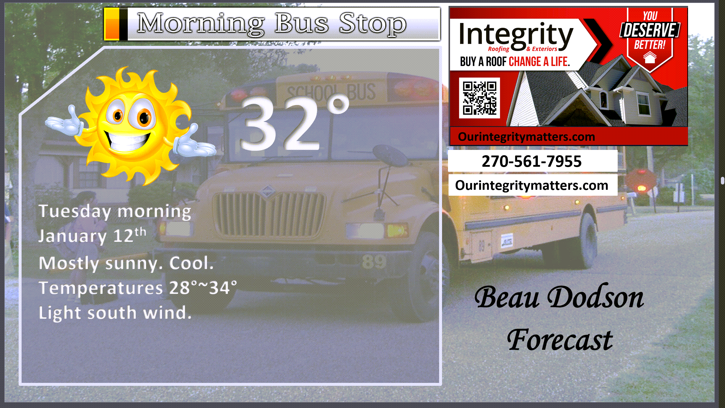
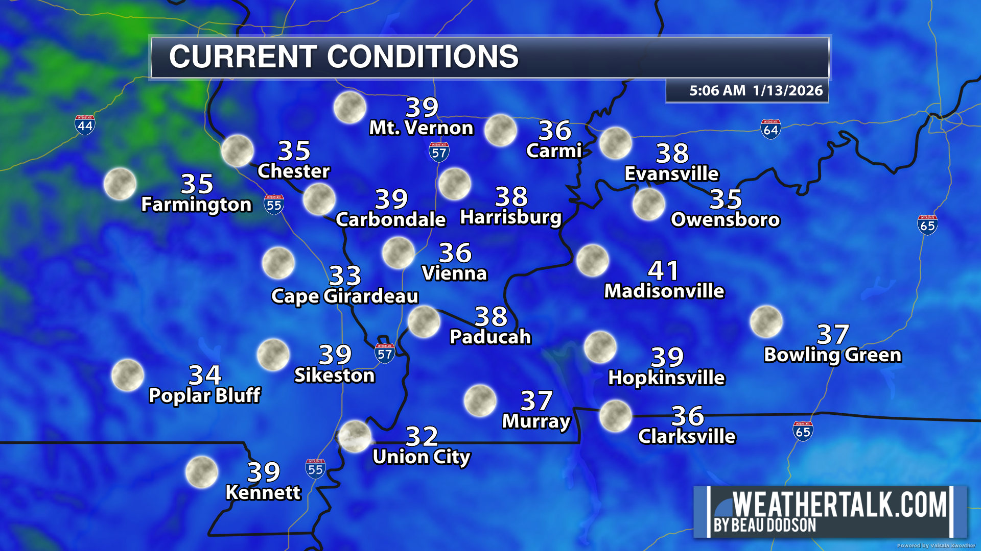
Here is your bus stop forecast
.
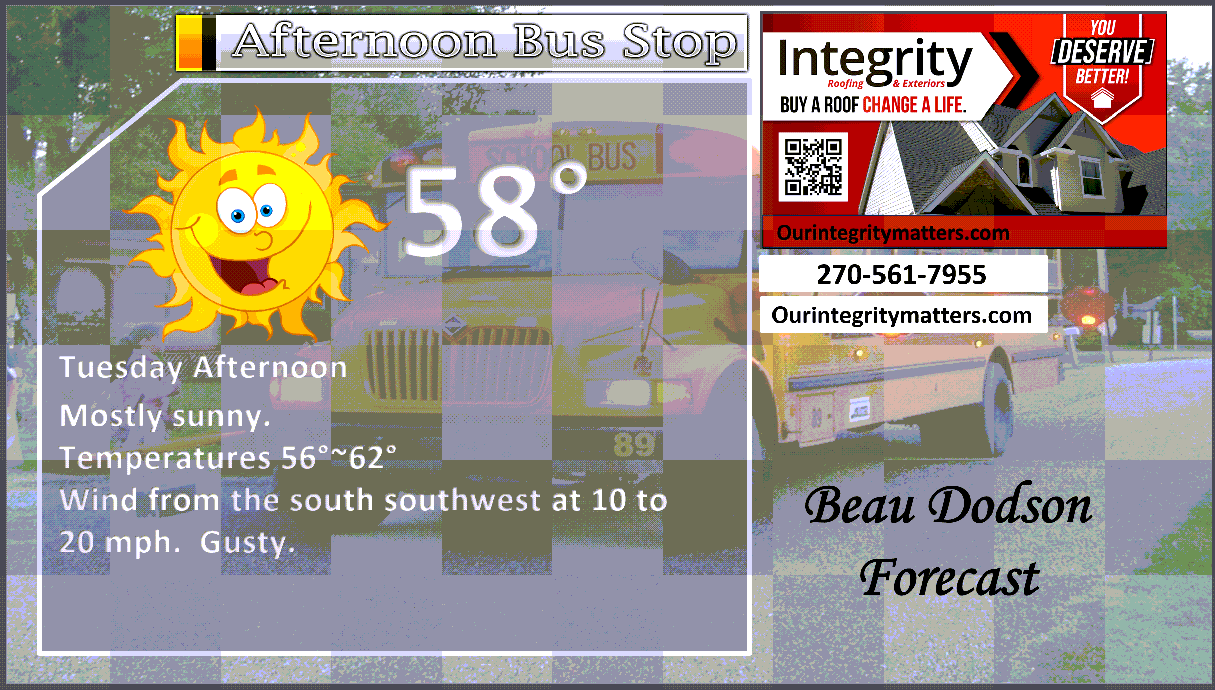
This afternoon
.


Forecast discussion
- A fairly quiet weather pattern.
- Today will be mild. Breezy.
- Cold temperatures over the coming ten days, for the most part. A few “warmer” days mixed in.
- A chance of light rain tonight and Wednesday. It could end as light flurries or snow showers.
- Falling temperatures on Wednesday.
- Another chance of light precipitation Thursday night and Friday. Small chances over the weekend, as well.
- Much colder on Saturday and Sunday. Several cold shots over the next two weeks.
- Breezy conditions over the coming seven days.
.
 .
.
.
What is the primary weather concern?
Several shots of cold air will be the primary weather story.
Today will be mild. Enjoy it.
A cold front will move through the region tonight and tomorrow. Light rain will accompany the front. It may end as a snow flurry or snow shower on Wednedsay afternoon and night.
A stronger cold front will arrive this weekend. As a matter of fact, it will definitely feel like winter on Saturday and Sunday. Brrr.
Rainfall totals between now and Sunday will range from trace to 0.15″. Not much. Not enough. Drought conditions will worsen.
.
.
Seven-day outlook graphic.
See the video or graphics below for more details specific to your county. This is a broad-brush overview of the entire region.
Notice the cold air this weekend. Brrr.
.
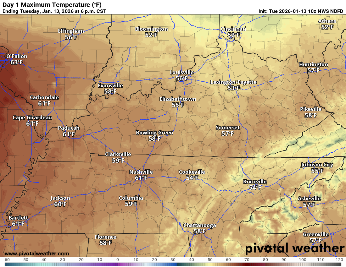
Today through Wednesday night
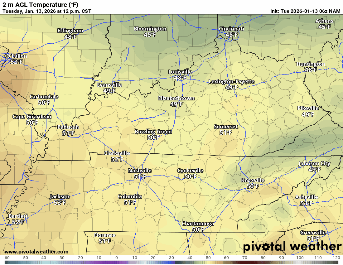
Today will be mild. Well above average temperatures.
Check out these high temperatures!
Southeast Missouri will be solidly in the 60s. Mostly fifties to around sixty everywhere else.
.
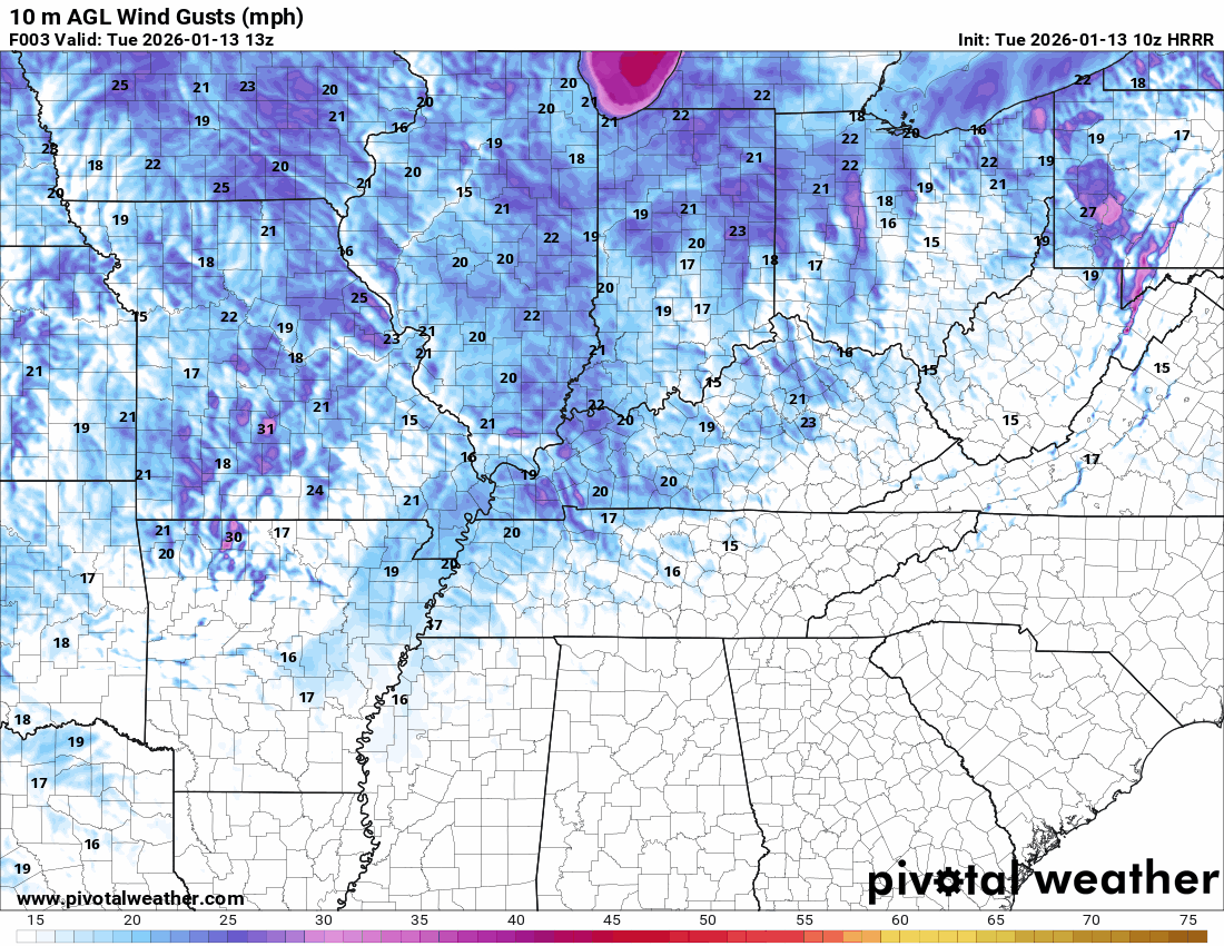
No weather concerns today. It will be breezy, at times. Strong south southwesterly winds.
Use caution when burning brush or leaves.
You can see today’s gusty winds in this animation.
.
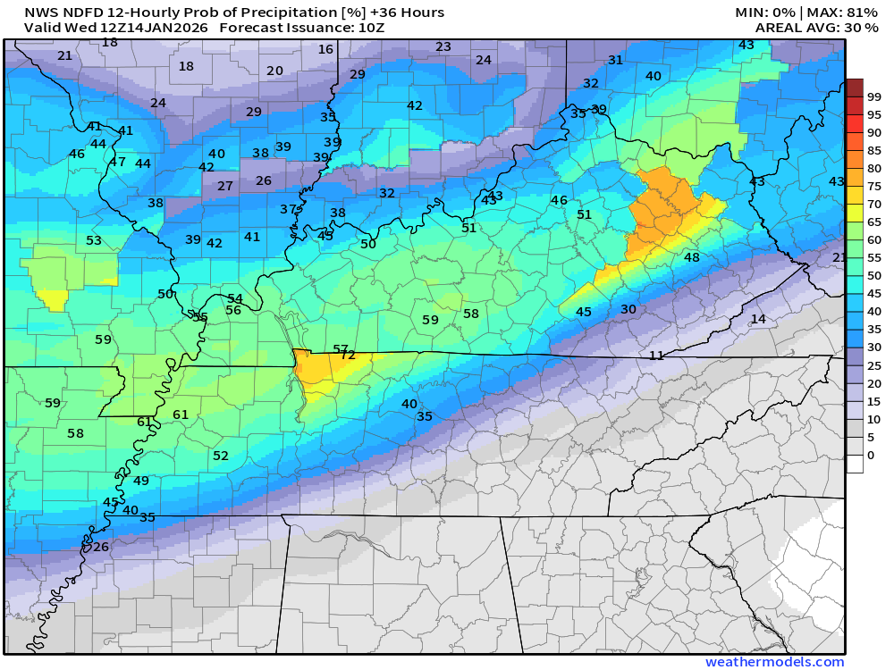
Clouds will increase tonight, with a chance of light showers after midnight. Rain totals will be light. Ranging from trace to 0.10″.
Here is the rainfall outlook. See the future-cast radars below, as well.
.
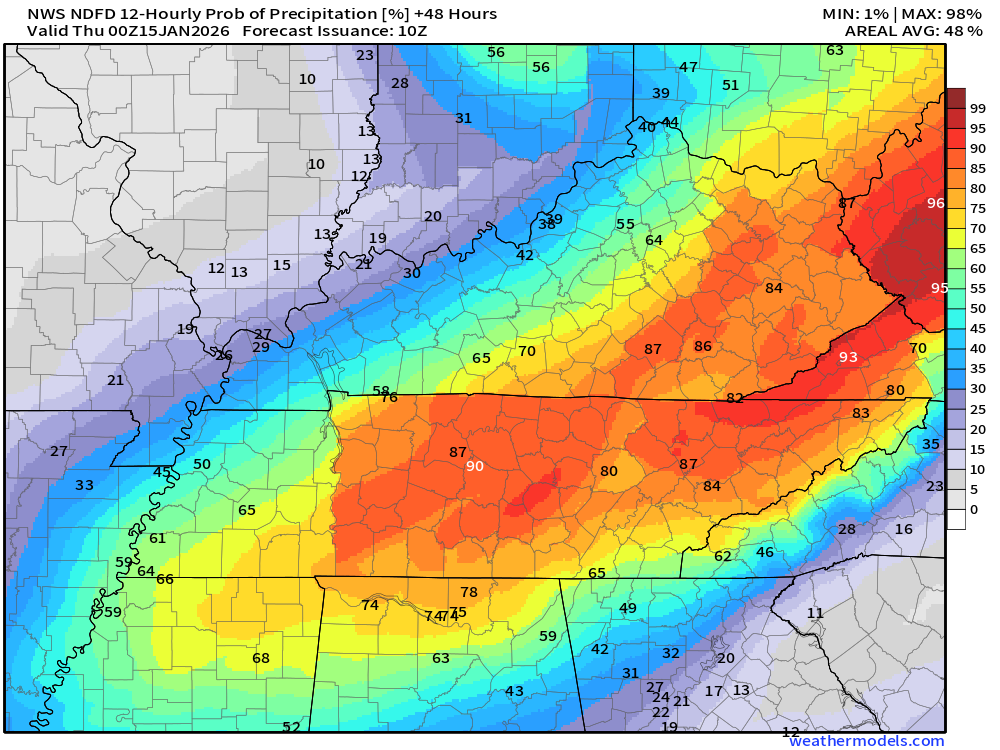
Tuesday night’s rain probabilities. What is the % chance of rain?
.
Temperatures on Wednesday will peak during the morning and will likely fall during the day.
You can see that on the NAM model. This is the temperature animation.
I can’t rule out the light rain ending as flurries on Wednesday afternoon and evening. Nothing of significance.
.
Thursday through Monday
Thursday and Friday will be cool.
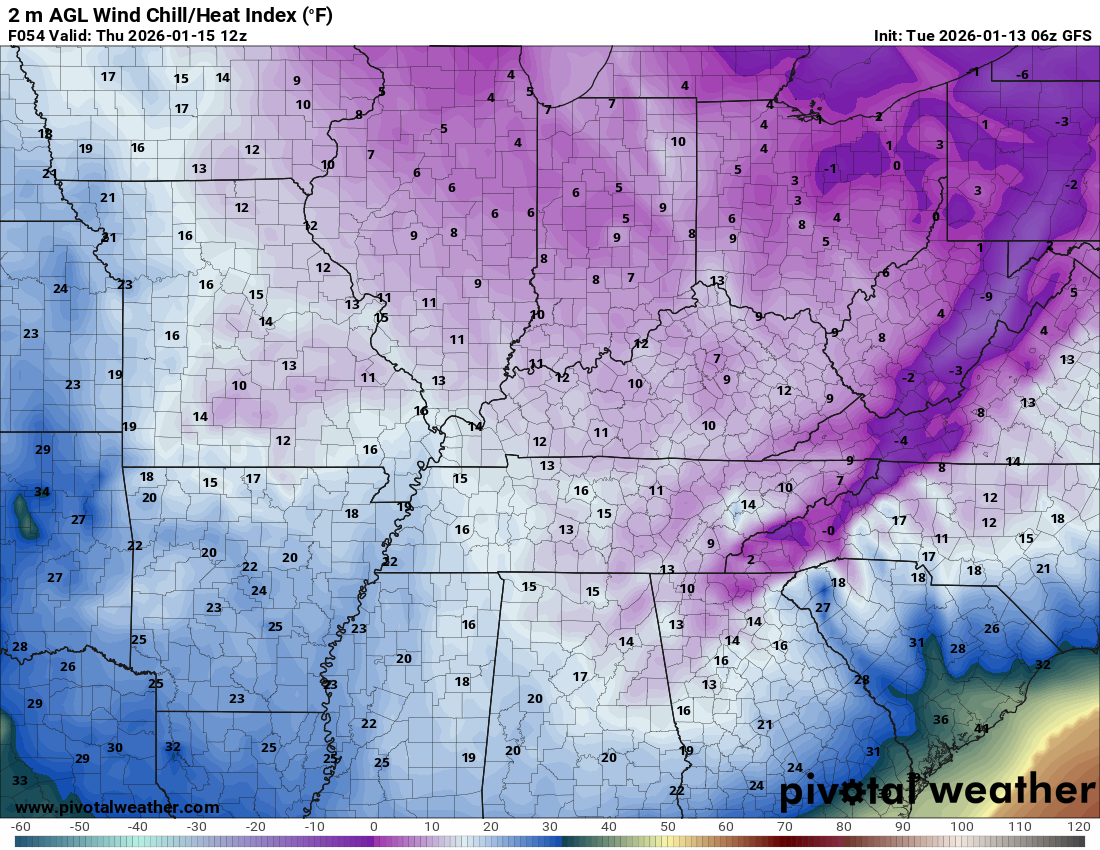
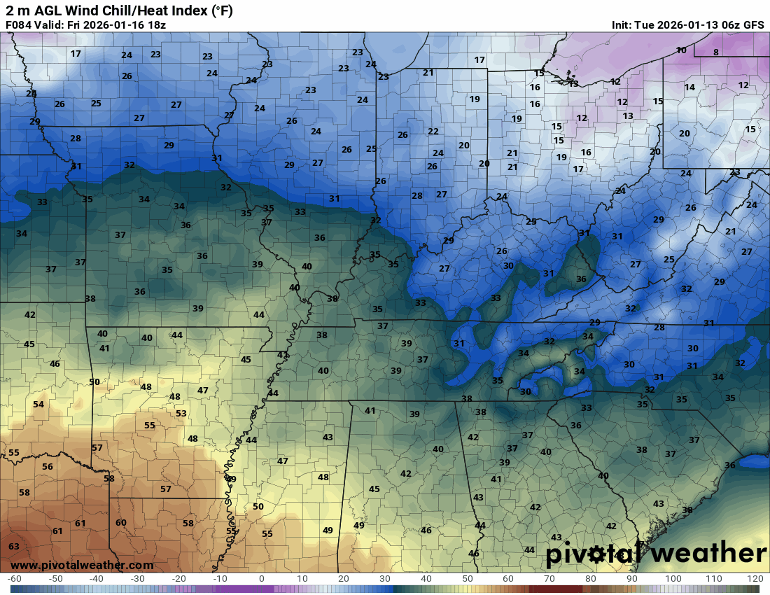
Wind chill values on Thursday morning will be in the teens. Brrr.
Breezy, at times. Winds on Friday could gust above 30 mph.
A cold front will move through the region late Thursday night into Friday. Some light showers may accompany it. Perhaps some snow flurries or snow showers. Nothing of significance.
Friday night into Sunday night will be cold. Cold temperatures.
As a matter of fact, wind chill values on Saturday and Sunday will likely be in the teens and may occasionally drop below ten degrees. Brrr.
Check out this wind chill animation. The timestamp is located in the upper-left corner of the image.
Double-click to enlarge the animation.
This takes us from Friday into next Tuesday. Notice another surge of cold air next Monday night and Tuesday.
There will be a mix of sun and clouds over the weekend. A few weak disturbances will move across the region.
These could be accompanied by light snow showers or snow flurries.
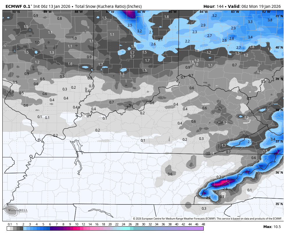
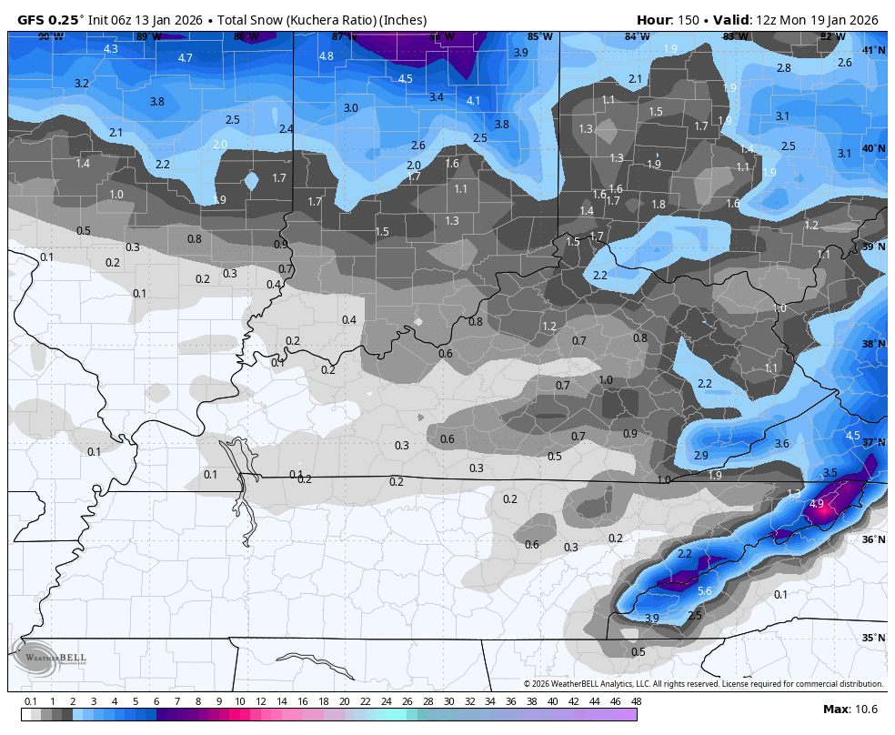
There is only a 20% chance of a dusting of snow between now and Sunday.
Here is the EC model snowfall through Sunday night.
Here is the GFS snowfall totals through Sunday night
.
I am not tracking any major precipitation events over the next seven days.
.

.
The timestamp (upper left) is in Zulu. 12z=6 am. 18z=12 pm. 00z=6 pm.
Double-click the animation to enlarge it.
Green is rain. Yellow is moderate rain. Orange and red indicate locally heavy rain.
Blue is snow.
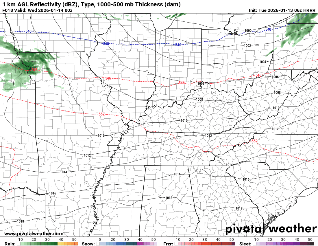
GFS model
.
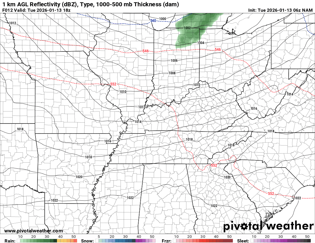
The timestamp (upper left) is in Zulu. 12z=6 am. 18z=12 pm. 00z=6 pm.
Double-click the animation to enlarge it.
Green is rain. Yellow is moderate rain. Red is locally heavy rain. Blue is snow.
NAM model
.
.
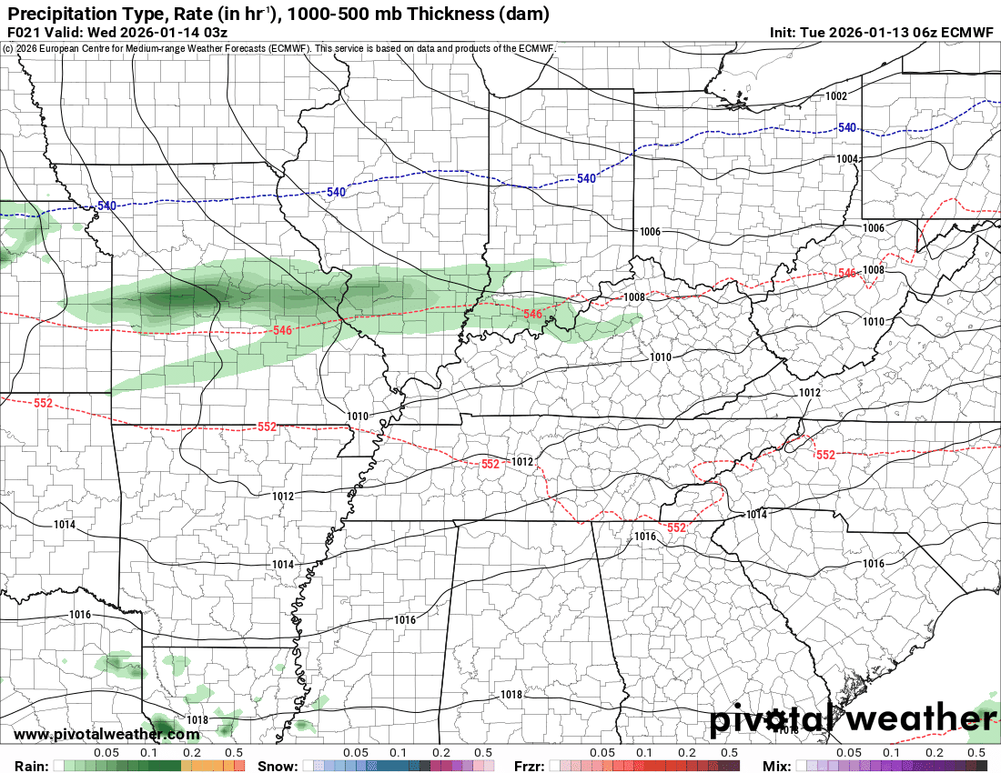
The timestamp (upper left) is in Zulu. 12z=6 am. 18z=12 pm. 00z=6 pm.
Double-click the animation to enlarge it.
Green is rain. Yellow is moderate rain. Blue is snow.
EC model
.
..
.
Click here if you would like to return to the top of the page.
.Average high temperatures for this time of the year are around 44 degrees.
Average low temperatures for this time of the year are around 28 degrees.
Average precipitation during this time period ranges from 1.00″ to 1.25″
Six to Ten Day Outlook.
Blue is below average. Red is above average. The no color zone represents equal chances.
Average highs for this time of the year are in the lower 60s. Average lows for this time of the year are in the lower 40s.

Green is above average precipitation. Yellow and brown favors below average precipitation. Average precipitation for this time of the year is around one inch per week.

.

Average low temperatures for this time of the year are around 26 degrees.
Average precipitation during this time period ranges from 1.00″ to 1.25″
.
Eight to Fourteen Day Outlook.
Blue is below average. Red is above average. The no color zone represents equal chances.

Green is above average precipitation. Yellow and brown favors below average precipitation. Average precipitation for this time of the year is around one inch per week.

.
.
.
We have a new service to complement your www.weathertalk.com subscription. This does NOTreplace www.weathertalk.com It is simply another tool for you to receive severe weather information.
.
https://weathercallservices.com/beau-dodson-weather


Want to receive the daily forecast/other products on your Beau Dodson Weather app?
Did you know you have four options in your www.weathertalk.com account
You will then receive these via your Beau Dodson Weather app.
Just log into your www.weathertalk.com account
Click the NOTIFICATION SETTINGS TAB
Then, turn them on (green) and off (red)
🌪️ Number 1 is the most important one. Severe alerts, tornado alerts, and so on.
Number 2 is the daily video, blog, livestream alerts, and severe weather Facebook threads on severe days or winter storm days.
Number 3 is the daily forecast. I send that out every day during the afternoon hours. It is the seven-day forecast, hazardous weather outlook, fire outlook, and more.
Number 4 is to receive the daily video, blog, and other content on NON-severe weather days (every day without severe threats in other words)
GREEN IS ON
RED IS OFF

I am going to start going live during bigger severe weather events.
Check it out here https://www.youtube.com/user/beaudodson
Click the subscribe button (it’s a free subscription button), and it will alert you when I go live. I will also send out alerts to the app when I go live for an event.

.

Radars and Lightning Data
Interactive-city-view radars. Clickable watches and warnings.
https://wtalk.co/B3XHASFZ
Old legacy radar site (some of you like it better)
https://weatherobservatory.com/weather-radar.htm
If the radar is not updating then try another one. If a radar does not appear to be refreshing then hit Ctrl F5. You may also try restarting your browser.
Backup radar site in case the above one is not working.
https://weathertalk.com/morani
Regional Radar
https://imagery.weathertalk.com/prx/RadarLoop.mp4
** NEW ** Zoom radar with chaser tracking abilities!
ZoomRadar
If the radar is not working, then email me: Email me at beaudodson@usawx.com
.
We do have some sponsors! Check them out.
Roof damage from recent storms? Link – Click here
INTEGRITY ROOFING AND EXTERIORS!
⛈️ Roof or gutter damage from recent storms? Today’s weather is sponsored by Integrity Roofing. Check out their website at this link https://www.ourintegritymatters.com/

![]()
![]()
![]()
Make sure you have three to five ways of receiving your severe weather information.
Weather Talk is one of those ways! Now, I have another product for you and your family.

.
Want to add more products to your Beau Dodson Weather App?
Receive daily videos, weather blog updates on normal weather days and severe weather and winter storm days, your county by county weather forecast, and more!
Here is how to do add those additional products to your app notification settings!
Here is a video on how to update your Beau Dodson Weather payment.
The app is for subscribers. Subscribe at www.weathertalk.com/welcome then go to your app store and search for WeatherTalk
Subscribers, PLEASE USE THE APP. ATT and Verizon are not reliable during severe weather. They are delaying text messages.
The app is under WeatherTalk in the app store.

Apple users click here

Android users click here
.
Radars and Lightning Data
Interactive-city-view radars. Clickable watches and warnings.
https://wtalk.co/B3XHASFZ
Old legacy radar site (some of you like it better)
https://weatherobservatory.com/weather-radar.htm
If the radar is not updating then try another one. If a radar does not appear to be refreshing then hit Ctrl F5. You may also try restarting your browser.
Backup radar site in case the above one is not working.
https://weathertalk.com/morani
Regional Radar
https://imagery.weathertalk.com/prx/RadarLoop.mp4
** NEW ** Zoom radar with chaser tracking abilities!
ZoomRadar
Lightning Data (zoom in and out of your local area)
https://wtalk.co/WJ3SN5UZ
Not working? Email me at beaudodson@usawx.com
National map of weather watches and warnings. Click here.
Storm Prediction Center. Click here.
Weather Prediction Center. Click here.
.

Live lightning data: Click here.
Real time lightning data (another one) https://map.blitzortung.org/#5.02/37.95/-86.99
Our new Zoom radar with storm chases
.
.

Interactive GOES R satellite. Track clouds. Click here.
GOES 16 slider tool. Click here.
College of DuPage satellites. Click here
.

Here are the latest local river stage forecast numbers Click Here.
Here are the latest lake stage forecast numbers for Kentucky Lake and Lake Barkley Click Here.
.
.
Find Beau on Facebook! Click the banner.


 .
.