The Justin Croach Memorial Scholarship
Daily WeatherTalk schedule

We offer interactive local city view radars and regional radars.
If a radar does not update then try another one. If a radar does not appear to be refreshing then hit Ctrl F5. You may also try restarting your browser.

Interactive Radars:
Interactive live weather radar page. Choose the city nearest your location. If one of the city radars won’t load then try a nearby one. Click here.
Live satellite views. Click here
If you are not a subscriber then consider becoming one.
You will receive videos, value-added content, and app / text notifications when I update the blog and Facebook!
Become a subscriber by visiting www.weathertalk.com
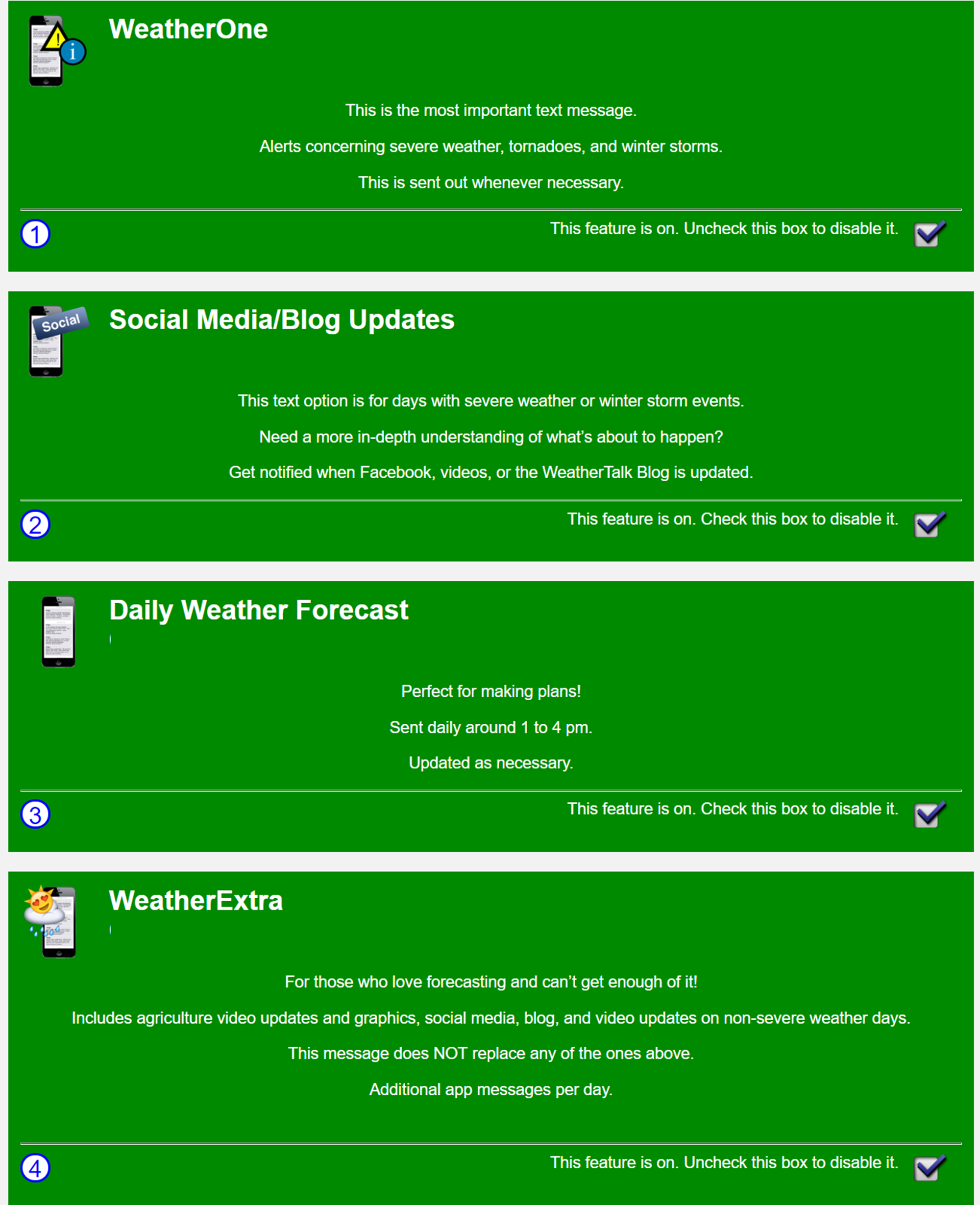
These are the four app/text message options you can activate in your www.weathertalk.com account
January 12, 2019
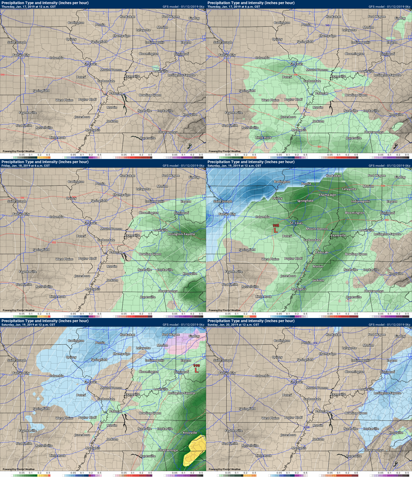
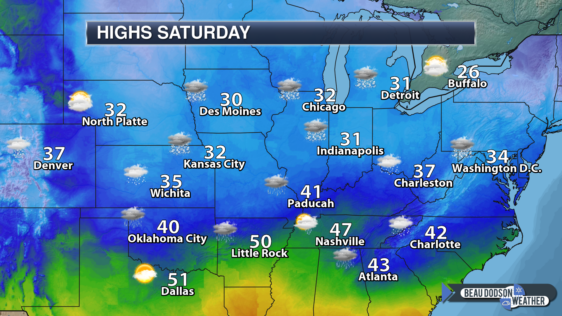
Saturday Forecast: Mostly cloudy. Damp and chilly. Widespread rain likely. A band of rain will move west to east through the region. A chance of a mixture from Perry County Missouri towards Jefferson County, Illinois.
My confidence in the forecast verifying: High (80% confidence in the forecast)
Temperature range: MO ~ 34 to 42 IL ~ 34 to 42 KY ~ 36 to 44 TN ~ 42 to 46
Wind direction and speed: East and northeast at 7 to 14 mph
Wind chill (feels like) temperature forecast: 20 to 30
What is the chance/probability of precipitation? MO ~ 90% IL ~ 90% KY ~ 90% TN ~ 90%
Coverage of precipitation: Widespread rain.
Is flash flooding anticipated? No
Is accumulating snow or ice anticipated? No additional accumulation for most of the region. Monitor areas to the north of Perry County, MO towards Mt Vernon.
Is non-accumulating snow or ice anticipated? Possible mix for some areas before it all changes to rain
Are icy road conditions anticipated? Saturday morning could deliver some snow packed roads. Roads should improve rather quickly as temperatures rise above freezing across most of my forecast area.
Is severe weather expected? No
The NWS officially defines severe weather as 58 mph wind or great, 1″ hail or larger, and/or tornadoes
Will lightning be possible? No
Should I cancel my outdoor plans? Have a plan B
What impacts are anticipated from the weather? Icy roads and wet roads.
Will the weather impact my outdoor plans? Yes. Rain will cause for damp and cold conditions. Icy roads may be a concern in some locations, as well.
UV Index: 1 Low
Sunrise: 7:09 AM
Saturday Night Forecast Details:
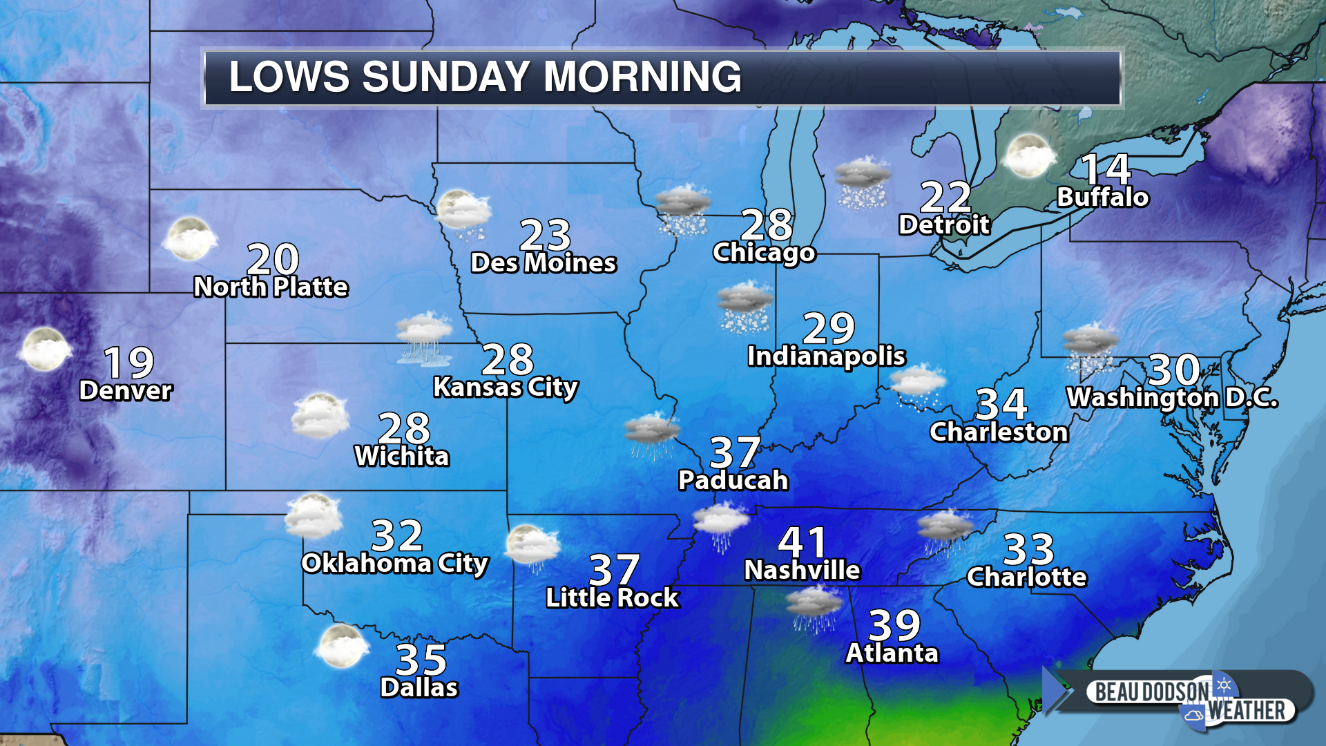
Forecast: Cloudy. A chance of rain and snow showers. Light freezing drizzle possible. Monitor updates in areas that drop below freezing. Black ice could occur.
My confidence in the forecast verifying: Medium (60% confidence in the forecast)
Temperature range: MO ~ 32 to 34 IL ~ 32 to 36 KY ~ 34 to 38 TN ~ 36 to 40
Wind direction and speed: North at 6 to 12 mph with higher gusts.
Wind chill (feels like) temperature forecast: 25 to 35
What is the chance/probability of precipitation? MO ~ 70% IL ~ 70% KY ~ 60% TN ~ 60%
Coverage of precipitation: Scattered to perhaps numerous
Is flash flooding anticipated? No
Is accumulating snow or ice anticipated? Unlikely but monitor updates if you live north of Perry County, MO towards Mt Vernon, Illinois.
Is non-accumulating snow or ice anticipated? Yes
Are icy road conditions anticipated? Possible across northern parts of southeast Missouri and northern portions of southern Illinois. Temperatures will be marginal for freezing.
Is severe weather expected? No
The NWS officially defines severe weather as 58 mph wind or great, 1″ hail or larger, and/or tornadoes
Will lightning be possible? No
Should I cancel my outdoor plans? Have a plan B
What impacts are anticipated from the weather? Damp road conditions. Monitor temperatures late tonight across our northern counties. Black ice possible.
Will the weather impact my outdoor plans? Yes. Snow and rain will cause for damp and cold conditions.
Sunset: 4:58 PM
Moonrise: 11:00 AM Waxing Crescent
Moonset: 11:10 PM
January 13, 2019
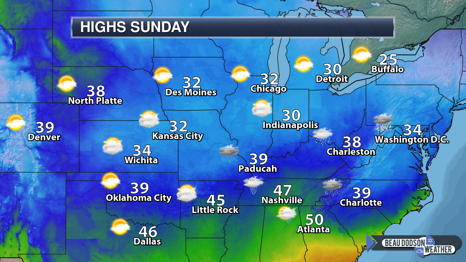
Sunday Forecast: Mostly cloudy. A few scattered rain or snow showers. Freezing drizzle possible over northern parts of southeast Missouri and northern parts of southern Illinois. Monitor updates.
My confidence in the forecast verifying: Medium (50% confidence in the forecast)
Temperature range: MO ~ 34 to 40 IL ~ 34 to 40 KY ~ 36 to 42 TN ~ 38 to 42
Wind direction and speed: North at 7 to 14 mph with gusts to 20 mph
Wind chill (feels like) temperature forecast: 20 to 30
What is the chance/probability of precipitation? MO ~ 30% IL ~ 40% KY ~ 40% TN ~ 40%
Coverage of precipitation: Scattered
Is flash flooding anticipated? No
Is accumulating snow or ice anticipated? Most likely no. Monitor areas from north of Perry County, MO towards Mt Vernon. Temperatures could be near freezing early in the day.
Is non-accumulating snow or ice anticipated? Possible
Are icy road conditions anticipated? Most areas will not have icy roads
Is severe weather expected? No
The NWS officially defines severe weather as 58 mph wind or great, 1″ hail or larger, and/or tornadoes
Will lightning be possible? No
Should I cancel my outdoor plans? Have a plan B
What impacts are anticipated from the weather? Wet road conditions.
Will the weather impact my outdoor plans? Damp and chilly conditions
UV Index: 2 Low
Sunrise: 7:09 AM
Sunday Night Forecast Details:
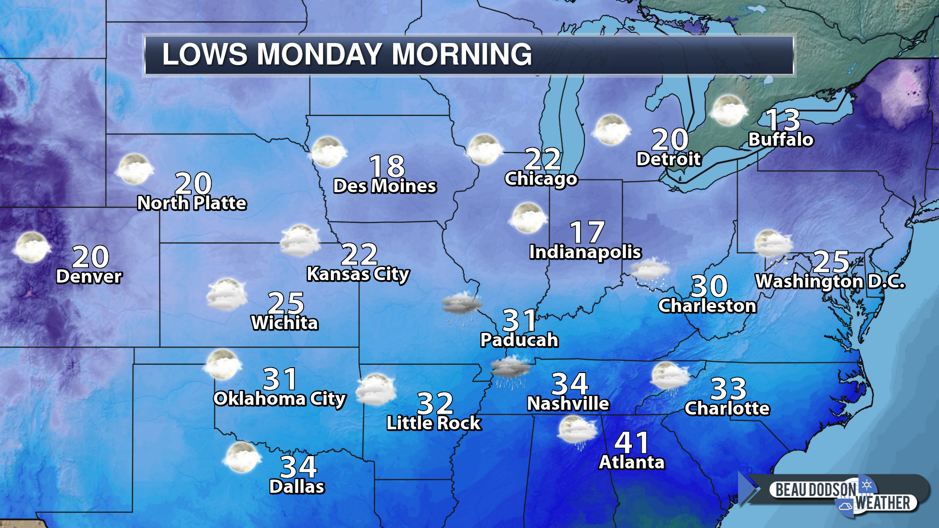
Forecast: Mostly cloudy. A few snow showers or snow flurries possible.
My confidence in the forecast verifying: Medium (60% confidence in the forecast)
Temperature range: MO ~ 22 to 26 IL ~ 22 to 26 KY ~ 26 to 28 TN ~ 30 to 32
Wind direction and speed: North 5 to 10 mph
Wind chill (feels like) temperature forecast: 20 to 30
What is the chance/probability of precipitation? MO ~ 20% IL ~ 30% KY ~ 30% TN ~ 20%
Coverage of precipitation: None to scattered
Is flash flooding anticipated? No
Is accumulating snow or ice anticipated? No
Is non-accumulating snow or ice anticipated? A flurry possible
Are icy road conditions anticipated? No
Is severe weather expected? No
The NWS officially defines severe weather as 58 mph wind or great, 1″ hail or larger, and/or tornadoes
Will lightning be possible? No
Should I cancel my outdoor plans? No
What impacts are anticipated from the weather? Monitor road conditions in areas that received snow on Friday night and Saturday.
Will the weather impact my outdoor plans? Damp conditions. Chilly conditions.
Sunset: 4:59 PM
Moonrise: 11:29 AM First Quarter
Moonset: 12:01 AM
I will update the rest of the week later today.
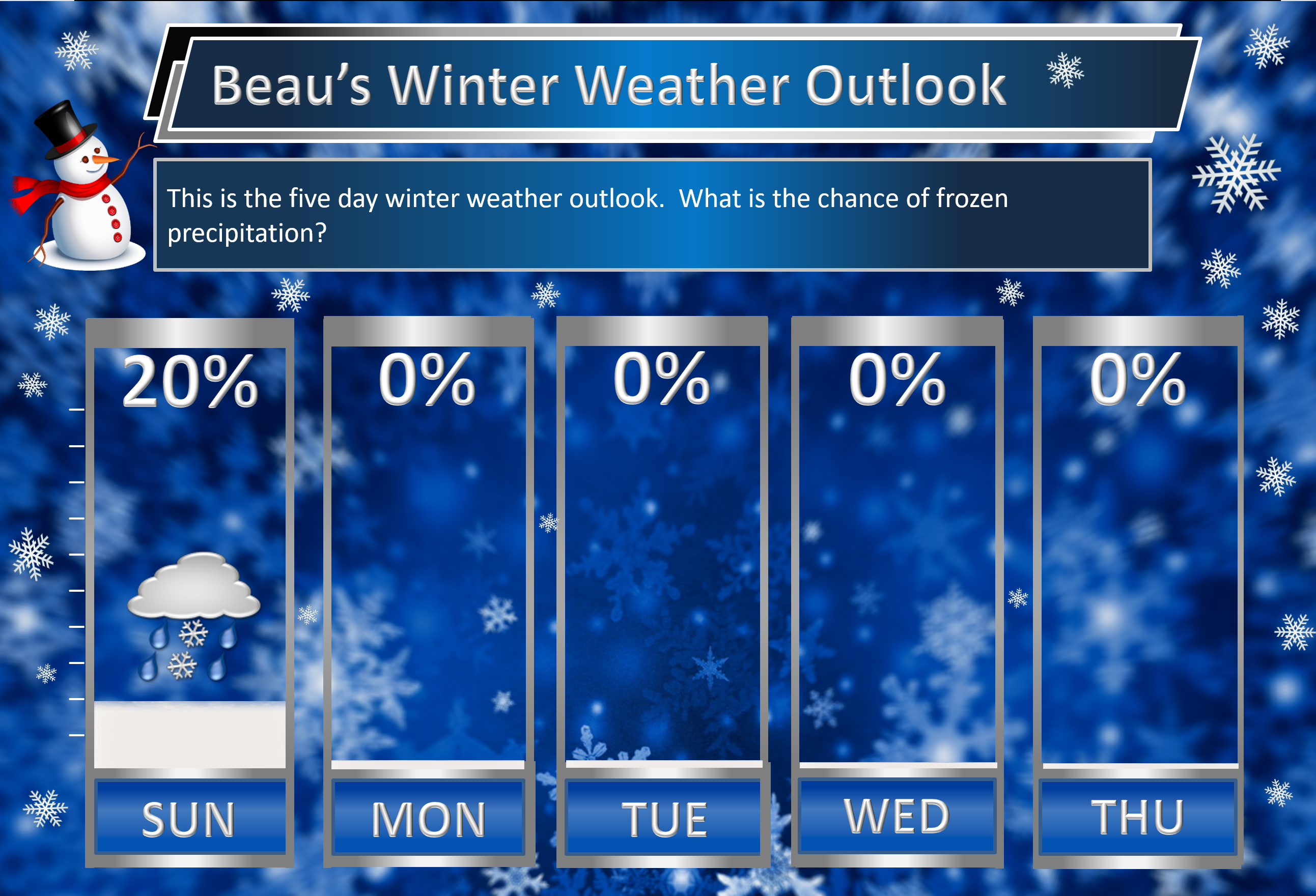
Saturday 12th: Yes. Wet snow and a wintry mix are possible across mainly northern parts of southeast Missouri and northern portions of southern Illinois before changing to rain. Elsewhere, rain is likely.
Saturday night: For the most part, no. Many areas will remain above freezing. Those who dip below freezing could experience some light wintry mix. Monitor updates if you live near Perry County, MO and then northeast towards Mt Vernon, IL.
Sunday 13th: Snow flurries are possible.
Monday 14th: Wintry precipitation is not anticipated.
Tuesday through Thursday: Wintry precipitation is not anticipated.
Subscribers, do you need a forecast for an outdoor event?
Did you know that you can find me on Twitter?
We offer interactive local city live radars and regional radars.
If a radar does not update then try another one. If a radar does not appear to be refreshing then hit Ctrl F5 on your keyboard.
You may also try restarting your browser. The local city view radars also have clickable warnings.
During the winter months, you can track snow and ice by clicking the winterize button on the local city view interactive radars.

Questions? Broken links? Other questions?
You may email me at beaudodson@usawx.com
The National Weather Service defines a severe thunderstorm as one that produces quarter size hail or larger, 58 mph winds or greater, and/or a tornado.
Today through next Thursday: Severe weather is not anticipated.
Interactive live weather radar page. Choose the city nearest your location. If one of the cities does not work then try a nearby one. Click here.
National map of weather watches and warnings. Click here.
Storm Prediction Center. Click here.
Weather Prediction Center. Click here.

Live lightning data: Click here.

Interactive GOES R satellite. Track clouds. Click here.

Here are the latest local river stage forecast numbers Click Here.
Here are the latest lake stage forecast numbers for Kentucky Lake and Lake Barkley Click Here.

.
Brief update today.
It has been a long week of forecasting!
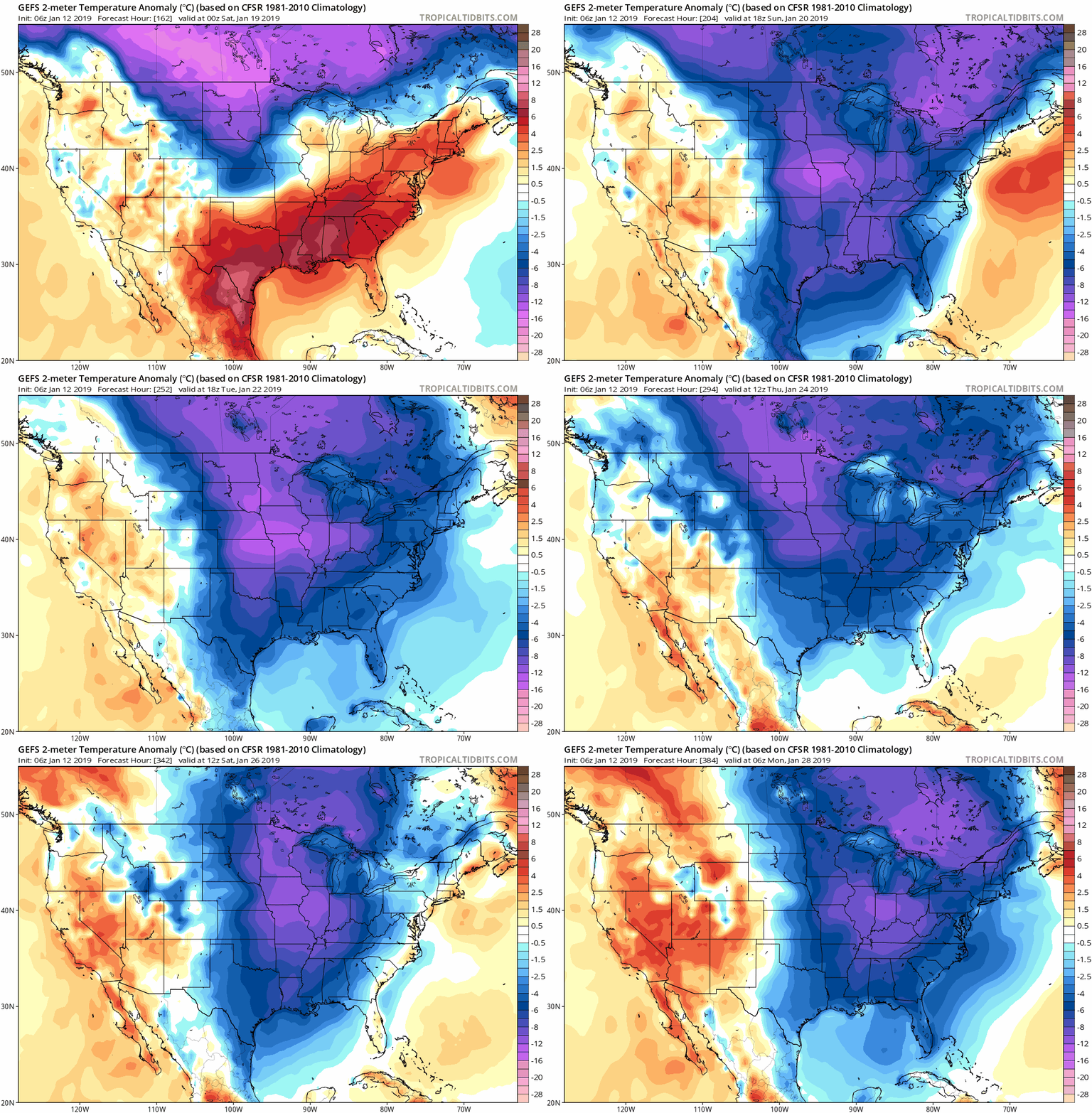
Temperature Anomalies
Let’s look at the temperature anomaly forecast map from the GFS model guidance.
I will keep showing you this graphic animation over the coming weeks.
Red colors indicate above normal temperatures. Blue colors represent below normal temperatures.
The time-stamp is located in the upper left portion of the map animation.
Click to enlarge. Date stamp upper left.
.
.





 .
.