…..
1232 PM CST Fri Mar 3 2023
THE TORNADO WARNING FOR NORTHEASTERN UNION COUNTY IS CANCELLED…
The tornadic thunderstorm which prompted the warning has moved out
of the warned area. Therefore, the warning
has been cancelled.
.
12:06 PM
Radar shows multiple rotations with the line of storms in Union County, KY. Areas in Webster County should be alert, as well.
The storms will be moving into Henderson County shortly.
Seek shelter if you are in the path of these thunderstorms.
BULLETIN – EAS ACTIVATION REQUESTED
Tornado Warning
National Weather Service Paducah KY
1202 PM CST Fri Mar 3 2023
The National Weather Service in Paducah has issued a
* Tornado Warning for…
Central Union County in northwestern Kentucky…
* Until 1230 PM CST.
* At 1202 PM CST, a severe thunderstorm capable of producing a
tornado was located over Sturgis, moving northeast at 45 mph.
HAZARD…Tornado.
SOURCE…Radar indicated rotation.
IMPACT…Flying debris will be dangerous to those caught without
shelter. Mobile homes will be damaged or destroyed.
Damage to roofs, windows, and vehicles will occur. Tree
damage is likely.
* This dangerous storm will be near…
Morganfield and Breckinridge Center around 1215 PM CST.
Uniontown around 1220 PM CST.
PRECAUTIONARY/PREPAREDNESS ACTIONS…
TAKE COVER NOW! Move to a basement or an interior room on the lowest
floor of a sturdy building. Avoid windows. If you are outdoors, in a
mobile home, or in a vehicle, move to the closest substantial shelter
and protect yourself from flying debris.
&&
…
Severe Thunderstorm Warning
National Weather Service Paducah KY
1155 AM CST Fri Mar 3 2023
The National Weather Service in Paducah has issued a
* Severe Thunderstorm Warning for…
Southeastern White County in southeastern Illinois…
Northeastern Gallatin County in southern Illinois…
Vanderburgh County in southwestern Indiana…
Posey County in southwestern Indiana…
Henderson County in northwestern Kentucky…
Northeastern Crittenden County in western Kentucky…
Northeastern Caldwell County in western Kentucky…
Western McLean County in northwestern Kentucky…
Hopkins County in northwestern Kentucky…
Union County in northwestern Kentucky…
Webster County in northwestern Kentucky…
* Until 100 PM CST.
* At 1154 AM CST, severe thunderstorms were located along a line
extending from near Eldorado to near Sturgis, moving northeast at
75 mph.
HAZARD…70 mph wind gusts.
SOURCE…Trained weather spotters. These storms havea history of
wind damage.
IMPACT…Expect considerable tree damage. Damage is likely to
mobile homes, roofs, and outbuildings.
* Locations impacted include…
Evansville, Henderson, Madisonville, Mount Vernon, Morganfield,
Providence, Sturgis, Shawneetown, Melody Hill, Breckinridge Center,
Sebree, Darmstadt, Clay, Poseyville, Uniontown, Ridgway, New
Harmony, Dixon, Corydon and Cynthiana.
This includes the following highways…
Interstate 69 in Kentucky between Mile Markers 84 and 86, between
Mile Markers 91 and 92, and between Mile Markers 114 and 148.
Interstate 69 in Indiana between Mile Markers 1 and 5, and between
Mile Markers 9 and 12.
Interstate 64 in Indiana between Mile Markers 9 and 27.
Audubon Parkway between Mile Markers 1 and 11.
PRECAUTIONARY/PREPAREDNESS ACTIONS…
A Tornado Watch remains in effect until 100 PM CST for southern
Illinois…and western and northwestern Kentucky. A Tornado Watch
also remains in effect until 400 PM CST for southern and southeastern
Illinois…southwestern Indiana…and northwestern Kentucky.
…
SPC COMMENTS
https://www.spc.noaa.gov/products/md/2023/md0245.html
…
11:38 AM
Turn on local media, as well. They have wall to wall weather coverage of the storms.
Numerous reports of wind damage with this line of thunderstorms. Occasionally the storms spin. Short lived tornadoes are possible.
Beau Dodson Radars and Lightning Data
Interactive local city-view radars. Clickable watches and warnings.
https://wtalk.co/B3XHASFZ
Backup radar site in case the above one is not working.
https://weathertalk.com/morani
Regional Radar
*NEW* Zoom interactive radar (with storm chaser streams)
https://wtalk.co/AVWG7GM7
Real time lightning tracker system two.
https://map.blitzortung.org/#5.02/37.95/-86.99
Lightning Data (zoom in and out of your local area)
https://wtalk.co/WJ3SN5UZ
…
BULLETIN – EAS ACTIVATION REQUESTED
Tornado Warning
National Weather Service Paducah KY
1123 AM CST Fri Mar 3 2023
The National Weather Service in Paducah has issued a
* Tornado Warning for…
East central Muhlenberg County in south central Kentucky…
* Until noon CST.
* At 1123 AM CST, a severe thunderstorm capable of producing a
tornado was located 7 miles north of Dunmor, or 10 miles southeast
of Central City, moving northeast at 35 mph.
HAZARD…Tornado.
SOURCE…Radar indicated rotation.
IMPACT…Flying debris will be dangerous to those caught without
shelter. Mobile homes will be damaged or destroyed.
Damage to roofs, windows, and vehicles will occur. Tree
damage is likely.
* This tornadic thunderstorm will remain over mainly rural areas of
east central Muhlenberg County, including the following
locations… Drakesboro.
PRECAUTIONARY/PREPAREDNESS ACTIONS…
…
March 3, 2023
11:10 AM
Tornado approaching Reidland area from the southwest moving northeast at 70 mph. A tornado may be occurring. Radar shows strong rotation.
Seek shelter immediately.
…
March 3, 2023
Christian KY-Todd KY-
1107 AM CST Fri Mar 3 2023
THE TORNADO WARNING FOR SOUTHEASTERN CHRISTIAN AND SOUTHERN TODD
COUNTIES IS CANCELLED…
The storm which prompted the warning has weakened below severe
limits, and no longer appears capable of producing a tornado.
Therefore, the warning has been cancelled.
A Tornado Watch remains in effect until 100 PM CST for south central
Kentucky.
Radars and Lightning Data
Interactive-city-view radars. Clickable watches and warnings.
https://wtalk.co/B3XHASFZ
If the radar is not updating then try another one. If a radar does not appear to be refreshing then hit Ctrl F5. You may also try restarting your browser.
Backup radar site in case the above one is not working.
https://weathertalk.com/morani
Regional Radar
https://imagery.weathertalk.com/prx/RadarLoop.mp4
** NEW ** Zoom radar with chaser tracking abilities!
ZoomRadar
Lightning Data (zoom in and out of your local area)
https://wtalk.co/WJ3SN5UZ
…
March 3, 2023
10:57 AM
Southeast Illinois western/northwestern Kentucky (please see the radars).
If you load the radars you will see a line of storms moving rapidly northeast. This line could produce pockets of 60+ mph wind gusts.
Other storms continue ahead of the primary line of storms. See radar for those, as well.
The NWS is issuing what we call blanket severe thunderstorm warnings that cover large areas. They are doing these because the system is very dynamic and has a lot of wind energy.
Remain weather aware until this line passes
…
March 3, 2023
10:52 AM
Tornado Warning
National Weather Service Paducah KY
1052 AM CST Fri Mar 3 2023
The National Weather Service in Paducah has issued a
* Tornado Warning for…
Southeastern Christian County in south central Kentucky…
Southern Todd County in south central Kentucky…
* Until 1145 AM CST.
* At 1052 AM CST, a severe thunderstorm capable of producing a
tornado was located over Oak Grove, moving northeast at 45 mph.
HAZARD…Tornado.
SOURCE…Radar indicated rotation.
IMPACT…Flying debris will be dangerous to those caught without
shelter. Mobile homes will be damaged or destroyed.
Damage to roofs, windows, and vehicles will occur. Tree
damage is likely.
* Locations impacted include…
Elkton.
This includes Interstate 24 in Kentucky between Mile Markers 83 and
92.
PRECAUTIONARY/PREPAREDNESS ACTIONS…
TAKE COVER NOW! Move to a basement or an interior room on the lowest
floor of a sturdy building. Avoid windows. If you are outdoors, in a
mobile home, or in a vehicle, move to the closest substantial shelter
and protect yourself from flying debris.
&&
LAT…LON 3667 8706 3664 8716 3664 8748 3672 8752
3692 8706 3677 8705
TIME…MOT…LOC 1652Z 240DEG 39KT 3668 8740
TORNADO…RADAR INDICATED
MAX HAIL SIZE…<.75 IN
Beau Dodson Radars and Lightning Data
Interactive local city-view radars. Clickable watches and warnings.
https://wtalk.co/B3XHASFZ
Backup radar site in case the above one is not working.
https://weathertalk.com/morani
Regional Radar
*NEW* Zoom interactive radar (with storm chaser streams)
https://wtalk.co/AVWG7GM7
Real time lightning tracker system two.
https://map.blitzortung.org/#5.02/37.95/-86.99
Lightning Data (zoom in and out of your local area)
https://wtalk.co/WJ3SN5UZ
….
March 3, 2023
10:46 AM
General Update and new warning
The line moving into and through northwest Tennessee, western Kentucky, and extreme southern Illinois is producing pockets of 70 to 80 mph wind gusts.
Be weather aware. These are unusually high winds.
Not everyone will experience these winds, but pockets of wind damage will occur.
Here is the latest warning.
BULLETIN – IMMEDIATE BROADCAST REQUESTED
Severe Thunderstorm Warning
National Weather Service Paducah KY
1044 AM CST Fri Mar 3 2023
The National Weather Service in Paducah has issued a
* Severe Thunderstorm Warning for…
Massac County in southern Illinois…
Southeastern Fulton County in western Kentucky…
Calloway County in western Kentucky…
Western Marshall County in western Kentucky…
Carlisle County in western Kentucky…
Hickman County in western Kentucky…
Ballard County in western Kentucky…
McCracken County in western Kentucky…
Graves County in western Kentucky…
Northeastern Mississippi County in southeastern Missouri…
* Until 1145 AM CST.
* At 1044 AM CST, severe thunderstorms were located along a line
extending from Wickliffe to Fulton, moving east at 60 mph.
HAZARD…70 mph wind gusts.
SOURCE…Trained weather spotters. Mesonet reported a 74 mph wind
gust at Fulton.
IMPACT…Expect considerable tree damage. Damage is likely to
mobile homes, roofs, and outbuildings.
* Locations impacted include…
Paducah, Murray, Mayfield, Metropolis, Benton, Fulton, Clinton, La
Center, Bardwell, Wickliffe, Reidland, Lone Oak, Brookport, Barlow,
Barkley Regional Airport, Lynnville, Fulgham, Sedalia,
Lovelaceville and West Paducah.
This includes the following highways…
Interstate 24 in Kentucky between Mile Markers 1 and 24.
Interstate 24 in Illinois between Mile Markers 31 and 38.
Interstate 69 in Kentucky between Mile Markers 1 and 49.
PRECAUTIONARY/PREPAREDNESS ACTIONS…
A Tornado Watch remains in effect until 100 PM CST for southern
Illinois…and western Kentucky.
For your protection move to an interior room on the lowest floor of a
building.
A Tornado Watch remains in effect until 100 PM CST for southern
Illinois…and western Kentucky.
Beau Dodson Radars and Lightning Data
Interactive local city-view radars. Clickable watches and warnings.
https://wtalk.co/B3XHASFZ
Backup radar site in case the above one is not working.
https://weathertalk.com/morani
Regional Radar
*NEW* Zoom interactive radar (with storm chaser streams)
https://wtalk.co/AVWG7GM7
Real time lightning tracker system two.
https://map.blitzortung.org/#5.02/37.95/-86.99
Lightning Data (zoom in and out of your local area)
https://wtalk.co/WJ3SN5UZ
…
BULLETIN – IMMEDIATE BROADCAST REQUESTED
Severe Thunderstorm Warning
National Weather Service Paducah KY
1044 AM CST Fri Mar 3 2023
The National Weather Service in Paducah has issued a
* Severe Thunderstorm Warning for…
Massac County in southern Illinois…
Southeastern Fulton County in western Kentucky…
Calloway County in western Kentucky…
Western Marshall County in western Kentucky…
Carlisle County in western Kentucky…
Hickman County in western Kentucky…
Ballard County in western Kentucky…
McCracken County in western Kentucky…
Graves County in western Kentucky…
Northeastern Mississippi County in southeastern Missouri…
* Until 1145 AM CST.
* At 1044 AM CST, severe thunderstorms were located along a line
extending from Wickliffe to Fulton, moving east at 60 mph.
HAZARD…70 mph wind gusts.
SOURCE…Trained weather spotters. Mesonet reported a 74 mph wind
gust at Fulton.
IMPACT…Expect considerable tree damage. Damage is likely to
mobile homes, roofs, and outbuildings.
* Locations impacted include…
Paducah, Murray, Mayfield, Metropolis, Benton, Fulton, Clinton, La
Center, Bardwell, Wickliffe, Reidland, Lone Oak, Brookport, Barlow,
Barkley Regional Airport, Lynnville, Fulgham, Sedalia,
Lovelaceville and West Paducah.
This includes the following highways…
Interstate 24 in Kentucky between Mile Markers 1 and 24.
Interstate 24 in Illinois between Mile Markers 31 and 38.
Interstate 69 in Kentucky between Mile Markers 1 and 49.
PRECAUTIONARY/PREPAREDNESS ACTIONS…
A Tornado Watch remains in effect until 100 PM CST for southern
Illinois…and western Kentucky.
For your protection move to an interior room on the lowest floor of a
building.
A Tornado Watch remains in effect until 100 PM CST for southern
Illinois…and western Kentucky.
…
March 3, 2023
10:41 AM
Radar shows very strong winds near Fort Campbell or near Pembroke moving E NE at a rapid pace.
Remember, a tornado is also possible with this thunderstorm. Be weather aware and seek shelter until the storm quickly passes your area.
Radar shows wind gusts at or above 70 mph in a small pocket.
Radars and Lightning Data
Interactive-city-view radars. Clickable watches and warnings.
https://wtalk.co/B3XHASFZ
If the radar is not updating then try another one. If a radar does not appear to be refreshing then hit Ctrl F5. You may also try restarting your browser.
Backup radar site in case the above one is not working.
https://weathertalk.com/morani
Regional Radar
https://imagery.weathertalk.com/prx/RadarLoop.mp4
** NEW ** Zoom radar with chaser tracking abilities!
ZoomRadar
Lightning Data (zoom in and out of your local area)
https://wtalk.co/WJ3SN5UZ
…
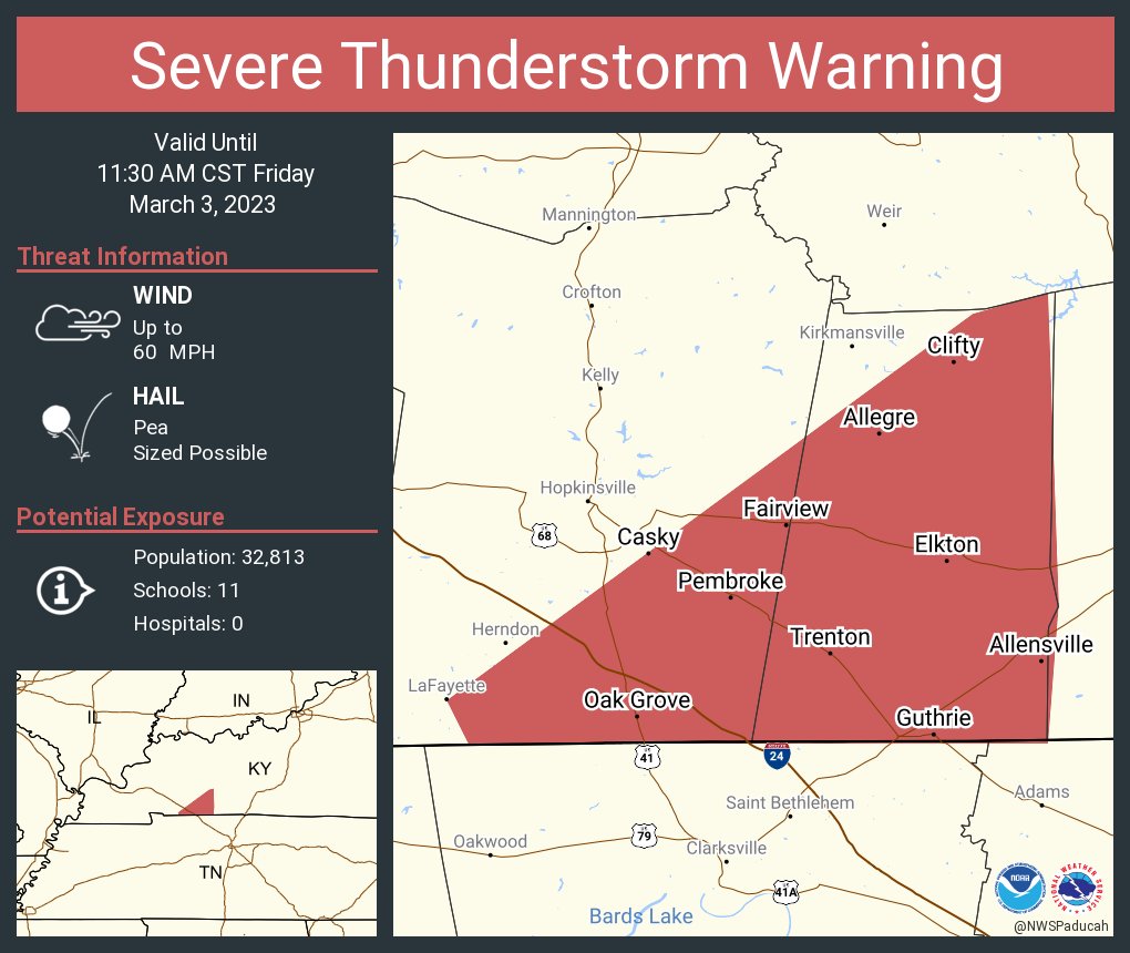
Severe Thunderstorm Warning
National Weather Service Paducah KY
1038 AM CST Fri Mar 3 2023
The National Weather Service in Paducah has issued a
* Severe Thunderstorm Warning for…
Southeastern Christian County in south central Kentucky…
Todd County in south central Kentucky…
* Until 1130 AM CST.
* At 1038 AM CST, severe thunderstorms were located along a line
extending from near Fort Campbell to 10 miles northeast of Erin,
moving northeast at 60 mph.
HAZARD…60 mph wind gusts.
SOURCE…Radar indicated.
IMPACT…Expect damage to roofs, siding, and trees.
* Locations impacted include…
Oak Grove, Elkton, Fort Campbell, Clarksville, Guthrie, Pembroke,
Trenton, Justice, Allensville, Allegre and Clifty.
This includes the following highways…
Interstate 24 in Kentucky between Mile Markers 81 and 92.
Pennyrile Parkway between Mile Markers 1 and 2.
PRECAUTIONARY/PREPAREDNESS ACTIONS…
A Tornado Watch remains in effect until 100 PM CST for south central
Kentucky.
For your protection move to an interior room on the lowest floor of a
building.
A Tornado Watch remains in effect until 100 PM CST for south central
Kentucky.
.
March 3, 2023
10:22 AM
What is likely the final line of storms is entering extreme southern IL, western KY, and NW TN. Additional storms could form ahead of this line. Thus, stay alert.
This line could become severe with damaging wind. I can’t rule out short lived quick tornado spin-ups. There is a lot of spin going on aloft.
Be weather aware as these storms will move northeast at 70+ mph. Fast moving storms provide little time to seek shelter.
The NWS may have to issue some warnings over the coming hours.
Avoid flooded roadways.
Radars were down for a few minutes as I rebooted the server. They are back up now. APP, as well
Radars and Lightning Data
Interactive-city-view radars. Clickable watches and warnings.
https://wtalk.co/B3XHASFZ
If the radar is not updating then try another one. If a radar does not appear to be refreshing then hit Ctrl F5. You may also try restarting your browser.
Backup radar site in case the above one is not working.
https://weathertalk.com/morani
Regional Radar
https://imagery.weathertalk.com/prx/RadarLoop.mp4
** NEW ** Zoom radar with chaser tracking abilities!
ZoomRadar
Lightning Data (zoom in and out of your local area)
https://wtalk.co/WJ3SN5UZ
…
March 3, 2023
9:44 AM
Radar shows the storms have weakened a bit. They are not rotating like they were a bit ago. They could still produce strong and gusty winds.
Since these are fast moving storms, I will keep you updated.
Additional storms are possible over the coming hours. Then, the system will pull away.
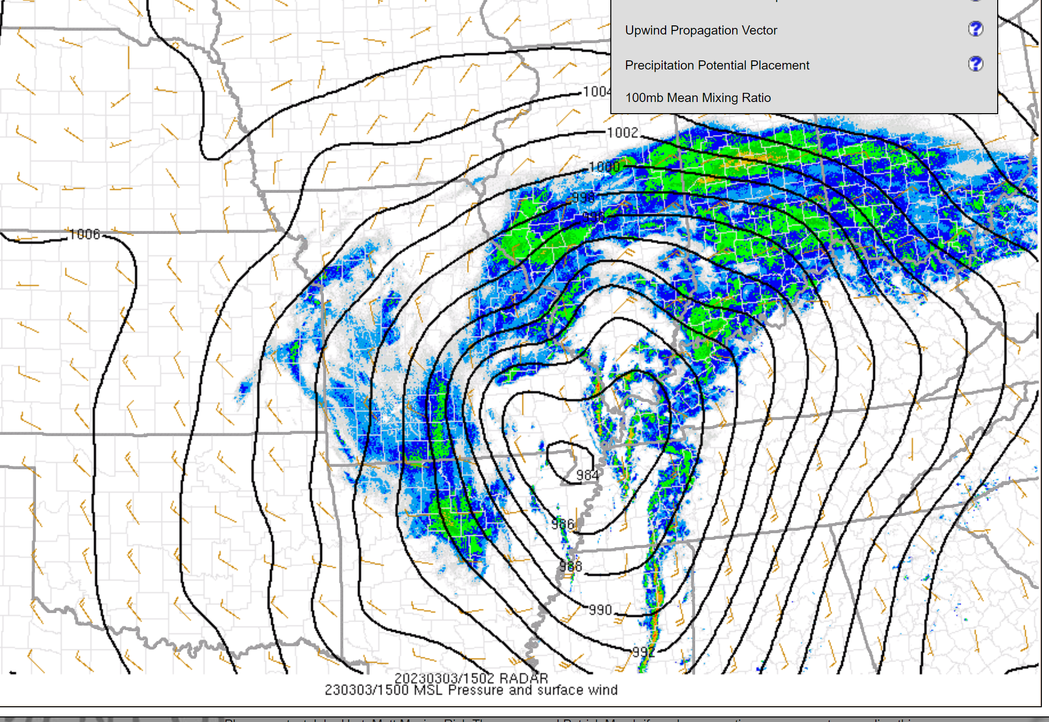
Strong gradient winds this morning and afternoon. Those will develop as the record low pressure center pulls away from the area.
Stay weather aware today.
…
March 3, 2023
9:29 AM
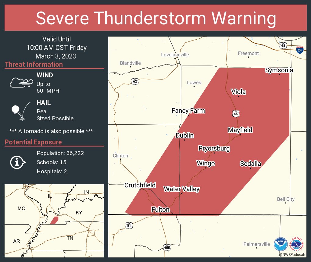
Radar shows rotation south of Water Valley, which is south of Wingo, Kentucky in southern Graves County. The storm is moving northeast at 75 mph. This storm could produce a tornado with little or no warning.
Be weather aware as this storm moves northeast. Additional warnings are possible.
….
….
….
Deep low over southeast MO. 984 mb.
March 3, 2023
9:15 AM
Eastern Obion, Weakley, Henry, Graves, Marshall, and Calloway County.
I am tracking a fast moving line of thunderstorm moving out of northwest Tennessee. Radar shows 70 mph winds right off the surface. If the surface can tap into the storm then it would bring down those winds.
The storm is moving north northeast at 75 mph. Storms today are moving very fast. Remember there is a tornado watch. A watch simply means to monitor updates. A WARNING means to take action and seek shelter.
Be weather aware in case this storm prompts the NWS to issue additional severe thunderstorm warnings.
Radars
Beau Dodson Radars and Lightning Data
Interactive local city-view radars. Clickable watches and warnings.
https://wtalk.co/B3XHASFZ
Backup radar site in case the above one is not working.
https://weathertalk.com/morani
Regional Radar
*NEW* Zoom interactive radar (with storm chaser streams)
https://wtalk.co/AVWG7GM7
Real time lightning tracker system two.
https://map.blitzortung.org/#5.02/37.95/-86.99
Lightning Data (zoom in and out of your local area)
https://wtalk.co/WJ3SN5UZ
—
March 3, 2023
8:21 AM
Extreme southeast/eastern Scott, Ballard, Pulaski, and Alexander County.
I am tracking a fast moving thunderstorm moving out of Mississippi County. Radar shows 70 mph winds right off the surface. If the surface can tap into the storm then it would bring down those winds.
The storm is moving north northeast at 85 mph. Fast mover.
Be weather aware in case this storm prompts the NWS to issue additional severe thunderstorm warnings.
Radars
Radars and Lightning Data
Interactive-city-view radars. Clickable watches and warnings.
https://wtalk.co/B3XHASFZ
If the radar is not updating then try another one. If a radar does not appear to be refreshing then hit Ctrl F5. You may also try restarting your browser.
Backup radar site in case the above one is not working.
https://weathertalk.com/morani
Regional Radar
https://imagery.weathertalk.com/prx/RadarLoop.mp4
** NEW ** Zoom radar with chaser tracking abilities!
ZoomRadar
Lightning Data (zoom in and out of your local area)
https://wtalk.co/WJ3SN5UZ
—-
March 3, 2023
7:42 AM
Eastern New Madrid, Fulton, Hickman, Mississippi, and Carlisle Counties.
I am tracking a fast moving cell coming out of northwest Tennessee. Radar shows 70 mph winds right off the surface. If the surface can tap into the storm then it would bring down those winds.
Be weather aware in case this storm becomes severe warned.
Radars
Radars and Lightning Data
Interactive-city-view radars. Clickable watches and warnings.
https://wtalk.co/B3XHASFZ
If the radar is not updating then try another one. If a radar does not appear to be refreshing then hit Ctrl F5. You may also try restarting your browser.
Backup radar site in case the above one is not working.
https://weathertalk.com/morani
Regional Radar
https://imagery.weathertalk.com/prx/RadarLoop.mp4
** NEW ** Zoom radar with chaser tracking abilities!
ZoomRadar
Lightning Data (zoom in and out of your local area)
https://wtalk.co/WJ3SN5UZ
——
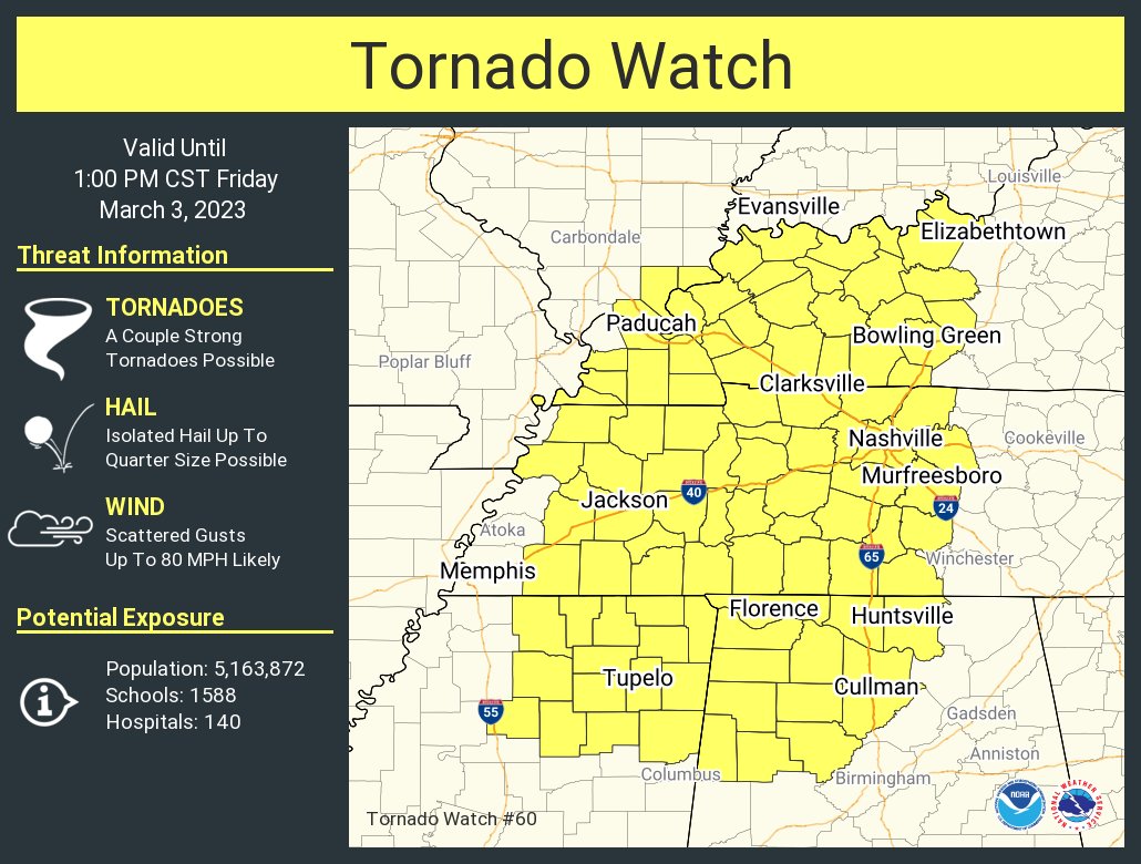
A tornado watch has been issued.
More information on the watch Storm Prediction Center Tornado Watch 60 (noaa.gov)
March 3, 2023
6:18 AM
Marshall, southern Livingston, northern Trigg, and Lyon County.
A line of severe thunderstorms is moving through Marshall County.
This line has a history of producing 60+ mph wind gusts in small patches. Be prepared for pockets of high winds as this line rapidly moves east northeast at 50+ mph.
The line will produce torrential rain with near zero visibility at the peak of the wind and rain. Not everyone will experience the wind, but pockets of wind damage will likely occur.
Radars and Lightning Data
Interactive-city-view radars. Clickable watches and warnings.
https://wtalk.co/B3XHASFZ
If the radar is not updating then try another one. If a radar does not appear to be refreshing then hit Ctrl F5. You may also try restarting your browser.
Backup radar site in case the above one is not working.
https://weathertalk.com/morani
Regional Radar
https://imagery.weathertalk.com/prx/RadarLoop.mp4
** NEW ** Zoom radar with chaser tracking abilities!
ZoomRadar
Lightning Data (zoom in and out of your local area)
https://wtalk.co/WJ3SN5UZ
A SEVERE THUNDERSTORM WARNING REMAINS IN EFFECT UNTIL 645 AM CST
FOR MARSHALL COUNTY…
At 614 AM CST, severe thunderstorms were located along a line
extending from near Reidland to near Benton to near Sedalia, moving
northeast at 50 mph.
HAZARD…60 mph wind gusts.
SOURCE…Radar indicated.
IMPACT…Expect damage to roofs, siding, and trees.
Locations impacted include…
Benton, Calvert City and Brewers.
This includes the following highways…
Interstate 24 in Kentucky between Mile Markers 19 and 29.
Interstate 69 in Kentucky between Mile Markers 34 and 51.
PRECAUTIONARY/PREPAREDNESS ACTIONS…
For your protection move to an interior room on the lowest floor of a
building.

Click one of the links below to take you directly to that section
Do you have any suggestions or comments? Email me at beaudodson@usawx.com
.
.
into www.weathertalk.com and then click the payment tab. Thank you
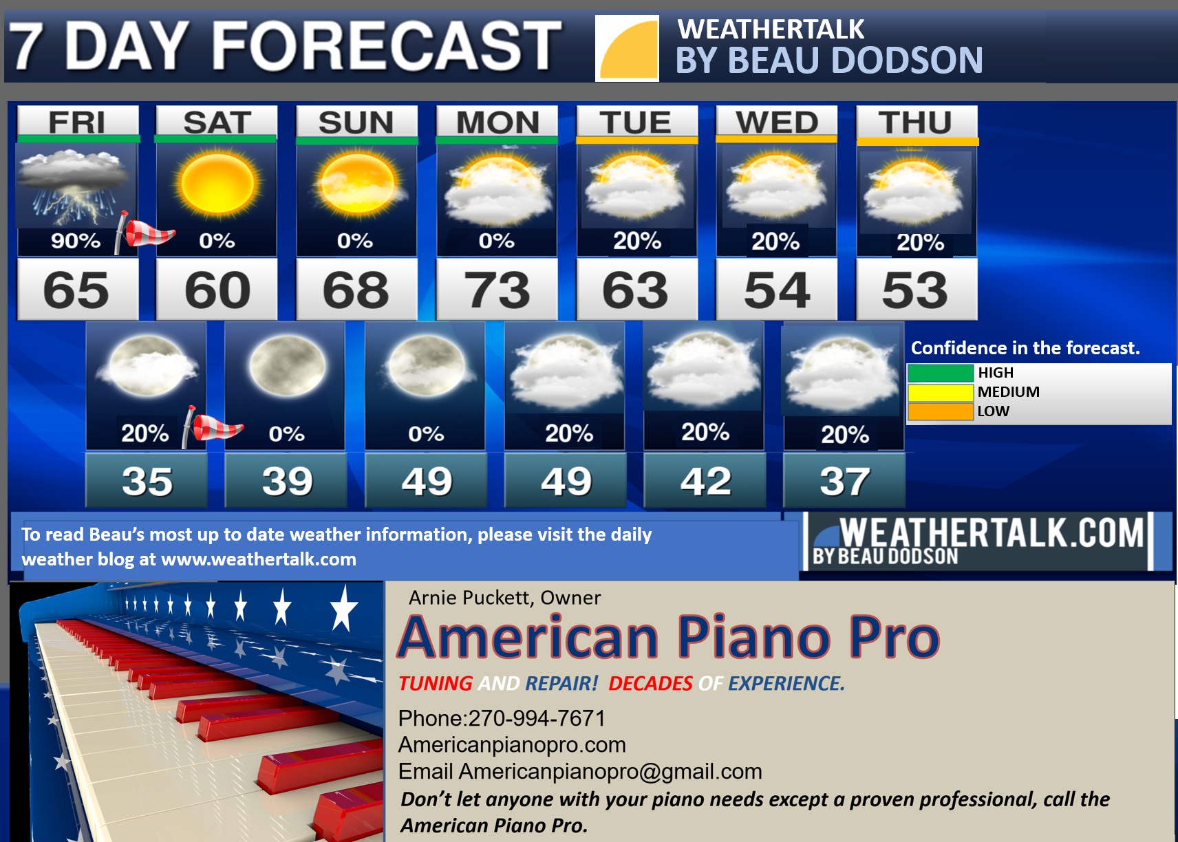
Seven-day forecast for southeast Missouri, southern Illinois, western Kentucky, and western Tennessee.
This is a BLEND for the region. Scroll down to see the region by region forecast.
THE FORECAST IS GOING TO VARY FROM LOCATION TO LOCATION. Scroll down to see the region by region forecast.
48-hour forecast
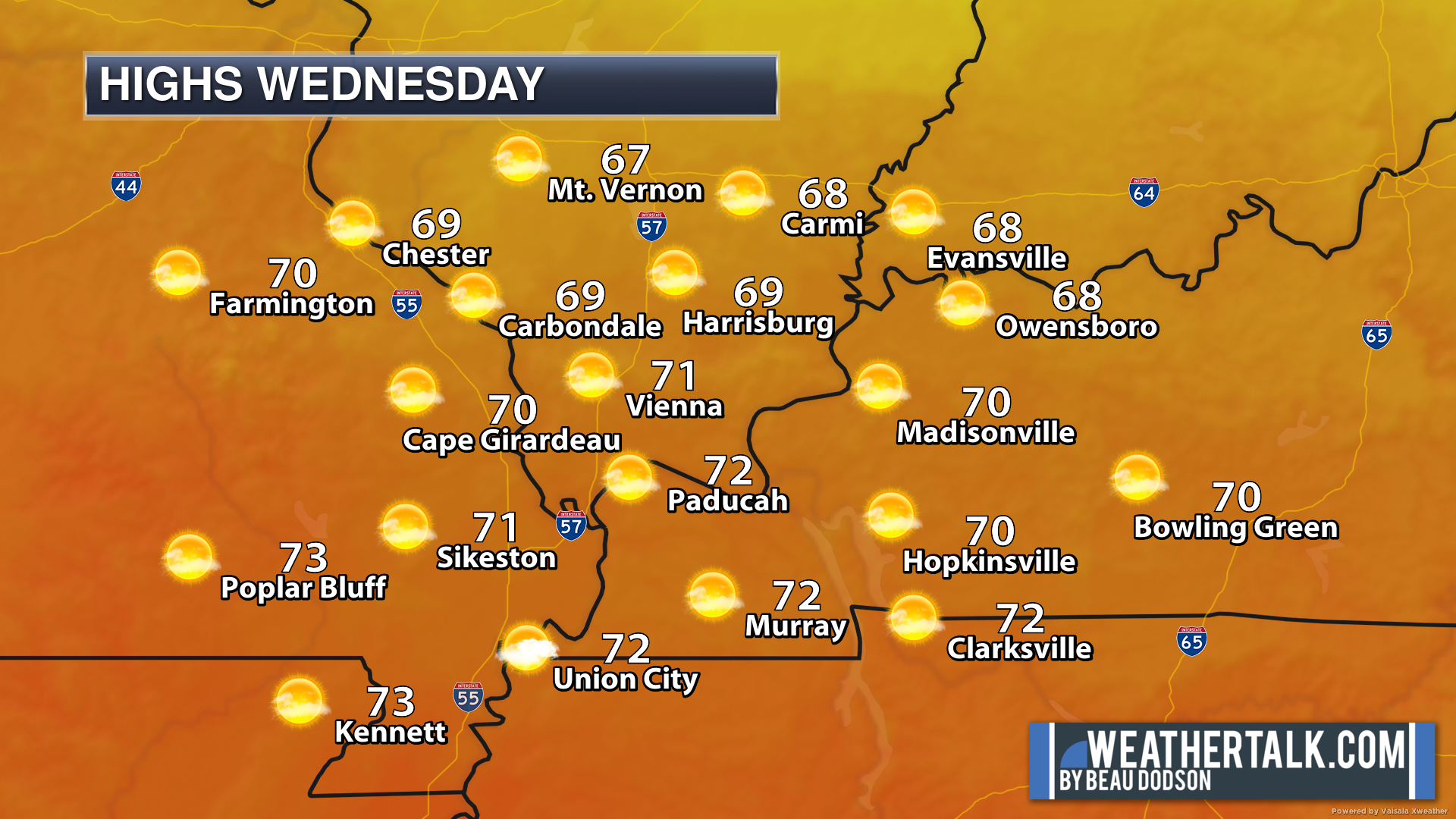
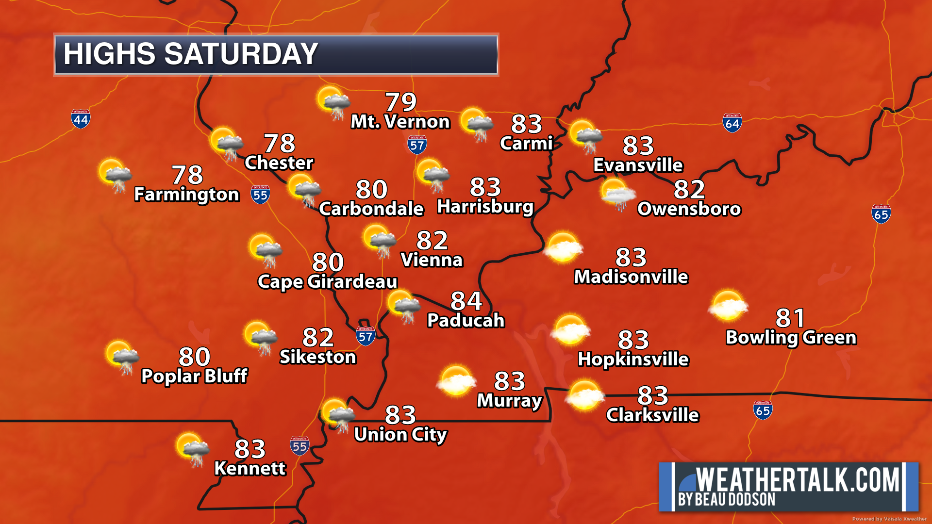
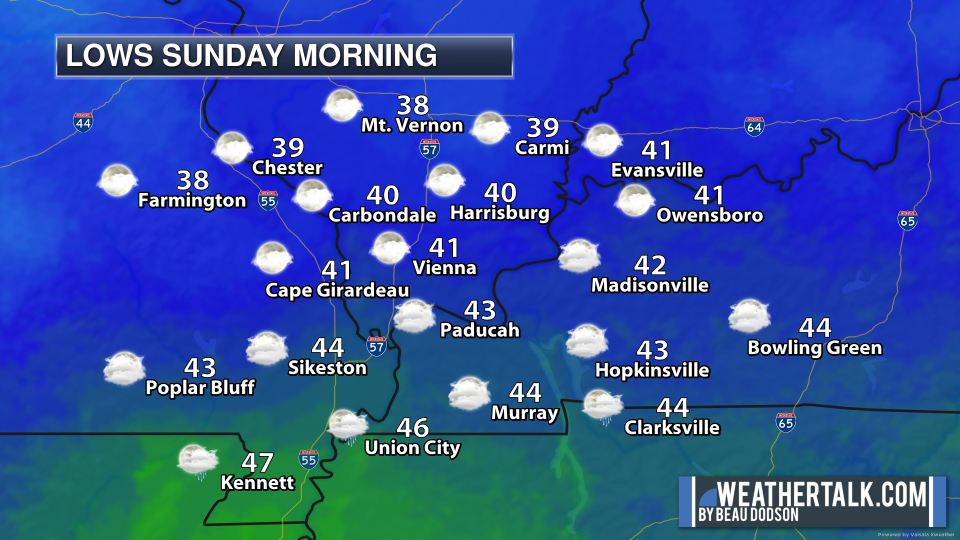
.

.
Friday to Friday
1. Is lightning in the forecast? Yes. Lightning is possible today.
2. Are severe thunderstorms in the forecast? Yes. A few storms could be severe today. Damaging wind and tornadoes will be the concern.
3. Is flash flooding in the forecast? Yes. Heavy rain is likely today. Area-wide rain totals of one to two inches with pockets of two to four inches.
4. Will the wind chill dip below 10 degrees? No.
5. Is measurable snow and/or sleet in the forecast? No.
6. Is freezing rain/ice in the forecast? No.
Freezing rain is rain that falls and instantly freezes on objects such as trees and power lines
6. Will the heat index exceed 100 degrees? No.
.
.
Friday, March 3, 2023
Confidence in the forecast? High Confidence
Friday Forecast: Mostly cloudy with a chance of showers and thunderstorms. Temperatures will vary based on frontal boundaries.
What is the chance of precipitation?
Far northern southeast Missouri ~ 80%
Southeast Missouri ~ 80%
The Missouri Bootheel ~ 80%
I-64 Corridor of southern Illinois ~ 80%
Southern Illinois ~ 80%
Extreme southern Illinois (southern seven counties) ~ 80%
Far western Kentucky ~ 80%
The Pennyrile area of western KY ~ 80%
Northwest Kentucky (near Indiana border) ~ 80%
Northwest Tennessee ~ 80%
Coverage of precipitation: Numerous.
Timing of the precipitation: Any given point of time.
Temperature range:
Far northern southeast Missouri ~ 48° to 52°
Southeast Missouri ~ 52° to 54°
The Missouri Bootheel ~ 58° to 62°
I-64 Corridor of southern Illinois ~ 50° to 55°
Southern Illinois ~ 52° to 54°
Extreme southern Illinois (southern seven counties) ~ 52° to 54°
Far western Kentucky ~ 52° to 54°
The Pennyrile area of western KY ~ 60° to 62°
Northwest Kentucky (near Indiana border) ~ 53° to 56°
Northwest Tennessee ~ 63° to 66°
Winds will be from this direction: East becoming south southwest becoming west 15 to 40 mph with gusts above 50 mph possible.
Wind chill or heat index (feels like) temperature forecast: 45° to 55°
What impacts are anticipated from the weather? Wet roadways. Locally heavy rain. Monitor the risk of severe weather early in the morning.
Should I cancel my outdoor plans? Have a plan B.
UV Index: 3. Moderate
Sunrise: 6:24 AM
Sunset: 5:51 PM
.
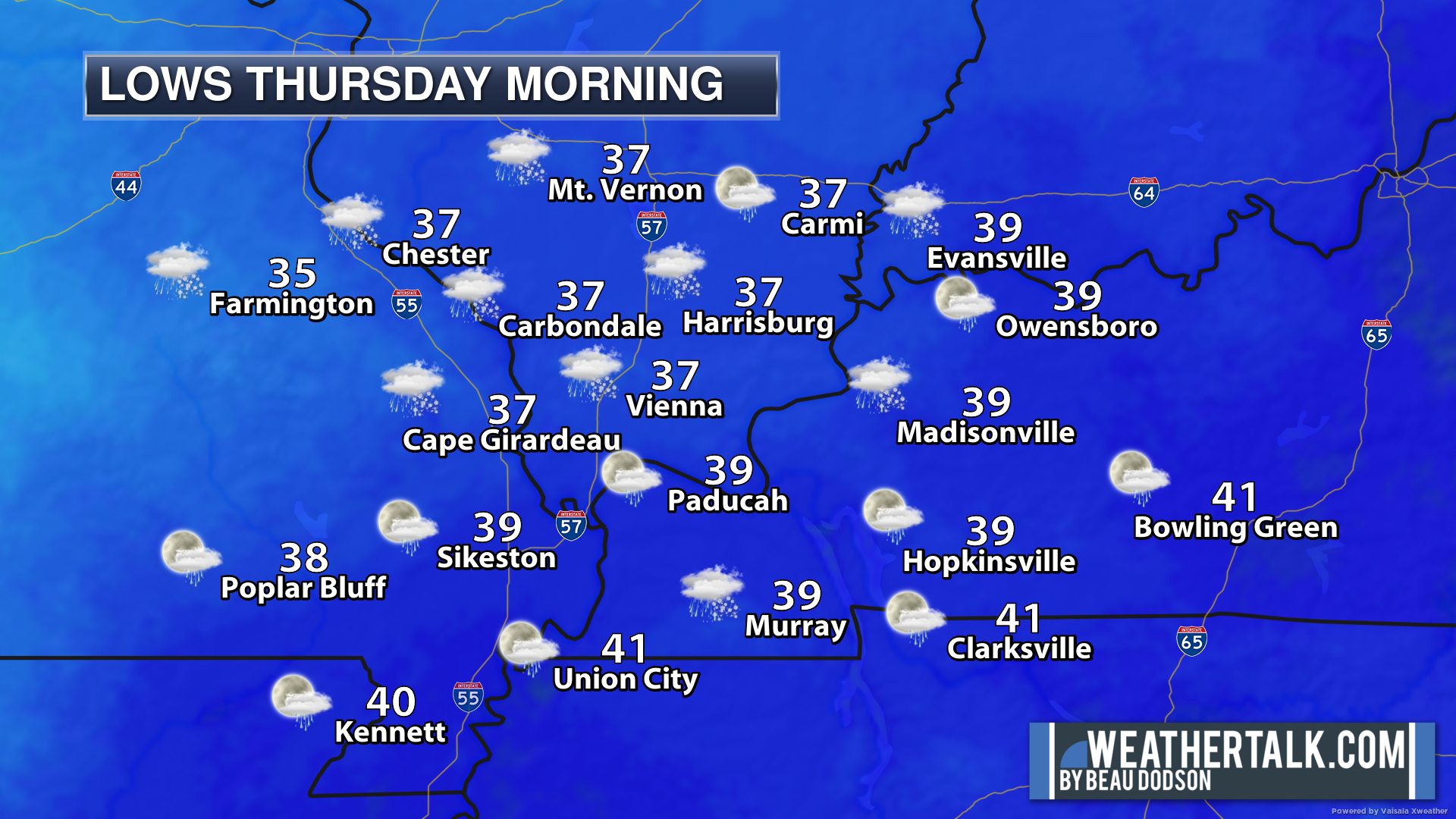
Friday night Forecast: Mostly cloudy early. Decreasing clouds. A slight chance of an early evening shower over Illinois and Kentucky.
What is the chance of precipitation?
Far northern southeast Missouri ~ 0%
Southeast Missouri ~ 0%
The Missouri Bootheel ~ 0%
I-64 Corridor of southern Illinois ~ 20%
Southern Illinois ~ 20%
Extreme southern Illinois (southern seven counties) ~ 10%
Far western Kentucky ~ 10%
The Pennyrile area of western KY ~ 20%
Northwest Kentucky (near Indiana border) ~ 20%
Northwest Tennessee ~ 0%
Coverage of precipitation: Isolated
Timing of the precipitation: Before 7 PM
Temperature range:
Far northern southeast Missouri ~ 28° to 32°
Southeast Missouri ~ 33° to 36°
The Missouri Bootheel ~ 34° to 38°
I-64 Corridor of southern Illinois ~ 34° to 38°
Southern Illinois ~ 34° to 38°
Extreme southern Illinois (southern seven counties) ~ 34° to 38°
Far western Kentucky ~ 34° to 38°
The Pennyrile area of western KY ~ 34° to 38°
Northwest Kentucky (near Indiana border) ~ 34° to 38°
Northwest Tennessee ~ 34° to 38°
Winds will be from this direction: West 15 to 35 mph. Becoming northwest. Evening gusts above 40 mph possible.
Wind chill or heat index (feels like) temperature forecast: 25° to 30°
What impacts are anticipated from the weather? Monitor
Should I cancel my outdoor plans? No
Moonrise: 2:33 PM
Moonset: 4:55 AM
The phase of the moon: Waxing Gibbous
.
Saturday, March 4, 2023
Confidence in the forecast? High Confidence
Saturday Forecast: Mostly sunny.
What is the chance of precipitation?
Far northern southeast Missouri ~ 0%
Southeast Missouri ~ 0%
The Missouri Bootheel ~ 0%
I-64 Corridor of southern Illinois ~ 0%
Southern Illinois ~ 0%
Extreme southern Illinois (southern seven counties) ~ 0%
Far western Kentucky ~ 0%
The Pennyrile area of western KY ~ 0%
Northwest Kentucky (near Indiana border) ~ 0%
Northwest Tennessee ~ 0%
Coverage of precipitation:
Timing of the precipitation:
Temperature range:
Far northern southeast Missouri ~ 53° to 56°
Southeast Missouri ~ 53° to 56°
The Missouri Bootheel ~ 54° to 56°
I-64 Corridor of southern Illinois ~ 53° to 56°
Southern Illinois ~ 52° to 54°
Extreme southern Illinois (southern seven counties) ~ 53° to 56°
Far western Kentucky ~ 54° to 56°
The Pennyrile area of western KY ~ 54° to 56°
Northwest Kentucky (near Indiana border) ~ 54° to 56°
Northwest Tennessee ~ 58° to 60°
Winds will be from this direction: West northwest 8 to 16 mph.
Wind chill or heat index (feels like) temperature forecast: 48° to 54°
What impacts are anticipated from the weather?
Should I cancel my outdoor plans? No
UV Index: 3. Moderate
Sunrise: 6:22AM
Sunset: 5:52 PM
.
Saturday night Forecast: Mostly clear.
What is the chance of precipitation?
Far northern southeast Missouri ~ 0%
Southeast Missouri ~ 0%
The Missouri Bootheel ~ 0%
I-64 Corridor of southern Illinois ~ 0%
Southern Illinois ~ 0%
Extreme southern Illinois (southern seven counties) ~ 0%
Far western Kentucky ~ 0%
The Pennyrile area of western KY ~ 0%
Northwest Kentucky (near Indiana border) ~ 0%
Northwest Tennessee ~ 0%
Coverage of precipitation:
Timing of the precipitation:
Temperature range:
Far northern southeast Missouri ~ 33° to 36°
Southeast Missouri ~ 34° to 36°
The Missouri Bootheel ~ 34° to 36°
I-64 Corridor of southern Illinois ~ 33° to 36°
Southern Illinois ~ 33° to 36°
Extreme southern Illinois (southern seven counties) ~ 33° to 36°
Far western Kentucky ~ 34° to 38°
The Pennyrile area of western KY ~ 33° to 36°
Northwest Kentucky (near Indiana border) ~ 34° to 36°
Northwest Tennessee ~ 34° to 38°
Winds will be from this direction: West northwest 7 to 14 mph
Wind chill or heat index (feels like) temperature forecast: 28° to 34°
What impacts are anticipated from the weather?
Should I cancel my outdoor plans? No
Moonrise: 3:13 PM
Moonset: 5:16 AM
The phase of the moon: Waxing Gibbous
.
Sunday, March 5, 2023
Confidence in the forecast? High Confidence
Sunday Forecast: Mostly sunny.
What is the chance of precipitation?
Far northern southeast Missouri ~ 0%
Southeast Missouri ~ 0%
The Missouri Bootheel ~ 0%
I-64 Corridor of southern Illinois ~ 0%
Southern Illinois ~ 0%
Extreme southern Illinois (southern seven counties) ~ 0%
Far western Kentucky ~ 0%
The Pennyrile area of western KY ~ 0%
Northwest Kentucky (near Indiana border) ~ 0%
Northwest Tennessee ~ 0%
Coverage of precipitation:
Timing of the precipitation:
Temperature range:
Far northern southeast Missouri ~ 62° to 64°
Southeast Missouri ~ 62° to 64°
The Missouri Bootheel ~ 64° to 68°
I-64 Corridor of southern Illinois ~ 62° to 64°
Southern Illinois ~ 62° to 65°
Extreme southern Illinois (southern seven counties) ~ 63° to 66°
Far western Kentucky ~ 64° to 66°
The Pennyrile area of western KY ~ 64° to 66°
Northwest Kentucky (near Indiana border) ~ 60° to 64°
Northwest Tennessee ~ 64° to 68°
Winds will be from this direction: East southeast 8 to 16 mph
Wind chill or heat index (feels like) temperature forecast: 55° to 65°
What impacts are anticipated from the weather?
Should I cancel my outdoor plans? No
UV Index: 3. Moderate
Sunrise: 6:21AM
Sunset: 5:53 PM
.
Sunday night Forecast: Mostly clear.
What is the chance of precipitation?
Far northern southeast Missouri ~ 0%
Southeast Missouri ~ 0%
The Missouri Bootheel ~ 0%
I-64 Corridor of southern Illinois ~ 0%
Southern Illinois ~ 0%
Extreme southern Illinois (southern seven counties) ~ 0%
Far western Kentucky ~ 0%
The Pennyrile area of western KY ~ 0%
Northwest Kentucky (near Indiana border) ~ 0%
Northwest Tennessee ~ 0%
Coverage of precipitation:
Timing of the precipitation:
Temperature range:
Far northern southeast Missouri ~ 44° to 48°
Southeast Missouri ~ 44° to 48°
The Missouri Bootheel ~ 44° to 48°
I-64 Corridor of southern Illinois ~ 44° to 48°
Southern Illinois ~ 44° to 48°
Extreme southern Illinois (southern seven counties) ~ 44° to 48°
Far western Kentucky ~ 44° to 48°
The Pennyrile area of western KY ~ 44° to 48°
Northwest Kentucky (near Indiana border) ~ 44° to 48°°
Northwest Tennessee ~ 44° to 48°
Winds will be from this direction: South 10 to 20 mph
Wind chill or heat index (feels like) temperature forecast: 40° to 45°
What impacts are anticipated from the weather?
Should I cancel my outdoor plans? No
Moonrise: 4:14 PM
Moonset: 5:47 AM
The phase of the moon: Waxing Gibbous
.
..![]()
** The farming portion of the blog has been moved further down. Scroll down to the weekly temperature and precipitation outlook. You will find the farming and long range graphics there. **
Click the tab below.
![]()
![]()
Click here if you would like to return to the top of the page.
.
Click here if you would like to return to the top of the page.
This outlook covers southeast Missouri, southern Illinois, western Kentucky, and far northwest Tennessee.
Today through March 5th: There will be a chance of severe weather today.
.
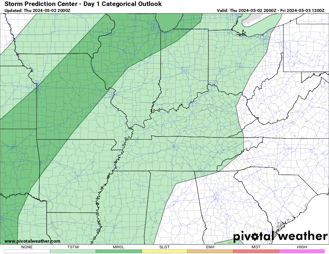
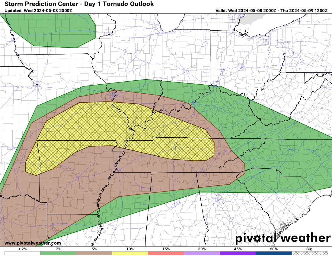
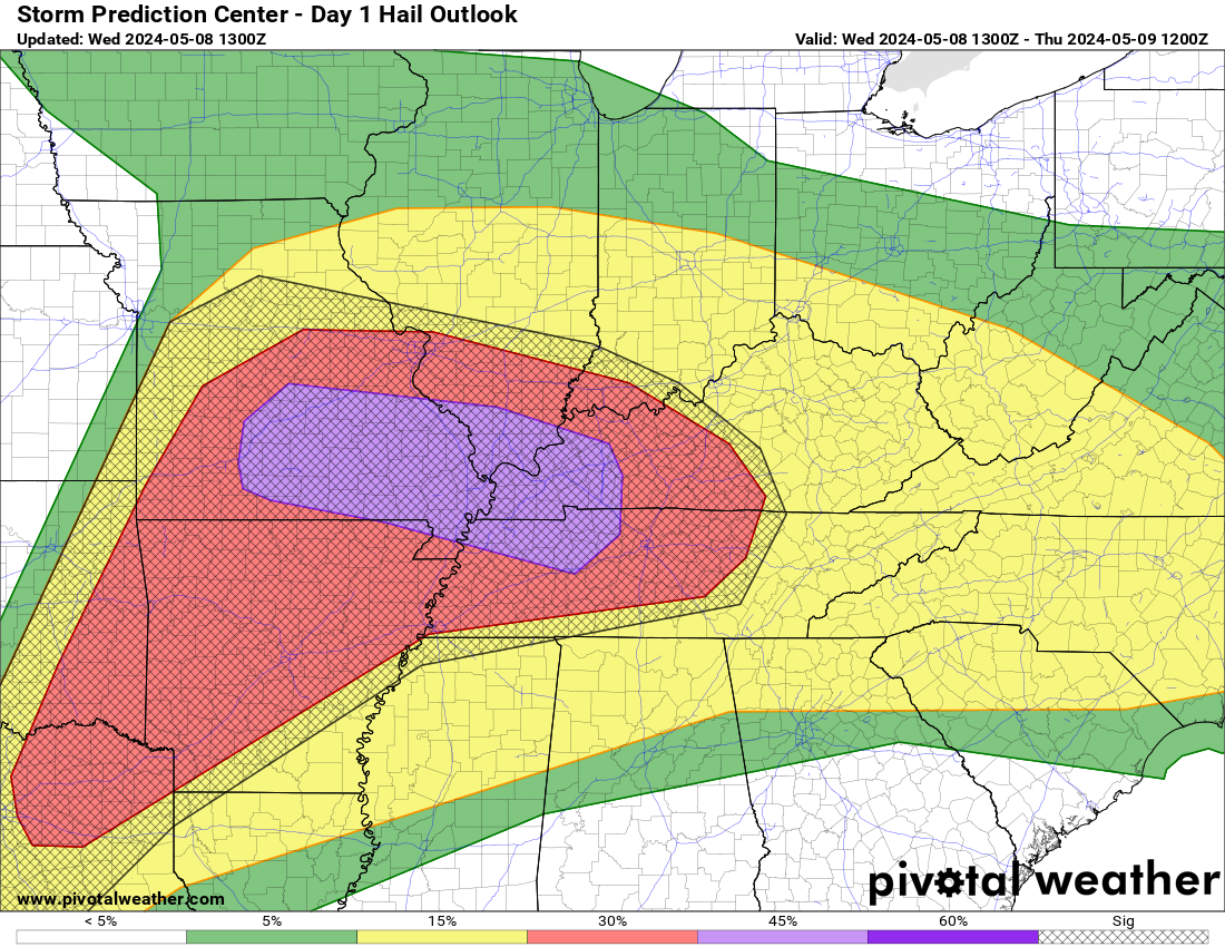
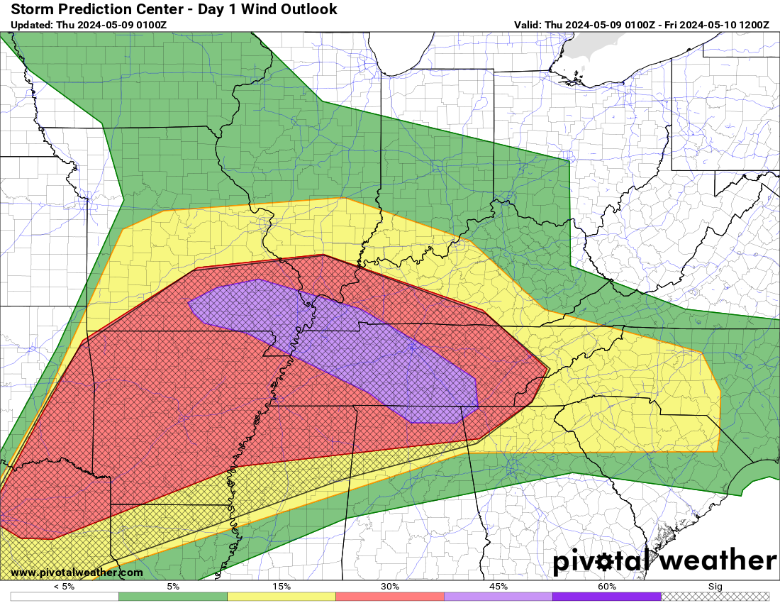
Today’s Storm Prediction Center’s Severe Weather Outlook
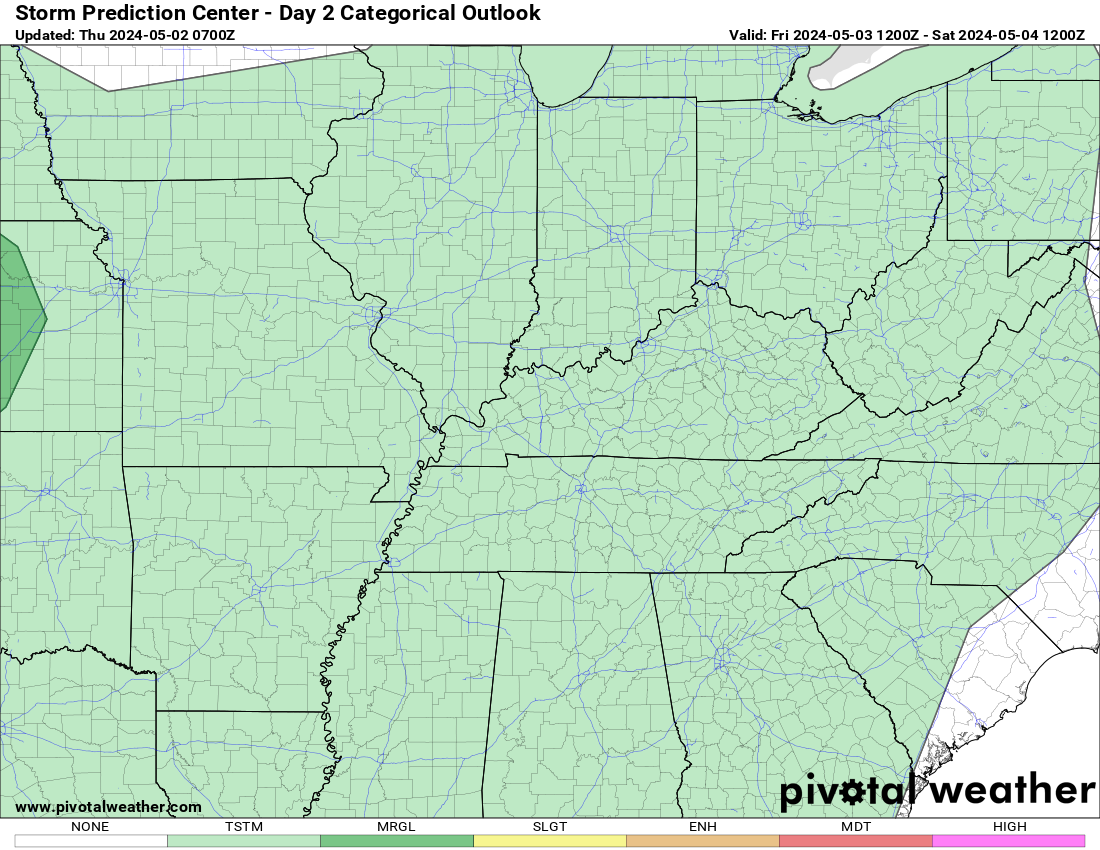
Light green is where thunderstorms may occur but should be below severe levels.
Dark green is a level one risk. Yellow is a level two risk. Orange is a level three (enhanced) risk. Red is a level four (moderate) risk. Pink is a level five (high) risk.
One is the lowest risk. Five is the highest risk.
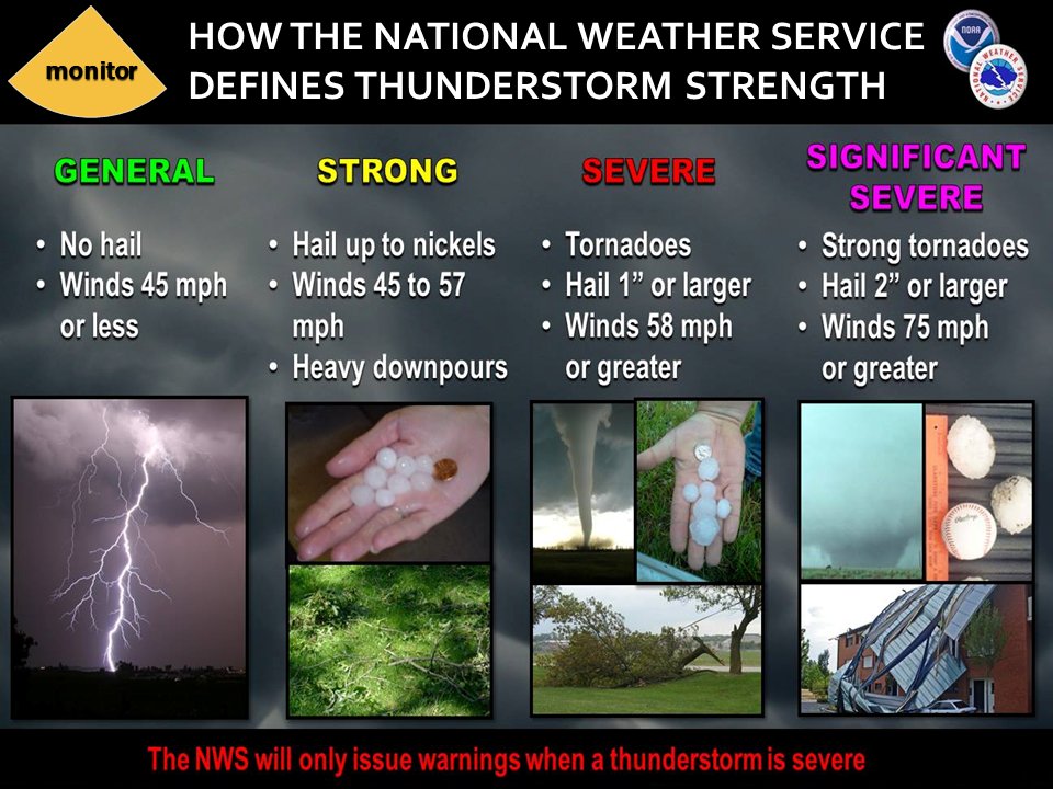
A severe storm is one that produces 58 mph wind or higher, quarter size hail, and/or a tornado.
Explanation of tables. Click here.
.
Tornado Probability Outlook
.
Large Hail Probability Outlook
.
High wind Probability Outlook
.
Tomorrow’s severe weather outlook.
.
Day Three Severe Weather Outlook
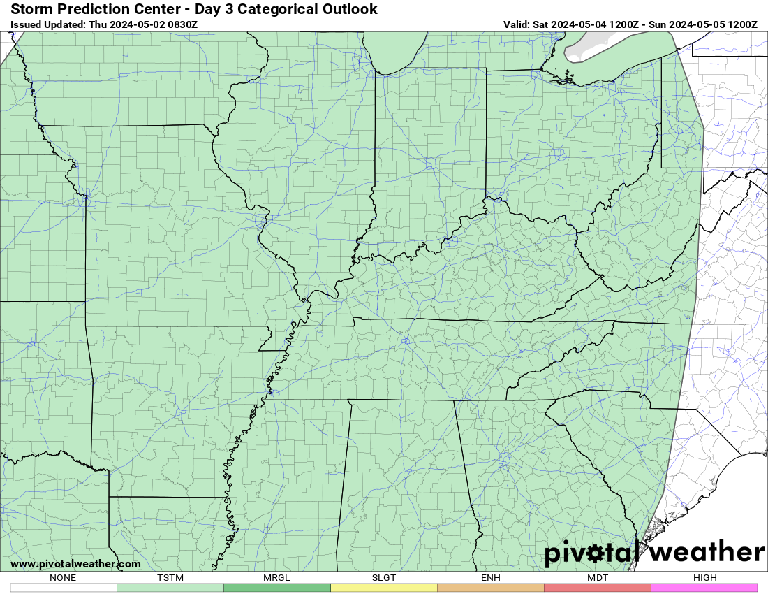
.

.
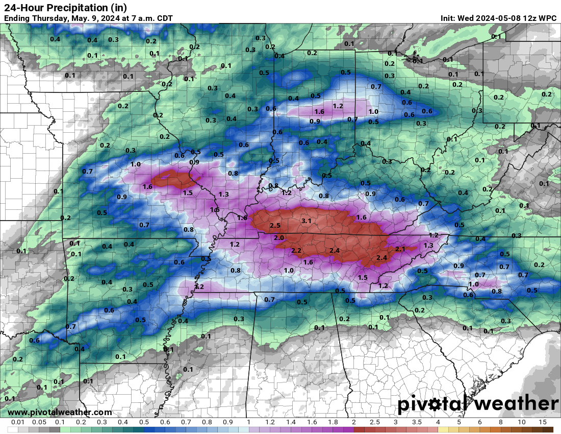
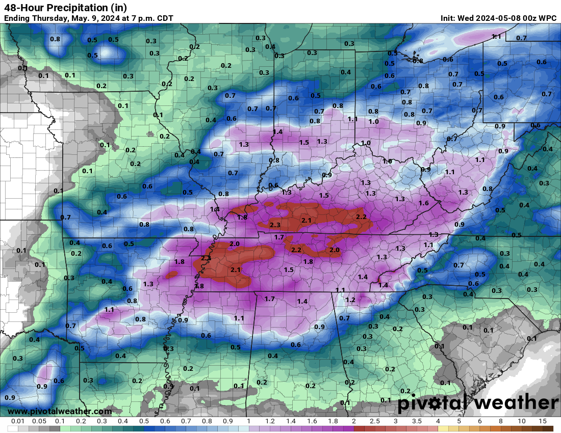
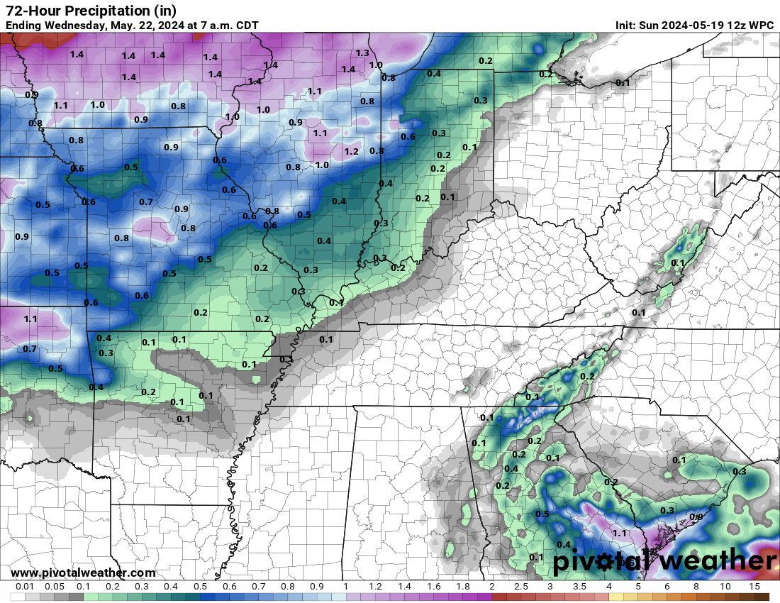
The images below are from NOAA’s Weather Prediction Center.
24-hour precipitation outlook..
 .
.
.
48-hour precipitation outlook.
.
.
72-hour precipitation outlook.
.
.
Weather Discussion
-
- Severe weather thread today
Weather advice:
Monitor your app for updates tonight and tomorrow morning.
Avoid flooded roadways. It seems every event we have people having to be rescued by emergency management, police, and fire departments. Driving into flood waters is not safe.
Forecast Discussion
Today’s focus is on severe weather only.
![]()
.

Click here if you would like to return to the top of the page.
Again, as a reminder, these are models. They are never 100% accurate. Take the general idea from them.
What should I take from these?
- The general idea and not specifics. Models usually do well with the generalities.
- The time-stamp is located in the upper left corner.
.
What am I looking at?
You are looking at different models. Meteorologists use many different models to forecast the weather. All models are wrong. Some are more wrong than others. Meteorologists have to make a forecast based on the guidance/models.
I show you these so you can see what the different models are showing as far as precipitation. If most of the models agree, then the confidence in the final weather forecast increases.
You can see my final forecast at the top of the page.
Occasionally, these maps are in Zulu time. 12z=7 AM. 18z=1 PM. 00z=7 PM. 06z=1 AM
Green represents light rain. Dark green represents moderate rain. Yellow and orange represent heavy rain.
Red represents freezing rain. Purple represents sleet. Blue represents snow. Dark blue represents heavy snow.
.
This animation is the HRW FV3 high resolution model.
This animation shows you what radar might look like as the next system pulls through the region. It is a future-cast radar.
Occasionally, these maps are in Zulu time. 12z=7 AM. 18z=1 PM. 00z=7 PM. 06z=1 AM
Green represents light rain. Dark green represents moderate rain. Yellow and orange represent heavy rain.
Red represents freezing rain. Purple represents sleet. Blue represents snow. Dark blue represents heavy snow.
Time-stamp upper left. Click the animation to enlarge it.
.
This animation is the Storm Prediction Center WRF model.
This animation shows you what radar might look like as the next system pulls through the region. It is a future-cast radar.
Time-stamp upper left. Click the animation to enlarge it.
Occasionally, these maps are in Zulu time. 12z=7 AM. 18z=1 PM. 00z=7 PM. 06z=1 AM
Green represents light rain. Dark green represents moderate rain. Yellow and orange represent heavy rain.
Red represents freezing rain. Purple represents sleet. Blue represents snow. Dark blue represents heavy snow.
Time-stamp upper left. Click the animation to enlarge it.
.
This animation is the Hrrr short-range model.
This animation shows you what radar might look like as the next system pulls through the region. It is a future-cast radar.
Occasionally, these maps are in Zulu time. 12z=7 AM. 18z=1 PM. 00z=7 PM. 06z=1 AM
Green represents light rain. Dark green represents moderate rain. Yellow and orange represent heavy rain.
Red represents freezing rain. Purple represents sleet. Blue represents snow. Dark blue represents heavy snow.
Time-stamp upper left. Click the animation to enlarge it.
Models are not picking up on much precipitation through Sunday night.
They show scattered sprinkles or flurries today into tomorrow.
You can barely see them on these graphics.
.
This animation is the higher resolution 3K NAM American Model.
Occasionally, these maps are in Zulu time. 12z=7 AM. 18z=1 PM. 00z=7 PM. 06z=1 AM
Green represents light rain. Dark green represents moderate rain. Yellow and orange represent heavy rain.
Red represents freezing rain. Purple represents sleet. Blue represents snow. Dark blue represents heavy snow.
Time-stamp upper left. Click the animation to enlarge it.
.
This next animation is the lower-resolution NAM American Model.
This animation shows you what radar might look like as the system pulls through the region. It is a future-cast radar.
Occasionally, these maps are in Zulu time. 12z=7 AM. 18z=1 PM. 00z=7 PM. 06z=1 AM
Green represents light rain. Dark green represents moderate rain. Yellow and orange represent heavy rain.
Red represents freezing rain. Purple represents sleet. Blue represents snow. Dark blue represents heavy snow.
Time-stamp upper left. Click the animation to enlarge it.
.
This next animation is the GFS American Model.
This animation shows you what radar might look like as the system pulls through the region. It is a future-cast radar.
Occasionally, these maps are in Zulu time. 12z=7 AM. 18z=1 PM. 00z=7 PM. 06z=1 AM
Green represents light rain. Dark green represents moderate rain. Yellow and orange represent heavy rain.
Red represents freezing rain. Purple represents sleet. Blue represents snow. Dark blue represents heavy snow.
Time-stamp upper left. Click the animation to enlarge it.
.
This next animation is the EC European Weather model.
This animation shows you what radar might look like as the system pulls through the region. It is a future-cast radar.
Occasionally, these maps are in Zulu time. 12z=7 AM. 18z=1 PM. 00z=7 PM. 06z=1 AM
Green represents light rain. Dark green represents moderate rain. Yellow and orange represent heavy rain.
Red represents freezing rain. Purple represents sleet. Blue represents snow. Dark blue represents heavy snow.
Time-stamp upper left. Click the animation to enlarge it.
.
This next animation is the Canadian Weather model.
This animation shows you what radar might look like as the system pulls through the region. It is a future-cast radar.
Occasionally, these maps are in Zulu time. 12z=7 AM. 18z=1 PM. 00z=7 PM. 06z=1 AM
Green represents light rain. Dark green represents moderate rain. Yellow and orange represent heavy rain.
Red represents freezing rain. Purple represents sleet. Blue represents snow. Dark blue represents heavy snow.
Time-stamp upper left. Click the animation to enlarge it.
.
.![]()
.

Double click the graphics below to enlarge them.
These graphics are usually not updated until after 10 AM
Double click on image to enlarge it
Morning long-range update (usually updated after 10:30 AM).
![]()
.

.
Click here if you would like to return to the top of the page.
.
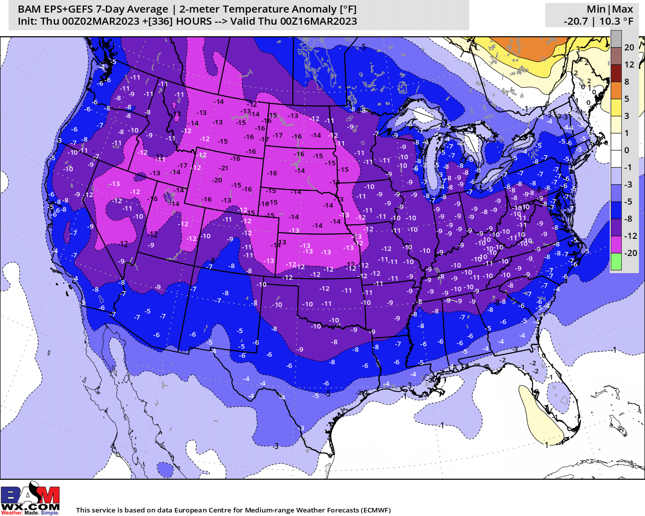
Average high temperatures for this time of the year are around 50 degrees.
Average low temperatures for this time of the year are around 35 degrees.
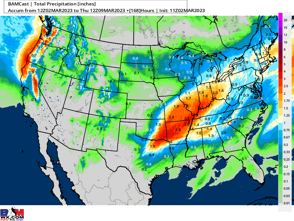
Average precipitation during this time period ranges from 0.80″ to 1.00″
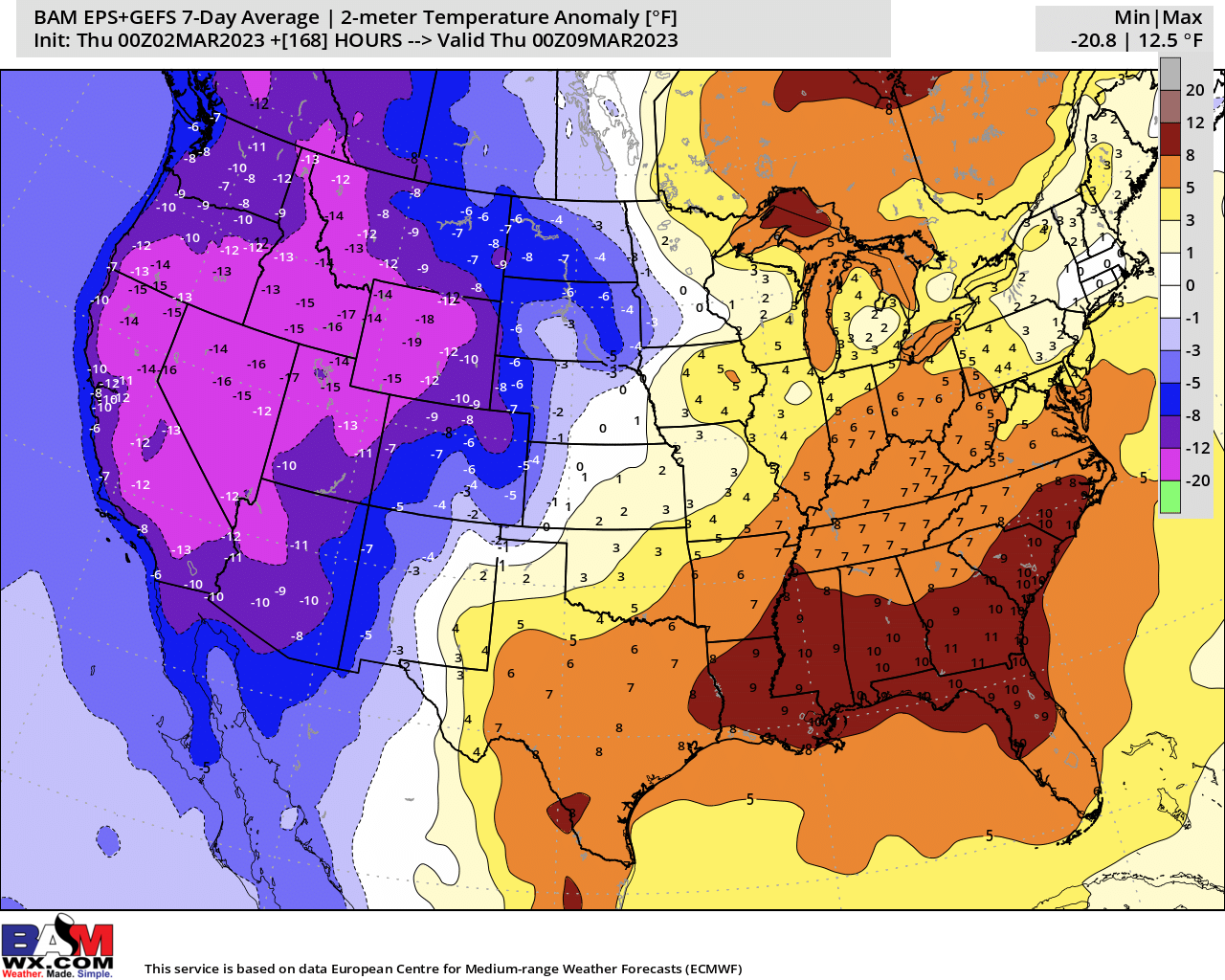
Yellow and orange colors are above average temperatures. Red is much above average. Light blue and blue are below-average temperatures. Green to purple colors represents much below-average temperatures.
Click on the image to expand it.
This outlook covers March 2, 2023 through March 8, 2023
Click on the image to expand it.

Average low temperatures for this time of the year are around 34 degrees.
Average precipitation during this time period ranges from 0.80″ to 1.00″
.
This outlook covers March 9th through March 15th
Click on the image to expand
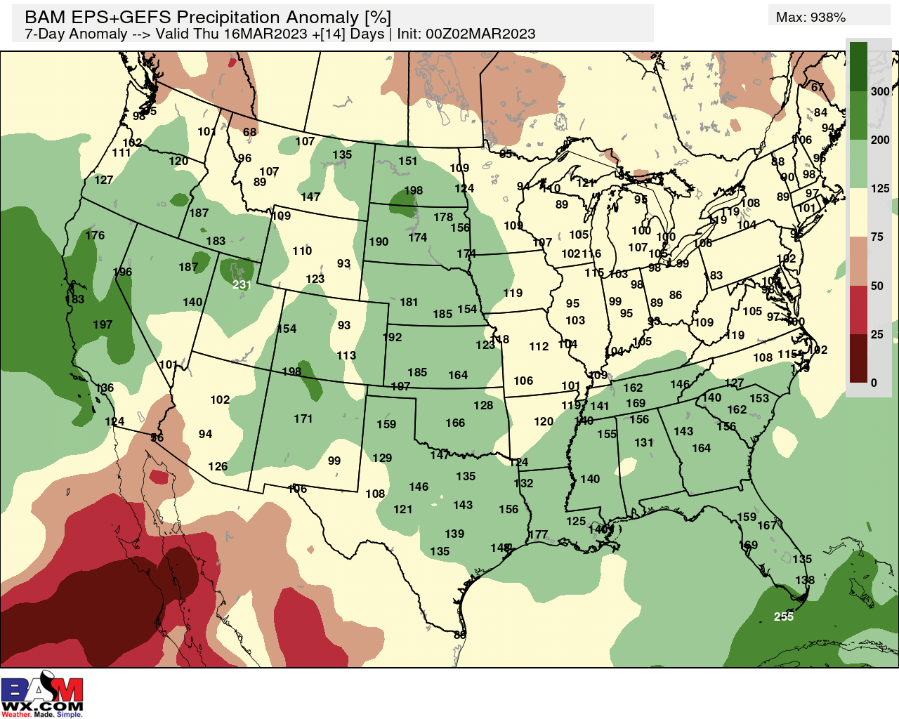
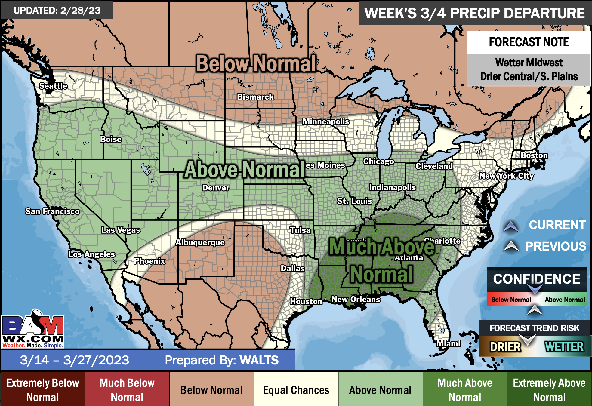
The precipitation forecast is PERCENT OF AVERAGE. Brown is below average. Green is above average. Blue is much above average.

EC = Equal chances of above or below average
BN= Below average
M/BN = Much below average
AN = Above average
M/AN = Much above average
E/AN = Extremely above average
Average low temperatures for this time of the year are around 40 degrees
Average precipitation during this time period ranges from 1.90″ to 2.40″
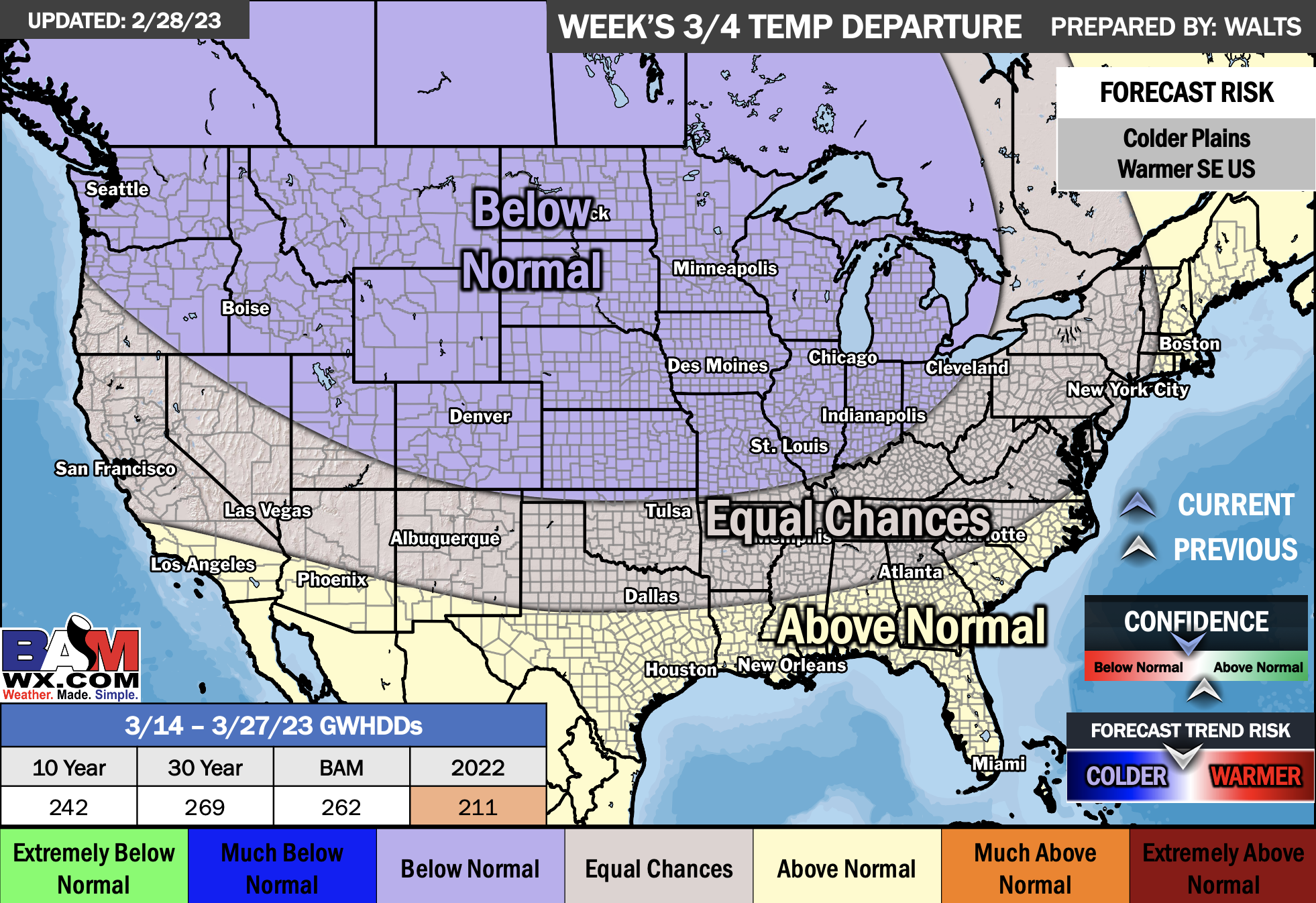
This outlook covers March 14th through March 27th
Monthly Outlooks
E/BN extremely below normal
M/BN is much below normal
EC equal chances
AN above normal
M/AN much above normal
E/AN extremely above normal
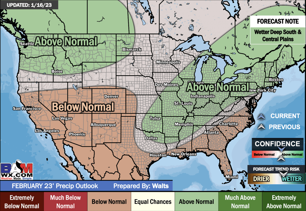
February Temperature and precipitation Outlook
Double click images to enlarge them.
E/BN extremely below normal
M/BN is much below normal
EC equal chances
AN above normal
M/AN much above normal
E/AN extremely above normal
.
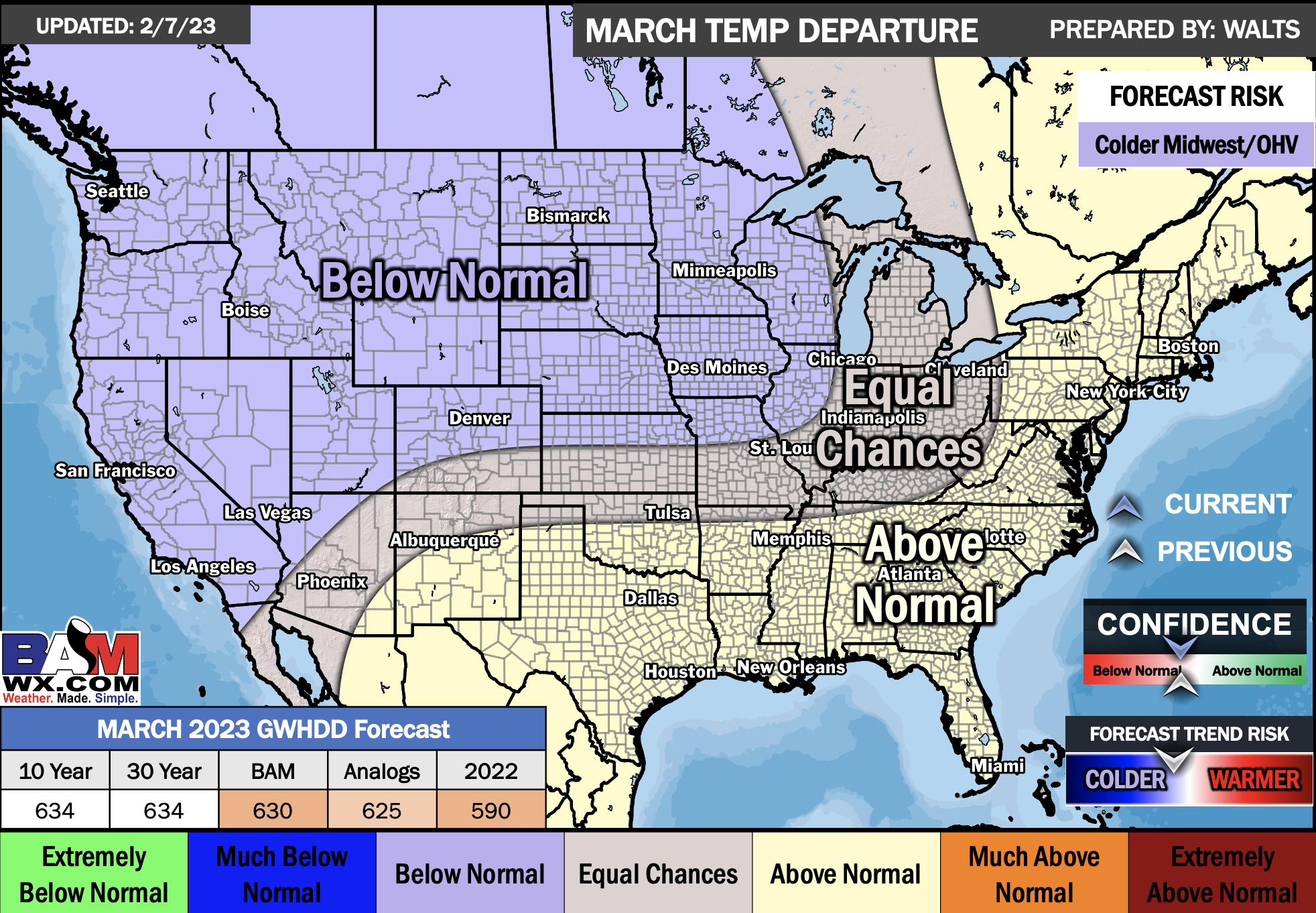
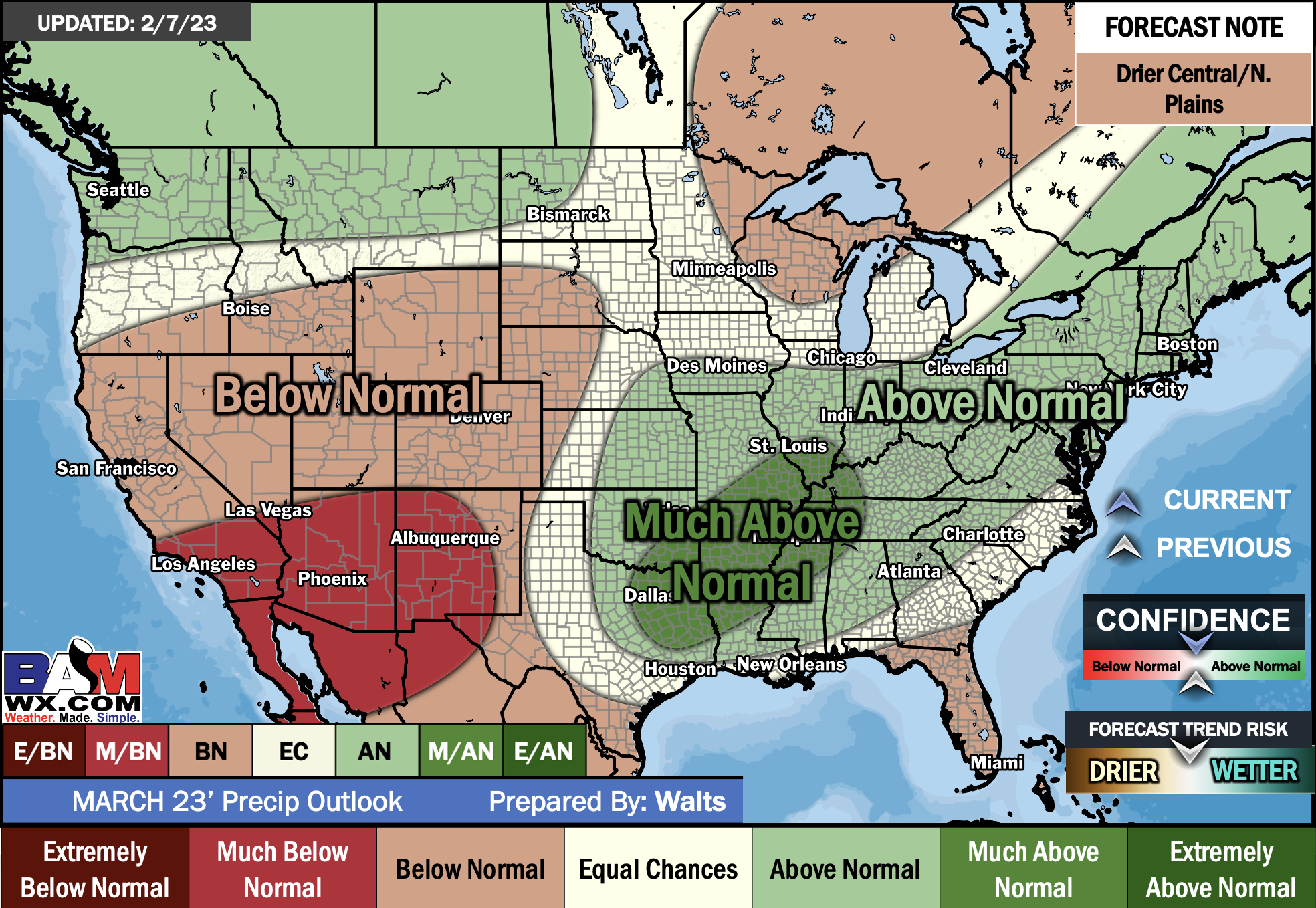
March Temperature and precipitation Outlook
Double click images to enlarge them.
.
E/BN extremely below normal
M/BN is much below normal
EC equal chances
AN above normal
M/AN much above normal
E/AN extremely above normal
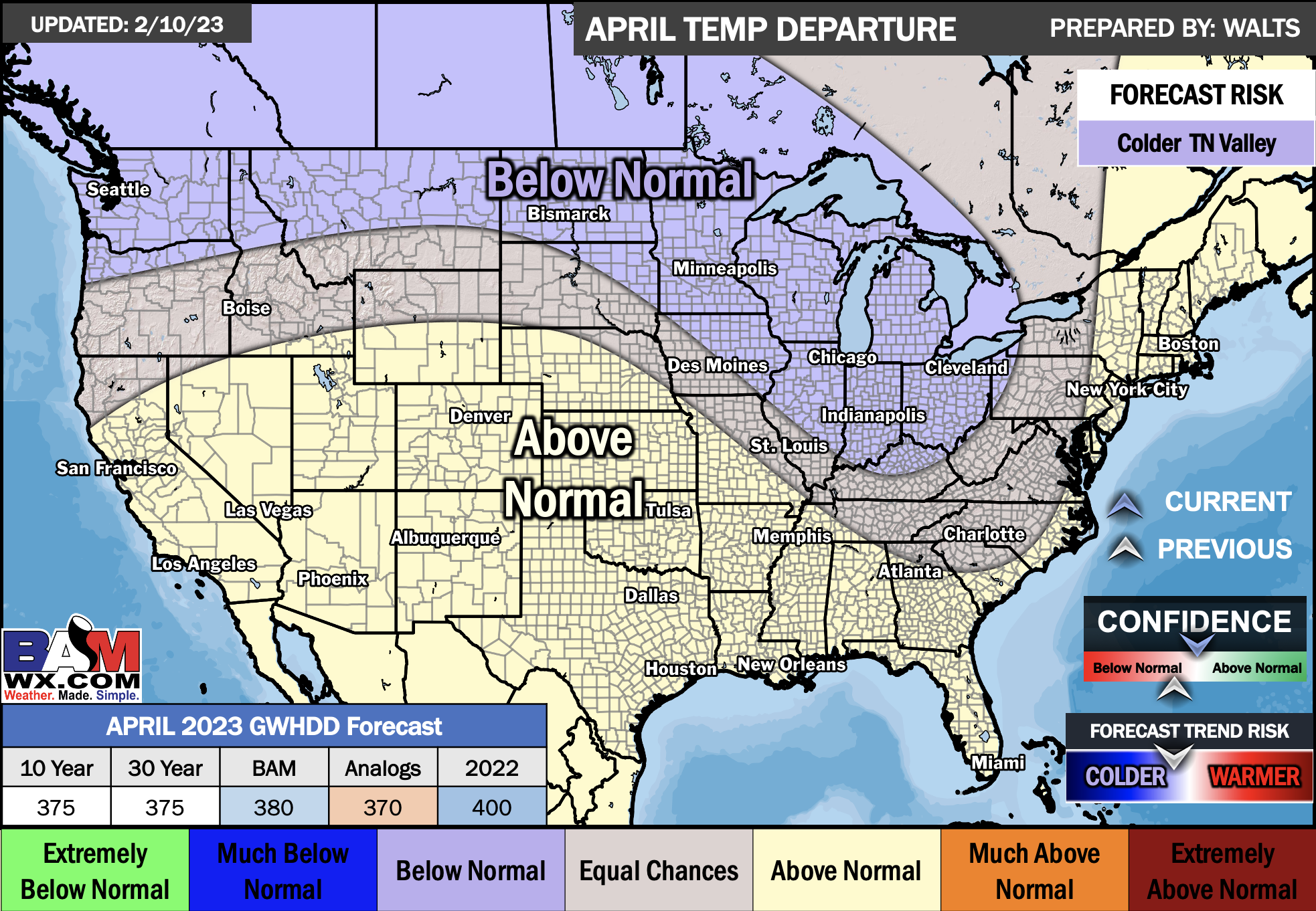
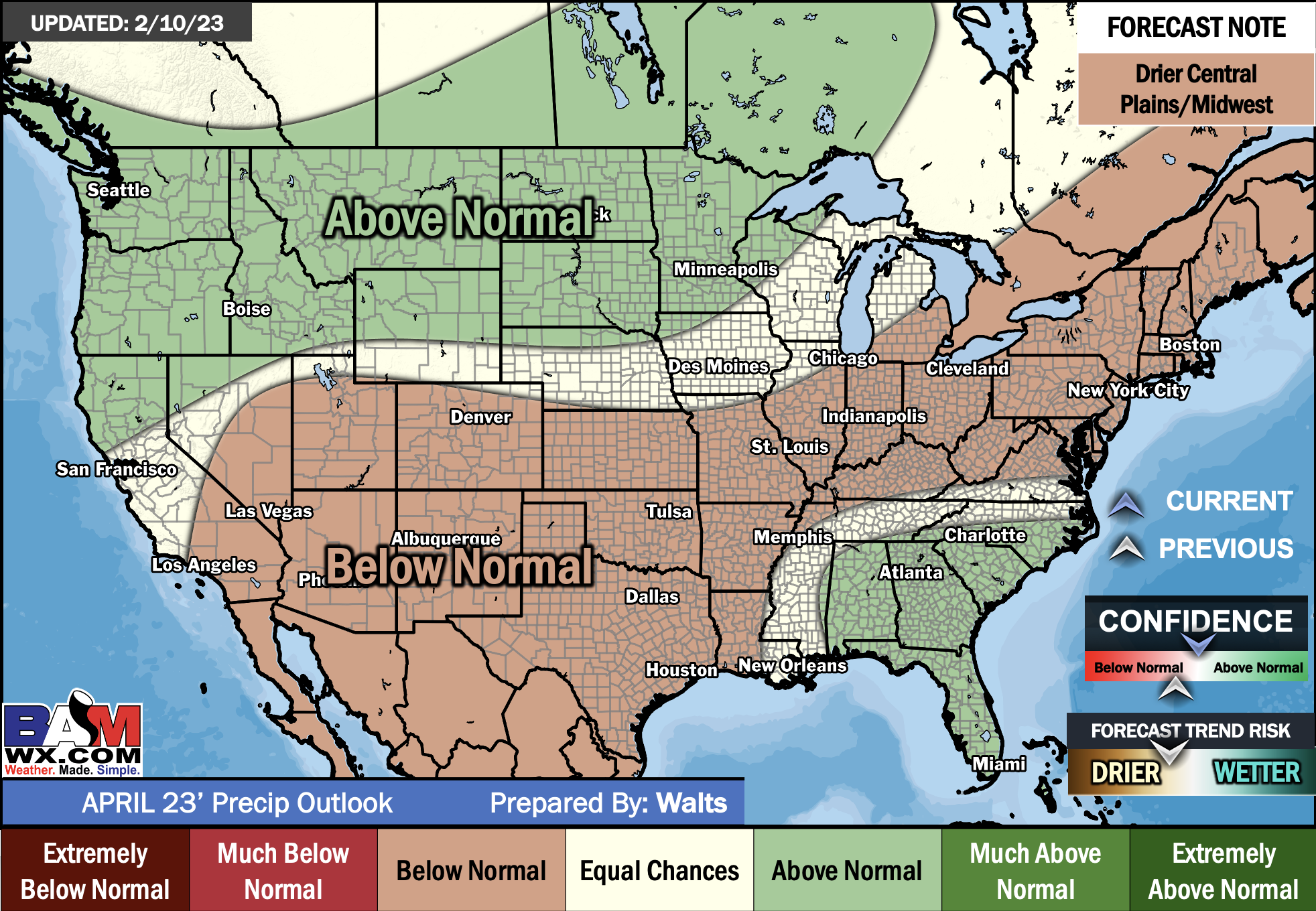
April Temperature and precipitation Outlook
Double click images to enlarge them.
.
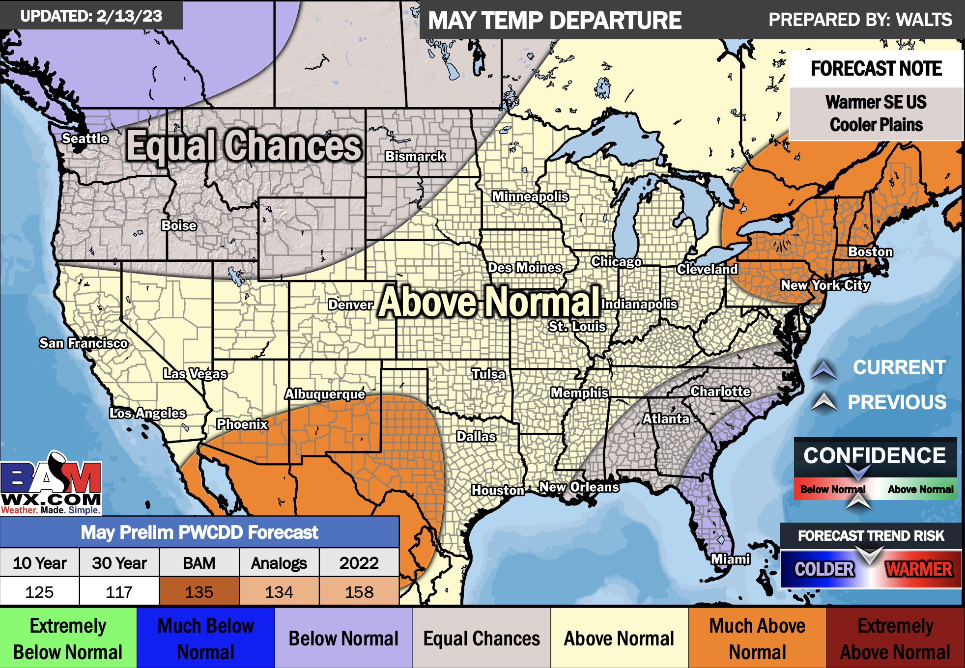
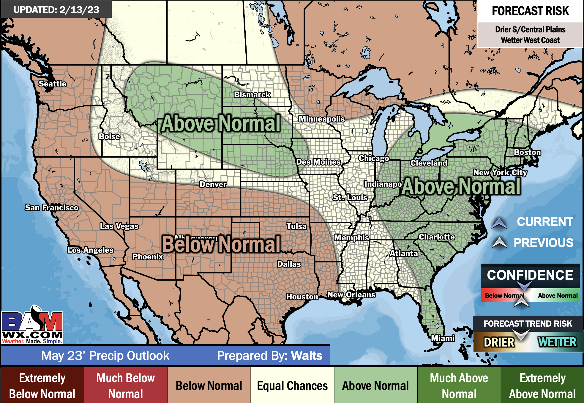
E/BN extremely below normal
M/BN is much below normal
EC equal chances
AN above normal
M/AN much above normal
E/AN extremely above normal
May Temperature and precipitation Outlook
Double click images to enlarge them.
.
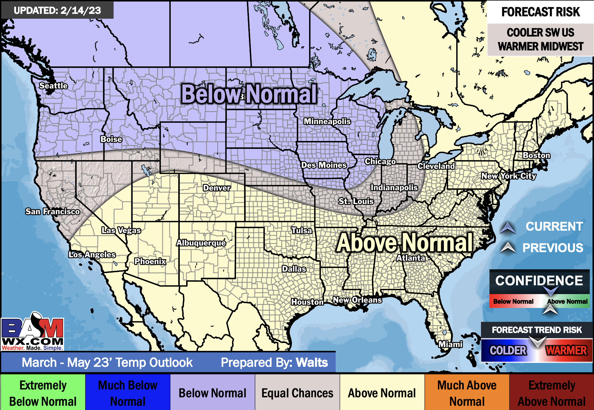
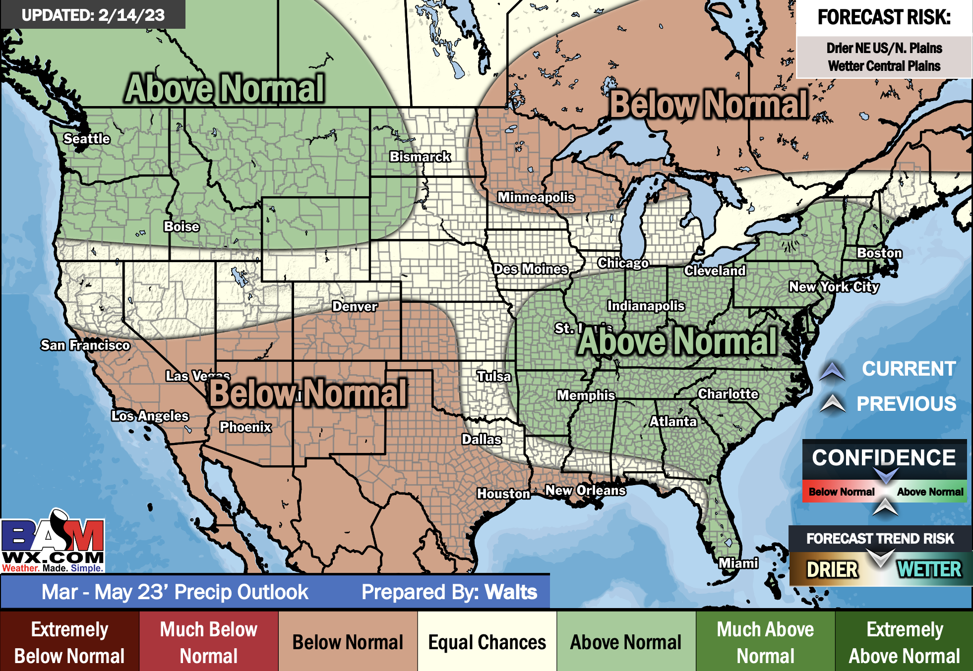
Seasonal temperature and precipitation outlook
March through May
.
![]()

Great news! The videos are now found in your WeatherTalk app and on the WeatherTalk website.
These are bonus videos for subscribers.
The app is for subscribers. Subscribe at www.weathertalk.com/welcome then go to your app store and search for WeatherTalk
Subscribers, PLEASE USE THE APP. ATT and Verizon are not reliable during severe weather. They are delaying text messages.
The app is under WeatherTalk in the app store.
Apple users click here
Android users click here
.

Radars and Lightning Data
Interactive-city-view radars. Clickable watches and warnings.
https://wtalk.co/B3XHASFZ
If the radar is not updating then try another one. If a radar does not appear to be refreshing then hit Ctrl F5. You may also try restarting your browser.
Backup radar site in case the above one is not working.
https://weathertalk.com/morani
Regional Radar
https://imagery.weathertalk.com/prx/RadarLoop.mp4
** NEW ** Zoom radar with chaser tracking abilities!
ZoomRadar
Lightning Data (zoom in and out of your local area)
https://wtalk.co/WJ3SN5UZ
Not working? Email me at beaudodson@usawx.com
National map of weather watches and warnings. Click here.
Storm Prediction Center. Click here.
Weather Prediction Center. Click here.
.

Live lightning data: Click here.
Real time lightning data (another one) https://map.blitzortung.org/#5.02/37.95/-86.99
Our new Zoom radar with storm chases
.
.

Interactive GOES R satellite. Track clouds. Click here.
GOES 16 slider tool. Click here.
College of DuPage satellites. Click here
.

Here are the latest local river stage forecast numbers Click Here.
Here are the latest lake stage forecast numbers for Kentucky Lake and Lake Barkley Click Here.
.
.
Find Beau on Facebook! Click the banner.









 .
.