

.
I have some question-and-answer threads over on the Facebook page. Link to those threads CLICK HERE
Or email me at beaudodsonweather@gmail.com
..

🌪️ Seven-Day Tornado Outlook ⛈️
August 29th through September 5th
Current risk: NONE.
Current confidence level: High confidence in the forecast.
Comments: We are not anticipating tornadoes.
.

Seven-Day Hazardous Weather Outlook
1. Is lightning in the forecast? POSSIBLE. A small chance on Monday/Monday night over portions of western KY and western TN. I am monitoring next Tuesday and Wednesday. Scattered showers and thunderstorms will develop along a cold front. A smaller chance on Thursday.
2. Are organized/widespread severe thunderstorms in the forecast? NO.
3. Is flash flooding in the forecast? NO.
4. Will non-thunderstorm winds top 40 mph? NO.
5. Will temperatures rise above 90 degrees? UNLIKELY.
6. Will temperatures rise above 100 degrees? NO.
7. Will the heat index (feels like) rise above 100 degrees? NO.
8. Will the heat index rise above 115 degrees? NO.
9. Will the temperature fall below 32 degrees? NO.
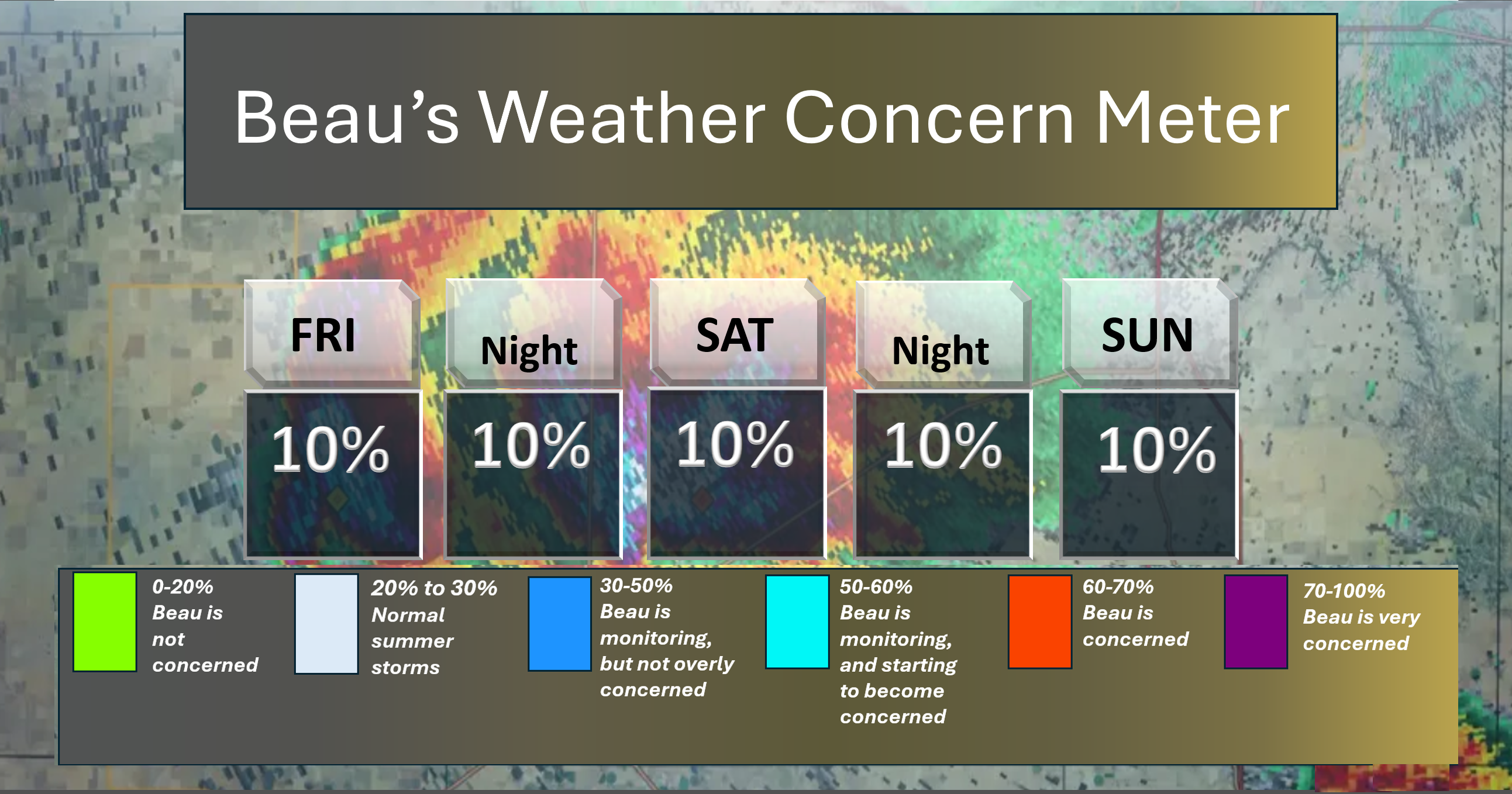
Here is the short-range concern meter..
Quiet weather. We are in the green.
.
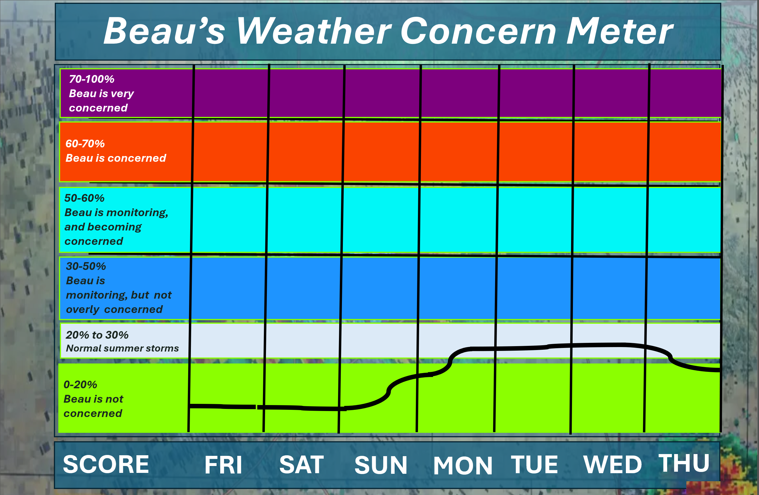
Here is the extended concern meter. This takes us through next Thursday.
Organized or widespread extreme/severe weather is not anticipated.
We are in the green through Sunday.
Isolated lightning is possible on Monday afternoon and night over western KY and western TN (small chance).
I am watching a cold front next Tuesday and Wednesday. Additional thunderstorms are possible along a cold front. At this time, severe weather is not anticipated.
A quick forecast glance. Your 48-hour forecast Graphics


.
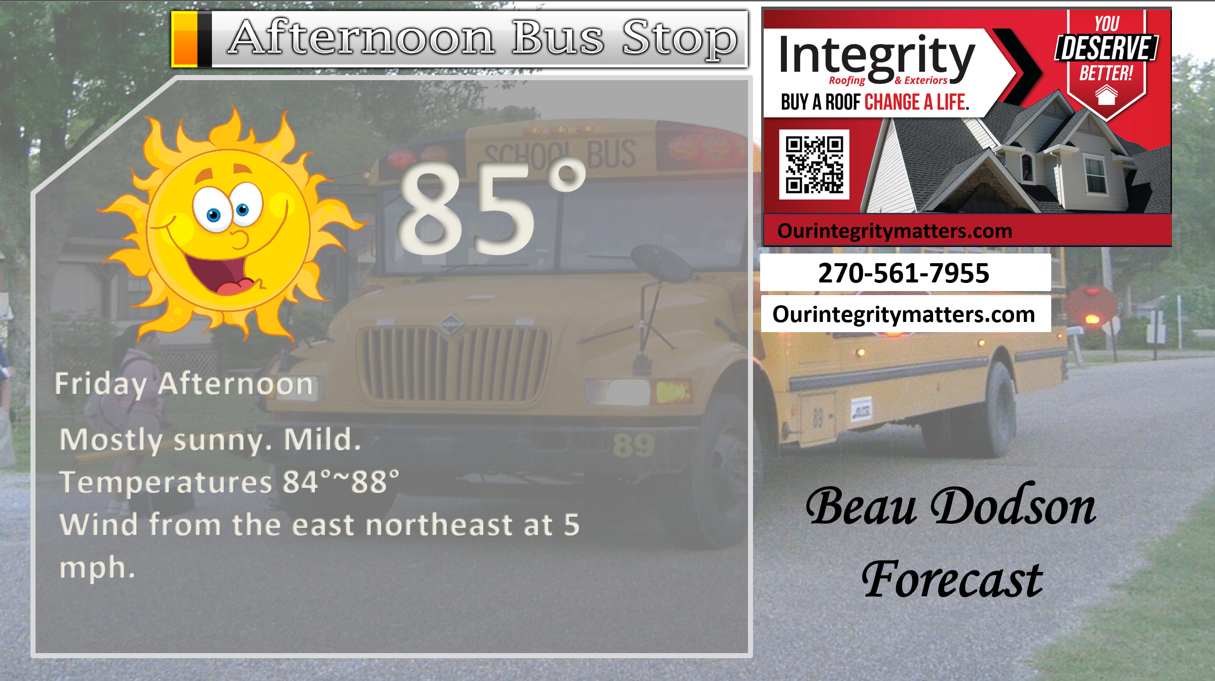
Here is your bus stop forecast.
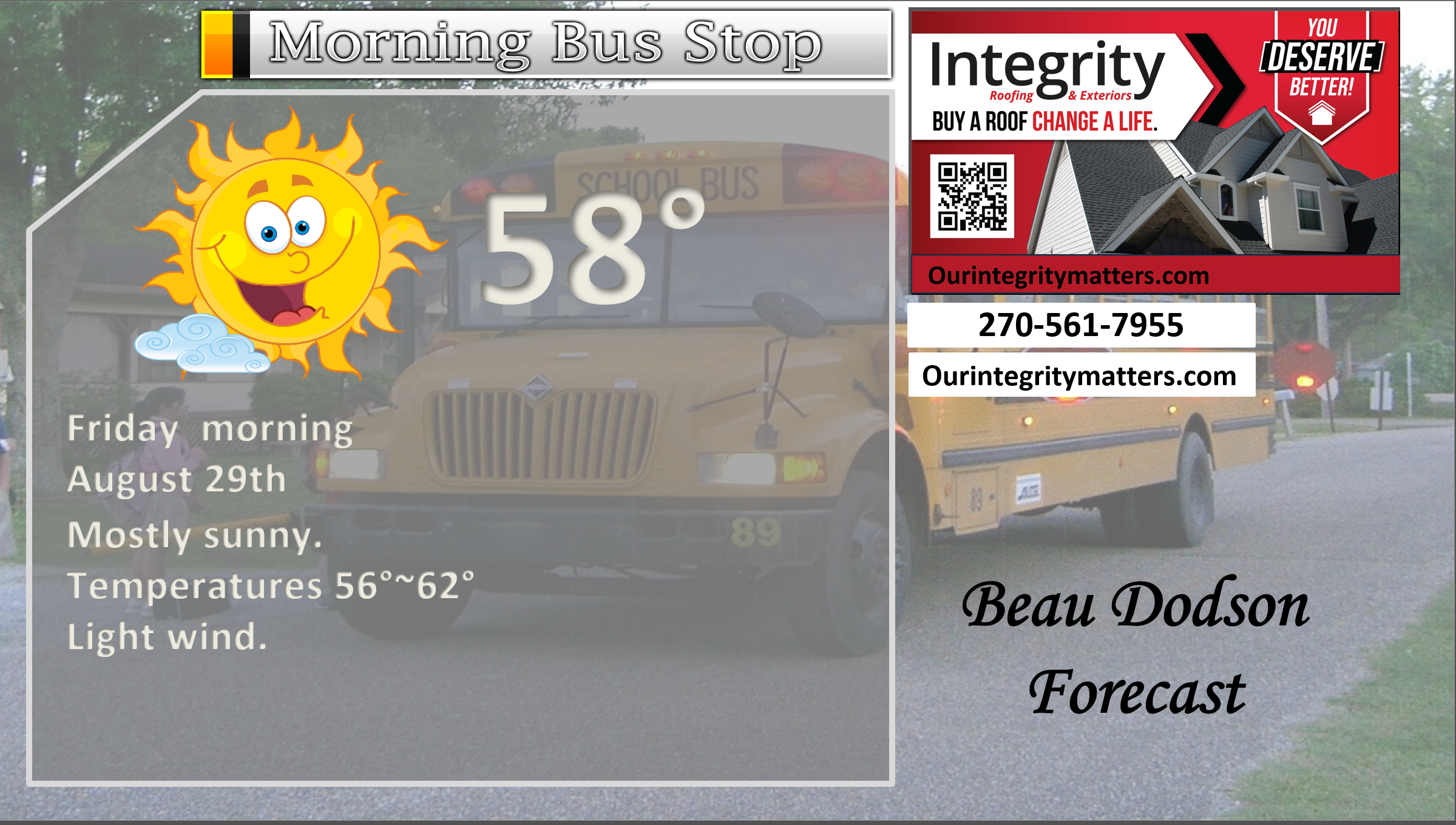
This afternoon
.

.

Forecast discussion.
- Mostly calm weather into early next week. A slow warming trend is expected, but temperatures will remain below average through Monday.
- A low-end chance of rain today from Butler County, Missouri, southeast into the Missouri Bootheel and western Tennessee. Don’t expect much.
- Drought conditions continue to worsen.
- I am watching rain chances next Monday afternoon, Tuesday, and Wednesday. See below.
.
 .
.
.
Good morning, everyone.
I hope you have a nice holiday weekend! The weather will be nice.
The new drought maps are out. Drought continues to spread across our region.
Yellow is low-end drought. Tan is a moderate drought. Let’s compare this week to last week.
Double-click to enlarge the graphics.
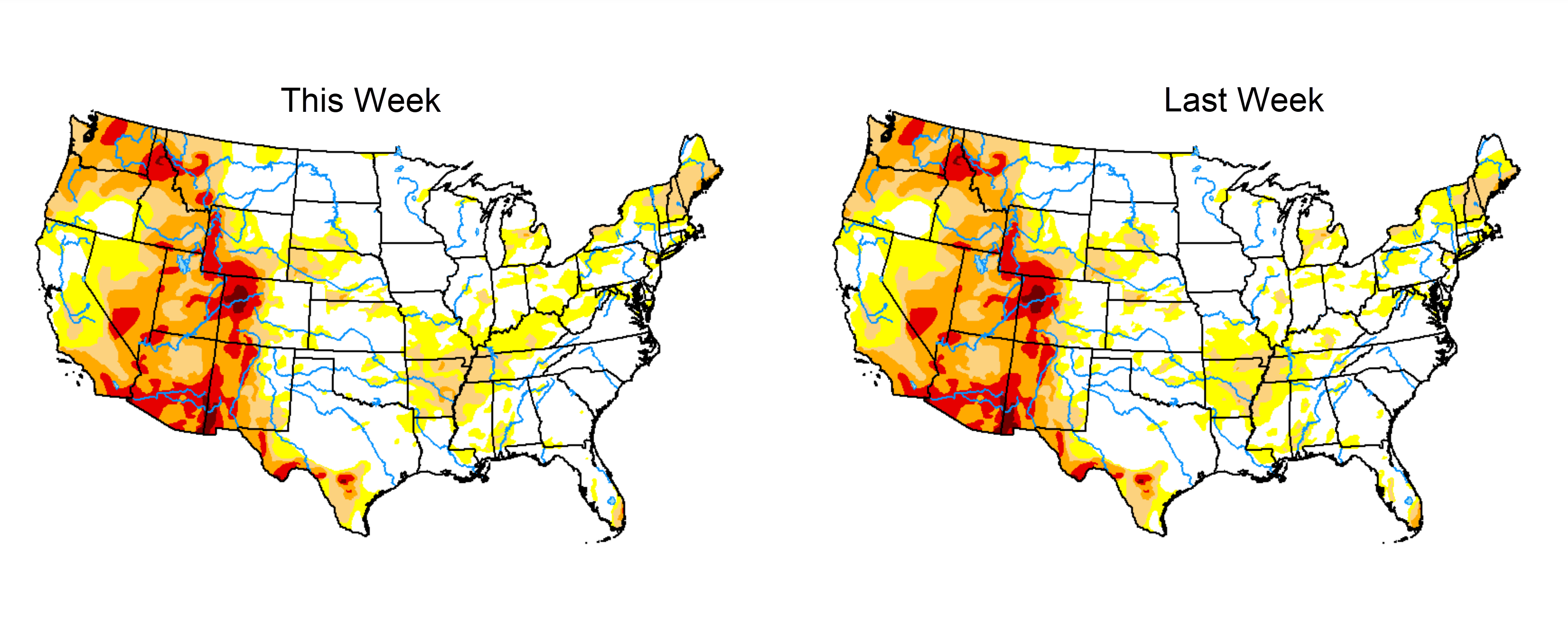
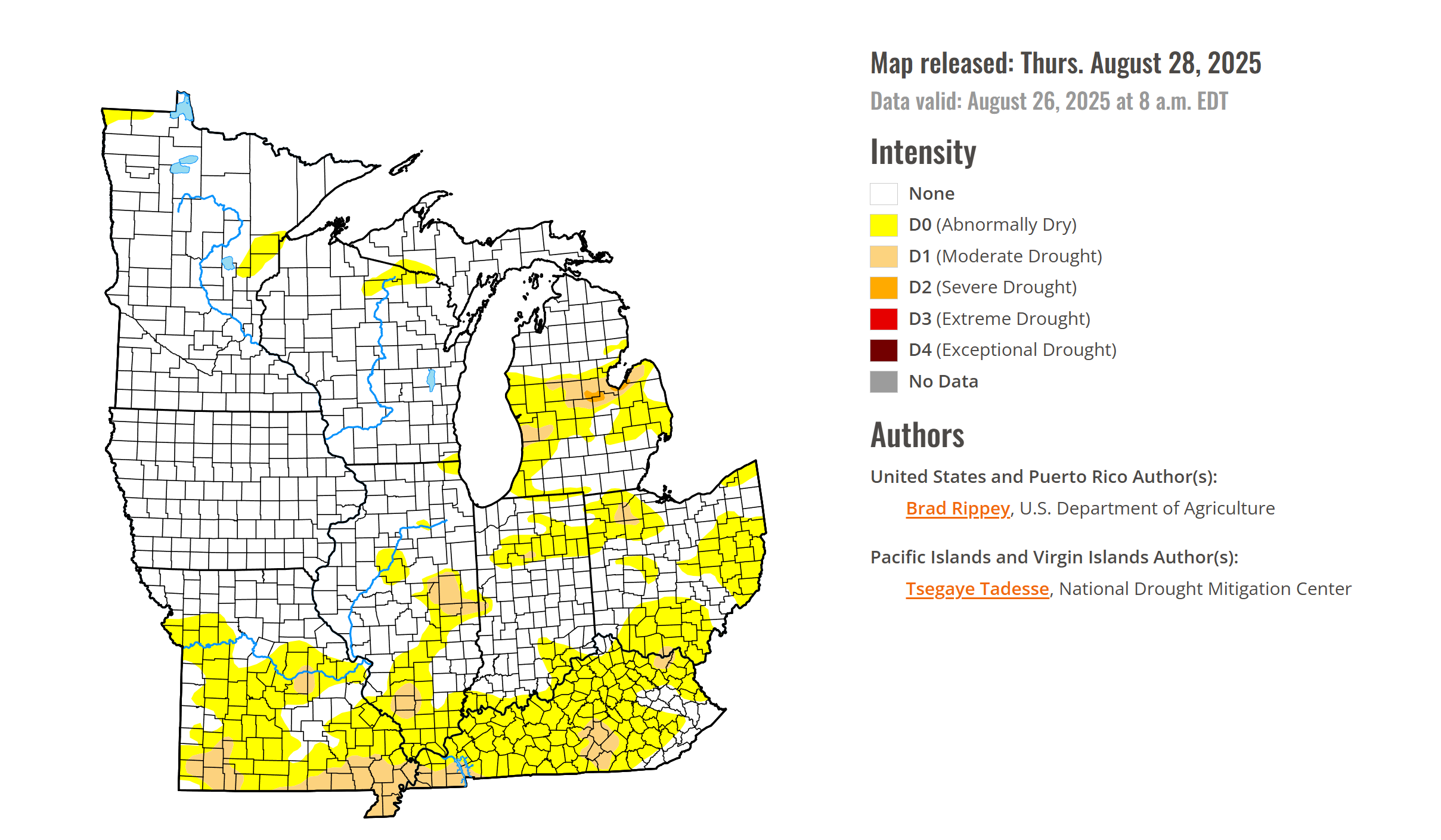
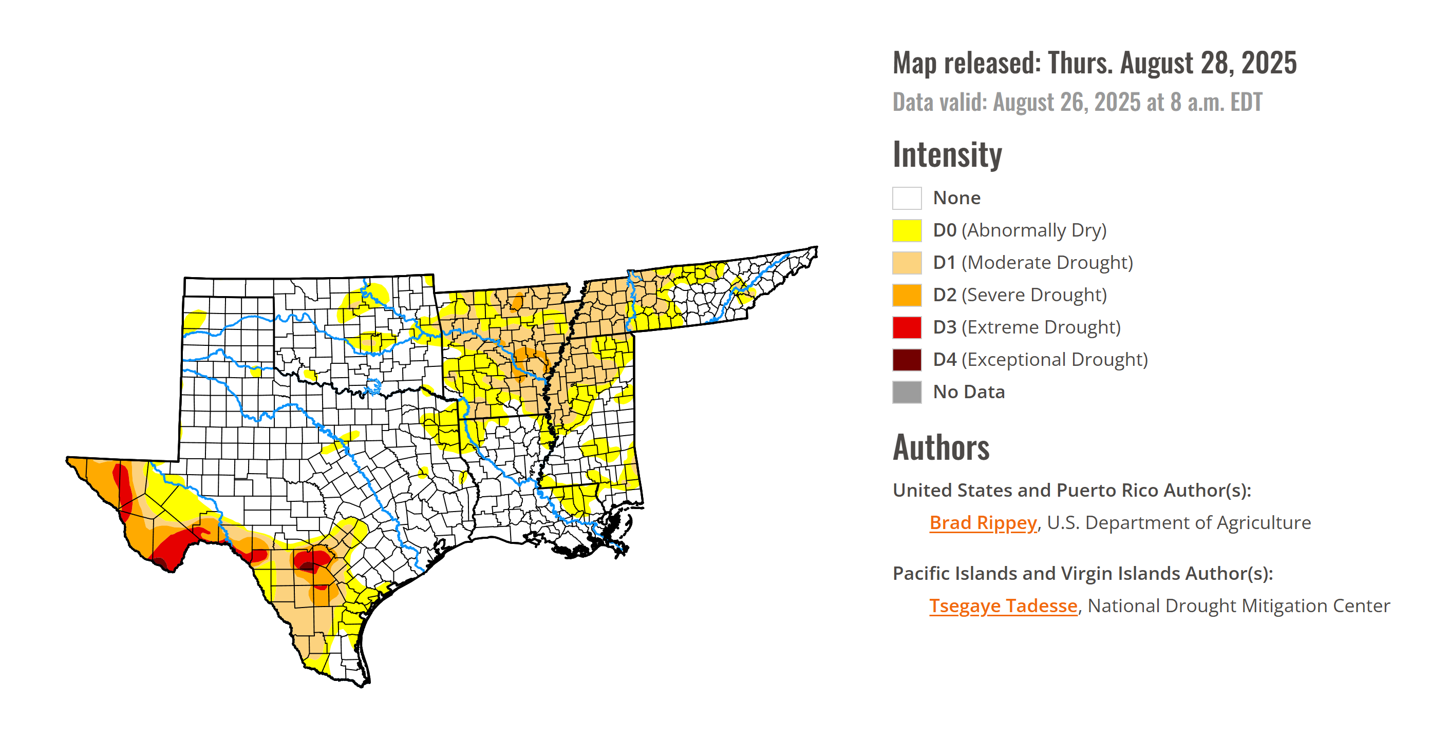
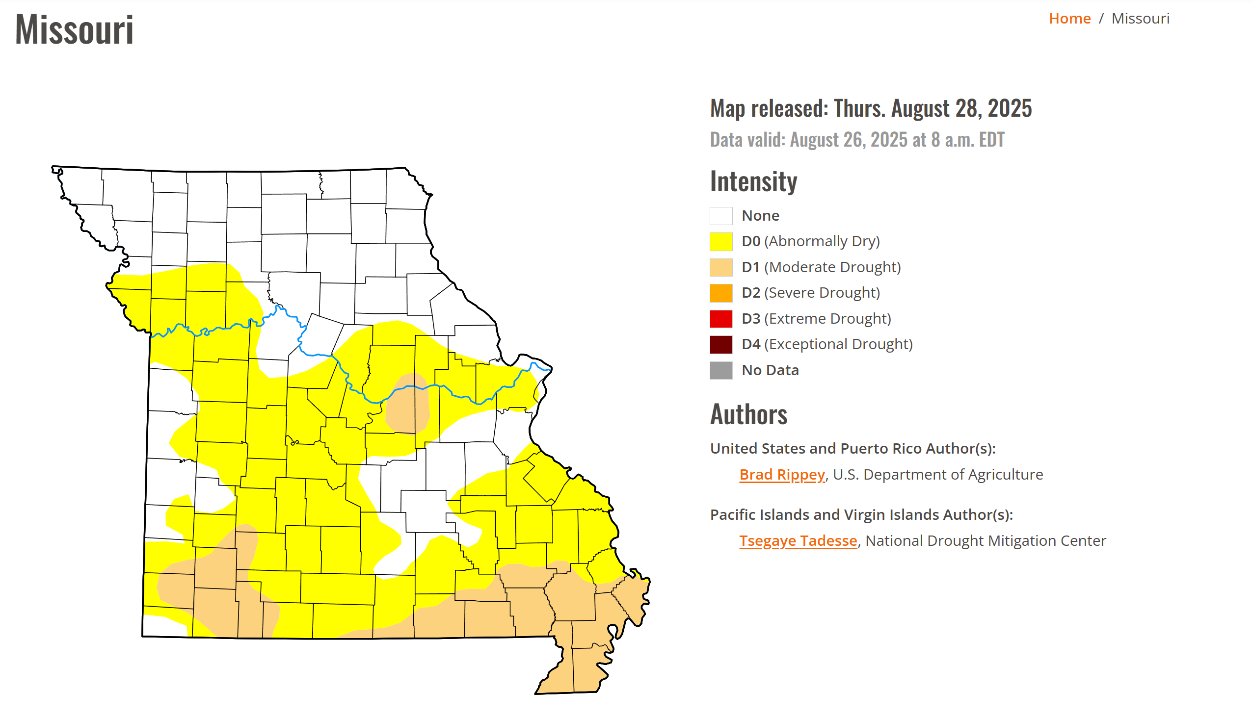
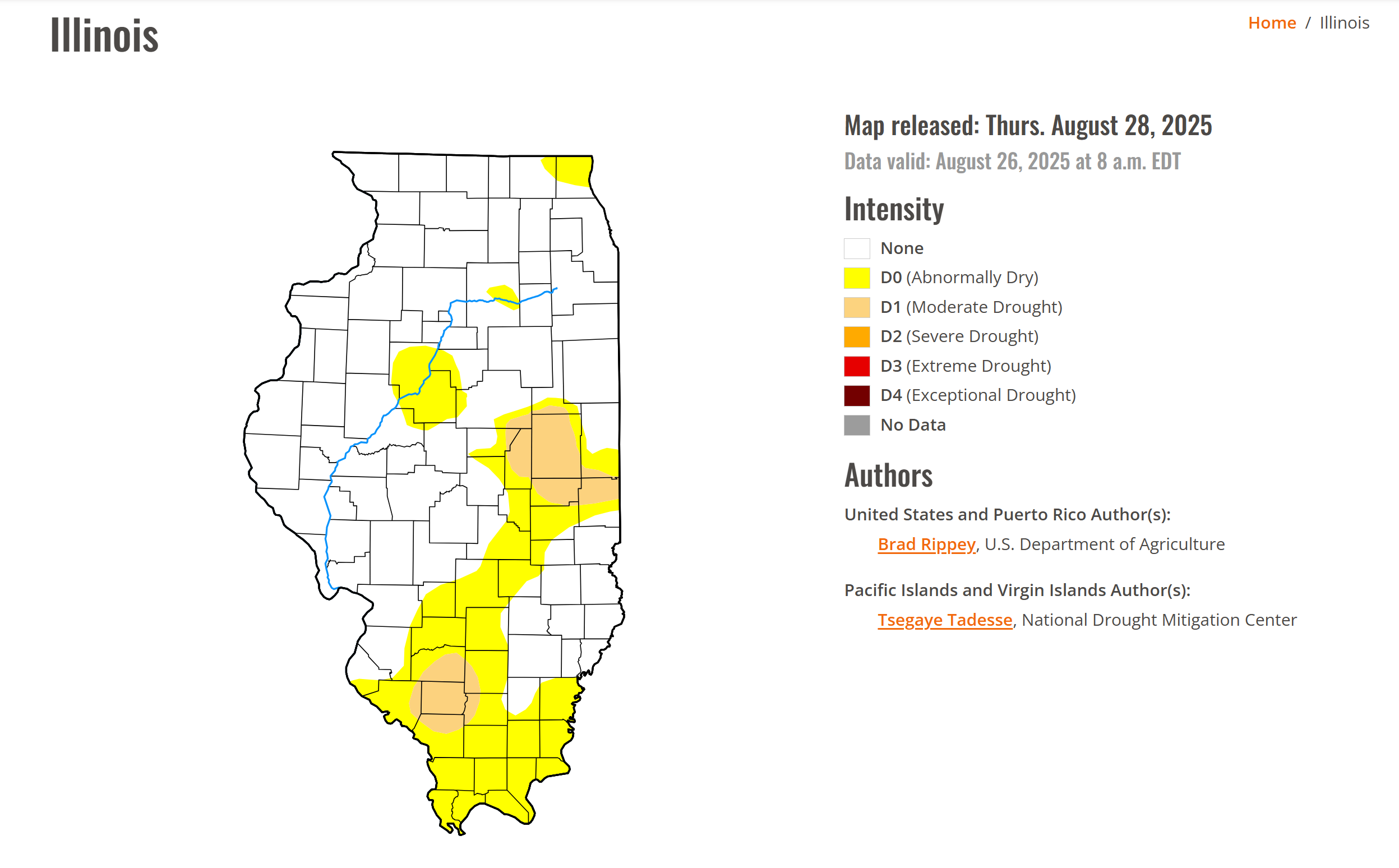
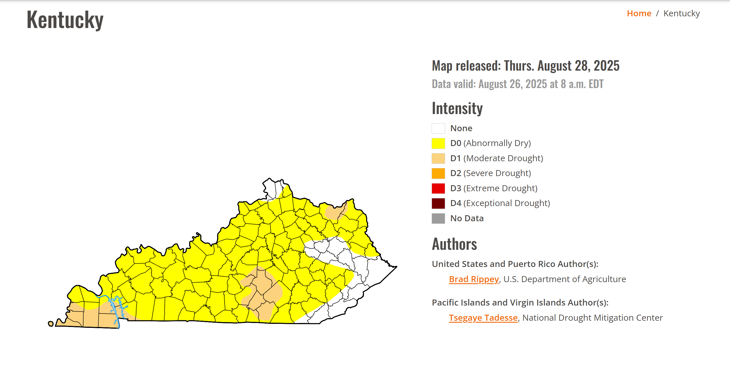
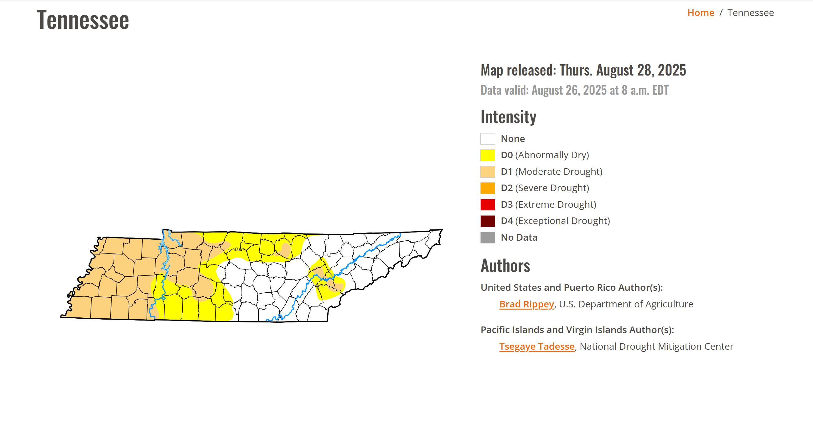
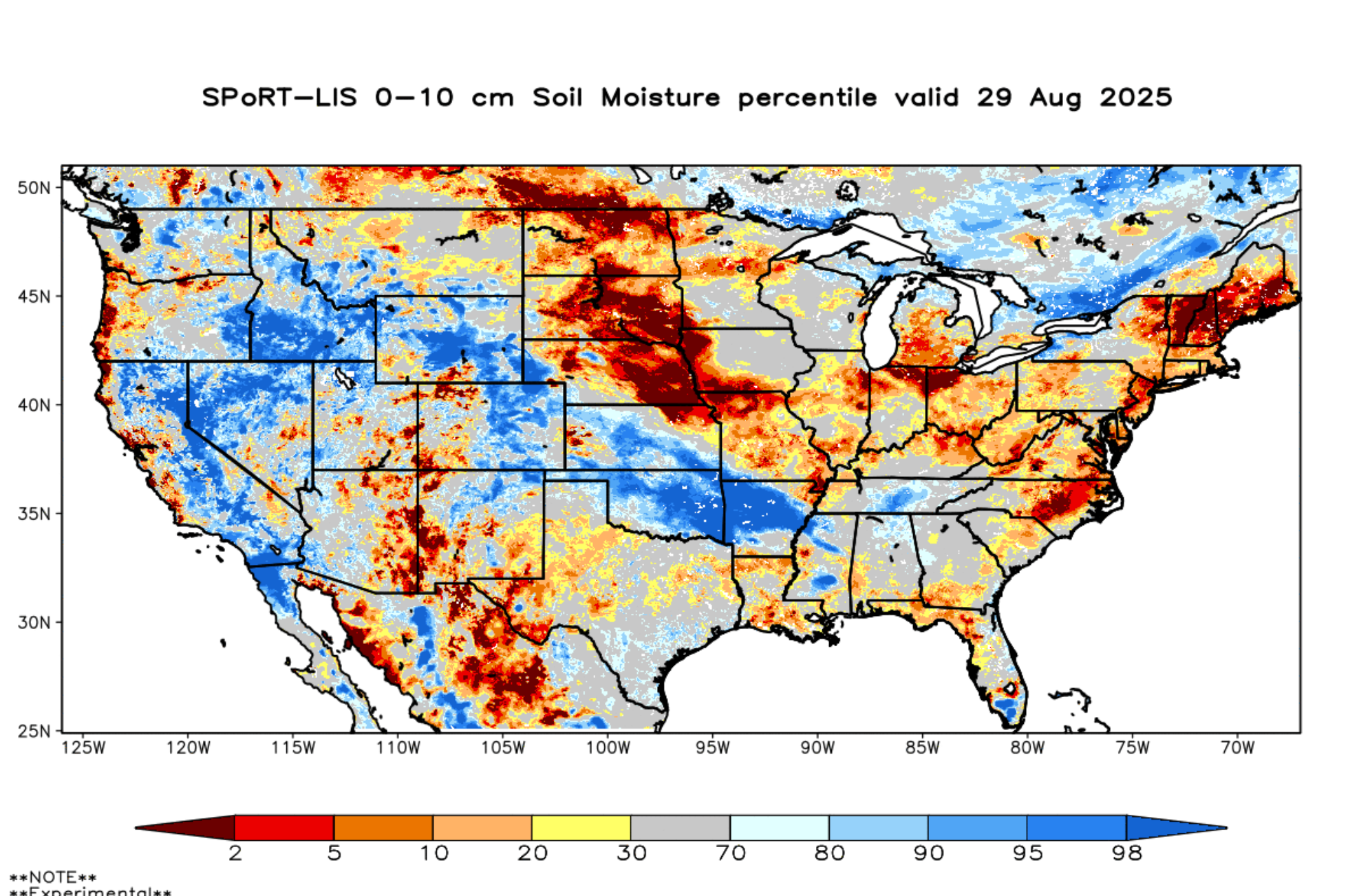
You can also see the dry topsoil on this map. A lot of orange and red colors. Very dry. Some of my forecast counties have not received measurable rain in over forty days!
You can also see where that rain tracked from Kansas into Arkansas over the last few days. So close!
.
We are waking up to nice temperatures again. Not as cool as recent days, but still nice.
Here were the 5 am temperatures
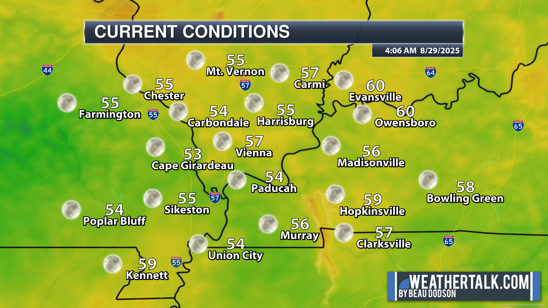
.
Friday, Saturday, and Sunday will be nice. Warm days. Cool nights. No weather concerns, except for the dryness.
High and low temperatures will be two to six degrees below average.
I am watching Monday and Monday night for a slight chance of a couple of pop-up showers and thunderstorms over western Kentucky and western Tennessee. For now, I kept the chances at 10%. Most areas will remain dry.
Here are the Monday afternoon rain probabilities. Not much of a chance.
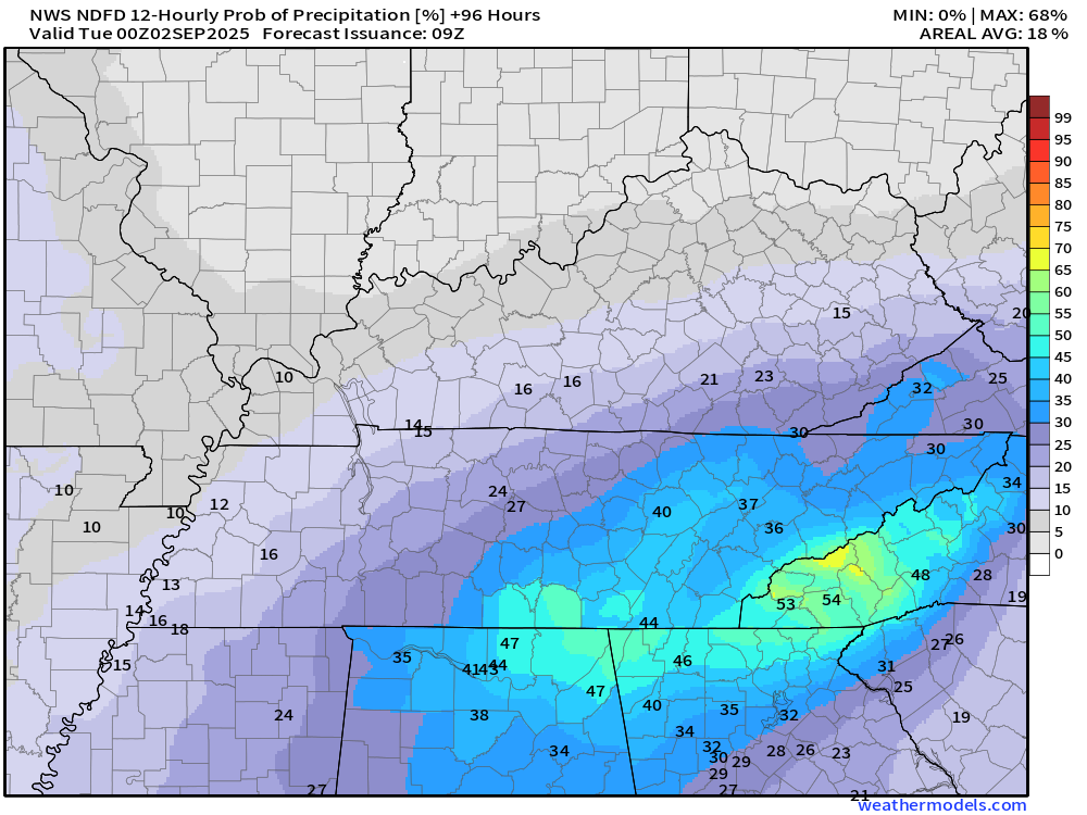
Here is Monday night. Not much.
.
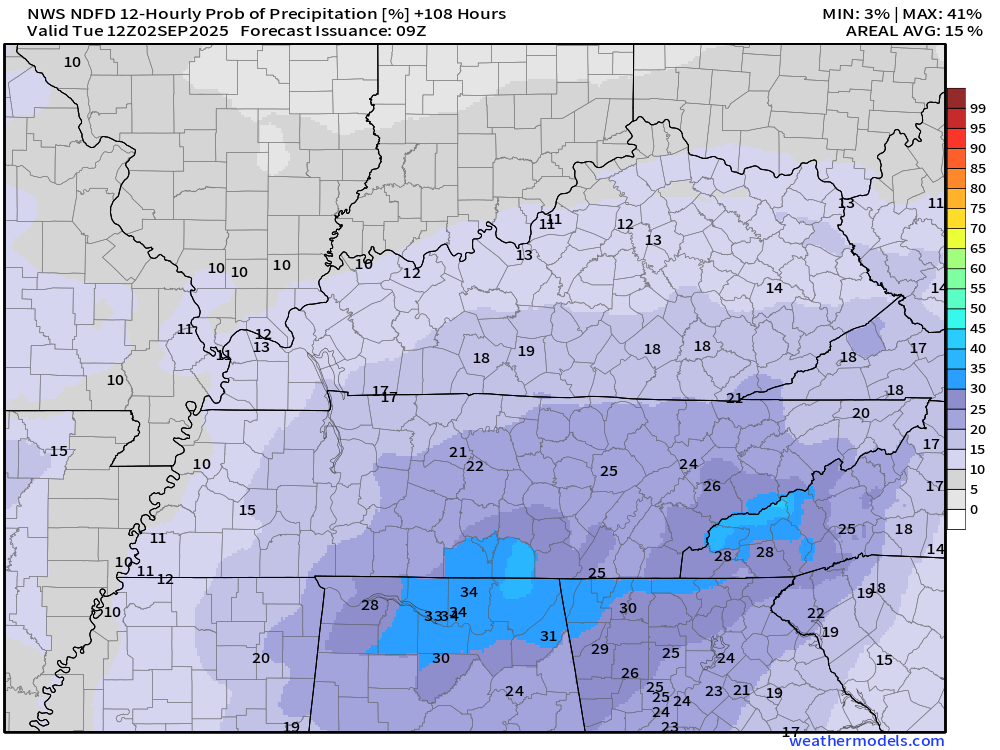
Another cold front next week.
Then, a cold front is expected to push towards the region on Tuesday and Wednesday. This will bring increasing clouds and a chance of scattered showers and thunderstorms. For now, I kept the chances at 30%. I will monitor trends and raise that number as confidence increases in the final forecast.
The front should push through the region by Wednesday night or Thursday. This will bring an end to the rain chances. If the front slows, then showers would linger into Thursday. For now, I kept Thursday’s chances at 20%.
This won’t bring enough rain to end the drought. And, some areas may miss out, yet again.
Some of you have not received measurable rain in over forty days. It is extremely dry in some counties.
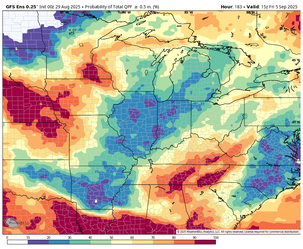
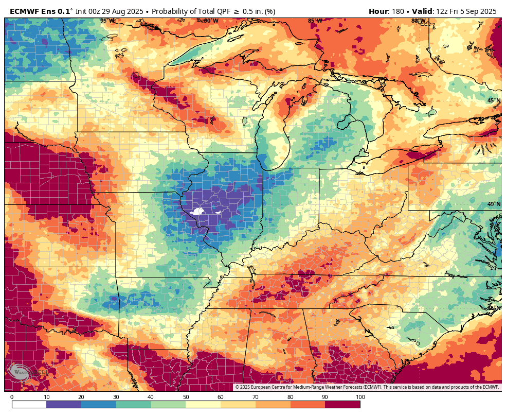
Let’s look at three models.
What is the percent chance of 0.50″ or more of rain with the cold front next week. Not the best odds.
The EC AI model
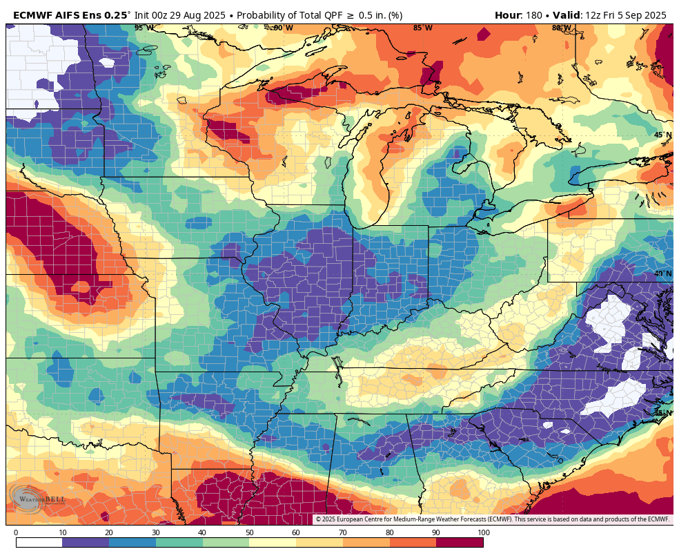
The GFS ensembles
The EC ensembles.
.
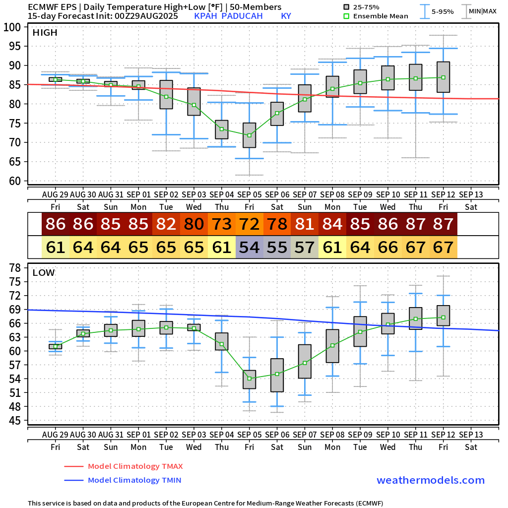
The 15-day EC model temperature outlook is nice.
I am watching the middle of September for several warmer days. The GFS model is showing hotter temperatures than the EC.
The EC has been steadier with its numbers. I am not sure we are completely done with 90-degree readings, but with each passing week, it becomes less likely. Especially days on end of the 90s.
Autumn is knocking.
.
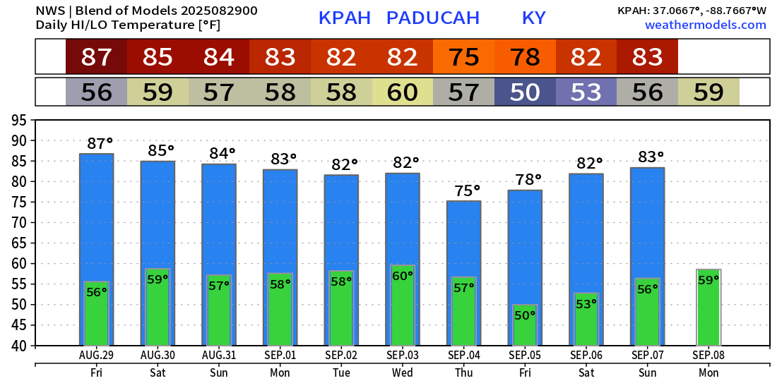
Here is a model blend of temperatures
.
.

.
The timestamp (upper left) is in Zulu. 12z=7 am. 18z=1 pm. 00z=7 pm.
Double-click the animation to enlarge it.
NAM 3K model
No rain on the NAM 3K through Monday morning.
.
The timestamp (upper left) is in Zulu. 12z=7 am. 18z=1 pm. 00z=7 pm.
Double-click the animation to enlarge it.
Hrrr model
No rain on the NAM 3K through Monday morning.
.
..
.
Click here if you would like to return to the top of the page.
.Average high temperatures for this time of the year are around 90 degrees.
Average low temperatures for this time of the year are around 68 degrees.
Average precipitation during this time period ranges from 1.00″ to 1.25″
Six to Ten Day Outlook.
Blue is below average. Red is above average. The no color zone represents equal chances.
Average highs for this time of the year are in the lower 60s. Average lows for this time of the year are in the lower 40s.

Green is above average precipitation. Yellow and brown favors below average precipitation. Average precipitation for this time of the year is around one inch per week.

.

Average low temperatures for this time of the year are around 67 degrees.
Average precipitation during this time period ranges from 1.00″ to 1.25″
.
Eight to Fourteen Day Outlook.
Blue is below average. Red is above average. The no color zone represents equal chances.

Green is above average precipitation. Yellow and brown favors below average precipitation. Average precipitation for this time of the year is around one inch per week.

.
.
.
We have a new service to complement your www.weathertalk.com subscription. This does NOTreplace www.weathertalk.com It is simply another tool for you to receive severe weather information.
.
https://weathercallservices.com/beau-dodson-weather


Want to receive the daily forecast/other products on your Beau Dodson Weather app?
Did you know you have four options in your www.weathertalk.com account
You will then receive these via your Beau Dodson Weather app.
Just log into your www.weathertalk.com account
Click the NOTIFICATION SETTINGS TAB
Then, turn them on (green) and off (red)
🌪️ Number 1 is the most important one. Severe alerts, tornado alerts, and so on.
Number 2 is the daily video, blog, livestream alerts, and severe weather Facebook threads on severe days or winter storm days.
Number 3 is the daily forecast. I send that out every day during the afternoon hours. It is the seven-day forecast, hazardous weather outlook, fire outlook, and more.
Number 4 is to receive the daily video, blog, and other content on NON-severe weather days (every day without severe threats in other words)
GREEN IS ON
RED IS OFF

I am going to start going live during bigger severe weather events.
Check it out here https://www.youtube.com/user/beaudodson
Click the subscribe button (it’s a free subscription button), and it will alert you when I go live. I will also send out alerts to the app when I go live for an event.

.

Radars and Lightning Data
Interactive-city-view radars. Clickable watches and warnings.
https://wtalk.co/B3XHASFZ
Old legacy radar site (some of you like it better)
https://weatherobservatory.com/weather-radar.htm
If the radar is not updating then try another one. If a radar does not appear to be refreshing then hit Ctrl F5. You may also try restarting your browser.
Backup radar site in case the above one is not working.
https://weathertalk.com/morani
Regional Radar
https://imagery.weathertalk.com/prx/RadarLoop.mp4
** NEW ** Zoom radar with chaser tracking abilities!
ZoomRadar
If the radar is not working, then email me: Email me at beaudodson@usawx.com
.
We do have some sponsors! Check them out.
Roof damage from recent storms? Link – Click here
INTEGRITY ROOFING AND EXTERIORS!
⛈️ Roof or gutter damage from recent storms? Today’s weather is sponsored by Integrity Roofing. Check out their website at this link https://www.ourintegritymatters.com/

![]()
![]()
![]()
Make sure you have three to five ways of receiving your severe weather information.
Weather Talk is one of those ways! Now, I have another product for you and your family.

.
Want to add more products to your Beau Dodson Weather App?
Receive daily videos, weather blog updates on normal weather days and severe weather and winter storm days, your county by county weather forecast, and more!
Here is how to do add those additional products to your app notification settings!
Here is a video on how to update your Beau Dodson Weather payment.
The app is for subscribers. Subscribe at www.weathertalk.com/welcome then go to your app store and search for WeatherTalk
Subscribers, PLEASE USE THE APP. ATT and Verizon are not reliable during severe weather. They are delaying text messages.
The app is under WeatherTalk in the app store.

Apple users click here

Android users click here
.
Radars and Lightning Data
Interactive-city-view radars. Clickable watches and warnings.
https://wtalk.co/B3XHASFZ
Old legacy radar site (some of you like it better)
https://weatherobservatory.com/weather-radar.htm
If the radar is not updating then try another one. If a radar does not appear to be refreshing then hit Ctrl F5. You may also try restarting your browser.
Backup radar site in case the above one is not working.
https://weathertalk.com/morani
Regional Radar
https://imagery.weathertalk.com/prx/RadarLoop.mp4
** NEW ** Zoom radar with chaser tracking abilities!
ZoomRadar
Lightning Data (zoom in and out of your local area)
https://wtalk.co/WJ3SN5UZ
Not working? Email me at beaudodson@usawx.com
National map of weather watches and warnings. Click here.
Storm Prediction Center. Click here.
Weather Prediction Center. Click here.
.

Live lightning data: Click here.
Real time lightning data (another one) https://map.blitzortung.org/#5.02/37.95/-86.99
Our new Zoom radar with storm chases
.
.

Interactive GOES R satellite. Track clouds. Click here.
GOES 16 slider tool. Click here.
College of DuPage satellites. Click here
.

Here are the latest local river stage forecast numbers Click Here.
Here are the latest lake stage forecast numbers for Kentucky Lake and Lake Barkley Click Here.
.
.
Find Beau on Facebook! Click the banner.


 .
.