What you need to know.
.
Key Points
1: Icy roads today. Icy surfaces. Be careful.
2: Bitterly cold air over the coming week. Frostbite, busted pipes, problems for outdoor pets, and increased number of house fires.
3: Two winter storms to track next week. Sunday night into Monday night and then Wednesday and Thursday. Monitor.
5. All of Beau’s Facebook Q&A Thread
https://www.facebook.com/beaudodsonweather
Winter Weather Radars. The local-city-view radars have a winterize button. Click it (once you are on the radar page).
Interactive city-view radars
http://weatherobservatory.com/weather-radar.htm
A third backup radar
https://weathertalk.com/morani
Clickable watches and warnings can be viewed on the local city-view interactive radars (link above). Be sure and turn on the warnings above the local radars.
A new regional radar we offer
https://imagery.weathertalk.com/prx/RadarLoop.mp4
Lightning data
https://wtalk.co/7QT7WHKU
.
Call to action.
Monitor updated weather forecasts.
Make sure you are using the Weather Talk app. Download it from the app store. It is under Weather Talk.
TURN ON YOUR BEAU DODSON WEATHER TALK APP. Make sure it is on. Make sure you have not accidentally logged out of the app.
The app is for subscribers (please log into your account and make sure your payment has been updated. We have a large number of declined cards and PayPal payments.
Subscribe at www.weathertalk.com/welcome then go to your app store and search for WeatherTalk. Apple users click here. Android users click here
.
February 11, 2021
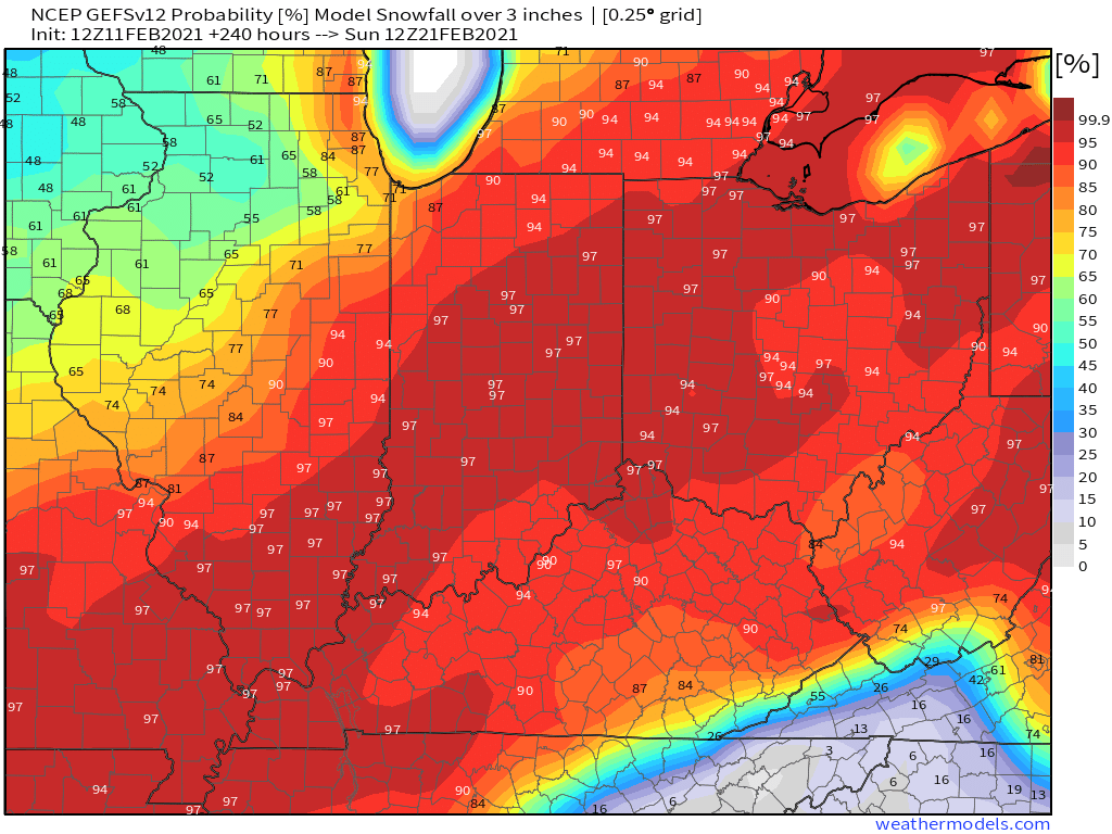
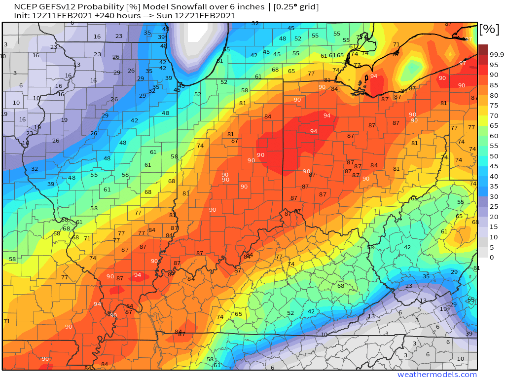
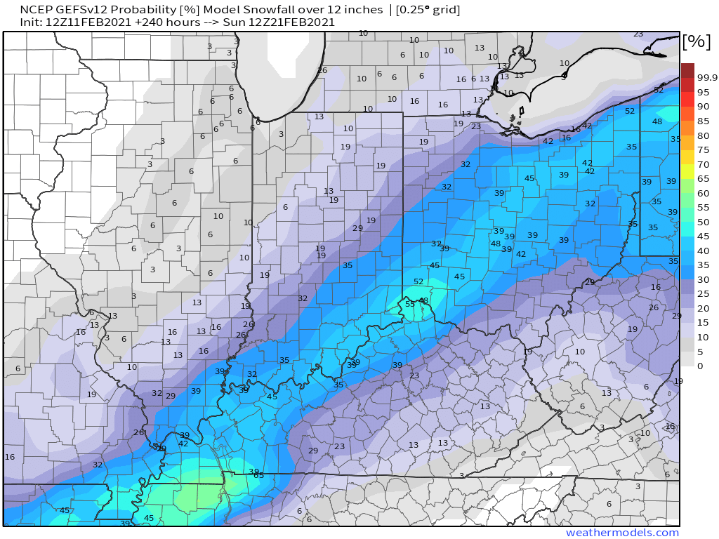
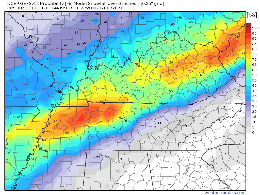
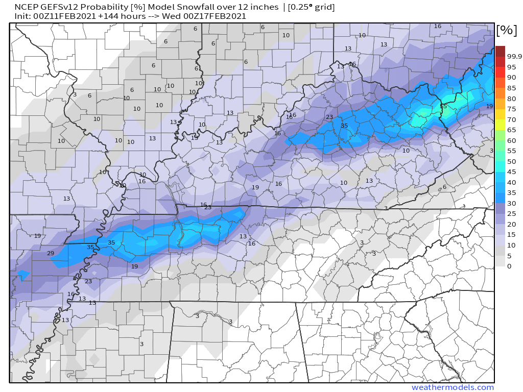
Let me show you one model. The GFS ensembles.
These are probability charts.
What is the chance of X amount of snow from Monday through Friday
3 inches
.
6 inches
.
12-inches
.
February 11, 2021
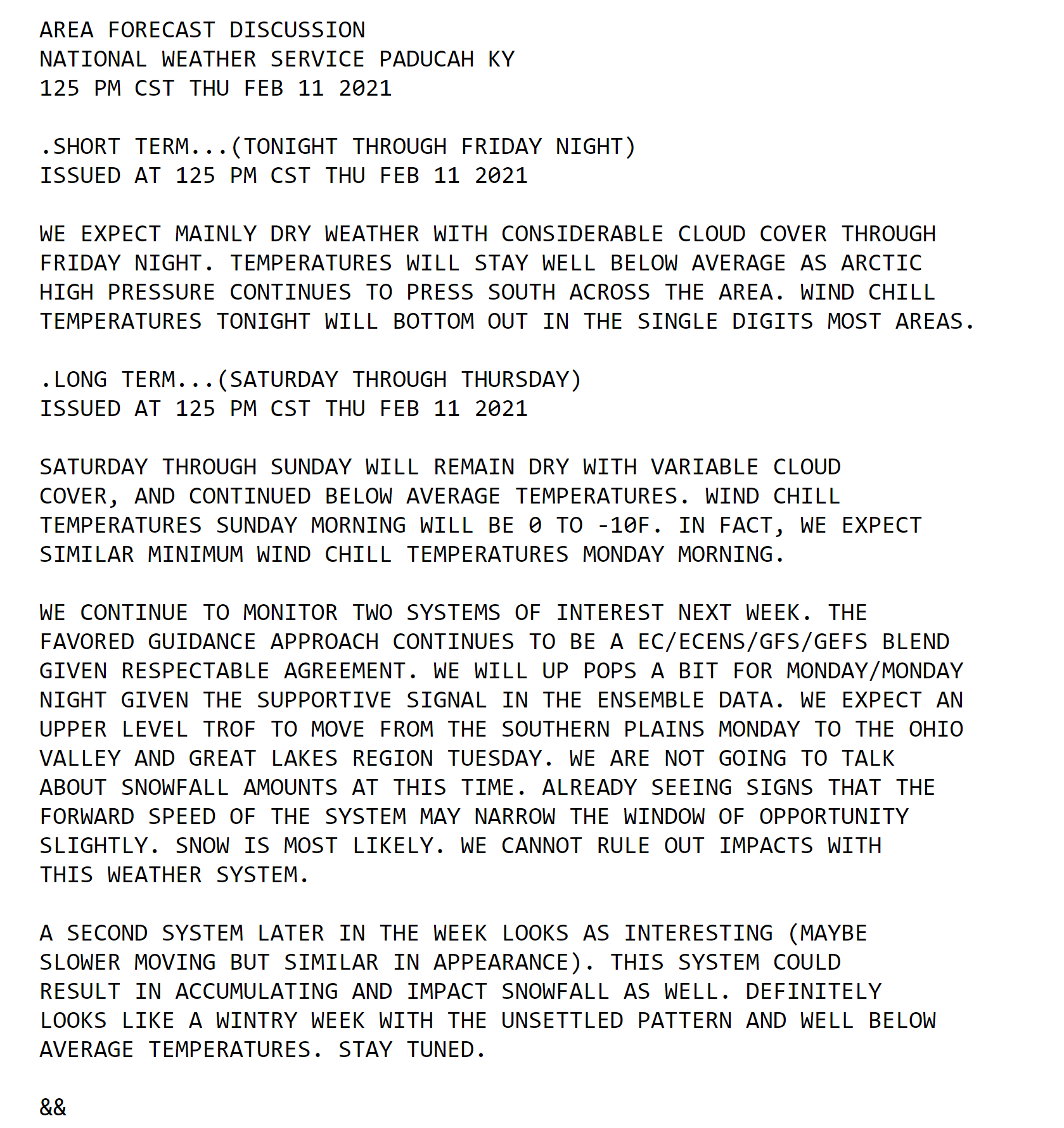
NWS Paducah comments.
Click the image to enlarge it.
End of their comments
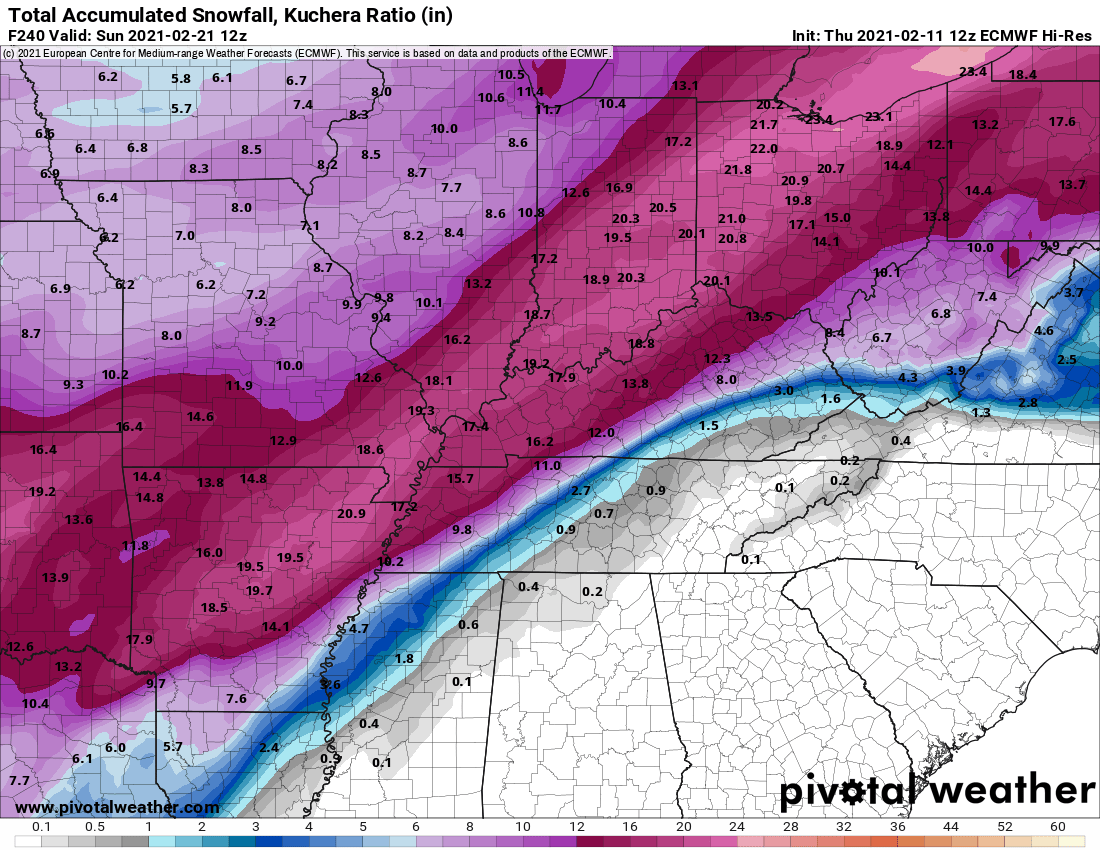
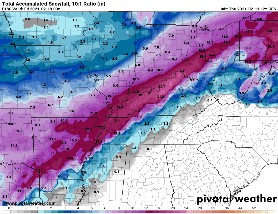
Models are showing a lot of snow next week.
It is still too early to make a forecast on amounts. It does appear three or more inches will be possible.
I am just going to show you these.
Two snowstorms. Monday and then mid-week. If that happens then more icy roads.
For now, this looks like mainly snow.
There could be a mix in Tennessee and parts of Kentucky.
Again, THIS IS NOT MY FORECAST for totals. I am just showing you the models.
EC model
GFS model
February 11, 2021
#tristatewx #kywx #NWSPaducah #icestorm #weather 2/11/21 Murray, Kentucky. Lot of ice this morning. Ginger Colson Norsworthy sent in this photo. Ice covered and thunder on Airport Rd in Murray/Calloway Co. pic.twitter.com/2S5m6nU0J4
— Beau Dodson (@BeauDodson) February 11, 2021
#tristatewx #mowx #NWSPaducah #NWSMemphis #icestorm #weather 2/11/21 East Prairie, Missouri. Tara Guzman sent in this photo. An icy morning for the region. Be careful! pic.twitter.com/gToHmmp9BD
— Beau Dodson (@BeauDodson) February 11, 2021
#tristatewx #kywx #NWSPaducah #icestorm #weather #Murray #kentucky 2/11/21 Murray, Kentucky. Reva Freeman sent in this photo.
94 and 280 Murray, KY. 0.20" of freezing rain. pic.twitter.com/W3C6kSg92E— Beau Dodson (@BeauDodson) February 11, 2021
February 11, 2021
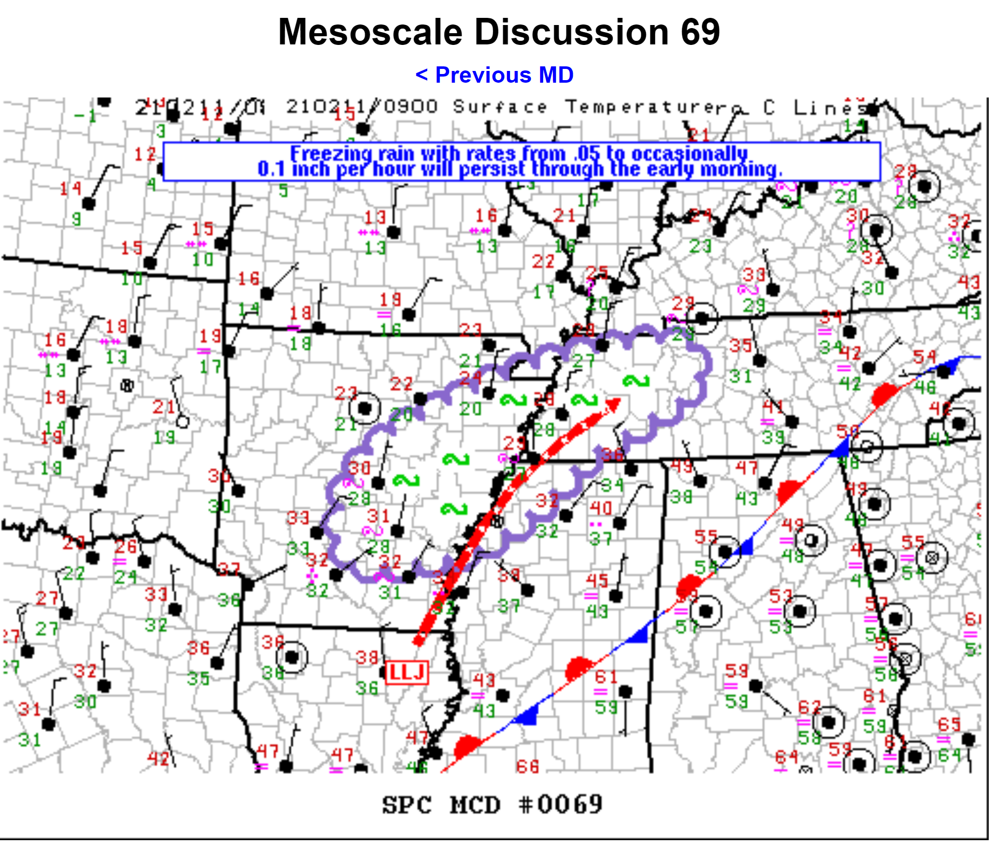
Numerous reports of thunderstorms with ice along the KY/TN State line.
.
February 11, 2021
I erased everything from yesterday so the page will load faster.
.
.
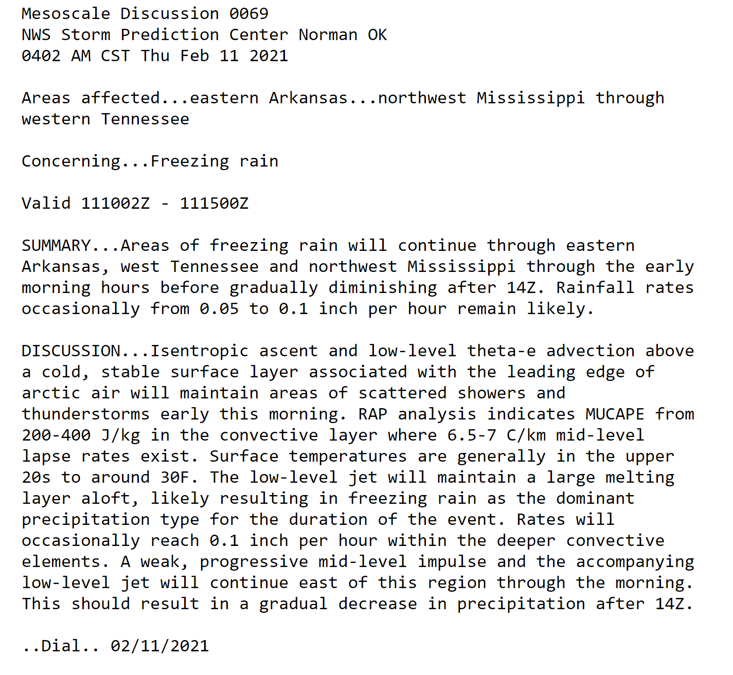
The bulk of the winter storm is over for most of the region.
The exception will be spotty light freezing drizzle, sleet, or snow today just about anywhere in the region.
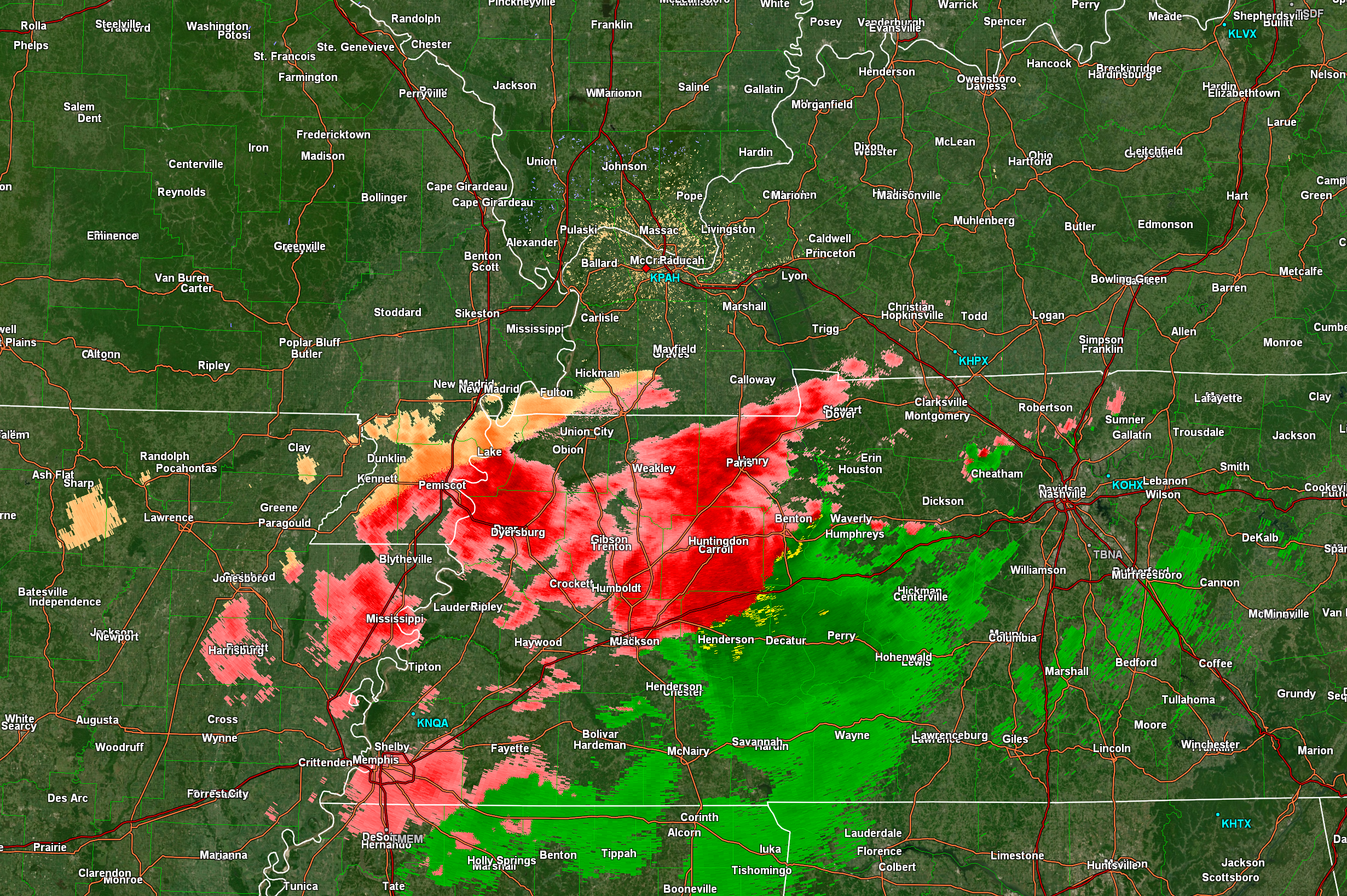
The other exception will be the Missouri Bootheel east along the Kentucky/Tennessee State line. From there southward there could be additional waves of freezing rain today.
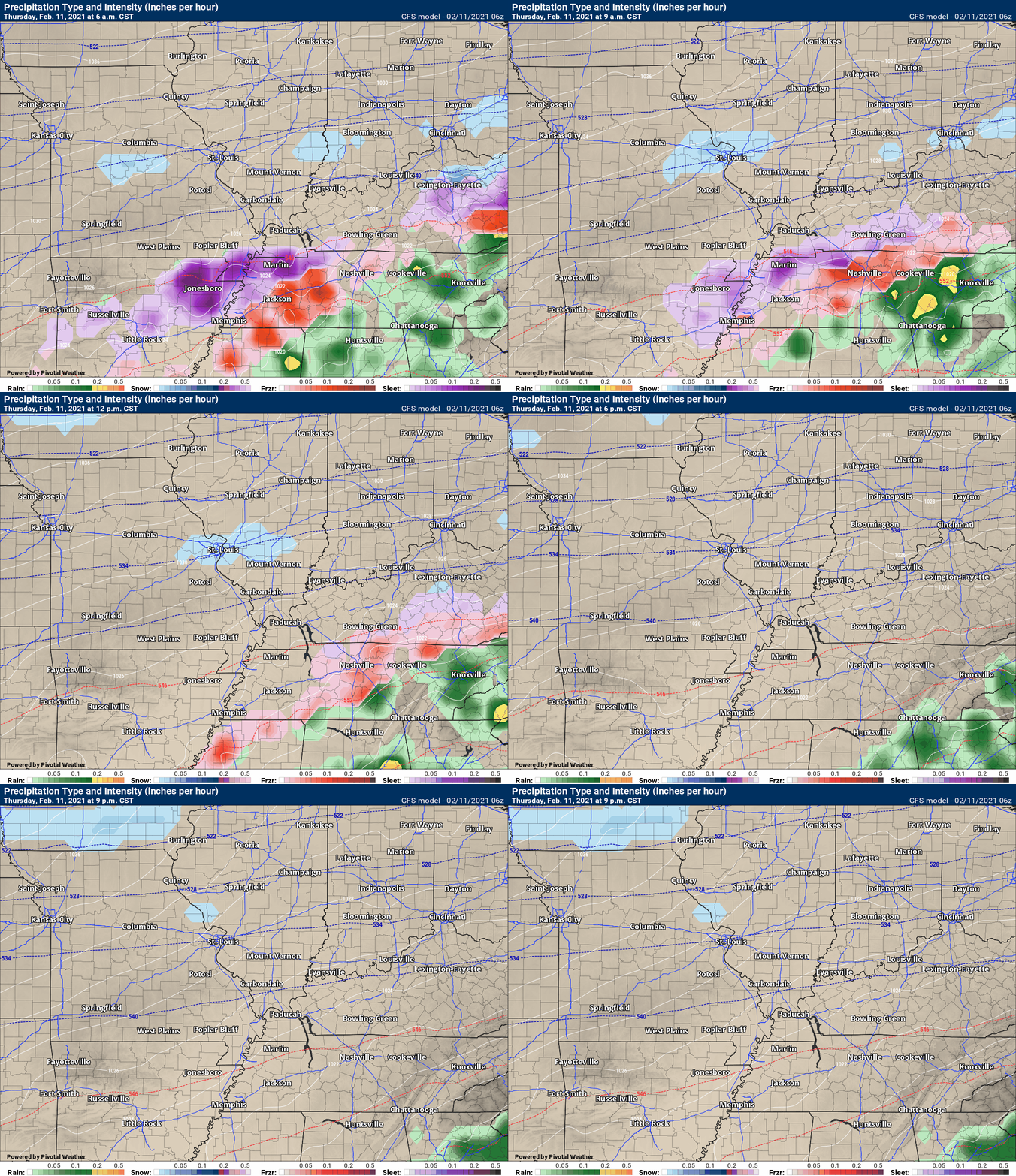
You can see the 6 AM radar. Orange is sleet. Red is freezing rain. Green is rain.
This is moving east. See the regional radar.
A new regional radar we offer
https://imagery.weathertalk.com/prx/RadarLoop.mp4
If you remember, from day one I have said the biggest forecast question was this last wave of precipitation and how far north to take it.
The above areas could still have accumulating freezing rain today. Use care.
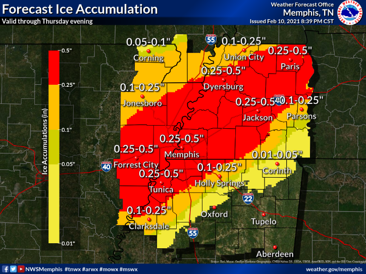
The Memphis, Tennessee, posted this graphic. This is their final totals forecast. What it should look like when all is said and done.
Some of those northern counties will need to be monitored. It may be lighter for some.
Areas further north into Kentucky could pick up a little more freezing rain today. 0.05″ to 0.10″. Locally higher if the wave is further north.
This would mainly be the KY/TN county line counties and then east of Land Between the Lakes. Monitor radars.
.
So far, the forecast across the northern three-quarters of the region seems to have verified. There was slightly more freezing rain in some Illinois and northwest Kentucky counties that I expected. About 0.10″ to 0.15″ more for some.
Otherwise, most areas have icy roads and icy surfaces (which was the impact part of the forecast).
A few trees fell in Owensboro, Kentucky and some other northwest Kentucky counties.
I am tracking two more winter storms. I will begin a new Winter Storm Blog for those later today.
Bitterly cold air is going to be a problem over the coming week. Perhaps lasting through most of next week.
Historically, these long cold spells produce expensive damage in our region. Busted pipes, busted mains, outdoor animals have problems with the cold, frostbite on humans, and an increase in house fires.
Please use care and check on the elderly during this extended period of cold weather.
Bitterly cold Arctic air will dominate much of the upcoming week. Sunday and Monday look to be two of the coldest days. Minimum wind chill readings both mornings are forecast below zero across the entire area, with some readings forecast as low as 15 below. pic.twitter.com/GJroRzuH5T
— NWS Paducah, KY (@NWSPaducah) February 11, 2021
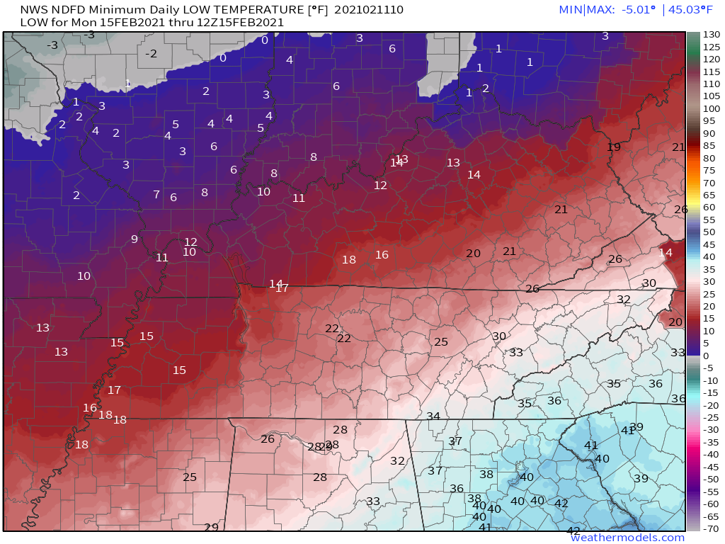
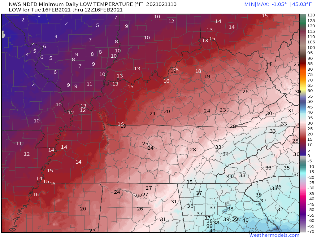
Some of the mornings will dip to near zero over parts of the region.
.
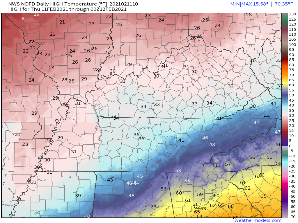
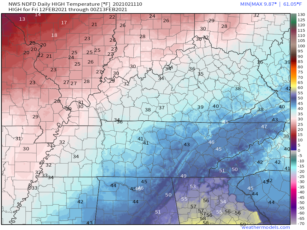
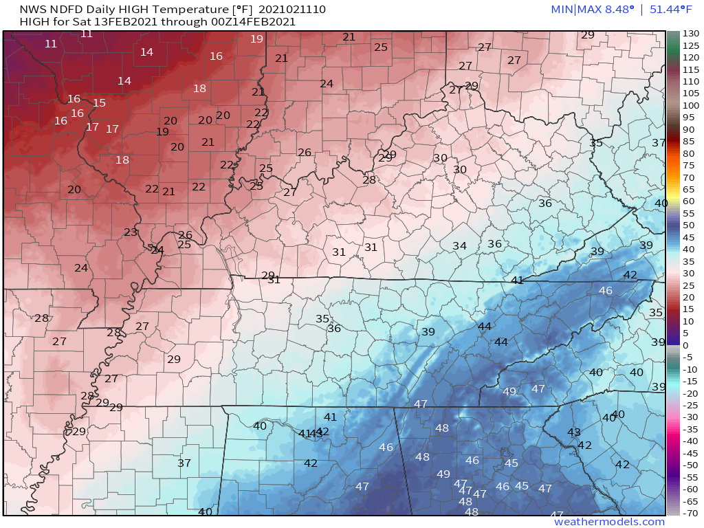
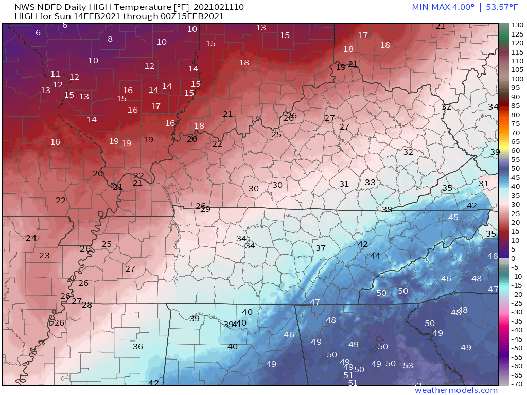
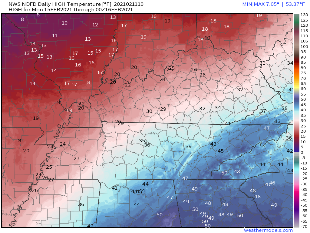
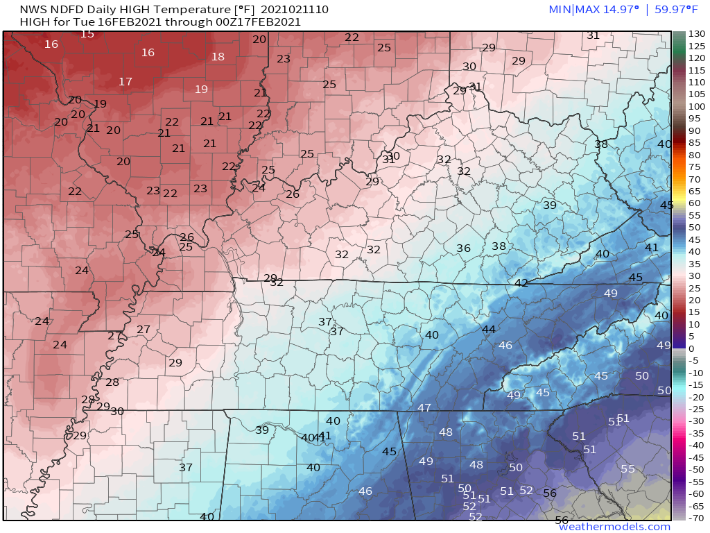
Let me show you some temperature graphics
High temperatures today
.
Friday
.
Saturday
.
Sunday
.
Monday
.
Tuesday
.
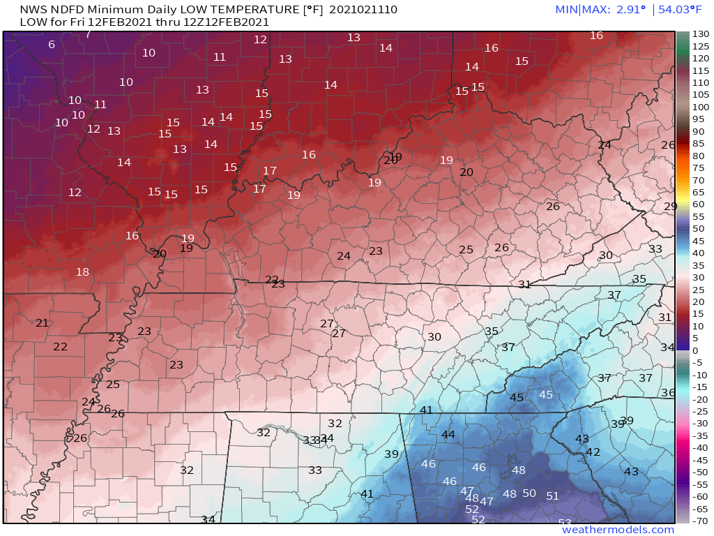
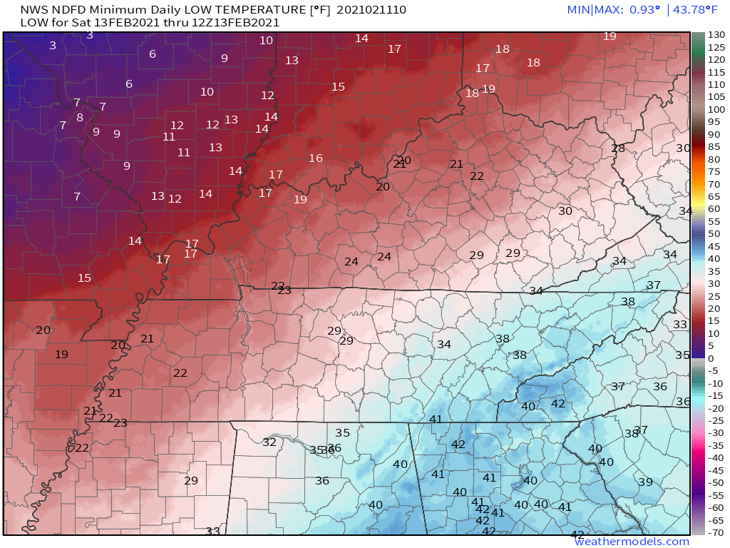
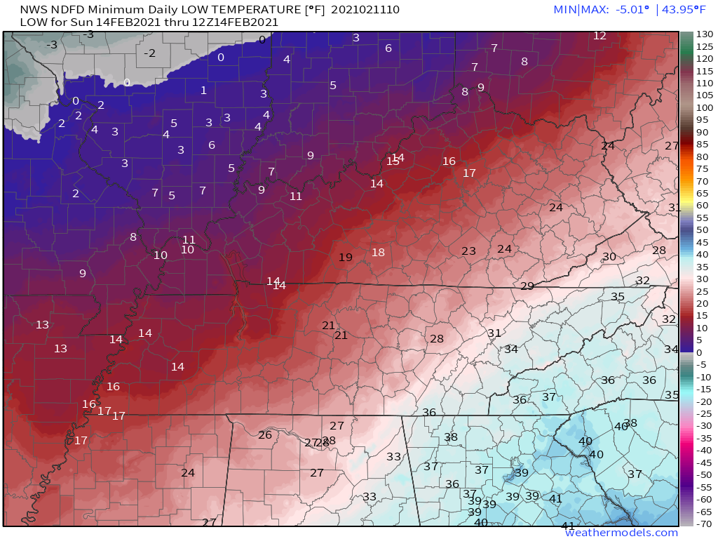
Let me show you some low temperatures. These may need adjusting if we have heavy snow next week.
Tonight
.
Saturday morning
.
Sunday morning
.
Monday morning
.
Tuesday morning
.
Another winter storm is possible Sunday night into Monday night and again Wednesday/Thursday.
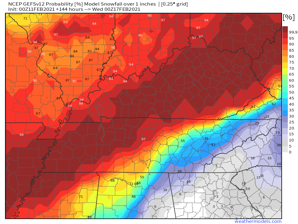
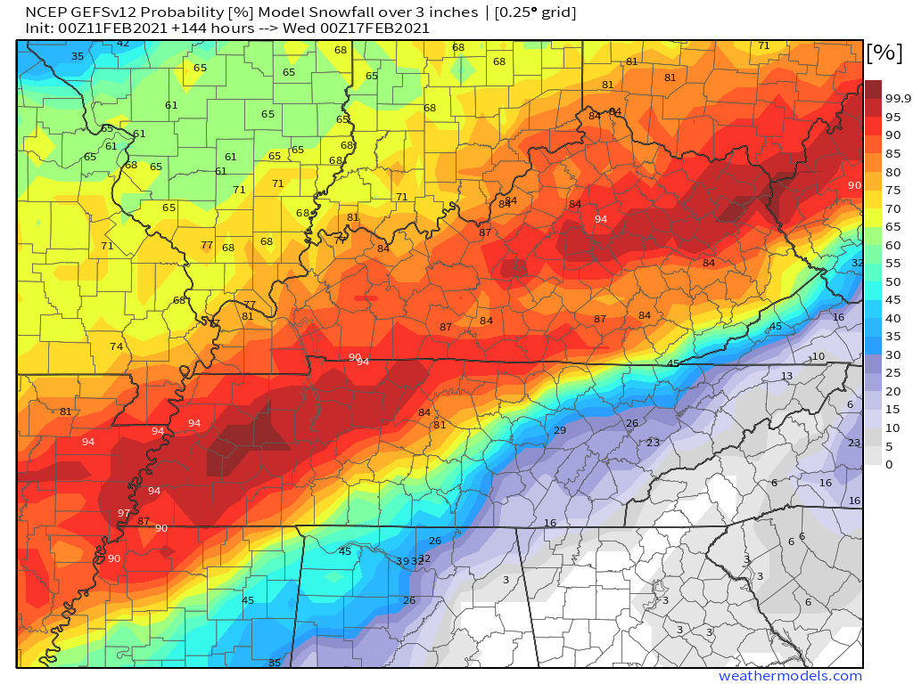
Keep in mind. These graphics WILL change. It is way early for a forecast.
I am just showing you the GFS model’s idea of this event. Again, this WILL change. There will be adjustments. Those adjustments may be large. Stay tuned.
Let me show you some graphics.
What are the chances of one inch or more of snow through Tuesday?
.
What are the chances of three inches or more of snow through Tuesday?
.
What are the chances of six inches or more of snow through Tuesday?
.
What are the chances of twelve inches or more of snow through Tuesday?
.
Our next storm system will bring the potential for accumulating snow to the region on Monday. Model guidance shows the potential for receiving a couple inches of snow is high, and there's even a chance that the snow accumulation could be significantly higher. Monitor for updates. pic.twitter.com/MPSmG0bmqF
— NWS Paducah, KY (@NWSPaducah) February 11, 2021
.
Future-cast radars.
Again, keep in mind that models are not going to handle the cold air all that well. I will need to closely monitor trends.
Small movements of the warm front will mean large forecast adjustments. Everything from rain to freezing rain, sleet, and snow.
This animation is the Storm Prediction Center WRF model.
This animation shows you what radar might look like as the next system pulls through the region. It is a future-cast radar.
Time-stamp upper left. Click the animation to enlarge it.
Green is rain. Blue is snow. Pink is sleet and freezing rain.
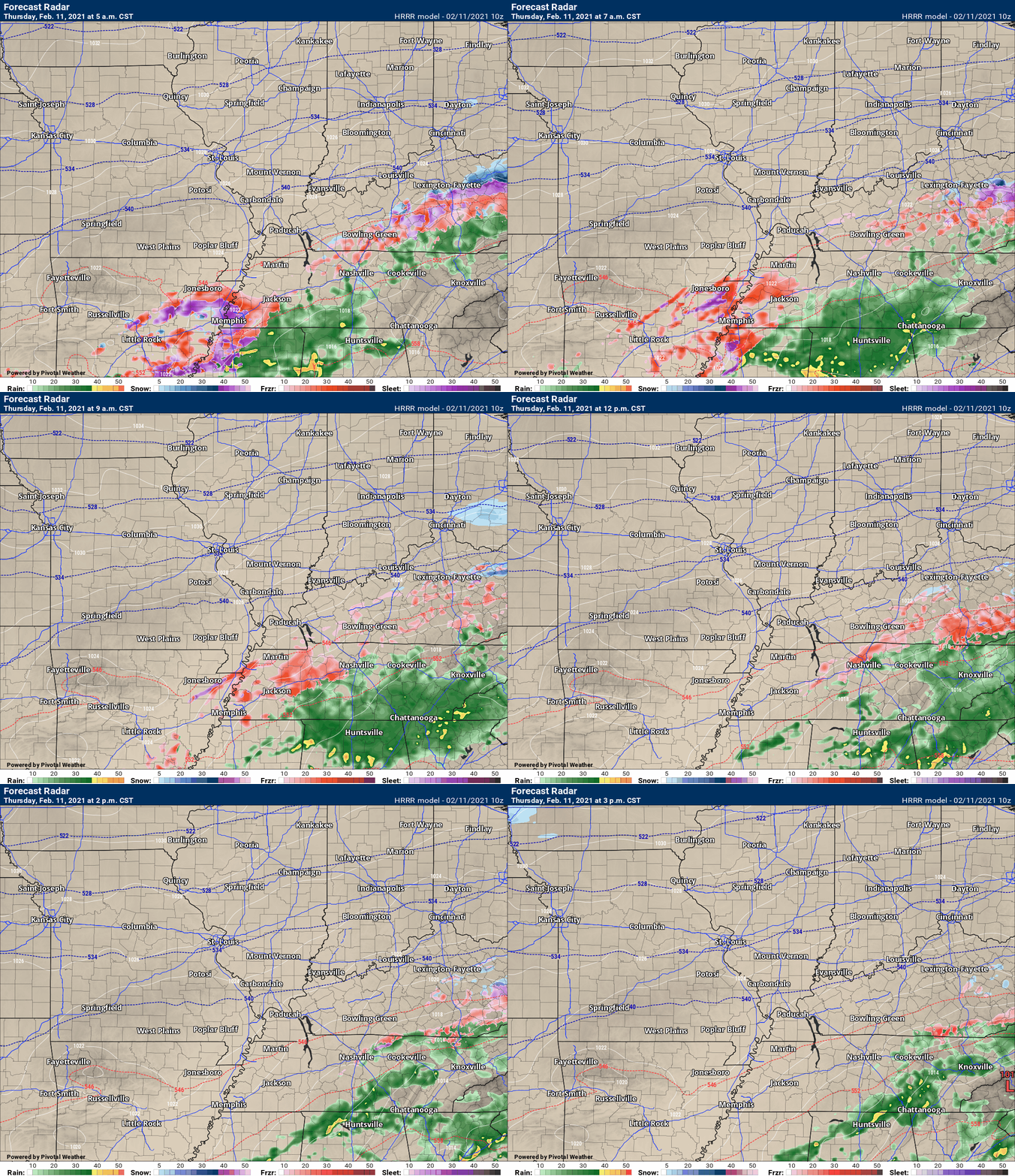
This animation is the Hrrr short-range model.
Green is rain. Blue is snow. Pink is sleet and freezing rain.
You can see that last wave of precipitation today over our southern counties.
.
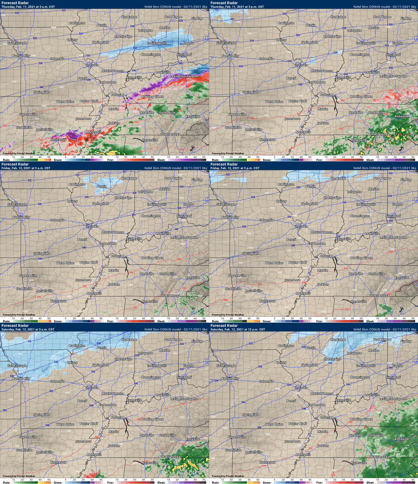
This animation is the 3K NAM American Model.
This animation shows you what radar might look like as the next system pulls through the region. It is a future-cast radar.
Time-stamp upper left. Click the animation to enlarge it.
Green is rain. Blue is snow. Pink is sleet and freezing rain.
You can see that last wave of precipitation today over our southern counties.
.
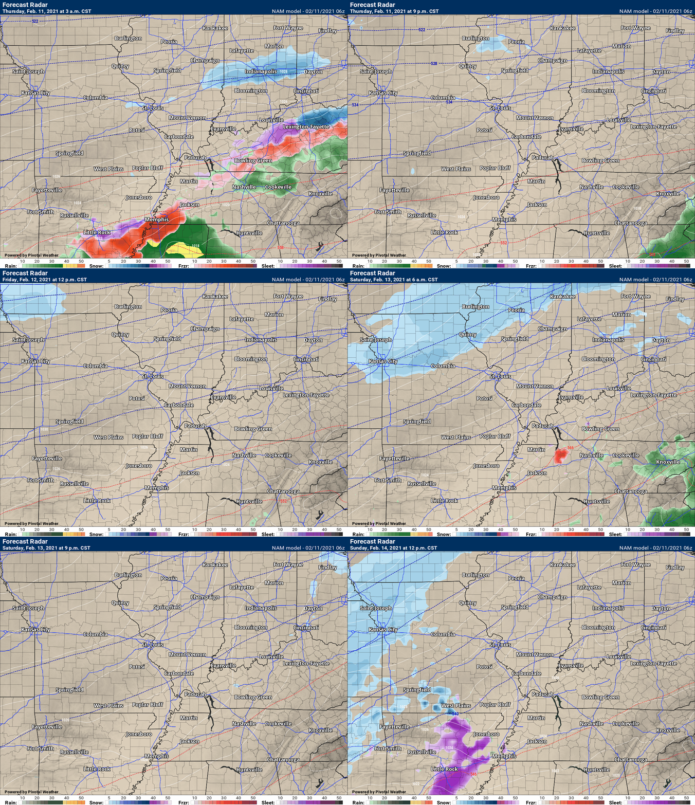
This next animation is the lower-resolution NAM American Model.
This animation shows you what radar might look like as the system pulls through the region. It is a future-cast radar.
Time-stamp upper left. Click the animation to enlarge it.
Green is rain. Blue is snow. Pink is sleet and freezing rain.
You can see that last wave of precipitation today over our southern counties.
.
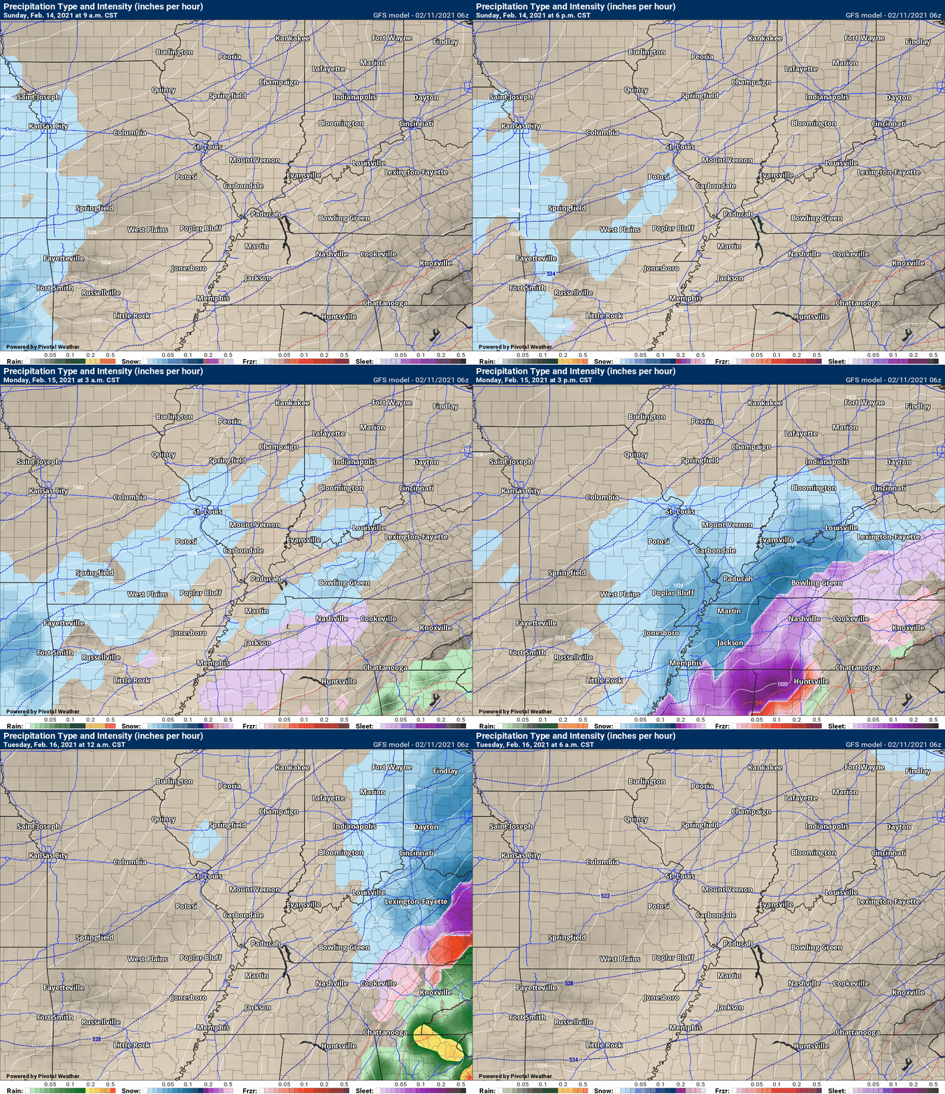
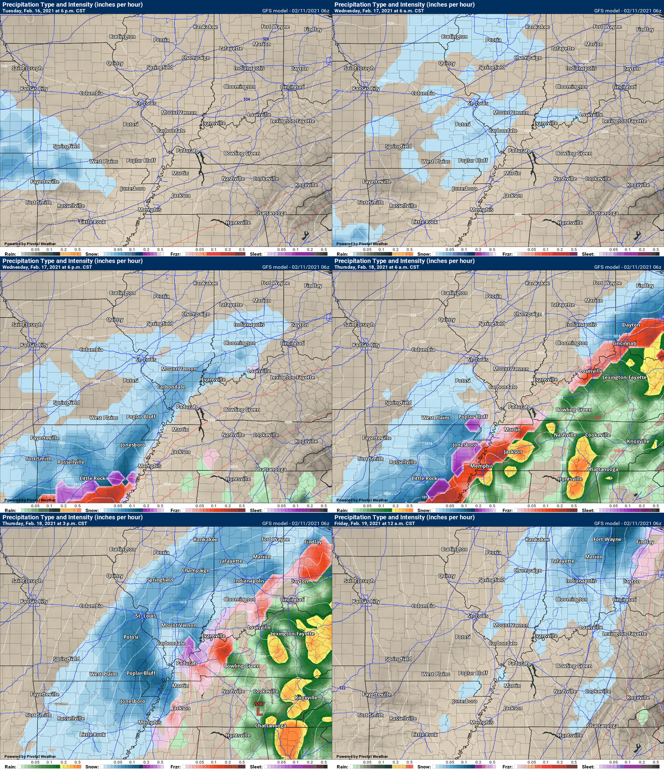
.This next animation is the GFS American Model.
This animation shows you what radar might look like as the system pulls through the region. It is a future-cast radar.
Time-stamp upper left. Click the animation to enlarge it.
Green is rain. Blue is snow. Pink is sleet and freezing rain.
You can see that last wave of precipitation today over our southern counties.
.
You can see the Sunday night into Monday snowstorm on the GFS model. Keep in mind we are DAYS away from this. We do well to forecast a winter storm within the 24-hour window. So, stay tuned. We will have to see how this trends. I will be posting updates, as always.
You can see the Wednesday or mid-week snowstorm on the GFS model. Keep in mind we are DAYS away from this. We do well to forecast a winter storm within the 24-hour window. So, stay tuned. We will have to see how this trends. I will be posting updates, as always.
This next animation is the EC European Weather model.
This animation shows you what radar might look like as the system pulls through the region. It is a future-cast radar.
Time-stamp upper left. Click the animation to enlarge it.
Green is rain. Blue is snow. Pink is sleet and freezing rain.
This the EC model.
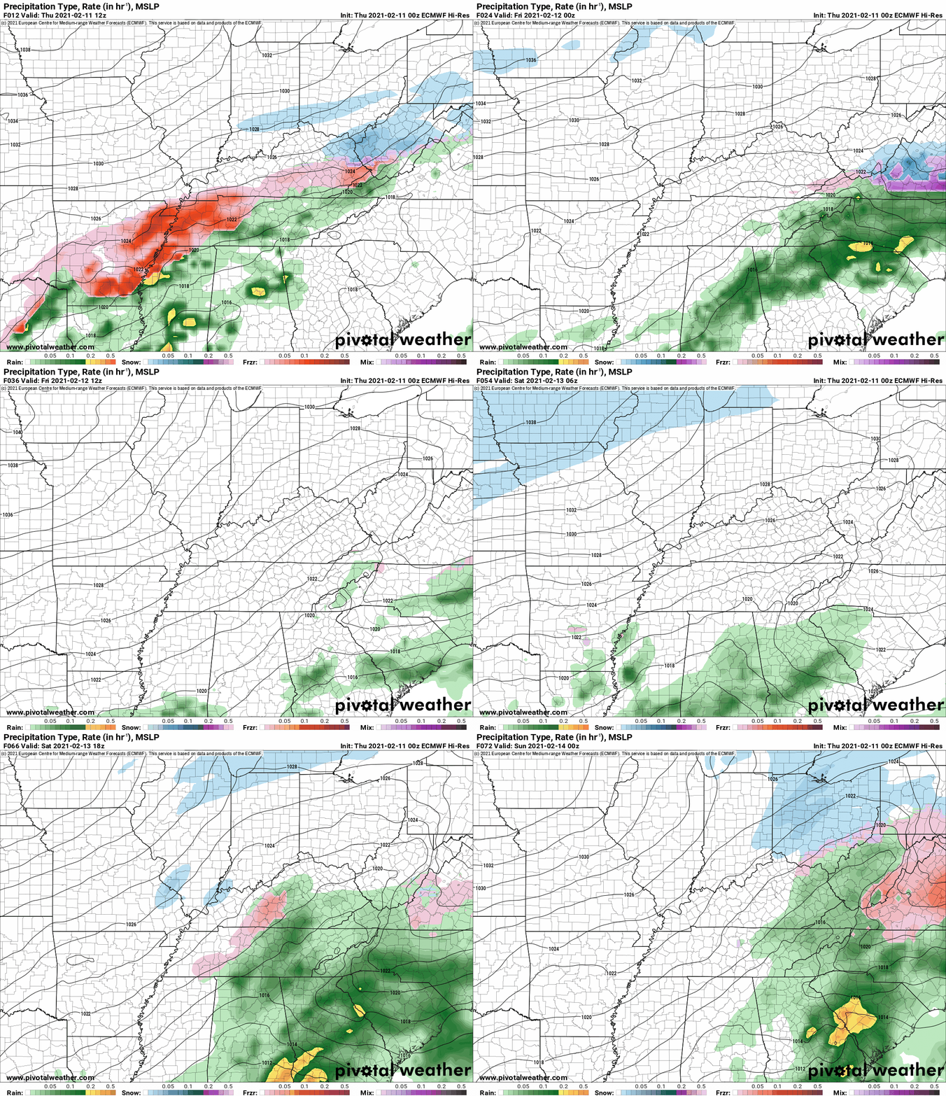
You can see today’s precipitation pushing away. One last wave over our southern counties.
Then, see the wave Friday night/Saturday that may clip our far eastern and southeastern counties (near Hopkinsville).
I will monitor that Friday night/Saturday system in case it is further northwest.
You can see the Sunday night into Monday snowstorm on the EC model. Keep in mind we are DAYS away from this. We do well to forecast a winter storm within the 24-hour window. So, stay tuned. We will have to see how this trends. I will be posting updates, as always.
Then, you can see the Wednesday/Thursday snowstorm. Again, very low confidence in numbers. Stay tuned.
.
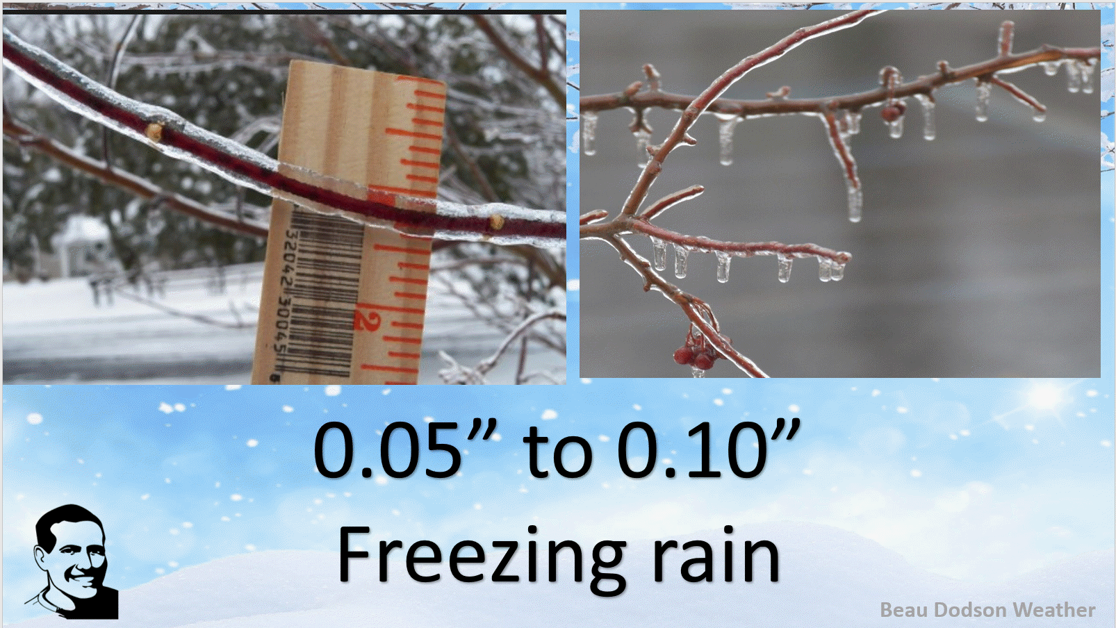
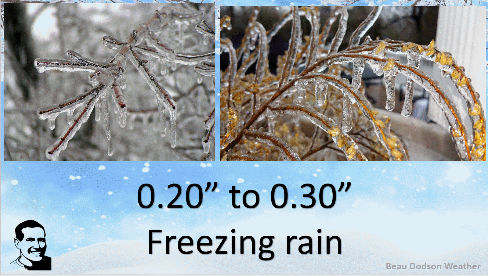
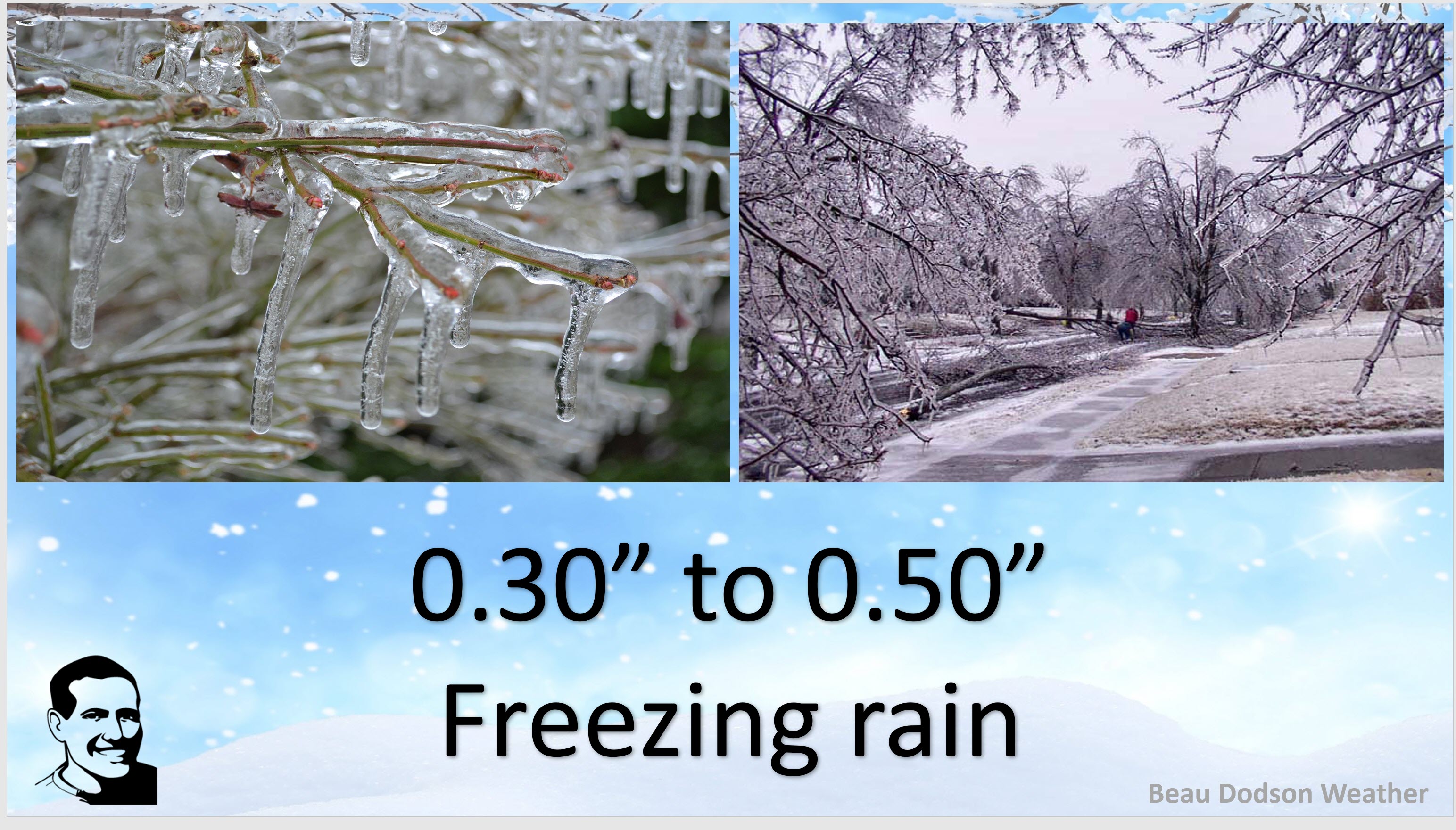
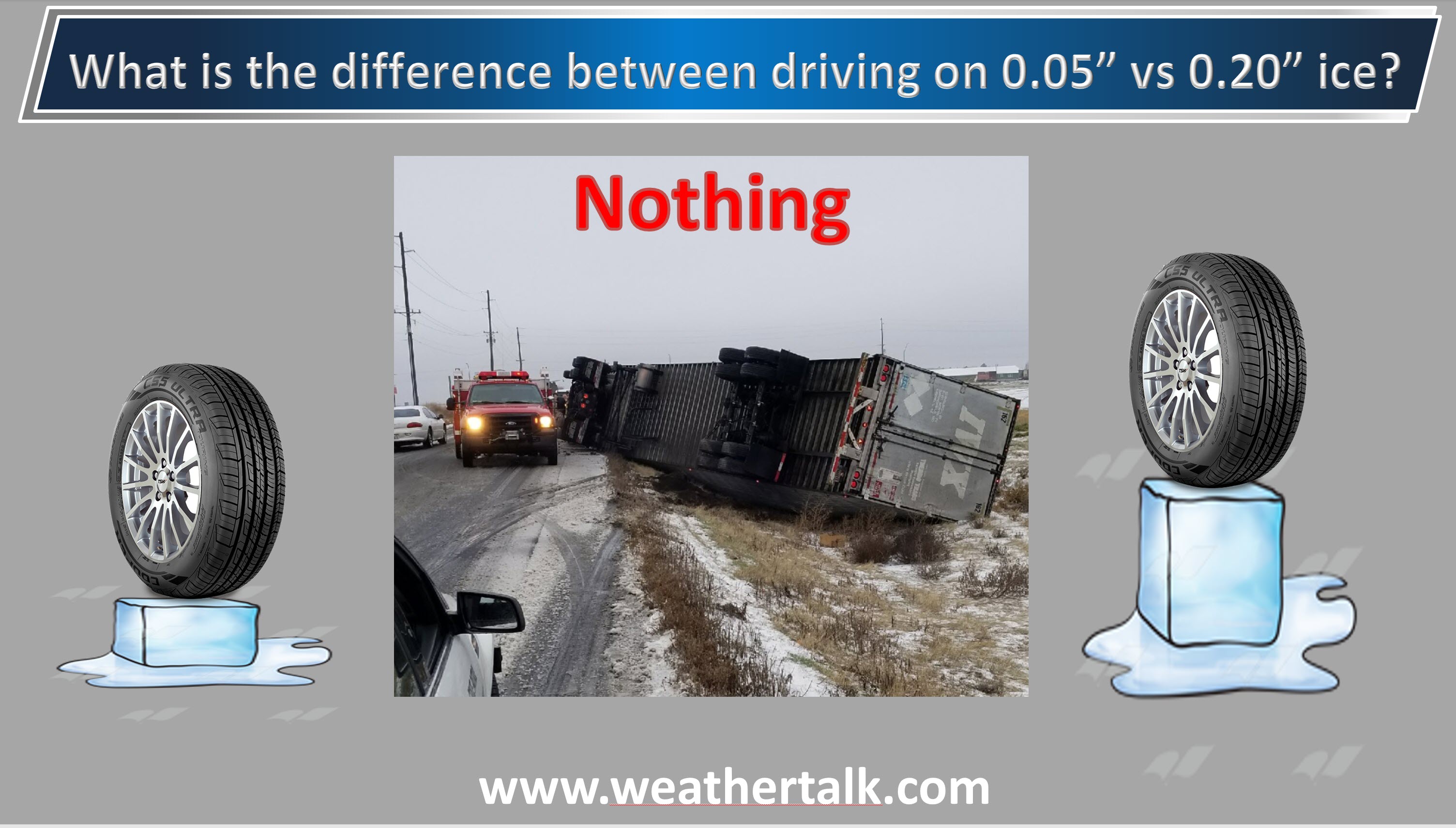
What do freezing rain totals look like?
Here are some examples.
.
.
.
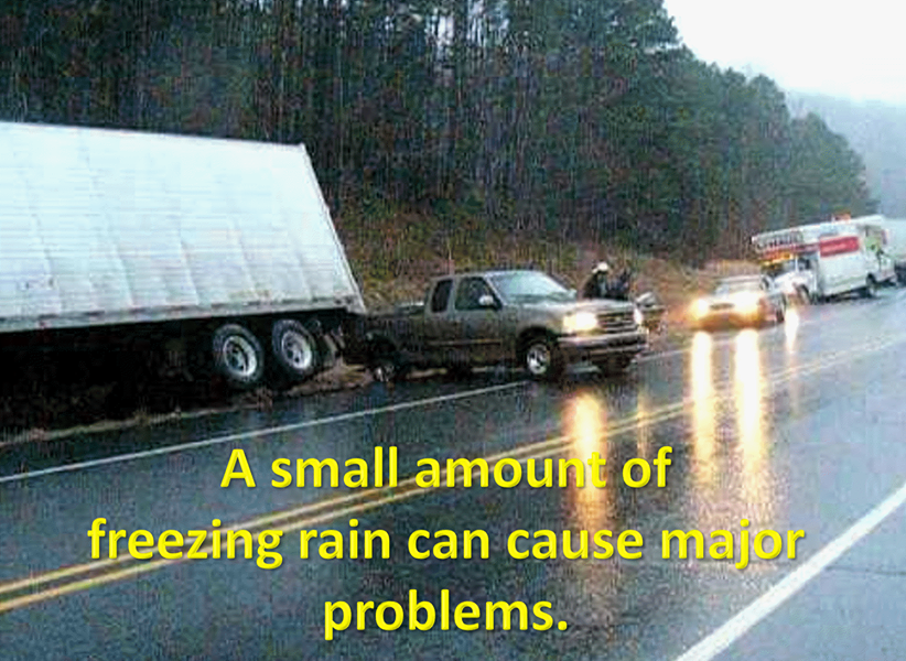
Even a small amount of freezing rain can cause problems.
.
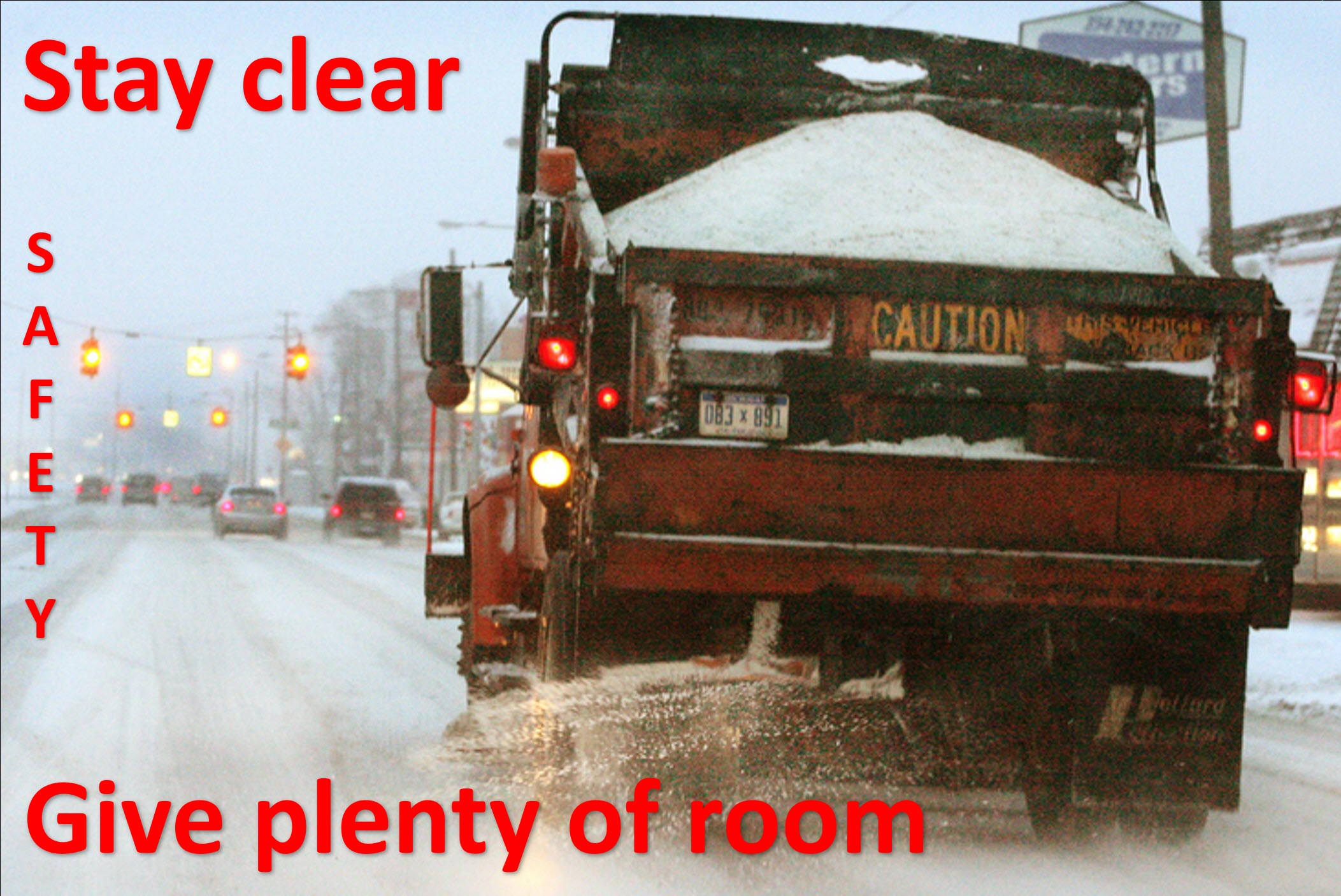
Give room
Check your WeatherTalk accounts.
Please check your www.weathertalk.com account to make sure your payment information is up to date. Log in. If you see “yellow colors” then it has not been updated. It will say free account. Click the update payment tab and go from there. I appreciate it.
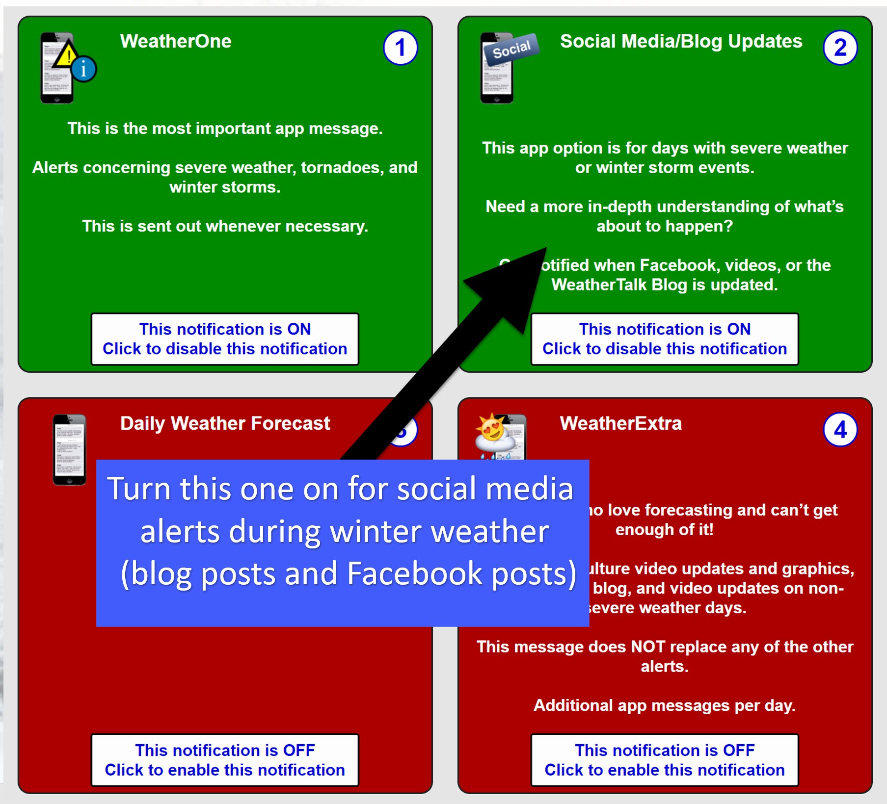
If you want to know when I send out a new winter weather social media alert then make sure you have this turned on in your www.weathertalk.com account
If you have questions or problems then email me at beaudodson@usawx.com
Find that here
.
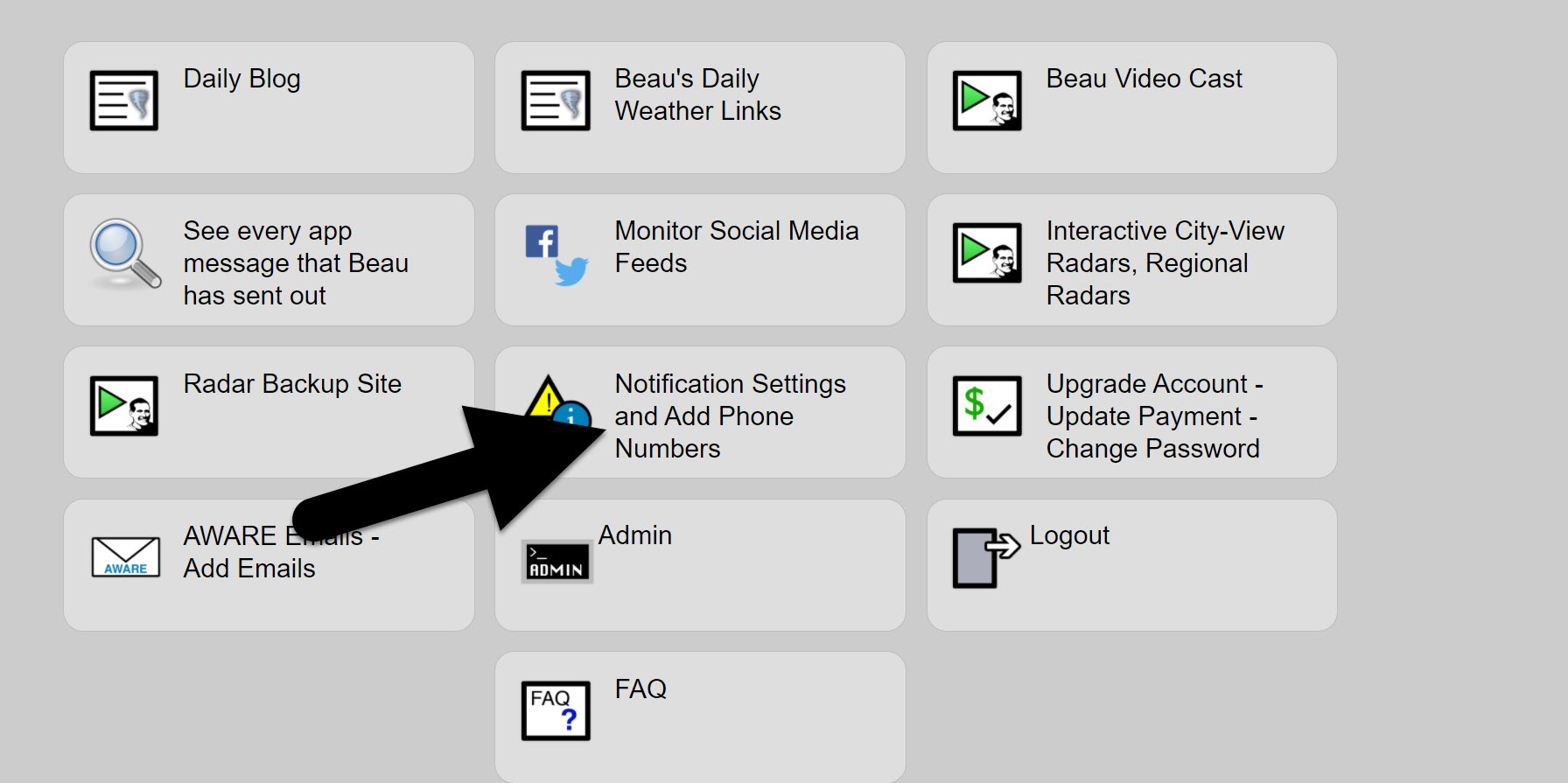
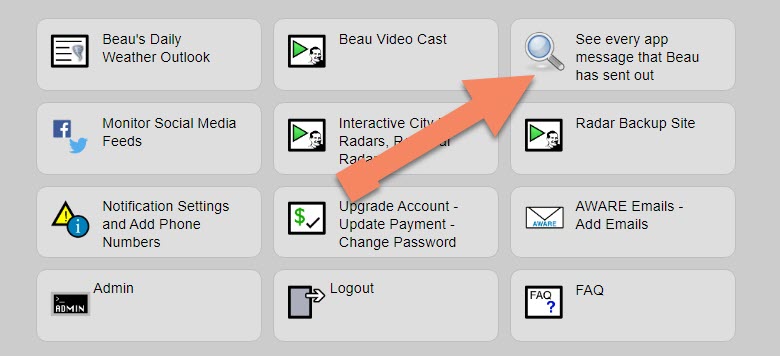
Note: We added a “see all” button on the website. This allows you to see every message that I have sent out (to all my forecast counties).
Here is the link. Click here.
To view the live radars, visit these links.
Radars
Interactive city-view radars
http://weatherobservatory.com/weather-radar.htm
A third backup radar
https://weathertalk.com/morani
Clickable watches and warnings can be viewed on the local city-view interactive radars (link above). Be sure and turn on the warnings above the local radars.
A new regional radar we offer
https://imagery.weathertalk.com/prx/RadarLoop.mp4
Lightning data
https://wtalk.co/7QT7WHKU
Not receiving app/text messages?
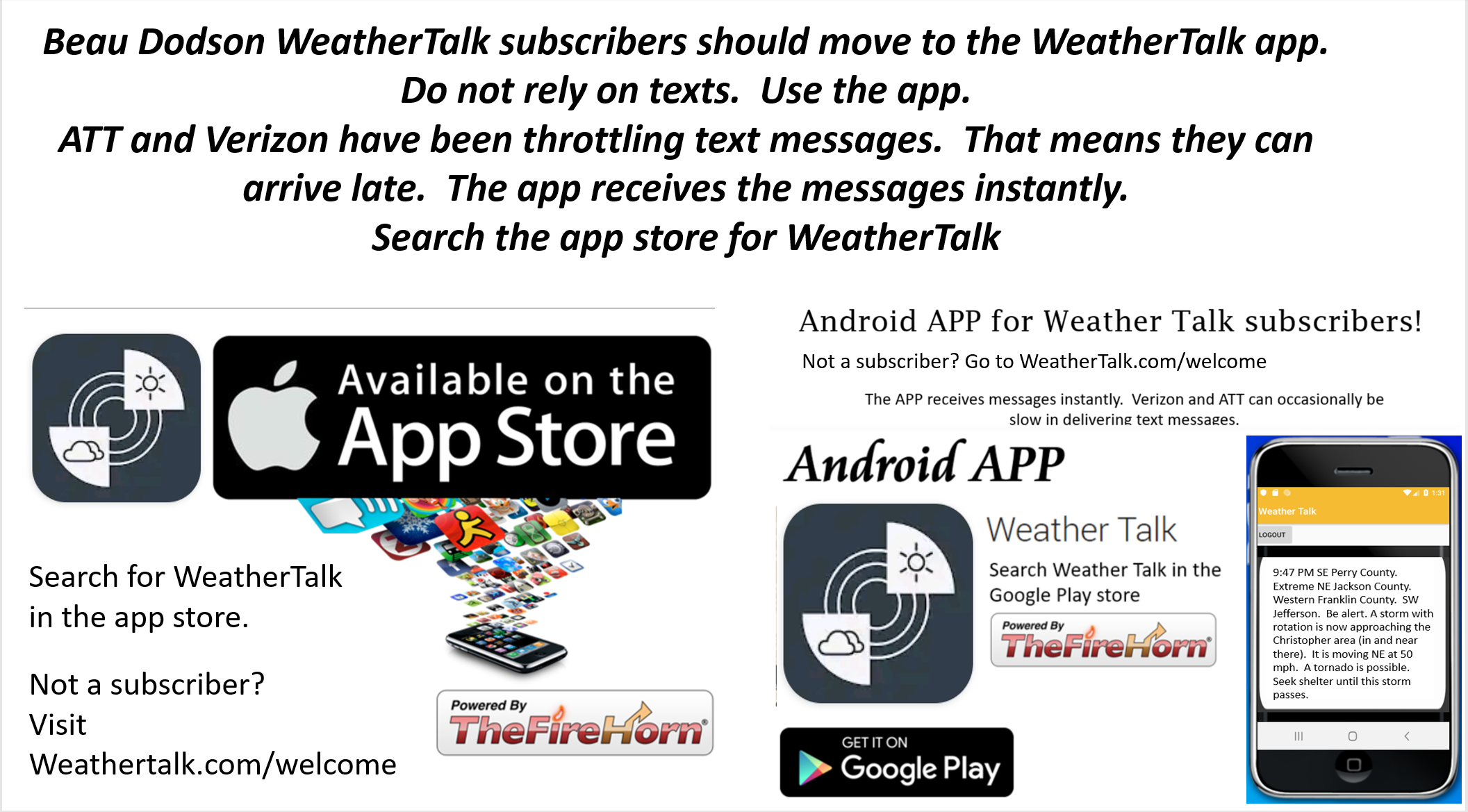
USE THE APP. ATT and Verizon are slowing or stopping the text messages.
Make sure you have the correct app/text options turned on. Find those under the personal notification settings tab at www.weathertalk.com. Red is off. Green is on.
Subscribers, PLEASE USE THE APP. ATT and Verizon are not reliable during severe weather. They are delaying text messages.
The app is under WeatherTalk in the app store.
Apple users click here
Android users click here
.

Live lightning data: Click here.


