
.

.
I have some question-and-answer threads over on the Facebook page. Link to those threads CLICK HERE
Or email me at beaudodsonweather@gmail.com
.

Seven-Day Hazardous Weather Outlook
1. Is lightning in the forecast? NO.
2. Are severe thunderstorms in the forecast? NO.
3. Is flash flooding in the forecast? ONGOING ISSUES.
4. Will non-thunderstorm winds top 40 mph? NO.
5. Will temperatures drop below 10 degrees? NO.
6. Will the wind chill dip below 0 degrees? NO.
7. Is measurable snow and/or sleet in the forecast? NO.
8. Is freezing rain/ice in the forecast? NO .
.
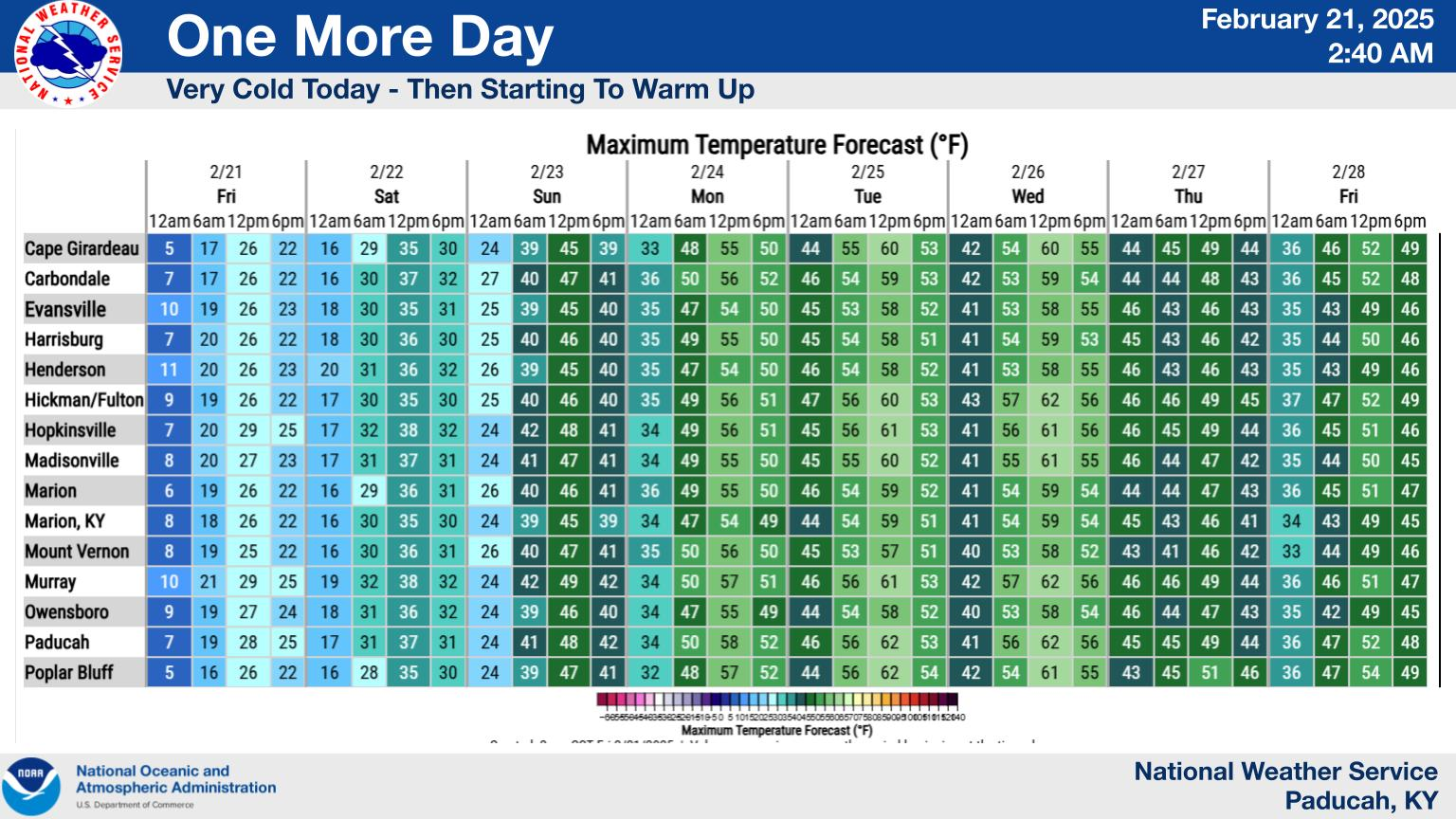
A quick forecast glance. Your 48-hour forecast Graphics


.

.
Double-click this image to make it larger. Find a city near you.


Forecast discussion. Active weather.
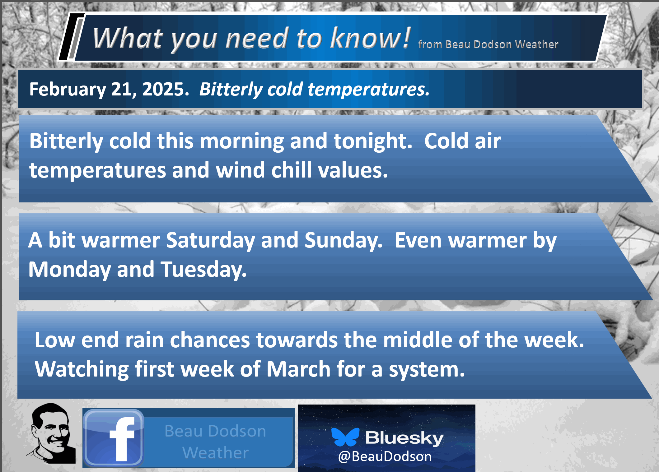
- Bitterly cold weather to continue into tonight.
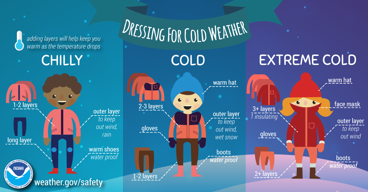
- Frostbite weather. Use care. Watch for black ice.
- Slow warming trend Saturday and Sunday. Quiet weather.
- Much warmer early next week! I can’t rule out some sixties on Tuesday. That will feel amazing.
- Flooding continues in some areas. Avoid flooded roadways
.
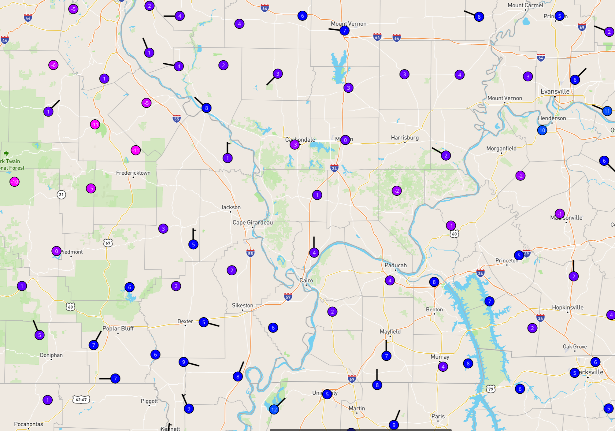
We are waking up to bitterly cold temperatures.
5 AM Temperatures
This is a mid-January-type cold.
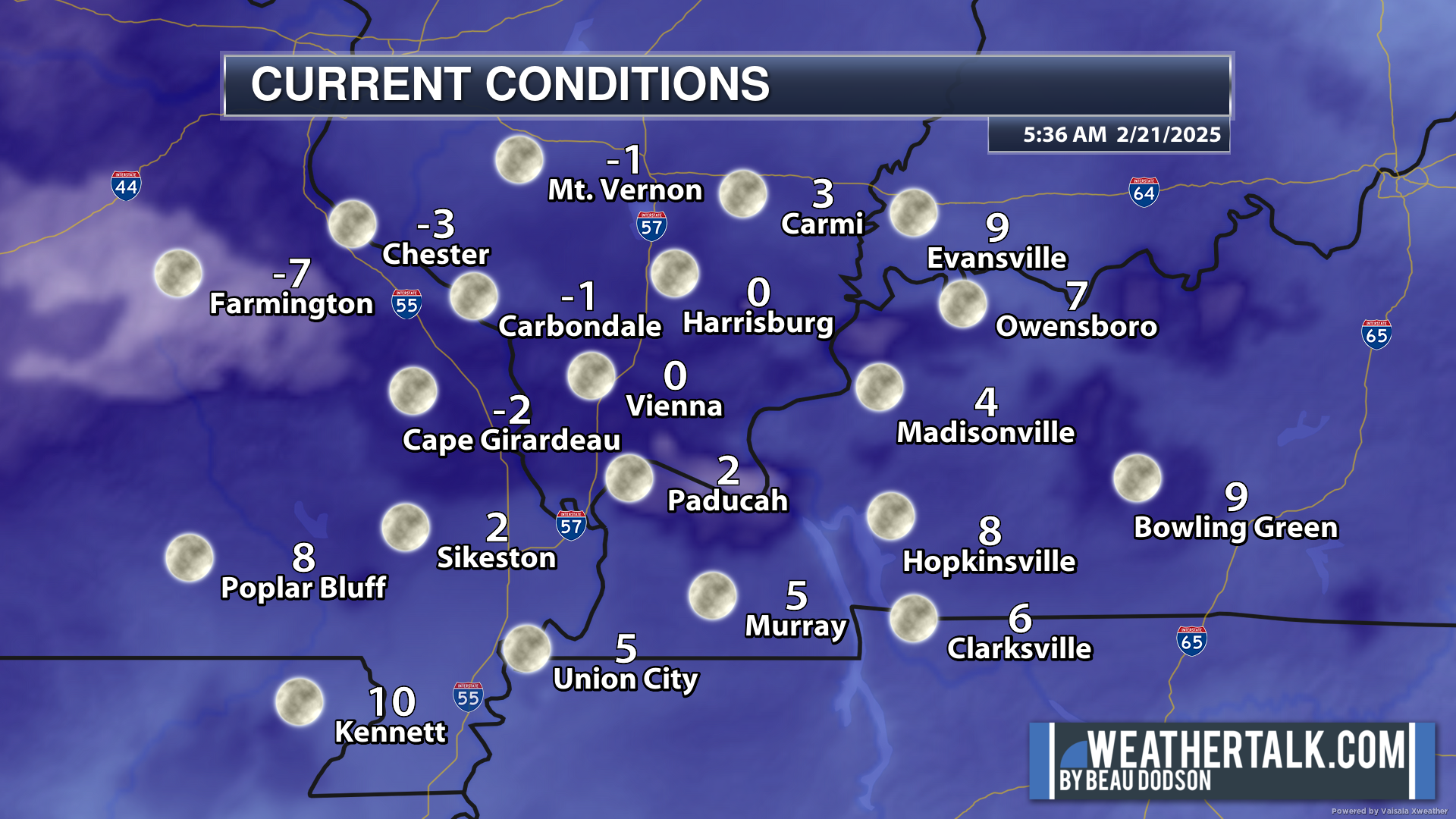
Check out these temperatures from the Wunder website. Portions of southeast Missouri are showing -5 to -11 readings!
Double click image to enlarge it
.
Use care this morning. Watch for black ice. Some roads in rural areas are still covered by snow and ice. Many schools are still closed.
We will see additional road improvements today and tomorrow.
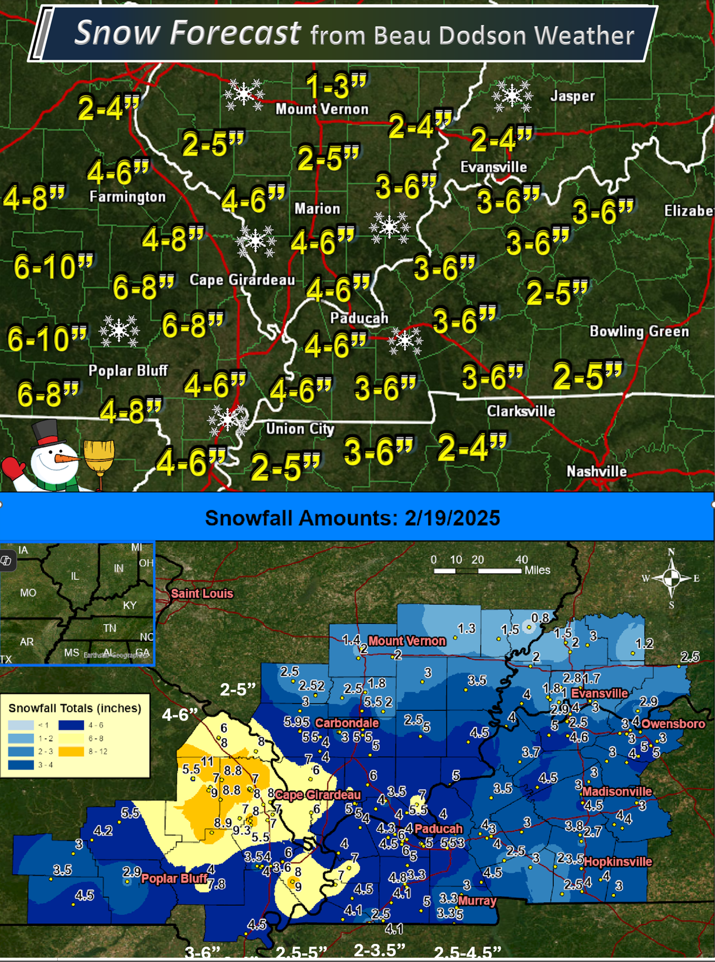
Here is the snow verification map from the other day. The top image was my final forecast. The bottom image is the NWS snow totals map.
Someone always receives more than expected. Someone always receives less than expected.
Double-click the image to enlarge it.
.
.
The good news is that we are entering a quiet weather pattern over the coming days. A much-needed break from our recent natural disasters.
It will remain cold today into Saturday morning. Bundle up for this weather.
There will be a slow warming trend tomorrow and Sunday. Every milder temperatures on Monday and Tuesday!
.

.
We still have icy roads this morning. Use care.
Watch for freezing fog, as well. Fog is patchy (not widespread).
Watch for fog tonight, as well.
Bitterly cold air will linger into tonight and tomorrow morning, Then, a warming trend.
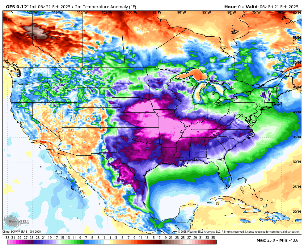
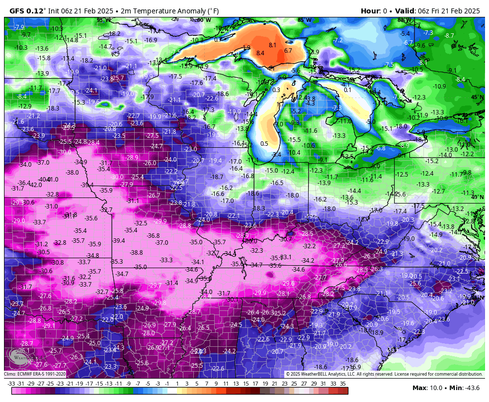
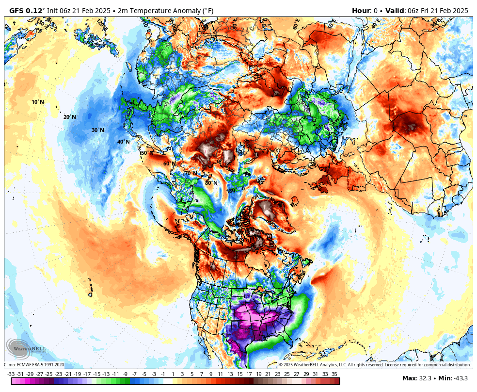
Check out this morning’s temperature anomaly map. How many degrees below average are temperatures?
Normal highs for mid-February are around 49 degrees
Normal lows for mid-February are around 30 degrees
.
Zoomed in view.
Again, these are not actual temperatures. These numbers represent how many degrees above or below average temperatures will be.
.
These are some of the coldest anomalies on the planet.
.
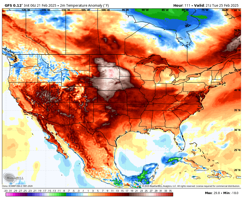
The great news is that it will be warmer from Sunday into next Wednesday.
Check out Tuesday’s temperature anomalies. We pop above freezing.
.
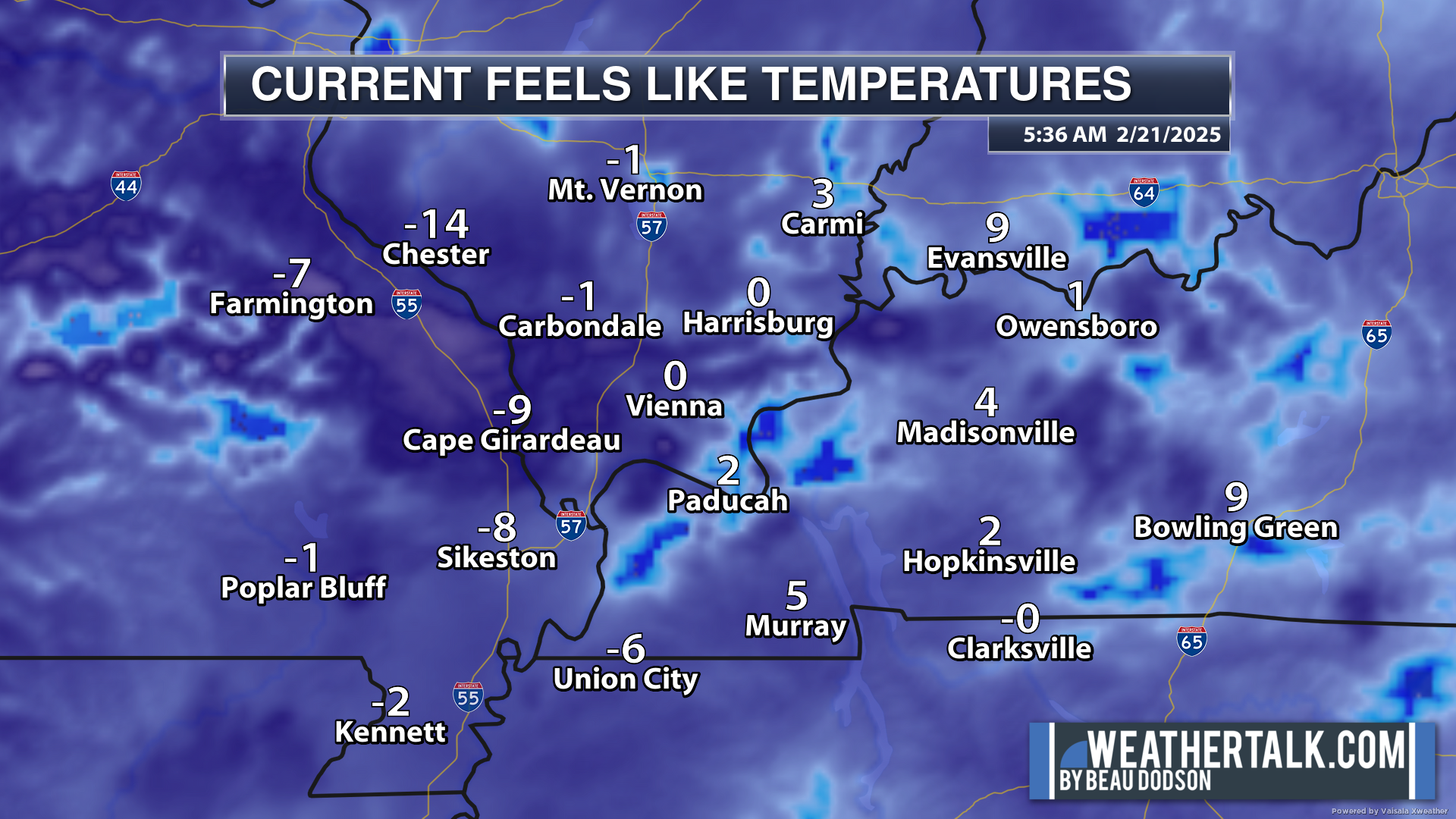
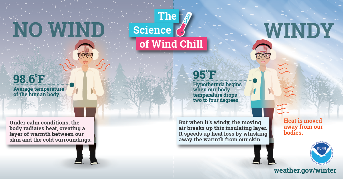
Remember, the body responds to wind chill. The wind chill is more important than the actual temperatures. Frostbite is a real concern with this upcoming winter event.
.
We still have some areas with flooded roadways. Avoid those roads, please.
The good news is that I do not have any significant precipitation in the forecast through Tuesday.
I am monitoring a chance of showers next Wednesday.
Confidence in this system bringing rain to the rain is low. Quite a bit of data is dry. It is a bit moisture-starved.
.

What radar might look like.
Here is the GFS future-cast radar. You can see those scattered showers on Wednesday.
Double-click the animation to enlarge it.
The timestamp (upper left) is in Zulu. 12z=6 am. 18z=12 pm. 00z=6 pm.
.
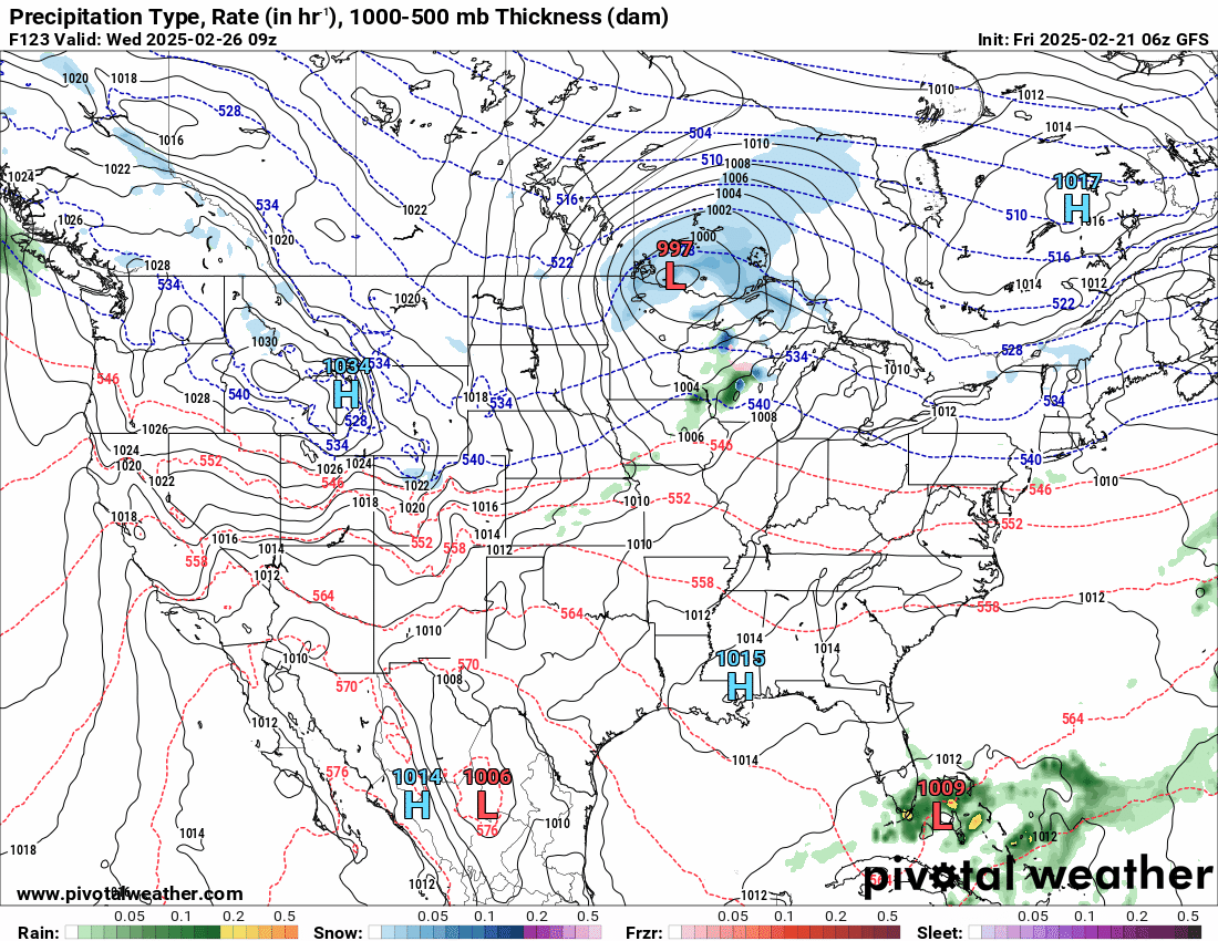
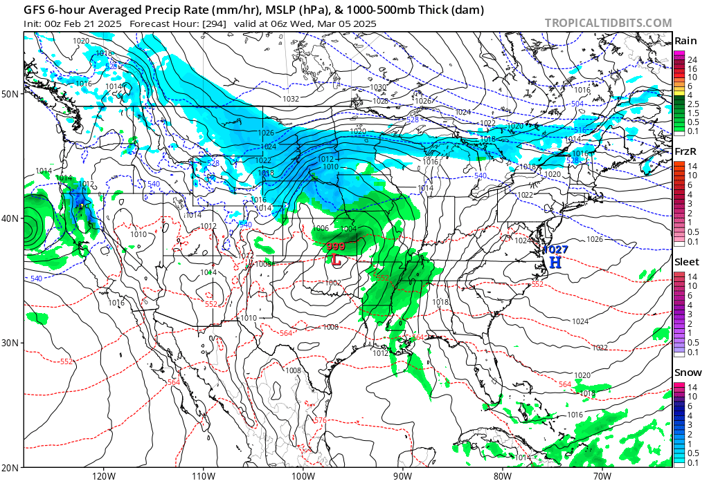
I am watching a bigger system around the first week of March.
That is a long way off to know how that event will impact us, if at all. Monitor updates.
The GFS shows that one. It keeps showing up on the charts. Something to monitor.
.
Have a great Friday, and stay warm.
.

Radars and Lightning Data
Interactive-city-view radars. Clickable watches and warnings.
https://wtalk.co/B3XHASFZ
Old legacy radar site (some of you like it better)
https://weatherobservatory.com/weather-radar.htm
If the radar is not updating then try another one. If a radar does not appear to be refreshing then hit Ctrl F5. You may also try restarting your browser.
Backup radar site in case the above one is not working.
https://weathertalk.com/morani
Regional Radar
https://imagery.weathertalk.com/prx/RadarLoop.mp4
** NEW ** Zoom radar with chaser tracking abilities!
ZoomRadar
If the radar is not working, then email me: Email me at beaudodson@usawx.com
.
We do have some sponsors! Check them out.
Connected and Protected.
They Specialize in Audio, Video, Networking, Security, Cameras, Electrical, New Construction, Remodels, and retrofitting Jobs. Experience the future of smart living and unmatched security with Connected & Protected Solutions today.
Link – Click here

.
Roof damage from recent storms? Link – Click here
INTEGRITY ROOFING AND EXTERIORS!
⛈️ Roof or gutter damage from recent storms? Today’s weather is sponsored by Integrity Roofing. Check out their website at this link https://www.ourintegritymatters.com/

![]()
![]()

.
Click here if you would like to return to the top of the page.
.Average high temperatures for this time of the year are around 50 degrees.
Average low temperatures for this time of the year are around 30 degrees.
Average precipitation during this time period ranges from 0.90″ to 1.20″
Six to Ten Day Outlook.
Blue is below average. Red is above average. The no color zone represents equal chances.
Average highs for this time of the year are in the lower 60s. Average lows for this time of the year are in the lower 40s.

Green is above average precipitation. Yellow and brown favors below average precipitation. Average precipitation for this time of the year is around one inch per week.

.

Average low temperatures for this time of the year are around 31degrees.
Average precipitation during this time period ranges from 0.90″ to 1.20″
.
Eight to Fourteen Day Outlook.
Blue is below average. Red is above average. The no color zone represents equal chances.

Green is above average precipitation. Yellow and brown favors below average precipitation. Average precipitation for this time of the year is around one inch per week.

.
![]()
Make sure you have three to five ways of receiving your severe weather information.
Weather Talk is one of those ways! Now, I have another product for you and your family.

.
.
https://weathercallservices.com/beau-dodson-weather


Want to add more products to your Beau Dodson Weather App?
Receive daily videos, weather blog updates on normal weather days and severe weather and winter storm days, your county by county weather forecast, and more!
Here is how to do add those additional products to your app notification settings!
Here is a video on how to update your Beau Dodson Weather payment.
The app is for subscribers. Subscribe at www.weathertalk.com/welcome then go to your app store and search for WeatherTalk
Subscribers, PLEASE USE THE APP. ATT and Verizon are not reliable during severe weather. They are delaying text messages.
The app is under WeatherTalk in the app store.

Apple users click here

Android users click here
.
Radars and Lightning Data
Interactive-city-view radars. Clickable watches and warnings.
https://wtalk.co/B3XHASFZ
Old legacy radar site (some of you like it better)
https://weatherobservatory.com/weather-radar.htm
If the radar is not updating then try another one. If a radar does not appear to be refreshing then hit Ctrl F5. You may also try restarting your browser.
Backup radar site in case the above one is not working.
https://weathertalk.com/morani
Regional Radar
https://imagery.weathertalk.com/prx/RadarLoop.mp4
** NEW ** Zoom radar with chaser tracking abilities!
ZoomRadar
Lightning Data (zoom in and out of your local area)
https://wtalk.co/WJ3SN5UZ
Not working? Email me at beaudodson@usawx.com
National map of weather watches and warnings. Click here.
Storm Prediction Center. Click here.
Weather Prediction Center. Click here.
.

Live lightning data: Click here.
Real time lightning data (another one) https://map.blitzortung.org/#5.02/37.95/-86.99
Our new Zoom radar with storm chases
.
.

Interactive GOES R satellite. Track clouds. Click here.
GOES 16 slider tool. Click here.
College of DuPage satellites. Click here
.

Here are the latest local river stage forecast numbers Click Here.
Here are the latest lake stage forecast numbers for Kentucky Lake and Lake Barkley Click Here.
.
.
Find Beau on Facebook! Click the banner.


 .
.