LONG RANGE OUTLOOKS/Videos/Graphics
February and March outlooks have been updated.
Bonus maps and videos have been updated.
Link to the long range outlooks and videos (for subscribers) – Click here
Subscribe at www.beaudodsonweather.com
Monthly costs to run Weather Talk can top $2000.00
Please consider subscribing!
Here are my monthly out of pocket costs to deliver you the weather.
.

.
Do you want more? How about short and long range outlooks, videos, and more detailed analysis!
Subscribe at www.beaudodsonweather.com
Once subscribed you can choose from four different app/text messages!
.
.
Be sure and download the app (subscribers). The app receives the messages much faster than regular text messaging (same messages, but faster).
.
.

.
February 2, 2018
Friday Forecast Details
Forecast: Mostly sunny. Some passing clouds. Much colder.
Temperatures: MO ~ 28 to 32 IL ~ 26 to 34 KY ~ 28 to 34
What is the chance of precipitation? MO ~ 0% IL ~ 0% KY ~ 0% TN ~ 0%
Coverage of precipitation: None
Wind chill values: 20 to 30
Accumulating snow or ice: No
Winds: North and northwest at 5 to 10 mph
What impacts are anticipated from the weather? None
My confidence in the forecast verifying: High
Is severe weather expected? No
The NWS defines severe weather as 58 mph wind or great, 1″ hail or larger, and/or tornadoes
Should I cancel my outdoor plans? No
.
Friday Night Forecast Details:
Forecast: Mostly clear early and then increasing clouds late. Cold. Temperatures may rise a bit after 1 am.
Temperatures: MO ~ 18 to 24 IL ~ 16 to 22 KY ~ 18 to 24
What is the chance of precipitation? MO ~ 0% IL ~ 0% KY ~ 0% TN ~ 0%
Coverage of precipitation: None
Wind chill values: 10 to 20
Accumulating snow or ice: No
Winds: Light and variable winds. Winds becoming south at 4 to 8 mph late.
What impacts are anticipated from the weather? Most likely none.
My confidence in the forecast verifying: High
Is severe weather expected? No
The NWS defines severe weather as 58 mph wind or great, 1″ hail or larger, and/or tornadoes
Should I cancel my outdoor plans: No
.
February 3, 2018
Saturday Forecast Details
Forecast: Becoming mostly cloudy. A few scattered showers mixed with snow/sleet possible late in the afternoon. The best chance would be across southeast Missouri. Precipitation will then spread northeast and east during the evening and overnight hours.
Temperatures: MO ~ 36 to 45 IL ~ 36 to 45 KY ~ 44 to 48
What is the chance of precipitation? MO ~ 40% (afternoon) IL ~ 20% (afternoon) KY ~ 20% (afternoon) TN ~ 30% (afternoon)
Coverage of precipitation: Scattered during the late afternoon and evening
Wind chill values: 30 to 40
Accumulating snow or ice: There is a risk that precipitation may begin as a brief wintry mix Saturday late afternoon and evening.
Winds: South at 6 to 12 mph
What impacts are anticipated from the weather? Wet roadways. Monitor the wintry mix part of the forecast for our northern counties.
My confidence in the forecast verifying: High
Is severe weather expected? No
The NWS defines severe weather as 58 mph wind or great, 1″ hail or larger, and/or tornadoes
Should I cancel my outdoor plans? Have a plan B and monitor radars.
.
Saturday Night Forecast Details:
Forecast: Mostly cloudy. Showers. Showers may begin as a brief period of sleet or snow. Showers may be mixed with freezing rain and sleet near the I-64 corridor (northern parts of southeast Missouri and northern parts of southern Illinois). Another area to monitor for snow will be northwest Kentucky. Along a line from Evansville, Indiana towards Central City, Kentucky. Rain may begin as a period of snow.
Temperatures: MO ~ 32 to 38 IL ~ 32 to 38 KY ~ 32 to 38
What is the chance of precipitation? MO ~ 50% IL ~ 50% KY ~ 60% TN ~ 60%
Coverage of precipitation: Scattered to perhaps widespread. Greatest coverage may be across southeast Illinois, western Kentucky, and northwest Tennessee.
Wind chill values: 25 to 35
Accumulating snow or ice: I will be monitoring the I-64 corridor for a wintry mix. I will be monitoring northwest Kentucky, as well.
Winds: South 7 to 14 mph with gusts to 16 mph
What impacts are anticipated from the weather? Wet roadways. I can’t rule out icy roads over northern parts of southeast Missouri and near the I-64 corridor in southern Illinois. I will be monitoring northwest Kentucky, as well.
My confidence in the forecast verifying: High
Is severe weather expected? No
The NWS defines severe weather as 58 mph wind or great, 1″ hail or larger, and/or tornadoes
Should I cancel my outdoor plans: Have a plan B
.
February 4, 2018
Sunday Forecast Details
Forecast: Quite a few clouds during the morning. Becoming partly cloudy. Rain or rain/snow ending before noon. A fast moving system could bring a few snow showers late Sunday afternoon and evening, as well.
Temperatures: MO ~ 36 to 42 IL ~ 36 to 42 KY ~ 36 to 42
What is the chance of precipitation? MO ~ 10% IL ~ 30% KY ~ 30% TN ~ 30%
Coverage of precipitation: Ending before noon. Scattered late in the day.
Wind chill values: 20 to 30
Accumulating snow or ice: Unlikley
Winds: Southwest winds becoming north and northwest at 6 to 12 mph.
What impacts are anticipated from the weather? Wet roadways.
My confidence in the forecast verifying: High
Is severe weather expected? No
The NWS defines severe weather as 58 mph wind or great, 1″ hail or larger, and/or tornadoes
Should I cancel my outdoor plans? No
.
Sunday Night Forecast Details:
Forecast: Partly cloudy. Slight chance of snow flurries across southeast Missouri and northern parts of southern Illinois.
Temperatures: MO ~ 16 to 20 IL ~ 16 to 20 KY ~ 18 to 22
What is the chance of precipitation? MO ~ 20% IL ~ 20% KY ~ 0% TN ~ 0%
Coverage of precipitation: None to isolated
Wind chill values: 8 to 16
Accumulating snow or ice: Unlikely
Winds: North 7 to 14 mph
What impacts are anticipated from the weather? None anticipated
My confidence in the forecast verifying: Medium
Is severe weather expected? No
The NWS defines severe weather as 58 mph wind or great, 1″ hail or larger, and/or tornadoes
Should I cancel my outdoor plans: No.
.
February 5, 2018
Monday Forecast Details
Forecast: Mostly sunny with passing clouds. Chilly.
Temperatures: MO ~ 35 to 40 IL ~ 34 to 38 KY ~ 35 to 40
What is the chance of precipitation? MO ~ 0% IL ~ 0% KY ~ 0% TN ~ 0%
Coverage of precipitation: None
Wind chill values: 25 to 35
Accumulating snow or ice: No
Winds: North 6 to 12 mph
What impacts are anticipated from the weather? None
My confidence in the forecast verifying: High
Is severe weather expected? No
The NWS defines severe weather as 58 mph wind or great, 1″ hail or larger, and/or tornadoes
Should I cancel my outdoor plans? No.
.
Monday Night Forecast Details:
Forecast: Increasing clouds. A chance of snow after 1 am. Chilly.
Temperatures: MO ~ 26 to 32 IL ~ 26 to 32 KY ~ 26 to 32
What is the chance of precipitation? MO ~ 40% IL ~ 40% KY ~ 40% TN ~ 40%
Coverage of precipitation: Scattered late
Wind chill values: 18 to 25
Accumulating snow or ice: Possible
Winds: East and southeast winds at 5 to 10 mph
What impacts are anticipated from the weather? Monitor updates
My confidence in the forecast verifying: Medium
Is severe weather expected? No
The NWS defines severe weather as 58 mph wind or great, 1″ hail or larger, and/or tornadoes
Should I cancel my outdoor plans: Monitor updates
.
February 6, 2018
Tuesday Forecast Details
Forecast: Cloudy. A wintry mix changing to rain.
Temperatures: MO ~ 38 to 44 IL ~ 38 to 44 KY ~ 38 to 44
What is the chance of precipitation? MO ~ 40% IL ~ 40% KY ~ 40% TN ~ 40%
Coverage of precipitation: Scattered to perhaps widespread
Wind chill values: 25 to 35
Accumulating snow or ice: Monitor updates
Winds: East and southeast winds at 7 to 14 mph
What impacts are anticipated from the weather? Monitor updates.
My confidence in the forecast verifying: LOW
Is severe weather expected? No
The NWS defines severe weather as 58 mph wind or great, 1″ hail or larger, and/or tornadoes
Should I cancel my outdoor plans? Have a plan B.
.
Tuesday Night Forecast Details:
Forecast: Cloudy. Rain. Rain becoming mixed with or changing to sleet and snow.
Temperatures: MO ~ 25 to 30 IL ~ 25 to 30 KY ~ 25 to 30
What is the chance of precipitation? MO ~ 40% IL ~ 40% KY ~ 40% TN ~ 40%
Coverage of precipitation: Perhaps widespread
Wind chill values: 20 to 30
Accumulating snow or ice: Possible, but confidence is low
Winds: Winds becoming north at 7 to 14 mph and gusty
What impacts are anticipated from the weather? Monitor updates
My confidence in the forecast verifying: LOW
Is severe weather expected? No
The NWS defines severe weather as 58 mph wind or great, 1″ hail or larger, and/or tornadoes
Should I cancel my outdoor plans: Have a plan B
.
February 7, 2018
Wednesday Forecast Details
Forecast: A chance of early morning snow showers or flurries. Partly sunny during the late morning and afternoon. Cold.
Temperatures: MO ~ 35 to 40 IL ~ 35 to 40 KY ~ 35 to 40
What is the chance of precipitation? MO ~ 20% IL ~ 20% KY ~ 20% TN ~ 20%
Coverage of precipitation: Ending
Wind chill values: 25 to 35
Accumulating snow or ice: Additional accumulation is not anticipated during the day on Wednesday
Winds: North at 6 to 12 mph
What impacts are anticipated from the weather? Most likely none. Monitor for icy roads if snow falls on Tuesday night.
My confidence in the forecast verifying: Medium
Is severe weather expected? No
The NWS defines severe weather as 58 mph wind or great, 1″ hail or larger, and/or tornadoes
Should I cancel my outdoor plans? No, but monitor updates.
.
Wednesday Night Forecast Details:
Forecast: Mostly clear. Chilly.
Temperatures: MO ~ 18 to 22 IL ~ 18 to 22 KY ~ 18 to 22
What is the chance of precipitation? MO ~ 0% IL ~ 0% KY ~ 0% TN ~ 0%
Coverage of precipitation: None
Wind chill values: 12 to 20
Accumulating snow or ice: No
Winds: North and northwest at 5 to 10 mph
What impacts are anticipated from the weather? None
My confidence in the forecast verifying: Medium
Is severe weather expected? No
The NWS defines severe weather as 58 mph wind or great, 1″ hail or larger, and/or tornadoes
Should I cancel my outdoor plans: No
.

.
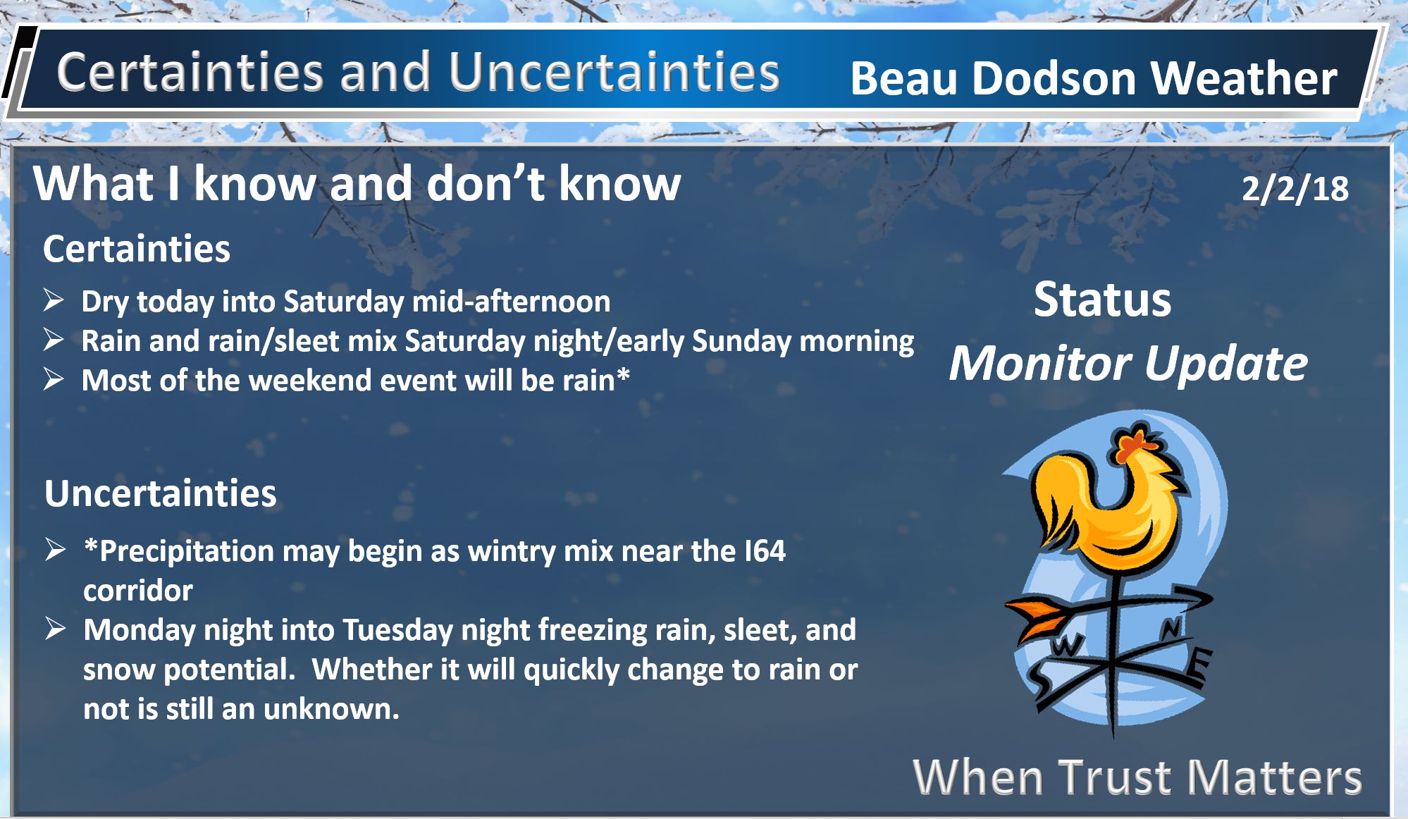
Friday into Saturday morning: No snow or ice anticipated.
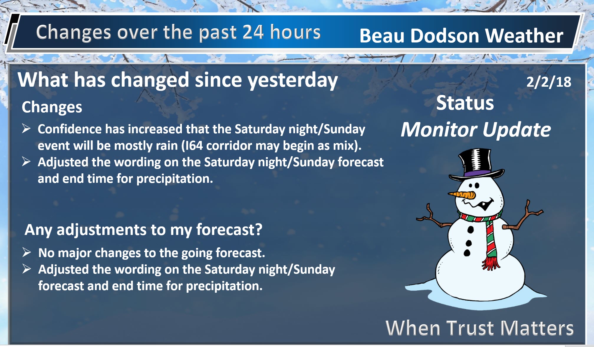
Rain and snow/sleet possible late Saturday afternoon/evening into early Sunday morning. It appears any wintry mix would be short lived. We should have all rain as we move into Saturday night. The only exception might be northern portions of southeast Missouri and near the I-64 corridor in southern Illinois.
A slight chance of snow flurries or snow showers Sunday night over our far northern counties (again near I-64).
I am monitoring another system late Monday night into Tuesday night. A wintry mix will be possible with that event, but it is still too early for confidence levels to be all that great. Precipitation appears likely. Type is the question. Monitor updates.
.

.
The National Weather Service definition of a severe thunderstorm is one that produces quarter size hail or larger, 58 mph winds or greater, and/or a tornado.
Now through next Friday No severe weather concerns.
.

.
February 2, 2018
Interactive Weather Radar Page. Choose the city nearest your location: Click this link.
.
.
.
Forecast:
Winter Weather Radar
Be sure and turn on the winterize button above the local city view radars
Interactive Weather Radar Page. Choose the city nearest your location: Click this link.
Friday into Sunday:
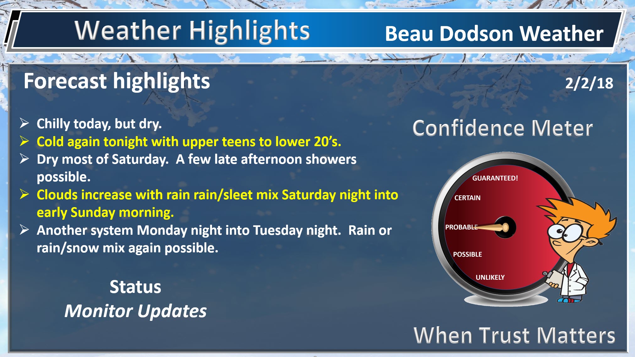
HIGHLIGHTS
- Colder today, but with quite a bit of sunshine.
- Dry through Saturday mid-afternoon. A few showers perhaps late in the day.
- Mostly a rain event for Saturday night and Sunday. A wintry mix possible across our far northern counties. Rain may briefly begin with snow and sleet pellets, elsewhere.
High confidence in the forecast through Sunday afternoon.
Dry weather is anticipated through most of Saturday.
Clouds will increase as we push into Saturday afternoon. A new storm system will spread light rain and rain showers back into the region Saturday (late afternoon or evening) into Saturday night. Rain should end by early Sunday morning over most of the area. A few remaining showers possible before 11 AM (esp our eastern counties).
Temperatures may be cold enough for a wintry mix at the beginning of the event. This is especially true across the I-64 corridor (norther portions of southeast Missouri and northern portions of southern Illinois). We should also monitor northwest Kentucky. Our far eastern counties. Along a line from Evansville towards Central City.
Elsewhere, this should be a rain event. Perhaps a few sleet pellets or wet snowflakes at the beginning.
Portions of southeast Missouri and southern Illinois may see very little in the way of measurable rainfall.
A fast moving disturbance could also bring snow showers Sunday afternoon and evening.
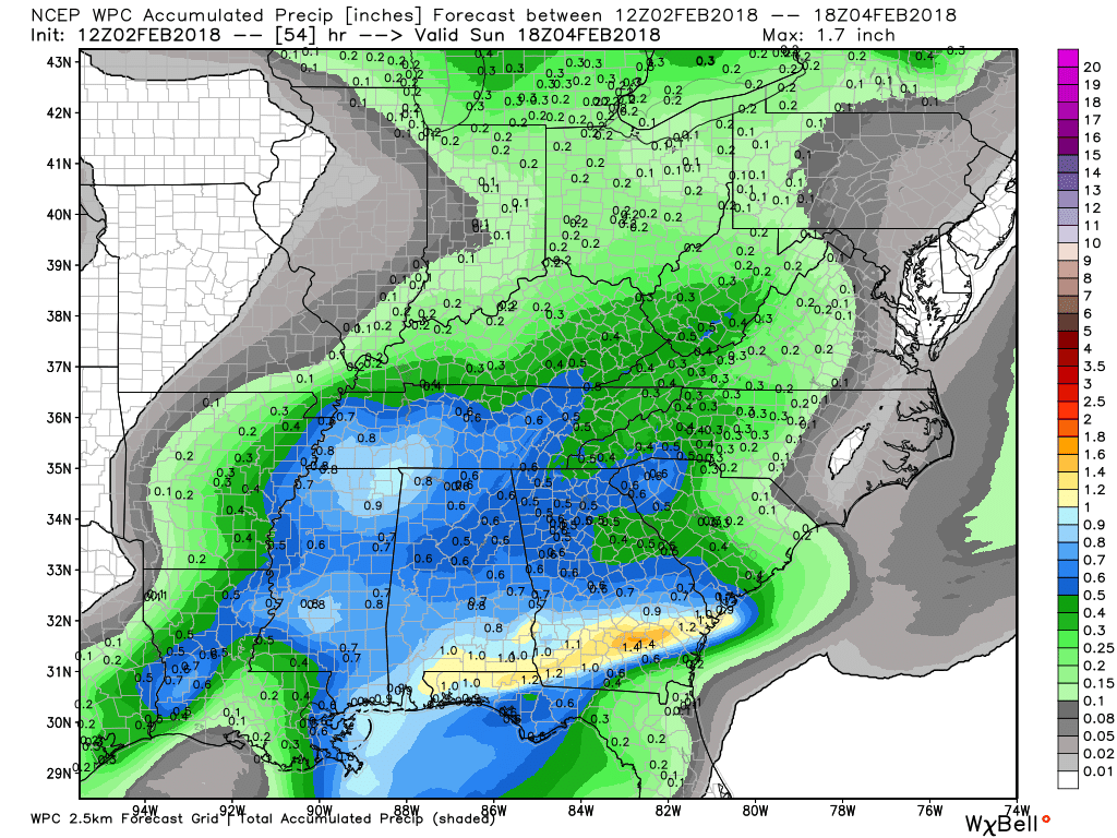
Here is the official WPC rainfall forecast map through Sunday morning. You can see light totals across portions of the region. Heavier totals to the south of our region.
Click image to enlarge.
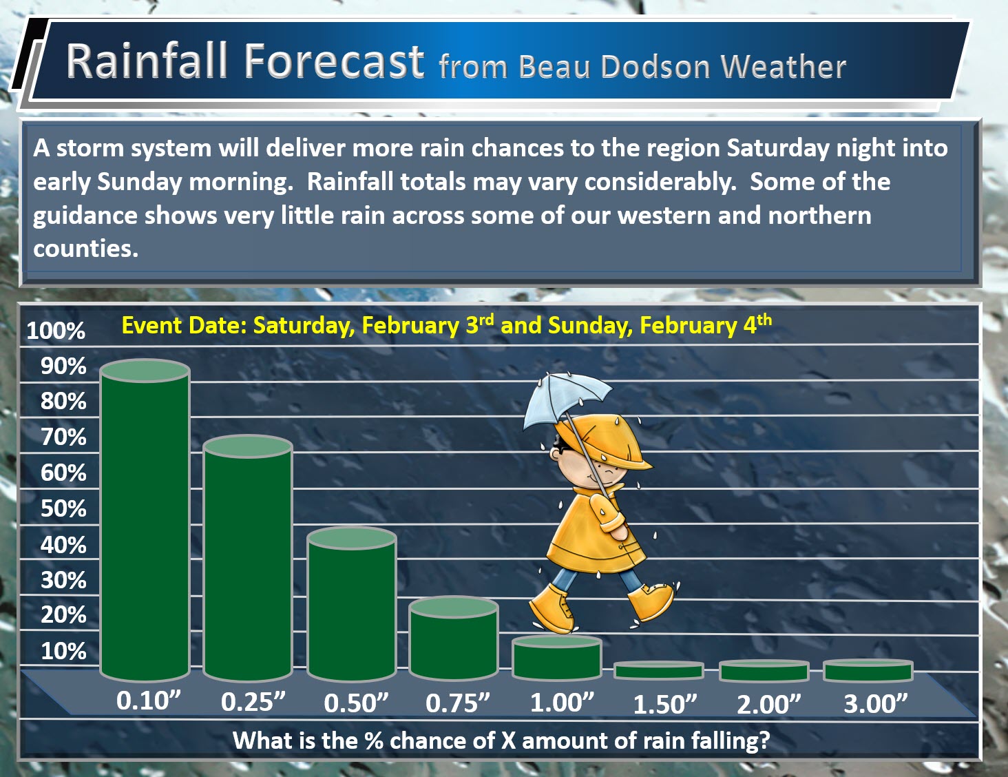
Here is my rainfall totals forecast.
What is the % chance of X amount of rain falling Saturday night into early Sunday morning.
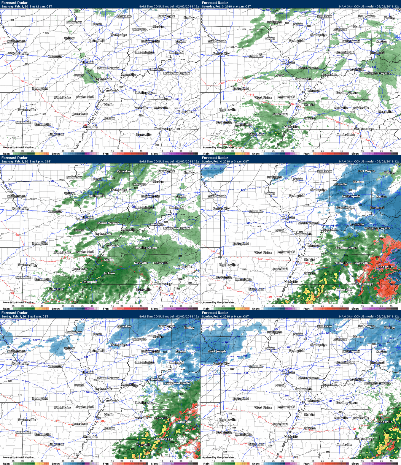
Here is the latest NAM model guidance future-cast radar. Green and yellow represent rain. Blue represents snow. Other colors are a wintry mix.
Time stamp upper left. Click image to enlarge.
This is for the late Saturday afternoon into Saturday night event.
.
.
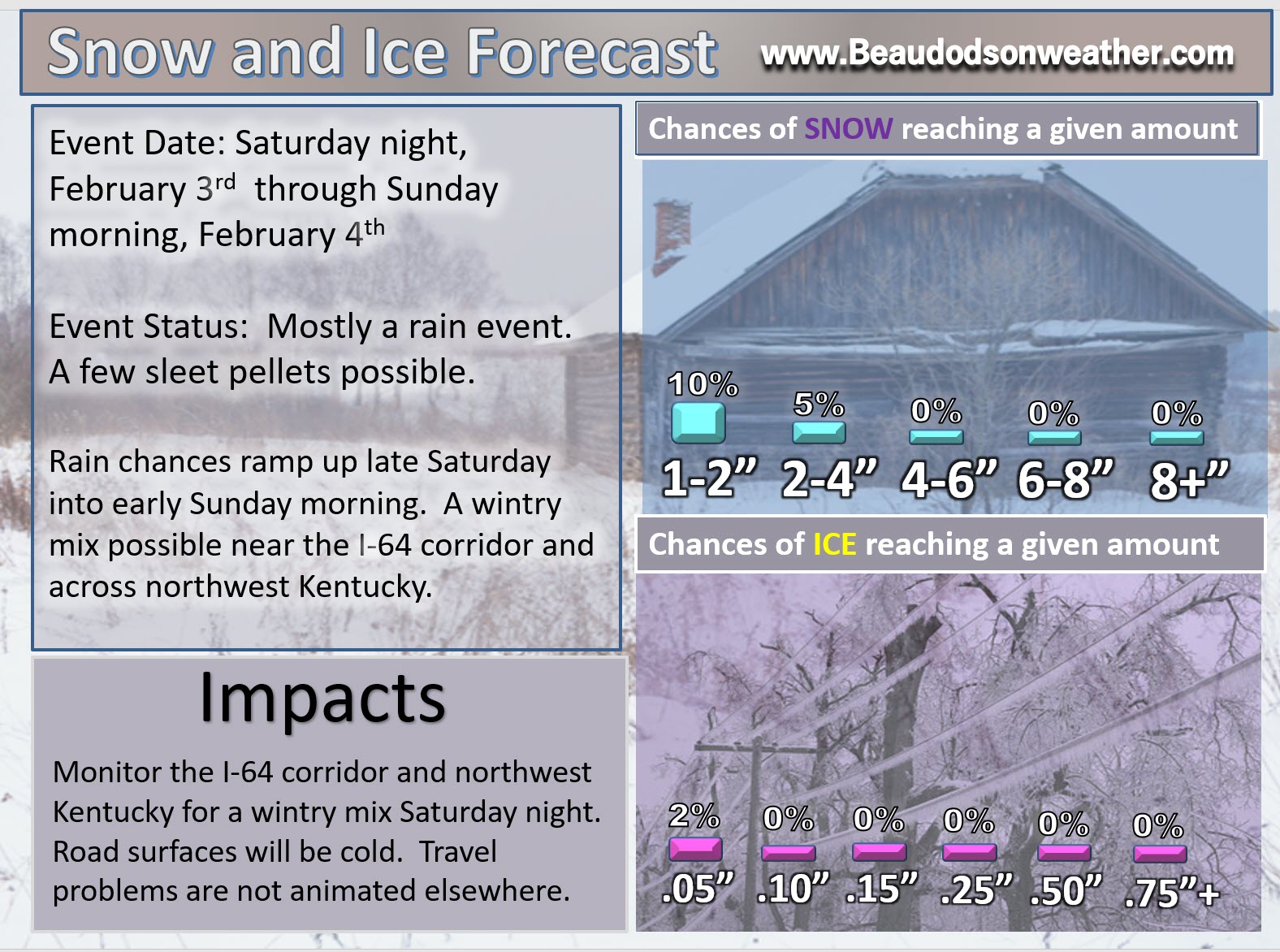
Here is my latest snow probability forecast map for Saturday night and Sunday.
This is mostly a rain event. A few snow flakes or sleet pellets possible at the beginning of the event. A wintry mix briefly possible near the I-64 corridor and across northwest Kentucky. Roads will be cold near the I-64 corridor. That could mean icy patches. Use care Saturday night.
.
.
Sunday night into Monday afternoon:
HIGHLIGHTS
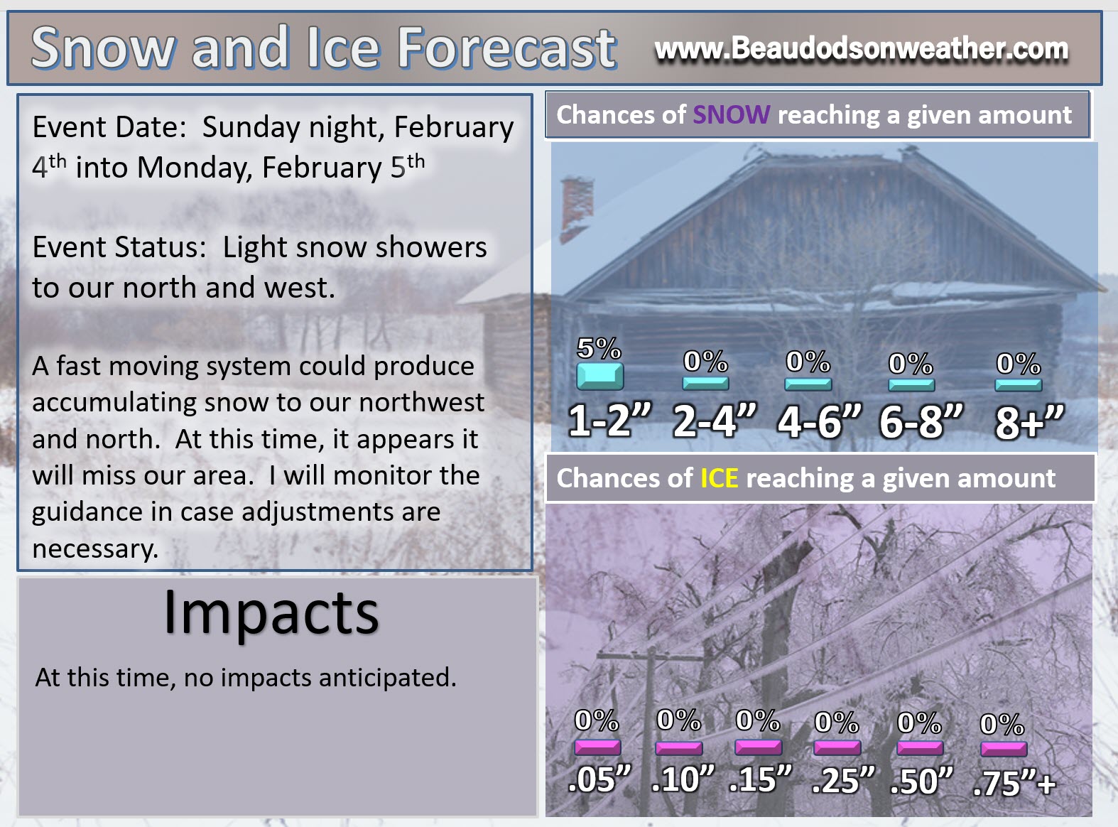
- Some clouds Sunday night. A chance of snow flurries or snow showers. This is especially true for southeast Missouri and southern Illinois. At this time, accumulation appears unlikely in our local area. Further north and west there could be some accumulation.
- Falling temperatures Sunday into Sunday afternoon.
- Cold Sunday night.
- Dry Monday morning and afternoon.
Medium to high confidence on the Sunday night through Monday afternoon forecast.
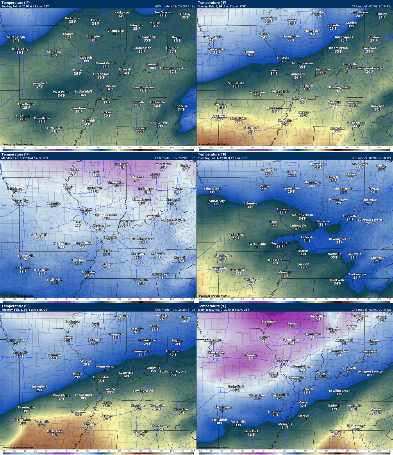
Temperatures will fall Sunday as the colder air wraps around the storm system (see graphic below).
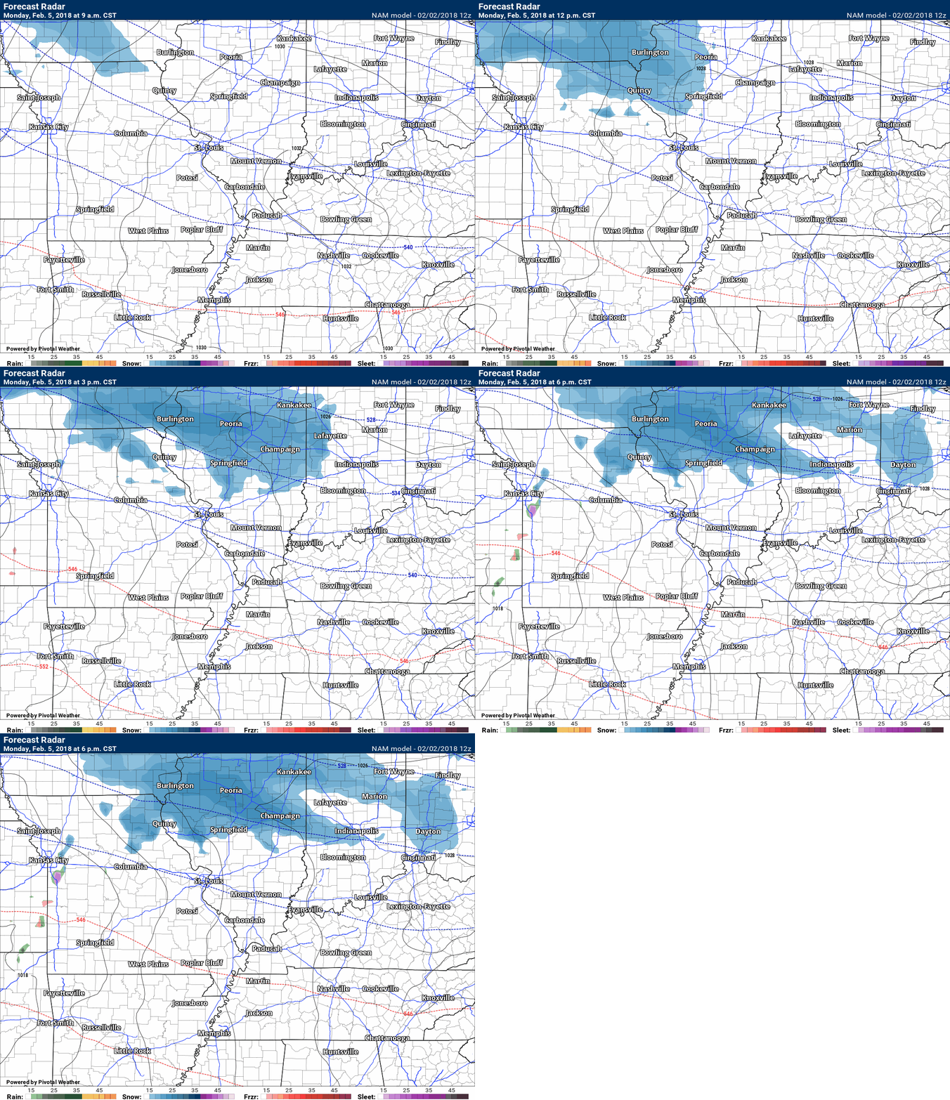
A fast moving disturbance could produce snow flurries and snow showers late Sunday night and Monday to our north and west. At this time, it appears it will produce little in the way of precipitation locally. I will, as always, keep an eye on it.
There are one or two model sets that bring it a tad further south.
You can see that system here on the NAM guidance. Blue would be snow. This runs from Monday 9 AM through Monday 6 PM. Other guidance produces the snow late Sunday night into Monday morning.
.
.
Here is my latest snow probability forecast map for Sunday night into Monday afternoon
.
.
Click image to enlarge.
You can see how temperatures fall during the day on Sunday. Time stamp upper left.
.
.
Monday night into Friday:
HIGHLIGHTS
- Another in a series of storm systems will spread precipitation back into our region. High confidence.
- A wintry mix to rain may be the end result, but confidence on precipitation type remains low.
- Most of the precipitation will likely have ended by Wednesday morning or afternoon. Medium confidence.
- Dry weather Thursday and possibly Friday. Medium confidence.
Yet another storm system will spread precipitation back into the region by late Monday night or Tuesday morning. Cold air will be in place at the start of the event. That could mean a wintry mix of sleet, freezing rain, and snow. Temperatures should warm on Tuesday and change precipitation to all rain.
Confidence on the exact type of precipitation and timing of change-over is low. Monitor updates, as always.
The track and intensity of the system is key to precipitation type. Monitor updates.
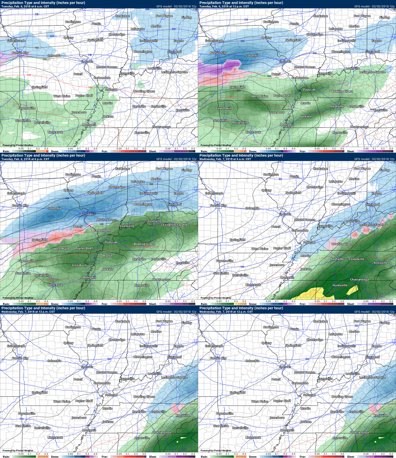
Here is the GFS model guidance future-cast radar for Tuesday and Wednesday.
Green is rain. Blue is snow. Pink is a wintry mix of sleet, freezing rain, and snow.
Time stamp upper left.
.
.
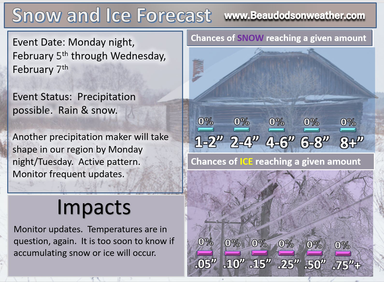
Here is my latest snow probability forecast map for Monday night into Wednesday morning
It is still too soon to make a snowfall forecast.
.
.
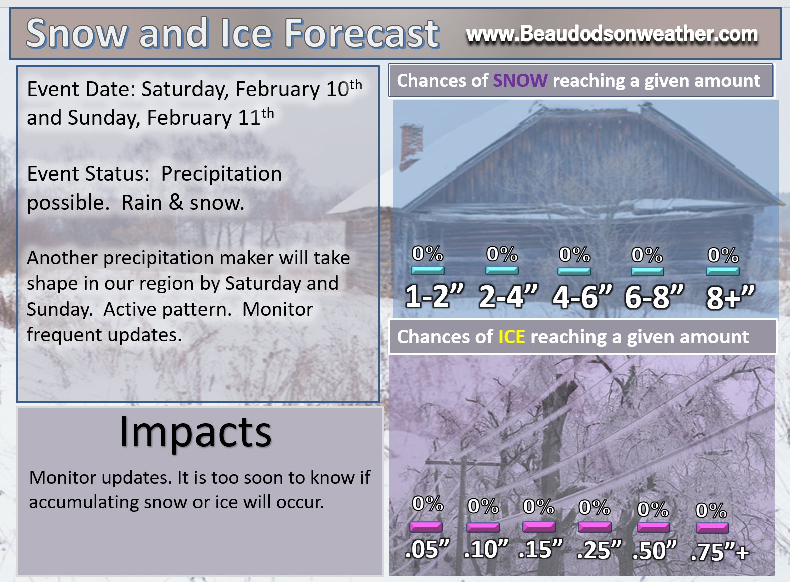
Friday night into Sunday (February 9th through the 11th)
HIGHLIGHTS
- Another in a series of storm systems may spread precipitation back into our region late next week. Low confidence.
- It is too early to know what type of precipitation. Monitor updates
I will initiate a graphic on next weekends system. Still early to know the details on this one.
.
.

We offer regional radars and local city radars – if a radar does not update then try another one. Occasional browsers need their cache cleared. You may also try restarting your browser. This will usually fix any problems.
During the winter you can track snow and ice by clicking the winterize button on the local city view interactive radars.
You may email me at beaudodson@usawx.com
Interactive Weather Radar Page. Choose the city nearest your location: Click this link
National interactive radar: Click this link.


