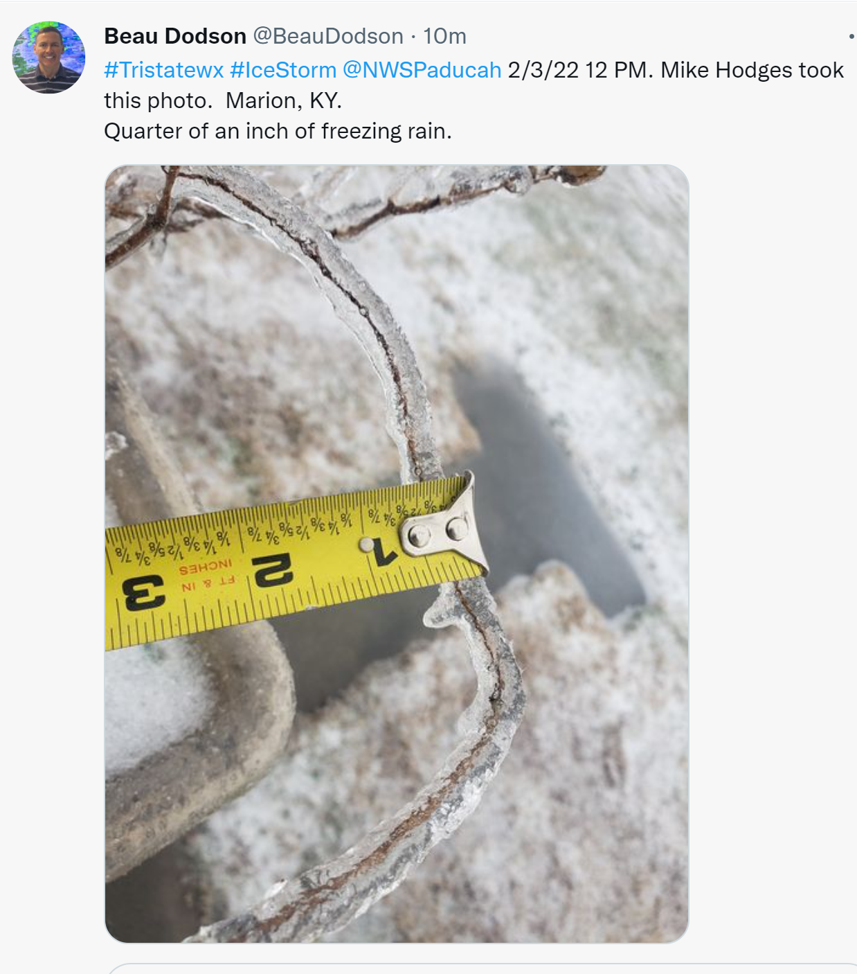
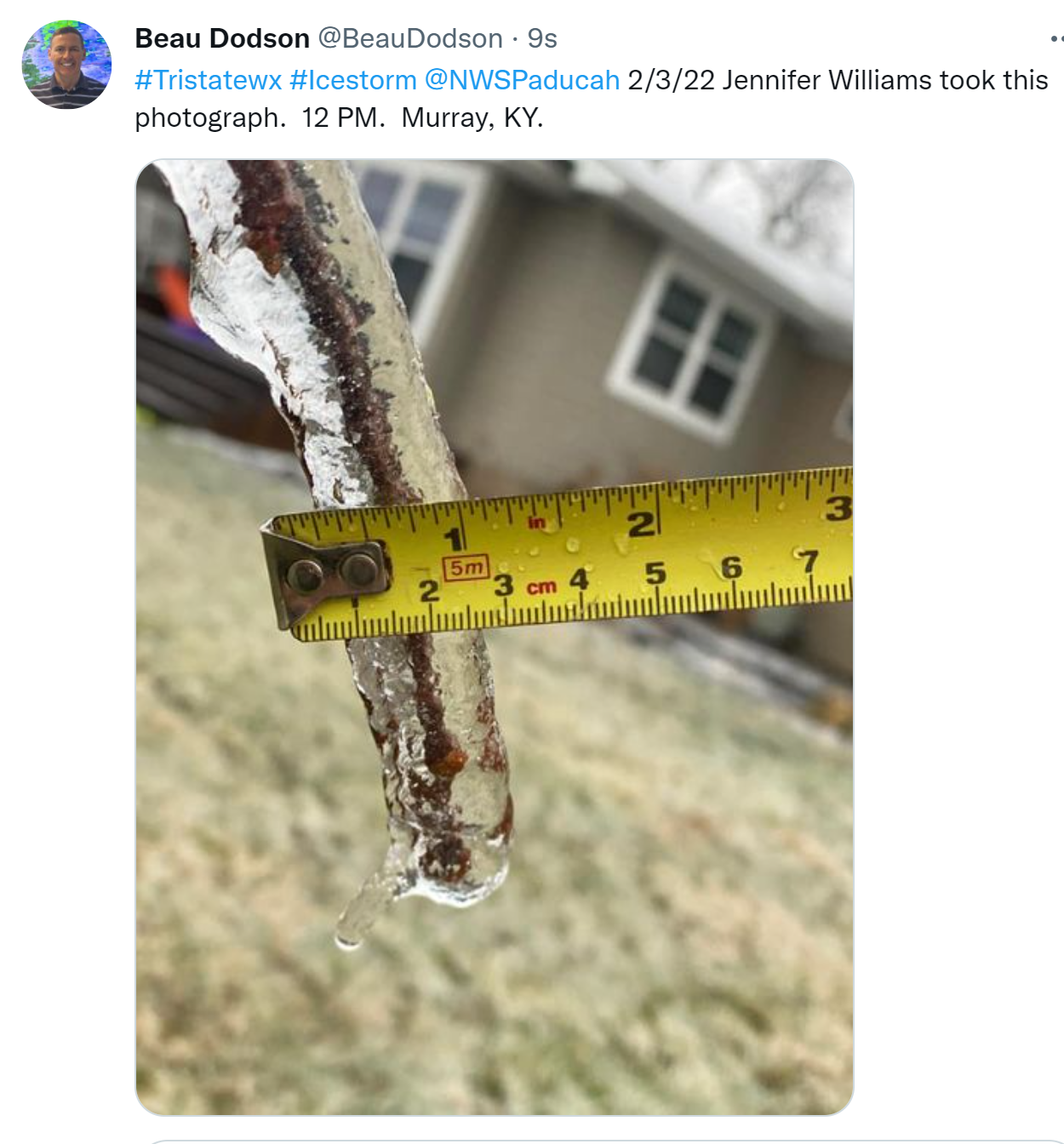
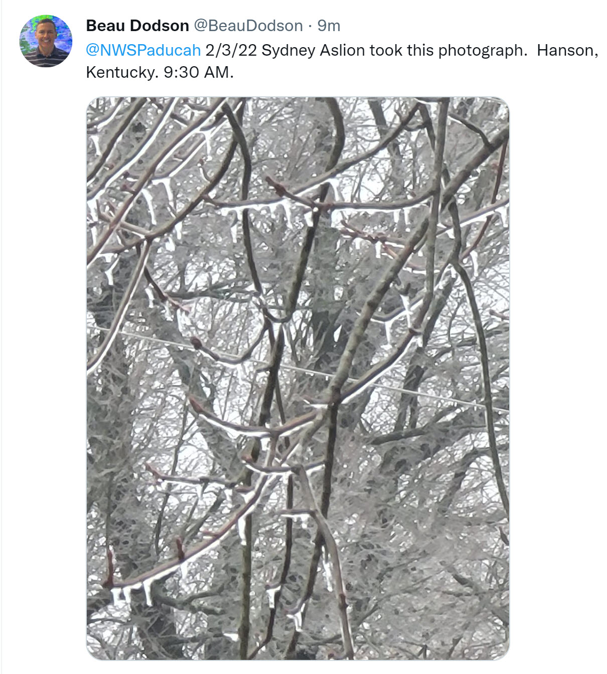
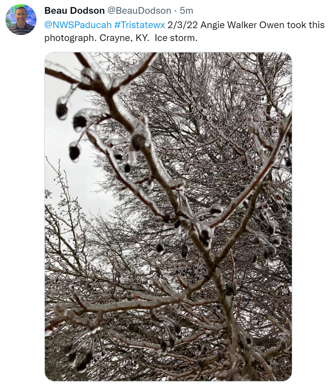
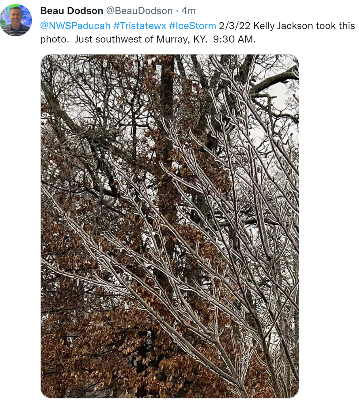
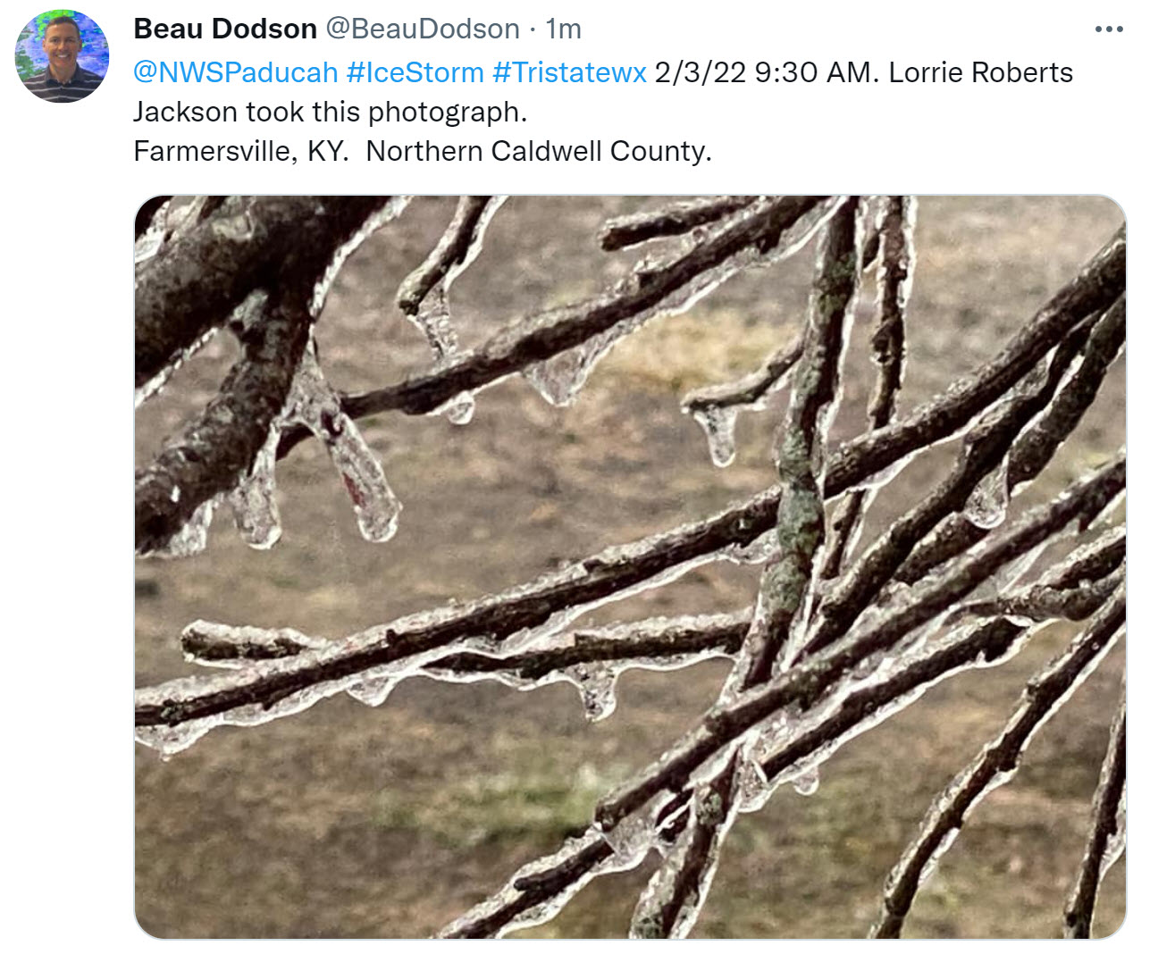
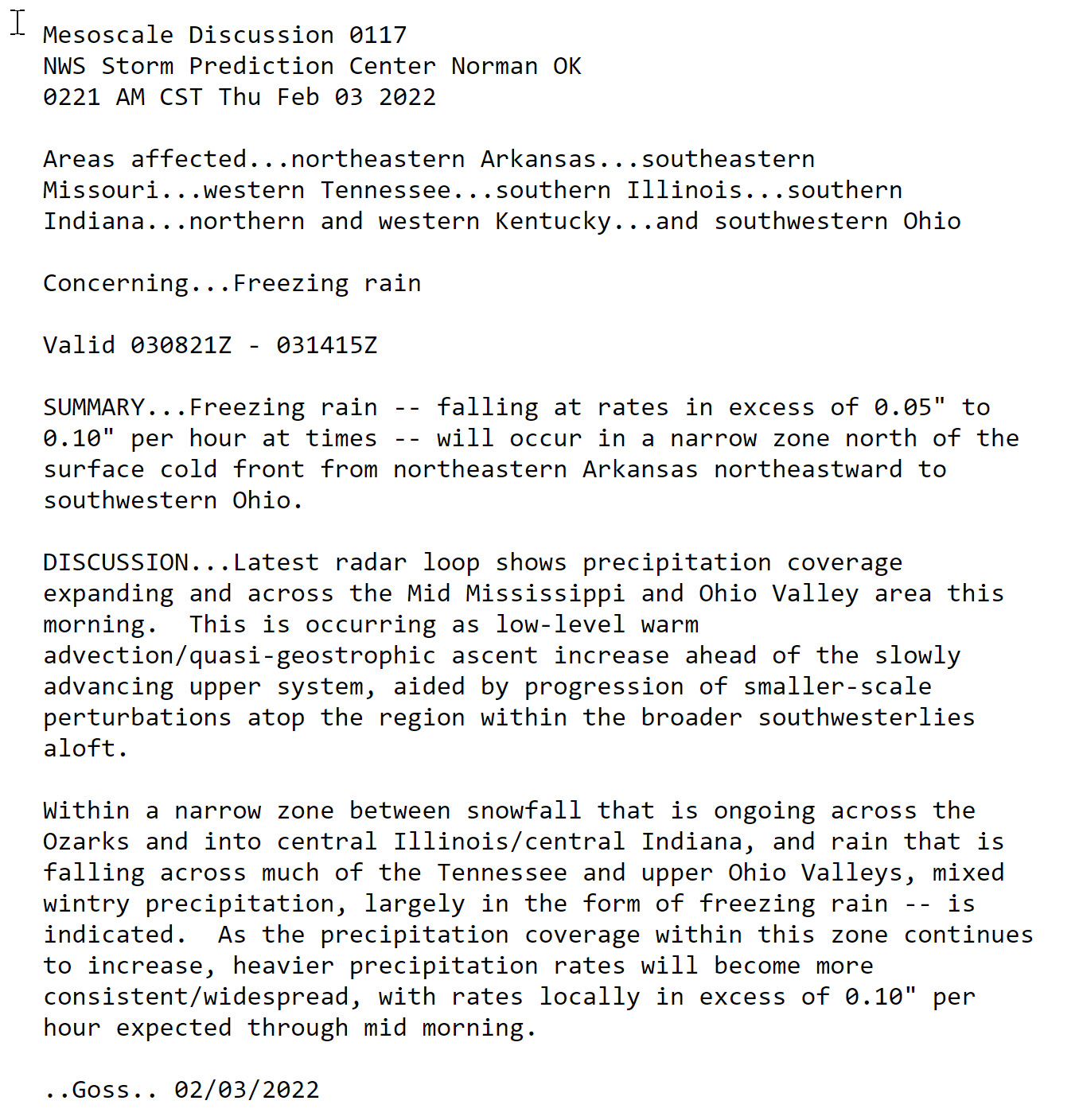
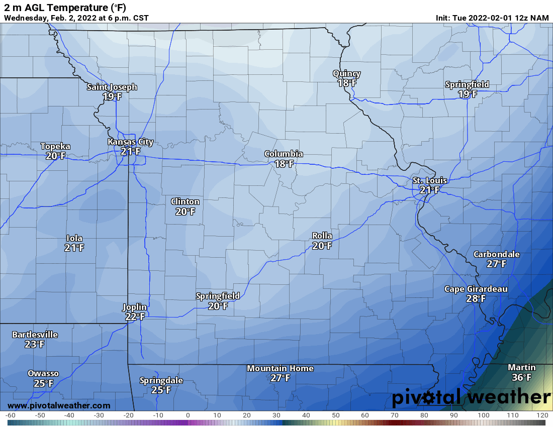
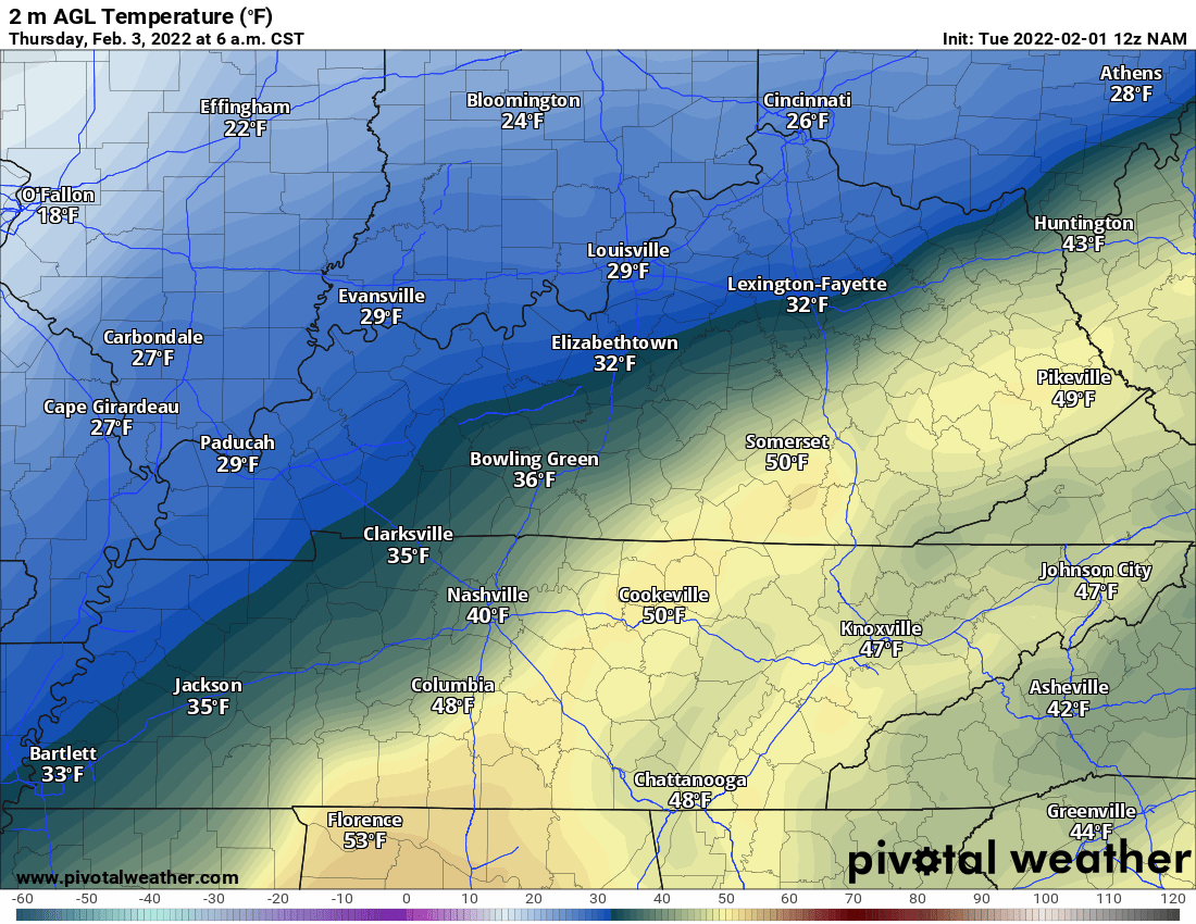
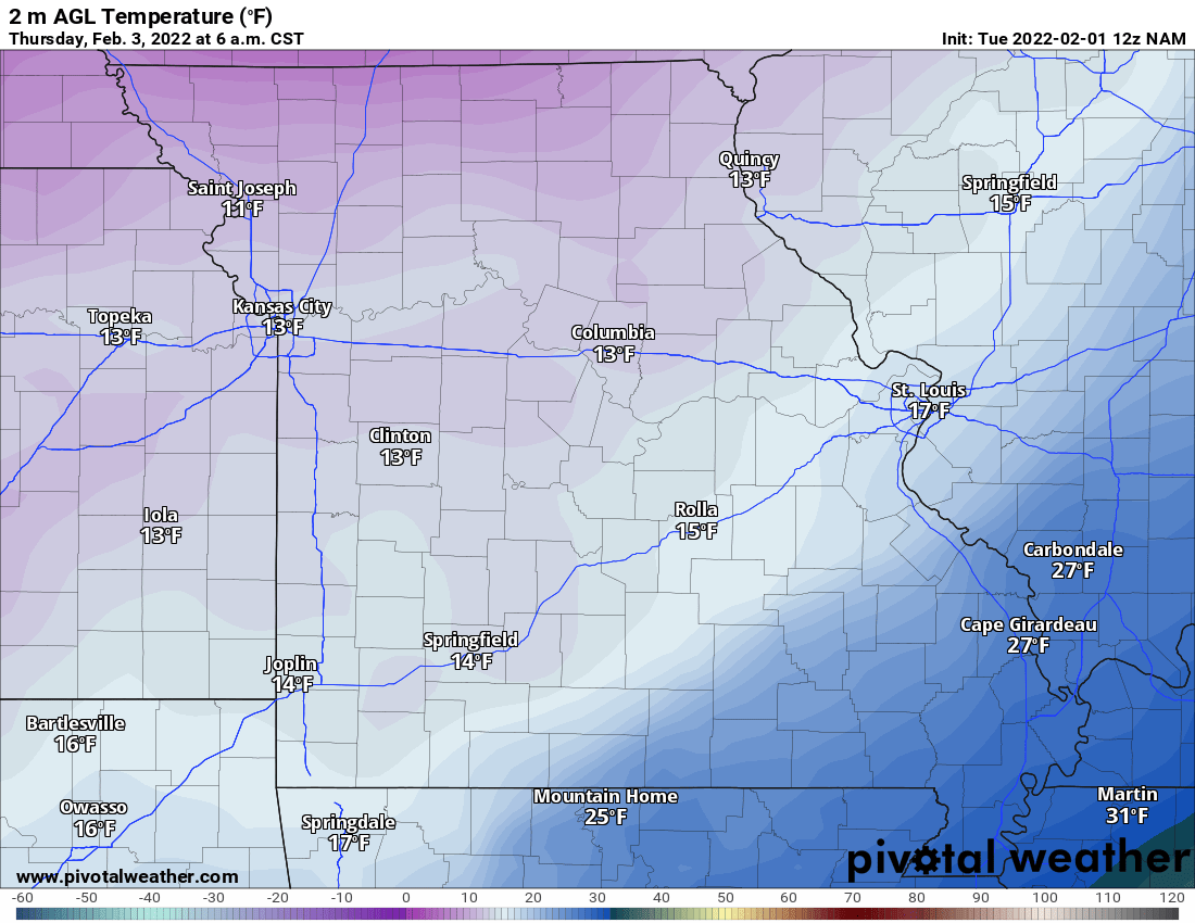
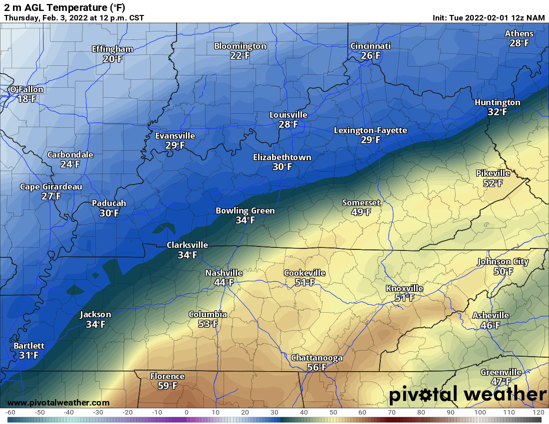
Click on the words below to subscribe
Storm Tracking Links
Interactive local city-view radars. Clickable watches and warnings.
https://wtalk.co/B3XHASFZ
Backup radar site in case the above one is not working.
https://weathertalk.com/morani
Regional Radar
https://imagery.weathertalk.com/prx/RadarLoop.mp4
*NEW* Zoom interactive radar (with storm chaser streams)
https://wtalk.co/AVWG7GM7
The app is for www.weathertalk.com subscribers. Subscriber first and then download the app.
Apple users click here. Android users click here.
What you need to know
Key Points
- A winter storm will impact the region Wednesday into Thursday night.
- A wide range of precipitation types and amounts.
- Plan on icy road conditions as early as Wednesday night over southeast Missouri and southern Illinois. Spreading southeast overnight into Thursday
.

Here is Facebooks’ Winter Weather Q&A threads.
Link https://www.facebook.com/beaudodsonweather
The latest update will be posted here at the top of Beau’s severe weather blog.
.
Thursday 3 PM
Additional light accumulation of snow, sleet, and freezing rain will occur tonight.
We have a final wave of snow later tonight that could drop a dusting to an inch of snow, as well.
Temperatures will fall tonight. Areas that have ice covered roadways will stay icy.
Wet roads may freeze.
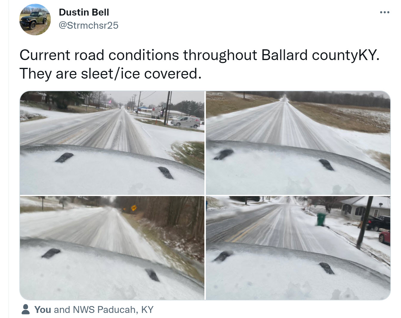
Bottom line: Use care if you are out and about tonight into tomorrow morning.
Highs tomorrow will be in the middle 20s to lower 30s. That should help road conditions (esp with treatments and a little sun).
Bitterly cold Friday night. That will be our coldest night with lows in the single digits.
Precip continues area-wide. There are lulls and the precip is lighter than earlier today.
Be careful as temps continue to fall tonight. Areas that have wet roads may freeze over.
Thursday 12 PM
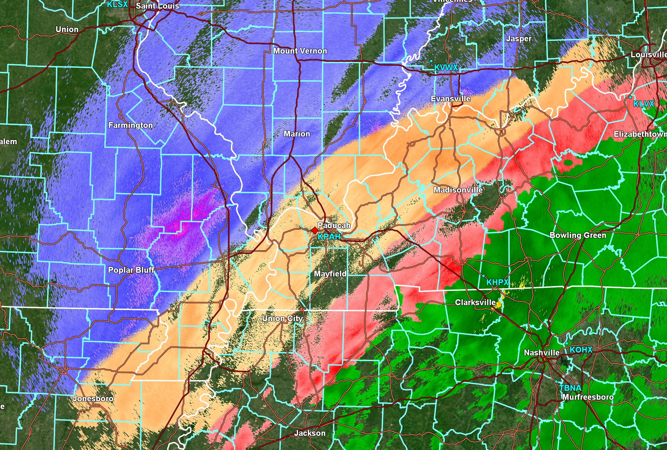
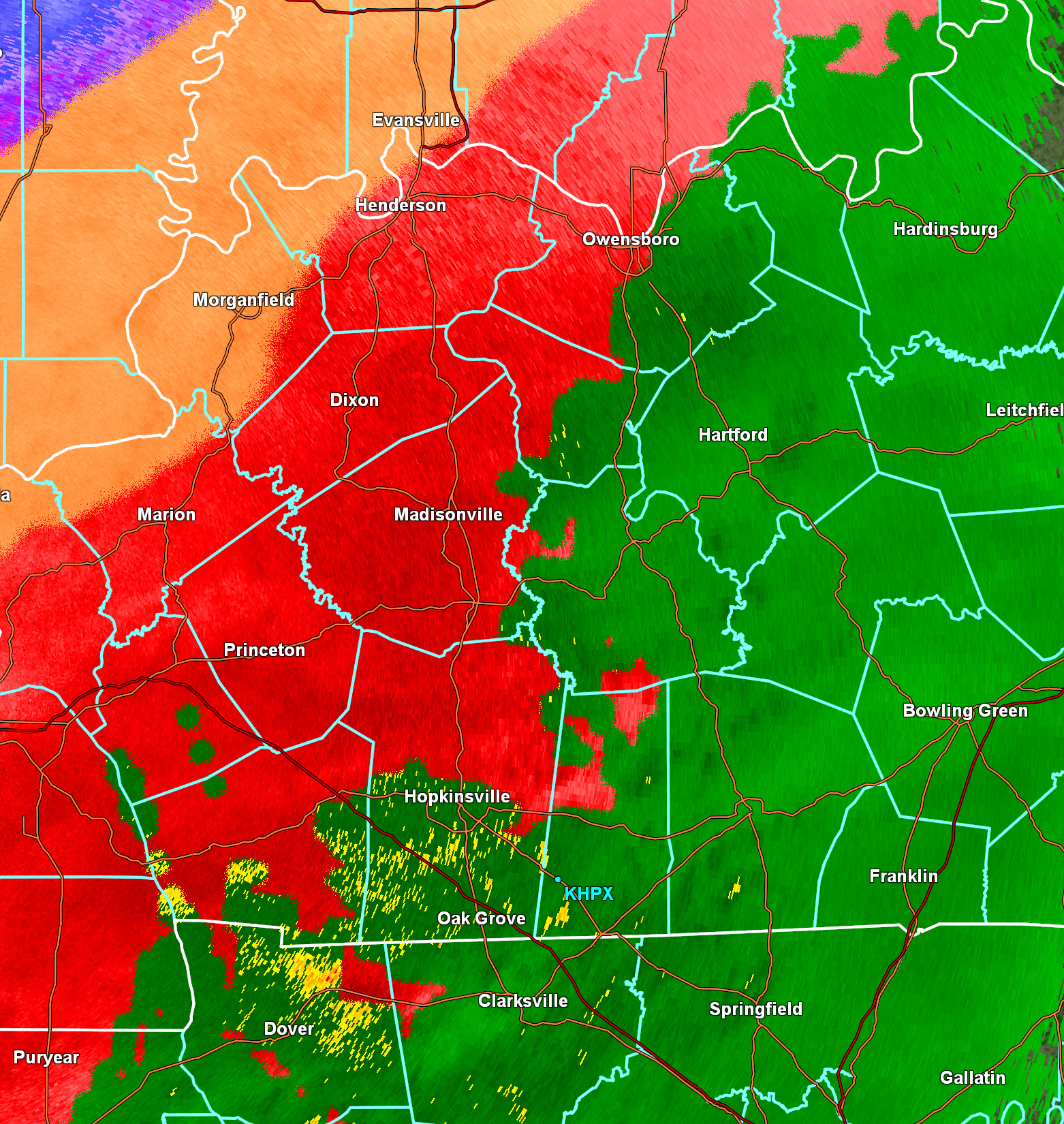
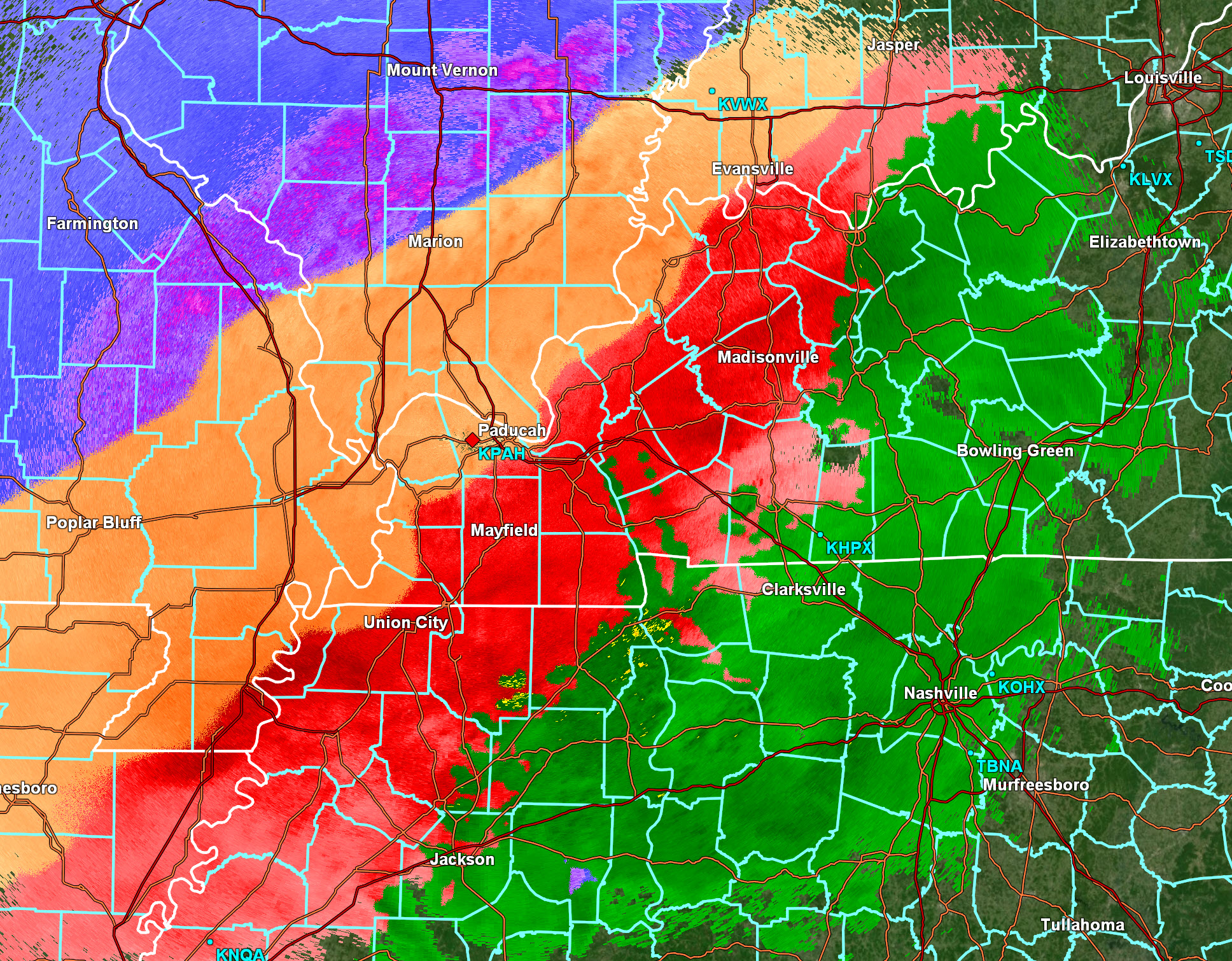
Precipitation continues area wide. This will linger into the afternoon and evening. With time, coverage and intensity will wane.
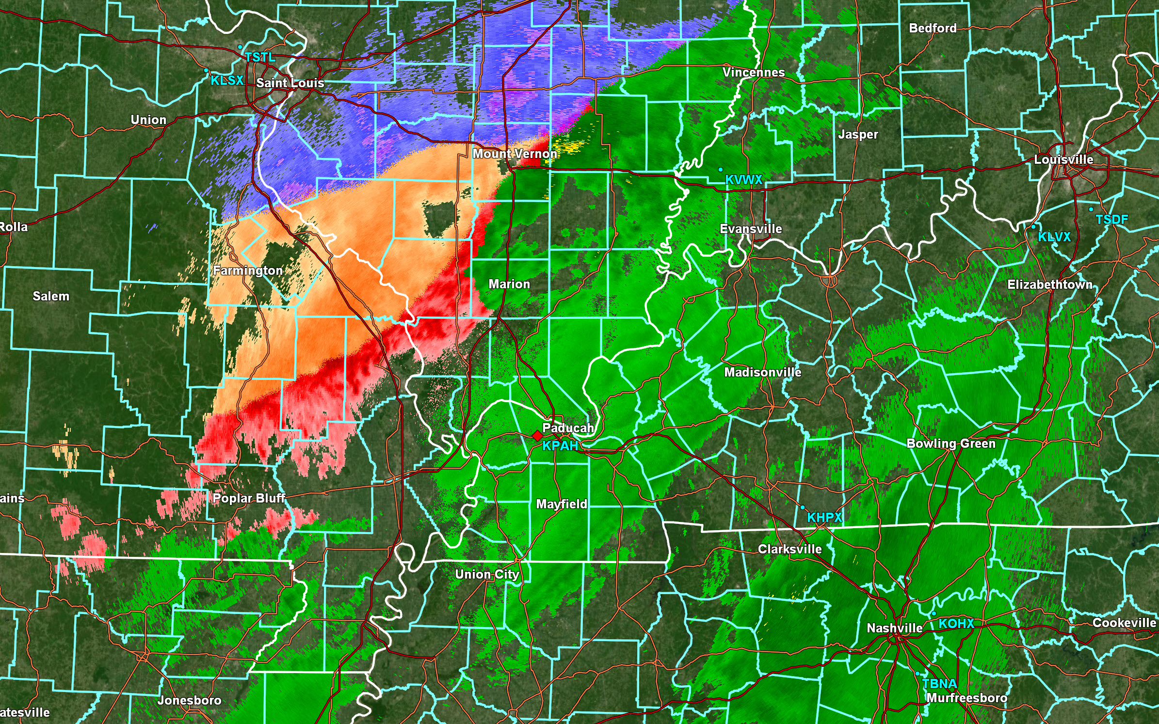
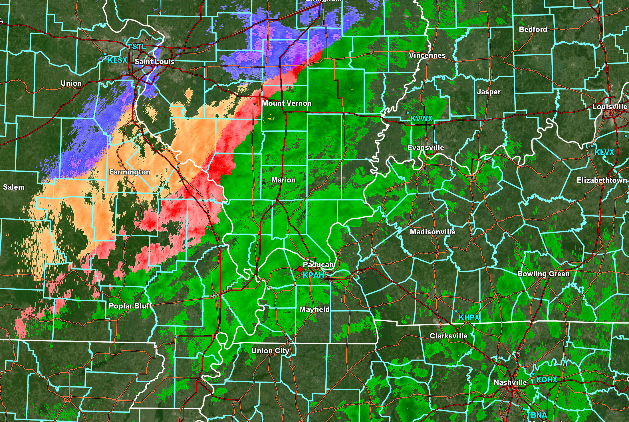
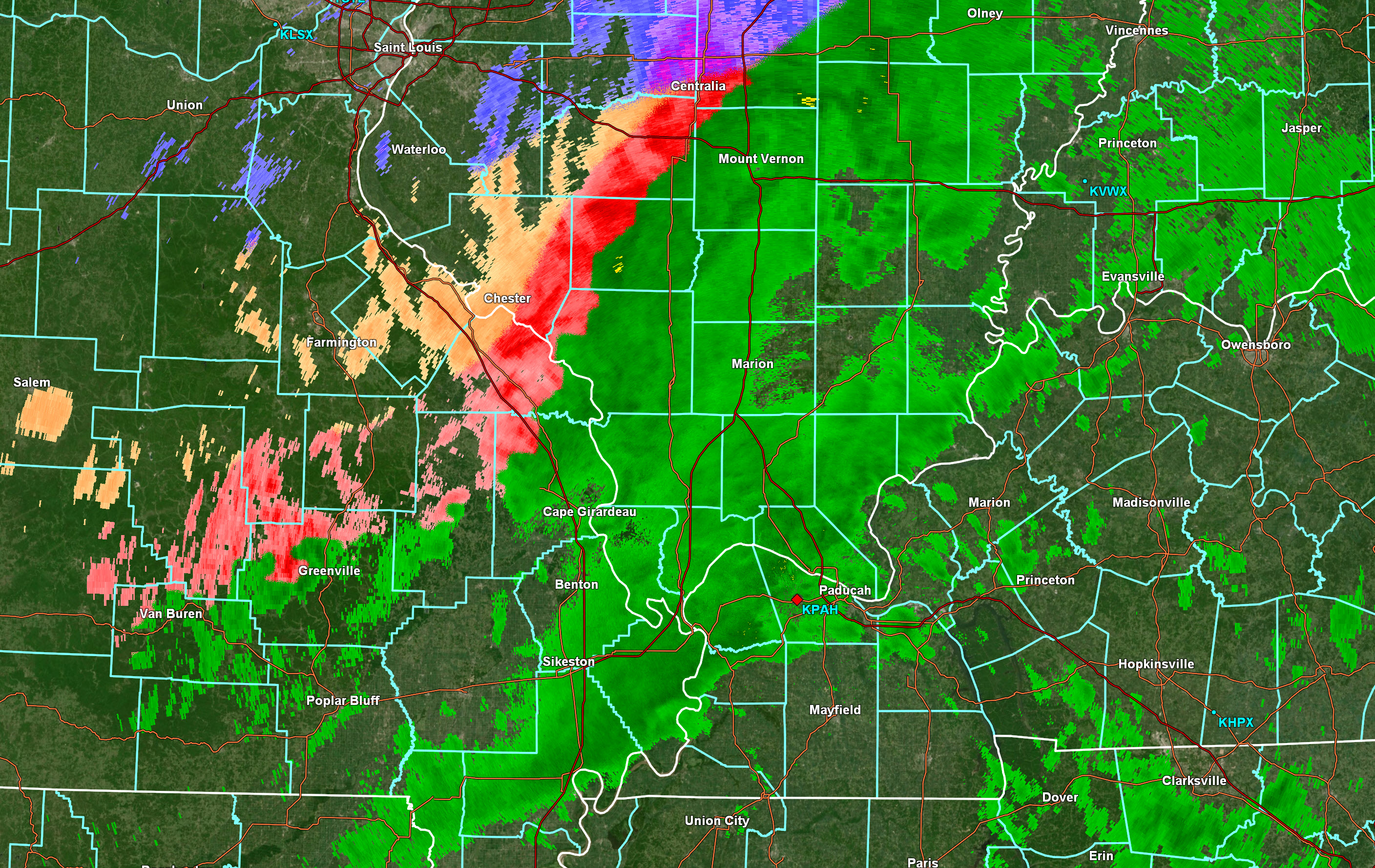
Blue is snow. Orange is sleet. Red is sleet and freezing rain. Green is rain (could be freezing rain on the edge of the red)
..
.
Thursday 11 AM.
Bitterly cold air into the weekend. This will be bad in areas that lose power.
.
Thursday 9:45 AM.
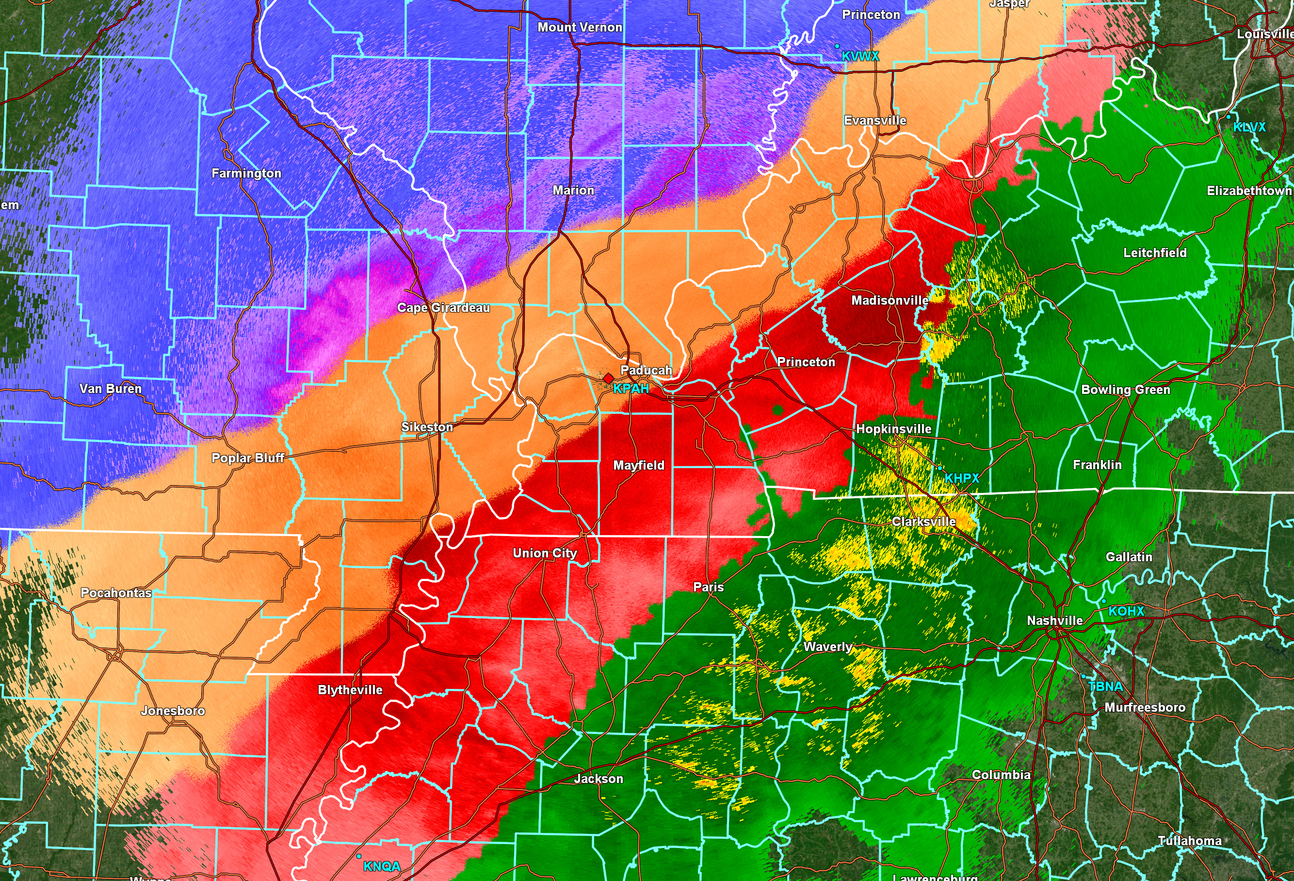
Radar
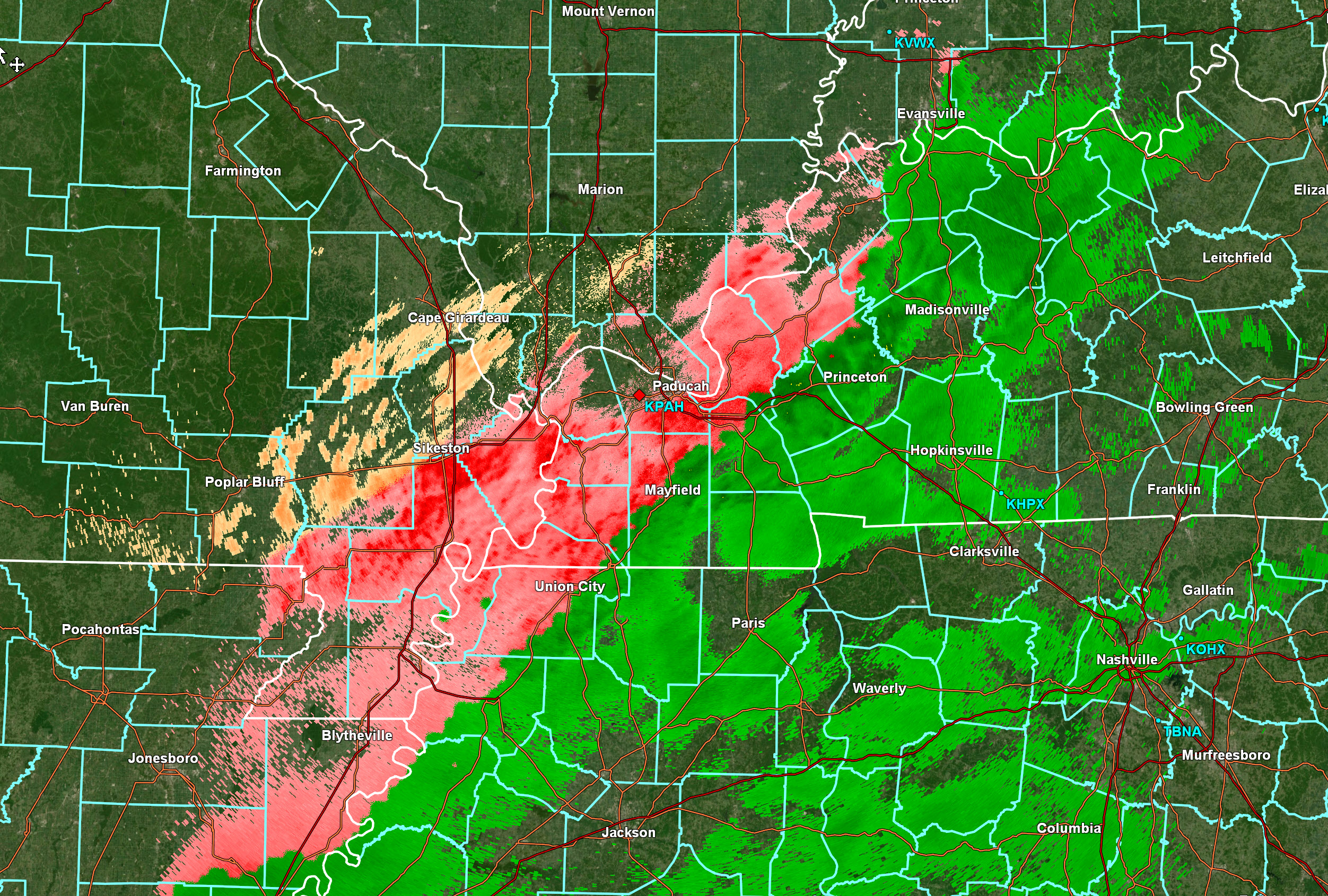
Blue is snow. Orange is sleet. Red is sleet and freezing rain. Green is rain.
.
Thursday 9:30 AM
.
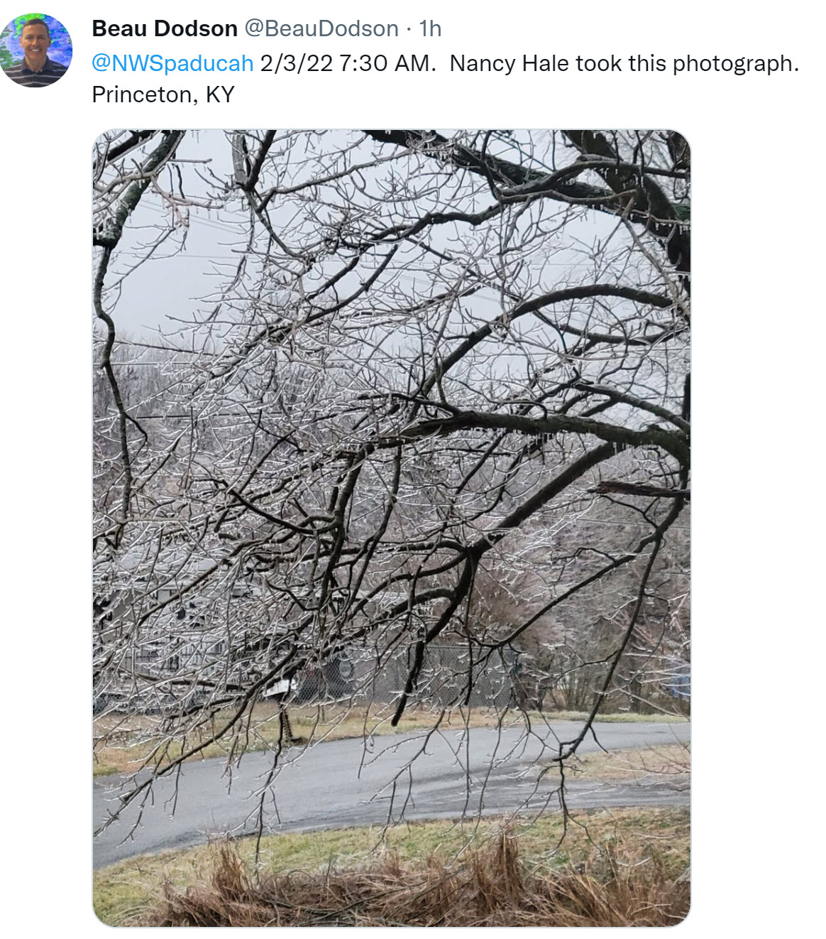
Thursday 7:30 AM
Princeton, KY 7:25am
.
Thursday 6:45 AM
Video update from the Memphis, Tennessee NWS
IGNORE the winter storm severity index maps. We don’t agree with their wording.
Thursday 6:45 AM
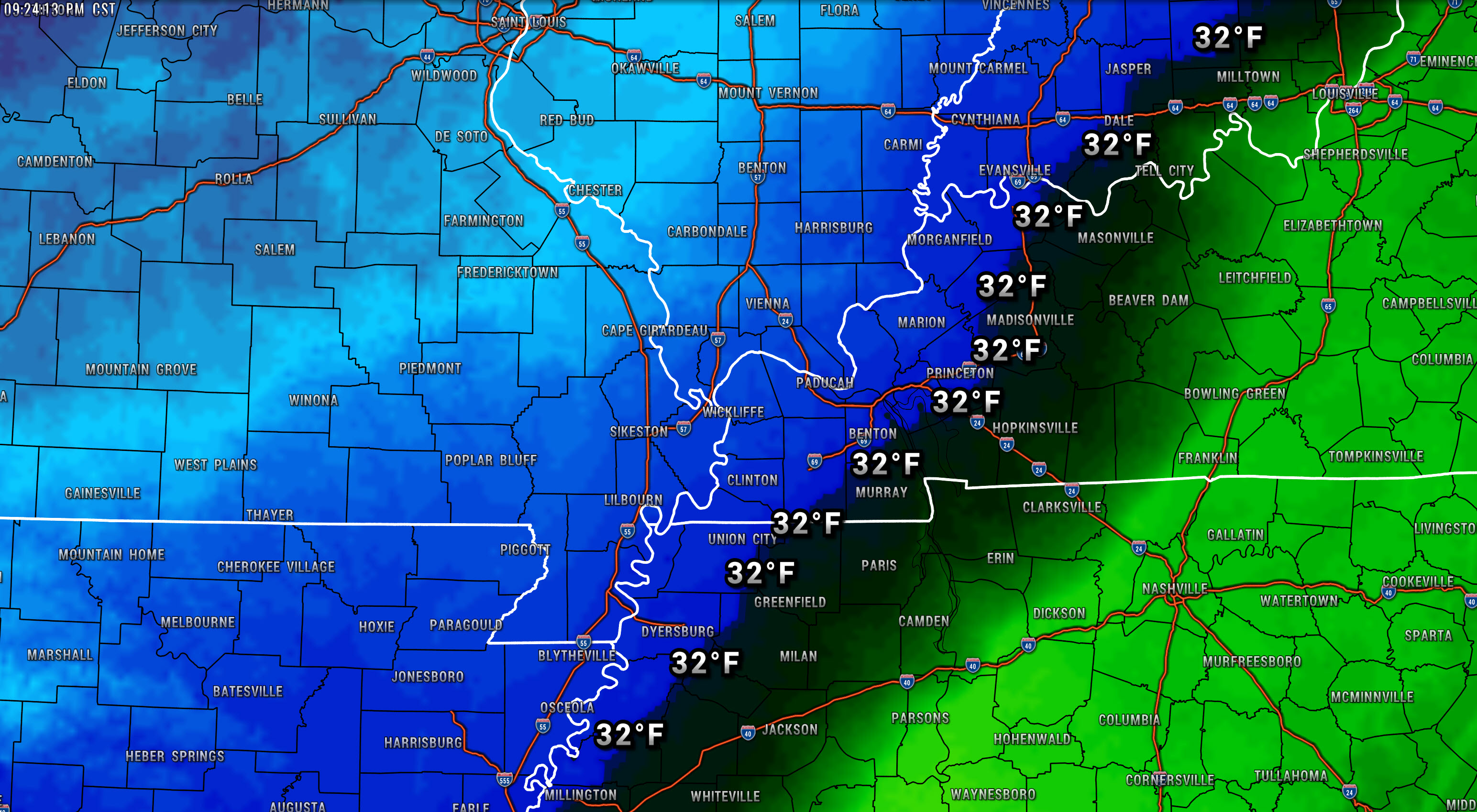
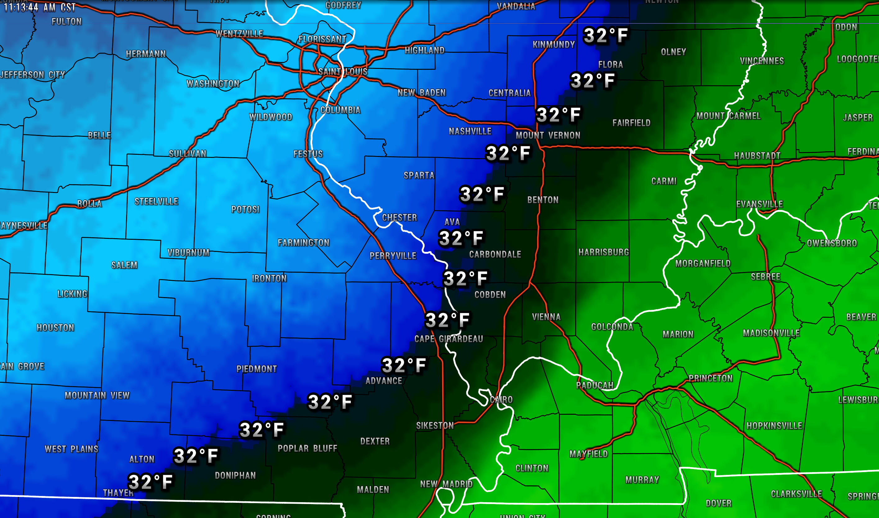
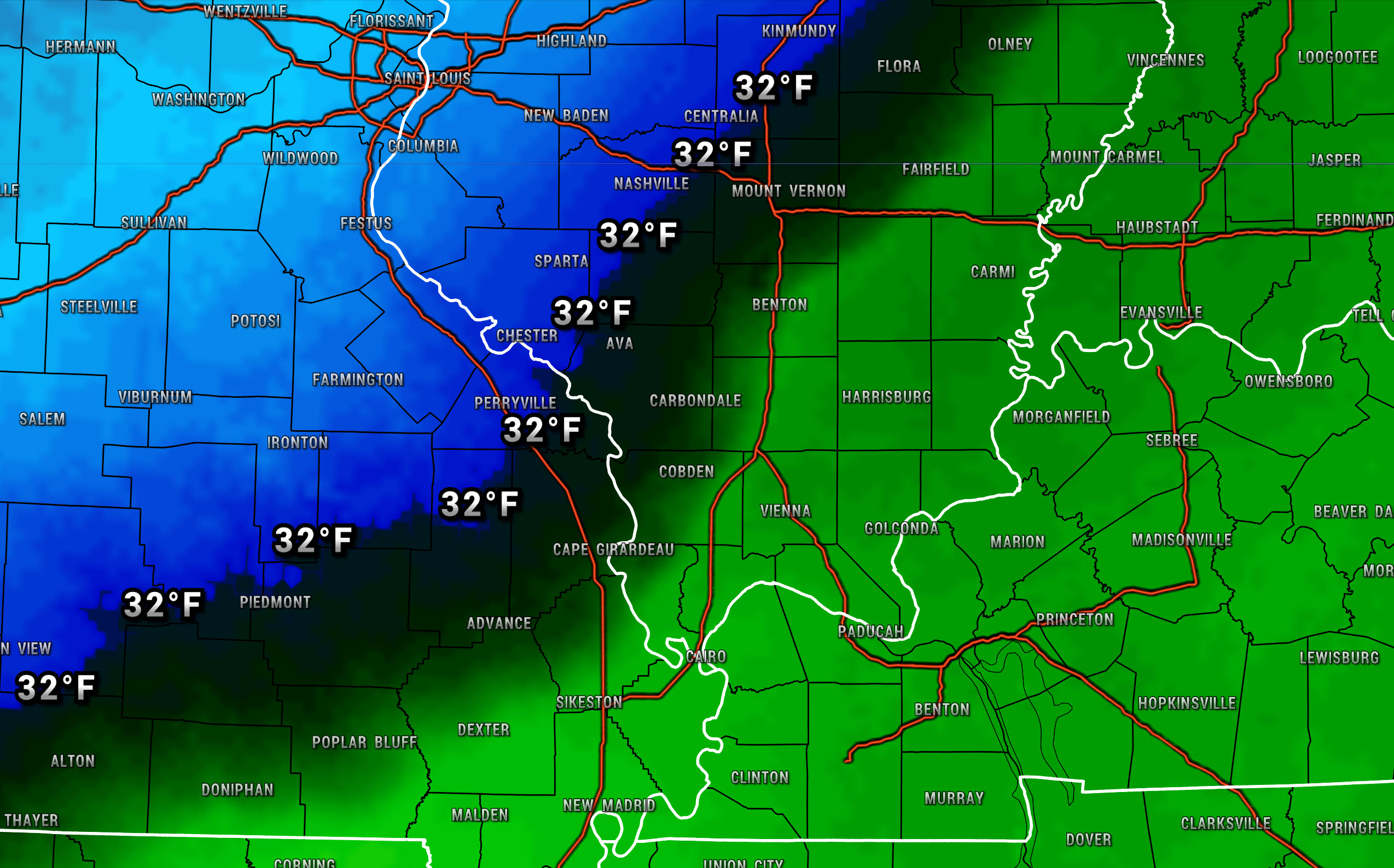
There is still some rain over my far eastern counties. The 32 degree line is very close to pushing across all of my forecast counties.
We will have to see how fast the temp falls below 32 degrees changing everything to freezing rain.
.
Thursday 6 AM Update
Today’s Facebook thread can be viewed at this link –> LINK
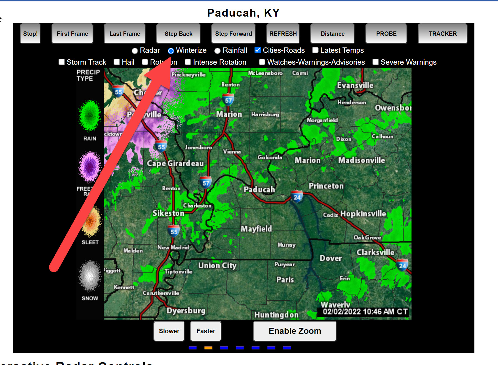
Interactive local city-view radars. Winter Weather radars. Click the winterize button above the local city-view radars.
https://wtalk.co/B3XHASFZ
Everything is on track and as expected. So far there have been no surprises with this winter storm.
The forecast is on track.
6 AM radar shows widespread precipitation. Blue is snow. Orange is sleet. Red is freezing rain. Green is rain.
Click image to enlarge it
Zoomed in
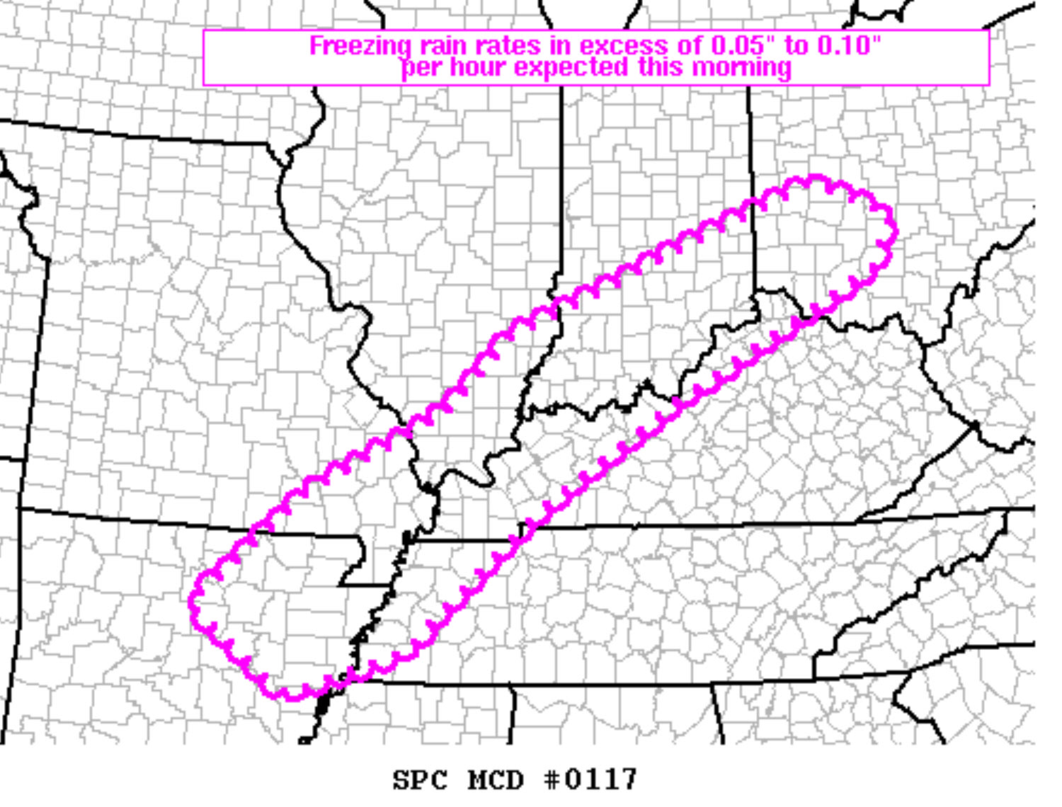
Special Weather Statement
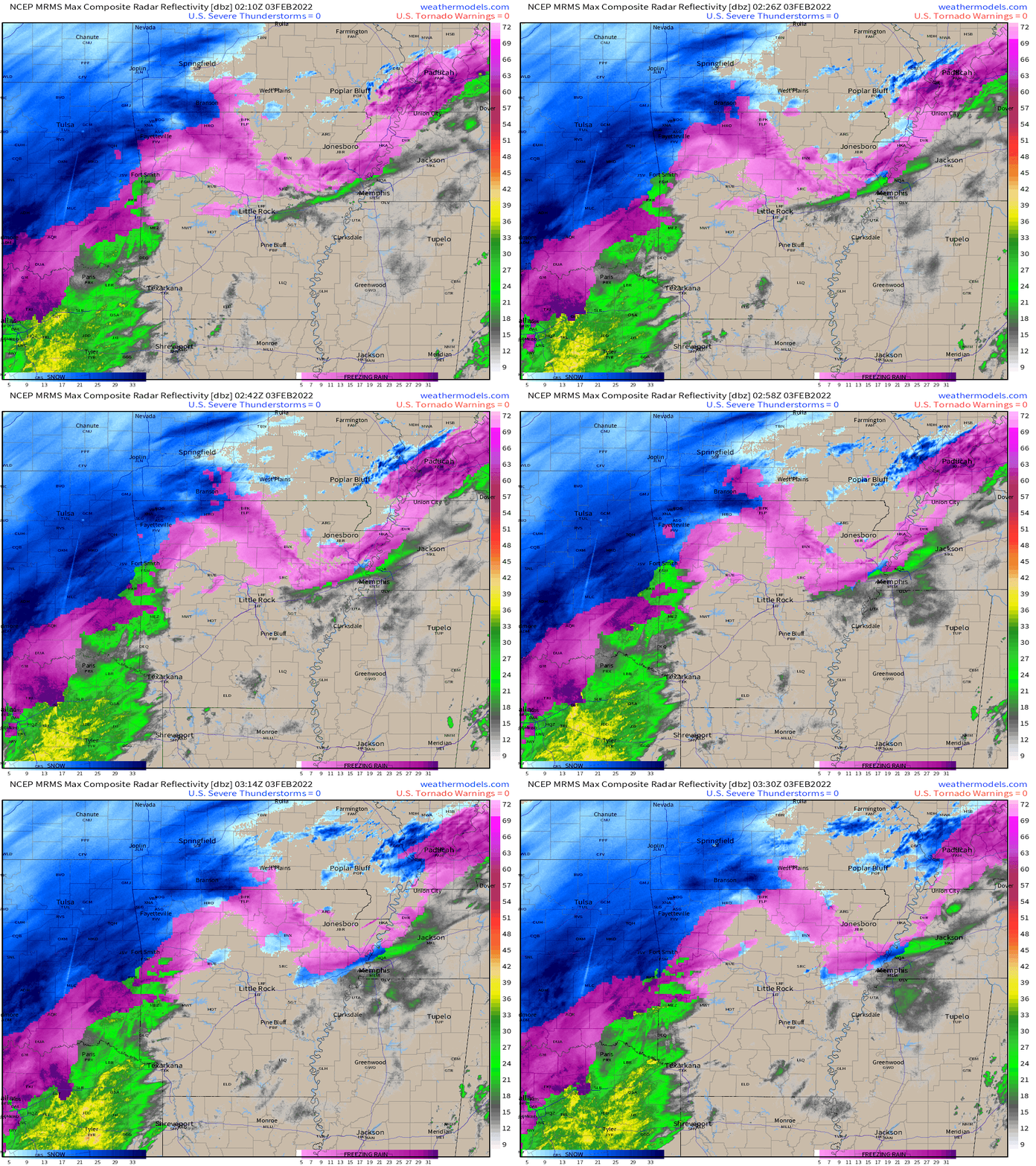
Wednesday 10 PM
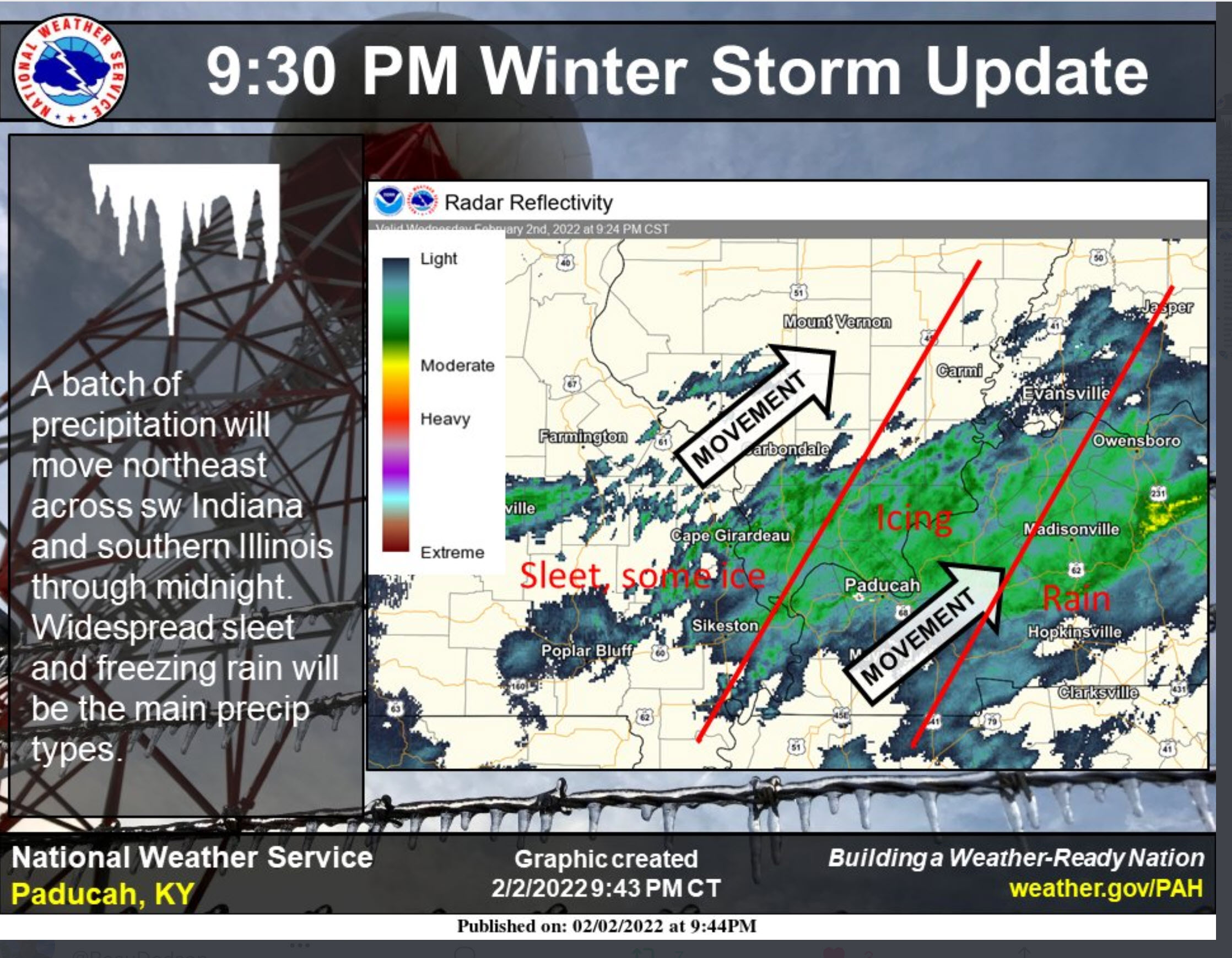
Wednesday 9:30 PM
Double click images to enlarge them.
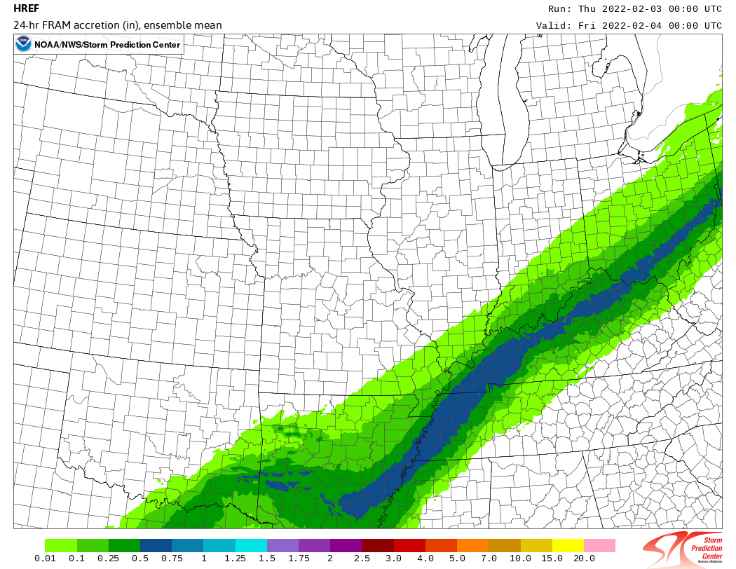
Href model shows where the heaviest freezing rain is most likely to fall.
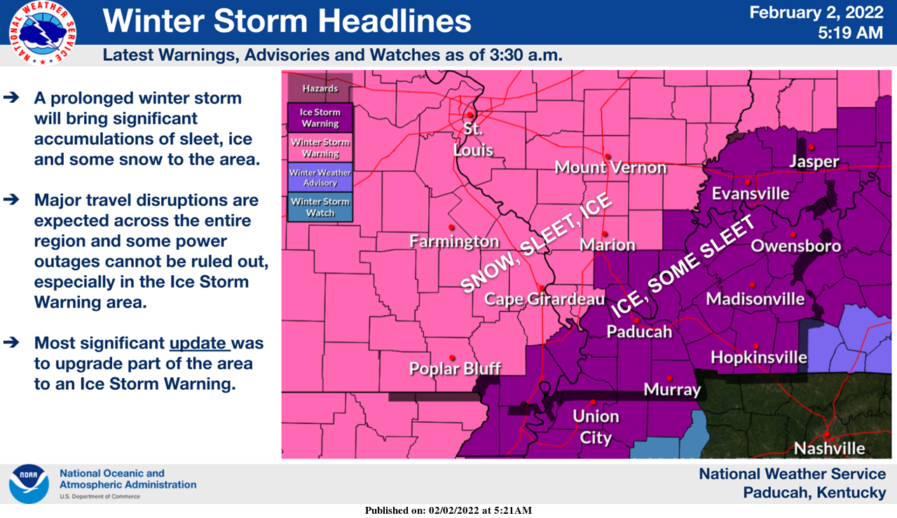
Updated ice storm warning map for my southern counties
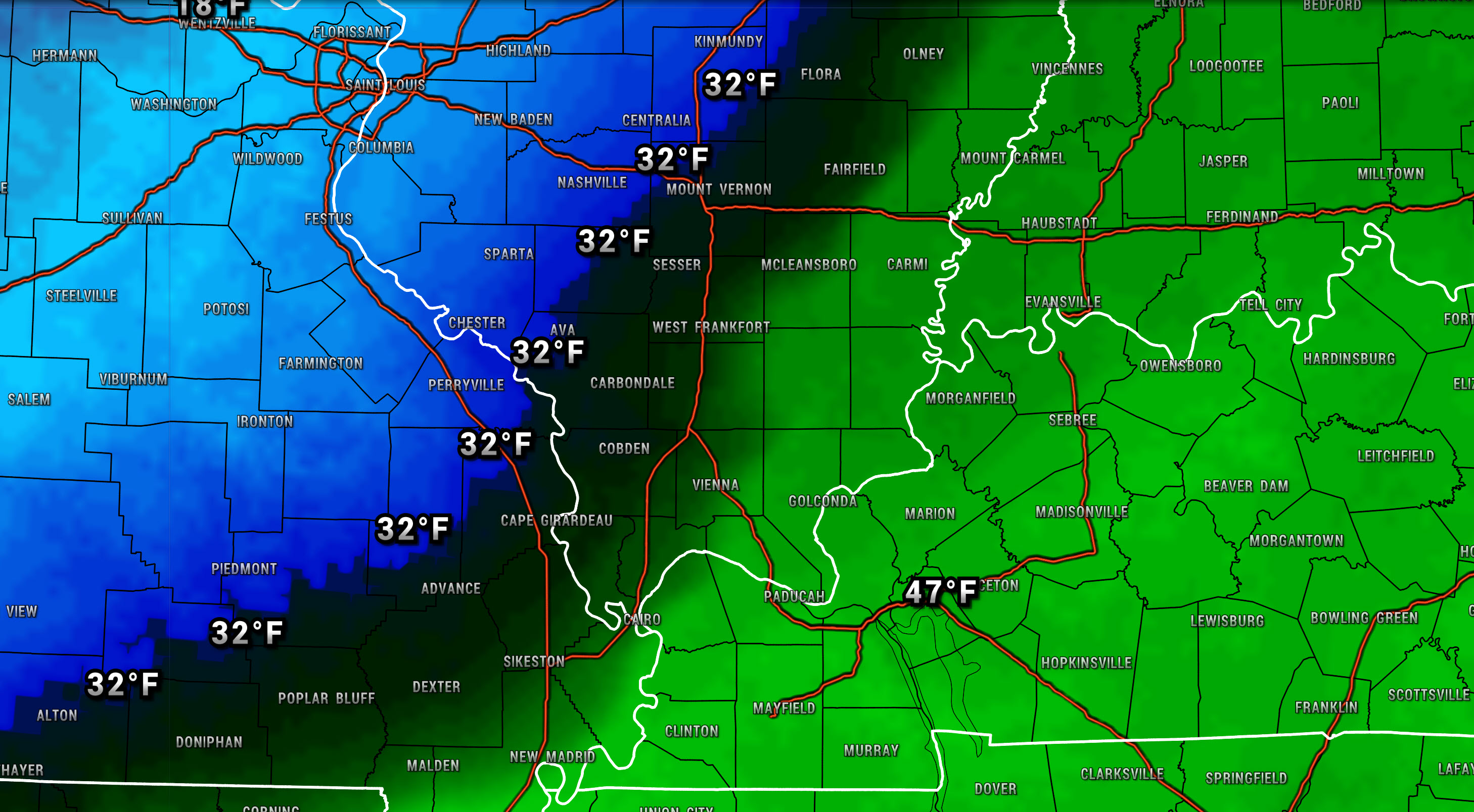
Current 32 degree line placement
Regional radar
Fancy Farm, KY. Sent in by Andy and Michelle Pendel
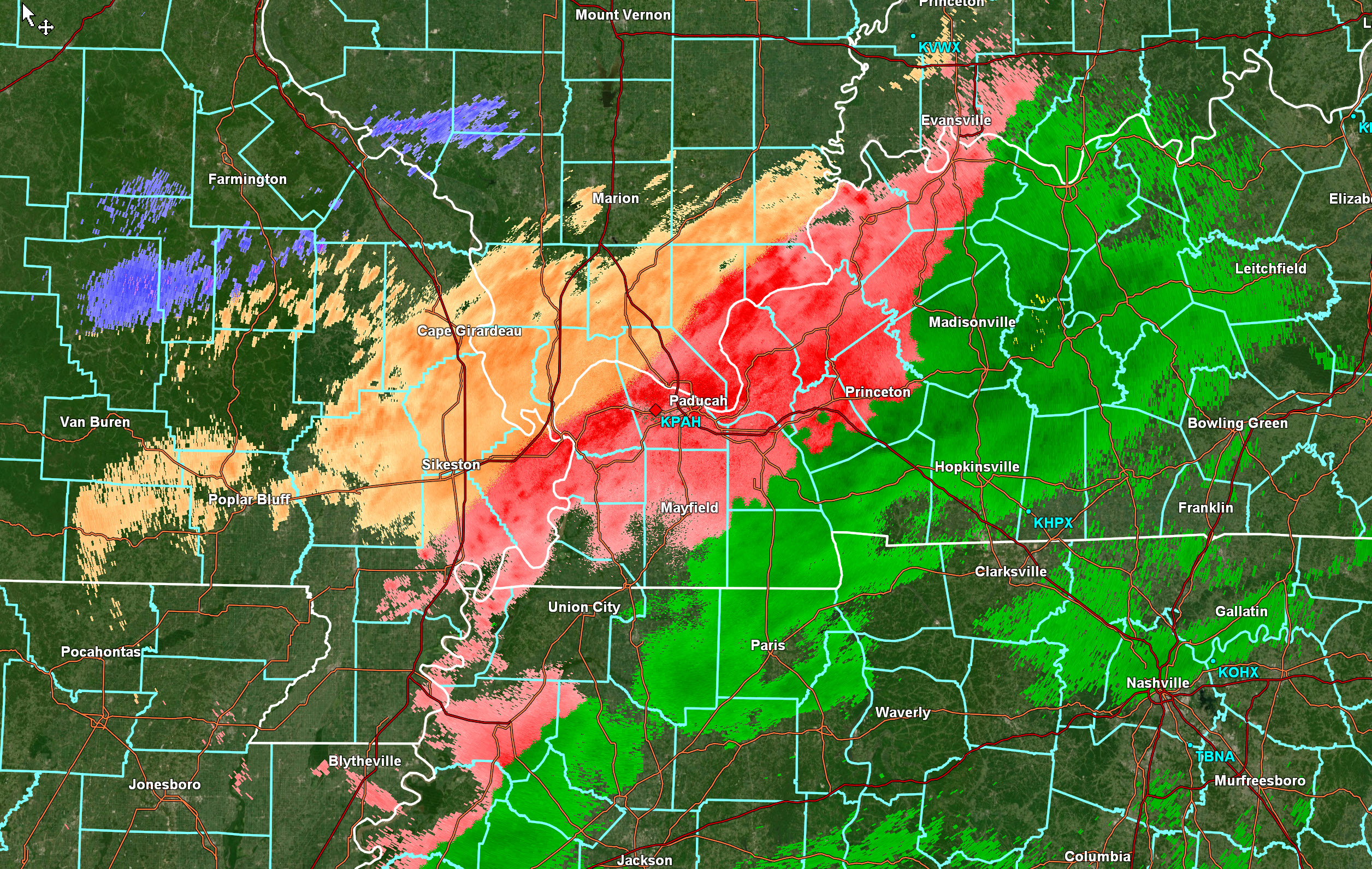
Wednesday 9 PMThere will be a battle between freezing rain and sleet tonight in some counties. You will likely go back and forth between the two. You can see that on radar.Orange is sleet. Red is freezing rain.The borderline counties will go back and forth.A push of colder air tomorrow will change it to all sleet. Just a matter of how many hours of freezing rain will you receive before that happens.The atmosphere will battle it out.
 Wednesday 8:30 PMCurrent conditions.Double click all images to enlarge them.
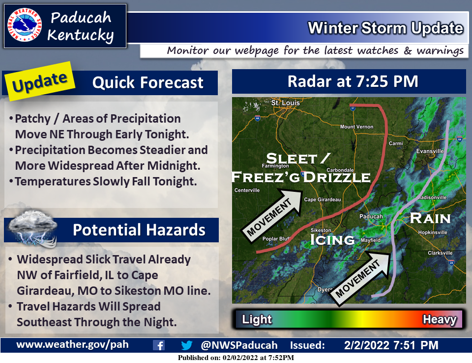 Current watches and warnings.
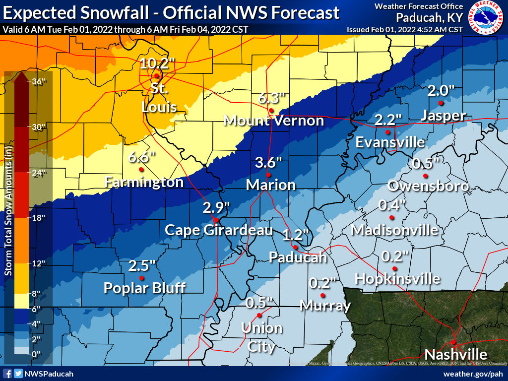
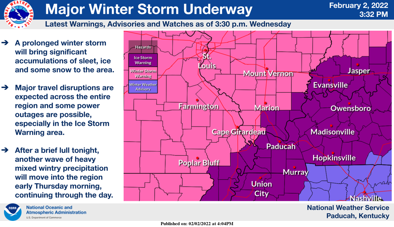 Snow forecast.
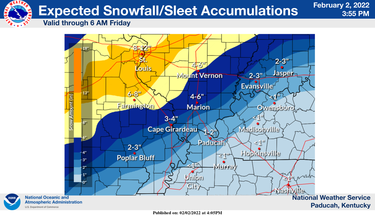 Freezing rain forecast. Totals will vary GREATLY depending on when you change over to sleet.
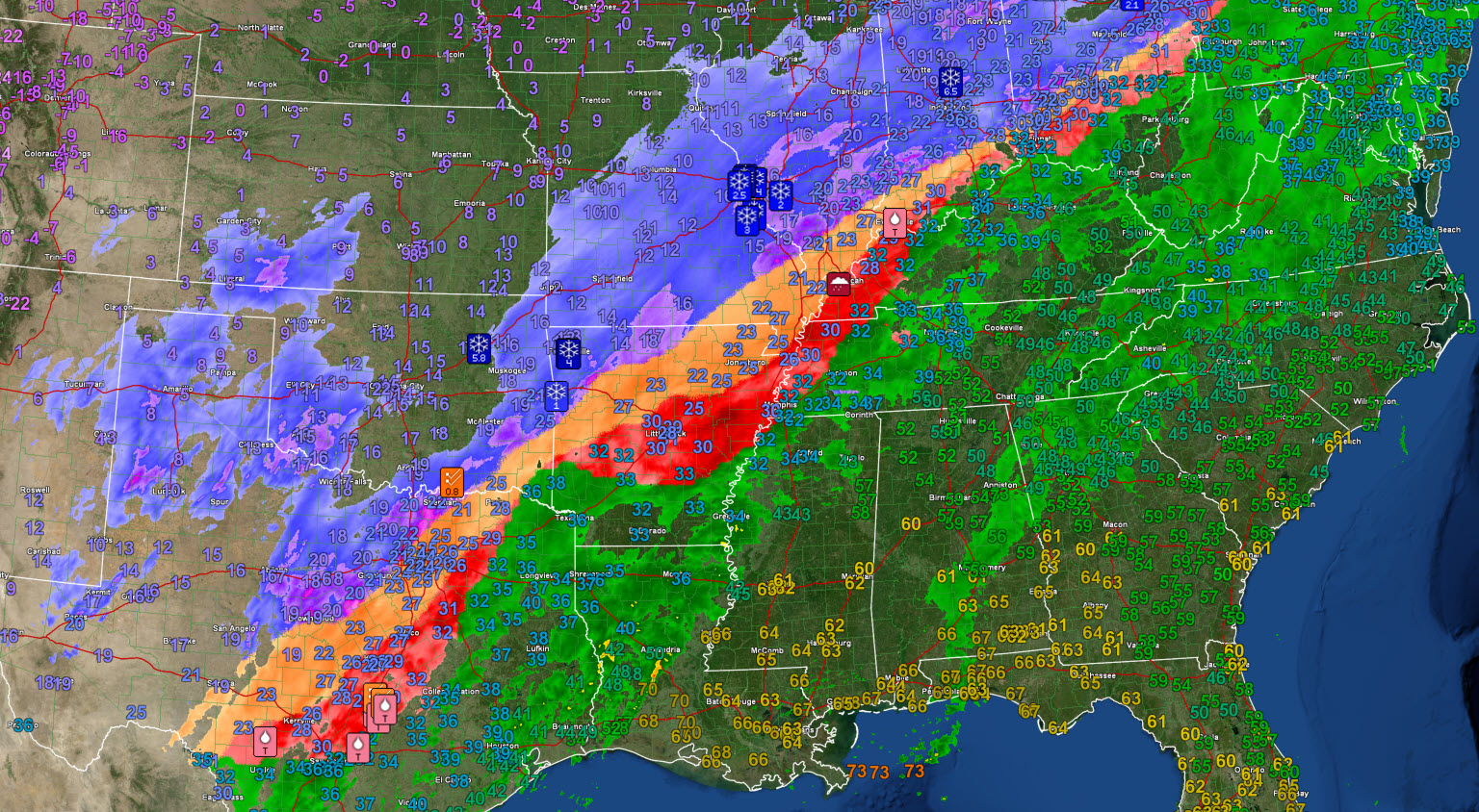
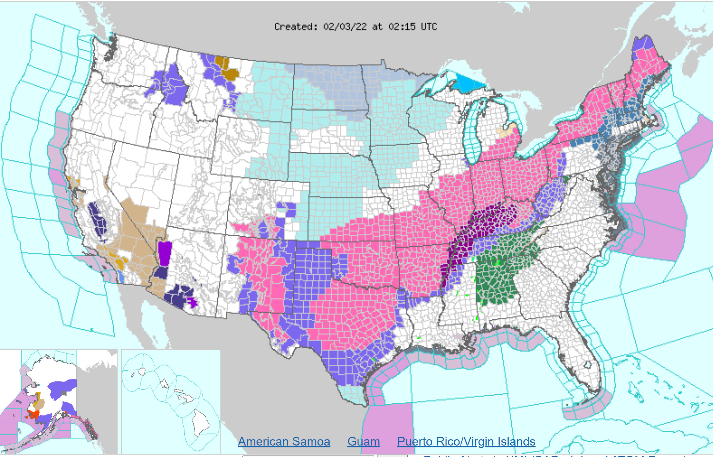
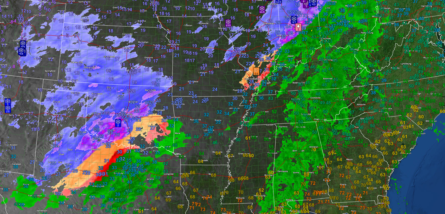
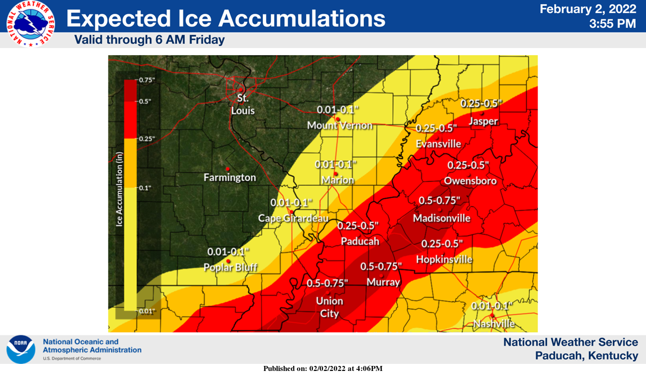 8 PMCheck out the size of this winter storm.
From New Mexico to Maine. Those are winter storm warnings.
.
7 PM
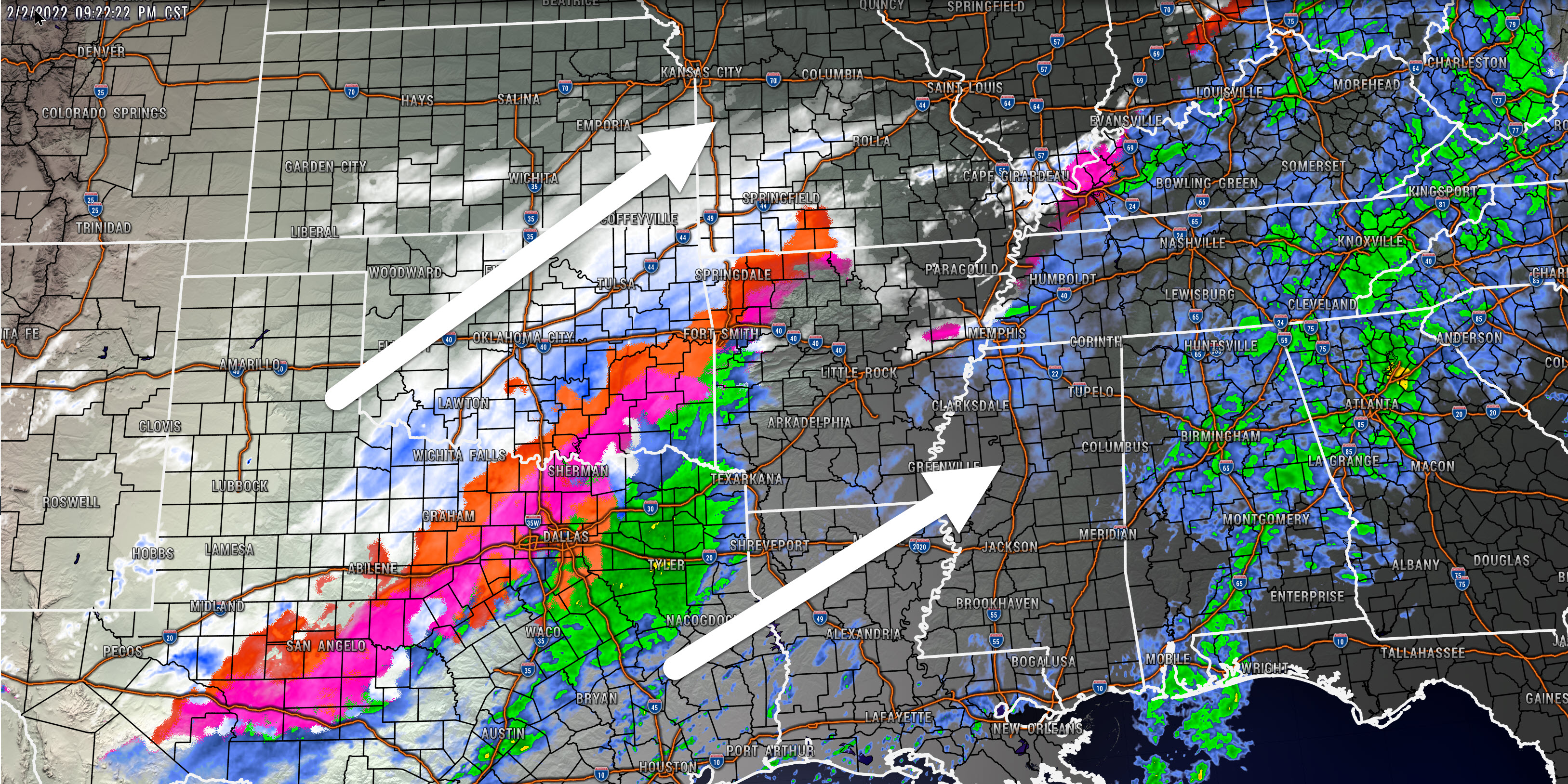
Precipitation is filling in. There may not be much of a lull tonight if this continues.
Blue is snow. Orange is sleet. Red is freezing rain. Green is rain.
Double click images to enlarge them.
Widespread precip in our local area.
Orange is sleet. Pink and red would be freezing rain. Green is rain.
.
5:00 PM
Click images to enlarge them
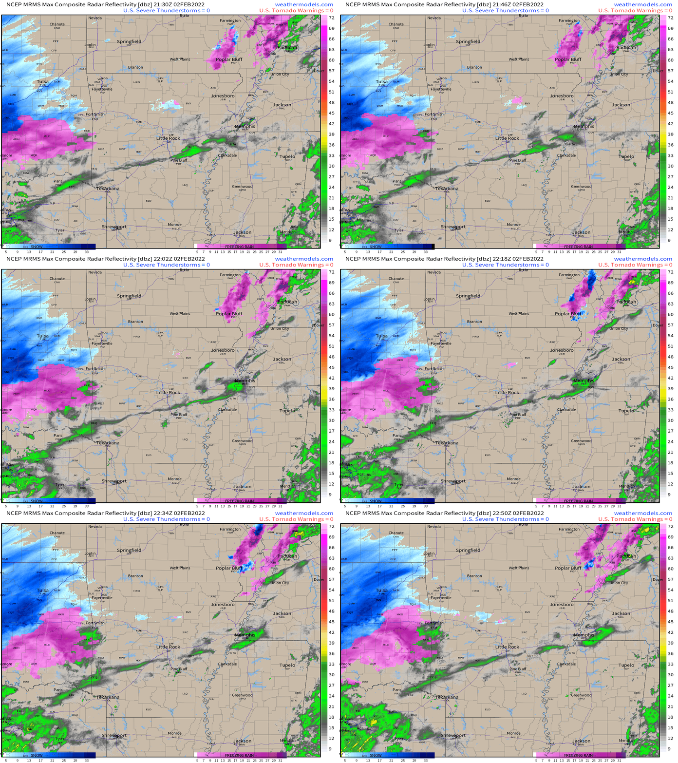
Here comes the main storm. It is coming out of Texas and Oklahoma. It will spread into our region tonight and tomorrow.
.
5:00 PM
.
Hope for sleet. Sleet will cut down the freezing rain totals.
Very difficult forecast on freezing rain vs sleet, but signals are there for significant freezing rain in the above mentioned area.
.
3:20 PM
The freezing line continues to slowly move east southeast.
Click on the image to enlarge it.
.
2 PM
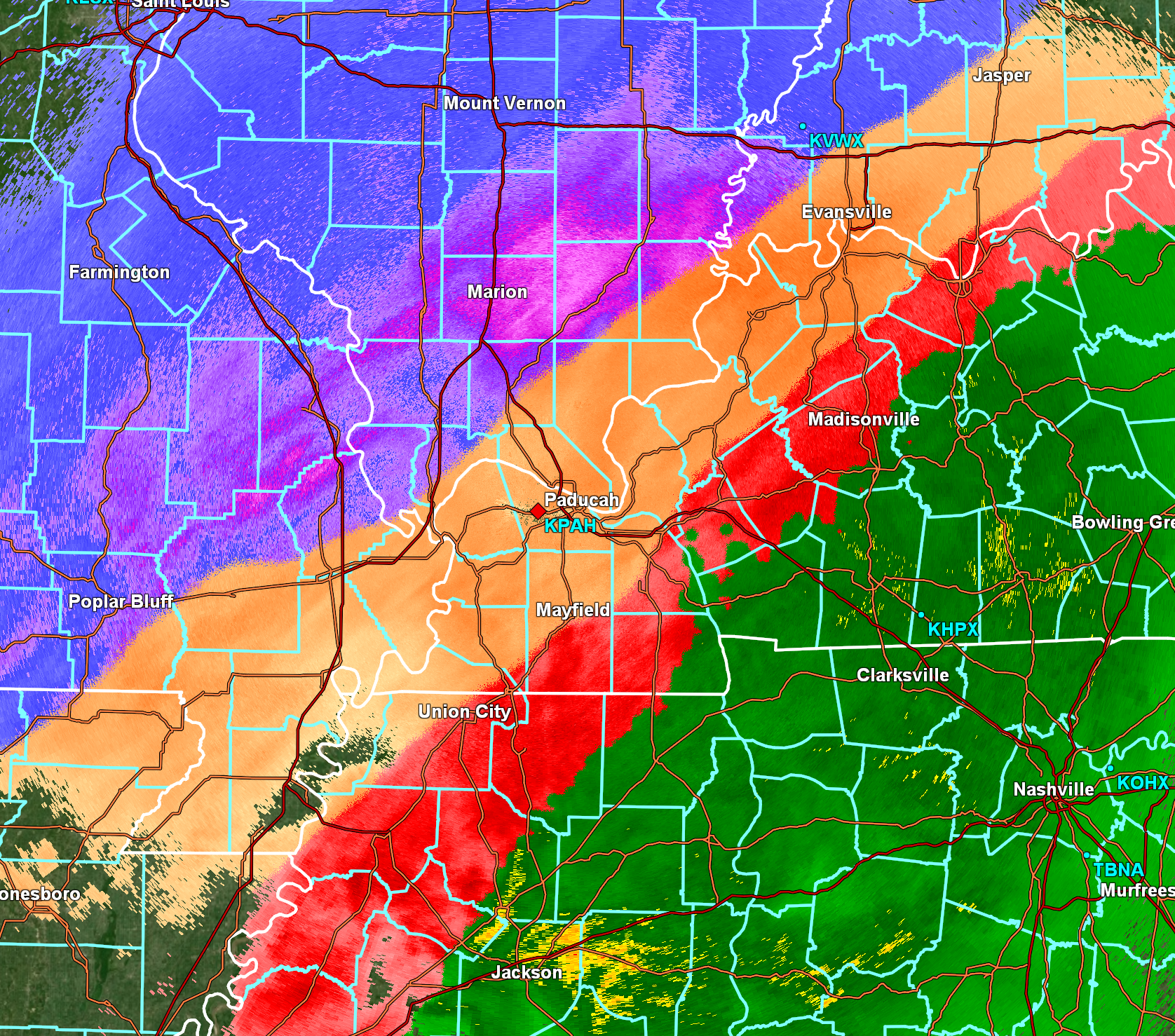
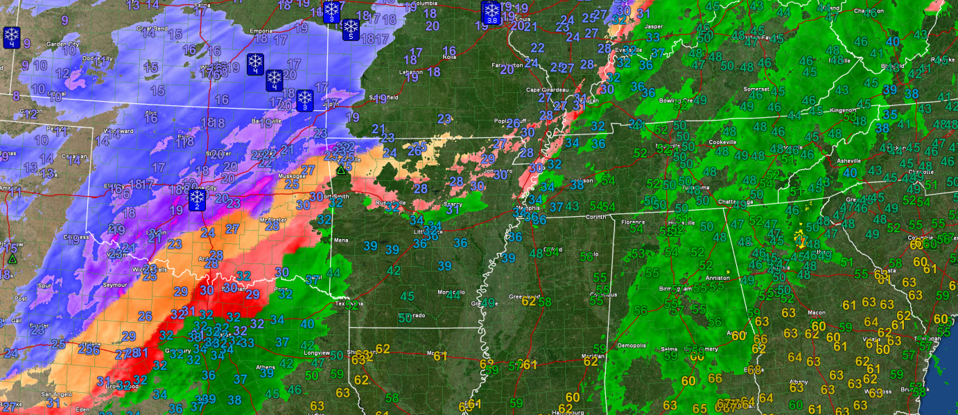
Radar at 2 PM shows a wide range of precipitation type. Snow in the blue and purple. Red and orange represents freezing rain and sleet. Green is rain.
This is moving northeast.
We may see a lull in this precip this evening (at least a bit more scattered with time).
I am concerned about icy roads in southeast Missouri and southern Illinois this evening. Already reports of icy roads in Perry County, MO.
The freezing line continues to push east/southeast.
.
Murphysboro, Illinois. Some sleet and freezing rain. A little light snow, as well.
Nancy Spear took this photograph.
.
1 PM
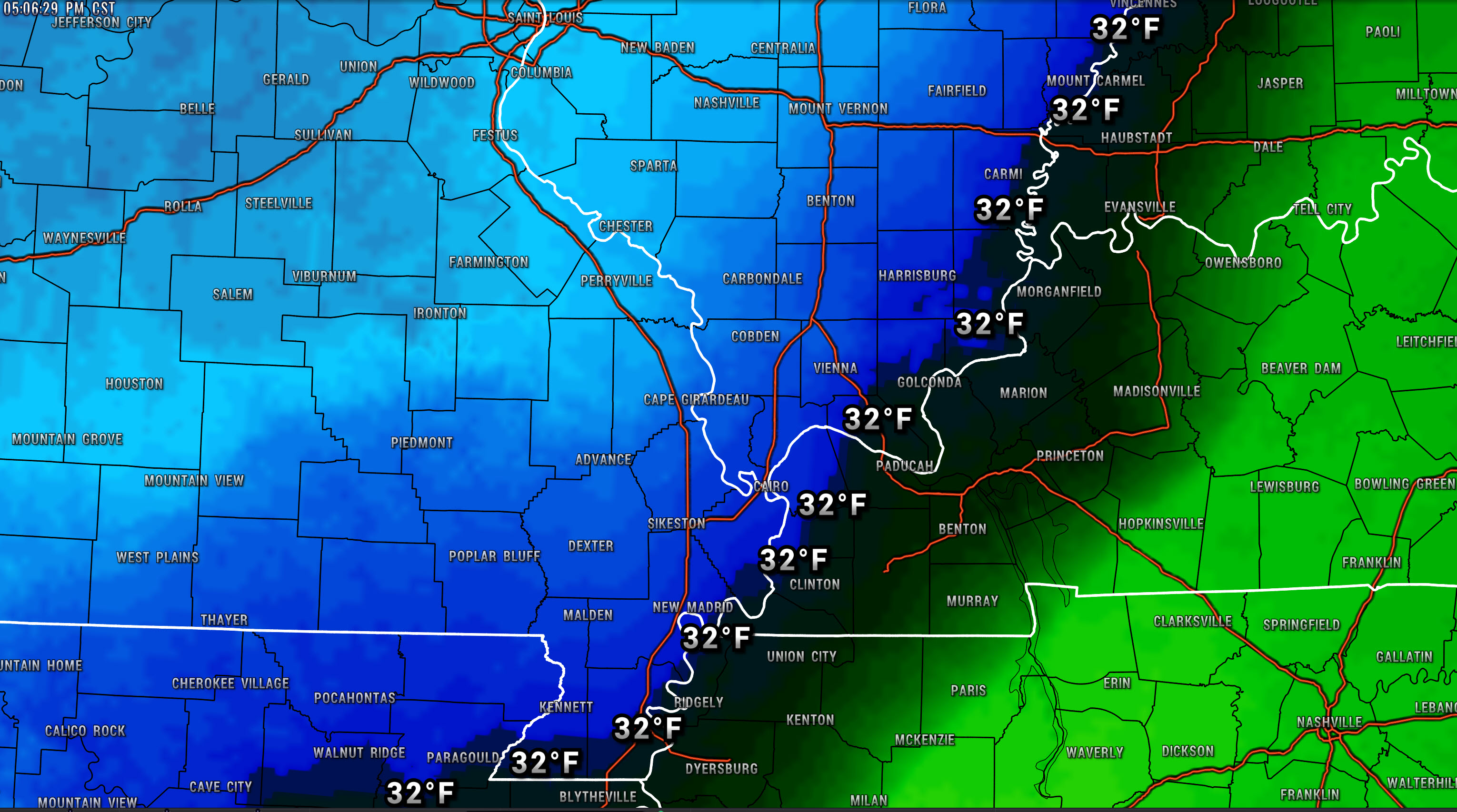
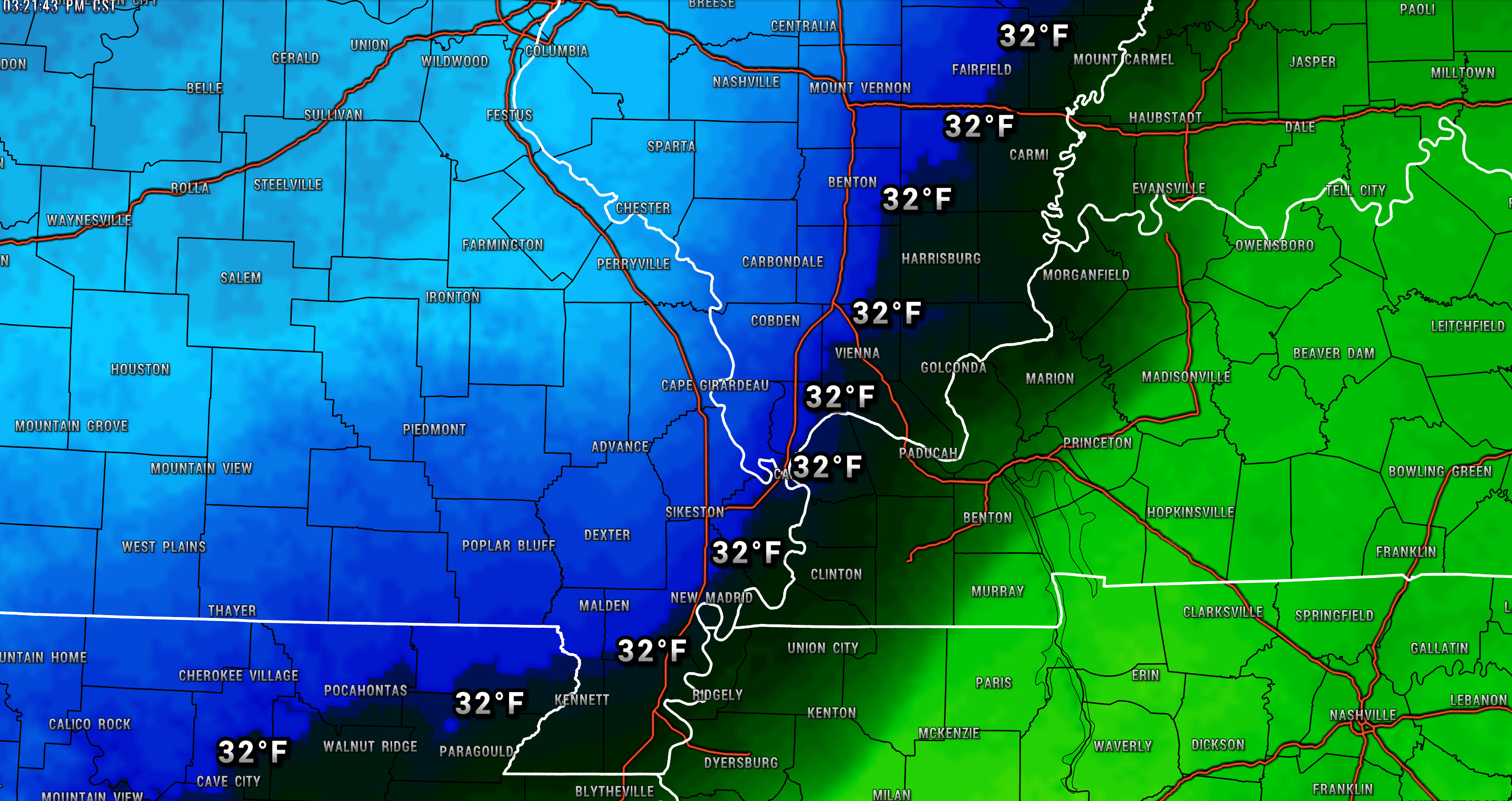
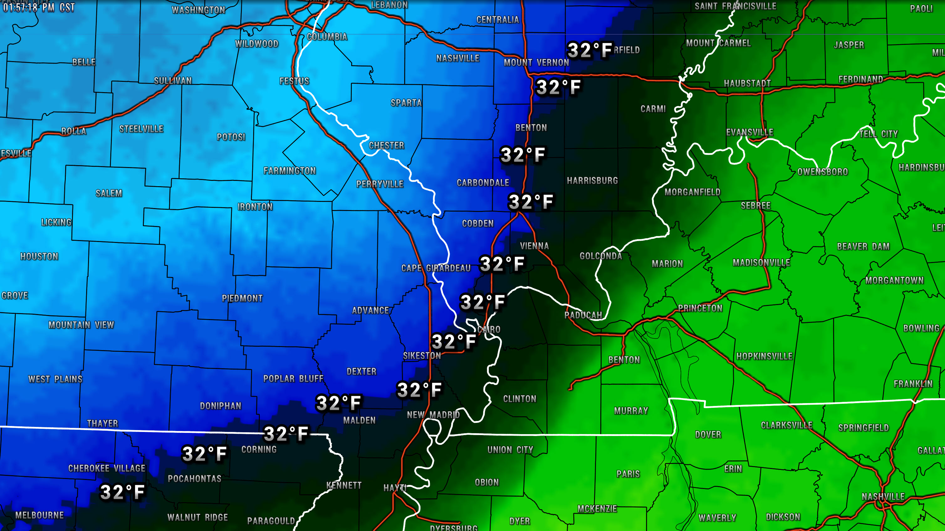
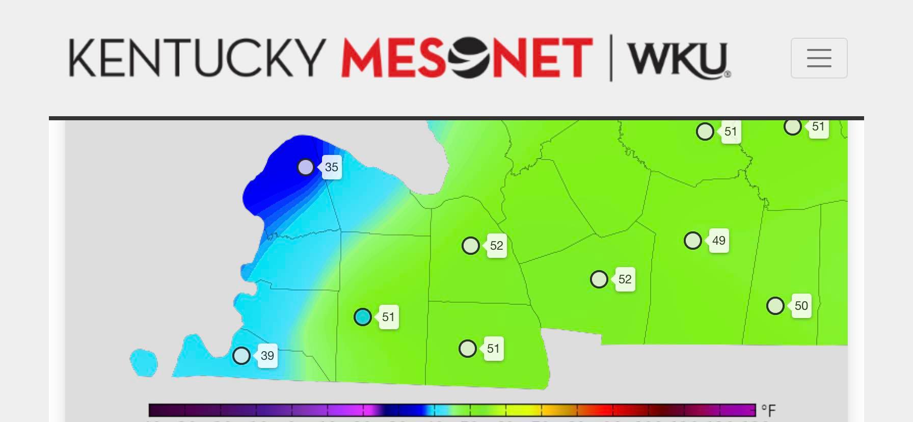
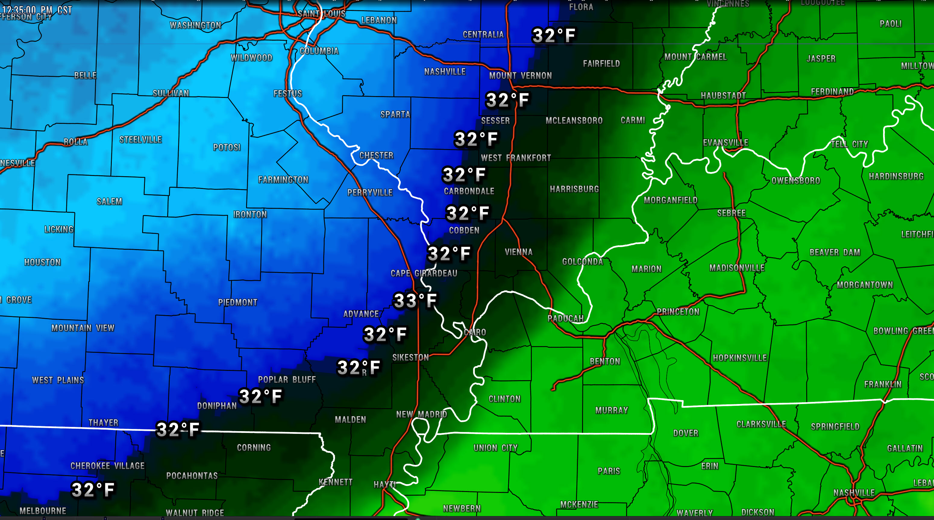
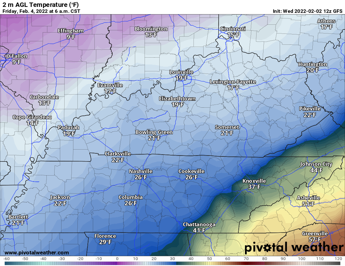
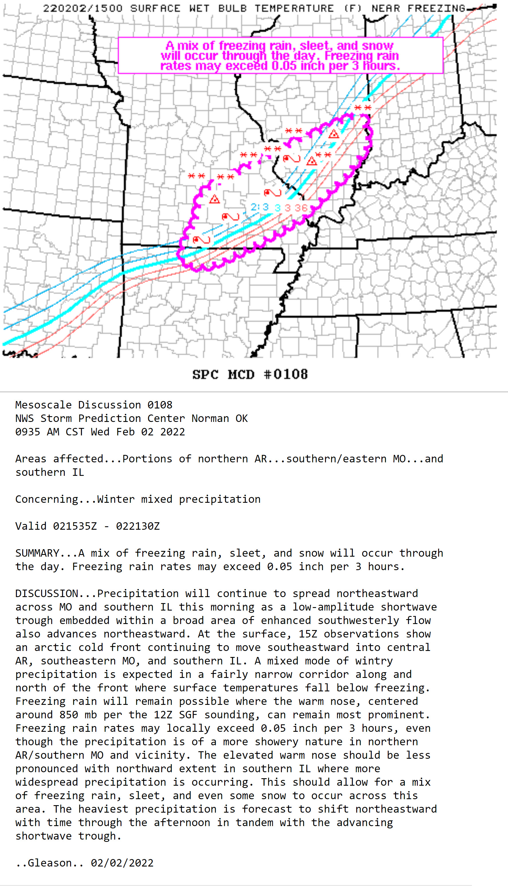
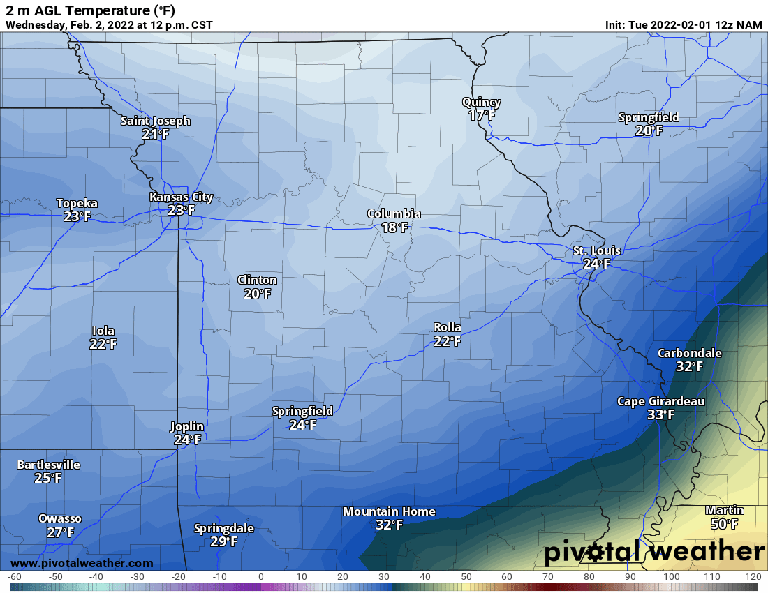
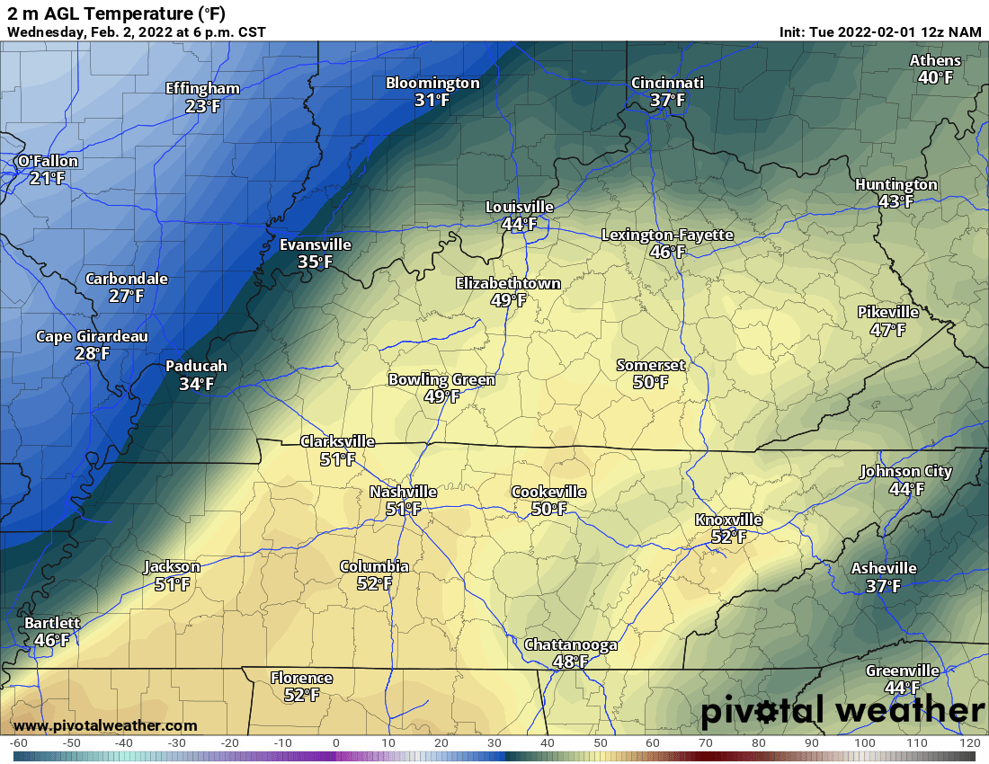
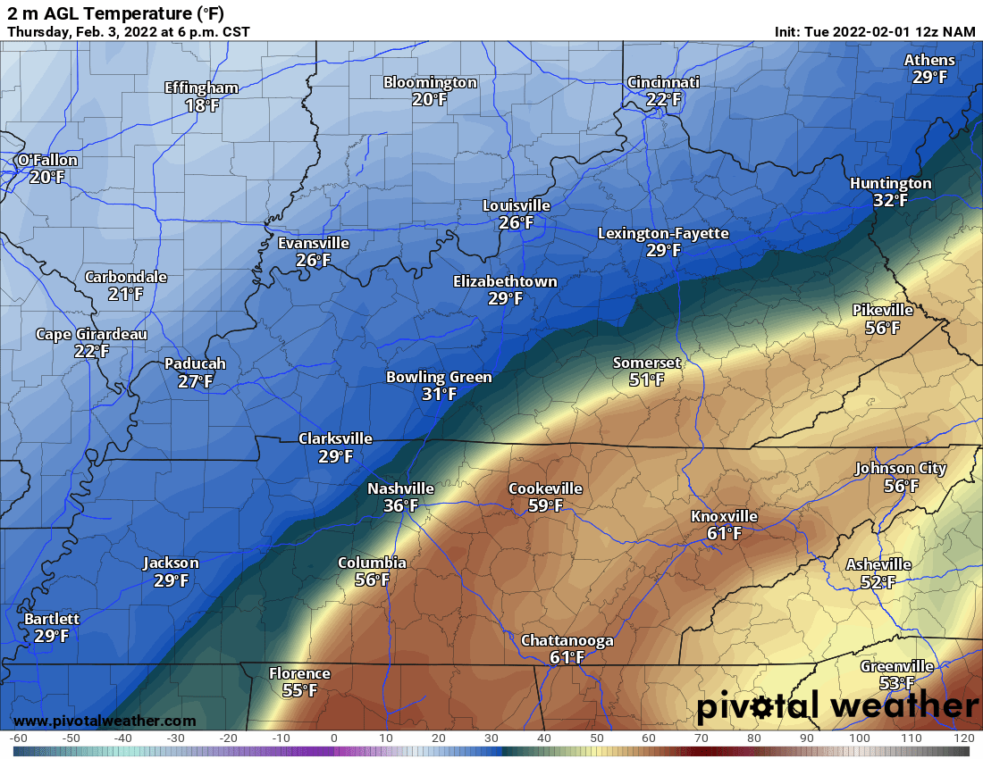
The cold front is entering western Kentucky. You can see it on this temperature chart.
Click images to enlarge them
.
12:45 PM
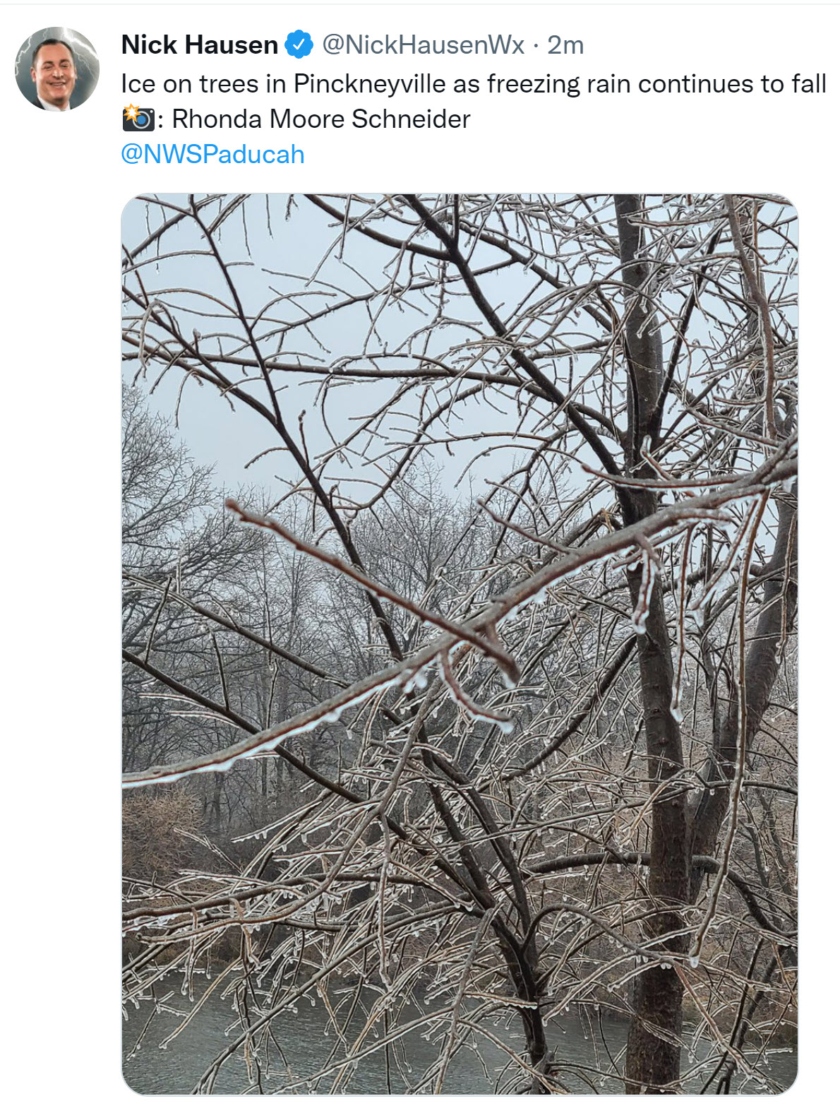
Pinckneyville, Illinois
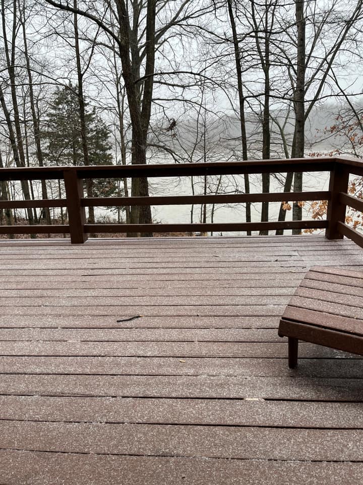
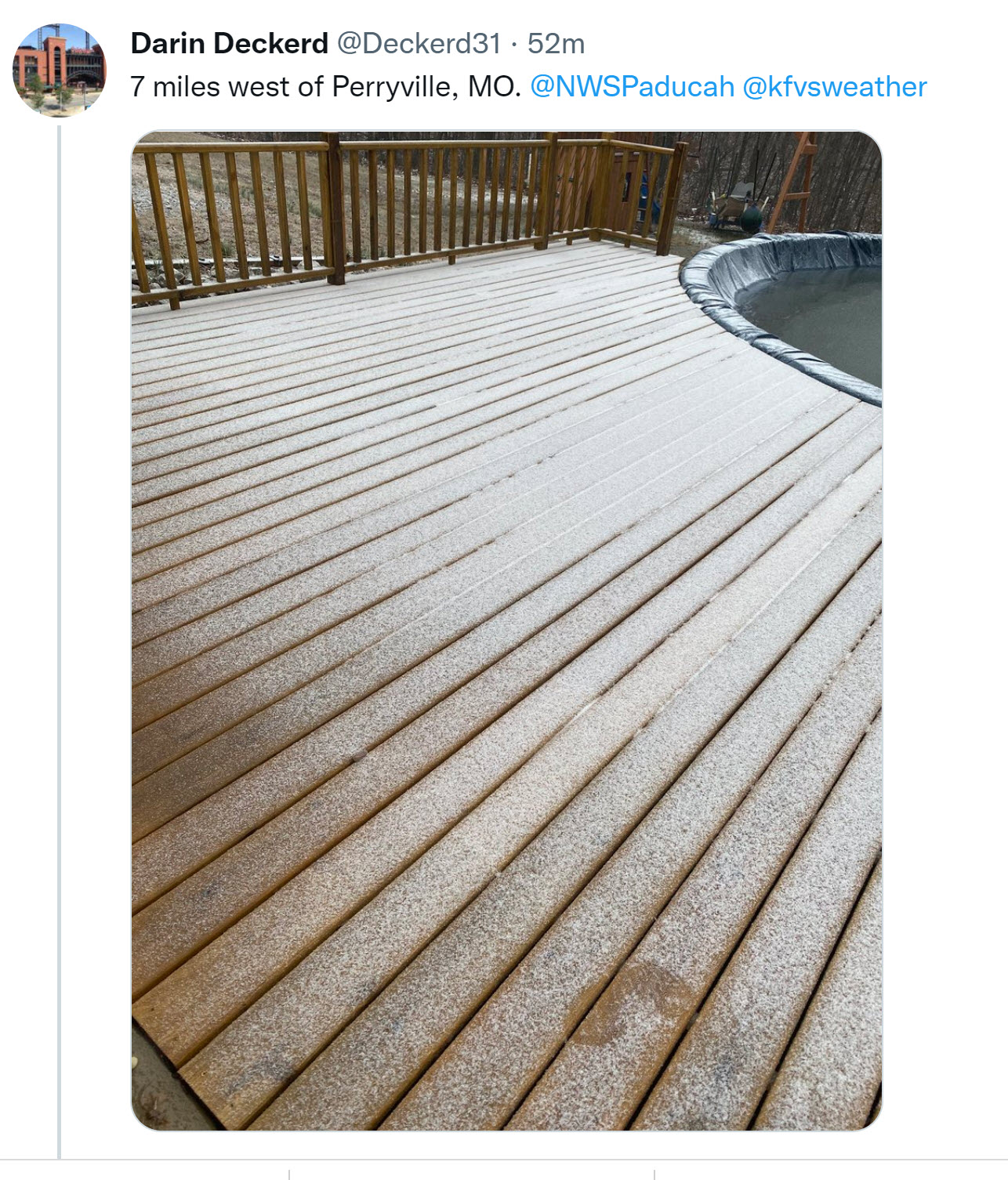
Perryville, Missouri
.
12:35 PM
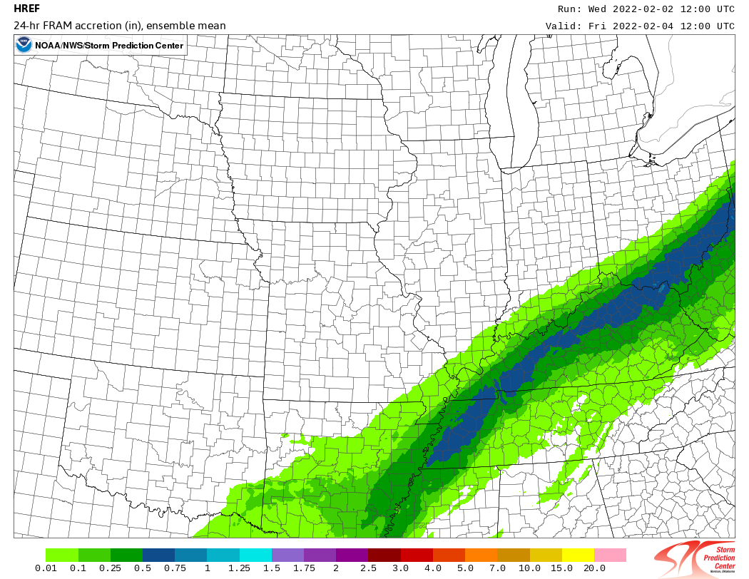
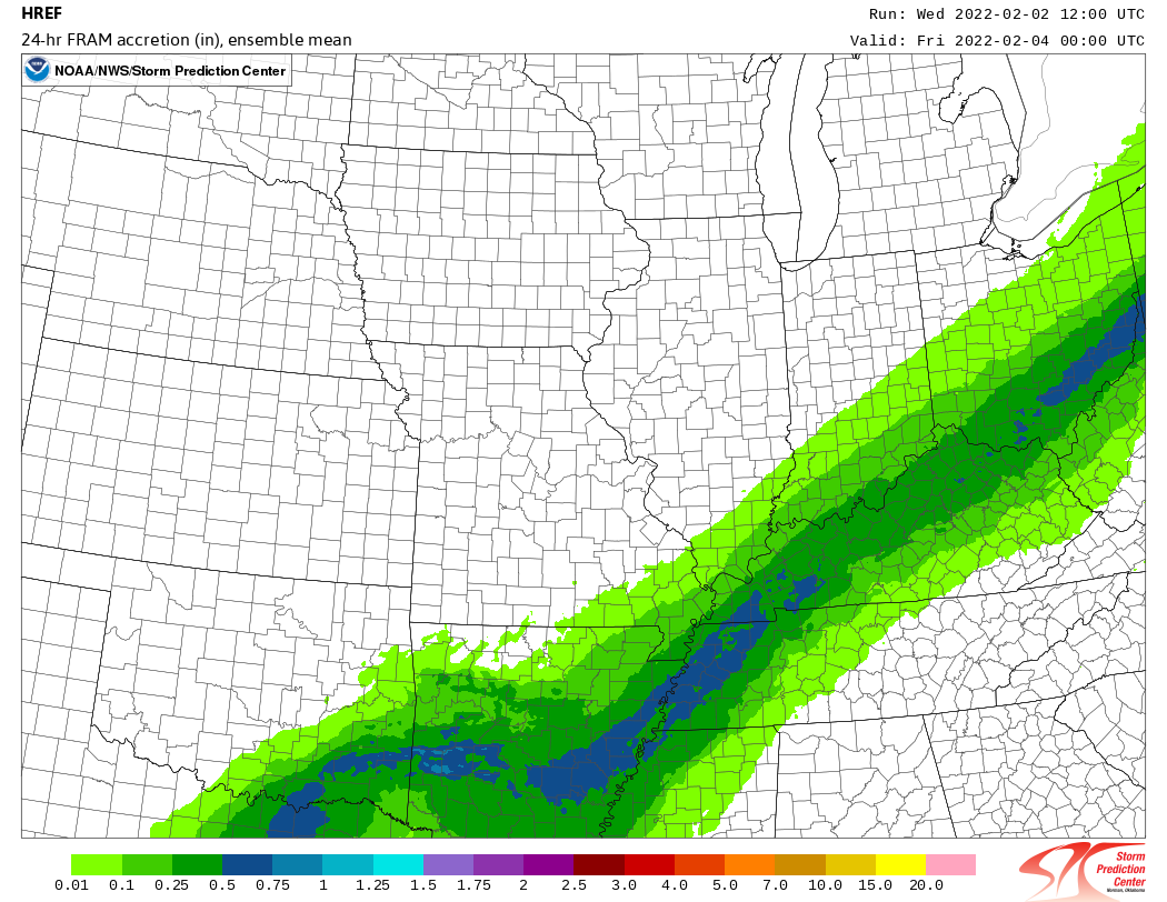
High resolution data shows where the greatest potential for heavy ice accumulation will be.
The blue zone is the highest risk zone for higher totals. Then, the dark green zone slightly lower totals.
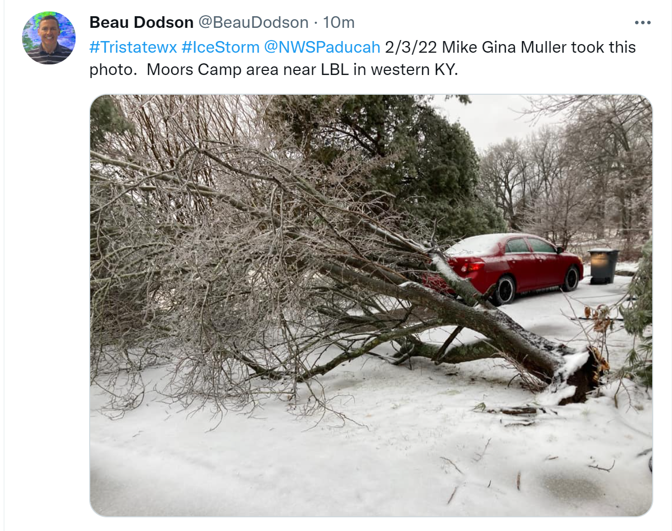
Either way, this is going to cause some damage to trees and power lines.
.
12:30 PM
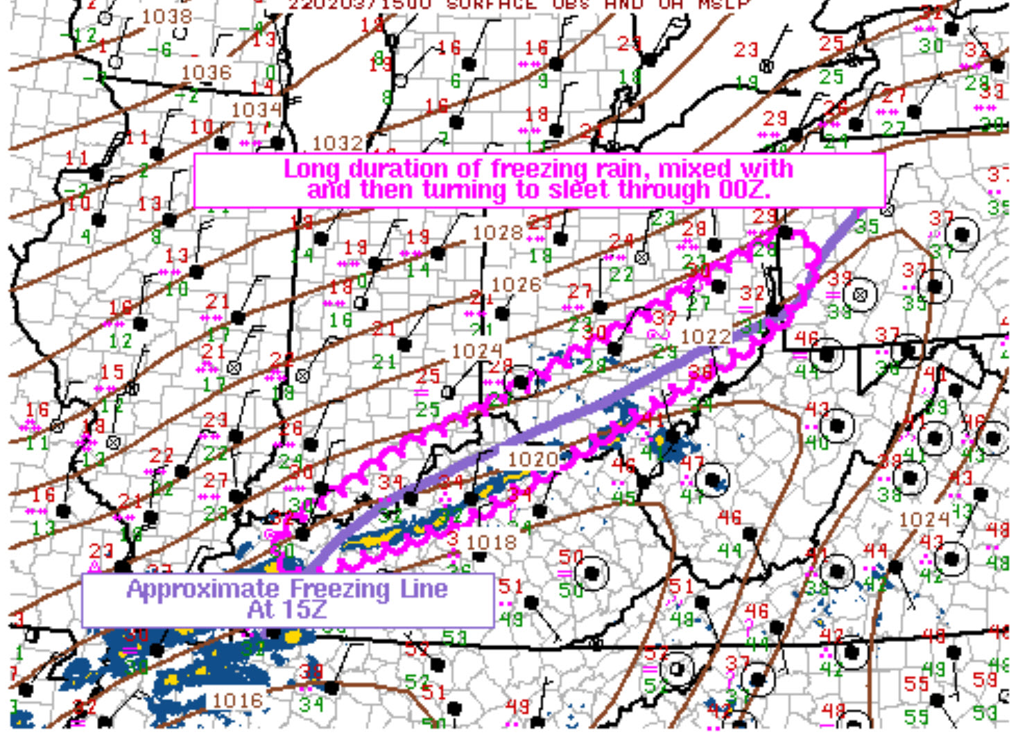
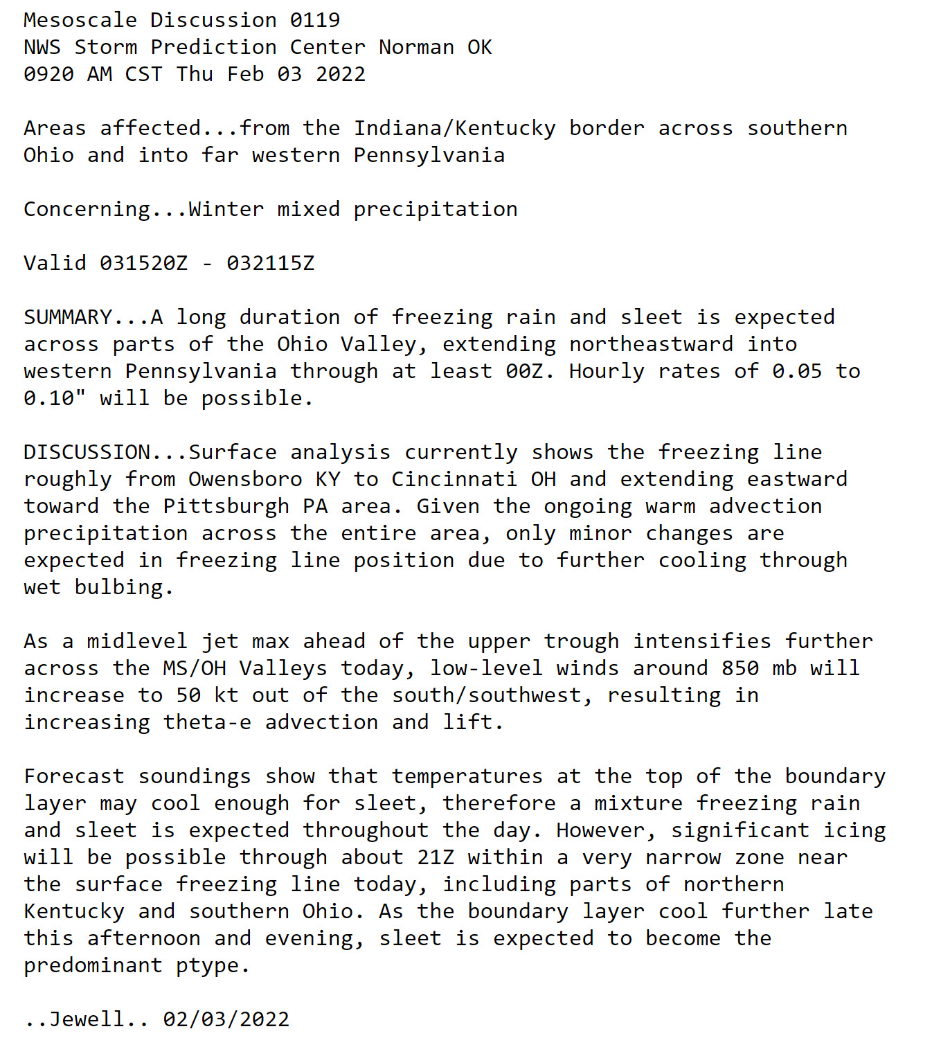
Freezing line
Click on the image to enlarge it.
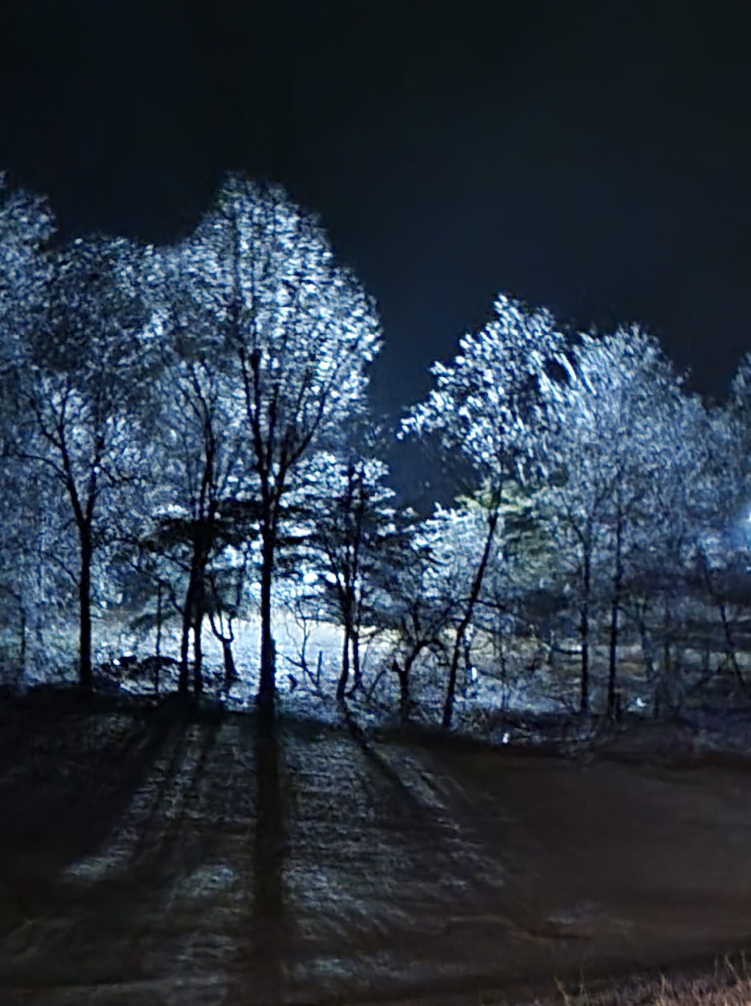
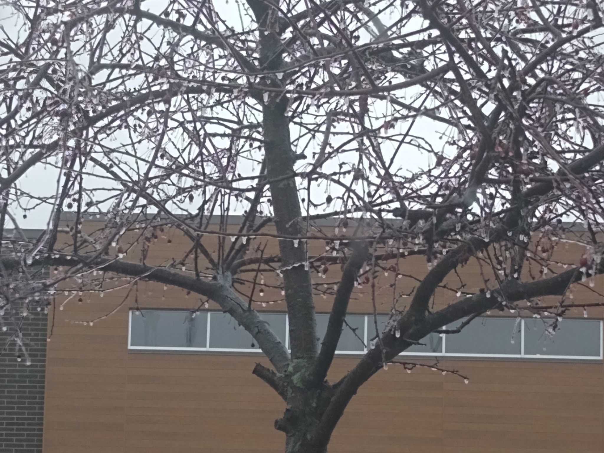
Tashia Lea White-Sumner sent in this photograph from Mt Vernon, Illinois.\
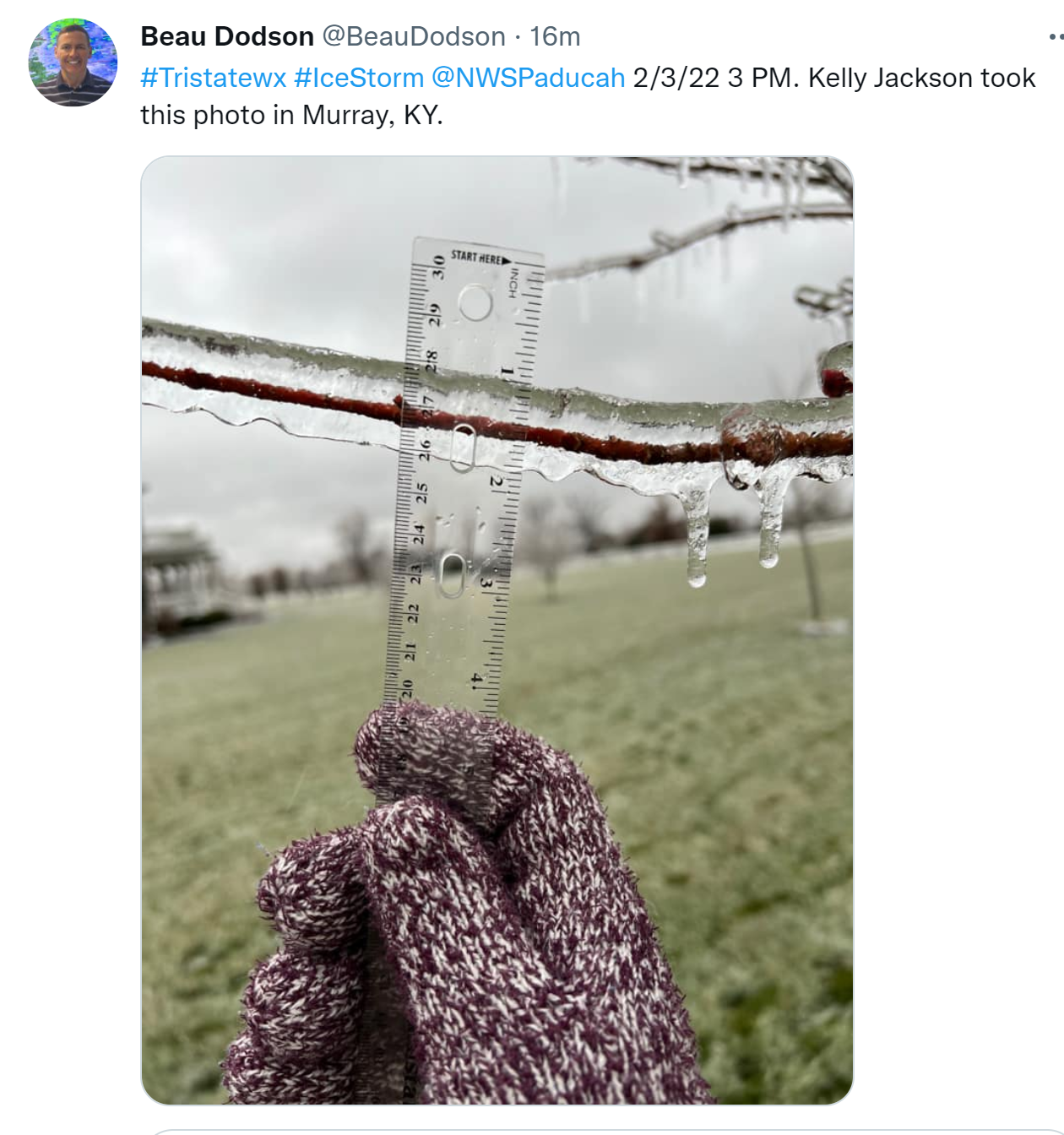
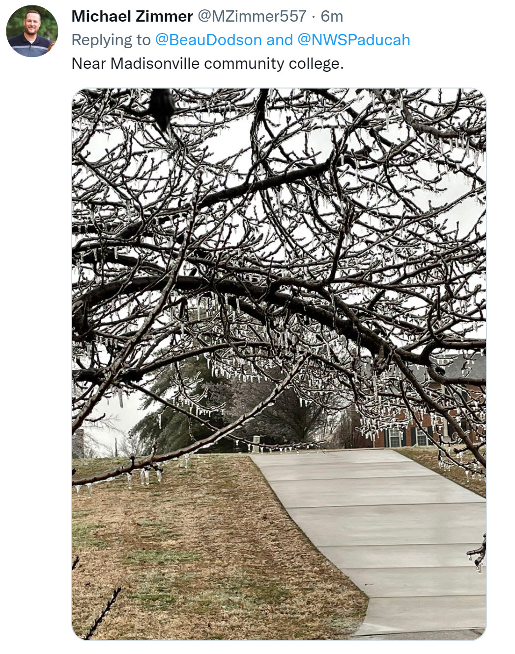
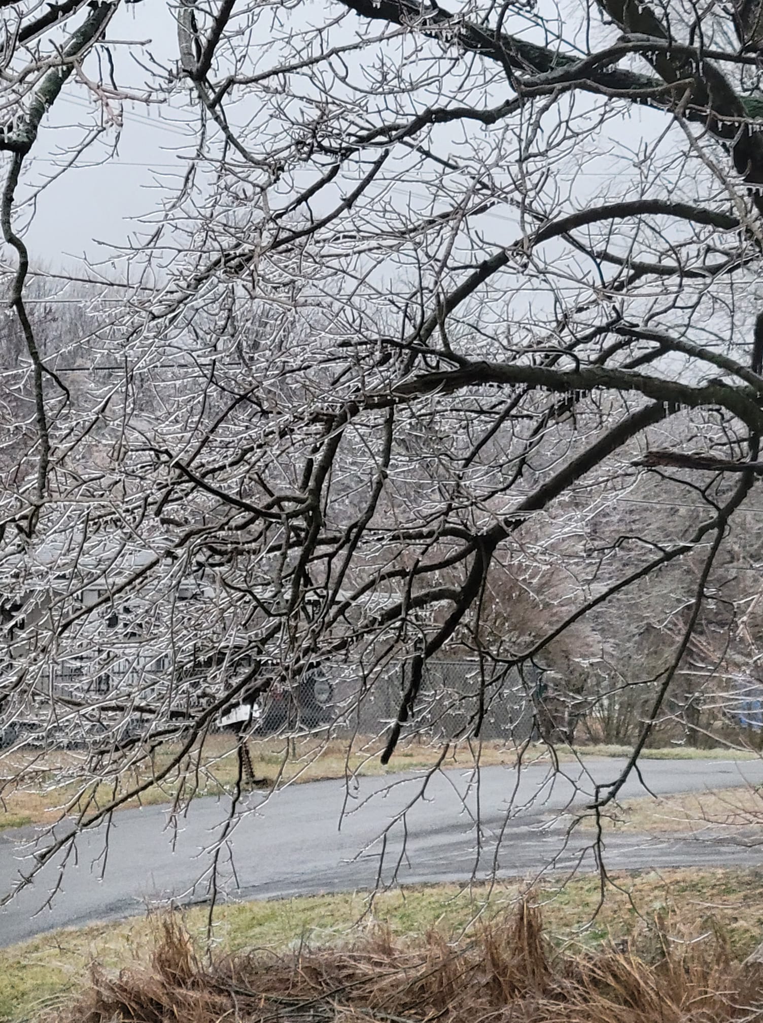
Freezing rain accumulating on trees.
11:20 AM
On the local city-view radars you can click the winterize button to see precipitation type.
https://weatherobservatory.com/weather-radar.htm?
.
11:15 AM Freezing line position
Freezing precipitation over portions of the area.
Keep in mind, there may be lulls in precipitation later today and evening.
Green is rain. Blue is snow. Pink and orange represents ice.
.
10:40 AM
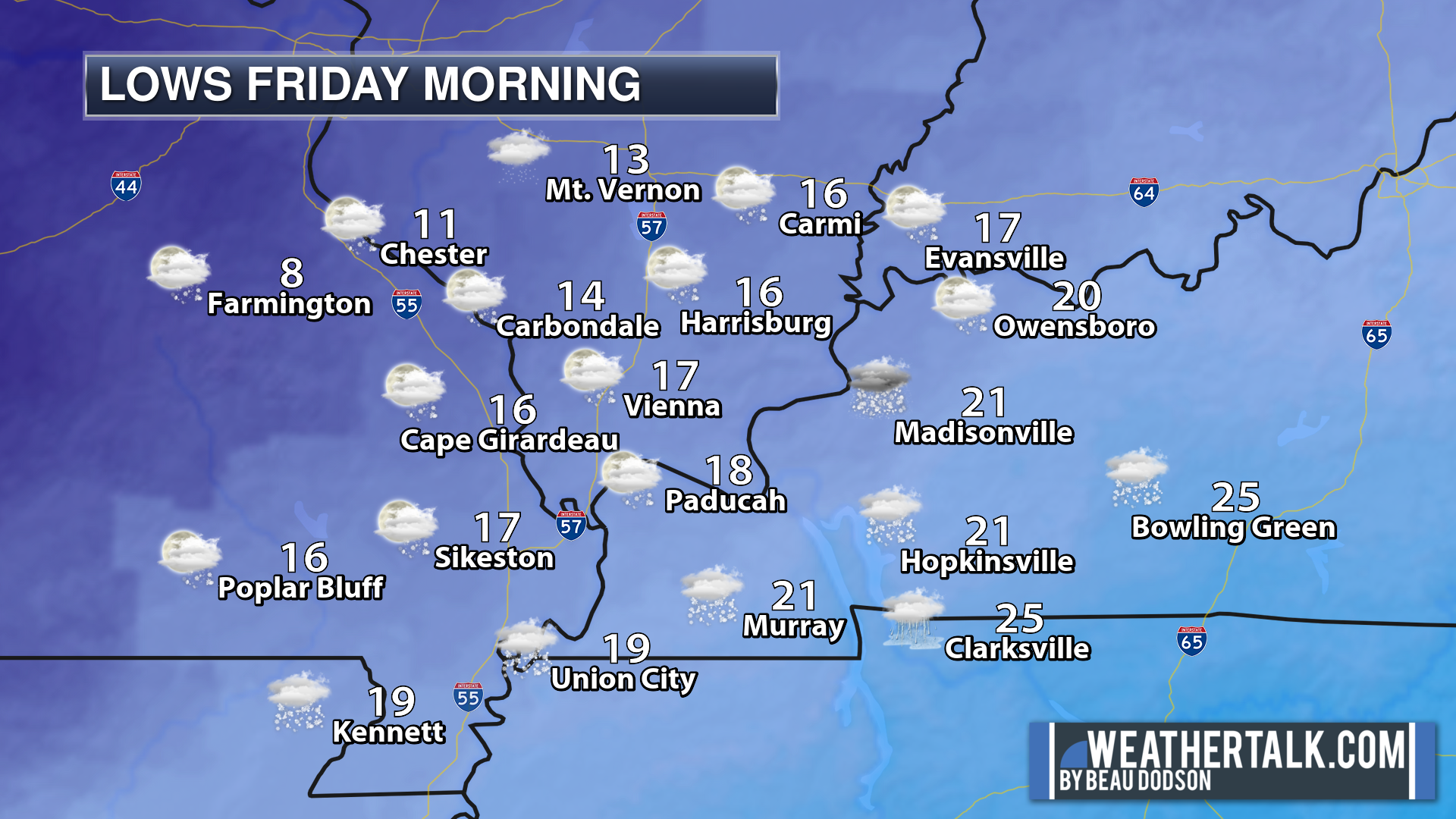
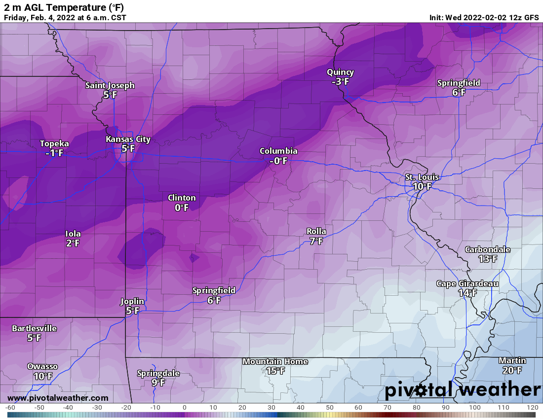
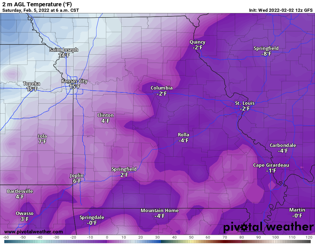
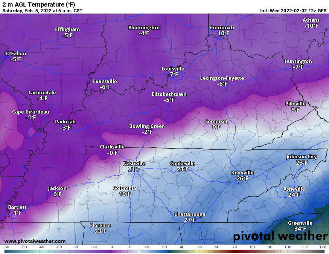
Friday morning temperatures will be cold.
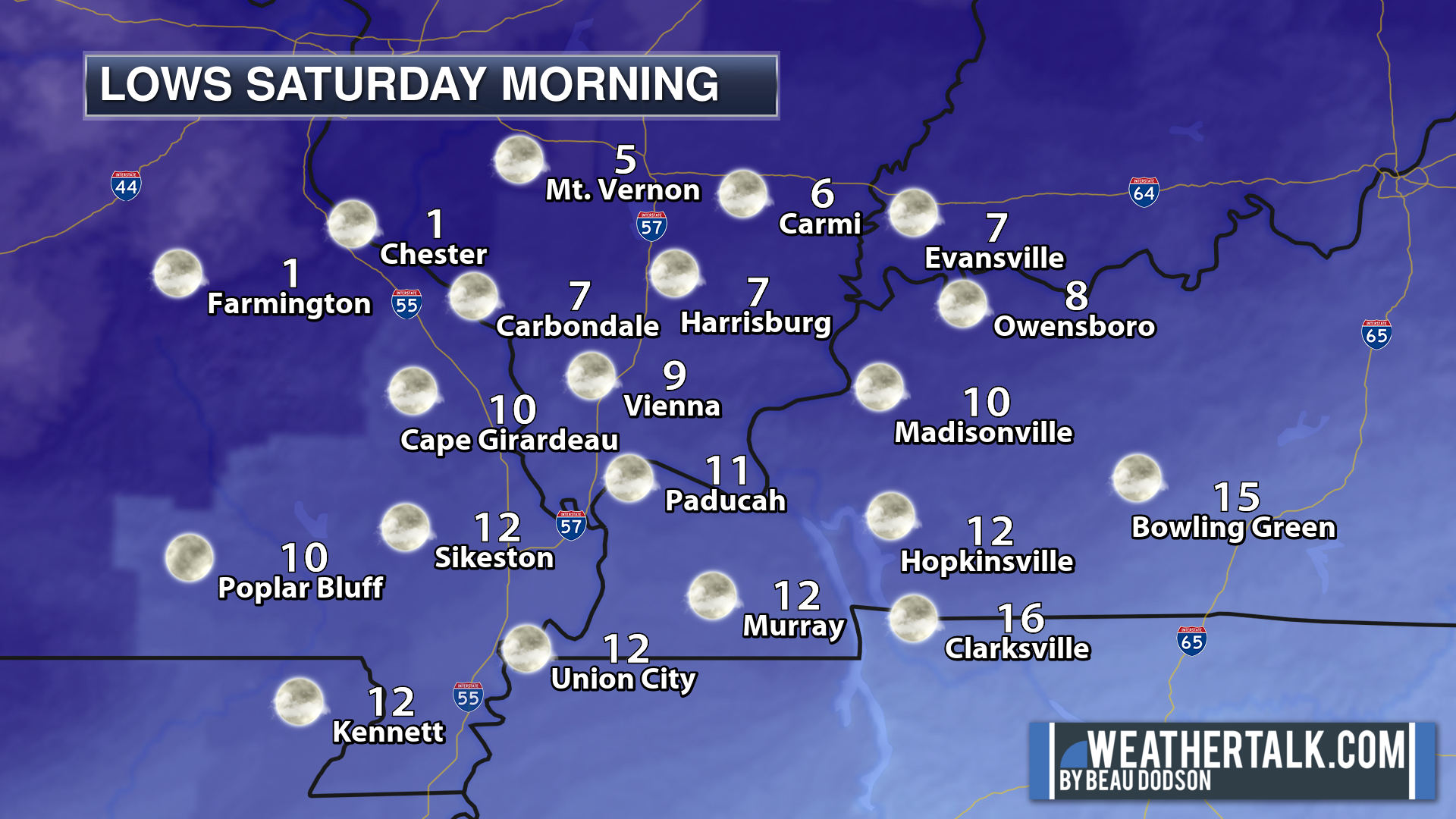
Saturday morning temperatures will be even colder.
.
10:20 AM NWS conference call.
.
10:15 AM
Click image to enlarge it
.
10 AM
Freezing line.
.
9:45 AM
.
9 AM
Freezing line position. This continues to push east southeast.
.
6:30 AM
Today’s Facebook Weather Thread
https://www.facebook.com/beaudodsonweather/posts/5376257232403741
.
6 AM Warnings
.
Freezing rain totals will vary based on when the freezing rain changes over to sleet.
.
Snow potential. Snow totals will vary based on when the sleet changes to snow.
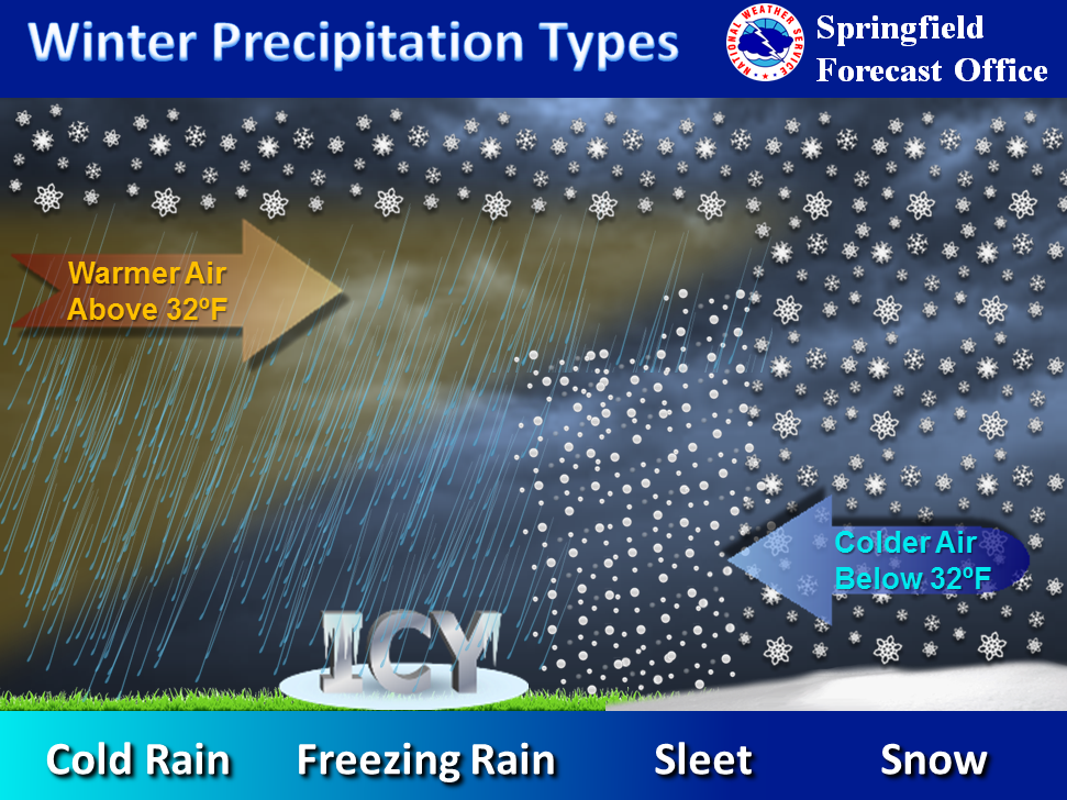
What determines precipitation type? Temperatures at the surface and aloft.
.
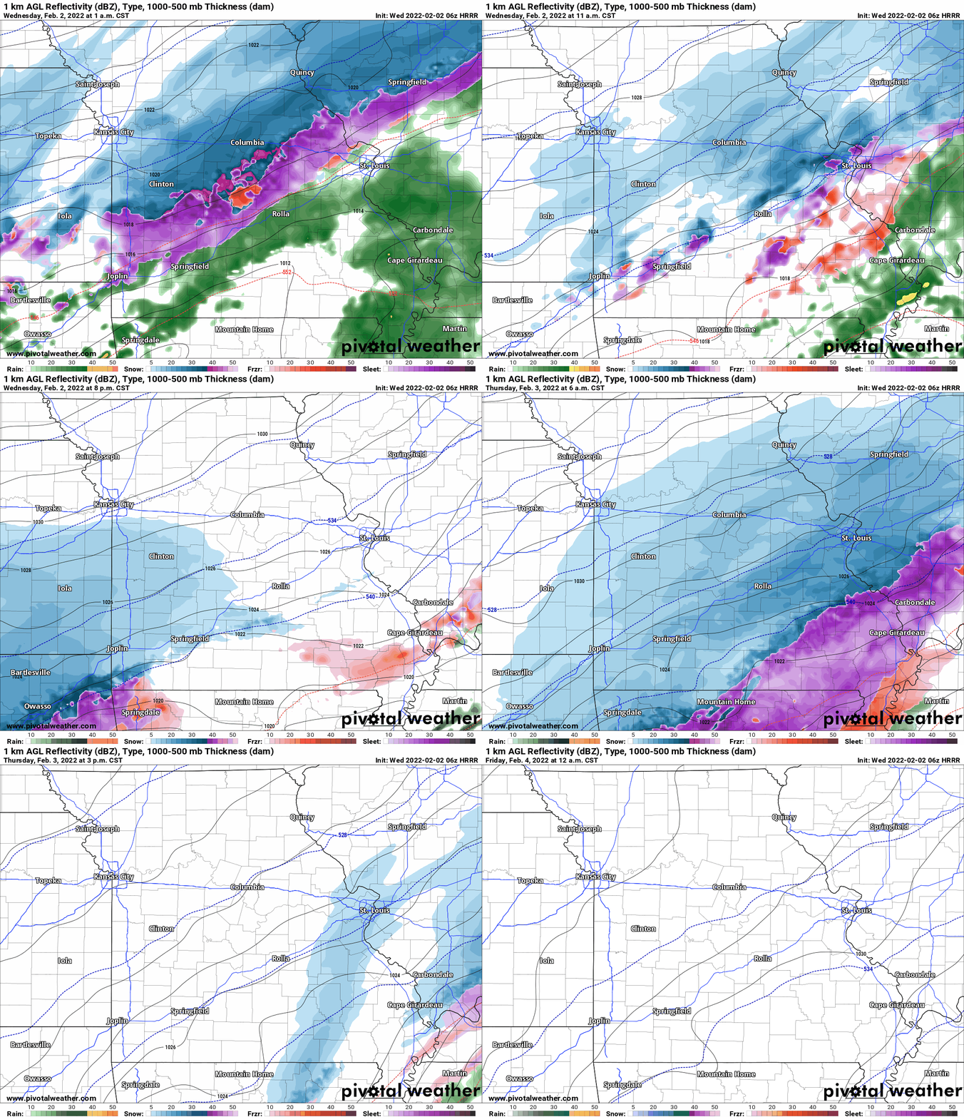
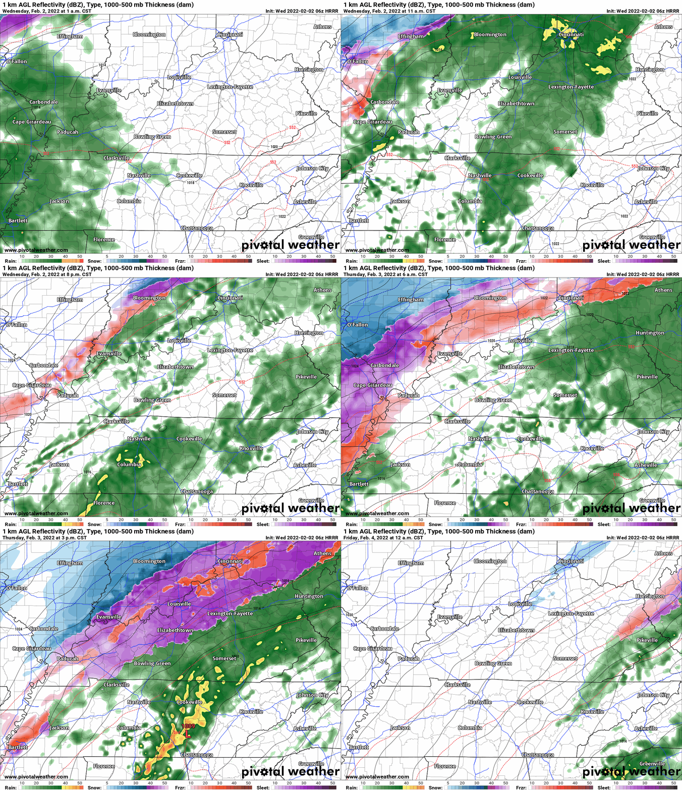
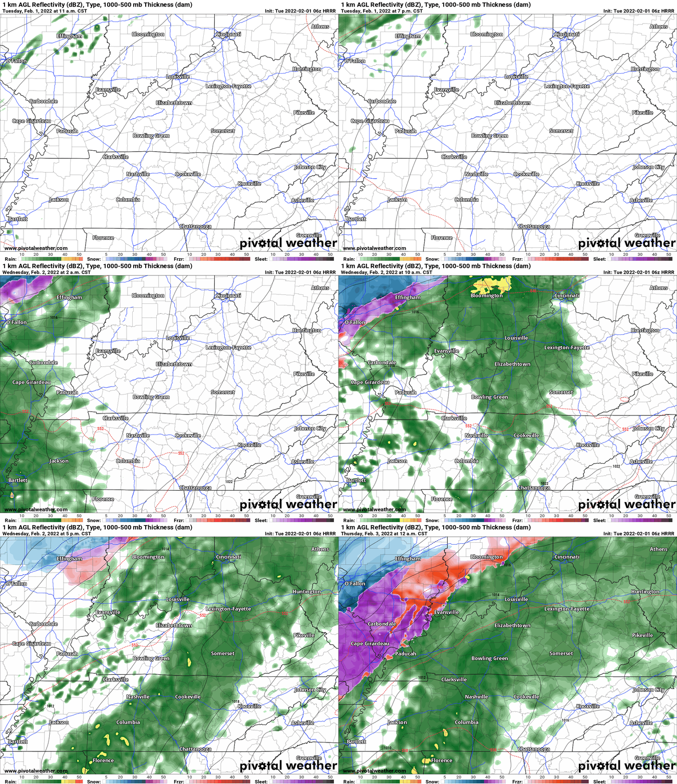
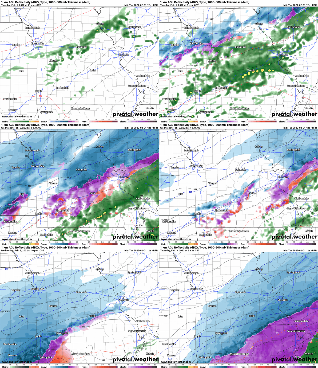
6 AM future-cast radars.
This animation is the Hrrr short-range model.
This animation shows you what radar might look like as the next system pulls through the region. It is a future-cast radar.
Time-stamp upper left. Click the animation to enlarge it.
.
.
.
5:15 AM Wednesday Update
First Major Winter Storm for the Quad State in 2022...

Key Messages:

1. This winter storm is just beginning to move into the Quad
State area early this Wednesday and impacts could be felt as
early as mid-morning over extreme southwest Illinois. Confidence
in minor to locally moderate impacts to residents of southeast
Missouri and southern Illinois remains high.

2. Recent and significant forecast changes in this winter storm
system suggest that a good portion of west Kentucky, southwest
Indiana, extreme southeast Illinois, and extreme southeast
Missouri could see significant icing from freezing rain. This will
likely cause major short term impacts and more prolonged extreme
impacts over a smaller part of the area. Therefore, the
aformentioned  area has been shifted from a Winter Storm Warning
to a Ice Storm Warning.

3. For the Winter Storm Warning area, the time period for the
greatest snow accumulations will be over southern illinois between
6am and 6 pm Thursday. For ice accumulations, the time period for
the greatest accumulations will be this morning through midnight
over southern Illinois and southeast Missouri. For sleet
accumulations, the greatest accumulations will likely occur from
midnight to noon on Thursday, with amounts in excess of an inch
mainly over southeast Missouri. Finally ice accumulations due to
freezing rain will be most impactful for southeast Missouri today
(especially this afternoon) through midnight and over southern
Illinois this afternoon through midnight tonight.

4. For the Ice Storm Warning area, lighter (generally less than
one tenth of an inch) ice accumulation can be expected to move
into the western half of the warning area this Wednesday evening,
with 0.10 to 0.15 of inch accumulation from midnight to 6am
Thursday. The highest accumulations, ranging from two to four
tenths of an inch are expected between 6 am and noon on Thursday
covering the bulk of the Ice Storm Warning area. From noon to 6 pm
CST Thursday, the ice accumulations are expected be near one
quarter inch, focused wholly in west Kentucky. After 6 pm and
through midnight, additional ice accumulations are minimal across
the Pennyrile of west Kentucky.

5. There still remains some forecast uncertainty as to final
winter precipitation accumulations, due to prior air, ground, and
road conditions. In addition, smaller scale weather features in
this massive winter weather system may enhance or reduce
perception amounts. Regardless, this winter storm should be taken
seriously for both travelers and residents of the Quad State
region served by the National Weather Service in Paducah Kentucky.
.
8 PM
No changes in the evening data.
The biggest question remains freezing rain totals. A difficult forecast.
If some locations top 0.25″ of freezing rain then tree limb damage and power line damage chances will increase. Especially true with gusty winds.
This will need to be closely monitoring.
Plan accordingly.
The highest threat of freezing rain will be from the Missouri Bootheel into extreme southern Illinois, western Kentucky, and northwest Tennessee.
.
5 PM Update
Tuesday evening update
I wanted to return to the freezing rain subject. I am a bit concerned about the confidence level in the totals. For the most part, I believe the bulk of the area remains at or below 0.25″ of freezing rain.
There is quite a bit of data that shows small bands of 0.25″ to 0.50″ of freezing rain (locally slightly higher).
Again, tree limb damage begins around 0.25″ and damage increases from there with higher totals. Gusty winds are a concern with this event. Wind gusts of 15 to 30 mph will be possible into Thursday night.
This could make up the difference for smaller freezing rain totals. In other words, lower totals could still have issues if we have strong wind gusts. Those strong wind gusts could bring down limbs and power lines.
For planning purposes, you should plan on some tree limb damage and scattered power outages. Then, as mentioned before, we hope for more sleet vs freezing rain.
I just wanted to be clear about the freezing rain portion of this forecast. There are a lot of variables that go into forecasting freezing rain totals.
.
3:15 PM
.
3:15 PM
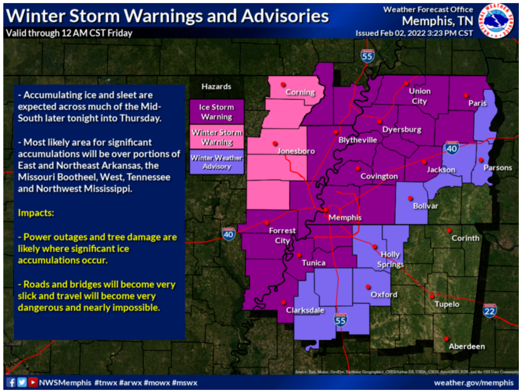
Winter Storm Warning for the Missouri Bootheel and northwest Tennessee
.
URGENT - WINTER WEATHER MESSAGE
NATIONAL WEATHER SERVICE MEMPHIS TN
305 PM CST TUE FEB 1 2022

ARZ009-018-MOZ113-021030-
/O.UPG.KMEG.WS.A.0002.220203T0000Z-220204T0600Z/
/O.NEW.KMEG.WS.W.0003.220203T0000Z-220204T0600Z/
CLAY-GREENE-DUNKLIN-
INCLUDING THE CITIES OF PIGGOTT, CORNING, PARAGOULD, AND KENNETT
305 PM CST TUE FEB 1 2022

...WINTER STORM WARNING IN EFFECT FROM 6 PM WEDNESDAY TO MIDNIGHT
CST THURSDAY NIGHT...

* WHAT...HEAVY MIXED PRECIPITATION EXPECTED. TOTAL ICE
  ACCUMULATIONS OF FOUR TENTHS TO ONE HALF OF AN INCH AND TOTAL
  SLEET AND SNOW ACCUMULATIONS OF AROUND ONE INCH. WINDS GUSTING
  AS HIGH AS 35 MPH.

* WHERE...IN ARKANSAS, CLAY AND GREENE COUNTIES. IN MISSOURI,
  DUNKLIN COUNTY.

* WHEN...FROM 6 PM WEDNESDAY TO MIDNIGHT CST THURSDAY NIGHT.

* IMPACTS...POWER OUTAGES AND TREE DAMAGE ARE LIKELY DUE TO THE
  ICE. TRAVEL COULD BE NEARLY IMPOSSIBLE. THE HAZARDOUS
  CONDITIONS COULD IMPACT THE MORNING OR EVENING COMMUTE.

PRECAUTIONARY/PREPAREDNESS ACTIONS...

IF YOU MUST TRAVEL, KEEP EXTRA BLANKETS, FOOD, WATER AND A
FLASHLIGHT IN YOUR VEHICLE IN CASE OF AN EMERGENCY.

THE LATEST ROAD CONDITIONS FOR THE STATE YOU ARE CALLING FROM CAN
BE OBTAINED BY CALLING 5 1 1.

&&

$$

ARZ026>028-MOZ115-021030-
/O.UPG.KMEG.WS.A.0002.220203T0600Z-220204T0600Z/
/O.NEW.KMEG.WS.W.0003.220203T0000Z-220204T0600Z/
CRAIGHEAD-POINSETT-MISSISSIPPI-PEMISCOT-
INCLUDING THE CITIES OF JONESBORO, HARRISBURG, BLYTHEVILLE,
AND CARUTHERSVILLE
305 PM CST TUE FEB 1 2022

...WINTER STORM WARNING IN EFFECT FROM 6 PM WEDNESDAY TO MIDNIGHT
CST THURSDAY NIGHT...

* WHAT...HEAVY MIXED PRECIPITATION EXPECTED. TOTAL ICE
  ACCUMULATIONS OF FOUR TENTHS TO ONE HALF OF AN INCH. TOTAL SLEET
  AND SNOW ACCUMULATIONS OF UP TO ONE INCH. WINDS GUSTING AS HIGH
  AS 35 MPH.

* WHERE...IN ARKANSAS, CRAIGHEAD, POINSETT AND MISSISSIPPI
  COUNTIES. IN MISSOURI, PEMISCOT COUNTY.

* WHEN...FROM 6 PM WEDNESDAY TO MIDNIGHT CST THURSDAY NIGHT.

* IMPACTS...EXPECT POWER OUTAGES AND TREE DAMAGE DUE TO THE ICE.
  TRAVEL COULD BE IMPOSSIBLE. THE HAZARDOUS CONDITIONS COULD
  IMPACT THE MORNING OR EVENING COMMUTE.

PRECAUTIONARY/PREPAREDNESS ACTIONS...

IF YOU MUST TRAVEL, KEEP EXTRA BLANKETS, FOOD, WATER AND A
FLASHLIGHT IN YOUR VEHICLE IN CASE OF AN EMERGENCY.

THE LATEST ROAD CONDITIONS FOR THE STATE YOU ARE CALLING FROM CAN
BE OBTAINED BY CALLING 5 1 1.

&&

$$

ARZ035-036-048-TNZ001>003-019-048-049-088-021030-
/O.UPG.KMEG.WS.A.0002.220203T0600Z-220204T0600Z/
/O.NEW.KMEG.WS.W.0003.220203T0600Z-220204T0600Z/
CROSS-CRITTENDEN-ST. FRANCIS-LAKE-OBION-WEAKLEY-DYER-LAUDERDALE-
TIPTON-SHELBY-
INCLUDING THE CITIES OF WYNNE, WEST MEMPHIS, FORREST CITY,
TIPTONVILLE, UNION CITY, MARTIN, DRESDEN, DYERSBURG, RIPLEY TN,
COVINGTON, BARTLETT, GERMANTOWN, COLLIERVILLE, MEMPHIS,
AND MILLINGTON
305 PM CST TUE FEB 1 2022

...WINTER STORM WARNING IN EFFECT FROM MIDNIGHT WEDNESDAY NIGHT
TO MIDNIGHT CST THURSDAY NIGHT...

* WHAT...HEAVY MIXED PRECIPITATION EXPECTED. TOTAL ICE
  ACCUMULATIONS OF ONE QUARTER TO ONE HALF OF AN INCH AND TOTAL
  SLEET AND SNOW ACCUMULATIONS OF LESS THAN ONE INCH.

* WHERE...PORTIONS OF WEST TENNESSEE AND EAST ARKANSAS.

* WHEN...FROM MIDNIGHT WEDNESDAY NIGHT TO MIDNIGHT CST THURSDAY
  NIGHT.

* IMPACTS...EXPECT POWER OUTAGES AND TREE DAMAGE DUE TO THE ICE.
  TRAVEL COULD BE IMPOSSIBLE. THE HAZARDOUS CONDITIONS COULD
  IMPACT THE MORNING OR EVENING COMMUTE.

PRECAUTIONARY/PREPAREDNESS ACTIONS...

IF YOU MUST TRAVEL, KEEP EXTRA BLANKETS, FOOD, WATER AND A
FLASHLIGHT IN YOUR VEHICLE IN CASE OF AN EMERGENCY.

THE LATEST ROAD CONDITIONS FOR THE STATE YOU ARE CALLING FROM CAN
BE OBTAINED BY CALLING 5 1 1.
.
3:00 PM
The NWS is in agreement with me on the freezing rain totals. They went with a winter storm warning instead of an ice storm warning.
.
This is a very difficult forecast. The difference between freezing rain and sleet will only be a couple of degrees.
We are trying to forecast those one or two degrees over a large area.
Tricky, at best.
We are hoping for more sleet vs freezing rain.
The end result will be the same. Icy road conditions.
.
Let’s hope we are right on the sleet vs freezing rain. Doing our best here.
.
2:45 PM
Winter Storm Warnings
URGENT - WINTER WEATHER MESSAGE
NATIONAL WEATHER SERVICE PADUCAH KY
237 PM CST TUE FEB 1 2022

ILZ075>077-080>082-084-085-088-MOZ076-086-087-100-107>110-021030-
/O.UPG.KPAH.WS.A.0001.220202T1800Z-220204T1200Z/
/O.NEW.KPAH.WS.W.0002.220202T1800Z-220204T1200Z/
JEFFERSON-WAYNE IL-EDWARDS-PERRY IL-FRANKLIN-HAMILTON-JACKSON-
WILLIAMSON-UNION-PERRY MO-BOLLINGER-CAPE GIRARDEAU-WAYNE MO-
CARTER-RIPLEY-BUTLER-STODDARD-
INCLUDING THE CITIES OF MOUNT VERNON, FAIRFIELD, ALBION,
PINCKNEYVILLE, WEST FRANKFORT, MCLEANSBORO, CARBONDALE,
MURPHYSBORO, HERRIN, JONESBORO, PERRYVILLE, MARBLE HILL,
CAPE GIRARDEAU, JACKSON, PIEDMONT, VAN BUREN, DONIPHAN,
POPLAR BLUFF, AND BLOOMFIELD
237 PM CST TUE FEB 1 2022

...WINTER STORM WARNING IN EFFECT FROM NOON WEDNESDAY TO 6 AM CST
FRIDAY...

* WHAT...HEAVY MIXED PRECIPITATION IS POSSIBLE. TOTAL SNOW AND
  SLEET ACCUMULATIONS OF 2 TO 5 INCHES, AND ICE ACCUMULATIONS OF
  ONE TENTH OF AN INCH WITH LOCALLY HIGHER AMOUNTS POSSIBLE.

* WHERE...PORTIONS OF SOUTHEAST MISSOURI AND SOUTHERN ILLINOIS.
  THIS AREA IS GENERALLY ALONG AND WEST OF A LINE FROM POPLAR
  BLUFF AND CAPE GIRARDEAU MISSOURI TO MARION AND ALBION
  ILLINOIS.

* WHEN...FROM WEDNESDAY AFTERNOON THROUGH LATE THURSDAY NIGHT.

* IMPACTS...POWER OUTAGES AND TREE DAMAGE ARE POSSIBLE DUE TO THE
  ICE. TRAVEL COULD BE NEARLY IMPOSSIBLE AND SHOULD BE AVOIDED
  UNLESS ABSOLUTELY NECESSARY. THE HAZARDOUS CONDITIONS COULD
  IMPACT THOSE TRAVELERS DURING THE MORNING OR EVENING COMMUTES,
  ESPECIALLY ON THURSDAY.

PRECAUTIONARY/PREPAREDNESS ACTIONS...

MONITOR THE LATEST FORECASTS FOR UPDATES ON THIS SITUATION.

&&

$$

ILZ078-083-086-087-089>094-INZ081-082-085>088-KYZ001>007-010-014-
015-018-MOZ111-112-114-021030-
/O.UPG.KPAH.WS.A.0001.220203T0000Z-220204T1200Z/
/O.NEW.KPAH.WS.W.0002.220203T0000Z-220204T1200Z/
WABASH-WHITE-SALINE-GALLATIN-JOHNSON-POPE-HARDIN-ALEXANDER-
PULASKI-MASSAC-GIBSON-PIKE-POSEY-VANDERBURGH-WARRICK-SPENCER-
FULTON-HICKMAN-CARLISLE-BALLARD-MCCRACKEN-GRAVES-LIVINGSTON-
CRITTENDEN-UNION KY-WEBSTER-HENDERSON-SCOTT-MISSISSIPPI-
NEW MADRID-
INCLUDING THE CITIES OF MOUNT CARMEL, CARMI, HARRISBURG,
SHAWNEETOWN, VIENNA, GOLCONDA, ELIZABETHTOWN, CAIRO, MOUND CITY,
METROPOLIS, FORT BRANCH, PETERSBURG, POSEYVILLE, EVANSVILLE,
BOONVILLE, ROCKPORT, HICKMAN, CLINTON, BARDWELL, WICKLIFFE,
PADUCAH, MAYFIELD, SMITHLAND, MARION, MORGANFIELD, DIXON,
HENDERSON, SIKESTON, CHARLESTON, AND NEW MADRID
237 PM CST TUE FEB 1 2022

...WINTER STORM WARNING IN EFFECT FROM 6 PM WEDNESDAY TO 6 AM CST
FRIDAY...

* WHAT...HEAVY MIXED PRECIPITATION IS POSSIBLE. TOTAL SNOW AND
  SLEET ACCUMULATIONS OF ONE HALF TO 2 INCHES, AND ICE
  ACCUMULATIONS OF ONE QUARTER OF AN INCH WITH LOCALLY HIGHER
  AMOUNTS POSSIBLE.

* WHERE...PORTIONS OF SOUTHWEST INDIANA, SOUTHEAST MISSOURI,
  WESTERN KENTUCKY AND SOUTHERN ILLINOIS. THIS AREA IS GENERALLY
  ALONG AND EAST OF A LINE FROM POPLAR BLUFF AND CAPE GIRARDEAU
  MISSOURI TO MARION AND ALBION ILLINOIS, STRETCHING EASTWARD TO
  MAYFIELD AND HENDERSON KENTUCKY TO SANTA CLAUS INDIANA.

* WHEN...FROM WEDNESDAY EVENING THROUGH LATE THURSDAY NIGHT.

* IMPACTS...POWER OUTAGES AND TREE DAMAGE ARE LIKELY DUE TO THE
  ICE. TRAVEL COULD BE NEARLY IMPOSSIBLE AND SHOULD BE AVOIDED
  UNLESS ABSOLUTELY NECESSARY. THE HAZARDOUS CONDITIONS COULD
  IMPACT THOSE TRAVELERS DURING THE MORNING OR EVENING COMMUTES,
  ESPECIALLY ON THURSDAY.

PRECAUTIONARY/PREPAREDNESS ACTIONS...

MONITOR THE LATEST FORECASTS FOR UPDATES ON THIS SITUATION.

&&

$$

KYZ008-009-011-013-016-019>021-021030-
/O.UPG.KPAH.WS.A.0001.220203T1200Z-220204T1200Z/
/O.NEW.KPAH.WS.W.0002.220203T1200Z-220204T1200Z/
MARSHALL-CALLOWAY-LYON-CALDWELL-HOPKINS-DAVIESS-MCLEAN-MUHLENBERG-
INCLUDING THE CITIES OF BENTON, MURRAY, EDDYVILLE, PRINCETON,
MADISONVILLE, OWENSBORO, CALHOUN, AND GREENVILLE
237 PM CST TUE FEB 1 2022

...WINTER STORM WARNING IN EFFECT FROM 6 AM THURSDAY TO 6 AM CST
FRIDAY...

* WHAT...HEAVY MIXED PRECIPITATION IS POSSIBLE. TOTAL SNOW AND
  SLEET ACCUMULATIONS OF A TRACE TO 2 INCHES, AND ICE
  ACCUMULATIONS OF ONE QUARTER INCH WITH LOCALLY HIGHER AMOUNTS
  POSSIBLE.

* WHERE...PORTIONS OF WESTERN KENTUCKY. THIS AREA IS EAST OF A
  LINE FROM MAYFIELD AND HENDERSON KENTUCKY EASTWARD TO MURRAY
  AND OWENSBORO KENTUCKY.

* WHEN...FROM THURSDAY MORNING THROUGH LATE THURSDAY NIGHT.

* IMPACTS...POWER OUTAGES AND TREE DAMAGE ARE LIKELY DUE TO THE
  ICE. TRAVEL COULD BE NEARLY IMPOSSIBLE AND SHOULD BE AVOIDED
  UNLESS ABSOLUTELY NECESSARY. THE HAZARDOUS CONDITIONS COULD
  IMPACT THOSE TRAVELERS DURING THE MORNING OR EVENING COMMUTES,
  ESPECIALLY ON THURSDAY.


PRECAUTIONARY/PREPAREDNESS ACTIONS...

MONITOR THE LATEST FORECASTS FOR UPDATES ON THIS SITUATION.
.
2 PM Update
Here is the latest Hrrr future-cast radar.
There continues to be low confidence in the sleet vs freezing rain zone. It is too close to call. It may be a mix of both. The more sleet we have the better off we are as far as tree limb damage and power line damage.
I am closely monitoring the Missouri Bootheel into western Kentucky and extreme southern Illinois. Northwest Tennessee, as well. That is the zone where freezing rain is most likely.
Eastern counties.
Double click the animation to enlarge it.
Western counties. Time stamp upper left.
.
12 PM Update
The roads are warm and will take a little bit of time to cool down, as well.
.
11 AM Update
These graphics are from the NWS.
They will likely need adjustments as it appears colder air will push faster into the region. That could increase snow totals across portions of southeast Missouri and southern Illinois. It may mean less freezing rain and more sleet, as well.
The NWS won’t update these again until this afternoon. I still believe there could be adjustments.
The bottom line is that icy road conditions will begin as early as Wednesday night over southeast Missouri and southern Illinois and then spread into Kentucky/Tennessee Thursday morning.
Snow accumulation forecast (adjustments likely).
It is possible that we need to push the heavier snow totals a tad further south and east.
.
Freezing rain accumulation. Adjustments likely.
It is possible we need to push the freezing rain line further south and east.
Models continue to trend colder. That will mean more snow and sleet vs freezing rain.
There remain questions about how much freezing rain will occur with this event. If the colder air continues to push deeper into the region then the band of freezing rain will shift south and east, as well.
Morning data would suggest quite a bit of sleet across portions of southeast Missouri and southern Illinois into Kentucky and Tennessee. With quite a bit of snow north of the sleet line.
I do like the trends in guidance as far as colder.
.
Most likely somewhere along and north of a line from Bollinger County northeast into Jackson and Williamson Counties and then northeast from there.
Along and north of that line is more likely to have snow mixed with sleet.
12 PM Wednesday.
Double click images to enlarge them.
.
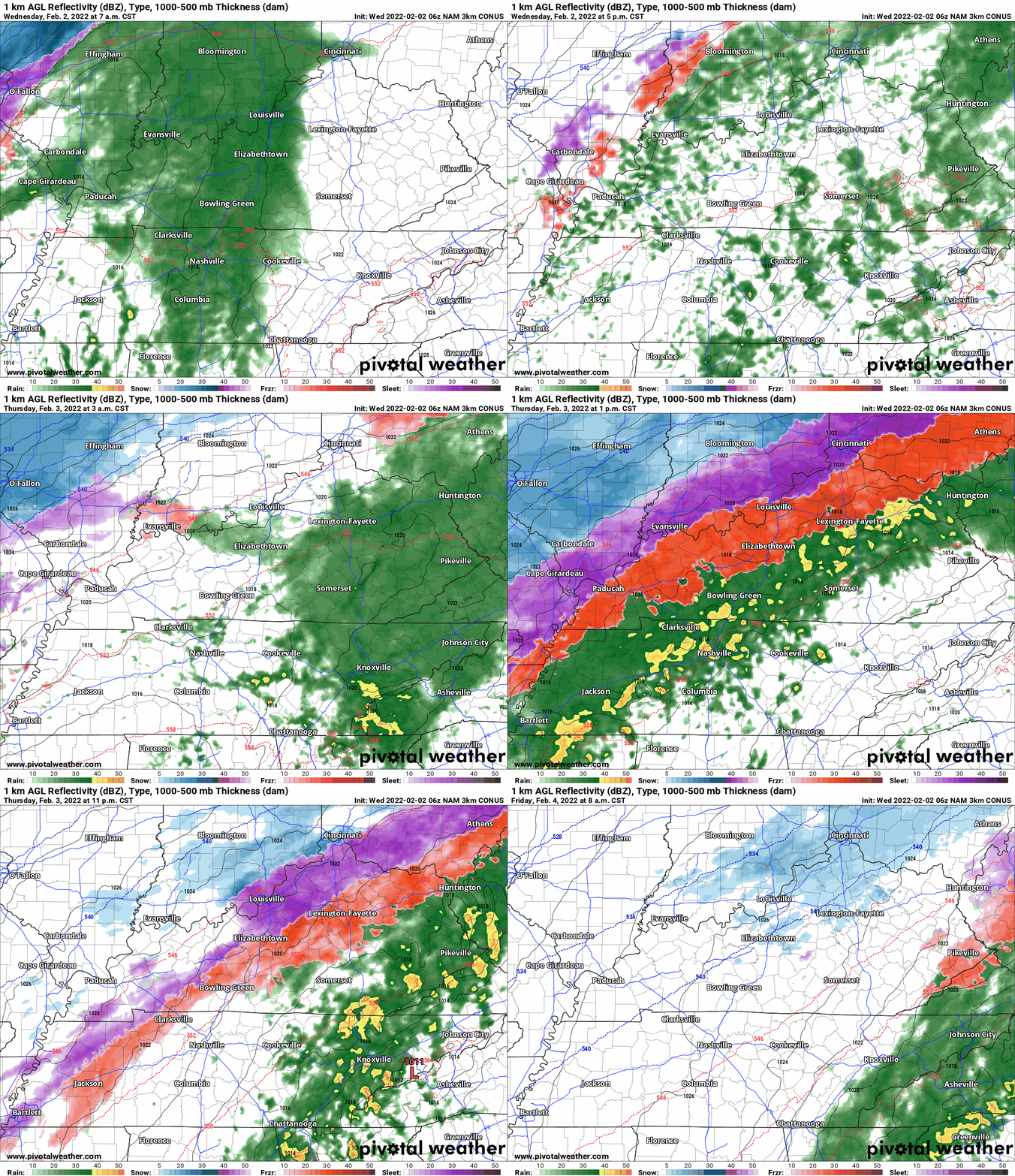
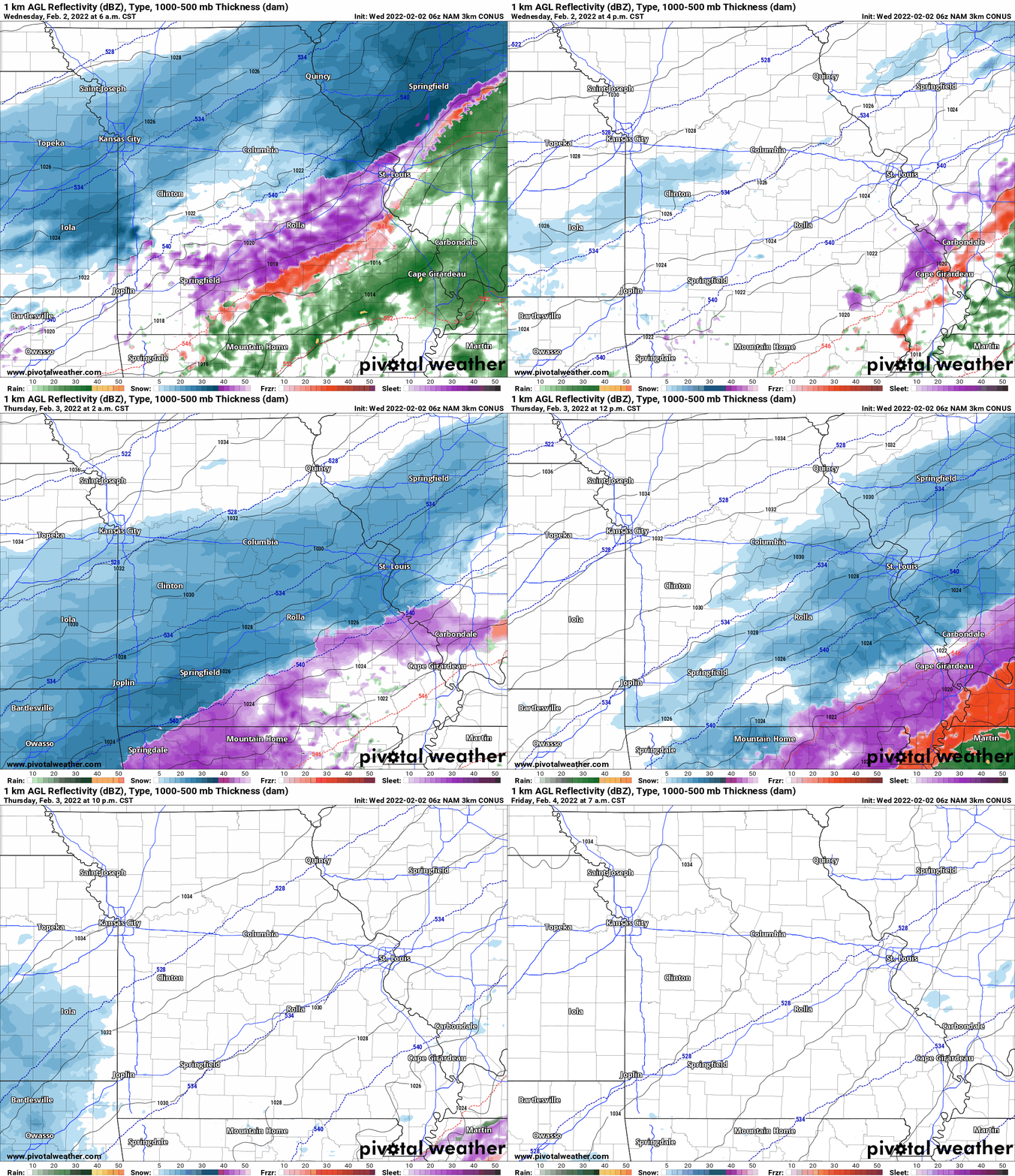
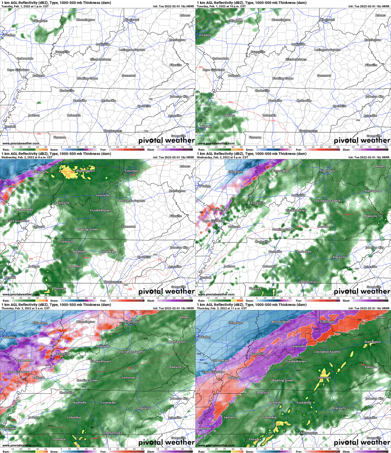
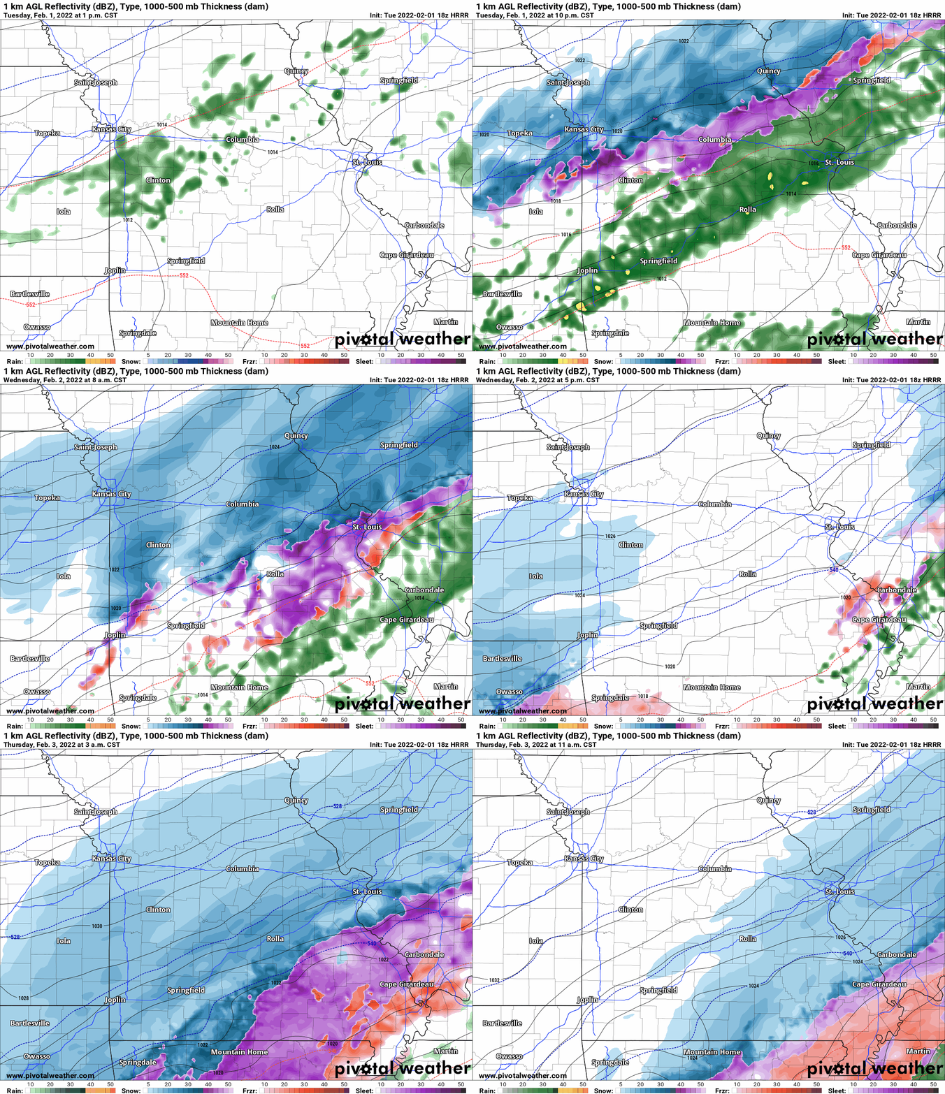
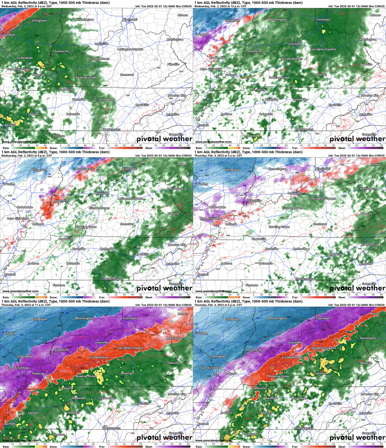
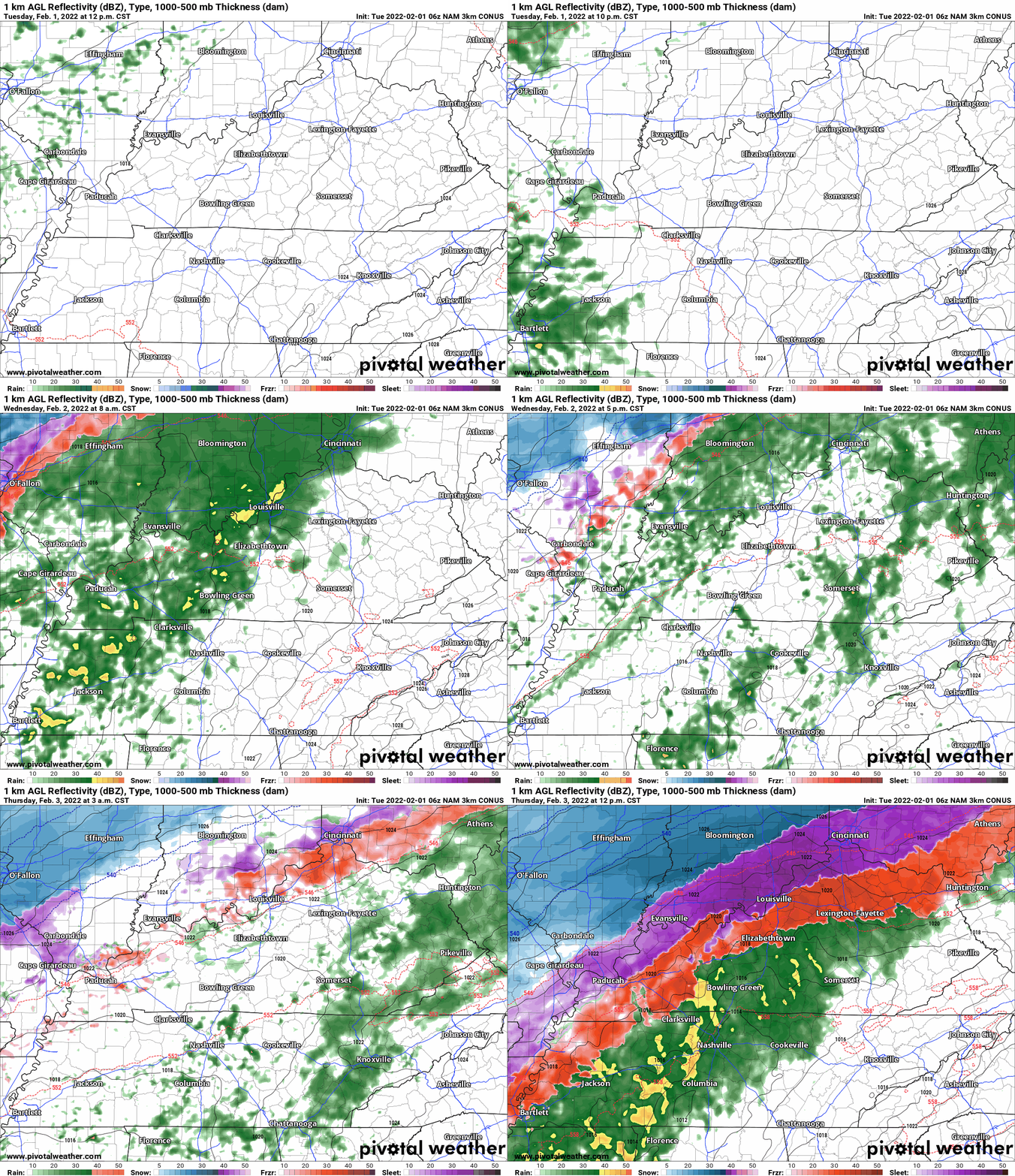
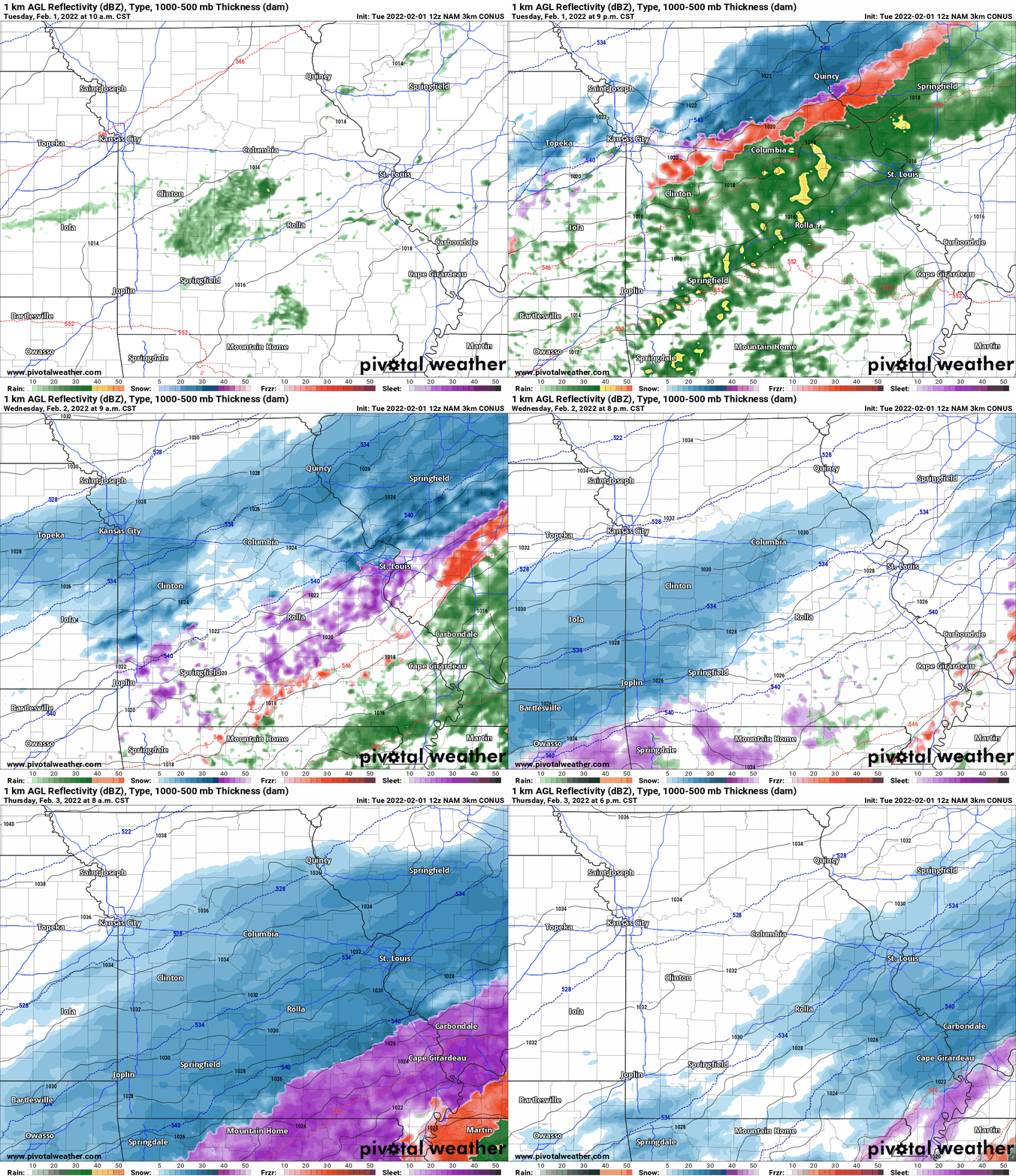
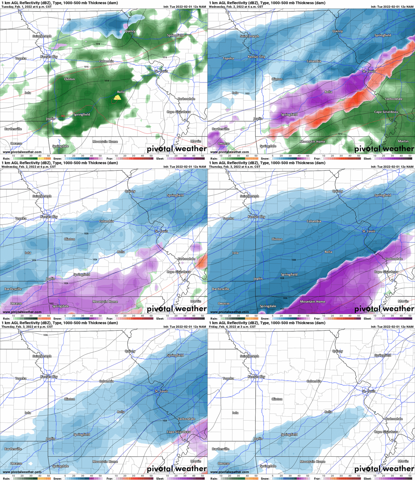
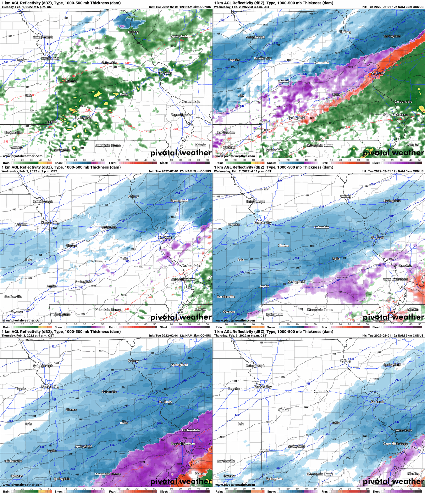
The latest future-cast radars from this mornings NAM.
Blue is snow. Purple is sleet. Red is freezing rain. Green and yellow represent rain.
Double click on the animations to enlarge them.
.
Weather advice:
Make sure you are using the Beau Dodson Weather Talk app and not text messages. We can’t rely on Verizon and ATT to send out the text messages in a timely manner. Thus, we made the app. See links at the bottom of the page.
Join me tonight for a question and answer Facebook thread.
See that on the Beau Dodson Weather Facebook page. Link
.
Weather Discussion
Widespread precipitation event Tuesday through Thursday:
Most of the region will remain dry today.
Clouds will be on the increase. A few showers are possible this afternoon and evening over primarily southeast Missouri and southeast Illinois. Rain totals today will be light (where rain occurs).
Widespread rain Tuesday night into Wednesday evening. Some of the rain will be locally moderate with amounts exceeding two inches in some counties.
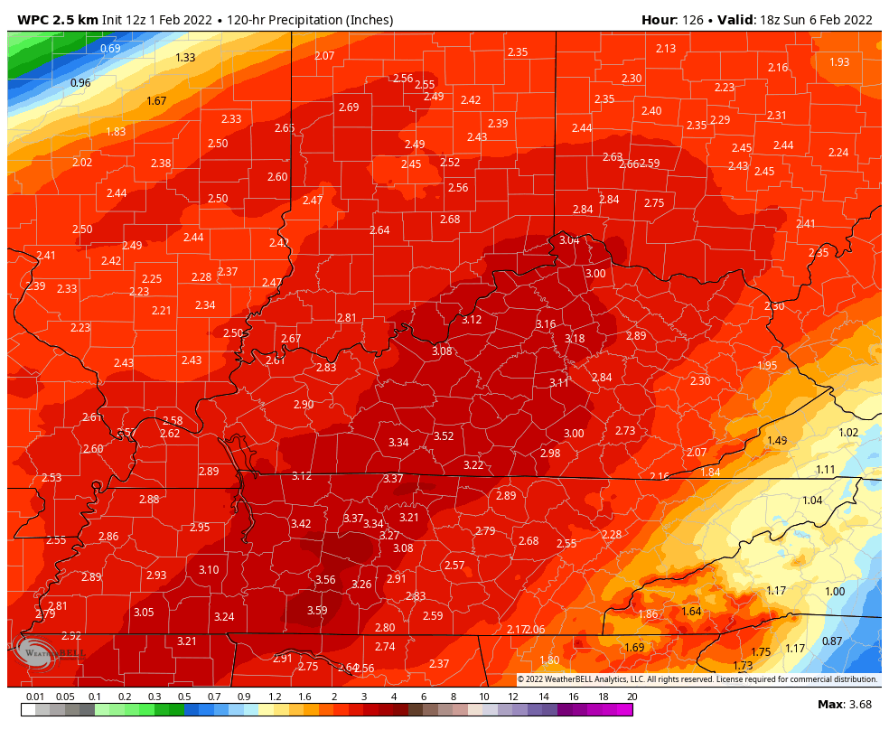
Here is the official WPC/NOAA rainfall forecast. They are showing a widespread one to two inches.
Much of this rain will quickly runoff into creeks and rivers. There may be some water issues in commonly flooded areas. Field flooding and ditches flooding will be possibl
.
Winter Storm likely Wednesday into Thursday.
This is not a slam-dunk forecast on the placement of rain vs freezing rain vs sleet vs snow.
If you don’t want freezing rain then hope for sleet. Sleet does not stick to power lines.
The difference between receiving quite a bit of freezing rain vs quite a bit of sleet will only be a couple of degrees. We are attempting to forecast exact temperatures more than 24 to 48 hours in advance.
Thus, confidence in the exact frozen precipitation totals is medium. A shift in the storm track by as little as twenty miles will impact your local city forecast.
If the colder air arrives slightly faster then you will experience more snow vs ice. I would focus on impacts. Icy road conditions beginning as early as Wednesday afternoon and evening over southeast Missouri and southern Illinois and then spreading south and east Wednesday night into Thursday.
Portions of western Kentucky may remain rain longer than other areas. Keep that in mind, as well.
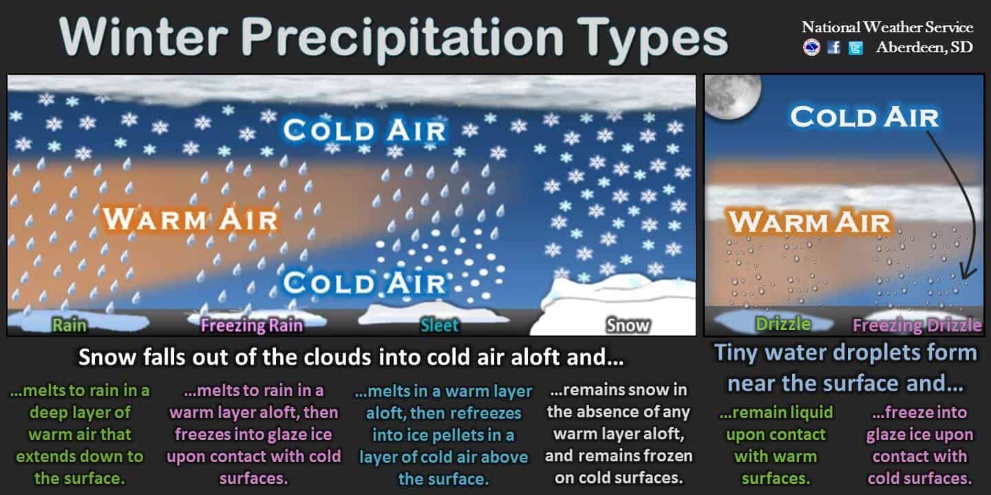
What determines precipitation type? Temperatures at the surface and aloft. The deeper the cold layer the greater chance of all snow. A warm nose of air aloft will change that snow to sleet and freezing rain.
Examples (double click to enlarge graphics)
.
A complex winter storm will develop Wednesday into Thursday evening.
The primary concern, during this time period, will be the timing of the cold front and arrival of the below freezing temperatures.
The colder air will be behind the front. This push of cold air will make its way across our entire region by Thursday.
Rain will change to freezing rain, sleet, and eventually snow across northern portions of southeast Missouri and portions of southern Illinois beginning Wednesday. The cold air will slowly continue to push further south and east during the day (Wednesday).
As the colder air pushes further south and east, the precipitation will change from rain to a wintry mix of freezing rain, sleet, and snow. As the deeper cold air arrives, the freezing rain and sleet will change to snow. See graphics above on precipitation types.
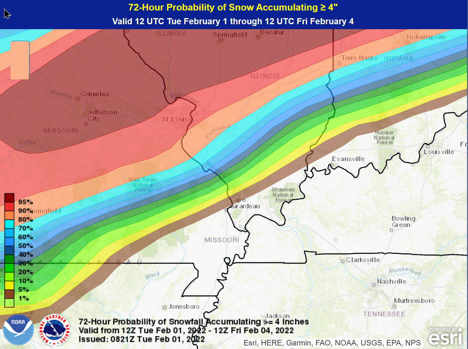
The highest chance of snow totals in excess of four inches will be along a north of a line from Butler County, Missouri and then northeast into Jackson County, Illinois and then northeast from there. See graphic below.
Areas along and north of that line will find itself deeper in the cold air. Thus, a highest chance of accumulating snow on top of some freezing rain and sleet.
If the cold air arrives earlier and is deeper, then snow totals would increase. In other words, the less freezing rain and sleet that you experience the greater your snow totals will be. Trends in the guidance have been colder. Thus, snow totals have increases across portions of my forecast area.
.
Here is the latest official snowfall forecast. There could still be adjustments. Most of this snow will fall Wednesday night into Thursday.
Totals have increased over the past 24 hours. The reason for that is the cold air will be deeper than previously thought.

.
South and east of that line will be the battleground between rain, freezing rain, and sleet.
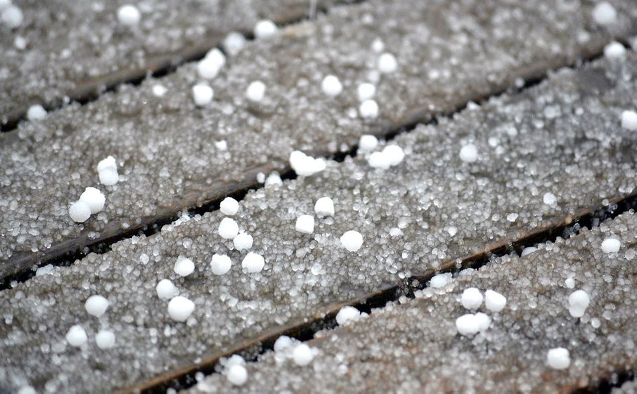
Remember, sleet are the little pellets of ice.
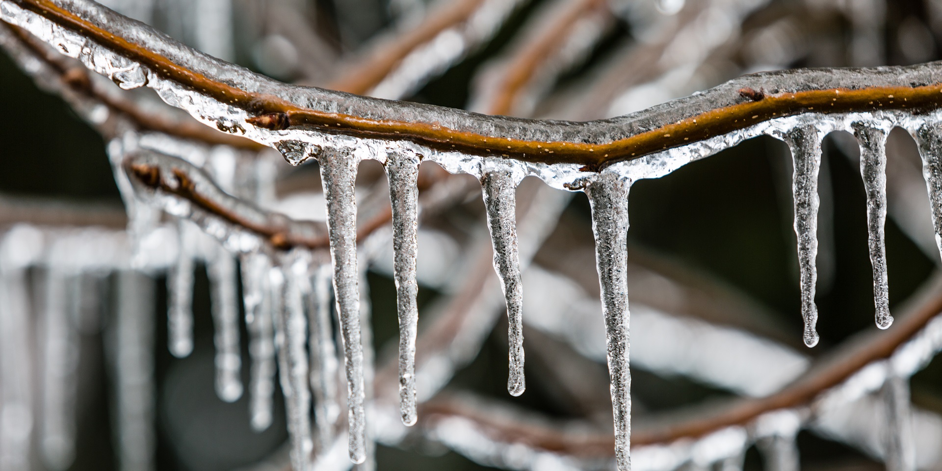
Freezing rain
.
Guidance, over the past 24 hours, has trended colder. That means more of the region is under the risk of wintry precipitation with travel issues.
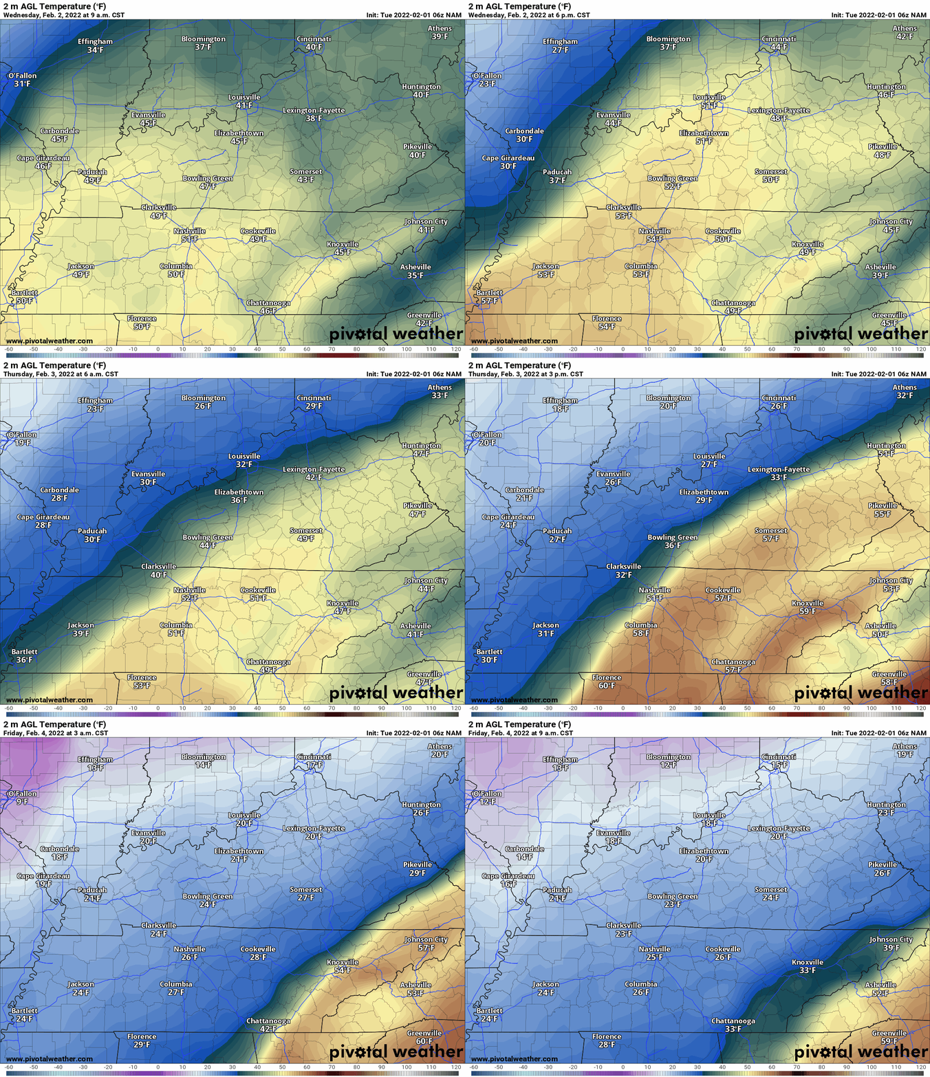
Let me show you the NAM model and how it advances the cold air from west to east.
Follow the freezing line to get an approximate time of change-over in your county. Keep in mind, this won’t be perfect (it is a model). It will be close.
Double click on the animation to enlarge it.
..
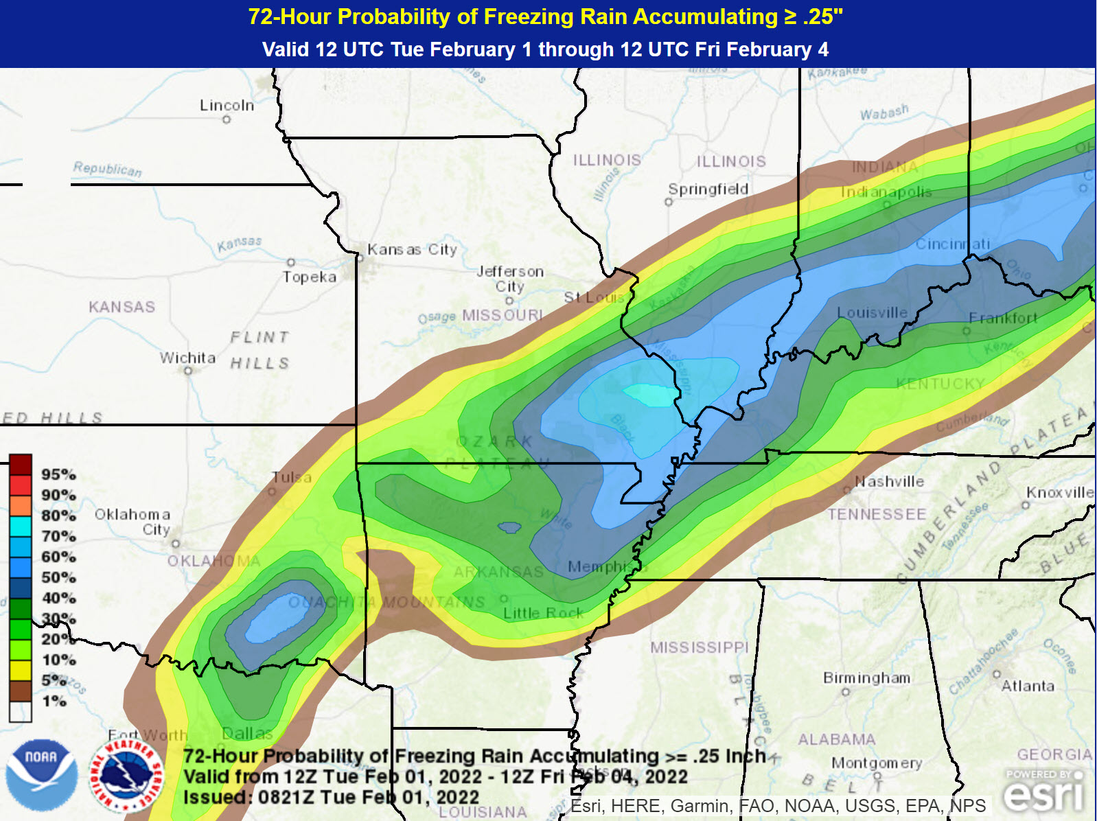
There is some disagreement on where to place the heaviest band of freezing rain. The trend, over the past 24-hours, has been to push it further south and east.
Here is what the WPC is showing for the risk of 0.25″ or greater of freezing rain. This may be too far north and west. I think it will be a tad further south and east with the higher probabilities.
..
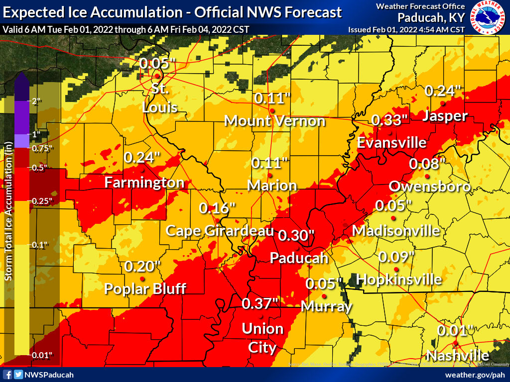
Let’s compare that forecast to the Paducah, Kentucky, NWS forecast for freezing rain accumulation.
This is a bit further southeast vs the above image.
I do believe the Paducah, Kentucky, NWS has a good handle on the placement of freezing rain.
Freezing rain totals are extremely difficult to forecast. They have lowered their forecast amounts from 12 hours ago.
I suspect these numbers will fluctuate a bit. Either way, some accumulating freezing rain is likely to occur as we move into Wednesday and Thursday. This will cause some tree limbs to break and perhaps some scattered power outages. This is NOT like 2009. The 2009 ice storm was 1″ to 2″ of freezing rain. We are not forecasting anything even close to that.
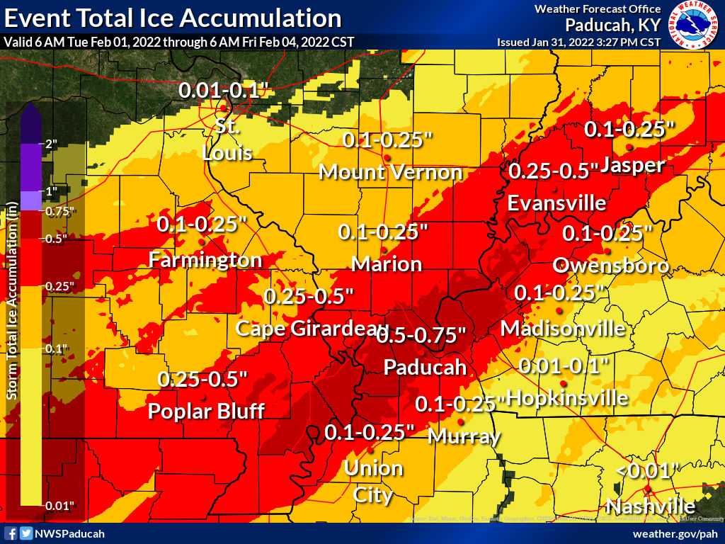
Here was the previous forecast from the Paducah, Kentucky NWS. Notice that they lowered totals a tad. That is mainly because they believe there will be a bit more sleet.
The more sleet will have the better off we will be. Sleet does not stick to tree limbs and power lines.
.
The morning NAM model is colder and would mean more sleet. It would also shift the freezing rain further south and east.
Here is what it shows. I usually cut these totals in half (from what the model shows).
.
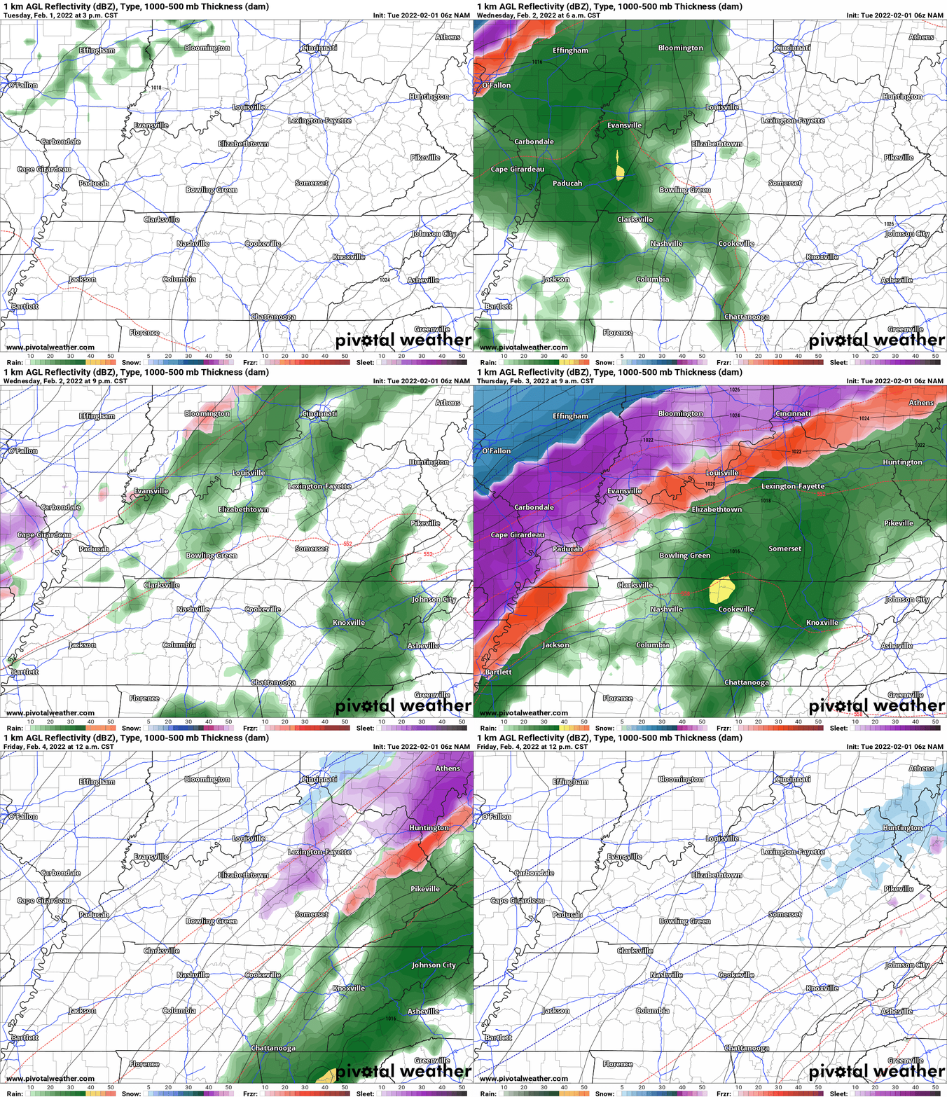
Now, let me show you some models.
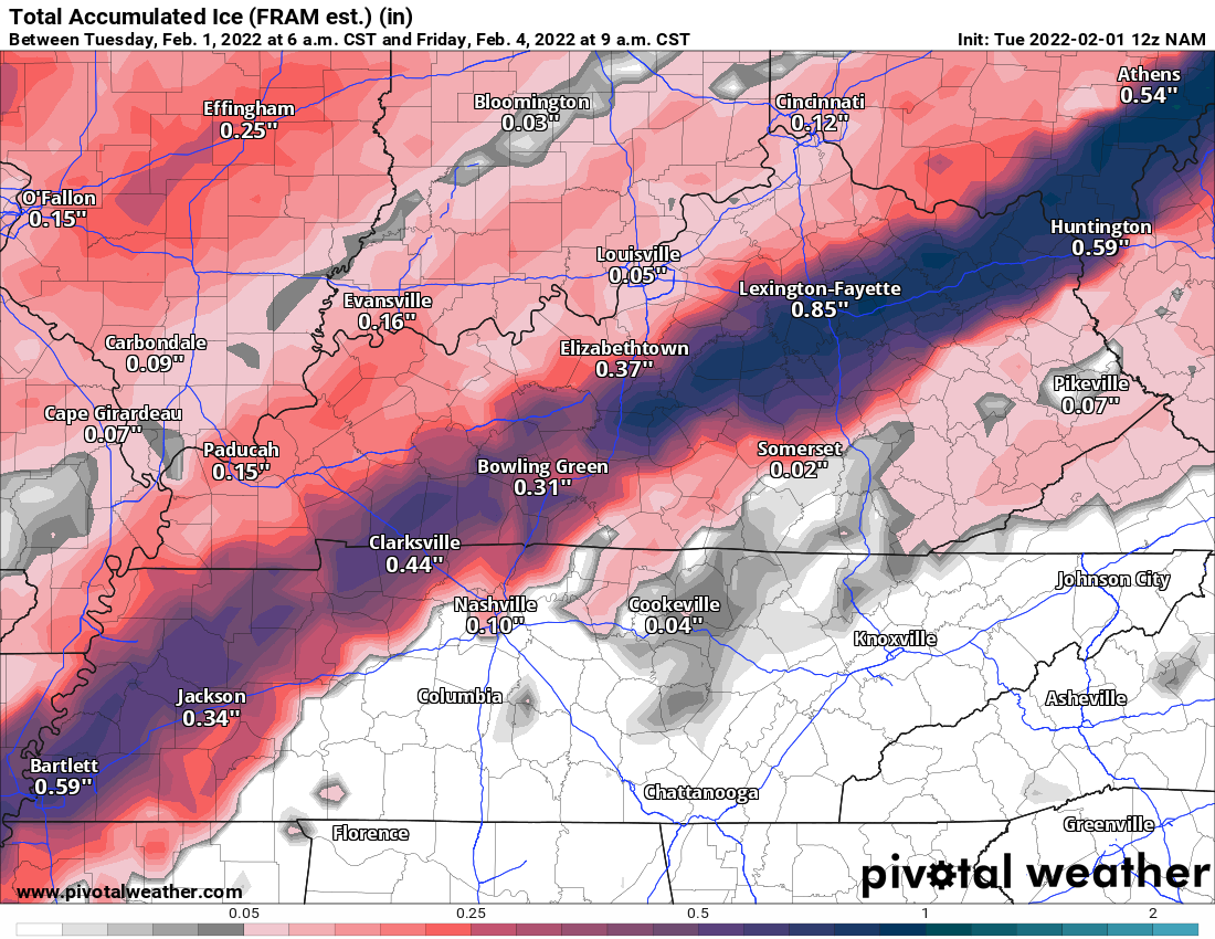
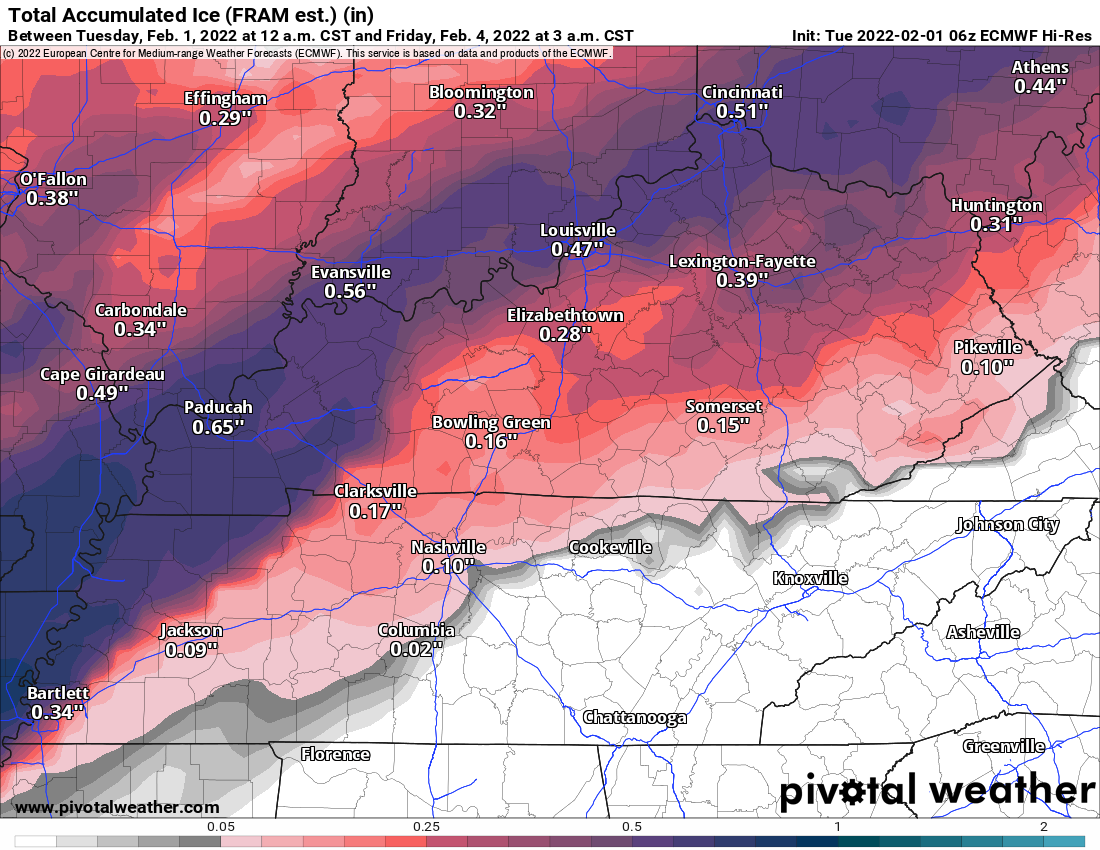
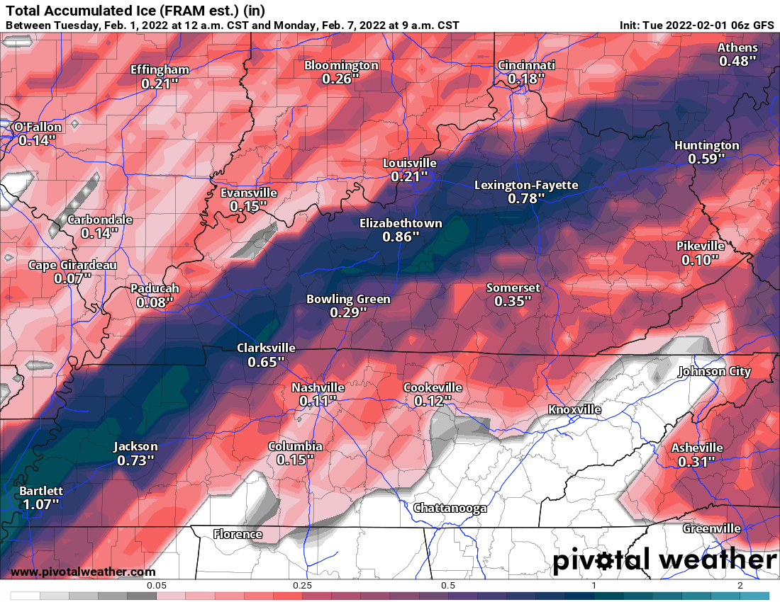
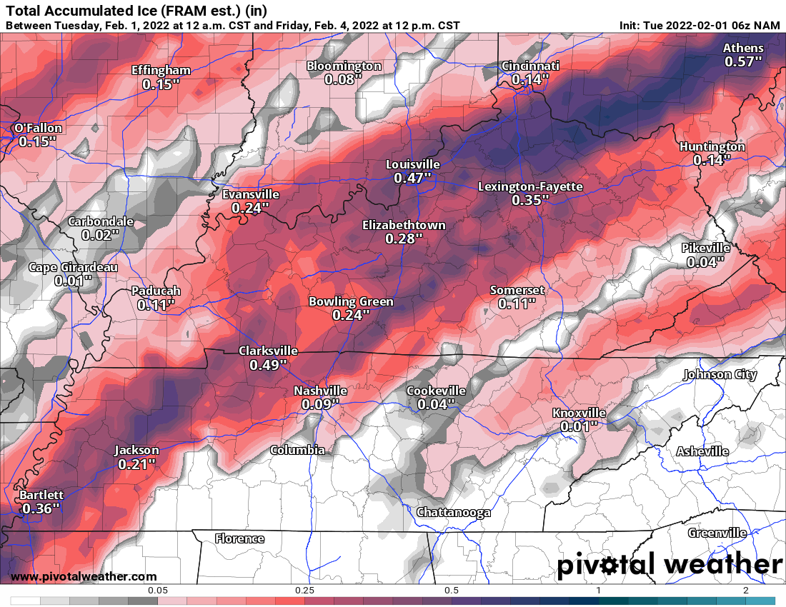
I usually subtract some from what these graphics show. Don’t get caught up in exact numbers.
Focus on placement. The models are in fair agreement as to where the freezing rain will occur.
Focus on the fact that there will be a band of freezing rain in this mess. It may be just enough to bring down some tree limbs and cause scattered power issues.
My forecast is for a band of at least 0.25″ across portions of the area. That would most likely be from the Missouri Bootheel into northwest Tennessee and western Kentucky. Perhaps extreme southern Illinois, as well.
I think the above map, from the Paducah, Kentucky NWS, is close to my thinking, as well.
If the cold air pushes a tad faster then shift that freezing rain south and east by another county or so.
The bottom line is that there will be icy road conditions from this event area-wide.
Euro Model freezing rain totals. Again, don’t focus on the numbers. They are likely a tad too high. This is simply raw model output.
I typically cut these numbers in half when making a forecast.
..
GFS model
..
NAM model freezing rain totals.
..
Let’s look at some NWS graphics concerning this event.
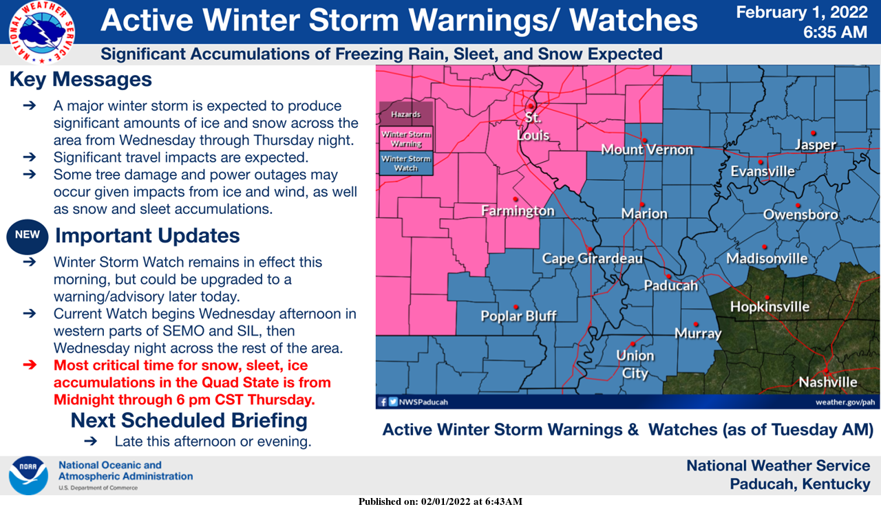
A winter storm watch covers almost all of my forecast counties (a few of my far eastern counties were left out of the watch for the time being).
An upgrade to a winter storm warning and ice storm warning is anticipated later today.
Pink is where the winter storm warning is in effect.
Blue is the watch (the watch will be upgraded to an ice storm warning and winter storm warning later today).
Notice a few of my east/southeast counties are currently not in the watch. That could still change if new data shows the cold air advancing faster.
Double click images to enlarge them.
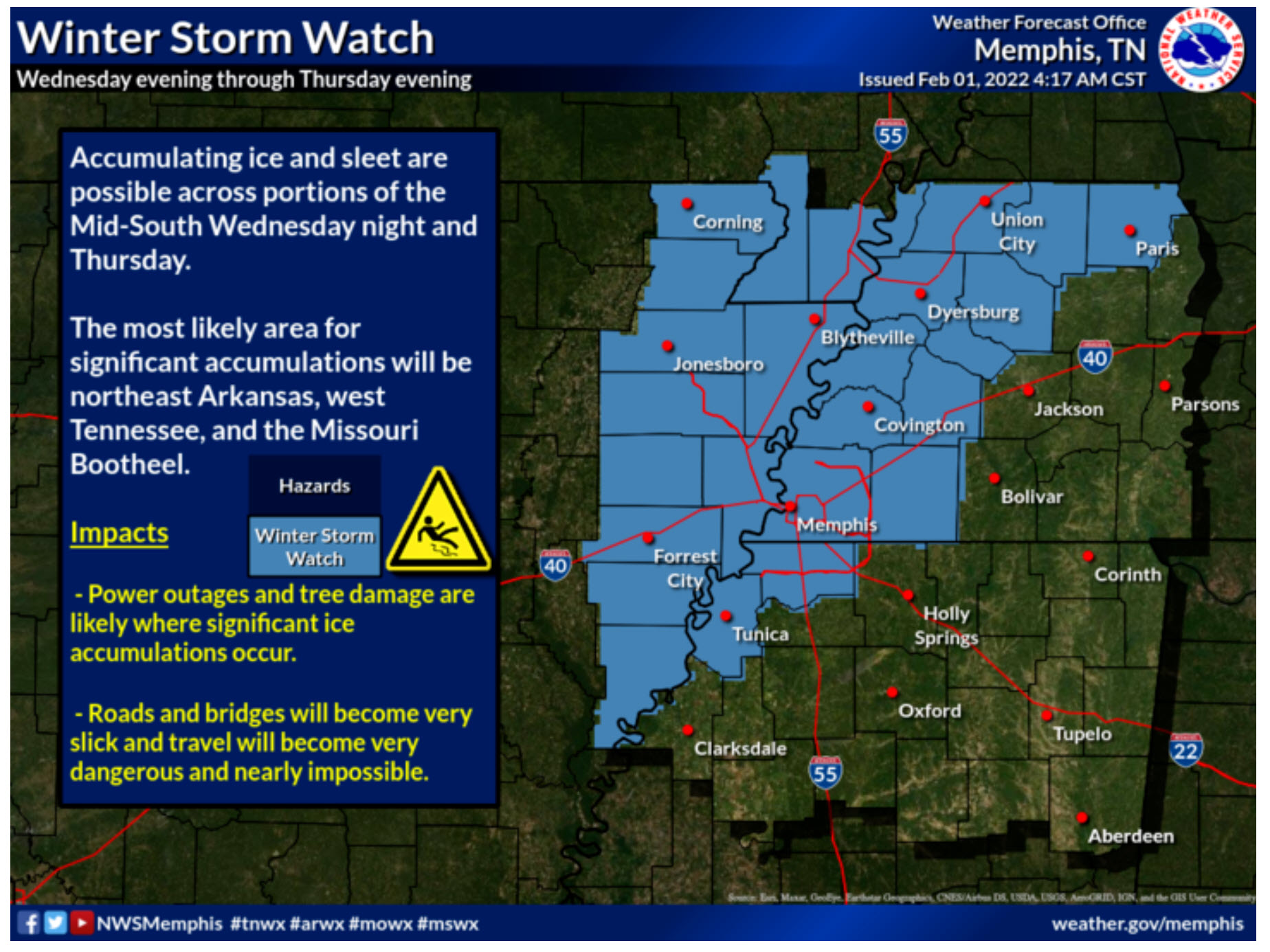
This next graphic covers my southern counties (Missouri/Tennessee).
Winter storm watch zone in blue. This will be upgraded to a warning.
.
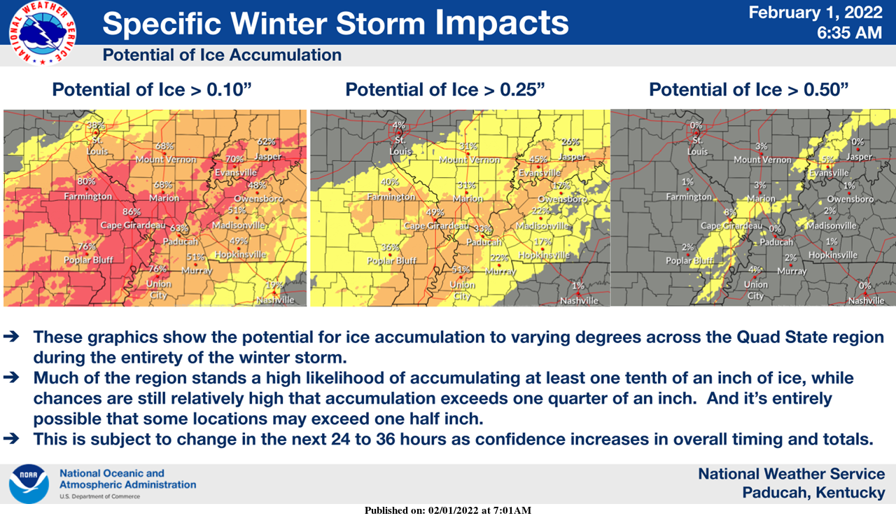
What is the chance of X amount of freezing rain.
Double click images to enlarge them.
.
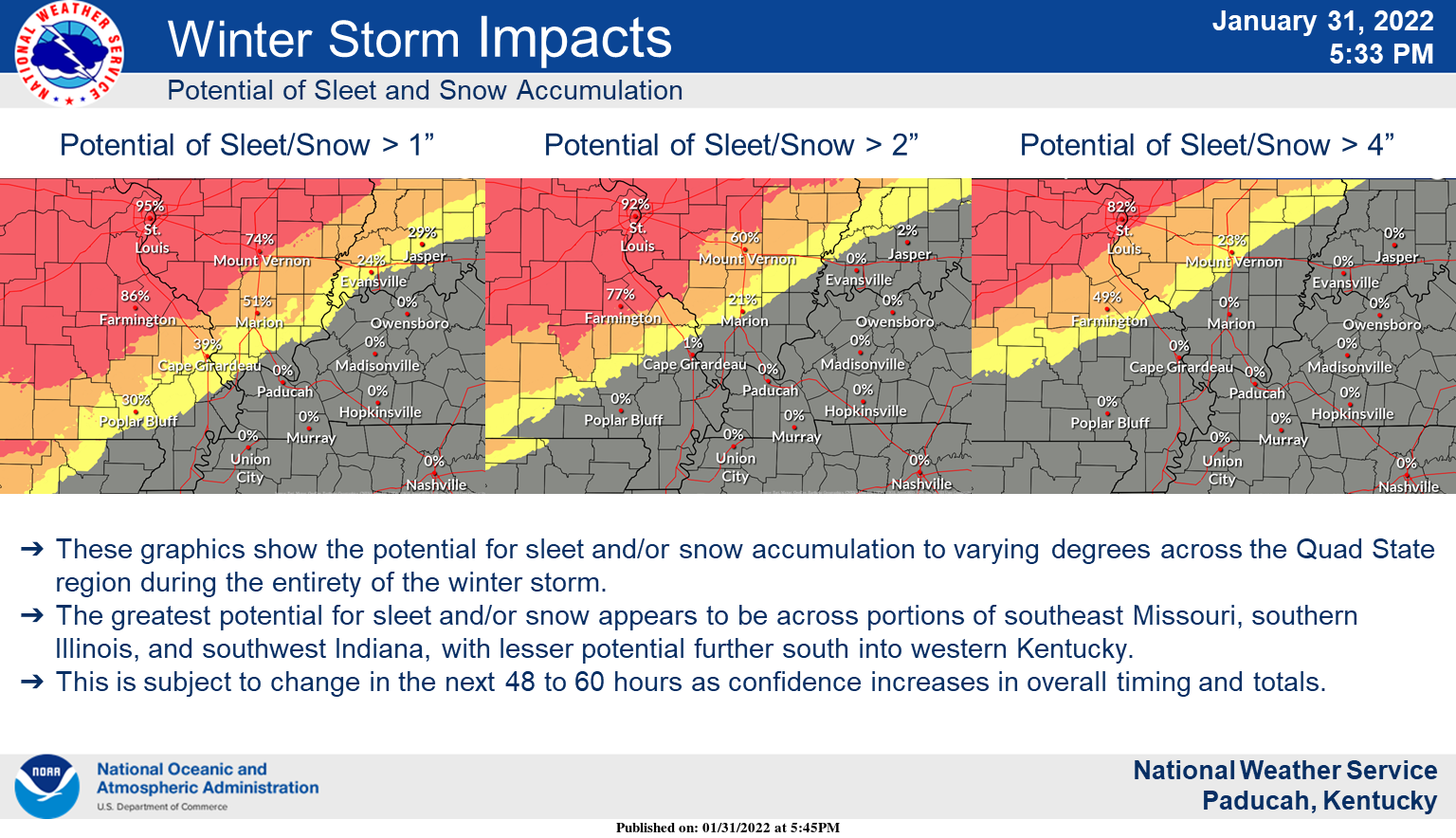
What is the chance of X amount of sleet and freezing rain.
.
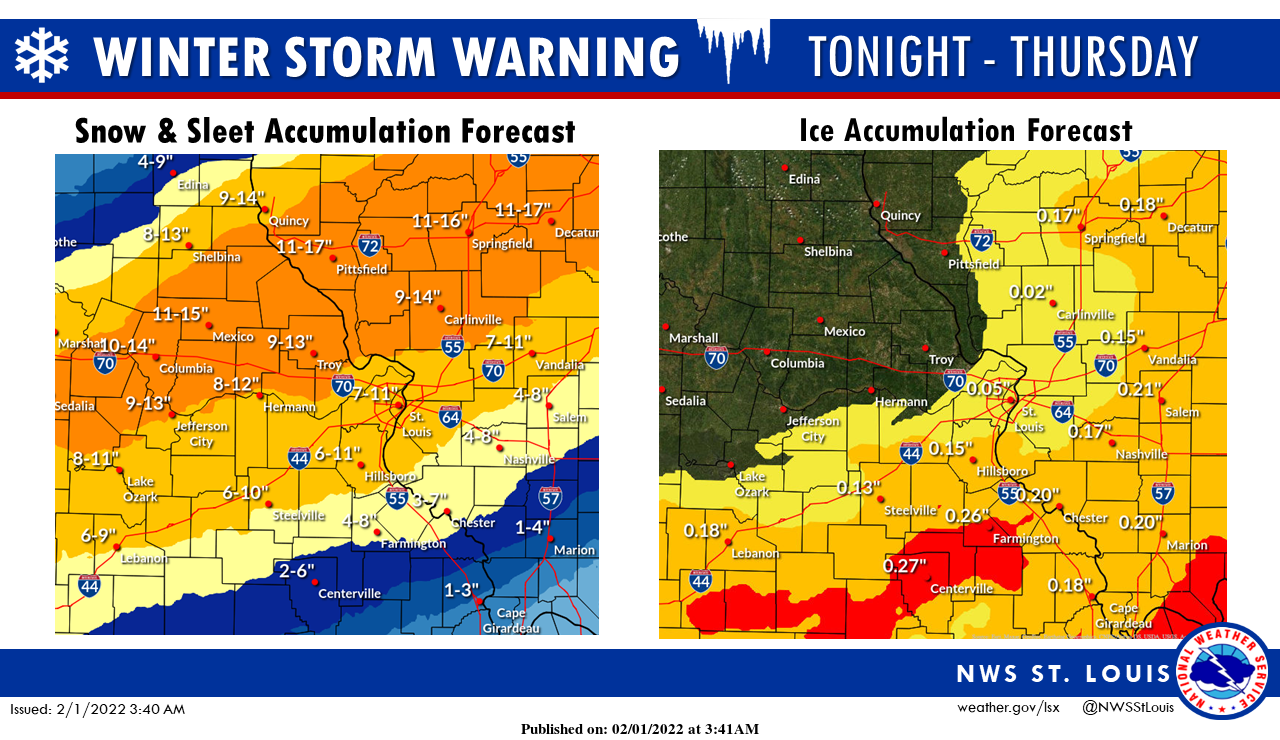
This next graphic is from the St Louis, Missouri NWS. You can see some of my northern counties on this map.
NWS offices are close in their forecasts (agreeing).
.
There are concerns about gusty winds in the ice zone. Winds may occasionally gust above 25 mph. This could enhance tree limb damage and power line issues. Keep that in mind. Hopefully, the winds won’t be as great as some of the guidance suggests. Either way, prepare for scattered power issues in the ice storm zone.
Bitterly cold air Friday and Saturday morning. Bundle up weather. Whatever falls will stick around into the weekend.
![]()
.

Click here if you would like to return to the top of the page.
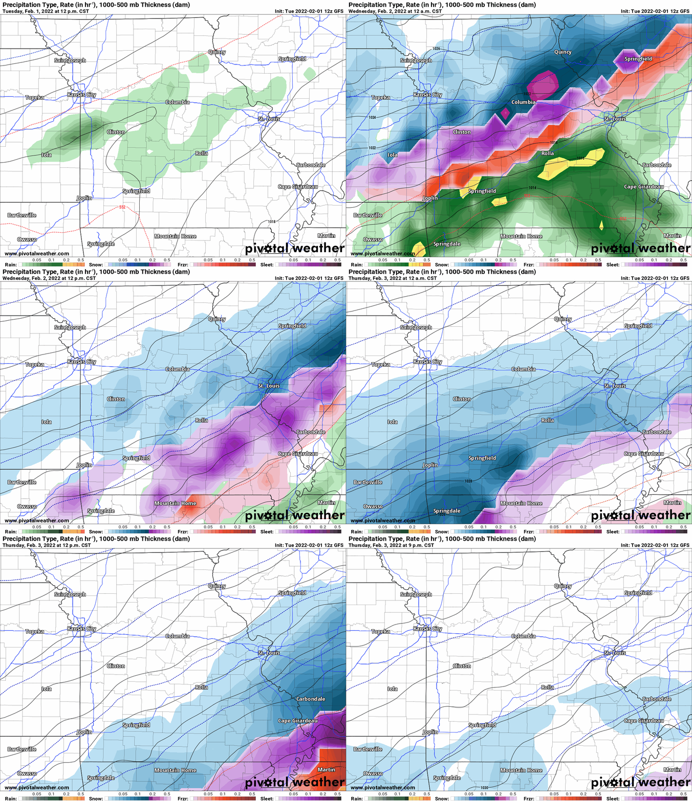
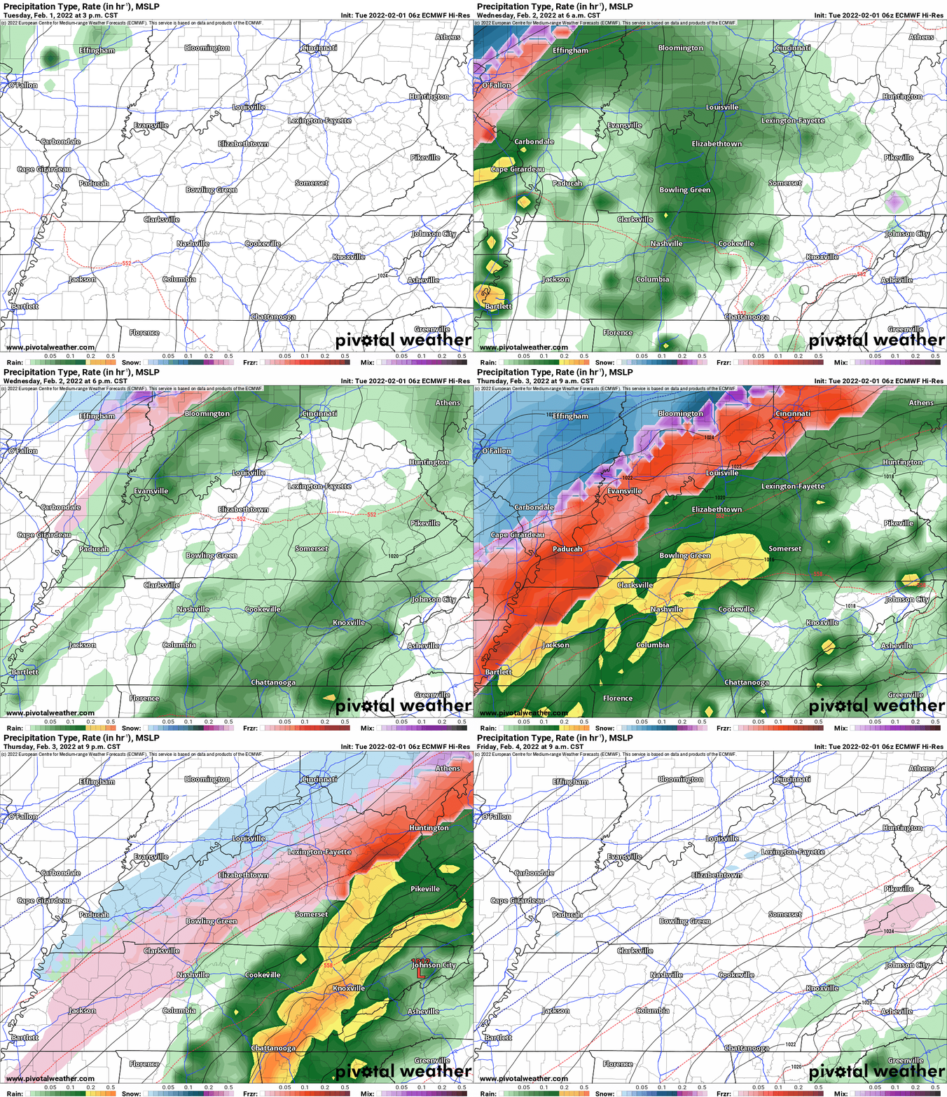
Again, as a reminder, these are models. They are never 100% accurate. Take the general idea from them.
What should I take from these?
- The general idea and not specifics. Models usually do well with the generalities.
- The time-stamp is located in the upper left corner.
- The EC European weather model is in Zulu time.
.
What am I looking at?
You are looking at different models. Meteorologists use many different models to forecast the weather. All models are wrong. Some are more wrong than others. Meteorologists have to make a forecast based on the guidance/models.
I show you these so you can see what the different models are showing as far as precipitation. If most of the models agree, then the confidence in the final weather forecast increases.
You can see my final forecast at the top of the page.
Occasionally, these maps are in Zulu time. 12z=6 AM. 18z=12 PM. 00z=6 PM. 06z=12 AM
.
This animation is the Storm Prediction Center WRF model.
This animation shows you what radar might look like as the next system pulls through the region. It is a future-cast radar.
Time-stamp upper left. Click the animation to enlarge it.
.
This animation is the Hrrr short-range model.
This animation shows you what radar might look like as the next system pulls through the region. It is a future-cast radar.
Time-stamp upper left. Click the animation to enlarge it.
.
.
This next animation is the lower-resolution NAM American Model.
This animation shows you what radar might look like as the system pulls through the region. It is a future-cast radar.
Time-stamp upper left. Click the animation to enlarge it.
.
.
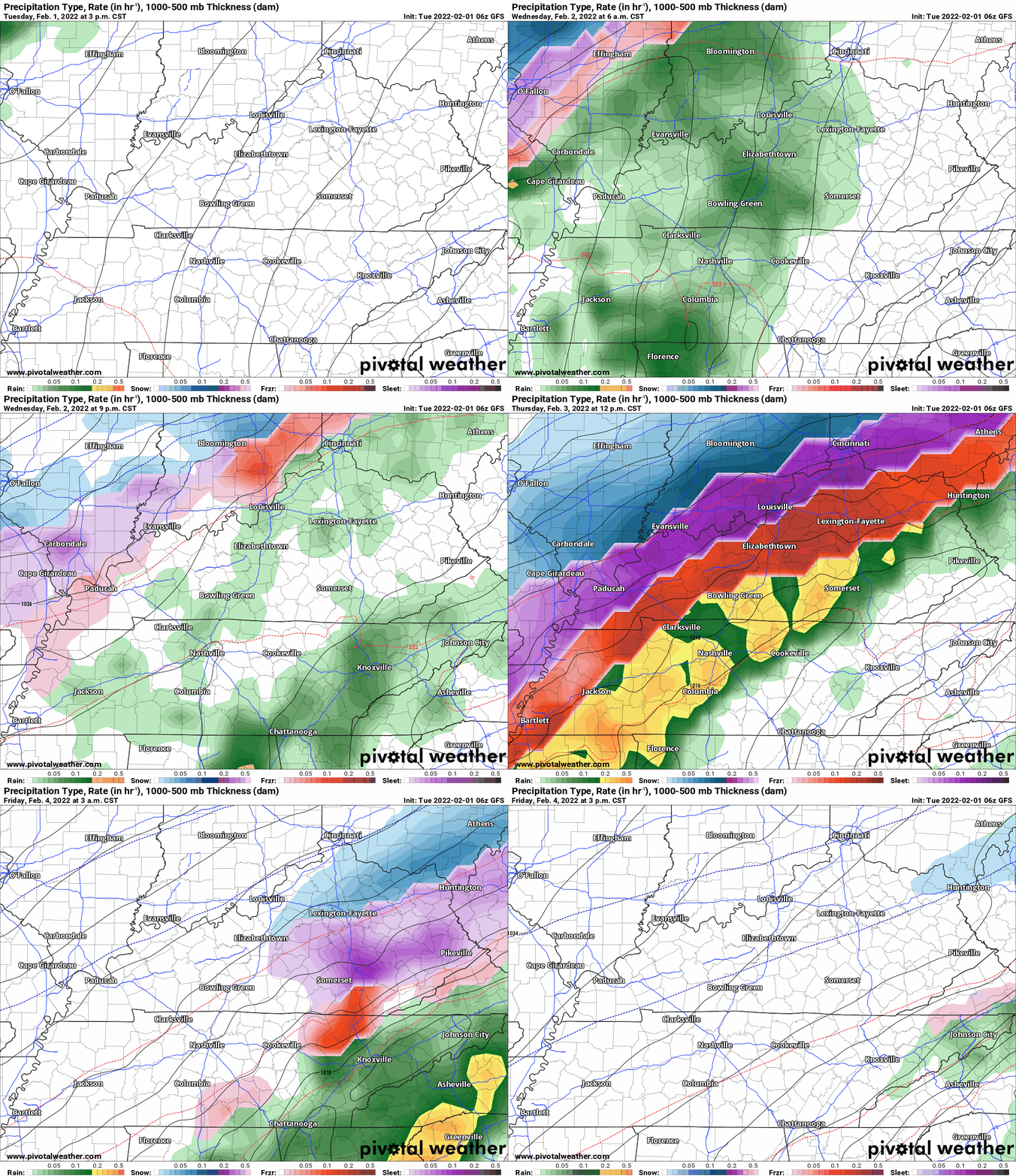
This next animation is the GFS American Model.
This animation shows you what radar might look like as the system pulls through the region. It is a future-cast radar.
Time-stamp upper left. Click the animation to enlarge it.
.
This next animation is the EC European Weather model.
This animation shows you what radar might look like as the system pulls through the region. It is a future-cast radar.
Time-stamp upper left. Click the animation to enlarge it.
.
This next animation is the Canadian Weather model.
This animation shows you what radar might look like as the system pulls through the region. It is a future-cast radar.
Time-stamp upper left. Click the animation to enlarge it.
Time is in Zulu. 12z=6 AM. 18z=12 PM. 00z=6 PM. 06z=12 AM
SUBSCRIBERS: Download the WeatherTalk app to keep abreast of my latest information.
The app is for subscribers. Subscribe at www.weathertalk.com/welcome then go to your app store and search for WeatherTalk
Subscribers, PLEASE USE THE APP. ATT and Verizon are not reliable during severe weather. They are delaying text messages.
The app is under WeatherTalk in the app store.
Apple users click here
Android users click here
![]()
![]()
.

Radar Link: Interactive local city-view radars & regional radars.
You will find clickable warning and advisory buttons on the local city-view radars.
If the radar is not updating then try another one. If a radar does not appear to be refreshing then hit Ctrl F5. You may also try restarting your browser.
Not working? Email me at beaudodson@usawx.com
Backup radar site in case the above one is not working.
https://weathertalk.com/morani
New ZOOM radar (with storm chasers)
https://wtalk.co/AVWG7GM7
Regional Radar
https://imagery.weathertalk.com/prx/RadarLoop.mp4
Lightning Data (zoom in and out of your local area)
https://wtalk.co/WJ3SN5UZ
Satellite Data
Computers and tablets. These two satellite links may not work well on cell phones.
Visible Satellite. This one is to be used during daylight only. Be sure and hit refresh once you are on the satellite page. Otherwise, the data will be old.
https://col.st/a5A0e
IR Satellite. This one shows cloud temperatures. Bright colors represent cold cloud tops. That could mean thunderstorms. Be sure and hit refresh once you are on the satellite page. Otherwise, the data will be old.
https://col.st/R2fw1
Water Vapor Satellite. This one shows mid-level moisture in the atmosphere. Be sure and hit refresh once you are on the satellite page. Otherwise, the data will be old.
https://col.st/xFVwx
.

Live lightning data: Click here.
Not receiving app/text messages?
Log in and out of your app.
USE THE APP. ATT and Verizon are slowing or stopping the text messages. Move to the app (not texts).
Make sure you have the correct app/text options turned on. Find those under the personal notification settings tab at www.weathertalk.com. Red is off. Green is on.
Subscribers, PLEASE USE THE APP. ATT and Verizon are not reliable during severe weather. They are delaying text messages.
The app is under WeatherTalk in the app store.
Apple users click here
Android users click here
.


