
.

I have some question and answer threads over on the Facebook page. Link to those threads CLICK HERE
Or email me at beaudodsonweather@gmail.com —>
.
3:30 PM
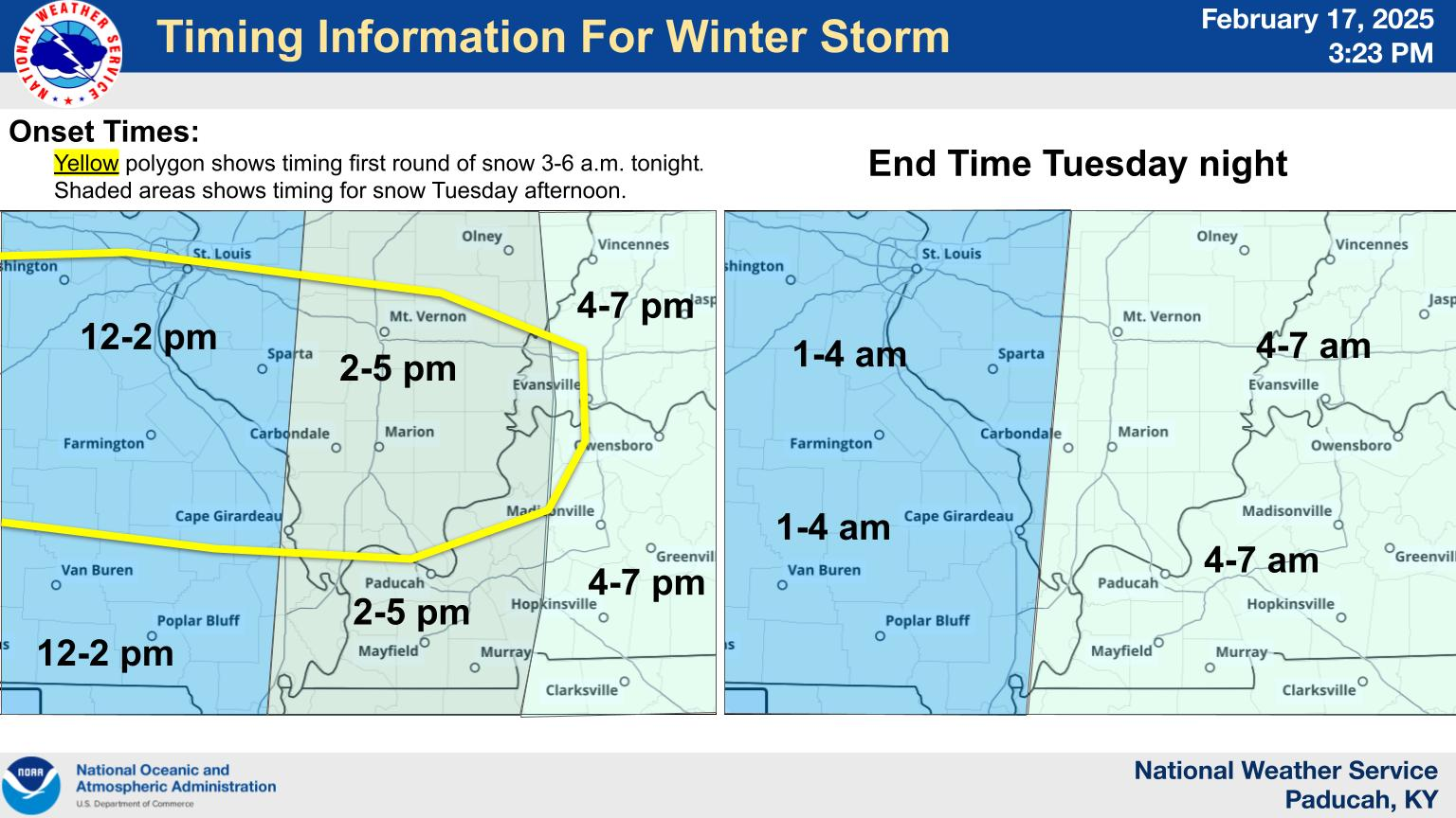
This yellow circled area is where snow could form tonight into tomorrow morning. Then, the main snow tomorrow PM and afternoon.
So, you don’t get confused. The yellow circle could have snow earlier than everyone else.
The times are for the MAIN snow event.
NWS Briefing
.
3:10 PM
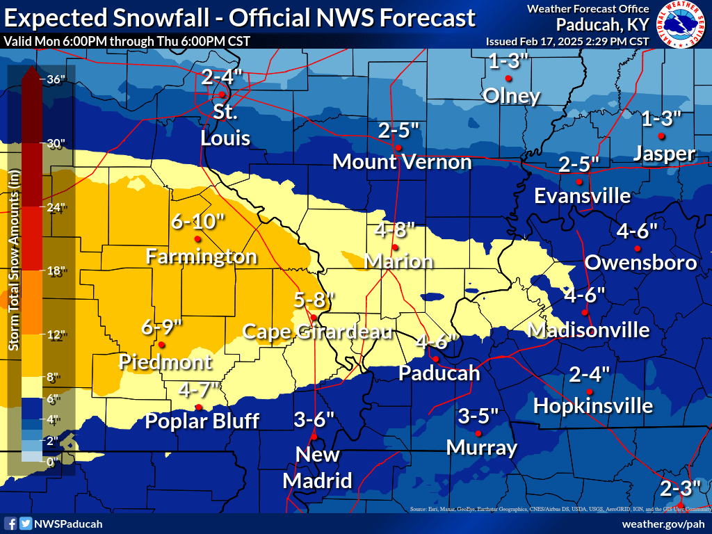
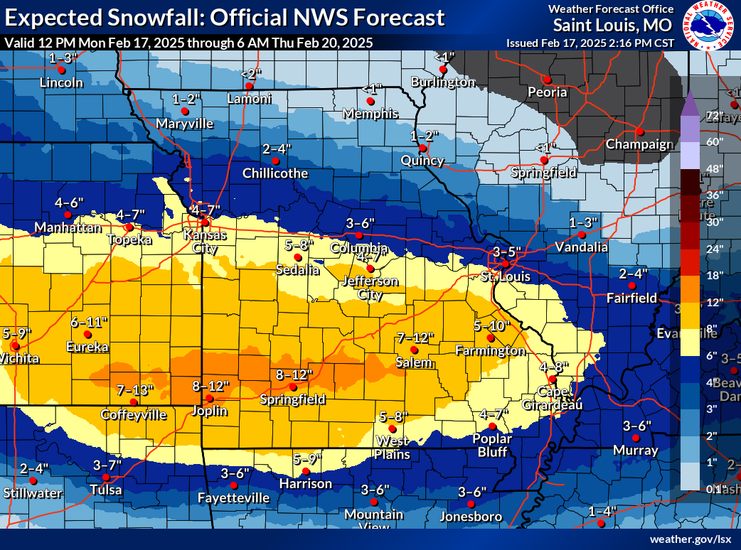
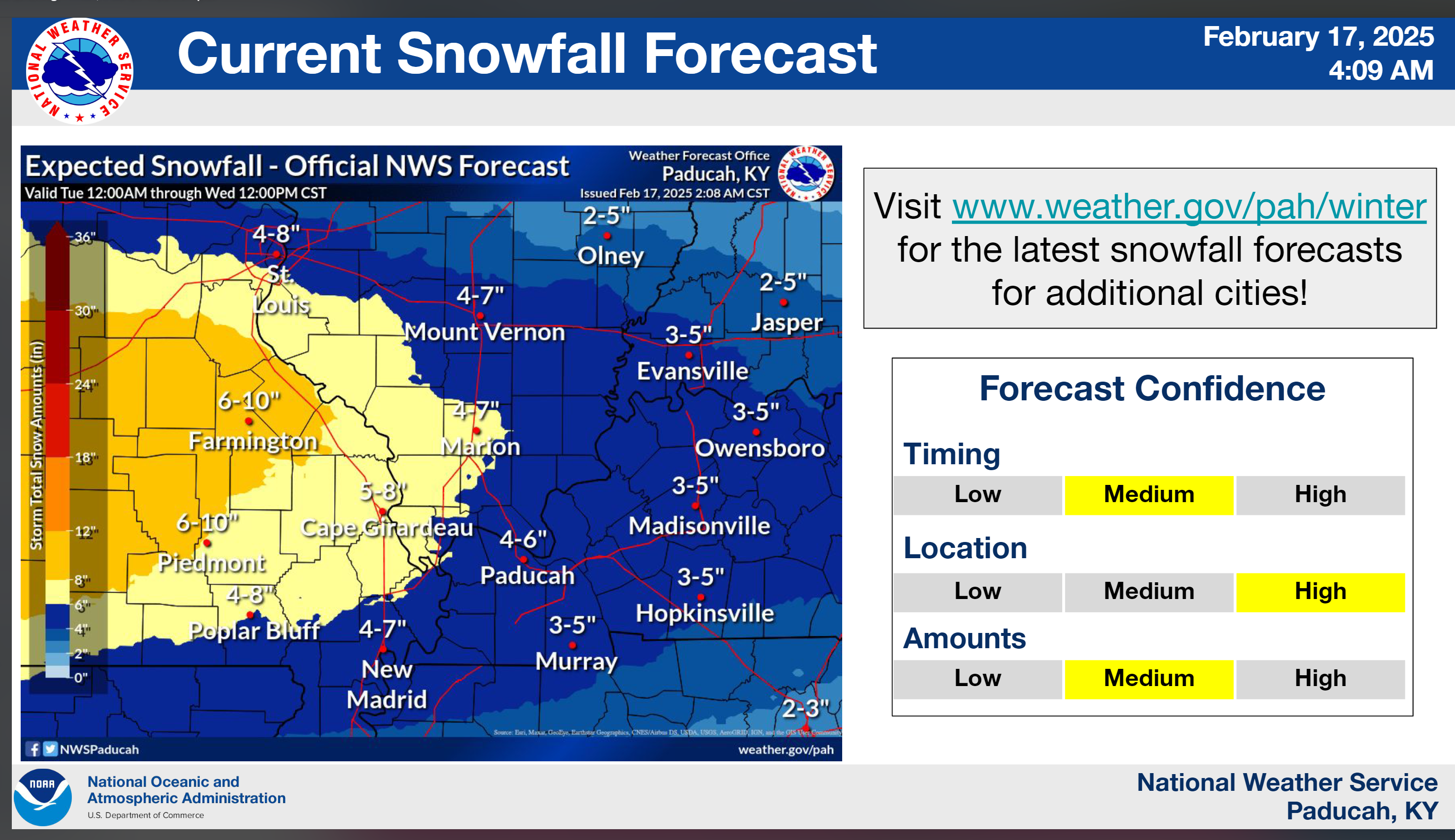
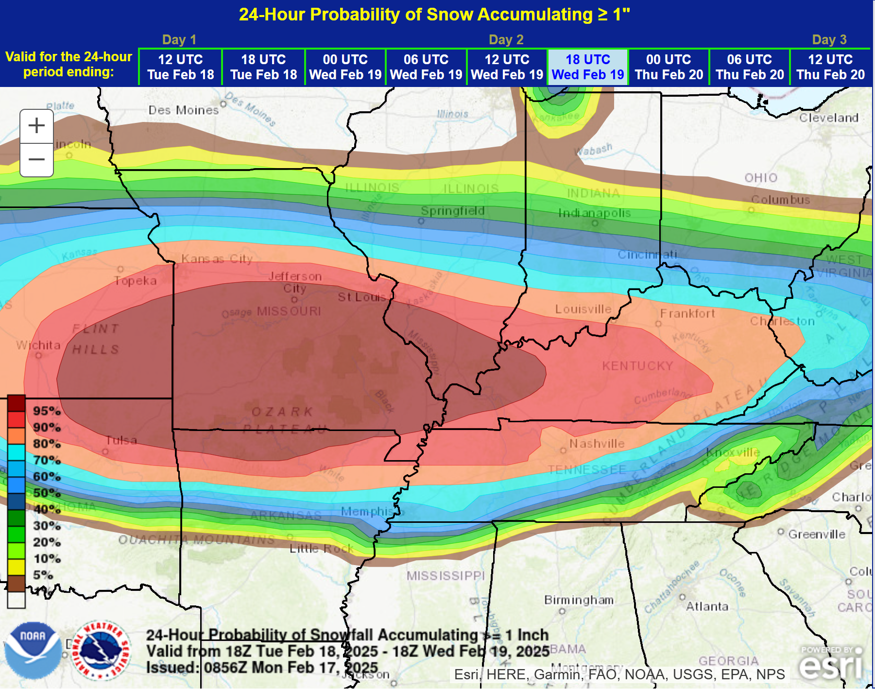
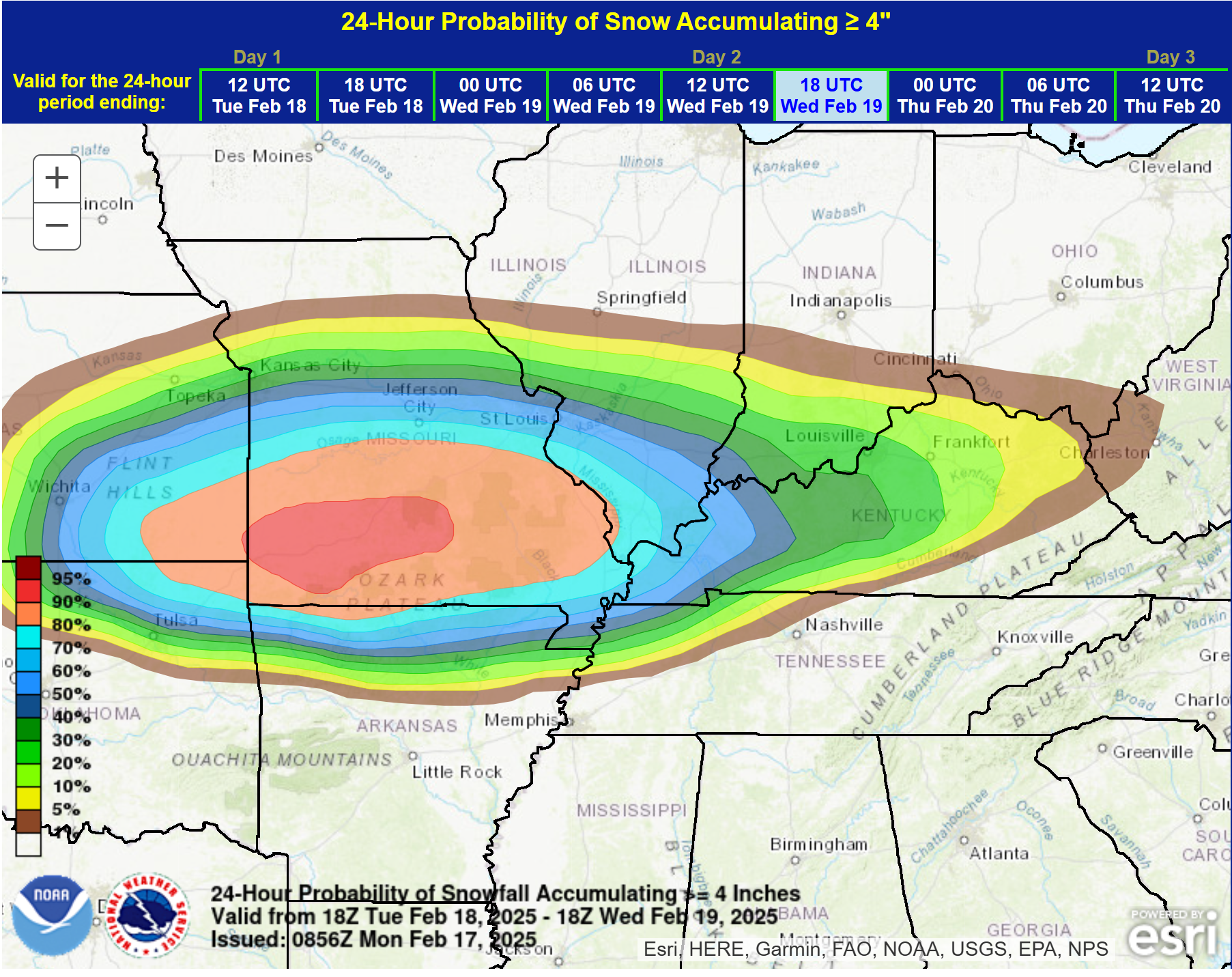
Latest NWS graphics. These are from the Paducah office.
Their expected totals
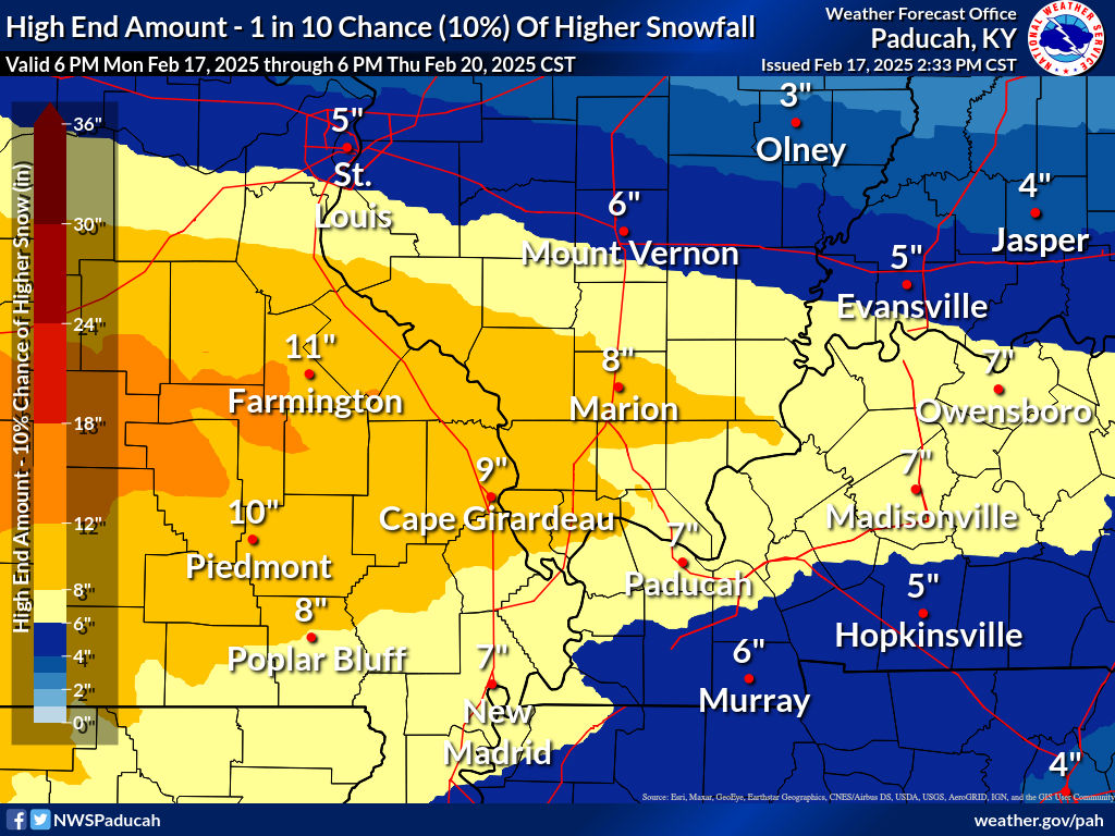
If it overperformed
If it were to underperform

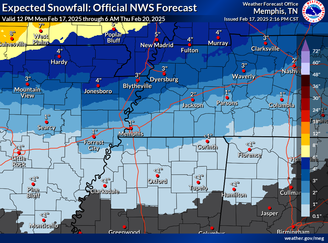
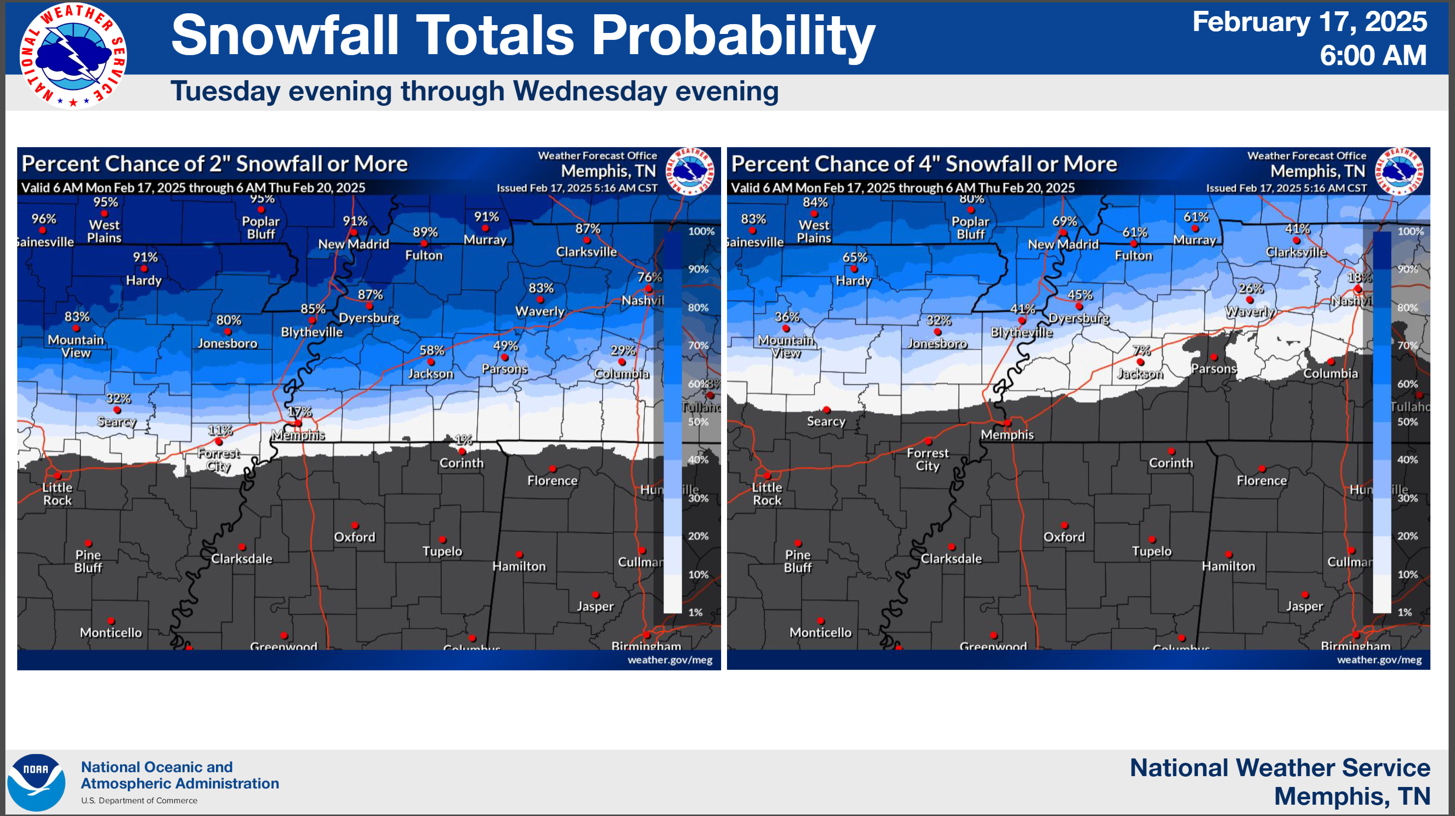
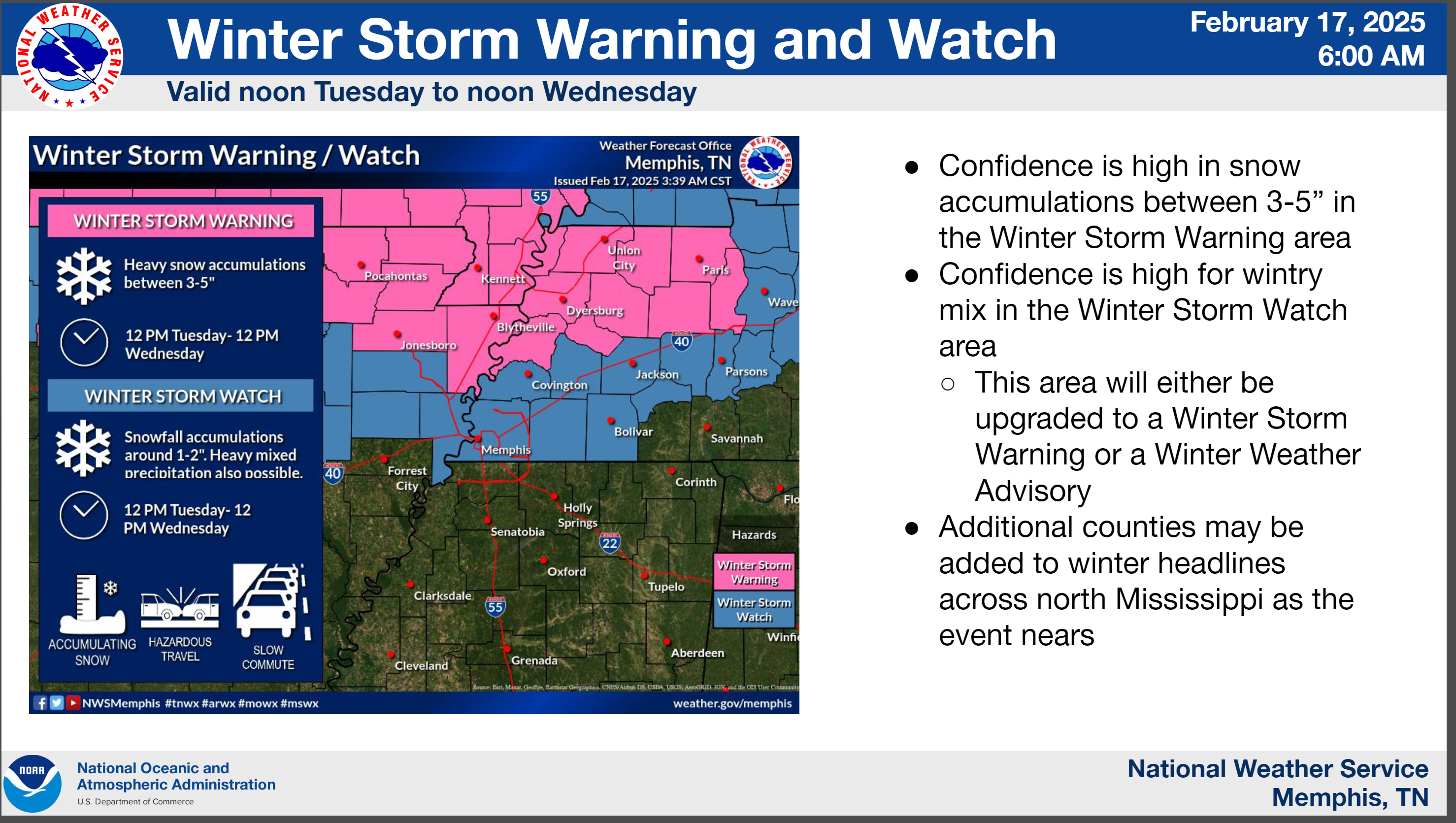
Here is the Memphis, TN NWS graphic
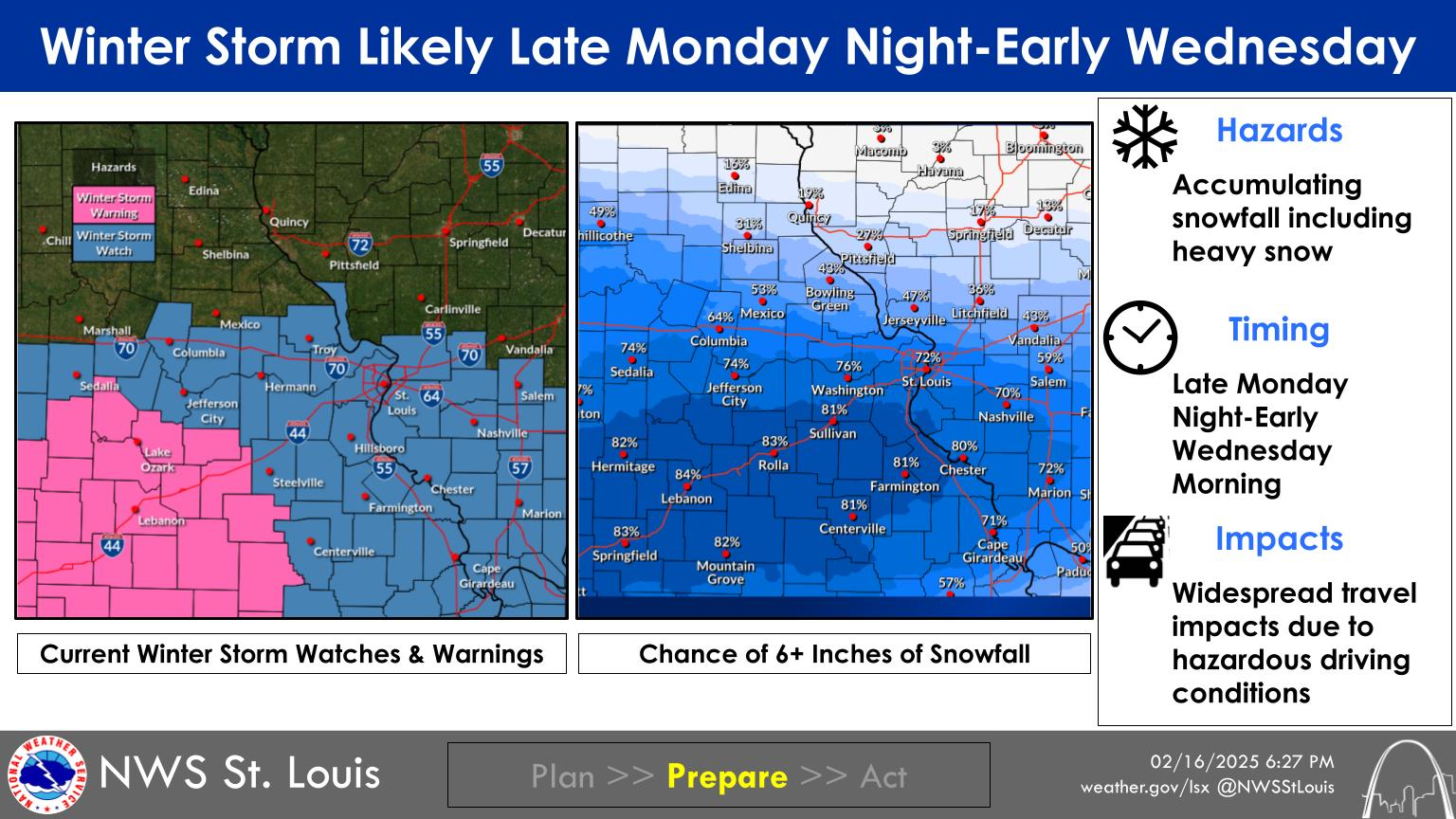
St Louis, Missouri, NWS graphic
As you can see, their graphics do vary a bit.
.
2 PM
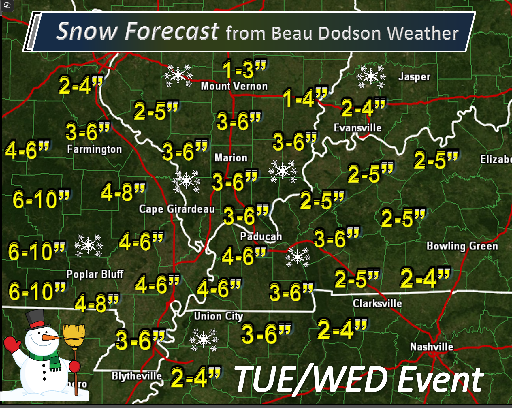
I have updated my snow forecast map.
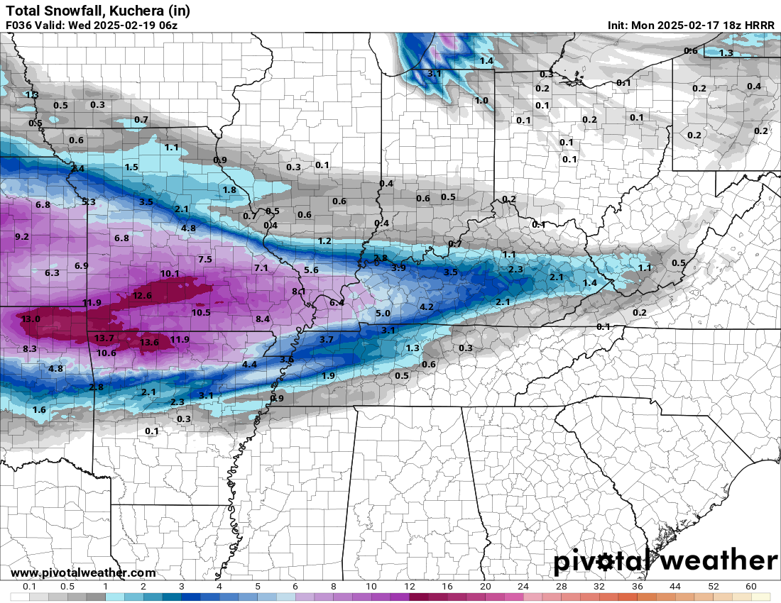
Here is the latest Hrrr model
It is a bit more bullish in some counties. By a couple of inches.
10 AM Video Update
.
8:45 AM Update
.
.
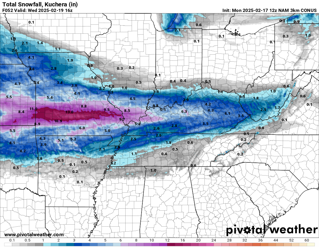
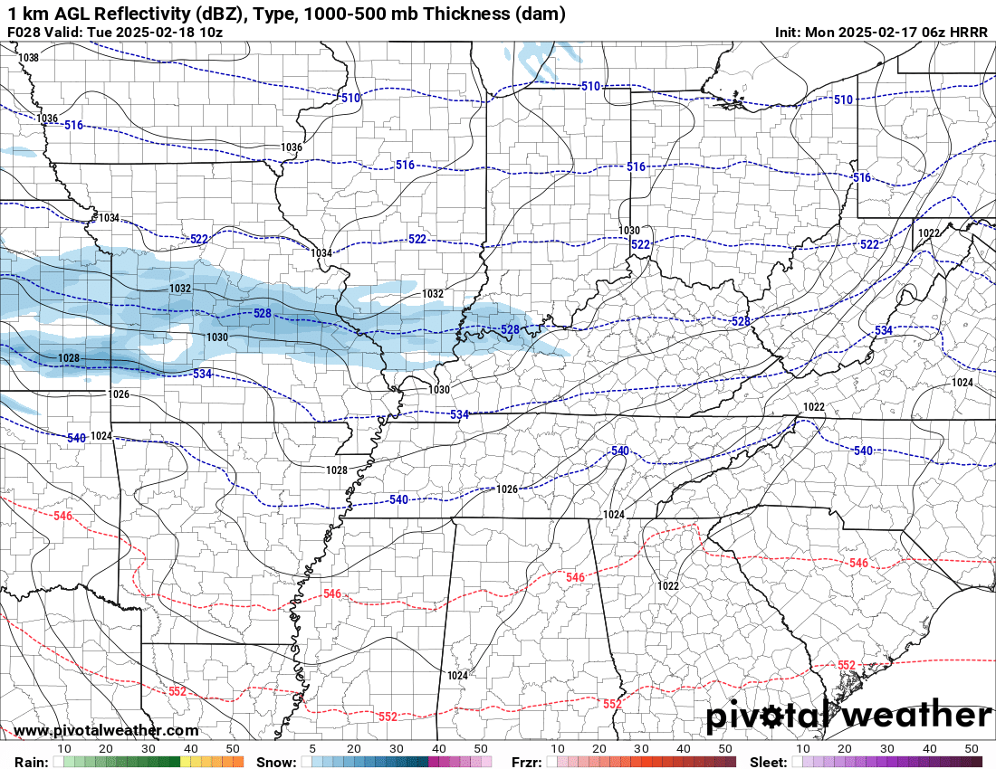
That band is also where the heaviest snow will fall.
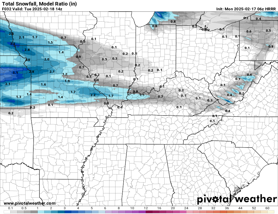
Here is the NAM 3K model for tonight tomorrow morning’s snow.
.
8 AM Update
This is for the main snow event (not the light event tonight/tomorrow morning)
.
Some data shows the snow arriving after 6 PM in the red square. This remains a question. I do think some of you will be mostly dry tomorrow and then snow moves in late TUE PM or evening hours. Keep that in mind.
Keep in mind, we also have to deal with a band of snow late tonight into tomorrow morning from west to east. That will throw off the forecast in some counties (with timing)
.
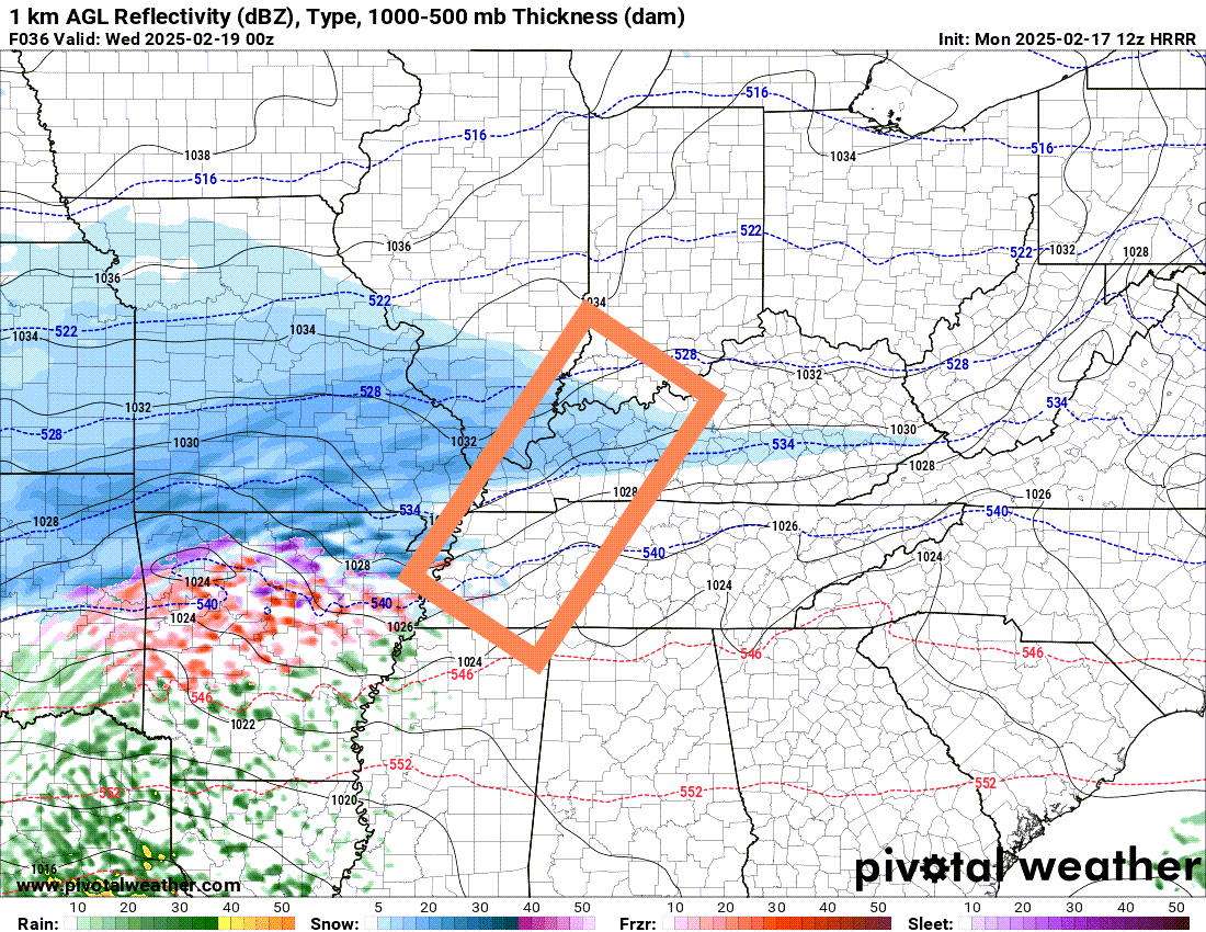
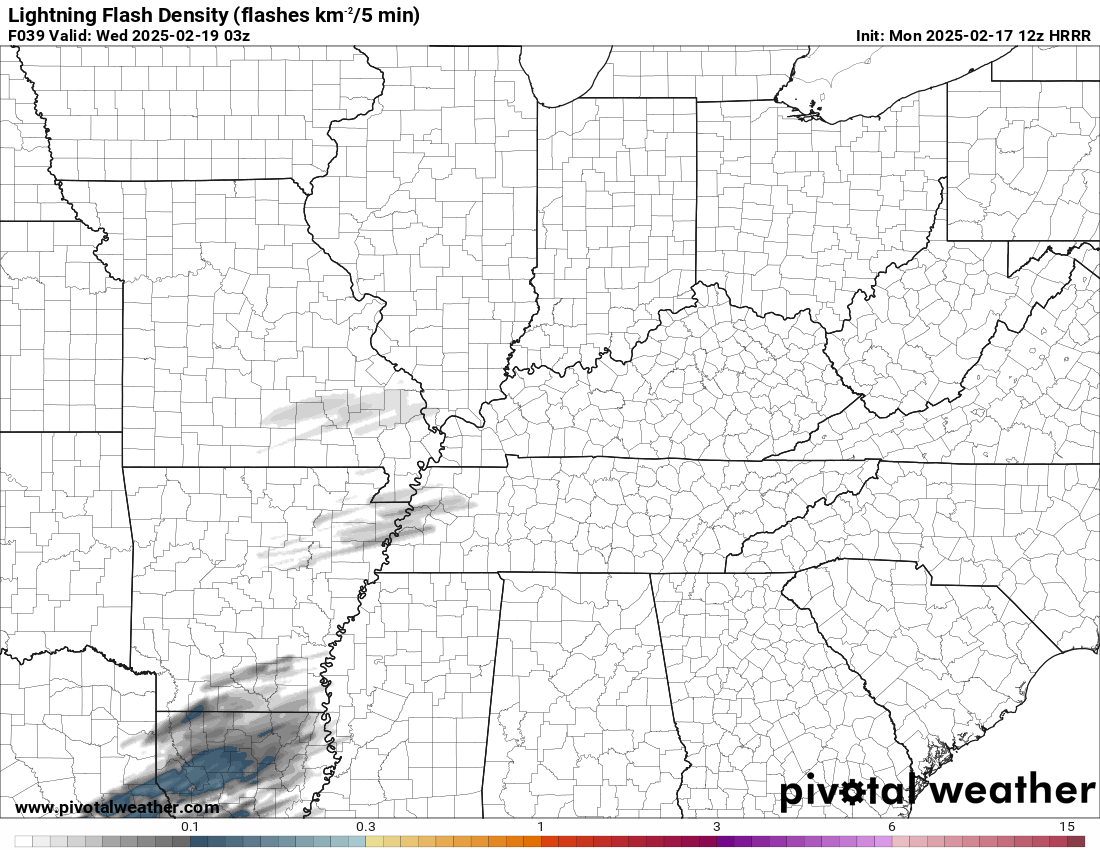
Lightning data does show some potential for thundersnow.
.
NOTE: Snow showers may begin as early as tonight and tomorrow morning across portions of the region. Light snow. Keep that in mind.
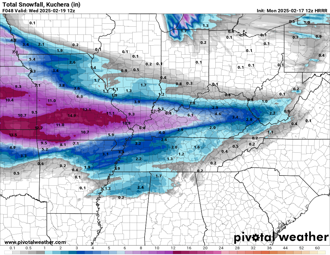
The snow totals tonight into tomorrow morning will be light. The heavier snow arrives Tuesday afternoon and night.
You can see that on these two graphics.
This is before sunrise. Blue is snow.
.
Here are snow totals tonight and early tomorrow morning. Notice that stripe across southeast Missouri into northwest Kentucky? We could have a bit of snow before the main event arrives. Keep that in mind. What falls will stick. Bitterly cold temperatures tonight.
A quick forecast glance. Your 48-hour forecast Graphics


.
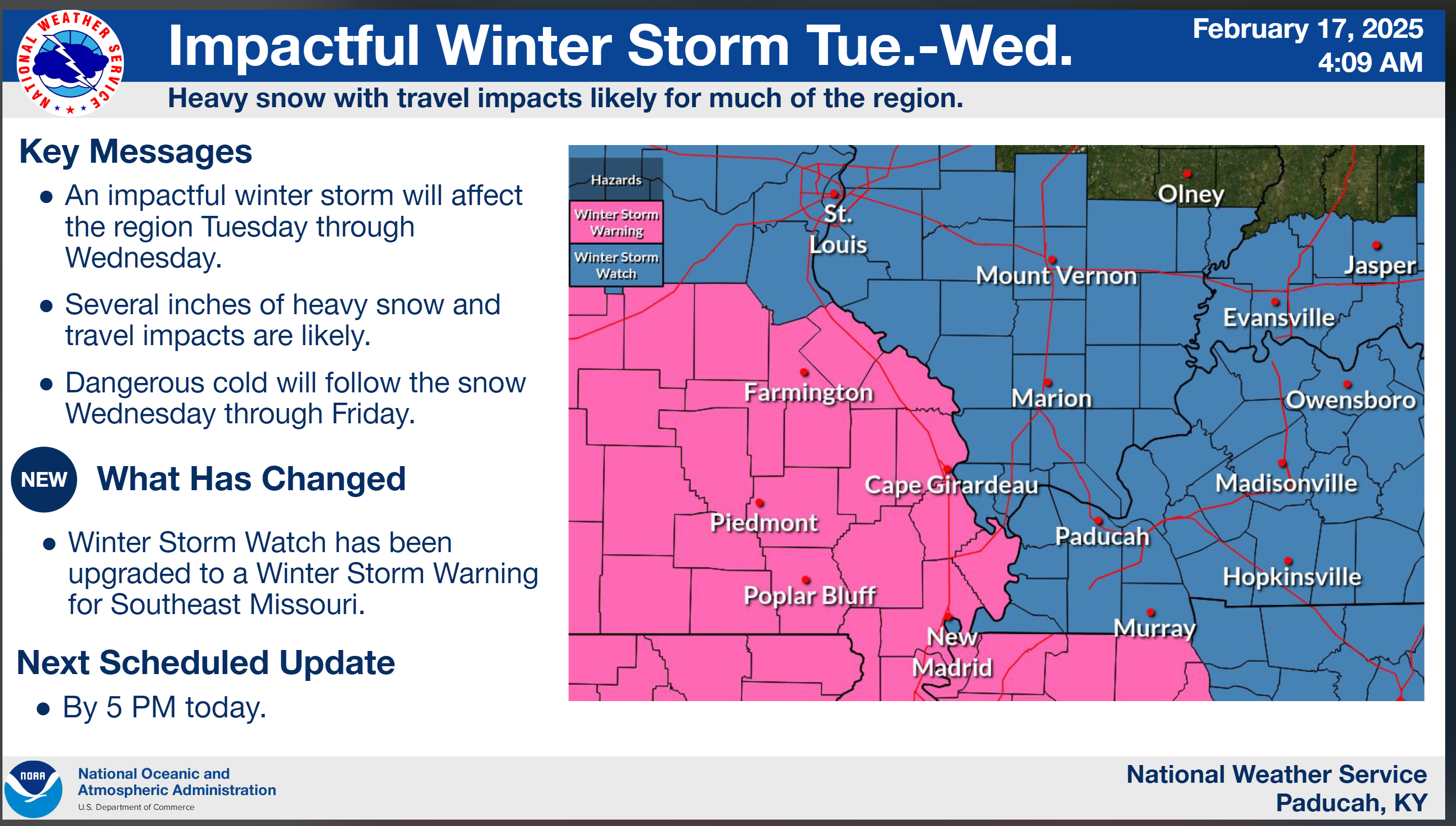
Bottom Line Up Front. An active weather pattern into next week.
- Snow showers may develop as early as tonight and tomorrow morning. Light accumulation. The heaviest snow will arrive on Tuesday afternoon and night.
- A winter storm will bring widespread snow (locally heavy) to the region Tuesday into Wednesday. Peak snow chances will be Tuesday afternoon into Wednesday morning. Widespread travel impacts are anticipated. Blowing and drifting snow likely.
- Bitterly cold temperatures this week. Bitterly cold wind chill values.
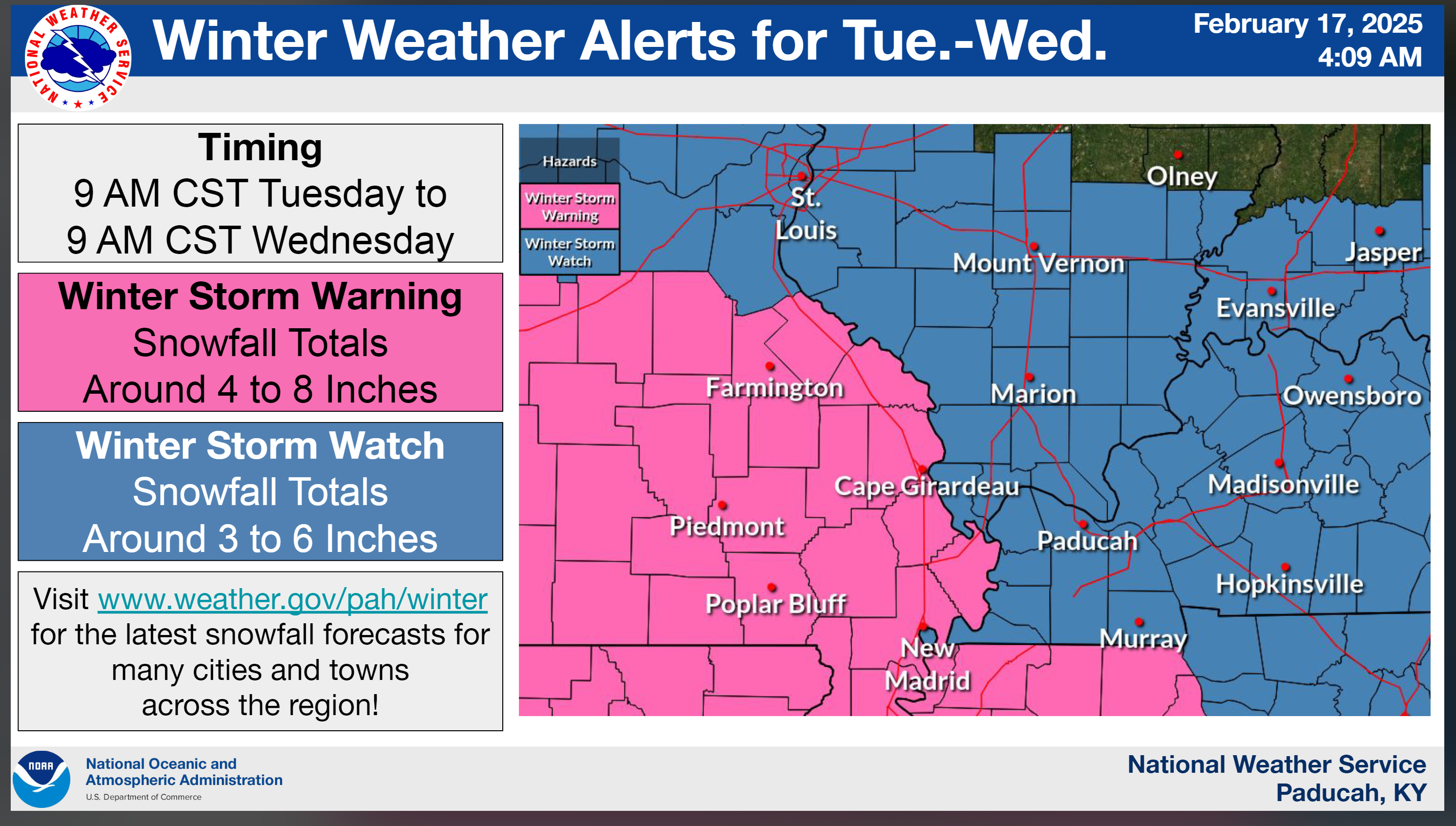
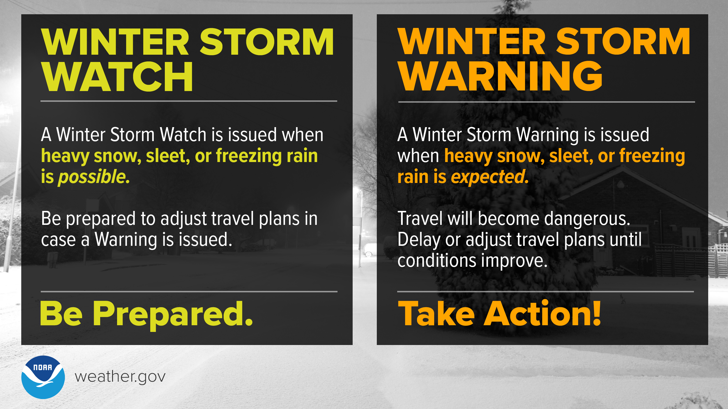
- The NWS has issued winter storm watches and warnings. See those below.
- Flooding continues in many areas. Avoid flooded roadways
![]()
.
Bottom Line Up Front
Winter storm to bring widespread snow to the region. Bitterly cold temperatures.
.
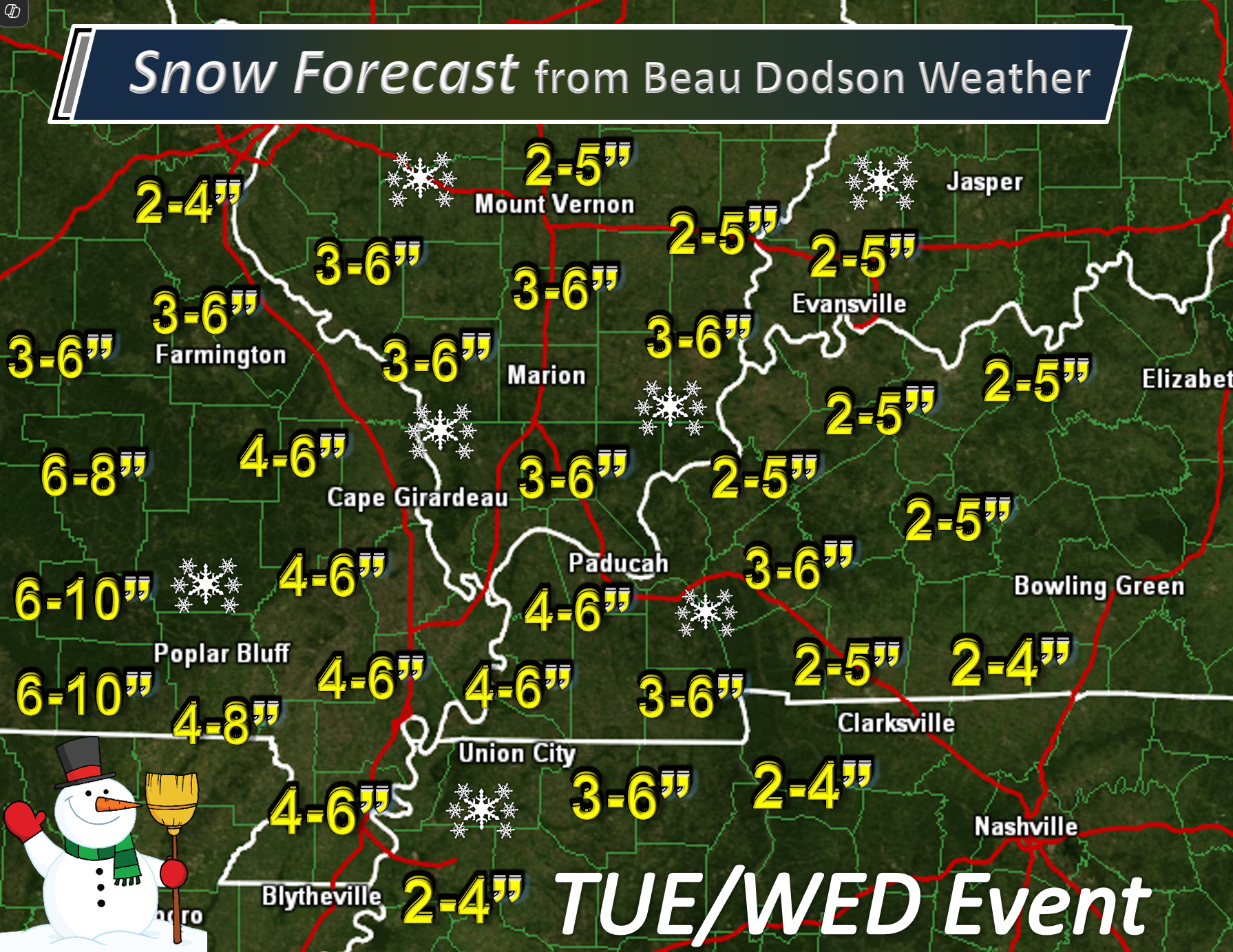
I have not changed my original snow forecast. Here it is.
Adjustments are still possible, keep that in mind. Notice how snow tapers west to east with amounts.
Again, do not focus on snow totals. Focus on impacts. Snow covered roadways.
.
.
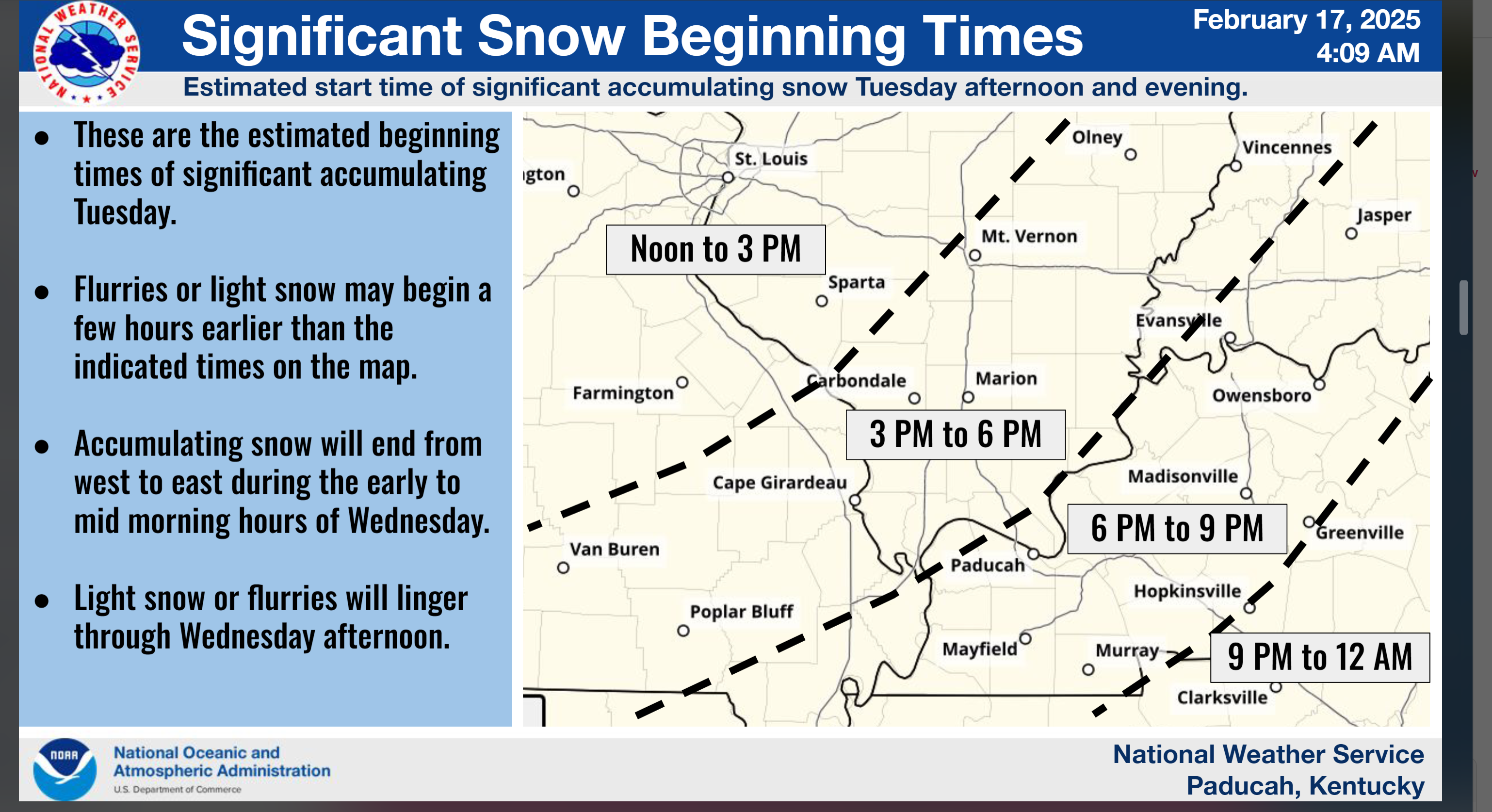
Tuesday and Wednesday Snow Potential
.
Here are some graphics that our friends at NWS/NOAA made.
Double click these images to enlarge them. Some of them are hard to read.
These are temperatures and wind chill values for the week ahead.
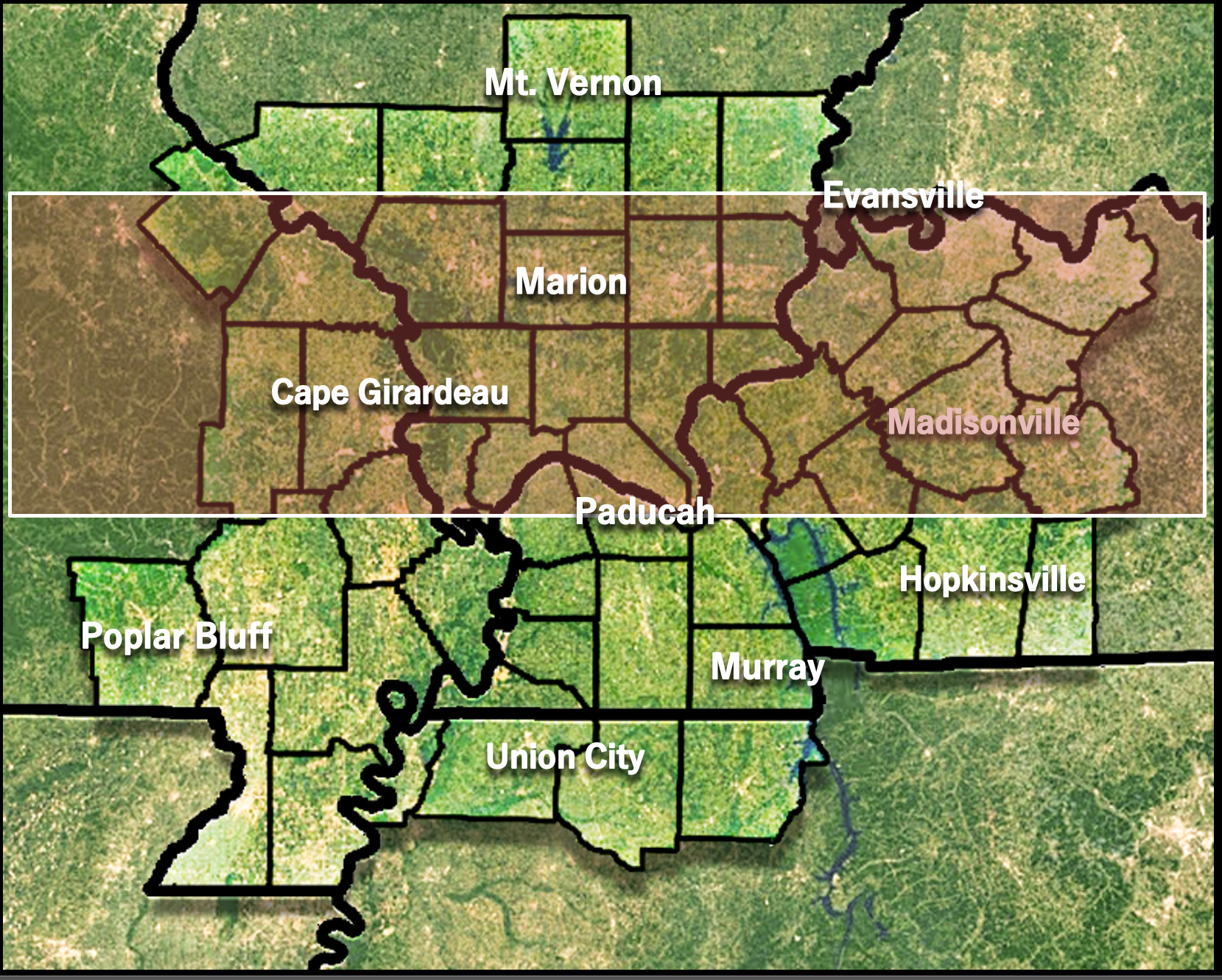
Find a town near you.
Southern counties
.
Let’s look at some more NWS maps.
Again, some snow is possible tonight/tomorrow morning. That would be light snow. The bulk of this arrives Tuesday afternoon and night.
Double click the image to enlarge it.
Here is the timing map.
** TIMING WILL VARY BASED ON THAT MORNING BAND OF SNOW FROM WEST TO EAST. **
.
Here is what the NWS is forecasting. It is not too far off from my forecast. Again, do not focus on snow totals. Focus on impacts. Snow covered roadways.
Southern counties
.
.
Southern counties
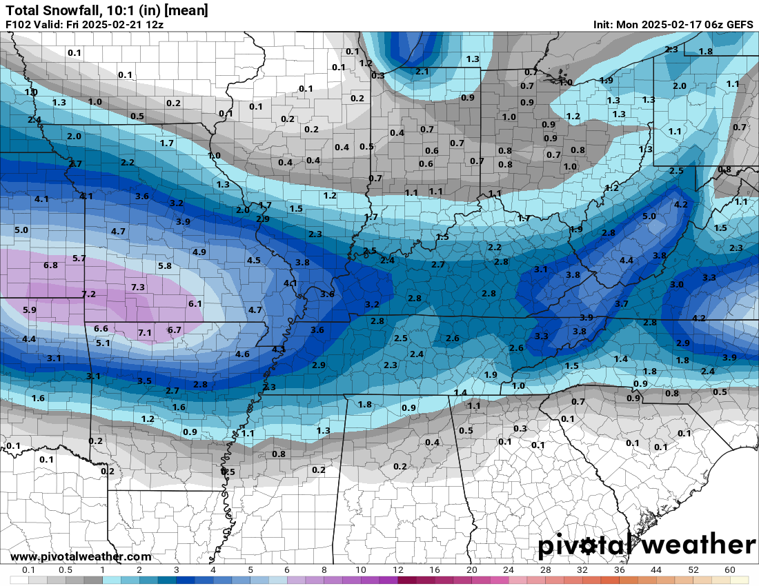
Here is the GEFS model. This is a decent ensemble model.
Notice how precipitation tapers west to east. That will happen. The system weakens as it moves eastward. Thus, higher snow totals west vs east.
This is using a 10:1 snow ratio. That means 1″ of liquid melted snow equals 10 inches of snow. This event will be closer to 15:1. That means 1″ of liquid equals 15 inches of snow.
A dry fluffy snow. So these totals, on this graphic, are a bit underdone. Tack on an inch or two and it sounds more reasonable.
Again, see my snow forecast map at the top of the page. I am just showing you some data.
.
.
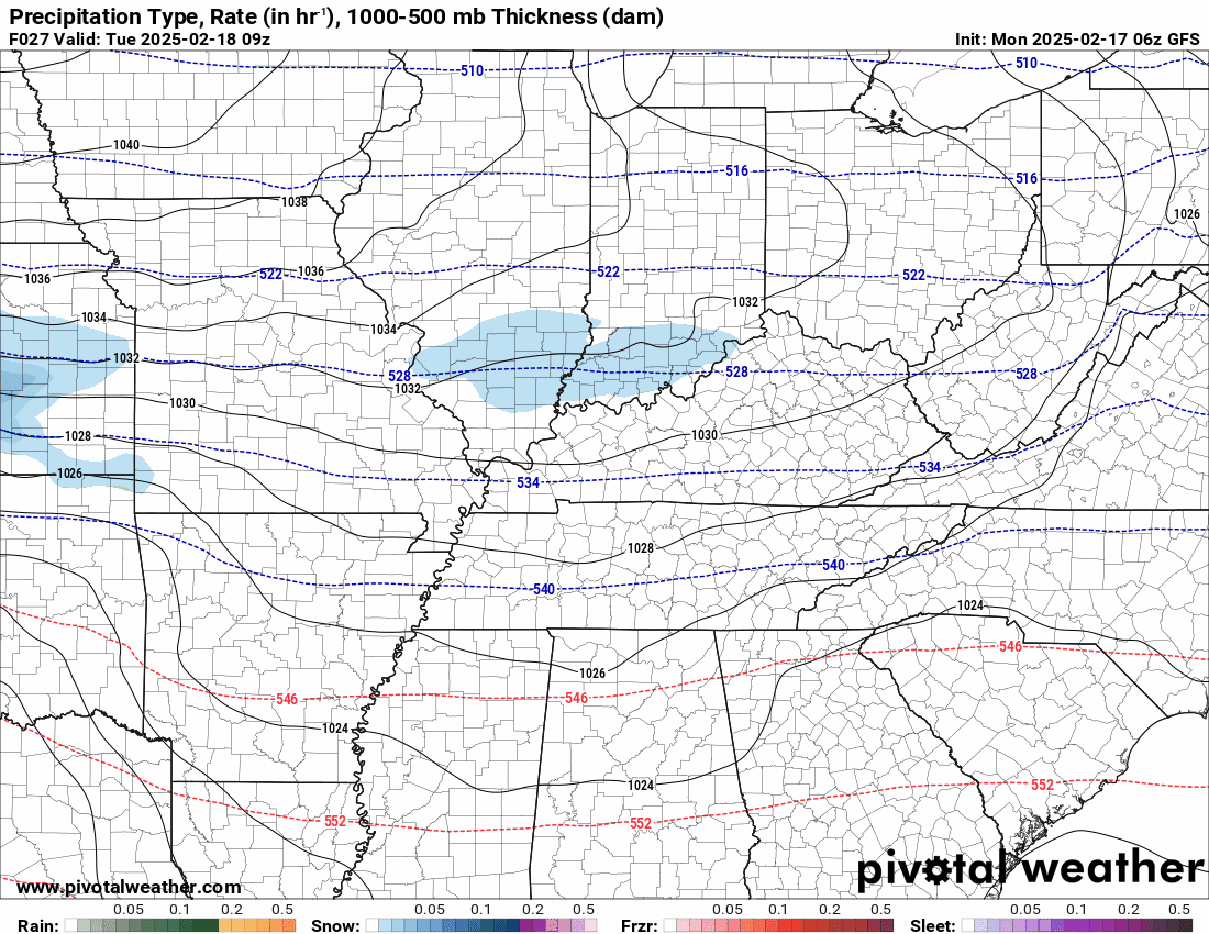
Future-cast Radars.
What radar might look like with our winter storm threat Tuesday and Wednesday.
Here is the GFS future-cast radar.
Double click the animation to enlarge it.
The time stamp (upper left) is in zulu. 12z=6 am. 18z=12 pm. 00z=6 pm.
.
Snow Potential Is Increasing tonight into Wednesday morning.
.
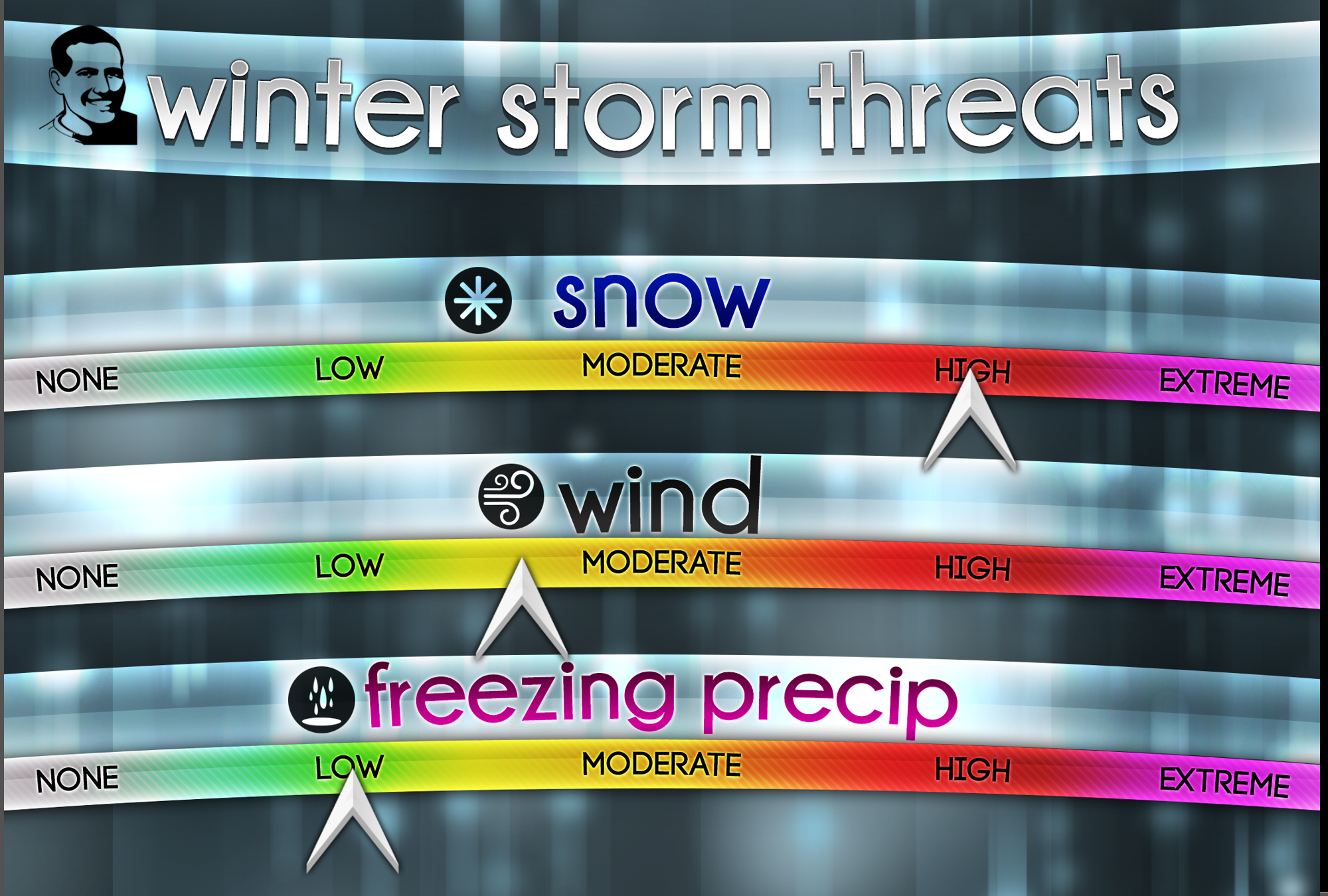
A winter storm will bring widespread snow, wind, and cold to the region this week. If you have travel plans Tuesday and Wednesday, then there will be impacts. Especially as we move through Tuesday afternoon and night.
Again, I can’t rule out some snow showers Monday night/Tuesday morning, But, chances ramp up later on Tuesday afternoon into Tuesday night. That is when the heaviest snow will fall.
The NWS will has issued winter storm watches and warnings.
.
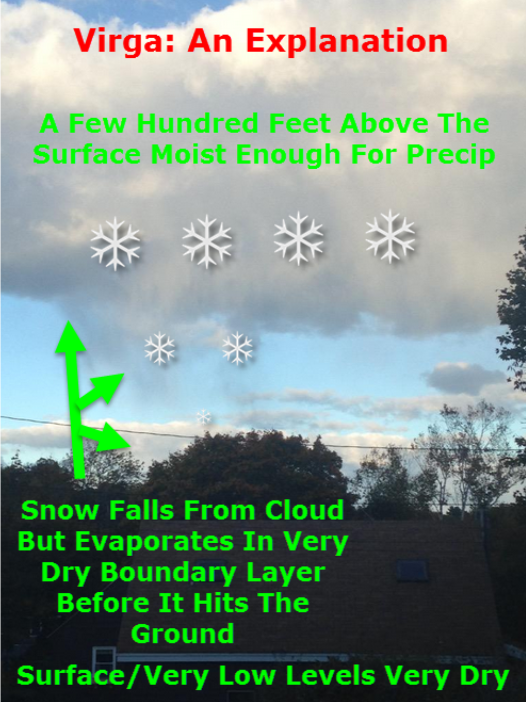
There is some dry air aloft at the beginning of this event. This will cause virga. The radar may look like it is snowing at your house, but it is evaporating before reaching the ground. In some winter storms, this can last for a few hours. I will need to monitor that portion of the forecast.
With time, the snow moistens up the atmosphere and the flakes reach the ground.
.

.
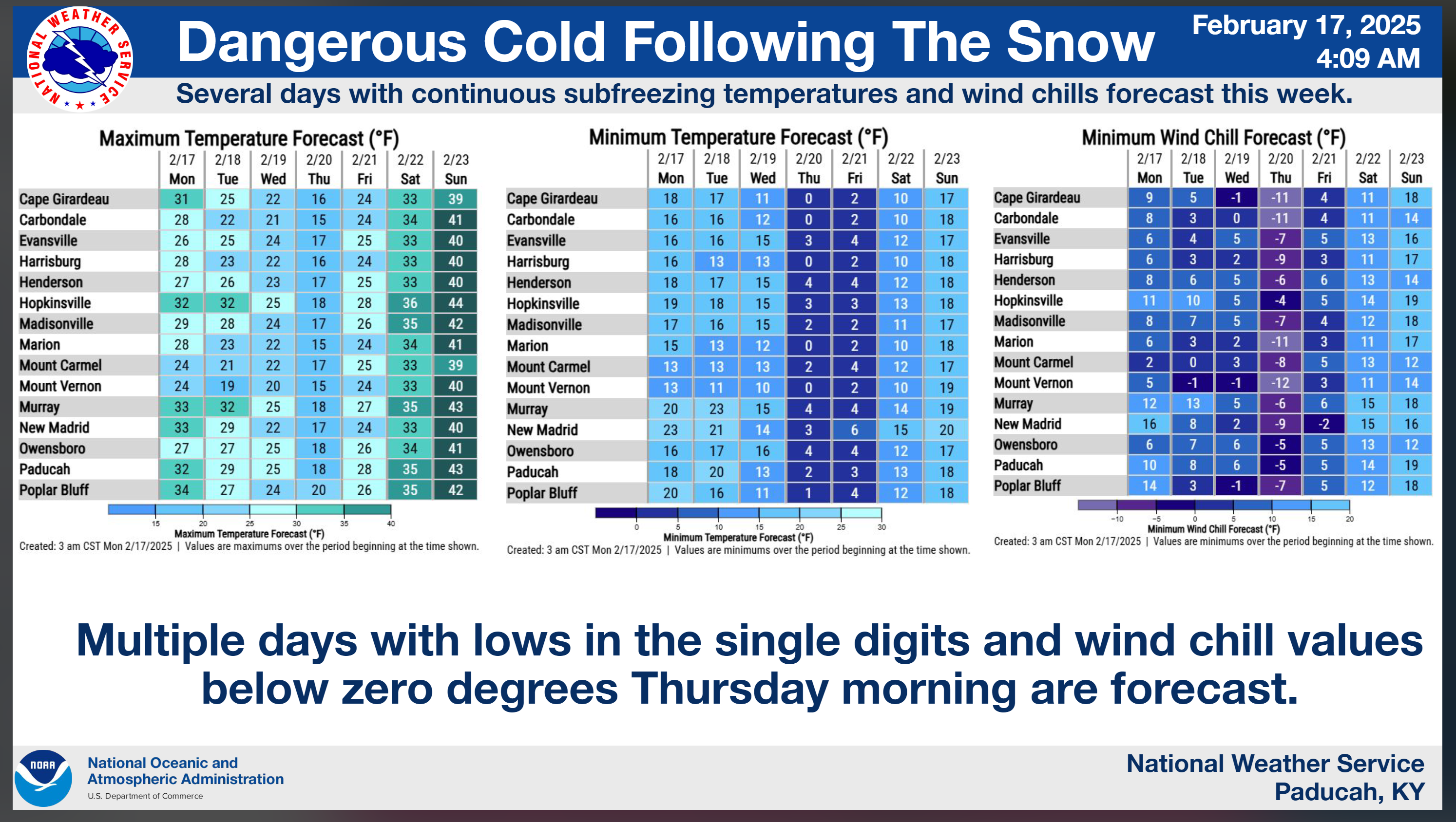
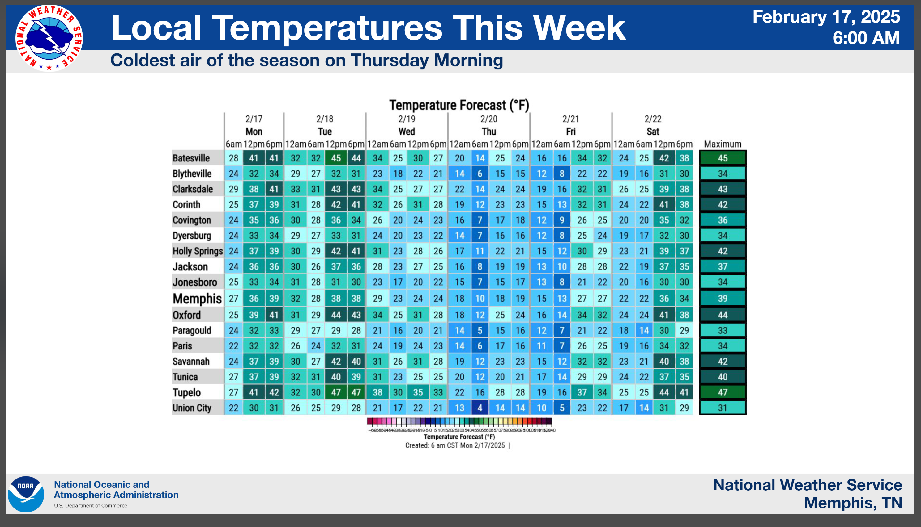
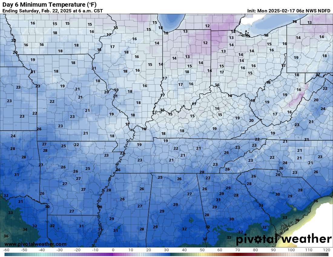
Bitterly cold air will linger into this coming weekend Some locations will stay below freezing for five days. It will feel like winter.
This will likely be the coldest air of the winter season, thus far.
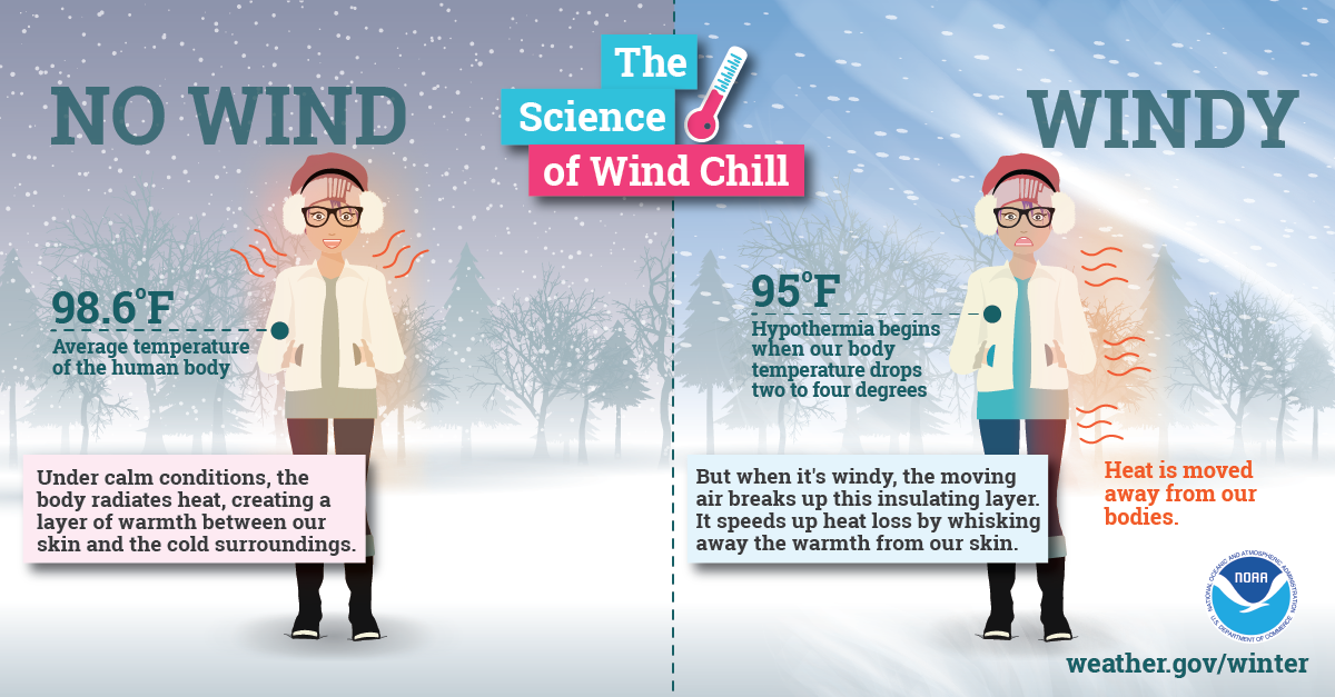
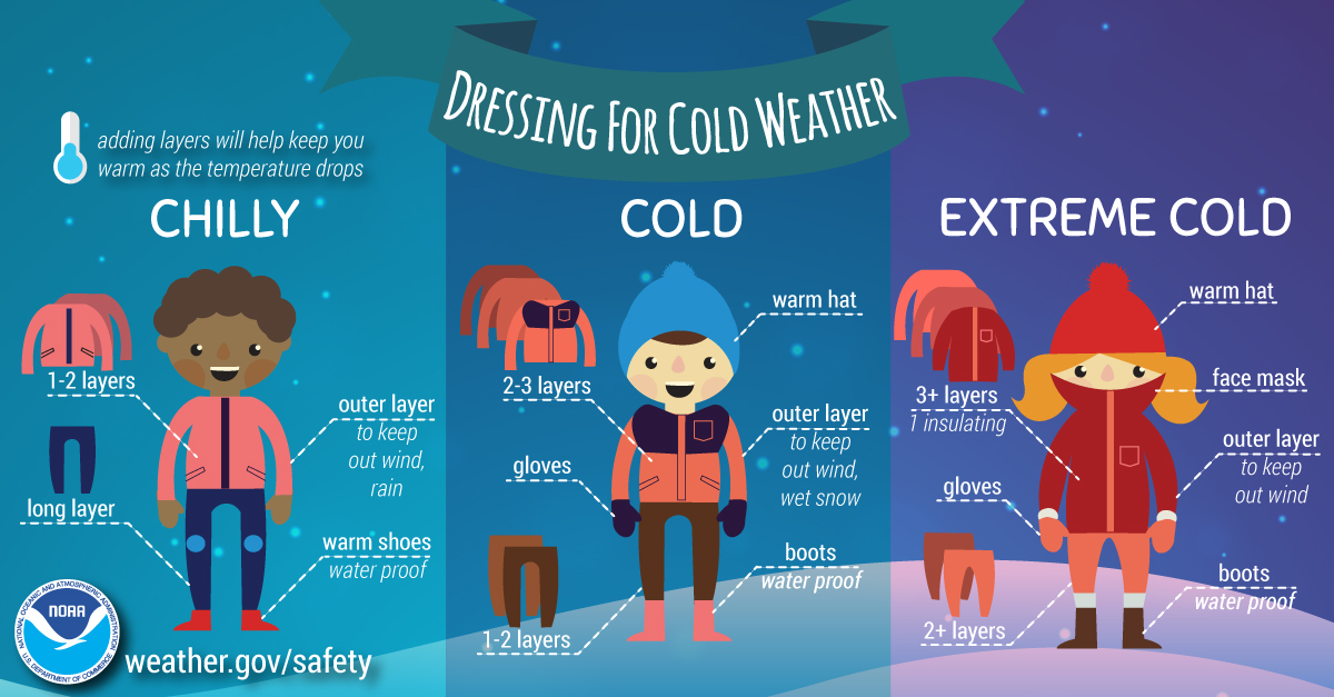
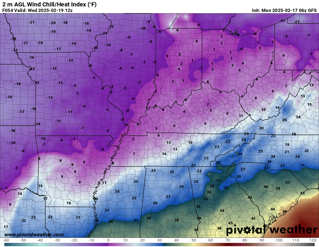
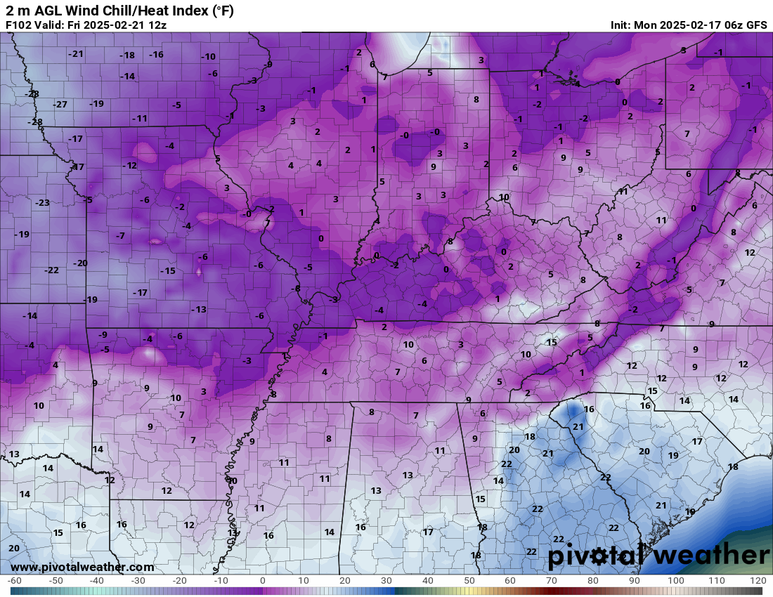
Wind chill temperatures will be even colder. Well below zero, at times. Harsh winter weather.
Remember, the body responds to wind chill. The wind chill is more important than the actual temperatures. Frostbite is a real concern with this upcoming winter event.
.
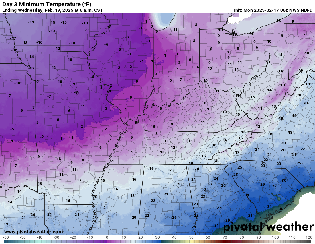
Check out these lows. Wind chill temperatures will be even colder!
Double click images to enlarge them.
Tuesday morning lows
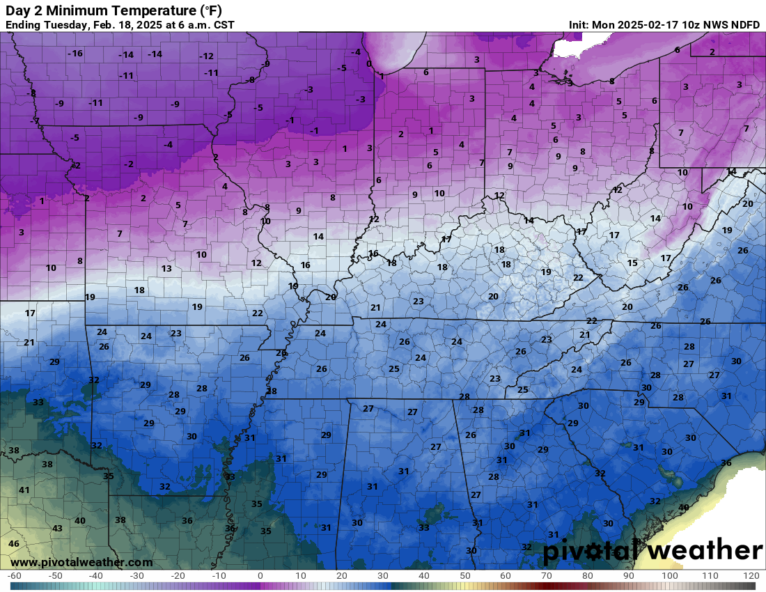
.
Wednesday morning lows
.
Thursday morning lows
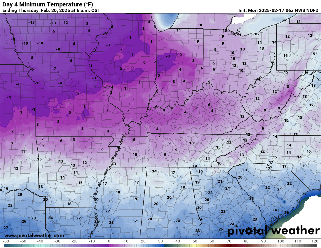
.
Friday morning lows
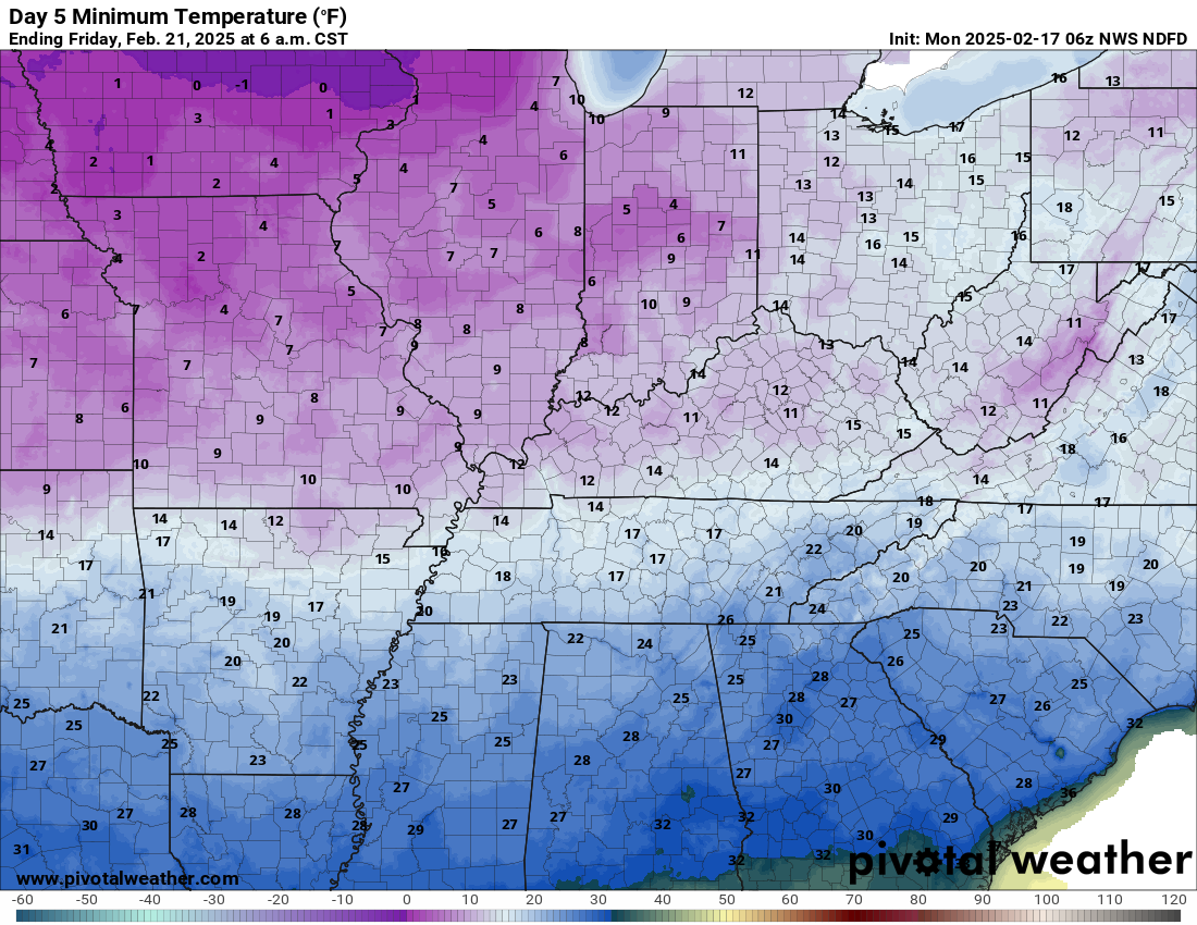
.
Wednesday morning wind chill values.
.
Thursday morning wind chill values.
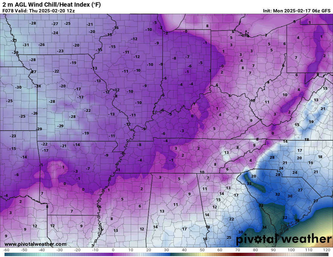
.
Friday morning wind chill values.
.
We do have some sponsors! Check them out.
Connected and Protected.
They Specialize in Audio, Video, Networking, Security, Cameras, Electrical, New Construction, Remodels, and retrofitting Jobs. Experience the future of smart living and unmatched security with Connected & Protected Solutions today.
Link – Click here

.
Roof damage from recent storms? Link – Click here
INTEGRITY ROOFING AND EXTERIORS!
⛈️ Roof or gutter damage from recent storms? Today’s weather is sponsored by Integrity Roofing. Check out their website at this link https://www.ourintegritymatters.com/

![]()
![]()

.
Click here if you would like to return to the top of the page.
.Average high temperatures for this time of the year are around 46 degrees.
Average low temperatures for this time of the year are around 29 degrees.
Average precipitation during this time period ranges from 0.90″ to 1.20″
Six to Ten Day Outlook.
Blue is below average. Red is above average. The no color zone represents equal chances.
Average highs for this time of the year are in the lower 60s. Average lows for this time of the year are in the lower 40s.

Green is above average precipitation. Yellow and brown favors below average precipitation. Average precipitation for this time of the year is around one inch per week.

.

Average low temperatures for this time of the year are around 29 degrees.
Average precipitation during this time period ranges from 0.90″ to 1.20″
.
Eight to Fourteen Day Outlook.
Blue is below average. Red is above average. The no color zone represents equal chances.

Green is above average precipitation. Yellow and brown favors below average precipitation. Average precipitation for this time of the year is around one inch per week.

.
![]()
Make sure you have three to five ways of receiving your severe weather information.
Weather Talk is one of those ways! Now, I have another product for you and your family.

.
.
https://weathercallservices.com/beau-dodson-weather


Want to add more products to your Beau Dodson Weather App?
Receive daily videos, weather blog updates on normal weather days and severe weather and winter storm days, your county by county weather forecast, and more!
Here is how to do add those additional products to your app notification settings!
Here is a video on how to update your Beau Dodson Weather payment.
The app is for subscribers. Subscribe at www.weathertalk.com/welcome then go to your app store and search for WeatherTalk
Subscribers, PLEASE USE THE APP. ATT and Verizon are not reliable during severe weather. They are delaying text messages.
The app is under WeatherTalk in the app store.

Apple users click here

Android users click here
.

Radars and Lightning Data
Interactive-city-view radars. Clickable watches and warnings.
https://wtalk.co/B3XHASFZ
Old legacy radar site (some of you like it better)
https://weatherobservatory.com/weather-radar.htm
If the radar is not updating then try another one. If a radar does not appear to be refreshing then hit Ctrl F5. You may also try restarting your browser.
Backup radar site in case the above one is not working.
https://weathertalk.com/morani
Regional Radar
https://imagery.weathertalk.com/prx/RadarLoop.mp4
** NEW ** Zoom radar with chaser tracking abilities!
ZoomRadar
Lightning Data (zoom in and out of your local area)
https://wtalk.co/WJ3SN5UZ
Not working? Email me at beaudodson@usawx.com
National map of weather watches and warnings. Click here.
Storm Prediction Center. Click here.
Weather Prediction Center. Click here.
.

Live lightning data: Click here.
Real time lightning data (another one) https://map.blitzortung.org/#5.02/37.95/-86.99
Our new Zoom radar with storm chases
.
.

Interactive GOES R satellite. Track clouds. Click here.
GOES 16 slider tool. Click here.
College of DuPage satellites. Click here
.

Here are the latest local river stage forecast numbers Click Here.
Here are the latest lake stage forecast numbers for Kentucky Lake and Lake Barkley Click Here.
.
.
Find Beau on Facebook! Click the banner.


 .
.