What you need to know.
.
Come on over to Facebook
LINK to the Facebook thread. I will be there throughout the event!
https://www.facebook.com/beaudodsonweather
.
Key Points
1: Icy road conditions into the weekend.
2. Focus on impacts and not snow totals. Icy roads. Some light freezing rain possible.
3: Snow ends today. Another dusting to an inch possible.
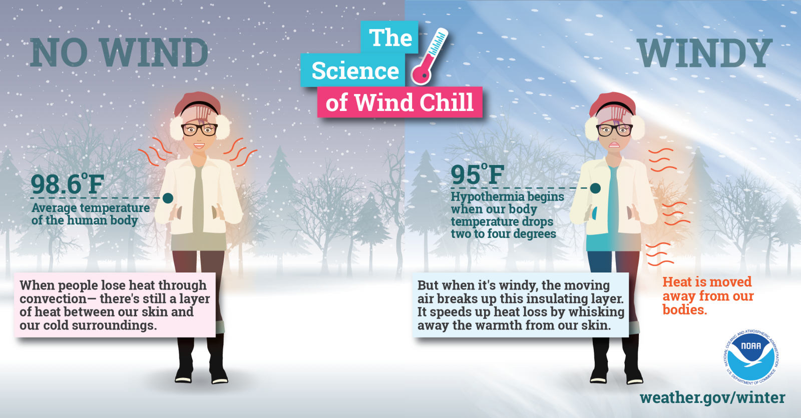
4: Plan on bitterly cold into Friday night. Frostbite, busted pipes, problems for outdoor pets, and increased number of house fires are all a concern..
5. Temperatures won’t be as severe Saturday and Sunday. Cold but not bitterly cold.
6. I will have Facebook Q&A Threads throughout the weekend and into next week.
https://www.facebook.com/beaudodsonweather
.
Call to action:
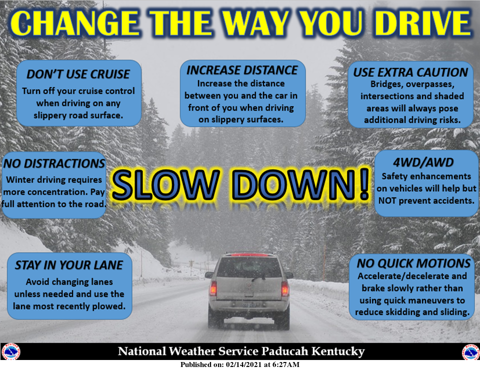
Plan on numerous icy roads over the coming days.
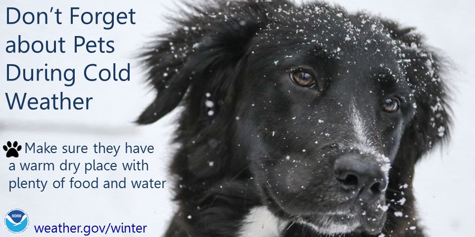
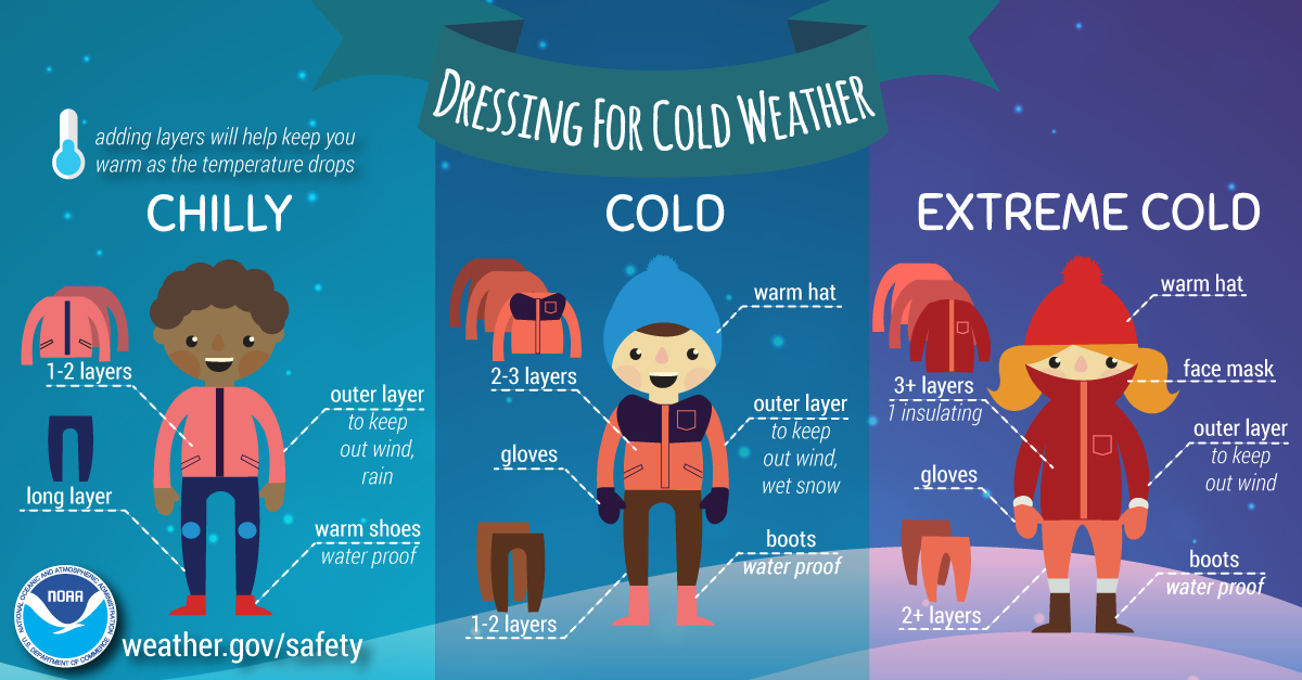
Take precautions against the bitterly cold air. Frostbite is likely with this type of weather. Outdoor animals will suffer, as well.
Historically, prolonged cold spells can cause expensive damage in our region.
Google how to keep your water pipes from freezing.
Make sure you are using the Beau Dodson Weather Talk app. Download it from the app store. It is under Weather Talk.
TURN ON YOUR BEAU DODSON WEATHER TALK APP. Make sure it is on. Make sure you have not accidentally logged out of the app.
For downloads: Apple users click here. Android users click here
.
Winter Weather Radars.
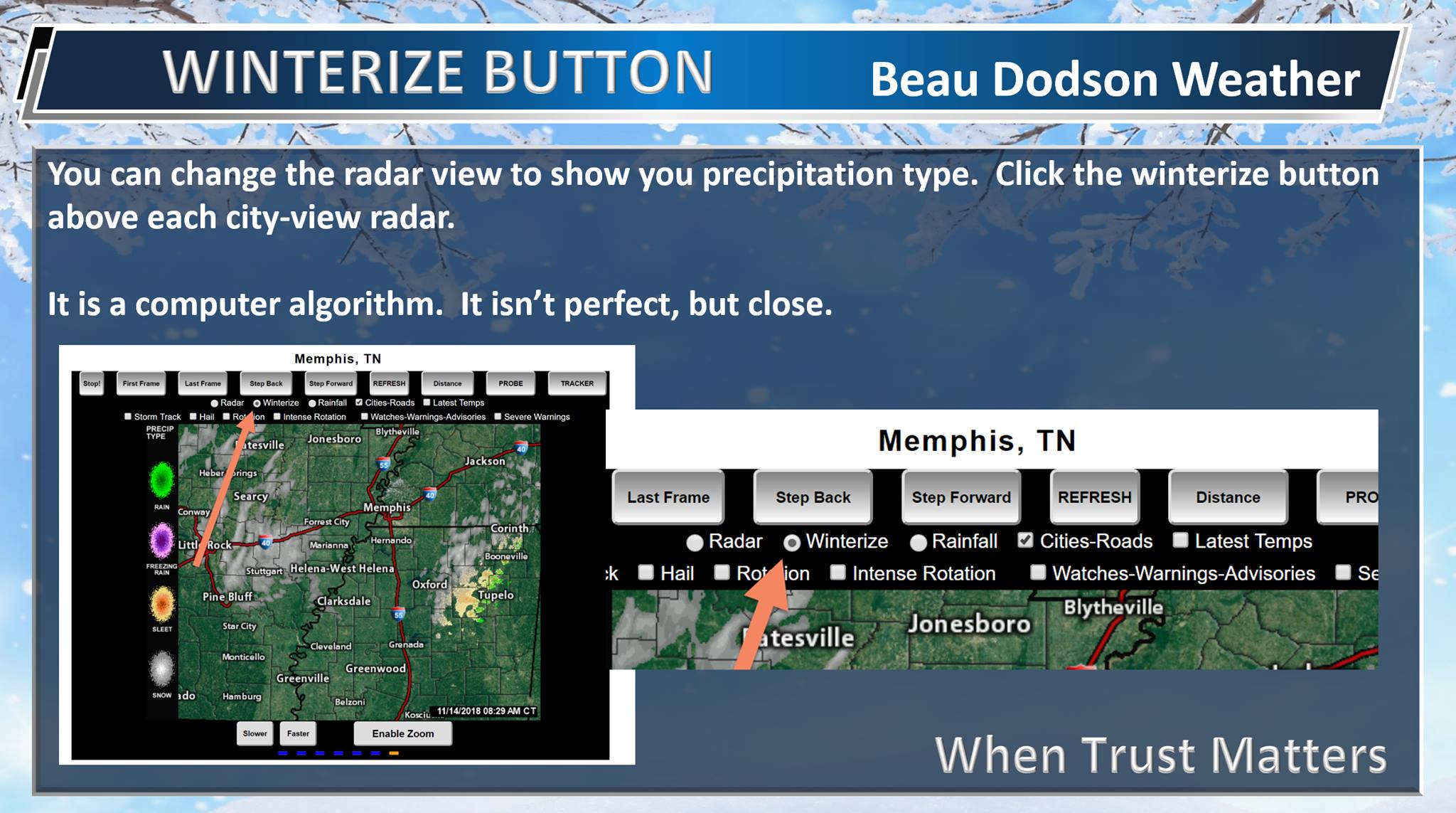
The local-city-view radars have a winterize button. Click it (once you are on the radar page).
Interactive city-view radars
http://weatherobservatory.com/weather-radar.htm
A third backup radar
https://weathertalk.com/morani
Clickable watches and warnings can be viewed on the local city-view interactive radars (link above). Be sure and turn on the warnings above the local radars.
A new regional radar we offer. This also shows you precipitation type.
https://imagery.weathertalk.com/prx/RadarLoop.mp4
Lightning data
https://wtalk.co/7QT7WHKU
.
February 18, 2021
Today’s Facebook thread
https://www.facebook.com/beaudodsonweather/posts/4251249508237858
We have some light snow and freezing rain in the region this morning. That is that little bonus snow that I talked about the last few days.
It will produce a dusting to an inch of snow.
See the radars.
Radars
Interactive city-view radars
http://weatherobservatory.com/weather-radar.htm
A third backup radar
https://weathertalk.com/morani
Clickable watches and warnings can be viewed on the local city-view interactive radars (link above). Be sure and turn on the warnings above the local radars.
A new regional radar we offer
https://imagery.weathertalk.com/prx/RadarLoop.mp4
.
February 17, 2021
The forecast is on track tonight.
February 17, 2021
5 PM Future-cast radar
This will give you an idea on timing.
.
February 17, 2021
Update
.
February 17, 2021
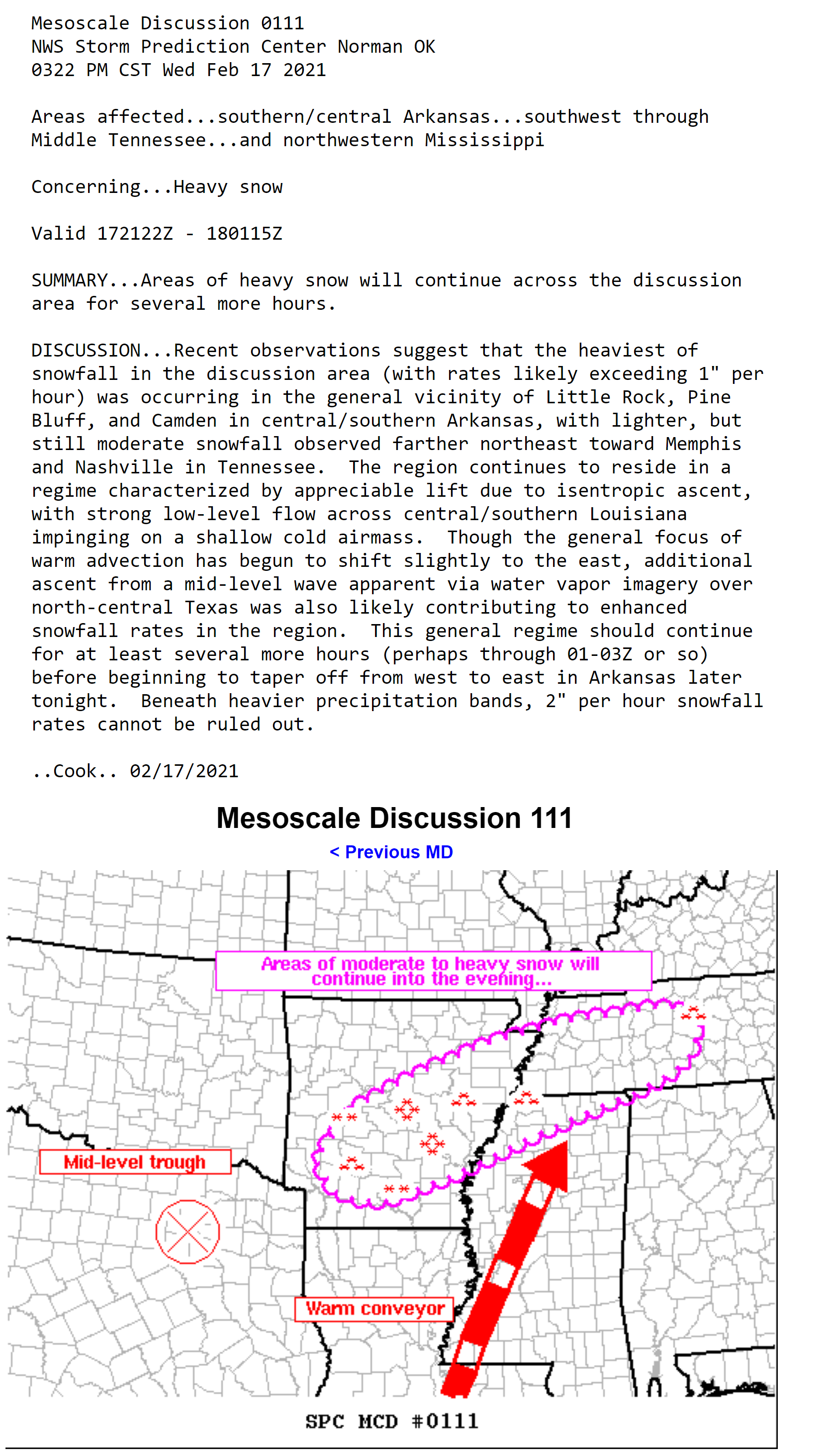
Mesoscale discussion from the SPC
February 17, 2021
Updated
.
February 17, 2021
The NWS moved to a warning for a few counties. Here is why.
.
So, it is not like it used to be. It used to be 4 or more inches for a warning.
That is no longer the case.
So, nothing has changed other than there are bigger concerns for the time of day of the event and evening/morning commute.
Because of that, the NWS has moved to a winter storm warning for some.
A widespread one to three inches is still the going forecast.
With pockets of higher (which I covered in my graphics and comments).
The locally higher totals are more likely from the Bootheel of MO into west KY and TN.
So, to answer all the questions
Nothing has really changed other than the NWS would like to hit the message harder because of evening and morning commute.
Hazardous road conditions.
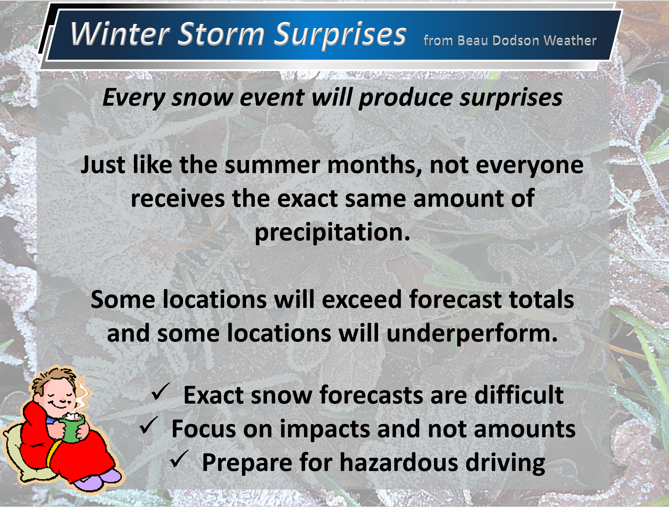
Remember, focus on the impacts and not the totals. I know I tell you that a lot.
Whether it is one inch of snow or three inches of snow. The difference is negligible. It ends up being icy road conditions.
The forecast from the NWS and mine remains intact from earlier today.
I hope that helps answer your questions
.
February 17, 2021
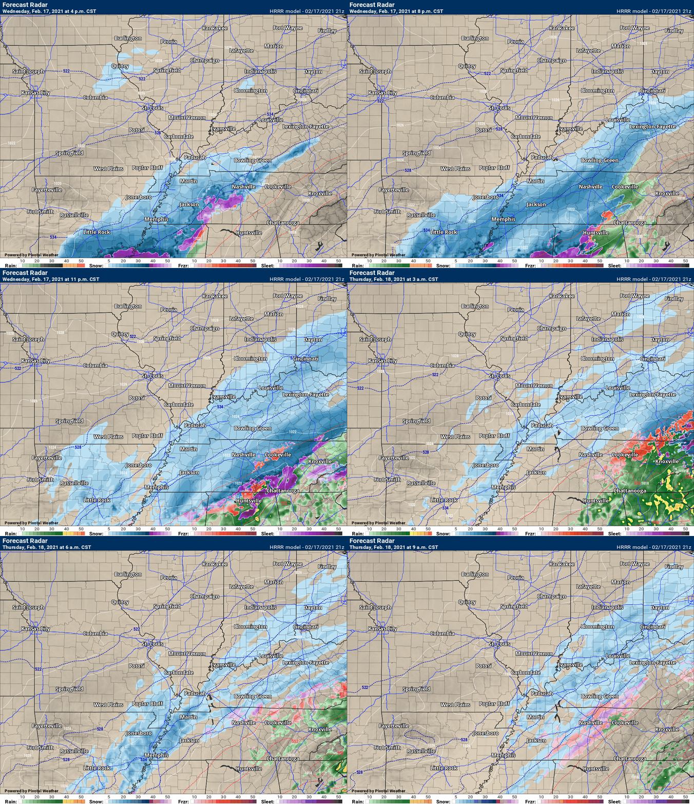
Here is the latest Hrrr model through 3 AM Thursday. Some more snow after that, but the model only goes out to 3 AM.
.
February 17, 2021
Memphis, Tennessee, NWS update
.
I am watching a second piece of energy late tonight and early tomorrow morning. This is behind the main system. You can see it here.
.
February 17, 2021
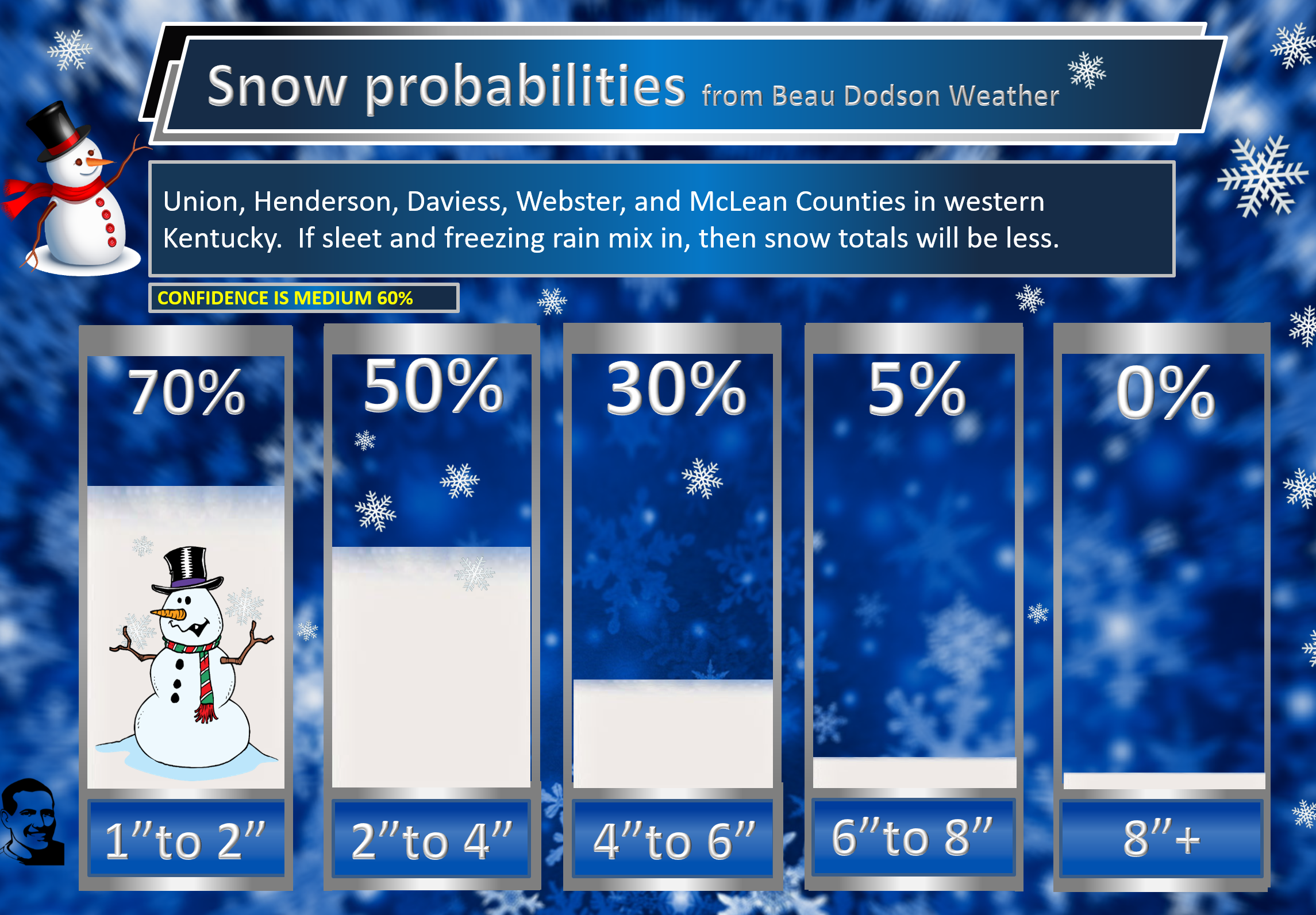
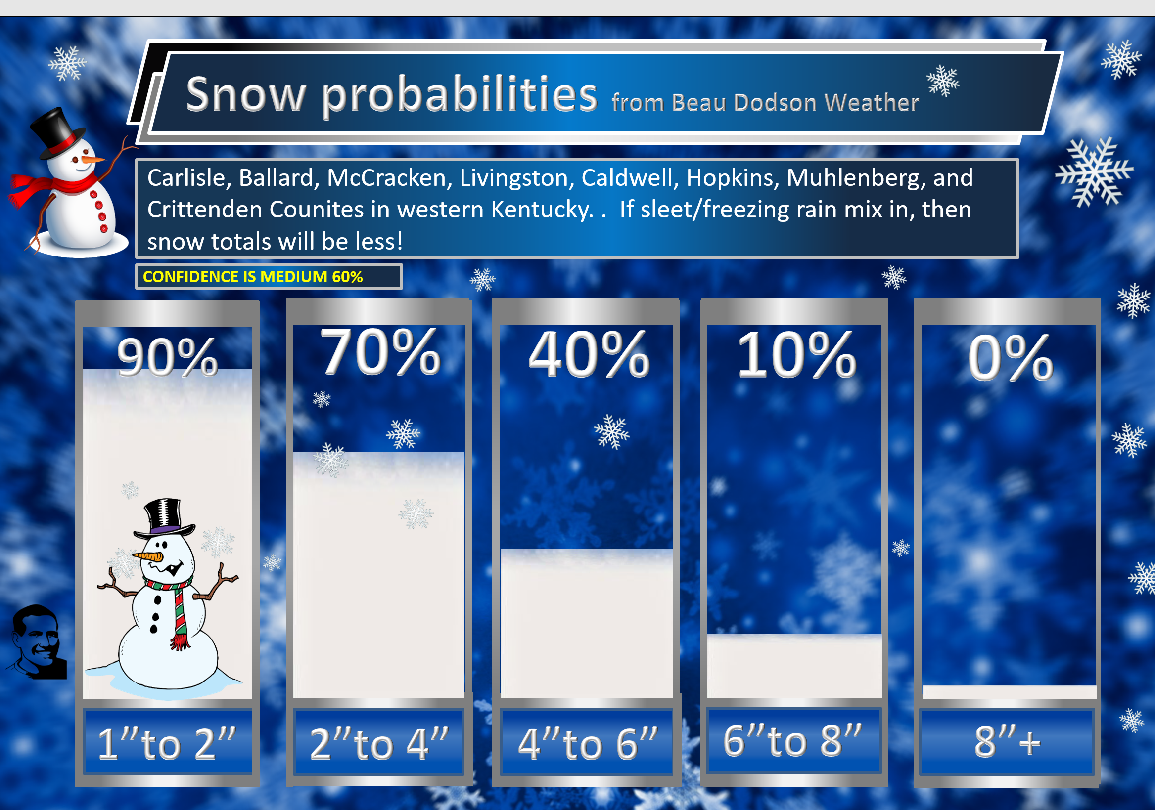
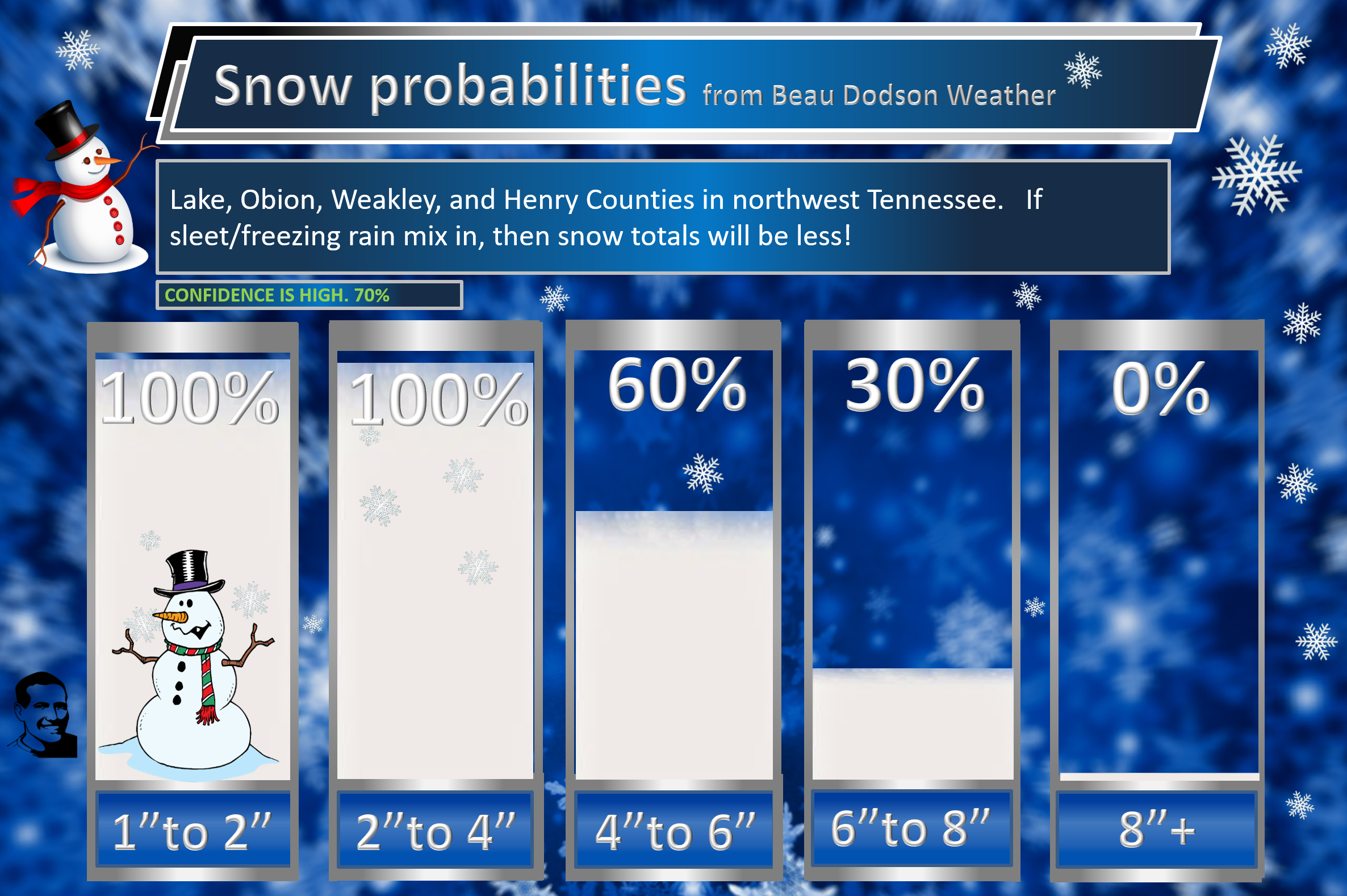
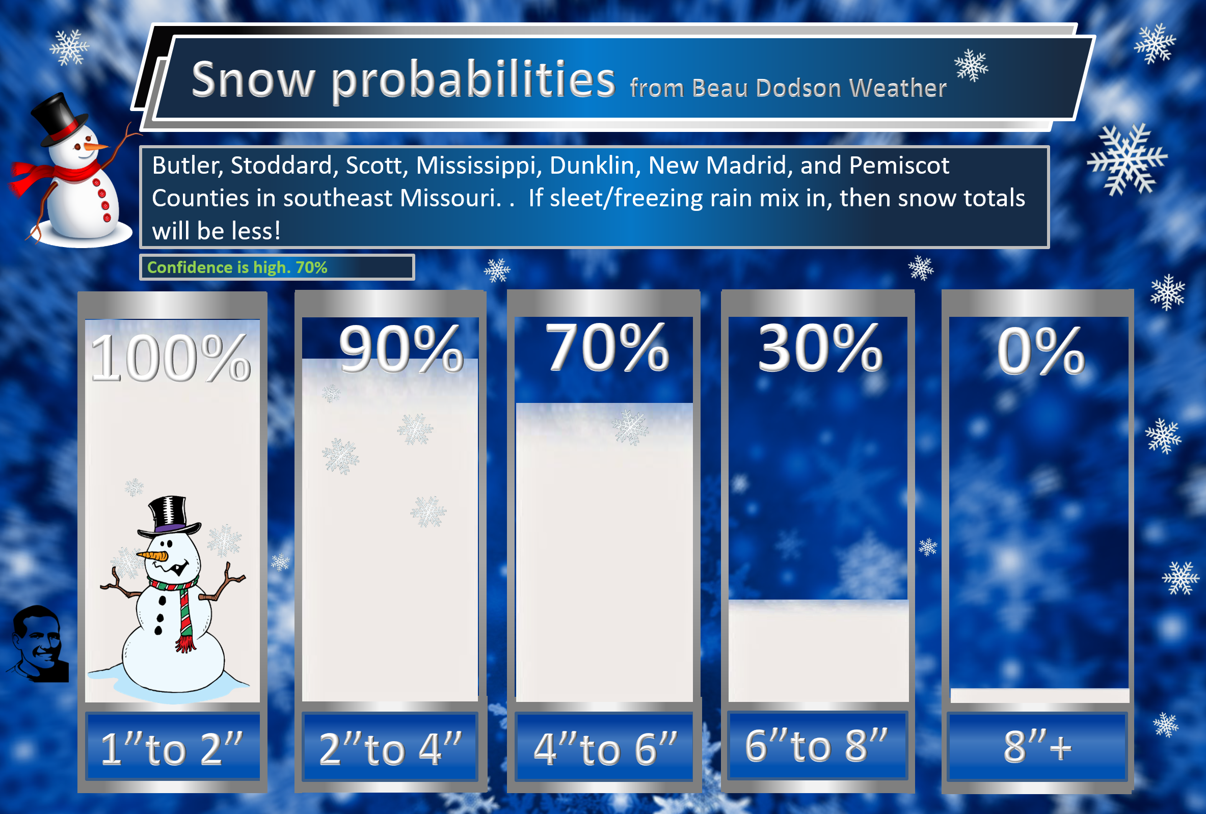
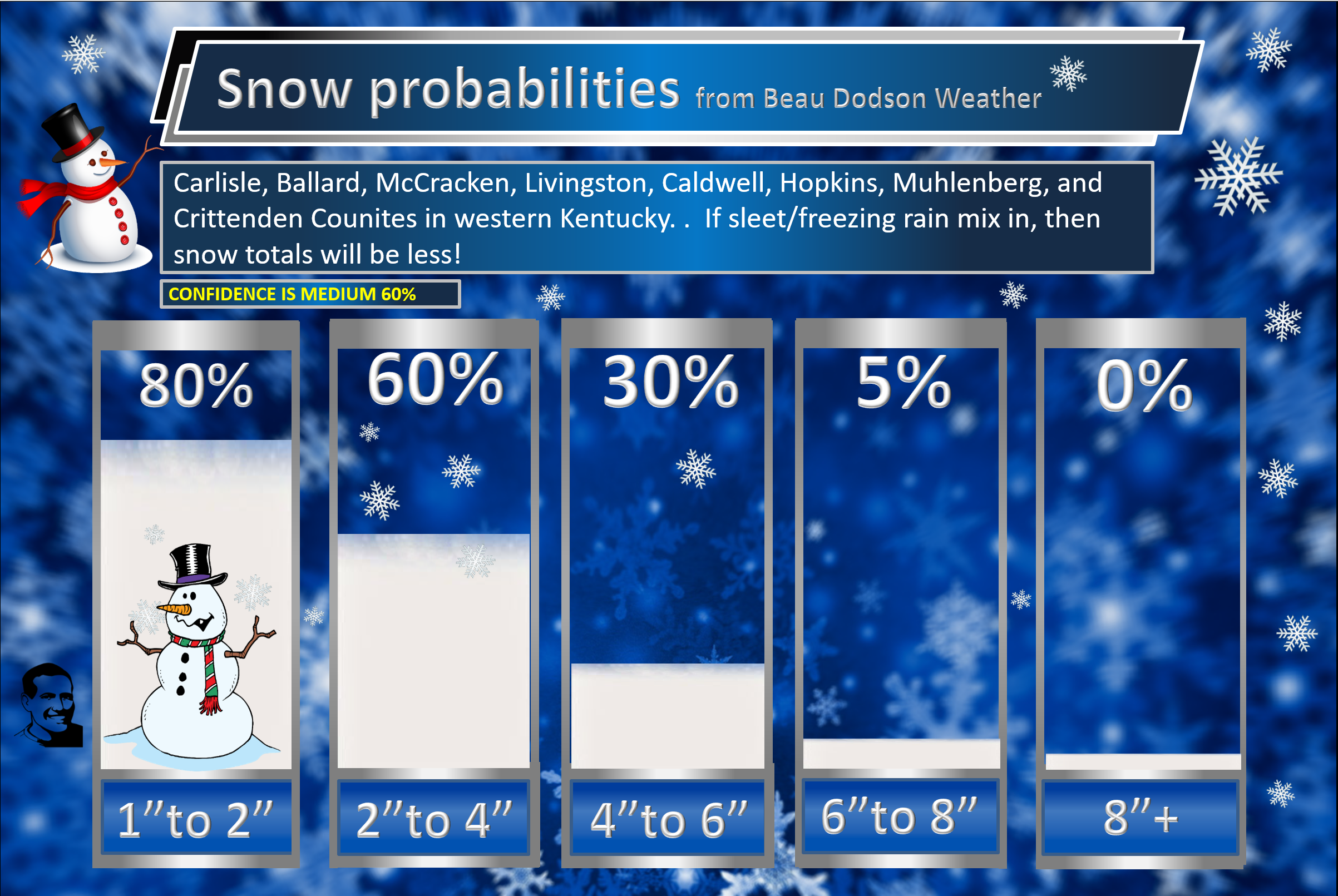
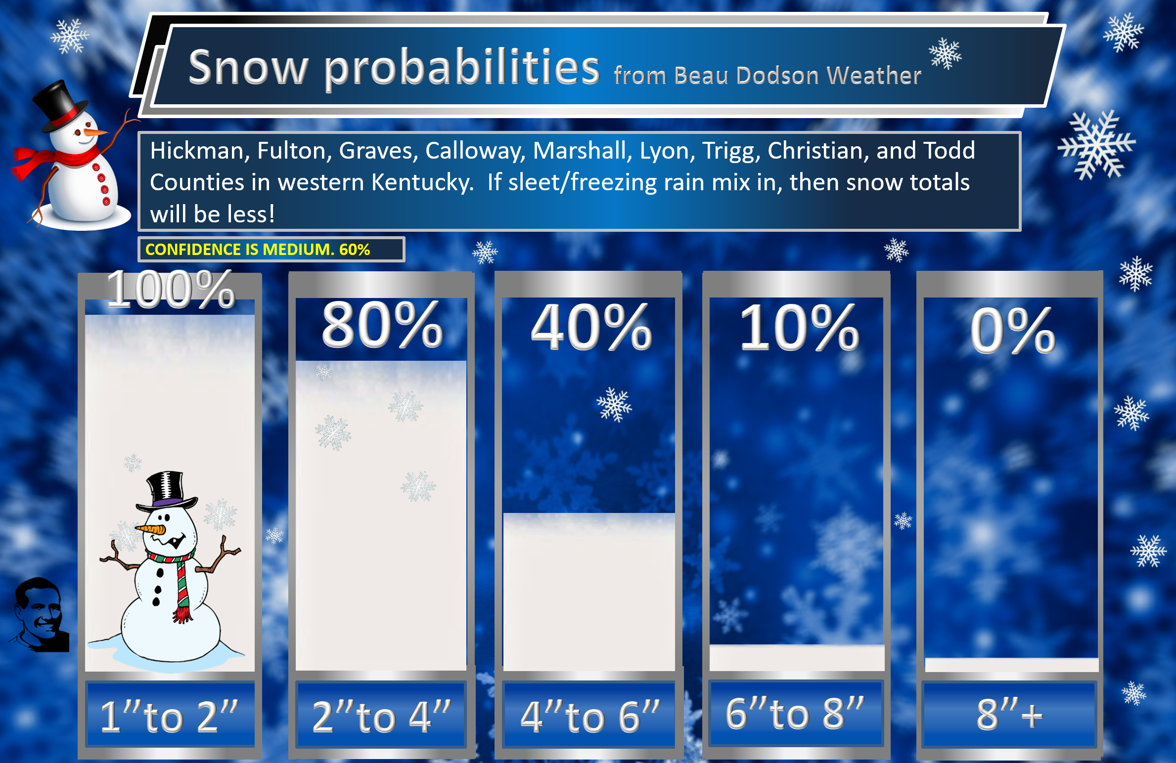
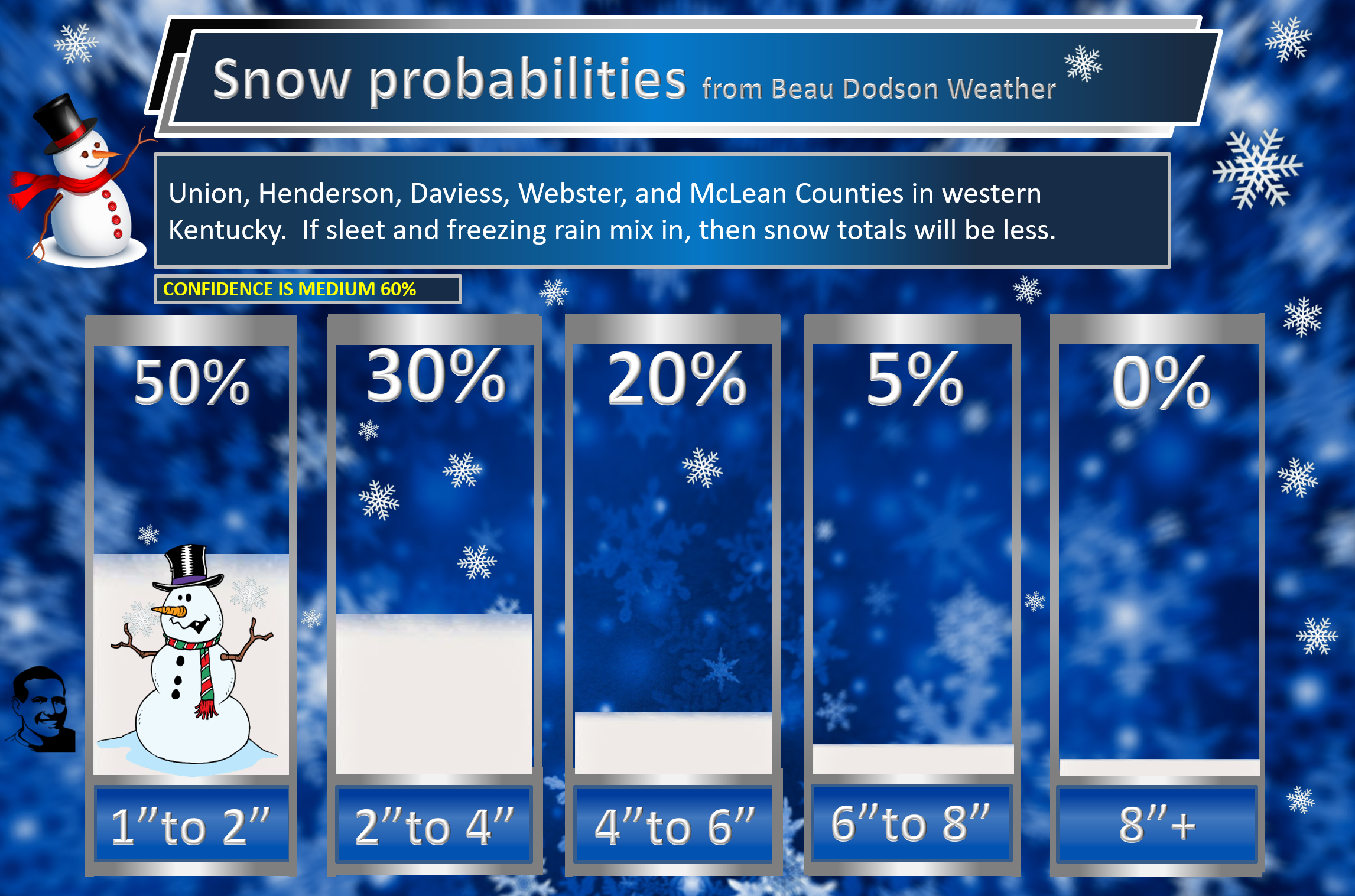
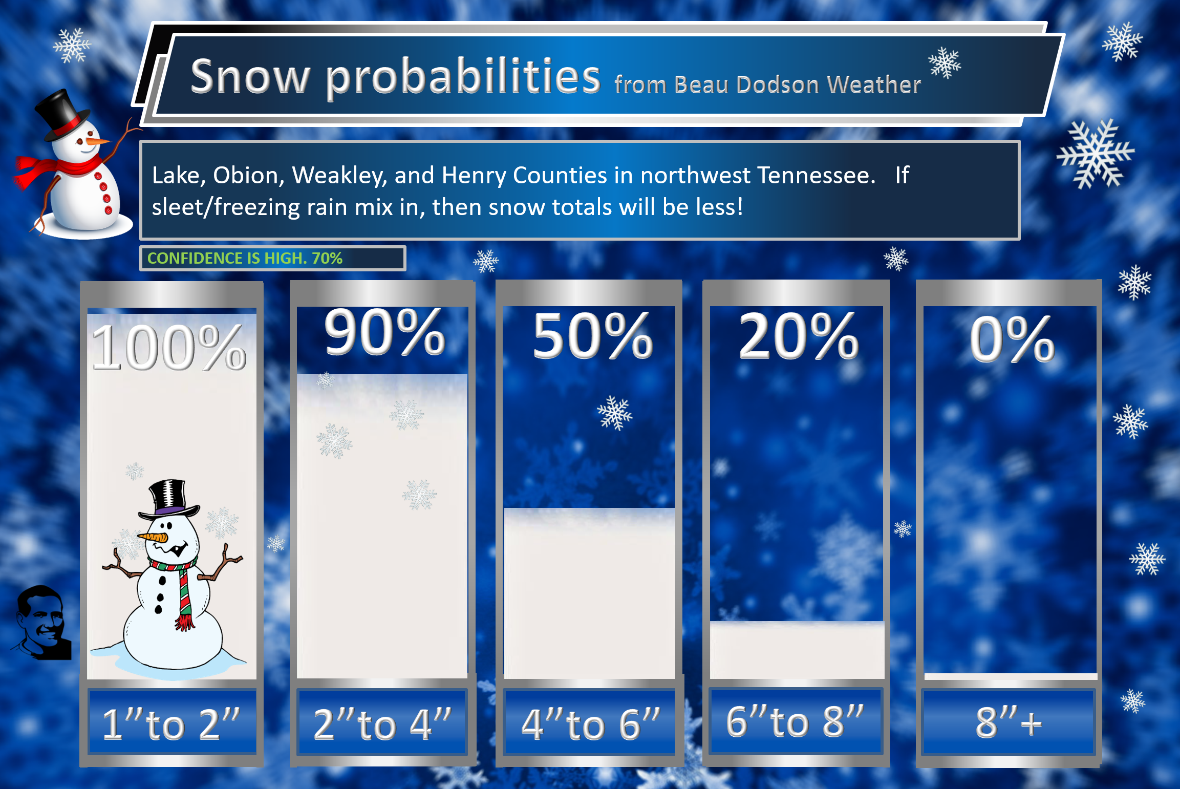
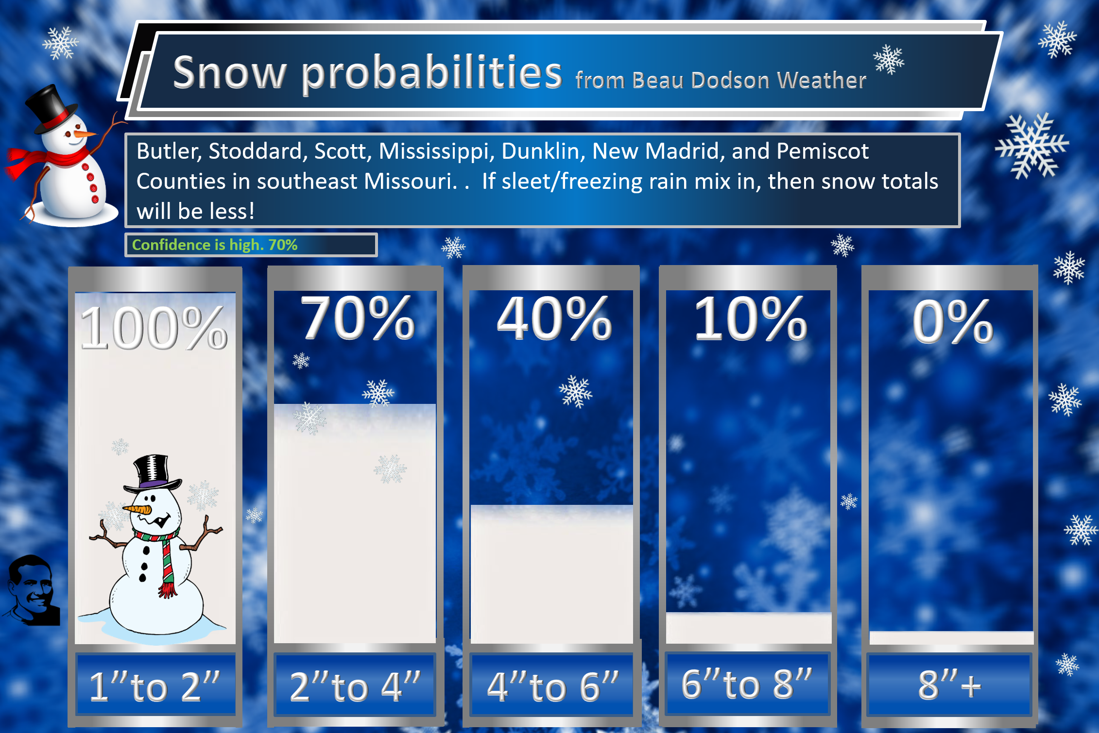
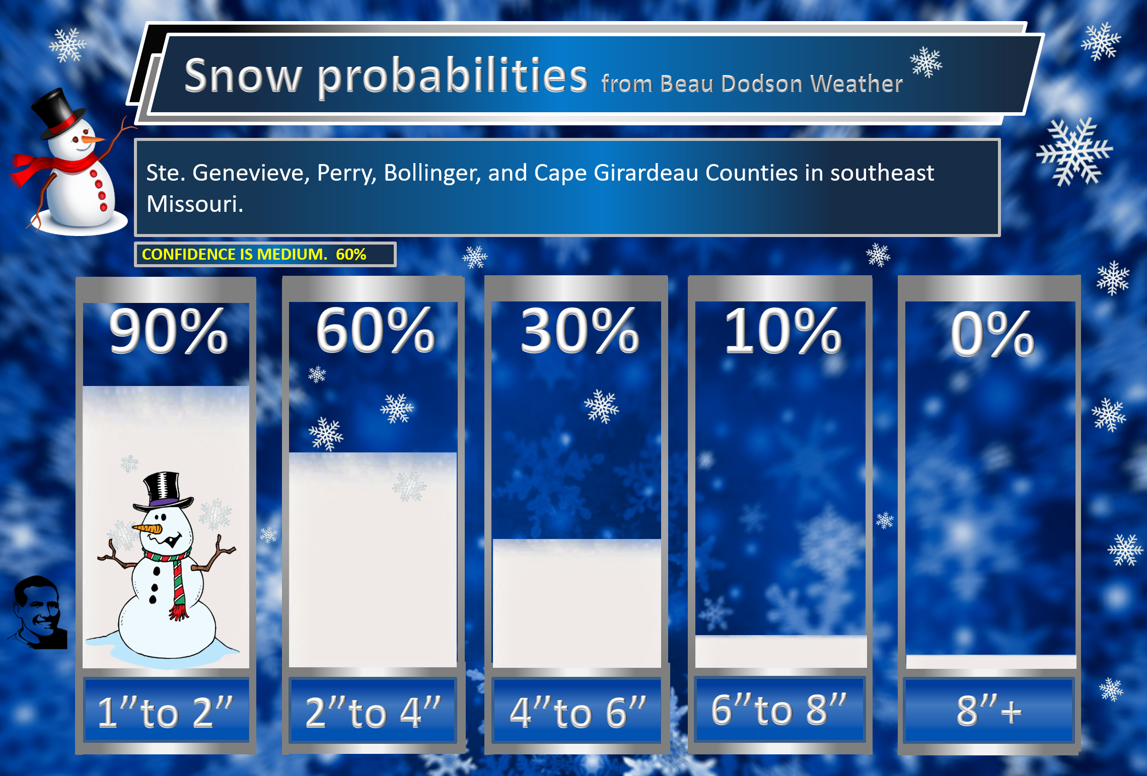
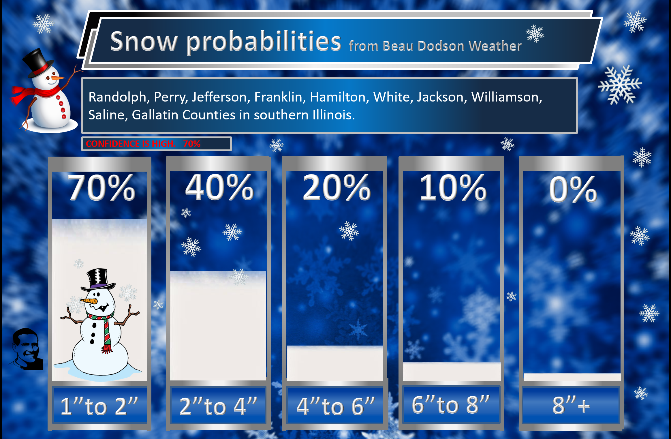
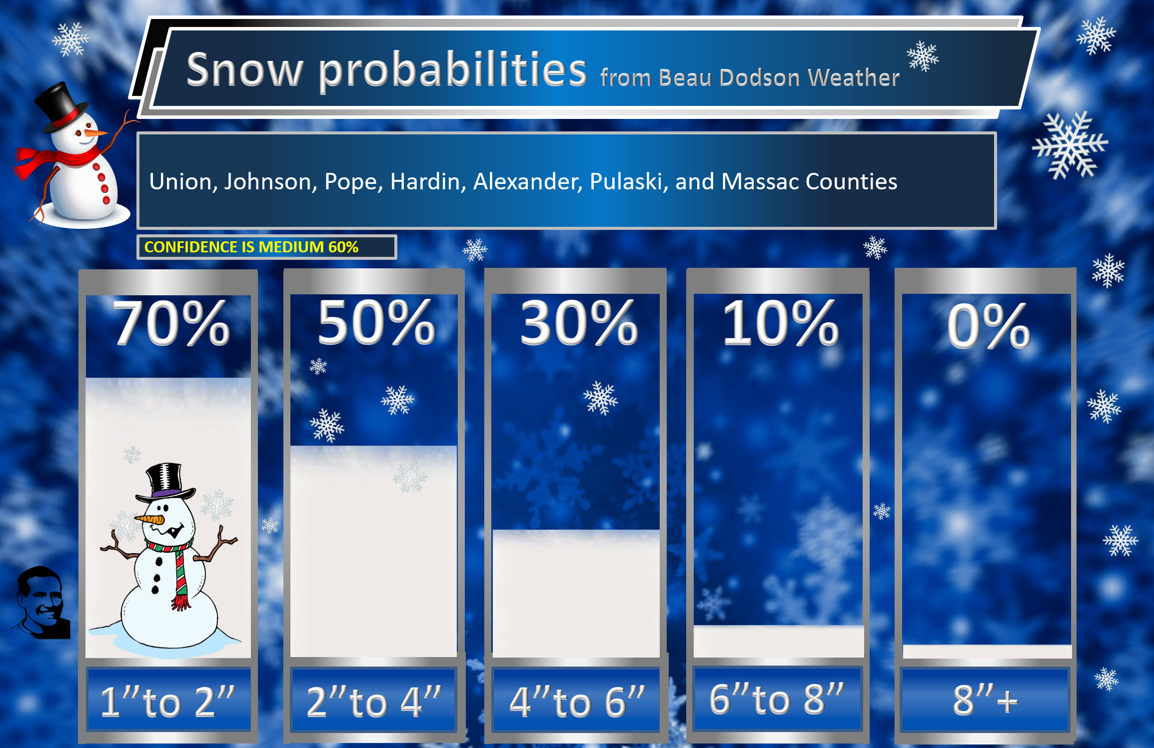
Here is my forecast for snow totals tonight through Thursday.
Each graphic has the county names. Each graphic has the confidence level.
Click them to enlarge them.
I broke it down into counties.
I always ask people to focus on impacts and not totals. Impacts are icy roads and bitterly cold temperatures.
.
KENTUCKY
Tennessee
NW Tennessee
.
MISSOURI
Far southeast Missouri and the Missouri Bootheel
Northern portions of southeast Missouri
.
ILLINOIS
Northern portions of southern Illinois
Far southern Illinois
.
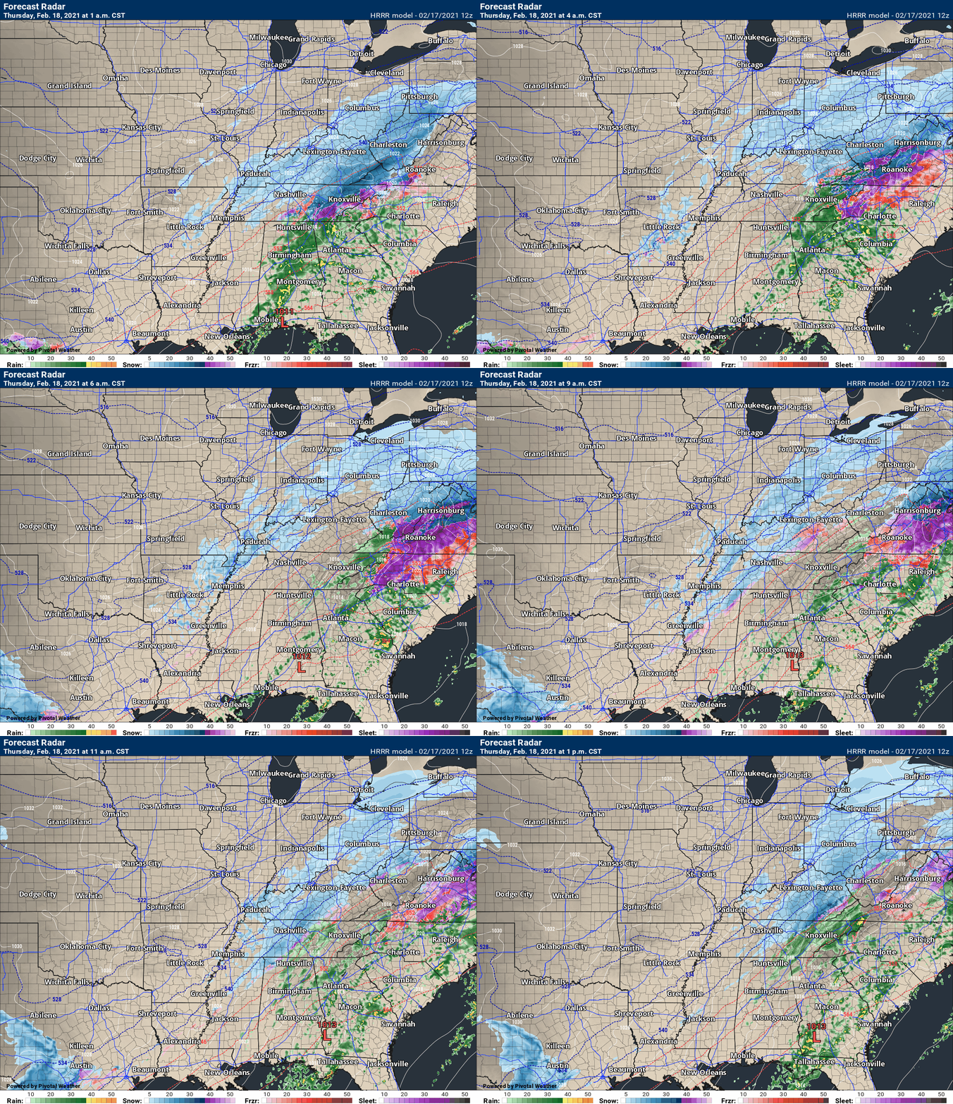
Future-cast radars
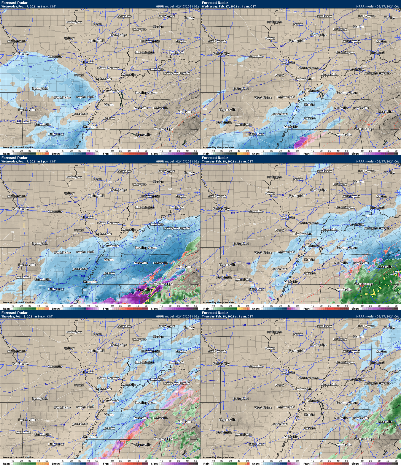
This next animation is the lower-resolution Hrrr American Model.
This animation shows you what radar might look like as the system pulls through the region. It is a future-cast radar.
Time-stamp upper left. Click the animation to enlarge it.
Green is rain. Blue is snow. Purple is sleet. Pink is freezing rain
.
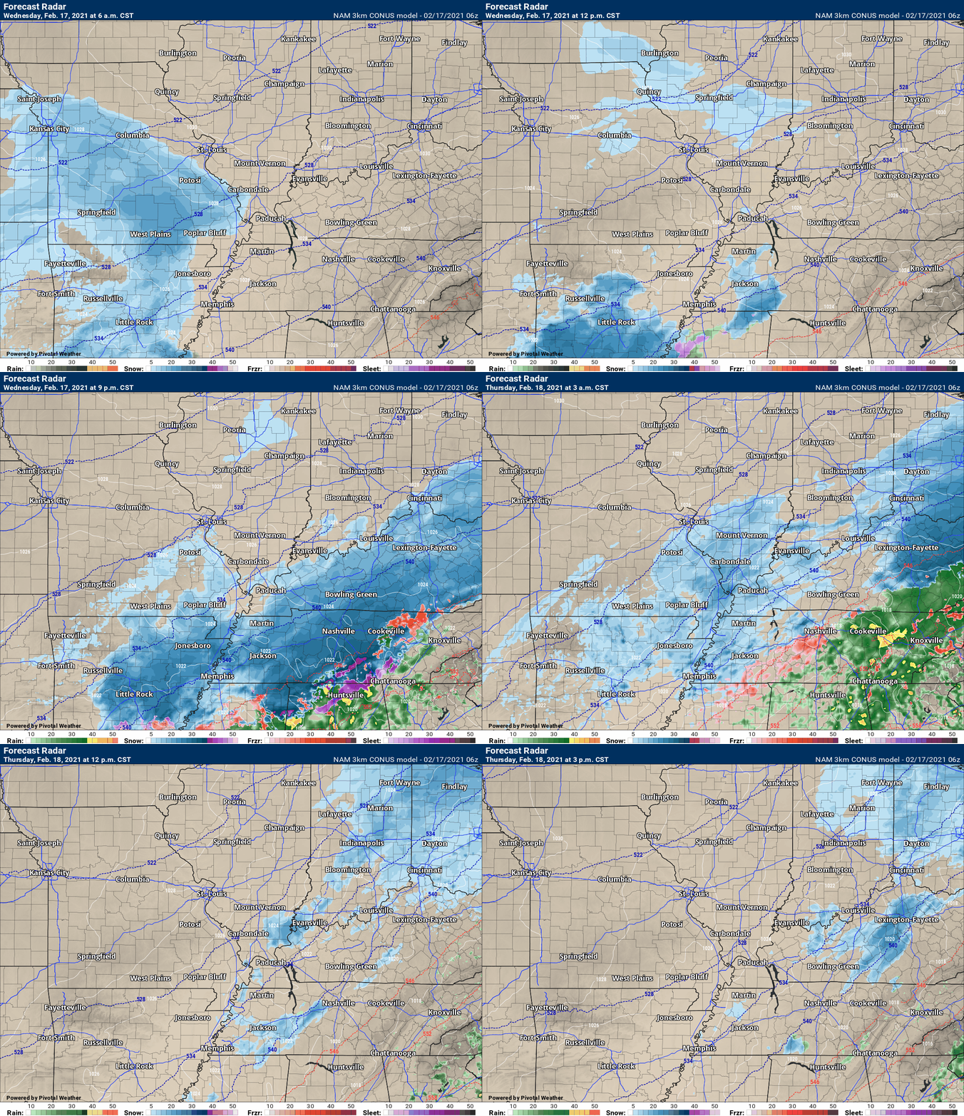
This next animation is the lower-resolution NAM 3K American Model.
This animation shows you what radar might look like as the system pulls through the region. It is a future-cast radar.
Time-stamp upper left. Click the animation to enlarge it.
Green is rain. Blue is snow. Purple is sleet. Pink is freezing rain
.
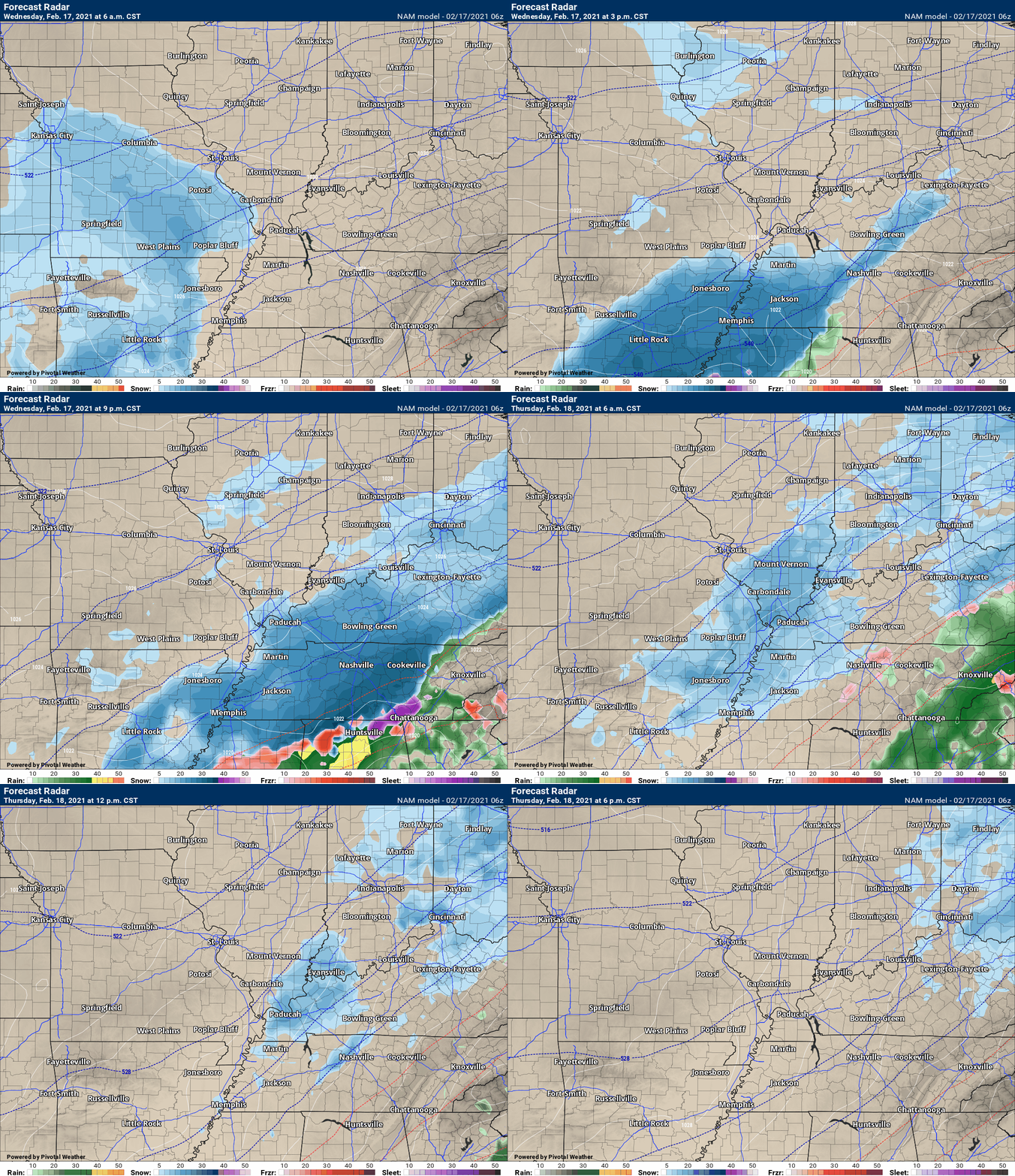
.This next animation is the NAM American Weather Model.
This animation shows you what radar might look like as the system pulls through the region. It is a future-cast radar.
Time-stamp upper left. Click the animation to enlarge it.
Green is rain. Blue is snow. Purple is sleet. Pink is freezing rain.
.
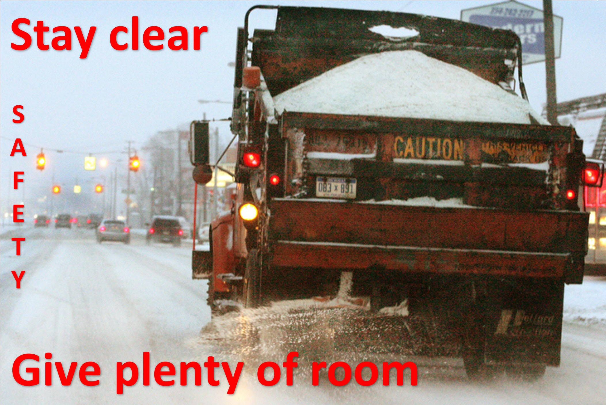
Give room
.
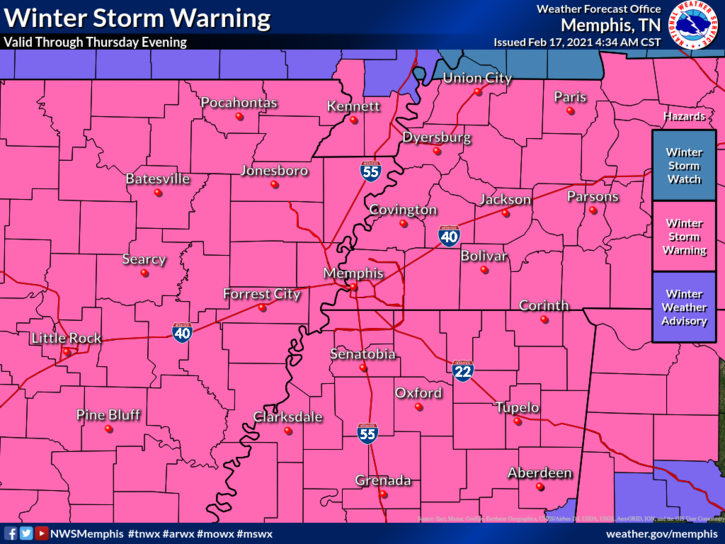
The Memphis, Tennessee NWS has issued a winter storm warning for the Bootheel into northwest Tennessee.
These areas may receive 2 to 4 inches of snow.
Each office has different criteria for watches and warnings. The further south you travel, the lower the snow totals have to be in order to receive a winter storm warning.
.
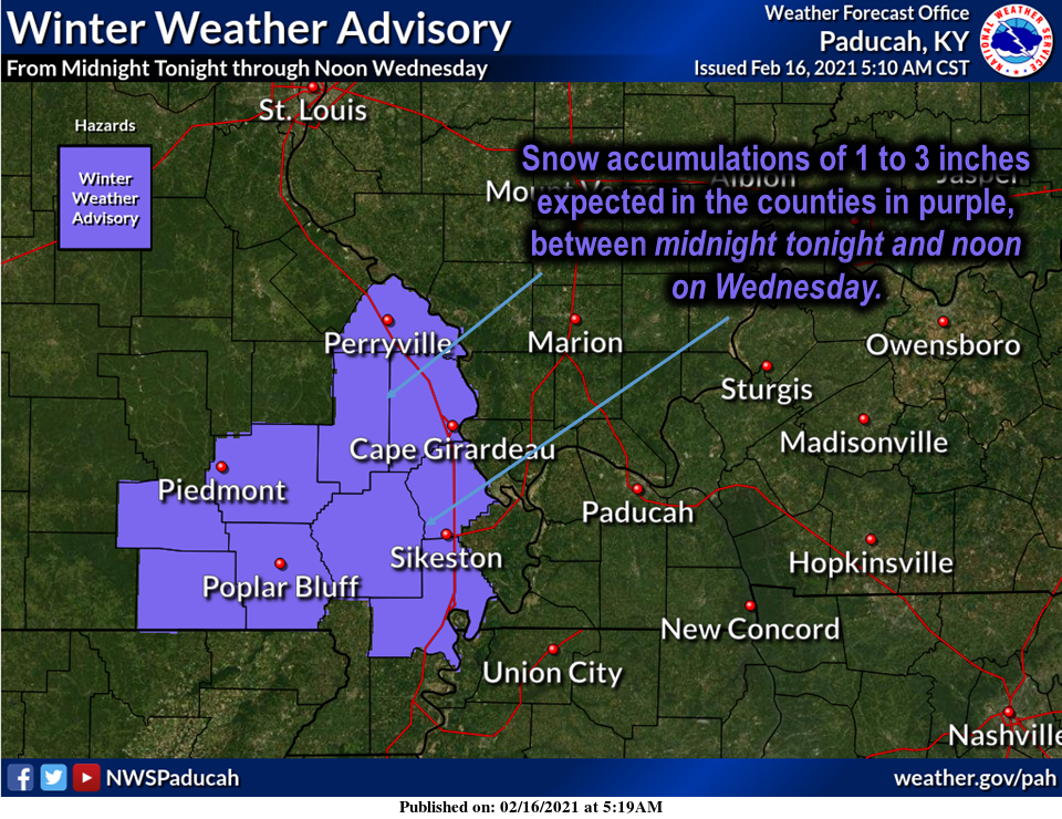
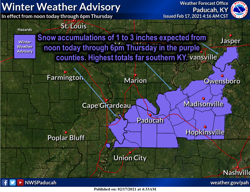
A winter weather advisory has been issued by the Paducah, Kentucky, NWS, for today across southeast Missouri.
The Paducah, Kentucky, NWS did not show the Bootheel and northwest Tennessee on their graphic.
Don’t be confused. The Bootheel and northwest Tennessee are under a winter storm warning today into tomorrow.
They just did not show it here.
This is for the event this morning . A light snow is likely over the winter weather advisory. The forecast is one to two inches with locally up to three inches.
.
Another winter weather advisory has been issued for this area below. This is for this afternoon into Thursday morning.
Again, they did not include Tennessee and the Bootheel in this graphic. Those areas are under a winter storm warning. See the other graphic.
Most of southern Illinois was left out of the advisory because snow totals will be lower in those areas.
There can always be adjustments to these advisories. Keep that in mind.
.
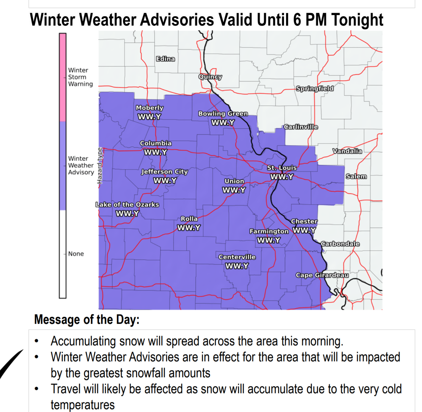
The NWS in St Louis shows you their winter weather advisory for today. A couple of my counties are included in this advisory. This is for light snow today. Accumulation of one to two inches is anticipated.
.
.
.
.
.
February 16, 2021
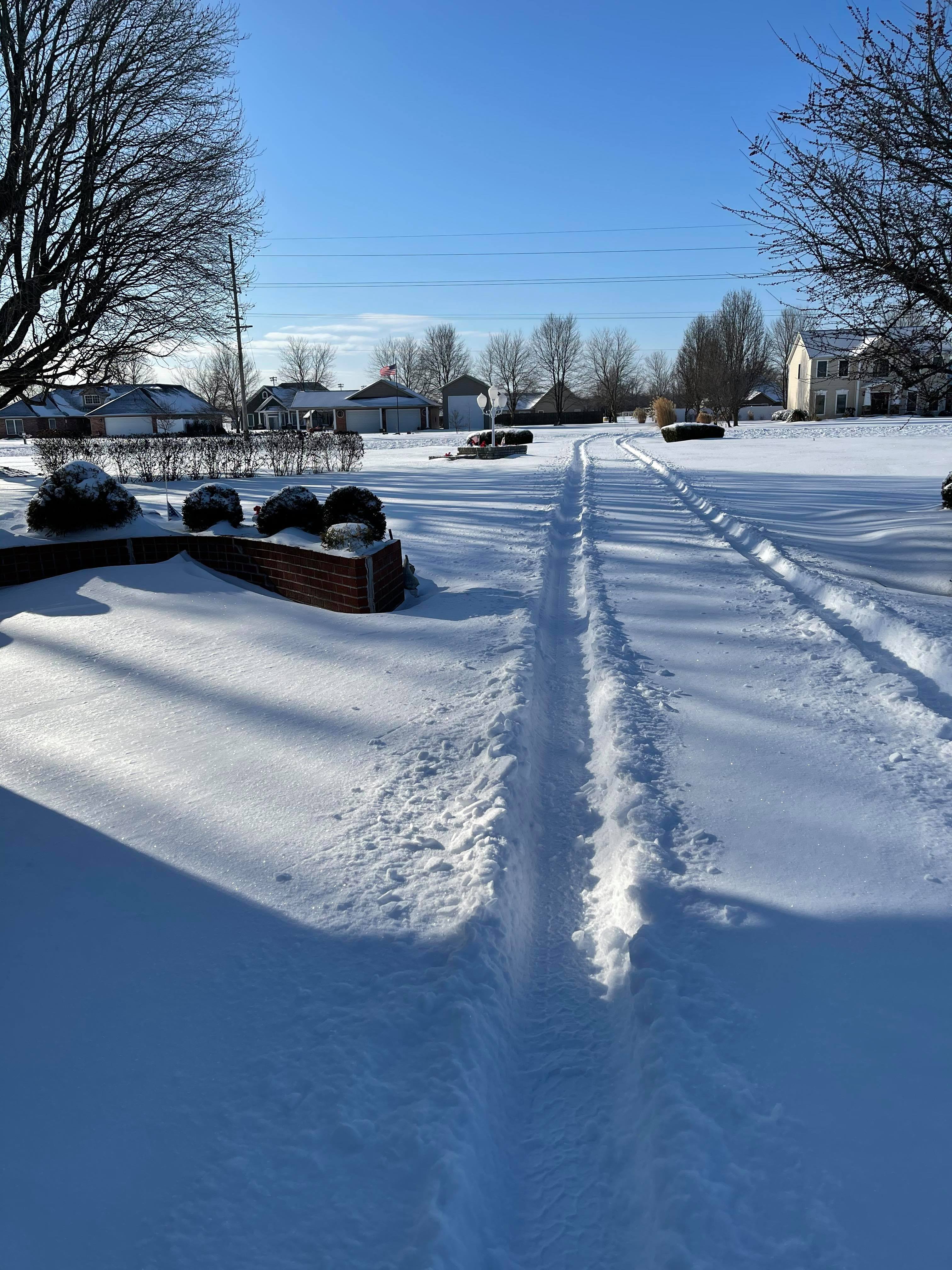
Cody Simmerman sent in this photo from Williamson County, IL. Rough traveling.
.
#NWSPaducah #Tristatewx #ILwx #winter #snow 2/16/21 Good wintry morning Dixon Springs! Tim White photo. pic.twitter.com/u1kk4KJvWX
— Beau Dodson (@BeauDodson) February 16, 2021
#NWSPaducah #Tristatewx #KYwx #winter #snow 2/16/21 Good wintry morning Reidland, Kentucky! Kent Wallace photo. pic.twitter.com/kvoJZF4OvB
— Beau Dodson (@BeauDodson) February 16, 2021
#NWSPaducah #Tristatewx #ILwx #winter #snow 2/16/21 Good wintry morning Simpson, Illinois! Lauren Gray photo.
Simpson, Il Johnson County. What a scene! Deep snow. pic.twitter.com/no1HkgYBlj— Beau Dodson (@BeauDodson) February 16, 2021
#NWSPaducah #Tristatewx #KYwx #winter #snow 2/16/21 Good wintry morning Lone Oak, Kentucky! Alexander Walker photo. pic.twitter.com/W3YB3TougJ
— Beau Dodson (@BeauDodson) February 16, 2021
#NWSPaducah #Tristatewx #KYwx #winter #snow 2/16/21 Good wintry morning Lone Oak, Kentucky! Alexander Walker video. You can see each snowflake. Cool factor! pic.twitter.com/0jTbaE6NzH
— Beau Dodson (@BeauDodson) February 16, 2021
.
Today’s social media links
Facebook
https://www.facebook.com/beaudodsonweather/posts/4242947232401419
Winter Storm Blog
https://wp-talk.weathertalk.com/february-11th-through-february-16th-2021-winter-storm-updates/
Interactive-city-view radars. Winter weather radar. Click winterize to see precipitation type.
Backup radar site in case the above one is not working.
https://weathertalk.com/morani
Regional Radar
https://imagery.weathertalk.com/prx/RadarLoop.mp4
Lightning Data (zoom in and out of your local area)
https://wtalk.co/WJ3SN5UZ
.
Give room
Check your WeatherTalk accounts.
Please check your www.weathertalk.com account to make sure your payment information is up to date. Log in. If you see “yellow colors” then it has not been updated. It will say free account. Click the update payment tab and go from there. I appreciate it.
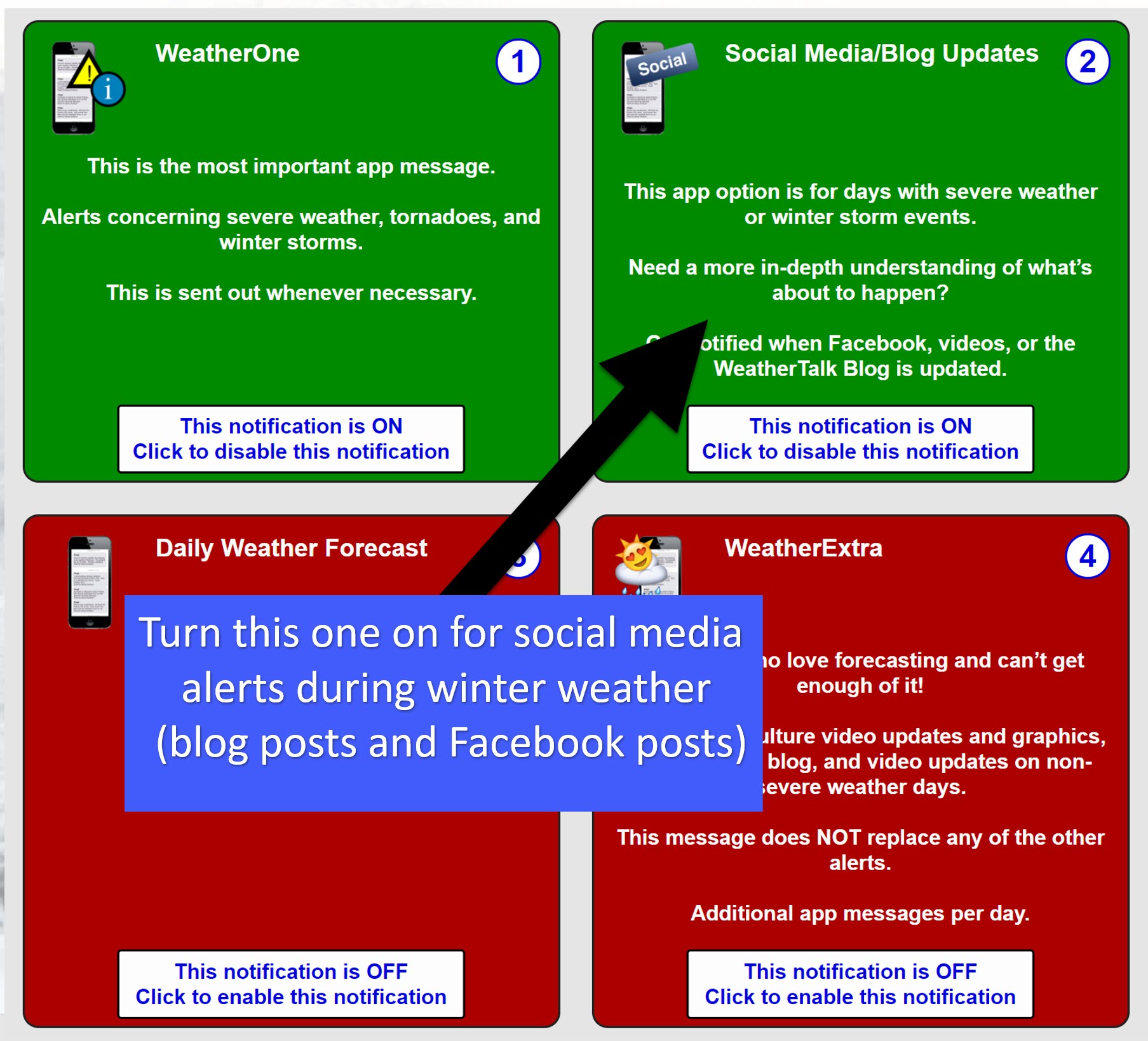
If you want to know when I send out a new winter weather social media alert then make sure you have this turned on in your www.weathertalk.com account
If you have questions or problems then email me at beaudodson@usawx.com
Find that here
.
Note: We added a “see all” button on the website. This allows you to see every message that I have sent out (to all my forecast counties).
Here is the link. Click here.
To view the live radars, visit these links.
Radars
Interactive city-view radars
http://weatherobservatory.com/weather-radar.htm
A third backup radar
https://weathertalk.com/morani
Clickable watches and warnings can be viewed on the local city-view interactive radars (link above). Be sure and turn on the warnings above the local radars.
A new regional radar we offer
https://imagery.weathertalk.com/prx/RadarLoop.mp4
Lightning data
https://wtalk.co/7QT7WHKU
Not receiving app/text messages?
USE THE APP. ATT and Verizon are slowing or stopping the text messages.
Make sure you have the correct app/text options turned on. Find those under the personal notification settings tab at www.weathertalk.com. Red is off. Green is on.
Subscribers, PLEASE USE THE APP. ATT and Verizon are not reliable during severe weather. They are delaying text messages.
The app is under WeatherTalk in the app store.
Apple users click here
Android users click here
.

Live lightning data: Click here.


