
.
Good morning, everyone.
Welcome to Sunday! I hope you had a nice Saturday!

I am experimenting with simplifying the daily blog. Send me comments at beaudodsonweather@gmail.com
.
A quick forecast glance. Your 48-hour forecast Graphics


.
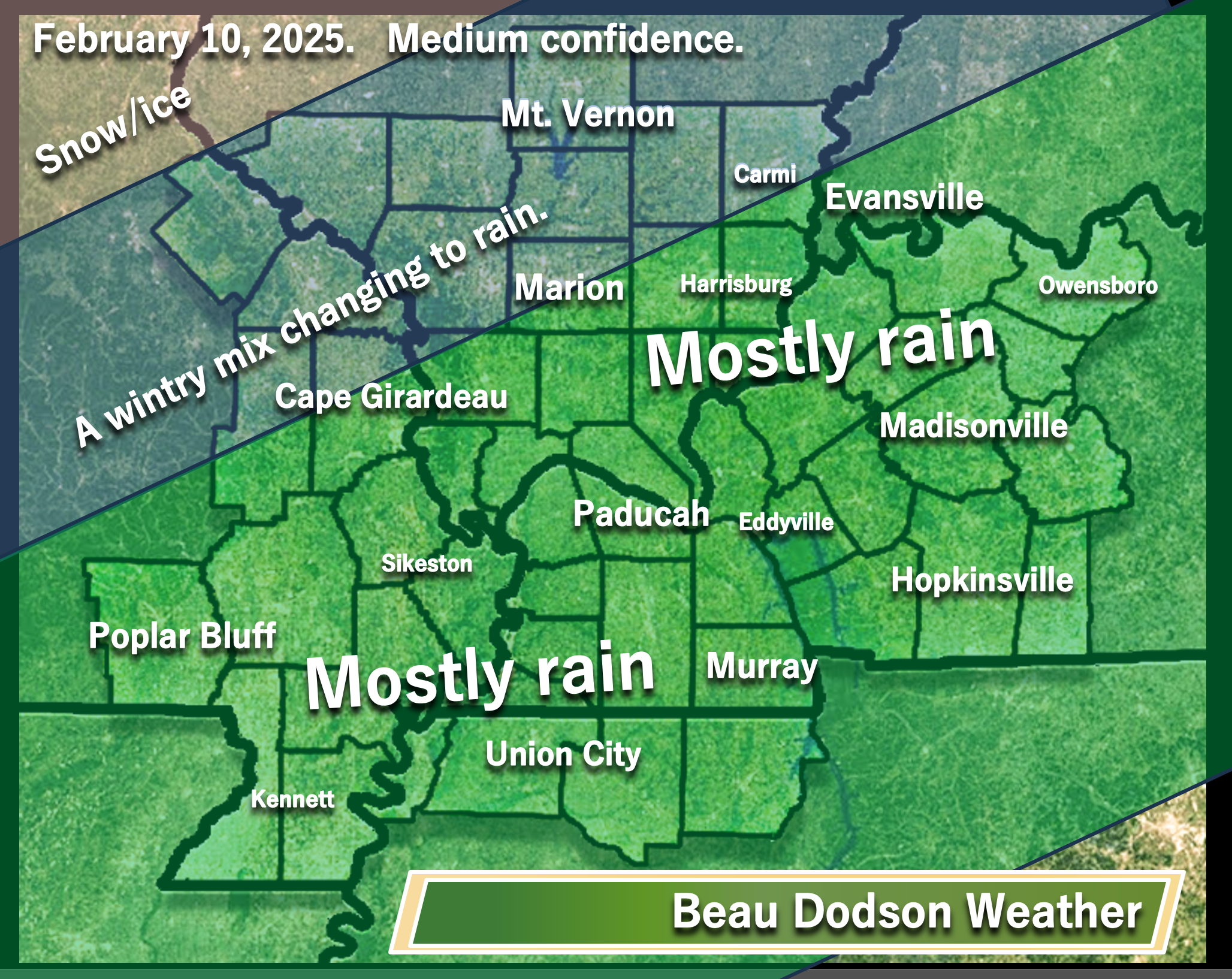
Bottom Line Up Front.
- Mostly dry today. Increasing clouds. Chilly temperatures. A slight chance of late afternoon showers over southeast Missouri.
- Rain (south) and snow (north) tonight ending tomorrow west to east. It is possible that our far northern counties receive very little precipitation with this first event.
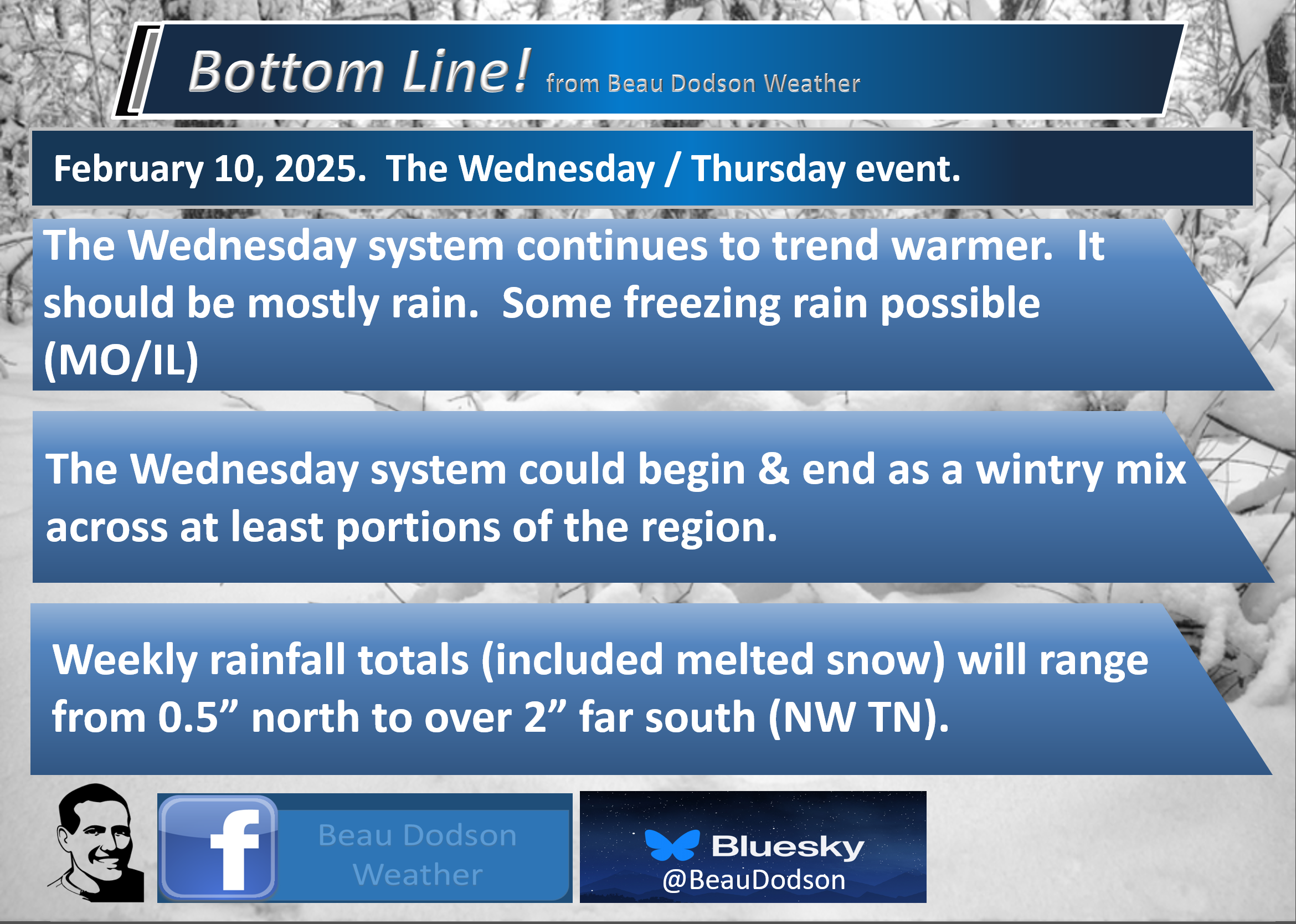
- Rain likely Wednesday/Wednesday night. It may begin as freezing rain over portions of SE MO/south IL.
- Rain likely Friday night into Saturday night. For now, this looks to be mostly a rain event.
.

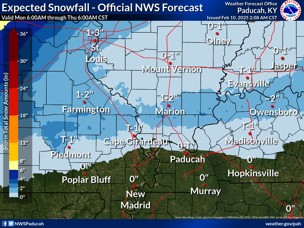
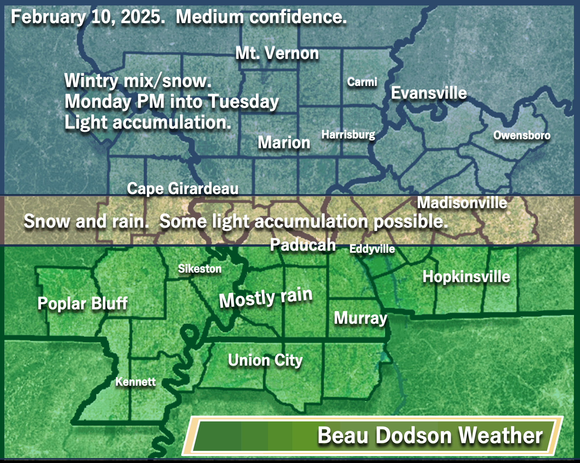
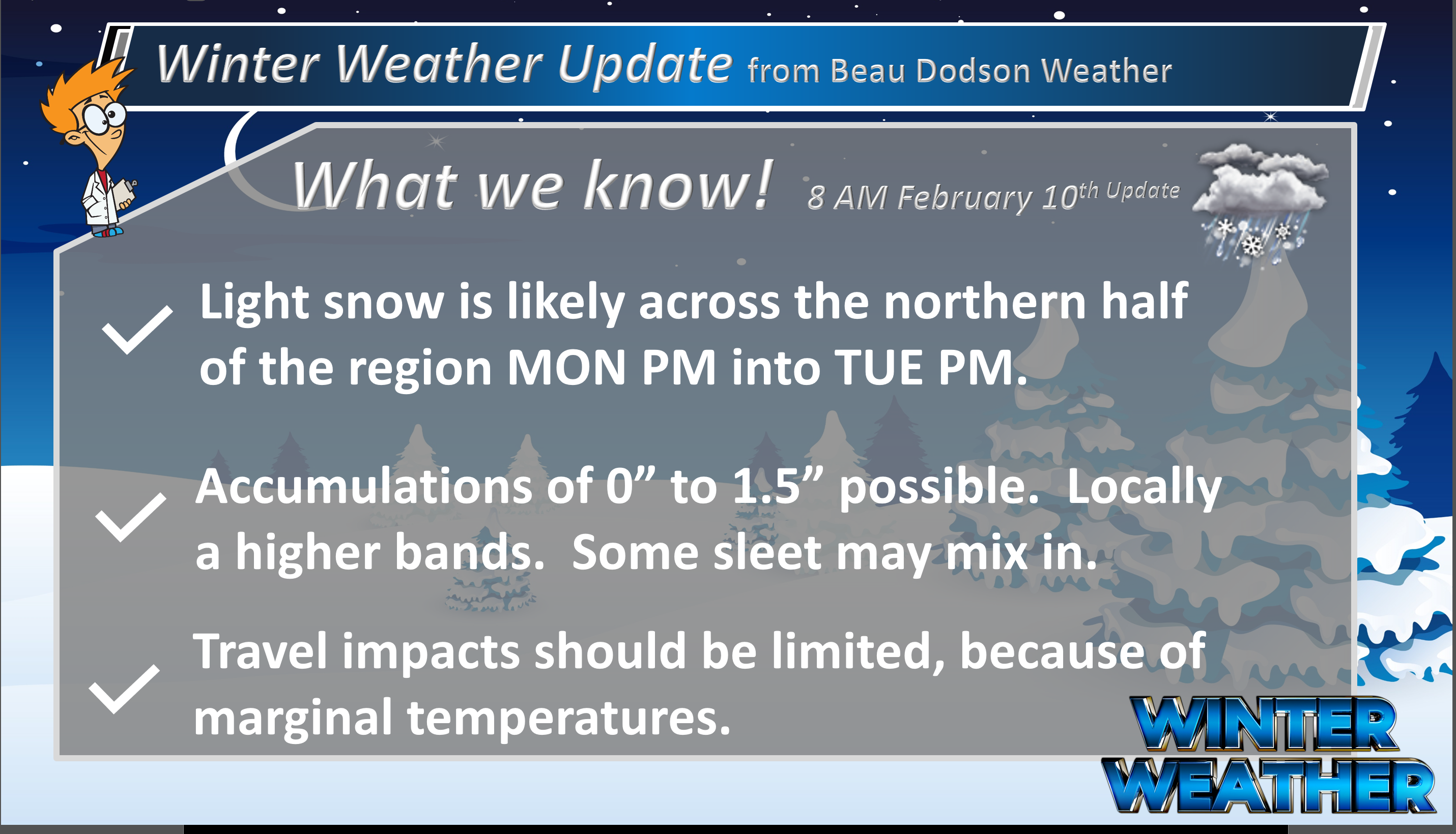
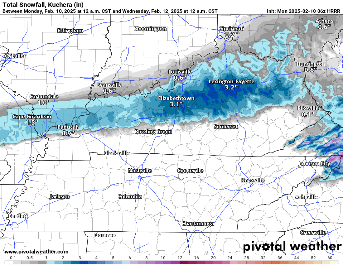
Here are the current snow totals forecast for tonight and tomorrow. Temperatures will be marginal for this event. That could mean main/treated roads remain mostly wet. Watch elevated surfaces and untreated roadways.
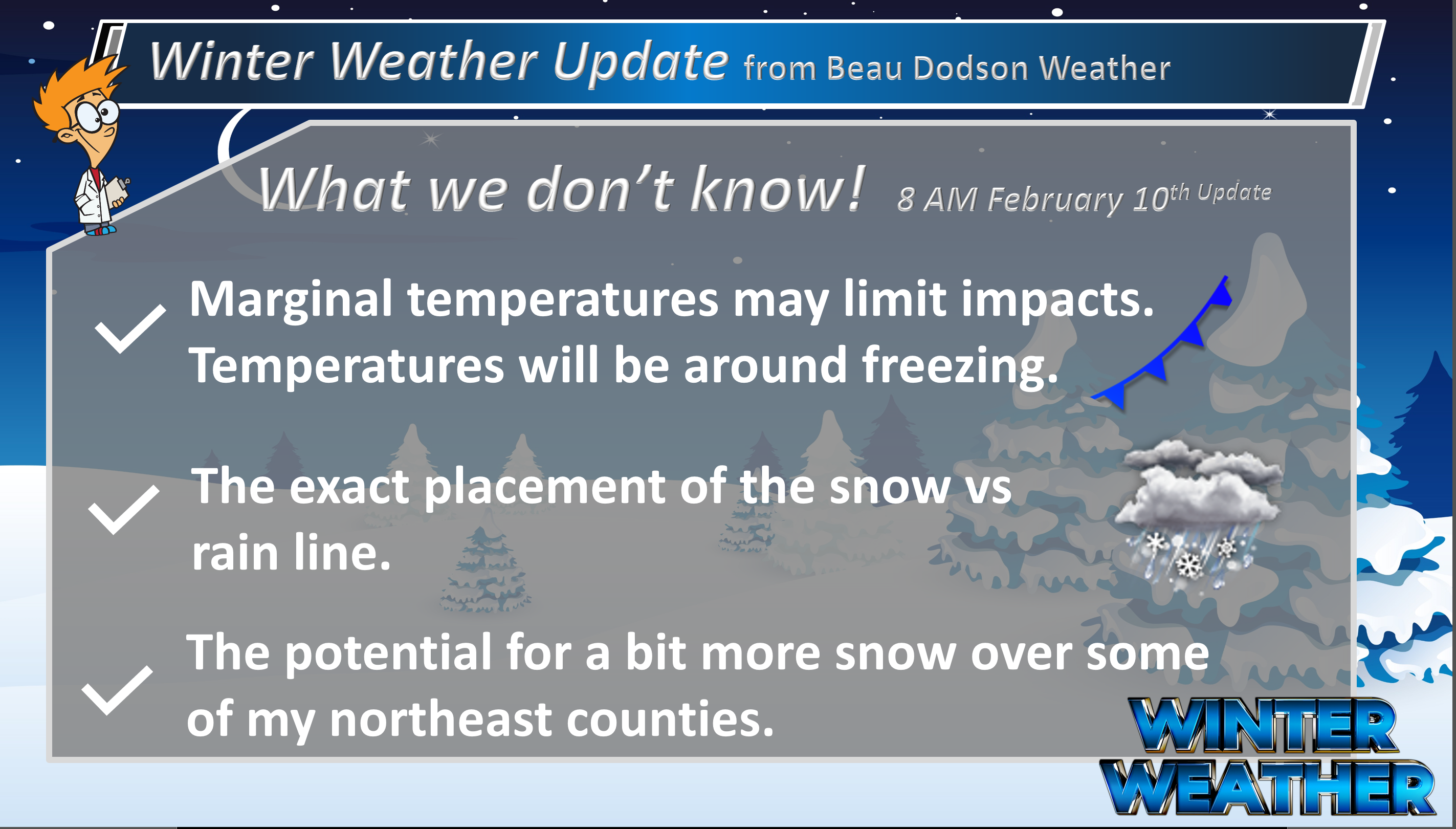
Notice that band of slightly higher totals from west to east. We will need to monitor that. Some data shows a thin band of heavier totals. A chance of one or two degrees, in the temperature department, would make all the difference.
It is possible that our far northern counties receive very little precipitation with this first event.
My forecast from two days ago matches the NWS almost to the mile.
Here are the expected snowfall totals. Most of this would fall tonight into Tuesday morning/afternoon.
.
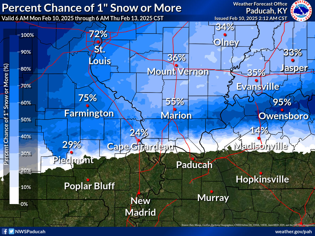
What is the probability of 1″ of snow? Again, see that darker band across portions of southeast Missouri, southern Illinois and then into northwest Kentucky? I will monitor that.
Southern counties will remain mostly rain. Wet roadways.
.
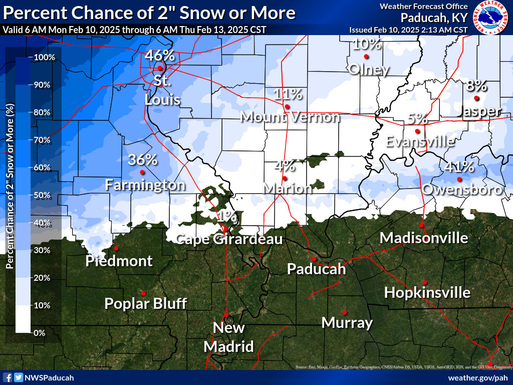
What is the probability of two inches of snow tonight and tomorrow? The upper left portion of the graphic includes a second system that arrives on Wednesday.
.

An active weather pattern today into the weekend. Multiple rounds of precipitation.
Two precipitation events between Monday and Thursday. A third arrives Friday night into Saturday.
Watches and warnings
The National Weather Service held off on issuing a winter weather advisory and instead went with a special weather statement for tonight and tomorrow for portions of the region. If confidence increases that slightly higher snow totals may materialize, then they can always upgrade it to a winter weather advisory.
Temperatures
Again, temperatures are going to be marginal for snow and sleet tonight into Tuesday.
With that said, it will be cold enough for some accumulation across portions of the region. Treated roadways should be okay. Untreated roadways could be slick. Monday night into Tuesday. As always, use care.
.
.
If temperatures were slightly colder, this would be a bigger event. Marginal temperatures will cut down on snow totals.
The Wednesday system appears warmer. It could still begin as freezing rain and sleet across portions of the region. It would then change to rain.
If you have travel plans in the region (or northward) then monitor updates over the coming days. Some wintry precipitation is likely to develop.
.
System one (Monday/Tuesday)
We have increasing chances of precipitation area-wide this evening into Tuesday. Ending over western Kentucky Tuesday afternoon. See the future-cast radars below.
It appears the battle-zone between snow and rain will be draped across southeast Missouri eastward along/near the Ohio River in southern Illinois/west Kentucky and then eastward from there.
Not much has changed over the last 48 hours. My initial forecast holds.
Southern counties should be mostly rain with no travel impacts (wet roadways).
Bottom line on the Monday/Tuesday system
.

.
Here is where I drew the rain vs snow line. The battle-ground zone in the middle could go back and forth. It would be a wet slushy snow.
.
Bottom line on the Wednesday/Thursday system
 .
.
.
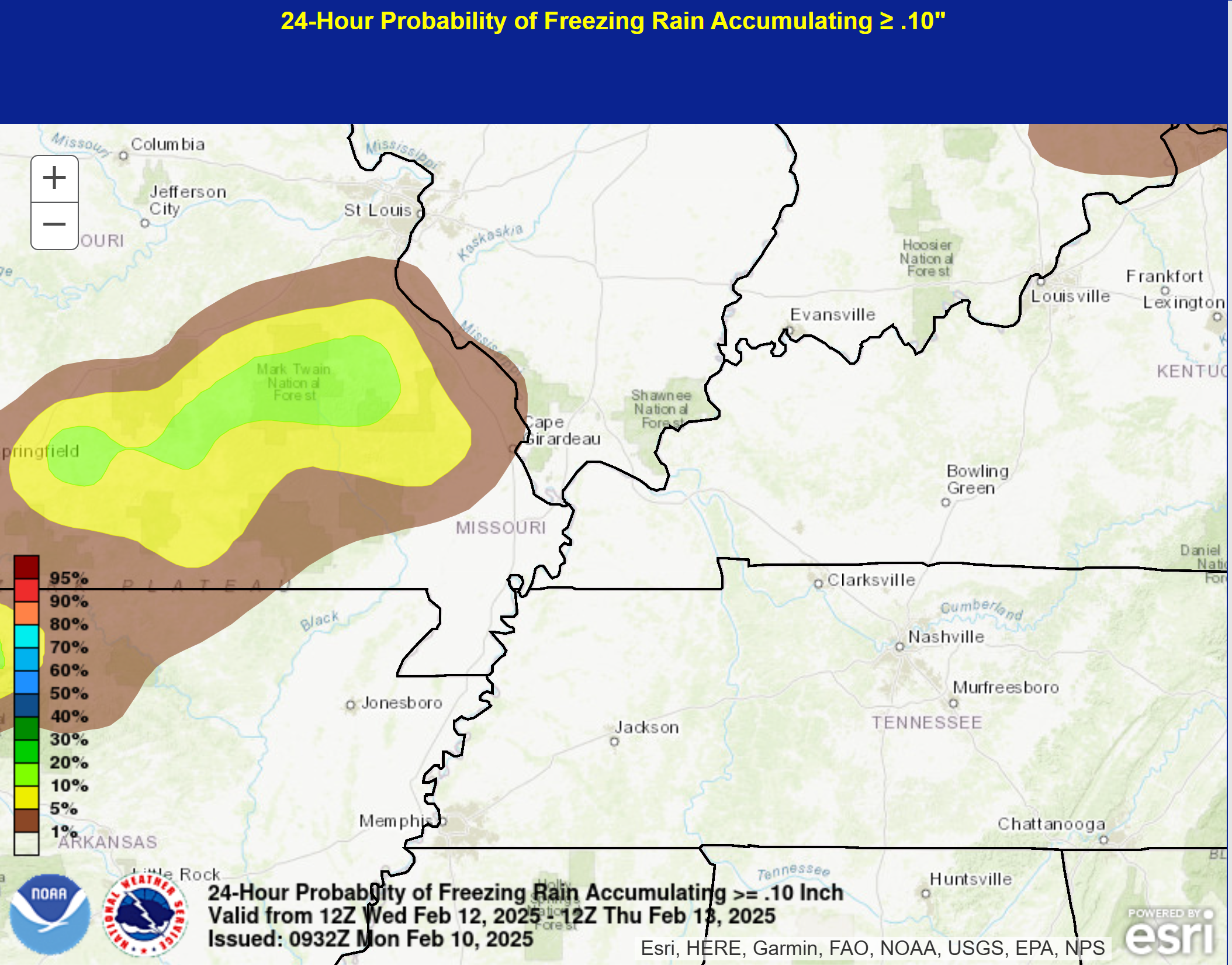
The Wednesday and Wednesday night system
.
Here is the probability of 0.10″ of freezing rain with the Wednesday system.
I will monitor southeast Missouri and portions of southern Illinois. With time, it would change to rain.
.
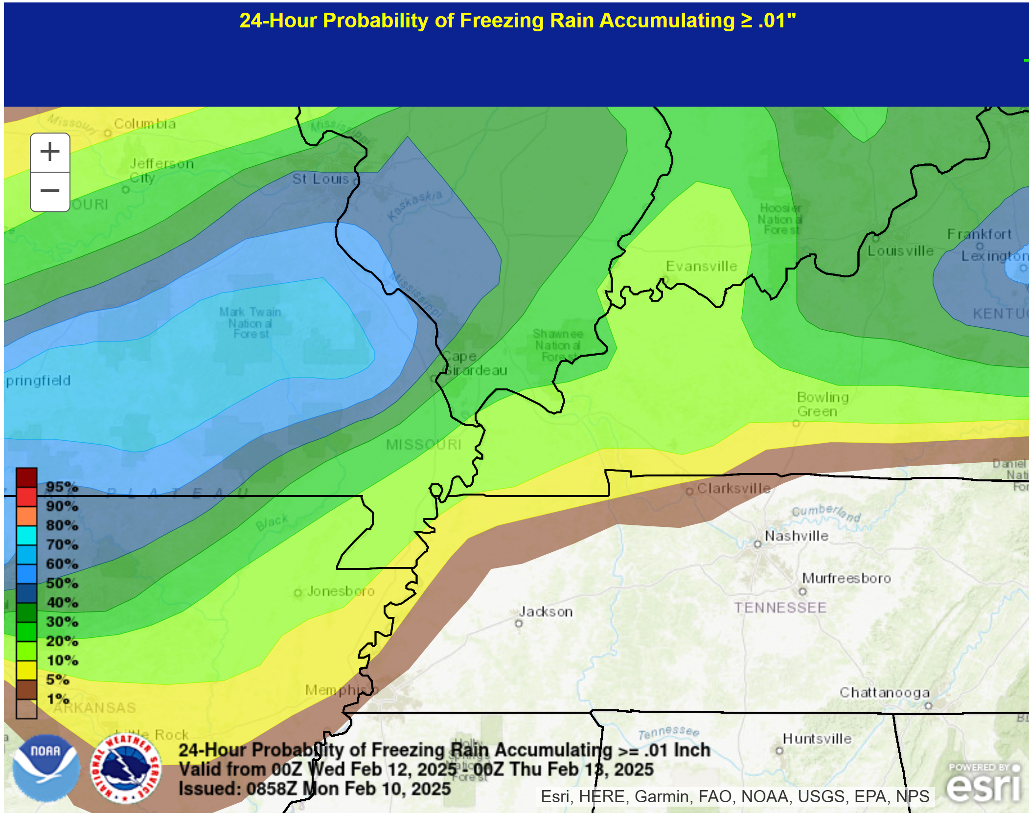
Here is the probability of 0.01″ trace amounts of freezing rain. Don’t focus on the lower probabilities. The main concern would be across portions of southeast Missouri and southern Illinois. The blue colors are the primary concern. Perhaps the dark green zone, as well.
 .
.
.
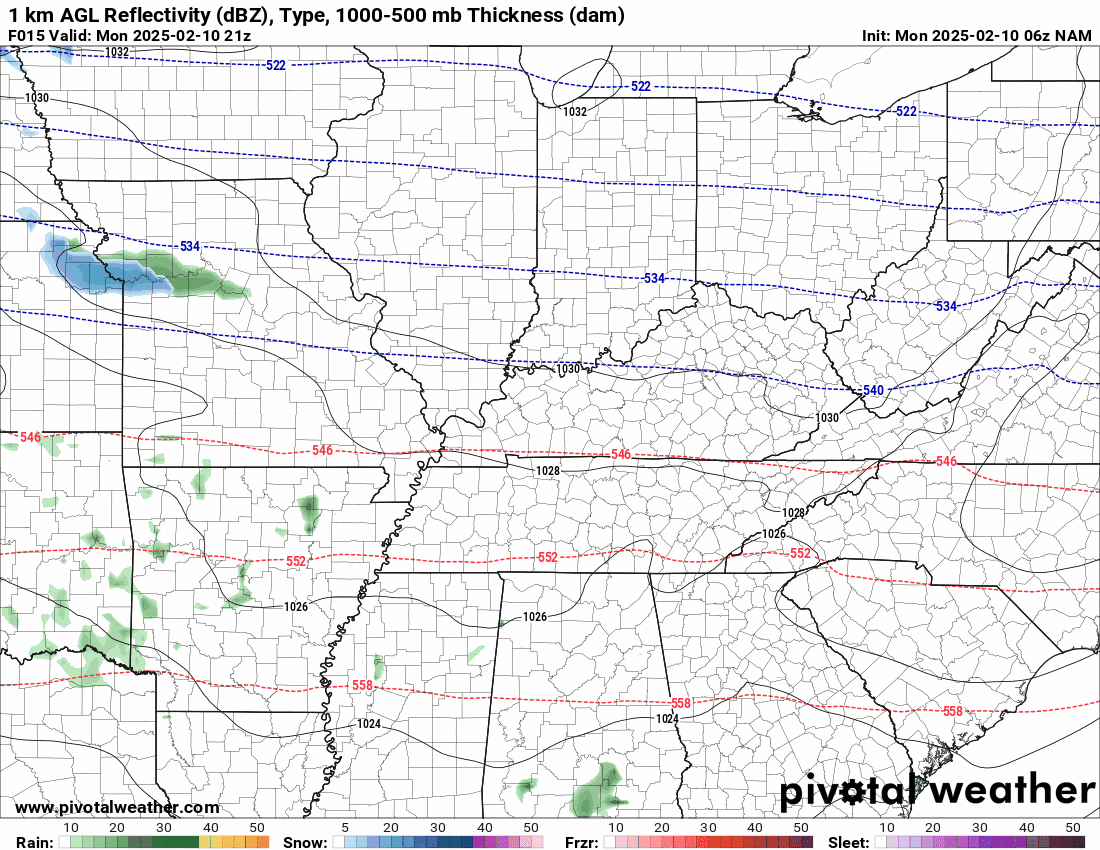
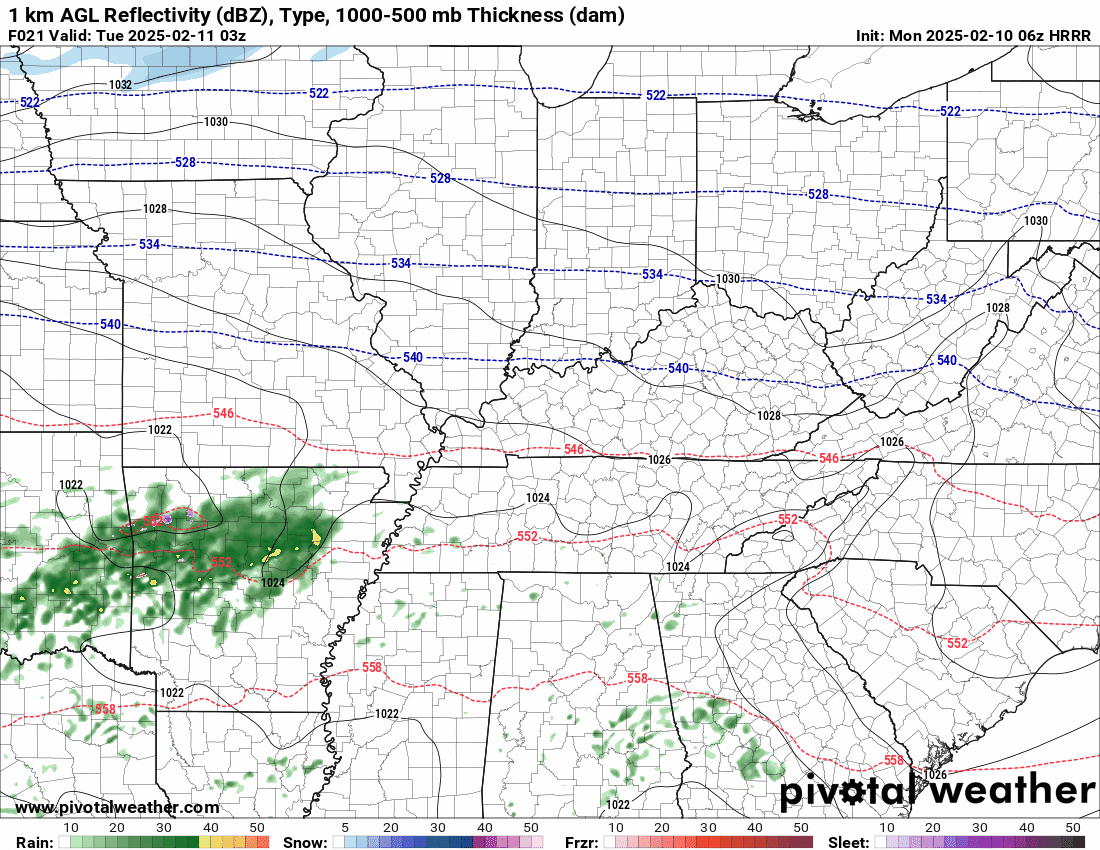
Future-cast Radars. What radar might look like with these events.
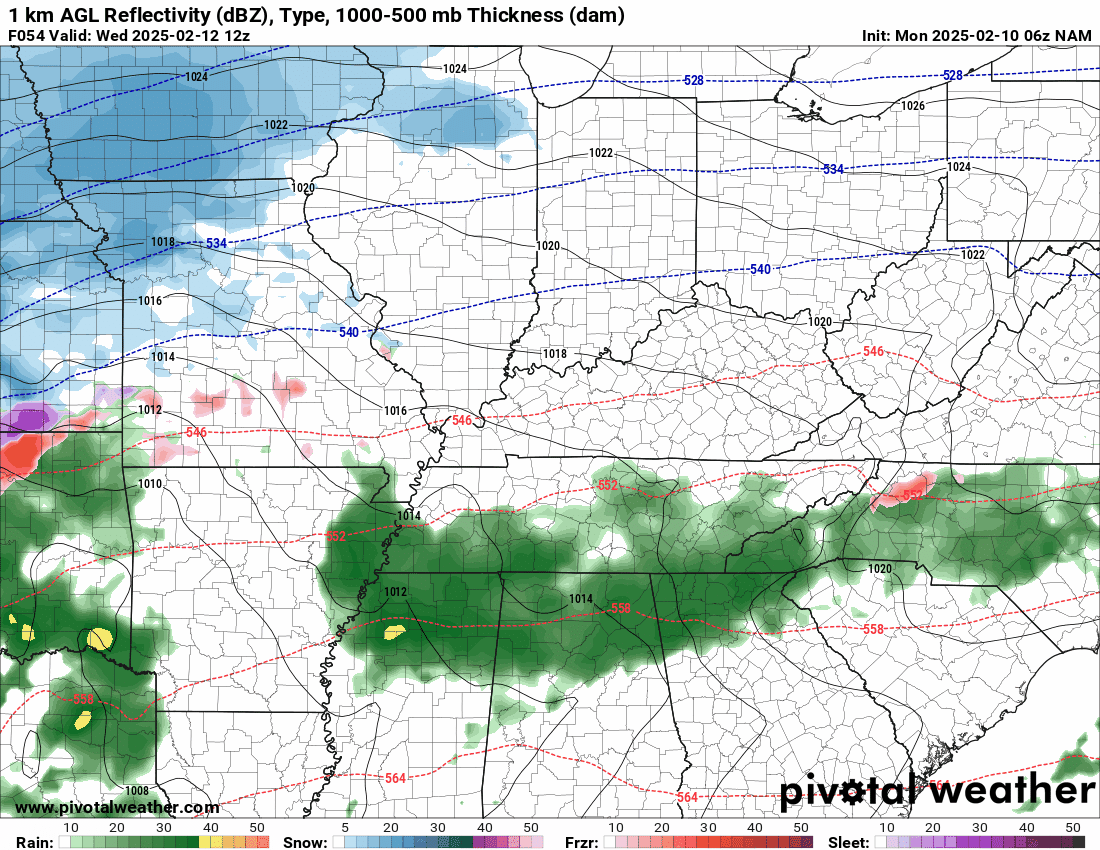
Here is the NAM model future-cast radar for the Monday and Tuesday event. The time-stamp is located in the upper left portion of the animation.
Blue is snow. Pink is ice. Green and yellow represent plain old rain.
As you can see the region is split in half. The NAM is slightly warmer and has the rain/snow line about one county north of other data.
Double click on animations to enlarge them.
Time stamp is in Zulu. 00z=6 pm. 06z=12 am. 12z=6 am. 18z=12 pm.
.
Here is the high resolution Hrrr model. This is the tonight/tomorrow event.
It is about one county south of the NAM model with the snow rain line.
.
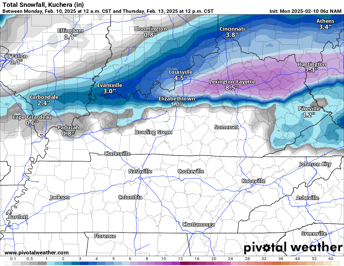
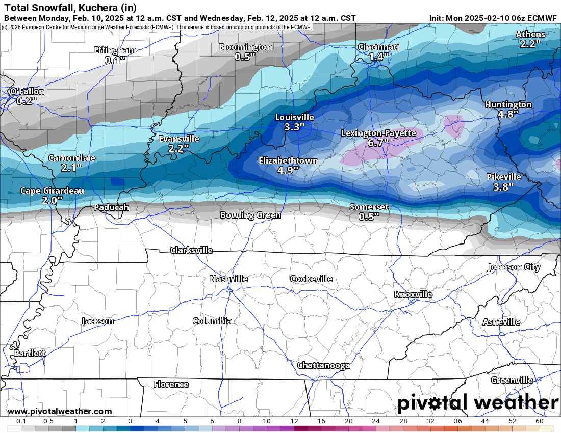
Let me quickly show you some model snowfall totals. The general theme is enough.
Hrrr model. Again, see those slightly darker colors in northwest Kentucky? I am watching that.
.
NAM model.
.
EC model. Again, see that slightly darker zone of colors across portions of southern Illinois and northwest Kentucky? I will keep an eye on that zone for a heavier band.
.
.
Then, we have a brief lull in the precipitation as we move through Tuesday night.
Another system quickly moves in Wednesday into Thursday!Confidence is increasing that this system will be a bit warmer.
Precipitation could begin and end as a wintry mix, but it looks mostly like a rain event. Still a few days away (so monitor updates).
Here is what the NAM model shows for the Wednesday event. Blue is snow. Red is freezing rain. Purple is sleet. Green is rain. Yellow is moderate rain.
I will be closely monitoring the freezing line. As you can see, the NAM model does bring at least a brief period of freezing rain to portions of the region (the red colors).
.
.
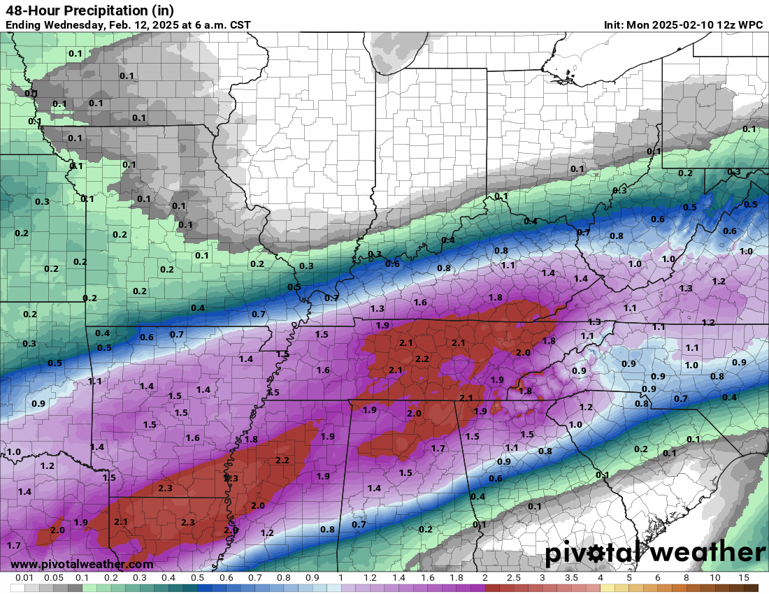
Let’s look at the rainfall or melted totals from system one. This is today through Wednesday morning.
You can double click these two graphics to enlarge them. The print is pretty small.
.
Here are the seven day rainfall totals. This includes the weekend rain event. Check out those heavy totals to our south! A lot of that water in Tennessee will flow northward. River flooding could become a concern for some.

.
Flooding Concerns?
Locally, the flood risk doesn’t look all that concerning. There could, however, be some overland field flooding, ditches flooded, sharp rises on streams, and nuisance flooding of commonly flooded roadways. Especially by the mid-week and late-week system. We will need to monitor rain totals, especially over Kentucky and Tennessee.
.
As mentioned above, another system is likely to bring rain to the region Friday night into Saturday. That system looks warm with showers and perhaps even some rumbles of thunder.
I will closely monitor temperatures at the beginning and end. I can’t rule out a brief wintry mix.
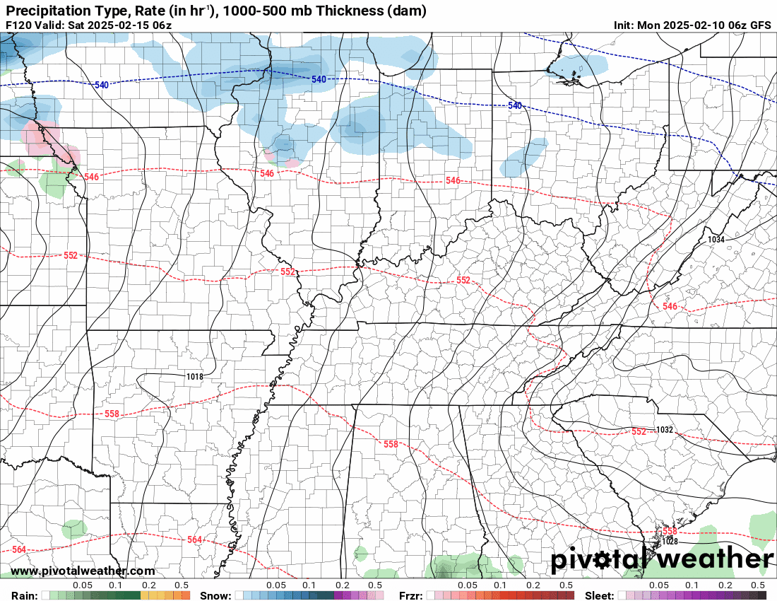
Here is what that looks like on the GFS model. The time-stamp is located in the upper left.
.
Here are two videos.
Here is my seven day video update
.
The St Louis, MO NWS posted this one (this covers my far northwest counties). They don’t really cover the rest of my forecast area.
This covers my northwest counties.
.
The latest eight to fourteen day temperature outlook looks chilly. Blue represents below average temperatures.
We will just have to see if precipitation accompanies these colder temperatures.

.
We have a few sponsors that are helping cover new technology costs! Check them out.
Heating problems?
One Hour Heating and Air – Click Here

Connected and Protected.
They Specialize in Audio, Video, Networking, Security, Cameras, Electrical, New Construction, Remodels, and retrofitting Jobs. Experience the future of smart living and unmatched security with Connected & Protected Solutions today.
Link – Click here

Roof damage from recent storms? Link – Click here

![]()
![]()

.
Click here if you would like to return to the top of the page.
.Average high temperatures for this time of the year are around 46 degrees.
Average low temperatures for this time of the year are around 29 degrees.
Average precipitation during this time period ranges from 0.90″ to 1.20″
Six to Ten Day Outlook.
Blue is below average. Red is above average. The no color zone represents equal chances.
Average highs for this time of the year are in the lower 60s. Average lows for this time of the year are in the lower 40s.

Green is above average precipitation. Yellow and brown favors below average precipitation. Average precipitation for this time of the year is around one inch per week.

.

Average low temperatures for this time of the year are around 29 degrees.
Average precipitation during this time period ranges from 0.90″ to 1.20″
.
Eight to Fourteen Day Outlook.
Blue is below average. Red is above average. The no color zone represents equal chances.
Green is above average precipitation. Yellow and brown favors below average precipitation. Average precipitation for this time of the year is around one inch per week.

.
![]()
Make sure you have three to five ways of receiving your severe weather information.
Weather Talk is one of those ways! Now, I have another product for you and your family.

.
.
https://weathercallservices.com/beau-dodson-weather


Want to add more products to your Beau Dodson Weather App?
Receive daily videos, weather blog updates on normal weather days and severe weather and winter storm days, your county by county weather forecast, and more!
Here is how to do add those additional products to your app notification settings!
Here is a video on how to update your Beau Dodson Weather payment.
The app is for subscribers. Subscribe at www.weathertalk.com/welcome then go to your app store and search for WeatherTalk
Subscribers, PLEASE USE THE APP. ATT and Verizon are not reliable during severe weather. They are delaying text messages.
The app is under WeatherTalk in the app store.

Apple users click here

Android users click here
.

Radars and Lightning Data
Interactive-city-view radars. Clickable watches and warnings.
https://wtalk.co/B3XHASFZ
Old legacy radar site (some of you like it better)
https://weatherobservatory.com/weather-radar.htm
If the radar is not updating then try another one. If a radar does not appear to be refreshing then hit Ctrl F5. You may also try restarting your browser.
Backup radar site in case the above one is not working.
https://weathertalk.com/morani
Regional Radar
https://imagery.weathertalk.com/prx/RadarLoop.mp4
** NEW ** Zoom radar with chaser tracking abilities!
ZoomRadar
Lightning Data (zoom in and out of your local area)
https://wtalk.co/WJ3SN5UZ
Not working? Email me at beaudodson@usawx.com
National map of weather watches and warnings. Click here.
Storm Prediction Center. Click here.
Weather Prediction Center. Click here.
.

Live lightning data: Click here.
Real time lightning data (another one) https://map.blitzortung.org/#5.02/37.95/-86.99
Our new Zoom radar with storm chases
.
.

Interactive GOES R satellite. Track clouds. Click here.
GOES 16 slider tool. Click here.
College of DuPage satellites. Click here
.

Here are the latest local river stage forecast numbers Click Here.
Here are the latest lake stage forecast numbers for Kentucky Lake and Lake Barkley Click Here.
.
.
Find Beau on Facebook! Click the banner.


 .
.