

.
I have some question-and-answer threads over on the Facebook page. Link to those threads CLICK HERE
Or email me at beaudodsonweather@gmail.com
..

🌪️ Seven-Day Tornado Outlook ⛈️
December 9th through December 15th.
Current risk: NONE
Current confidence level: High confidence.
Comments:
.

Seven-Day Hazardous Weather Outlook
1. Is lightning in the forecast? NO.
2. Are organized/widespread severe thunderstorms in the forecast? NO.
4. Will non-thunderstorm winds top 40 mph? LOW RISK. A small chance of gusts above 40 mph tonight and tomorrow morning.
5. Will the temperature fall below 20 degrees? POSSIBLE. On Friday, Saturday, and Sunday night.
6. Is the wind chill forecast to drop below ten degrees? POSSIBLE. Friday night into Sunday night.
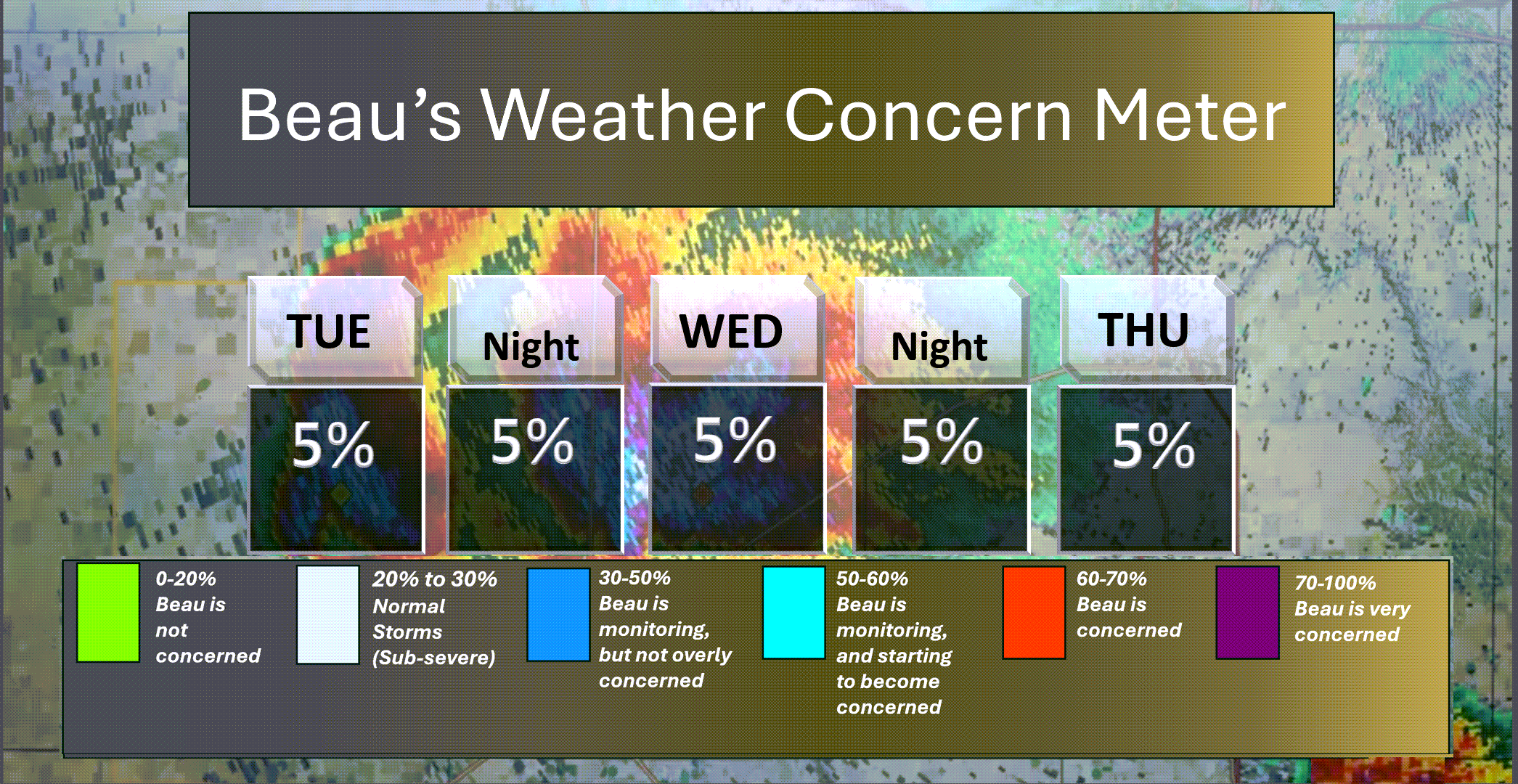
Here is the short-range concern meter.
.
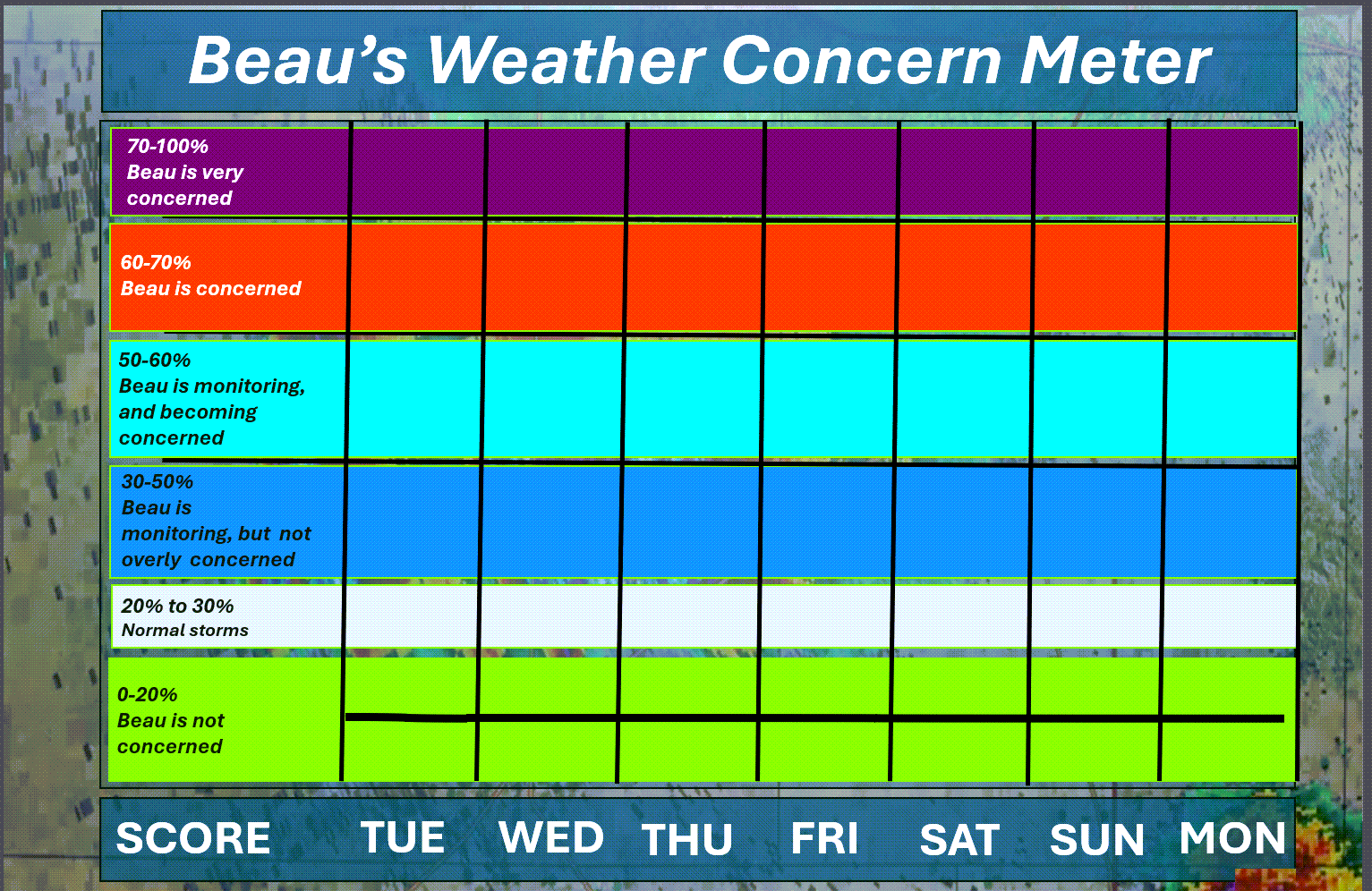
Here is the extended concern meter.
No severe weather concerns.
.
A quick forecast glance. Your 48-hour forecast Graphics


.
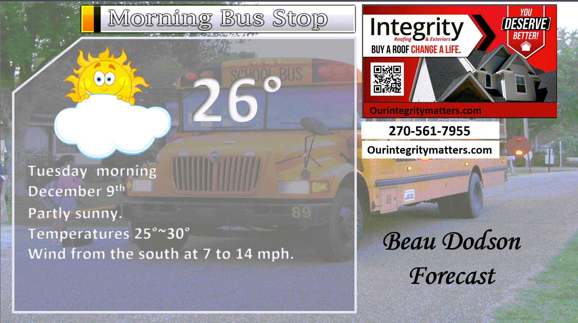
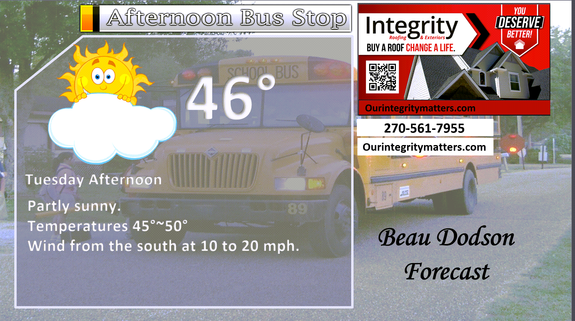
Here is your bus stop forecast
.
This afternoon
.


Forecast discussion
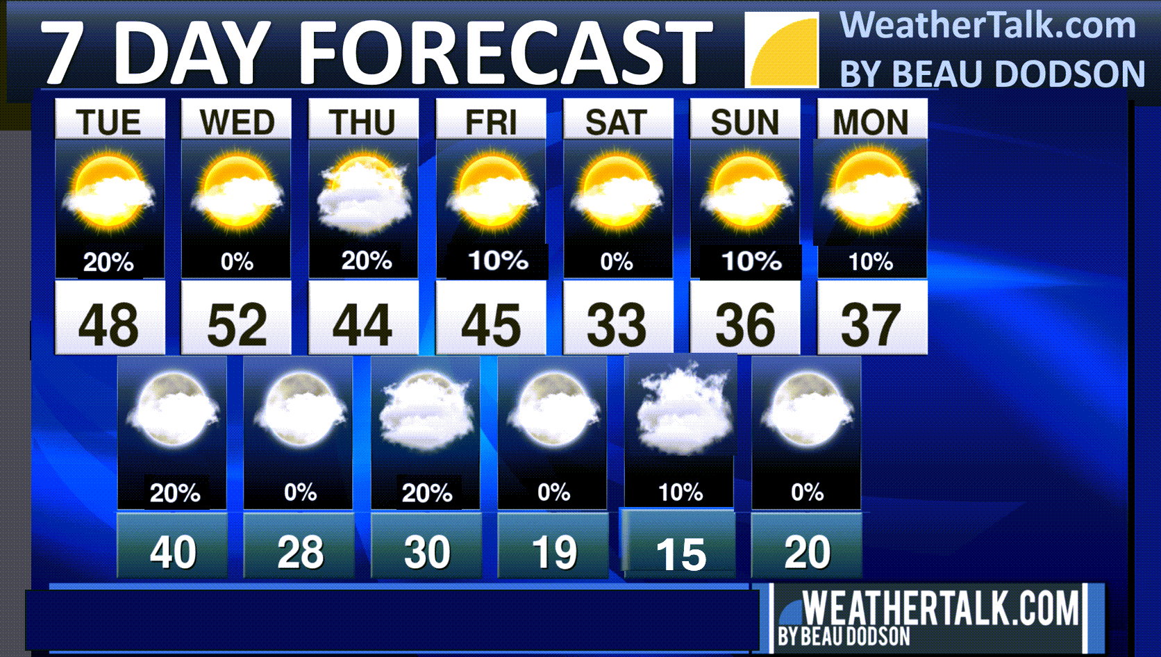
- A brief “warm up” today and tomorrow. Winds will make it feel cooler.
- The cold front arrives on Friday. Cold Friday, Saturday, and Sunday. But, how cold?
- Low-end rain and snow chances this week. We do not expect anything impactful at this time.
- I am monitoring Saturday. Some data shows a higher chance of precipitation, but for now, they are the outlier.
.
 .
.
.
Seven-day outlook graphic.
See the video for more details specific to your county. This is a broad-brushed outlook for the entire region.
.
Today through Friday
Good morning, everyone.
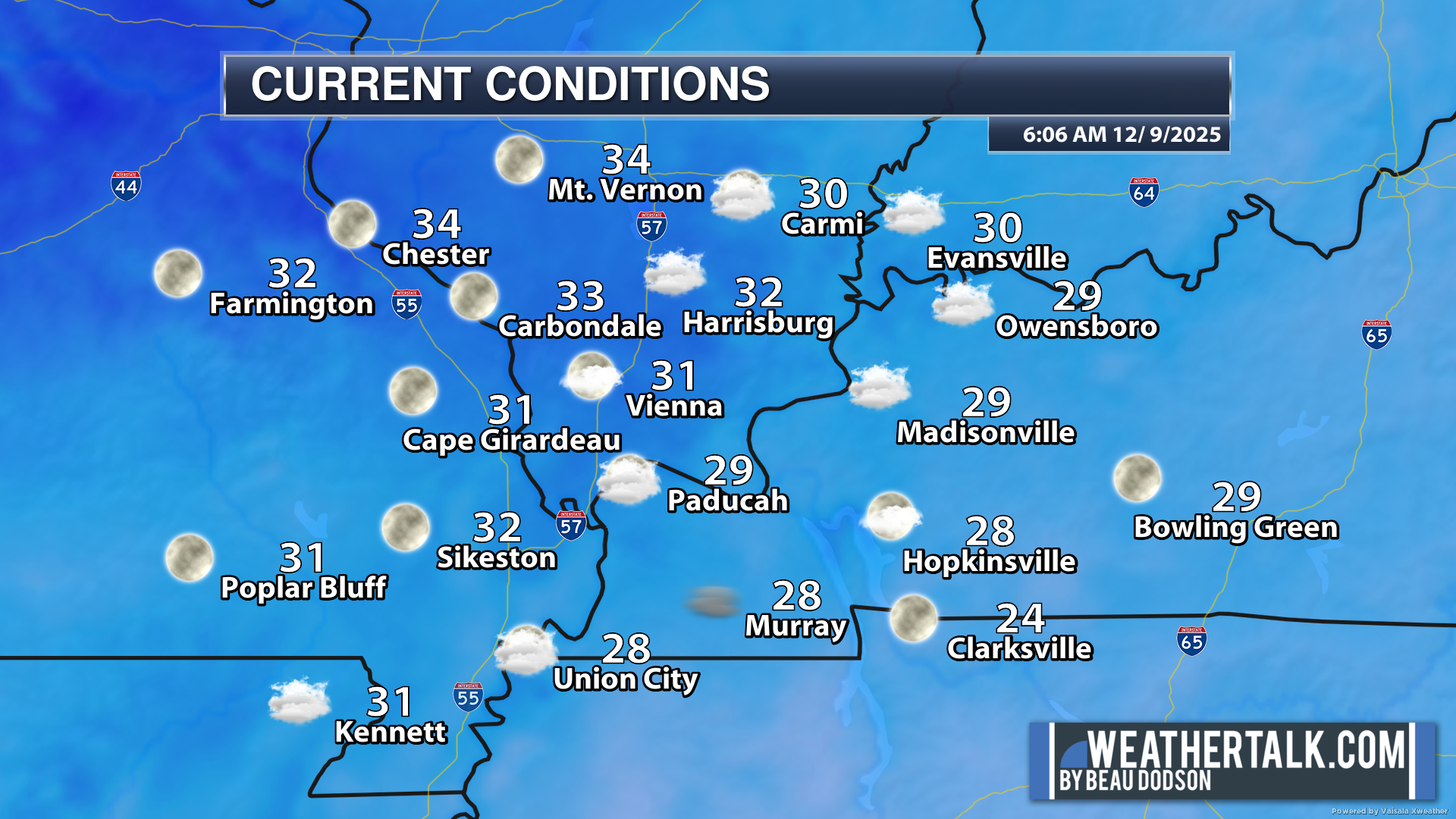
6 AM temperatures
We are once again waking up to chilly temperatures.
All in all, nothing extreme. Just chilly.
.
A relatively tranquil weather pattern will continue into the weekend. We will have some low-end rain and snow chances, but the precipitation will likely be so light that it has little or no impact on travel or otherwise.
It is becoming a bit dry across the region. We could use some precipitation.
A cold front will move through the region on Wednesday.
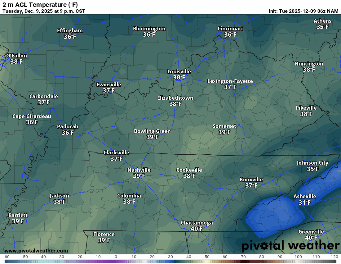
Today and Wednesday will be warmer. It will feel cooler, however, because of the strong southerly winds. Winds will gust in the 10 to 20 mph range. They may gust even higher on Wednesday.
Temperatures on Wednesday will actually fall during the day. This will happen from north to south as the cold front moves through the region.
Here are the temperatures on Wednesday. Notice how they fall during the day. Especially over the northern half of the region.
Double-click the animation to make it larger.
.
.
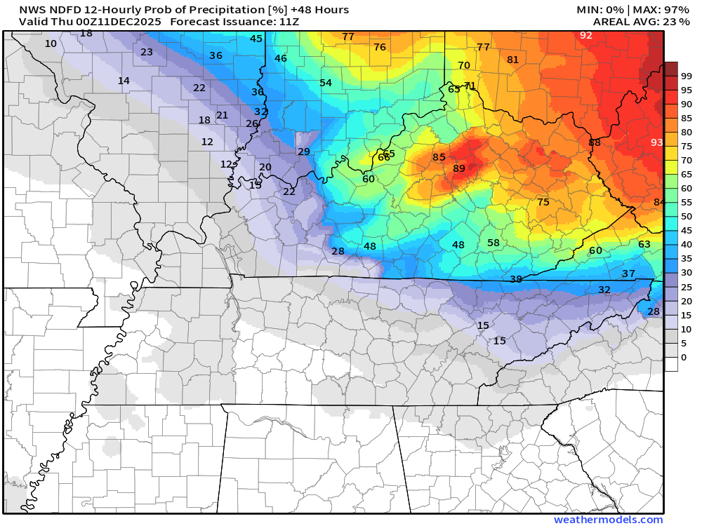
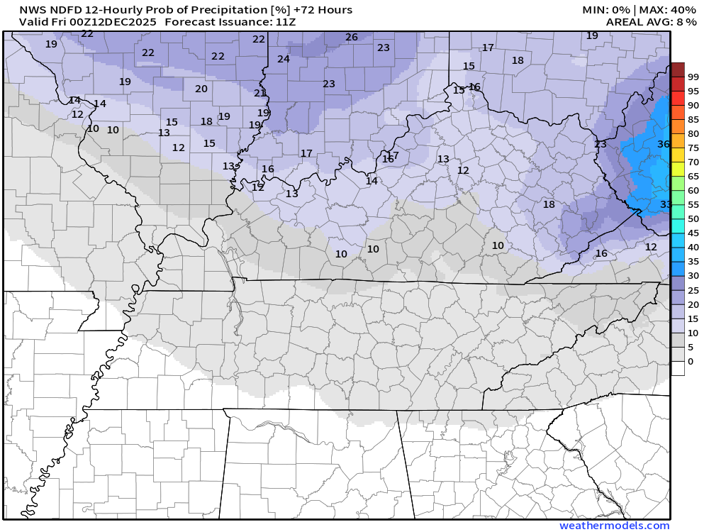
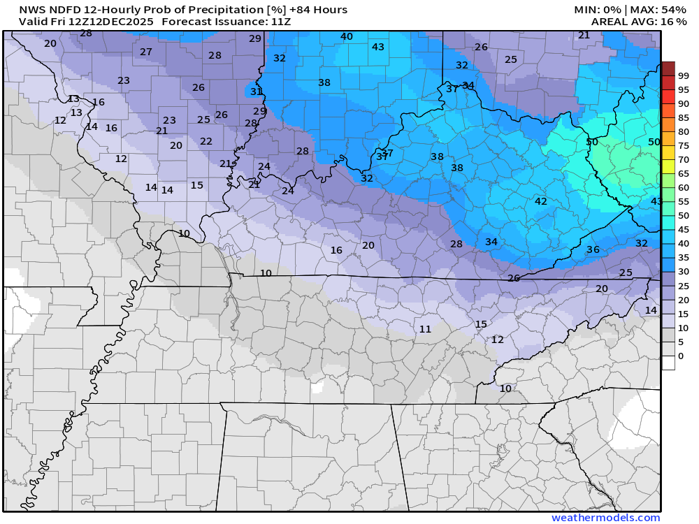
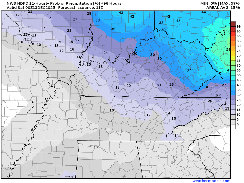
Let me show you the precipitation probabilities.
Overall, low-end chances of light rain and flurries over the coming days.
What is the % chance of precipitation?
Tuesday 6 PM to Wednesday 6 AM
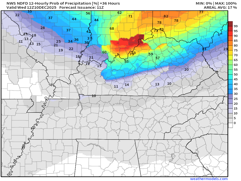
Wednesday 6 AM to Wednesday 6 PM
.
Saturday to Monday
Another cold front will push through the region on Thursday and Thursday night.
The cold air has slowed a tad. The cold air has also modified a bit from previous outlooks. Not quite as cold.
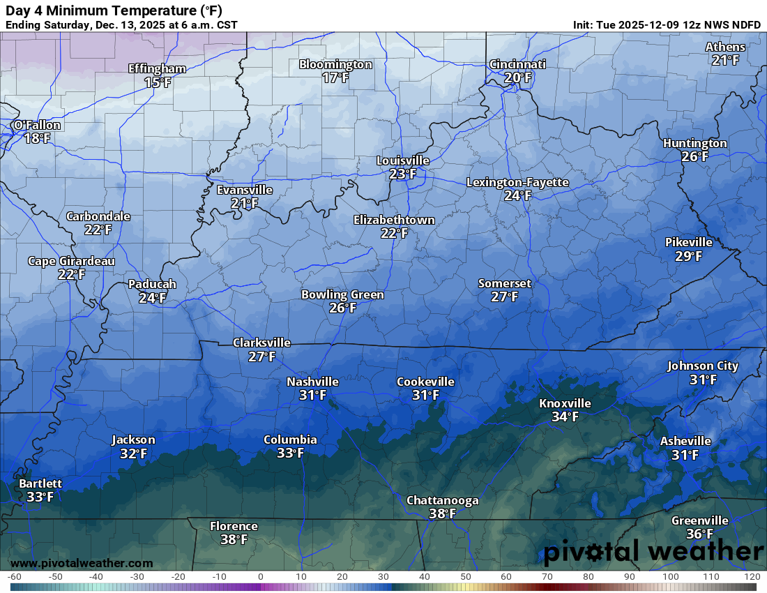
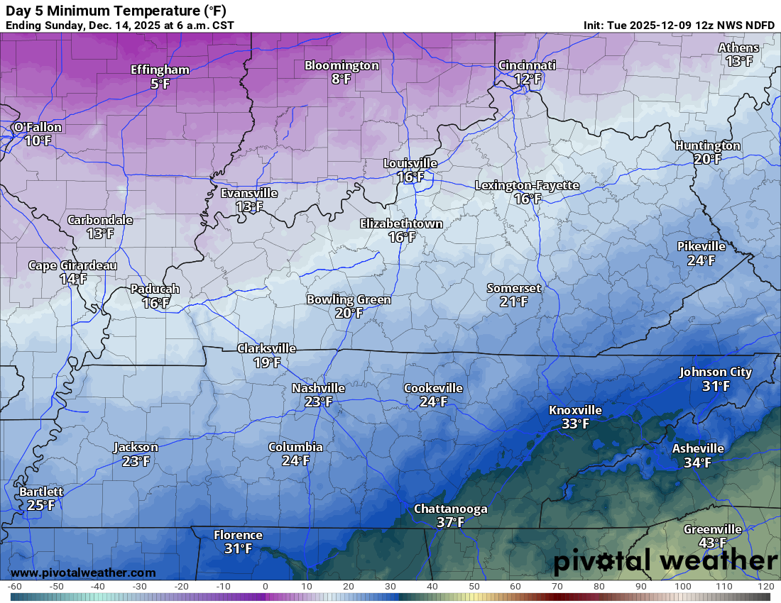
Yesterday, I was forecasting single digits on Saturday morning. That no longer appears to be the case. We will likely see lows in the teens and twenties on Saturday morning.
It now appears that Sunday morning will be the coldest. That would mean low teens near Mt Vernon to the upper teens and lower twenties across the Missouri Bootheel and along the Kentucky/Tennessee border southward.
Saturday morning lows
Sunday morning lows
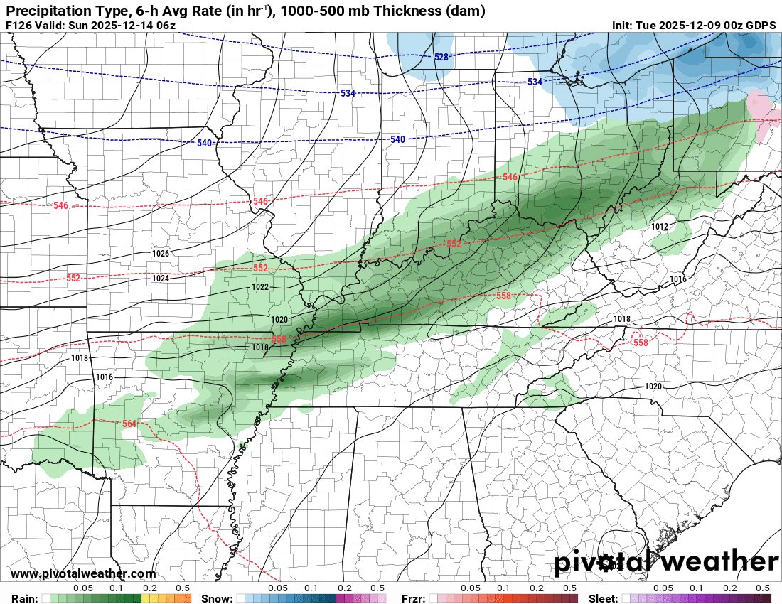
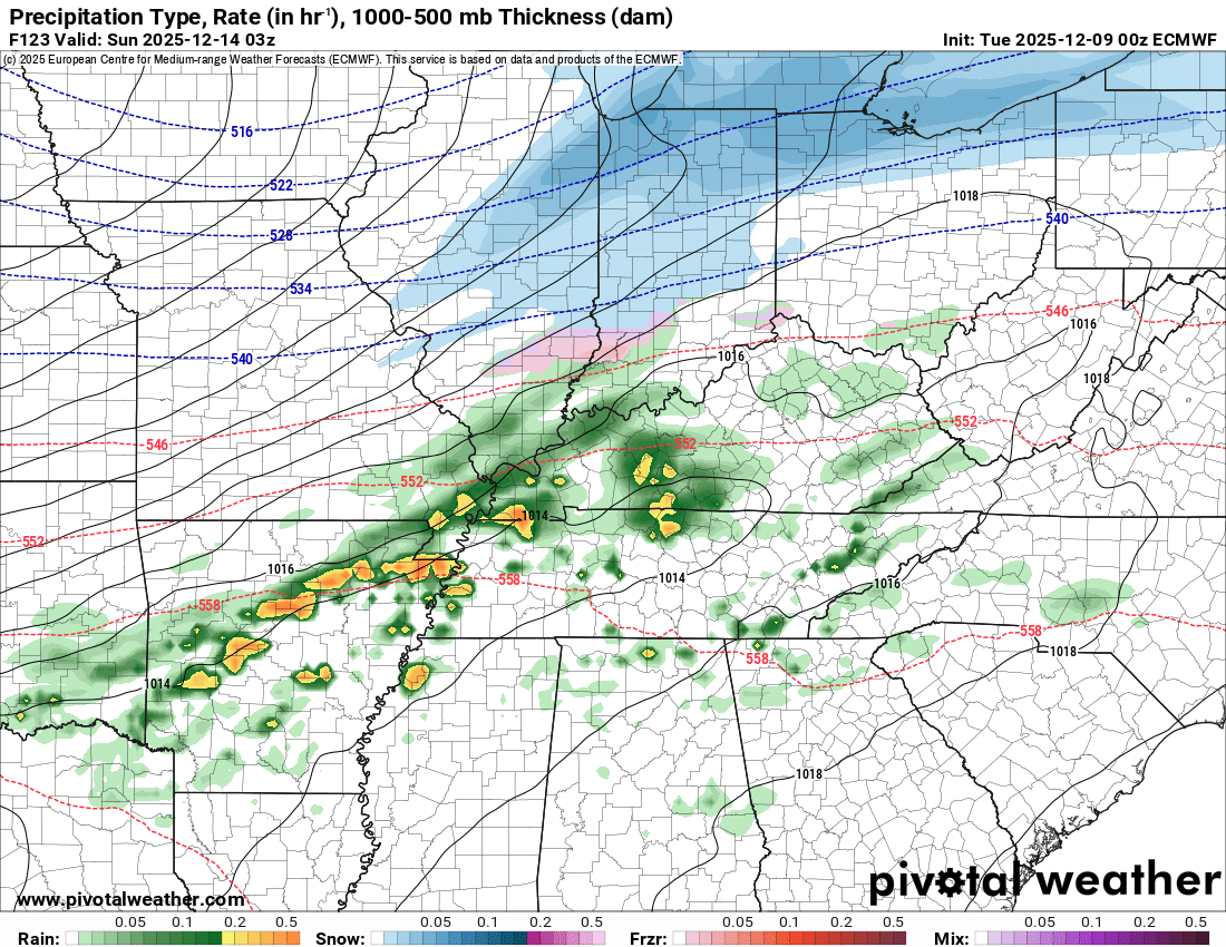
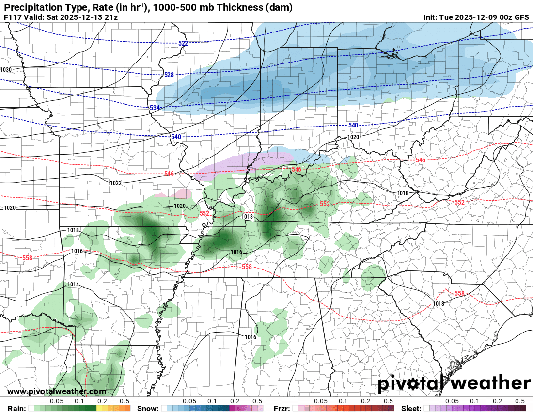
There are a lot of questions about the Saturday forecast.
More and more data is showing precipitation. I am not confident in the probabilities of rain or a wintry mix on Saturday and Saturday night. I am closely monitoring it.
For now, I have tossed the models that are showing what you see below. With that said, I will monitor trends.
Here is what some of the data is showing
GDFS model for Saturday afternoon and evening.
Green is rain. Blue is snow.
EC model for Saturday afternoon and evening
GFS model for Saturday afternoon
.
I will monitor trends in today’s data. If precipitation falls on Saturday and Saturday night, then it would likely be rain or a wintry mix.
Frostbite is a concern for those who work outside on Friday night into Sunday night. Take common-sense precautions if you must work outside.
.

.
The timestamp (upper left) is in Zulu. 12z=6 am. 18z=12 pm. 00z=6 pm.
Double-click the animation to enlarge it.
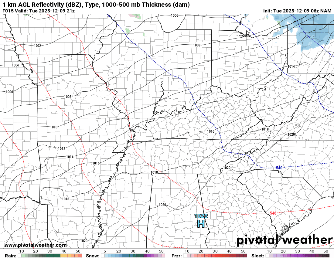
NAM model
Green is rain. Blue is snow. Pink, red, and purple are freezing rain and sleet.
.
.
The timestamp (upper left) is in Zulu. 12z=6 am. 18z=12 pm. 00z=6 pm.
Double-click the animation to enlarge it.
GFS model
Green is rain. Blue is snow. Pink, red, and purple are freezing rain and sleet.
.
.
..
.
Click here if you would like to return to the top of the page.
.Average high temperatures for this time of the year are around 50 degrees.
Average low temperatures for this time of the year are around 32 degrees.
Average precipitation during this time period ranges from 1.00″ to 1.25″
Six to Ten Day Outlook.
Blue is below average. Red is above average. The no color zone represents equal chances.
Average highs for this time of the year are in the lower 60s. Average lows for this time of the year are in the lower 40s.

Green is above average precipitation. Yellow and brown favors below average precipitation. Average precipitation for this time of the year is around one inch per week.

.

Average low temperatures for this time of the year are around 31 degrees.
Average precipitation during this time period ranges from 1.00″ to 1.25″
.
Eight to Fourteen Day Outlook.
Blue is below average. Red is above average. The no color zone represents equal chances.

Green is above average precipitation. Yellow and brown favors below average precipitation. Average precipitation for this time of the year is around one inch per week.

.
.
.
We have a new service to complement your www.weathertalk.com subscription. This does NOTreplace www.weathertalk.com It is simply another tool for you to receive severe weather information.
.
https://weathercallservices.com/beau-dodson-weather


Want to receive the daily forecast/other products on your Beau Dodson Weather app?
Did you know you have four options in your www.weathertalk.com account
You will then receive these via your Beau Dodson Weather app.
Just log into your www.weathertalk.com account
Click the NOTIFICATION SETTINGS TAB
Then, turn them on (green) and off (red)
🌪️ Number 1 is the most important one. Severe alerts, tornado alerts, and so on.
Number 2 is the daily video, blog, livestream alerts, and severe weather Facebook threads on severe days or winter storm days.
Number 3 is the daily forecast. I send that out every day during the afternoon hours. It is the seven-day forecast, hazardous weather outlook, fire outlook, and more.
Number 4 is to receive the daily video, blog, and other content on NON-severe weather days (every day without severe threats in other words)
GREEN IS ON
RED IS OFF

I am going to start going live during bigger severe weather events.
Check it out here https://www.youtube.com/user/beaudodson
Click the subscribe button (it’s a free subscription button), and it will alert you when I go live. I will also send out alerts to the app when I go live for an event.

.

Radars and Lightning Data
Interactive-city-view radars. Clickable watches and warnings.
https://wtalk.co/B3XHASFZ
Old legacy radar site (some of you like it better)
https://weatherobservatory.com/weather-radar.htm
If the radar is not updating then try another one. If a radar does not appear to be refreshing then hit Ctrl F5. You may also try restarting your browser.
Backup radar site in case the above one is not working.
https://weathertalk.com/morani
Regional Radar
https://imagery.weathertalk.com/prx/RadarLoop.mp4
** NEW ** Zoom radar with chaser tracking abilities!
ZoomRadar
If the radar is not working, then email me: Email me at beaudodson@usawx.com
.
We do have some sponsors! Check them out.
Roof damage from recent storms? Link – Click here
INTEGRITY ROOFING AND EXTERIORS!
⛈️ Roof or gutter damage from recent storms? Today’s weather is sponsored by Integrity Roofing. Check out their website at this link https://www.ourintegritymatters.com/

![]()
![]()
![]()
Make sure you have three to five ways of receiving your severe weather information.
Weather Talk is one of those ways! Now, I have another product for you and your family.

.
Want to add more products to your Beau Dodson Weather App?
Receive daily videos, weather blog updates on normal weather days and severe weather and winter storm days, your county by county weather forecast, and more!
Here is how to do add those additional products to your app notification settings!
Here is a video on how to update your Beau Dodson Weather payment.
The app is for subscribers. Subscribe at www.weathertalk.com/welcome then go to your app store and search for WeatherTalk
Subscribers, PLEASE USE THE APP. ATT and Verizon are not reliable during severe weather. They are delaying text messages.
The app is under WeatherTalk in the app store.

Apple users click here

Android users click here
.
Radars and Lightning Data
Interactive-city-view radars. Clickable watches and warnings.
https://wtalk.co/B3XHASFZ
Old legacy radar site (some of you like it better)
https://weatherobservatory.com/weather-radar.htm
If the radar is not updating then try another one. If a radar does not appear to be refreshing then hit Ctrl F5. You may also try restarting your browser.
Backup radar site in case the above one is not working.
https://weathertalk.com/morani
Regional Radar
https://imagery.weathertalk.com/prx/RadarLoop.mp4
** NEW ** Zoom radar with chaser tracking abilities!
ZoomRadar
Lightning Data (zoom in and out of your local area)
https://wtalk.co/WJ3SN5UZ
Not working? Email me at beaudodson@usawx.com
National map of weather watches and warnings. Click here.
Storm Prediction Center. Click here.
Weather Prediction Center. Click here.
.

Live lightning data: Click here.
Real time lightning data (another one) https://map.blitzortung.org/#5.02/37.95/-86.99
Our new Zoom radar with storm chases
.
.

Interactive GOES R satellite. Track clouds. Click here.
GOES 16 slider tool. Click here.
College of DuPage satellites. Click here
.

Here are the latest local river stage forecast numbers Click Here.
Here are the latest lake stage forecast numbers for Kentucky Lake and Lake Barkley Click Here.
.
.
Find Beau on Facebook! Click the banner.


 .
.