

.
I have some question-and-answer threads over on the Facebook page. Link to those threads CLICK HERE
Or email me at beaudodsonweather@gmail.com
..

🌪️ Seven-Day Tornado Outlook ⛈️
December 31st through January 6th
Current risk: None
Current confidence level: High confidence.
Comments: None.
.

Seven-Day Hazardous Weather Outlook
1. Is lightning in the forecast? NO.
2. Are organized/widespread severe thunderstorms in the forecast? NO.
4. Will non-thunderstorm winds top 40 mph? NO.
5. Will the temperature fall below 20 degrees? NO.
6. Is the wind chill forecast to drop below ten degrees? NO.
Here is the short-range thunderstorm concern meter.
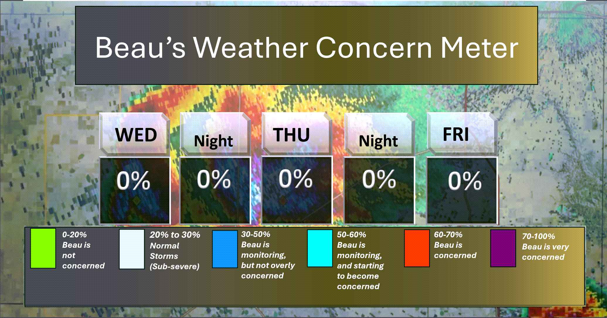
.
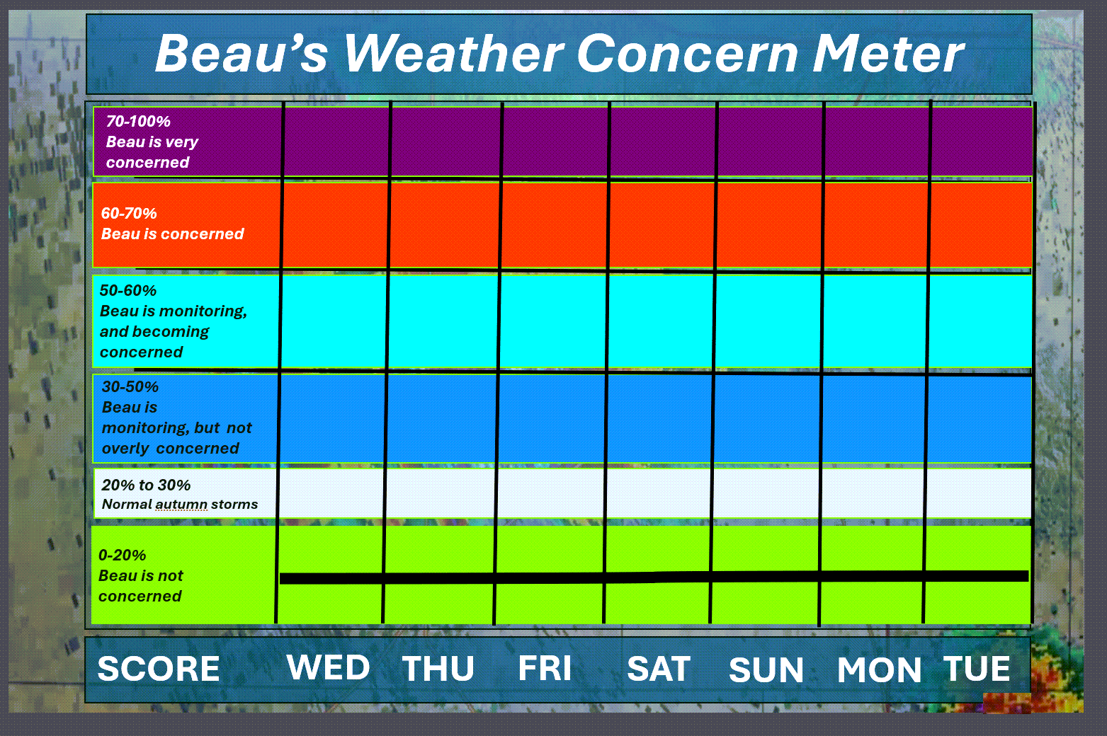
Here is the extended concern meter.
We are in the green. No severe concerns.
.
A quick forecast glance. Your 48-hour forecast Graphics


.
Here is your bus stop forecast
No school. Holidays.
.
This afternoon
No school. Holidays.
.


Forecast discussion
- Cool temperatures. A slow warming trend this weekend.
- A few showers over our southern counties on Friday. The system continues to trend southward. Rainfall totals, if any, will be under 0.10″.
- Watching the long range for a few systems.
.
 .
.
.
What is the primary weather concern?
The significant weather concerns today through Monday. Cool conditions. A slow warming trend into next week.
Isolated showers on Friday/Friday night. Rain totals will be light (if any).
.
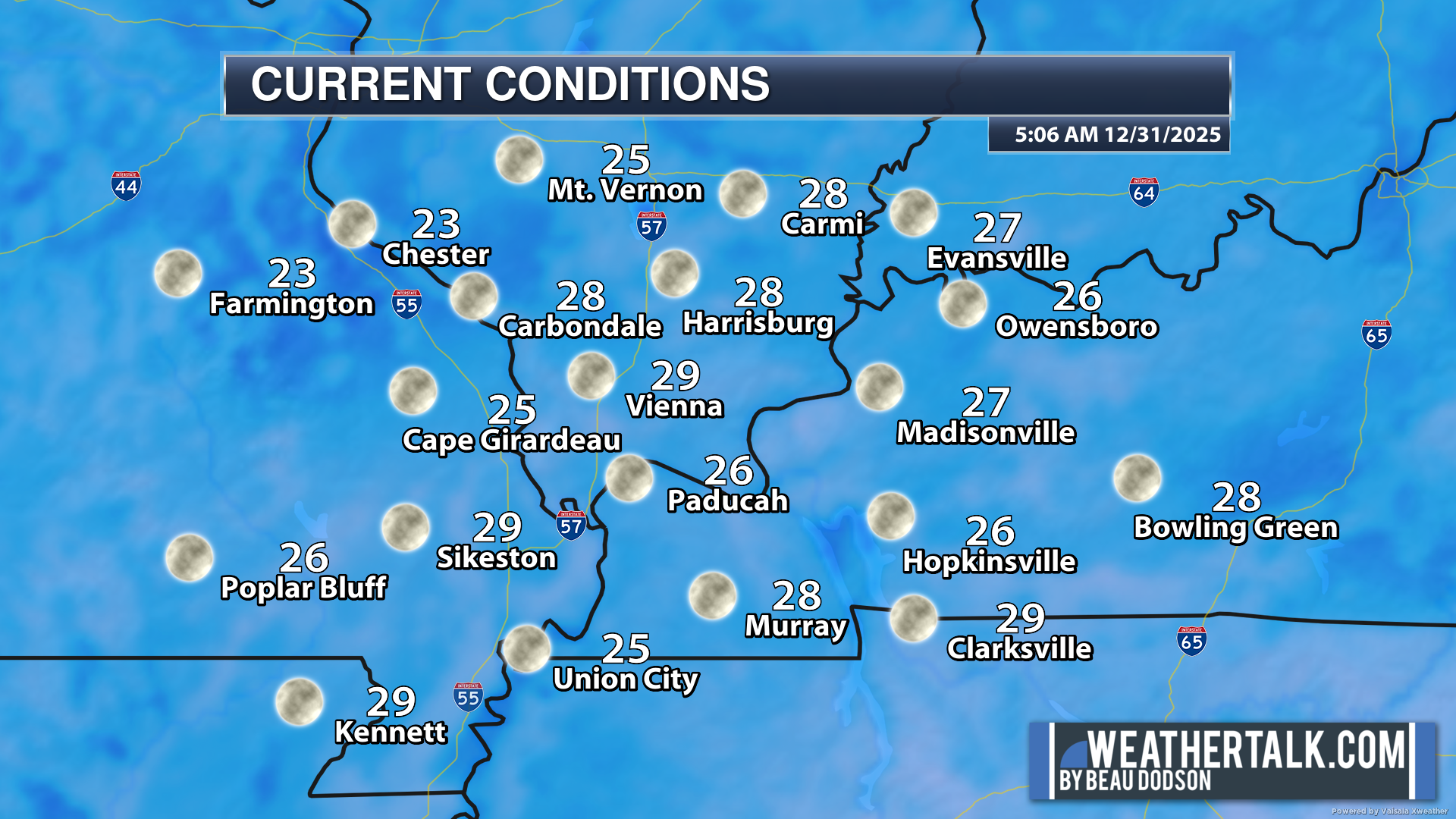
Here were the 6 AM temperatures. Chilly.
.
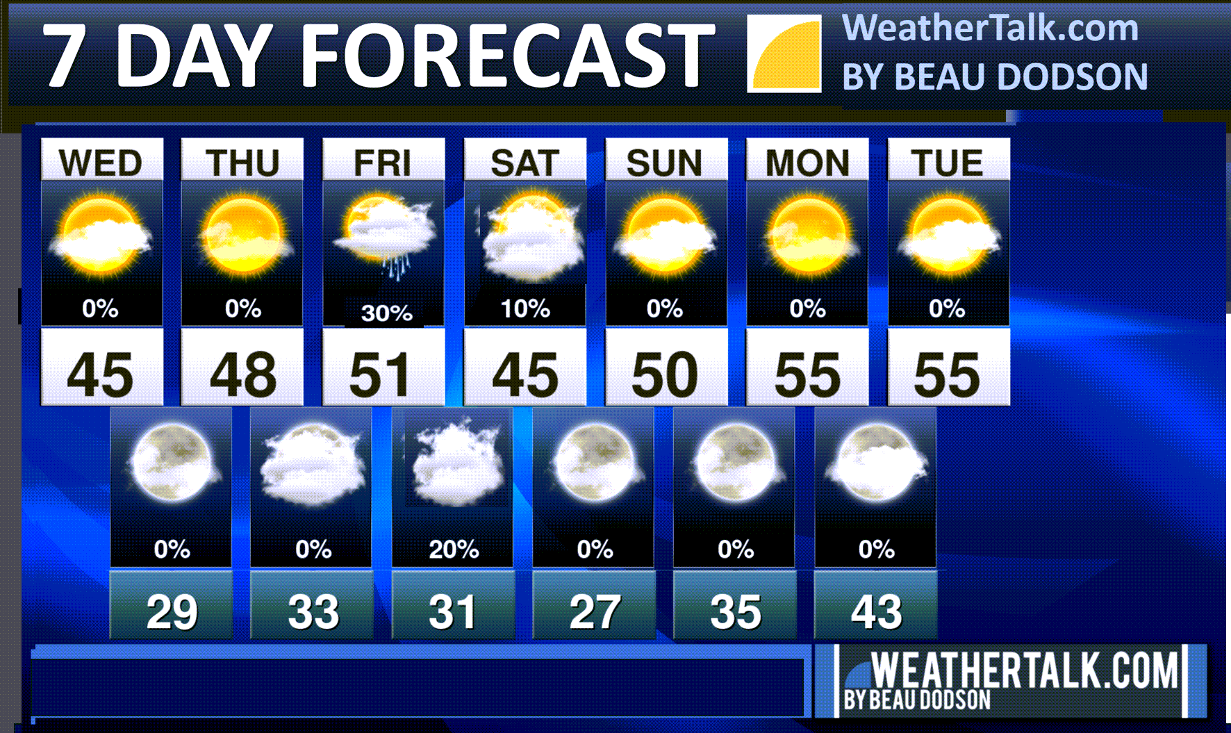
Seven-day outlook graphic.
See the video or graphics below for more details specific to your county. This is a broad-brush overview of the entire region.
.
Today through Thursday night
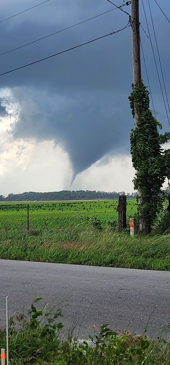
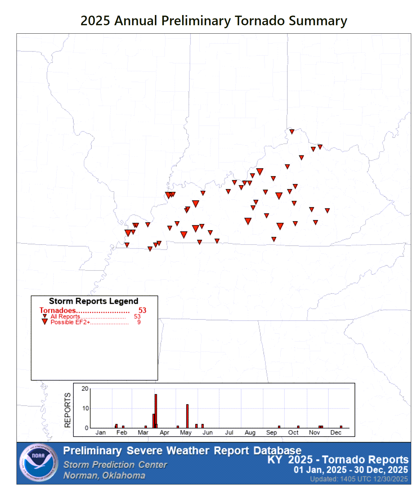
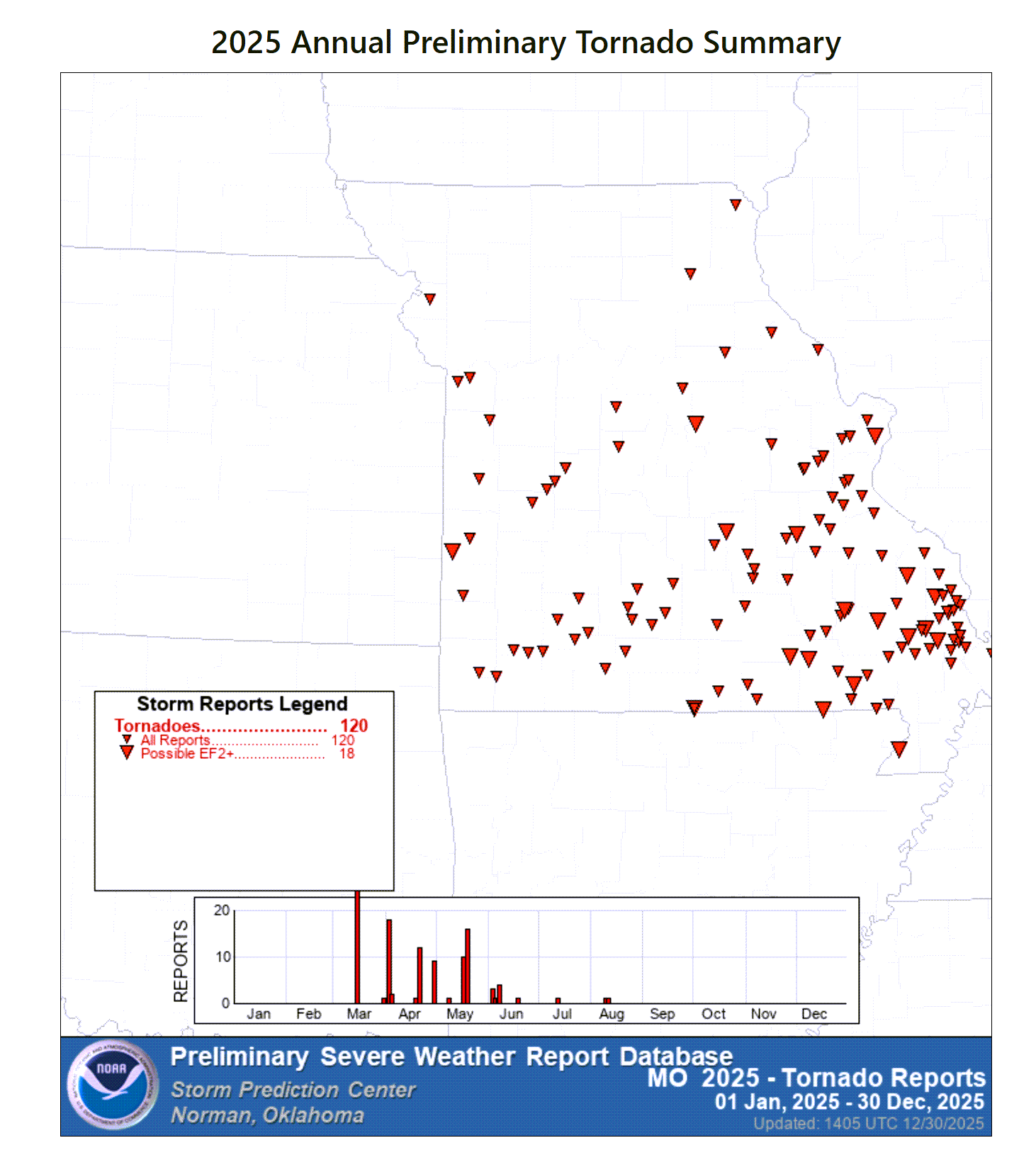
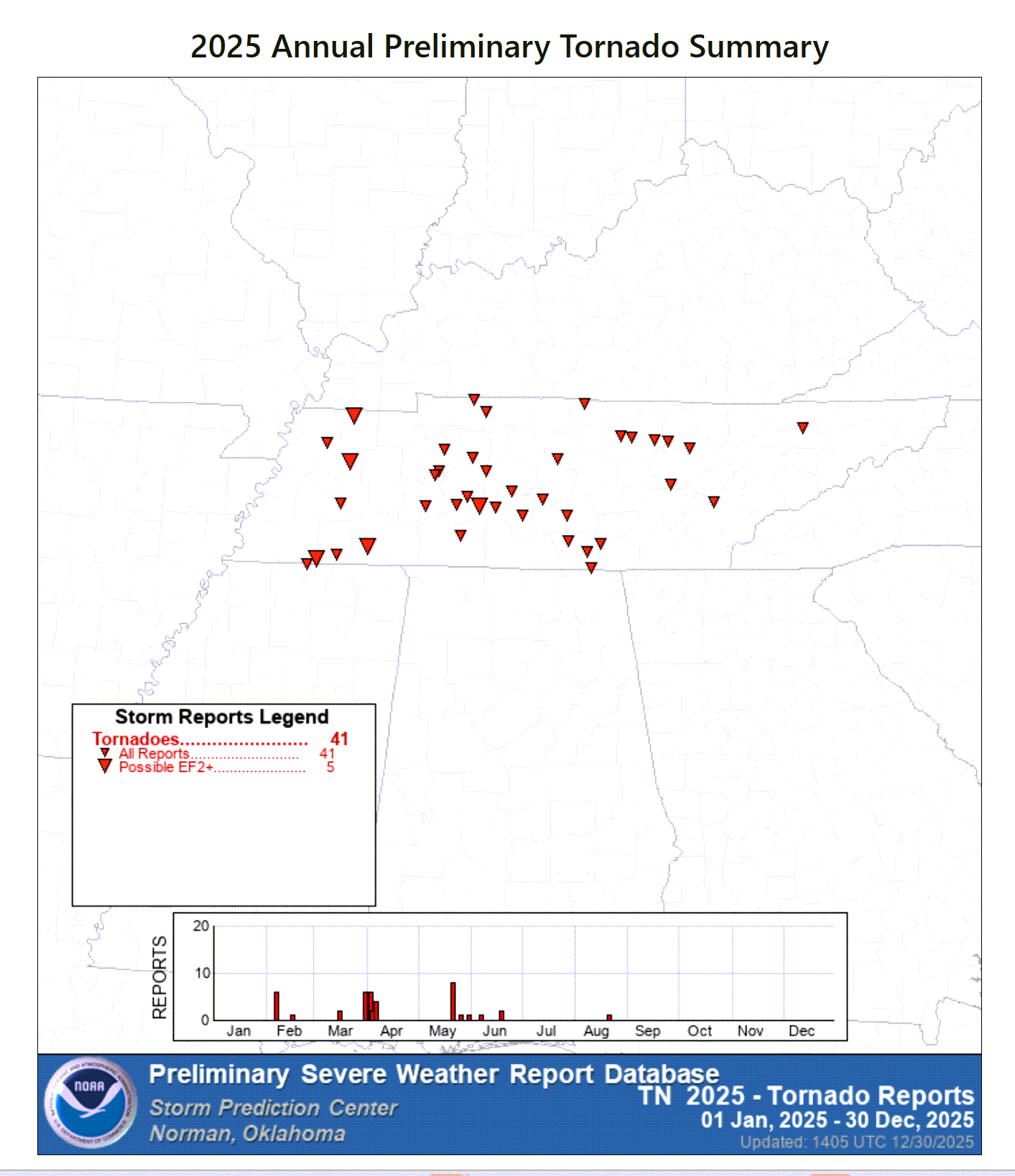
2025 was one of the most extreme years that I have experienced in our region.
Here is a summary of some of the more extreme weather events. The Paducah, Kentucky, NWS put this out.
Link https://www.weather.gov/pah/2025YearInReview
.
A record number of tornadoes, record hailstorms (some larger than softballs), record flooding, and severe drought.
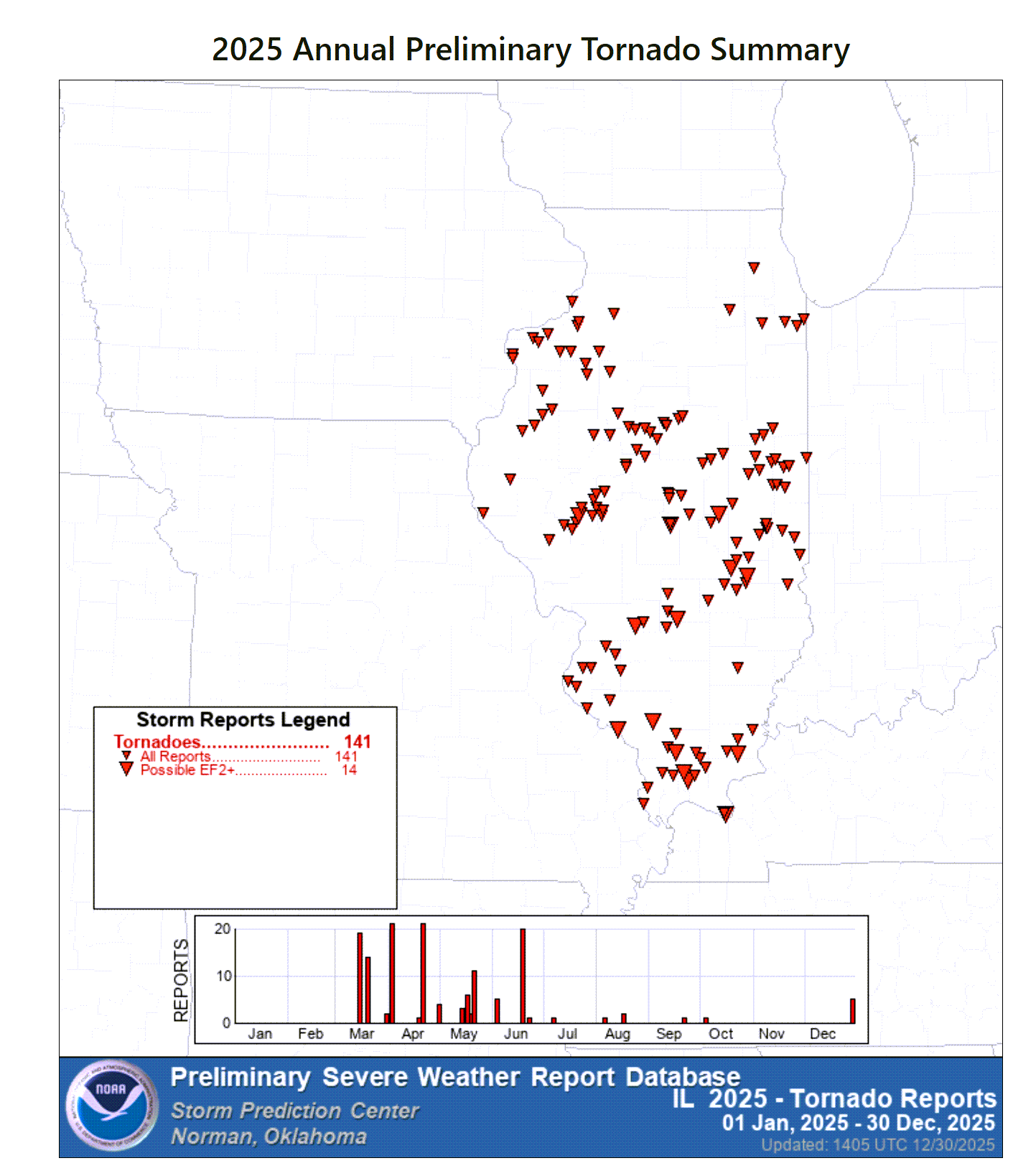
Here were the 2025 tornadoes.
Our region was very active.
Double-click images to enlarge them.
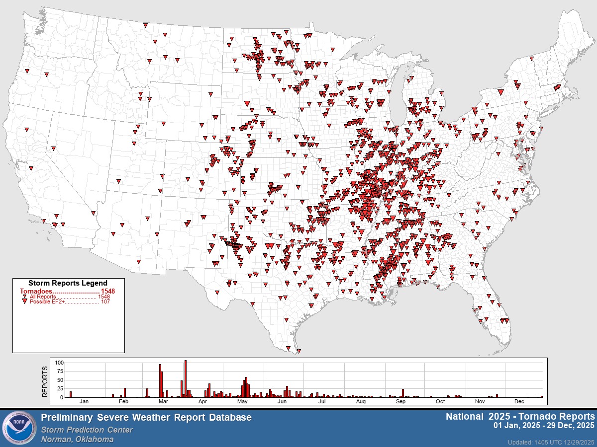
Here were the tornadoes by state.
Illinois
Kentucky
Missouri
Tennessee
.
There are no significant weather concerns through Thursday.
Cool and calm weather.
Somewhat “not as cold” temperatures will arrive later this week.
.
Friday through Sunday
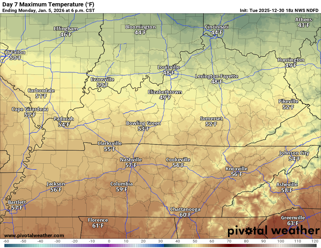
There will be a slow warming trend from Friday into Monday.
Friday highs
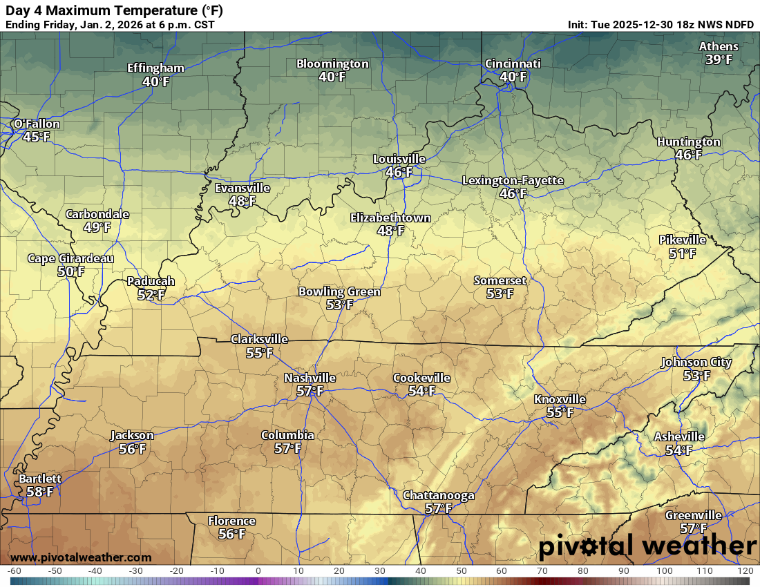
Saturday highs
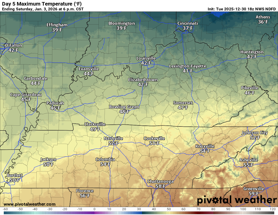
Sunday
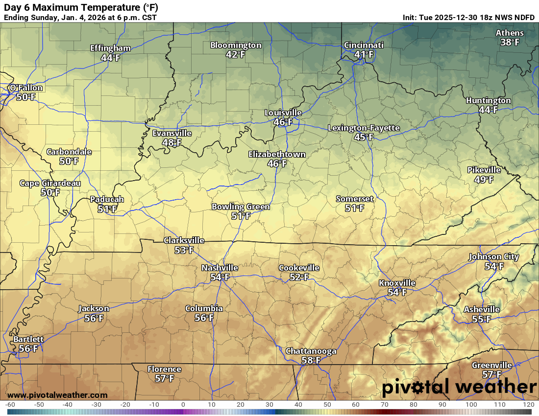
Monday
A weak weather system will bring some clouds to the region on Friday. For now, I kept rain chances around 20% to 30%.
The chance of rain is highest along the MO/AR and KY/TN border. In other words, my southern counties.
Rain chances will be lower as you travel north.
Let me show you the official rainfall probability maps.
Thursday 6 pm to Friday 6 am
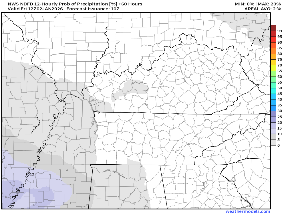
Friday 6 am to Friday 6 pm
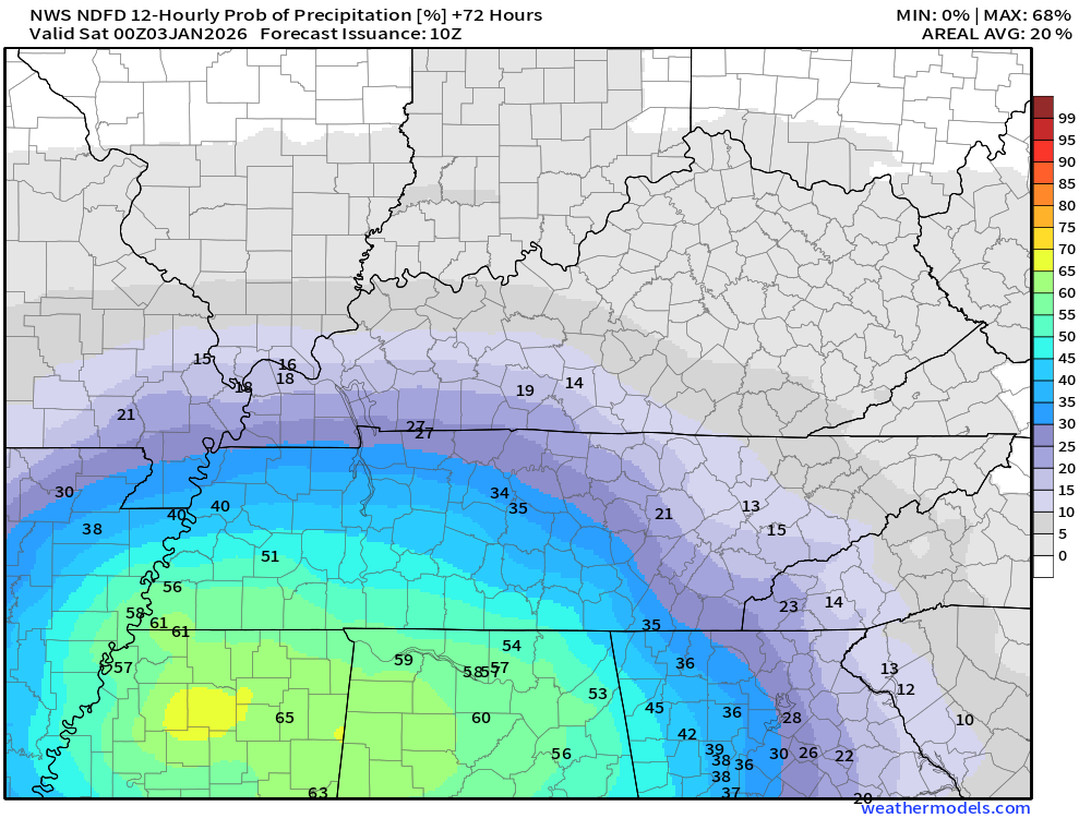
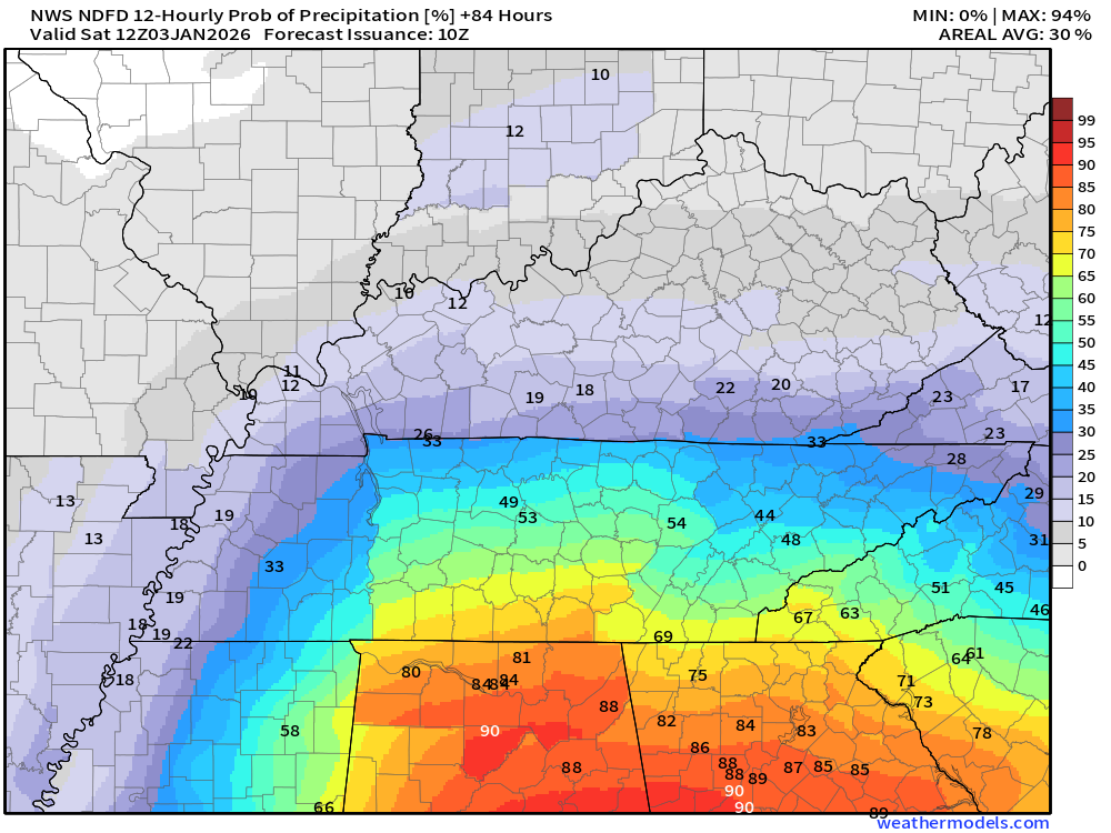
.Rain totals on Friday/Friday night will likely remain below 0.10″.Not much and not enough. We are walking back into drought.
.
.
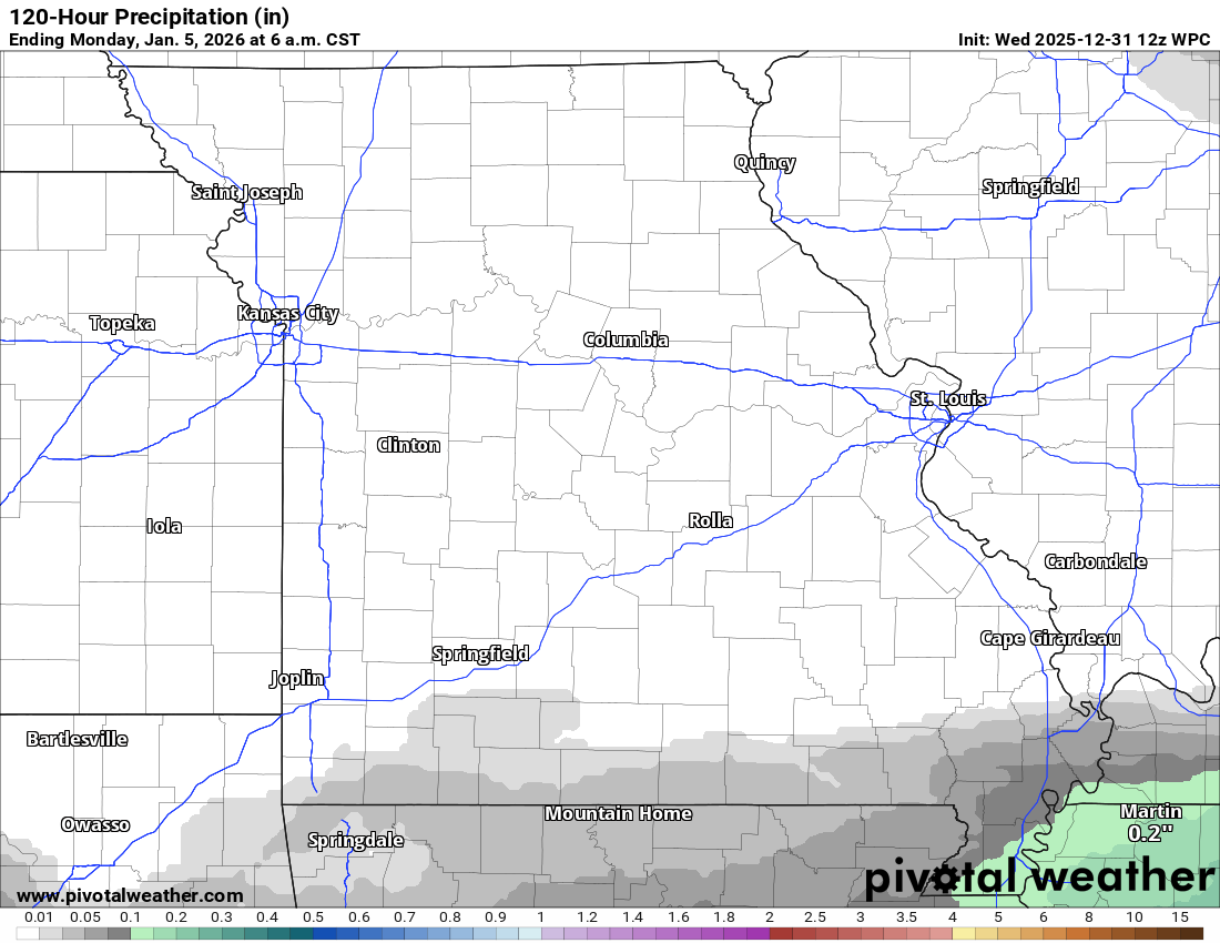
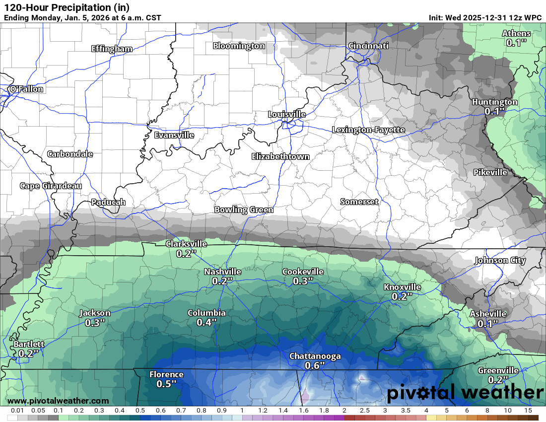
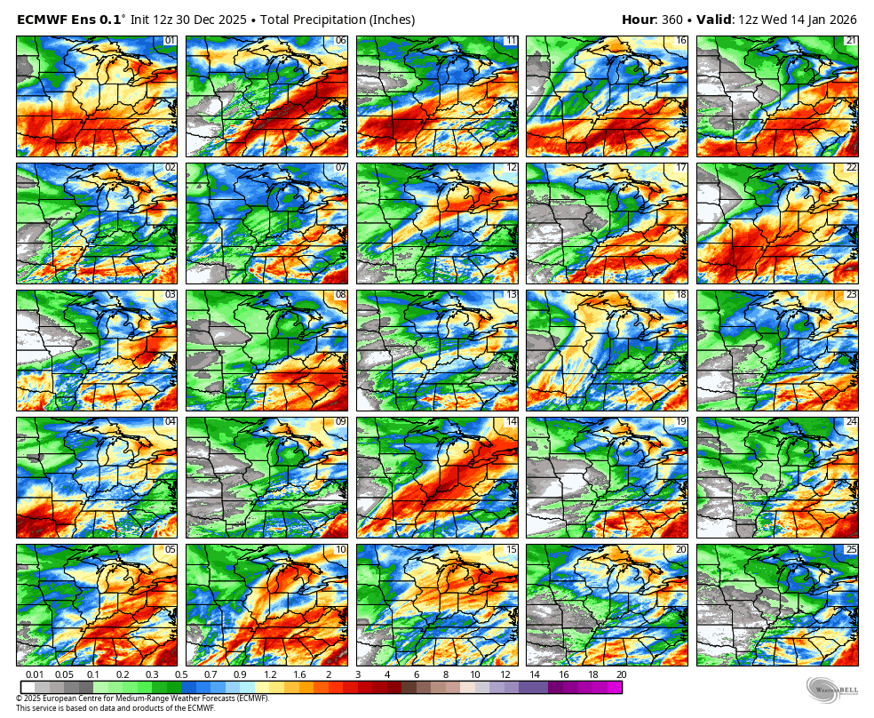
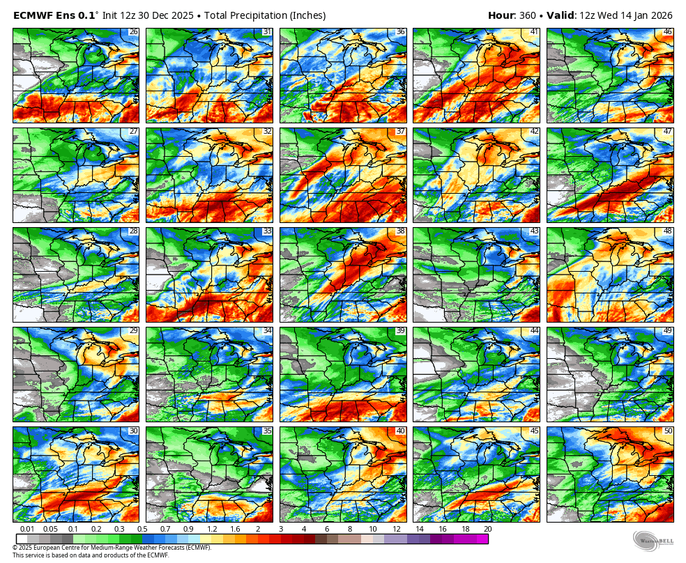
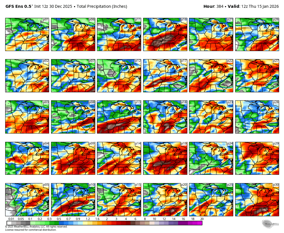
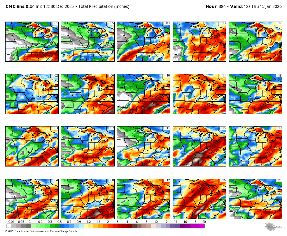
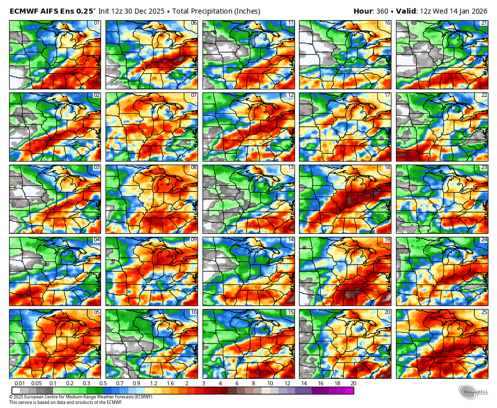
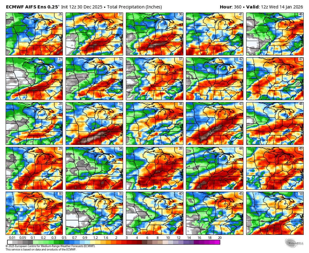
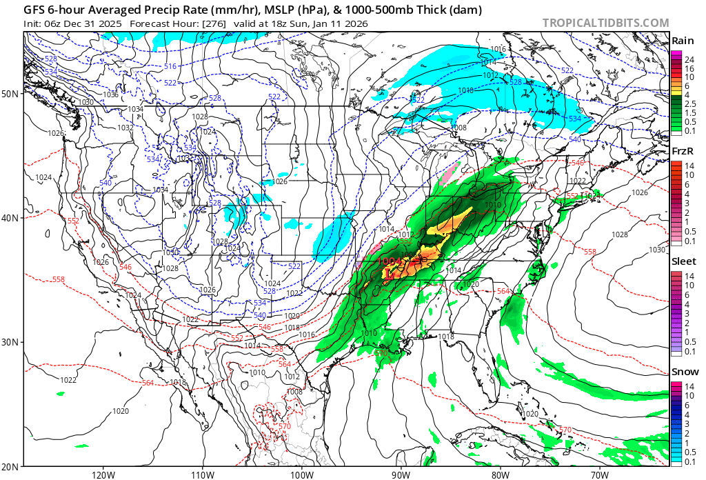
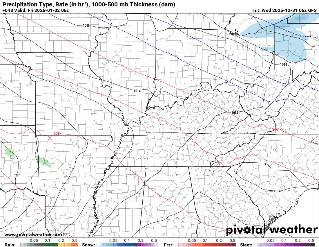
The GFS model shows a couple of systems. Too soon to know the exact track or precipitation type.
I feel confident we will have a few systems in the long-range forecast.
Perhaps one around the 9th to 12th.
.
Another one follows it.
I will keep a close eye on them. I will know more over the coming days.
.
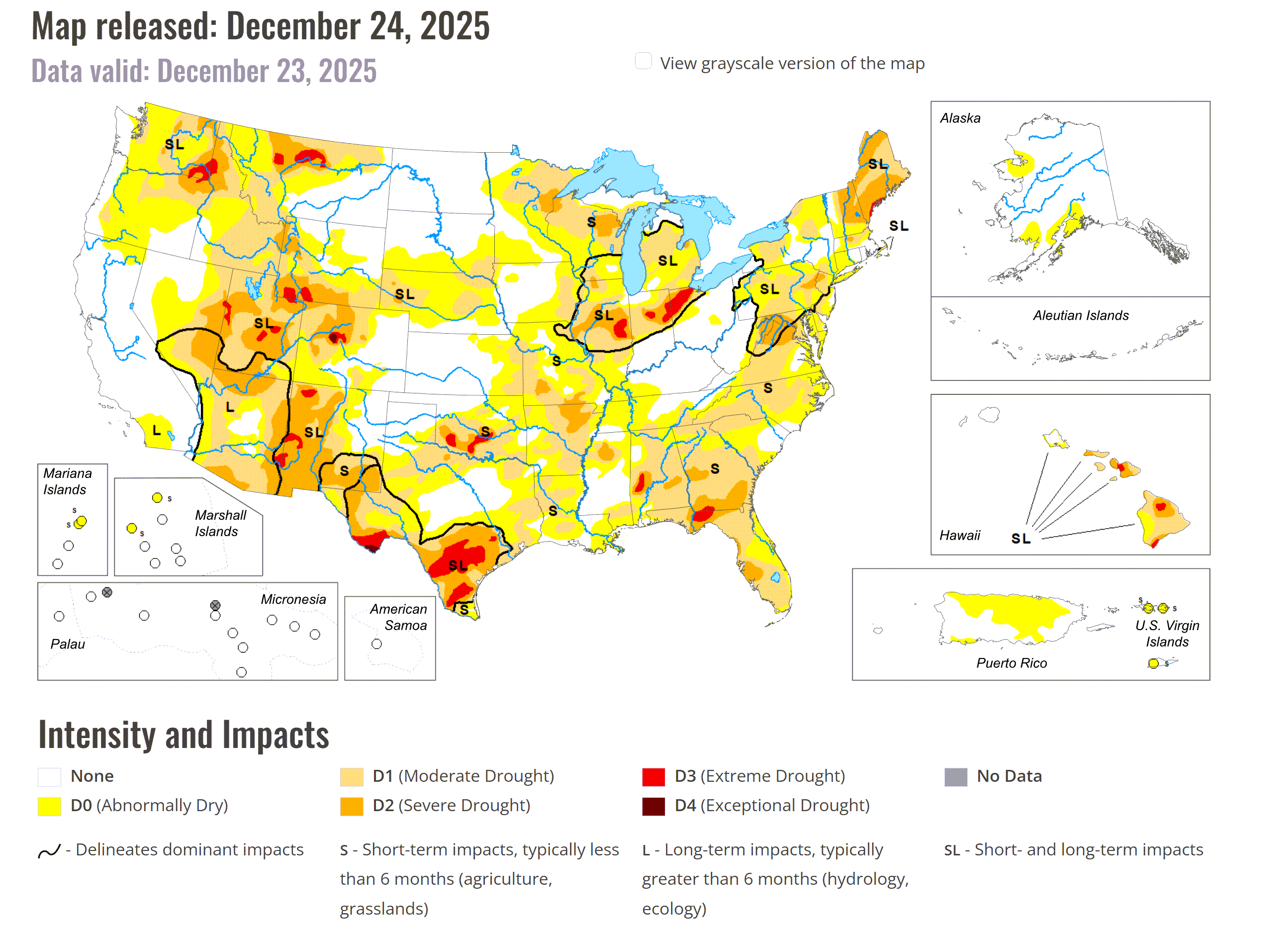
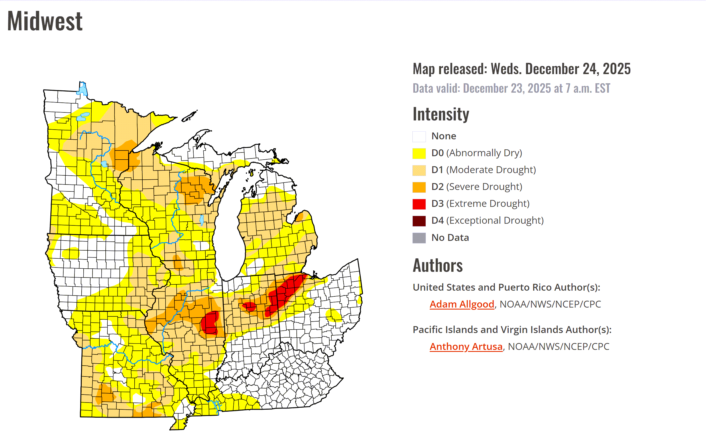
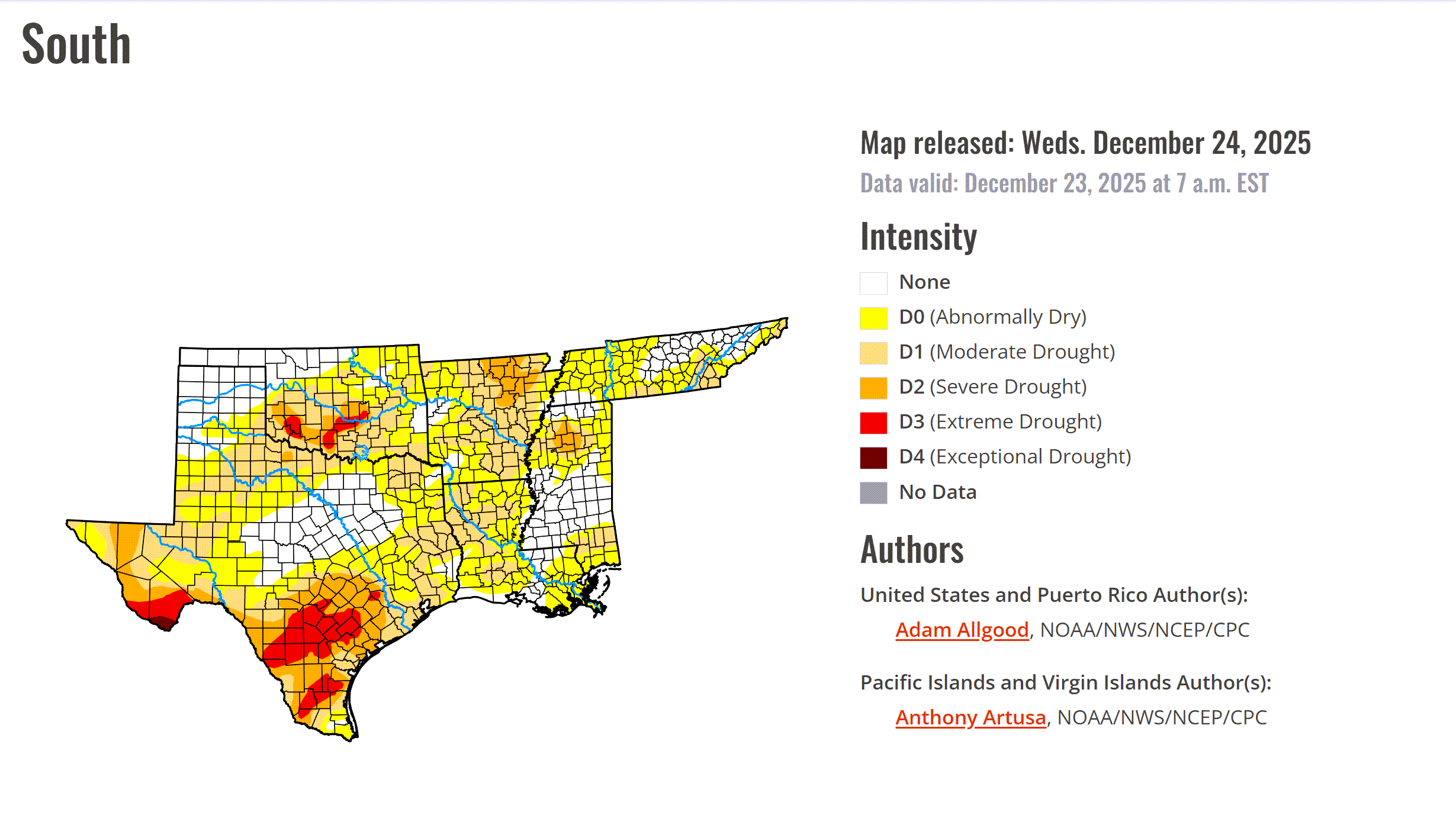
We are abnormally dry. Portions of the region are in drought.
We need rain.
Here are the latest drought monitor maps.
Double-click on the images to enlarge them.
.
Have a great day and a happy New Year!
.

.
The timestamp (upper left) is in Zulu. 12z=6 am. 18z=12 pm. 00z=6 pm.
Double-click the animation to enlarge it.
Green is rain. Yellow is moderate rain. Blue is snow.
GFS model
.
The timestamp (upper left) is in Zulu. 12z=6 am. 18z=12 pm. 00z=6 pm.
Double-click the animation to enlarge it.
Green is rain. Yellow is moderate rain. Blue is snow.
EC model
.
..
.
Click here if you would like to return to the top of the page.
.Average high temperatures for this time of the year are around 43 degrees.
Average low temperatures for this time of the year are around 26 degrees.
Average precipitation during this time period ranges from 1.00″ to 1.25″
Six to Ten Day Outlook.
Blue is below average. Red is above average. The no color zone represents equal chances.
Average highs for this time of the year are in the lower 60s. Average lows for this time of the year are in the lower 40s.

Green is above average precipitation. Yellow and brown favors below average precipitation. Average precipitation for this time of the year is around one inch per week.

.

Average low temperatures for this time of the year are around 25 degrees.
Average precipitation during this time period ranges from 1.00″ to 1.25″
.
Eight to Fourteen Day Outlook.
Blue is below average. Red is above average. The no color zone represents equal chances.

Green is above average precipitation. Yellow and brown favors below average precipitation. Average precipitation for this time of the year is around one inch per week.

.
.
.
We have a new service to complement your www.weathertalk.com subscription. This does NOTreplace www.weathertalk.com It is simply another tool for you to receive severe weather information.
.
https://weathercallservices.com/beau-dodson-weather


Want to receive the daily forecast/other products on your Beau Dodson Weather app?
Did you know you have four options in your www.weathertalk.com account
You will then receive these via your Beau Dodson Weather app.
Just log into your www.weathertalk.com account
Click the NOTIFICATION SETTINGS TAB
Then, turn them on (green) and off (red)
🌪️ Number 1 is the most important one. Severe alerts, tornado alerts, and so on.
Number 2 is the daily video, blog, livestream alerts, and severe weather Facebook threads on severe days or winter storm days.
Number 3 is the daily forecast. I send that out every day during the afternoon hours. It is the seven-day forecast, hazardous weather outlook, fire outlook, and more.
Number 4 is to receive the daily video, blog, and other content on NON-severe weather days (every day without severe threats in other words)
GREEN IS ON
RED IS OFF

I am going to start going live during bigger severe weather events.
Check it out here https://www.youtube.com/user/beaudodson
Click the subscribe button (it’s a free subscription button), and it will alert you when I go live. I will also send out alerts to the app when I go live for an event.

.

Radars and Lightning Data
Interactive-city-view radars. Clickable watches and warnings.
https://wtalk.co/B3XHASFZ
Old legacy radar site (some of you like it better)
https://weatherobservatory.com/weather-radar.htm
If the radar is not updating then try another one. If a radar does not appear to be refreshing then hit Ctrl F5. You may also try restarting your browser.
Backup radar site in case the above one is not working.
https://weathertalk.com/morani
Regional Radar
https://imagery.weathertalk.com/prx/RadarLoop.mp4
** NEW ** Zoom radar with chaser tracking abilities!
ZoomRadar
If the radar is not working, then email me: Email me at beaudodson@usawx.com
.
We do have some sponsors! Check them out.
Roof damage from recent storms? Link – Click here
INTEGRITY ROOFING AND EXTERIORS!
⛈️ Roof or gutter damage from recent storms? Today’s weather is sponsored by Integrity Roofing. Check out their website at this link https://www.ourintegritymatters.com/

![]()
![]()
![]()
Make sure you have three to five ways of receiving your severe weather information.
Weather Talk is one of those ways! Now, I have another product for you and your family.

.
Want to add more products to your Beau Dodson Weather App?
Receive daily videos, weather blog updates on normal weather days and severe weather and winter storm days, your county by county weather forecast, and more!
Here is how to do add those additional products to your app notification settings!
Here is a video on how to update your Beau Dodson Weather payment.
The app is for subscribers. Subscribe at www.weathertalk.com/welcome then go to your app store and search for WeatherTalk
Subscribers, PLEASE USE THE APP. ATT and Verizon are not reliable during severe weather. They are delaying text messages.
The app is under WeatherTalk in the app store.

Apple users click here

Android users click here
.
Radars and Lightning Data
Interactive-city-view radars. Clickable watches and warnings.
https://wtalk.co/B3XHASFZ
Old legacy radar site (some of you like it better)
https://weatherobservatory.com/weather-radar.htm
If the radar is not updating then try another one. If a radar does not appear to be refreshing then hit Ctrl F5. You may also try restarting your browser.
Backup radar site in case the above one is not working.
https://weathertalk.com/morani
Regional Radar
https://imagery.weathertalk.com/prx/RadarLoop.mp4
** NEW ** Zoom radar with chaser tracking abilities!
ZoomRadar
Lightning Data (zoom in and out of your local area)
https://wtalk.co/WJ3SN5UZ
Not working? Email me at beaudodson@usawx.com
National map of weather watches and warnings. Click here.
Storm Prediction Center. Click here.
Weather Prediction Center. Click here.
.

Live lightning data: Click here.
Real time lightning data (another one) https://map.blitzortung.org/#5.02/37.95/-86.99
Our new Zoom radar with storm chases
.
.

Interactive GOES R satellite. Track clouds. Click here.
GOES 16 slider tool. Click here.
College of DuPage satellites. Click here
.

Here are the latest local river stage forecast numbers Click Here.
Here are the latest lake stage forecast numbers for Kentucky Lake and Lake Barkley Click Here.
.
.
Find Beau on Facebook! Click the banner.


 .
.