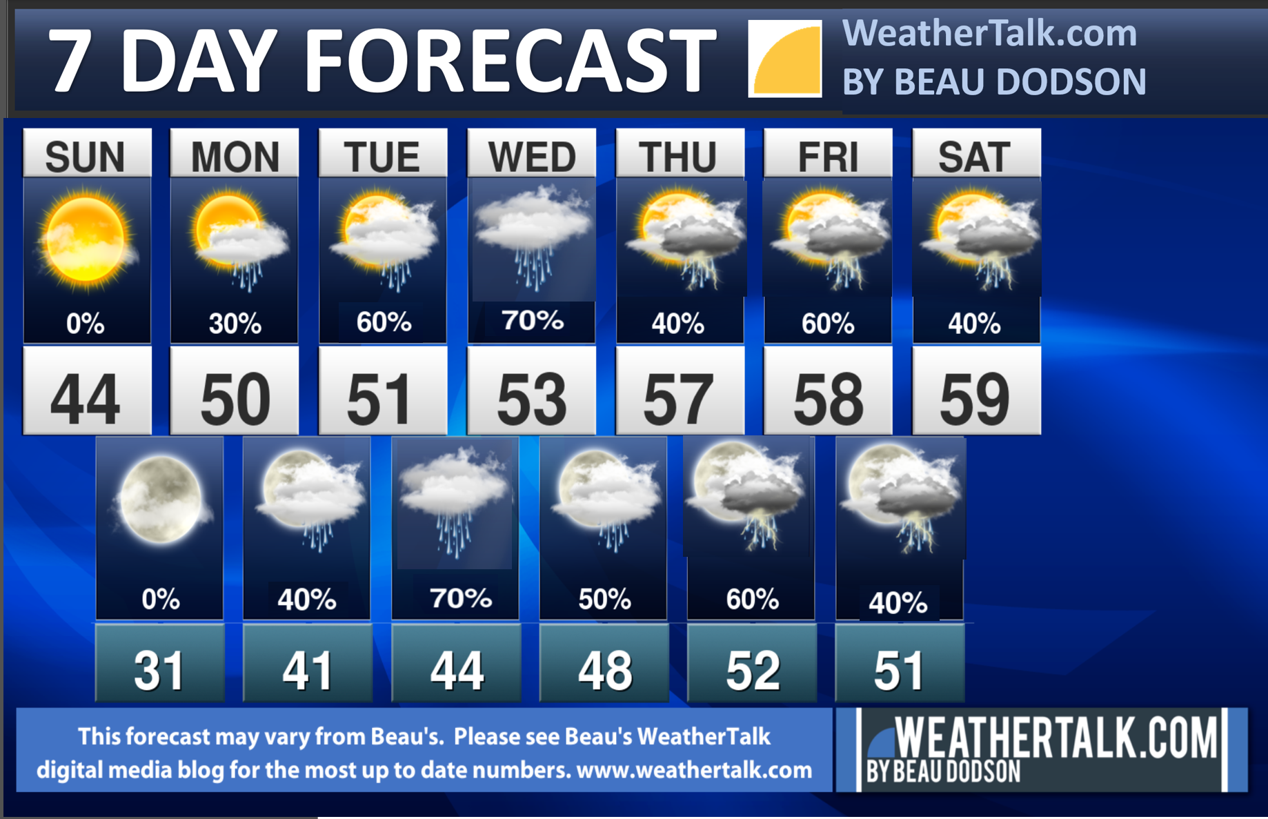
We will have a very active pattern this week. There will be multiple storm systems that will bring clouds and rain. There could also be some thunderstorms.
We will have above average temperatures through at least next Saturday.
For now, there is no clear signal for severe weather. I know there have been numerous Facebook pages posting about severe weather in our region. It is too soon to be telling people that.
I will monitor the Thursday through Saturday time-frame. For now, I have lightning in the forecast later this week. I will monitor the threat of severe weather.
For now, the National Weather Service and the Storm Prediction Center are downplaying the concerns locally. These events are still several days away, thus monitor updates information. I will be on top of it.
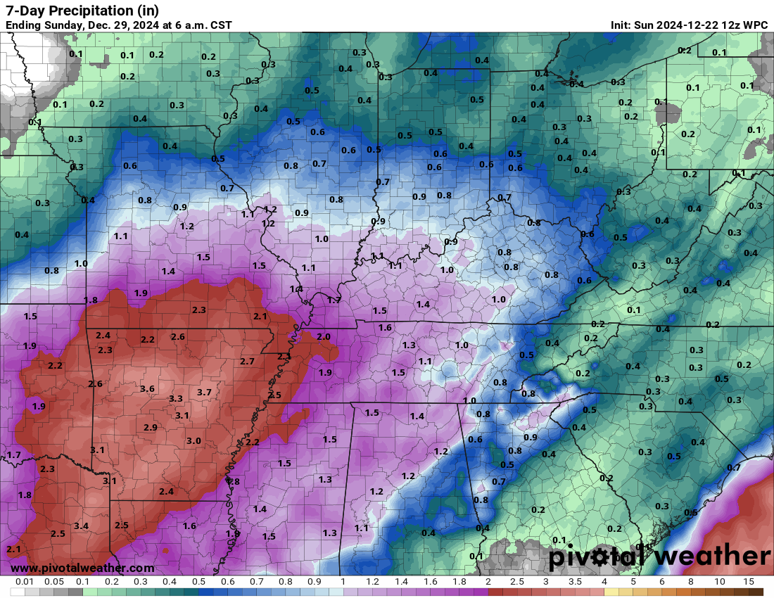
We will have daily chances of rain from tomorrow through at least Saturday.
Rainfall totals through next Sunday morning could be locally heavy. I will need to monitor the risk of sporadic flooding. Especially in areas that commonly flood during a decent rain event.
Double click images to enlarge them.
Peak rain chances, with this first rain event, through Christmas will be Tuesday night into Wednesday morning. Otherwise, some showers are possible as early as tomorrow afternoon through Wednesday evening.
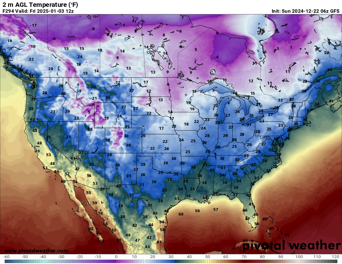
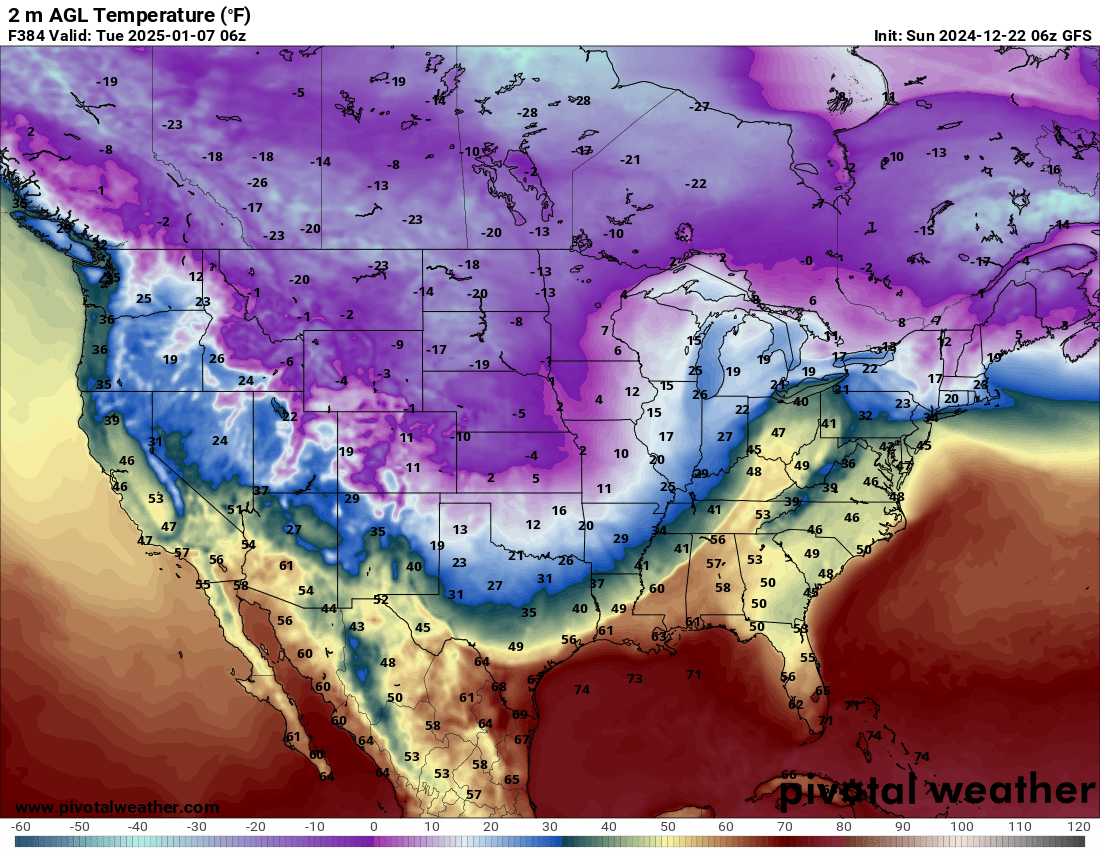
I am watching a couple of cold shots in early January.
The first one is a normal January cold snap. That will occur around the third of the month. Another one is possible a few days later.
This is past the long-range forecast time period. You know the drill. We don’t trust models past day five or six during the winter months.
I will say, there are strong signals for the colder weather. Thus, confidence is medium that we will see a couple of cold shots.
The extent of the cold will need to be monitored. Whether there is any moisture with the cold remains a question.
Some data shows the first cold shot dissipating as warmer air and rain arrives. Then, temperatures turn cold again.
That happens a lot in our region. We warm up and it rains. We cool down and it is dry. Sometimes we see winter weather as cold exits. In other words, as warmer air arrives it meets up with the cold air. That can cause overrunning precipitation. Usually a wintry mix.
I will be monitoring the charts over the coming days.
Cold shot one (medium confidence). Around the third or so.
Cold shot two (lower confidence). Around the sixth or seventh.


