

.
I have some question-and-answer threads over on the Facebook page. Link to those threads CLICK HERE
Or email me at beaudodsonweather@gmail.com
..

🌪️ Seven-Day Tornado Outlook ⛈️
December 17th through December 23rd
Current risk: NONE
Current confidence level: High confidence.
Comments:
.

Seven-Day Hazardous Weather Outlook
1. Is lightning in the forecast? POSSIBLE. A chance scattered tonight and tomorrow (Thursday).
2. Are organized/widespread severe thunderstorms in the forecast? NOT AT THIS TIME. A few of the storms on Thursday could produce dime-sized hail and gusty winds. Organized severe weather appears unlikely. If a warning were issued, it would be for strong wind gusts.
4. Will non-thunderstorm winds top 40 mph? POSSIBLE. Winds on Thursday could gust close to 40 mph.
5. Will the temperature fall below 20 degrees? POSSIBLE. Isolated areas on Thursday night/Friday morning.
6. Is the wind chill forecast to drop below ten degrees? NO.
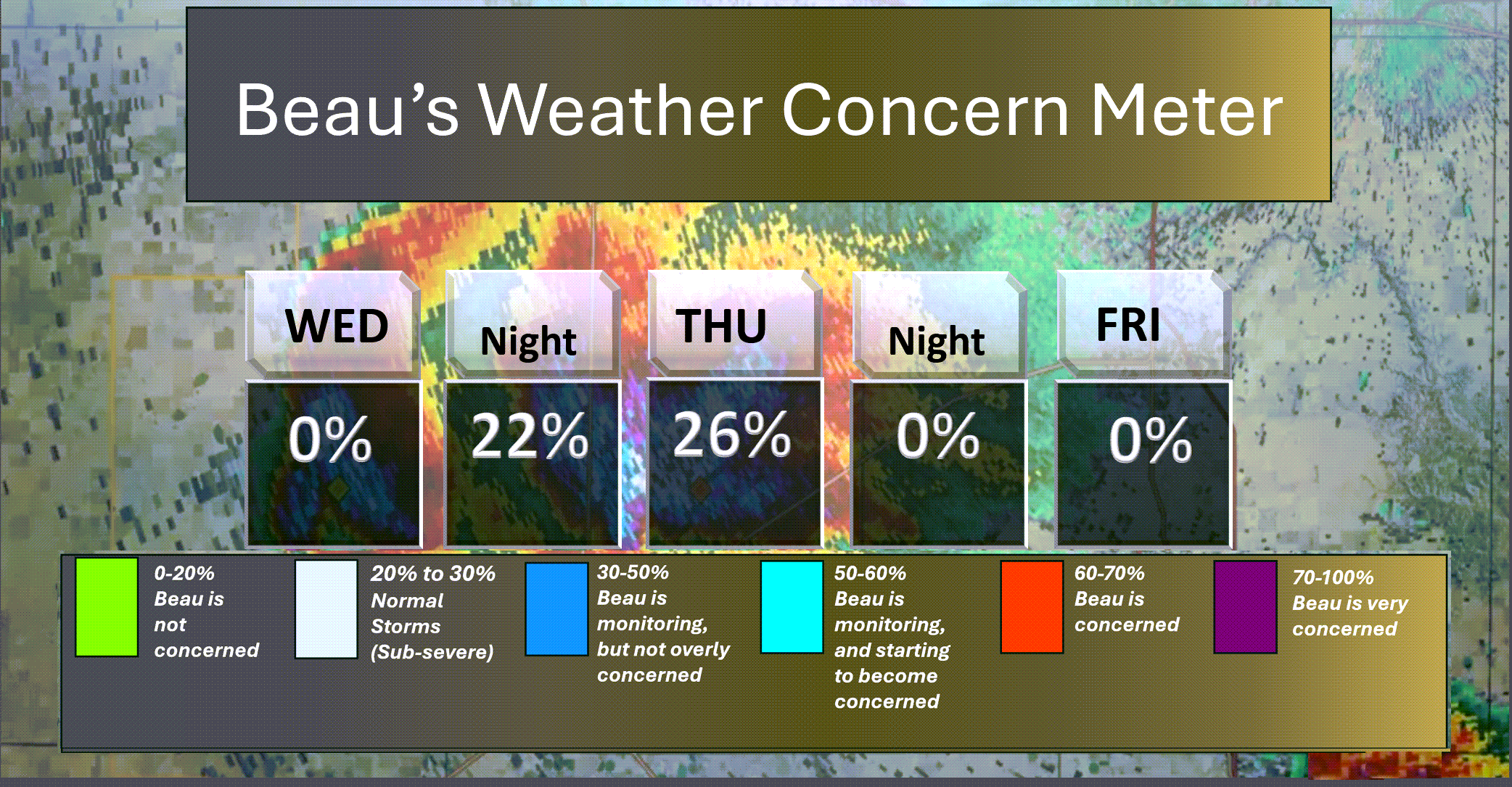
Here is the short-range thunderstorm concern meter.
A chance of lightning on Wednesday night and Thursday.
.
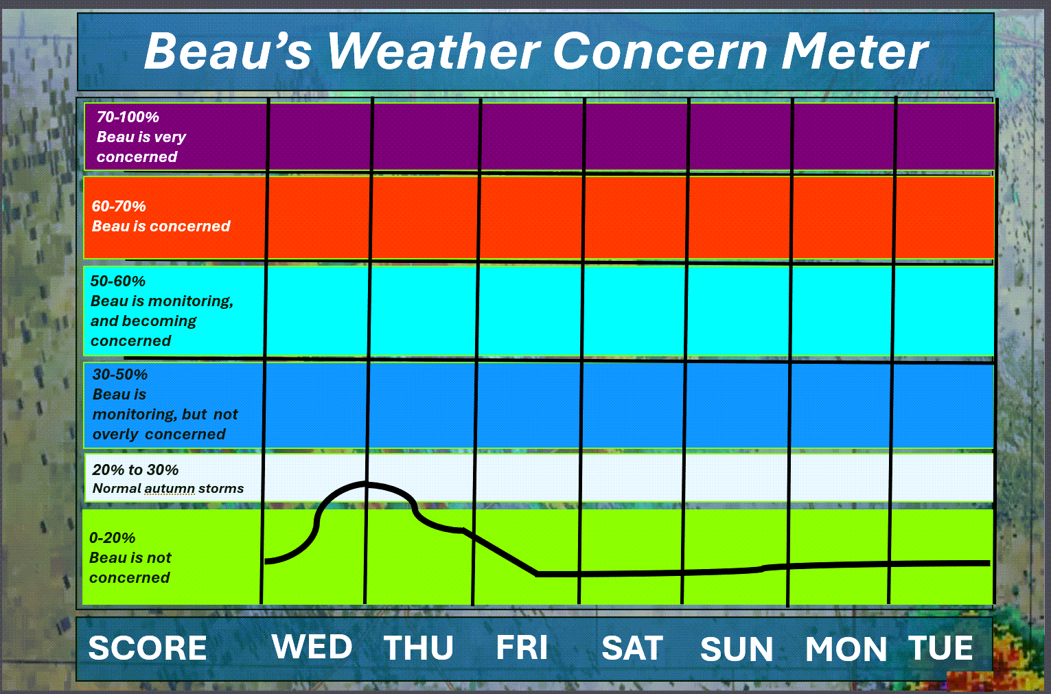
Here is the extended concern meter.
A chance of lightning tonight and tomorrow.
At this time, there are no significant severe weather concerns. I will keep an eye on tomorrow. A couple of storms could produce small hail and gusty winds.
Winds could gust to 40 mph along the cold front.
.
A quick forecast glance. Your 48-hour forecast Graphics


.
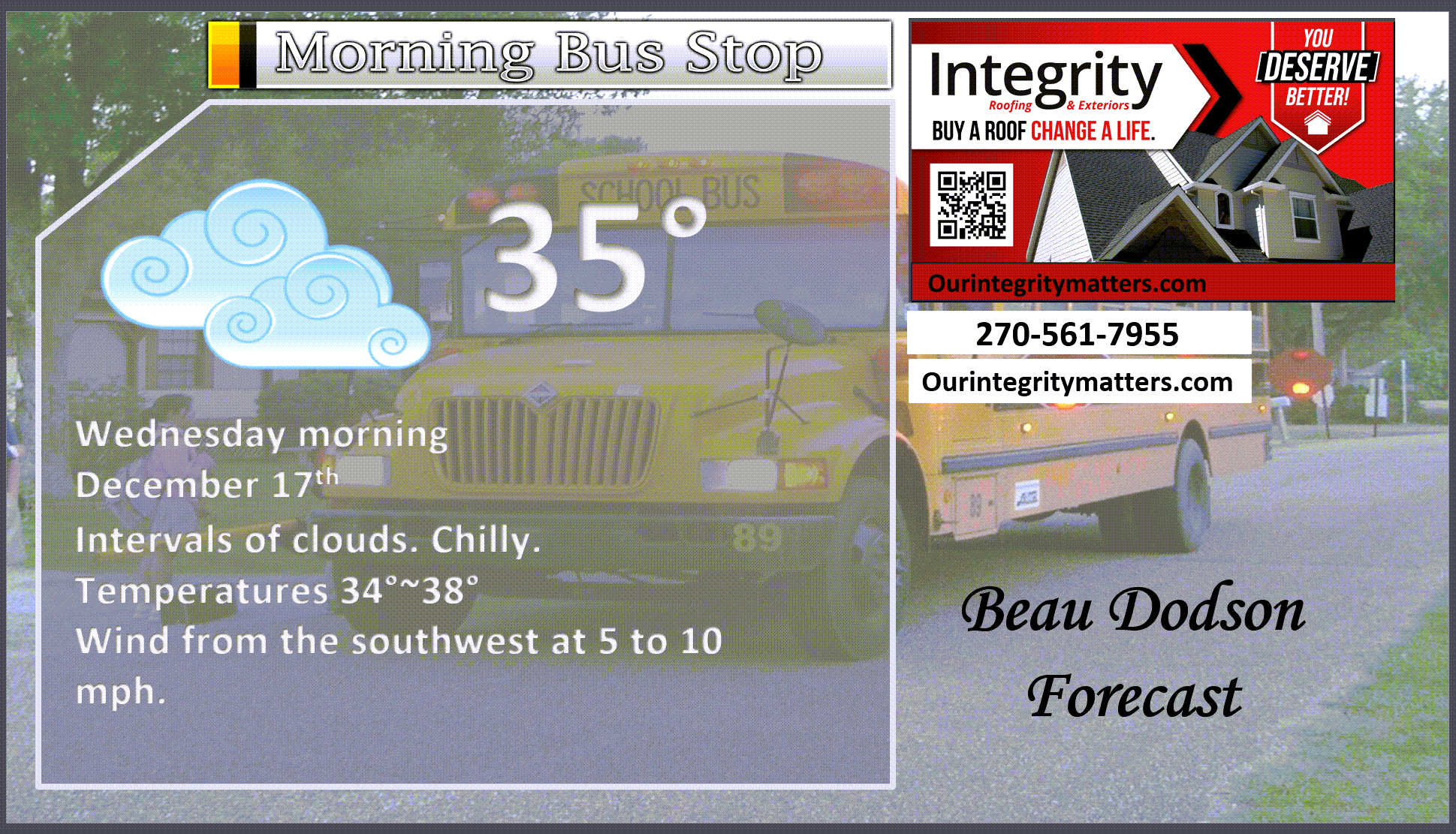
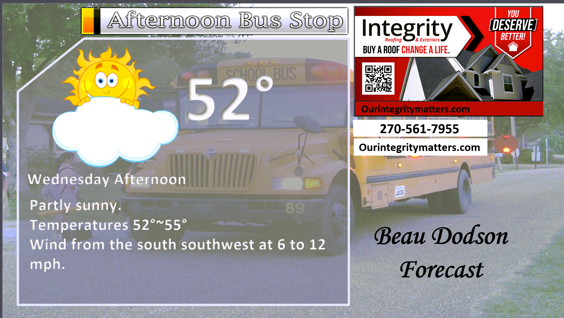
Here is your bus stop forecast
.
This afternoon
.


Forecast discussion
- A mix of sun and clouds today. A bit warmer.
- Rain showers are likely on Wednesday night and Thursday. A rumble of thunder is possible.
- Gusty winds tonight and Thursday. Winds could gust to 40 mph along and behind the cold front. Any thunderstorms that form could produce dime-sized hail and gusty winds.
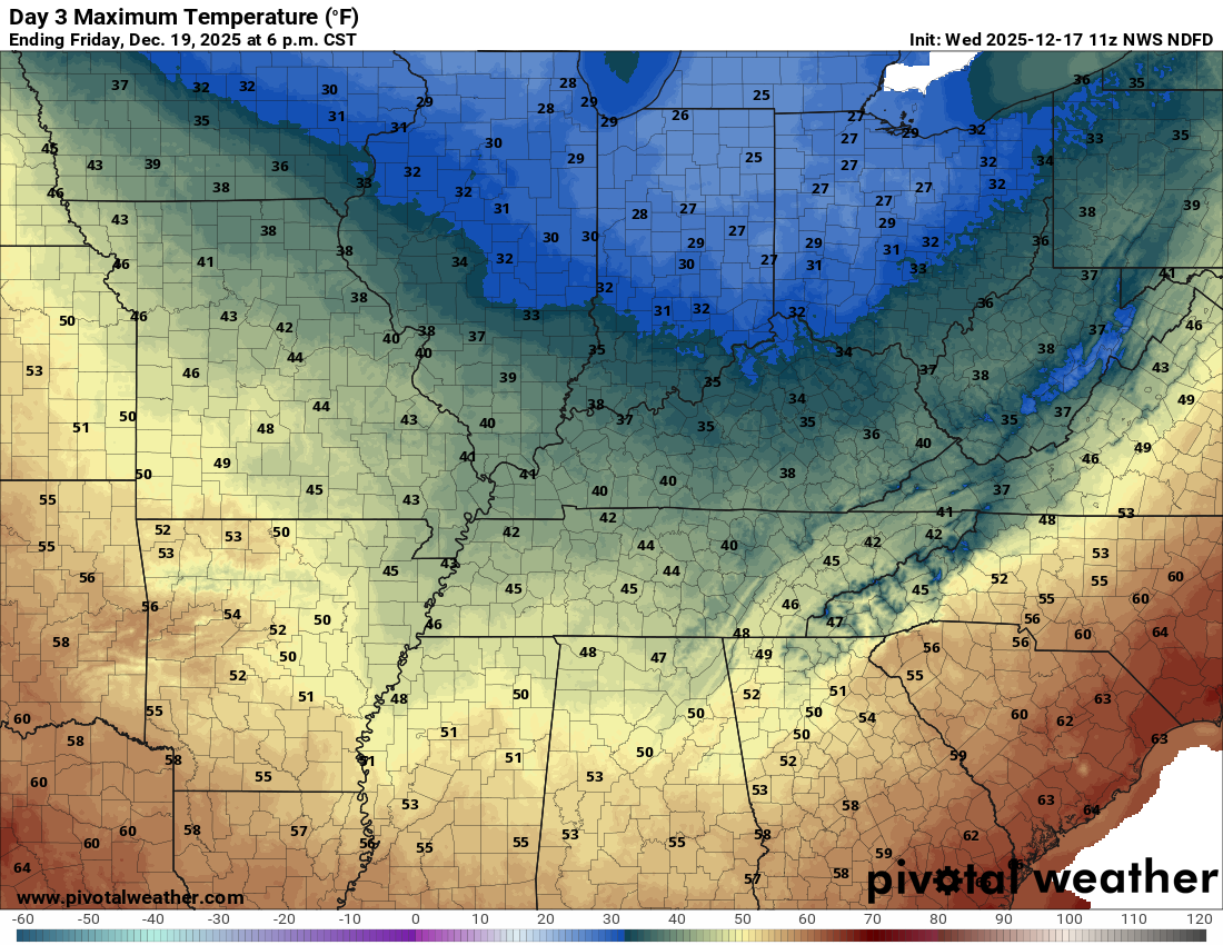
- Colder temperatures on Friday.
- A bit milder on Saturday. A bit cooler on Sunday. The risk of light showers on Saturday and Sunday remains low.
- For now, Christmas Eve and Christmas Day are shaping up to deliver average to above-average temperatures. Perhaps some isolated showers.
.
 .
.
.
What is the primary weather concern?
The primary weather concern will be showers and thunderstorms late tonight into tomorrow evening. Rainfall totals of 0.40″ to 0.60″ will be common. A few locations could receive a bit more.
There is a chance of dime-sized hail and gusty winds with the most intense storms. We do not anticipate severe weather. Dew points are low. Instability is lacking. I will monitor it. If a warning were issued, it could be for gusty winds along the cold front.
.
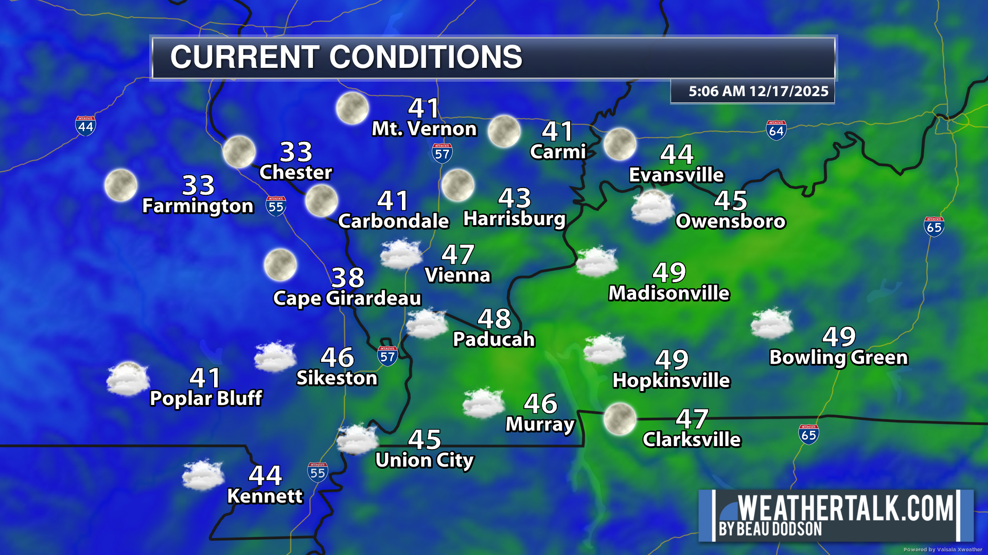
Here were the 6 AM temperatures. You can see where the clouds are thicker. Those areas are a bit warmer this morning.
.
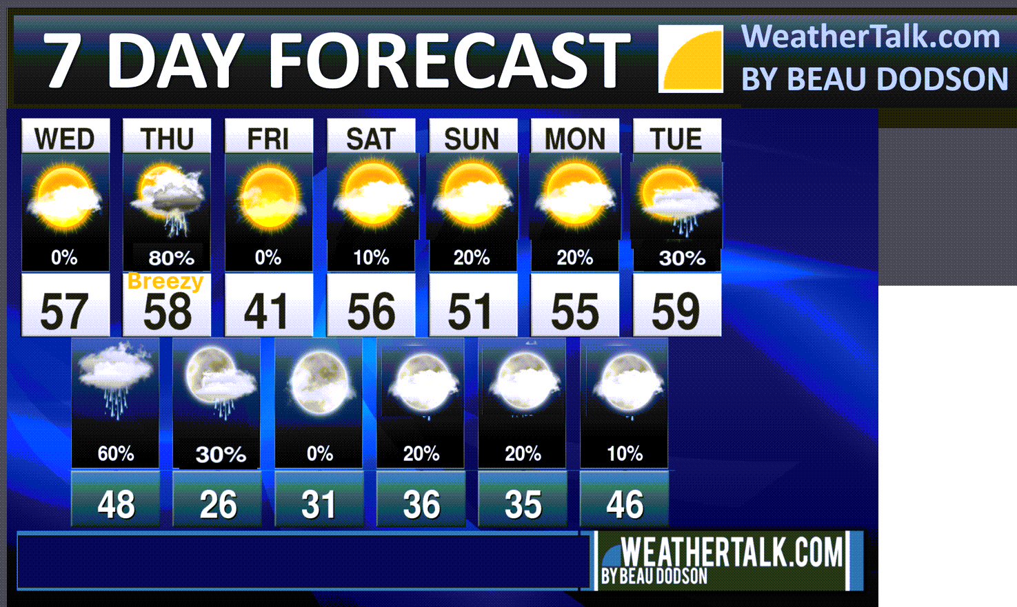
Seven-day outlook graphic.
See the video for more details specific to your county. This is a broad-brush overview of the entire region.
.
Today
No significant weather concerns through this afternoon.
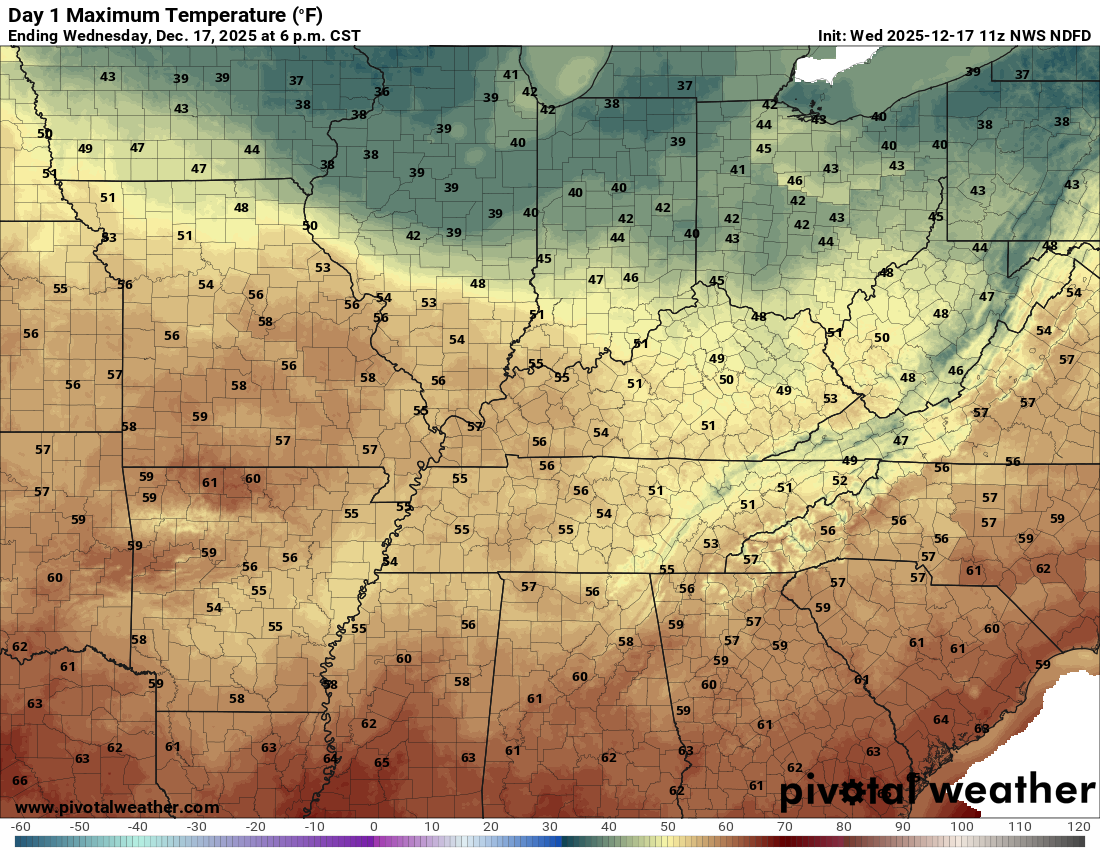
We will have a mix of sun and clouds today. Hopefully, we get a bit more sunshine. Yesterday ended up with a lot of clouds over a good chunk of our region. This kept temperatures a tad cooler.
The clouds today aren’t the low stratus clouds. Thus, they should be a bit easier to mix out.
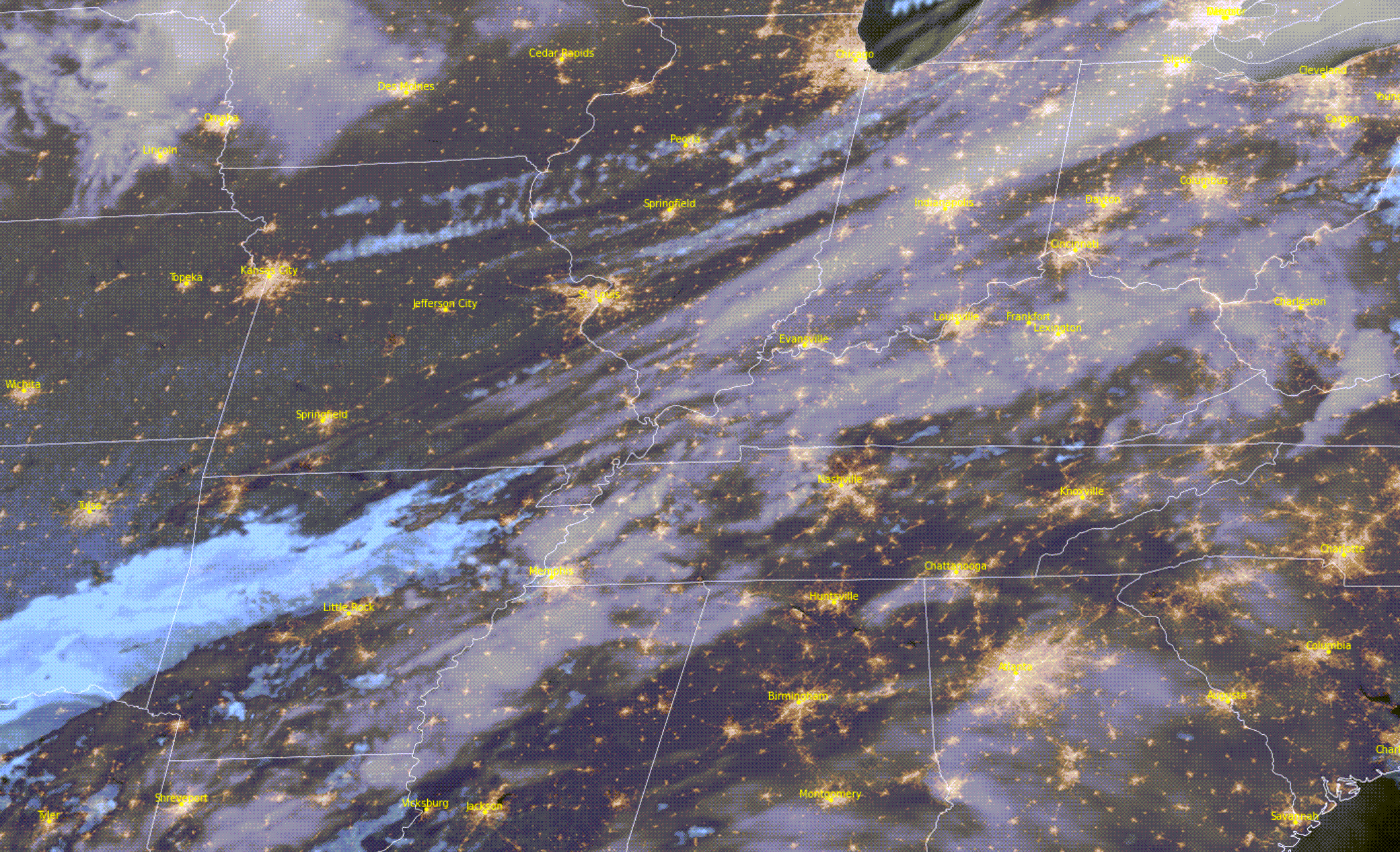
Here was the 6 am satellite view. You can see the clouds.
.
Tonight through Friday Night
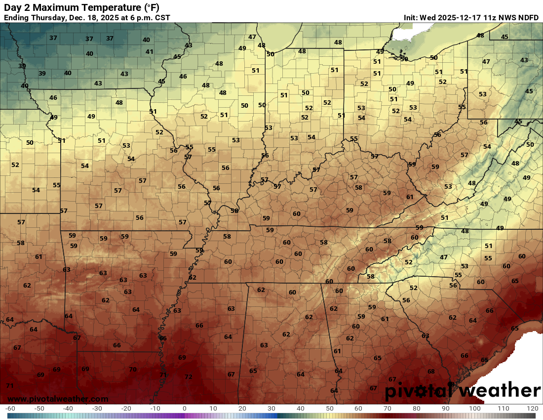
Temperatures will pop above average on Thursday.
It is possible that high temperatures are reached early in the day on Thursday (for some). A cold front will sweep across the region on Thursday, bringing falling temperatures.
It is just a matter of how fast the front moves across the region.
The front will arrive first over southeast Missouri and southwest Illinois. Then, it will push eastward from there.
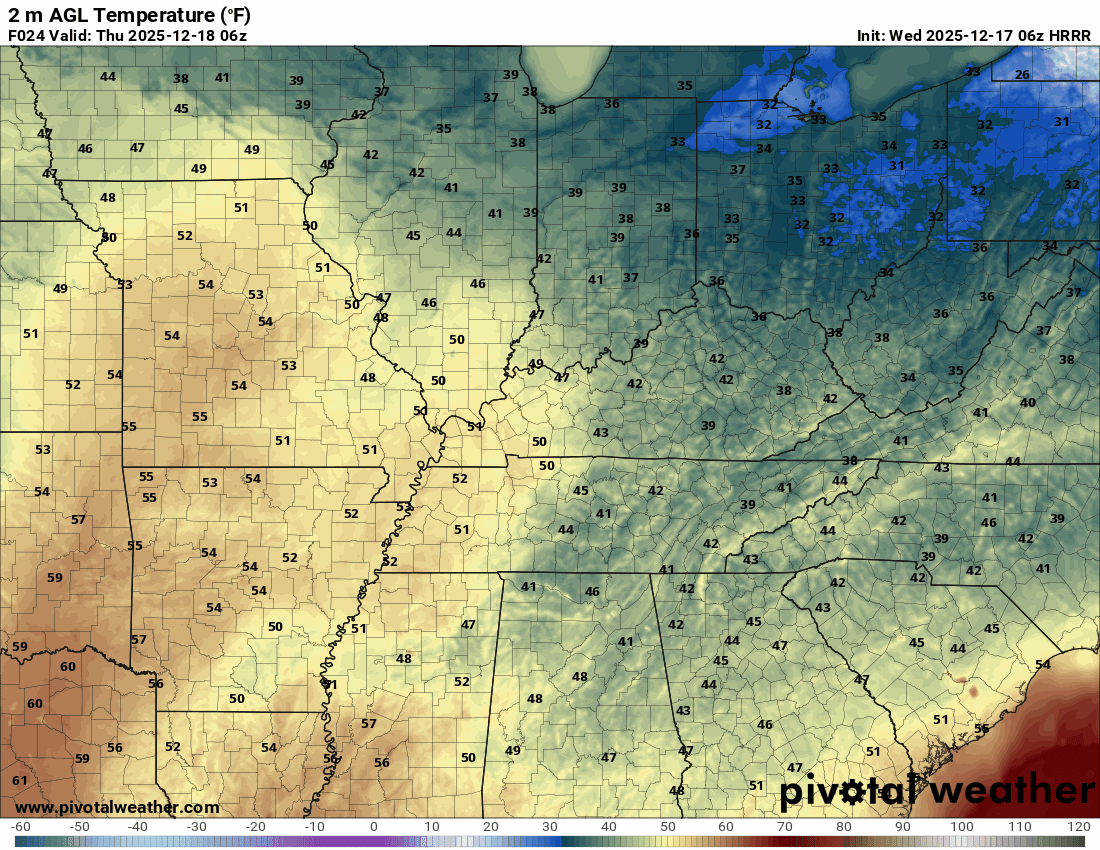
Here is the temperature animation.
Time stamp at the top of the animation.
The timestamp (upper left) is in Zulu. 12z=6 am. 18z=12 pm. 00z=6 pm.
.
Here are the highs for today
Here are the highs for Thursday
.
Numerous showers and thunderstorms will accompany the front. See the video and future-cast radars.
The bulk of the rain will fall late tonight and especially on Thursday. Perhaps lingering into Thursday evening.
The rain should end before colder air arrives on Thursday night.
At this time, it does not appear that dewpoints will be high enough for severe thunderstorms. The risk of severe weather is tiny.
At most, a few of the storms could produce gusty winds and pea to dime-sized hail.
Speaking of gusty winds.
It will be a bit windy on Thursday. A deep area of low pressure will pass to our north. This will produce a tight pressure gradient. That equals gusty winds in general. Mainly in the 20 to 35 mph range. Occasionally, higher gusts.
Winds will begin late tonight and continue into tomorrow evening.
Let’s look at rain totals. This will fall tonight into Thursday afternoon.
Not too much change in this from the previous update. Rain totals increased a bit across southeast Missouri and southern Illinois.
Double-click the image to enlarge it.

.
Friday through Sunday
A roller-coaster ride in the temperature department over the coming weeks.
It will turn colder on Friday.
Highs will be in the 30s and 40s.
Double-click the image to enlarge it.
.
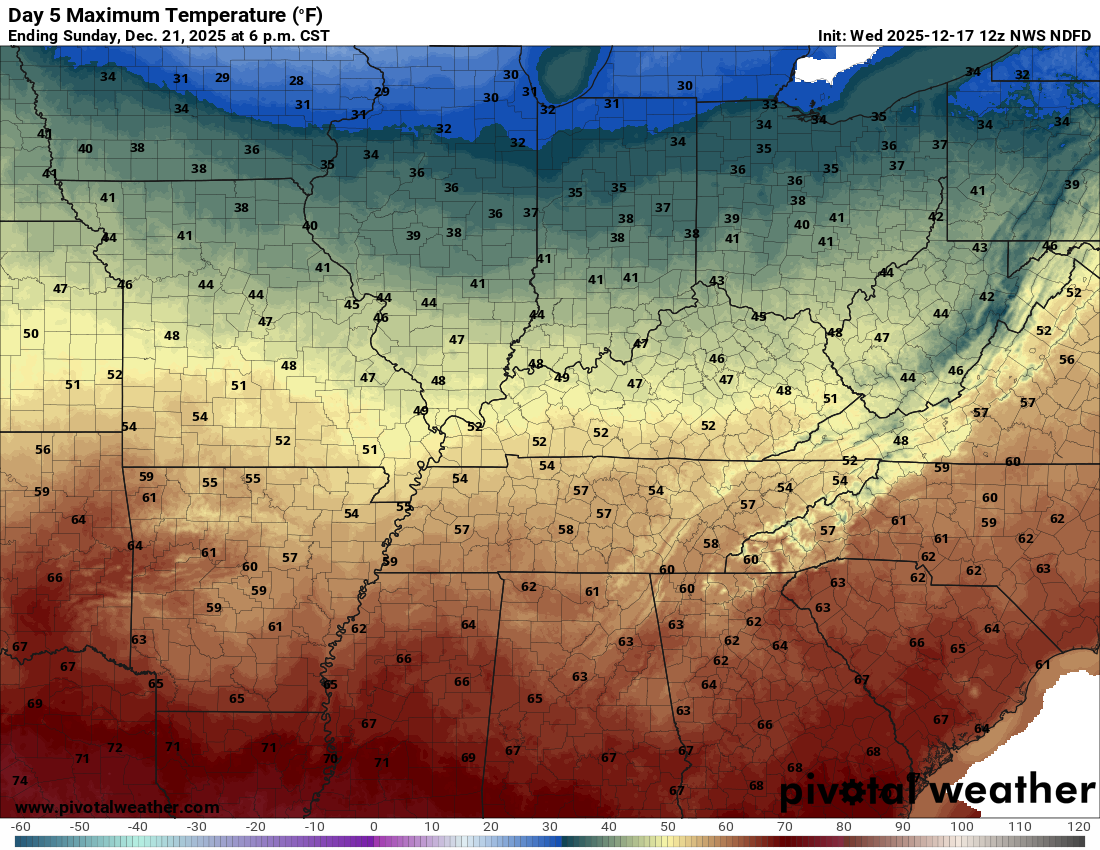
Friday will be dry and chilly.
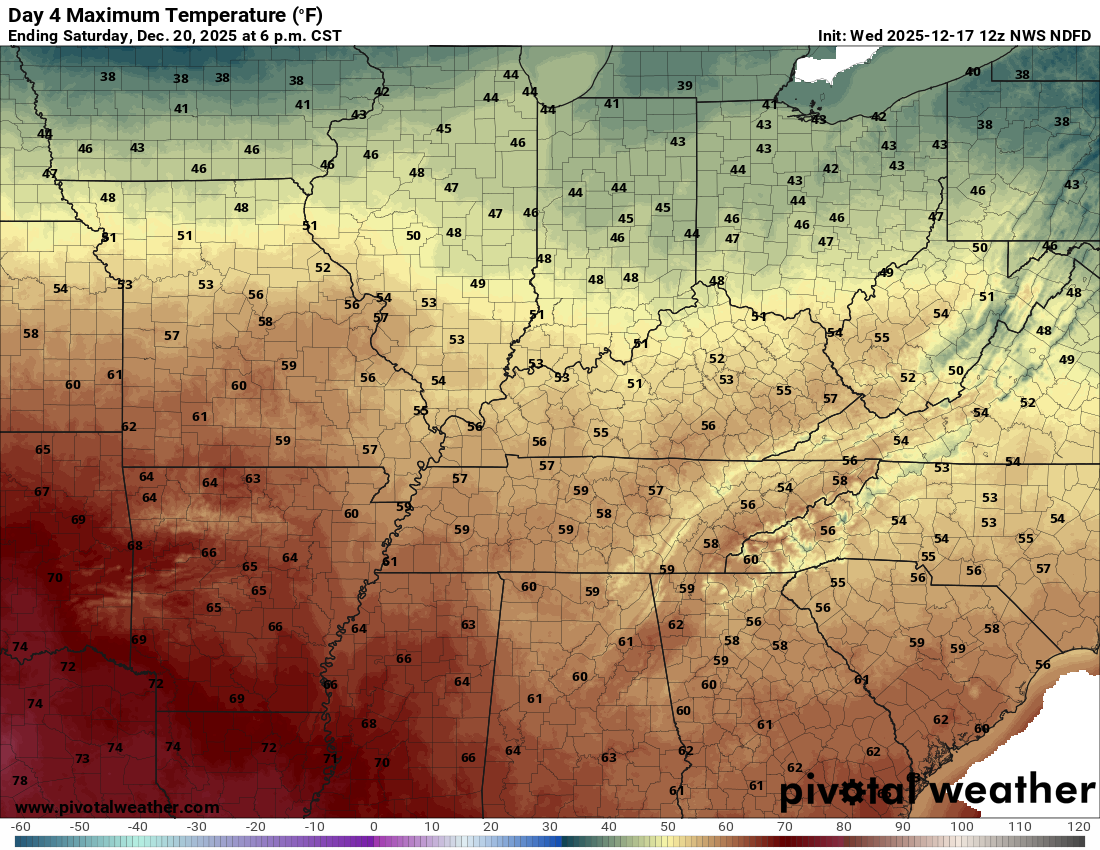
Temperatures will warm into the forties and fifties on Saturday and Sunday.
Saturday may end up a bit warmer than Sunday.
Double-click on images to enlarge them.
Saturday highs
Sunday highs
.
There will be a chance of isolated showers on Saturday and Sunday. For now, I kept the chances low. I will monitor trends over the coming days.
.
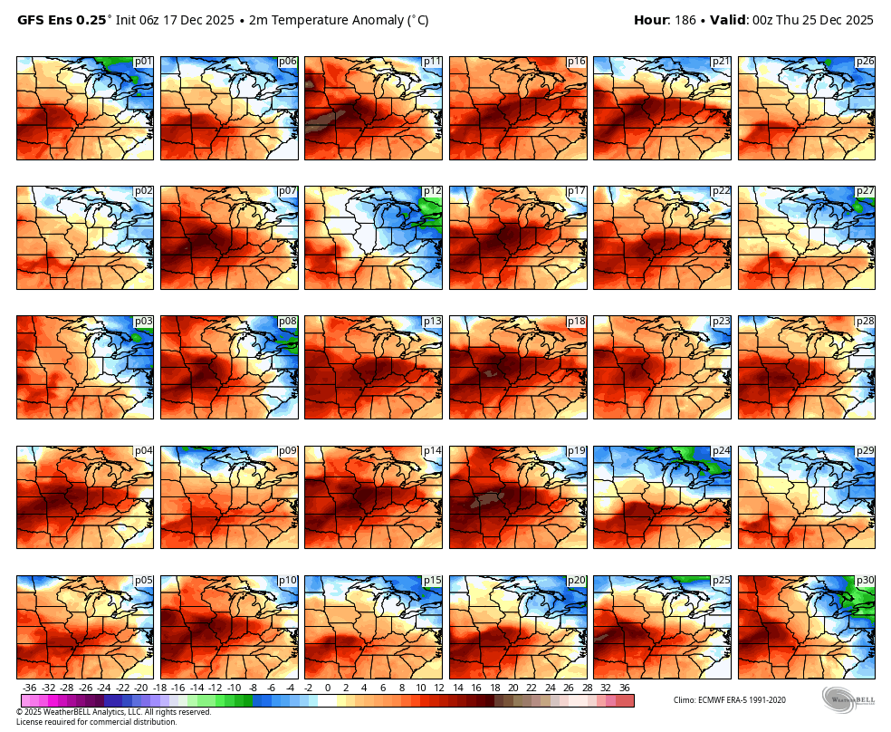
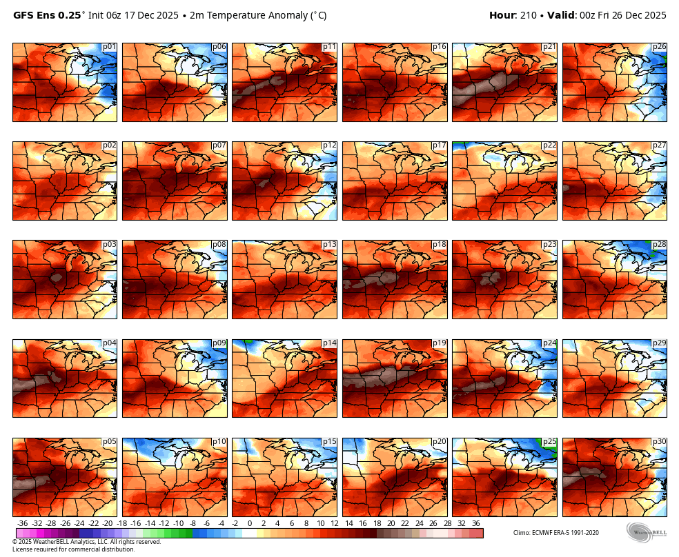
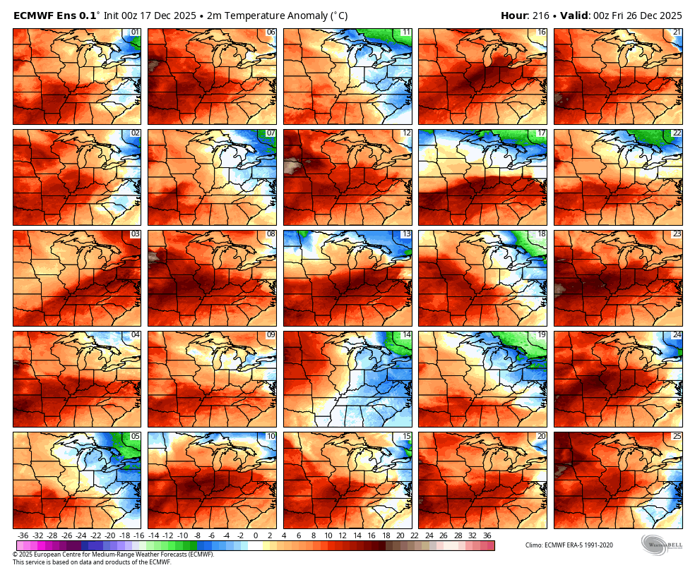
Christmas Eve and Christmas Day
At this time, both Christmas Eve and Christmas Day will deliver average to above-average temperatures.
You can see that in the ensembles.
The more squares that agree, the higher the confidence in the final forecast.
Red and deep red indicate above-average temperatures.
As you can see, the vast majority of squares indicate above-average temperatures.
.
There could be some showers around Christmas. Right now, the signal for a bigger system is not there.
No significant snow or ice in the forecast.
Some data shows a return to colder air around the first week of January. Long way out, but I will monitor it.
.

.
The timestamp (upper left) is in Zulu. 12z=6 am. 18z=12 pm. 00z=6 pm.
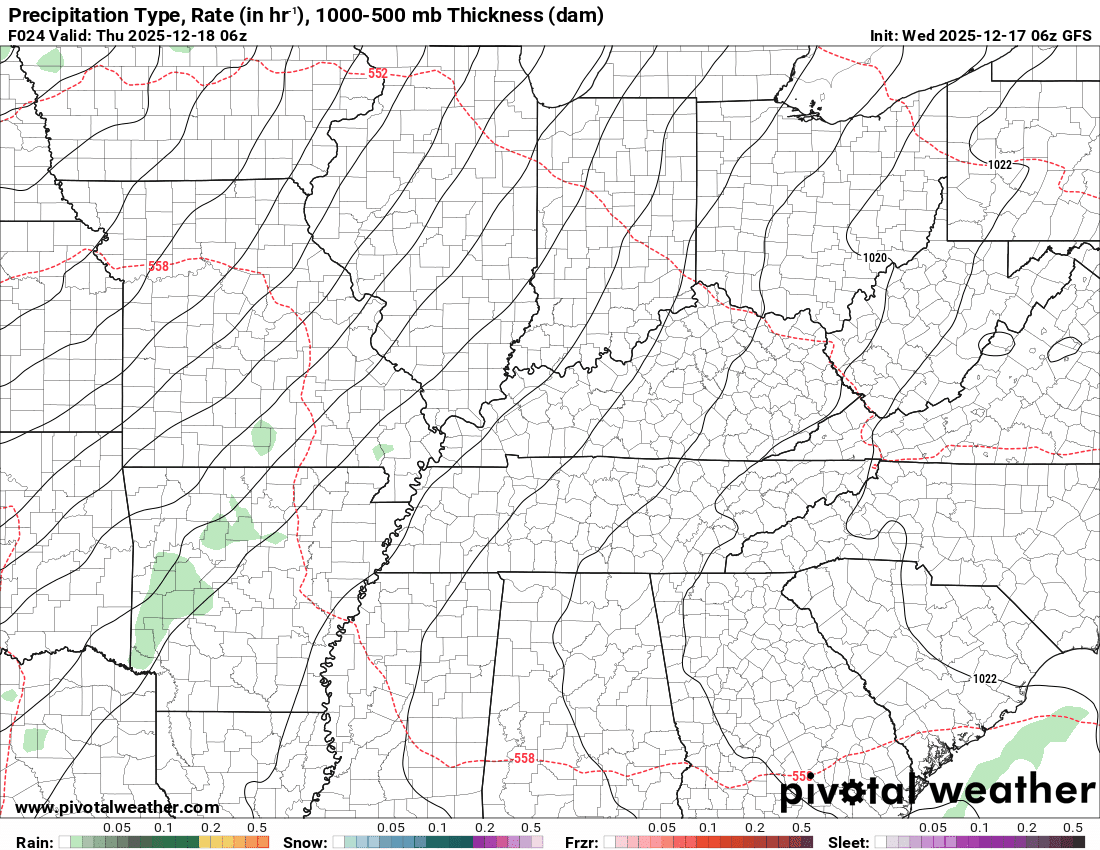
Double-click the animation to enlarge it.
GFS model
On this particular model, green is rain. Yellow and orange indicate moderate to heavy rain. Blue is snow. Pink, red, and purple are freezing rain and sleet.
.
.
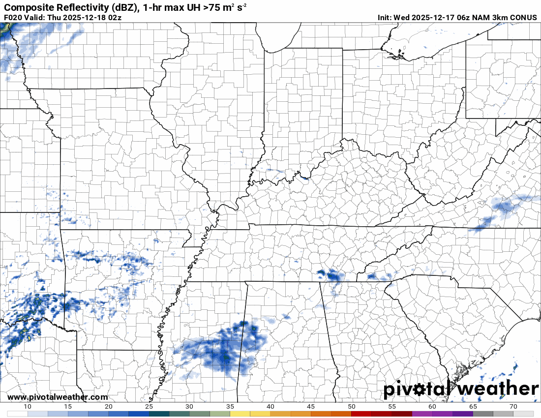
The timestamp (upper left) is in Zulu. 12z=6 am. 18z=12 pm. 00z=6 pm.
Double-click the animation to enlarge it.
NAM 3K model
.
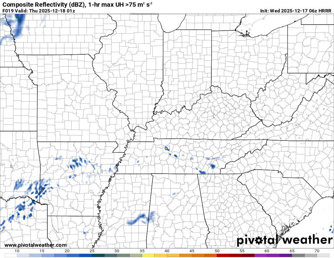
The timestamp (upper left) is in Zulu. 12z=6 am. 18z=12 pm. 00z=6 pm.
Double-click the animation to enlarge it.
Hrrr model
 ..
..
..
.
Click here if you would like to return to the top of the page.
.Average high temperatures for this time of the year are around 50 degrees.
Average low temperatures for this time of the year are around 32 degrees.
Average precipitation during this time period ranges from 1.00″ to 1.25″
Six to Ten Day Outlook.
Blue is below average. Red is above average. The no color zone represents equal chances.
Average highs for this time of the year are in the lower 60s. Average lows for this time of the year are in the lower 40s.

Green is above average precipitation. Yellow and brown favors below average precipitation. Average precipitation for this time of the year is around one inch per week.

.

Average low temperatures for this time of the year are around 31 degrees.
Average precipitation during this time period ranges from 1.00″ to 1.25″
.
Eight to Fourteen Day Outlook.
Blue is below average. Red is above average. The no color zone represents equal chances.

Green is above average precipitation. Yellow and brown favors below average precipitation. Average precipitation for this time of the year is around one inch per week.

.
.
.
We have a new service to complement your www.weathertalk.com subscription. This does NOTreplace www.weathertalk.com It is simply another tool for you to receive severe weather information.
.
https://weathercallservices.com/beau-dodson-weather


Want to receive the daily forecast/other products on your Beau Dodson Weather app?
Did you know you have four options in your www.weathertalk.com account
You will then receive these via your Beau Dodson Weather app.
Just log into your www.weathertalk.com account
Click the NOTIFICATION SETTINGS TAB
Then, turn them on (green) and off (red)
🌪️ Number 1 is the most important one. Severe alerts, tornado alerts, and so on.
Number 2 is the daily video, blog, livestream alerts, and severe weather Facebook threads on severe days or winter storm days.
Number 3 is the daily forecast. I send that out every day during the afternoon hours. It is the seven-day forecast, hazardous weather outlook, fire outlook, and more.
Number 4 is to receive the daily video, blog, and other content on NON-severe weather days (every day without severe threats in other words)
GREEN IS ON
RED IS OFF

I am going to start going live during bigger severe weather events.
Check it out here https://www.youtube.com/user/beaudodson
Click the subscribe button (it’s a free subscription button), and it will alert you when I go live. I will also send out alerts to the app when I go live for an event.

.

Radars and Lightning Data
Interactive-city-view radars. Clickable watches and warnings.
https://wtalk.co/B3XHASFZ
Old legacy radar site (some of you like it better)
https://weatherobservatory.com/weather-radar.htm
If the radar is not updating then try another one. If a radar does not appear to be refreshing then hit Ctrl F5. You may also try restarting your browser.
Backup radar site in case the above one is not working.
https://weathertalk.com/morani
Regional Radar
https://imagery.weathertalk.com/prx/RadarLoop.mp4
** NEW ** Zoom radar with chaser tracking abilities!
ZoomRadar
If the radar is not working, then email me: Email me at beaudodson@usawx.com
.
We do have some sponsors! Check them out.
Roof damage from recent storms? Link – Click here
INTEGRITY ROOFING AND EXTERIORS!
⛈️ Roof or gutter damage from recent storms? Today’s weather is sponsored by Integrity Roofing. Check out their website at this link https://www.ourintegritymatters.com/

![]()
![]()
![]()
Make sure you have three to five ways of receiving your severe weather information.
Weather Talk is one of those ways! Now, I have another product for you and your family.

.
Want to add more products to your Beau Dodson Weather App?
Receive daily videos, weather blog updates on normal weather days and severe weather and winter storm days, your county by county weather forecast, and more!
Here is how to do add those additional products to your app notification settings!
Here is a video on how to update your Beau Dodson Weather payment.
The app is for subscribers. Subscribe at www.weathertalk.com/welcome then go to your app store and search for WeatherTalk
Subscribers, PLEASE USE THE APP. ATT and Verizon are not reliable during severe weather. They are delaying text messages.
The app is under WeatherTalk in the app store.

Apple users click here

Android users click here
.
Radars and Lightning Data
Interactive-city-view radars. Clickable watches and warnings.
https://wtalk.co/B3XHASFZ
Old legacy radar site (some of you like it better)
https://weatherobservatory.com/weather-radar.htm
If the radar is not updating then try another one. If a radar does not appear to be refreshing then hit Ctrl F5. You may also try restarting your browser.
Backup radar site in case the above one is not working.
https://weathertalk.com/morani
Regional Radar
https://imagery.weathertalk.com/prx/RadarLoop.mp4
** NEW ** Zoom radar with chaser tracking abilities!
ZoomRadar
Lightning Data (zoom in and out of your local area)
https://wtalk.co/WJ3SN5UZ
Not working? Email me at beaudodson@usawx.com
National map of weather watches and warnings. Click here.
Storm Prediction Center. Click here.
Weather Prediction Center. Click here.
.

Live lightning data: Click here.
Real time lightning data (another one) https://map.blitzortung.org/#5.02/37.95/-86.99
Our new Zoom radar with storm chases
.
.

Interactive GOES R satellite. Track clouds. Click here.
GOES 16 slider tool. Click here.
College of DuPage satellites. Click here
.

Here are the latest local river stage forecast numbers Click Here.
Here are the latest lake stage forecast numbers for Kentucky Lake and Lake Barkley Click Here.
.
.
Find Beau on Facebook! Click the banner.


 .
.