

.
I have some question-and-answer threads over on the Facebook page. Link to those threads CLICK HERE
Or email me at beaudodsonweather@gmail.com
..

🌪️ Seven-Day Tornado Outlook ⛈️
December 11th through December 17th.
Current risk: NONE
Current confidence level: High confidence.
Comments:
.

Seven-Day Hazardous Weather Outlook
1. Is lightning in the forecast? NO.
2. Are organized/widespread severe thunderstorms in the forecast? NO.
4. Will non-thunderstorm winds top 40 mph? NO.
5. Will the temperature fall below 20 degrees? YES. A slight chance on Friday night. A high chance on Saturday and Sunday night.
6. Is the wind chill forecast to drop below ten degrees? YES. Saturday night into Monday morning. At times, wind chill values could dip below zero.
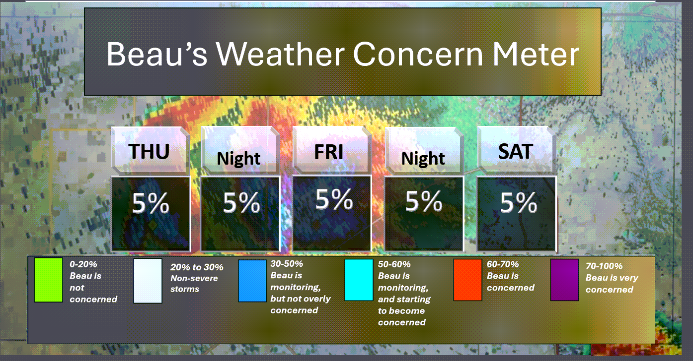
Here is the short-range concern meter.
.
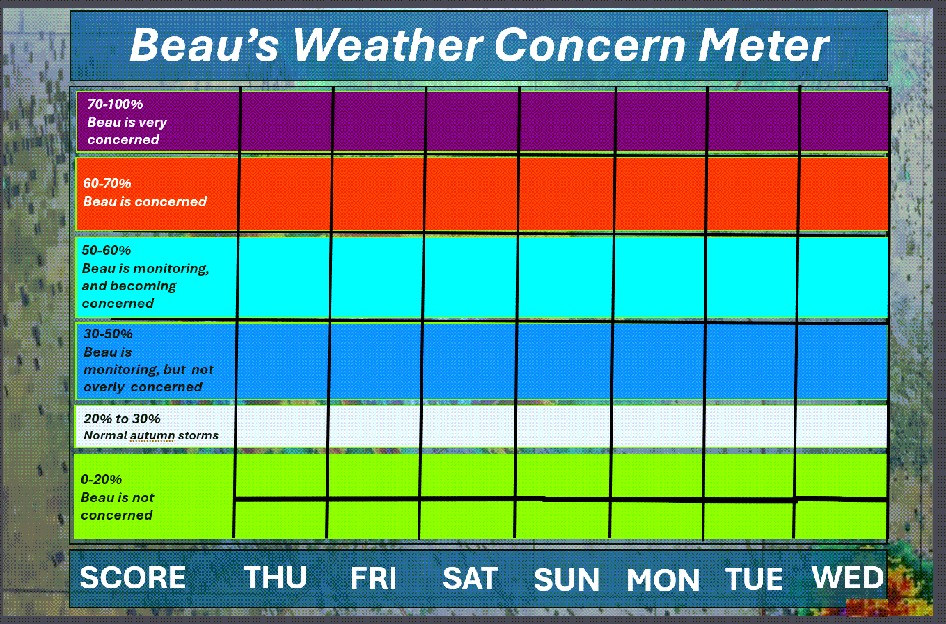
Here is the extended concern meter.
No severe weather concerns.
.
A quick forecast glance. Your 48-hour forecast Graphics


.
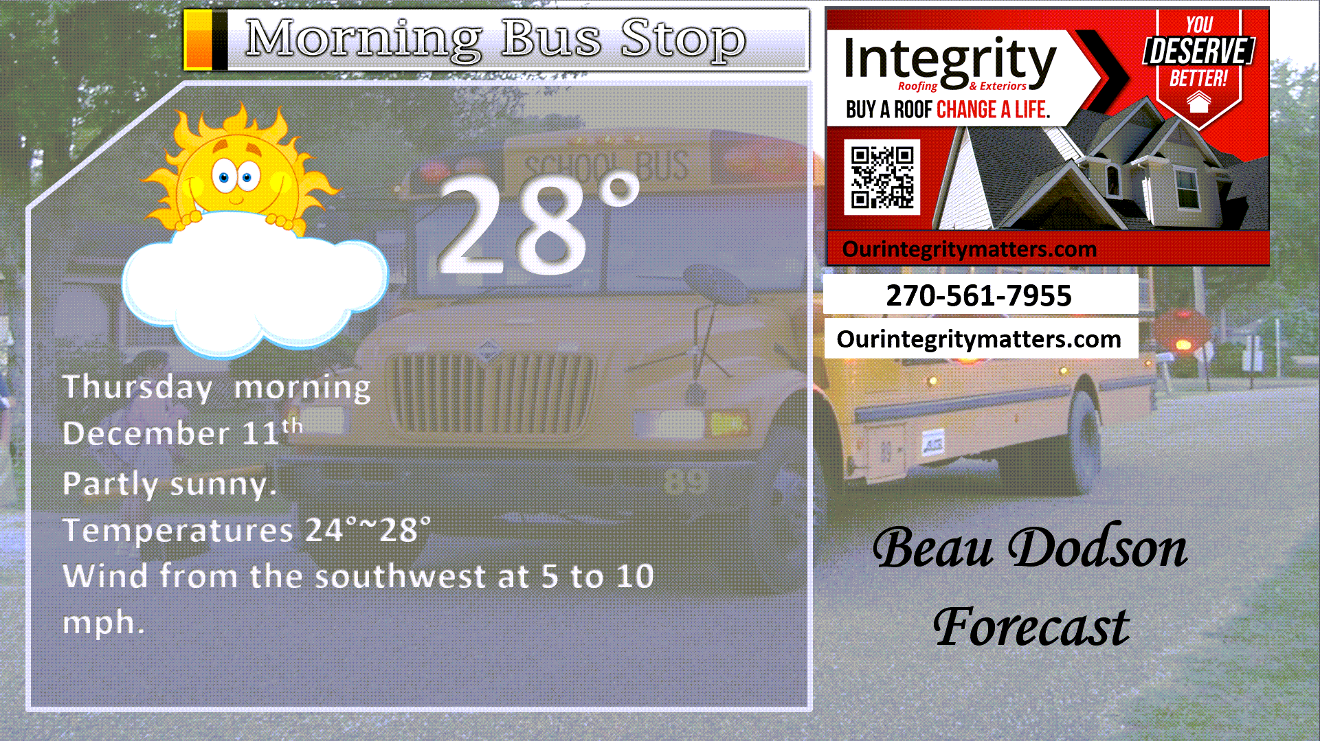
Here is your bus stop forecast
.
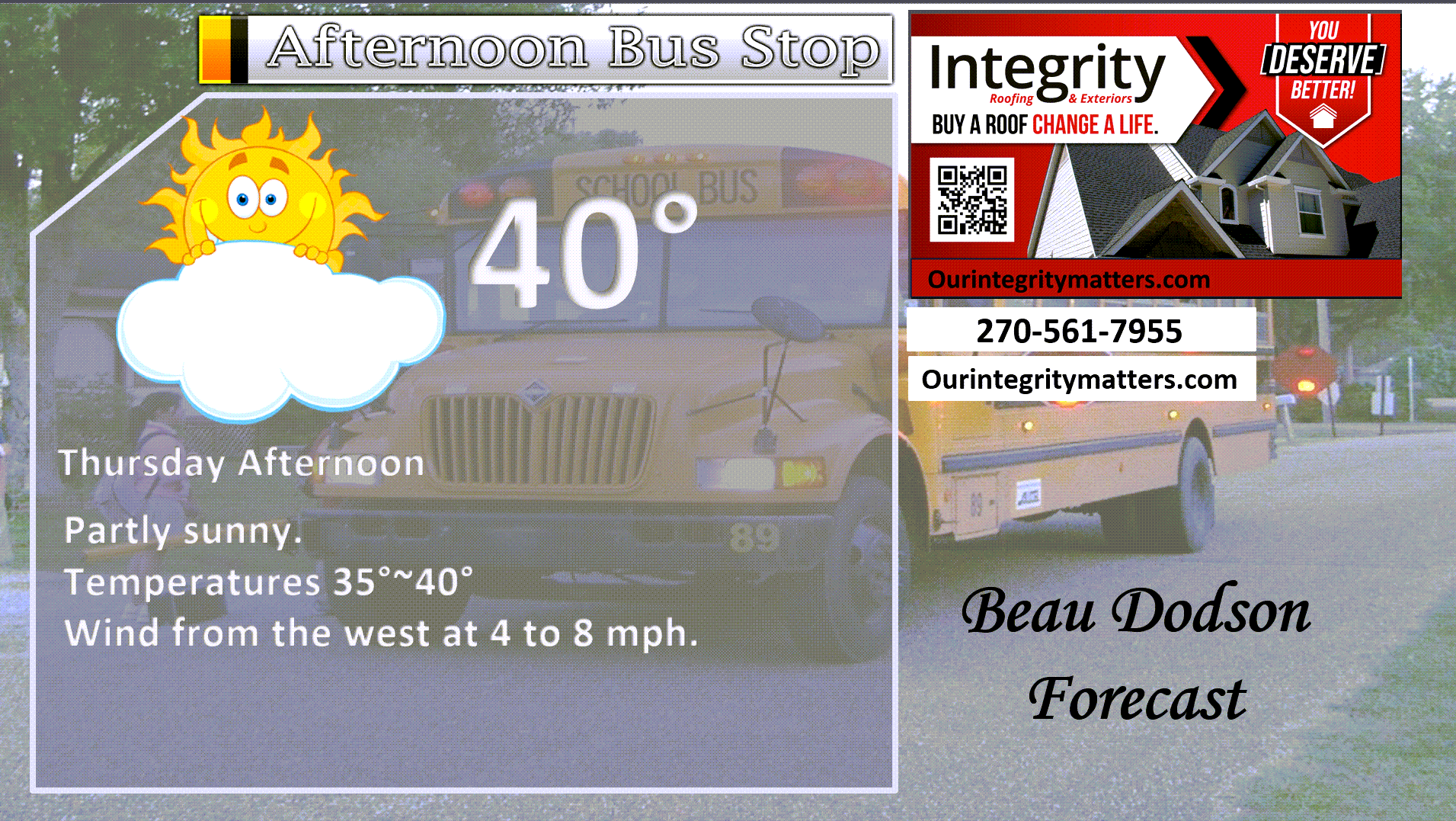
This afternoon
.


Forecast discussion
- An okay day ahead of us.
- Snow chances tonight over my far northern and northeastern counties. Little or no impacts.
- Friday will be the pick day of the weekend.
- A cold weekend ahead of us. The coldest night will be Saturday night/Sunday morning.
- Monitoring a warming trend in weeks two and three.
.
 .
.
.
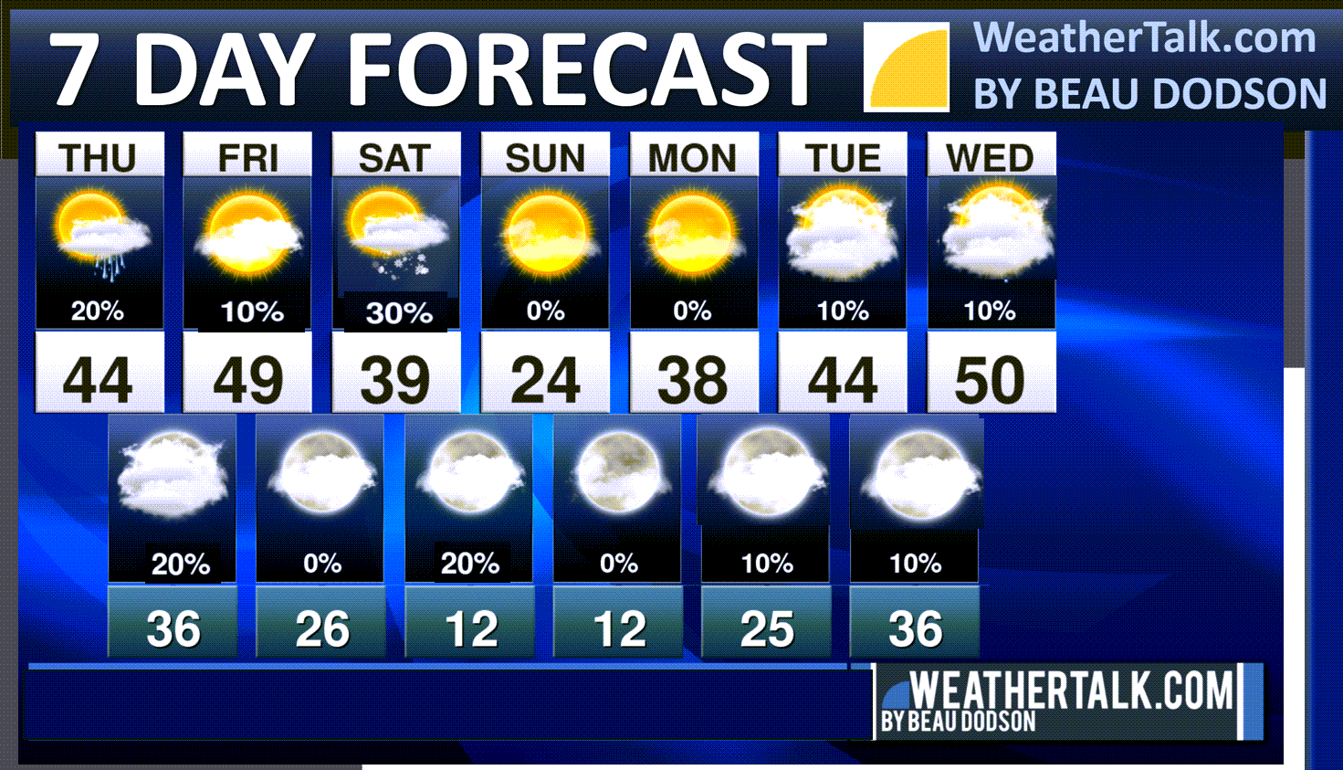
Seven-day outlook graphic.
See the video for more details specific to your county. This is a broad-brushed outlook for the entire region.
.
Today through Friday
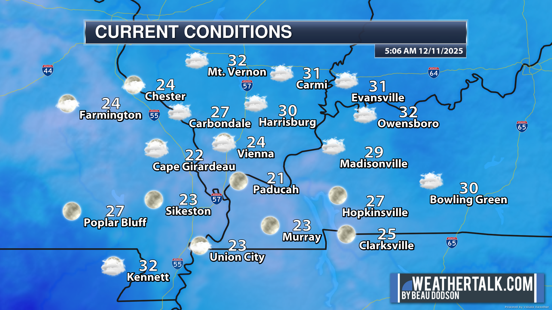
Good morning, everyone.
We are waking up to chilly temperatures.
6 AM temperatures
.
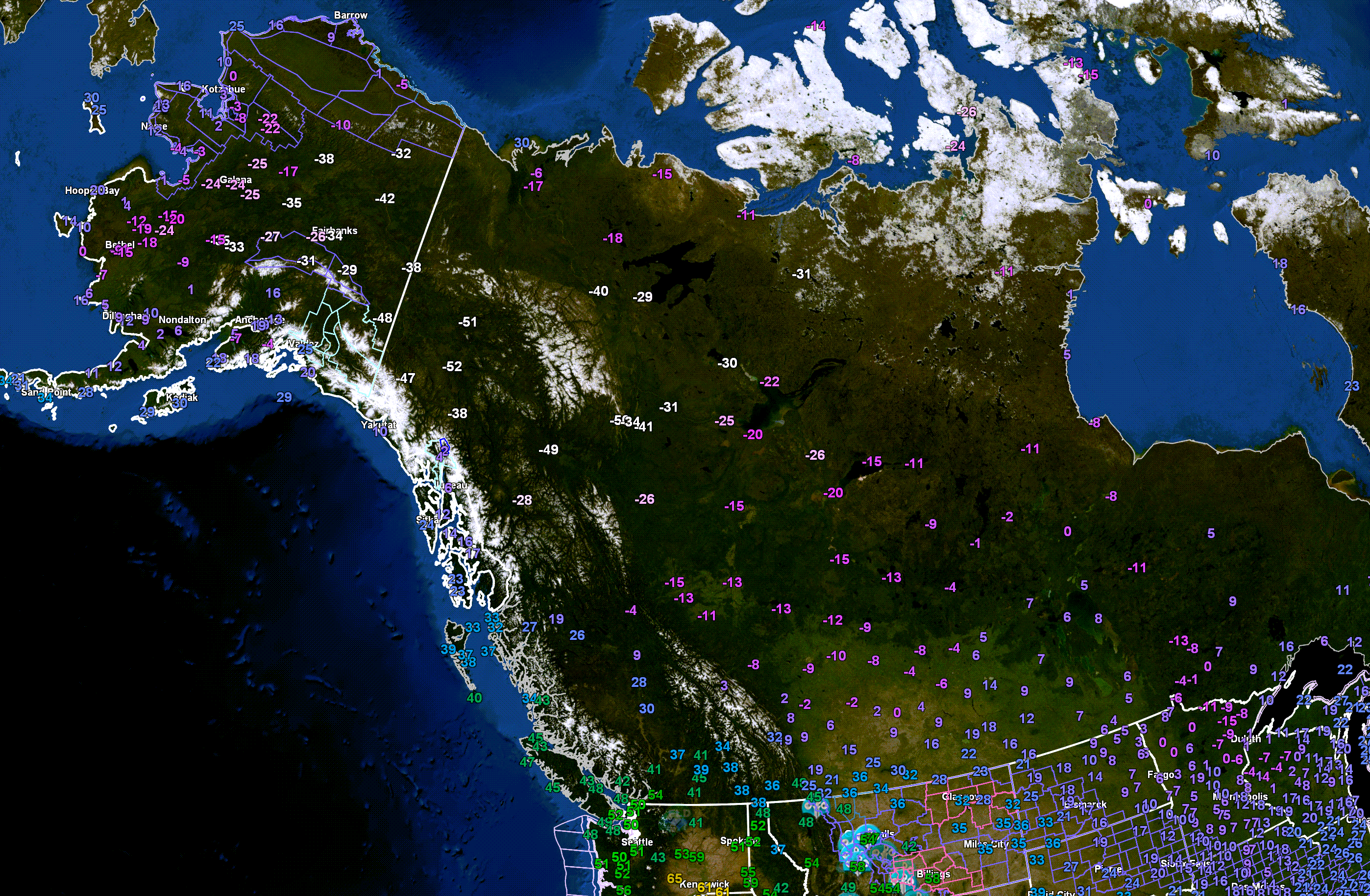
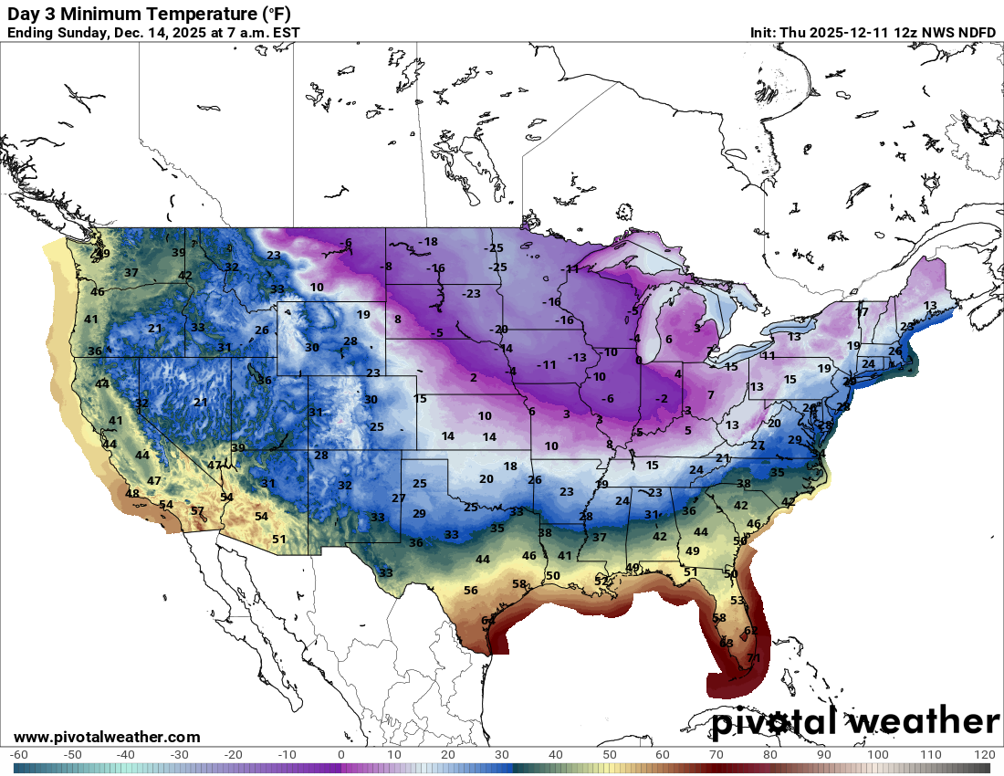
Once again, check out the temperatures in Alaska and Canada. Yes, some locations are -50 below zero! Wind chill values are in the -60s. Incredibly cold.
This is the source region for our weekend cold snap. Thankfully, it won’t be THAT cold here.
Double-click the image to enlarge it.
.
Our mostly quiet weather continues. There are no significant precipitation events in the forecast. There are, however, some light ones.
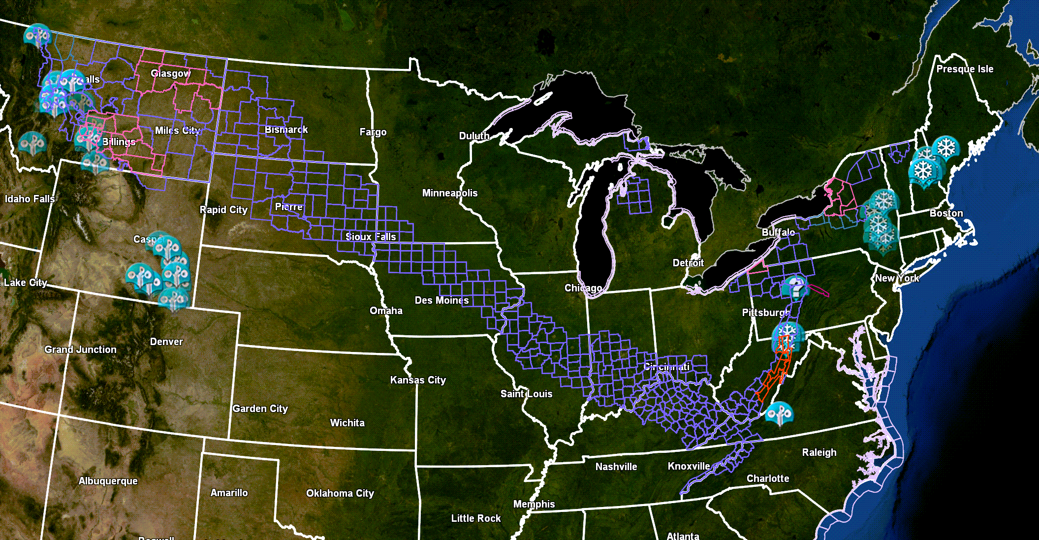
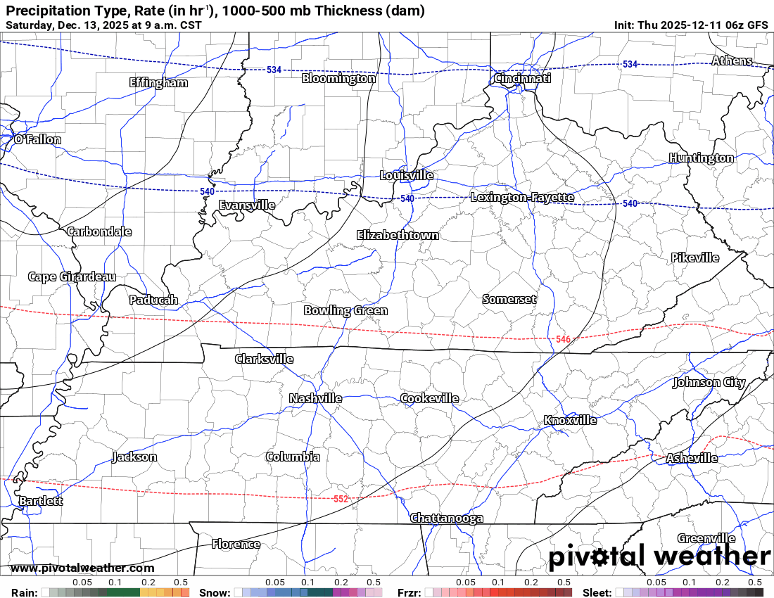
Check out the winter storm warnings and winter weather advisories on this morning’s weather map.
Those red colors are blizzard warnings in West Virginia. I believe it is day three for blizzard warnings in that location!
It has been a harsh start to winter. December has been quite cold. One of the colder starts to December in our local region, as well.
The long line of advisories is just to our north and northeast. You don’t see a long line of advisories like that very often. They run from Canada almost to the East Coast.
They do not include any of my forecast counties.
.
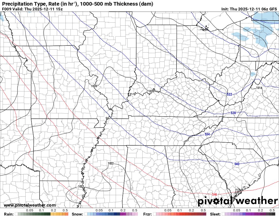
This will be a clipper-type system that will race southeast over the coming 24 to 36 hours.
This will bring snow just to our north and east. It may clip my northern counties tonight. Mostly along a line from Mt Vernon, Illinois, to Owensboro, Kentucky.
Here is the future-cast radar for tonight from the RRFS model guidance. The blue is snow. It just barely clips my far northern and northeastern counties.
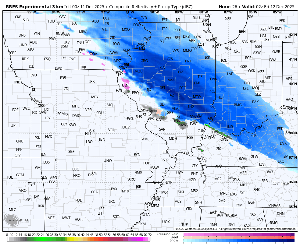
.
Locally, temperatures will be marginal for accumulation. Maybe a hint of snow on grassy surfaces.
Here is the accumulation path for tonight’s system. Just a tad northeast of my counties.
.
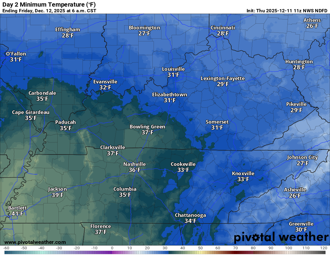
Lows tonight will be in the 30s, perhaps near freezing from Mt Vernon southeast to Owensboro.
Thus, the risk of accumulating snow is low. Maybe a dusting here and there if the system trends a bit more southwest.
We are not expecting any impacts.
The rest of the region will be dry tonight.
Here is the low temperature forecast for tonight/tomorrow morning.
.
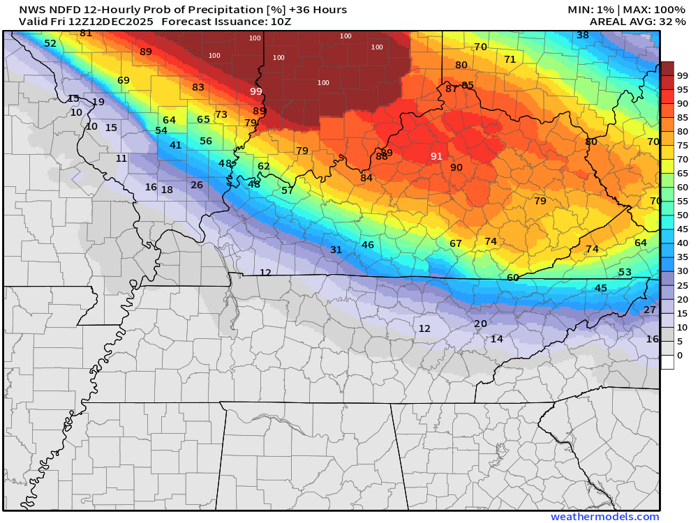
Let me show you the precipitation probabilities.
What is the % chance of precipitation?
Thursday 6 PM to Friday 6 AM
Saturday to Monday
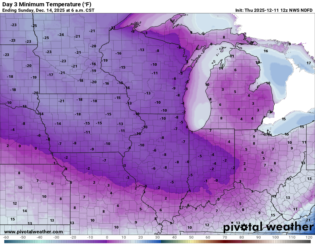
Another cold front will push through the region on Saturday. This is the Arctic cold front.
Bitterly cold air will follow this frontal passage.
Just look at how cold it will be over the Midwest
At least it won’t be THIS cold locally. These are actual air temperatures. Wind chill values will be even colder!
.
Let’s look at the local numbers. Keep in mind, wind chill values will be even colder.
Saturday morning lows
Sunday morning lows
.
Monday morning lows
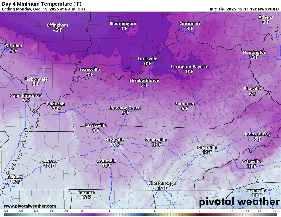
.
Check out the highs on Sunday. Brrr!

.
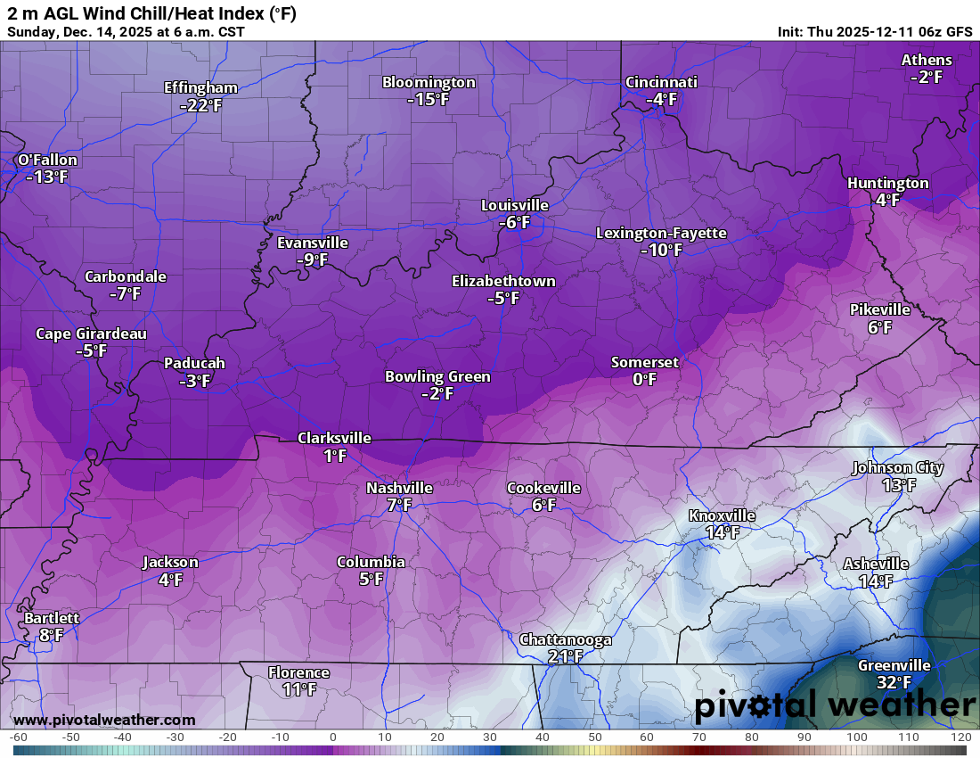
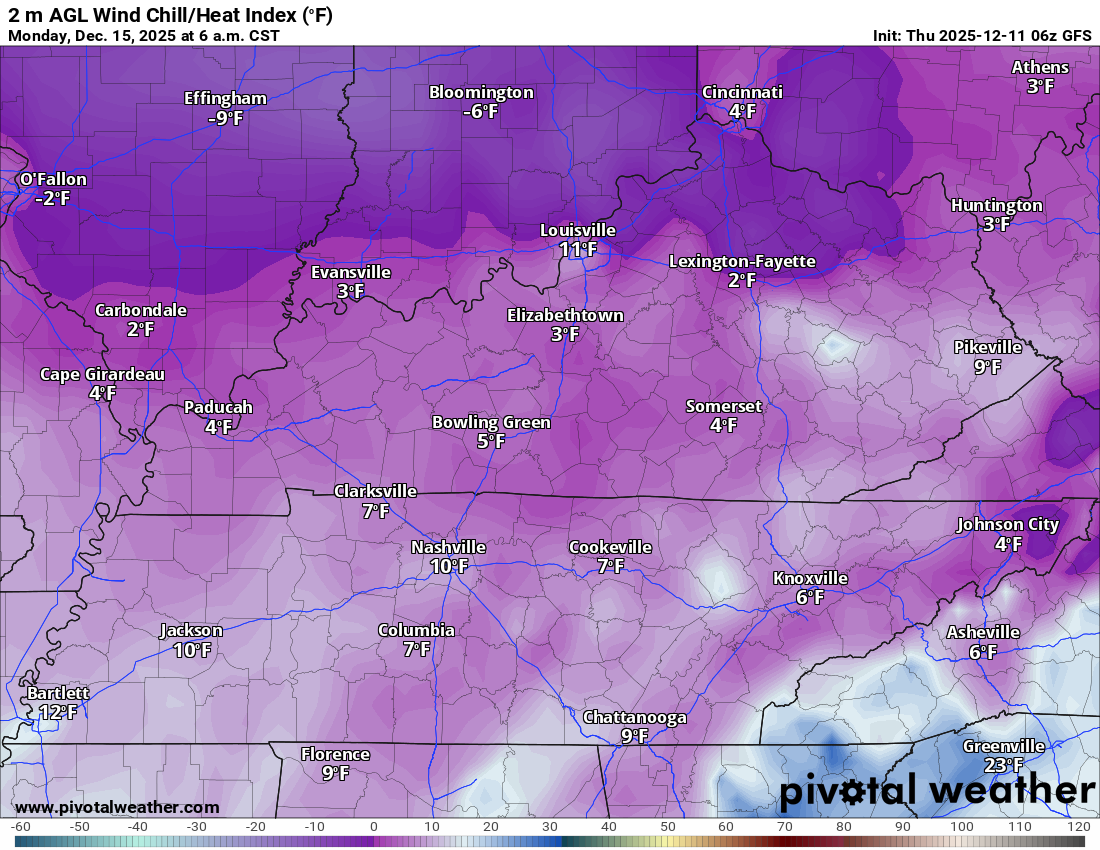
Let’s look at the wind chill values. Brrr Brrr Brrr
Sunday morning wind chill values.
.
Monday morning wind chill values
.
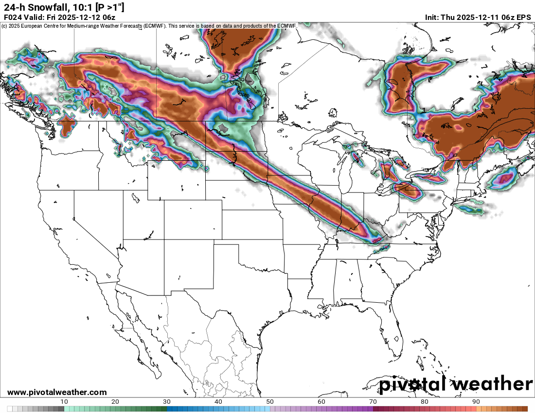
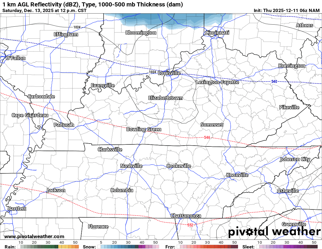
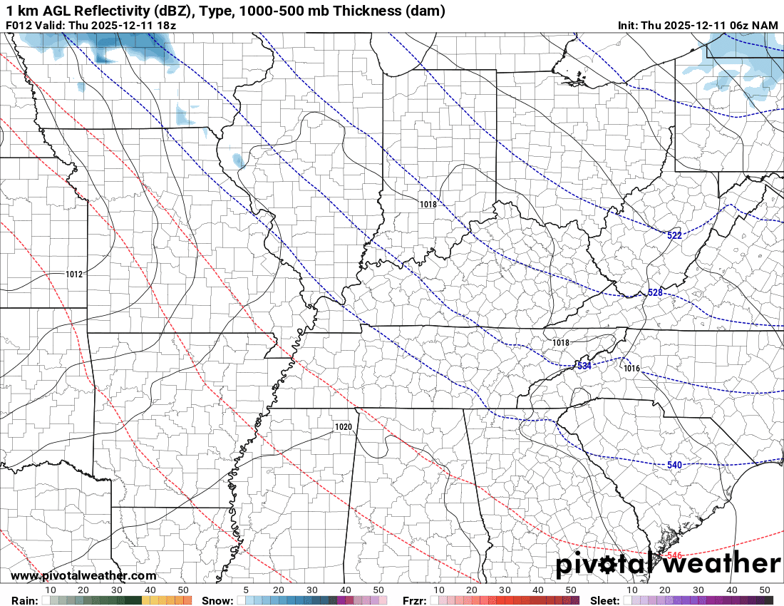
The cold front will be accompanied by scattered snow showers. Once again, the chances appear a bit higher to our north and northeast.
You can see the snow on the NAM future-cast radar.
The blue represents snow. This is for Saturday afternoon and evening. I will monitor trends. If it trends a bit farther south southwest, then perhaps portions of our region will receive a little bit of snow.
.
The GFS model shows it, as well. Again, this is Saturday afternoon and evening.
.
Temperatures will begin to moderate a bit on Tuesday and Wednesday. It won’t be as cold.
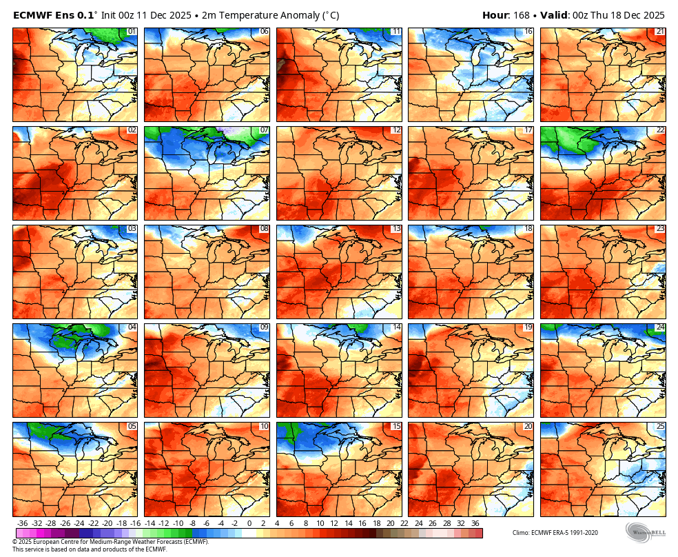
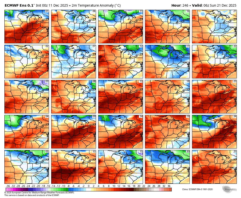
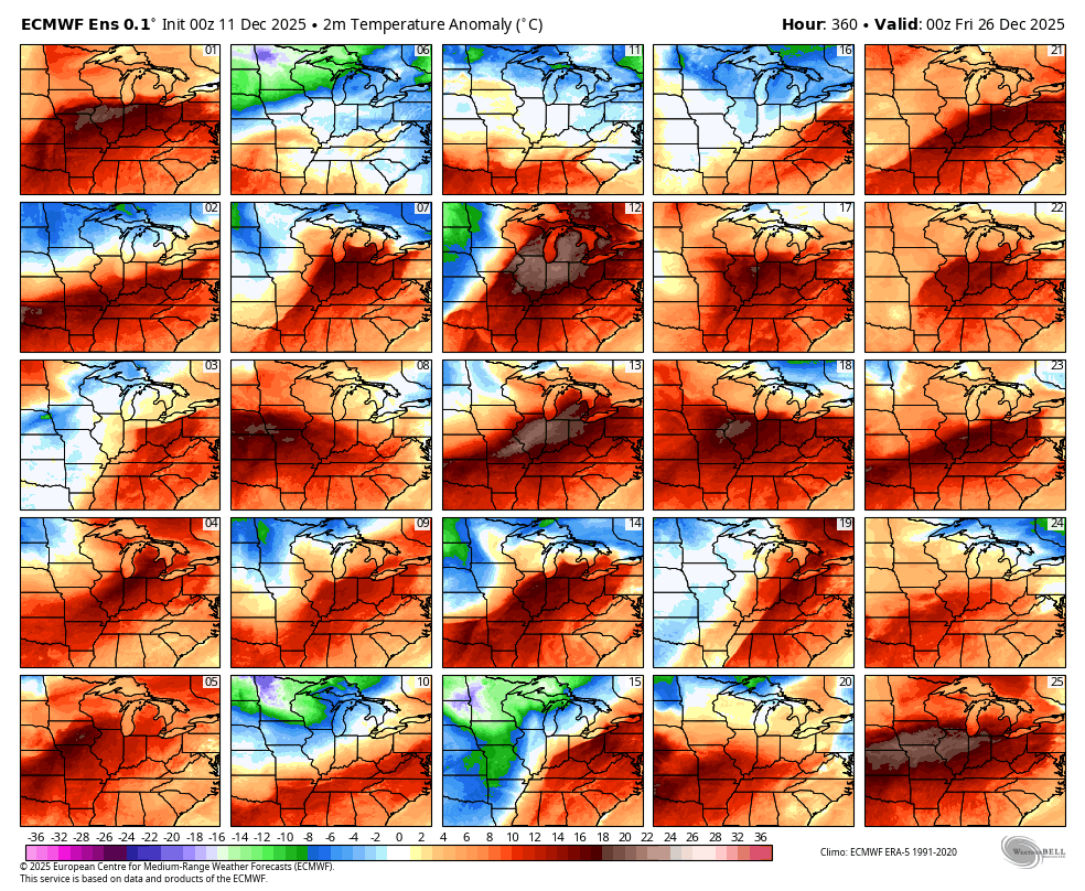
The long-range models indicate above-average temperatures as we approach Christmas.
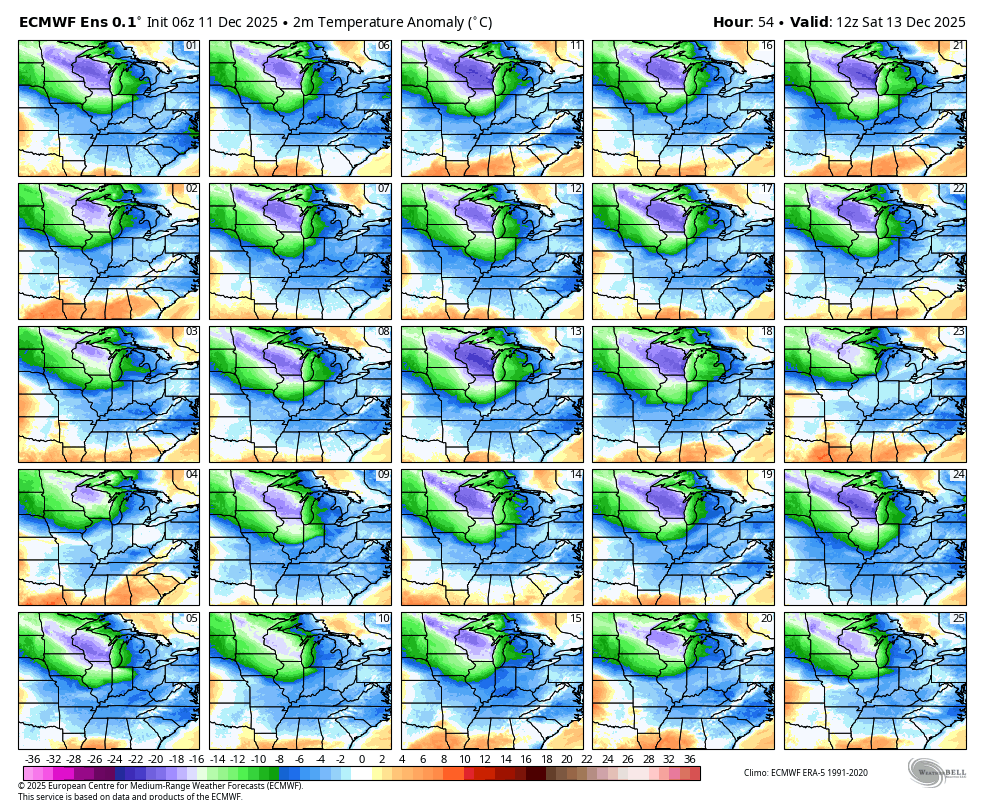
Let me show you some temperature anomaly maps.
Anomalies tell you how many degrees below or above average temperatures will be.
These are the EC ensembles.
Ensembles are the same model run multiple times. The more squares that agree, the higher the probability of the outcome.
For example, here are the temperature anomalies for Sunday morning.
Notice all the blue? That equals below-average temperatures. Notice how all the squares agree? That means a HIGH confidence in the forecast outcome.
Now, let’s look ahead.
Here is the forecast for December 18th. A lot of orange and red. That indicates above-average temperatures.
Here is December 21st. Again, a lot of orange and red. Above-average temperatures.
Here is December 24th. Again, a lot of orange and red. Above-average temperatures.
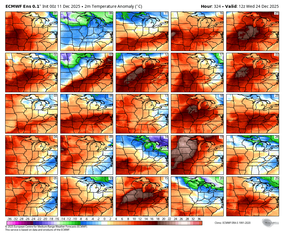
Here is December 25th. Again, a lot of orange and red. Above-average temperatures.
.
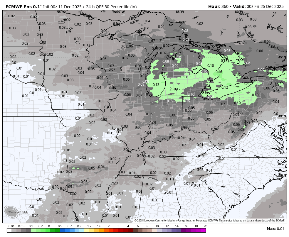
Let’s look at precipitation.
A rain system around the 18th and 19th.
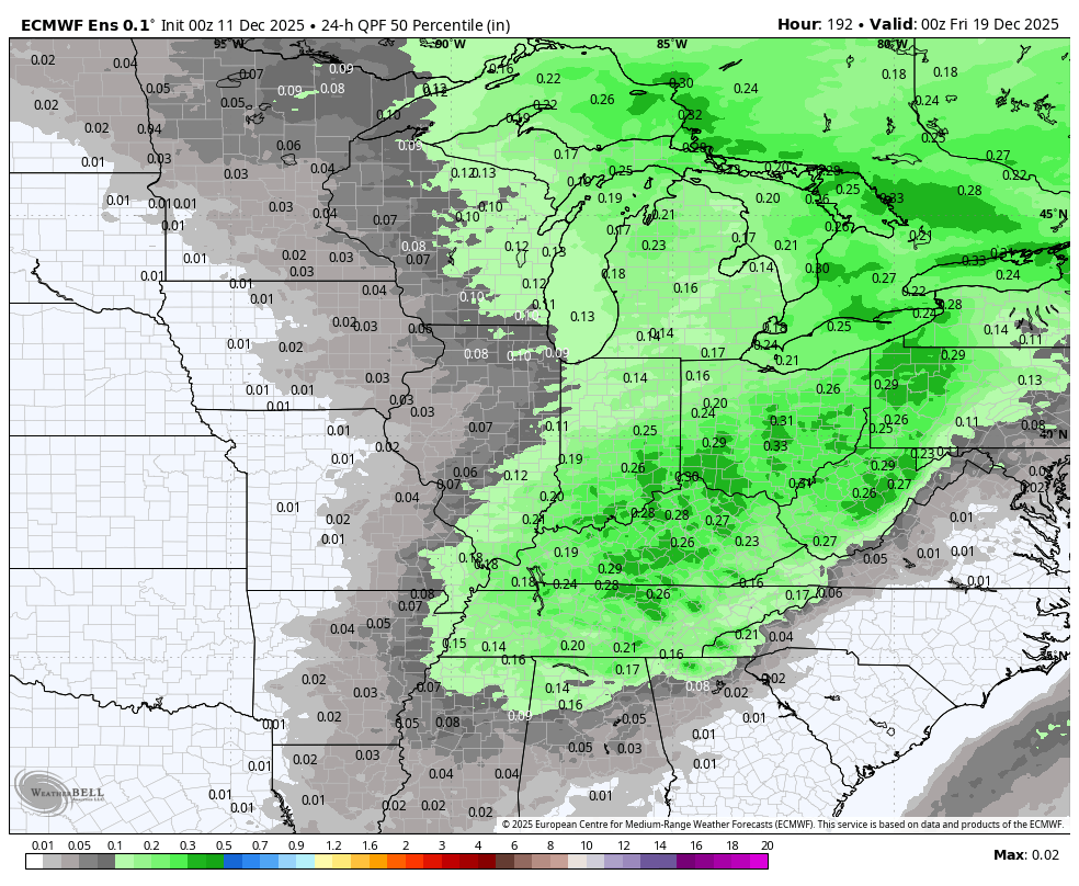
Another potential system around December 23rd
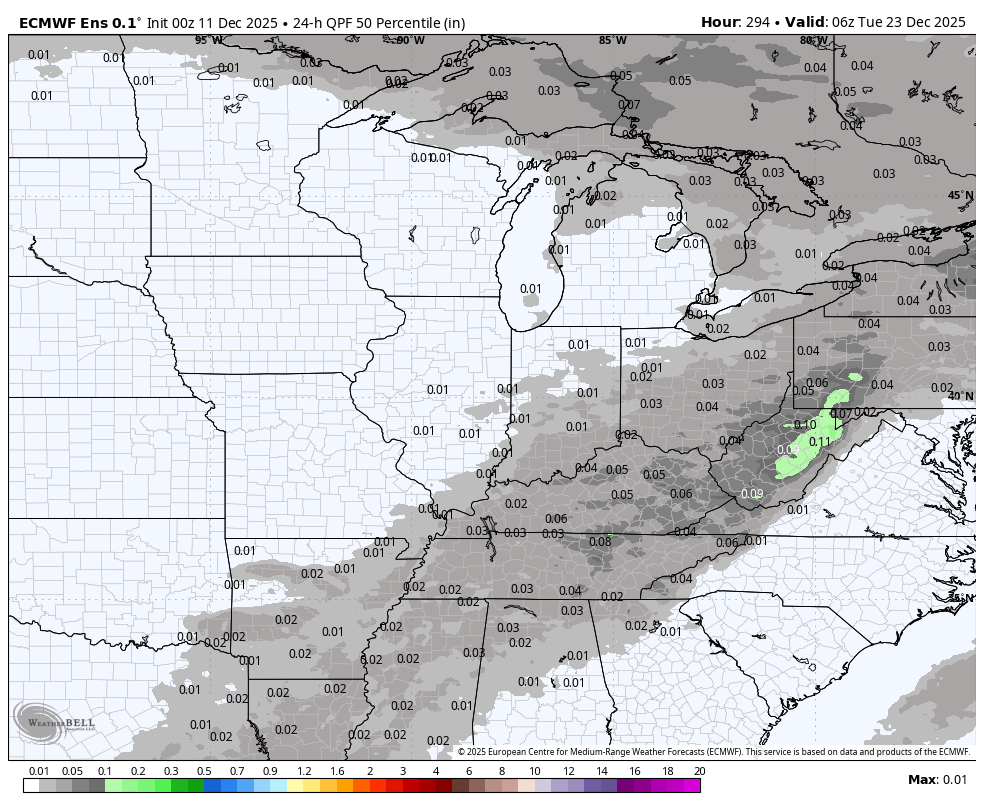
Another system around the 25th
.
Perhaps a more active pattern from the 18th into the end of the month.
It is too soon to know if we will have to deal with severe weather or wintry weather. Monitor updates. Plenty of time to watch each system.
.

.
The timestamp (upper left) is in Zulu. 12z=6 am. 18z=12 pm. 00z=6 pm.
Double-click the animation to enlarge it.
RRFS model
Green is rain. Blue is snow. Pink, red, and purple are freezing rain and sleet.
.
.
The timestamp (upper left) is in Zulu. 12z=6 am. 18z=12 pm. 00z=6 pm.
Double-click the animation to enlarge it.
GFS model
Green is rain. Blue is snow. Pink, red, and purple are freezing rain and sleet.
.
The timestamp (upper left) is in Zulu. 12z=6 am. 18z=12 pm. 00z=6 pm.
Double-click the animation to enlarge it.
NAM model
Green is rain. Blue is snow. Pink, red, and purple are freezing rain and sleet.
.
.
..
.
Click here if you would like to return to the top of the page.
.Average high temperatures for this time of the year are around 50 degrees.
Average low temperatures for this time of the year are around 32 degrees.
Average precipitation during this time period ranges from 1.00″ to 1.25″
Six to Ten Day Outlook.
Blue is below average. Red is above average. The no color zone represents equal chances.
Average highs for this time of the year are in the lower 60s. Average lows for this time of the year are in the lower 40s.

Green is above average precipitation. Yellow and brown favors below average precipitation. Average precipitation for this time of the year is around one inch per week.

.

Average low temperatures for this time of the year are around 31 degrees.
Average precipitation during this time period ranges from 1.00″ to 1.25″
.
Eight to Fourteen Day Outlook.
Blue is below average. Red is above average. The no color zone represents equal chances.

Green is above average precipitation. Yellow and brown favors below average precipitation. Average precipitation for this time of the year is around one inch per week.

.
.
.
We have a new service to complement your www.weathertalk.com subscription. This does NOTreplace www.weathertalk.com It is simply another tool for you to receive severe weather information.
.
https://weathercallservices.com/beau-dodson-weather


Want to receive the daily forecast/other products on your Beau Dodson Weather app?
Did you know you have four options in your www.weathertalk.com account
You will then receive these via your Beau Dodson Weather app.
Just log into your www.weathertalk.com account
Click the NOTIFICATION SETTINGS TAB
Then, turn them on (green) and off (red)
🌪️ Number 1 is the most important one. Severe alerts, tornado alerts, and so on.
Number 2 is the daily video, blog, livestream alerts, and severe weather Facebook threads on severe days or winter storm days.
Number 3 is the daily forecast. I send that out every day during the afternoon hours. It is the seven-day forecast, hazardous weather outlook, fire outlook, and more.
Number 4 is to receive the daily video, blog, and other content on NON-severe weather days (every day without severe threats in other words)
GREEN IS ON
RED IS OFF

I am going to start going live during bigger severe weather events.
Check it out here https://www.youtube.com/user/beaudodson
Click the subscribe button (it’s a free subscription button), and it will alert you when I go live. I will also send out alerts to the app when I go live for an event.

.

Radars and Lightning Data
Interactive-city-view radars. Clickable watches and warnings.
https://wtalk.co/B3XHASFZ
Old legacy radar site (some of you like it better)
https://weatherobservatory.com/weather-radar.htm
If the radar is not updating then try another one. If a radar does not appear to be refreshing then hit Ctrl F5. You may also try restarting your browser.
Backup radar site in case the above one is not working.
https://weathertalk.com/morani
Regional Radar
https://imagery.weathertalk.com/prx/RadarLoop.mp4
** NEW ** Zoom radar with chaser tracking abilities!
ZoomRadar
If the radar is not working, then email me: Email me at beaudodson@usawx.com
.
We do have some sponsors! Check them out.
Roof damage from recent storms? Link – Click here
INTEGRITY ROOFING AND EXTERIORS!
⛈️ Roof or gutter damage from recent storms? Today’s weather is sponsored by Integrity Roofing. Check out their website at this link https://www.ourintegritymatters.com/

![]()
![]()
![]()
Make sure you have three to five ways of receiving your severe weather information.
Weather Talk is one of those ways! Now, I have another product for you and your family.

.
Want to add more products to your Beau Dodson Weather App?
Receive daily videos, weather blog updates on normal weather days and severe weather and winter storm days, your county by county weather forecast, and more!
Here is how to do add those additional products to your app notification settings!
Here is a video on how to update your Beau Dodson Weather payment.
The app is for subscribers. Subscribe at www.weathertalk.com/welcome then go to your app store and search for WeatherTalk
Subscribers, PLEASE USE THE APP. ATT and Verizon are not reliable during severe weather. They are delaying text messages.
The app is under WeatherTalk in the app store.

Apple users click here

Android users click here
.
Radars and Lightning Data
Interactive-city-view radars. Clickable watches and warnings.
https://wtalk.co/B3XHASFZ
Old legacy radar site (some of you like it better)
https://weatherobservatory.com/weather-radar.htm
If the radar is not updating then try another one. If a radar does not appear to be refreshing then hit Ctrl F5. You may also try restarting your browser.
Backup radar site in case the above one is not working.
https://weathertalk.com/morani
Regional Radar
https://imagery.weathertalk.com/prx/RadarLoop.mp4
** NEW ** Zoom radar with chaser tracking abilities!
ZoomRadar
Lightning Data (zoom in and out of your local area)
https://wtalk.co/WJ3SN5UZ
Not working? Email me at beaudodson@usawx.com
National map of weather watches and warnings. Click here.
Storm Prediction Center. Click here.
Weather Prediction Center. Click here.
.

Live lightning data: Click here.
Real time lightning data (another one) https://map.blitzortung.org/#5.02/37.95/-86.99
Our new Zoom radar with storm chases
.
.

Interactive GOES R satellite. Track clouds. Click here.
GOES 16 slider tool. Click here.
College of DuPage satellites. Click here
.

Here are the latest local river stage forecast numbers Click Here.
Here are the latest lake stage forecast numbers for Kentucky Lake and Lake Barkley Click Here.
.
.
Find Beau on Facebook! Click the banner.


 .
.