Noon graphic update
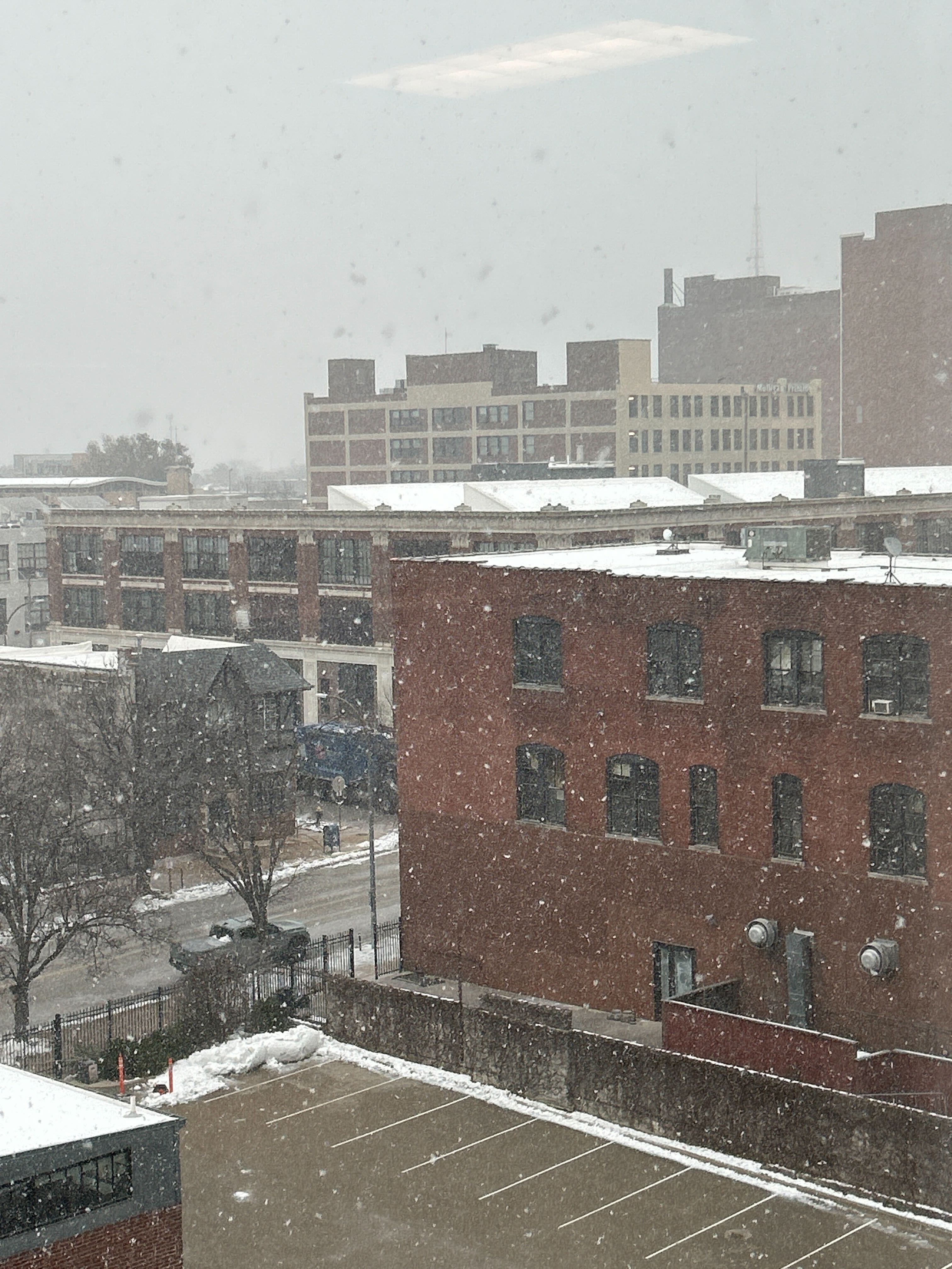
Snow has arrived in St Louis. Portions of southeast Missouri and northern portions of southern Illinois are reporting snow, as well.
St Louis photo
.
Updated graphics
.
.
.
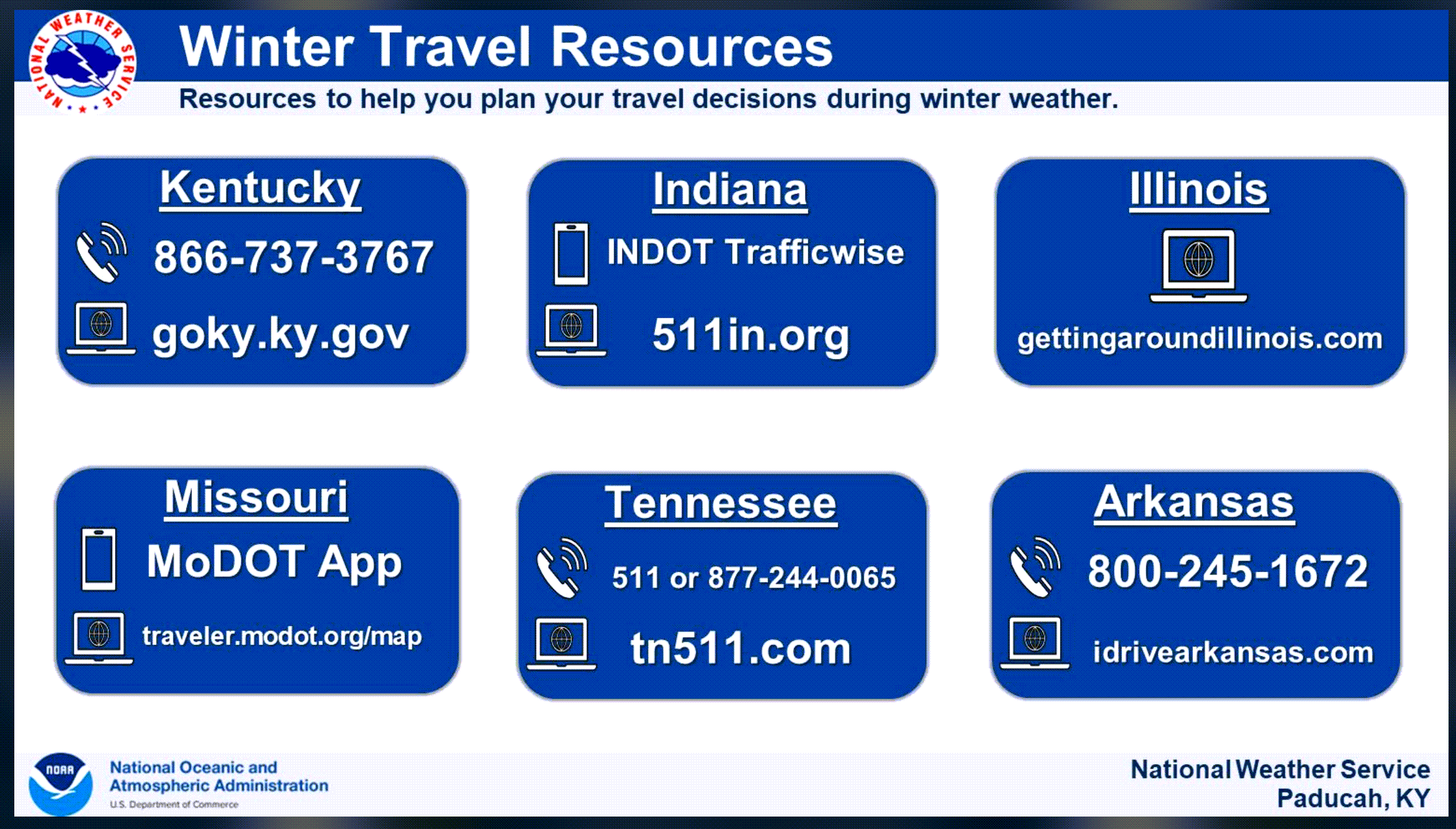
❄️ Don’t forget, our LOCAL CITY-VIEW RADARS have a special winterize button above them. ❄️
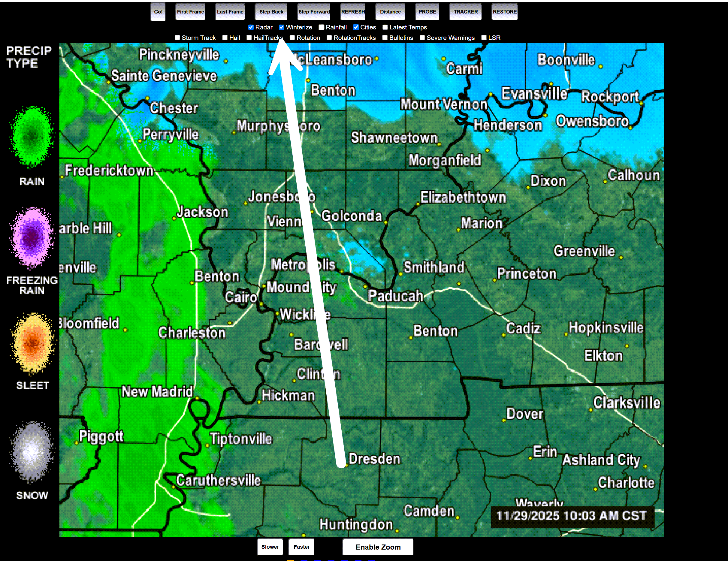
This shows you the precipitation type.
Beau Dodson Weather Radars
There are several backup sites for those local city-view radars. Links below.
Beau’s Weather Radars (local interactive radars)
https://beaudodsonweather.com/weather-radars/
Old legacy radar site (some of you like it better)
https://weatherobservatory.com/weather-radar.htm
Or
https://beaudodsonweather.com/weather-radars-legacy/
Backup radar site (in case the other sites are temporarily down)
https://weathertalk.com/morani
Regional Radar
https://imagery.weathertalk.com/prx/RadarLoop.mp4
Zoom National Interactive Radar
https://wtalk.co/AVWG7GM7


.
I have some question-and-answer threads over on the Facebook page. Link to those threads CLICK HERE
Or email me at beaudodsonweather@gmail.com
..

🌪️ Seven-Day Tornado Outlook ⛈️
December 1st through December 7th.
Current risk: NONE
Current confidence level: High confidence.
Comments:
.

Seven-Day Hazardous Weather Outlook
1. Is lightning in the forecast? NO.
2. Are organized/widespread severe thunderstorms in the forecast? NO.
4. Will non-thunderstorm winds top 40 mph? NO.
5. Will the temperature fall below 20 degrees? POSSIBLE. Some counties will fall below 20 degrees Tuesday night through Thursday night.
6. Is the wind chill forecast to drop below ten degrees? NO.
Here is the short-range concern meter.
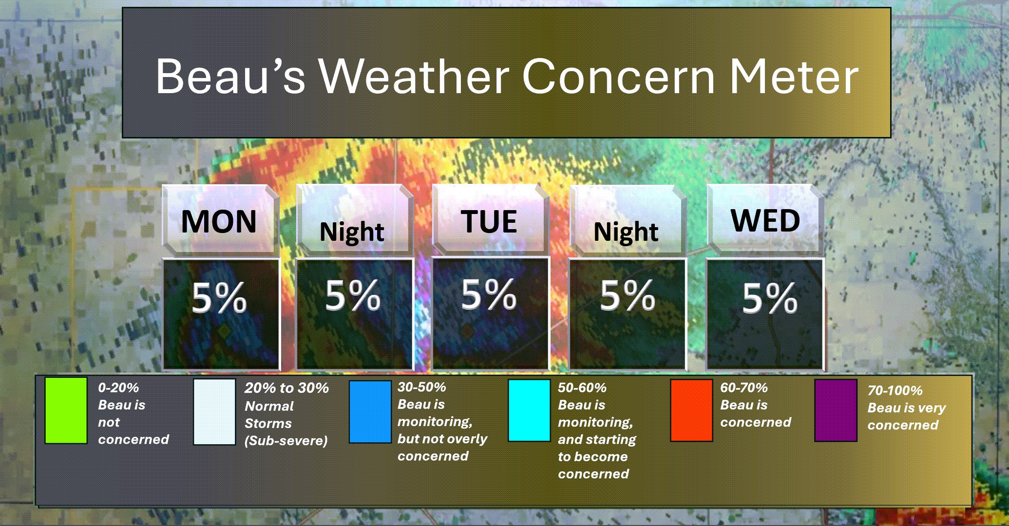
.
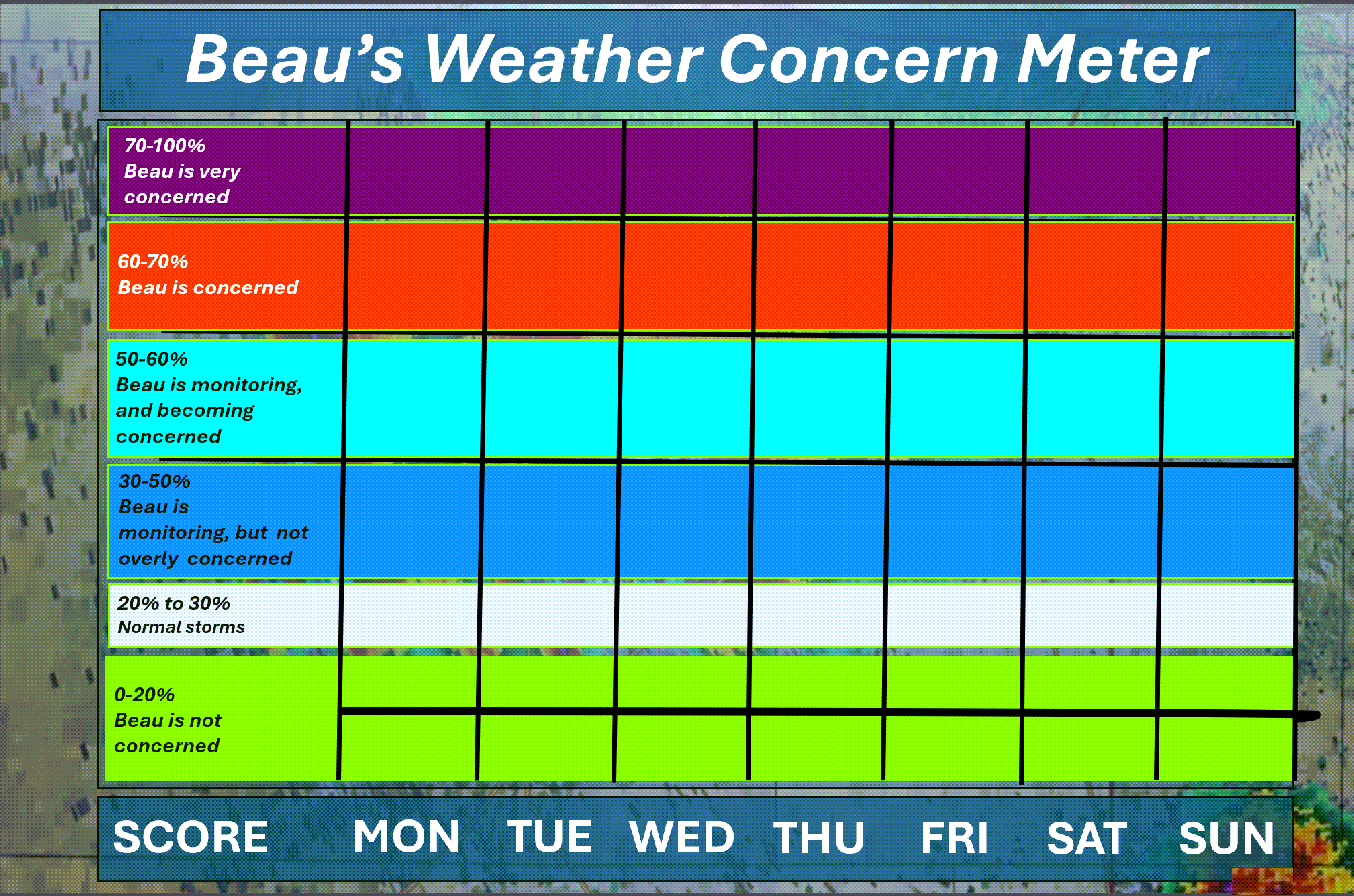
Here is the extended concern meter.
No severe weather concerns.
.
A quick forecast glance. Your 48-hour forecast Graphics


.
Here is your bus stop forecast.
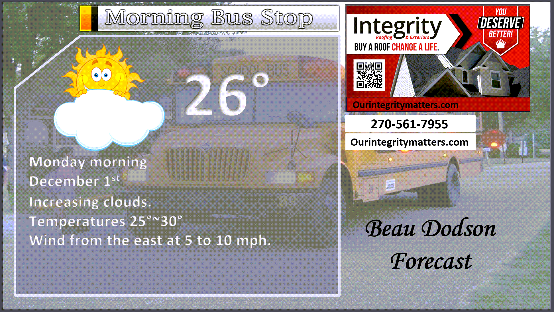
.
This afternoon

.


Forecast discussion
- Cold week ahead of us.
- A light wintry mix later today and tonight. There could be some slick spots on surfaces and roadways.
- Don’t be surprised if some areas receive very little precipitation. That is the forecast.
- Another weak system arrives on Thursday night and Friday.
.
 .
.
.
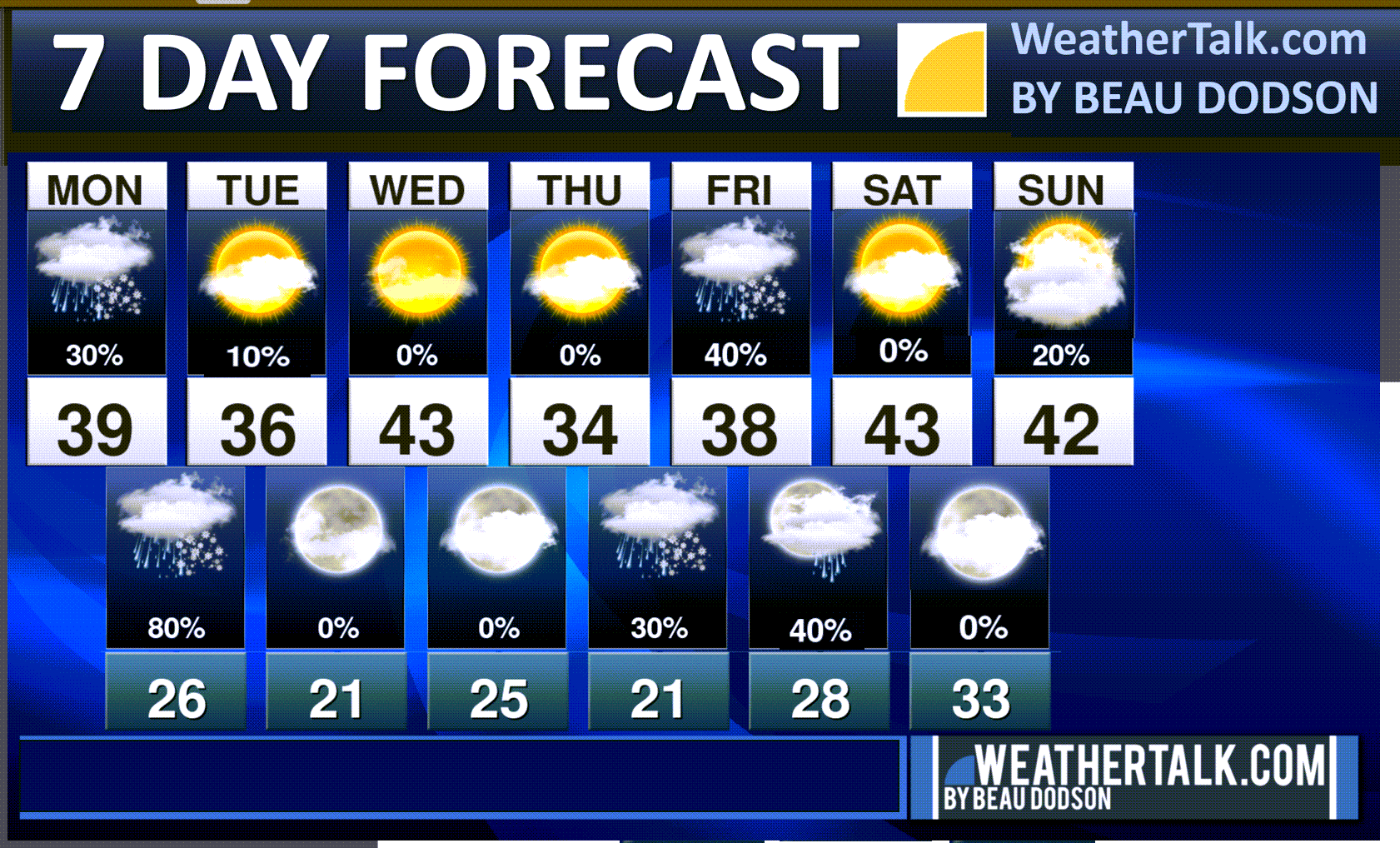
Seven-day outlook graphic.
See the video for more details specific to your county. This is a broad-brushed outlook for the entire region.
.
Today and tomorrow
Good morning, everyone.
We are waking up to cold temperatures. The entire week is going to be chilly with below average temperatures.
A fast-moving weak system will bring a mixture of rain, freezing rain, sleet, and snow to the region late this afternoon and especially tonight and tomorrow.
This event won’t bring much in the way of accumulation, but a few spots could receive an inch or two of snow. Other areas will have a glaze of sleet and freezing rain.
Do not be surprised if some areas receive little in the way of measurable precipitation. This is not a big event.
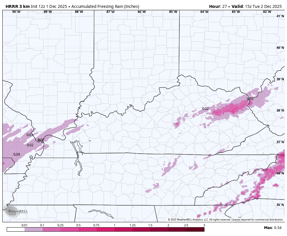
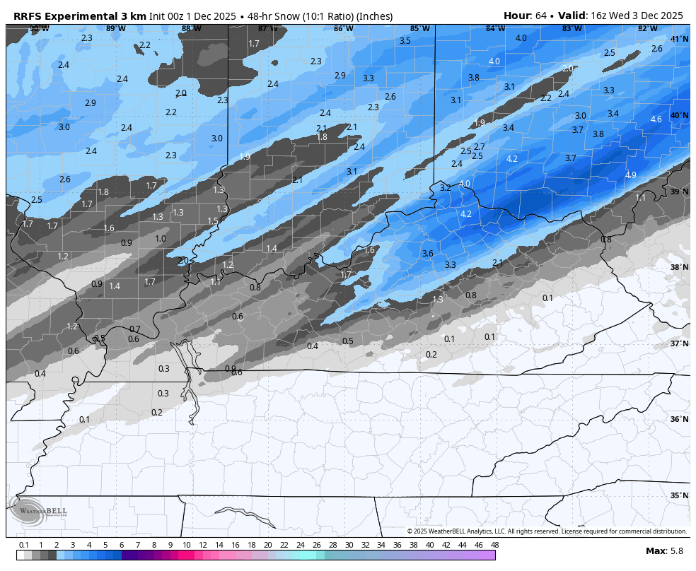
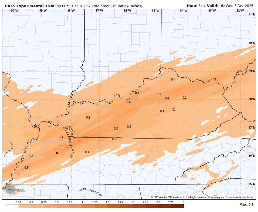
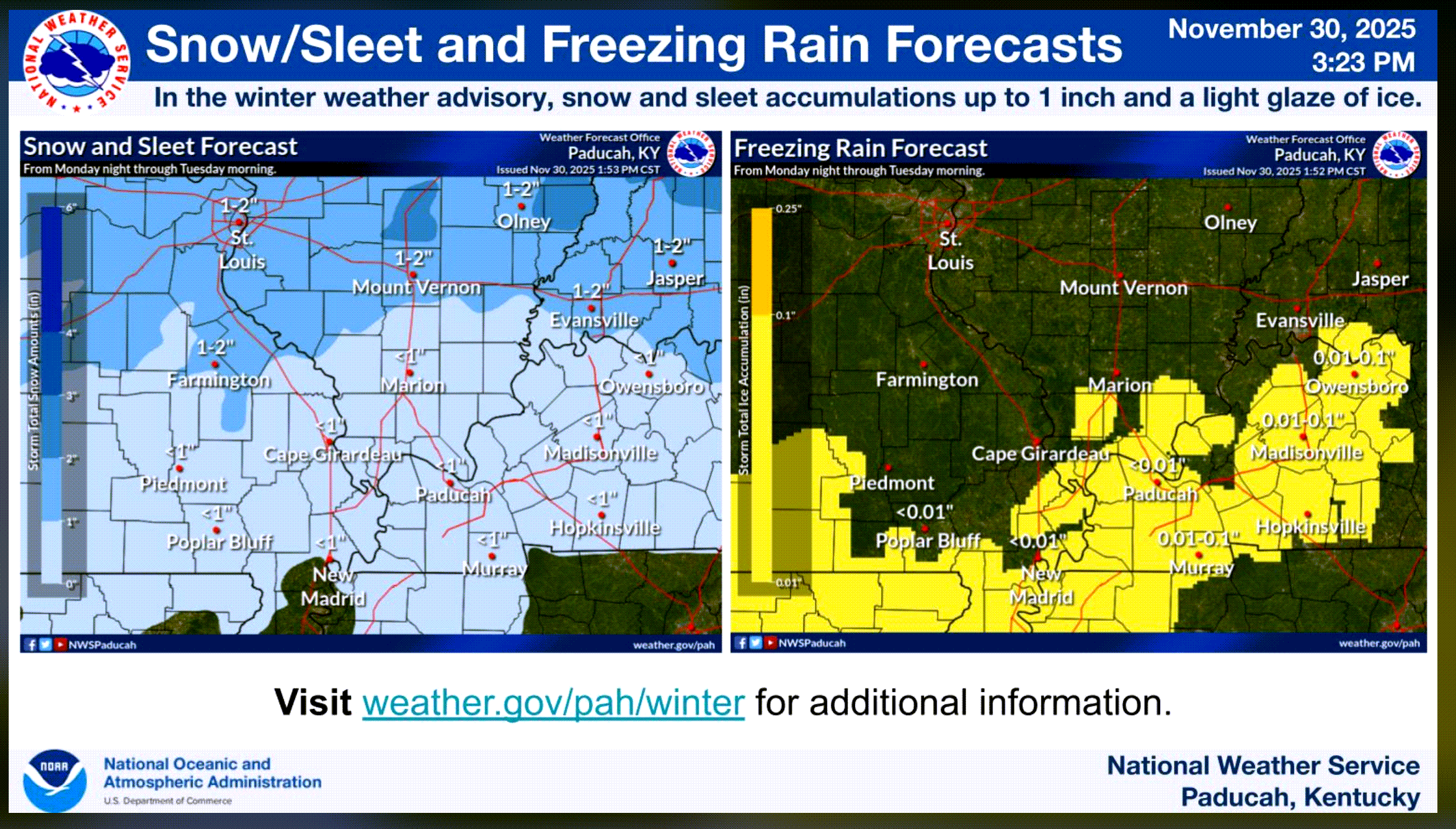
Let’s look at some totals.
This won’t be exact, of course. Take the general idea from it.
Freezing rain totals
Snow totals
Sleet totals
.
Rain may linger a bit longer along the Kentucky/Tennessee border. Then, with time, it will change to a mix there, as well.
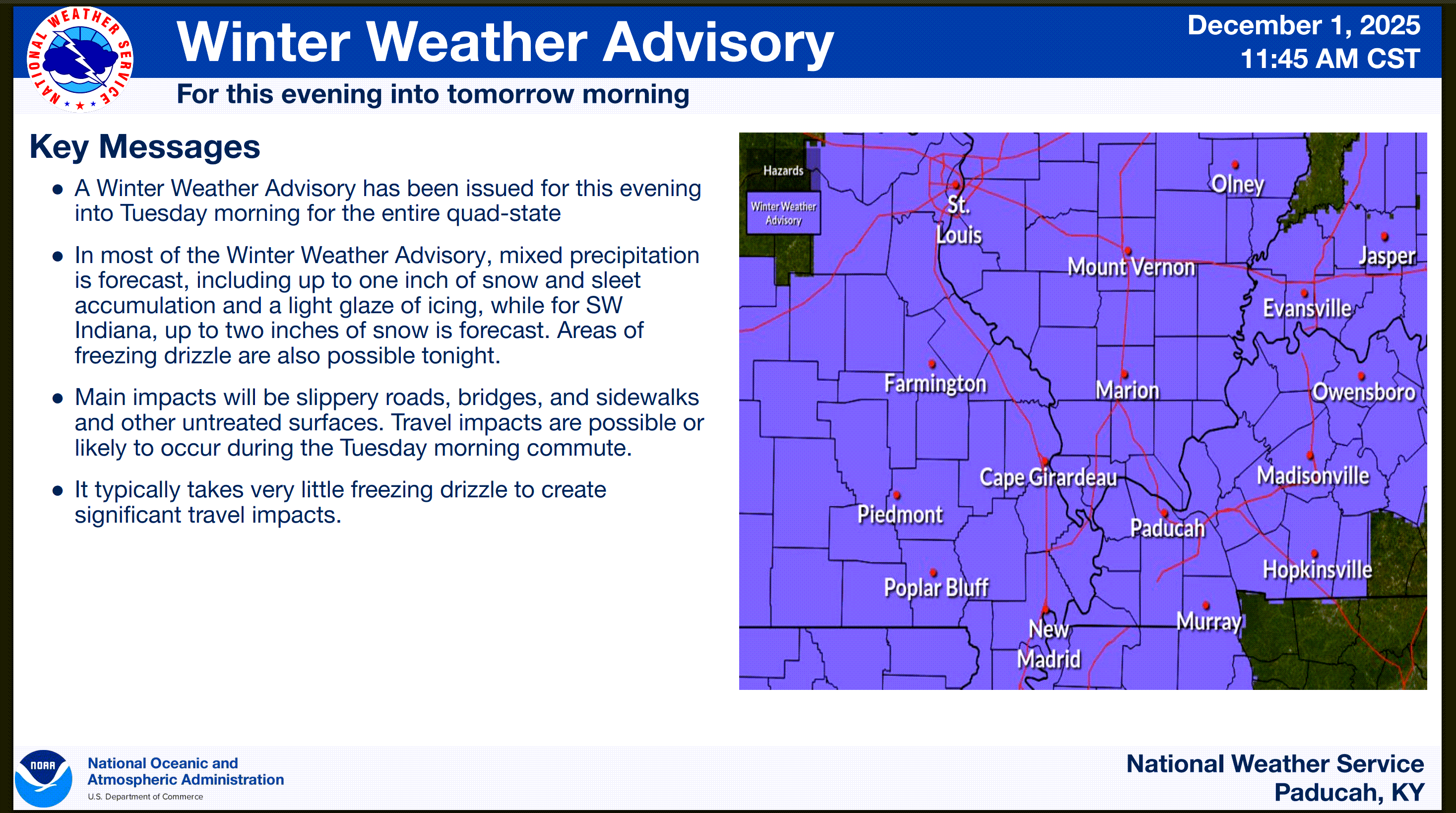
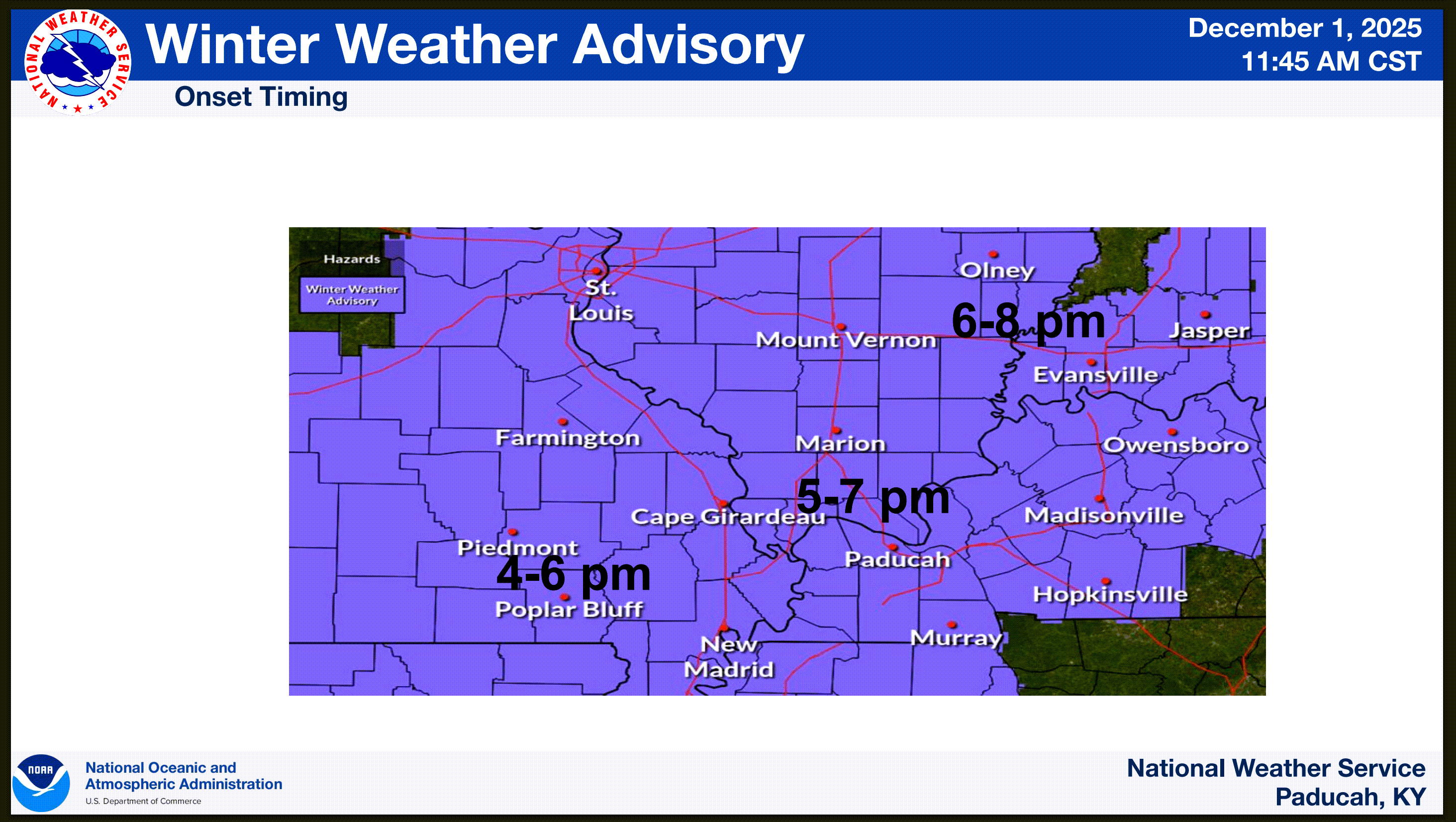
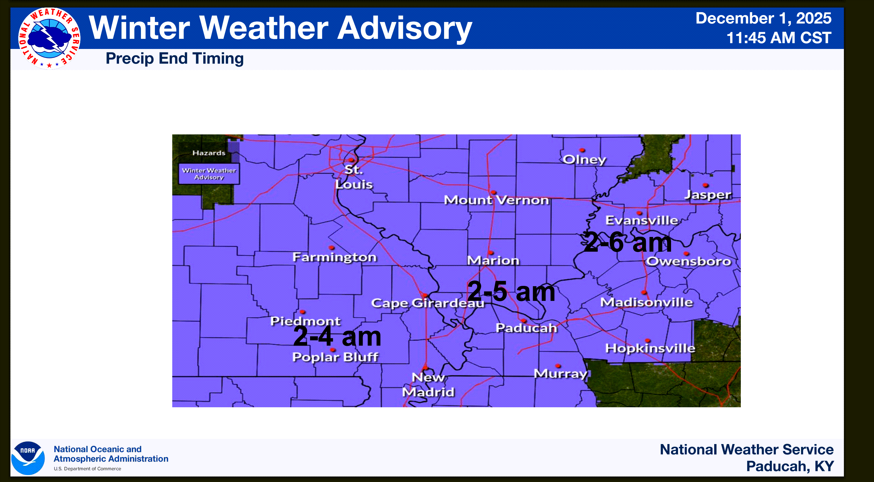
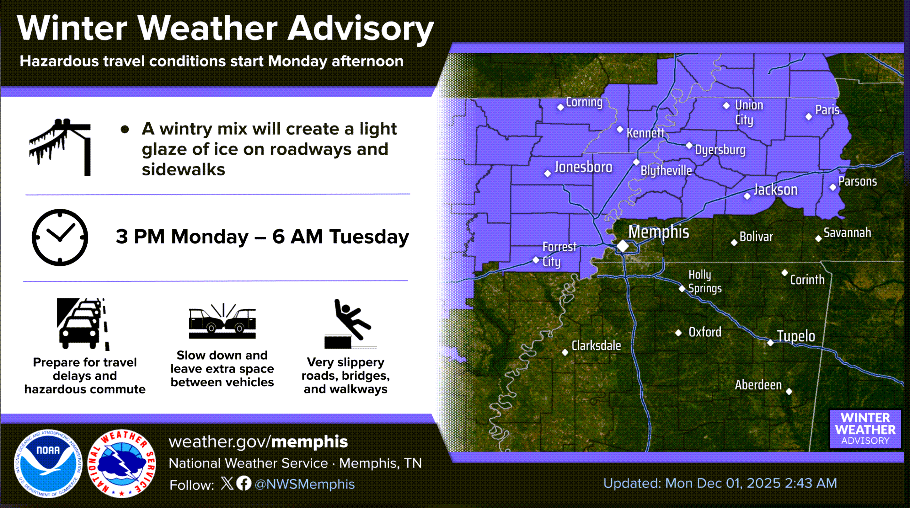
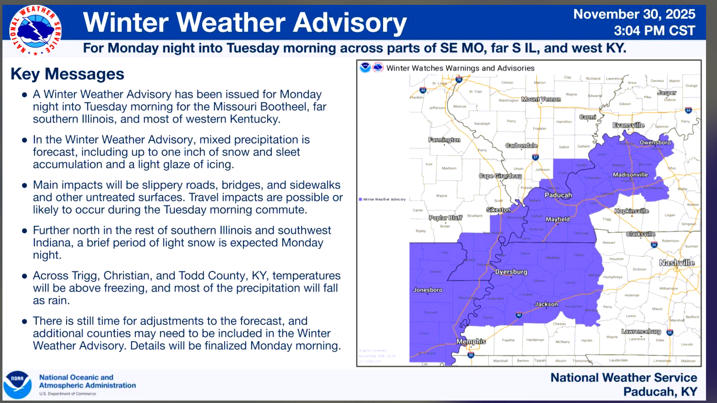
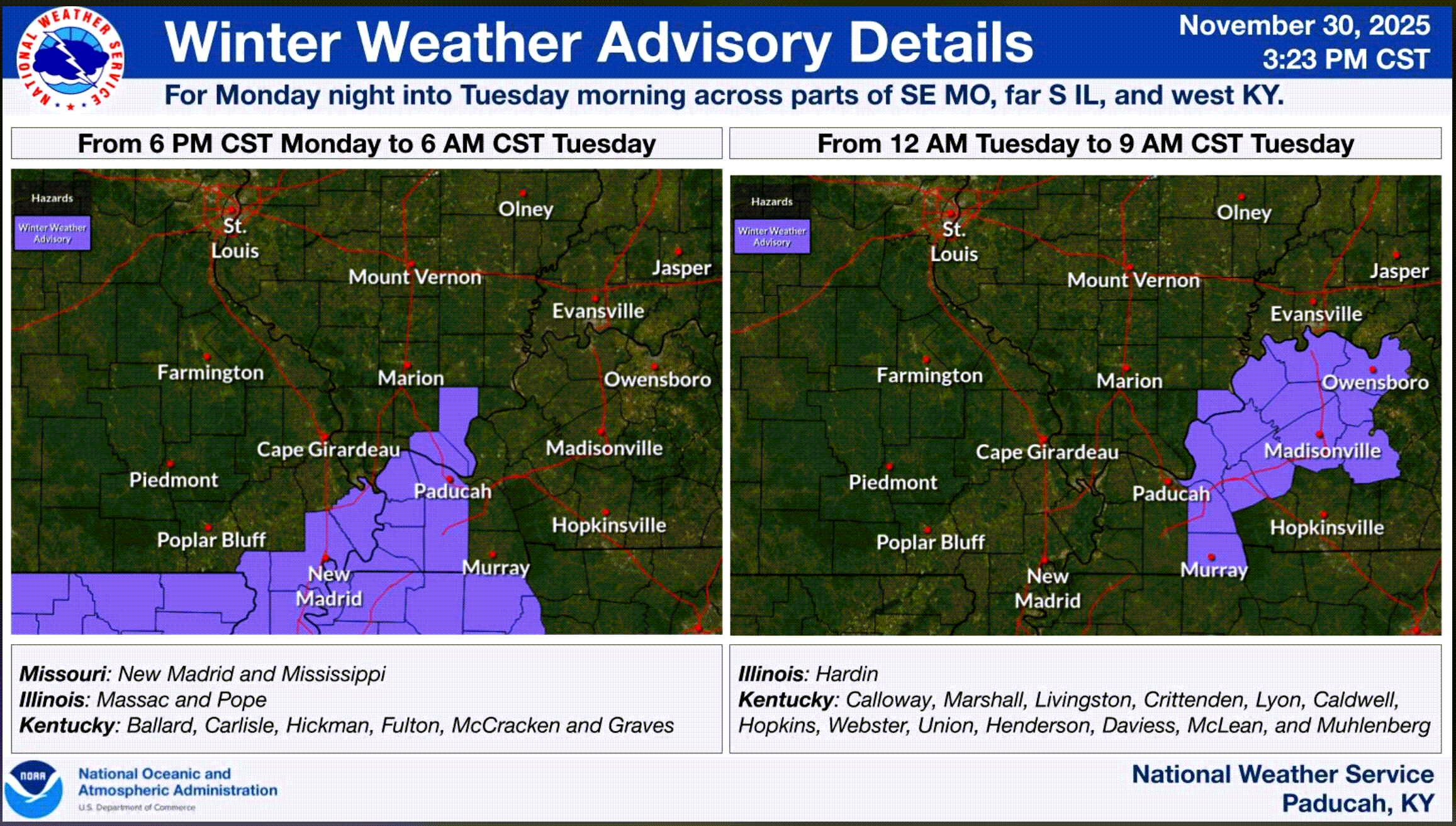
Officially, the NWS has issued a winter weather advisory for portions of the region. This is where confidence is a bit higher that there will be impacts.
Watch sidewalks, decks, porches, and elevated surfaces. They will freeze before other surfaces. Watch your first step. It could be a slick one.
Historically, these light events actually produce more traffic accidents.
The precipitation will move out of the region by Tuesday morning. Perhaps some lingering freezing drizzle in some spots.
Tuesday night will be dry and cold.
Let’s look at a few NWS graphics
Double-click images to enlarge them.
This is from the Memphis, Tennessee, NWS. This shows you the Bootheel and northwest Tennessee advisory
These graphics are from the Paducah, Kentucky, NWS
.
Wednesday through Saturday
Wednesday into Thursday afternoon will be dry and cold. Well below average temperatures.
A fast-moving system will bring another chance of a wintry mix to the region Thursday night into Friday. At this time, it appears that it would be cold enough for some freezing rain and sleet. It may change to rain on Friday as somewhat warmer air moves into the area.
Accumulations, if any, would be light. Of course, it only takes a little bit of freezing rain to cause problems. Monitor updates concerning that event.
Saturday will be dry and chilly.
No severe weather in the forecast. So, we can be thankful for that.

.
The timestamp (upper left) is in Zulu. 12z=6 am. 18z=12 pm. 00z=6 pm.
Double-click the animation to enlarge it.
Hrrr model
Green is rain. Blue is snow. Pink, red, and purple are freezing rain and sleet.
.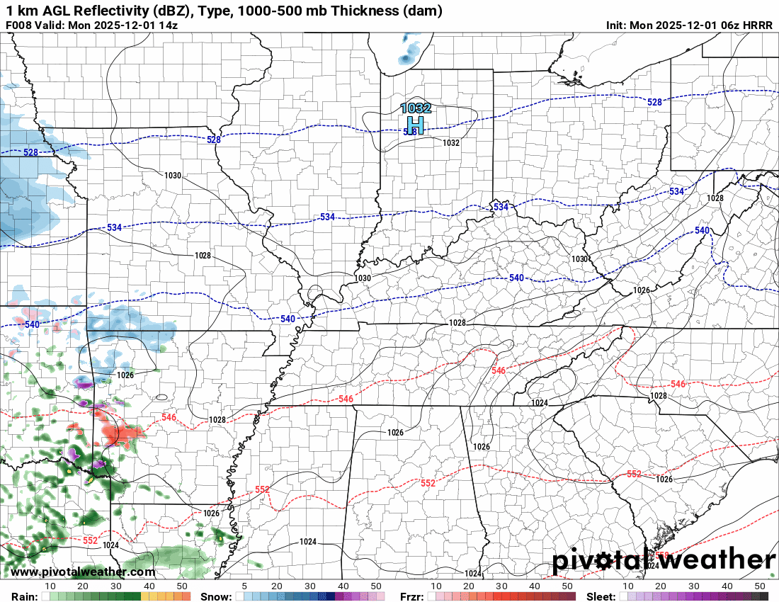
.
The timestamp (upper left) is in Zulu. 12z=6 am. 18z=12 pm. 00z=6 pm.
Double-click the animation to enlarge it.
NAM 3K model
Green is rain. Blue is snow. Pink, red, and purple are freezing rain and sleet.
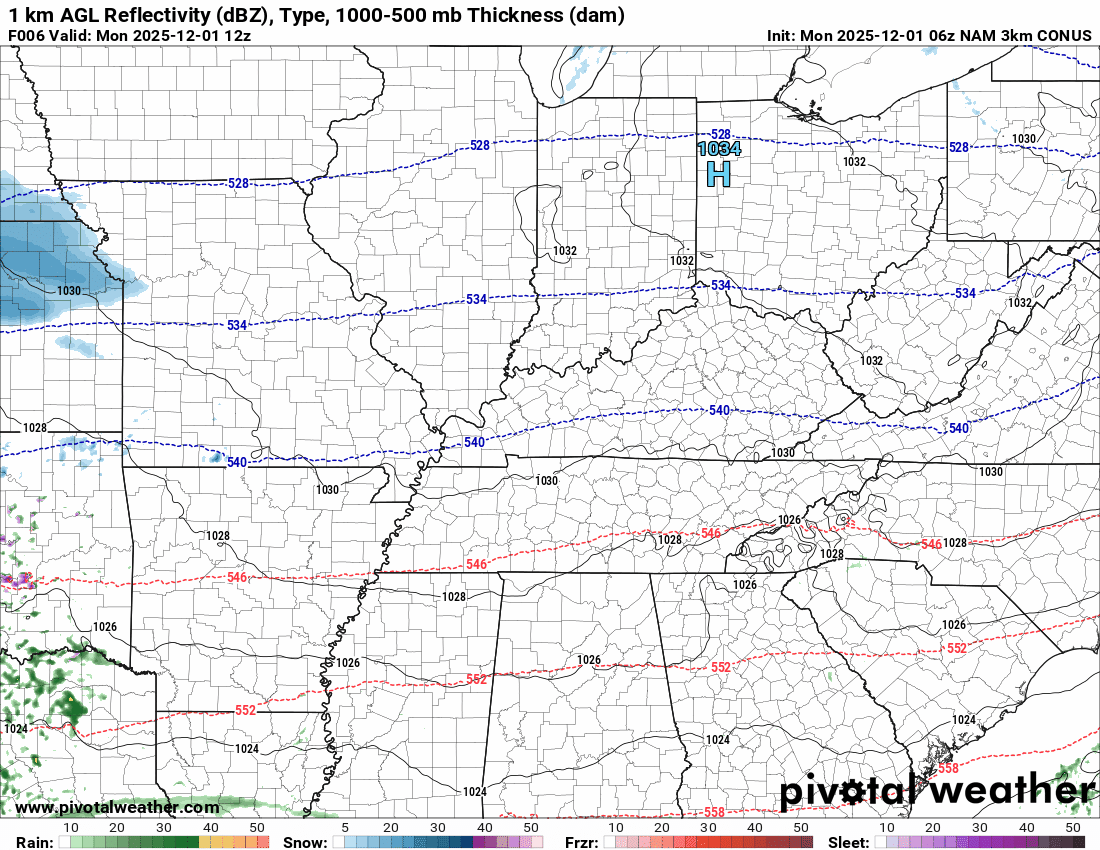
.
.
..
.
Click here if you would like to return to the top of the page.
.Average high temperatures for this time of the year are around 60 degrees.
Average low temperatures for this time of the year are around 40 degrees.
Average precipitation during this time period ranges from 1.00″ to 1.25″
Six to Ten Day Outlook.
Blue is below average. Red is above average. The no color zone represents equal chances.
Average highs for this time of the year are in the lower 60s. Average lows for this time of the year are in the lower 40s.

Green is above average precipitation. Yellow and brown favors below average precipitation. Average precipitation for this time of the year is around one inch per week.

.

Average low temperatures for this time of the year are around 38 degrees.
Average precipitation during this time period ranges from 1.00″ to 1.25″
.
Eight to Fourteen Day Outlook.
Blue is below average. Red is above average. The no color zone represents equal chances.

Green is above average precipitation. Yellow and brown favors below average precipitation. Average precipitation for this time of the year is around one inch per week.

.
.
.
We have a new service to complement your www.weathertalk.com subscription. This does NOTreplace www.weathertalk.com It is simply another tool for you to receive severe weather information.
.
https://weathercallservices.com/beau-dodson-weather


Want to receive the daily forecast/other products on your Beau Dodson Weather app?
Did you know you have four options in your www.weathertalk.com account
You will then receive these via your Beau Dodson Weather app.
Just log into your www.weathertalk.com account
Click the NOTIFICATION SETTINGS TAB
Then, turn them on (green) and off (red)
🌪️ Number 1 is the most important one. Severe alerts, tornado alerts, and so on.
Number 2 is the daily video, blog, livestream alerts, and severe weather Facebook threads on severe days or winter storm days.
Number 3 is the daily forecast. I send that out every day during the afternoon hours. It is the seven-day forecast, hazardous weather outlook, fire outlook, and more.
Number 4 is to receive the daily video, blog, and other content on NON-severe weather days (every day without severe threats in other words)
GREEN IS ON
RED IS OFF

I am going to start going live during bigger severe weather events.
Check it out here https://www.youtube.com/user/beaudodson
Click the subscribe button (it’s a free subscription button), and it will alert you when I go live. I will also send out alerts to the app when I go live for an event.

.

Radars and Lightning Data
Interactive-city-view radars. Clickable watches and warnings.
https://wtalk.co/B3XHASFZ
Old legacy radar site (some of you like it better)
https://weatherobservatory.com/weather-radar.htm
If the radar is not updating then try another one. If a radar does not appear to be refreshing then hit Ctrl F5. You may also try restarting your browser.
Backup radar site in case the above one is not working.
https://weathertalk.com/morani
Regional Radar
https://imagery.weathertalk.com/prx/RadarLoop.mp4
** NEW ** Zoom radar with chaser tracking abilities!
ZoomRadar
If the radar is not working, then email me: Email me at beaudodson@usawx.com
.
We do have some sponsors! Check them out.
Roof damage from recent storms? Link – Click here
INTEGRITY ROOFING AND EXTERIORS!
⛈️ Roof or gutter damage from recent storms? Today’s weather is sponsored by Integrity Roofing. Check out their website at this link https://www.ourintegritymatters.com/

![]()
![]()
![]()
Make sure you have three to five ways of receiving your severe weather information.
Weather Talk is one of those ways! Now, I have another product for you and your family.

.
Want to add more products to your Beau Dodson Weather App?
Receive daily videos, weather blog updates on normal weather days and severe weather and winter storm days, your county by county weather forecast, and more!
Here is how to do add those additional products to your app notification settings!
Here is a video on how to update your Beau Dodson Weather payment.
The app is for subscribers. Subscribe at www.weathertalk.com/welcome then go to your app store and search for WeatherTalk
Subscribers, PLEASE USE THE APP. ATT and Verizon are not reliable during severe weather. They are delaying text messages.
The app is under WeatherTalk in the app store.

Apple users click here

Android users click here
.
Radars and Lightning Data
Interactive-city-view radars. Clickable watches and warnings.
https://wtalk.co/B3XHASFZ
Old legacy radar site (some of you like it better)
https://weatherobservatory.com/weather-radar.htm
If the radar is not updating then try another one. If a radar does not appear to be refreshing then hit Ctrl F5. You may also try restarting your browser.
Backup radar site in case the above one is not working.
https://weathertalk.com/morani
Regional Radar
https://imagery.weathertalk.com/prx/RadarLoop.mp4
** NEW ** Zoom radar with chaser tracking abilities!
ZoomRadar
Lightning Data (zoom in and out of your local area)
https://wtalk.co/WJ3SN5UZ
Not working? Email me at beaudodson@usawx.com
National map of weather watches and warnings. Click here.
Storm Prediction Center. Click here.
Weather Prediction Center. Click here.
.

Live lightning data: Click here.
Real time lightning data (another one) https://map.blitzortung.org/#5.02/37.95/-86.99
Our new Zoom radar with storm chases
.
.

Interactive GOES R satellite. Track clouds. Click here.
GOES 16 slider tool. Click here.
College of DuPage satellites. Click here
.

Here are the latest local river stage forecast numbers Click Here.
Here are the latest lake stage forecast numbers for Kentucky Lake and Lake Barkley Click Here.
.
.
Find Beau on Facebook! Click the banner.


 .
.