

.
I have some question-and-answer threads over on the Facebook page. Link to those threads CLICK HERE
Or email me at beaudodsonweather@gmail.com
..

🌪️ Seven-Day Tornado Outlook ⛈️
August 6th through August 12th
Current risk: NONE.
Current confidence level: High confidence in the forecast.
Comments: We are not anticipating tornadoes.
.

Seven-Day Hazardous Weather Outlook
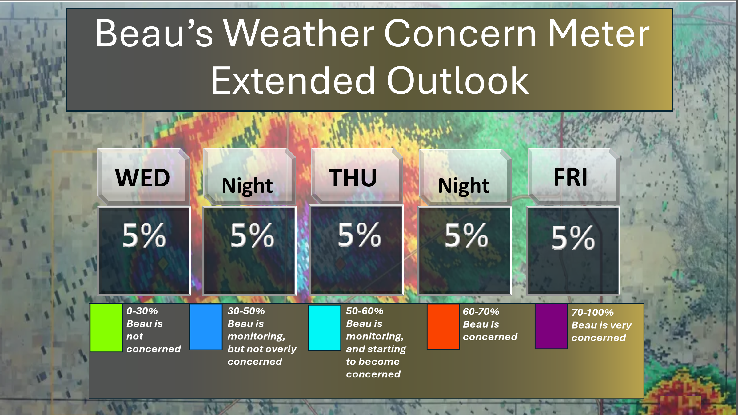
1. Is lightning in the forecast? ISOLATED. A small chance of lightning today and tomorrow. Isolated lightning will be possible on on Sunday, Monday, Tuesday, and Wednesday.
2. Are organized severe thunderstorms in the forecast? NO. Thunderstorms, during the summer months, can produce isolated gusty winds. Organized severe weather is not anticipated.
3. Is flash flooding in the forecast? NO. Slow-moving summer storms can produce isolated torrential downpours that can briefly flood ditches and roadways. Organized or widespread flash flooding is not anticipated.
4. Will non-thunderstorm winds top 40 mph? NO.
5. Will temperatures rise above 90 degrees? POSSIBLE. I will monitor Thursday through Tuesday. Temperatures may approach or slightly exceed 90 degrees.
6. Will temperatures rise above 100 degrees? NO.
7. Will the heat index (feels like) rise above 100 degrees? NOT AT THIS TIME.
8. Will the heat index rise above 115 degrees? NO.
Here is my concern meter through Friday. No significant concerns.
.
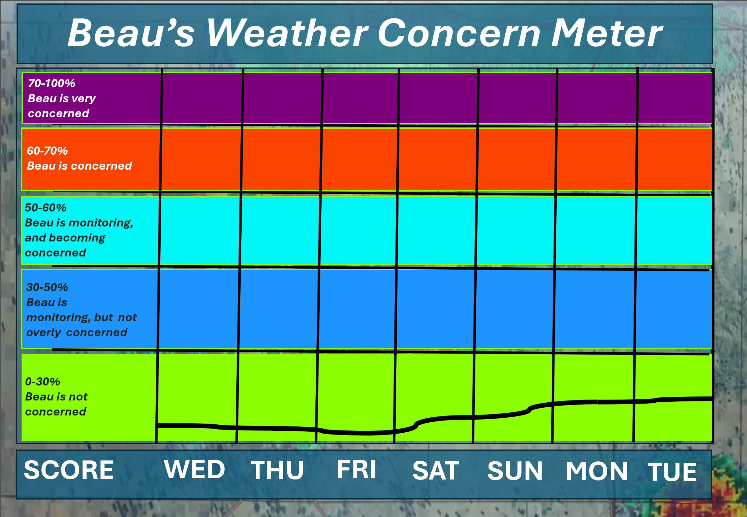
Here is the extended outlook. This takes us through next Tuesday. Extreme weather is not anticipated.
Keep in mind that typical August/summer thunderstorms can produce isolated heavy rain, lightning, and gusty winds.
.A quick forecast glance. Your 48-hour forecast Graphics


.

.
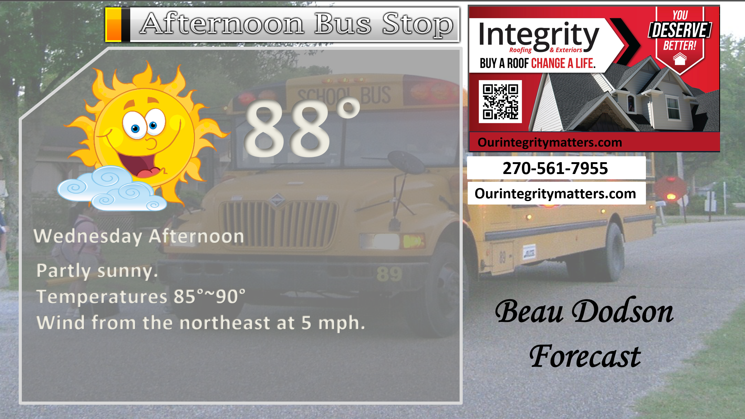
This afternoon
.

.

Forecast discussion.
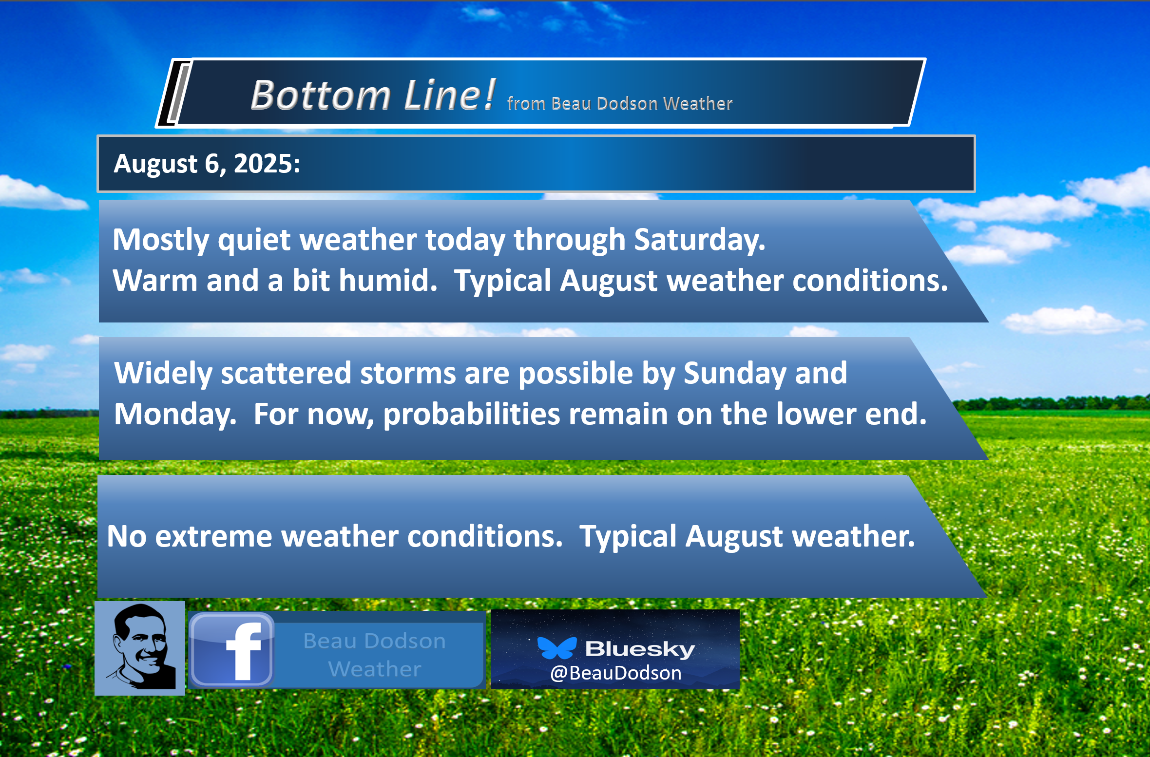
- Warm and humid weather ahead. Typical August weather.
- A slow warming trend as we move through the new work week. A bit more humid mid to late week. Nothing extreme. Normal August weather.
- The chance of showers and thunderstorms will be low today through Saturday.
- An isolated thunderstorm will be possible from Sunday through Wednesday.
.

Good morning, everyone. I hope you are having a nice week.
We did have a couple of thunderstorms yesterday in the region. Where they occurred, they produced some downpours, lightning, and gusty winds.
Most areas remained dry.
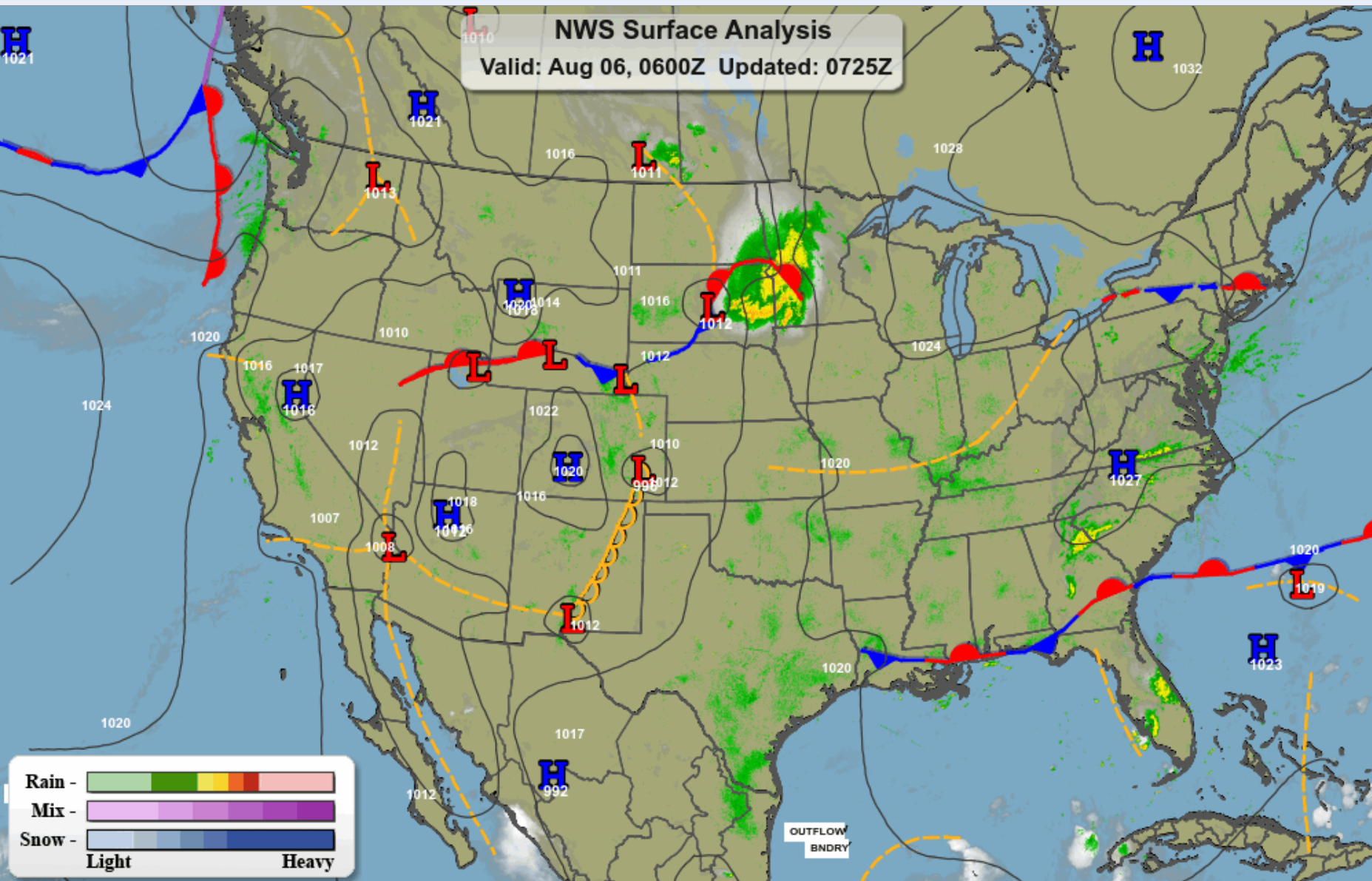
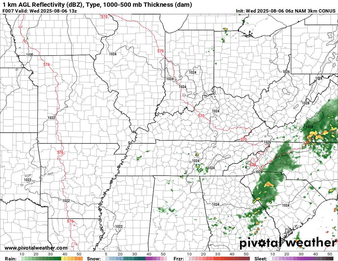
This morning’s weather map shows quiet weather over our region.
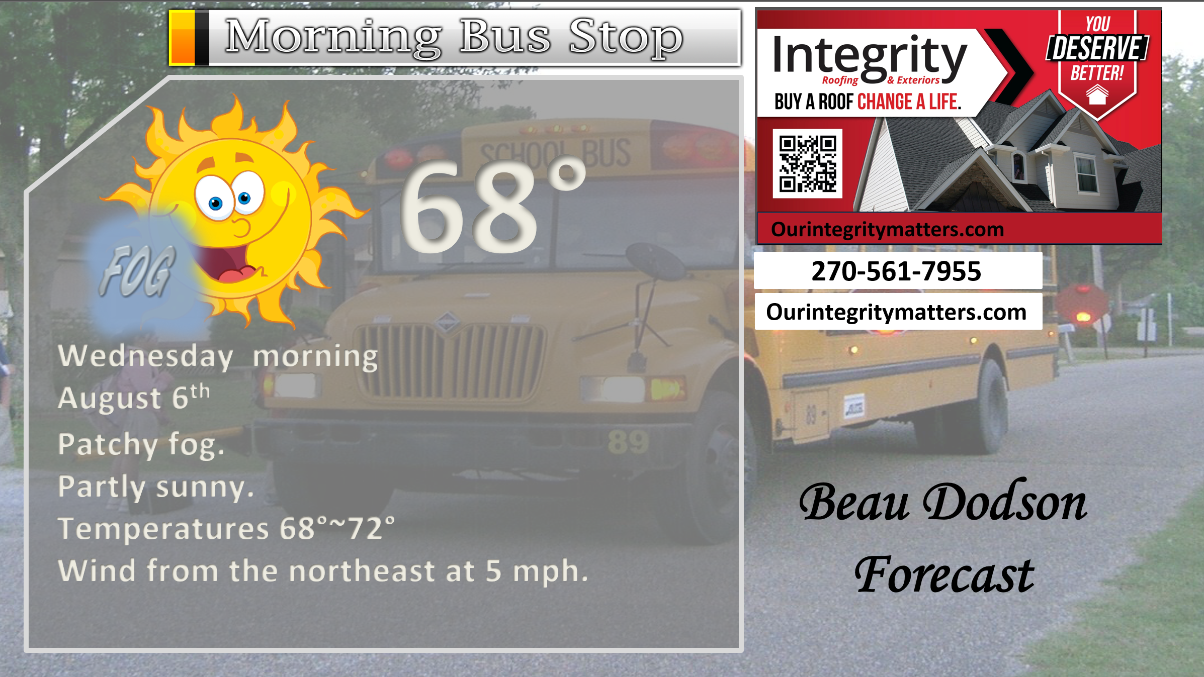
We do have some patchy dense fog. Use care.
A large complex of storms was moving through South Dakota and Minnesota. That is moving southeast, but it will dissipate before reaching our local area.
.
We will have a relatively stagnant weather pattern through next Tuesday. I can’t rule out an isolated heat-of-the-day pop-up storm, but the vast majority of the region will remain dry.
Currently, I have a 20% chance of storms from Sunday through Wednesday. We will see if one of those days trends higher with probabilities.
For now, it does not appear to be widespread precipitation.
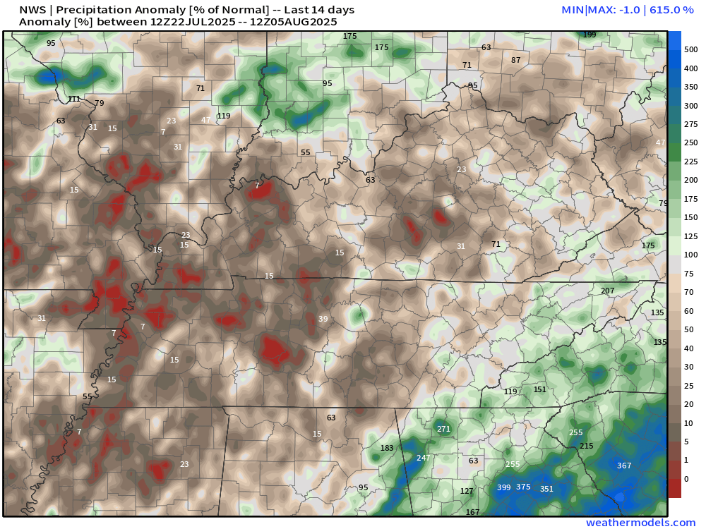
I know some areas could use a little rain. It is becoming dry.
Here is the 14-day percent of normal rainfall. As you can see, our region has a lot of brown. That means dry. Of course, there have been pockets of locally heavy thunderstorms over the past week. Typical for August. Feast or famine, as I like to say.
.
The weather may become more active towards the middle/end of next week. Confidence in that happening, this far out, is low. I will keep an eye on it. Perhaps some higher shower and thunderstorm chances will return to the region.
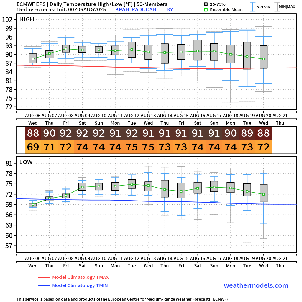
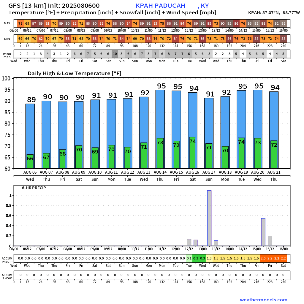
It will be warm this week. Temperatures will range from the upper eighties to the lower nineties for daytime highs. And around seventy degrees for overnight lows. We are not going back to the extreme numbers we saw over the last two weeks. Thankfully.
It will be a bit humid, at times. Normal August weather. Summer isn’t over, quite yet!
The extended EC and GFS model output shows warm weather ahead of us.
.
The GFS model is quite warm in the long range. Let’s see how this trends in the long range.
.
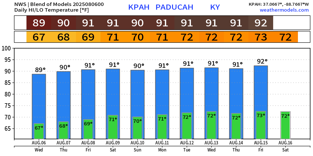
Here is the NWS blend of model temperatures. It does not go out quite as far as the other two models.
.
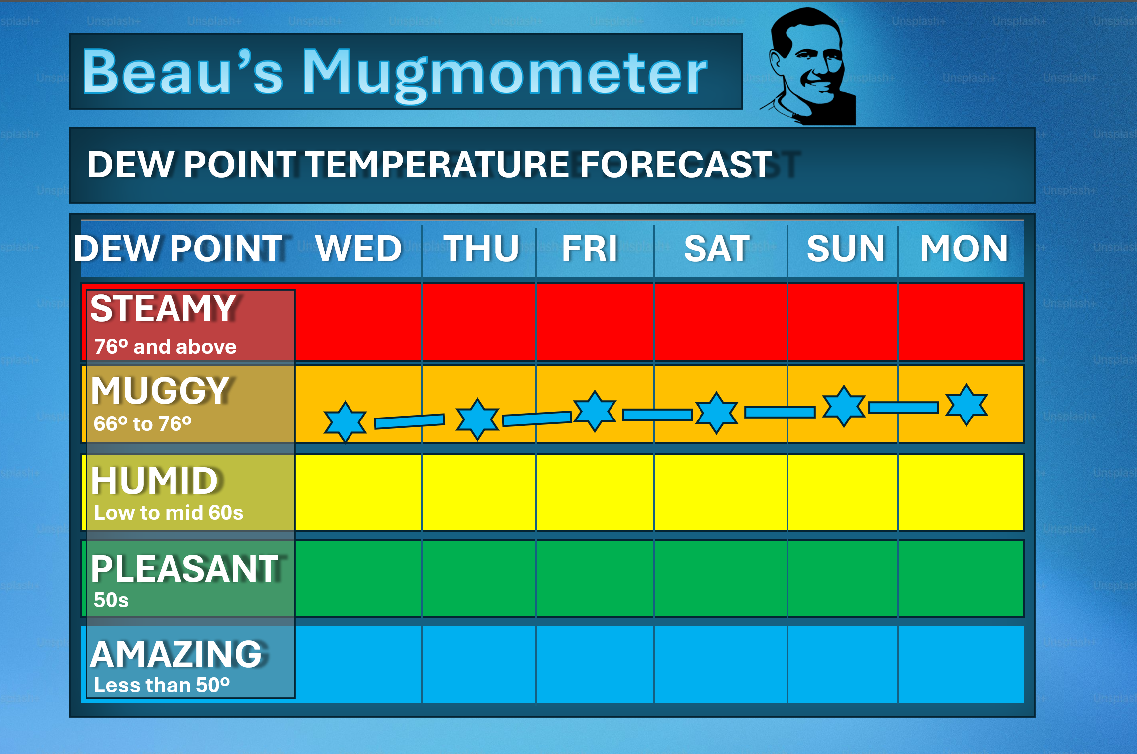
Here is my mugmometer. How muggy will it feel?
Remember, dew point is what controls how humid it feels outside. It will be a bit more humid/sticky as we move through the week, but nothing extreme.
.
No tropical storm or hurricane threats in our region through the next ten days.
I will keep an eye on mid to late August for a higher risk of tropical development in the Gulf of Mexico. For now, nothing of concern.
Have a super Wednesday!
.

.
The timestamp (upper left) is in Zulu. 12z=7 am. 18z=1 pm. 00z=7 pm.
Double-click the animation to enlarge it.
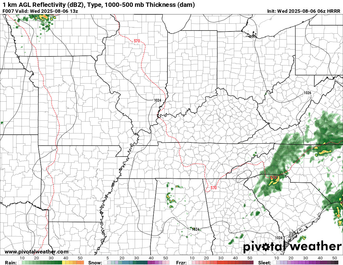
NAM 3K model
.
The timestamp (upper left) is in Zulu. 12z=7 am. 18z=1 pm. 00z=7 pm.
Double-click the animation to enlarge it.
Hrrr model
..
.
Click here if you would like to return to the top of the page.
.Average high temperatures for this time of the year are around 88 degrees.
Average low temperatures for this time of the year are around 68 degrees.
Average precipitation during this time period ranges from 1.00″ to 1.25″
Six to Ten Day Outlook.
Blue is below average. Red is above average. The no color zone represents equal chances.
Average highs for this time of the year are in the lower 60s. Average lows for this time of the year are in the lower 40s.

Green is above average precipitation. Yellow and brown favors below average precipitation. Average precipitation for this time of the year is around one inch per week.

.

Average low temperatures for this time of the year are around 67 degrees.
Average precipitation during this time period ranges from 1.00″ to 1.25″
.
Eight to Fourteen Day Outlook.
Blue is below average. Red is above average. The no color zone represents equal chances.

Green is above average precipitation. Yellow and brown favors below average precipitation. Average precipitation for this time of the year is around one inch per week.

.
.
.
We have a new service to complement your www.weathertalk.com subscription. This does NOTreplace www.weathertalk.com It is simply another tool for you to receive severe weather information.
.
https://weathercallservices.com/beau-dodson-weather


Want to receive the daily forecast/other products on your Beau Dodson Weather app?
Did you know you have four options in your www.weathertalk.com account
You will then receive these via your Beau Dodson Weather app.
Just log into your www.weathertalk.com account
Click the NOTIFICATION SETTINGS TAB
Then, turn them on (green) and off (red)
🌪️ Number 1 is the most important one. Severe alerts, tornado alerts, and so on.
Number 2 is the daily video, blog, livestream alerts, and severe weather Facebook threads on severe days or winter storm days.
Number 3 is the daily forecast. I send that out every day during the afternoon hours. It is the seven-day forecast, hazardous weather outlook, fire outlook, and more.
Number 4 is to receive the daily video, blog, and other content on NON-severe weather days (every day without severe threats in other words)
GREEN IS ON
RED IS OFF

I am going to start going live during bigger severe weather events.
Check it out here https://www.youtube.com/user/beaudodson
Click the subscribe button (it’s a free subscription button), and it will alert you when I go live. I will also send out alerts to the app when I go live for an event.

.

Radars and Lightning Data
Interactive-city-view radars. Clickable watches and warnings.
https://wtalk.co/B3XHASFZ
Old legacy radar site (some of you like it better)
https://weatherobservatory.com/weather-radar.htm
If the radar is not updating then try another one. If a radar does not appear to be refreshing then hit Ctrl F5. You may also try restarting your browser.
Backup radar site in case the above one is not working.
https://weathertalk.com/morani
Regional Radar
https://imagery.weathertalk.com/prx/RadarLoop.mp4
** NEW ** Zoom radar with chaser tracking abilities!
ZoomRadar
If the radar is not working, then email me: Email me at beaudodson@usawx.com
.
We do have some sponsors! Check them out.
Roof damage from recent storms? Link – Click here
INTEGRITY ROOFING AND EXTERIORS!
⛈️ Roof or gutter damage from recent storms? Today’s weather is sponsored by Integrity Roofing. Check out their website at this link https://www.ourintegritymatters.com/

![]()
![]()
![]()
Make sure you have three to five ways of receiving your severe weather information.
Weather Talk is one of those ways! Now, I have another product for you and your family.

.
Want to add more products to your Beau Dodson Weather App?
Receive daily videos, weather blog updates on normal weather days and severe weather and winter storm days, your county by county weather forecast, and more!
Here is how to do add those additional products to your app notification settings!
Here is a video on how to update your Beau Dodson Weather payment.
The app is for subscribers. Subscribe at www.weathertalk.com/welcome then go to your app store and search for WeatherTalk
Subscribers, PLEASE USE THE APP. ATT and Verizon are not reliable during severe weather. They are delaying text messages.
The app is under WeatherTalk in the app store.

Apple users click here

Android users click here
.
Radars and Lightning Data
Interactive-city-view radars. Clickable watches and warnings.
https://wtalk.co/B3XHASFZ
Old legacy radar site (some of you like it better)
https://weatherobservatory.com/weather-radar.htm
If the radar is not updating then try another one. If a radar does not appear to be refreshing then hit Ctrl F5. You may also try restarting your browser.
Backup radar site in case the above one is not working.
https://weathertalk.com/morani
Regional Radar
https://imagery.weathertalk.com/prx/RadarLoop.mp4
** NEW ** Zoom radar with chaser tracking abilities!
ZoomRadar
Lightning Data (zoom in and out of your local area)
https://wtalk.co/WJ3SN5UZ
Not working? Email me at beaudodson@usawx.com
National map of weather watches and warnings. Click here.
Storm Prediction Center. Click here.
Weather Prediction Center. Click here.
.

Live lightning data: Click here.
Real time lightning data (another one) https://map.blitzortung.org/#5.02/37.95/-86.99
Our new Zoom radar with storm chases
.
.

Interactive GOES R satellite. Track clouds. Click here.
GOES 16 slider tool. Click here.
College of DuPage satellites. Click here
.

Here are the latest local river stage forecast numbers Click Here.
Here are the latest lake stage forecast numbers for Kentucky Lake and Lake Barkley Click Here.
.
.
Find Beau on Facebook! Click the banner.


 .
.