August 29, 2021
Semi-optimistic that there is better news for our region concerning Hurricane Ida.
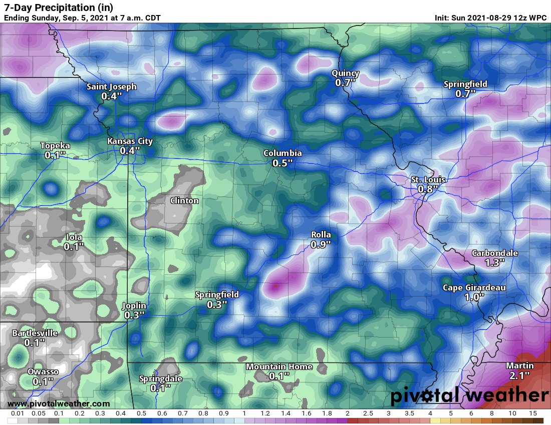
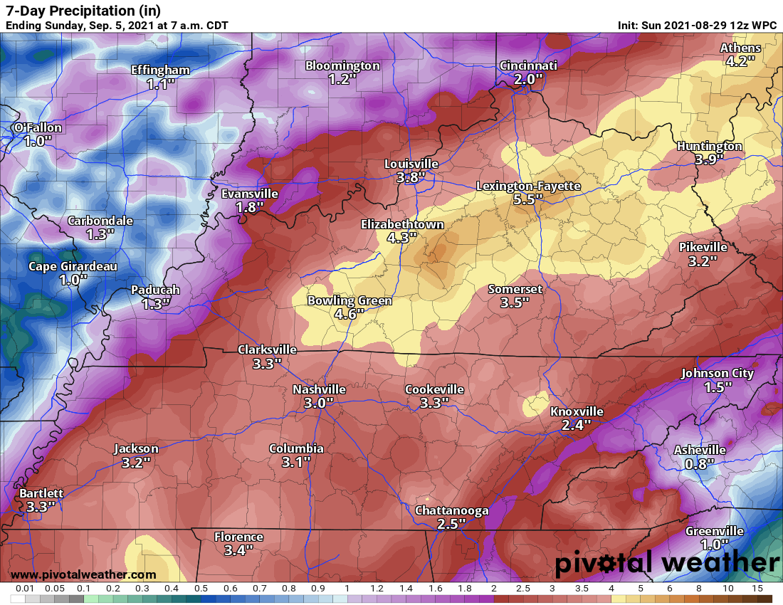
Updated rainfall forecast. Adjustments made based on the track of category four Hurricane Ida. Additional adjustments area still possible.
High confidence in Monday afternoons thunderstorm activity across portions of southeast Missouri and southern Illinois.
Lower confidence in a band from the Missouri Bootheel into Kentucky/Tennessee Monday afternoon/night.
Medium confidence that some locally heavy rain will occur with the remnants of Ida Tuesday into Wednesday morning. Totals have come down considerably from 24 hours ago.
Yesterday, I said there would be adjustments and there have been. The adjustments were for the better locally. Less in the way of extreme rainfall (for most).
Locally heavy rain will be possible as the remnants of Hurricane Ida move across the Mississippi and Tennessee Valleys.
Two areas of potential heavy rain. Two time periods of concern.
One will be Monday and Monday night across southeast Missouri, southern Illinois, and northwest Kentucky. We will have to watch a cold front nudging southward.
That would most likely be along and north of a line from Cape Girardeau, Missouri, east northeast into southern Illinois and then towards Evansville. That appears to be the most likely area for Monday’s heavy rain potential.
This cold front will bump into warm and humid air. It will produce a west to east band of showers and thunderstorms. Some of the thunderstorms could train over the same area.
IF that happens, then some locations will pick up two to four inches of rain. This could flood some roadways.
That is not reflected on the official NOAA maps posted below. That is my prediction based on looking at the charts.
The bands of locally heavy rain, Monday and Monday night, won’t impact everyone.
Another potential area of locally heavy rain Monday afternoon/night will be from the Missouri Bootheel and then along the Kentucky/Tennessee state line southward. Confidence in this area is lower.
We will have to watch and see if some of the bands from the hurricane move into that area. It is certainly possible.
Then, the remnants of Hurricane Ida will push northeast and east into the Mississippi and Tennessee Valleys Monday night into Tuesday/Tuesday night. It will pull away from our region Wednesday.
The remnants will brush our region. The overall trend over the past 24 hours has been to shift the heavier rain south and southeast. That would mean lower rain totals in our area.
General rain totals (from the remnants of Ida) across much of the area will be 0.25″ to 0.50″ with heavier totals from the Missouri Bootheel into portions of Kentucky and Tennessee.
It is possible that some locations pick up one to three inches of rain. That will be if the bands can push this far north. There remain questions about that.
If those bands don’t push further north then totals will remain on the light side.
Some of the guidance shows less than an inch of rain even from the Bootheel into Kentucky/Tennessee. So, there remain differences in the guidance packages.
Monitor updates as we continue to track Hurricane Ida.
At this time, we are expecting wind gusts of 15 to 25 mph. This is NOT another Hurricane Ike for our region.
For now, the tornado threat appears to be greater to our south and east.
Latest rainfall forecast
(Heavier totals are possible Monday/Monday night across portions of Missouri and Illinois)
.
Rest of the area
Rest of the area


