

.
I have some question-and-answer threads over on the Facebook page. Link to those threads CLICK HERE
Or email me at beaudodsonweather@gmail.com
..

🌪️ Seven-Day Tornado Outlook ⛈️
August 18th through August 24th
Current risk: NONE.
Current confidence level: High confidence in the forecast.
Comments: We are not anticipating tornadoes.
.

Seven-Day Hazardous Weather Outlook
1. Is lightning in the forecast? YES. The risk of lightning today through tomorrow morning is low. Scattered lightning becomes more likely Tuesday PM into Wednesday PM. The chance of lightning on Thursday will be low. I am monitoring Sunday.
2. Are organized severe thunderstorms in the forecast? NOT AT THIS TIME. Thunderstorms, during the summer months, can produce isolated gusty winds. Organized severe weather is not anticipated. You can never rule out an isolated severe thunderstorm warning during the summer months (for downburst winds).
3. Is flash flooding in the forecast? ISOLATED. Slow-moving summer storms can produce isolated torrential downpours that can briefly flood ditches and roadways. Organized or widespread flash flooding is not anticipated.
4. Will non-thunderstorm winds top 40 mph? NO.
5. Will temperatures rise above 90 degrees? YES. Temperatures today and tomorrow will rise well into the 90s. Locations south of the cold front will exceed 90 degrees on Wednesday, as well.
6. Will temperatures rise above 100 degrees? NO.
7. Will the heat index (feels like) rise above 100 degrees? YES. Heat index values will likely exceed 100 degrees today and tomorrow. Perhaps on Wednesday south of the cold front.
8. Will the heat index rise above 115 degrees? NO.
.
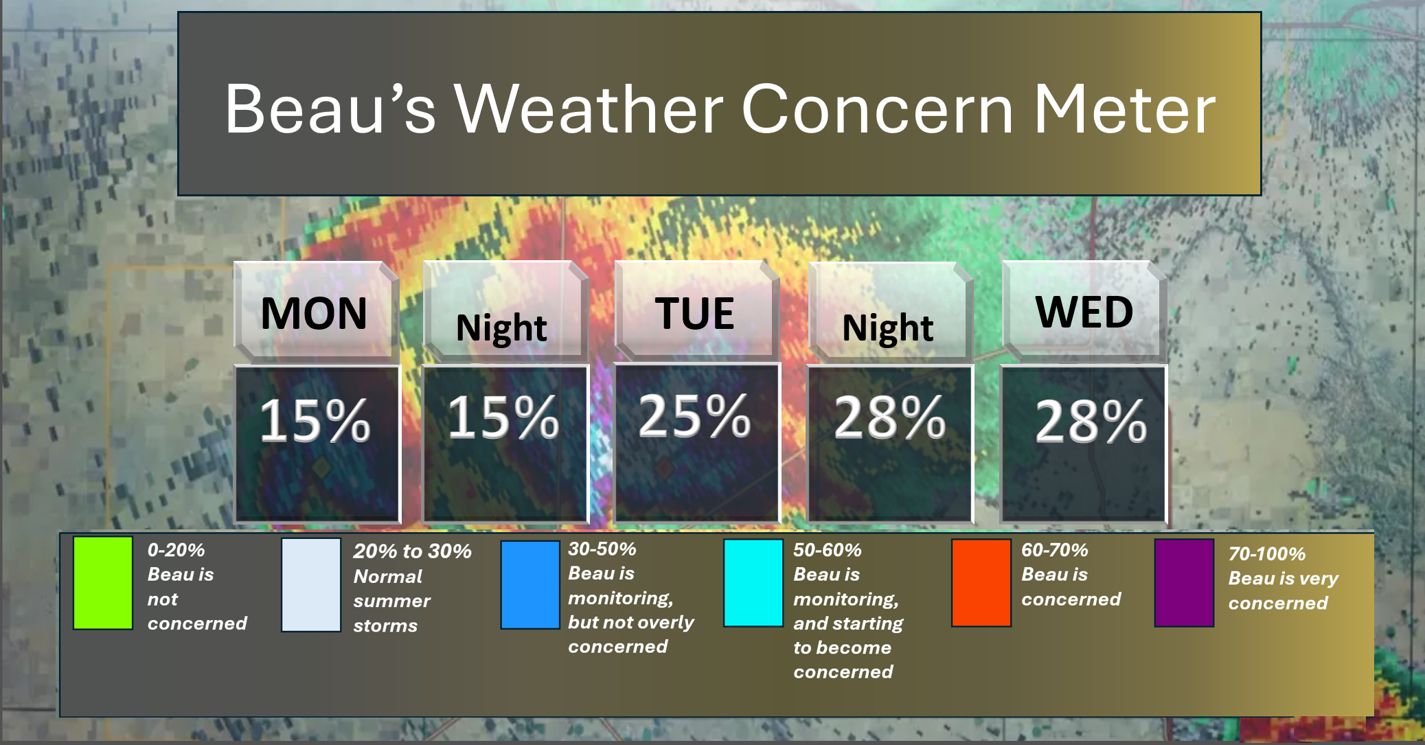
Here is the short-range concern meter. An isolated thunderstorm is possible today; otherwise, we are in the green.
Keep in mind that typical August/summer thunderstorms can produce isolated heavy rain, lightning, and gusty winds.
.
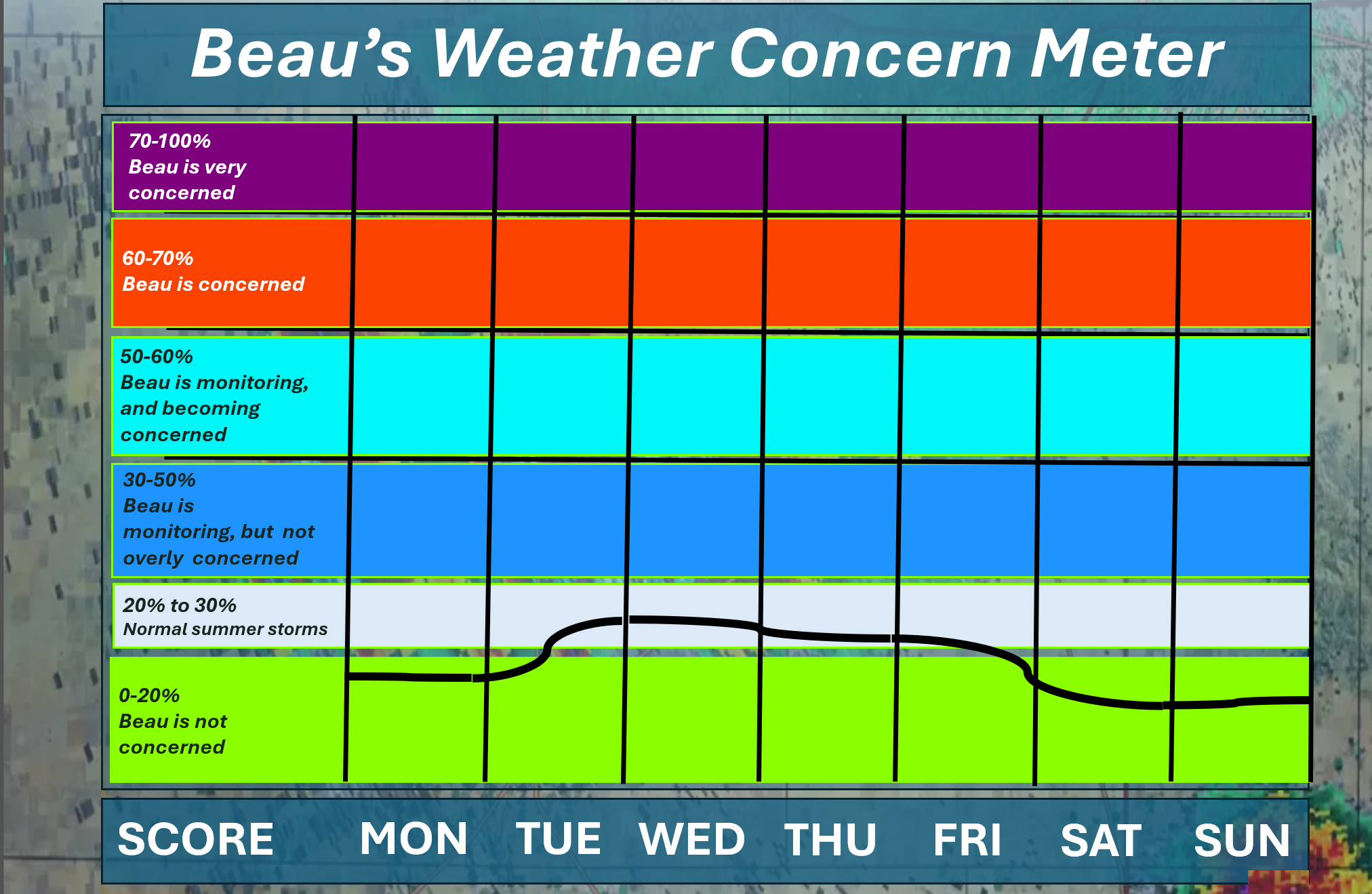
Here is the extended concern meter. This takes us through next Sunday.
Organized or widespread extreme weather is not anticipated.
A few storms are likely with the cold front on Tuesday PM into Wednesday PM. Locally heavy rain, lightning, and gusty winds will accompany the storms. An isolated flash flood risk. Typical summer thunderstorms.
I will monitor Sunday for a few storms, as well. For now, I left it dry.
A quick forecast glance. Your 48-hour forecast Graphics


.
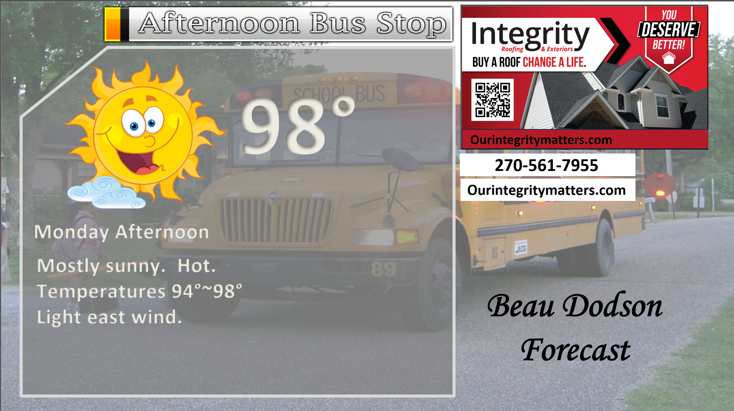
Here is your bus stop forecast.
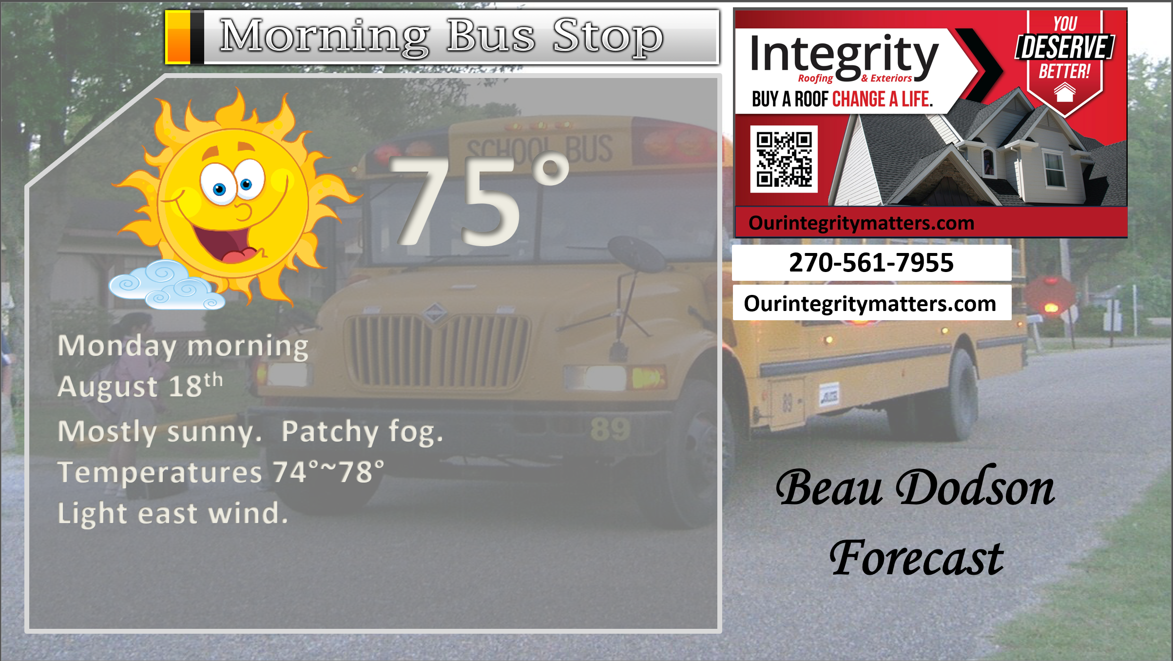
This afternoon
.

.

Forecast discussion.
- Hot today and tomorrow.
- A cold front arrives on Wednesday. Scattered showers and thunderstorms from Tuesday PM into Wednesday PM.
- Somewhat cooler from Thursday into the weekend.
- Monitoring temperatures next week. The trend is a bit cooler vs warmer.
.

.
Good morning, everyone!
I hope you had a nice weekend. It sure was hot.
Check out yesterday’s temperatures.
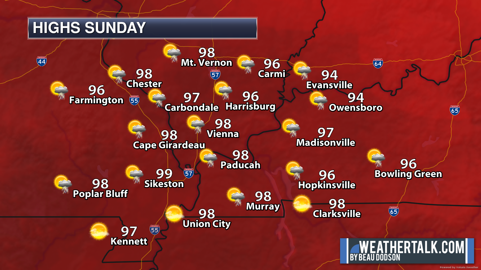
Summer!
It will be hot today and it will be hot tomorrow. Two more days of middle to upper nineties.
Thankfully, it won’t be all that humid. Heat index values will be a few degrees above the actual air temperatures.
Use common sense heat safety rules.
The great news is that a cold front will push into the region Tuesday night and Wednesday. It will slowly move from north to south. The front should be south of our region by Thursday morning.
The front will do three things. It will bring scattered showers and thunderstorms. It will bring cooler temperatures. Less humid air, as well.
Some of the thunderstorms will produce locally heavy rain, lightning, and gusty winds. Typical for August.
Not everyone will receive measurable rainfall. Some locations could receive an inch or so in the heaviest thunderstorms. Perhaps even higher totals if the storms are slow-moving. Typical summer gully-washers.
Unfortunately, others will remain dry. It is becoming quite dry in some counties. Some locations have received little or no rainfall in the past 25+ days.
This front will bring our best chance of rain for the week. I capped chances around 30 to 40%. Scattered.
Cooler and less humid air will filter into the region from Wednesday into Thursday. It may still be hot on Wednesday ahead of the front. Keep that in mind.
Temperatures will lower into the eighties by Thursday, Friday, Saturday, and Sunday. Most likely mid to upper eighties. But hey, we will take it! Anything is better than mid to upper nineties.
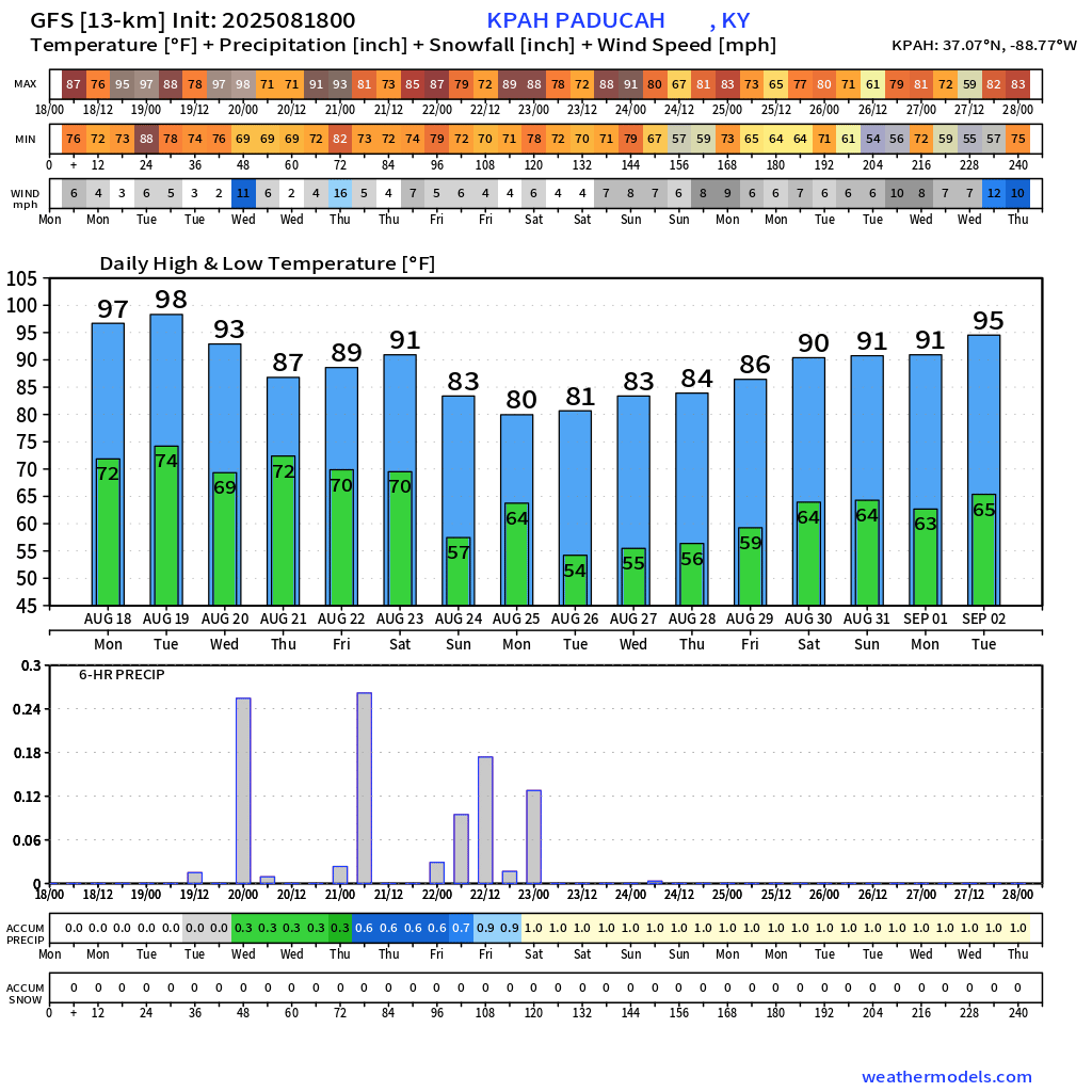
The trend for next week is a bit cooler. Instead of widespread nineties, a lot of data is showing widespread eighties. No promises, yet. I am monitoring trends in the guidance and will know more in the coming days.
It would be nice to see a gradual cooling down from all of this hot air.
Here is what the EC and GEFS ensembles are showing for temperatures next week. I chose Paducah as a central location. Temperatures in the region will be similar.
The trend has been cooler.
The EC ensembles
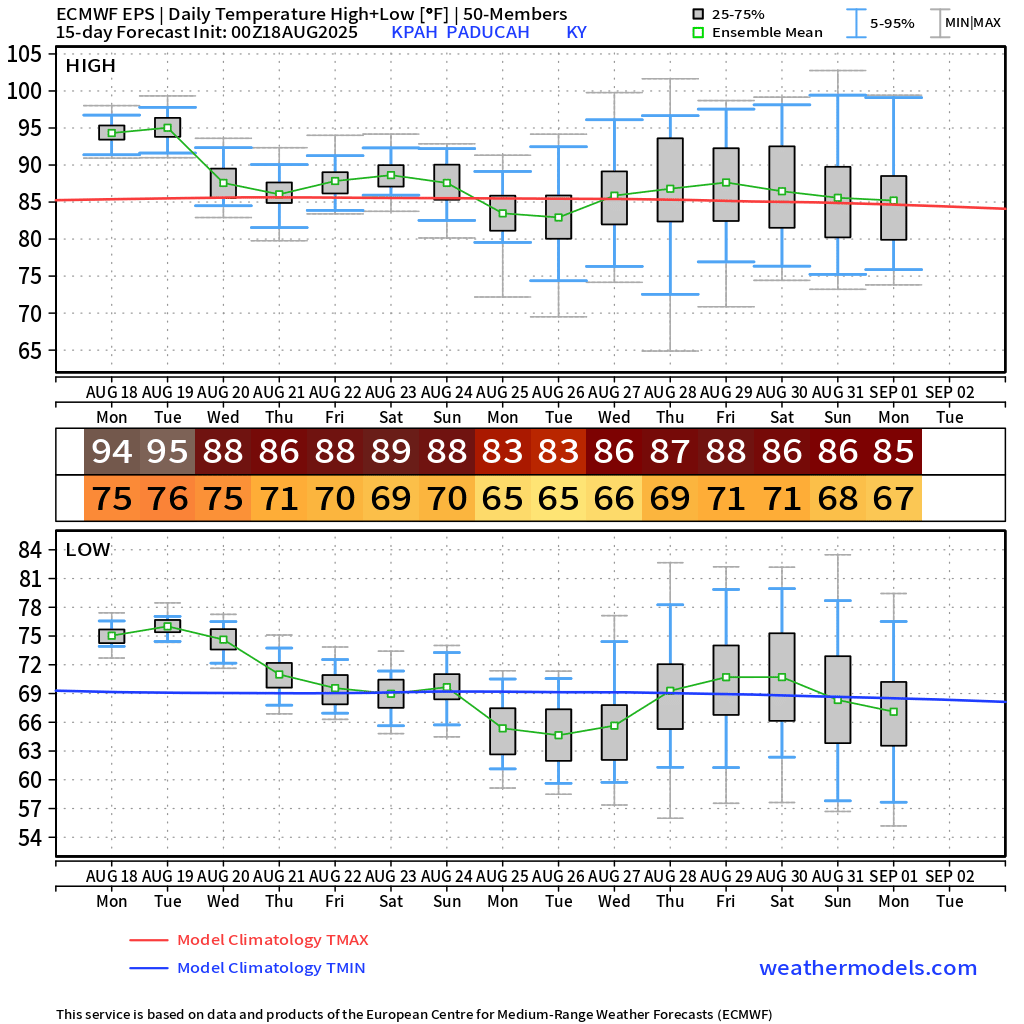
And the GEFS model
.
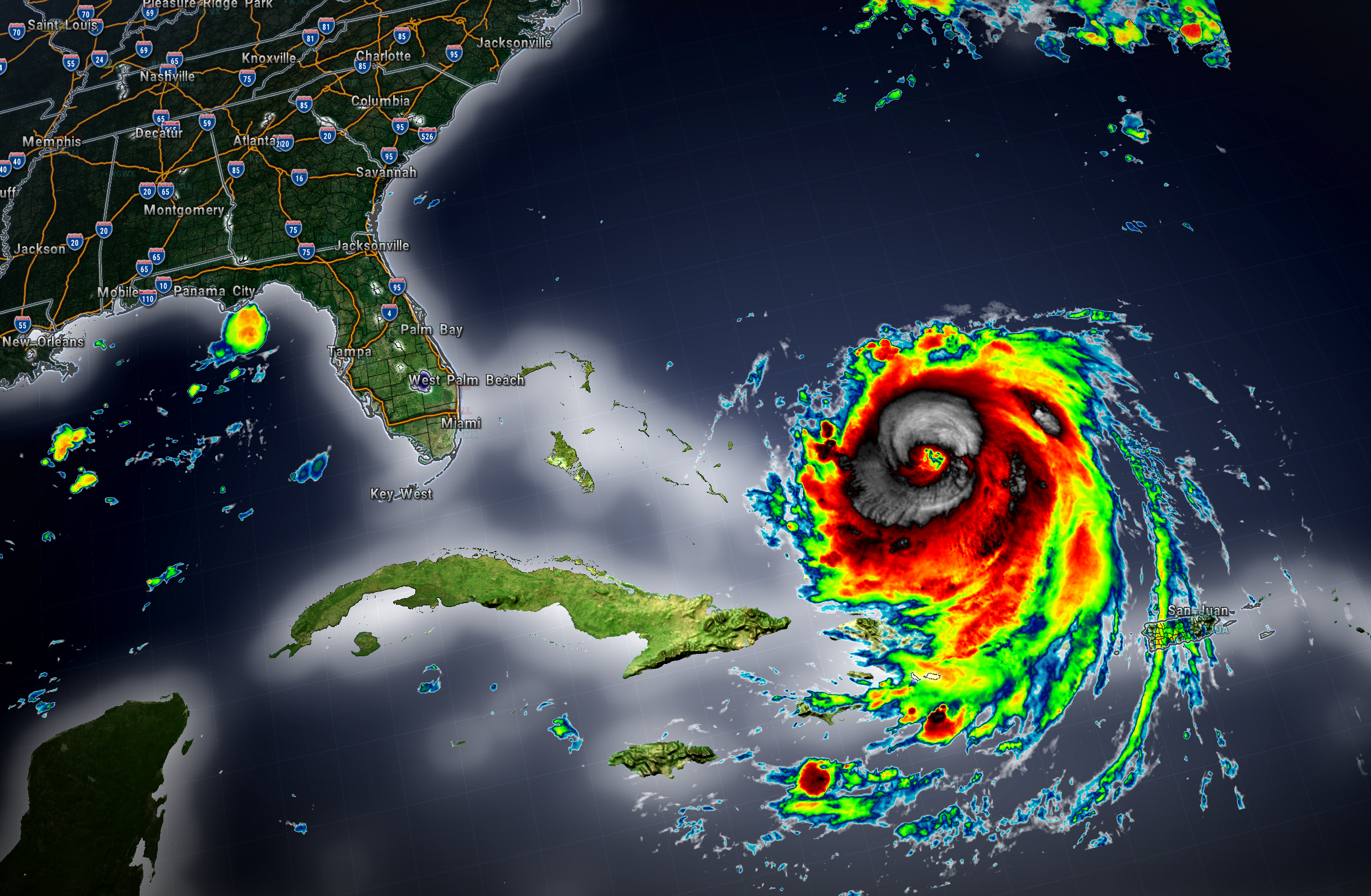
Hurricane Erin continues to churn well off the southeast coast of the United States.
It will eventually move north and then northeast (out to sea).
There will likely be some impacts on the East Coast. Swells, erosion, rip currents, and even some squally weather (for some).
Winds, as of 5 am, were 130 mph.
This system will help bring cooler air into our region. We will not receive any wind or rain from it.
.

.
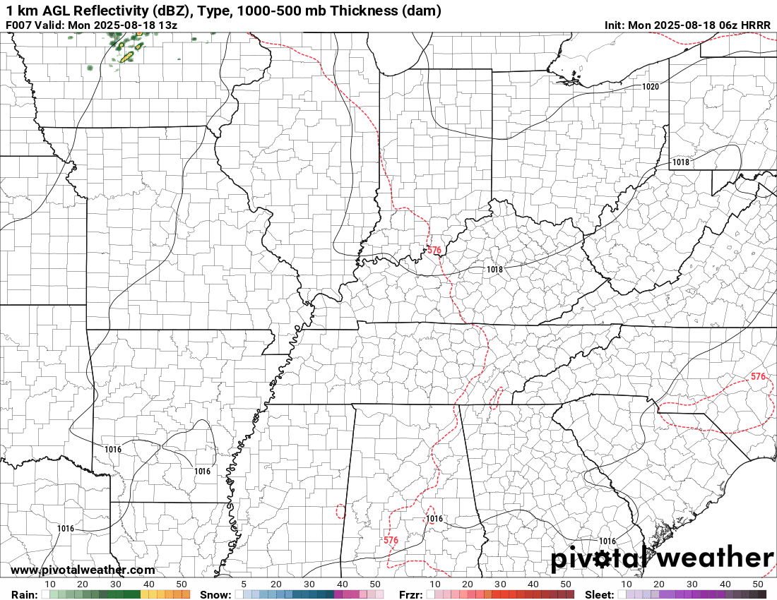
The timestamp (upper left) is in Zulu. 12z=7 am. 18z=1 pm. 00z=7 pm.
Double-click the animation to enlarge it.
Hrrr model
.
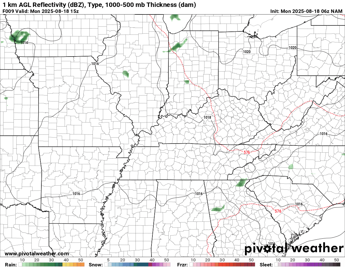
The timestamp (upper left) is in Zulu. 12z=7 am. 18z=1 pm. 00z=7 pm.
Double-click the animation to enlarge it.
NAM model
..
.
Click here if you would like to return to the top of the page.
.Average high temperatures for this time of the year are around 90 degrees.
Average low temperatures for this time of the year are around 68 degrees.
Average precipitation during this time period ranges from 1.00″ to 1.25″
Six to Ten Day Outlook.
Blue is below average. Red is above average. The no color zone represents equal chances.
Average highs for this time of the year are in the lower 60s. Average lows for this time of the year are in the lower 40s.

Green is above average precipitation. Yellow and brown favors below average precipitation. Average precipitation for this time of the year is around one inch per week.

.

Average low temperatures for this time of the year are around 67 degrees.
Average precipitation during this time period ranges from 1.00″ to 1.25″
.
Eight to Fourteen Day Outlook.
Blue is below average. Red is above average. The no color zone represents equal chances.

Green is above average precipitation. Yellow and brown favors below average precipitation. Average precipitation for this time of the year is around one inch per week.

.
.
.
We have a new service to complement your www.weathertalk.com subscription. This does NOTreplace www.weathertalk.com It is simply another tool for you to receive severe weather information.
.
https://weathercallservices.com/beau-dodson-weather


Want to receive the daily forecast/other products on your Beau Dodson Weather app?
Did you know you have four options in your www.weathertalk.com account
You will then receive these via your Beau Dodson Weather app.
Just log into your www.weathertalk.com account
Click the NOTIFICATION SETTINGS TAB
Then, turn them on (green) and off (red)
🌪️ Number 1 is the most important one. Severe alerts, tornado alerts, and so on.
Number 2 is the daily video, blog, livestream alerts, and severe weather Facebook threads on severe days or winter storm days.
Number 3 is the daily forecast. I send that out every day during the afternoon hours. It is the seven-day forecast, hazardous weather outlook, fire outlook, and more.
Number 4 is to receive the daily video, blog, and other content on NON-severe weather days (every day without severe threats in other words)
GREEN IS ON
RED IS OFF

I am going to start going live during bigger severe weather events.
Check it out here https://www.youtube.com/user/beaudodson
Click the subscribe button (it’s a free subscription button), and it will alert you when I go live. I will also send out alerts to the app when I go live for an event.

.

Radars and Lightning Data
Interactive-city-view radars. Clickable watches and warnings.
https://wtalk.co/B3XHASFZ
Old legacy radar site (some of you like it better)
https://weatherobservatory.com/weather-radar.htm
If the radar is not updating then try another one. If a radar does not appear to be refreshing then hit Ctrl F5. You may also try restarting your browser.
Backup radar site in case the above one is not working.
https://weathertalk.com/morani
Regional Radar
https://imagery.weathertalk.com/prx/RadarLoop.mp4
** NEW ** Zoom radar with chaser tracking abilities!
ZoomRadar
If the radar is not working, then email me: Email me at beaudodson@usawx.com
.
We do have some sponsors! Check them out.
Roof damage from recent storms? Link – Click here
INTEGRITY ROOFING AND EXTERIORS!
⛈️ Roof or gutter damage from recent storms? Today’s weather is sponsored by Integrity Roofing. Check out their website at this link https://www.ourintegritymatters.com/

![]()
![]()
![]()
Make sure you have three to five ways of receiving your severe weather information.
Weather Talk is one of those ways! Now, I have another product for you and your family.

.
Want to add more products to your Beau Dodson Weather App?
Receive daily videos, weather blog updates on normal weather days and severe weather and winter storm days, your county by county weather forecast, and more!
Here is how to do add those additional products to your app notification settings!
Here is a video on how to update your Beau Dodson Weather payment.
The app is for subscribers. Subscribe at www.weathertalk.com/welcome then go to your app store and search for WeatherTalk
Subscribers, PLEASE USE THE APP. ATT and Verizon are not reliable during severe weather. They are delaying text messages.
The app is under WeatherTalk in the app store.

Apple users click here

Android users click here
.
Radars and Lightning Data
Interactive-city-view radars. Clickable watches and warnings.
https://wtalk.co/B3XHASFZ
Old legacy radar site (some of you like it better)
https://weatherobservatory.com/weather-radar.htm
If the radar is not updating then try another one. If a radar does not appear to be refreshing then hit Ctrl F5. You may also try restarting your browser.
Backup radar site in case the above one is not working.
https://weathertalk.com/morani
Regional Radar
https://imagery.weathertalk.com/prx/RadarLoop.mp4
** NEW ** Zoom radar with chaser tracking abilities!
ZoomRadar
Lightning Data (zoom in and out of your local area)
https://wtalk.co/WJ3SN5UZ
Not working? Email me at beaudodson@usawx.com
National map of weather watches and warnings. Click here.
Storm Prediction Center. Click here.
Weather Prediction Center. Click here.
.

Live lightning data: Click here.
Real time lightning data (another one) https://map.blitzortung.org/#5.02/37.95/-86.99
Our new Zoom radar with storm chases
.
.

Interactive GOES R satellite. Track clouds. Click here.
GOES 16 slider tool. Click here.
College of DuPage satellites. Click here
.

Here are the latest local river stage forecast numbers Click Here.
Here are the latest lake stage forecast numbers for Kentucky Lake and Lake Barkley Click Here.
.
.
Find Beau on Facebook! Click the banner.


 .
.