

.
I have some question-and-answer threads over on the Facebook page. Link to those threads CLICK HERE
Or email me at beaudodsonweather@gmail.com
..

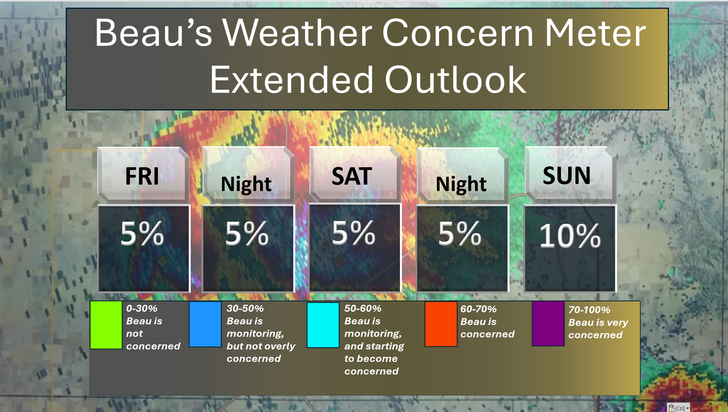
🌪️ Seven-Day Tornado Outlook ⛈️
August 1st through August 7th
Current risk: NONE.
Current confidence level: High confidence in the forecast.
Comments: We are not anticipating tornadoes.
.

Seven-Day Hazardous Weather Outlook
1. Is lightning in the forecast? YES. Scattered lightning is possible Monday into the new work week. Peak chances, at this time, appear to be on Monday and Tuesday. I will monitor Wednesday through Friday.
2. Are organized severe thunderstorms in the forecast? LOW RISK. Thunderstorms, during the summer months, can produce isolated gusty winds. Organized severe weather is not anticipated.
A cold front will bring an increased risk of scattered strong thunderstorms today. Some of the thunderstorms could produce strong wind gusts.
3. Is flash flooding in the forecast? ISOLATED. Slow-moving summer storms can produce torrential downpours that can briefly flood ditches and roadways.
4. Will non-thunderstorm winds top 40 mph? NO.
5. Will temperatures rise above 90 degrees? POSSIBLE. I will monitor Wednesday through Friday. Temperatures may approach 90 degrees.
6. Will temperatures rise above 100 degrees? NO.
7. Will the heat index (feels like) rise above 100 degrees? NOT AT THIS TIME.
8. Will the heat index rise above 115 degrees? NO.
.
A quick forecast glance. Your 48-hour forecast Graphics


.

.

.

Forecast discussion.
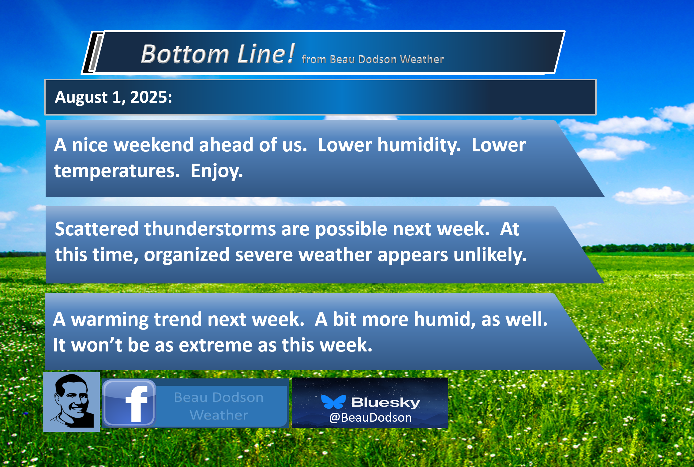
- Nicer weather has arrived. Today will be less humid. Enjoy!
- Smoke from the Canadian wildfires could cause some issues today and tomorrow. Hazy sky conditions are possible. Some areas could have near surface smoke that could cause problems for those with breathing issues.
- A slight chance of a shower or thunderstorm in western Kentucky on Sunday afternoon.
- Scattered showers and thunderstorms next week. A bit warmer. A bit more humid. Typical August weather.
.

Good morning, everyone
Welcome to August!
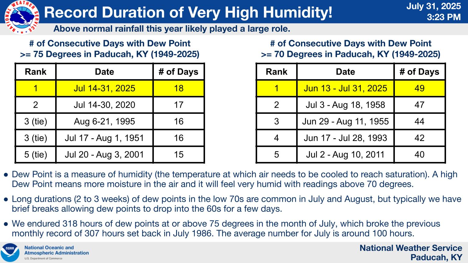
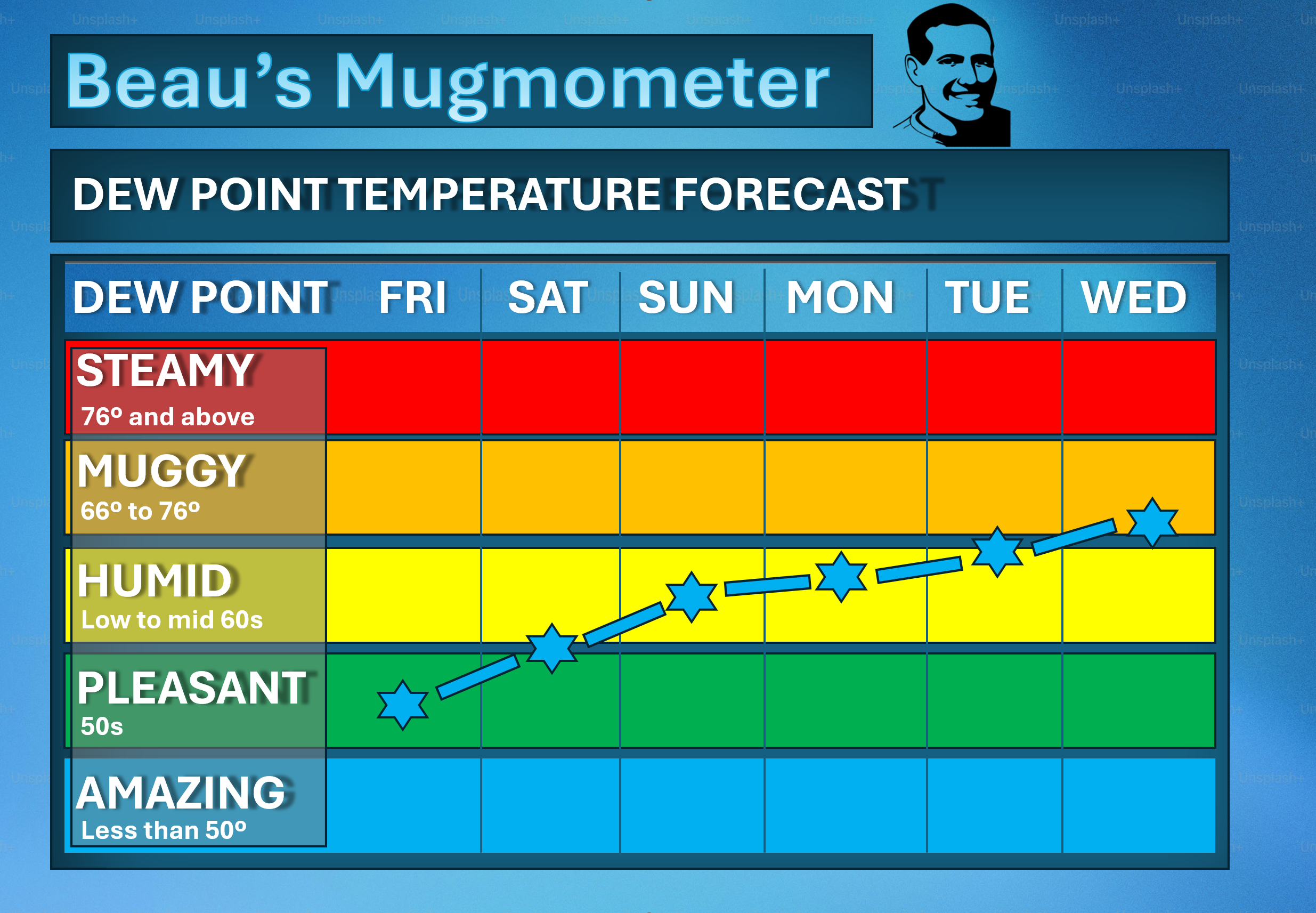
We made it through a record stretch of high humidity levels. It was muggy, as you know.
We have reached the end of the longest stretch of continuously high humidity that Paducah has witnessed in the past 75 years. The number of hours at oppressive levels (dew points 75+) has exceeded 300% of normal for the month of July.
The Paducah NWS made a page about the heat wave. Here is that page. Click here.
.
Nicer weather has arrived. It will be less humid today. Temperatures will be pleasant. We have earned this nicer weather.
We do still have some clouds in the region. Those clouds should shift southward with time.
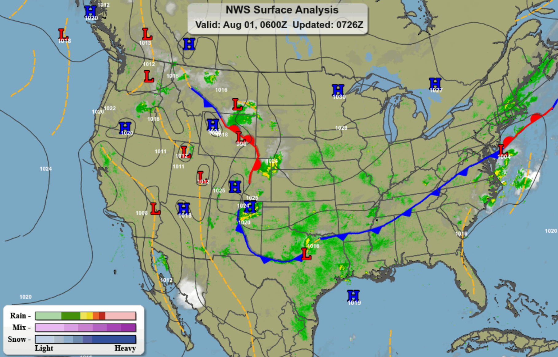
The cold front has pushed off to our south. You can see that on this morning’s surface weather map.
Dry conditions prevail across the entire area.
Here is the muggy meter.
.
I hope you can get outside and enjoy the weather. A great weekend for camping or mowing.
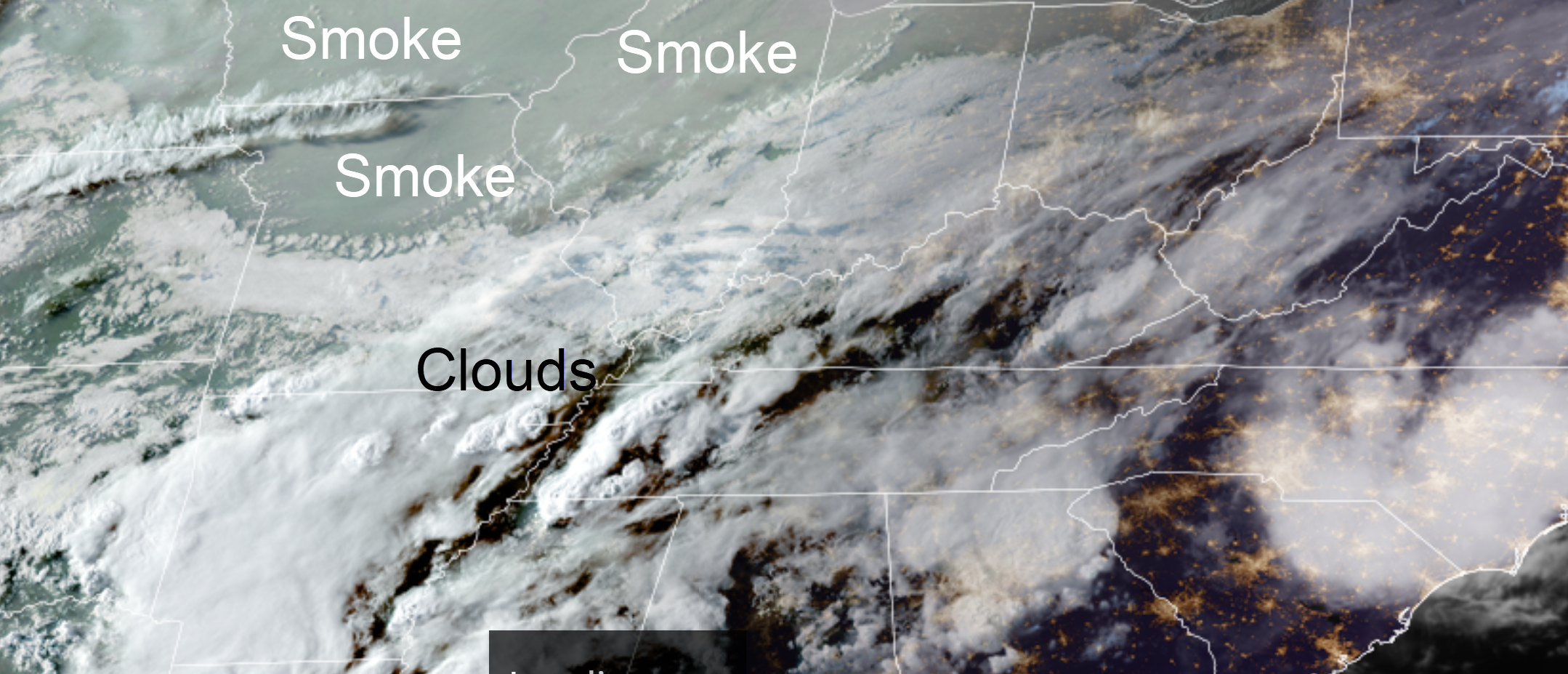
We do have some Canadian wildfire smoke pushing into the region from the north. This could be a concern for those with breathing issues. Illinois has issued an air quality alert for the entire state.
Instead of pure sunshine, the sky could look hazy in some areas.
This was the satellite from yesterday evening. You can see the smoke to our north. It is moving south.
.
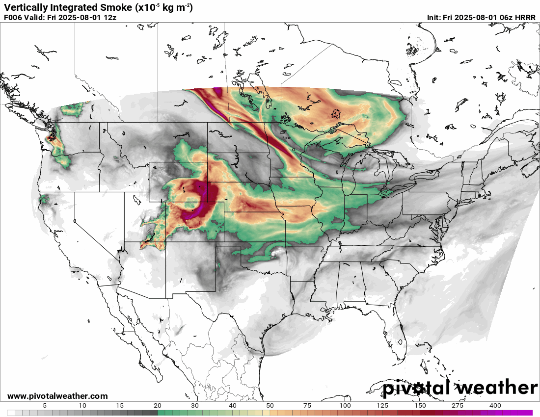
Here is the Hrrr model smoke forecast. Again, a lot of this may be aloft. Meaning, not at the surface. With that said, I can’t rule out some surface smoke in some counties.
.
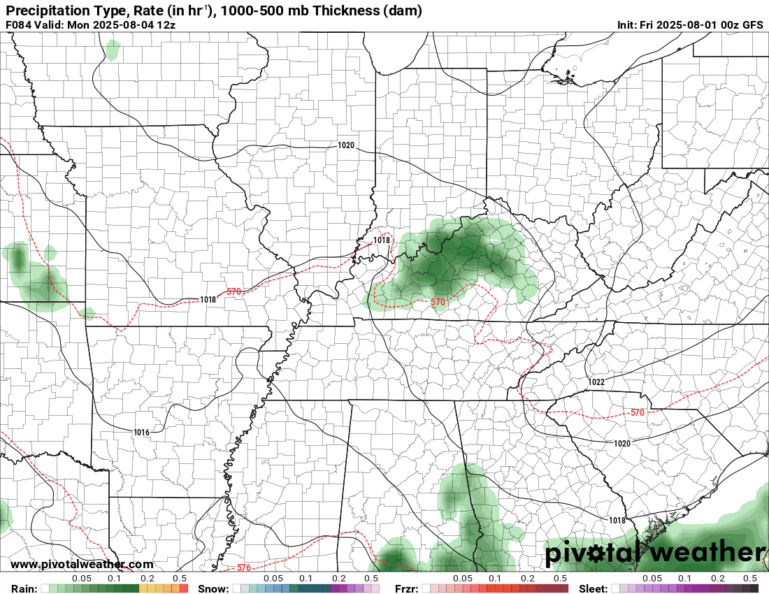
Today and tomorrow will be dry in the region.
I do have a slight chance of a shower or thunderstorm on Sunday afternoon east of Land Between the Lakes in western Kentucky. The vast majority of the region will remain dry.
Some areas could use a little rain.
It will be a bit warmer by Monday and Tuesday. A bit more humid, as well. I do not believe we will return to the extreme numbers we witnessed this past week. But, it could be humid again. Typical summer/August conditions for our region.
Scattered thunderstorms are possible through much of next week. There are no strong signals for a 12-hour period to have precipitation probabilities above 40%, but I will monitor it. A thunderstorm complex or two may impact the region next week. That would mean higher precipitation probabilities.
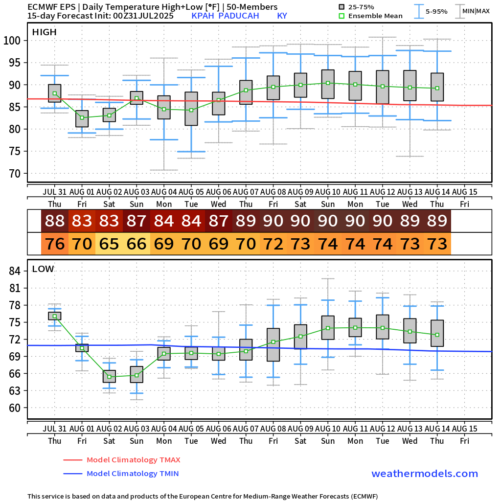
The long-range temperature outlook is fairly warm. Not extreme.
The GEFS model is a bit warmer than the EC model.
Here is the EC model
I chose Paducah as a central point.
Here is the GEFS model
.
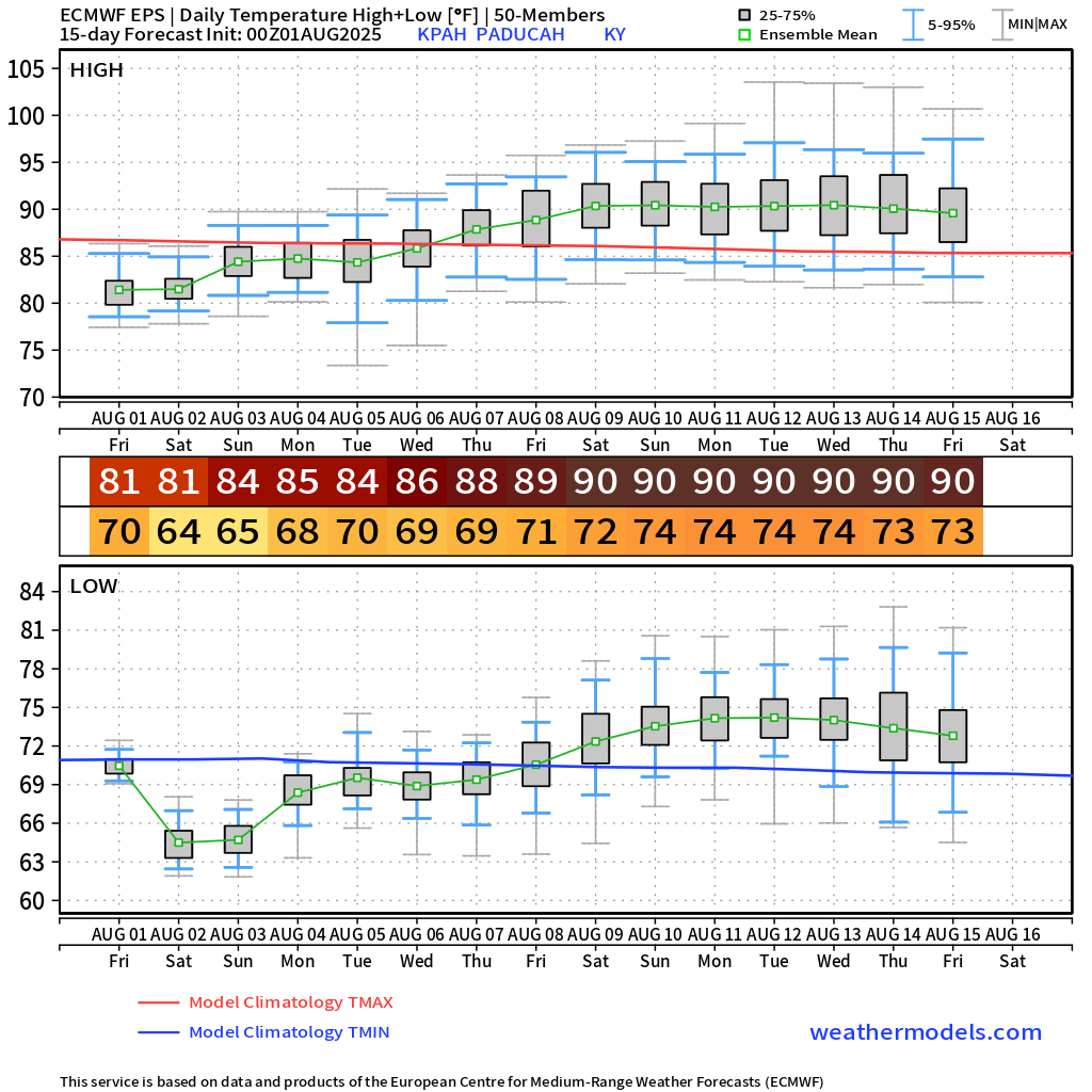
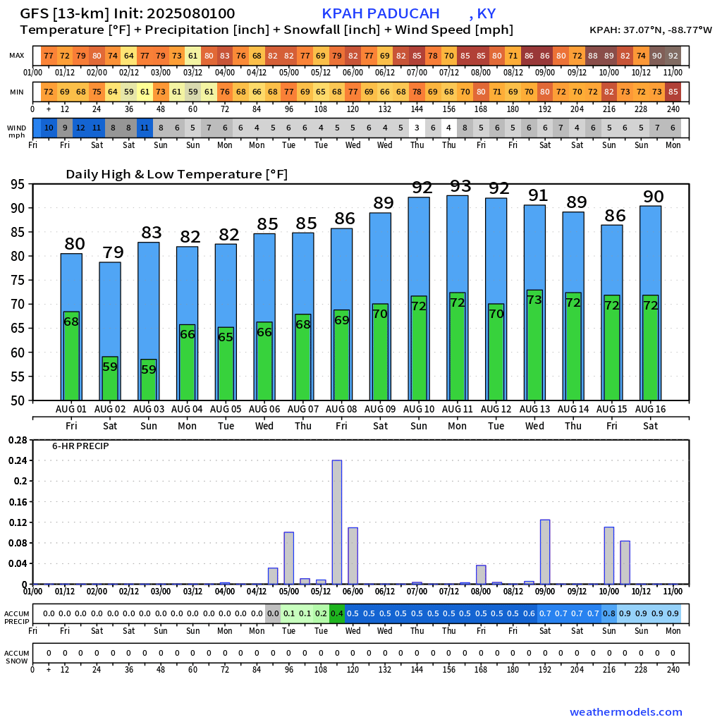
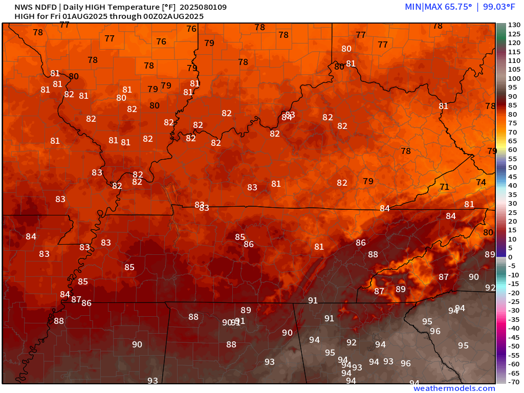
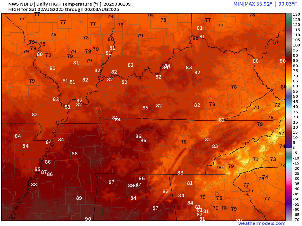
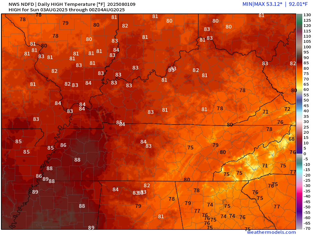
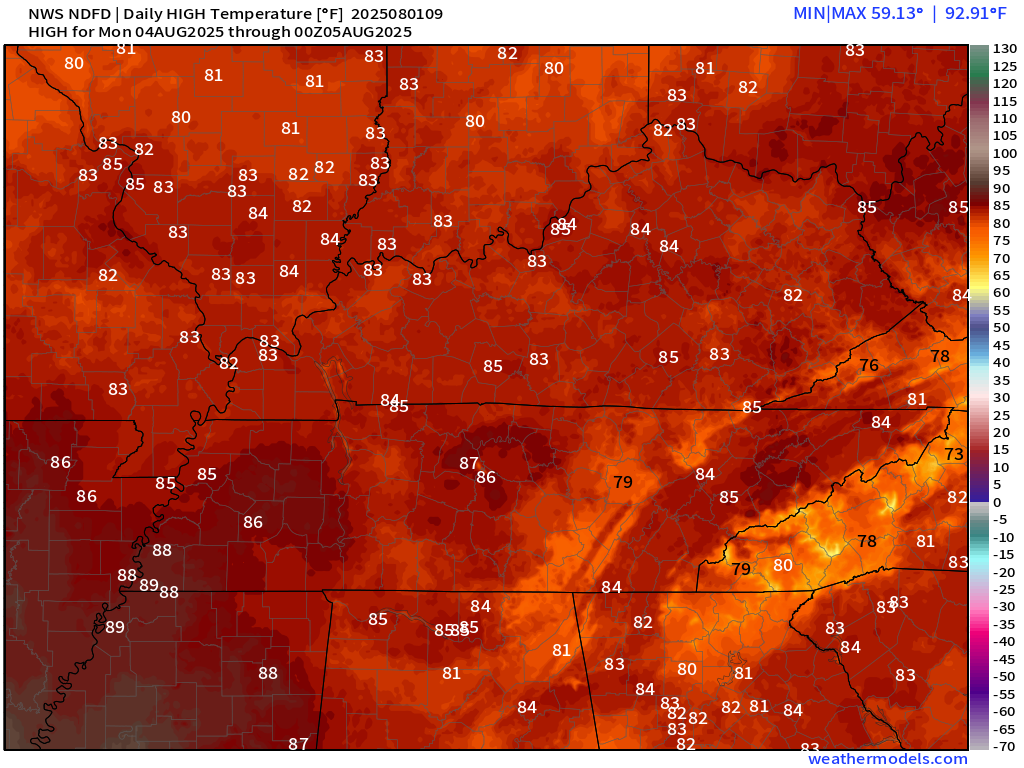
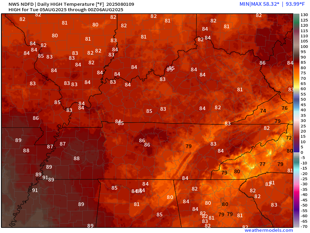
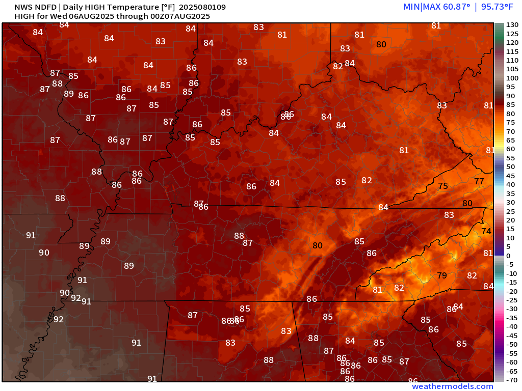
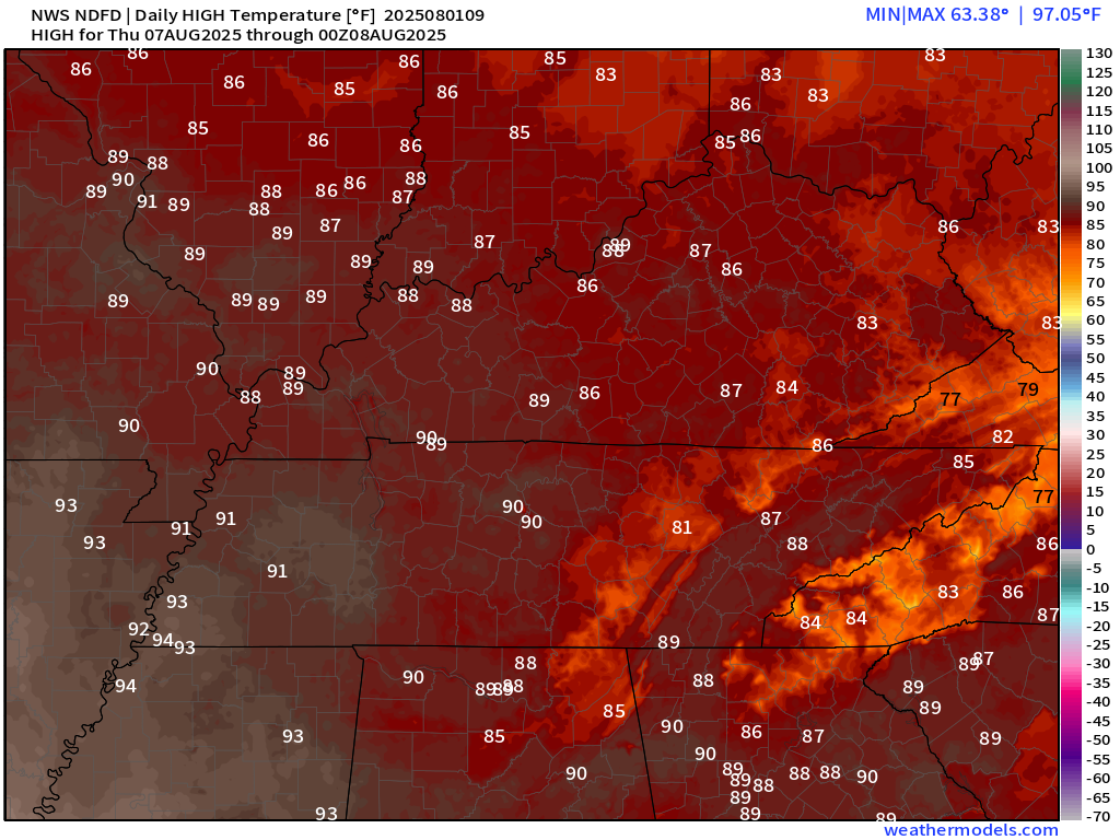
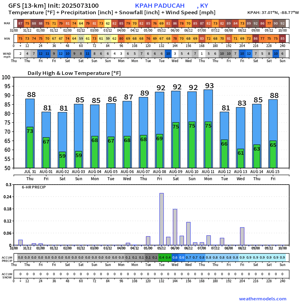
Here are the daily temperature forecasts. Better than recent days.
Today
Saturday
Sunday
Monday
Tuesday
Wednesday
Thursday
.
Lows will range from the upper 50s to middle 60s through Tuesday night. Climbing into the mid to upper 60s towards the middle/end of next week.
Let me show you two models. The GEFS model and the EC model.
This shows you the temperatures in the long range.
This looks like fairly typical August weather.
The GEFS model
The EC model
.

.
The timestamp (upper left) is in Zulu. 12z=7 am. 18z=1 pm. 00z=7 pm.
Double-click the animation to enlarge it.
GFS model
.
The timestamp (upper left) is in Zulu. 12z=7 am. 18z=1 pm. 00z=7 pm.
Double-click the animation to enlarge it.
Hrrr model
..
.
Click here if you would like to return to the top of the page.
.Average high temperatures for this time of the year are around 89 degrees.
Average low temperatures for this time of the year are around 69 degrees.
Average precipitation during this time period ranges from 1.00″ to 1.25″
Six to Ten Day Outlook.
Blue is below average. Red is above average. The no color zone represents equal chances.
Average highs for this time of the year are in the lower 60s. Average lows for this time of the year are in the lower 40s.

Green is above average precipitation. Yellow and brown favors below average precipitation. Average precipitation for this time of the year is around one inch per week.

.

Average low temperatures for this time of the year are around 69 degrees.
Average precipitation during this time period ranges from 1.00″ to 1.25″
.
Eight to Fourteen Day Outlook.
Blue is below average. Red is above average. The no color zone represents equal chances.

Green is above average precipitation. Yellow and brown favors below average precipitation. Average precipitation for this time of the year is around one inch per week.

.
.
.
We have a new service to complement your www.weathertalk.com subscription. This does NOTreplace www.weathertalk.com It is simply another tool for you to receive severe weather information.
.
https://weathercallservices.com/beau-dodson-weather


Want to receive the daily forecast/other products on your Beau Dodson Weather app?
Did you know you have four options in your www.weathertalk.com account
You will then receive these via your Beau Dodson Weather app.
Just log into your www.weathertalk.com account
Click the NOTIFICATION SETTINGS TAB
Then, turn them on (green) and off (red)
🌪️ Number 1 is the most important one. Severe alerts, tornado alerts, and so on.
Number 2 is the daily video, blog, livestream alerts, and severe weather Facebook threads on severe days or winter storm days.
Number 3 is the daily forecast. I send that out every day during the afternoon hours. It is the seven-day forecast, hazardous weather outlook, fire outlook, and more.
Number 4 is to receive the daily video, blog, and other content on NON-severe weather days (every day without severe threats in other words)
GREEN IS ON
RED IS OFF

I am going to start going live during bigger severe weather events.
Check it out here https://www.youtube.com/user/beaudodson
Click the subscribe button (it’s a free subscription button), and it will alert you when I go live. I will also send out alerts to the app when I go live for an event.

.

Radars and Lightning Data
Interactive-city-view radars. Clickable watches and warnings.
https://wtalk.co/B3XHASFZ
Old legacy radar site (some of you like it better)
https://weatherobservatory.com/weather-radar.htm
If the radar is not updating then try another one. If a radar does not appear to be refreshing then hit Ctrl F5. You may also try restarting your browser.
Backup radar site in case the above one is not working.
https://weathertalk.com/morani
Regional Radar
https://imagery.weathertalk.com/prx/RadarLoop.mp4
** NEW ** Zoom radar with chaser tracking abilities!
ZoomRadar
If the radar is not working, then email me: Email me at beaudodson@usawx.com
.
We do have some sponsors! Check them out.
Roof damage from recent storms? Link – Click here
INTEGRITY ROOFING AND EXTERIORS!
⛈️ Roof or gutter damage from recent storms? Today’s weather is sponsored by Integrity Roofing. Check out their website at this link https://www.ourintegritymatters.com/

![]()
![]()
![]()
Make sure you have three to five ways of receiving your severe weather information.
Weather Talk is one of those ways! Now, I have another product for you and your family.

.
Want to add more products to your Beau Dodson Weather App?
Receive daily videos, weather blog updates on normal weather days and severe weather and winter storm days, your county by county weather forecast, and more!
Here is how to do add those additional products to your app notification settings!
Here is a video on how to update your Beau Dodson Weather payment.
The app is for subscribers. Subscribe at www.weathertalk.com/welcome then go to your app store and search for WeatherTalk
Subscribers, PLEASE USE THE APP. ATT and Verizon are not reliable during severe weather. They are delaying text messages.
The app is under WeatherTalk in the app store.

Apple users click here

Android users click here
.
Radars and Lightning Data
Interactive-city-view radars. Clickable watches and warnings.
https://wtalk.co/B3XHASFZ
Old legacy radar site (some of you like it better)
https://weatherobservatory.com/weather-radar.htm
If the radar is not updating then try another one. If a radar does not appear to be refreshing then hit Ctrl F5. You may also try restarting your browser.
Backup radar site in case the above one is not working.
https://weathertalk.com/morani
Regional Radar
https://imagery.weathertalk.com/prx/RadarLoop.mp4
** NEW ** Zoom radar with chaser tracking abilities!
ZoomRadar
Lightning Data (zoom in and out of your local area)
https://wtalk.co/WJ3SN5UZ
Not working? Email me at beaudodson@usawx.com
National map of weather watches and warnings. Click here.
Storm Prediction Center. Click here.
Weather Prediction Center. Click here.
.

Live lightning data: Click here.
Real time lightning data (another one) https://map.blitzortung.org/#5.02/37.95/-86.99
Our new Zoom radar with storm chases
.
.

Interactive GOES R satellite. Track clouds. Click here.
GOES 16 slider tool. Click here.
College of DuPage satellites. Click here
.

Here are the latest local river stage forecast numbers Click Here.
Here are the latest lake stage forecast numbers for Kentucky Lake and Lake Barkley Click Here.
.
.
Find Beau on Facebook! Click the banner.


 .
.