

.
I have some question-and-answer threads over on the Facebook page. Link to those threads CLICK HERE
Or email me at beaudodsonweather@gmail.com
.

🌪️ Seven-Day Tornado Outlook ⛈️
April 7th through April 13th
Current risk: NO.
Current confidence level: HIGH.
Comment: None
.

Seven-Day Hazardous Weather Outlook
1. Is lightning in the forecast? YES. Lightning is possible Wednesday night into Thursday night.
2. Are severe thunderstorms in the forecast? NOT AT THIS TIME. I will monitor Thursday.
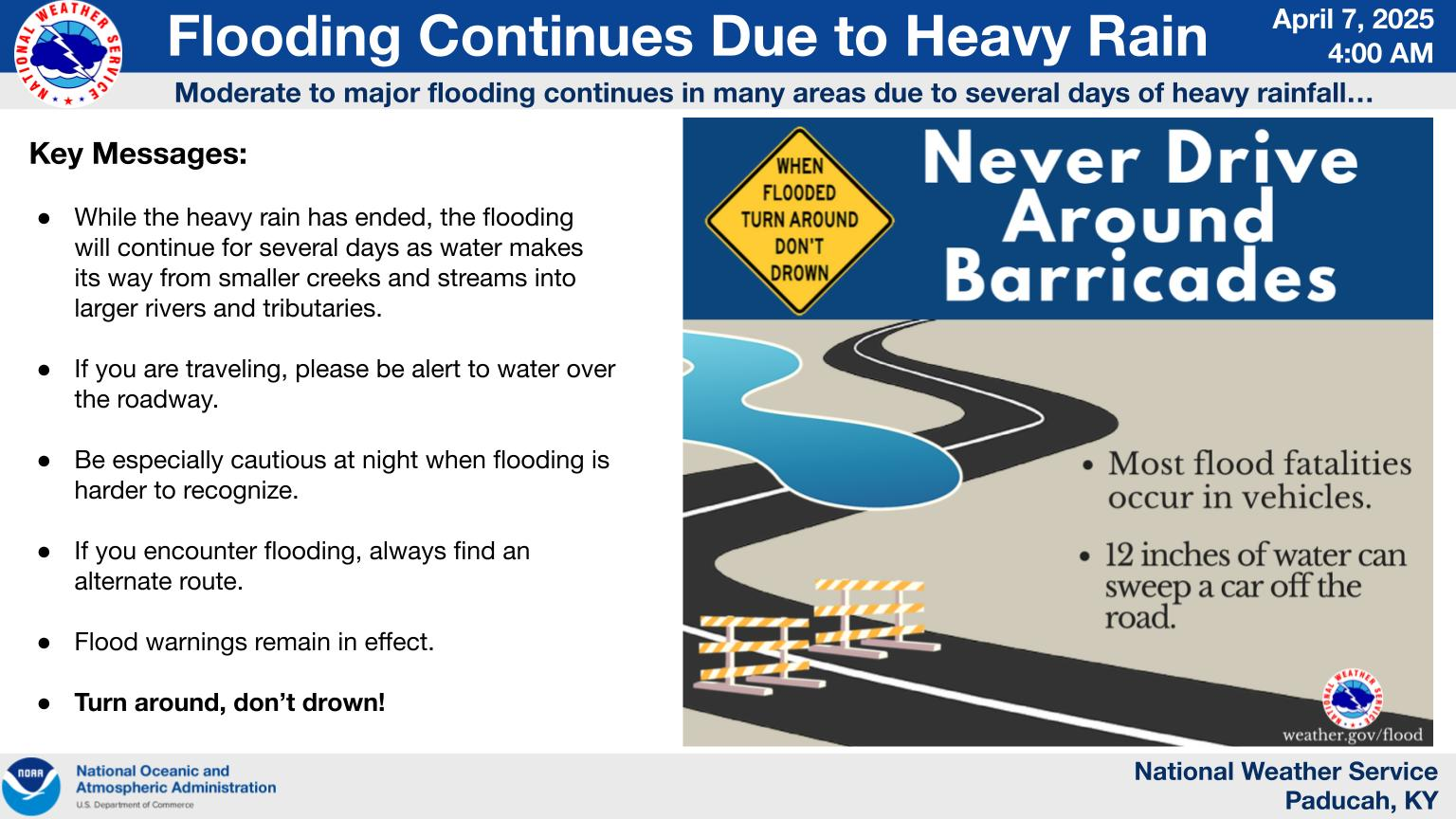
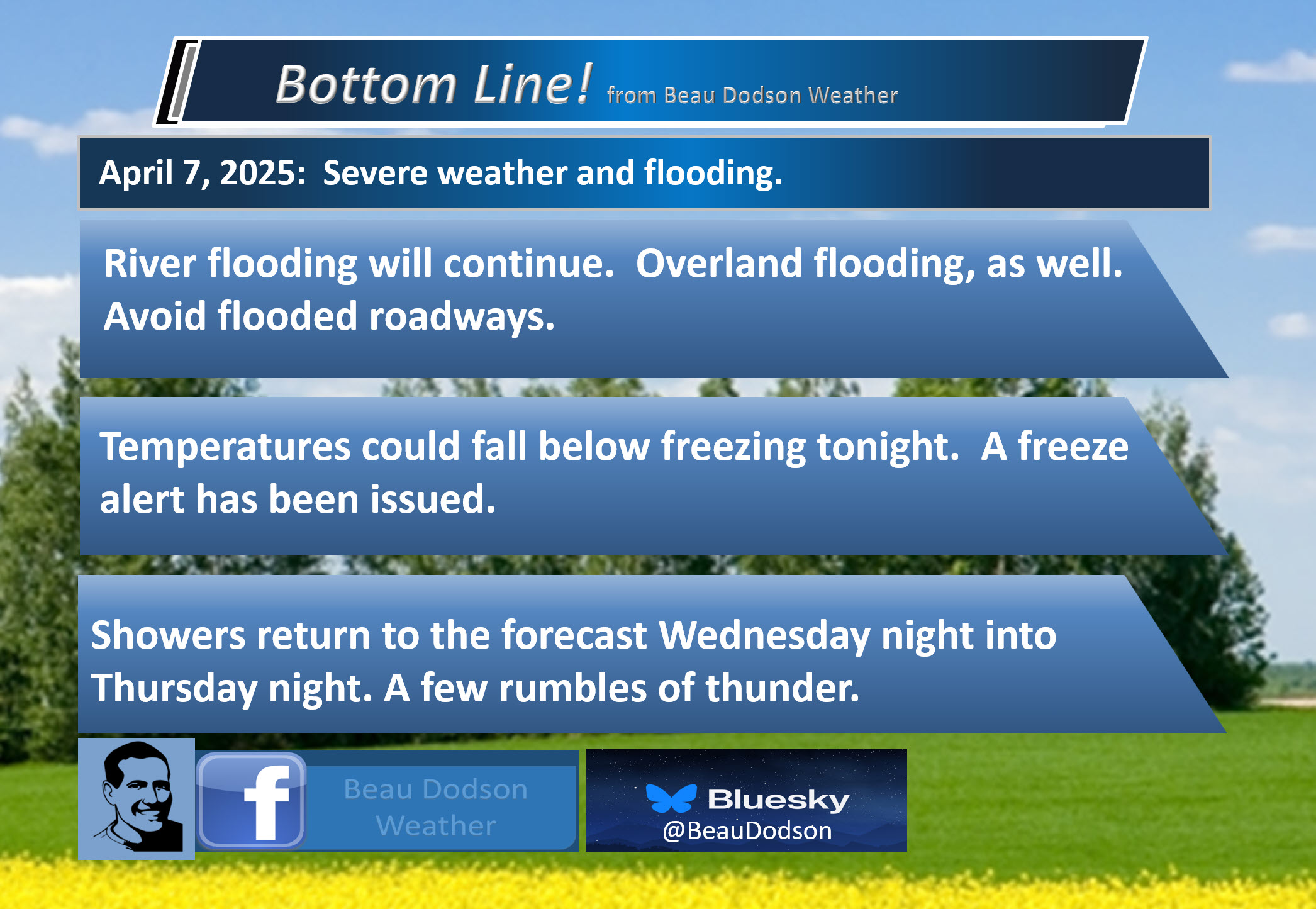
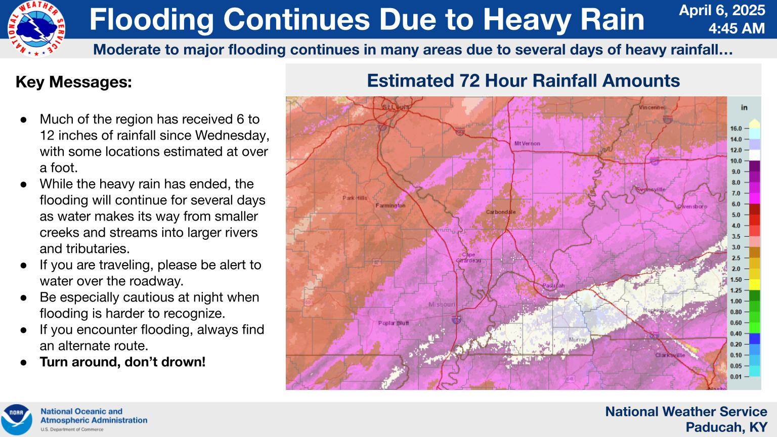
3. Is flash flooding in the forecast? NO. Ongoing river and overland flooding will continue.
4. Will non-thunderstorm winds top 40 mph? NO.
5. Will temperatures rise above 90 degrees? NO.
6. Will the heat index rise above 100 degrees? NO.
.
A quick forecast glance. Your 48-hour forecast Graphics


.

.


Forecast discussion.
- Calm weather for a few days.
- Cold temperatures. Freeze alert.
- Flooding will continue on rivers. Avoid flooded roadways.
- Monitoring shower and thunderstorm chances on Thursday.
.

.
Good morning,
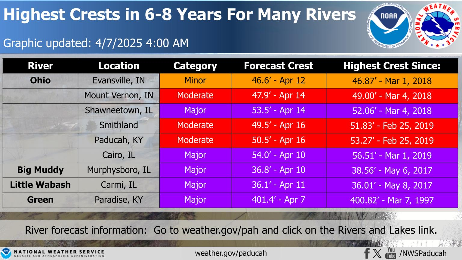
Well, it has been a long four weeks of severe weather and flooding.
Here are some of the crest forecasts.
.
Here are some of the radar-estimated rain totals. A historic event for some countries.
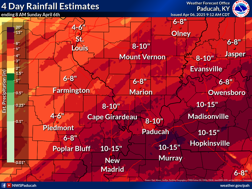
Those areas in white experienced ten or more inches of rain.
.
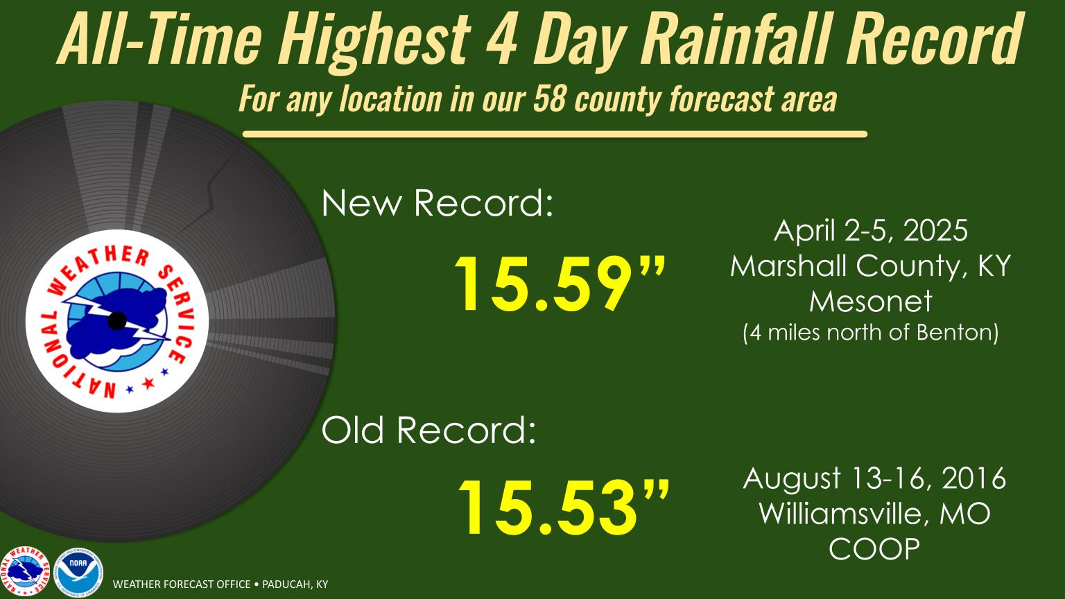
This system broke another record, as well.
.
Check out the tornado count for 2025, mostly in our region of the country.
And spring is just starting. Let’s hope the rest of spring is kinder to us.
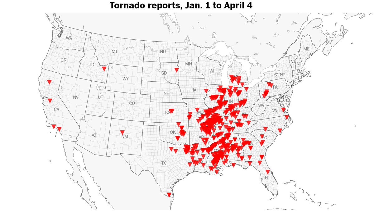
From Ben Noll
There have been a remarkable 430 tornadoes reported across the United States so far this year. That’s well above the year-to-date average of 250. Since 2010, only 2023 and 2017 had more tornadoes year-to-date. The Plains have had far fewer tornadoes than average this year.
Here’s the tornado count per state:
Mississippi 81
Missouri 55
Illinois 45
Alabama 40
Arkansas 29
Indiana 27
Louisiana 21
Texas 20
Kentucky 19
Tennessee 19
.
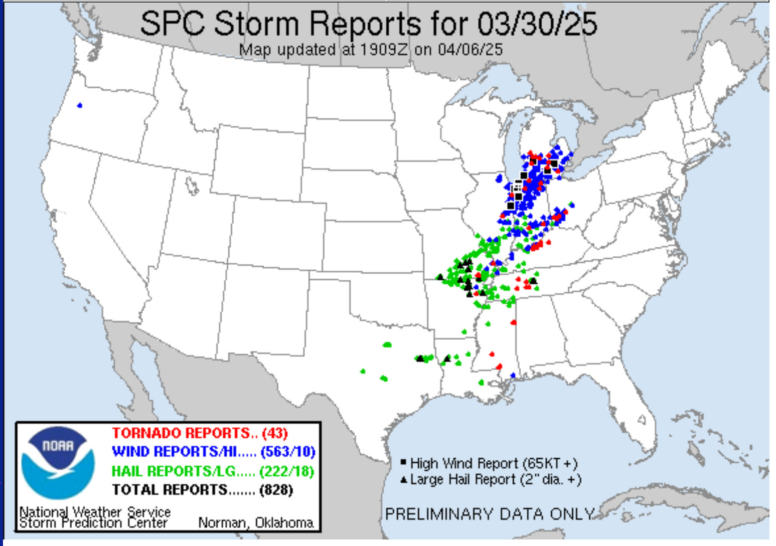
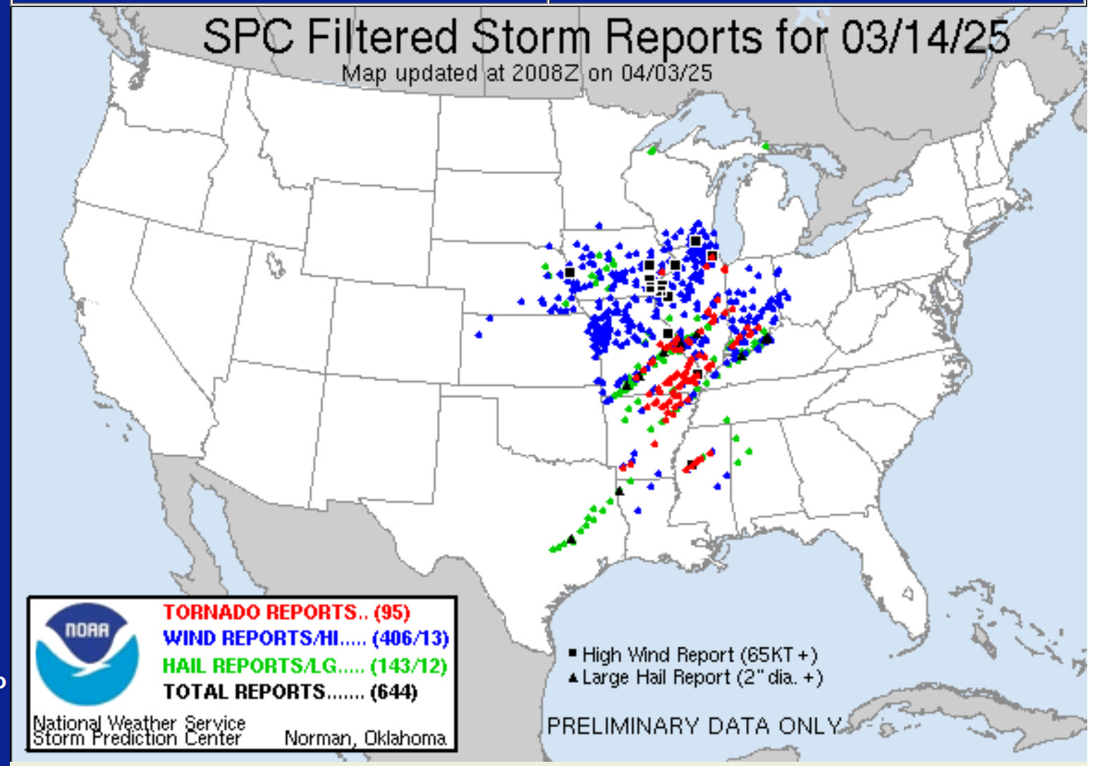
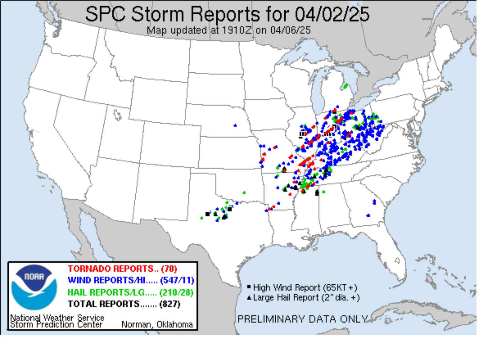
Here were the three biggest severe weather events.
March 6th event
.
March 14th event
.
April 2nd event.
More tornadoes will be added to this. The NWS is still conducting surveys.
.
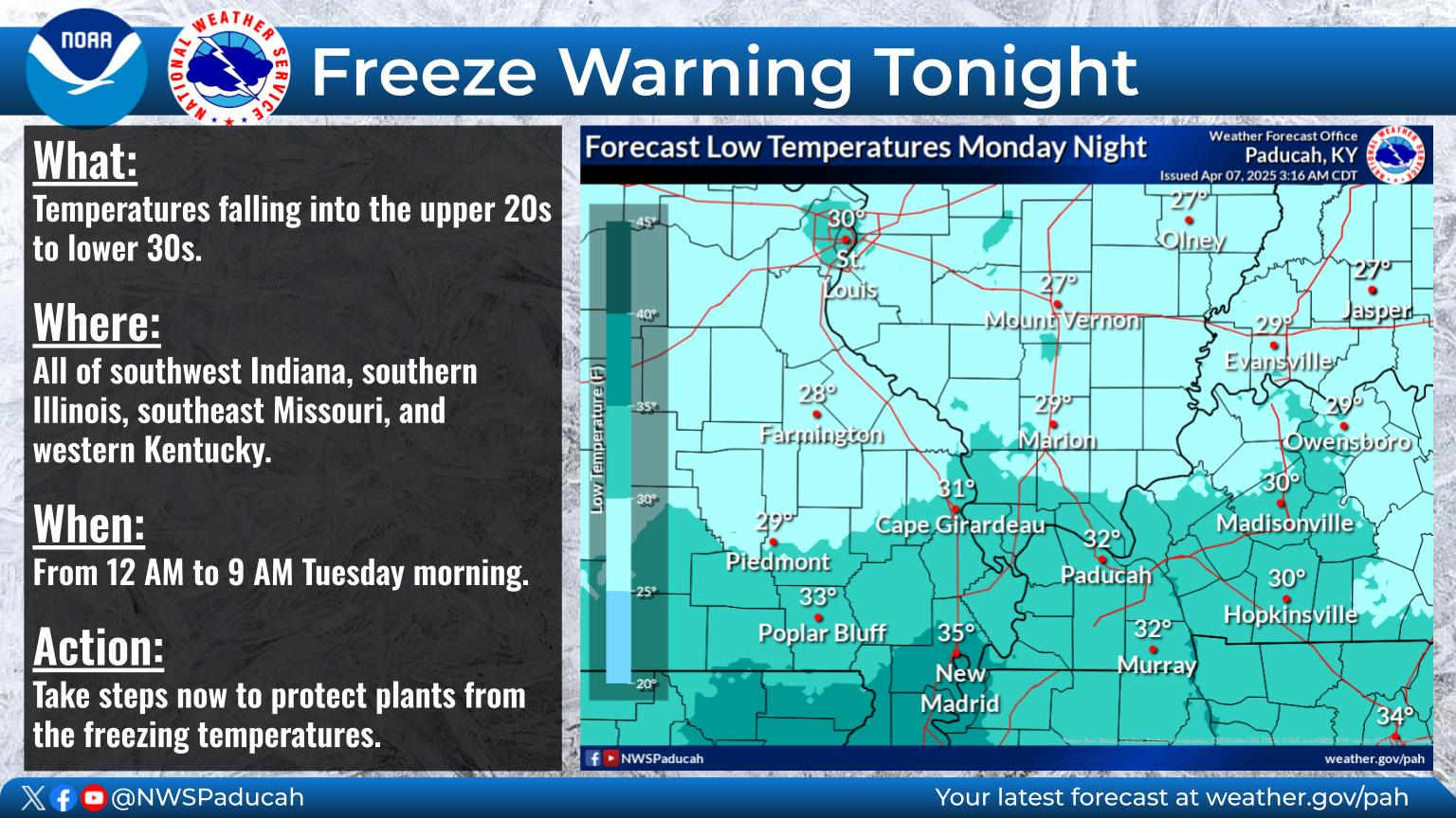
The GREAT news is that it will be calm today.
It will be chilly.
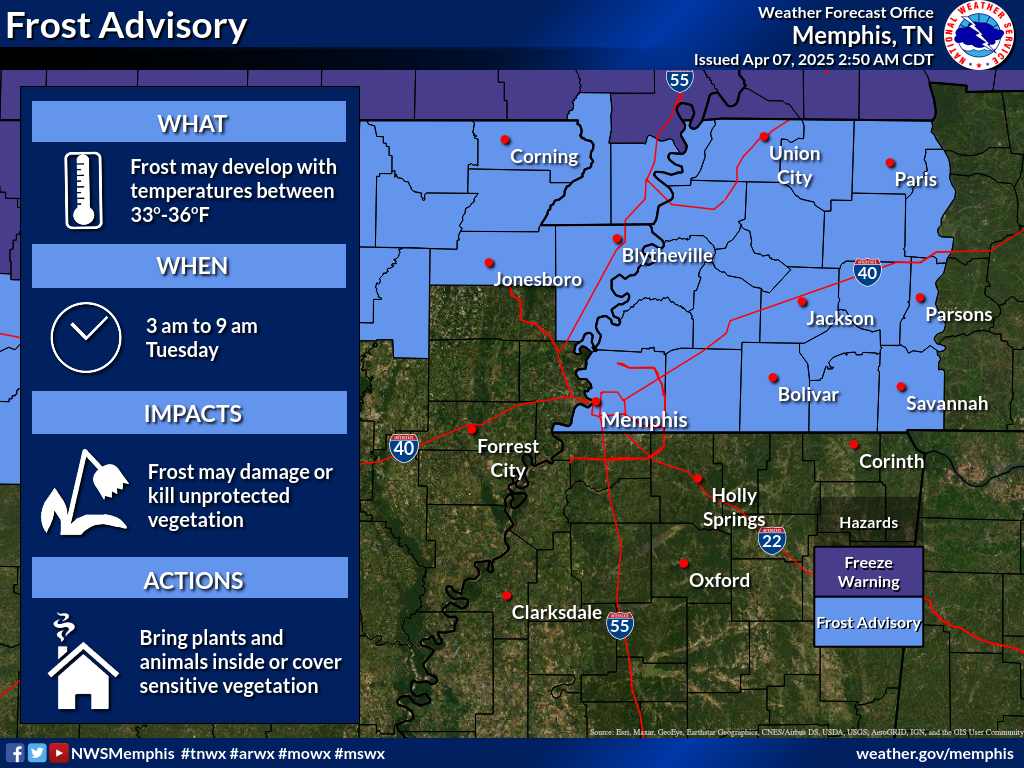
There is a freeze warning for the region tonight.
The Missouri Bootheel and northwest Tennessee are in a frost advisory. The rest of the area is under a freeze warning.
Temperatures will drop into the upper 20s and lower 30s. Brrr.
It will be chilly on Tuesday night, as well. Frost is also possible.
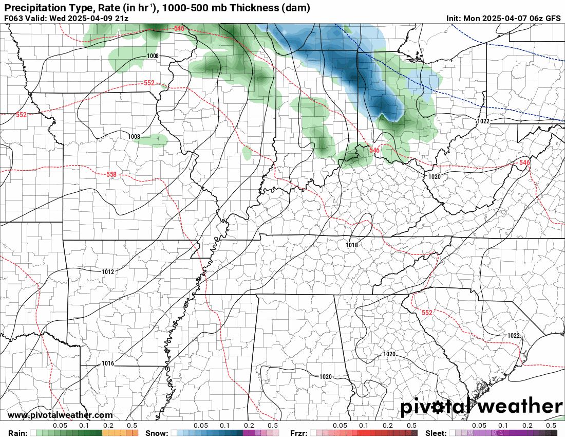
Clouds will increase on Wednesday afternoon and night. There will be a cold front pushing back into the region.
We have a chance of showers and thunderstorms Wednesday night into Thursday night. Peak Chances will arrive on Thursday.
At this time, severe weather appears unlikely. I can’t completely rule out the Storm Prediction Center placing our region in a low level one risk of severe weather, but the threat appears minimal.
I will monitor it.
Rainfall totals will be on the light side.

Dry conditions return Friday through Sunday. Cool to warm temperatures.
I am watching a few systems between April 15th and 25th.
.

The timestamp (upper left) is in Zulu. 12z=6 am. 18z=12 pm. 00z=6 pm.
Double-click the animation to enlarge it.
Double-click the animation to enlarge it.
This is the GFS model.
.
.
.
Click here if you would like to return to the top of the page.
.Average high temperatures for this time of the year are around 66 degrees.
Average low temperatures for this time of the year are around 56 degrees.
Average precipitation during this time period ranges from 0.90″ to 1.20″
Six to Ten Day Outlook.
Blue is below average. Red is above average. The no color zone represents equal chances.
Average highs for this time of the year are in the lower 60s. Average lows for this time of the year are in the lower 40s.

Green is above average precipitation. Yellow and brown favors below average precipitation. Average precipitation for this time of the year is around one inch per week.

.

Average low temperatures for this time of the year are around 56 degrees.
Average precipitation during this time period ranges from 0.90″ to 1.20″
.
Eight to Fourteen Day Outlook.
Blue is below average. Red is above average. The no color zone represents equal chances.

Green is above average precipitation. Yellow and brown favors below average precipitation. Average precipitation for this time of the year is around one inch per week.

.
.
.
We have a new service to complement your www.weathertalk.com subscription. This does NOT replace www.weathertalk.com It is simply another tool for you to receive severe weather information.
.


.

Radars and Lightning Data
Interactive-city-view radars. Clickable watches and warnings.
https://wtalk.co/B3XHASFZ
Old legacy radar site (some of you like it better)
https://weatherobservatory.com/weather-radar.htm
If the radar is not updating then try another one. If a radar does not appear to be refreshing then hit Ctrl F5. You may also try restarting your browser.
Backup radar site in case the above one is not working.
https://weathertalk.com/morani
Regional Radar
https://imagery.weathertalk.com/prx/RadarLoop.mp4
** NEW ** Zoom radar with chaser tracking abilities!
ZoomRadar
If the radar is not working, then email me: Email me at beaudodson@usawx.com
.
We do have some sponsors! Check them out.
Roof damage from recent storms? Link – Click here
INTEGRITY ROOFING AND EXTERIORS!
⛈️ Roof or gutter damage from recent storms? Today’s weather is sponsored by Integrity Roofing. Check out their website at this link https://www.ourintegritymatters.com/

![]()
![]()
![]()
Make sure you have three to five ways of receiving your severe weather information.
Weather Talk is one of those ways! Now, I have another product for you and your family.

.
Want to add more products to your Beau Dodson Weather App?
Receive daily videos, weather blog updates on normal weather days and severe weather and winter storm days, your county by county weather forecast, and more!
Here is how to do add those additional products to your app notification settings!
Here is a video on how to update your Beau Dodson Weather payment.
The app is for subscribers. Subscribe at www.weathertalk.com/welcome then go to your app store and search for WeatherTalk
Subscribers, PLEASE USE THE APP. ATT and Verizon are not reliable during severe weather. They are delaying text messages.
The app is under WeatherTalk in the app store.

Apple users click here

Android users click here
.
Radars and Lightning Data
Interactive-city-view radars. Clickable watches and warnings.
https://wtalk.co/B3XHASFZ
Old legacy radar site (some of you like it better)
https://weatherobservatory.com/weather-radar.htm
If the radar is not updating then try another one. If a radar does not appear to be refreshing then hit Ctrl F5. You may also try restarting your browser.
Backup radar site in case the above one is not working.
https://weathertalk.com/morani
Regional Radar
https://imagery.weathertalk.com/prx/RadarLoop.mp4
** NEW ** Zoom radar with chaser tracking abilities!
ZoomRadar
Lightning Data (zoom in and out of your local area)
https://wtalk.co/WJ3SN5UZ
Not working? Email me at beaudodson@usawx.com
National map of weather watches and warnings. Click here.
Storm Prediction Center. Click here.
Weather Prediction Center. Click here.
.

Live lightning data: Click here.
Real time lightning data (another one) https://map.blitzortung.org/#5.02/37.95/-86.99
Our new Zoom radar with storm chases
.
.

Interactive GOES R satellite. Track clouds. Click here.
GOES 16 slider tool. Click here.
College of DuPage satellites. Click here
.

Here are the latest local river stage forecast numbers Click Here.
Here are the latest lake stage forecast numbers for Kentucky Lake and Lake Barkley Click Here.
.
.
Find Beau on Facebook! Click the banner.


 .
.