

.
I have some question-and-answer threads over on the Facebook page. Link to those threads CLICK HERE
Or email me at beaudodsonweather@gmail.com
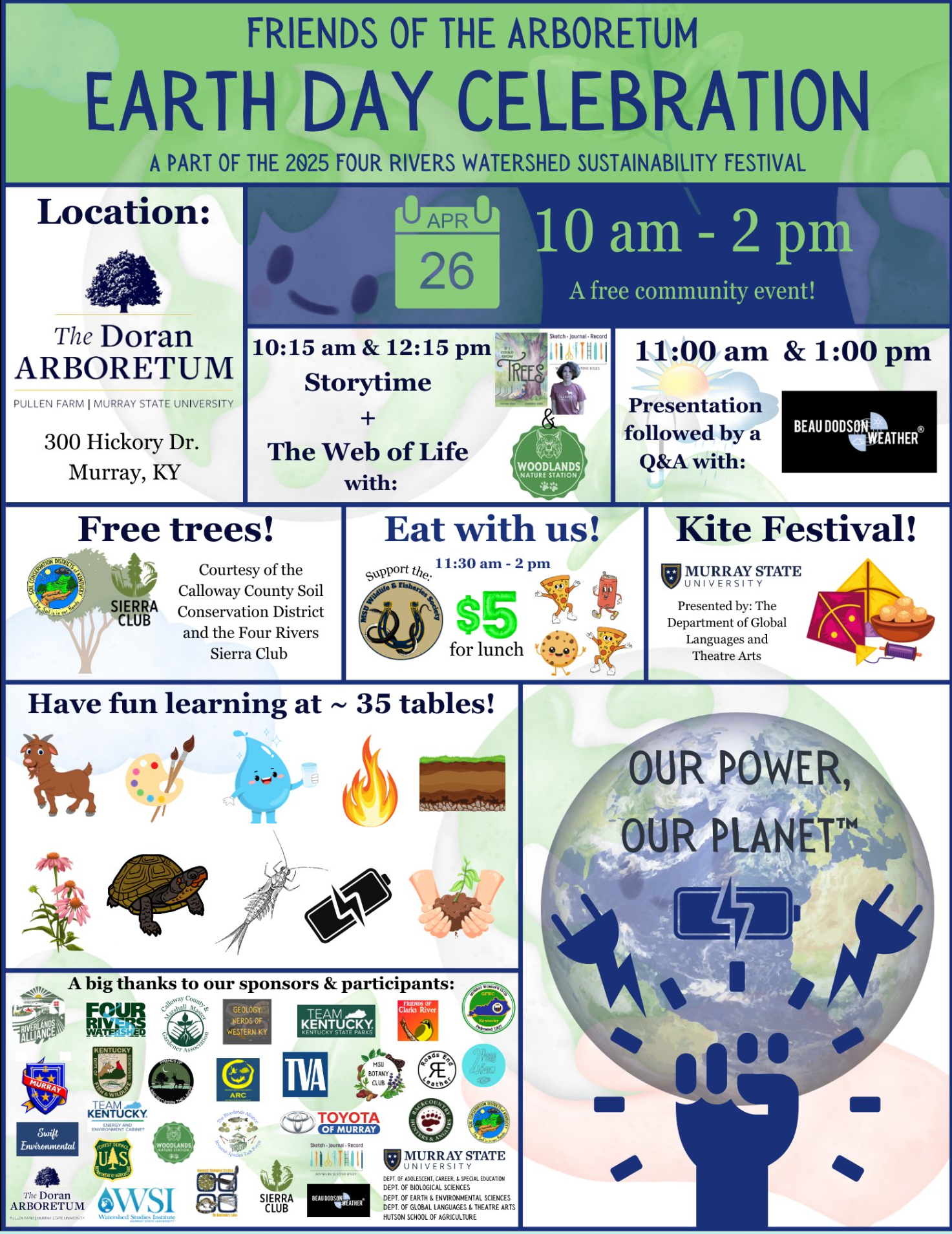
Earth day celebrations will be today in Murray, Kentucky.
I will be speaking at 11 am and 1 pm. Come out and bring the kids for a fun day of activities.
Double click on this graphic to enlarge it.
.

Radars and Lightning Data
Interactive-city-view radars. Clickable watches and warnings.
https://wtalk.co/B3XHASFZ
Old legacy radar site (some of you like it better)
https://weatherobservatory.com/weather-radar.htm
If the radar is not updating, then try another one. If a radar does not appear to be refreshing, then hit Ctrl F5. You may also try restarting your browser.
Backup radar site in case the above one is not working.
https://weathertalk.com/morani
Regional Radar
https://imagery.weathertalk.com/prx/RadarLoop.mp4
** NEW ** Zoom radar with chaser tracking abilities!
ZoomRadar
Lightning Data (zoom in and out of your local area)
https://wtalk.co/WJ3SN5UZ
.

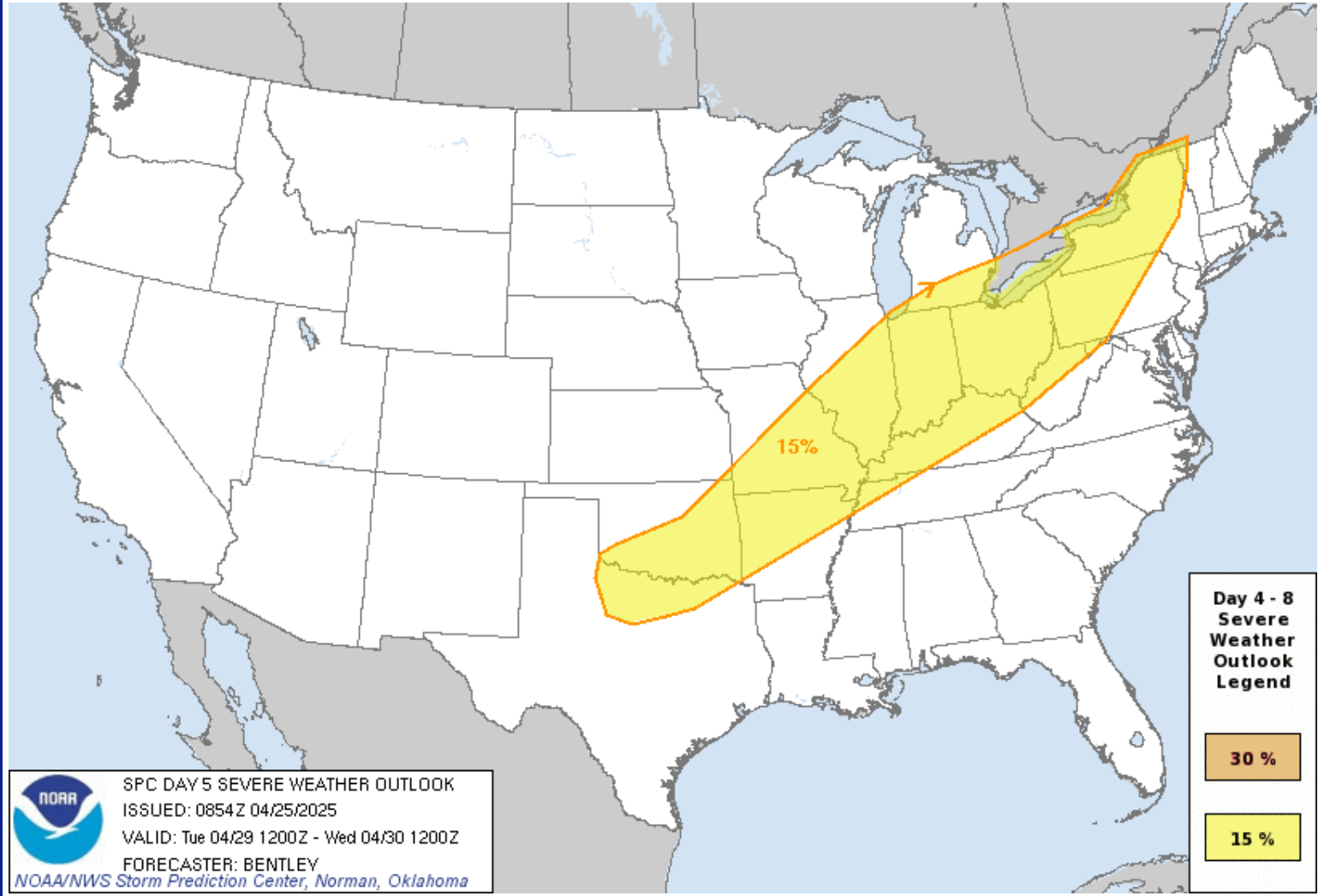
🌪️ Seven-Day Tornado Outlook ⛈️
April 25th through May 2nd
Current risk: MONITOR.
Current confidence level: Medium.
Comment: I will be monitoring next Tuesday, Wednesday, and Thursday. Severe thunderstorms are possible. This is in the long range. I will know more over the coming days. A cold front will bring showers and storms back to the region late Monday into Tuesday night.
Currently, the highest chance of severe weather appears to be on Tuesday afternoon and Tuesday night. Monitor updates.
For now, the Storm Prediction Center has outlined our area for severe weather on Tuesday afternoon and night. I will be monitoring trends in the guidance. They have not outlined Wednesday or Thursday, yet.
.

Seven-Day Hazardous Weather Outlook
1. Is lightning in the forecast? YES. A chance of lightning today and tonight. A small chance of lightning on Monday. A higher chance of lightning on Tuesday afternoon and Tuesday night. I will monitor next Wednesday and Thursday.
2. Are severe thunderstorms in the forecast? MONITOR. Some storms could be severe next Tuesday afternoon and Tuesday night. I will monitor next Wednesday and Thursday.
3. Is flash flooding in the forecast? NOT AT THIS TIME. I will monitor next week. If the front stalls, then locally heavy rain totals will be possible.
4. Will non-thunderstorm winds top 40 mph? NO.
5. Will temperatures rise above 90 degrees? NO.
6. Will the heat index rise above 100 degrees? NO.
.
A quick forecast glance. Your 48-hour forecast Graphics


.

.


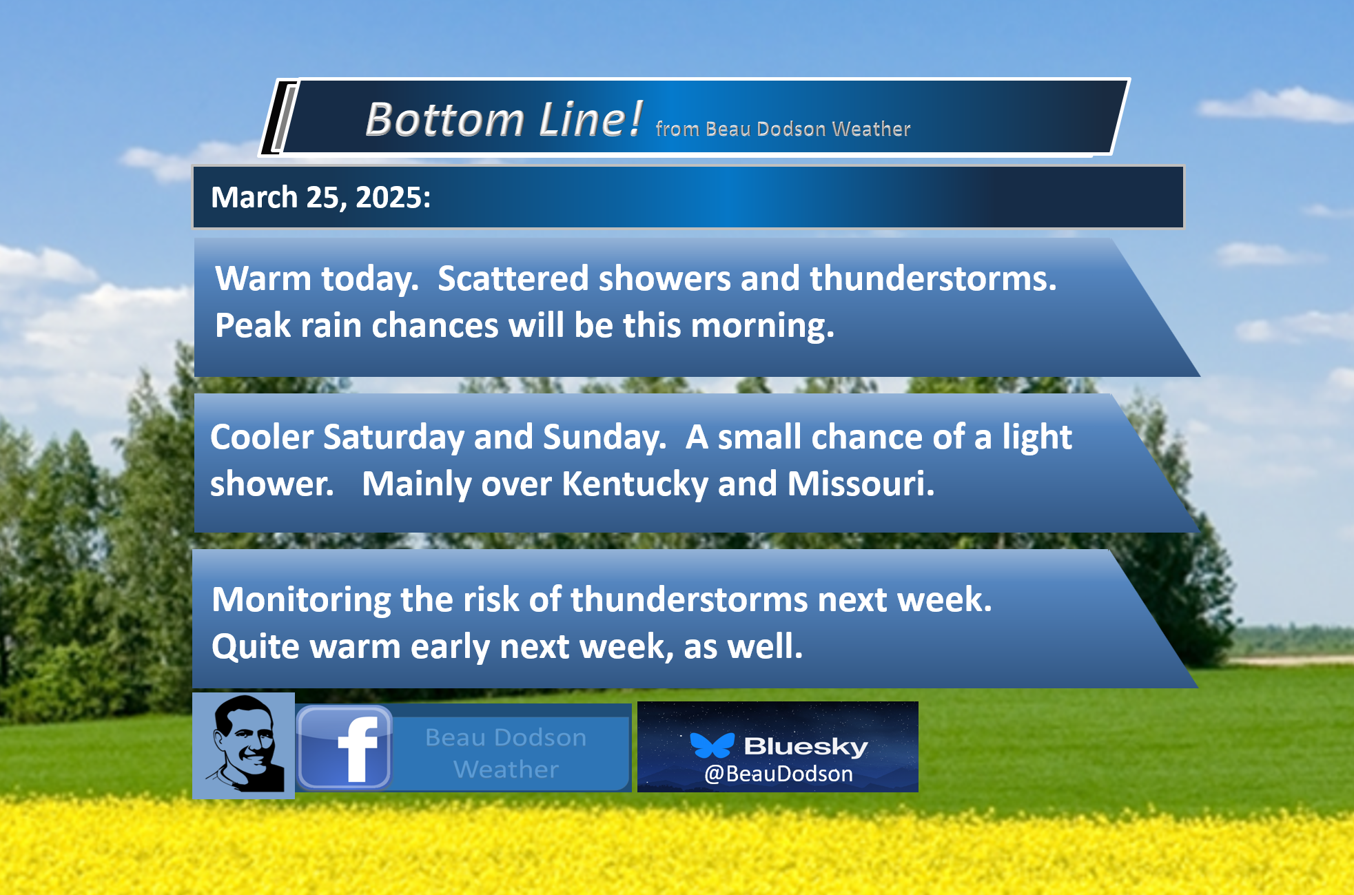
Forecast discussion.
- Mild today. It will be cooler on Saturday and Sunday. It will be much warmer on Monday and Tuesday.
- A few showers and storms today and tonight. Peak shower and thunderstorm chances will be this morning.
- Another chance of thunderstorms Monday and Tuesday. Peak thunderstorm chances early next week appear to be on Tuesday afternoon/Tuesday night. I will monitor next Wednesday and Thursday.
- It will be quite warm early next week, with temperatures in the 80s.
- A few storms could be severe next Tuesday afternoon and Tuesday night. I will monitor next Wednesday and Thursday.
.

.
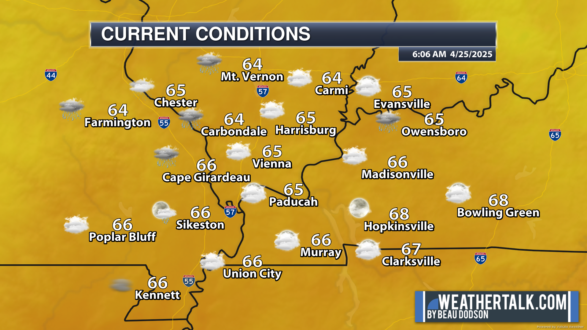
Good morning, everyone.
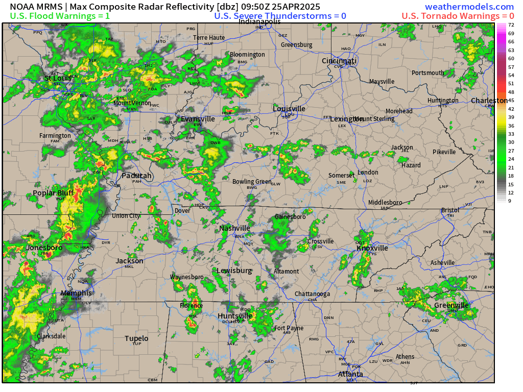
We are waking up to mild temperatures. Scattered showers and thunderstorms dot the weather radars.
.
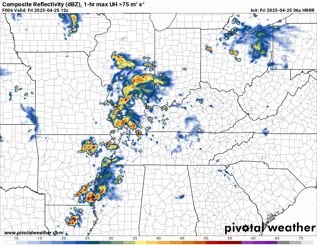
This is what the radar looked like at 6:15 AM
All of this activity is moving east northeast at 35 mph. Peak rain chances will be this morning. Then, scattered showers and thunderstorms this afternoon and evening.
.
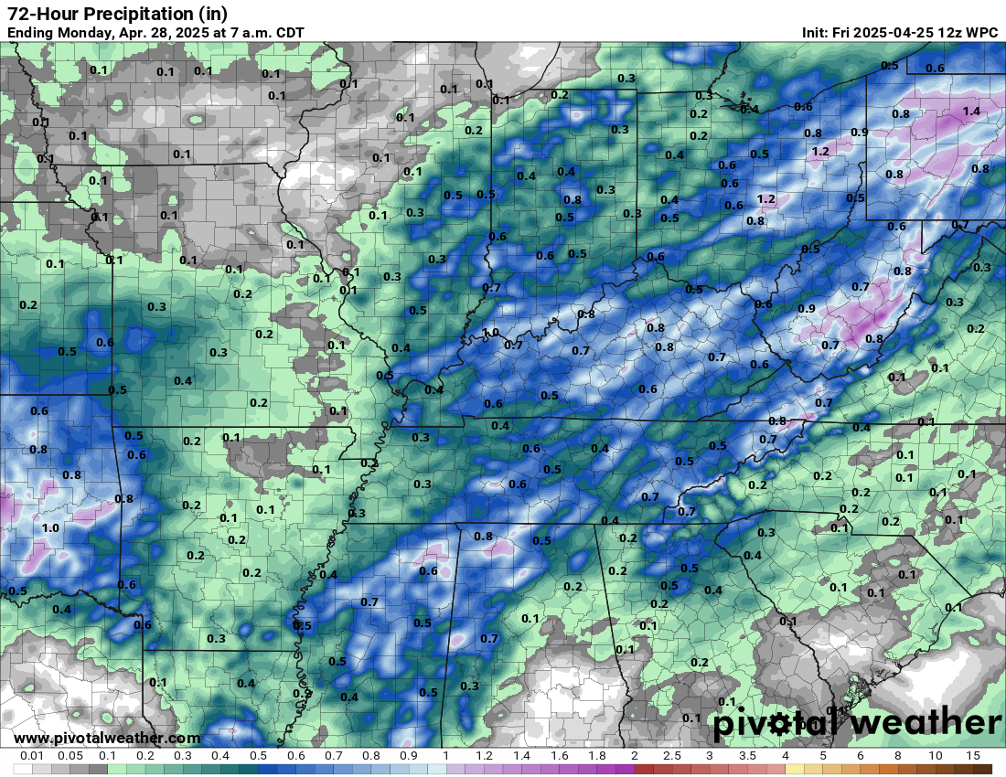
Here are the anticipated rainfall totals through tomorrow. Totals will vary based on thunderstorm placement.
Double-click the image to enlarge it
.
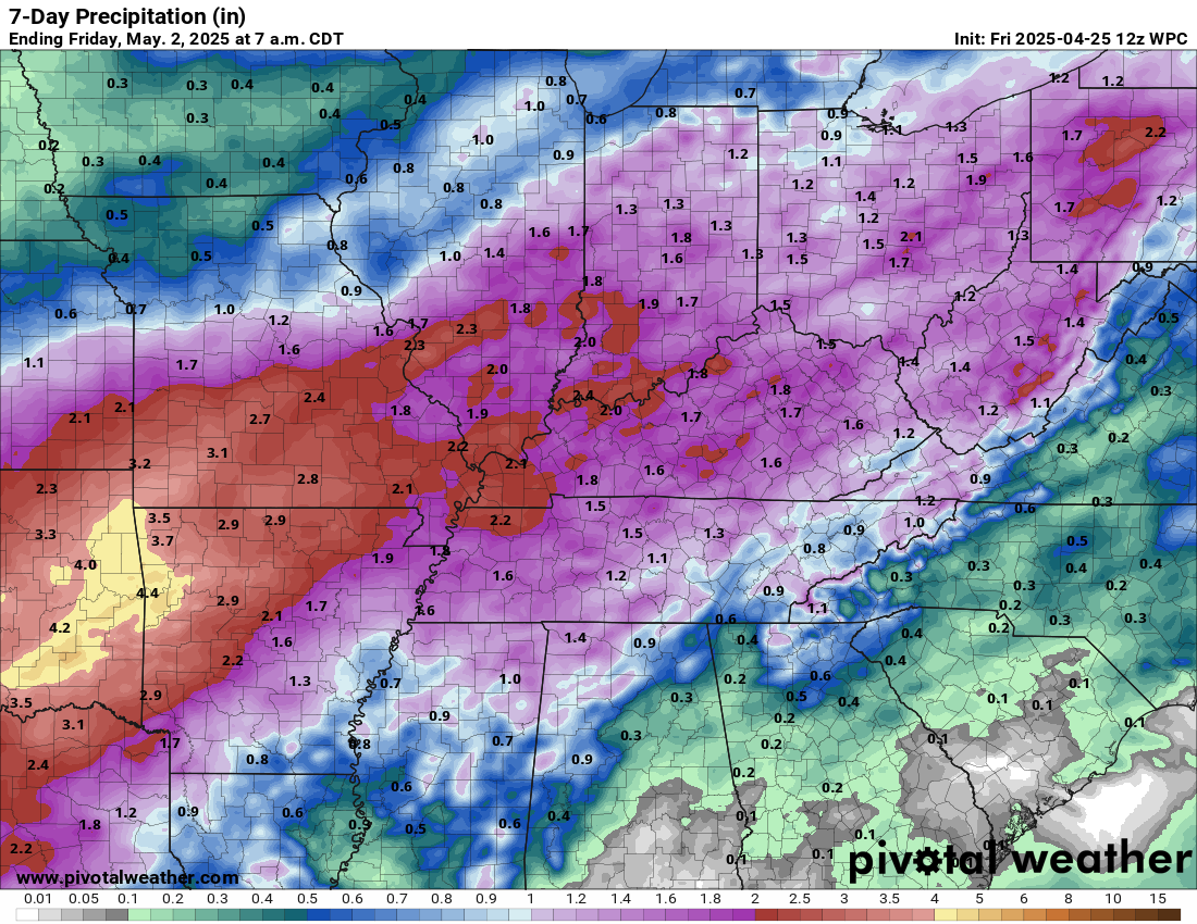
Seven-day rain totals. Additional showers and thunderstorms are likely next week.
Double-click the image to enlarge it.
.
I am watching another system next week. Rain chances on Monday and Monday night appear low. Those chances will increase on Tuesday, Wednesday, and Thursday.
The front may still in or near our region on Wednesday and Thursday. If that happens, then thunderstorm chances will continue for several days.
A few of those thunderstorms could be severe, especially Tuesday afternoon and night.
For now, the Storm Prediction Center has outlined our region as being at risk for severe weather on Tuesday afternoon and Tuesday night.
I am monitoring Wednesday and Thursday, as well. For now, they have not outlined a risk zone for those two days. That could change in future updates.
Temperatures will be warm today, but much cooler tomorrow and Sunday.
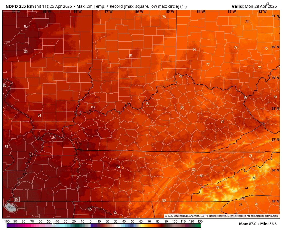
A warming trend begins in earnest on Monday.
The warmest days will likely be next Monday and Tuesday. Some locations could hit the middle to upper 80s early next week!
Monday’s highs
Double-click the image to enlarge it
.
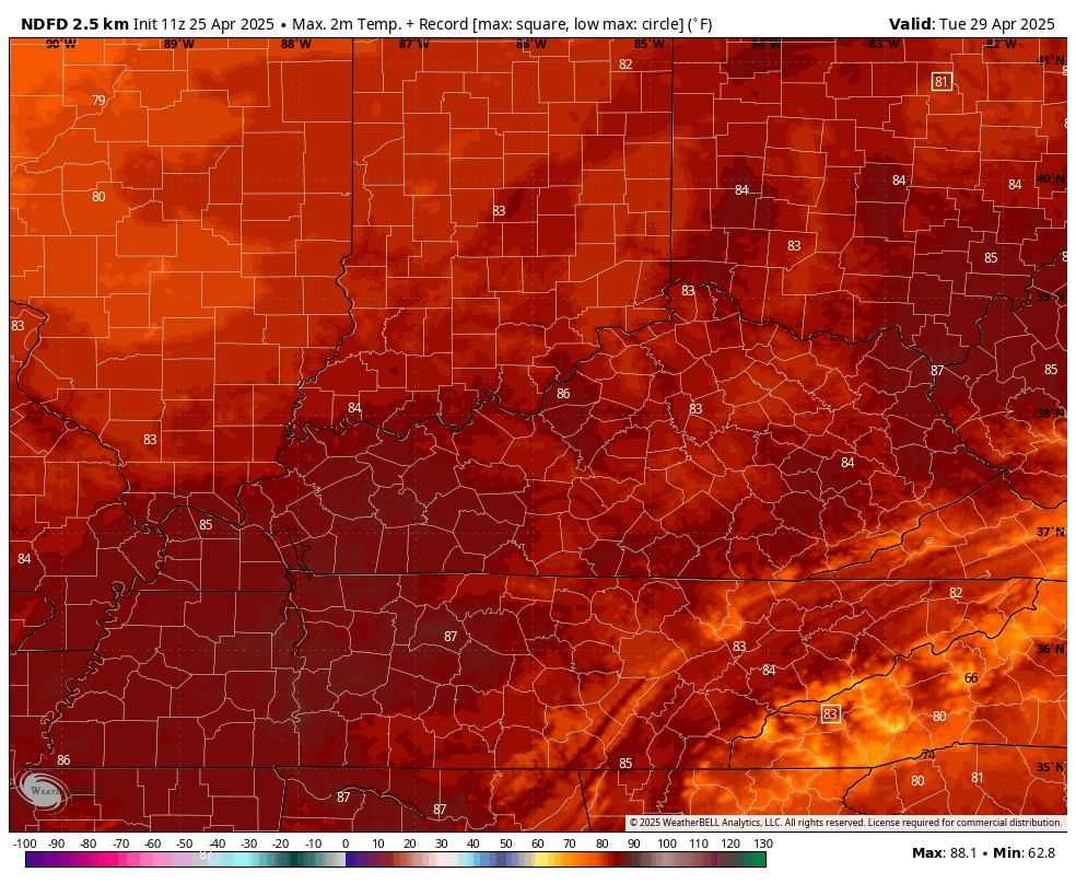
Tuesday’s highs
Double-click the image to enlarge it
.

The timestamp (upper left) is in Zulu. 12z=7 am. 18z=1 pm. 00z=7 pm.
Double-click the animation to enlarge it.
NAM model
This animation shows you from tomorrow to Saturday.
.
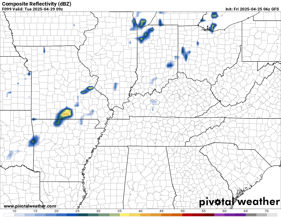
Let’s look further out. This is the system next week.
.
.
.
Click here if you would like to return to the top of the page.
.Average high temperatures for this time of the year are around 72 degrees.
Average low temperatures for this time of the year are around 50 degrees.
Average precipitation during this time period ranges from 1.00″ to 1.40″
Six to Ten Day Outlook.
Blue is below average. Red is above average. The no color zone represents equal chances.
Average highs for this time of the year are in the lower 60s. Average lows for this time of the year are in the lower 40s.

Green is above average precipitation. Yellow and brown favors below average precipitation. Average precipitation for this time of the year is around one inch per week.

.

Average low temperatures for this time of the year are around 54 degrees.
Average precipitation during this time period ranges from 1.20″ to 1.50″
.
Eight to Fourteen Day Outlook.
Blue is below average. Red is above average. The no color zone represents equal chances.

Green is above average precipitation. Yellow and brown favors below average precipitation. Average precipitation for this time of the year is around one inch per week.

.
.
.
We have a new service to complement your www.weathertalk.com subscription. This does NOT replace www.weathertalk.com It is simply another tool for you to receive severe weather information.
.


.
Radars and Lightning Data
Interactive-city-view radars. Clickable watches and warnings.
https://wtalk.co/B3XHASFZ
Old legacy radar site (some of you like it better)
https://weatherobservatory.com/weather-radar.htm
If the radar is not updating then try another one. If a radar does not appear to be refreshing then hit Ctrl F5. You may also try restarting your browser.
Backup radar site in case the above one is not working.
https://weathertalk.com/morani
Regional Radar
https://imagery.weathertalk.com/prx/RadarLoop.mp4
** NEW ** Zoom radar with chaser tracking abilities!
ZoomRadar
If the radar is not working, then email me: Email me at beaudodson@usawx.com
.
We do have some sponsors! Check them out.
Roof damage from recent storms? Link – Click here
INTEGRITY ROOFING AND EXTERIORS!
⛈️ Roof or gutter damage from recent storms? Today’s weather is sponsored by Integrity Roofing. Check out their website at this link https://www.ourintegritymatters.com/

![]()
![]()
![]()
Make sure you have three to five ways of receiving your severe weather information.
Weather Talk is one of those ways! Now, I have another product for you and your family.

.
Want to add more products to your Beau Dodson Weather App?
Receive daily videos, weather blog updates on normal weather days and severe weather and winter storm days, your county by county weather forecast, and more!
Here is how to do add those additional products to your app notification settings!
Here is a video on how to update your Beau Dodson Weather payment.
The app is for subscribers. Subscribe at www.weathertalk.com/welcome then go to your app store and search for WeatherTalk
Subscribers, PLEASE USE THE APP. ATT and Verizon are not reliable during severe weather. They are delaying text messages.
The app is under WeatherTalk in the app store.

Apple users click here

Android users click here
.
Radars and Lightning Data
Interactive-city-view radars. Clickable watches and warnings.
https://wtalk.co/B3XHASFZ
Old legacy radar site (some of you like it better)
https://weatherobservatory.com/weather-radar.htm
If the radar is not updating then try another one. If a radar does not appear to be refreshing then hit Ctrl F5. You may also try restarting your browser.
Backup radar site in case the above one is not working.
https://weathertalk.com/morani
Regional Radar
https://imagery.weathertalk.com/prx/RadarLoop.mp4
** NEW ** Zoom radar with chaser tracking abilities!
ZoomRadar
Lightning Data (zoom in and out of your local area)
https://wtalk.co/WJ3SN5UZ
Not working? Email me at beaudodson@usawx.com
National map of weather watches and warnings. Click here.
Storm Prediction Center. Click here.
Weather Prediction Center. Click here.
.

Live lightning data: Click here.
Real time lightning data (another one) https://map.blitzortung.org/#5.02/37.95/-86.99
Our new Zoom radar with storm chases
.
.

Interactive GOES R satellite. Track clouds. Click here.
GOES 16 slider tool. Click here.
College of DuPage satellites. Click here
.

Here are the latest local river stage forecast numbers Click Here.
Here are the latest lake stage forecast numbers for Kentucky Lake and Lake Barkley Click Here.
.
.
Find Beau on Facebook! Click the banner.


 .
.