Winter Weather Update
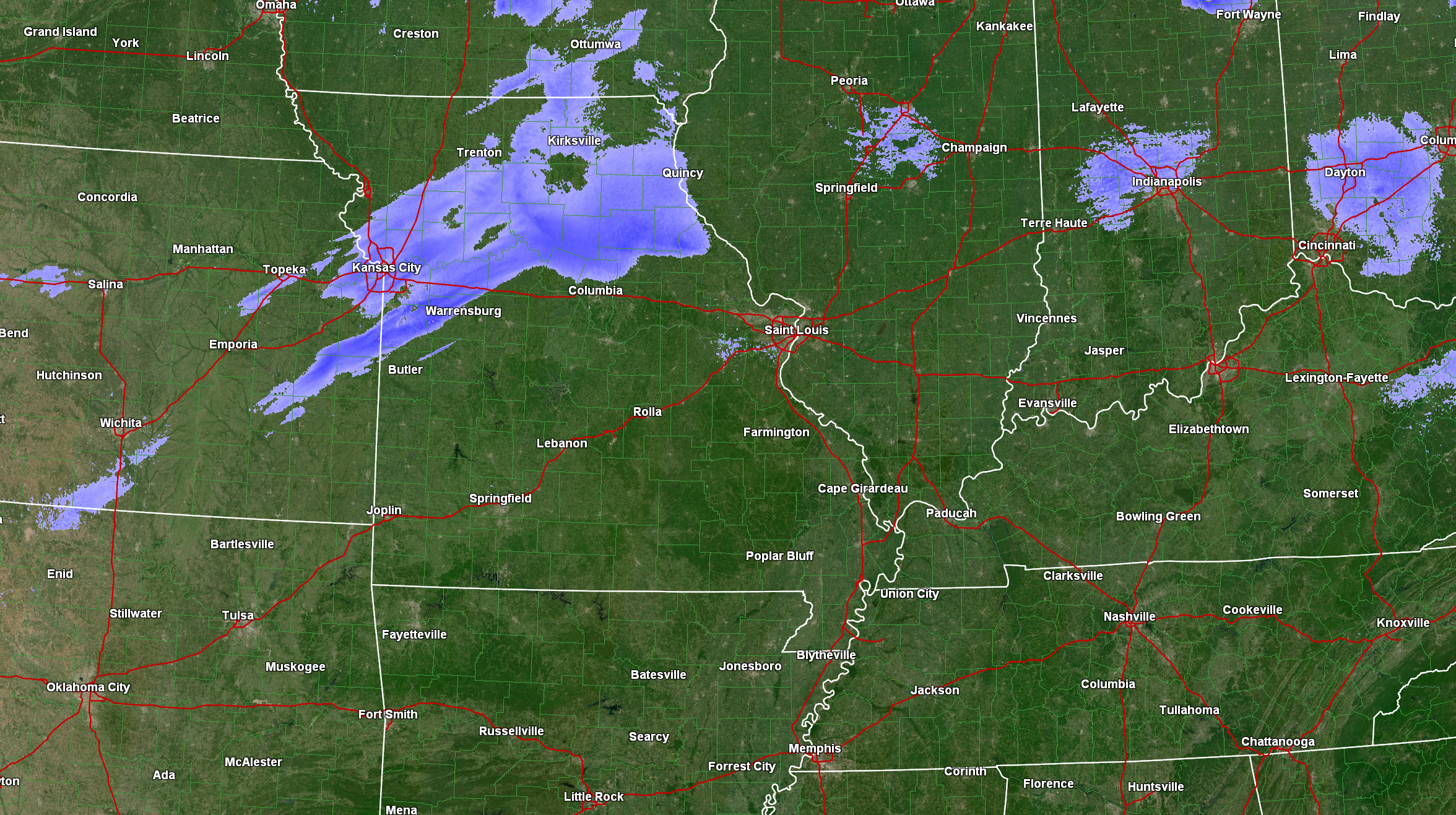
Our local city-view radars do have a WINTERIZE button on them. Click that to see lighter snow and precipitation type.
Radars can be viewed here. CLICK HERE
7 PM A few updated graphics
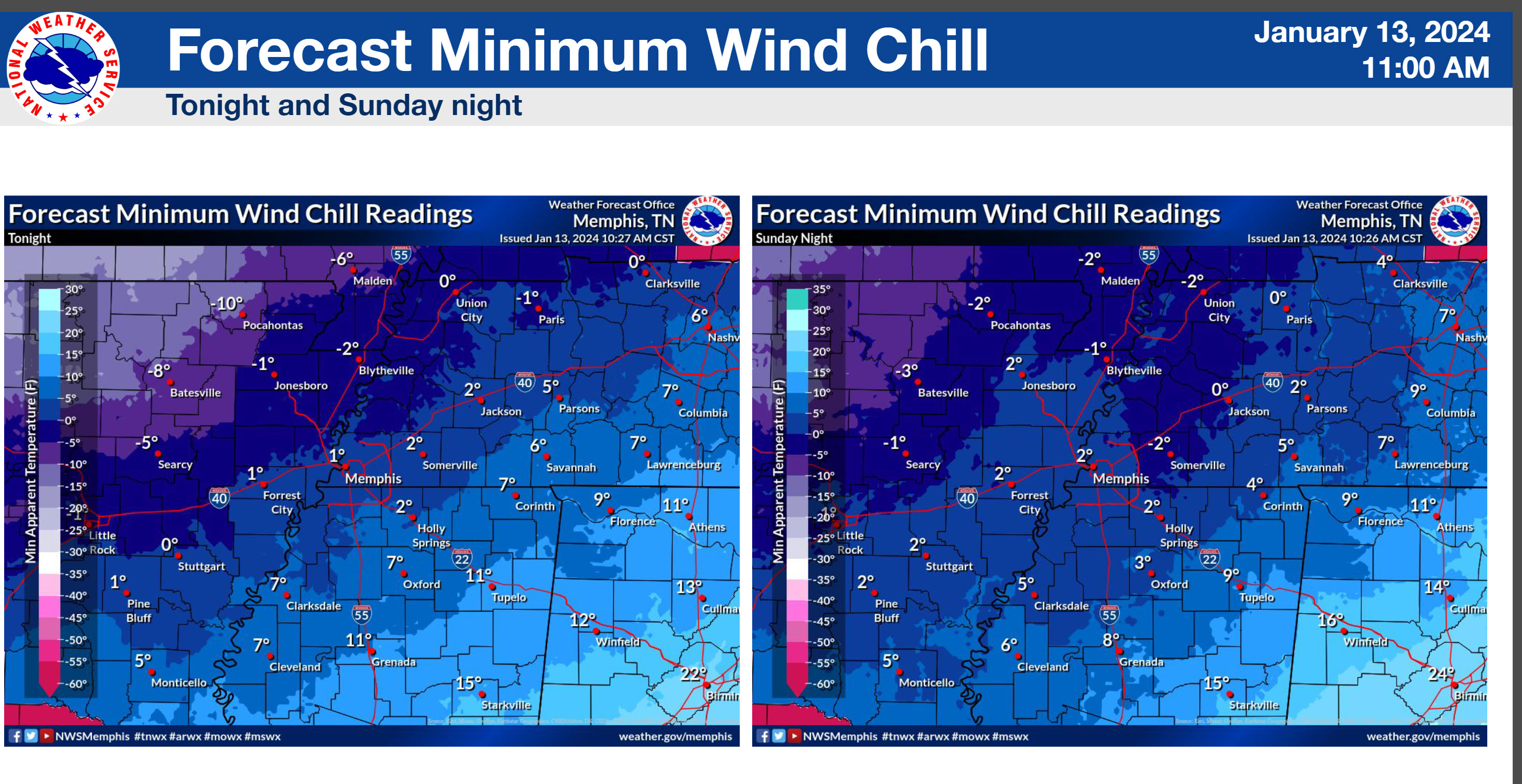
Looking at our southern counties. Wind chill advisory has been expanded southward.
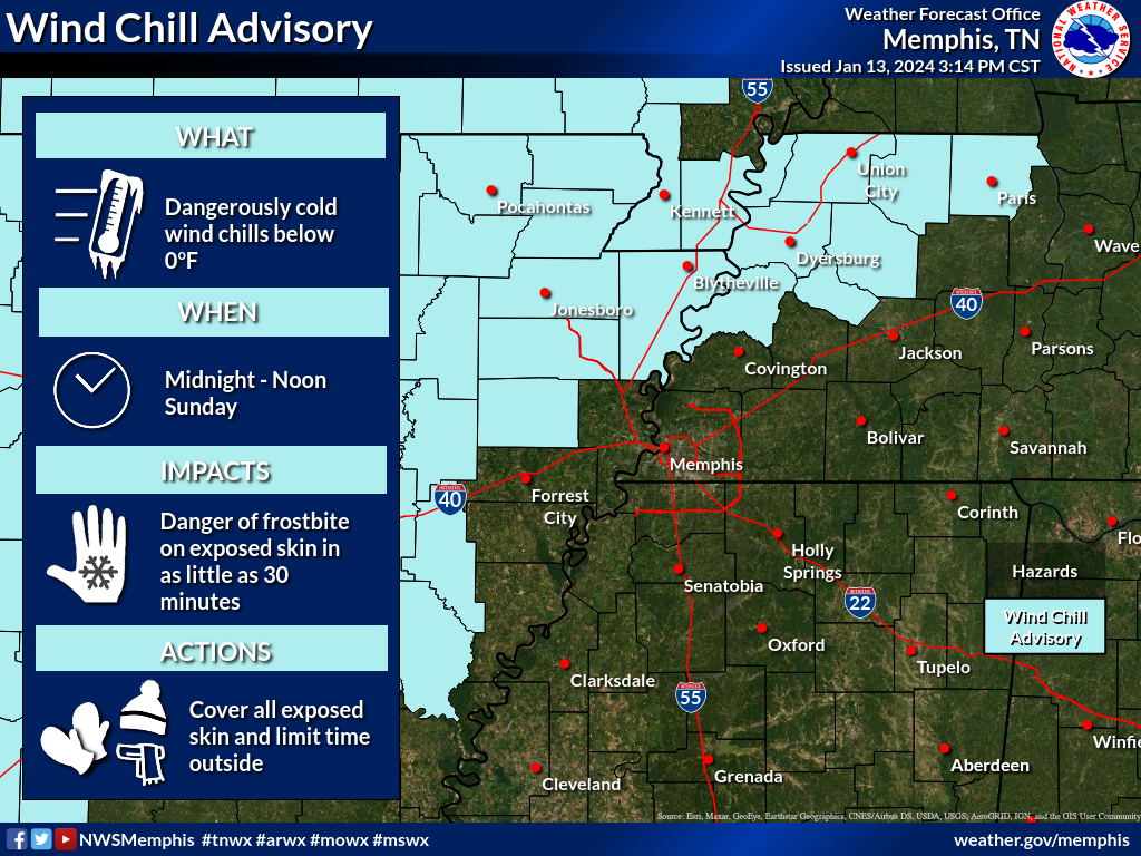
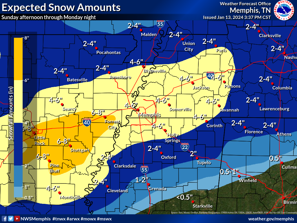
Memphis, TN NWS posted this. I agree with it.
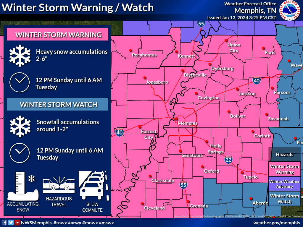
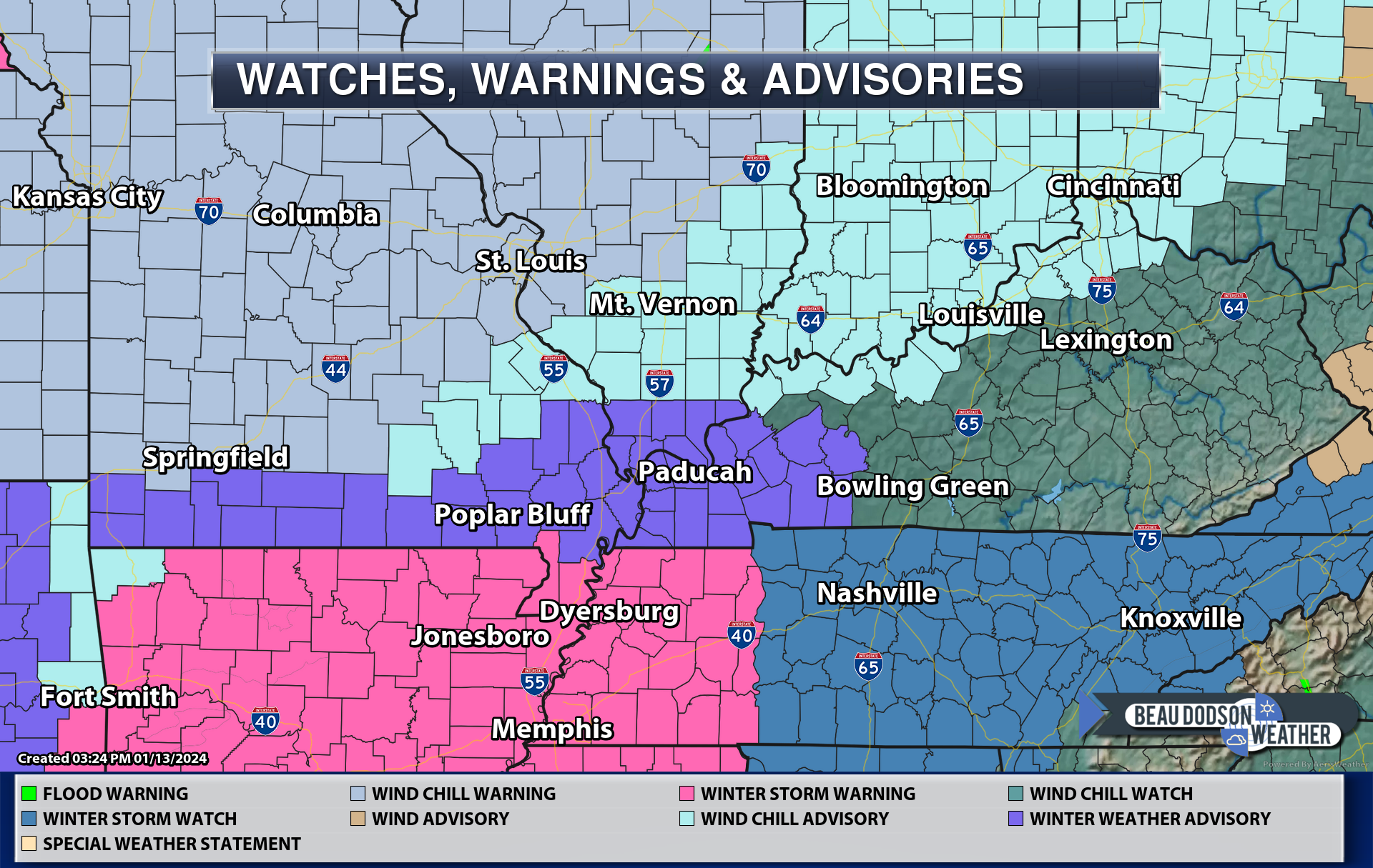
Southern areas. Winter storm warning now for Bootheel into west TN.
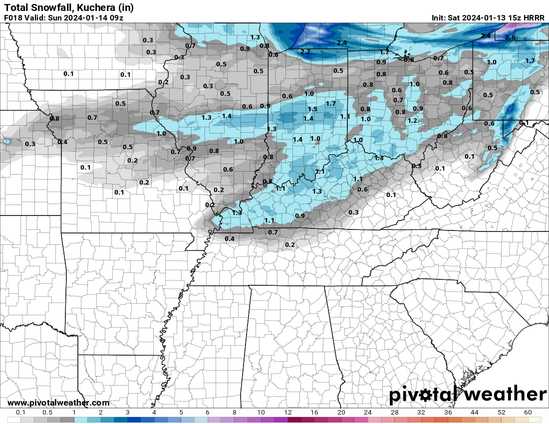
First, before I forget. I do have snow showers and flurries in the forecast today and tonight. A dusting to an inch possible.
The Hrrr model shows some light accumulation.
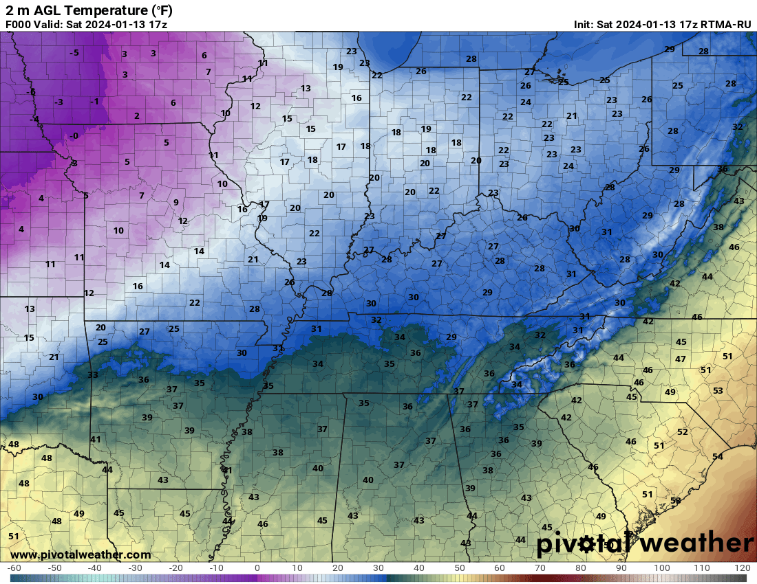
Can you find the arctic front?
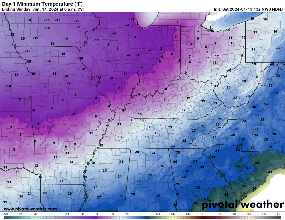
11 AM temperatures
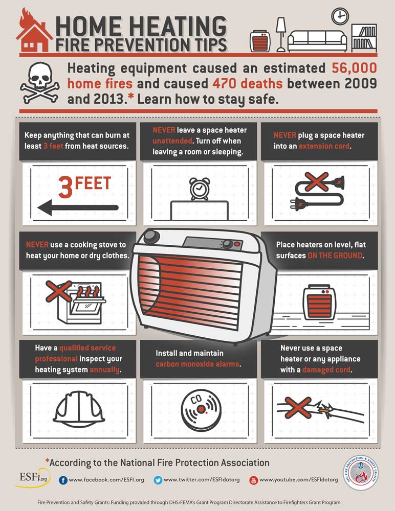
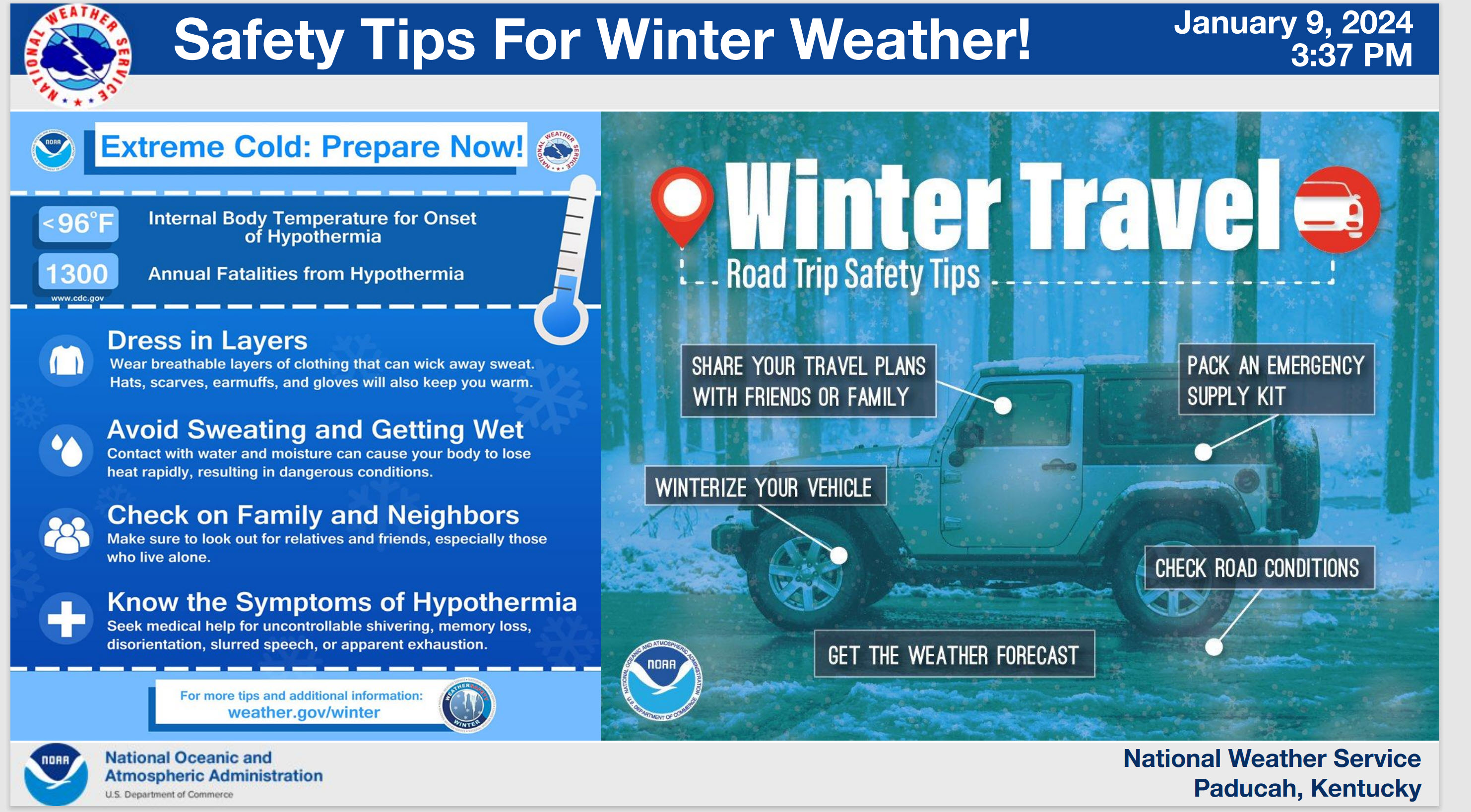
Safety first.
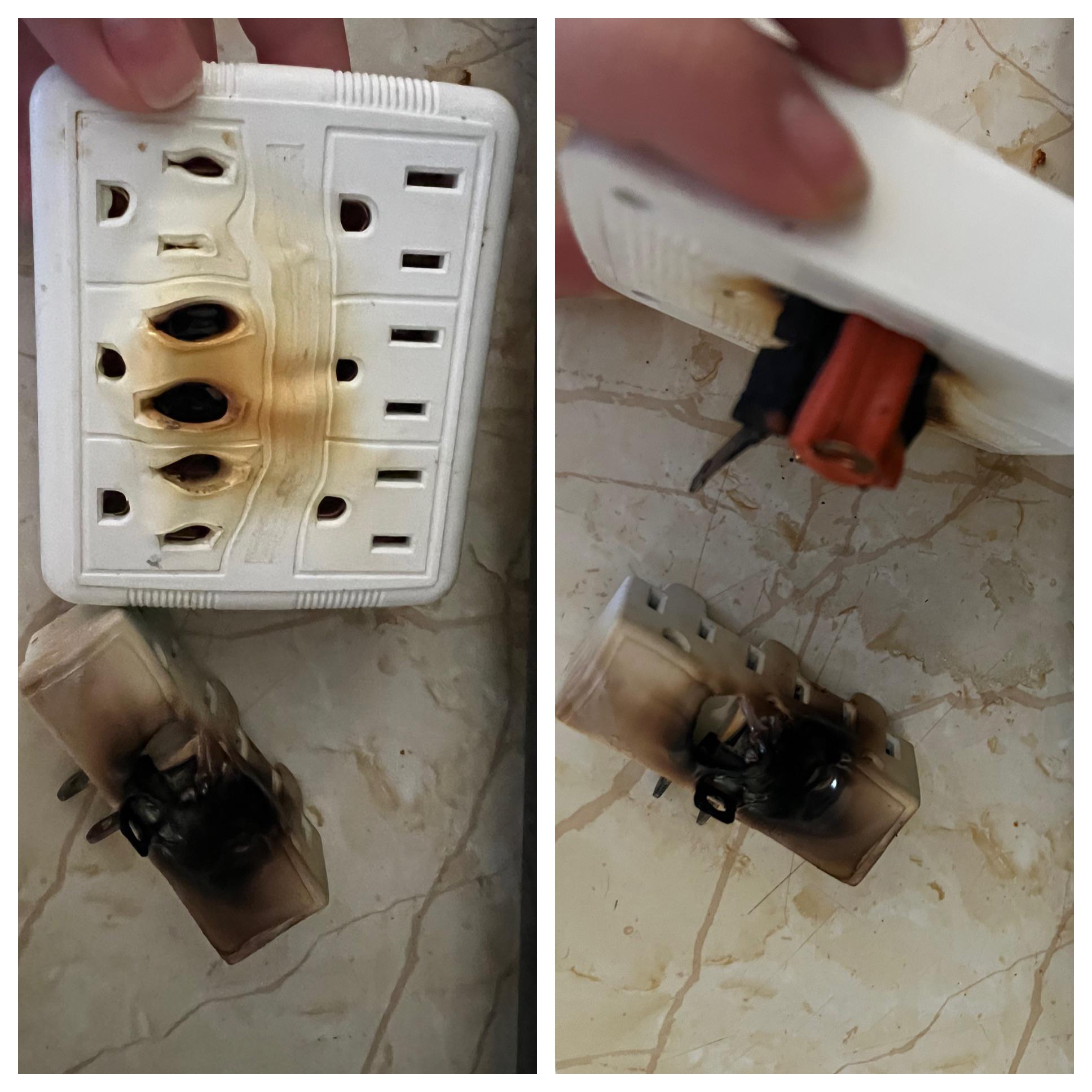
Avoid extension cords with space heaters. Use care with kerosene heaters.
Extension cords, attached to space heaters, can lead to house fires. Let’s keep everyone safe through this cold snap.
.
WINTER WEATHER UPDATE
Let’s focus on the impacts of the cold and snow.
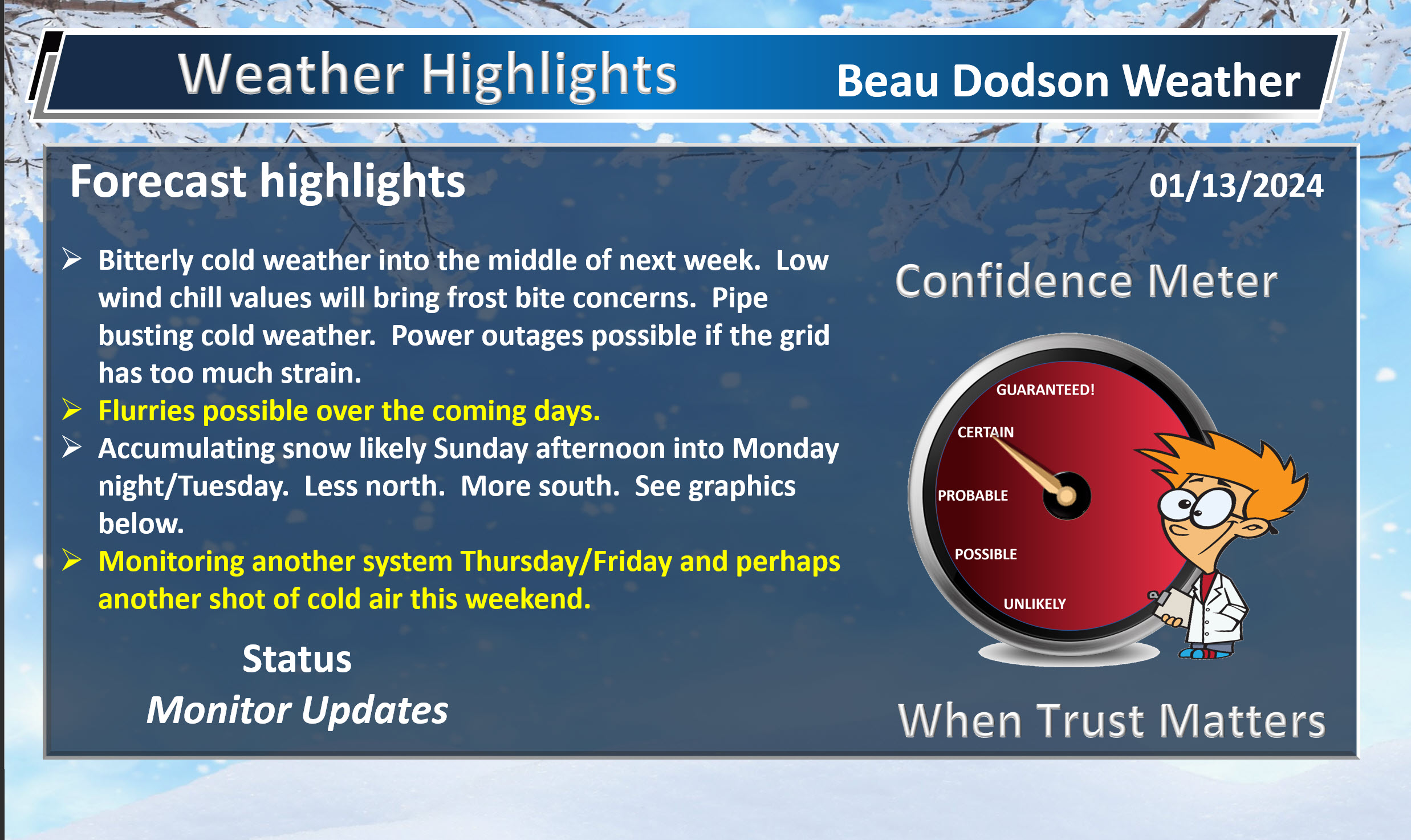
Whether you have a dusting of snow or a few inches of snow, it will be bitterly cold and there will be icy roadways. What snow does accumulate will be with us all week. Temperatures will remain cold. A unusually long cold spell for our region.
Some schools could be out for days. Plan accordingly. We will have to see how easy it is to remove the dry fluffy snow. The bitterly cold temperatures may also be a reason for some schools to cancel classes.
My going forecast from the last five days remains the same. Less snow north. More south. Impacts similar whether you have an inch of snow or four inches of snow. Icy surfaces. Bitterly cold.
Double click on graphics to enlarge them.
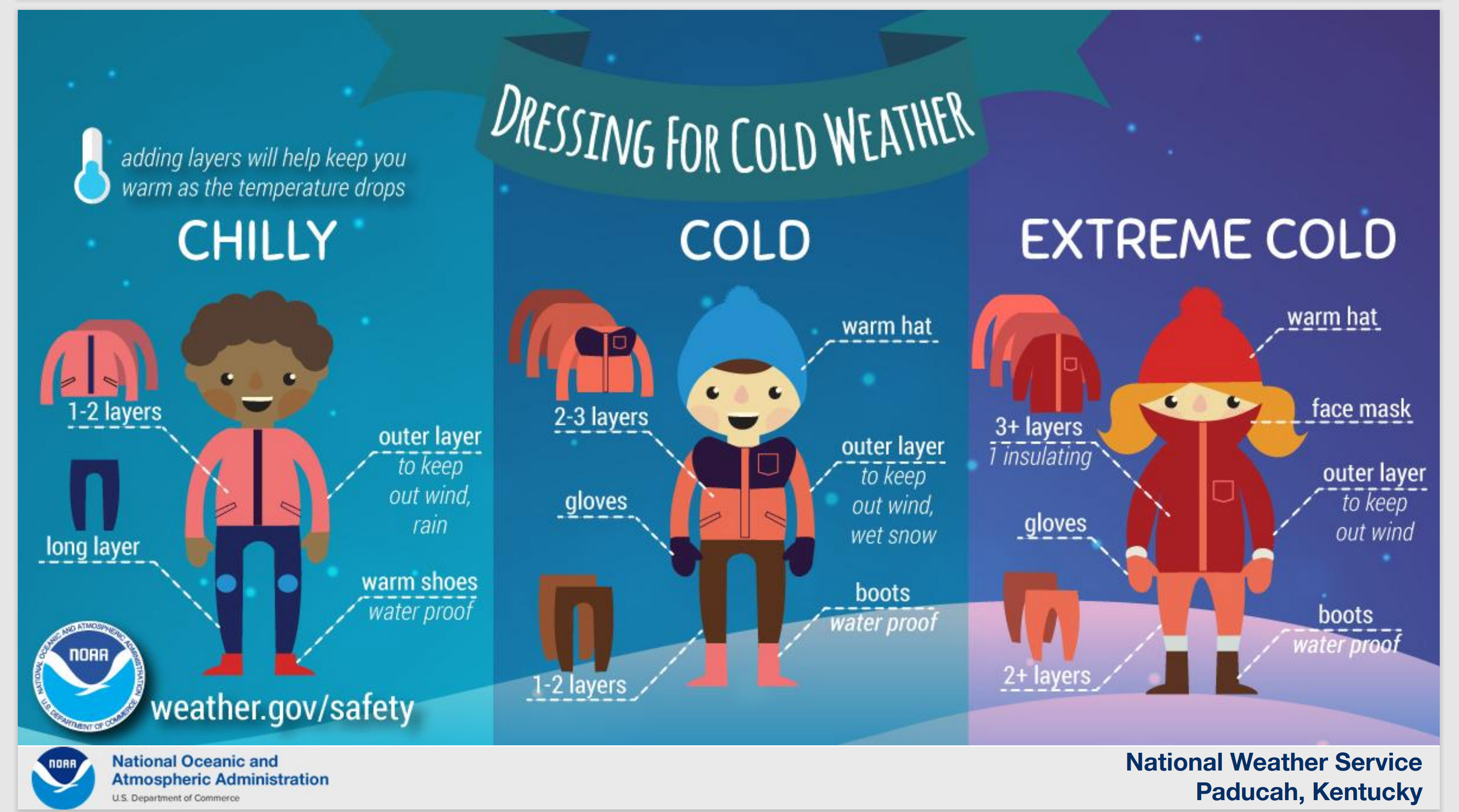
Common sense winter wear will be necessary. If it does snow, then protect the children with proper clothing. They will want to play in the snow.
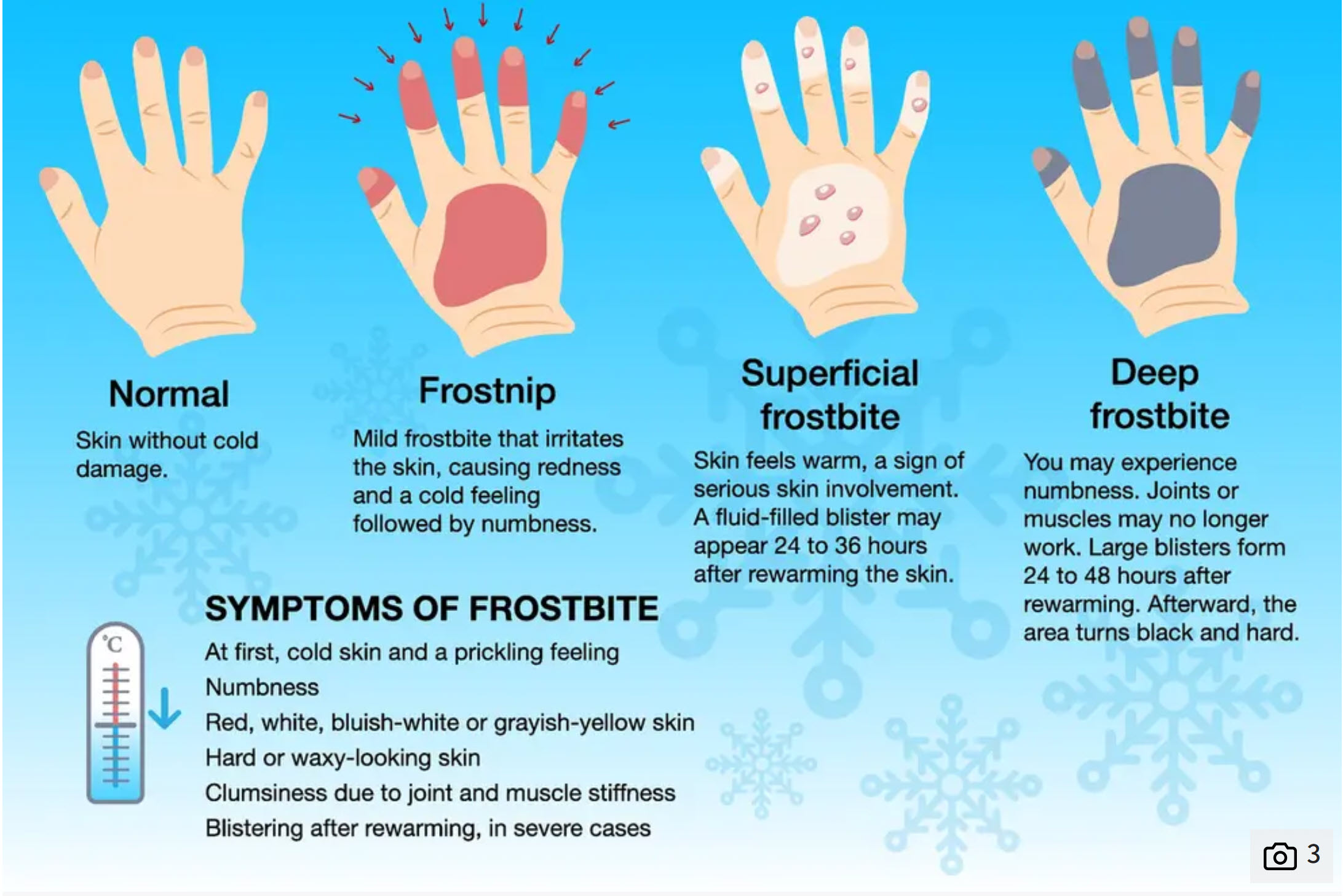
Frost bite, with these type of temperatures, can cause frostbite in a matter of minutes. Frost nip, as well. The beginnings of frost bite.
It is already cold, but it is going to become even colder.
Bitterly cold air is arriving behind an arctic front that is pushing into the region from the north. It is already cold this morning. But, even colder air is on the way.
Double click on images to make them larger.
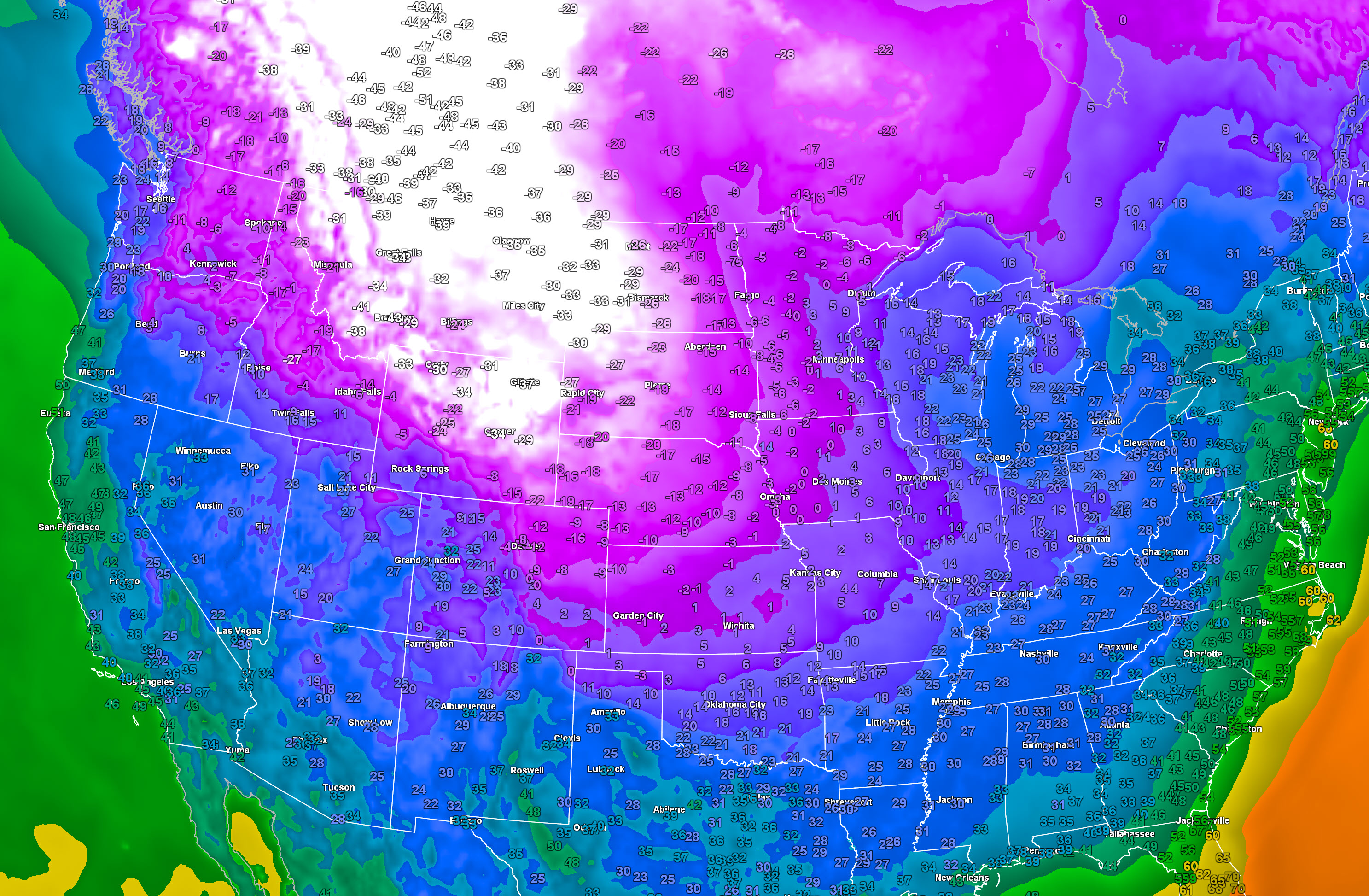
Check out these absolutely brutal temperatures. These are not wind chill values. Incredible temperatures in Canada into the central and northern Plains. Some areas are below -50 degrees!
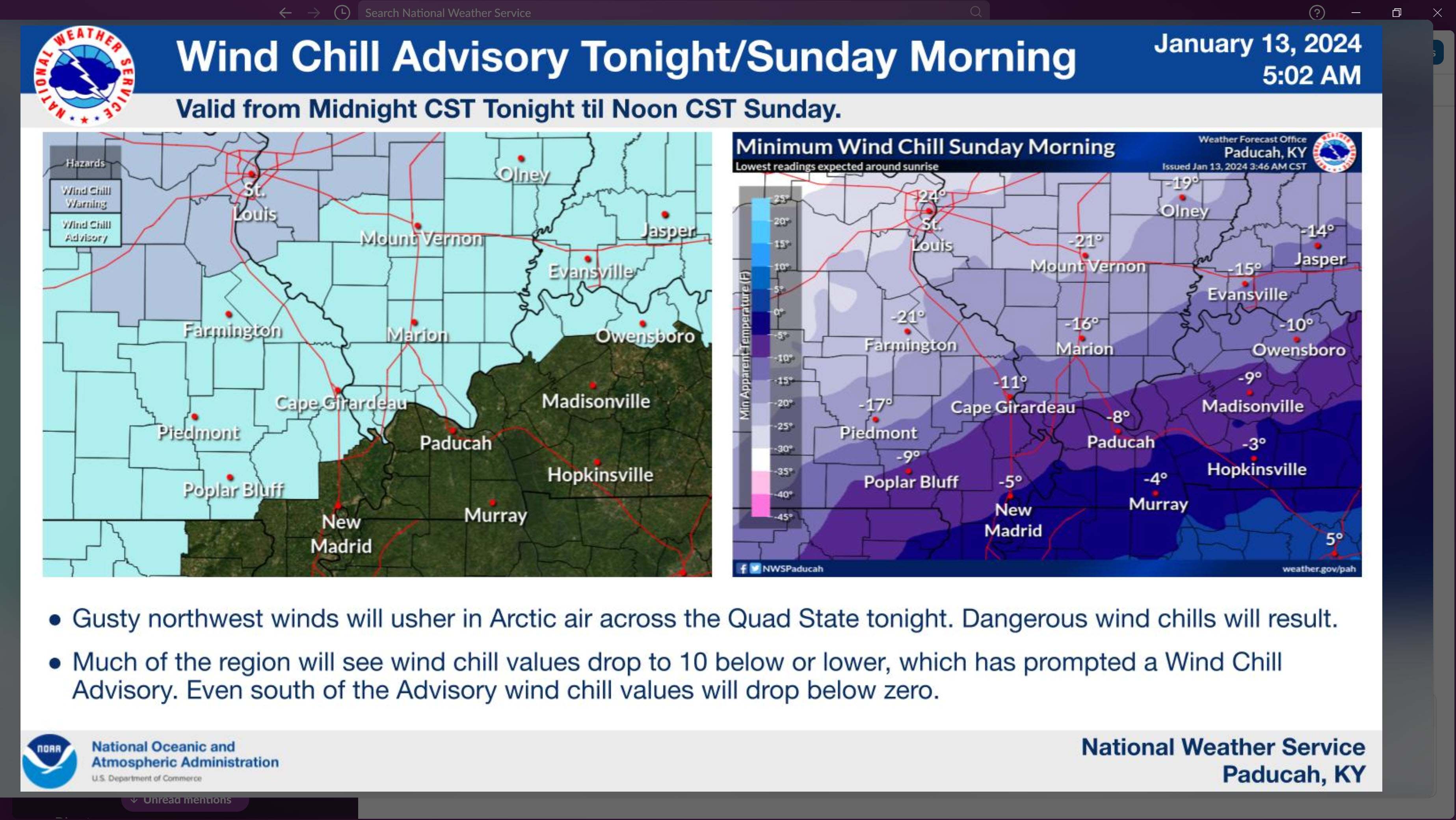
The NWS has issued a wind chill advisory for portions of the region. Ignore the fact that some of you are not in the advisory. It will be bitterly/dangerously cold area-wide. The NWS has certain criteria they use to issue their advisories. The NWS could always add more counties, but again it does not matter. It will be bitterly cold area-wide.
A winter storm watch covers the Bootheel into northwest Tennessee. Additional statements/advisories and watches/warnings are certainly possible farther north. Just waiting on the NWS to issue those.
Frost bite is a real concern for those who must be outside. First responders and others will want to prepare. If you have to work a wreck or a fire, then it is going to be very uncomfortable.
Double click the image to make it larger. This is the 9 AM advisory zone. Again, the NWS could add more counties. Either way, cold area-wide.
This next graphic is from the Memphis, TN NWS
Double click images to enlarge them.
The dark blue is a winter storm watch in the Bootheel and western Tennessee. The lighter blue represents wind chill warnings and advisories.
This is the 9 AM map. Click here to see the updated map.
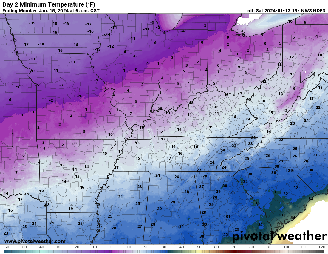
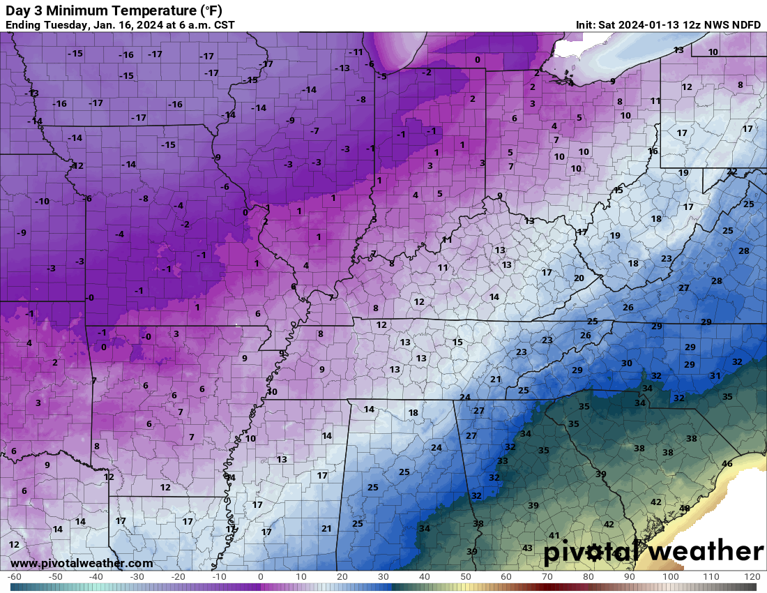
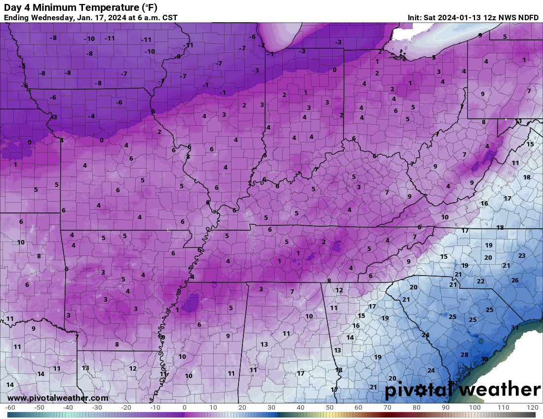
Let’s look at some of the low temperature numbers. Snow could make it even colder. Either way, COLD!
Tonight/tomorrow morning.
Sunday night/Monday morning.
Monday night/Tuesday morning
Tuesday night/Wednesday morning
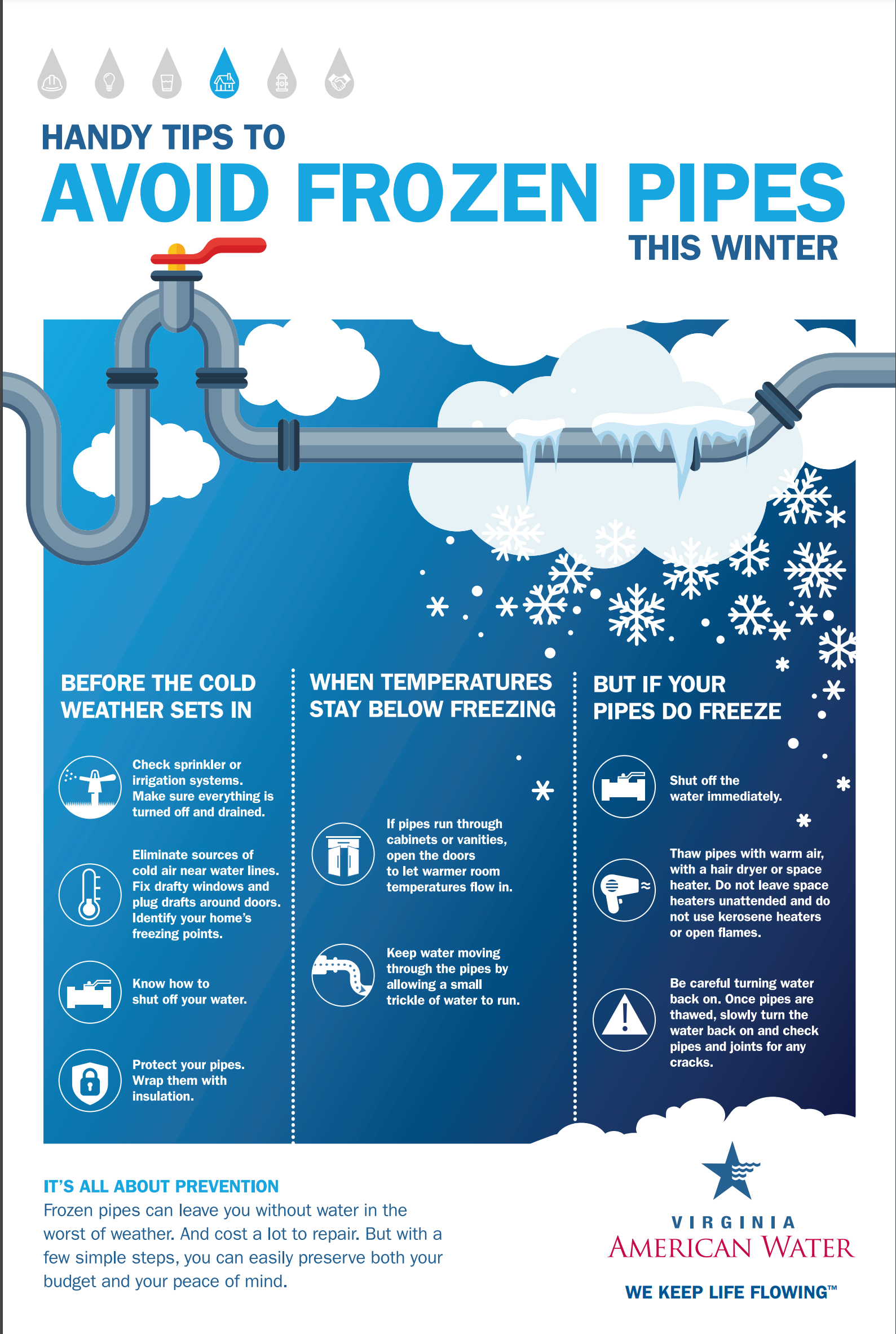
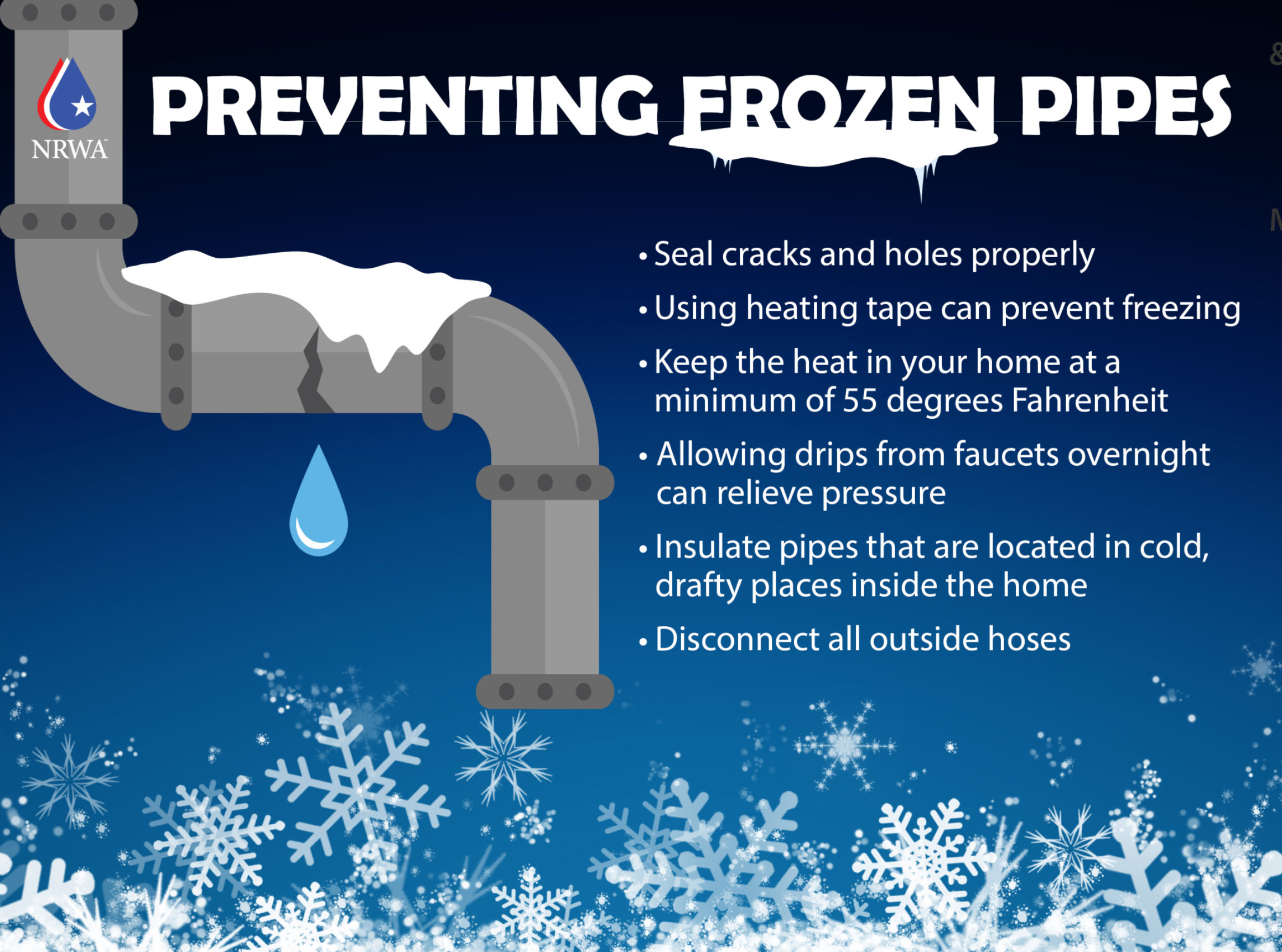
Frozen pipes are a significant concern.
Google how to protect your pipes. Open cabinets. Let the water drip.
There have already been reports of power outages in the region. Additional power outages are possible, because of the strain on the power grid. In 2022 there were rolling blackouts over Tennessee and Kentucky. Locally, quite a few of you lost power. This would complicate the situation. Keep this in mind.
That covers the cold.
Another shot of cold air is possible late next week and weekend. I am monitoring that.
Stay warm and stay safe!
What about snow?
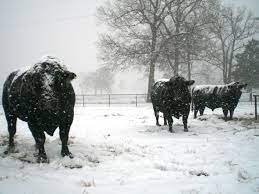
Many of you are wondering about the snow portion of my forecast. Again, much like 2022, the focus on this event continues to be the bitterly cold air.
My forecast from the past five days has not changed all that much.
Again, before I forget, some light snow is possible this afternoon into tonight. A dusting to an inch or so not out of the question right along the front.
Keep that in mind.
Confidence in snow totals over our far northern counites remains lower than our far southern counties.
Snow is likely to develop Sunday afternoon into Monday night. There remain some questions about the timing. Snow is possible in southeast Missouri as early as 12 PM to 3 PM. Then, it moves eastward.
Occasionally, these type of snow events arrive earlier than forecast. For planning purposes, let’s plan on Sunday afternoon into evening for snow developing across the region.
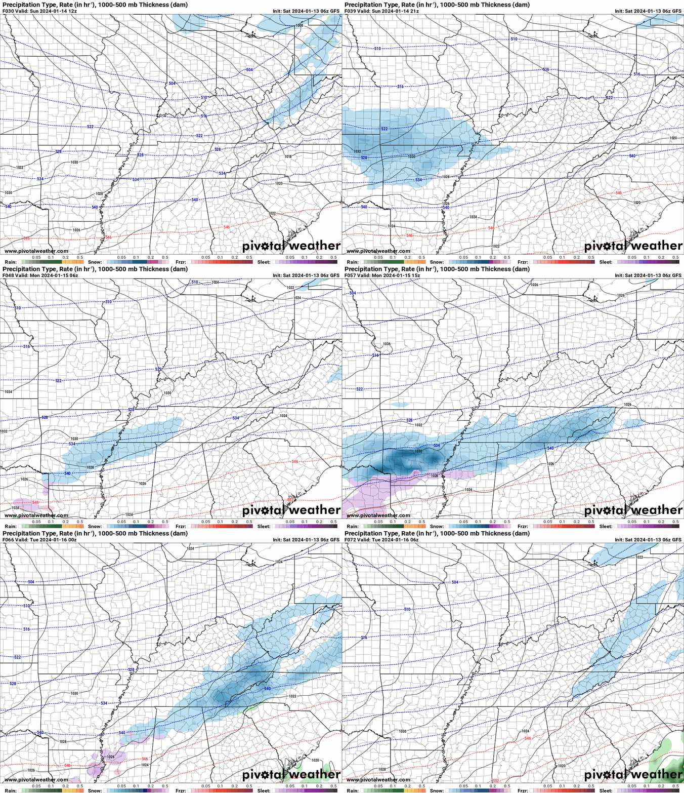
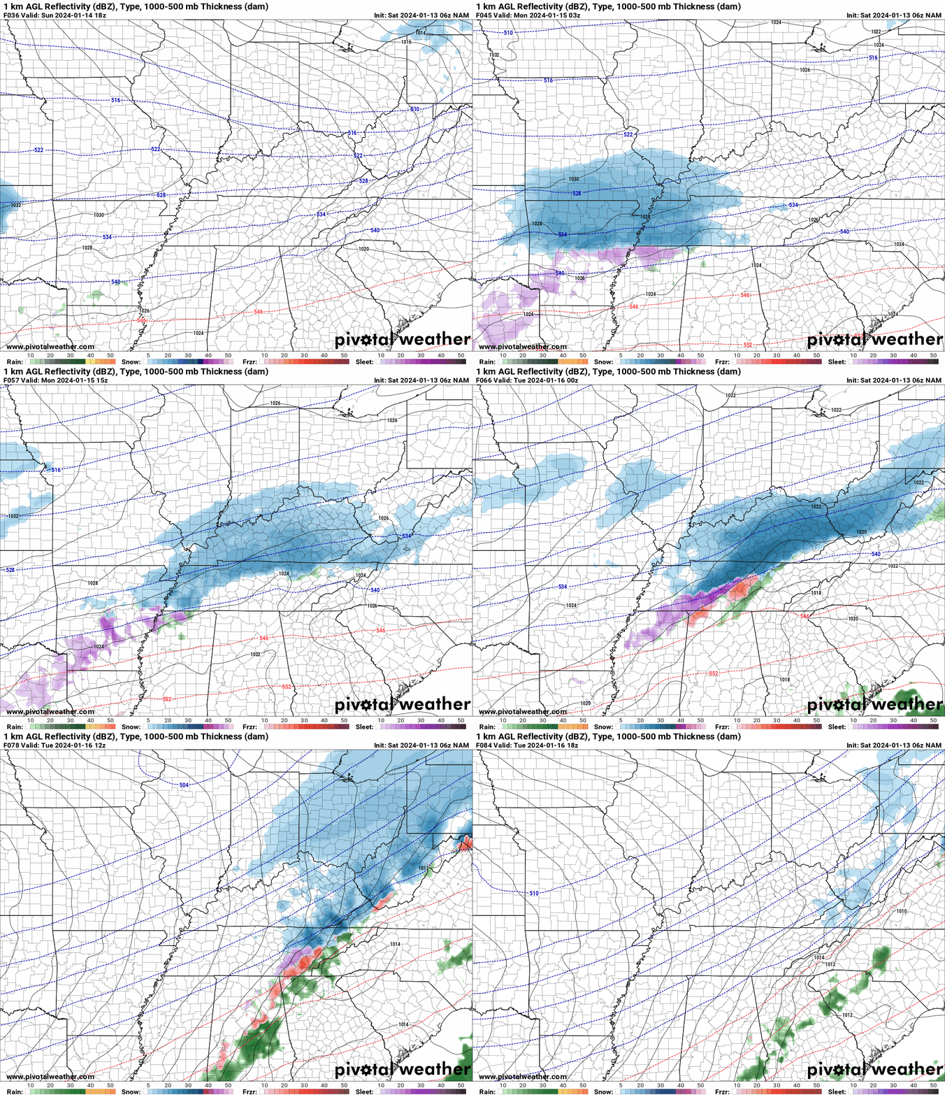
Let me show you some future-cast radars.
These are model depictions of what might happen. Of course, they won’t be exact, but take the general idea from them.
GFS model. Time is in Zulu. 00z= 6 pm. 06z=12 am. 12z=6 am. 18z=12 pm.
NAM model. Time is in Zulu. 00z= 6 pm. 06z=12 am. 12z=6 am. 18z=12 pm.
Snow ratios will be higher with this event.
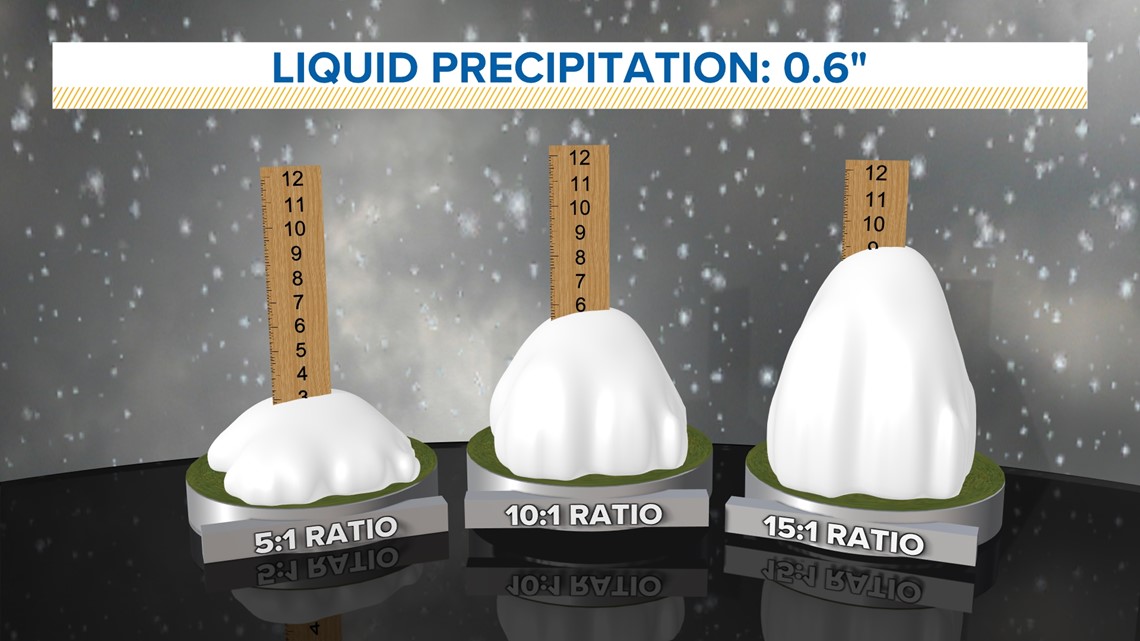
What is the snow ratio?
Typically, we have a 10:1 snow ratio. That means one inch of melted liquid snow equals ten inches of snow. This event could have 15:1 to 30:1 ratios. That means a fluffy dry snow. Lot of air pockets. Thus, what would normally be an inch of snow could be two to three inches of snow.
Another example of 0.6″ liquid (melted). A 5:1 ratio would be three inches of snow. A 10:1 ratio would be six inches of snow. A 15:1 ratio would be nearly ten inches of snow. You get the general idea? Higher snow ratios equal a dry fluffy snow.
Dry snow typically occurs when we have bitterly cold air in the region. That will be the case with this event.
For the past week I have been saying less snow as you travel north. More snow as you travel south. Then, that leaves a bunch of you in the middle!
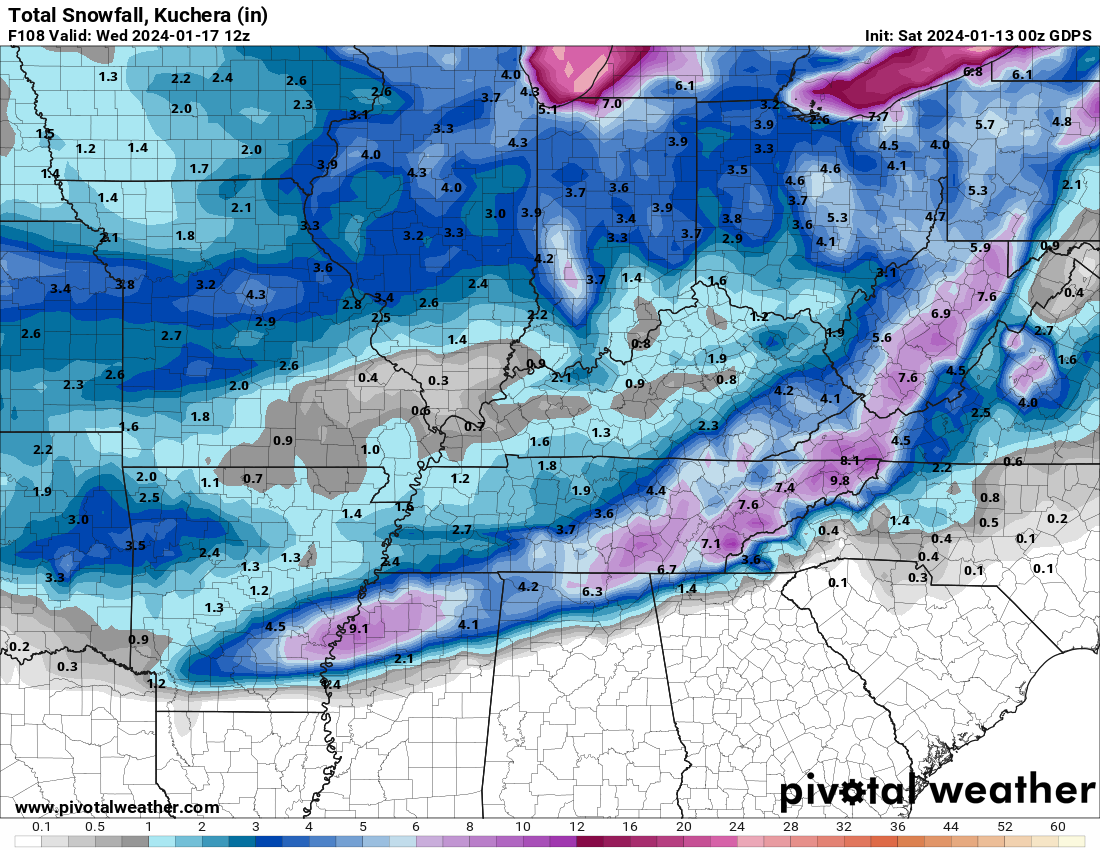
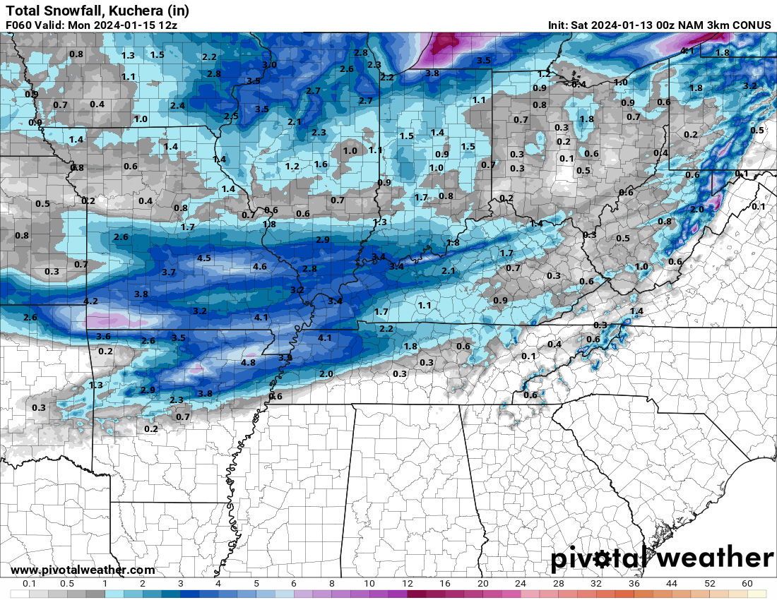
Models are all over the place with snow totals. Want to see?
GFS model
NAM model
Quite the difference! Wide range on the models. Not unusual to see that. They just don’t handle snow all that well.
As you know, I don’t trust models when it comes to forecasting snow totals. There are other things that I look at when considering snow totals.
For planning purposes, let’s plan one a general one to three inches of snow area-wide. Yes, it is possible that our northern counties have less than an inch. It is possible our far southern counties have three or four+ inches of snow.
Either way, icy roadways will be the end result. Because it is going to be so cold, I would avoid venturing out if you can help it. If you don’t have to be out on the roads,, don’t.
We also don’t want our first responders having to be out in this mess, either. Let’s keep everyone as warm as possible.
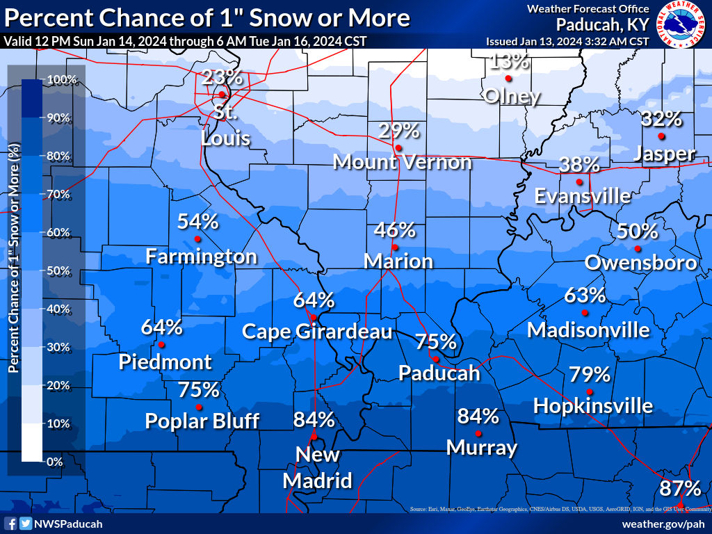
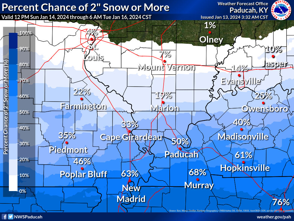
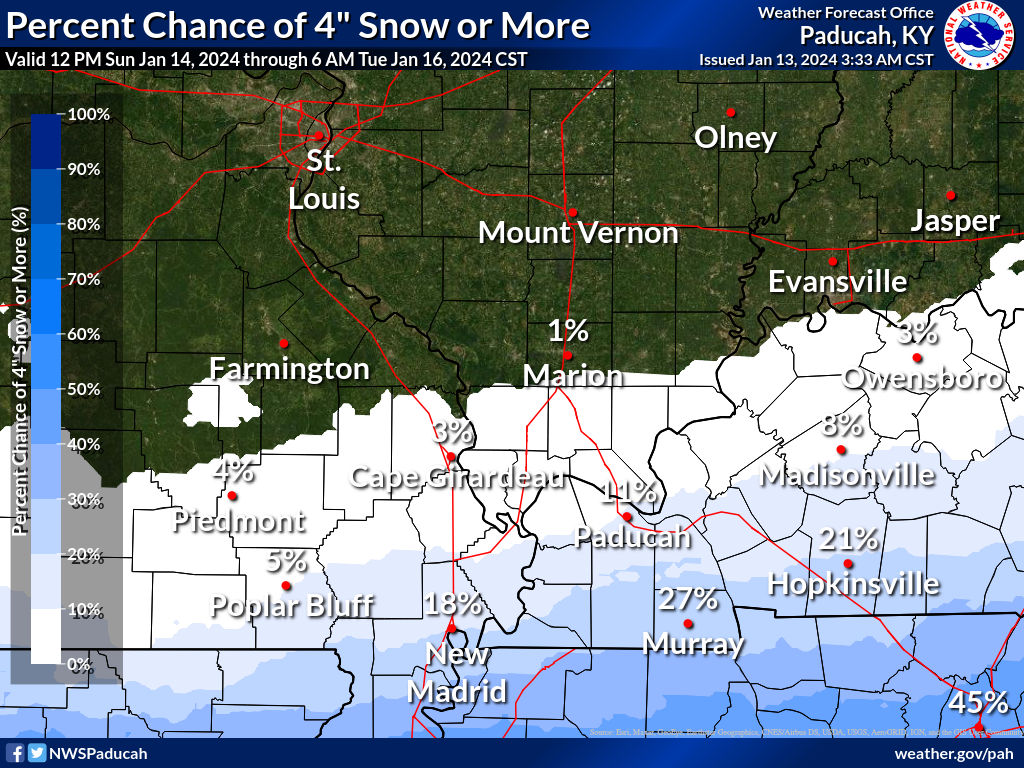
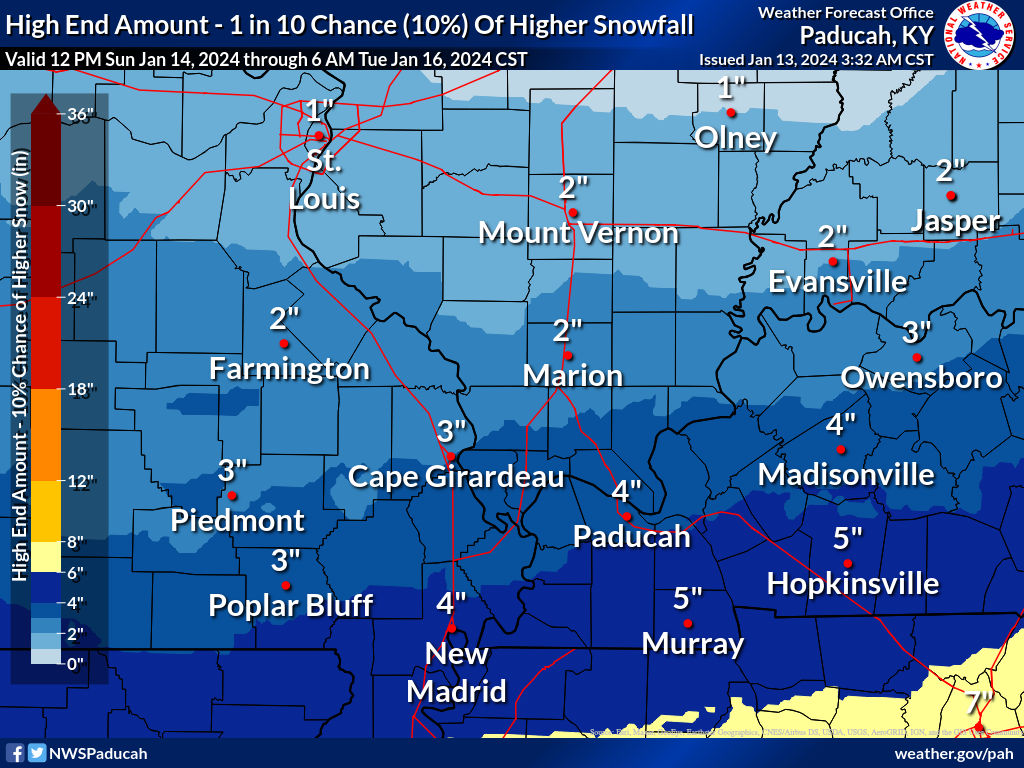
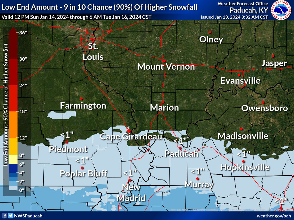
Let me show you some over under graphics.
Again, double click images to enlarge them.
There could still be adjustments to this. Keep that in mind. More data will roll in throughout today and tonight. Leading up to tomorrow afternoon/night’s event.
What if the system overachieves?
And, underachieves. A 10% chance of this happening.
Bottom line.
I know everyone wants a specific amount for their backyard. Every winter weather event produces a wide range of totals. Someone always has more. Someone always has less. Nature of the beast in our region.
This is why I try to get you to focus on impacts vs specific numbers.
The bottom line is the some snow will likely accumulate with these event. That will lead to some icy road conditions. What does fall will stick.
The above graphics are the official NWS forecast.
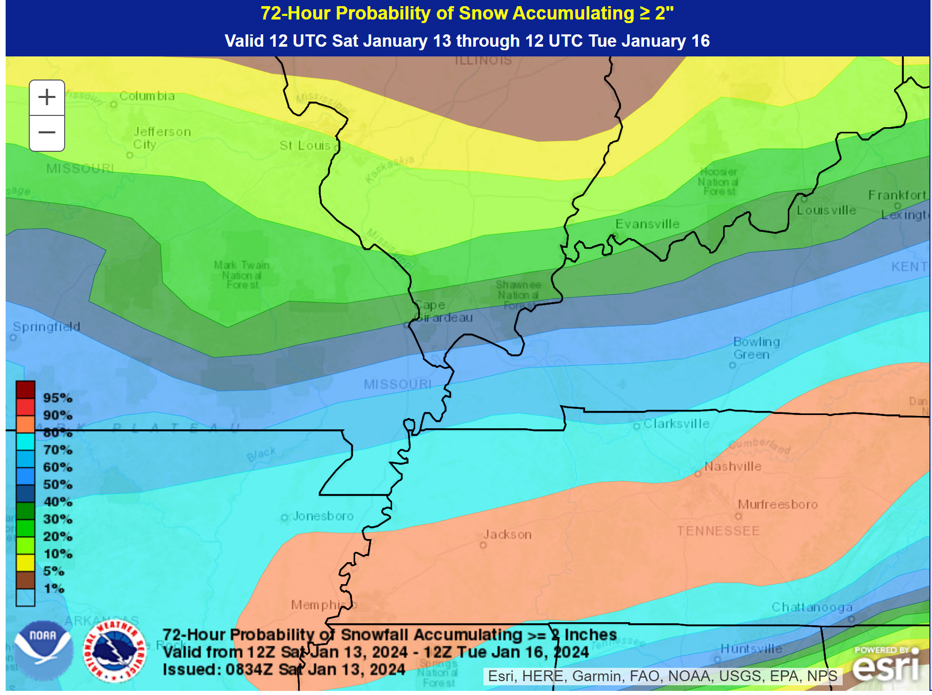
Let’s look at the WPC NOAA. I wanted to show you the gradient. Less north. More south.
Here is what they have for the probability of two or more inches of snow.
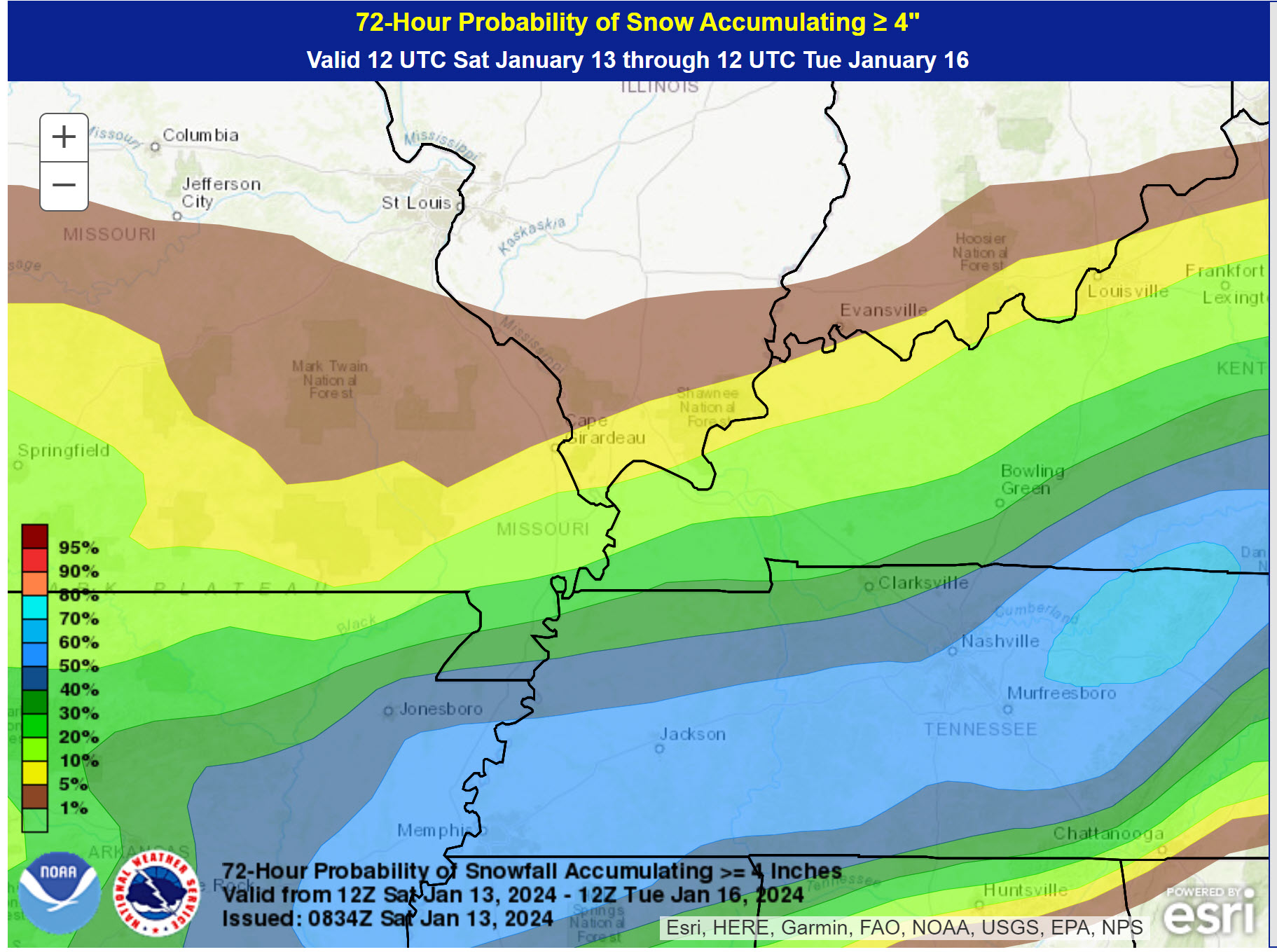
Four or more inches of snow.
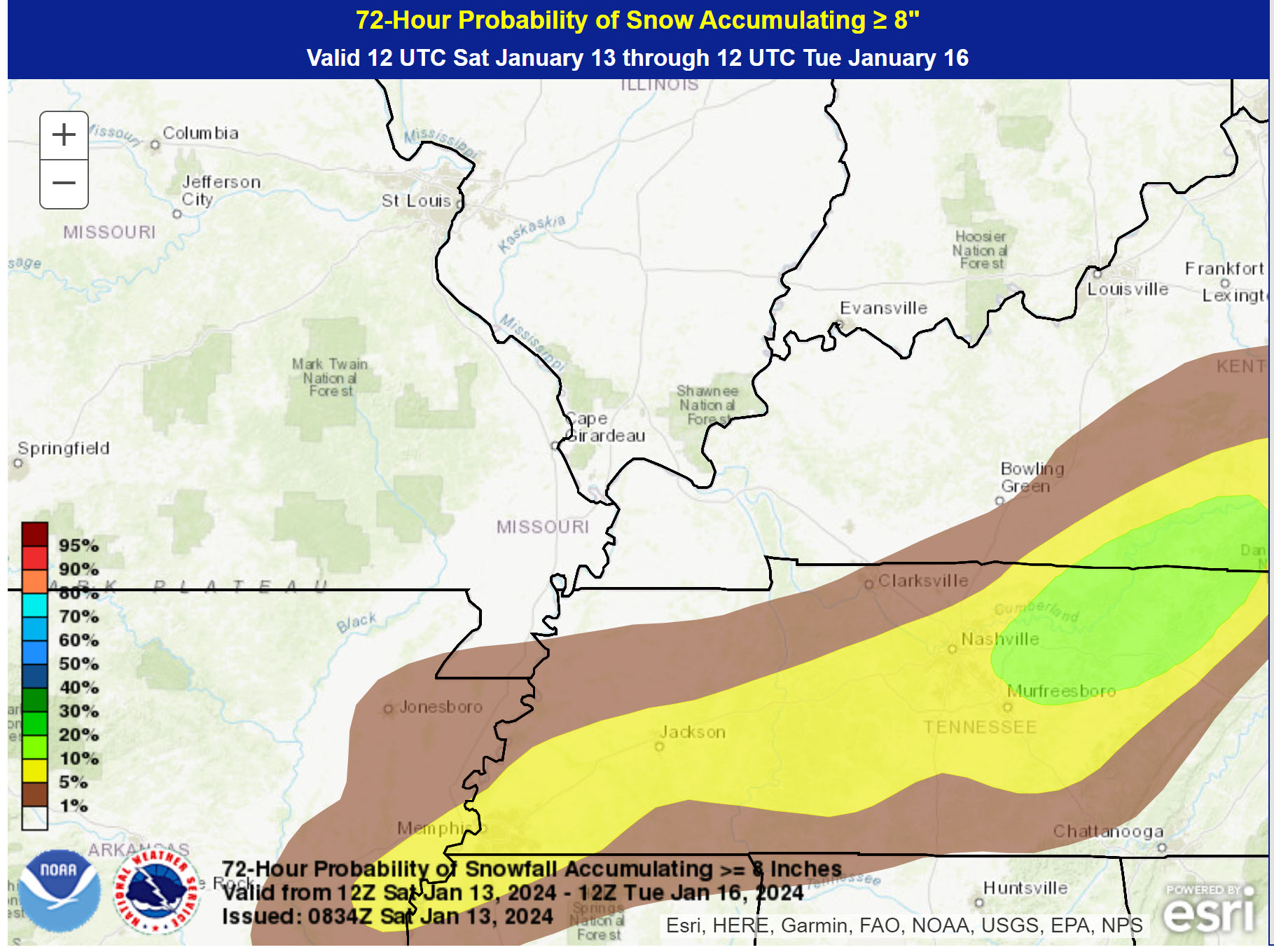
Eight or more inches of snow. Probabilities.
![]()
The app is for subscribers. Subscribe at www.weathertalk.com/welcome then go to your app store and search for WeatherTalk
Subscribers, PLEASE USE THE APP. ATT and Verizon are not reliable during severe weather. They are delaying text messages.
The app is under WeatherTalk in the app store.
Apple users click here
Android users click here
.

Radars and Lightning Data
Interactive-city-view radars. Clickable watches and warnings.
https://wtalk.co/B3XHASFZ
If the radar is not updating then try another one. If a radar does not appear to be refreshing then hit Ctrl F5. You may also try restarting your browser.
Backup radar site in case the above one is not working.
https://weathertalk.com/morani
Regional Radar
https://imagery.weathertalk.com/prx/RadarLoop.mp4
** NEW ** Zoom radar with chaser tracking abilities!
ZoomRadar
Lightning Data (zoom in and out of your local area)
https://wtalk.co/WJ3SN5UZ
Not working? Email me at beaudodson@usawx.com
National map of weather watches and warnings. Click here.
Storm Prediction Center. Click here.
Weather Prediction Center. Click here.
.

Live lightning data: Click here.
Real time lightning data (another one) https://map.blitzortung.org/#5.02/37.95/-86.99
Our new Zoom radar with storm chases
.
.

Interactive GOES R satellite. Track clouds. Click here.
GOES 16 slider tool. Click here.
College of DuPage satellites. Click here
.

Here are the latest local river stage forecast numbers Click Here.
Here are the latest lake stage forecast numbers for Kentucky Lake and Lake Barkley Click Here.
.
.
Find Beau on Facebook! Click the banner.




 .
.