Good morning, everyone
Just a brief update today. The full blog will return tomorrow.
We have a chance of severe thunderstorms Wednesday and Wednesday night. Locally heavy rain could cause flash flooding, as well.
A strong system is going to push across our region. Wind shear will be high for August. There will likely be enough CAPE/instability for severe storms.
There are some questions, however, about how Wednesday’s event will unfold.
There is likely going to be at least one or two MCS events move across our area. MCS’s are large summer thunderstorm complexes. They are usually found on the edge of the heat ridge (all the news stories about the heat to our south and southwest).
We have experienced numerous MCS’s over the past five weeks. Those are what delivered severe weather and severe flash flooding to the area.
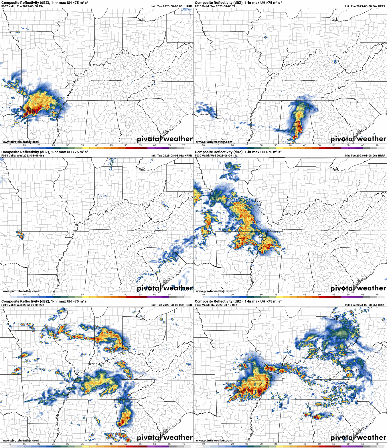
If we have a morning MCS, then it will keep instability lower. Meaning, the severe threat will be lower. If, however, the MCS moves out fast enough and sky conditions clear, then the threat of severe weather will be higher.
If the atmosphere can recover from the morning complex, then a second MCS is likely to impact our region Wednesday late afternoon into Wednesday night.
These MCS’s are likely going to product damaging wind, heavy rain, and frequent lightning. If we have two MCS’s, then the threat of flash flooding will increase.
We will need to monitor the risk of a tornado or two, as well.
Confidence in how Wednesday unfolds is lower than usual. We may not know until Wednesday morning as to whether or not severe thunderstorms will be a concern.
Monitor updates. I will send out Beau Dodson Weather App messages.
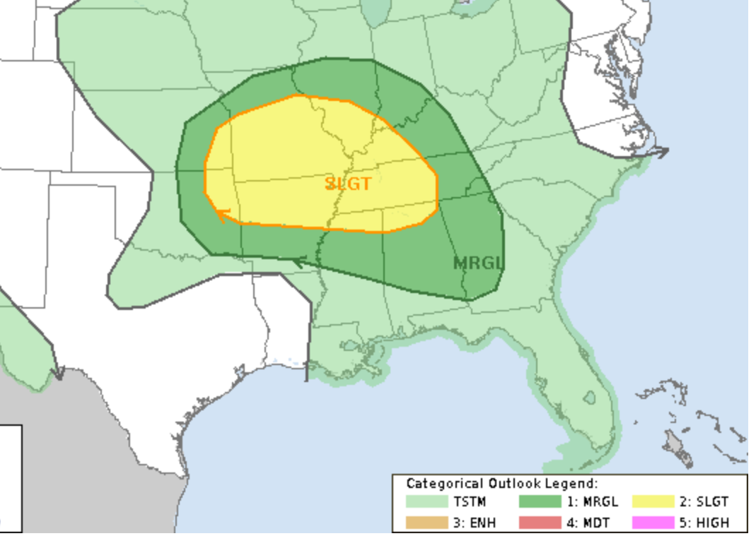
Here is the day two SPC severe weather outlook. For now, we are in a level one and two severe risk. Portions of the level two may be upgraded to a level three. That would occur if confidence increases in the second MCS.
The risk level goes up to five on the SPC outlooks.
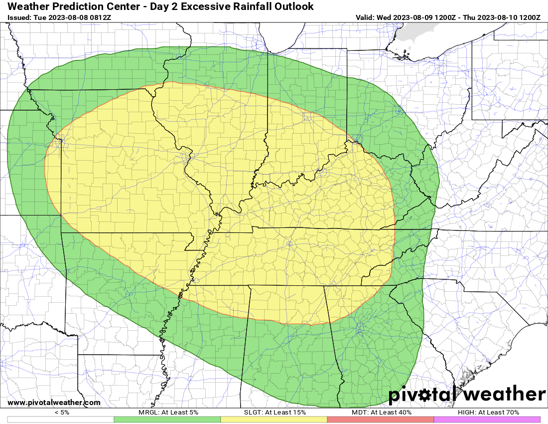
We are in a level two out of four flash flood risk, as well. This is for Wednesday and Wednesday night.
Future-cast radar
Monitor updates moving forward.
A few showers and thunderstorms may linger into Thursday, but overall we will be drying out.
Additional thunderstorm chances arrive Friday into Sunday. MCS’s are again possible with locally heavy rain and perhaps even some severe weather.


