August 3, 2023
I have been up all night dealing with storms. Short update.
Thursday, August 3, 2023
Hit share.
Q&A Thread for today and tonight.
The primary concern today/tonight will be locally heavy rain and lightning. A few storms could also produce damaging wind and hail.
Avoid flooded roadways.
Flash flooding is a concern where storms repeatedly train over the same areas.
Forecast Discussion
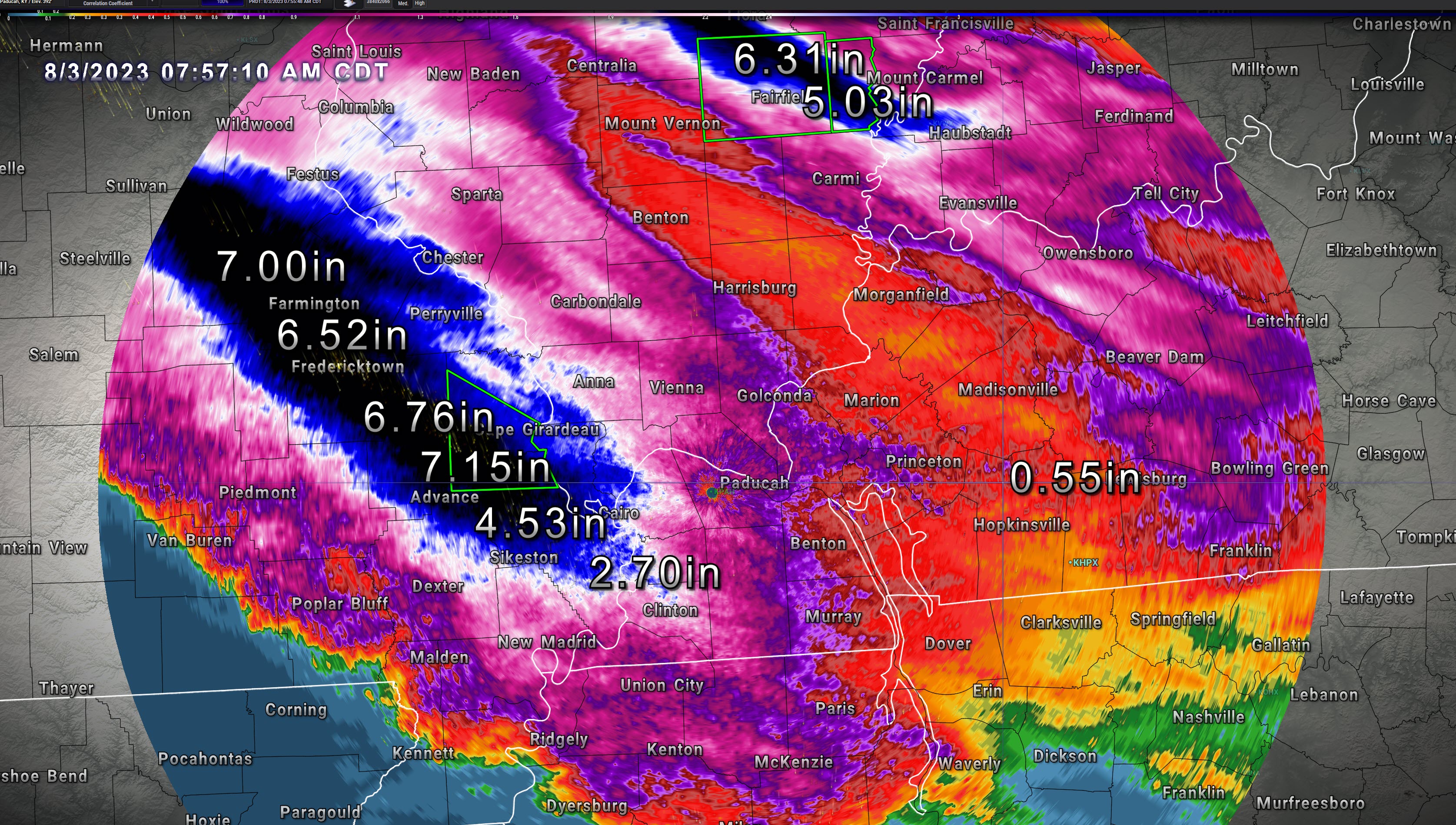
We are waking up to widespread rain in the region. Rain totals have varied from less than an inch to over seven inches.
There have been bands of 3 to 6 with pockets of greater than 6 inches of rain across portions of southeast Missouri into extreme southern Illinois and western Kentucky.
Another band of 3 to 6 inches of rain extended from southeast Illinois into southwest Indiana.
There have been some flash flood warnings.
There were numerous severe thunderstorms last night that caused quite a bit of wind damage across portions of southeast Missouri. Some of that extended into southern Illinois, as well.
The atmosphere will remain juiced today with very high PWAT values. PWAT is a measure of moisture.
Precipitation will be widespread this morning. Then, it will taper off late morning into the early afternoon.
Additional thunderstorms will develop later this afternoon into tonight. I can’t rule out some severe thunderstorm warnings from those storms. Mainly for hail and wind.
Stay weather aware today. Avoid flooded roadways.
Rain totals, as of 7 AM


