June 24, 2023
Severe Thunderstorm Update
Special video update from the video team
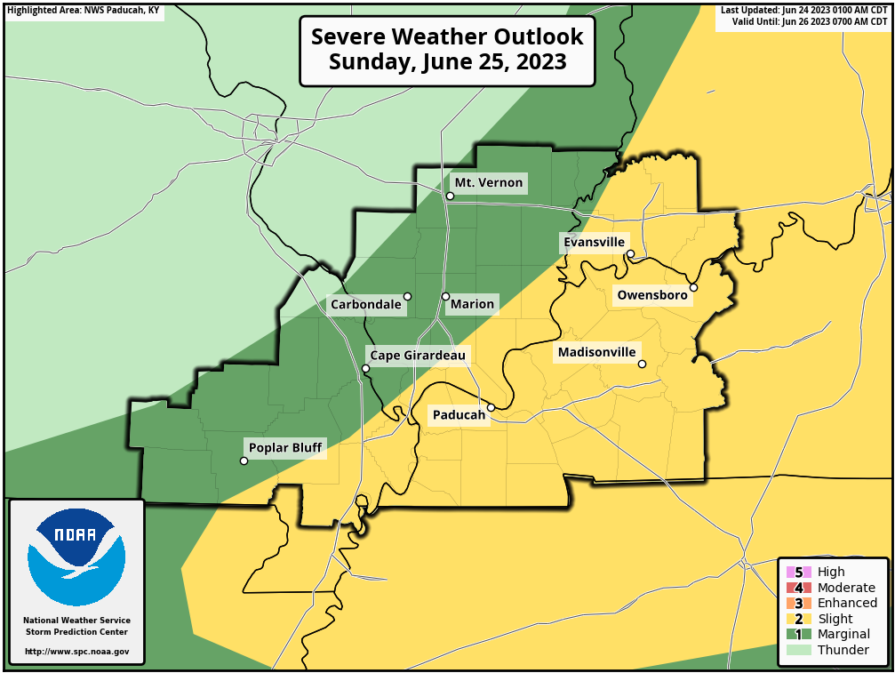
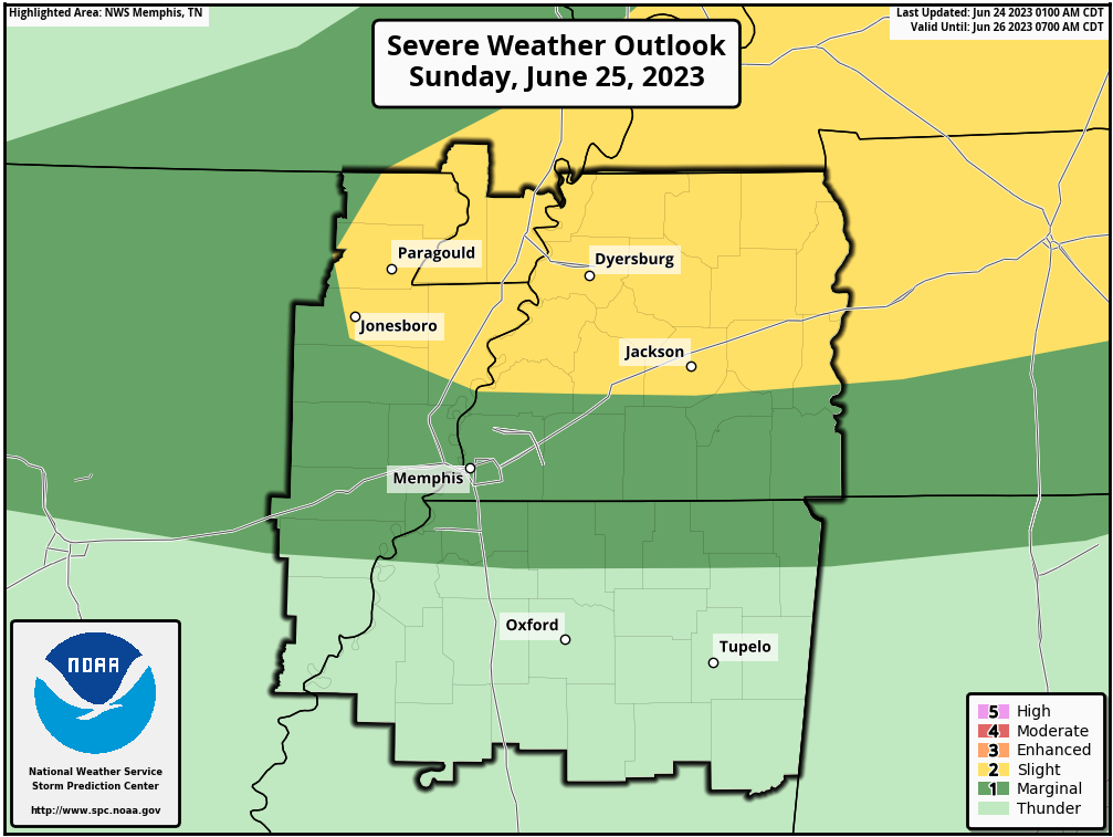
Graphic shows you the Storm Prediction Center’s Sunday severe weather outlook. Light green is non-severe storms. Dark green is a level one risk. Yellow is a level two severe weather risk.
The black outline is simply the NWS zone forecast area for Paducah, Kentucky, and Memphis, Tennessee.
These graphics will likely be adjusted over the next 24 hours. Monitor updates.
Confidence remains low in the exact forecast details.
There are a couple of time-frames of concern.
A couple of isolated storms will be possible late this afternoon and evening over northern portions of southeast Missouri and northern portions of southern Illinois.
If storms form, they could be strong with isolated hail and high winds.
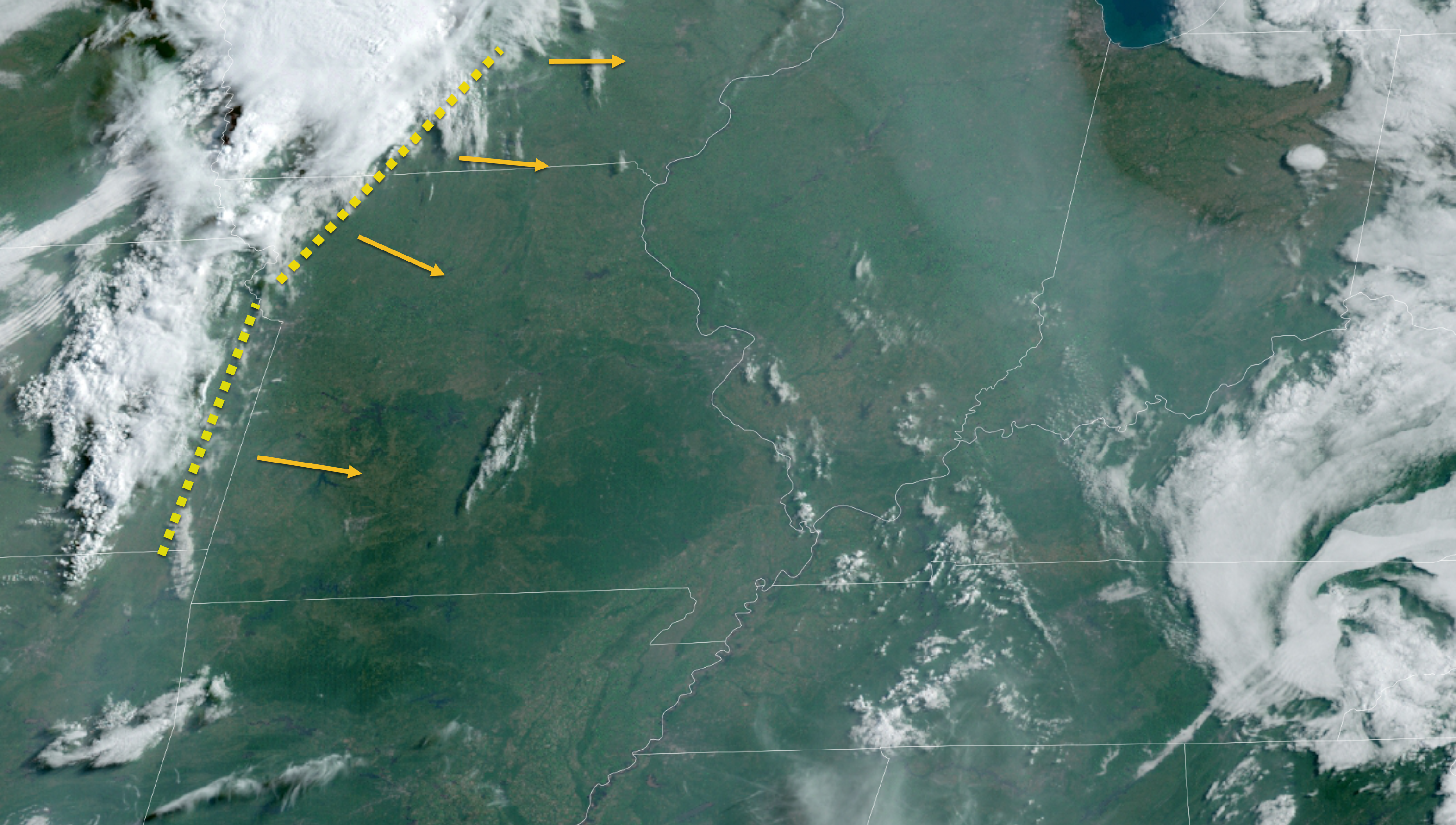
There is an outflow boundary approaching from Kansas and Iowa. This will move east southeast through today/this afternoon.
Eventually, new storms may form along this boundary.
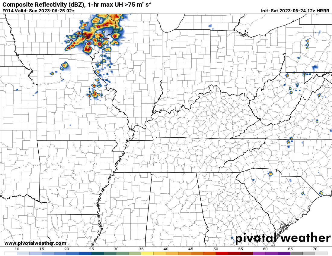
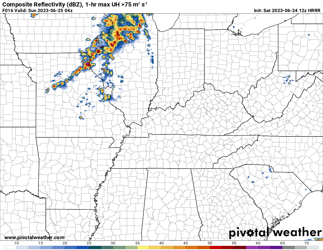
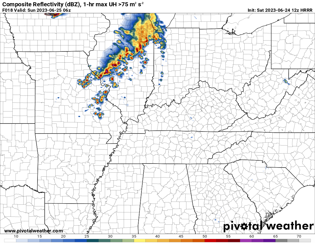
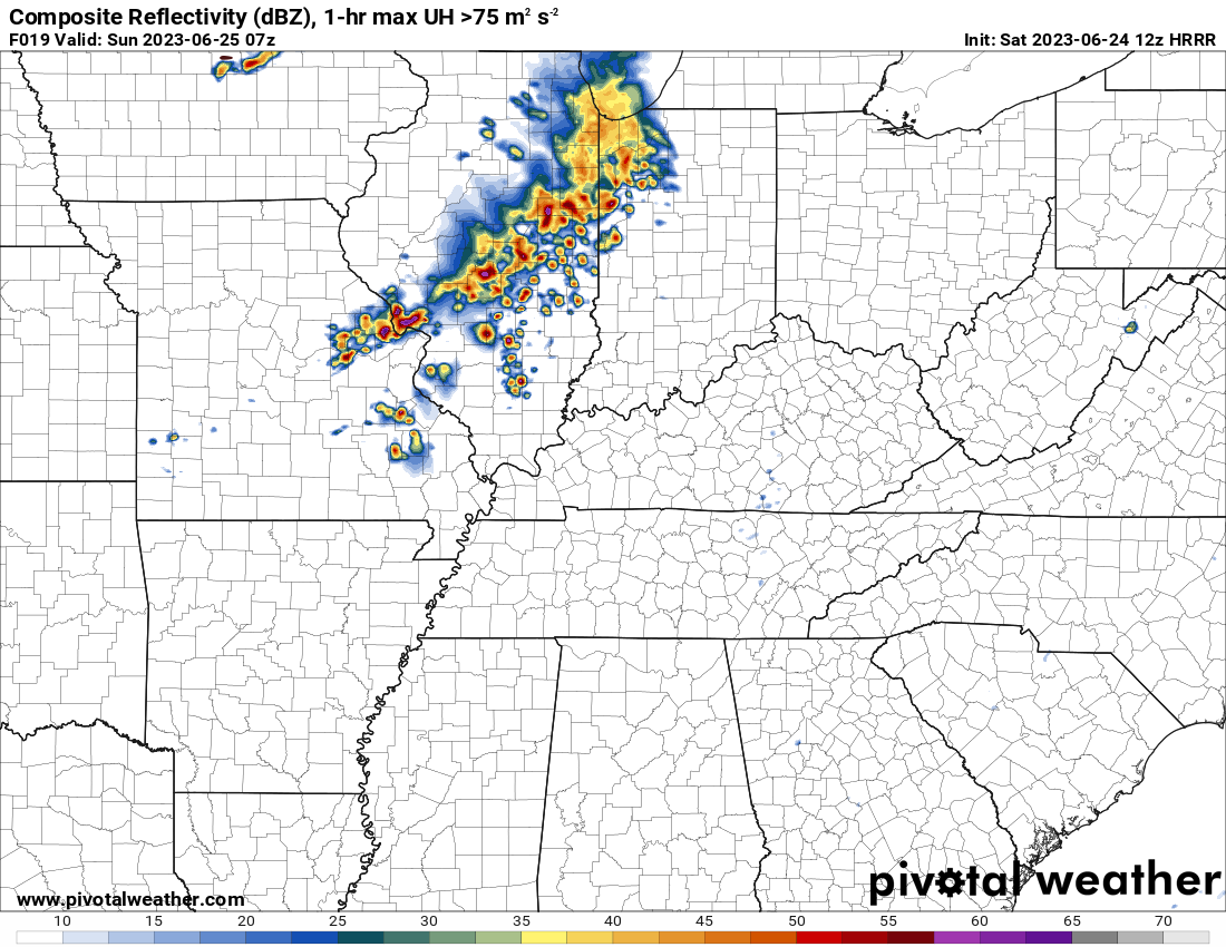
The Hrrr model shows this new development this evening. We will need to monitor these storms as they move east and perhaps southeast.
This future-cast radar is time-stamped 9 PM tonight.
11 PM Saturday night
1 AM Sunday Morning. This is the Hrrr future-cast radar.
2 AM Sunday Morning
Of greater concern, will be after midnight tonight into Sunday morning. And then, tomorrow afternoon and evening.
I wish I had higher confidence in the outcome of this forecast. Unfortunately, during the summer months, it is extremely difficult to nail down the details of these type of events.
The models change every single run. Some runs showing widespread severe thunderstorms and other runs showing basically nothing.
We are reliant on the weather models, until now-cast time. Now-cast time is typically 12 hours before an event.
My current forecast
Scattered showers and thunderstorms will develop after midnight tonight. They will move in from central and northern Missouri, extending into central Illinois, and then extending into Indiana.
These showers and thunderstorms will push south southeast.
Some of these storms could produce nickel to quarter size hail, isolated wind damage, frequent lightning, and heavy rain.
These storms will be battling an increasingly unfavorable atmosphere for severe weather.
We need rain. I hope the late night storms do develop. They may deliver the best chance at beneficial rainfall for portions of the region.
At this time, it appears the highest shower and thunderstorms chances, late tonight/tomorrow morning, will be across southeast Illinois, southwest Indiana, and northwest Kentucky.
Other areas will also have a chance of rain, but perhaps a lower probability.
Then, all eyes turn to tomorrow afternoon and night.
The atmosphere will become very unstable with CAPE values of 2500 to 4000. CAPE is energy that storms tap into. Those are high values.
Wind shear will also increase.
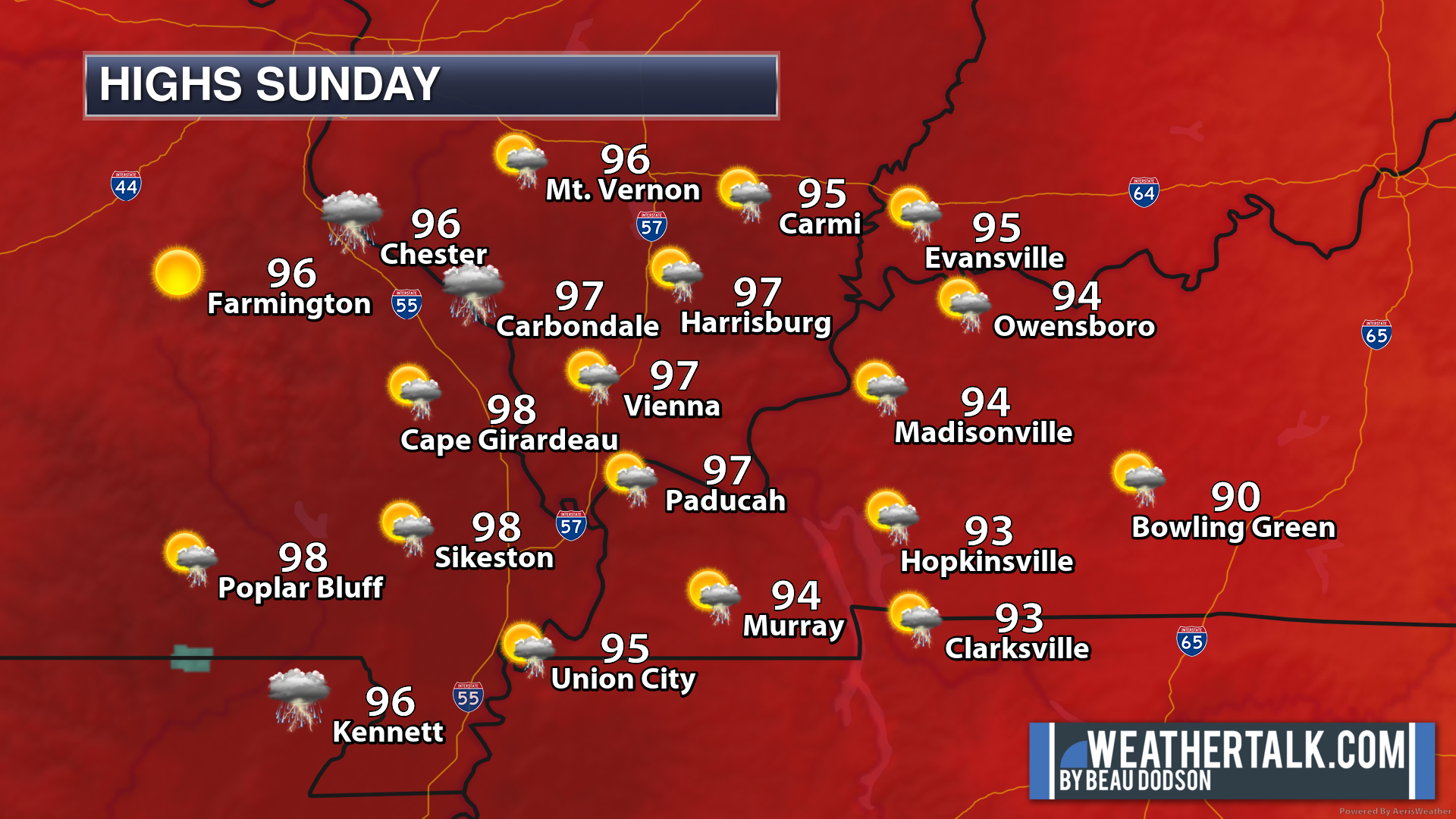
Temperatures will soar into the 90s with heat index values of 100 to 110 degrees.
That is a lot of energy, if storms form.
The only question left is will there be enough force to produce thunderstorms.
Model guidance indicates everything from numerous severe thunderstorms to no storms, at all.
It is possible that the storms form too far east to impact our region, as well.
My current forecast has scattered severe thunderstorms developing after 3 PM Sunday.
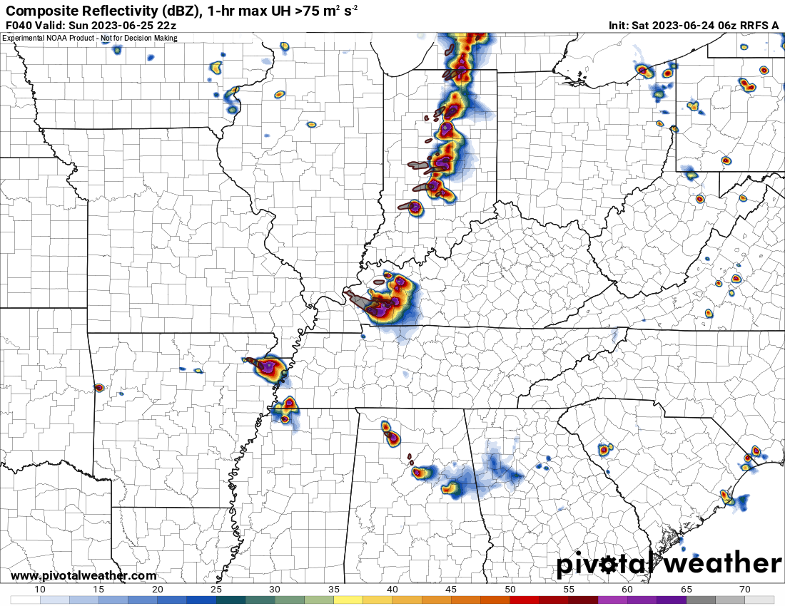
One model shows this. Scattered supercell severe thunderstorms late Sunday afternoon and evening.
4 PM Sunday. RRFS future-cast radar shows storms firing in Indiana and then trailing into Kentucky, Tennessee, Missouri, and Arkansas.
Keep in mind, this is just one model. Other models differ on how development occurs. Monitor updates.
If the storms do form, then they could produce golf ball size hail, 70+ mph wind gusts, frequent lightning, torrential rain, and even a tornado.
Stay weather aware Sunday and monitor the Beau Dodson Weather Radars and the Beau Dodson Weather App.
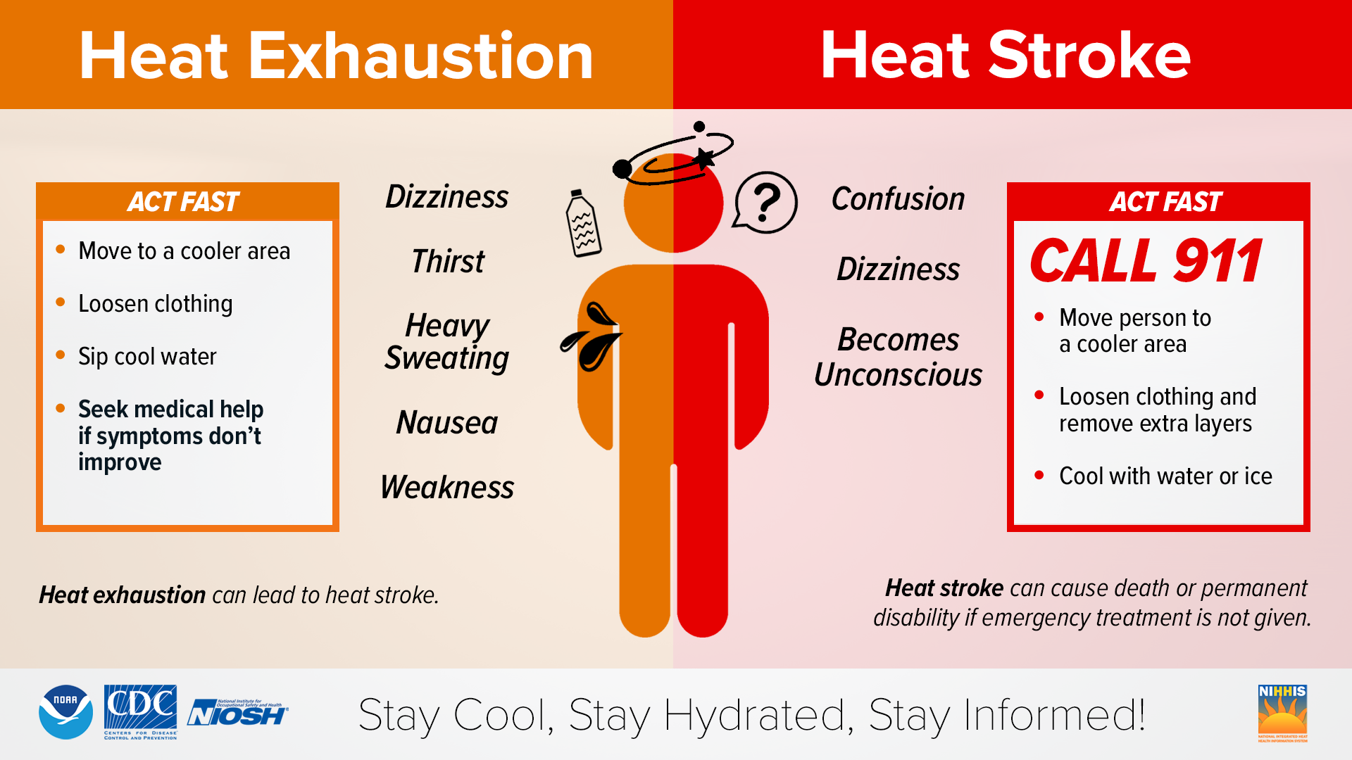
It will also be quite hot Sunday with heat index values of 100 to 110+ degrees.


