Saturday, April 15, 2023
I have a Facebook thread going, as well
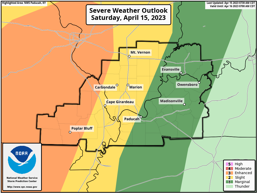
We are in a level one, two, and three risk of severe thunderstorms today and tonight. The orange is the highest risk.
Today’s Storm Prediction Center’s Severe Weather Outlook
Light green is where thunderstorms may occur but should be below severe levels.
Dark green is a level one risk. Yellow is a level two risk. Orange is a level three (enhanced) risk. Red is a level four (moderate) risk. Pink is a level five (high) risk.
One is the lowest risk. Five is the highest risk.
A severe storm is one that produces 58 mph wind or higher, quarter size hail, and/or a tornado.
A couple of showers and thunderstorms will develop this morning over southeast Missouri and spread eastward. One or two of those storms could produce hail.
If you have plans later this morning into the afternoon hours, then check out the Beau Dodson Weather radars at the bottom of this post.
The primary time-frame of concern (for severe weather) will be 5 PM to 11 PM tonight. This is when the main cold front will push a line of thunderstorms across the region.
With time, instability/CAPE (energy) will wane. That is why the risk is higher over Missouri vs areas farther to the east.
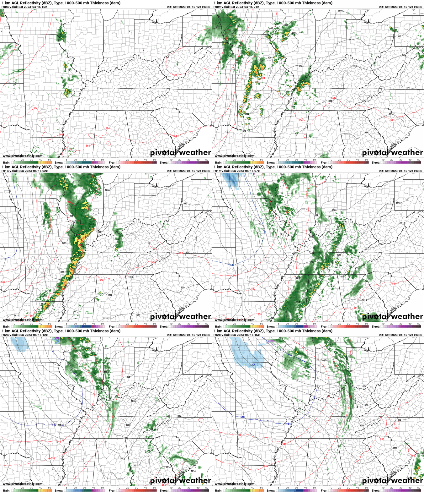
You are looking at computer model data. Meteorologists use many different models to forecast the weather.
Occasionally, these maps are in Zulu time. 12z=7 AM. 18z=1 PM. 00z=7 PM. 06z=1 AM
Green represents light rain. Dark green represents moderate rain. Yellow and orange represent heavier rain.
This animation is the Hrrr Model.
A few of tonight’s thunderstorms could produce 60 mph wind gusts, quarter to half-dollar size hail, and there is an isolated tornado risk with any bowing line segments. Short-lived (if any at all).
I will be sending out Beau Dodson Weather Talk app messages. Monitor your app.
Now a subscriber? Visit www.weathertalk.com
Rainfall amounts of 0.5 to 1.00″ are anticipated. Heavier where severe thunderstorms occur.
Overall, this is a fairly basic/common April event.
The good news is that with time, the line of storms will weaken as we push deeper into the overnight hours.
Strong and gusty winds will develop today into Sunday, as well. Some gusts around or a bit above 30 mph will be possible. Boaters use caution.
A few showers will linger into Sunday morning. Ending west to east.

Radars and Lightning Data
Interactive-city-view radars. Clickable watches and warnings.
https://wtalk.co/B3XHASFZ
If the radar is not updating then try another one. If a radar does not appear to be refreshing then hit Ctrl F5. You may also try restarting your browser.
Backup radar site in case the above one is not working.
https://weathertalk.com/morani
Regional Radar
https://imagery.weathertalk.com/prx/RadarLoop.mp4
** NEW ** Zoom radar with chaser tracking abilities!
ZoomRadar
Lightning Data (zoom in and out of your local area)
https://wtalk.co/WJ3SN5UZ
Not working? Email me at beaudodson@usawx.com
National map of weather watches and warnings. Click here.
Storm Prediction Center. Click here.
Weather Prediction Center. Click here.
.

Live lightning data: Click here.
Real time lightning data (another one) https://map.blitzortung.org/#5.02/37.95/-86.99


