
Click one of the links below to take you directly to that section
Do you have any suggestions or comments? Email me at beaudodson@usawx.com
.
.
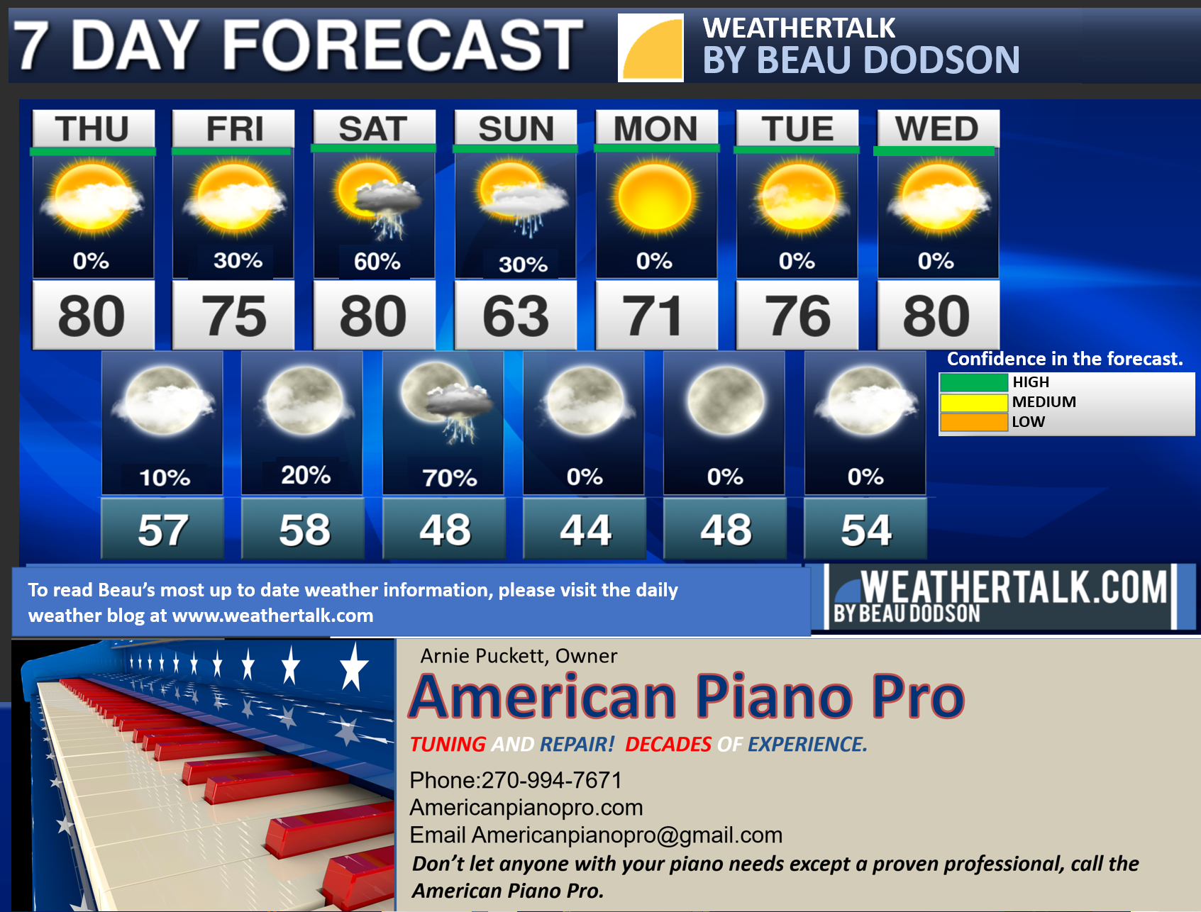
Seven-day forecast for southeast Missouri, southern Illinois, western Kentucky, and western Tennessee.
This is a BLEND for the region. Scroll down to see the region by region forecast.
THE FORECAST IS GOING TO VARY FROM LOCATION TO LOCATION. Scroll down to see the region by region forecast.
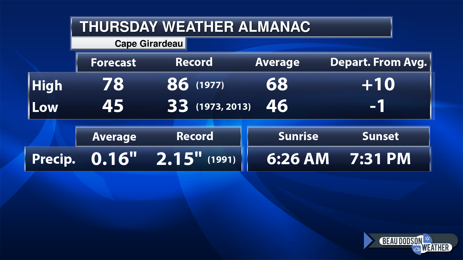
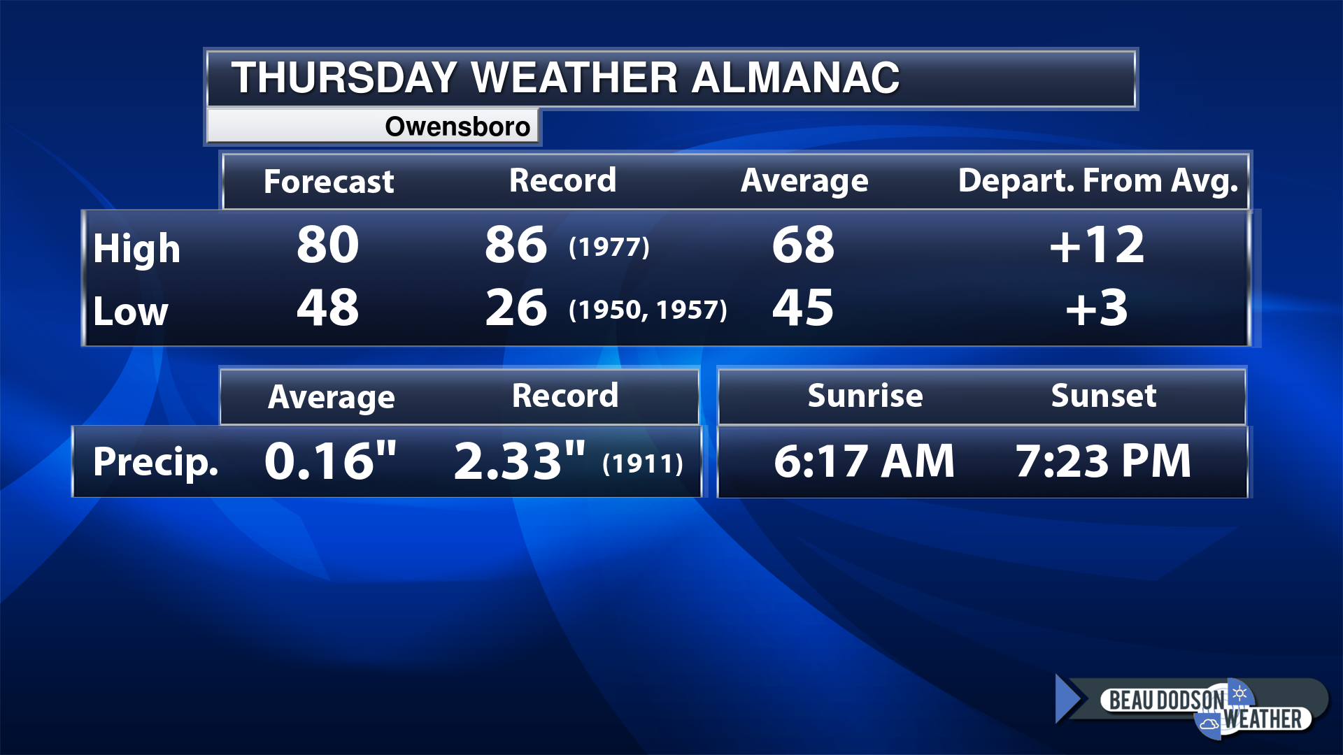
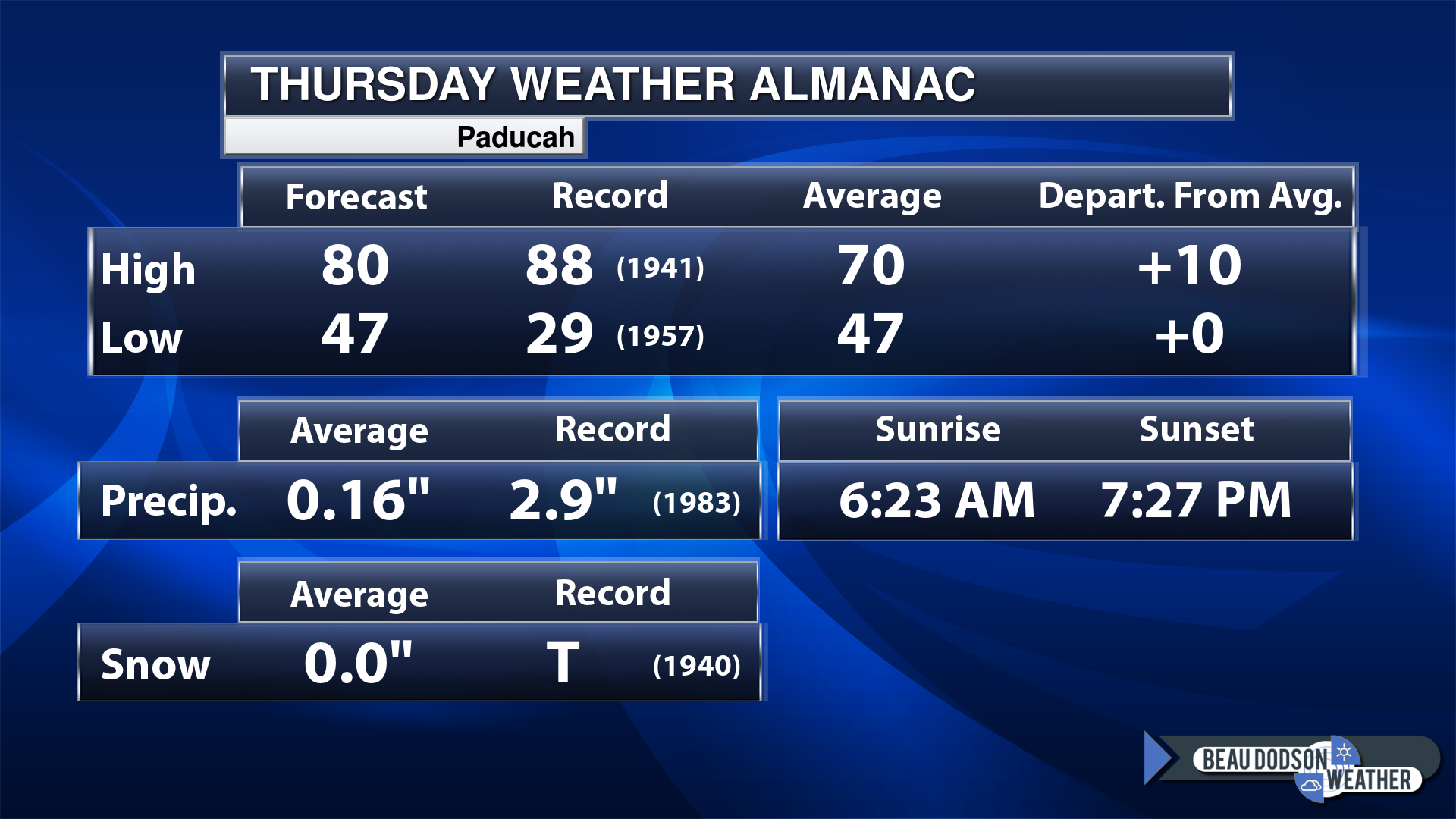
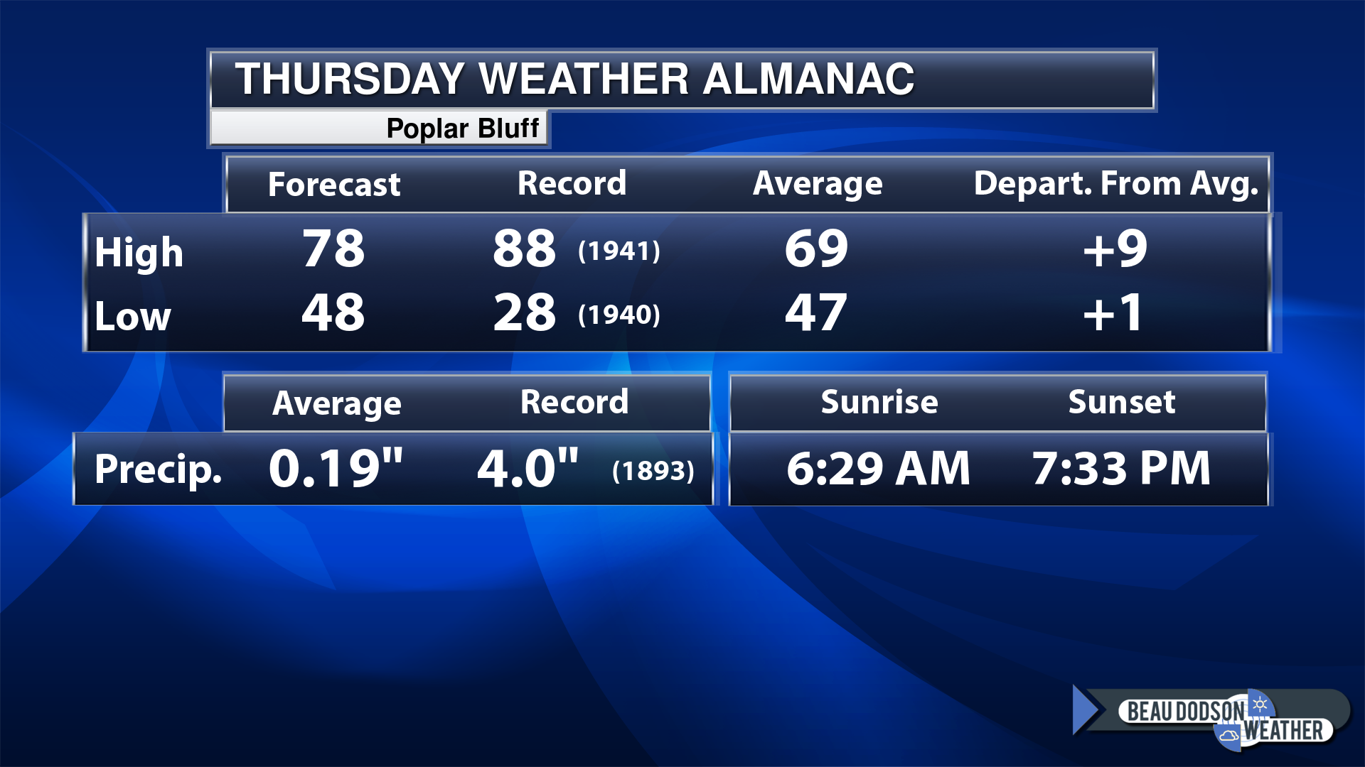
Today’s Local Almanacs (for a few select cities). Your location will be comparable.
Note, the low is this morning’s low and not tomorrows.
This shows you the forecast high. The records. The average and then the departure (how many degrees above or below average will temperatures be).
The graphic shows you what our average daily rainfall is for the day. That is not what is expected (that is the average from past years).
If you have not subscribed to my YouTube Channel then click on this link and it will take you to my videos.
Click the button below and it will take you to the Beau Dodson YouTube Channel.
48-hour forecast


.

.
Thursday to Thursday
1. Is lightning in the forecast? Yes. Friday into Saturday night.
2. Are severe thunderstorms in the forecast? Possible. A few storms could be severe Saturday afternoon and evening. For now, the overall risk is low, but not zero.
3. Is flash flooding in the forecast? No.
4. Will the heat index exceed 100 degrees? No.
5. Will the wind chill dip below 10 degrees? No.
6. Is measurable snow and/or sleet in the forecast? No.
7. Is freezing rain/ice in the forecast? No.
Freezing rain is rain that falls and instantly freezes on objects such as trees and power lines
.
Thursday, April 13, 2023
Confidence in the forecast? High Confidence
Thursday Forecast: Partly sunny. Mild.
What is the chance of precipitation?
Far northern southeast Missouri ~ 0%
Southeast Missouri ~ 0%
The Missouri Bootheel ~ 0%
I-64 Corridor of southern Illinois ~ 0%
Southern Illinois ~ 0%
Extreme southern Illinois (southern seven counties) ~ 0%
Far western Kentucky ~ 0%
The Pennyrile area of western KY ~ 0%
Northwest Kentucky (near Indiana border) ~ 0%
Northwest Tennessee ~ 0%
Coverage of precipitation:
Timing of the precipitation:
Temperature range:
Far northern southeast Missouri ~ 75° to 80°
Southeast Missouri ~ 75° to 80°
The Missouri Bootheel ~ 75° to 80°
I-64 Corridor of southern Illinois ~ 75° to 80°
Southern Illinois ~ 75° to 80°
Extreme southern Illinois (southern seven counties) ~ 75° to 80°
Far western Kentucky ~ 75° to 80°
The Pennyrile area of western KY ~ 75° to 80°
Northwest Kentucky (near Indiana border) ~ 75° to 80°
Northwest Tennessee ~ 75° to 80°
Winds will be from this direction: Southeast 6 to 12 mph
Wind chill or heat index (feels like) temperature forecast: 75° to 80°
What impacts are anticipated from the weather?
Should I cancel my outdoor plans? No
UV Index: 7. High
Sunrise: 6:24 AM
Sunset: 7:28 PM
.
Thursday night Forecast: Partly cloudy.
What is the chance of precipitation?
Far northern southeast Missouri ~ 0%
Southeast Missouri ~ 0%
The Missouri Bootheel ~ 0%
I-64 Corridor of southern Illinois ~ 0%
Southern Illinois ~ 0%
Extreme southern Illinois (southern seven counties) ~ 0%
Far western Kentucky ~ 0%
The Pennyrile area of western KY ~ 0%
Northwest Kentucky (near Indiana border) ~ 0%
Northwest Tennessee ~ 0%
Coverage of precipitation:
Timing of the precipitation:
Temperature range:
Far northern southeast Missouri ~ 53° to 56°
Southeast Missouri ~ 53° to 56°
The Missouri Bootheel ~ 53° to 56°
I-64 Corridor of southern Illinois ~ 53° to 56°
Southern Illinois ~ 53° to 56°
Extreme southern Illinois (southern seven counties) ~ 53° to 56°
Far western Kentucky ~ 53° to 56°
The Pennyrile area of western KY ~ 53° to 56°
Northwest Kentucky (near Indiana border) ~ 53° to 56°
Northwest Tennessee ~ 53° to 56°
Winds will be from this direction: Southeast 7 to 14 mph
Wind chill or heat index (feels like) temperature forecast: 53° to 56°
What impacts are anticipated from the weather?
Should I cancel my outdoor plans? No
Moonrise: 2:41 AM
Moonset: 12:06 PM
The phase of the moon: Last Quarter
.
Friday, April 14, 2023
Confidence in the forecast? High Confidence
Friday Forecast: Partly sunny. Mild. A chance of a couple of showers and thunderstorms over our eastern counties. That would mainly be over western Kentucky and Tennessee. The farther east southeast you travel the higher the chance of running into some rain.
What is the chance of precipitation?
Far northern southeast Missouri ~ 0%
Southeast Missouri ~ 0%
The Missouri Bootheel ~ 0%
I-64 Corridor of southern Illinois ~ 0%
Southern Illinois ~ 0%
Extreme southern Illinois (southern seven counties) ~ 10%
Far western Kentucky ~ 20%
The Pennyrile area of western KY ~ 40%
Northwest Kentucky (near Indiana border) ~ 20%
Northwest Tennessee ~ 30%
Coverage of precipitation: Scattered
Timing of the precipitation: After 10 AM
Temperature range:
Far northern southeast Missouri ~ 74° to 78°
Southeast Missouri ~ 74° to 78°
The Missouri Bootheel ~ 74° to 78°
I-64 Corridor of southern Illinois ~ 74° to 78°
Southern Illinois ~ 74° to 78°
Extreme southern Illinois (southern seven counties) ~ 74° to 78°
Far western Kentucky ~ 74° to 78°
The Pennyrile area of western KY ~ 74° to 78°
Northwest Kentucky (near Indiana border) ~ 74° to 78°
Northwest Tennessee ~ 74° to 78°
Winds will be from this direction: South southeast 6 to 12 mph
Wind chill or heat index (feels like) temperature forecast: 74° to 78°
What impacts are anticipated from the weather? Wet roadways. Lightning.
Should I cancel my outdoor plans? No, but check the Beau Dodson Weather Radars
UV Index: 7. High
Sunrise: 6:23 AM
Sunset: 7:29 PM
.
Friday night Forecast: Partly cloudy. A slight chance of an evening shower or thunderstorm over Kentucky and Tennessee.
What is the chance of precipitation?
Far northern southeast Missouri ~ 0%
Southeast Missouri ~ 0%
The Missouri Bootheel ~ 0%
I-64 Corridor of southern Illinois ~ 0%
Southern Illinois ~ 0%
Extreme southern Illinois (southern seven counties) ~ 0%
Far western Kentucky ~ 10%
The Pennyrile area of western KY ~ 20%
Northwest Kentucky (near Indiana border) ~ 20%
Northwest Tennessee ~ 20%
Coverage of precipitation: Isolated
Timing of the precipitation: Before midnight
Temperature range:
Far northern southeast Missouri ~ 54° to 58°
Southeast Missouri ~ 54° to 58°
The Missouri Bootheel ~ 54° to 58°
I-64 Corridor of southern Illinois ~ 54° to 58°
Southern Illinois ~ 54° to 58°
Extreme southern Illinois (southern seven counties) ~ 54° to 58°
Far western Kentucky ~ 54° to 58°
The Pennyrile area of western KY ~ 54° to 58°
Northwest Kentucky (near Indiana border) ~ 54° to 58°
Northwest Tennessee ~ 54° to 58°
Winds will be from this direction: South southeast 7 to 14 mph
Wind chill or heat index (feels like) temperature forecast: 54° to 58°
What impacts are anticipated from the weather? Wet roadways. Lightning.
Should I cancel my outdoor plans? No, but check the Beau Dodson Weather Radars
Moonrise: 3:28 AM
Moonset: 1:19 PM
The phase of the moon: Waning Crescent
.
Saturday, April 15, 2023
Confidence in the forecast? High Confidence
Saturday Forecast: Thickening clouds. A chance of showers and thunderstorms.
What is the chance of precipitation?
Far northern southeast Missouri ~ 60%
Southeast Missouri ~ 60%
The Missouri Bootheel ~ 60%
I-64 Corridor of southern Illinois ~ 60%
Southern Illinois ~ 60%
Extreme southern Illinois (southern seven counties) ~ 60%
Far western Kentucky ~ 60%
The Pennyrile area of western KY ~ 60%
Northwest Kentucky (near Indiana border) ~ 60%
Northwest Tennessee ~ 60%
Coverage of precipitation: Scattered
Timing of the precipitation: After 10 AM
Temperature range:
Far northern southeast Missouri ~ 74° to 78°
Southeast Missouri ~ 74° to 78°
The Missouri Bootheel ~ 74° to 78°
I-64 Corridor of southern Illinois ~ 74° to 78°
Southern Illinois ~ 74° to 78°
Extreme southern Illinois (southern seven counties) ~ 74° to 78°
Far western Kentucky ~ 74° to 78°
The Pennyrile area of western KY ~ 74° to 78°
Northwest Kentucky (near Indiana border) ~ 74° to 78°
Northwest Tennessee ~ 74° to 78°
Winds will be from this direction: South 10 to 20 mph
Wind chill or heat index (feels like) temperature forecast: 74° to 78°
What impacts are anticipated from the weather? Wet roadways. Lightning. Monitor updates concerning a few severe thunderstorms.
Should I cancel my outdoor plans? No, but check the Beau Dodson Weather Radars
UV Index: 7. High
Sunrise: 6:21 AM
Sunset: 7:30 PM
.
Saturday night Forecast: Mostly cloudy with showers and thunderstorms likely.
What is the chance of precipitation?
Far northern southeast Missouri ~ 60%
Southeast Missouri ~ 60%
The Missouri Bootheel ~ 70%
I-64 Corridor of southern Illinois ~ 60%
Southern Illinois ~ 60%
Extreme southern Illinois (southern seven counties) ~ 70%
Far western Kentucky ~ 70%
The Pennyrile area of western KY ~ 60%
Northwest Kentucky (near Indiana border) ~ 70%
Northwest Tennessee ~ 70%
Coverage of precipitation: Numerous
Timing of the precipitation: Any given point of time but more numerous before 2 AM.
Temperature range:
Far northern southeast Missouri ~45° to 50°
Southeast Missouri ~ 46° to 52°
The Missouri Bootheel ~ 50° to 55°
I-64 Corridor of southern Illinois ~ 45° to 50°
Southern Illinois ~ 46° to 52°
Extreme southern Illinois (southern seven counties) ~ 50° to 55°
Far western Kentucky ~ 50° to 55°
The Pennyrile area of western KY ~ 50° to 55°
Northwest Kentucky (near Indiana border) ~ 50° to 55°
Northwest Tennessee ~ 50° to 55°
Winds will be from this direction: South southwest 10 to 20 mph
Wind chill or heat index (feels like) temperature forecast: 45° to 52°
What impacts are anticipated from the weather? Wet roadways. Lightning. A few of the thunderstorms could be intense.
Should I cancel my outdoor plans? No, but check the Beau Dodson Weather Radars
Moonrise: 4:07 AM
Moonset: 2:34 PM
The phase of the moon: Waning Crescent
Click here if you would like to return to the top of the page.
-
- Increasing thunderstorm chances.
- Warm/mild.
- Cooler behind the weekend cold front. Briefly.
Weather advice:
As we prepare for spring, let’s make sure you have three to five ways of receiving your severe weather information.
.
Forecast Discussion
Good day, everyone. I hope you are having a nice week.
The weather has been simply amazing. Nothing to complain about! Great temperatures. Lots of sunshine.
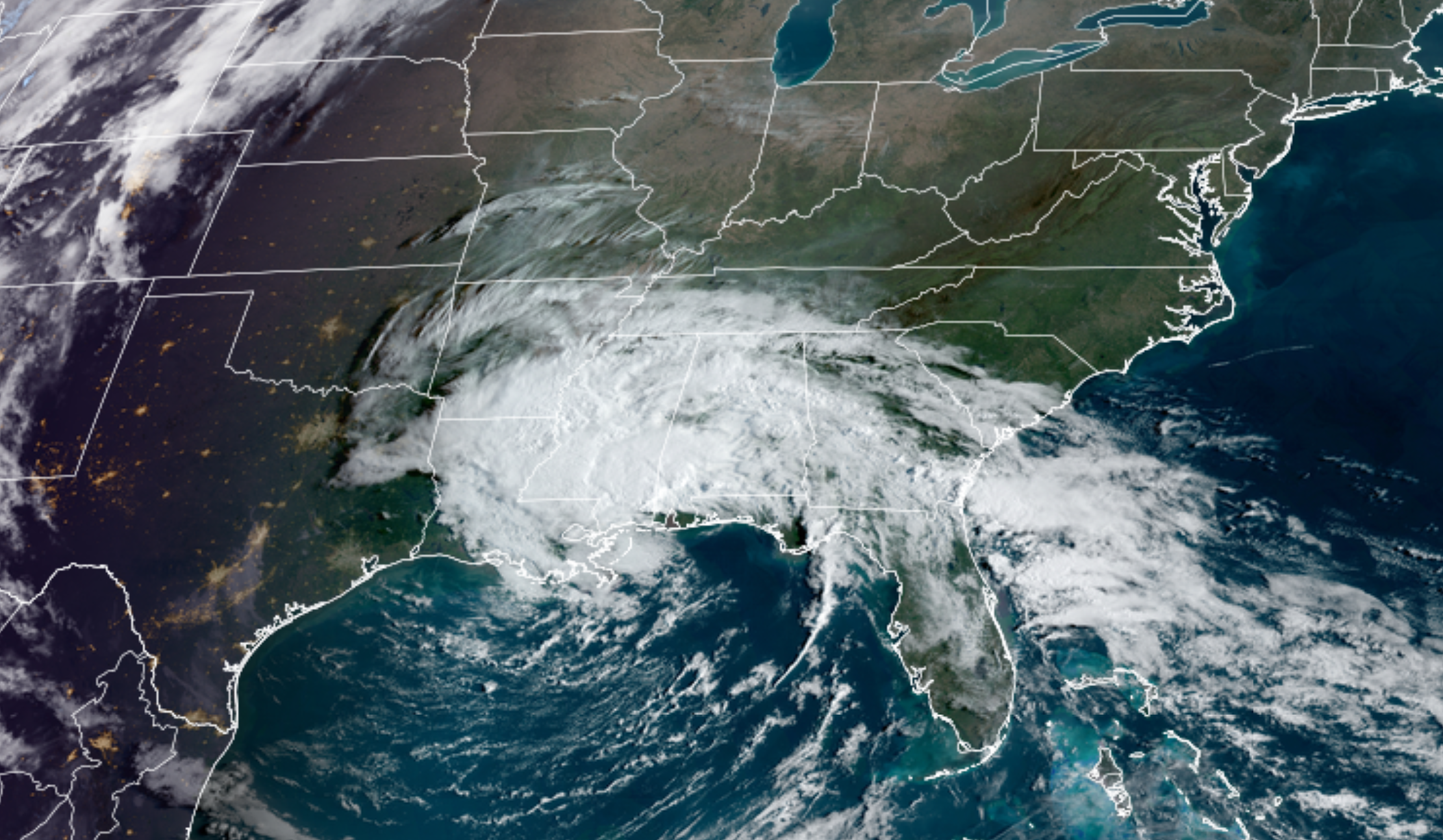
The nice weather will continue today. There will be some increase in high clouds as the area of low pressure, out over the Gulf of Mexico, begins to lift northeast.
This system brought more than 25 inches of rain to Fort Lauderdale, Florida. Busting there old record by more than ten inches. Just incredible. Widespread flooding was the end result.
Here is what it looks like on satellite
Thankfully, we will not be dealing with anything of that sort.
The low pressure center will push into the Tennessee Valley Friday and Friday night. That will bring increasing clouds to our region. A few showers and thunderstorms may dot radar over Kentucky and Tennessee. It is unlikely that Missouri and Illinois experience rain from tomorrow’s event. I will keep an eye on extreme southeast Illinois.
The chances are higher the farther south and east you travel.
That system will pull away form our region Friday night. It won’t be lingering.
A new system will develop over Iowa Friday night into Saturday. This area of low pressure will then push into the Great Lakes. A trailing cold front will sweep across our region Saturday afternoon into Sunday morning.
This front will be accompanied by showers and thunderstorms.
There should be just enough instability for a few of the thunderstorms to become severe with damaging wind and large hail. Some of the hail could be larger than quarters, especially over Missouri.
The tornado risk appears low, but one can’t ever rule out a brief tornado when we have severe thunderstorms in the region.
We are not looking at a tornado outbreak or long-tracked supercell tornadoes.
The primary concern will be late Saturday afternoon into the first half of Saturday night. This is when the ingredients come together for a few of the thunderstorms to become severe.
Monitor your Beau Dodson Weather Talk app for updates.
Rainfall totals of 0.25″ to 0.50″ are anticipated from this event. Locally higher in severe thunderstorms.
That system will pull away from the region Sunday morning. Perhaps a few lingering showers and thunderstorms over our eastern counties the first half of the day. The bulk of the rain should be on its way out.
That will leave Sunday with some clouds and somewhat cooler temperatures behind the cold front.
Dry conditions are anticipated Monday and Tuesday. Perhaps Wednesday. I am watching another chance of showers and thunderstorms late next week.
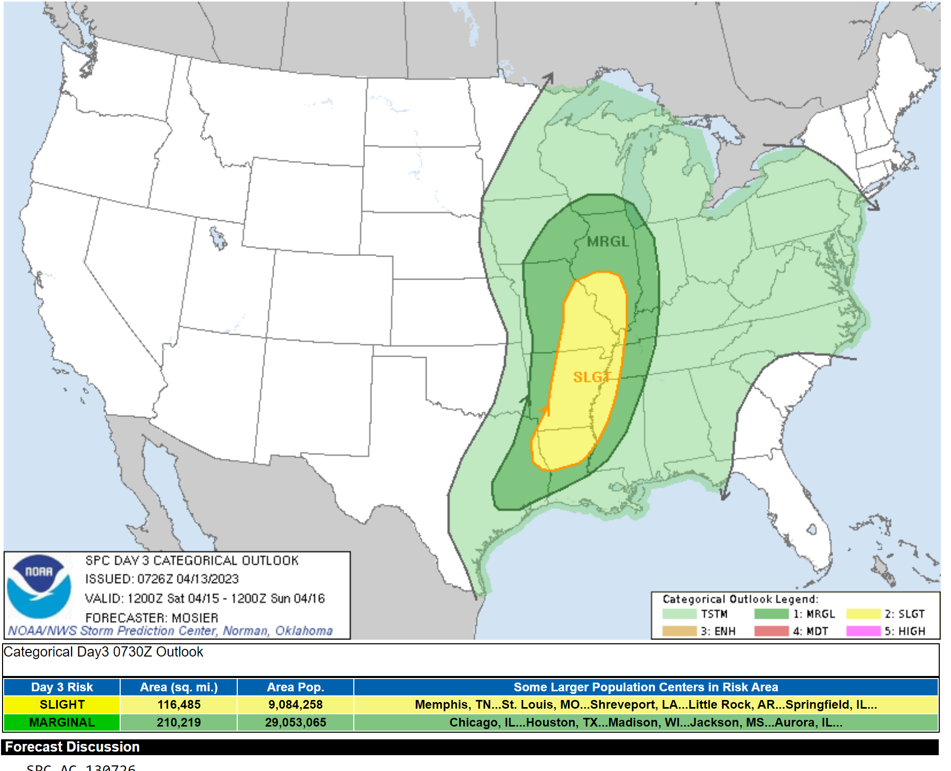
The Storm Prediction Center has outlined us in a low end risk of severe weather Saturday.
Saturday’s outlook
Dark green is a marginal level 1 risk. Yellow is a slight risk/level 2 risk.
.
Click here if you would like to return to the top of the page.
This outlook covers southeast Missouri, southern Illinois, western Kentucky, and far northwest Tennessee.
Today through April 18th: A couple of the Saturday thunderstorms could produce damaging wind and hail. There is a low-end severe weather risk Saturday.
.
Today’s Storm Prediction Center’s Severe Weather Outlook
Light green is where thunderstorms may occur but should be below severe levels.
Dark green is a level one risk. Yellow is a level two risk. Orange is a level three (enhanced) risk. Red is a level four (moderate) risk. Pink is a level five (high) risk.
One is the lowest risk. Five is the highest risk.
A severe storm is one that produces 58 mph wind or higher, quarter size hail, and/or a tornado.
Explanation of tables. Click here.

.
Tornado Probability Outlook

.
Large Hail Probability Outlook

.
High wind Probability Outlook

.
Tomorrow’s severe weather outlook.

.
Day Three Severe Weather Outlook

.

.
The images below are from NOAA’s Weather Prediction Center.
24-hour precipitation outlook..
 .
.
.
48-hour precipitation outlook.
. .
.
![]()
_______________________________________
.

Click here if you would like to return to the top of the page.
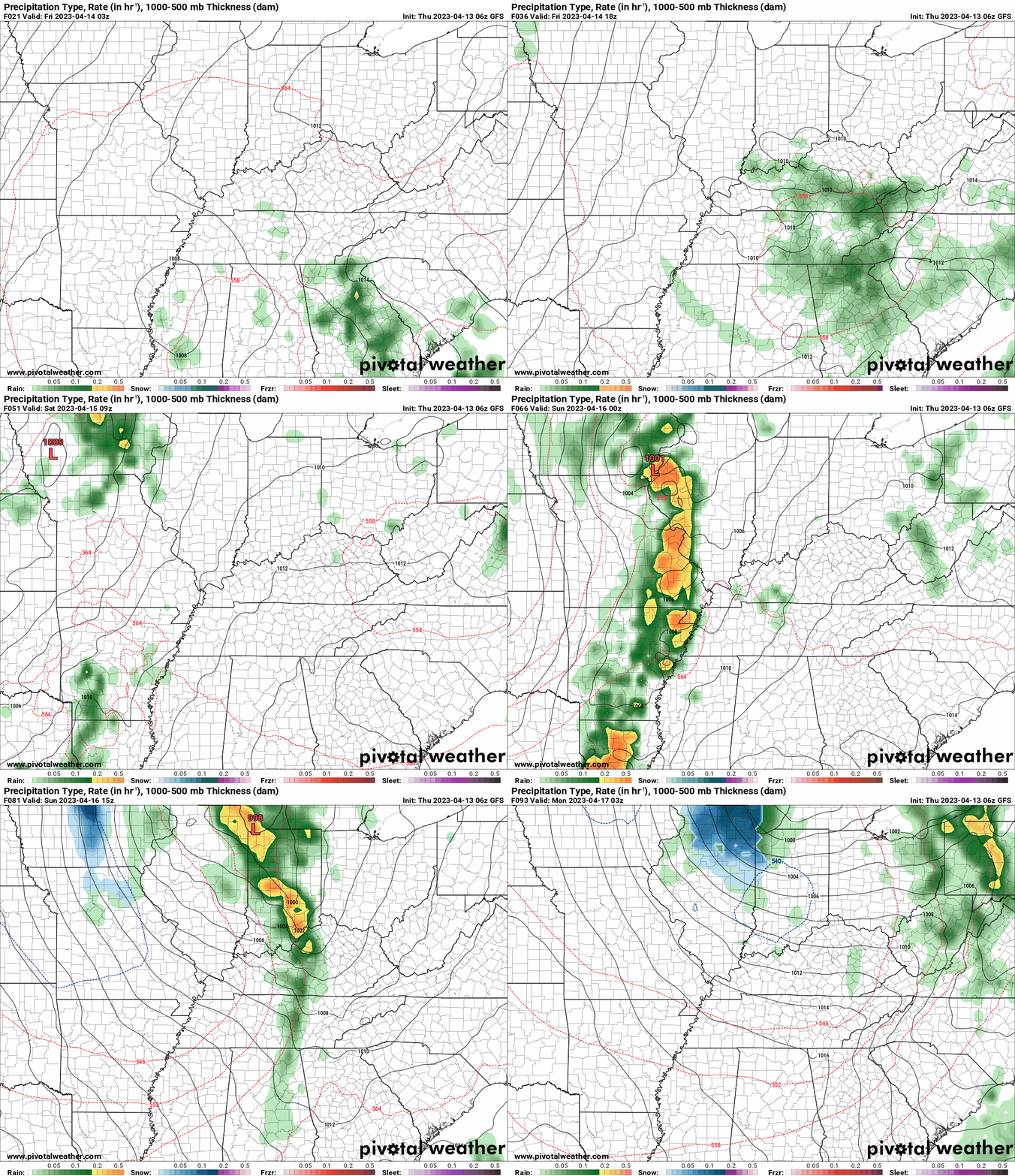
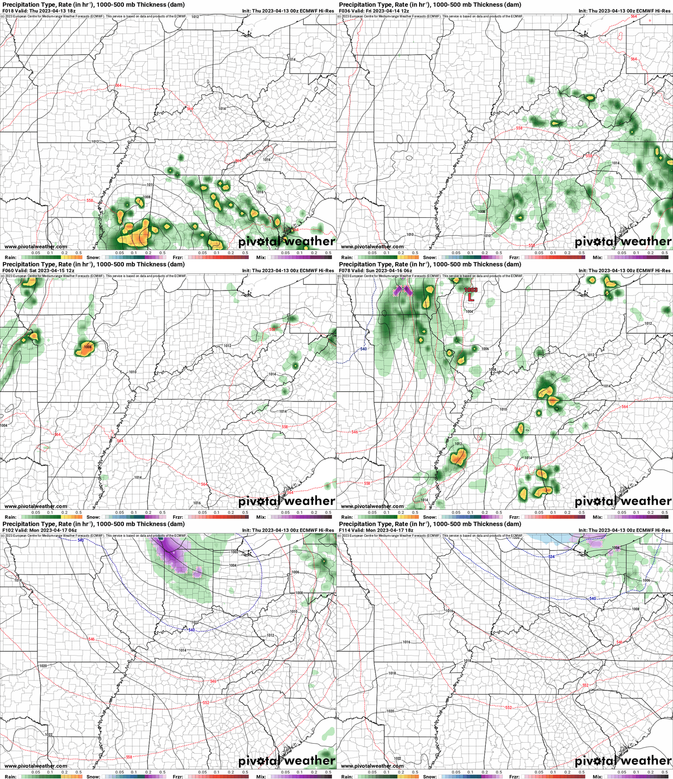
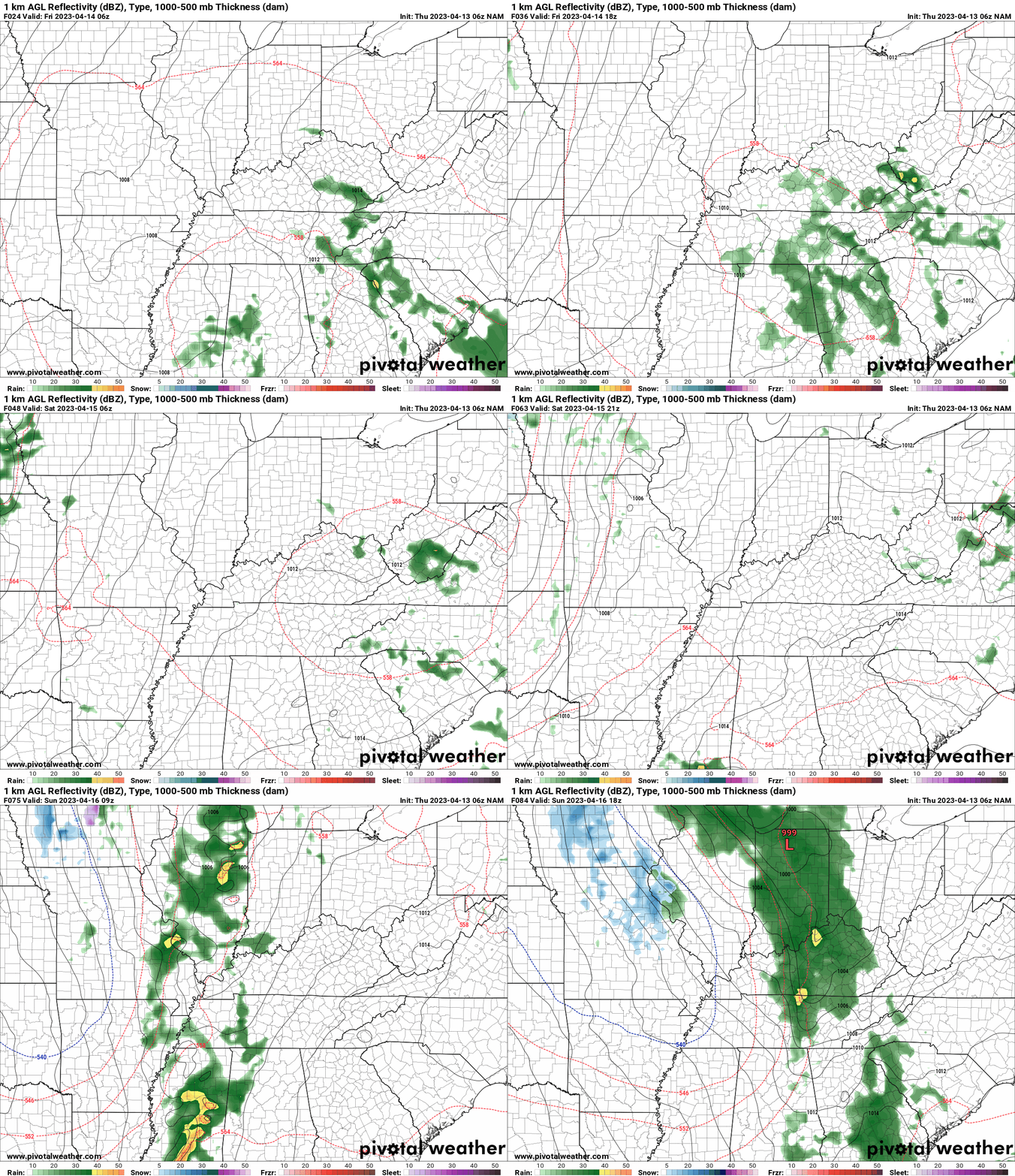
Again, as a reminder, these are models. They are never 100% accurate. Take the general idea from them.
What should I take from these?
- The general idea and not specifics. Models usually do well with the generalities.
- The time-stamp is located in the upper left corner.
.
What am I looking at?
You are looking at computer model data. Meteorologists use many different models to forecast the weather.
Occasionally, these maps are in Zulu time. 12z=7 AM. 18z=1 PM. 00z=7 PM. 06z=1 AM
Green represents light rain. Dark green represents moderate rain. Yellow and orange represent heavier rain.
This animation is the GFS Model.
This animation is the EC Model.
.
This animation is the NAM Model.
Occasionally, these maps are in Zulu time. 12z=7 AM. 18z=1 PM. 00z=7 PM. 06z=1 AM
.
..![]()

.
Click here if you would like to return to the top of the page.
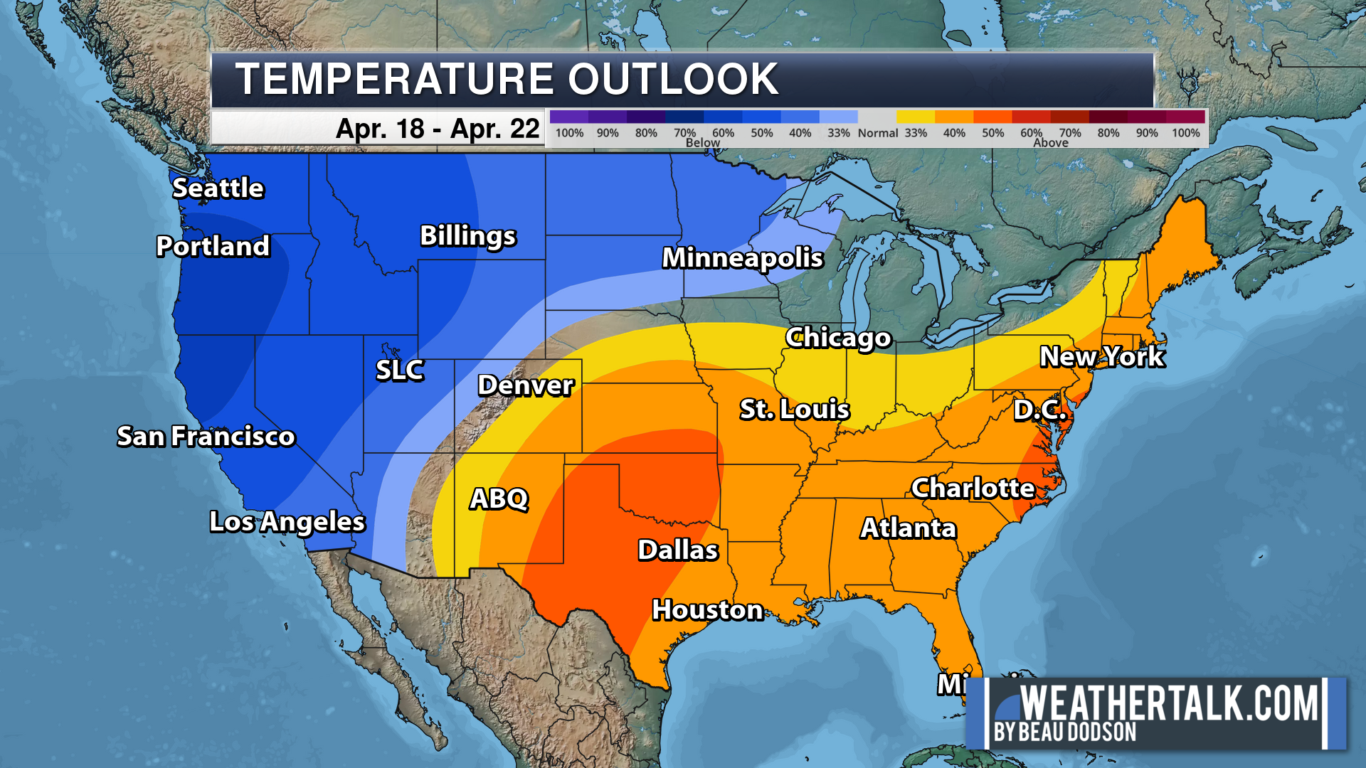
.Average high temperatures for this time of the year are around 65 degrees.
Average low temperatures for this time of the year are around 45 degrees.
Average precipitation during this time period ranges from 0.80″ to 1.00″
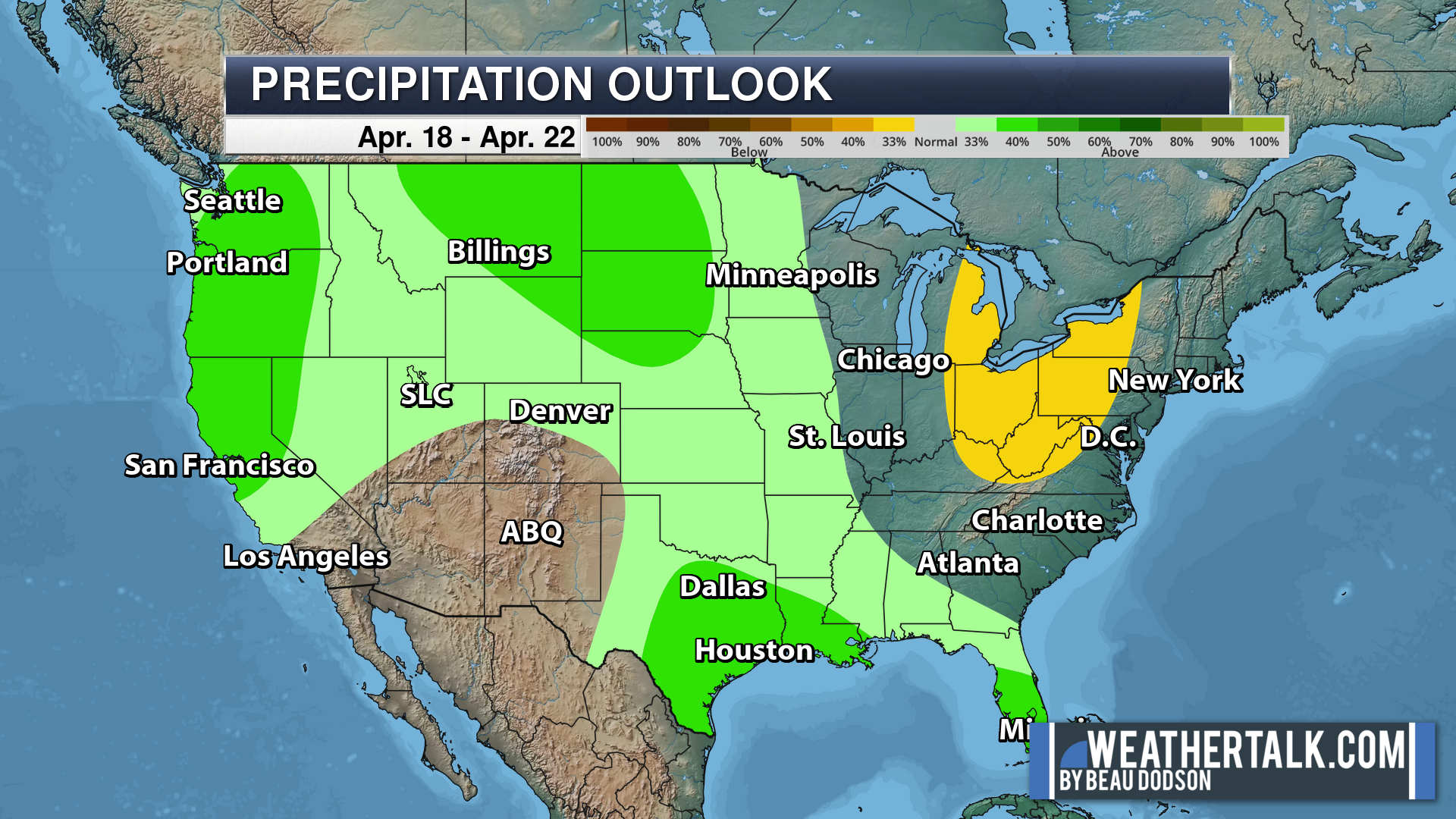
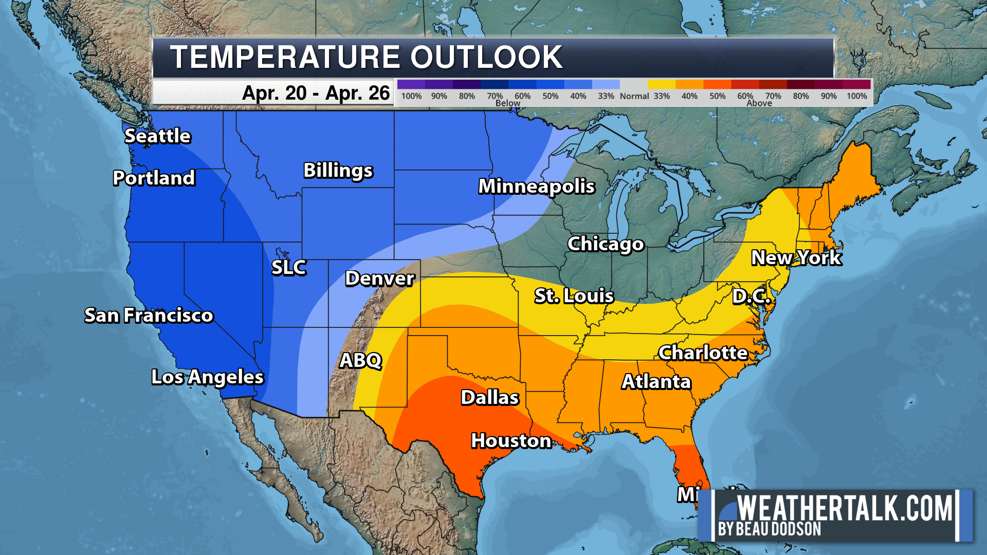
Six to Ten Day Outlook.
Blue is below average. Red is above average. The no color zone represents equal chances.
Average highs for this time of the year are in the lower 60s. Average lows for this time of the year are in the lower 40s.
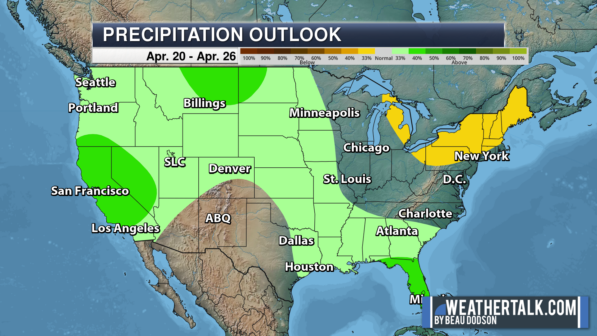
Green is above average precipitation. Yellow and brown favors below average precipitation. Average precipitation for this time of the year is around one inch per week.
.

Average low temperatures for this time of the year are around 45 degrees.
Average precipitation during this time period ranges from 0.80″ to 1.00″
.
.
![]()
The app is for subscribers. Subscribe at www.weathertalk.com/welcome then go to your app store and search for WeatherTalk
Subscribers, PLEASE USE THE APP. ATT and Verizon are not reliable during severe weather. They are delaying text messages.
The app is under WeatherTalk in the app store.
Apple users click here
Android users click here
.

Radars and Lightning Data
Interactive-city-view radars. Clickable watches and warnings.
https://wtalk.co/B3XHASFZ
If the radar is not updating then try another one. If a radar does not appear to be refreshing then hit Ctrl F5. You may also try restarting your browser.
Backup radar site in case the above one is not working.
https://weathertalk.com/morani
Regional Radar
https://imagery.weathertalk.com/prx/RadarLoop.mp4
** NEW ** Zoom radar with chaser tracking abilities!
ZoomRadar
Lightning Data (zoom in and out of your local area)
https://wtalk.co/WJ3SN5UZ
Not working? Email me at beaudodson@usawx.com
National map of weather watches and warnings. Click here.
Storm Prediction Center. Click here.
Weather Prediction Center. Click here.
.

Live lightning data: Click here.
Real time lightning data (another one) https://map.blitzortung.org/#5.02/37.95/-86.99
Our new Zoom radar with storm chases
.
.

Interactive GOES R satellite. Track clouds. Click here.
GOES 16 slider tool. Click here.
College of DuPage satellites. Click here
.

Here are the latest local river stage forecast numbers Click Here.
Here are the latest lake stage forecast numbers for Kentucky Lake and Lake Barkley Click Here.
.
.
Find Beau on Facebook! Click the banner.







 .
.