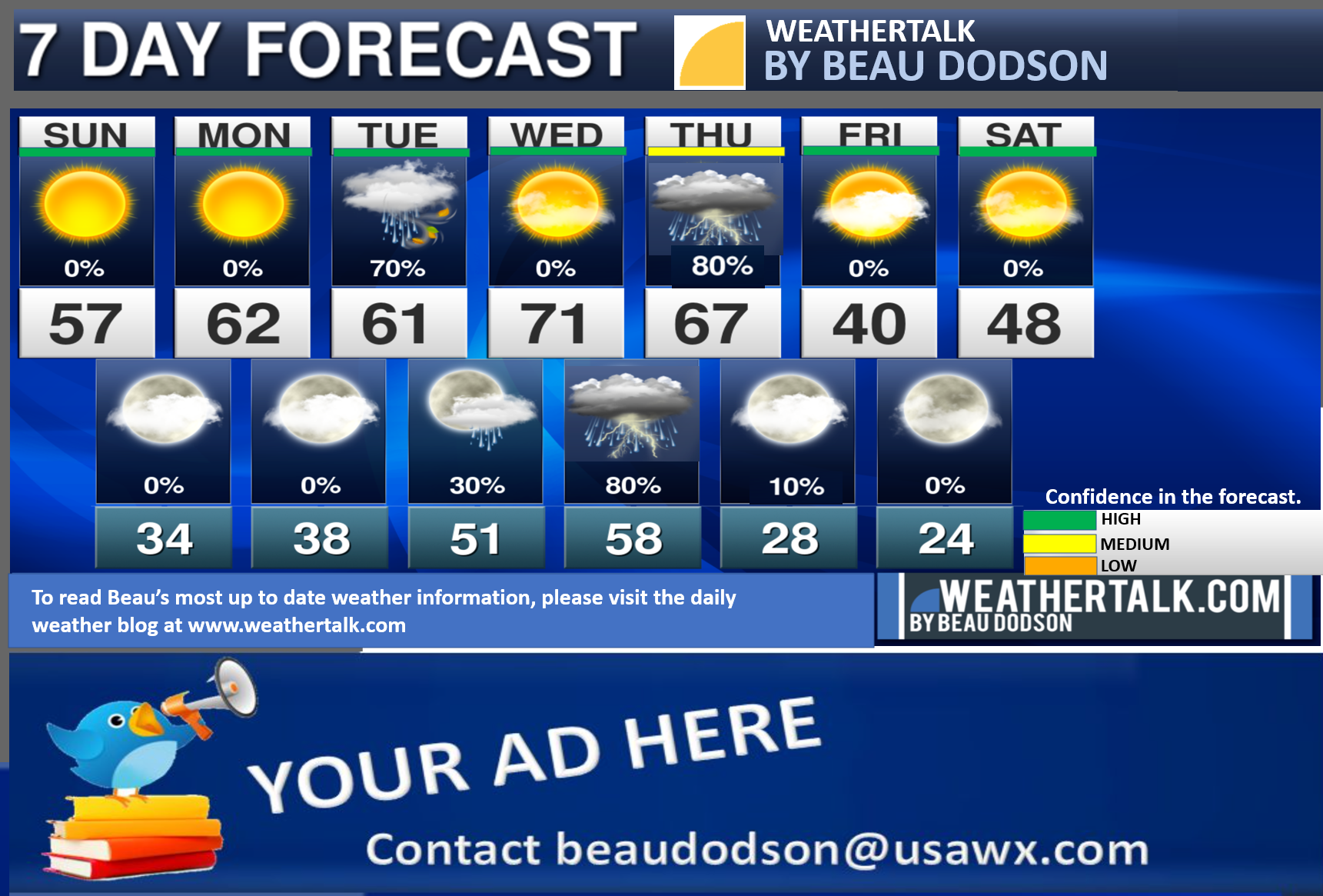
Seven-day forecast for southeast Missouri, southern Illinois, western Kentucky, and western Tennessee.
This is a BLEND for the region. Scroll down to see the region by region forecast.
THE FORECAST IS GOING TO VARY FROM LOCATION TO LOCATION. Scroll down to see the region by region forecast.
Rain chances ramp up Tuesday and Wednesday night into Thursday.
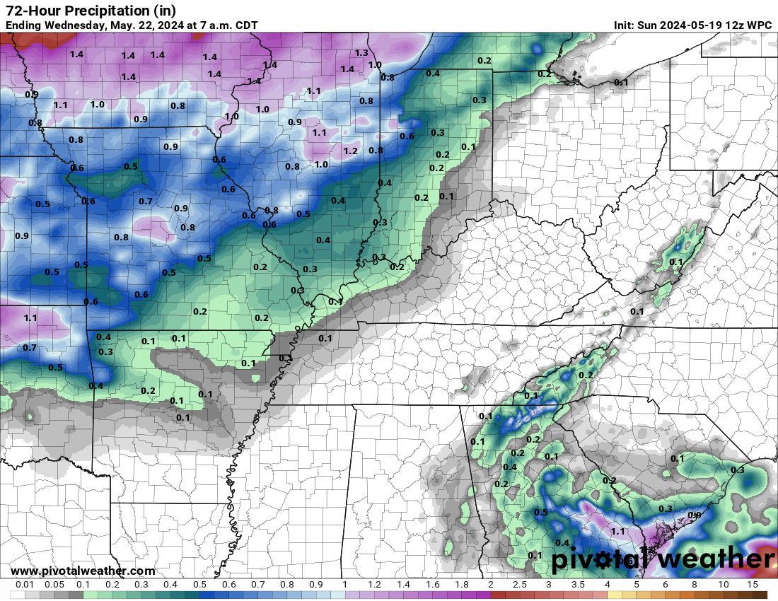
Rain totals Tuesday will range from a trace to 0.30″. Rain totals Wednesday night into Thursday will range from 0.6 to 1.2″. Locally higher totals are possible where thunderstorms occur.
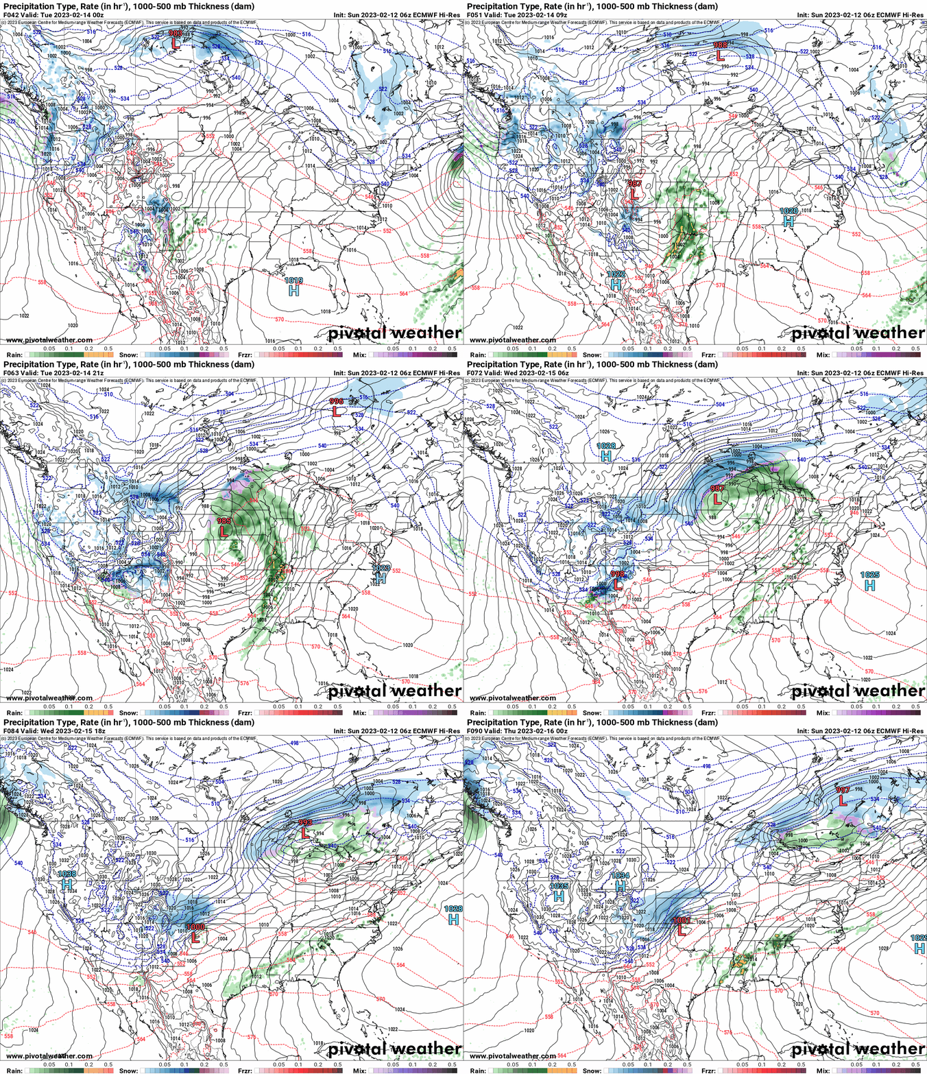
Here is the EC model showing the Tuesday and Wednesday storm systems.
Too early to know if severe storms will threaten. It is possible.
My two minute weather video update
Beau’s AM Weather. Longer version.
If you have not subscribed to my YouTube Channel then click on this link and it will take you to my videos.
Click the button below and it will take you to the Beau Dodson YouTube Channel.
48-hour forecast


.

.
The images below are from NOAA’s Weather Prediction Center.
24-hour precipitation outlook..
 .
.
.
48-hour precipitation outlook.
.
.
72-hour precipitation outlook.
.
.


