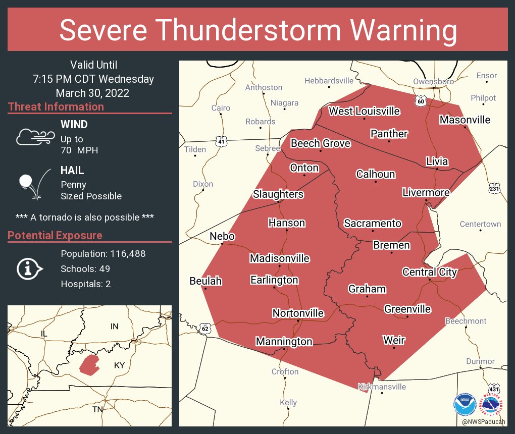
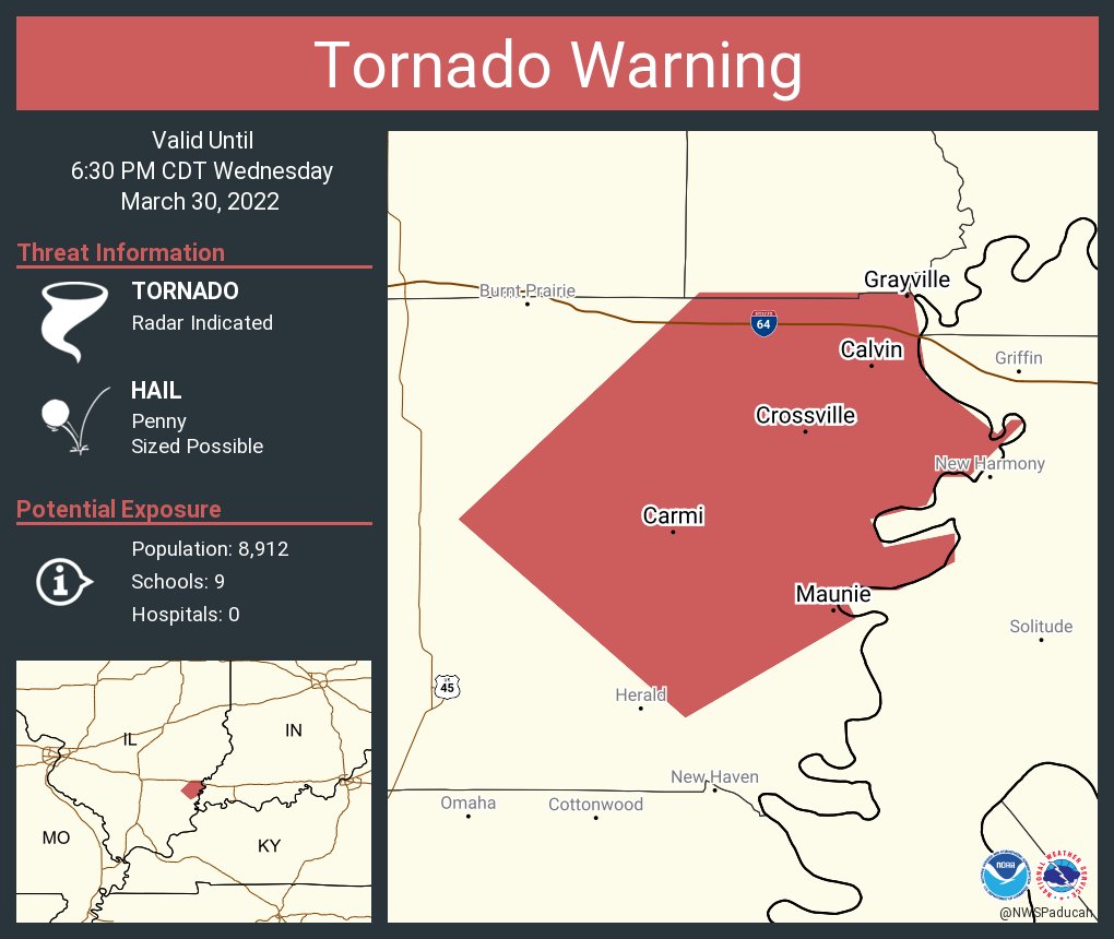
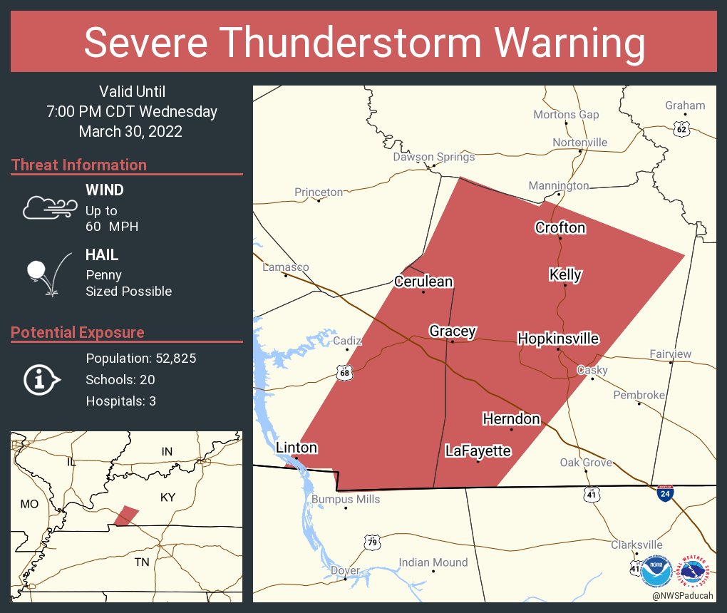
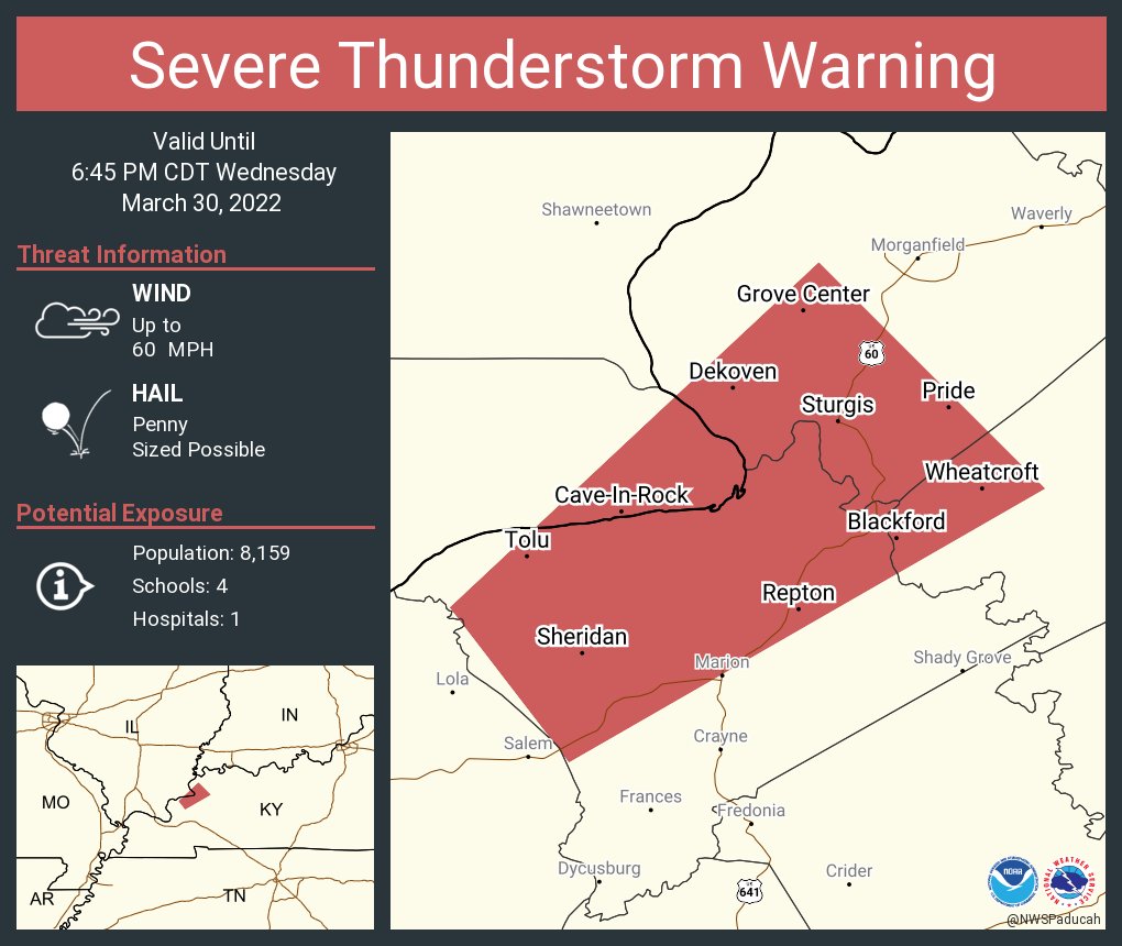
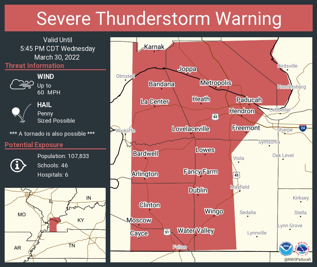
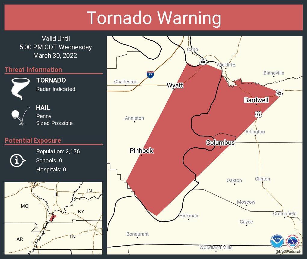
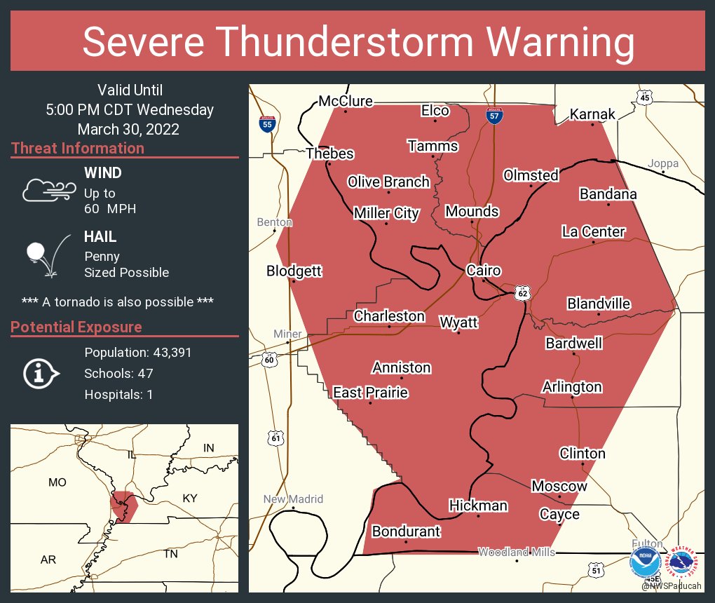
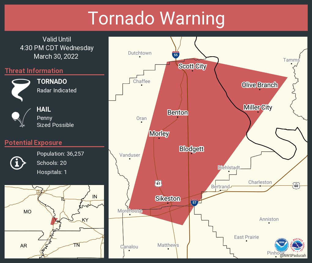
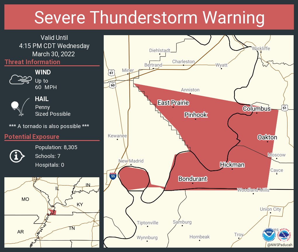
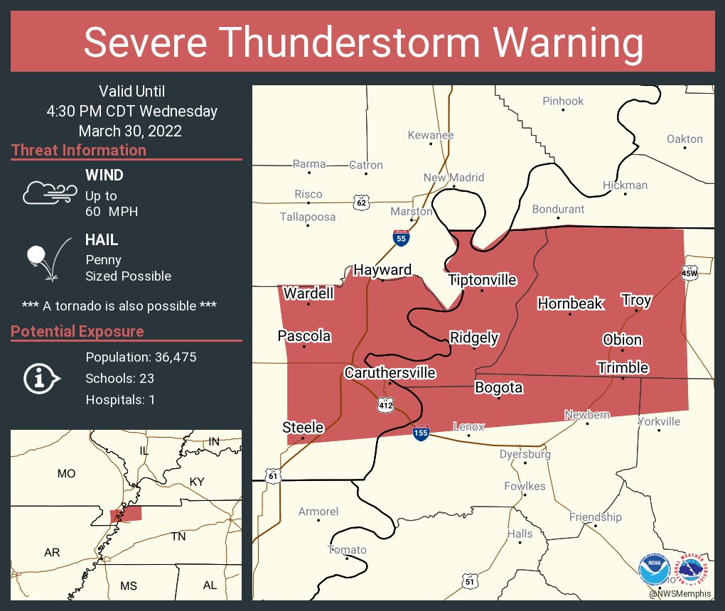
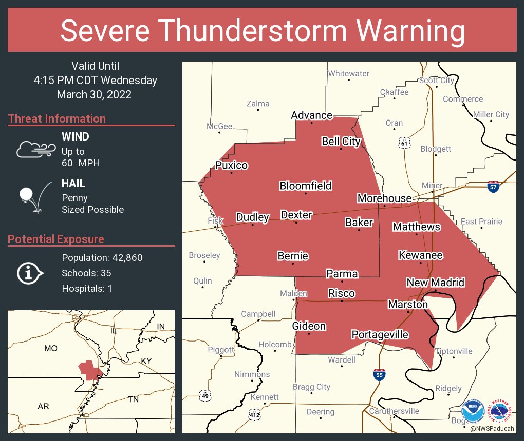
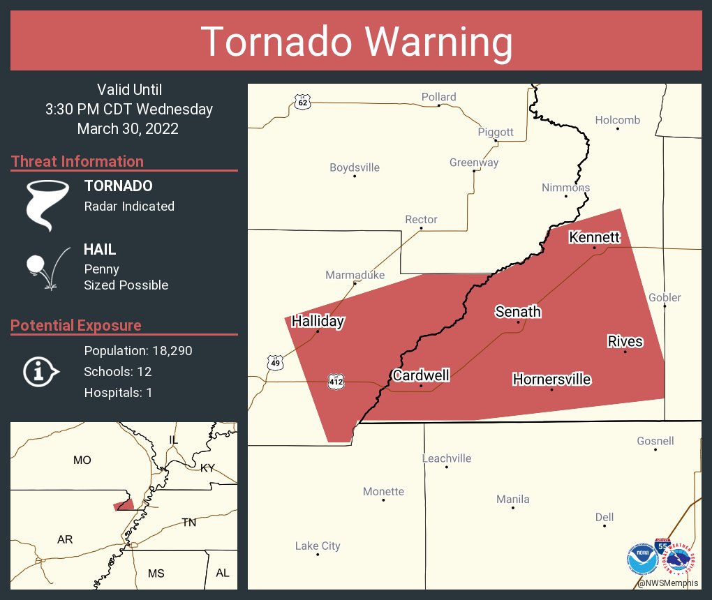
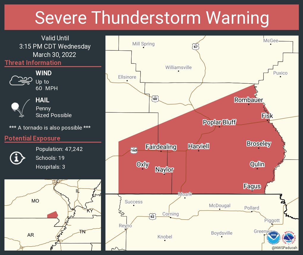
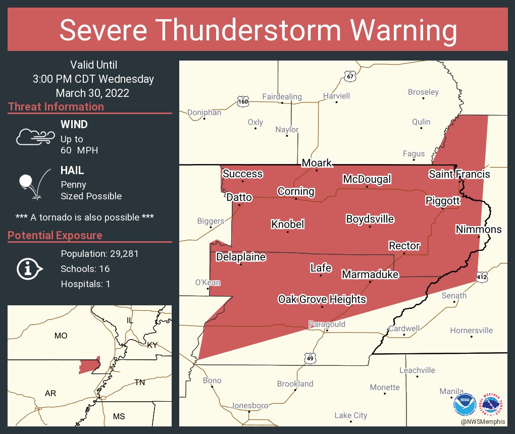
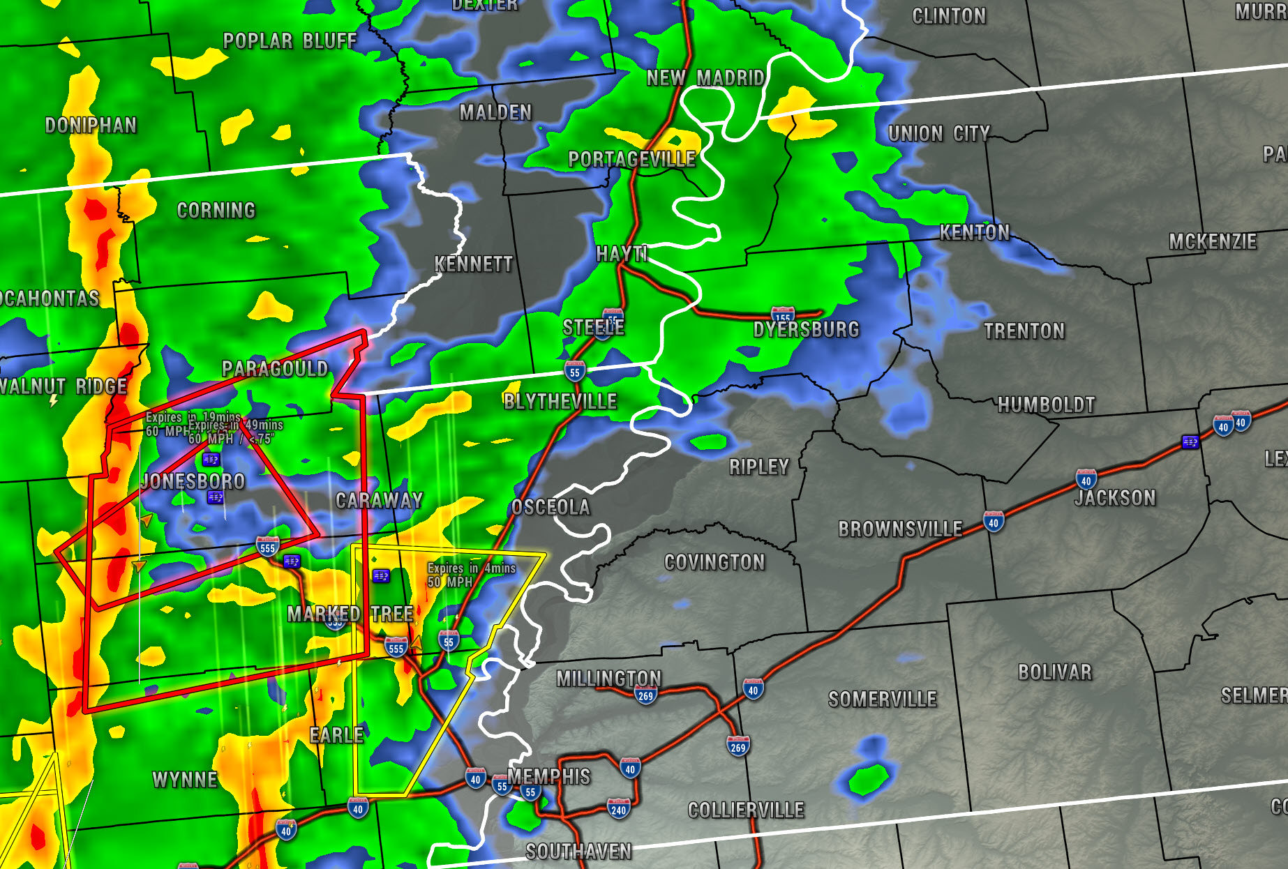
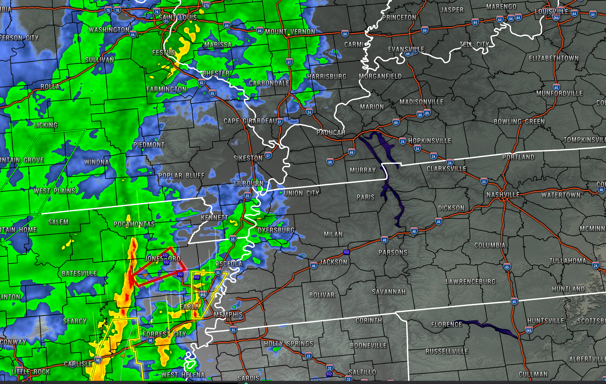
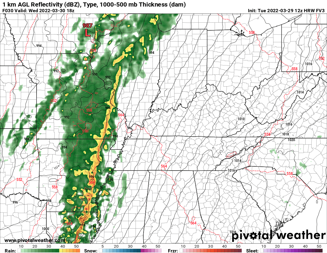
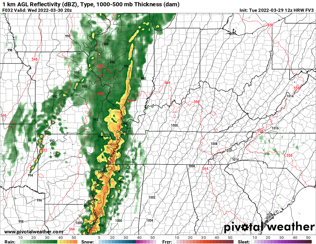
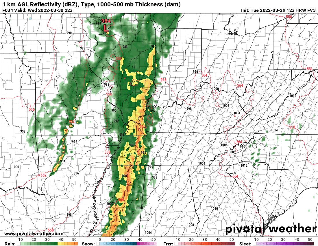
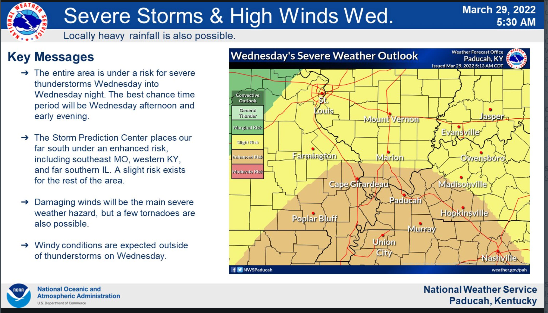
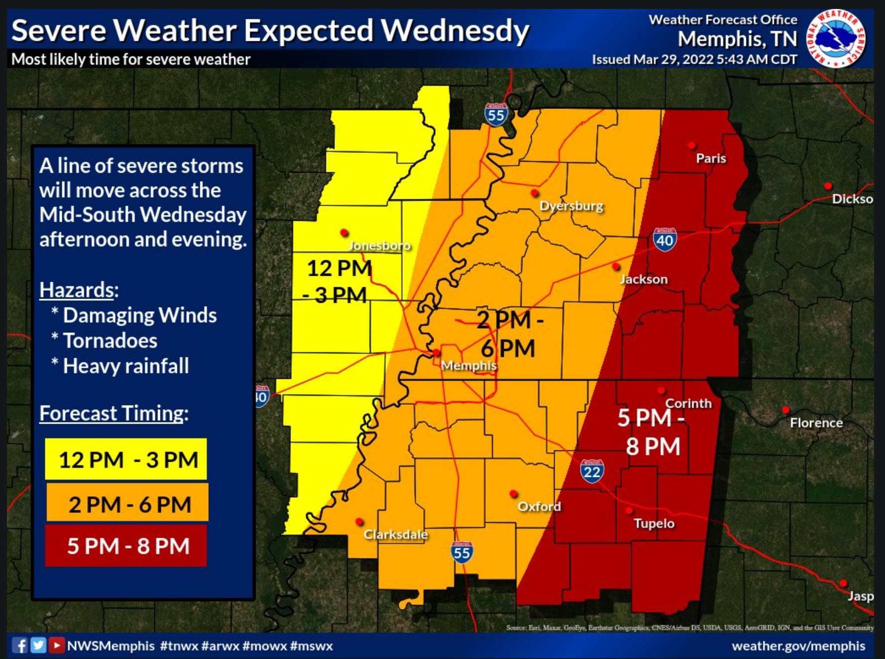
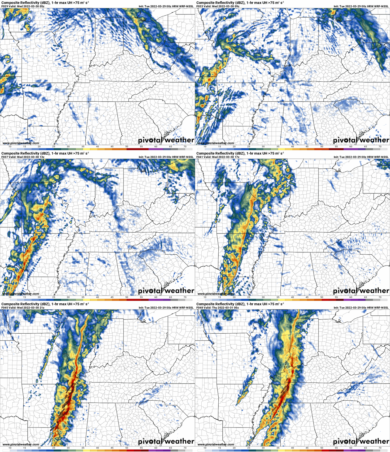
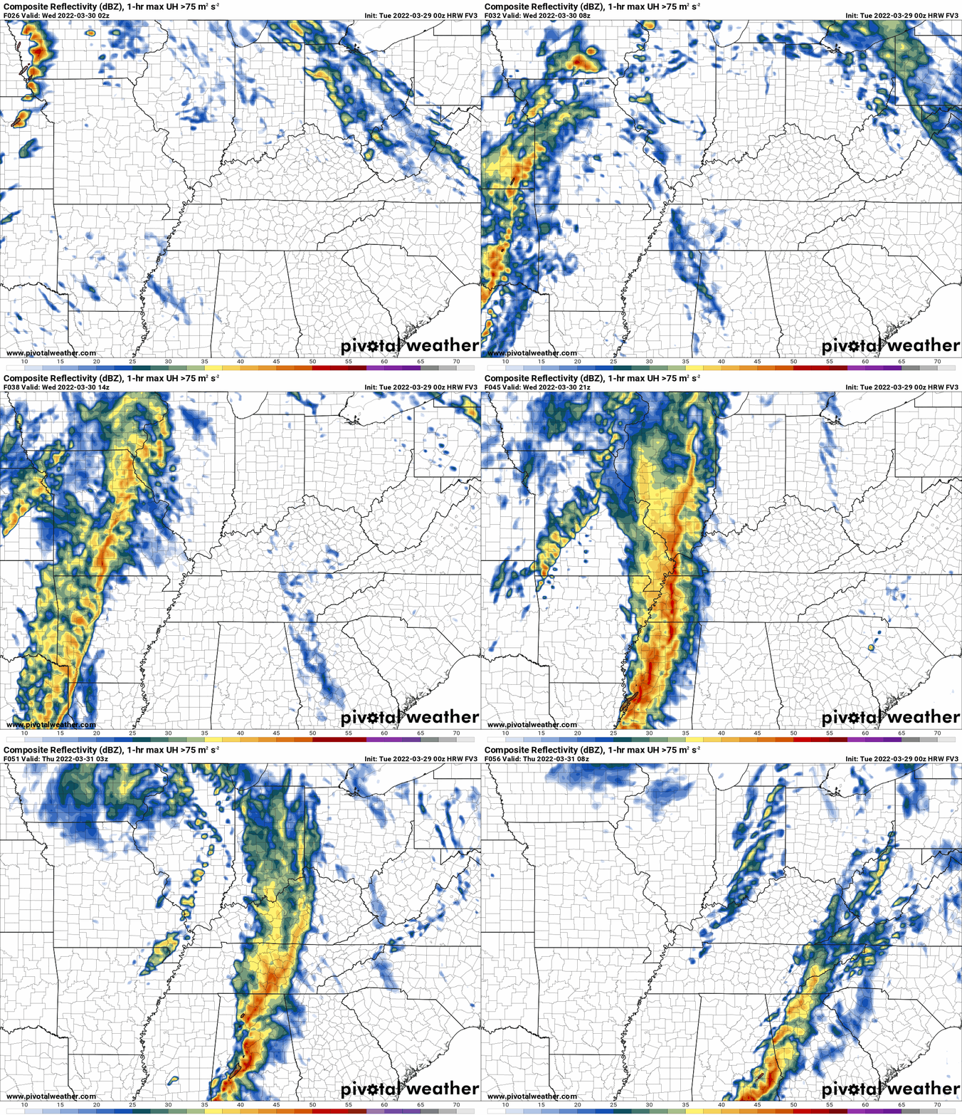
.
SCROLL DOWN THE PAGE FOR UPDATES
.
Click on the words below to subscribe
Storm Tracking Links
Interactive local city-view radars. Clickable watches and warnings.
https://wtalk.co/B3XHASFZ
Backup radar site in case the above one is not working.
https://weathertalk.com/morani
Regional Radar
https://imagery.weathertalk.com/prx/RadarLoop.mp4
*NEW* Zoom interactive radar (with storm chaser streams)
https://wtalk.co/AVWG7GM7
Real time lightning tracker system two.
https://map.blitzortung.org/#5.02/37.95/-86.99
Lightning Data (zoom in and out of your local area)
https://wtalk.co/WJ3SN5UZ
The app is for www.weathertalk.com subscribers. Subscriber first and then download the app.
Apple users click here. Android users click here.
What you need to know
Key Points
- Strong and gusty non-thunderstorm winds Wednesday (wind gusts may top 45 mph).
- Thunderstorms will push across the region Wednesday. Beginning in southeast Missouri before noon. Spreading west to east across the rest of the area during the late morning and afternoon hours.
- Wednesday’s thunderstorms may produce pockets of 60+ mph wind gusts and even a short-lived tornado.
- Have your Beau Dodson Weather app on. Check it. Make sure you have not logged out of the app.
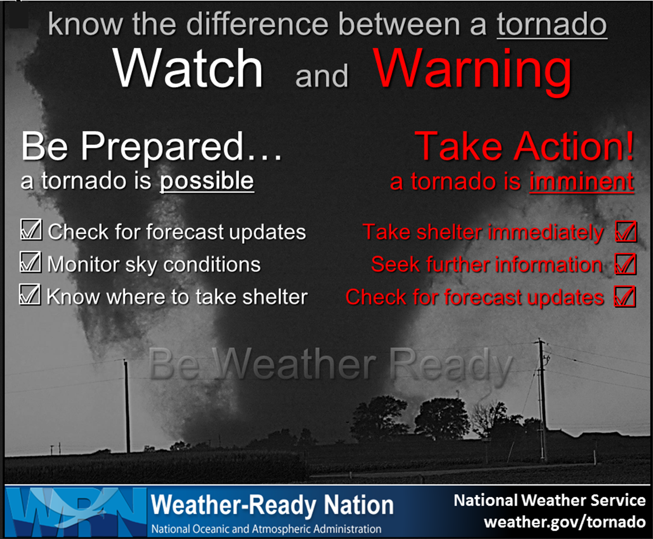
- Remember, a watch means to monitor updates. A warning means to seek shelter. A warning is a higher threat and means to seek shelter immediately. Severe weather may occur in or near your location.
.

Here is Facebooks’ Severe Weather Q&A threads.
Link https://www.facebook.com/beaudodsonweather
.
The latest blog updates will be posted here at the top of Beau’s severe weather blog.
.
Wednesday, March 30, 2022
8:13 PM
Once this storm exits SE Christian County and Toddy County, then the severe risk will end for my forecast area
.
7:53 PM
Southeast half of Christian County. Todd County.
A new line of storms is moving into Christian and Todd Counties. These storms are approaching from the south/southwest.
Storms are moving northeast at 55 mph.
Some of these storms could produce damaging wind gusts in excess of 60.
Seek shelter if you feel threatened by these storms.
Radar
https://weatherobservatory.com/radar_hoptown.htm
.
6:57 PM
Henderson, Daviess, Webster, and McLean Counties.
Several lines of storms are moving northeast through the area. These storms have a history of 60 to 75 mph wind gusts. These type of winds can cause quite a bit of damage.
Pockets of wind damage are likely with these severe thunderstorms.
Short-lived tornadoes are also possible. Be weather aware as the storms race northeast.
Radar
https://weatherobservatory.com/radar_evans.htm
.
6:42 PM
New warning.
.
6:33 PM
Eastern Trigg County. Christian County.
A very strong thunderstorm was located on the county line moving into Christian County.
This storm has 70 to 80 mph wind gusts and could cause extensive damage if caught in its path.
A tornado watch is also in effect. Short-lived tornadoes are possible with this line of thunderstorms.
Seek shelter until this storm moves past your location.
Radar
https://weatherobservatory.com/radar_hoptown.htm
.
6:30 PM
White County tornado warning has expired.
.
6:18 PM
TORNADO WARNING
NATIONAL WEATHER SERVICE PADUCAH KY
617 PM CDT WED MAR 30 2022

THE NATIONAL WEATHER SERVICE IN PADUCAH HAS ISSUED A

* TORNADO WARNING FOR...
  CENTRAL WHITE COUNTY IN SOUTHEASTERN ILLINOIS...

* UNTIL 630 PM CDT.

* AT 617 PM CDT, A SEVERE THUNDERSTORM CAPABLE OF PRODUCING A TORNADO
  WAS LOCATED OVER CARMI, MOVING NORTHEAST AT 55 MPH.

  HAZARD...TORNADO.

  SOURCE...RADAR INDICATED ROTATION.

  IMPACT...FLYING DEBRIS WILL BE DANGEROUS TO THOSE CAUGHT WITHOUT
           SHELTER. MOBILE HOMES WILL BE DAMAGED OR DESTROYED.
           DAMAGE TO ROOFS, WINDOWS, AND VEHICLES WILL OCCUR.  TREE
           DAMAGE IS LIKELY.

* THIS DANGEROUS STORM WILL BE NEAR...
  CROSSVILLE AROUND 625 PM CDT.
  GRAYVILLE AROUND 630 PM CDT.

THIS INCLUDES INTERSTATE 64 IN ILLINOIS BETWEEN MILE MARKERS 121 AND
130.

PRECAUTIONARY/PREPAREDNESS ACTIONS...

TAKE COVER NOW! MOVE TO A BASEMENT OR AN INTERIOR ROOM ON THE LOWEST
FLOOR OF A STURDY BUILDING. AVOID WINDOWS. IF YOU ARE OUTDOORS, IN A
MOBILE HOME, OR IN A VEHICLE, MOVE TO THE CLOSEST SUBSTANTIAL SHELTER
AND PROTECT YOURSELF FROM FLYING DEBRIS.
.
6:15 PM
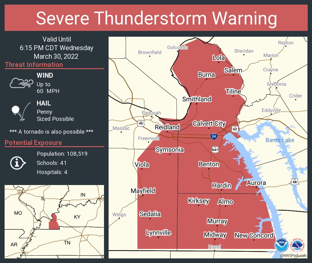
New warnings in western Kentucky.
.
.
6 PM
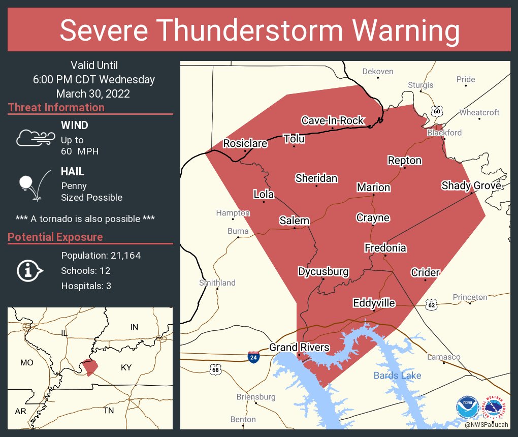
Trigg, Christian, Hopkins, Todd, Muhlenberg, Union, Henderson, Daviess, Webster, and McLean Counties.
Radar shows several lines of thunderstorms moving through western Tennessee and Kentucky.
Over the past thirty minutes there has been some weakening with the line.
With that said, some of the thunderstorms could still produce 50+ mph wind gusts, torrential rain, and lightning.
Let’s remain weather aware as the storms continue to race east/northeast at 60+ mph.
Fast moving storms.
Radars
Radar
https://weatherobservatory.com/radar_paducah.htm
Radar
https://weatherobservatory.com/radar_hoptown.htm
.
5:35 PM
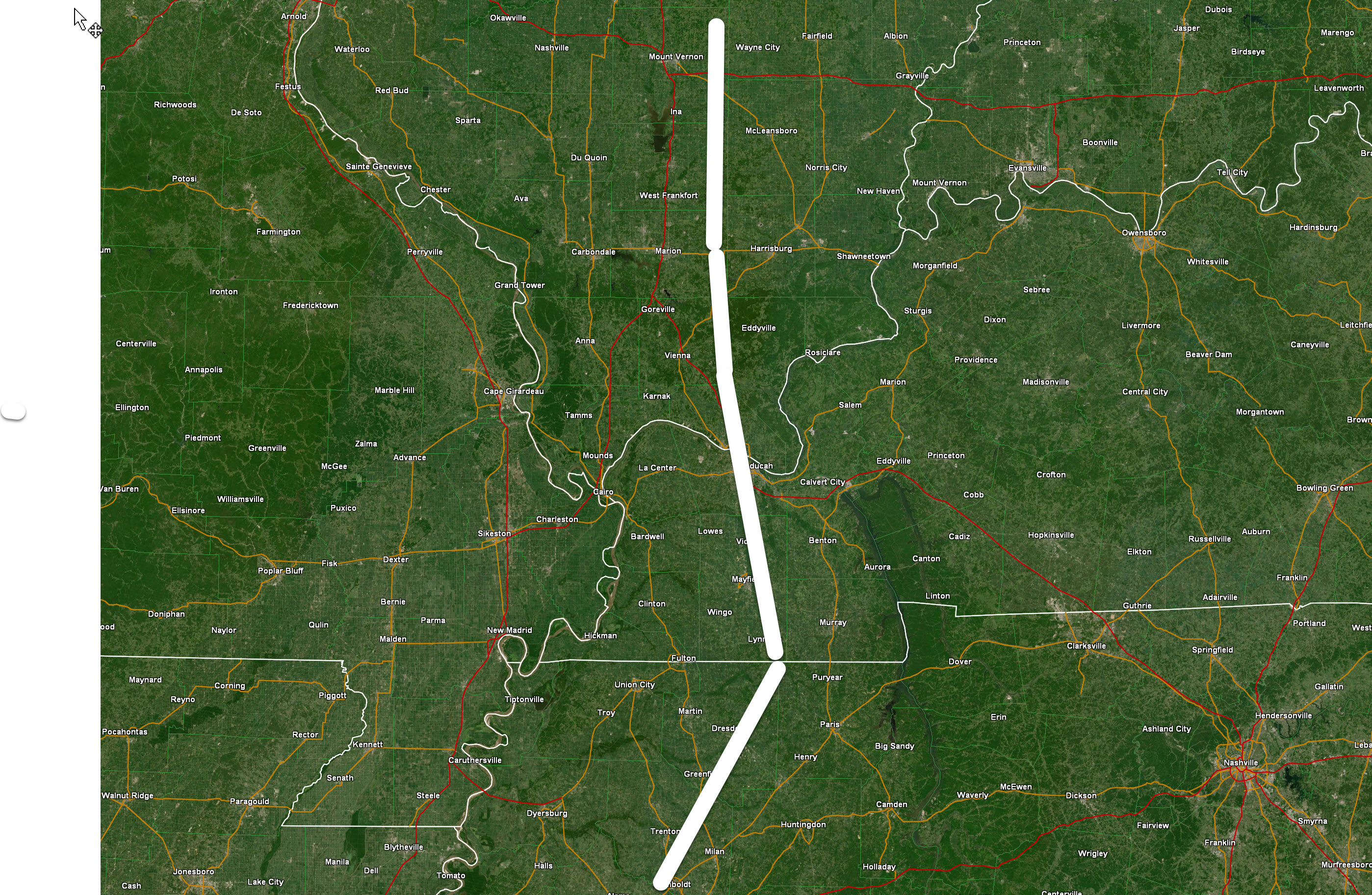
The severe threat has ended to the left of this white line
.
5:30 PM
.
.
5:23 PM
Crittenden and Caldwell Counties.
A line of intense thunderstorms is approaching from the southwest. This line is rapidly moving northeast at 70 mph. Some of these storms could produce wind damage.
Short-lived tornadoes are possible with these types of thunderstorms, as well. Be weather aware as these storms move into the area.
Another line of storms was further west/southwest. It is possible that you will experience more than one round of thunderstorms.
Radar
https://weatherobservatory.com/radar_paducah.htm
.
5:15 PM
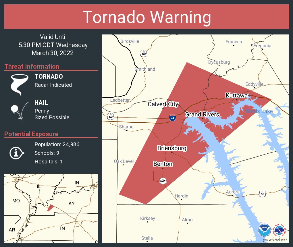
Tornado warning update
Radar shows rotation near Calvert City moving north northeast at 70 mph. This is a fast-moving storm.
This is a radar indicated tornado. Let’s stay weather aware as these thunderstorms move through the area. Damaging wind is possible. Torrential downpours, as well.Radar
https://weatherobservatory.com/radar_paducah.htm
PAH continues Tornado Warning [tornado: RADAR INDICATED, hail: <.75 IN] for Livingston, Lyon, Marshall [KY] till 5:30 PM CDT …AT 515 PM CDT, A SEVERE THUNDERSTORM CAPABLE OF PRODUCING A TORNADO WAS LOCATED NEAR CALVERT CITY, MOVING NORTHEAST AT 70 MPH.
.
5:15 PM
Franklin, Hamilton, White, Williamson, Saline, Gallatin, Johnson, Pope, and Hardin Counties.
A line of severe thunderstorms is moving through and approaching your county.
This line of thunderstorms has a history of producing pockets of wind damage. Winds in excess of 60 mph will be possible with these thunderstorms.
Torrential rain, as well.
These storms have occasionally produced pockets of rotation. A tornado watch is also in effect. That means that a quick spin-up could occur with little or no additional warning.
Be prepared to seek shelter until these storms pass your location.
Radar
https://weatherobservatory.com/radar_paducah.htm
And radar
https://weatherobservatory.com/radar_marion.htm
.
5:08 PM
TORNADO WARNING
NATIONAL WEATHER SERVICE PADUCAH KY
507 PM CDT WED MAR 30 2022

THE NATIONAL WEATHER SERVICE IN PADUCAH HAS ISSUED A

* TORNADO WARNING FOR...
  SOUTHEASTERN LIVINGSTON COUNTY IN WESTERN KENTUCKY...
  CENTRAL MARSHALL COUNTY IN WESTERN KENTUCKY...
  NORTHWESTERN LYON COUNTY IN WESTERN KENTUCKY...

* UNTIL 530 PM CDT.

* AT 506 PM CDT, A SEVERE THUNDERSTORM CAPABLE OF PRODUCING A TORNADO
  WAS LOCATED NEAR BENTON, MOVING NORTHEAST AT 70 MPH.

  HAZARD...TORNADO.

  SOURCE...RADAR INDICATED ROTATION.

  IMPACT...FLYING DEBRIS WILL BE DANGEROUS TO THOSE CAUGHT WITHOUT
           SHELTER. MOBILE HOMES WILL BE DAMAGED OR DESTROYED.
           DAMAGE TO ROOFS, WINDOWS, AND VEHICLES WILL OCCUR.  TREE
           DAMAGE IS LIKELY.

* THIS DANGEROUS STORM WILL BE NEAR...
  CALVERT CITY AROUND 520 PM CDT.

OTHER LOCATIONS IN THE PATH OF THIS TORNADIC THUNDERSTORM INCLUDE
EDDYVILLE.

THIS INCLUDES THE FOLLOWING HIGHWAYS...
 INTERSTATE 24 IN KENTUCKY BETWEEN MILE MARKERS 24 AND 44.
 INTERSTATE 69 IN KENTUCKY BETWEEN MILE MARKERS 37 AND 68.
.
5:04 PM
Pulaski County.
I have been watching the storms in Pulaski County but radar showed them below severe levels. Some 40 mph wind gusts.
The storms continue to push eastward across the county.
.
5 PM
Johnson, Pope, and Massac Counties.
A line of severe thunderstorms is approaching from the southwest. The storms are moving east/northeast at 60 mph. Fast moving storms.
These storms could produce pockets of damaging wind gusts. Be weather aware as the storms move through your location.
A tornado watch is also in effect for your area. That means conditions are also favorable for short-lived tornadoes.
Radar
https://weatherobservatory.com/radar_paducah.htm
.
5 PM
Mississippi. Carlisle and Hickman Counties.
The tornado warning has expired.
Remain alert as additional storms are moving through the area. These storms could still produce high winds and even brief short-lived tornadoes.
Radar
https://weatherobservatory.com/radar_paducah.htm
.
4:50 PM
Graves, McCracken, Livingston, Marshall, and Calloway Counties.
Multiple lines of thunderstorms are moving into the area.
One line was just crossing the Mississippi River.
Another line was centered in Graves County.
These storms are moving north/northeast at 60 mph.
These storms could produce damaging wind gusts in excess of 60 mph. Torrential rain, as well.
A tornado watch is effect for the warned area, as well.
These types of storms can produce short-lived tornadoes. They are difficult to issue warnings on. Let’s be weather aware as the storms move through your location. Be prepared to seek shelter.
Keep in mind, you may experience more than one thunderstorm.
.
4:46 PM
Tornado warning update.
AT 444 PM CDT, A SEVERE THUNDERSTORM CAPABLE OF PRODUCING A TORNADO WAS LOCATED NEAR TOWOSAHGY STATE HISTORIC SITE, MOVING NORTHEAST AT 55 MPH.
That is southwest of Berkley, Kentucky (Carlisle County).
.
4:43 PM
Ballard County, Kentucky.
Radar shows a line of severe thunderstorms moving into Ballard County. Some of these storms could produce winds in excess of 60 mph. Torrential rain, as well.
Let’s be weather aware as these storms move through the county.
Occasionally, these storms have shown rotation on radar, as well. Be alert and ready to seek shelter.
Radar
https://weatherobservatory.com/radar_paducah.htm
.
4:40 PM
Union County, IL.
Radar shows a line of intense thunderstorms moving into and through Union County, IL. These storms occasionally have produced areas of rotation.
These storms could produce high winds. Torrential rain, as well.
Let’s be weather aware as these storms move through the county.
Radar
https://weatherobservatory.com/radar_paducah.htm
.
4:37 PM
Mississippi County. Carlisle and Hickman Counties.
Radar shows a possible tornado near Highway 102 in Mississippi County, MO. That is near Pinhook, MO. Moving N NE at 70 mph.
This is a fast-moving storm.
Radar is showing rotation. There have not been any spotter reports of a tornado, thus far.
Seek shelter if you are in the path of this tornadic thunderstorm.
Radar
https://weatherobservatory.com/radar_paducah.htm
.
4:30 PM
Tornado Warning
Mississippi. Hickman. Carlisle County.
The storm was on the Fulton County line but has since moved northward. Fulton County, this particular tornadic storm is out of your area now.
THE NATIONAL WEATHER SERVICE IN PADUCAH HAS ISSUED A
* TORNADO WARNING FOR…
NORTHWESTERN HICKMAN COUNTY IN WESTERN KENTUCKY…
WESTERN CARLISLE COUNTY IN WESTERN KENTUCKY…
EASTERN MISSISSIPPI COUNTY IN SOUTHEASTERN MISSOURI…
* UNTIL 500 PM CDT.
* AT 427 PM CDT, A SEVERE THUNDERSTORM CAPABLE OF PRODUCING A TORNADO
WAS LOCATED OVER BIG OAK TREE STATE PARK, MOVING NORTHEAST AT 70
MPH.
HAZARD…TORNADO.
SOURCE…RADAR INDICATED ROTATION.
IMPACT…FLYING DEBRIS WILL BE DANGEROUS TO THOSE CAUGHT WITHOUT
SHELTER. MOBILE HOMES WILL BE DAMAGED OR DESTROYED.
DAMAGE TO ROOFS, WINDOWS, AND VEHICLES WILL OCCUR. TREE
DAMAGE IS LIKELY.
* THIS DANGEROUS STORM WILL BE NEAR…
TOWOSAHGY STATE HISTORIC SITE AROUND 430 PM CDT.
WYATT AROUND 440 PM CDT.
BARDWELL AROUND 445 PM CDT.
.
4:28 PM
Carlisle County.
Be aware that there is a storm with some rotation west of the City of Hickman, Kentucky. This storm is moving N NE at 65 mph.
Let’s be weather aware. A tornado could develop from this storm.
.
4:27 PM
Far eastern New Madrid County. Mississippi County. Hickman and Fulton Counties.
Be aware that there is a storm with some rotation west of the City of Hickman, Kentucky. This storm is moving N NE at 60 mph.
Let’s be weather aware. A tornado could develop from this storm.
.
4:21 PM
Tornado Warning for Alexander and Scott Counties till 4:30 PM CDT.
AT 4:19 PM CDT, A SEVERE THUNDERSTORM CAPABLE OF PRODUCING A TORNADO WAS LOCATED NEAR KELSO, OR NEAR SCOTT CITY, MOVING NORTH AT 70 MPH.
Fast moving storm. Seek shelter until this storm passes your location.
.
4:17 PM
Mississippi County, MO.
Alexander and Pulaski Counties in southern IL.
Fulton, Hickman, and Carlisle Counties in western KY.
Numerous thunderstorms are moving through and into your location. Some of these storms could produce pockets of wind damage. Winds in excess of 60 mph will be possible in the strongest thunderstorm cores.
Torrential rain, as well.
These storms have occasionally shown rotation. Let’s continue to be weather aware as storms race east/northeast at 55+ mph.
Radar
https://weatherobservatory.com/radar_paducah.htm
.
4:09 PM
Perry County, MO. Jackson County, IL.
A line of severe thunderstorms is moving through Perry County, MO. This line of storms is moving east/northeast at 50+ mph.
These storms could produce pockets of wind damage. There is also some weak rotation with this thunderstorm. Be weather aware and prepared to seek shelter if threatened by this thunderstorm.
Radar
https://weatherobservatory.com/radar_paducah.htm
.
4:04 PM
The tornado, if it is on the ground, is on the north side of Sikeston moving north at 70 mph.
Seek shelter now. Radar shows rotation in that area. This is a fast moving storm.
.
4 PM
TORNADO WARNING
NATIONAL WEATHER SERVICE PADUCAH KY
403 PM CDT WED MAR 30 2022

THE NATIONAL WEATHER SERVICE IN PADUCAH HAS ISSUED A

* TORNADO WARNING FOR...
  SOUTHWESTERN ALEXANDER COUNTY IN SOUTHERN ILLINOIS...
  SCOTT COUNTY IN SOUTHEASTERN MISSOURI...
  NORTH CENTRAL NEW MADRID COUNTY IN SOUTHEASTERN MISSOURI...

* UNTIL 430 PM CDT.

* AT 403 PM CDT, A SEVERE THUNDERSTORM CAPABLE OF PRODUCING A TORNADO
  WAS LOCATED OVER SIKESTON, MOVING NORTH AT 70 MPH.

  HAZARD...TORNADO.

  SOURCE...RADAR INDICATED ROTATION.

  IMPACT...FLYING DEBRIS WILL BE DANGEROUS TO THOSE CAUGHT WITHOUT
           SHELTER. MOBILE HOMES WILL BE DAMAGED OR DESTROYED.
           DAMAGE TO ROOFS, WINDOWS, AND VEHICLES WILL OCCUR.  TREE
           DAMAGE IS LIKELY.

* THIS DANGEROUS STORM WILL BE NEAR...
  MORLEY AROUND 410 PM CDT.
  BENTON AROUND 415 PM CDT.
  SCOTT CITY, KELSO AND OLIVE BRANCH AROUND 420 PM CDT.

THIS INCLUDES THE FOLLOWING HIGHWAYS...
 INTERSTATE 57 IN MISSOURI NEAR MILE MARKER 1.
 INTERSTATE 55 BETWEEN MILE MARKERS 65 AND 92.
.
3:48 PM
Mississippi County, MO. Carlisle, Hickman, and Fulton Counties in western Kentucky.
A line of severe thunderstorms is approaching from the west/southwest. This line is moving east/northeast at 50+ mph.
The line may produce pockets of 60+ mph wind gusts.
There is also a tornado watch in effect. A tornado watch means that conditions are favorable for the development of short-lived tornadoes.
Let’s stay weather aware as storms move through the area.
Radar https://weatherobservatory.com/radar_paducah.htm
.
3:45 PM
3:19 PM
Lake and Obion Counties.
A line of severe thunderstorms is moving into northwest Tennessee from the Missouri Bootheel. Some of these storms could produce pockets of wind damage.
In addition to the above, there is a tornado watch in effect. That means that conditions are favorable for the development of tornadoes. Be weather aware as these storms enter your area.
Radar
https://weatherobservatory.com/radar_dyers.htm
.
3:15 PM
Tornado warning for Dunklin County has been cancelled. Stay alert.
Severe thunderstorm warnings continue. Intense storms are moving into and through the area. Damaging wind is the main concern.
Radar
https://weatherobservatory.com/radar_dyers.htm
.
3:11 PM
Stoddard and New Madrid Counties.
A line of severe thunderstorms is approaching from the west/southwest. These storms are moving east/northeast at 50+ mph.
These storms may produce pockets of damaging wind gusts. A tornado watch is also in effect for the warned counties. That means to be weather aware for quick spin-ups.
Radar
https://weatherobservatory.com/radar_cape.htm
.
3 PM
Tornado Warning
Dunklin County.
A storm moving out of Arkansas into the Missouri Bootheel could produce a tornado. Seek shelter until this storm passes.
Southern Dunklin County in southeastern Missouri…
Until 330 PM CDT.
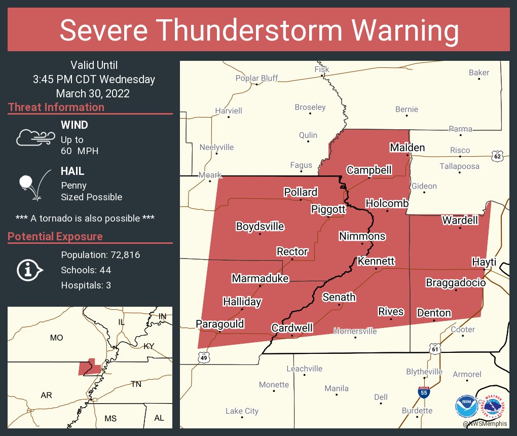
At 301 PM CDT, a severe thunderstorm producing a tornado was located near Cardwell, or 7 miles south of Marmaduke, moving east
at 45 mph.
Tornado reported by spotters on the ground in NE AR moving into the Bootheel.
Locations impacted include…
Paragould, Kennett, Senath, Cardwell, Hornersville, Arbyrd, Fritz,
Bard, Mounds, Halliday, West Kennett, Noland, Brighton, Bertig,
Cotton Belt, Rives, Hornersville Junction, Octa, Paulding and
Scobeville.
.
2:58 PM
New warning for the Bootheel
.
2:45 PM
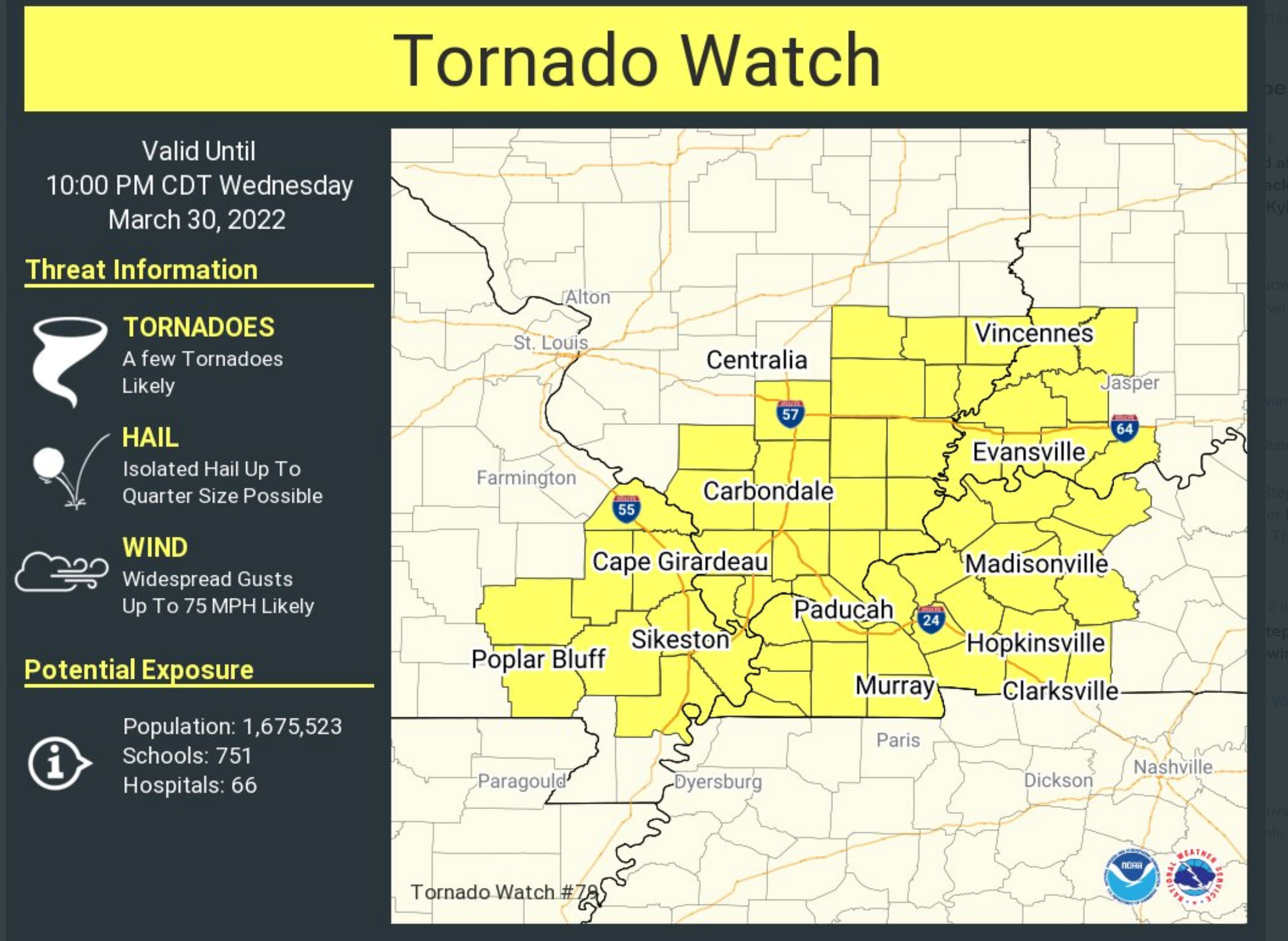
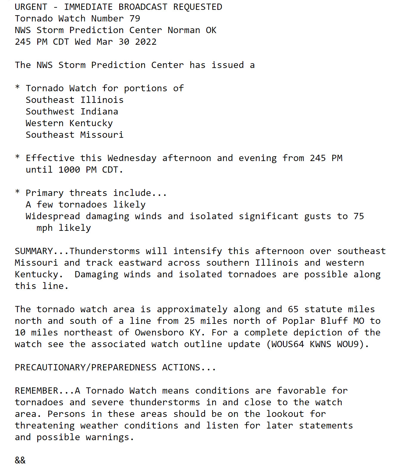
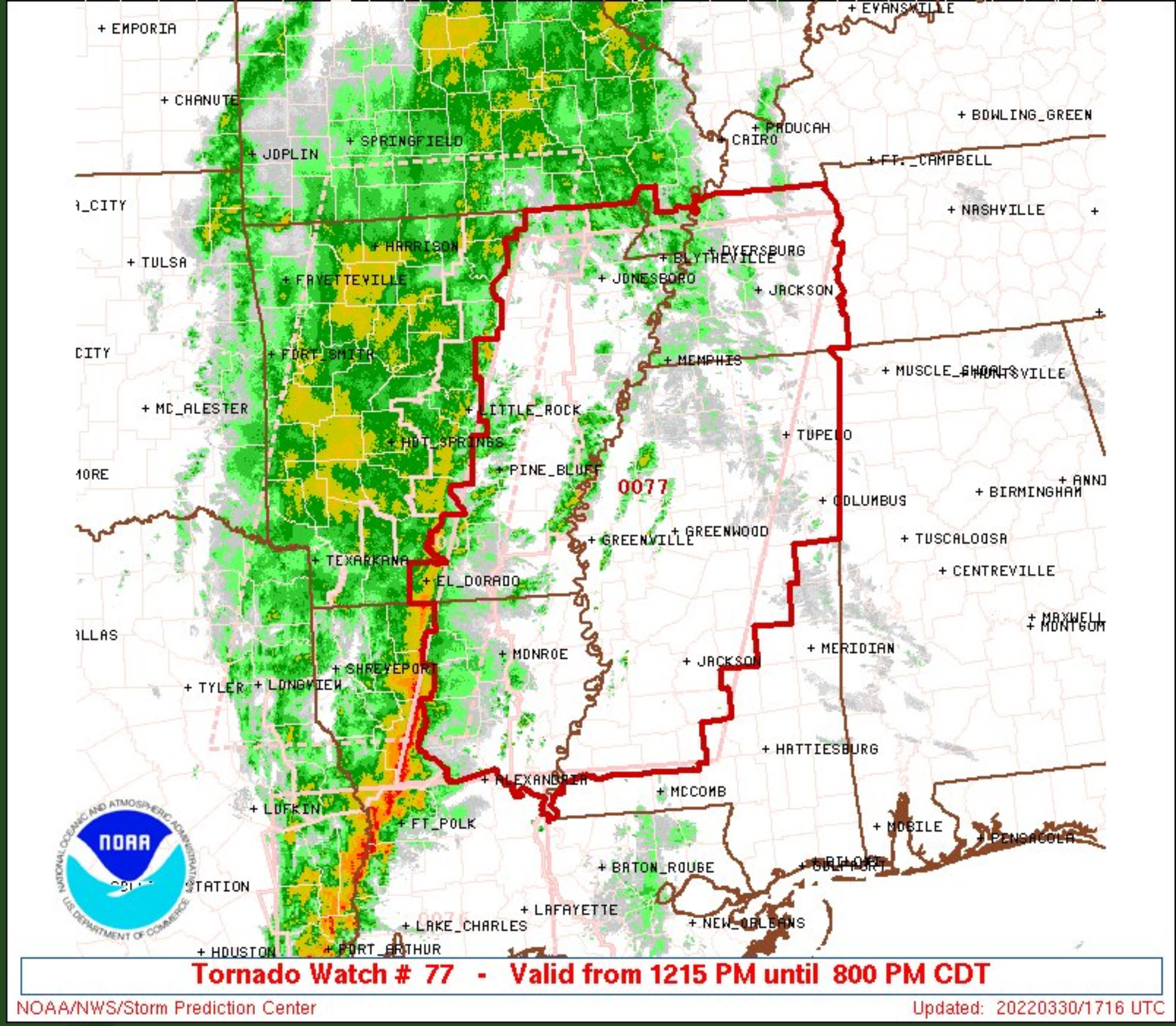
Tornado watch. Remember, the Bootheel and TN are already under a tornado watch. This is a new box.
.
2:31 PM
March 30, 2022
Butler County, Missouri.
2:31 PM
Radar shows a line of severe thunderstorms approaching from the west/southwest. The storms are moving east/northeast at 50 mph. These storms have a history of producing high wind gusts.
Be prepared to seek shelter until these thunderstorms pass your location.
.
2:31 PM
Dunklin and Pemiscot Counties.
Radar shows a line of severe thunderstorms approaching the Missouri Bootheel from northeast Arkansas. These storms have a history of producing high wind gusts. Occasionally, the storms have shown rotation.
Be prepared to seek shelter until these thunderstorms pass your location.
.
2:30 PM
Severe storms approaching the Missouri Bootheel with high winds.
.
2:15 PM
Watching this cell in NE AR move towards the MO Bootheel. Has some rotation in it. Severe thunderstorm warning issued on it.
.
2 PM
Sort of a messy setup right now.
Lot of precip over SE MO and southern IL. This may keep instability down in some counties.
I am watching the storms coming out of eastern AR and some cells on the TN/AR state line, as well.
All of this is rapidly moving east/northeast at 50+ mph.
Instability is greater over eastern AR into TN and then southward. Where the tornado watch is.
This is defin not a clear cut severe weather set-up.
We need to see how the low level jet does over the next few hours as it interacts with the line of storms rapidly moving out of eastern AR.
That line may overtake some of these storms ahead of it.
The storms ahead of it are trying to become severe, but so far have not been able to do that.
Continue to monitor as all of this pushes into the area.
.
12:45 PM
.
12:15 PM
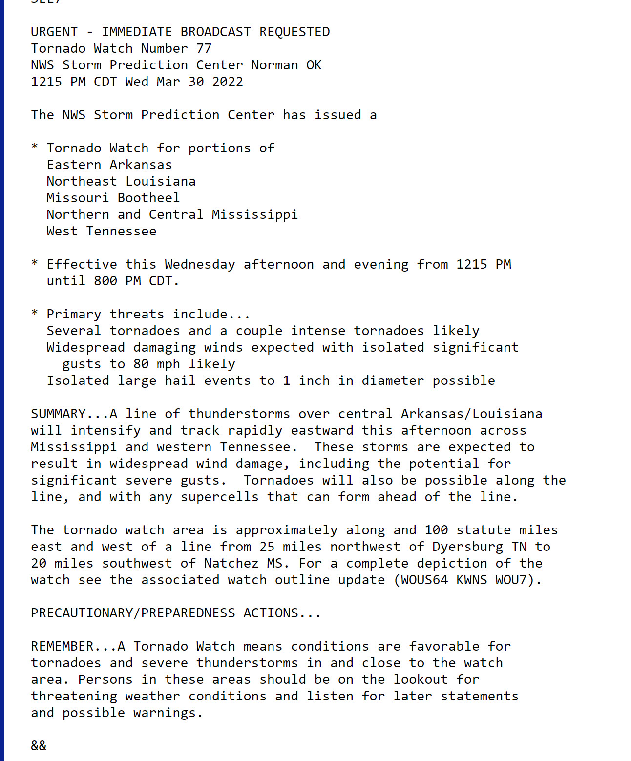
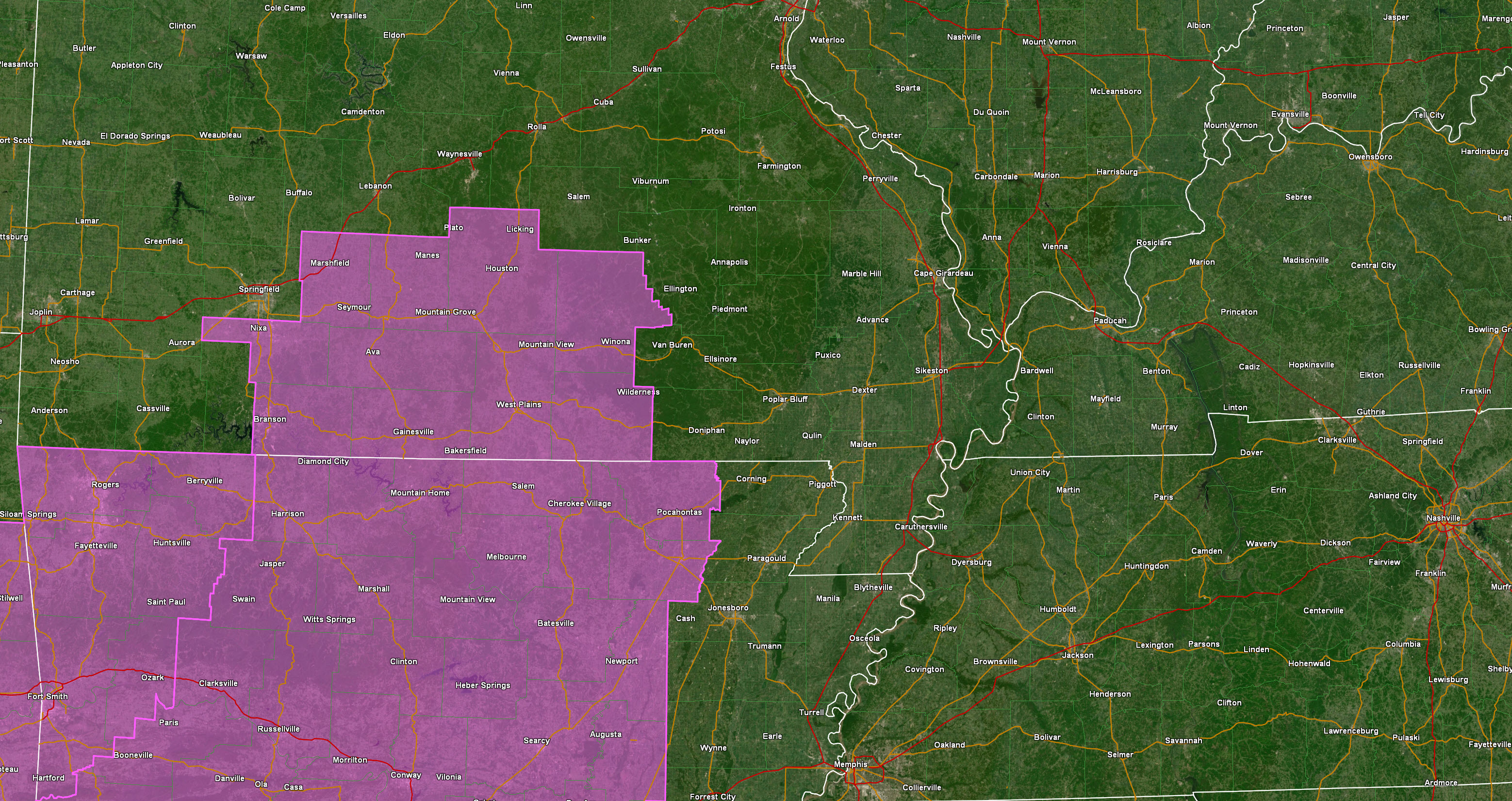
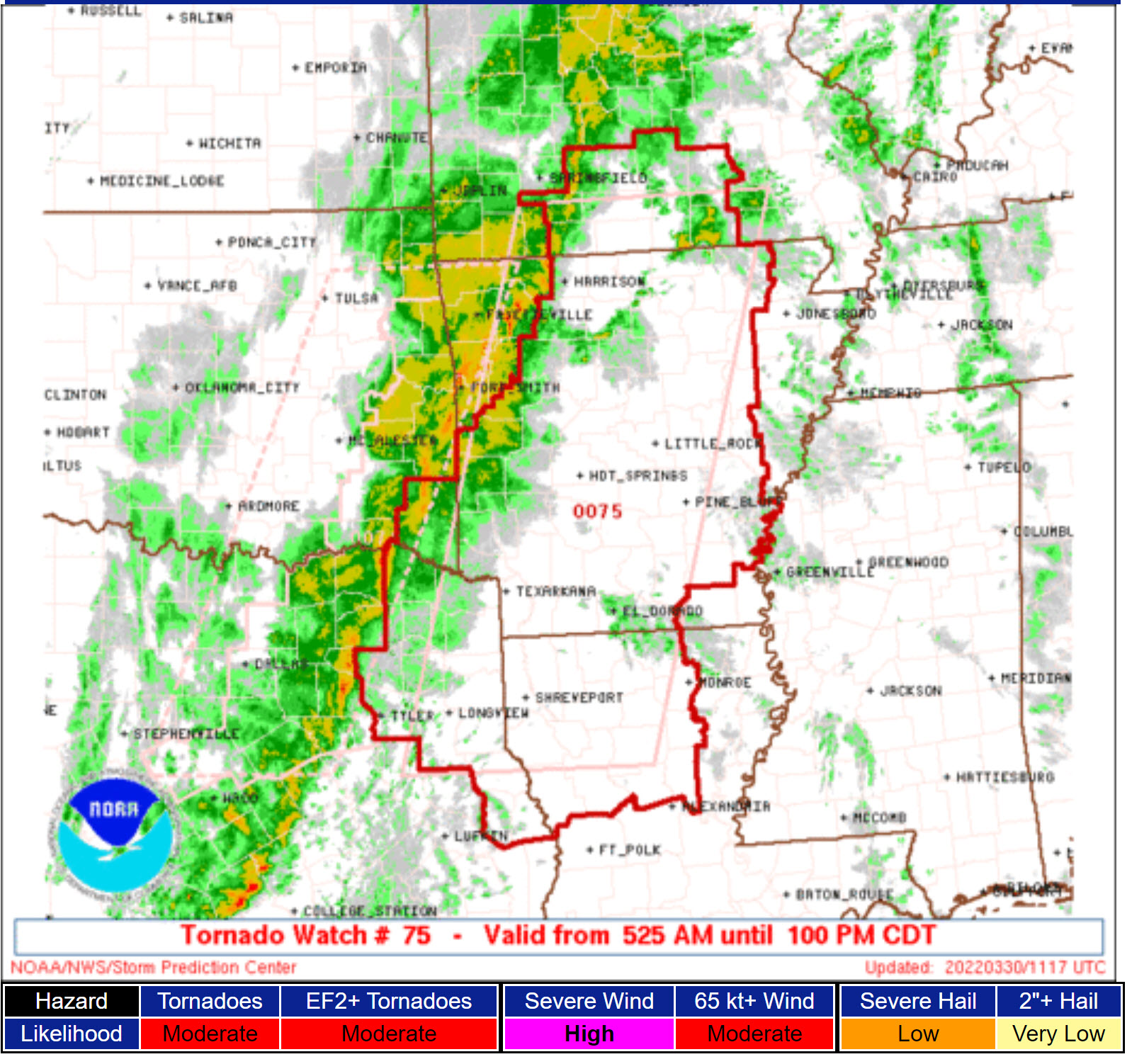
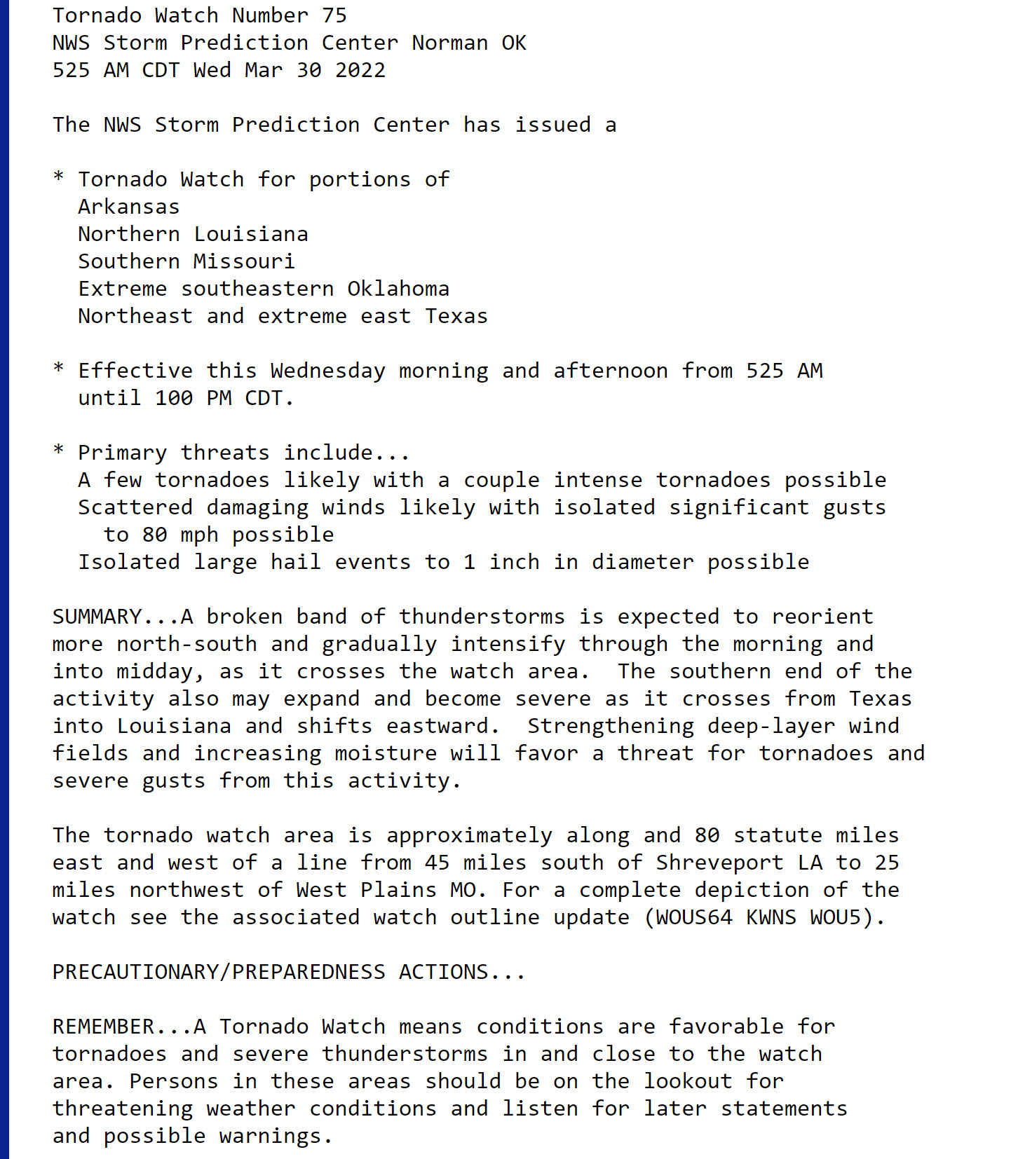
A tornado watch has been issued for the Bootheel and northwest Tennessee. Additional watches are likely later today.
11:15 AM
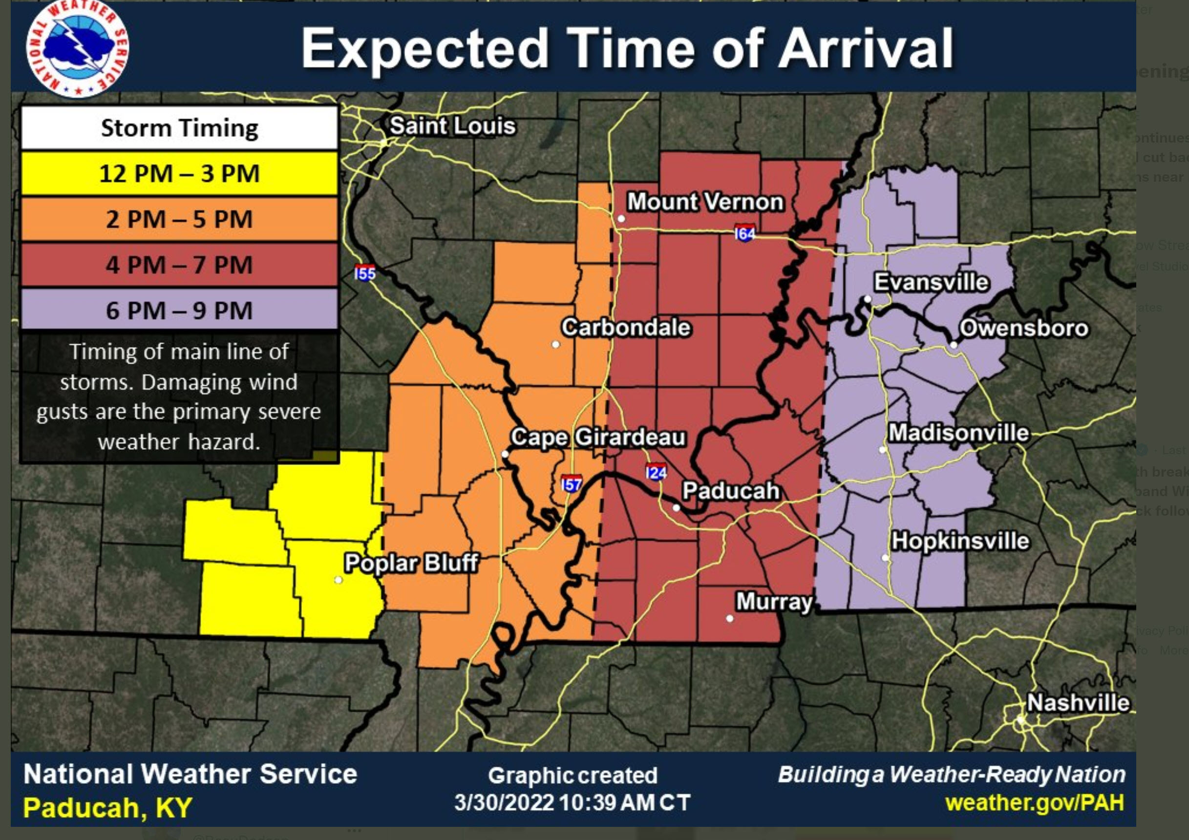
Updated timing.
.
10:45 AM
The system has slowed. The primary line may not reach the Mississippi River until after 2 PM.
Scattered showers and storms can occur ahead of the line.
.
9:45 AM
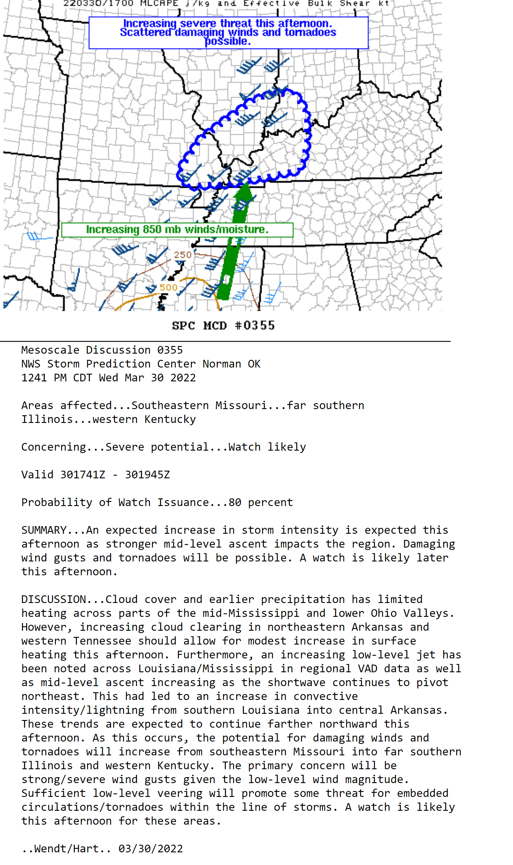
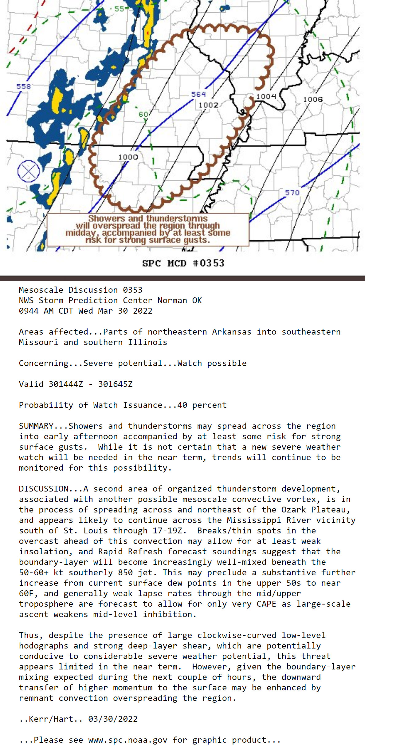
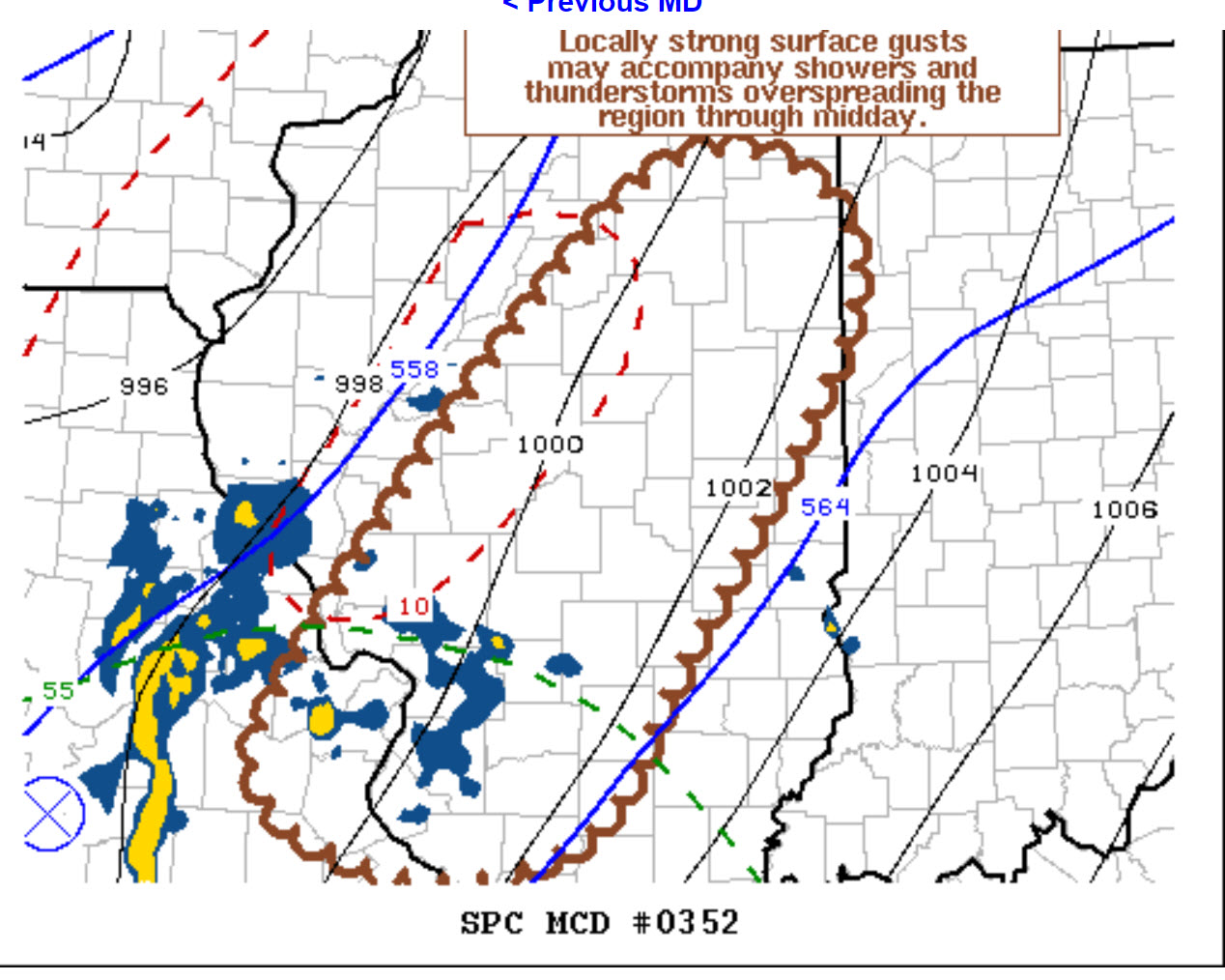
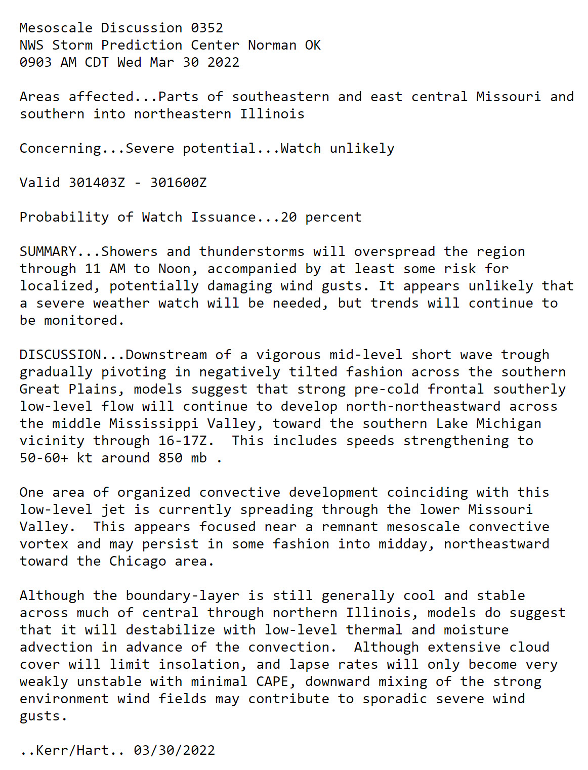
Special weather statement from the Storm Prediction Center. For my far northern counties.
.
Today’s Facebook Q&A thread link. CLICK HERE.
9 AM
Special weather statement from the Storm Prediction Center. For my far northern counties.
.
7 AM
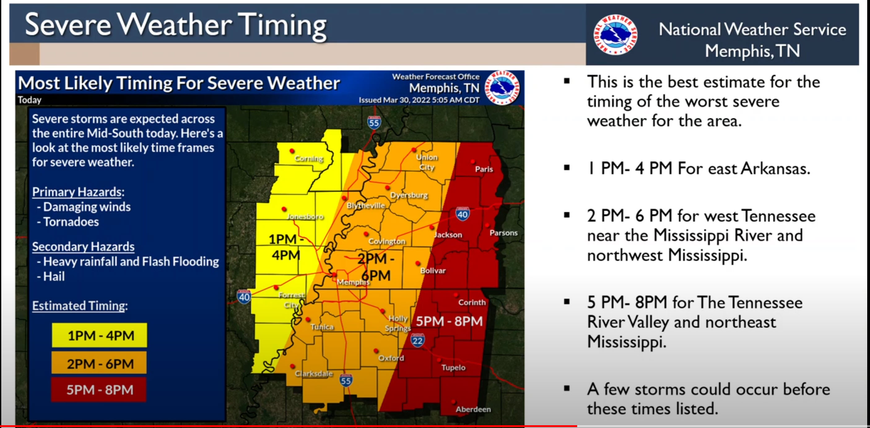
Severe weather briefing from the Memphis, Tennessee NWS.
.
6:20 AM
A tornado watch has been issued just to our west.
Additional watches will cover our region later today.
.
6:15 AM
A strong cold front will sweep across the region today and tonight. This system will have very high wind shear. Wind shear is the change of wind speed and direction with height. There will be a lot of spin in the atmosphere today. One ingredient for severe thunderstorms.
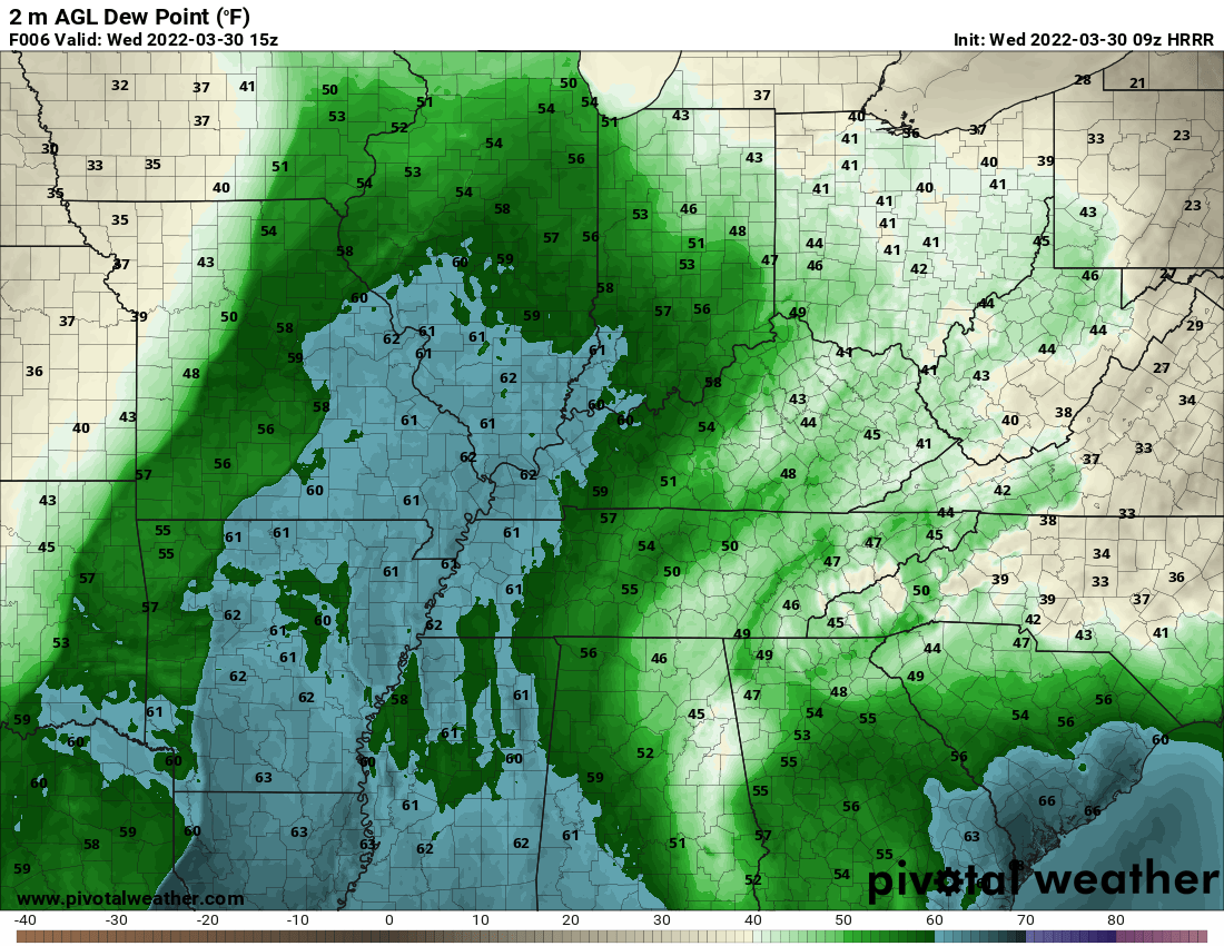
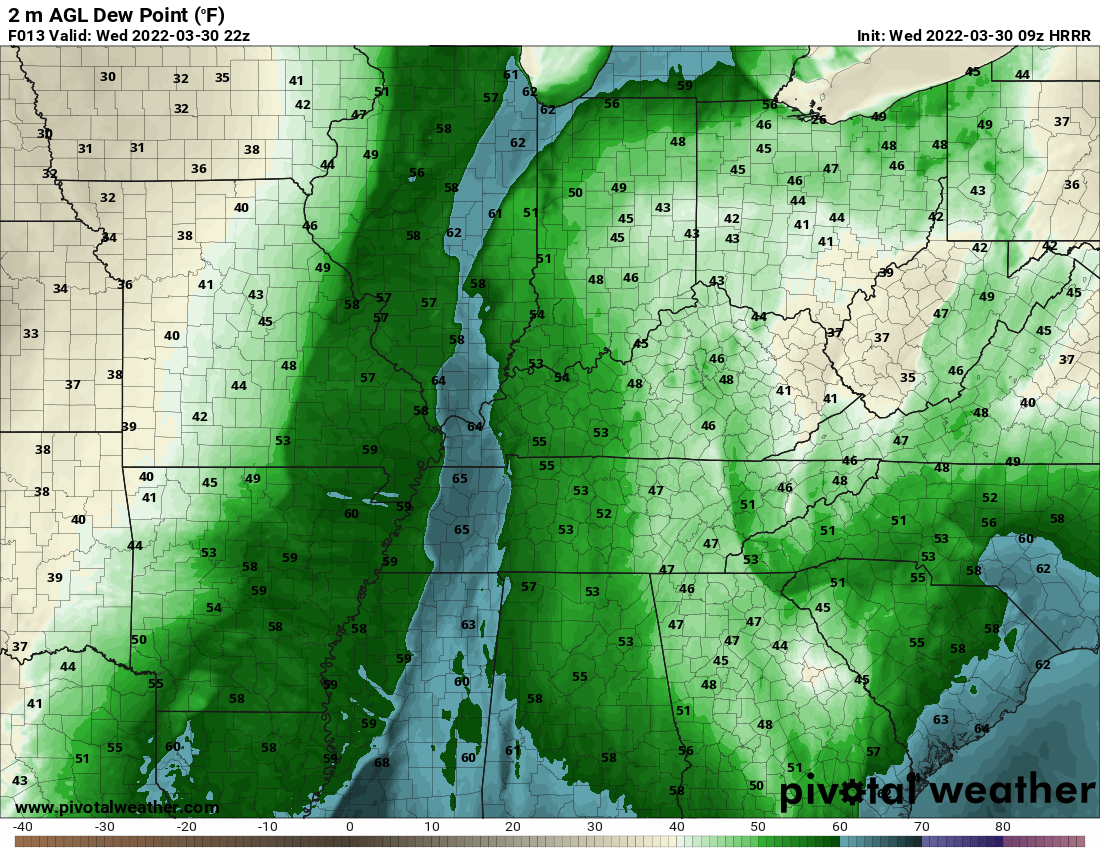
Dew points are already rising. Dew point is a measure of moisture in the atmosphere. For severe weather I typically look for upper 50s to 60s. Model guidance indicates we will reach those numbers today.
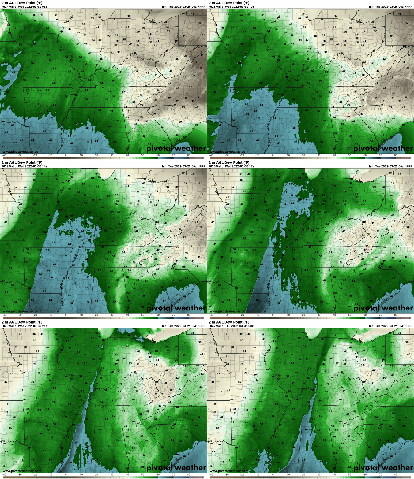
You can see the surge of dew points on the Hrrr model guidance. The blue color represents 60 or above dew points.
Some of those dew points may mix out this morning and drop.
That leaves a small tongue of higher dew points for the storms to tap into later today. You can see that here.
The higher dew points are found right ahead of the line of storms.
CAPE is lacking today. CAPE is fuel for storms to tap into.
This is a high shear low CAPE severe weather event. Sometimes the shear can make up the difference for the lack of CAPE. That may be the case today.
We will also have high gradient winds today. Gradient winds are caused by rapidly rising and falling barometric pressure. Gradient winds today will top 50 mph. This could cause some tree limb and power line damage.
Those gradient winds will be non-thunderstorm winds.
A line of thunderstorms will push across the region later this morning into this evening.
A few showers and thunderstorms will be possible ahead of the primary line.
A solid line of storms will push from west to east later today. This line will be moving east/northeast at 60+ mph. Fast moving line. This fast movement won’t give you much time to seek shelter if damaging wind or a tornado develops. Be weather aware today in the event severe weather develops.
Every weather model is showing this line of thunderstorms. There is high confidence in the line of storms occurring.
The trend over the last 24 hours is to slow down the line of storms by a few hours. Compared to what it was showing yesterday.
The line may not reach the Mississippi River until after 1 PM.
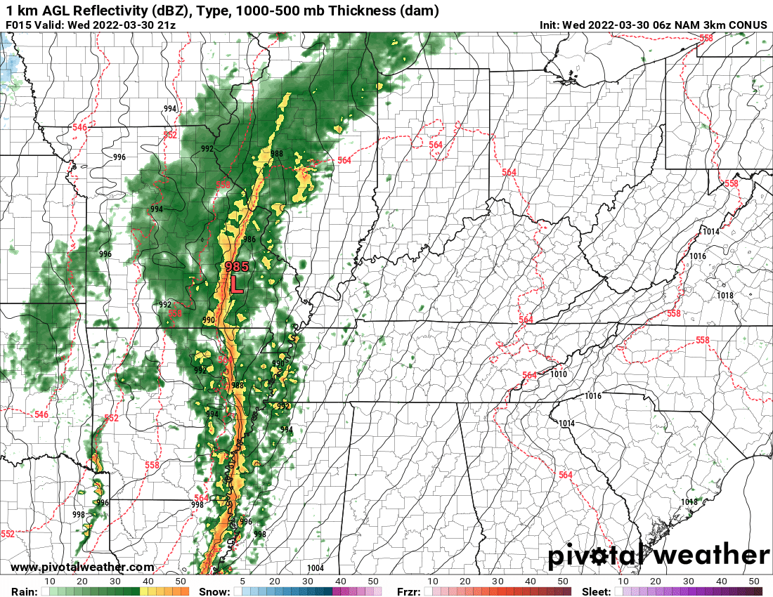
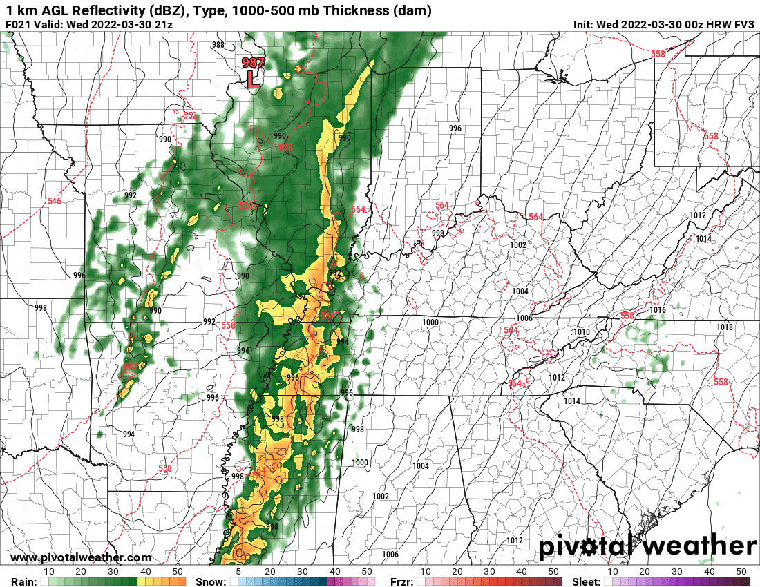
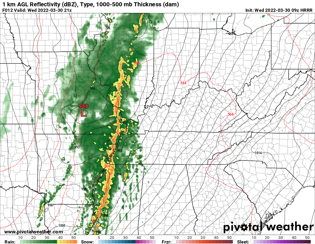
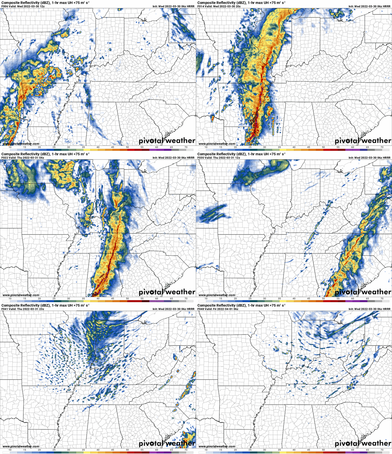
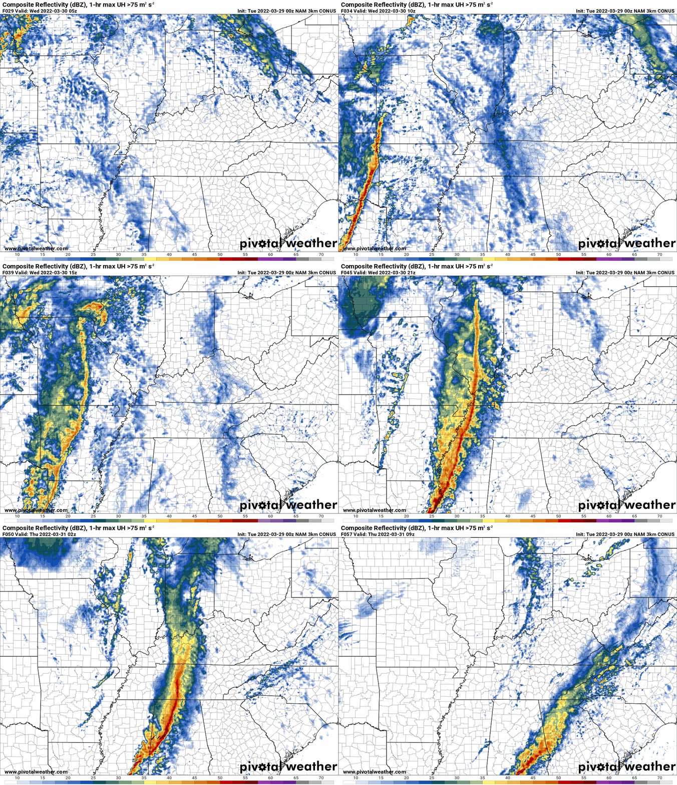
Here are a few models.
SPC WRF model. 4 PM.
NAM 3K model. 4 PM. This seems to slow. I think the line will be further east by 4 PM.
HRW FV3. 4 PM future-cast radar.
Hrrr model. 4 PM future-cast radar.
.
The primary concern with this line of thunderstorms will be damaging wind gusts and a few tornadoes.
This appears to be a QLCS tornado potential. QLCS tornadoes are typically embedded within the line of storms.
The December 10, 2021 Quad State Tornado was a supercell long-tracked tornado. Not the same as QLCS.
With that said, any tornado can cause damage. So, let’s be prepared in the event tornado warnings are issued.
Again, these QLCS tornadoes tend to be short lived and difficult to issue warnings on. They can develop within one or two radar scans and then dissipate.
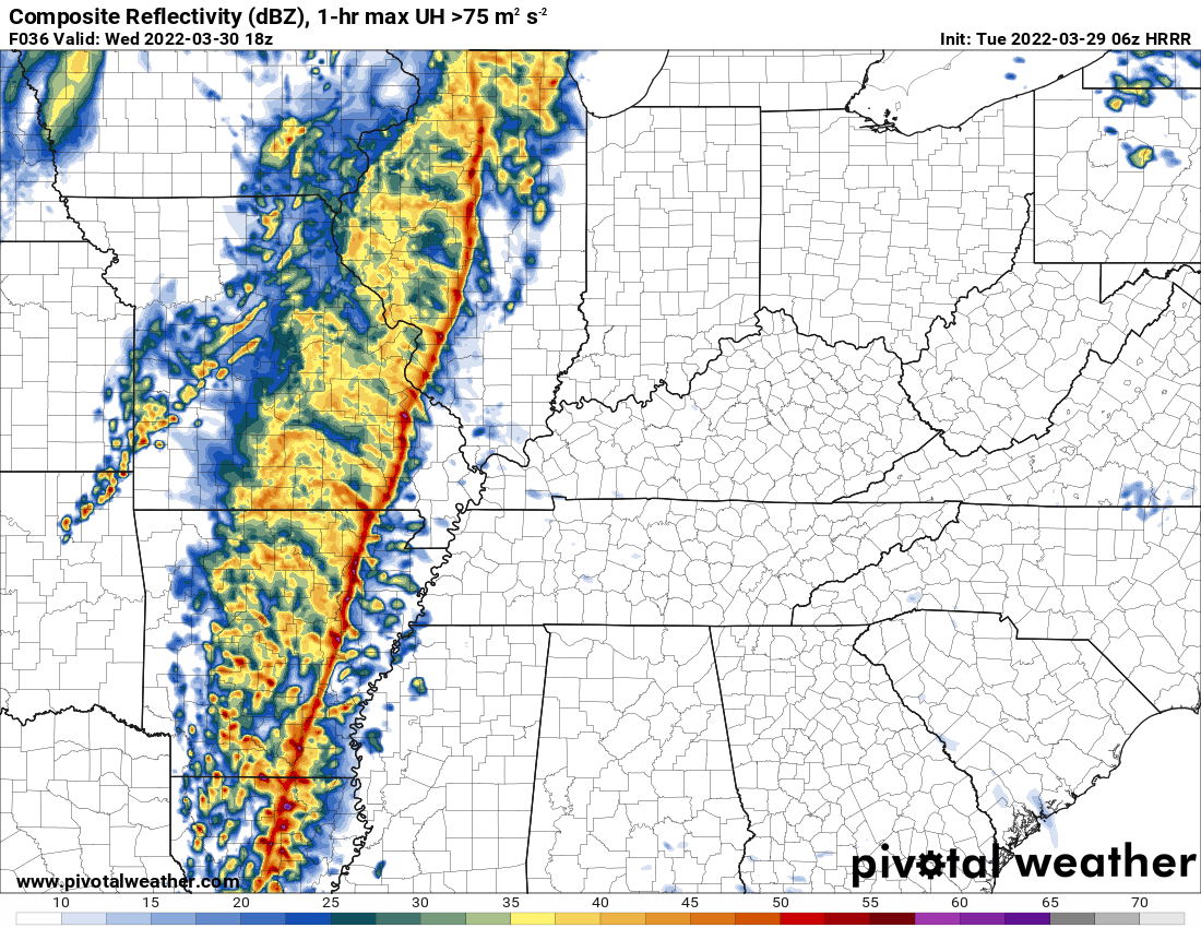
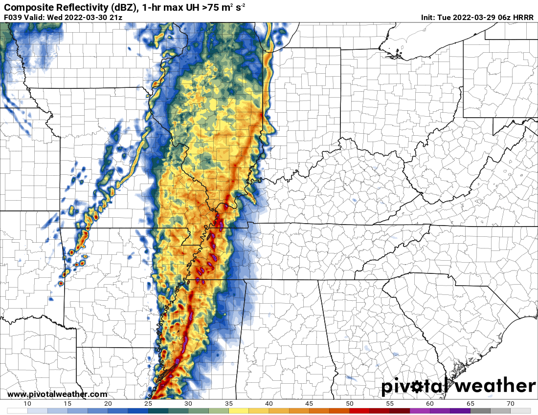
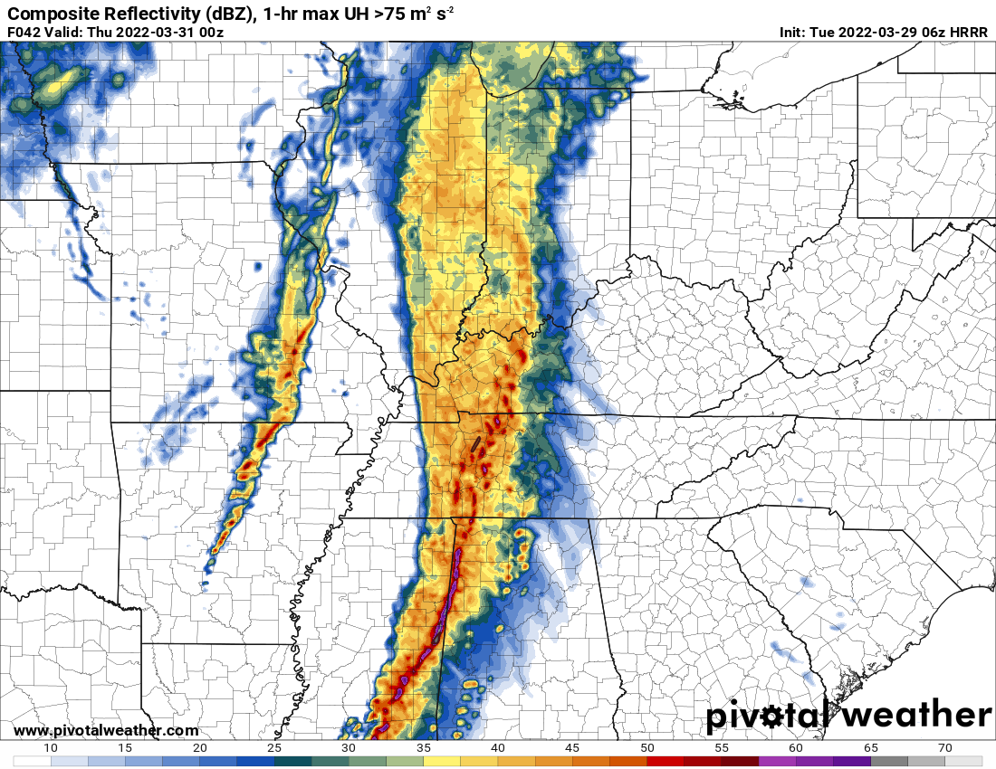
Hrrr future-cast radar. Time stamp upper left. That is in Zulu time. 18z=1 PM. 00z=7 PM.
.
6 AM
A few early morning graphics.
The forecast is on track. High winds today. Gusts above 50 mph likely. These will be gradient non-thunderstorm winds.
In addition to the above, thunderstorms will sweep rapidly across the region during the late morning and afternoon hours. Some of these storms will be severe.
A tornado or severe thunderstorm watch will be issued for the area later this morning into the afternoon hours. Remember, a watch means to monitor updates. Conditions are favorable for severe storms. A WARNING is more serious. A warning means to seek shelter. A severe thunderstorm is imminent in or near your location.
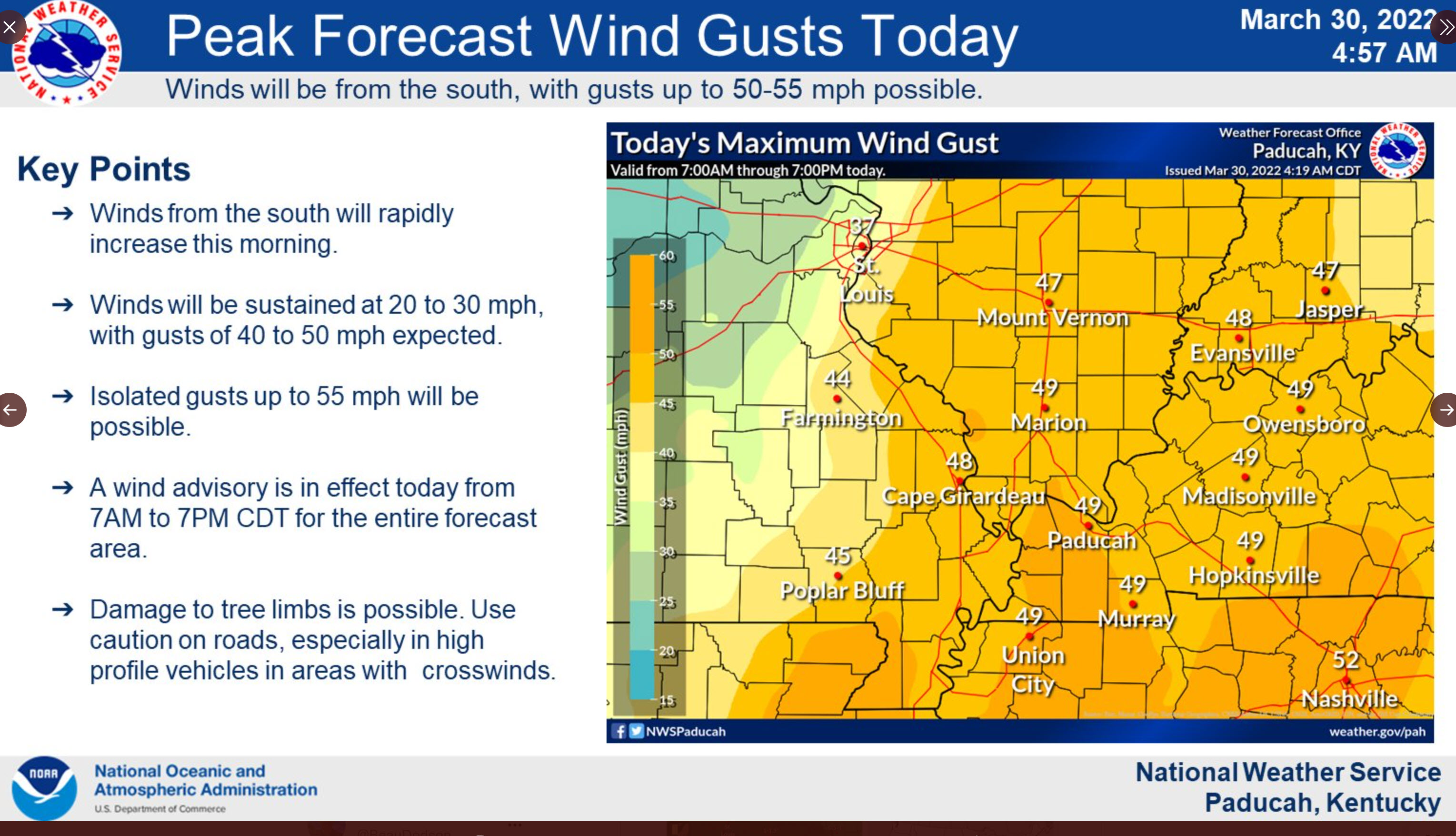
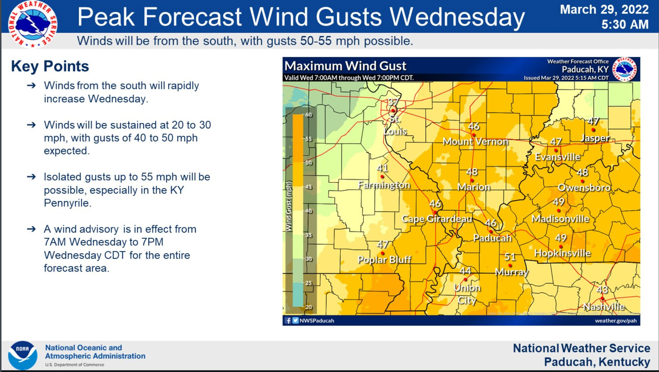
A wind advisory has been issued across the entire Quad State from 7AM-7PM Wednesday. Southerly winds sustained at 20-30 mph with gusts up to 45-55 mph are expected. Isolated gusts to 55 mph will be possible, especially in the KY Pennyrile.
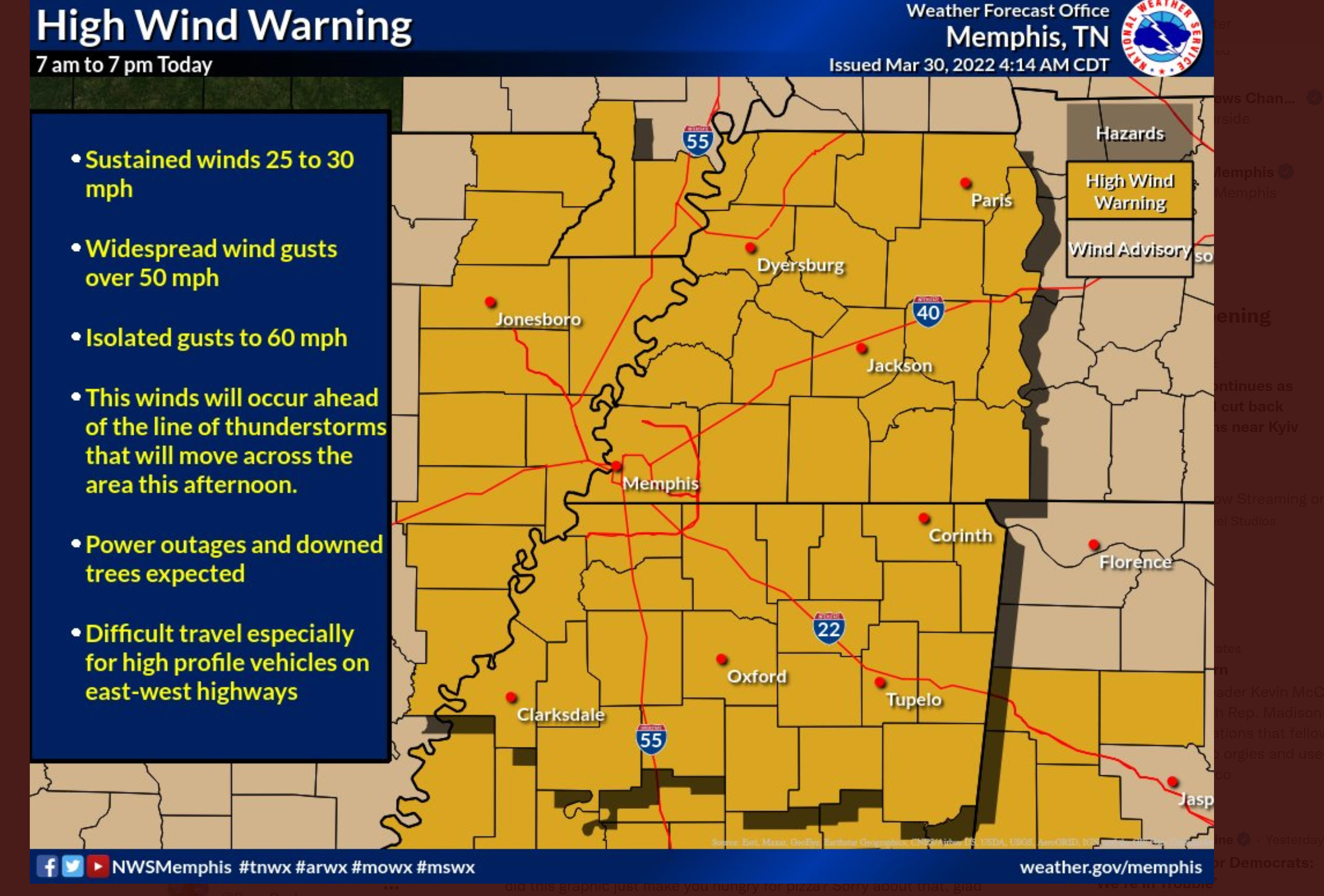
A high wind warning for the Missouri Bootheel and northwest Tennessee. Winds above 55 mph are likely.
The LIVE SEVERE WEATHER BLOG has been activated for Wednesday’s severe weather potential.
Here is the link to the live severe weather blog. CLICK HERE.
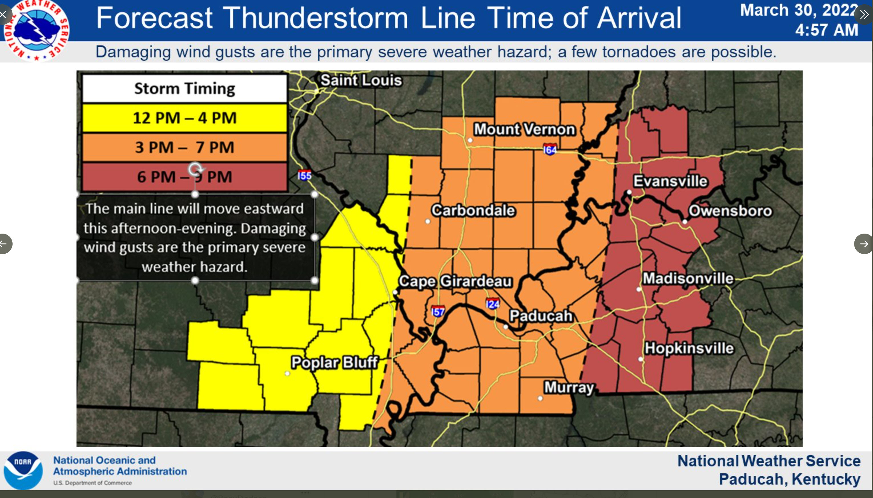
Timing of the storms. Approximate.
You can figure out the timing for the Bootheel and northwest Tennessee on this graph, as well. Just draw the lines further south.
Tuesday, March 29, 2022
4 PM
NWS Memphis, Tennessee. Update on severe weather for the Bootheel and western Tennessee.
.
2 PM NWS conference call concerning Wednesday’s high wind and severe weather event.
1 PM
The Storm Prediction Center has pushed the moderate risk further north in their latest update. This brings it almost to the Missouri Bootheel and much of western Tennessee.
Light green is where thunderstorms may occur but should be below severe levels.
Dark green is a level one risk. Yellow is a level two risk. Orange is a level three (enhanced) risk. Red is a level four (moderate) risk. Pink is a level five (high) risk.
One is the lowest risk. Five is the highest risk.
A severe storm is one that produces 60 mph wind or higher, quarter size hail, and/or a tornado.
Smoothed
12:30 PM
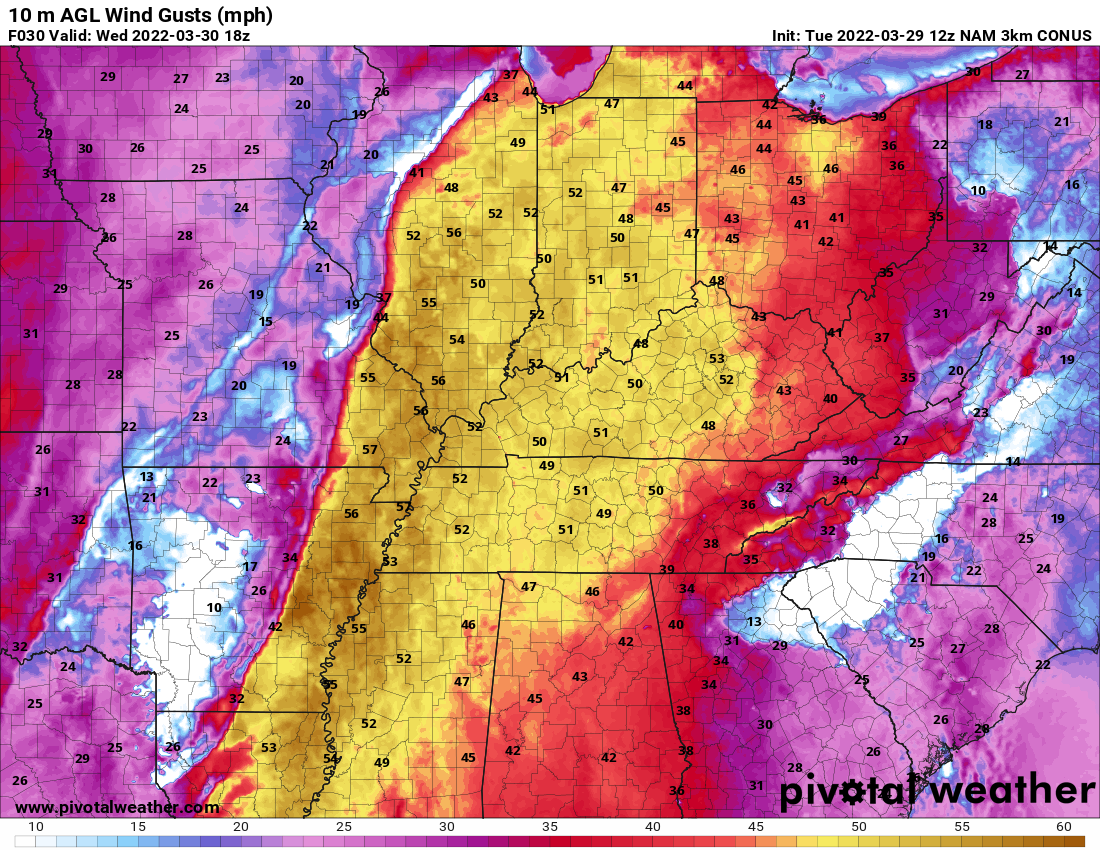
Non-thunderstorm winds will be high tomorrow. NAM model shows widespread 30 to 50 mph gusts.
These are because of the rapidly falling and rising barometric pressure.
12:30 PM Update
Latest future-cast radar for tomorrow.
1 PM
3 PM
5 PM
.
8 AM Update
Severe thunderstorms are possible late Wednesday morning into Wednesday evening.
Our next big weather system will arrive late tonight into Wednesday night.
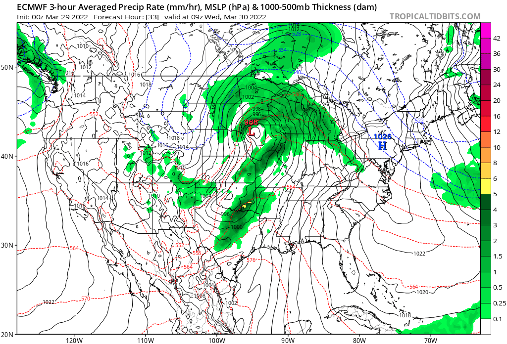
A developing area of low pressure will skirt to our north over the next 36 hours. This will drag a cold front across our region from west to east.
You can see that low on this weather map. The red L is the area of low pressure.
Showers and thunderstorms will be the end result. Some of the rain could be locally heavy and a few storms could be severe.
Rain totals of 0.7″ to 1.4″ are likely area-wide. Thunderstorms can produce locally higher totals.
Rain chances will ramp up late tonight over southeast Missouri. A line of showers and thunderstorms will approach the region from western Missouri and Arkansas.
Tonight’s storms will remain below severe levels in my forecast area. There is a chance of severe storms further west later today and tonight.
Shower and thunderstorm chances will ramp up area-wide tomorrow into tomorrow night.
A solid line of showers and thunderstorms will push west to east across our region.
There remain questions about how unstable the atmosphere will become tomorrow. There may very well be pockets of sunshine that will help heat up the atmosphere. This is especially true across Kentucky and Tennessee. This could cause CAPE values to be a bit higher in those areas. CAPE is basically energy/fuel that storms tap into.
Further west, clouds may be thicker as the showers and thunderstorms advance eastward.
Wind shear will be strong tomorrow. Wind shear is the change of wind direction and speed with height. There will be no lack of wind shear with this system. Typical for this time of the year. Plenty of jet stream energy.
The biggest question, for the threat of severe weather, will be dew points. Remember, one ingredient in severe weather are dew points (moisture).
Dew point is a measure of moisture. In this case, a measure of moisture at the ground level.
Typically, for severe weather, I look for dew point readings in the upper 50s and 60s.
Model guidance indicates a sliver of 60 degree dew points in our region.
I took a snapshot from two models that will show that. This would be moving west to east (so this is just showing you the sliver of 60 dew points over the center portion of our region).
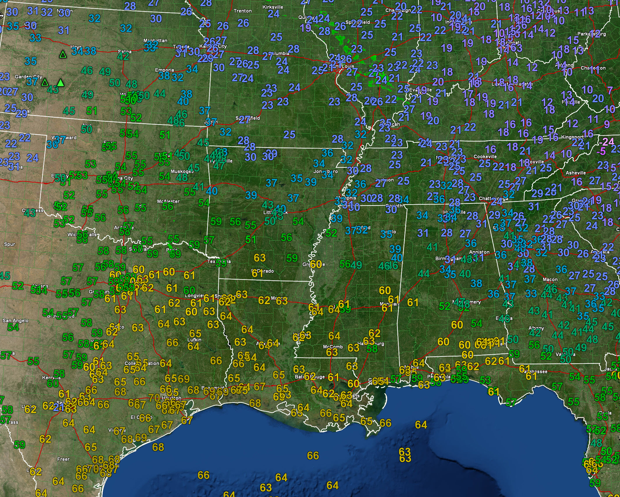
First, let me show you current dew points. A wide area of 60s well to our south.
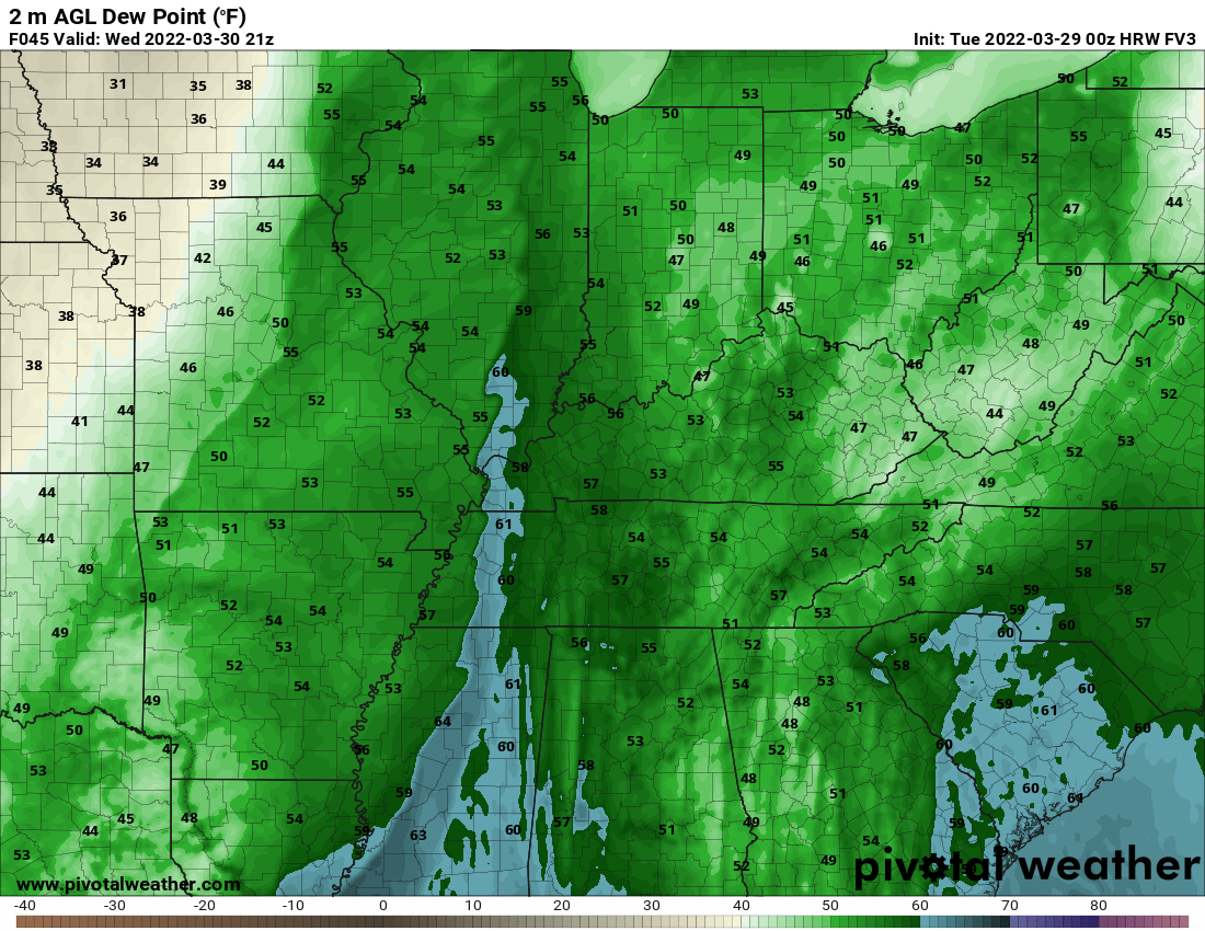
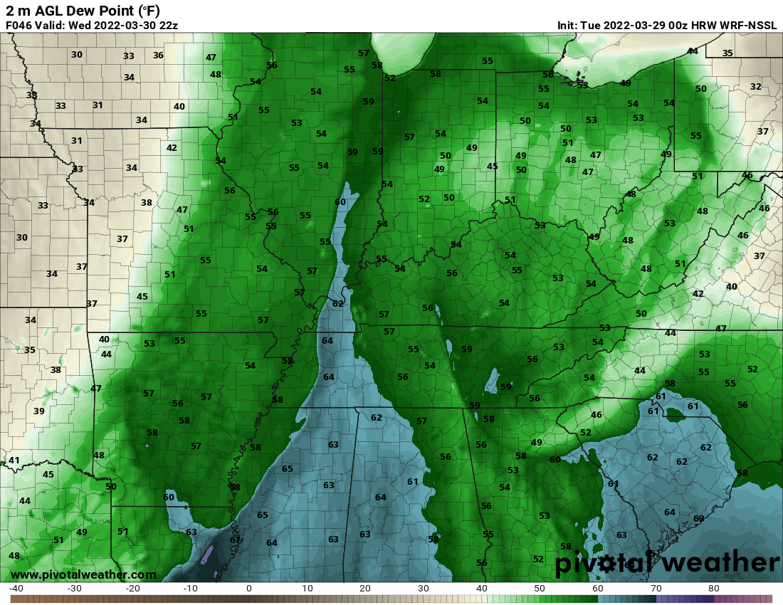
Now, let’s look at the model forecast for tomorrow’s dew points.
Two models. A sliver of 60 degree dew points.
The higher numbers are shunted off well to our south.
You can also see the moisture being cut off on this animation from the Hrrr model guidance.
Notice the widespread 60+ dew points surge northward and then become cut off as the day wears on (Wednesday).
That is because of the widespread showers and thunderstorms south of our region. This raises questions about our severe weather threat. Lower dew points would lower our severe threat. Something to monitor moving forward.
Models are showing an almost north to south line of thunderstorms (QLCS is what we call this line of storms).
This raises questions about moisture transport northward. Will the storms to our south cut off the better moisture flowing into our local area. That is a possibility. If that happens, then the risk of severe weather will be lower.
If the line was a bit more southwest to northeast then I would be more concerned with damaging wind and tornadoes. That would allow the storms to tap into better moisture and enhanced wind fields.
Timing:
This is the approximate timing.
1 PM
.
4 PM
.
7 PM
.
Bottom Line:
Strong and gusty gradient winds Wednesday. Wind gusts could top 40 mph. Those are non-thunderstorm winds.
A line of thunderstorms, with locally heavy rain, will sweep across the region Wednesday. See the future-cast radars.
Some of these thunderstorms will produce strong and gusty winds, as well. Some wind damage will be possible with the line of thunderstorms.
If line segments or bowing develops, along the line of storms, then quick spin-up tornadoes will be possible. Typically, these type of tornadoes only last a few minutes. They can cause damage. Like all tornadoes.
The best advice is to stay weather aware Wednesday. Monitor your Beau Dodson Weather Talk app. Monitor updated forecast information.
Monitor updates. Monitor your Beau Dodson Weather App. Monitor local media. Have THREE TO FIVE ways of receiving severe weather information. Do not rely on just one source. Every source can fail at one point or another. Thus, having multiple sources of severe weather information is the best advice.
.
A wind advisory has been issued across the entire Quad State from 7AM-7PM Wednesday. Southerly winds sustained at 20-30 mph with gusts up to 40-50 mph are expected. Isolated gusts to 55 mph will be possible, especially in the KY Pennyrile.
The Memphis, Tennessee, NWS put this graphic out. The Paducah, Kentucky, NWS will likely post one later today (I will post it when they do).
Timing for the Missouri Bootheel and western Tennessee (you can extend this northward).
.
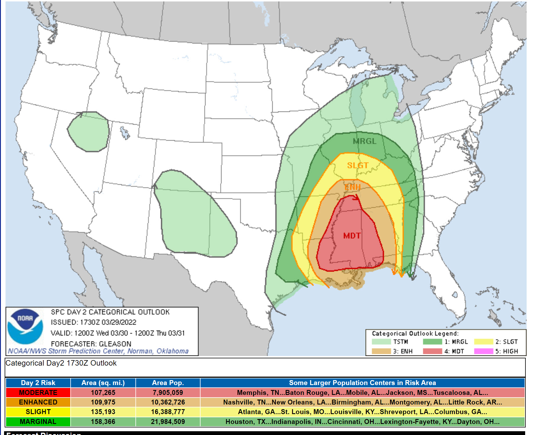
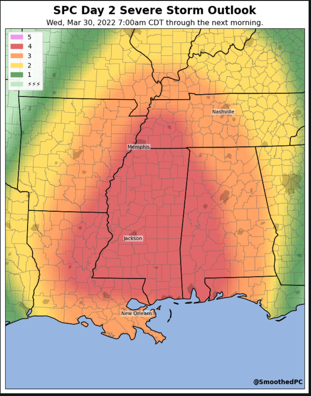
The Storm Prediction Center has outlined a zone for the threat of severe weather Wednesday across portions of our region.
Light green is where thunderstorms may occur but should be below severe levels.
Dark green is a level one risk. Yellow is a level two risk. Orange is a level three (enhanced) risk. Red is a level four (moderate) risk. Pink is a level five (high) risk.
One is the lowest risk. Five is the highest risk.
A severe storm is one that produces 60 mph wind or higher, quarter size hail, and/or a tornado.
Tomorrow’s severe weather outlook.

.
What am I looking at?
You are looking at different models. Meteorologists use many different models to forecast the weather. All models are wrong. Some are more wrong than others. Meteorologists have to make a forecast based on the guidance/models.
I show you these so you can see what the different models are showing as far as precipitation. If most of the models agree, then the confidence in the final weather forecast increases.
You can see my final forecast at the top of the page.
Occasionally, these maps are in Zulu time. 12z=7 AM. 18z=1 PM. 00z=7 PM. 06z=1 AM
.
This animation is the Storm Prediction Center WRF model.
This animation shows you what radar might look like as the next system pulls through the region. It is a future-cast radar.
Time-stamp upper left. Click the animation to enlarge it.
.
This animation is the HRW FV3 high resolution model.
This animation shows you what radar might look like as the next system pulls through the region. It is a future-cast radar.
Time-stamp upper left. Click the animation to enlarge it.
Occasionally, these maps are in Zulu time. 12z=7 AM. 18z=1 PM. 00z=7 PM. 06z=1 AM
.
This animation is the Hrrr short-range model.
This animation shows you what radar might look like as the next system pulls through the region. It is a future-cast radar.
Time-stamp upper left. Click the animation to enlarge it.
Double click the animation to enlarge it.
Occasionally, these maps are in Zulu time. 12z=7 AM. 18z=1 PM. 00z=7 PM. 06z=1 AM
.
Monitor updates. Monitor your Beau Dodson Weather App. Monitor local media. Have THREE TO FIVE ways of receiving severe weather information. Do not rely on just one source. Every source can fail at one point or another. Thus, having multiple sources of severe weather information is the best advice.
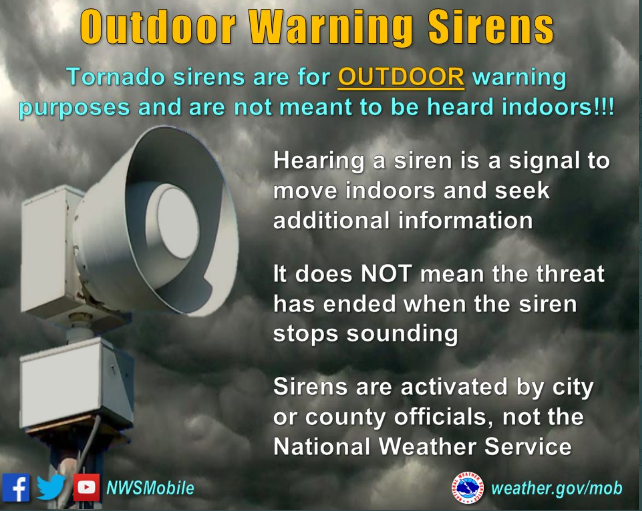
Know your families safety plan in the event severe weather develops.
Have multiple ways of receiving severe weather information. Not just my weather app. Have other ways, as well. All technology can fail. Thus, having more than one source will help keep you safe.
Remember, a WATCH means to monitor updates. You don’t have to change your behavior for a watch. Be prepared.
A WARNING is more serious. A WARNING means severe weather is imminent in or near your location. A WARNING means to seek shelter.
.
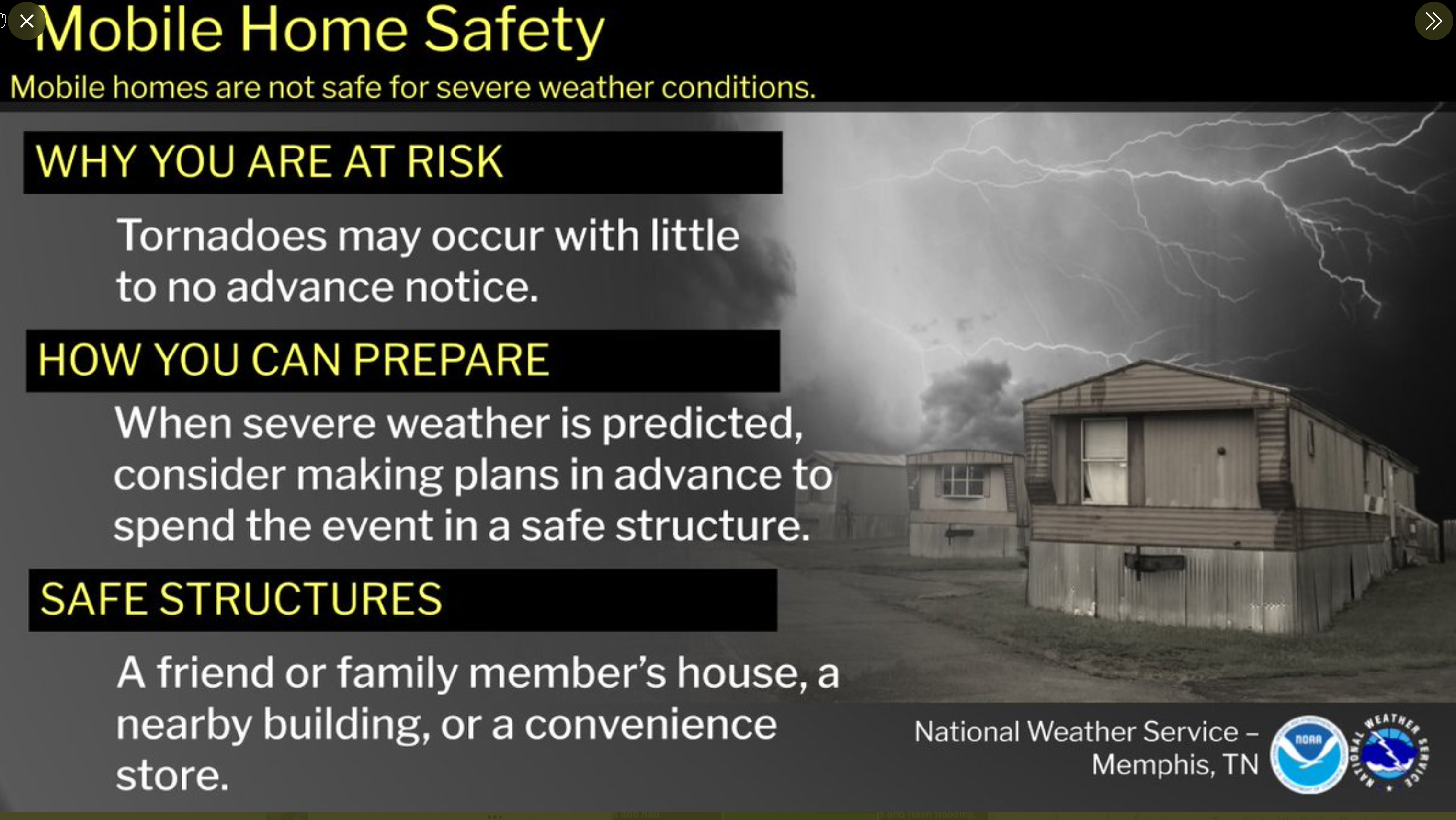
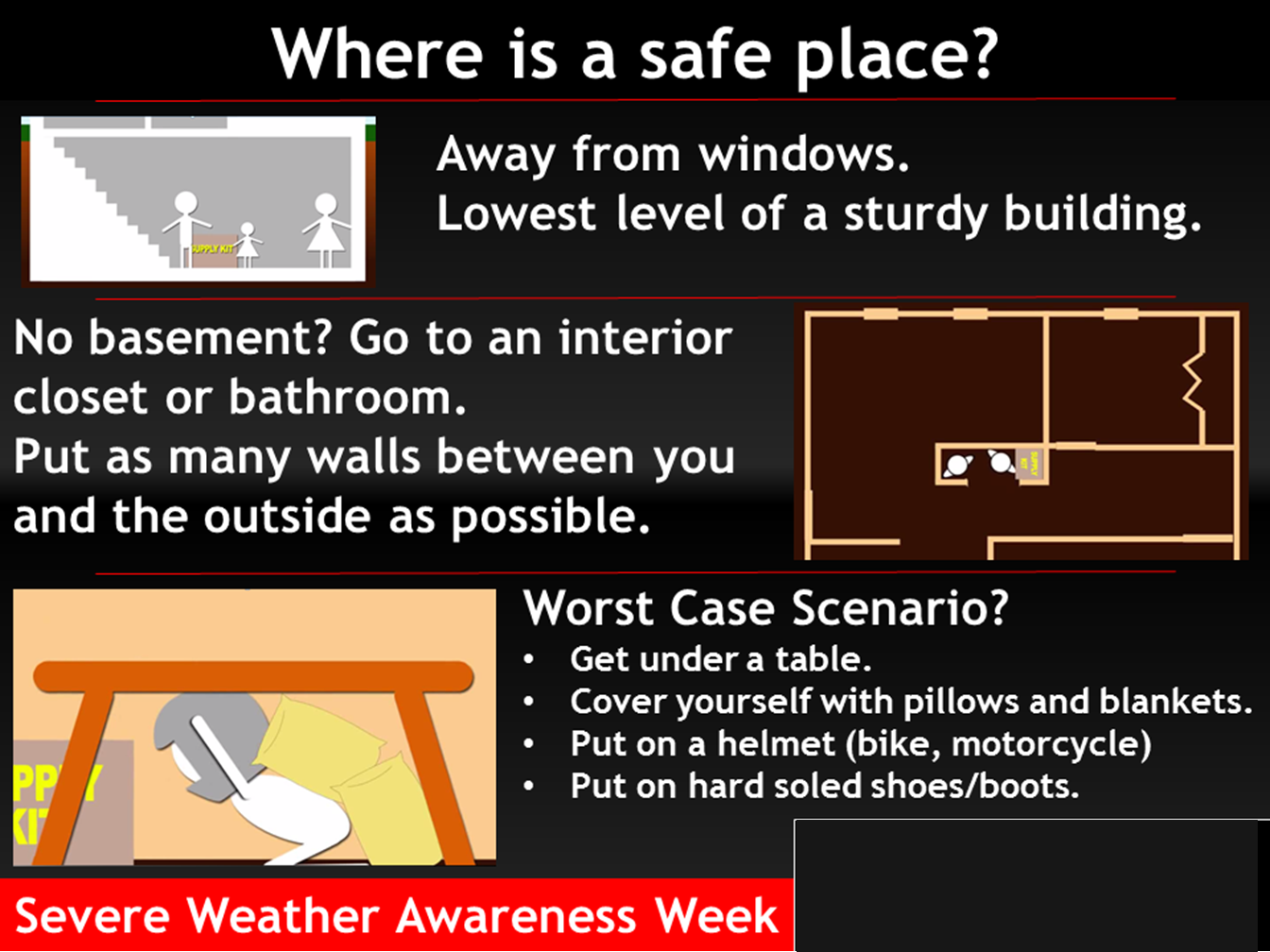
Where is a safe place to hide when tornadoes threaten your location.
.
![]()
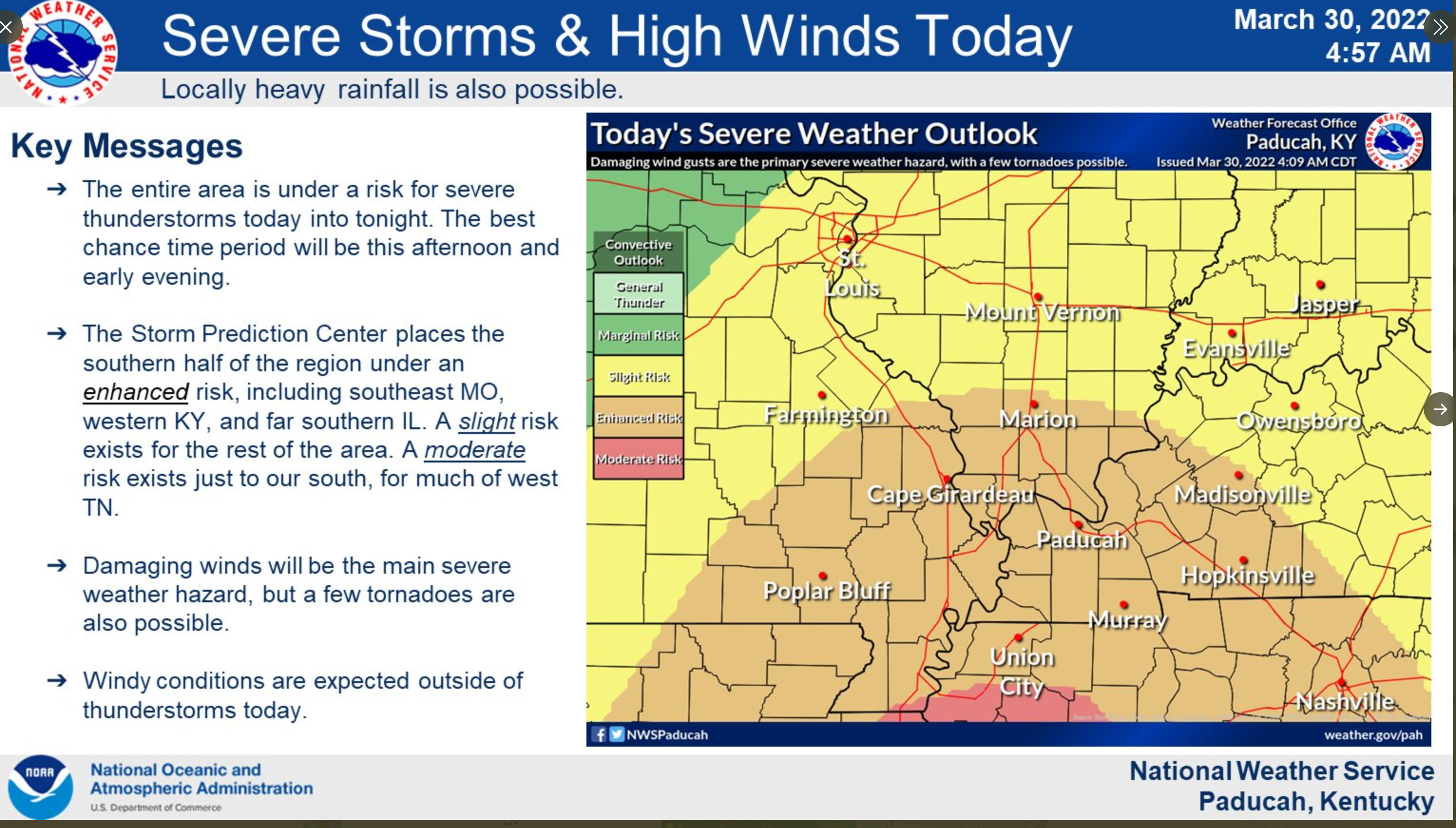
Today’s severe weather outlook from the Storm Prediction Center (below).
Light green is where thunderstorms may occur but should be below severe levels.
Dark green is a level one risk. Yellow is a level two risk. Orange is a level three (enhanced) risk. Red is a level four (moderate) risk. Pink is a level five (high) risk.
One is the lowest risk. Five is the highest risk.
A severe storm is one that produces 58 mph wind or higher, quarter size hail, and/or a tornado.
The tan states are simply a region that SPC outlined on this particular map. Just ignore that.

The black outline is our local area.

.
Tomorrow’s severe weather outlook.

.
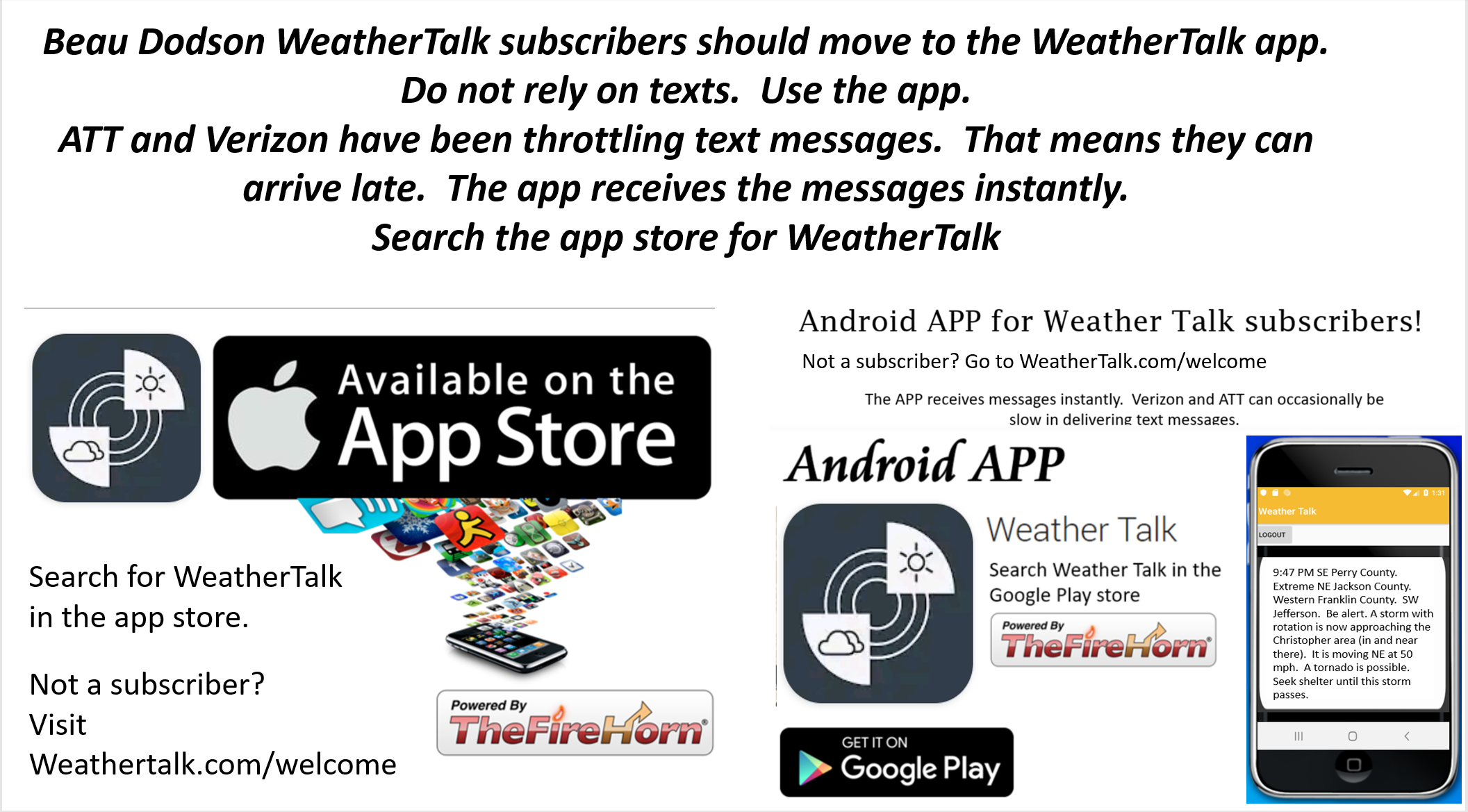
SUBSCRIBERS: Download the WeatherTalk app to keep abreast of my latest information.
The app is for subscribers. Subscribe at www.weathertalk.com/welcome then go to your app store and search for WeatherTalk
Subscribers, PLEASE USE THE APP. ATT and Verizon are not reliable during severe weather. They are delaying text messages.
The app is under WeatherTalk in the app store.
Apple users click here
Android users click here
![]()
![]()
.

Radar Link: Interactive local city-view radars & regional radars.
You will find clickable warning and advisory buttons on the local city-view radars.
If the radar is not updating then try another one. If a radar does not appear to be refreshing then hit Ctrl F5. You may also try restarting your browser.
Not working? Email me at beaudodson@usawx.com
Backup radar site in case the above one is not working.
https://weathertalk.com/morani
New ZOOM radar (with storm chasers)
https://wtalk.co/AVWG7GM7
Regional Radar
https://imagery.weathertalk.com/prx/RadarLoop.mp4
Lightning Data (zoom in and out of your local area)
https://wtalk.co/WJ3SN5UZ
Satellite Data
Computers and tablets. These two satellite links may not work well on cell phones.
Visible Satellite. This one is to be used during daylight only. Be sure and hit refresh once you are on the satellite page. Otherwise, the data will be old.
https://col.st/a5A0e
IR Satellite. This one shows cloud temperatures. Bright colors represent cold cloud tops. That could mean thunderstorms. Be sure and hit refresh once you are on the satellite page. Otherwise, the data will be old.
https://col.st/R2fw1
Water Vapor Satellite. This one shows mid-level moisture in the atmosphere. Be sure and hit refresh once you are on the satellite page. Otherwise, the data will be old.
https://col.st/xFVwx
.

Live lightning data: Click here.
Not receiving app/text messages?
Log in and out of your app.
USE THE APP. ATT and Verizon are slowing or stopping the text messages. Move to the app (not texts).
Make sure you have the correct app/text options turned on. Find those under the personal notification settings tab at www.weathertalk.com. Red is off. Green is on.
Subscribers, PLEASE USE THE APP. ATT and Verizon are not reliable during severe weather. They are delaying text messages.
The app is under WeatherTalk in the app store.
Apple users click here
Android users click here
.


