.
SCROLL DOWN THE PAGE FOR UPDATES
.
Click on the words below to subscribe
Storm Tracking Links
Interactive local city-view radars. Clickable watches and warnings.
https://wtalk.co/B3XHASFZ
Backup radar site in case the above one is not working.
https://weathertalk.com/morani
Regional Radar
https://imagery.weathertalk.com/prx/RadarLoop.mp4
*NEW* Zoom interactive radar (with storm chaser streams)
https://wtalk.co/AVWG7GM7
Real time lightning tracker system two.
https://map.blitzortung.org/#5.02/37.95/-86.99
Lightning Data (zoom in and out of your local area)
https://wtalk.co/WJ3SN5UZ
The app is for www.weathertalk.com subscribers. Subscriber first and then download the app.
Apple users click here. Android users click here.
What you need to know
Key Points
- Thunderstorms likely late tonight into Friday evening.
- Severe weather risk increase Friday afternoon and evening. Damaging wind, hail, and tornadoes will be possible.
- Have your Beau Dodson Weather app on. Check it. Make sure you have not logged out of the app.
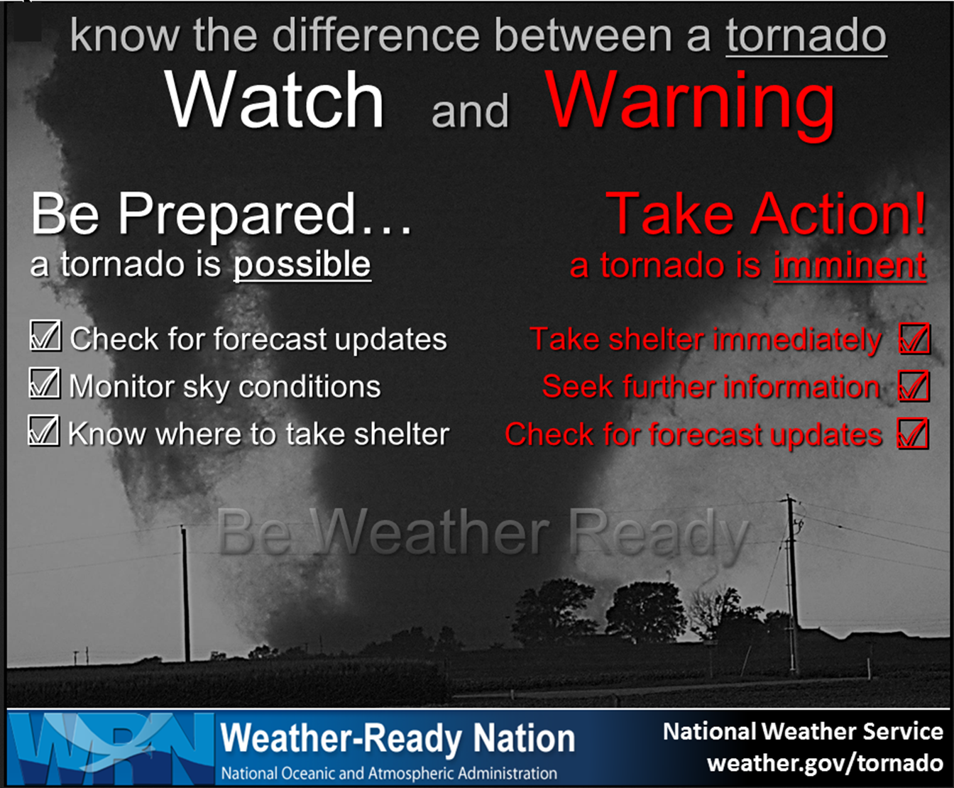
- Remember, a watch means to monitor updates. A warning means to seek shelter. A warning is a higher threat and means to seek shelter immediately. Severe weather may occur in or near your location.
.

Here is Facebooks’ Severe Weather Q&A threads.
Link https://www.facebook.com/beaudodsonweather
.
The latest blog updates will be posted here at the top of Beau’s severe weather blog.
.
Friday, March 18, 2022
8 PM
The severe threat has ended.
There was one tornado today. Numerous reports of pea to nickel size hail. Several reports of quarter to large than half-dollar size hail. Several reports of 50 to 60 mph wind gusts.
.
6:06 PM
Caldwell County.
An intense thunderstorm is moving through Lyon County. This storm has a history of quarter to half dollar size hail. If it maintains its strength, then it will soon move into Caldwell County.
Let’s be weather aware as this storm moves into the county. Hail is likely with this storm.
Radars
https://weatherobservatory.com/weather-radar.htm
.
5:53 PM
Quarter size hail reported in Grand Rivers, KY.
.
5:52 PM
Lyon County.
An intense thunderstorm is moving into Lyon County. This storm has signs of winds above 60 mph. It also has some rotation in it.
Let’s be weather aware as this storm moves into the county. Hail is likely with this storm.
Radars
https://weatherobservatory.com/weather-radar.htm
.
5:45 PM
Southern Livingston and Lyon Counties.
A severe thunderstorm was approaching from northern Marshall County. This storm is moving E NE at 45 mph.
This storm may produce pockets of wind damage and hail.
Radars
https://weatherobservatory.com/weather-radar.htm
.
5:33 PM
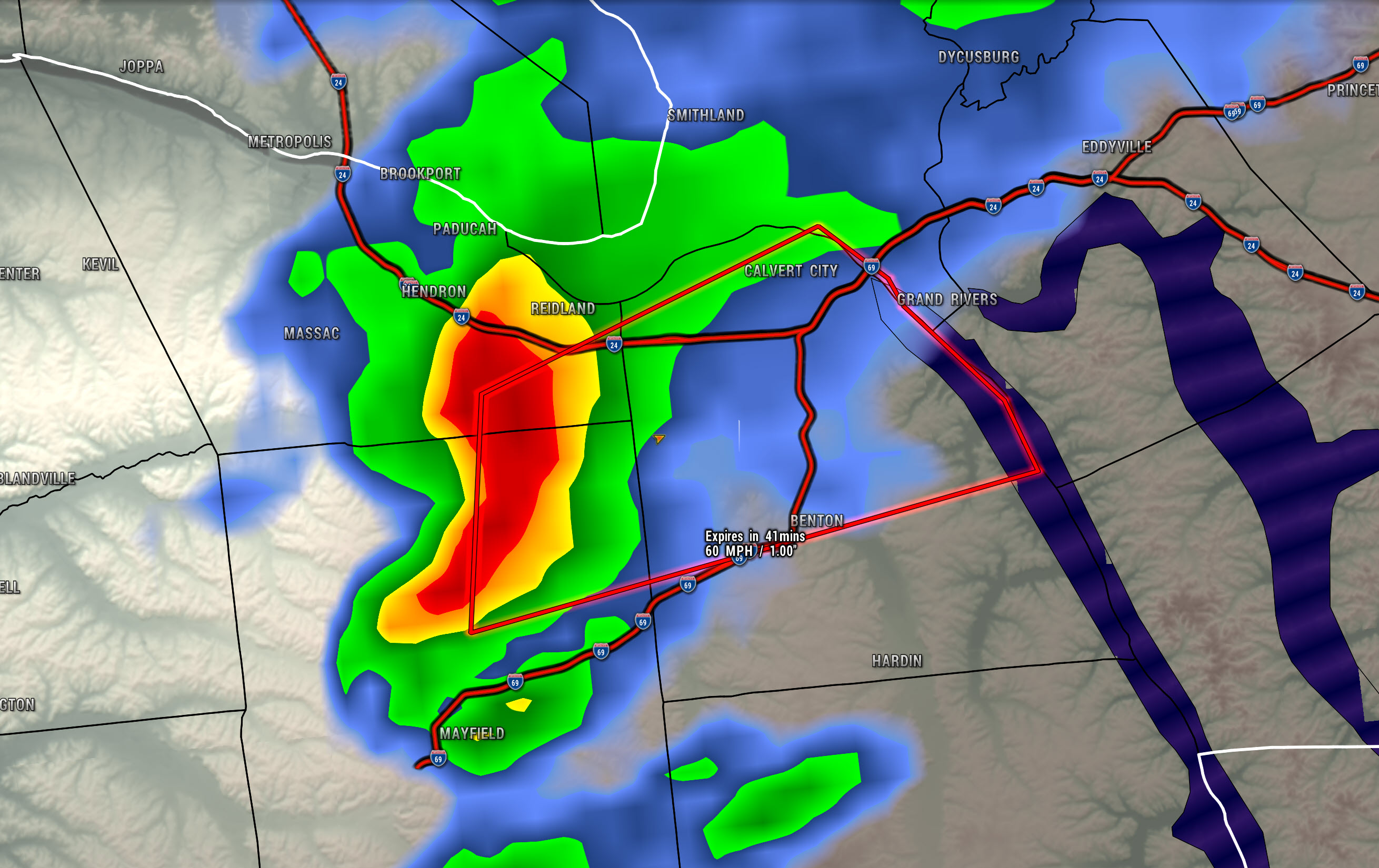
The National Weather Service in Paducah has issued a
Severe Thunderstorm Warning for…
Northern Marshall County in western Kentucky…
Southeastern McCracken County in western Kentucky…
Northeastern Graves County in western Kentucky…
Until 615 PM CDT.
At 531 PM CDT, a severe thunderstorm was located near Reidland, moving east at 40 mph.
HAZARD…60 mph wind gusts and quarter size hail.
SOURCE…Radar indicated.
IMPACT…Hail damage to vehicles is expected. Expect wind damage
to roofs, siding, and trees.
This severe thunderstorm will be near…
Benton around 540 PM CDT.
Calvert City around 545 PM CDT.
This includes the following highways…
Interstate 24 in Kentucky between Mile Markers 15 and 29.
Interstate 69 in Kentucky between Mile Markers 39 and 51.
.
4:40 PM
Storms have weakened quite a bit over the past 10 minutes. These storms have been pulsing up and down since they moved through northeast Arkansas.
These storms may still produce brief heavy rain, small hail, lightning, and gusty winds.
For now, the severe threat (with these particular storms) has decreased. I will continue to monitor them as they move northeast.
If they pulse back up to severe levels then I will send out another message.
Radar
https://weatherobservatory.com/radar_paducah.htm
.
4:20 PM
Southern Ballard, central and northern Graves, and McCracken County.
Strong to severe thunderstorms are currently moving into Carlisle and Hickman Counties.
These storms have a history of hail and high wind. If they hold together, then they will move into southern Ballard, central and northern Graves, and McCracken Counties.
The storms do have some broad rotation with them. Let’s remain weather aware as these thunderstorms move northeast over the coming hour.
Radars
https://weatherobservatory.com/weather-radar.htm
.
4:15 PM
Carlisle, Hickman, and Fulton
Strong to severe thunderstorms continue to move northeast and are crossing the Mississippi River.
These storms have a history of hail and high winds. There was a report of a brief tornado touchdown in southeast New Madrid County a bit earlier.
The storms do have some rotation with them. Let’s remain weather aware as these thunderstorms push through the area.
Radars
https://weatherobservatory.com/weather-radar.htm
.
4:03 PM
Local Storm Report by NWS PAH: Lilbourn [New Madrid Co, MO] emergency mngr reports HAIL of E0.70 INCH at 03:55 PM CDT
.
3:57 PM
Carlisle and Hickman Counties.
Intense thunderstorms are approaching from the southwest. These storms are currently in far southeast Missouri and are moving east/northeast at 40 mph.
These storms have a history of producing hail and strong wind gusts. If they maintain their intensity, then they will move into Carlisle and Hickman Counties.
Radars
https://weatherobservatory.com/weather-radar.htm
.
3:55 PM
New Madrid, southern Mississippi, and western Fulton Counties
A severe thunderstorm was pushing northeast out of New Madrid County.
This storm may produce quarter size hail (or larger) and pockets of 60 mph wind gusts.
LOCATIONS IN THE PATH OF THIS SEVERE THUNDERSTORM INCLUDE EAST PRAIRIE, BIG OAK TREE STATE PARK AND TOWOSAHGY STATE HISTORIC SITE. THIS INCLUDES INTERSTATE 55 BETWEEN MILE MARKERS 39 AND 54.
Radars
https://weatherobservatory.com/weather-radar.htm
.
3:06 PM
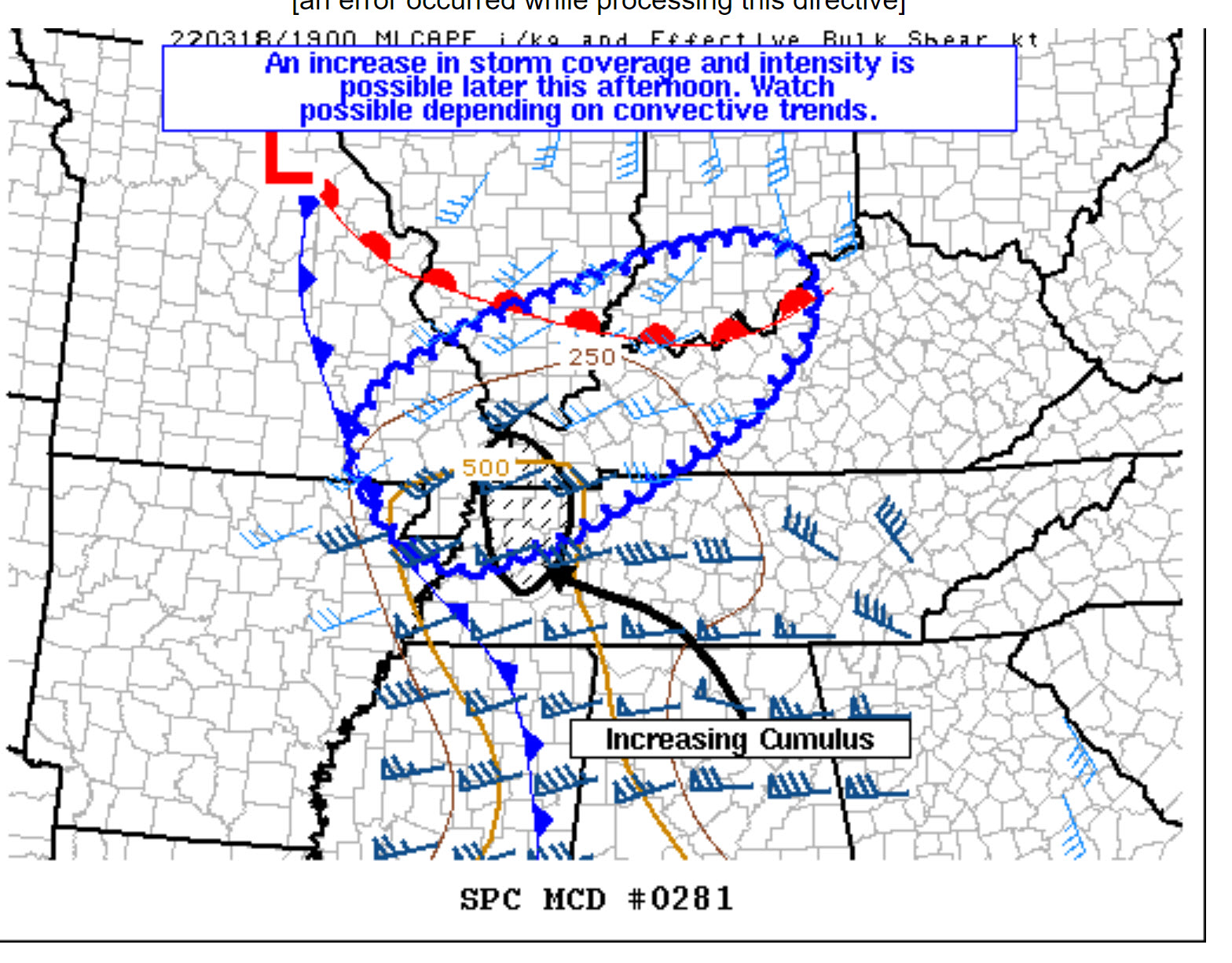
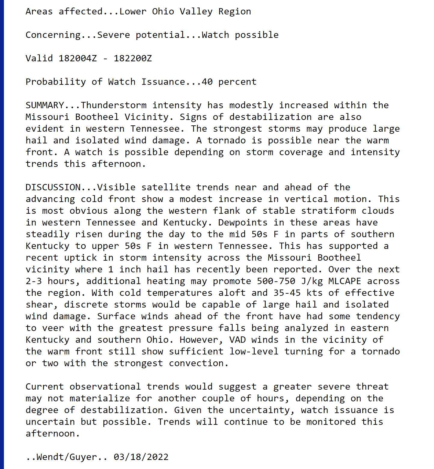
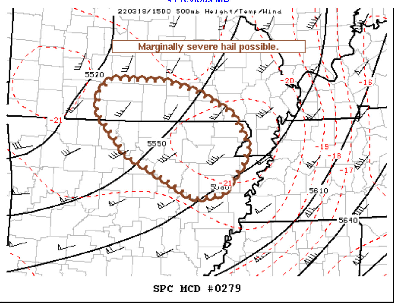
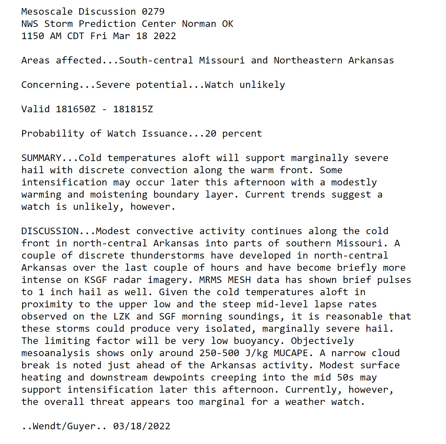
The Storm Prediction Center may issue a watch this afternoon and evening. Here are their comments.
.
2:57 PM
Butler County
The storm moving into Butler County has shown some signs of weakening. It produced heavy hail in Ripley County. Often times, these storms will pulse up and down.
Link
https://weatherobservatory.com/radar_dyers.htm
.
2:27 PM
Butler County.
A severe thunderstorm was approaching Butler County from the southwest. This storm has signs of producing quarter size hail or larger and isolated damaging wind gusts.
The storms is moving east/northeast at 40 mph.
WOW! Check out this hail video from Poyner, MO that Madison Whisnant sent me!!! #mowx pic.twitter.com/yVFIslvZUS
— ʀʏᴀɴ ᴠᴀᴜɢʜᴀɴ (@ryanvaughan) March 18, 2022
.
12 PM
Storms should begin to develop over the coming hours. For now, the primary concern will be a couple of storms producing large hail and perhaps damaging wind.
There may be numerous reports of small hail today.
A severe thunderstorm warning is issued when hail is expected to reach 1″ in size or larger.
This does not look to be a severe thunderstorm outbreak.
Storms will be moving out of the southwest and moving northeast.
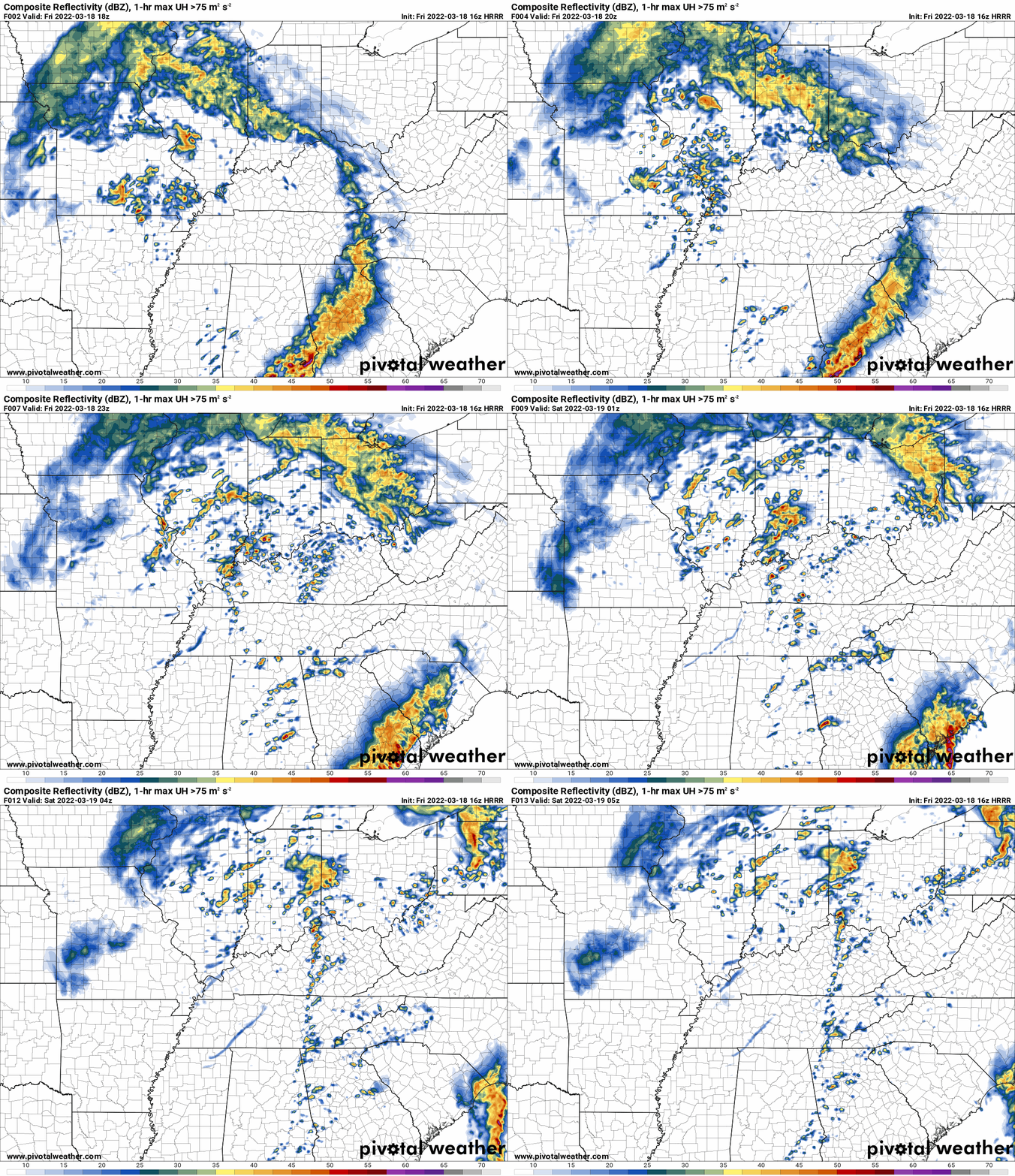
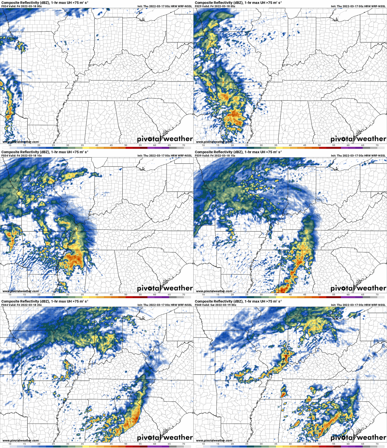
Future-cast radar
Occasionally, these maps are in Zulu time. 12z=6 AM. 18z=12 PM. 00z=6 PM. 06z=12 AM
.
12 PM
.
7:30 AM
Double click images to enlarge them.
.
7 AM
We have some showers in the area this morning. Most of the rain was light. Rain totals with this system will likely range from 0.10″ to 0.30″. A thunderstorm can always produce locally higher totals.
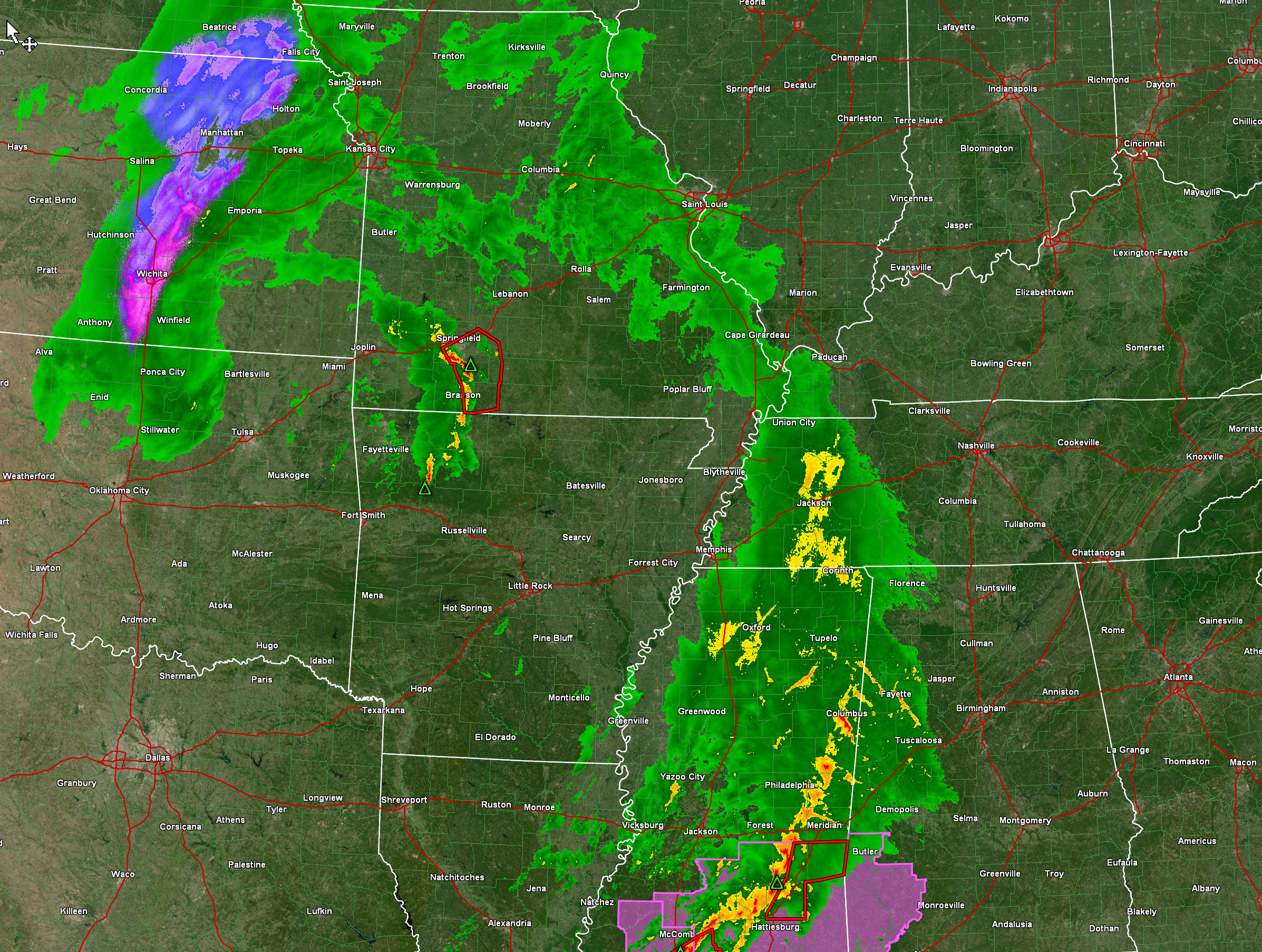
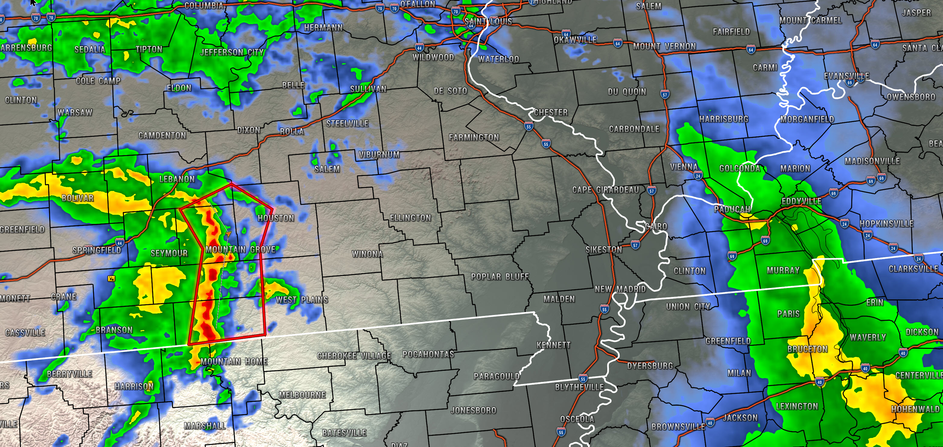
At 6 AM, radar looked like this. Note the severe storms in southwest Missouri closer to the area of low pressure.
Zoomed in on the southwest Missouri storms
Double click on images to enlarge them. These southwest Missouri storms are moving east/northeast. We will have to see if they hold together.
.
This rain will push off to the east over the coming hours.
The atmosphere will likely become a bit more unstable this afternoon. That will set the stage for a few thunderstorms to develop.
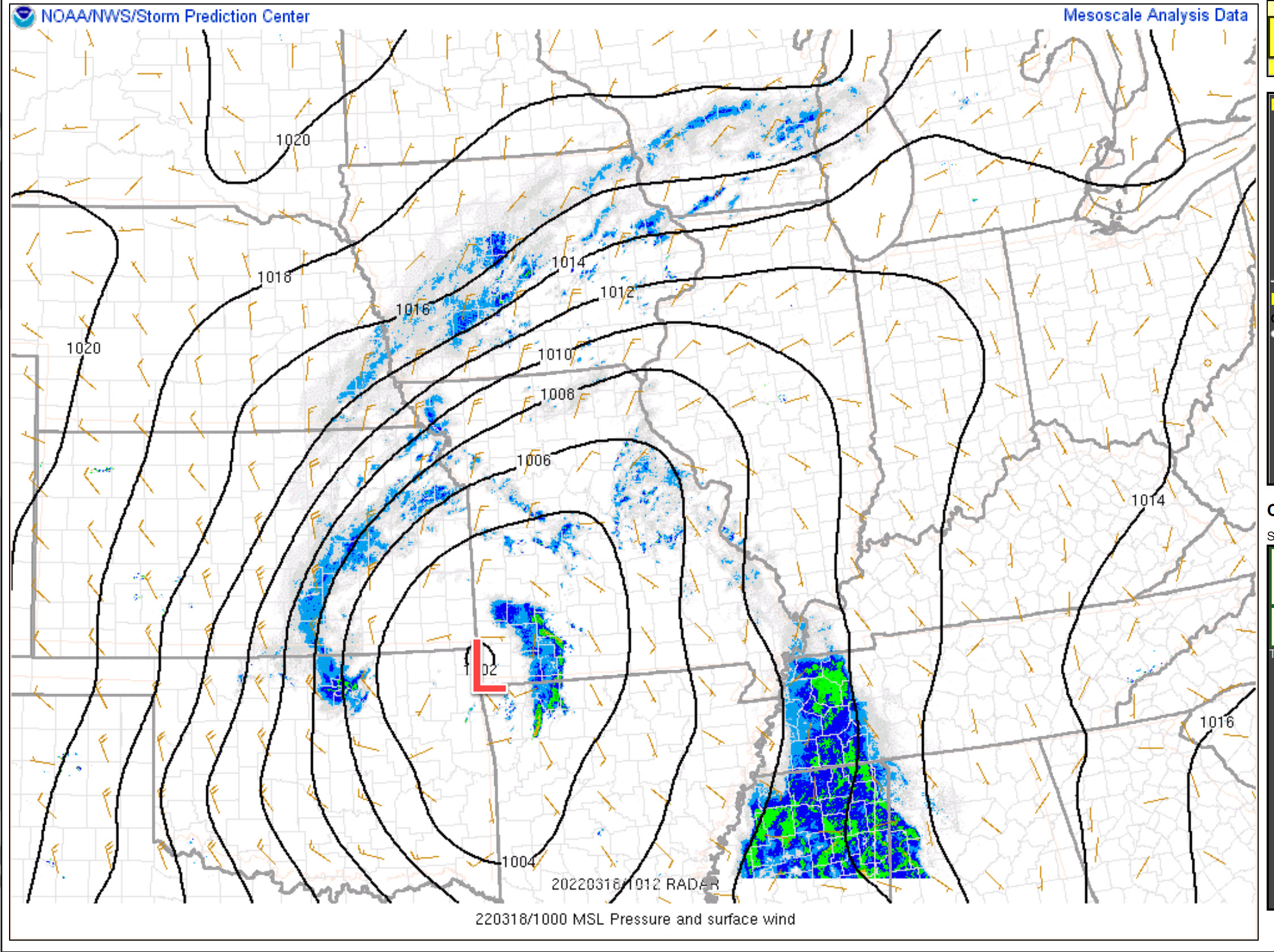
An area of low pressure will push into our region from the southwest. You can see that low on the morning weather map.
The low pressure center is the red L. That is moving northeast. Remember, when a low passes to our south we rarely have severe weather. That means we are in the cool sector.
When a low passes to our north, then we are in the warm sector. The warm sector is where severe weather is most likely to occur.
This low is moving northeast into the St Louis area. That places us in the warm sector.
.
There is a risk of severe thunderstorms. This does not appear to be a big severe weather outbreak. Rather, it appears that a few thunderstorms will form. Perhaps some low-topped supercells.
There remain some questions about how high dew points will be this afternoon. Remember, I typically look for dew points in the upper 50s and 60s. That is a signal for severe weather.
It is possible that the higher dew points remain to our south. It is a “monitor updates” type of day.
The risk is highest from around 12 PM through 6 PM.
These thunderstorms could produce large hail and damaging wind gusts. The tornado risk is low, but not zero. We are not expecting long-tracked tornadoes. Of course, any tornado can produce damage.
Thunderstorms will be moving from the southwest towards the northeast at 50 mph.
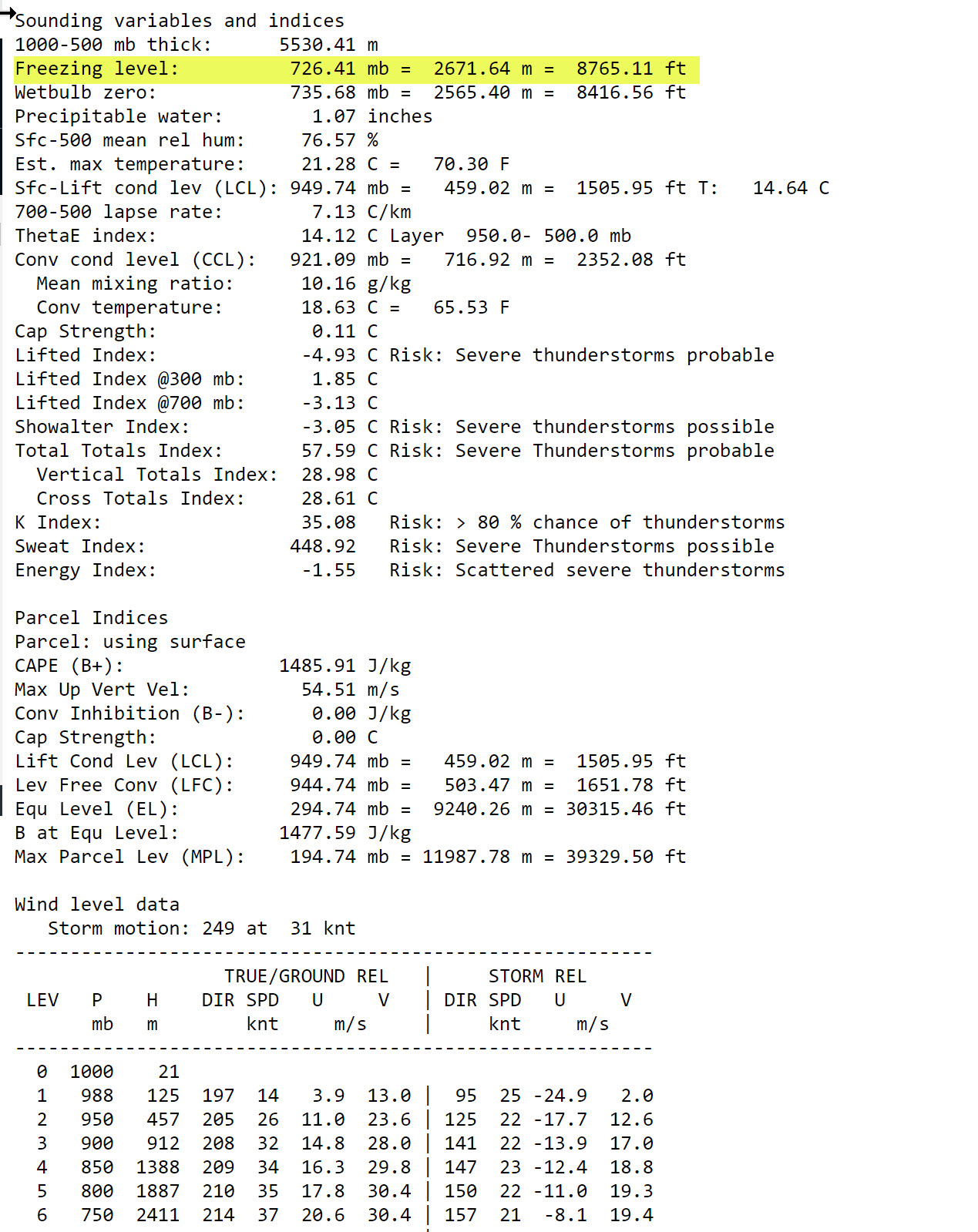
The atmospheric freezing level will be fairly low today. That means hail is a threat. The Storm Prediction Center has even mentioned the potential of golf ball size hail. This will need to be monitored.
You can see on this chart. The freezing level is below 10,000 feet. That is quite low. That increases the threat of hail.
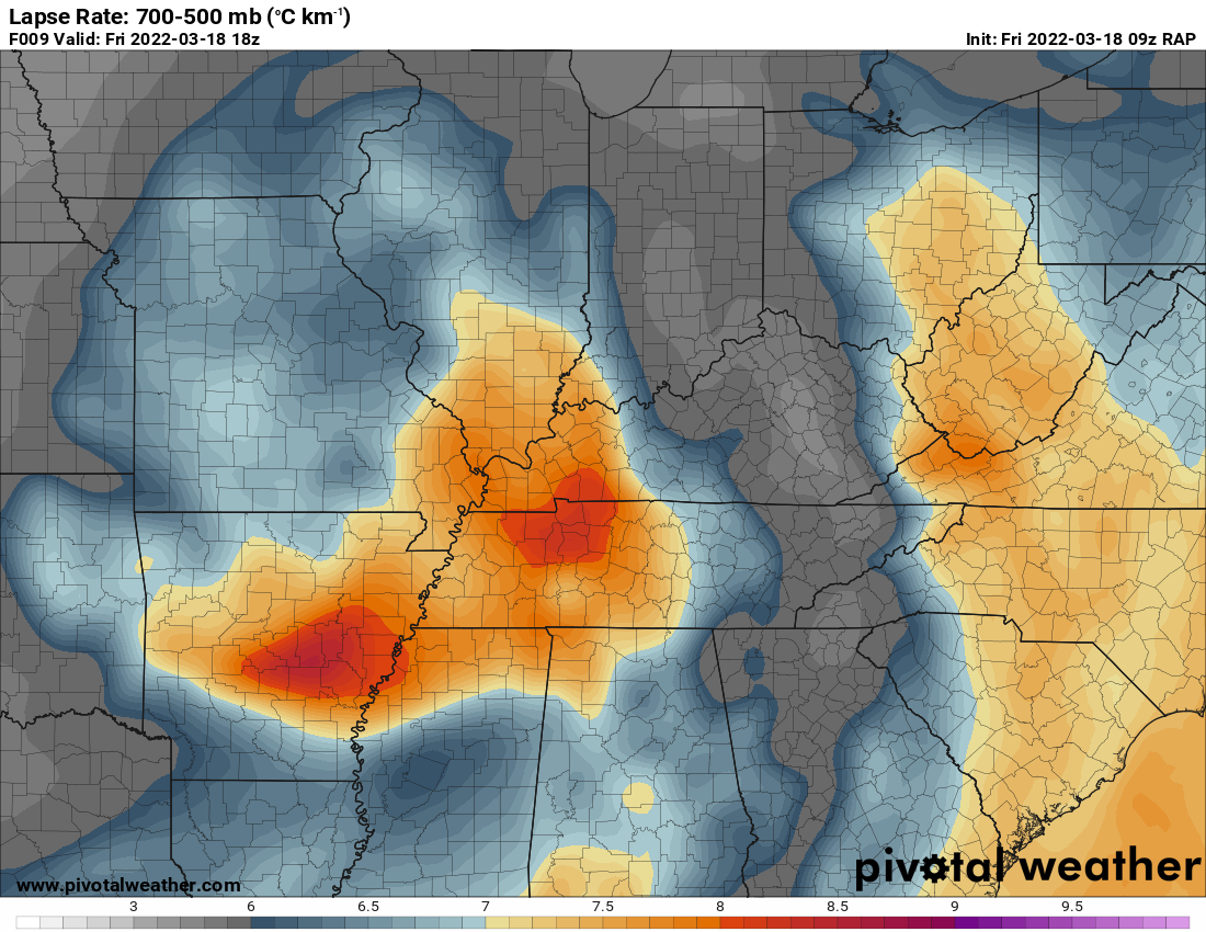
Lapse rates will be high today. Lapse rates show you how fast temperatures fall as a parcel of air rising into the atmosphere.
The lapse rate is the change in temperature divided by the change in height. Lapse rates are important to weather forecasting since they help assess the (in)stability of layers in the troposphere. A higher number of lapse rate indicates a greater cooling with height.
This chart shows today’s lapse rates. Those are some decent numbers for large hail. Don’t be surprised if storms produce quite a bit of hail (if storms can get going).
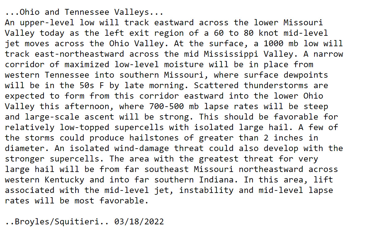
Here are the comments from the Storm Prediction Center
.
Make sure you have several ways of receiving severe weather information. Do not rely on just one source. Make sure you have your Beau Dodson Weather app available. Don’t forget it has a see all button on it. That shows you every message that I send out (to every county).
Thunderstorms will push off to the east this evening.
.
Thursday, March 17, 2022
6 PM
I was at a NWS conference all day today. Sorry for the late update.
No real changes to the morning forecast. The risk appears to be Friday afternoon and evening.
Some of the data shows large hail. Perhaps greater than golf ball size.
I should note that some data shows very little activity forming.
That could mean a few supercell thunderstorms. Monitor updates.
.
7:00 AM
No weather concerns today.
Shower chances will increase late tonight from west to east. Some rumbles of thunder will also be possible.
The primary change in the forecast has been the threat of severe thunderstorms. If you remember, I told you if the low were to track further north then our severe weather risk would increase. The low is tracking further north.
The primary concern will be Friday afternoon and evening. This is when the ingredients will come together for the potential of damaging wind, hail, and tornadoes.
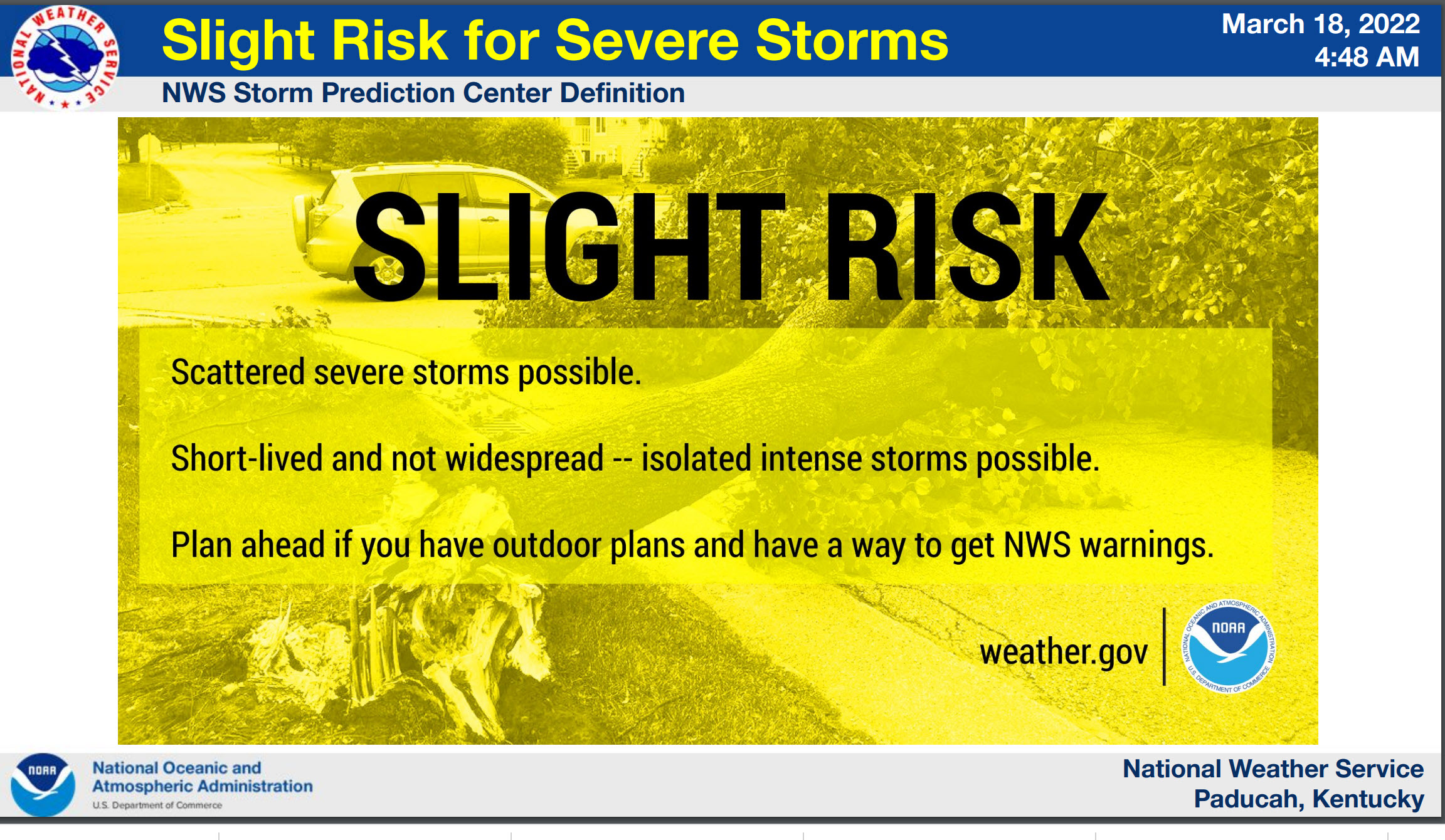
The Storm Prediction Center has upgraded us to a level two our of five severe weather risk. One being the lowest. Five being the highest.
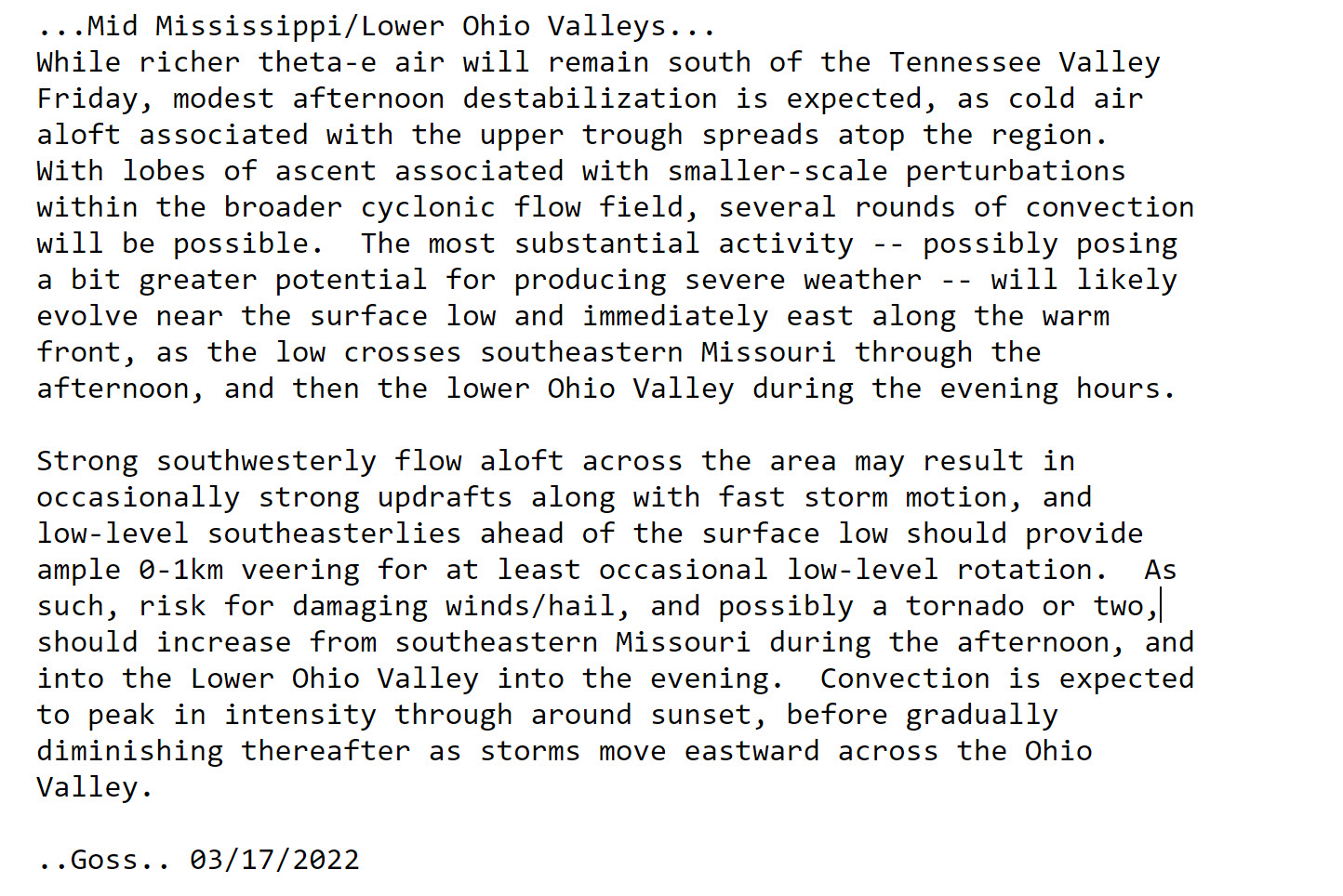
SPC forecast comments.
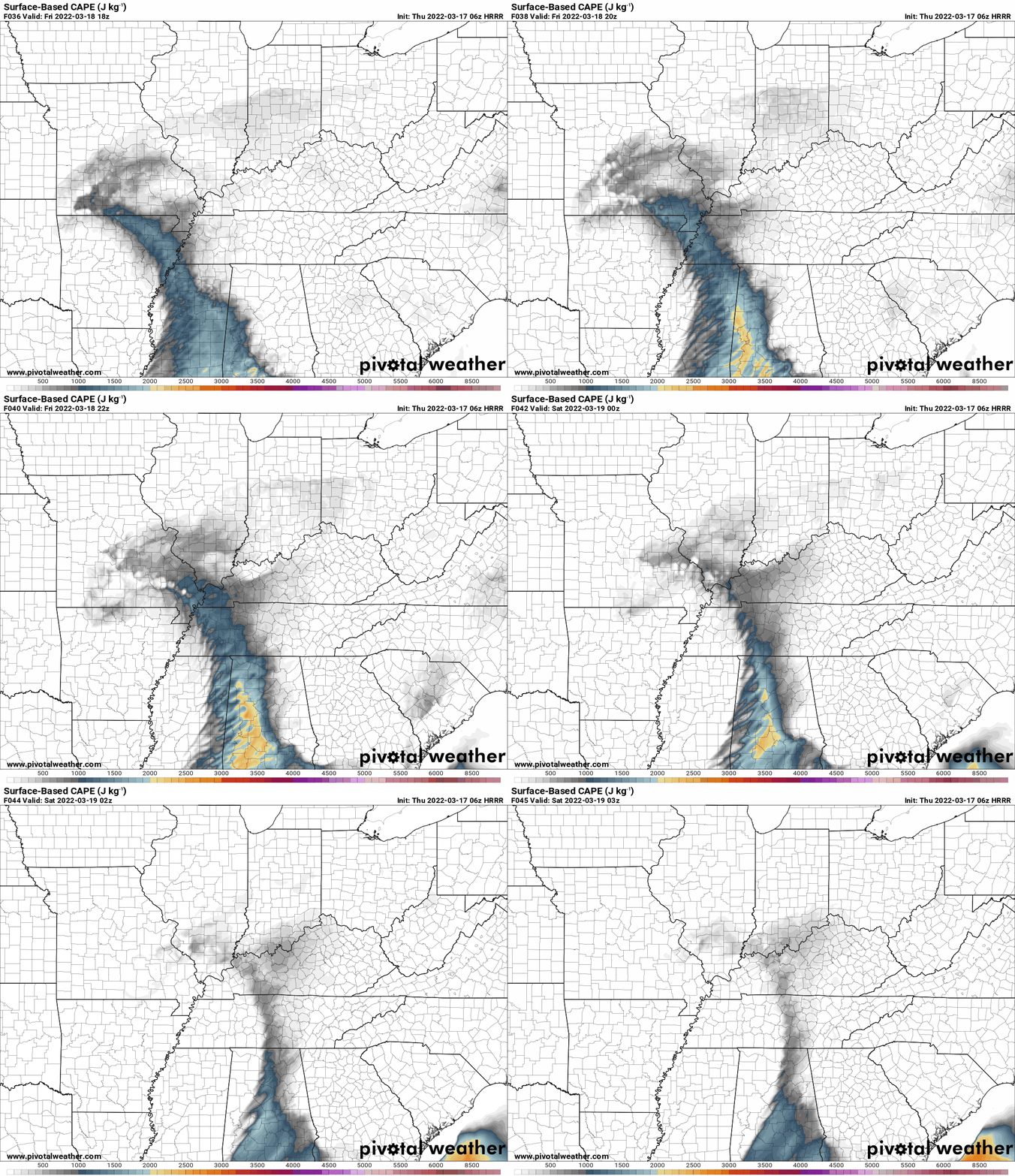
I always watch CAPE levels during these events.
Here is the Hrrr model CAPE forecast. Think of CAPE as energy for thunderstorms to tap into.
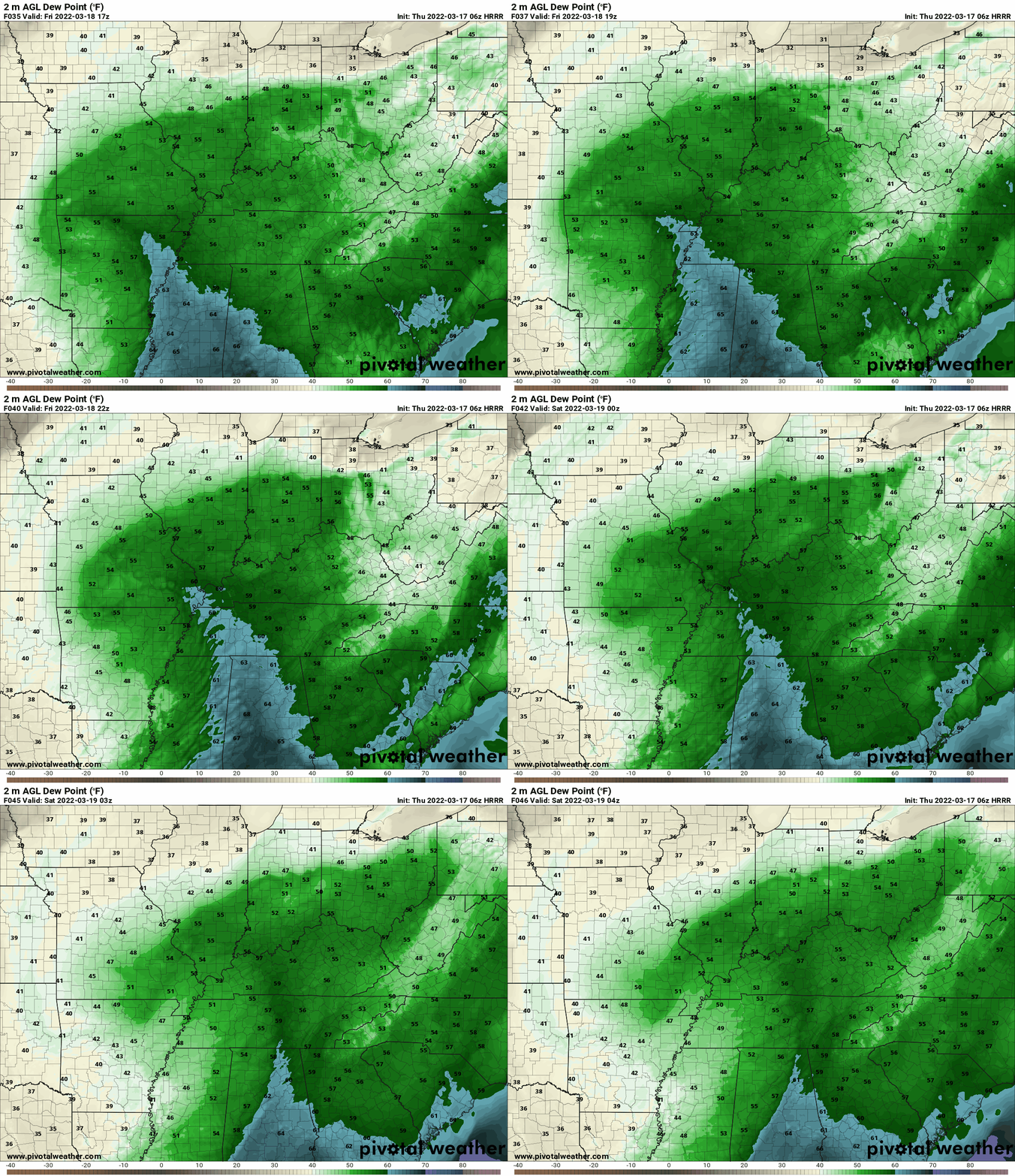
I also watch dew points. Typically, dew points in the upper 50s to lower 60s are sufficient for a severe weather risk.
Those blue colors represent the 60 degree dew point line. As you can see, it does push into at least a good portion of our local area.
Monitor your Beau Dodson Weather app. Have several ways of receiving your severe weather information in the event one of those ways fails.
Storms will be moving southwest to northeast at 50 mph. Fast moving thunderstorms.
It is possible we have some supercell type thunderstorms Friday afternoon. Those would be the ones that tend to be more scattered. Either way, there is a threat of severe weather.
.
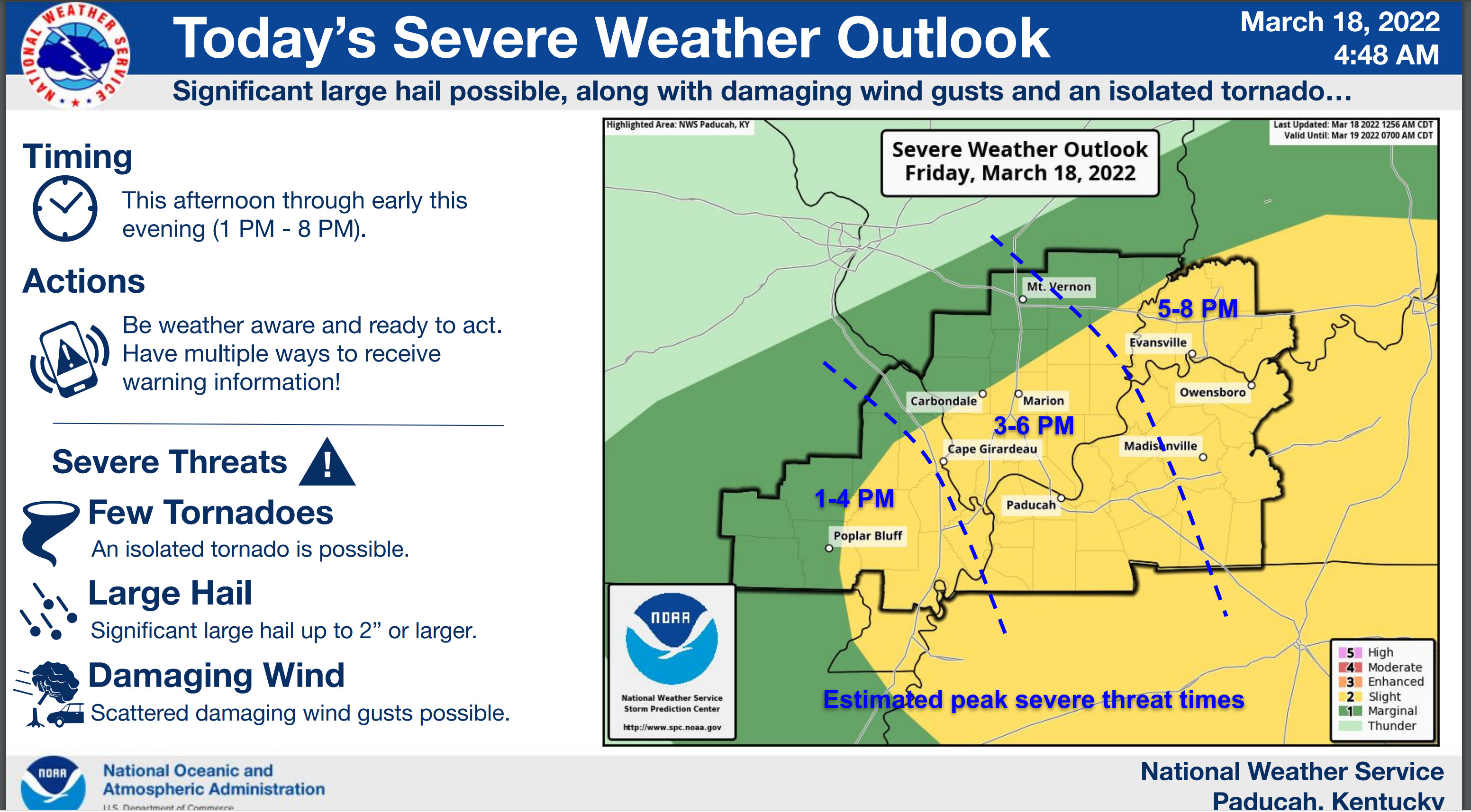
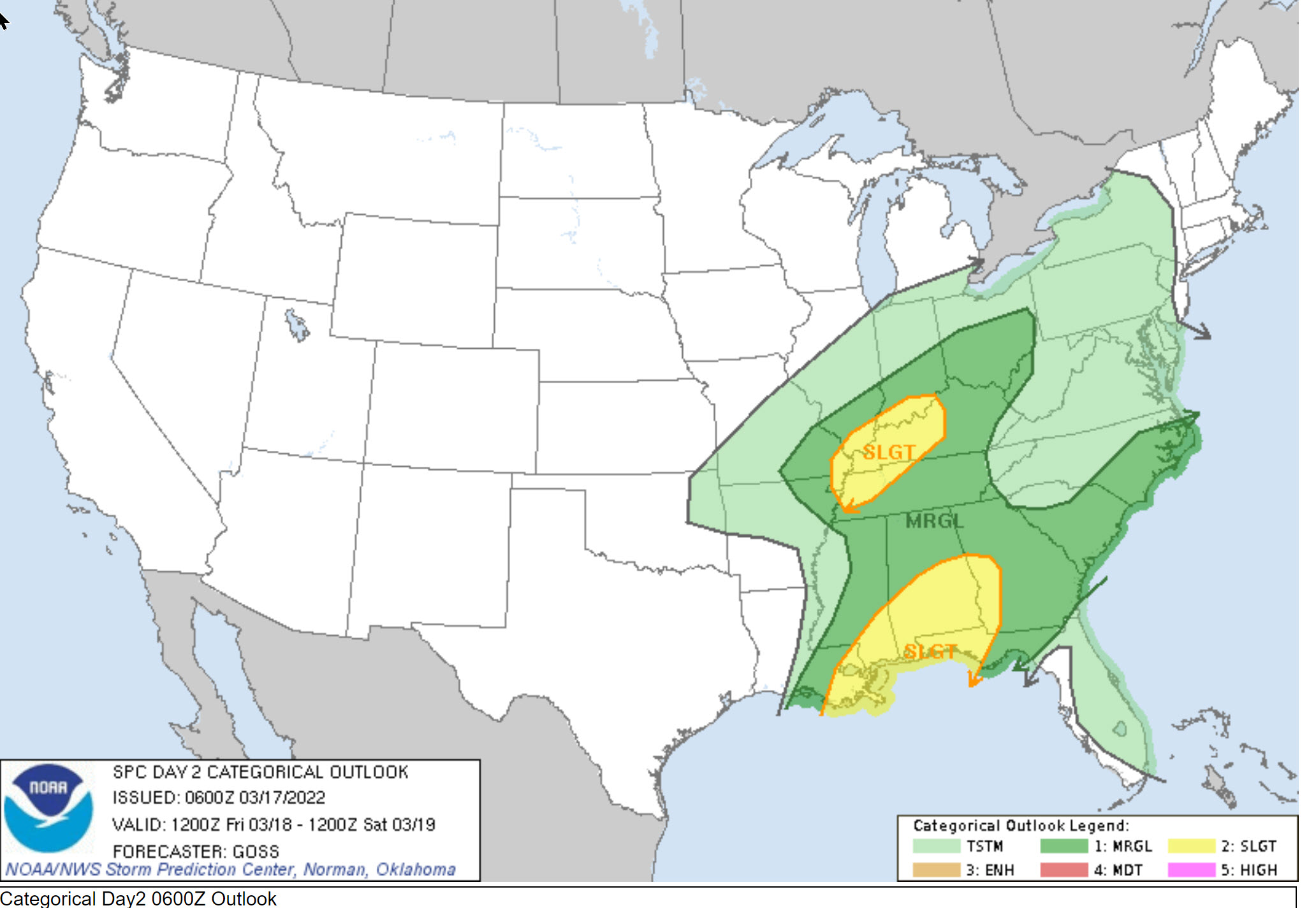
The Storm Prediction Center has outlined a zone for the threat of severe weather Friday afternoon and evening across portions of our region.
Light green is where thunderstorms may occur but should be below severe levels.
Dark green is a level one risk. Yellow is a level two risk. Orange is a level three (enhanced) risk. Red is a level four (moderate) risk. Pink is a level five (high) risk.
One is the lowest risk. Five is the highest risk.
A severe storm is one that produces 58 mph wind or higher, quarter size hail, and/or a tornado.
The tan states are simply a region that SPC outlined on this particular map. Just ignore that.

The black outline is our local area.

.
Tomorrow’s severe weather outlook.

.
What am I looking at?
You are looking at different models. Meteorologists use many different models to forecast the weather. All models are wrong. Some are more wrong than others. Meteorologists have to make a forecast based on the guidance/models.
I show you these so you can see what the different models are showing as far as precipitation. If most of the models agree, then the confidence in the final weather forecast increases.
You can see my final forecast at the top of the page.
Occasionally, these maps are in Zulu time. 12z=6 AM. 18z=12 PM. 00z=6 PM. 06z=12 AM
.
This animation is the Storm Prediction Center WRF model.
This animation shows you what radar might look like as the next system pulls through the region. It is a future-cast radar.
Time-stamp upper left. Click the animation to enlarge it.
.
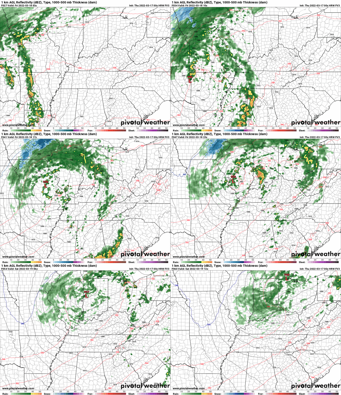
This animation is the HRW FV3 high resolution model.
This animation shows you what radar might look like as the next system pulls through the region. It is a future-cast radar.
Time-stamp upper left. Click the animation to enlarge it.
.
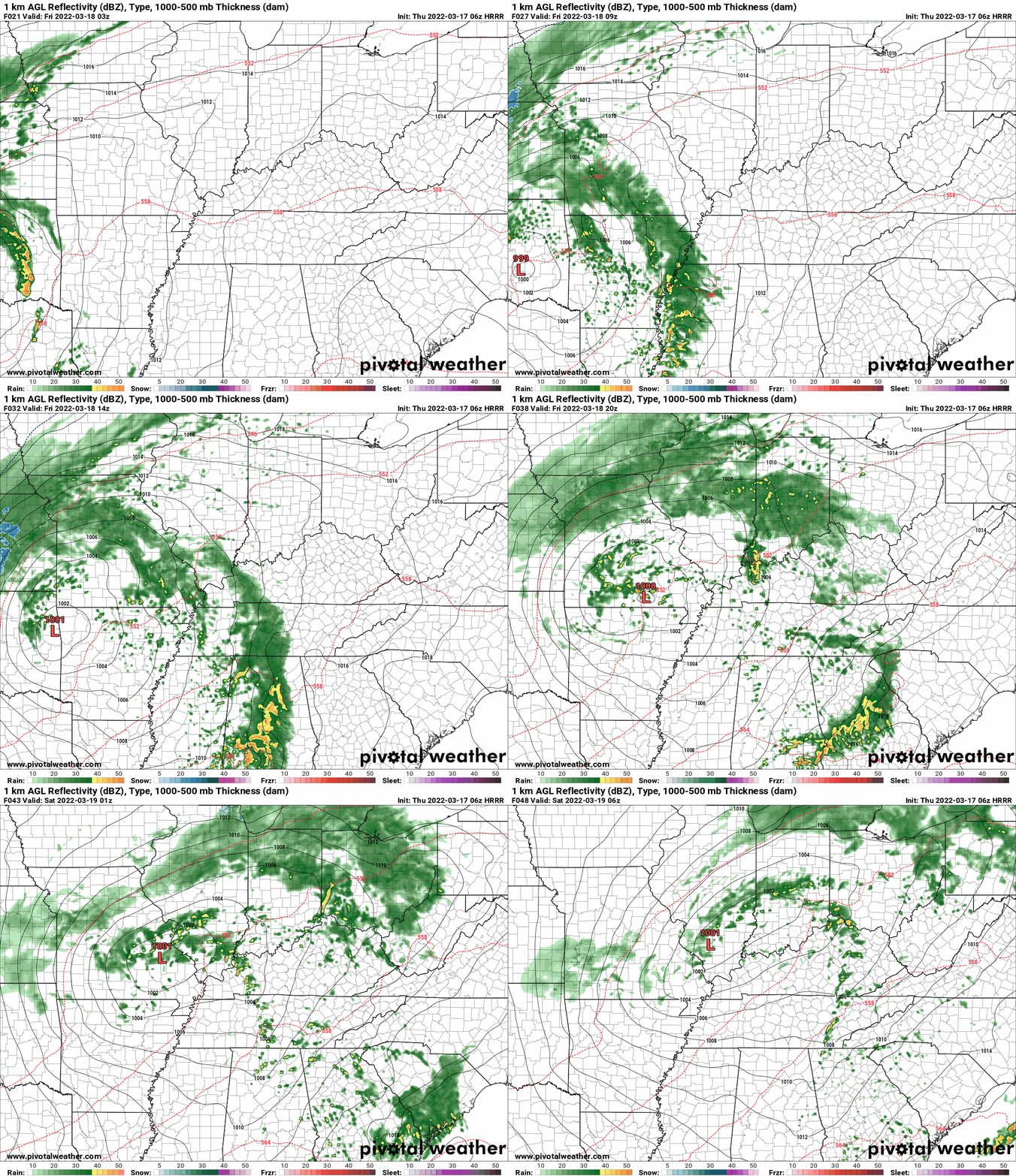
This animation is the Hrrr short-range model.
This animation shows you what radar might look like as the next system pulls through the region. It is a future-cast radar.
Time-stamp upper left. Click the animation to enlarge it.
Double click the animation to enlarge it.
These maps are in Zulu time. 12z=6 AM. 18z=12 PM. 00z=6 PM. 06z=12 AM
.
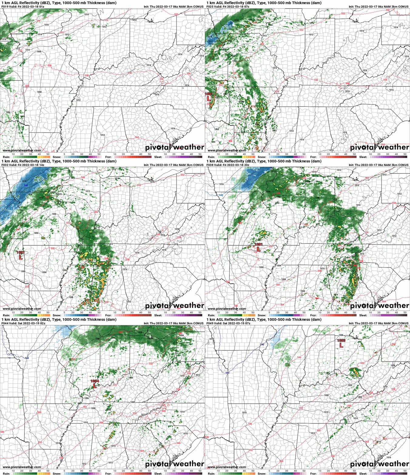
.This animation is the higher-resolution 3K NAM American Model.
Double click the animation to enlarge it.
Time is in Zulu. 12z=6 AM. 18z=12 PM. 00z=6 PM. 06z=12 AM
.
Monitor updates. Monitor your Beau Dodson Weather App. Monitor local media. Have THREE TO FIVE ways of receiving severe weather information. Do not rely on just one source. Every source can fail at one point or another. Thus, having multiple sources of severe weather information is the best advice.
Know your families safety plan in the event severe weather develops.
Have multiple ways of receiving severe weather information. Not just my weather app. Have other ways, as well. All technology can fail. Thus, having more than one source will help keep you safe.
Remember, a WATCH means to monitor updates. You don’t have to change your behavior for a watch. Be prepared.
A WARNING is more serious. A WARNING means severe weather is imminent in or near your location. A WARNING means to seek shelter.
.
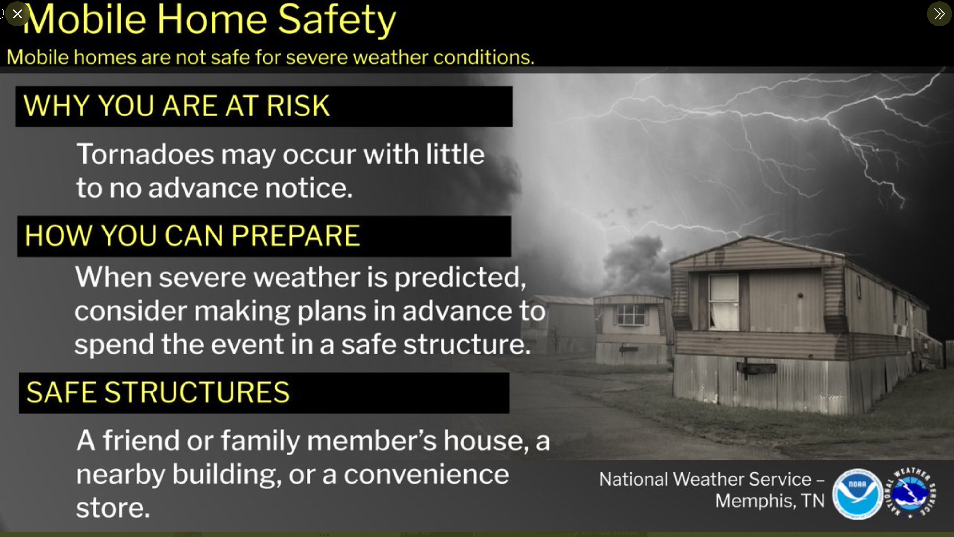
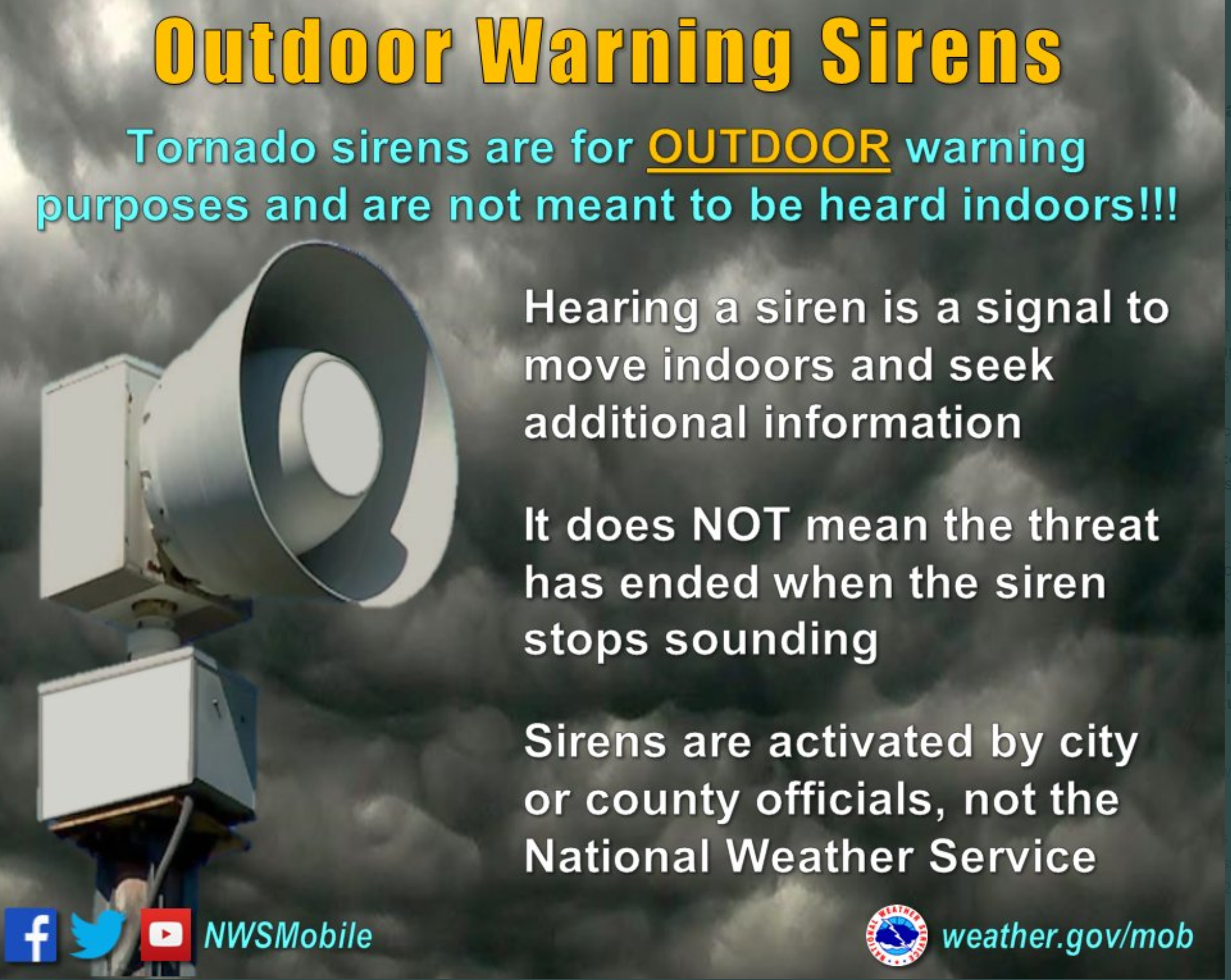
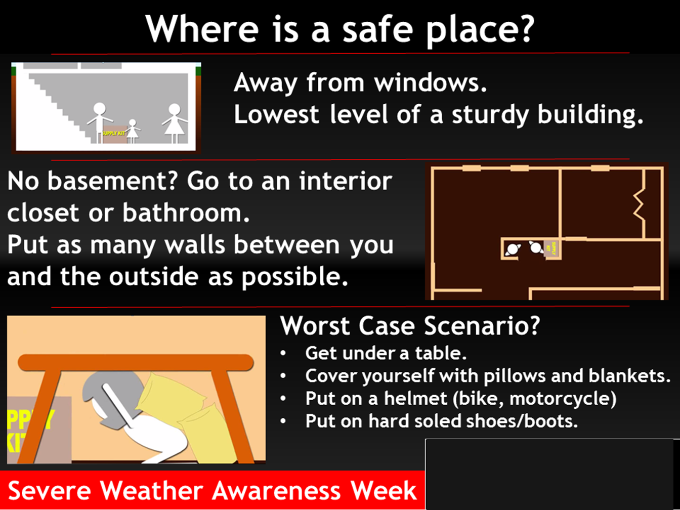
Where is a safe place to hide when tornadoes threaten your location.
.
![]()
Today’s severe weather outlook from the Storm Prediction Center (below).
Light green is where thunderstorms may occur but should be below severe levels.
Dark green is a level one risk. Yellow is a level two risk. Orange is a level three (enhanced) risk. Red is a level four (moderate) risk. Pink is a level five (high) risk.
One is the lowest risk. Five is the highest risk.
A severe storm is one that produces 58 mph wind or higher, quarter size hail, and/or a tornado.
The tan states are simply a region that SPC outlined on this particular map. Just ignore that.

The black outline is our local area.

.
Tomorrow’s severe weather outlook.

.
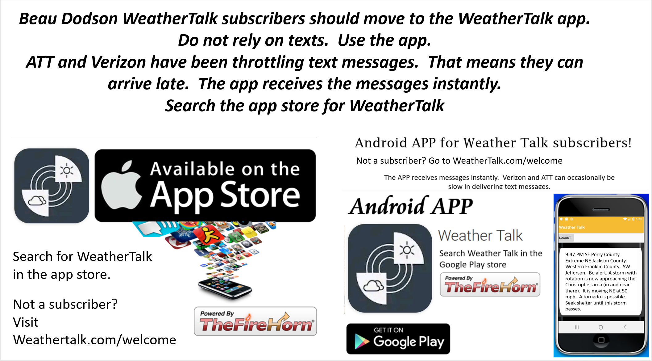
SUBSCRIBERS: Download the WeatherTalk app to keep abreast of my latest information.
The app is for subscribers. Subscribe at www.weathertalk.com/welcome then go to your app store and search for WeatherTalk
Subscribers, PLEASE USE THE APP. ATT and Verizon are not reliable during severe weather. They are delaying text messages.
The app is under WeatherTalk in the app store.
Apple users click here
Android users click here
![]()
![]()
.

Radar Link: Interactive local city-view radars & regional radars.
You will find clickable warning and advisory buttons on the local city-view radars.
If the radar is not updating then try another one. If a radar does not appear to be refreshing then hit Ctrl F5. You may also try restarting your browser.
Not working? Email me at beaudodson@usawx.com
Backup radar site in case the above one is not working.
https://weathertalk.com/morani
New ZOOM radar (with storm chasers)
https://wtalk.co/AVWG7GM7
Regional Radar
https://imagery.weathertalk.com/prx/RadarLoop.mp4
Lightning Data (zoom in and out of your local area)
https://wtalk.co/WJ3SN5UZ
Satellite Data
Computers and tablets. These two satellite links may not work well on cell phones.
Visible Satellite. This one is to be used during daylight only. Be sure and hit refresh once you are on the satellite page. Otherwise, the data will be old.
https://col.st/a5A0e
IR Satellite. This one shows cloud temperatures. Bright colors represent cold cloud tops. That could mean thunderstorms. Be sure and hit refresh once you are on the satellite page. Otherwise, the data will be old.
https://col.st/R2fw1
Water Vapor Satellite. This one shows mid-level moisture in the atmosphere. Be sure and hit refresh once you are on the satellite page. Otherwise, the data will be old.
https://col.st/xFVwx
.

Live lightning data: Click here.
Not receiving app/text messages?
Log in and out of your app.
USE THE APP. ATT and Verizon are slowing or stopping the text messages. Move to the app (not texts).
Make sure you have the correct app/text options turned on. Find those under the personal notification settings tab at www.weathertalk.com. Red is off. Green is on.
Subscribers, PLEASE USE THE APP. ATT and Verizon are not reliable during severe weather. They are delaying text messages.
The app is under WeatherTalk in the app store.
Apple users click here
Android users click here
.


