Click on the words below to subscribe
Storm Tracking Links
Interactive local city-view radars. Clickable watches and warnings.
https://wtalk.co/B3XHASFZ
Backup radar site in case the above one is not working.
https://weathertalk.com/morani
Regional Radar
https://imagery.weathertalk.com/prx/RadarLoop.mp4
*NEW* Zoom interactive radar (with storm chaser streams)
https://wtalk.co/AVWG7GM7
Real time lightning tracker system two.
https://map.blitzortung.org/#5.02/37.95/-86.99
Lightning Data (zoom in and out of your local area)
https://wtalk.co/WJ3SN5UZ
Apple users click here. Android users click here.
What you need to know
Key Points
- Scattered non-severe showers/thunderstorms today.
- The severe weather risk increases tonight into Monday morning. Damaging wind, hail, and tornadoes will be possible.
- Have your Beau Dodson Weather app on. Check it. Make sure you have not logged out of the app.
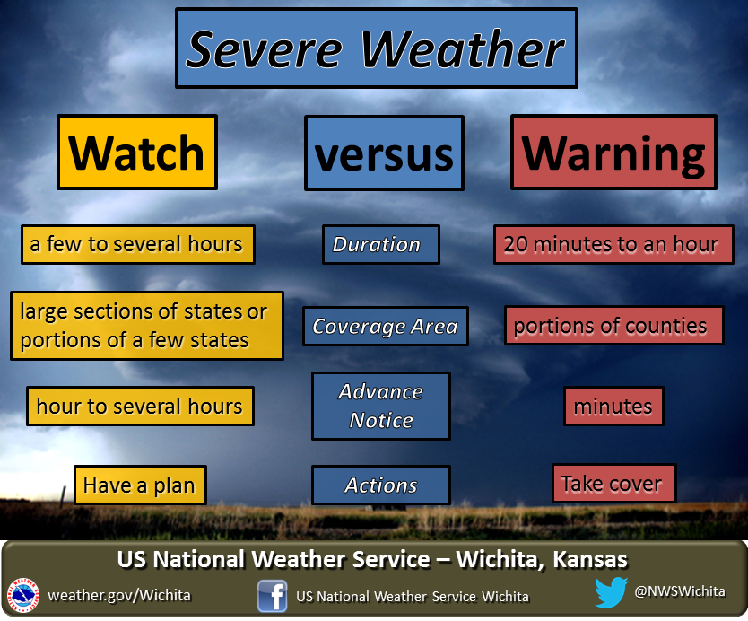
- Remember, a watch means to monitor updates. A warning means to seek shelter. A warning is a higher threat.
.

Here is Facebooks’ Severe Weather Q&A thread.
Link https://www.facebook.com/beaudodsonweather/posts/5148743858488414
The latest update will be posted here at the top of Beau’s severe weather blog.
.
4:20 AM
Severe weather threat has ENDED for my counties.
.
The strongest storms that remain on radar are in Christian County, Kentucky but will soon exit that county, as well.
.
NWS will do storm surveys in the tornado warned areas to see if there were some touchdowns.
.
4:00 AM
The rotation has weakened in Calloway County. The tornado threat has ended for Calloway County.
.
3:41 AM
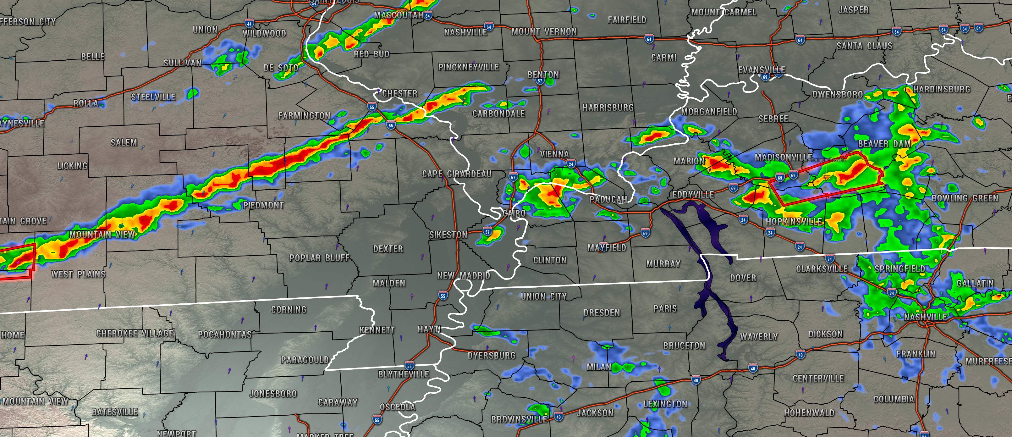
Radar indicated a possible tornado crossing the Graves/Calloway County line. The storm is moving east at 50 mph. The storm was about 7 miles west of Murray, Kentucky.
This is a radar indicated tornado and we do not have ground truth reports, as of yet.
See shelter if you are in the path of this tornado.
.
3:30 AM
.
11PM
Line of storms moving through southeast Missouri and southern Illinois. The NWS has been issuing quite a few warnings with the line.
There may be some isolated wind damage with this line of storms.
Occasionally, the a few storms will show brief rotation. It seems to be one or two radar scans and then it disappears.
Stay weather aware tonight as this line moves across the region.
.
10:27 PM
.
.
.
10:15 PM
New tornado warning for southeast Perry County, Missouri, and Jackson County, Illinois.
This is a radar indicated tornado.
At 1012 PM CST, a severe thunderstorm capable of producing a tornado was located over Altenburg, or 14 miles southwest of Murphysboro, moving east at 55 mph.
.
10 PM
It is getting late into the night. We have several areas of thunderstorms on radar. The main line of storms has now formed over southeast Missouri and southern Illinois.
.
There has occasionally been some rotation with a few storms tonight. Briefly.
.
The primary concern over the coming hours will be wind gusts above 55 mph, nickel size hail, locally heavy rain, and lightning.
.
I suspect the NWS will issue quite a few severe thunderstorm warnings tonight. Mainly for lower-end severe wind gusts.
.
If I see anything tornadic then I will be sending out app alerts. If I see a storm that could produce quite a bit of wind damage then I will send out an app notice, as well.
.
Be weather aware tonight.
.
9:54 PM
Radar shows a possible tornado in Jackson County, Illinois.
.
The radar indicated tornado will pass in or near Harrison, Oraville, Ava, and Murphysboro, Illinois.
.
Seek shelter.
.
9:38 PM
Radar shows a possible tornado entering western Jackson County, Illinois.
The towns of Glenn, Raddle, and Jacob are in the path of this radar indicated tornado.
Seek shelter.
.
9:36 PM
The tornado has exited Perry County, Missouri.
.
9:30 PM
Tornado warning for Perry County, Missouri and Jackson County, Illinois.
.
At 929 PM CST, a severe thunderstorm capable of producing a tornado was located 9 miles northwest of Altenburg, or 10 miles east of Perryville, moving east at 50 mph.
.
9:26 PM
The main line of storms is now forming over southeast Missouri. This line of storms will move southeast over the coming hours.
Some of the storms could produce high wind, hail, and even a tornado.
.
9:00 PM
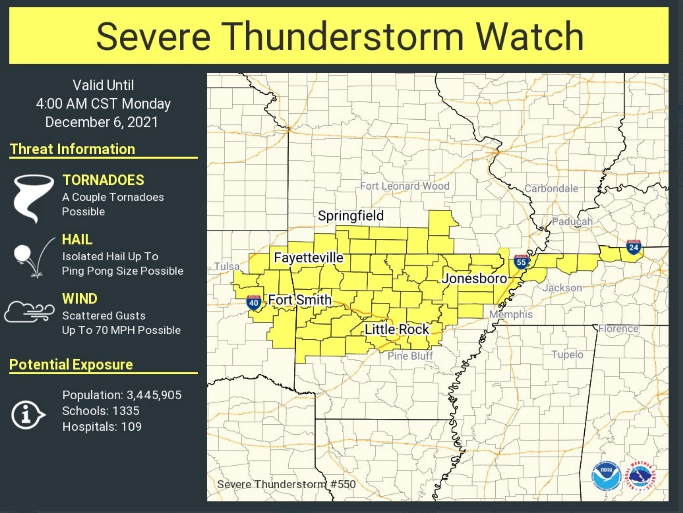
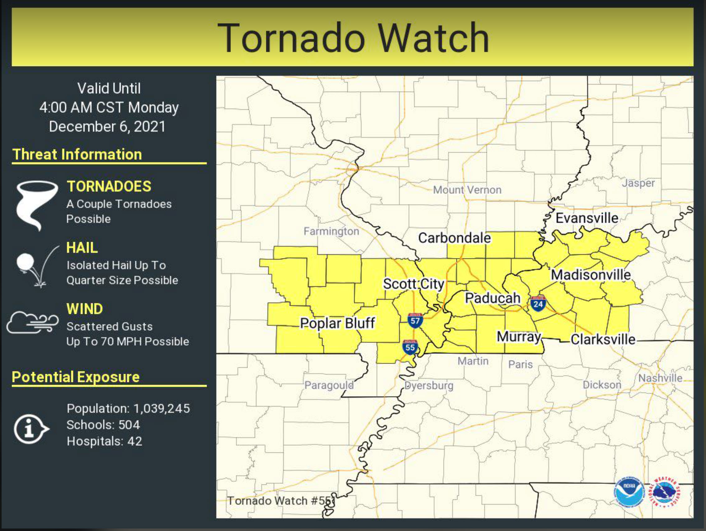
A tornado watch and severe thunderstorm watch has been issued for much of the region.
.
8:45 PM
12/5/21
Severe Weather Update
Pope, Crittenden, Livingston, and Lyon Counties.
The tornado warning has been cancelled. The rotation has dramatically weakened. Strong thunderstorms continue to move across the region. Some of the storms could produce hail and high wind.
Let’s continue to be weather aware over the coming hours. Additional storms are likely.
.
8:45 PM
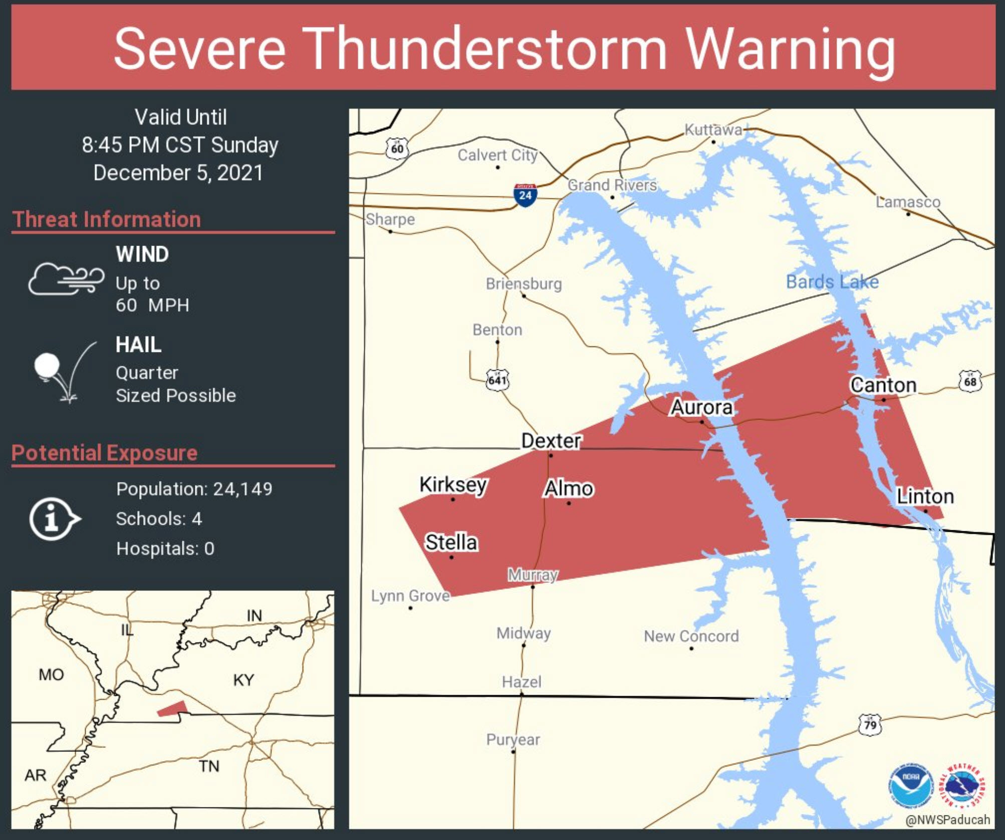
Northern Christian, southern Hopkins, and Muhlenberg Counties.
Radar shows several intense thunderstorms pushing through the area. Some of these storms could produce isolated wind damage and quarter size hail. Occasionally, these storms have some rotation, as well.
Be weather aware as these storms move through your area.
.
8:42 PM
Eastern Johnson County and Pope County.
Radar shows an intense thunderstorm producing hail in eastern Johnson County. The storm will soon move into Pope County. There is some rotation with this thunderstorm near or south of Simpson, Illinois.
Be weather aware as these storms move through your area.
.
8:33 PM
12/5/21
8:33 PM
Extreme southern Pope County, southern and central Livingston County, southern Crittenden County, and northern Lyon County.
.
Tornado warning.
.
Radar indicates high winds in extreme southern Pope County. This storm is moving northeast at 60 mph. It may continue to produce isolated wind damage and hail.
.
A tornado is possible with this thunderstorm.
.
Be weather aware as storms move through your location.
.
8:25 PM
8:16 PM
.
8:10 PM
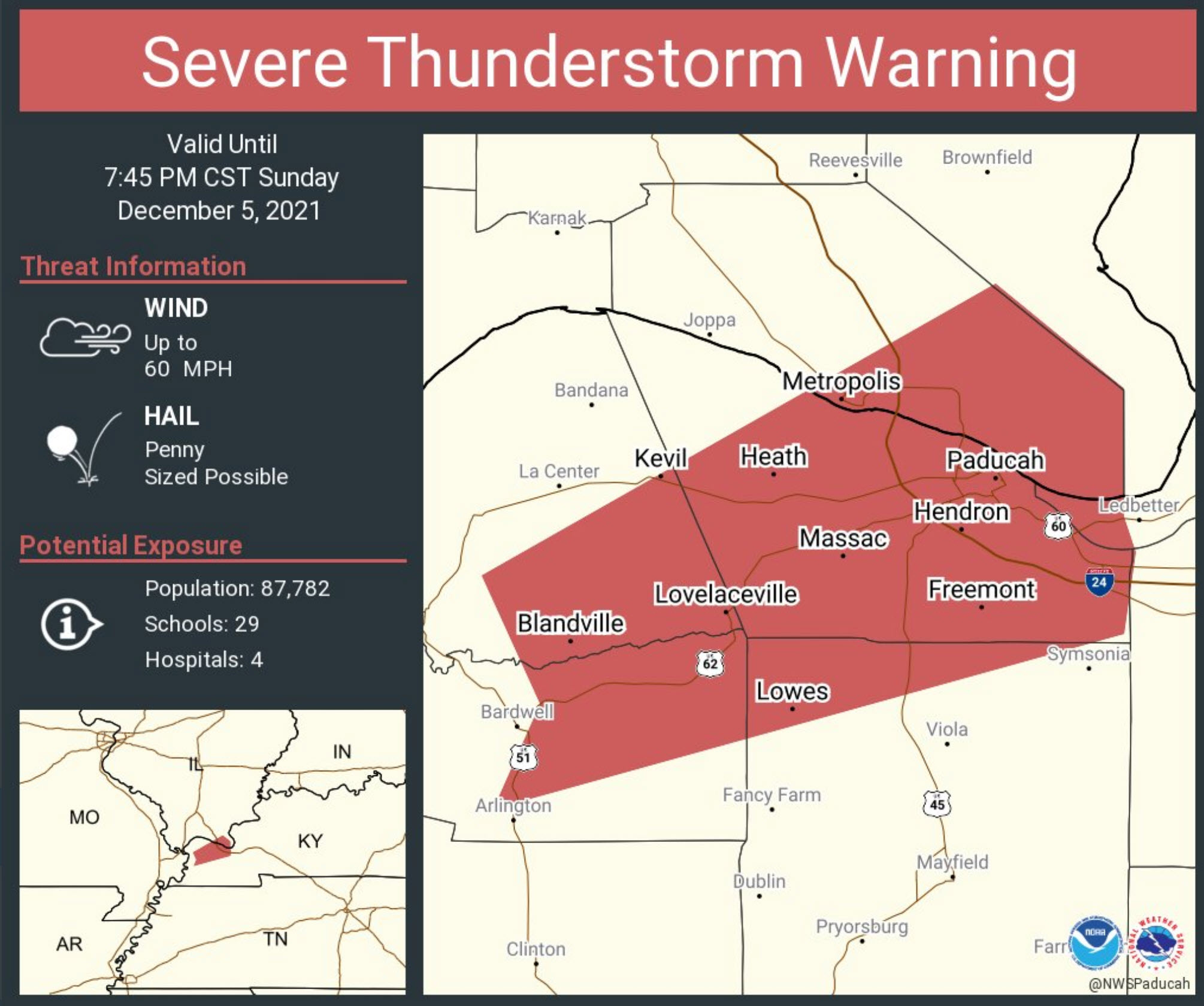
Local Storm Report by NWS PAH: 3 SW Lone Oak [Mccracken Co, KY] nws employee reports HAIL of ping pong ball size (E1.50 INCH) at 07:35 PM CST — most hail was dimed size largest was 1.5 inches.
.
7:38 PM
7:30 PM
Local Storm Report by NWS PAH: Gage [Ballard Co, KY] public reports HAIL of penny size (U0.75 INCH) at 07:16 PM CST — report from mping: dime (0.75 in.).
.
7:15 PM
.
7 PM
Interactive local city-view radars. Clickable watches and warnings.
https://wtalk.co/B3XHASFZ
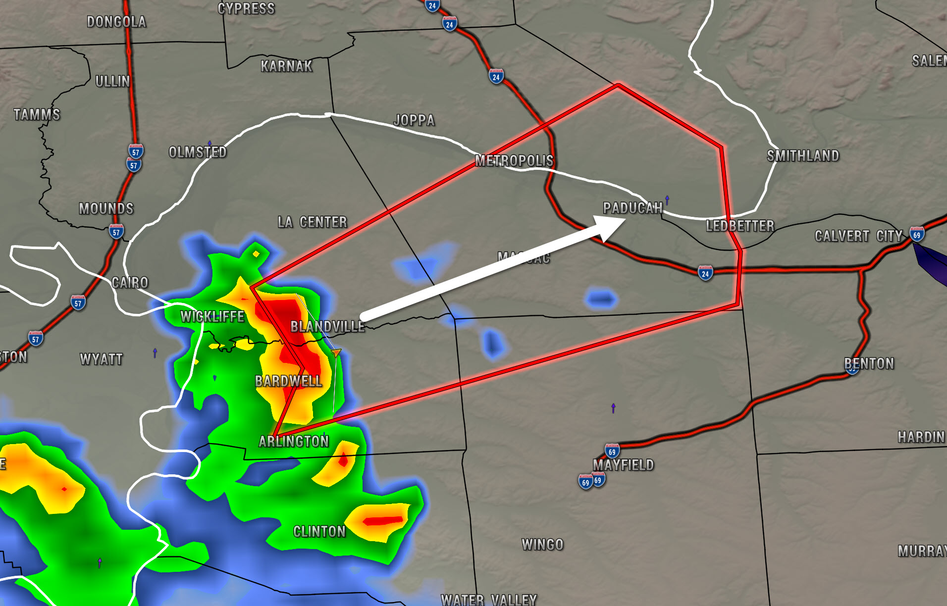
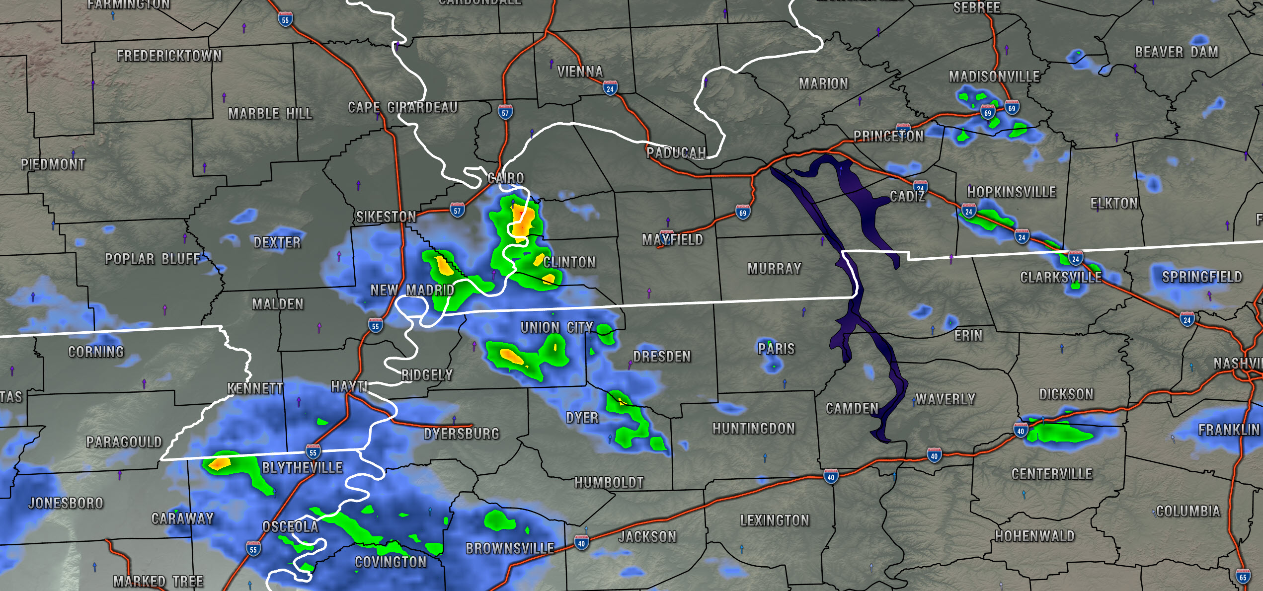
Storms are below severe levels, at this time.
Some intense storms are moving out of southeast Missouri into western Kentucky and northwest Tennessee.
These storms could produce wind gusts of 40 to 45 mph, heavy rain, lightning, and dime size hail.
You can see them here on this static radar shot. They are moving northeast at 55 mph.
.
5:10 PM
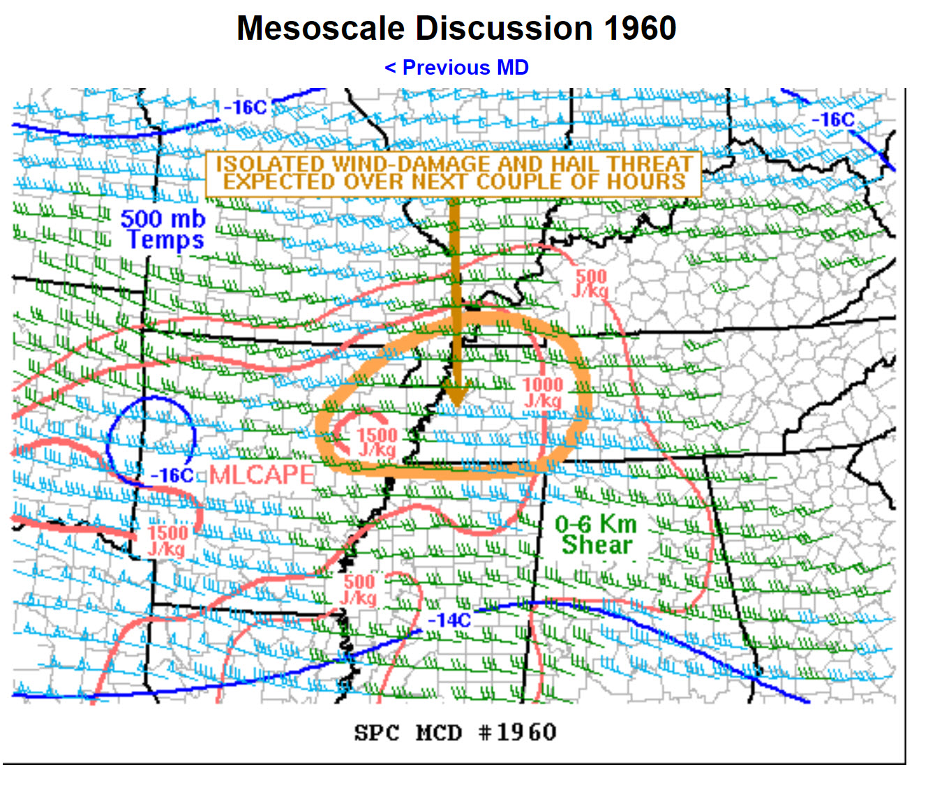
Storm Prediction Center Special Weather Statement
Additional special weather statements are likely further north and northeast, as well. Monitor updates.
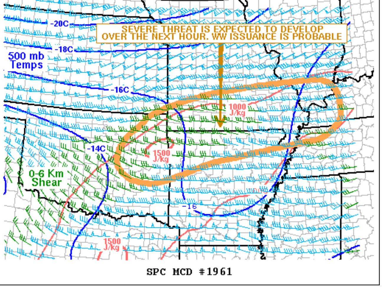
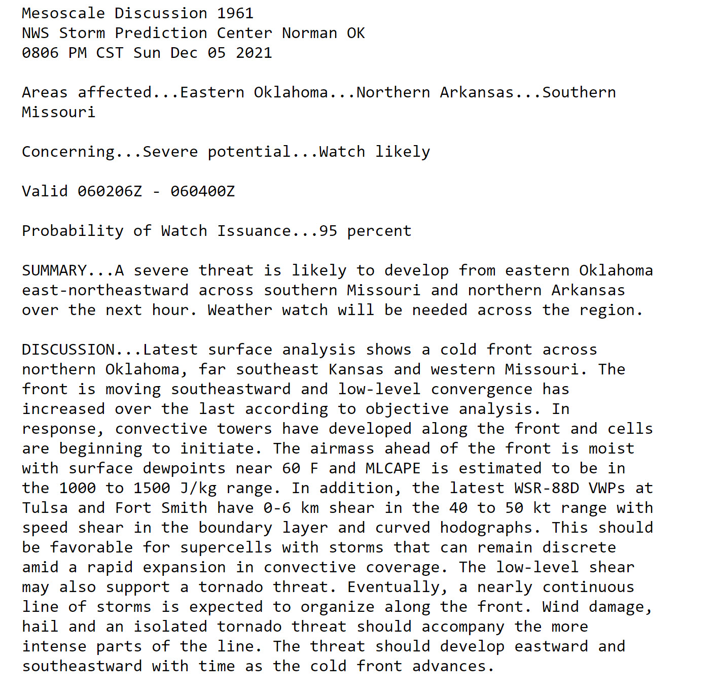
Mesoscale Discussion 1960
NWS Storm Prediction Center Norman OK
0505 PM CST Sun Dec 05 2021
Areas affected…Northeast Arkansas…Far Southeast
Missouri…Western Tennessee
Concerning…Severe potential…Watch possible
Valid 052305Z – 060130Z
Probability of Watch Issuance…40 percent
SUMMARY…An isolated and marginal severe threat will likely
continue for the next few hours from northeast Arkansas into western
Tennessee. Weather watch issuance remains possible across parts of
the mid Mississippi Valley early this evening.
DISCUSSION…The latest radar imagery from Memphis shows scattered
convection to the northeast of Little Rock, with a second more
isolated area located to the east-northeast of Memphis. This
convection is located along an axis of moderate instability where
MLCAPE is estimated in the 1000 to 1500 J/kg range by the RAP. This
surface-based development is being supported by warm advection
associated with a low-level jet in the mid Mississippi Valley. The
diurnally warmed boundary layer is also likely contributing as well.
In addition, the WSR-88D VWP at Little Rock has 0-6 km shear at 45
Kt with substantial speed shear in the lowest 1 km. This should
support a marginal wind-damage and hail threat. The hodograph from
Memphis also has some curvature suggesting that a marginal tornado
threat will also be possible. The severe threat may slowly increase
as the low-level jet in northern Arkansas shifts southeastward. This
increasing potential is somewhat conditional because the loss of
daytime heating may negatively impact development further east. Over
the next couple of hours, weather watch issuance still remains
possible for this convection, especially if storm coverage ramps up
quicker than expected.
..Broyles/Guyer.. 12/05/2021
4:30 PM
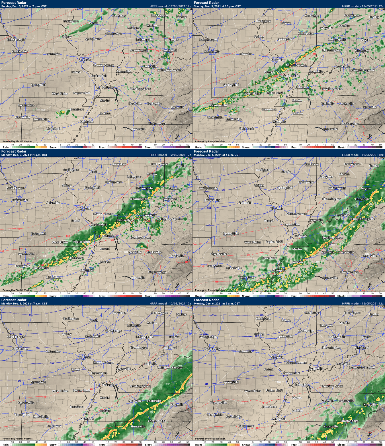
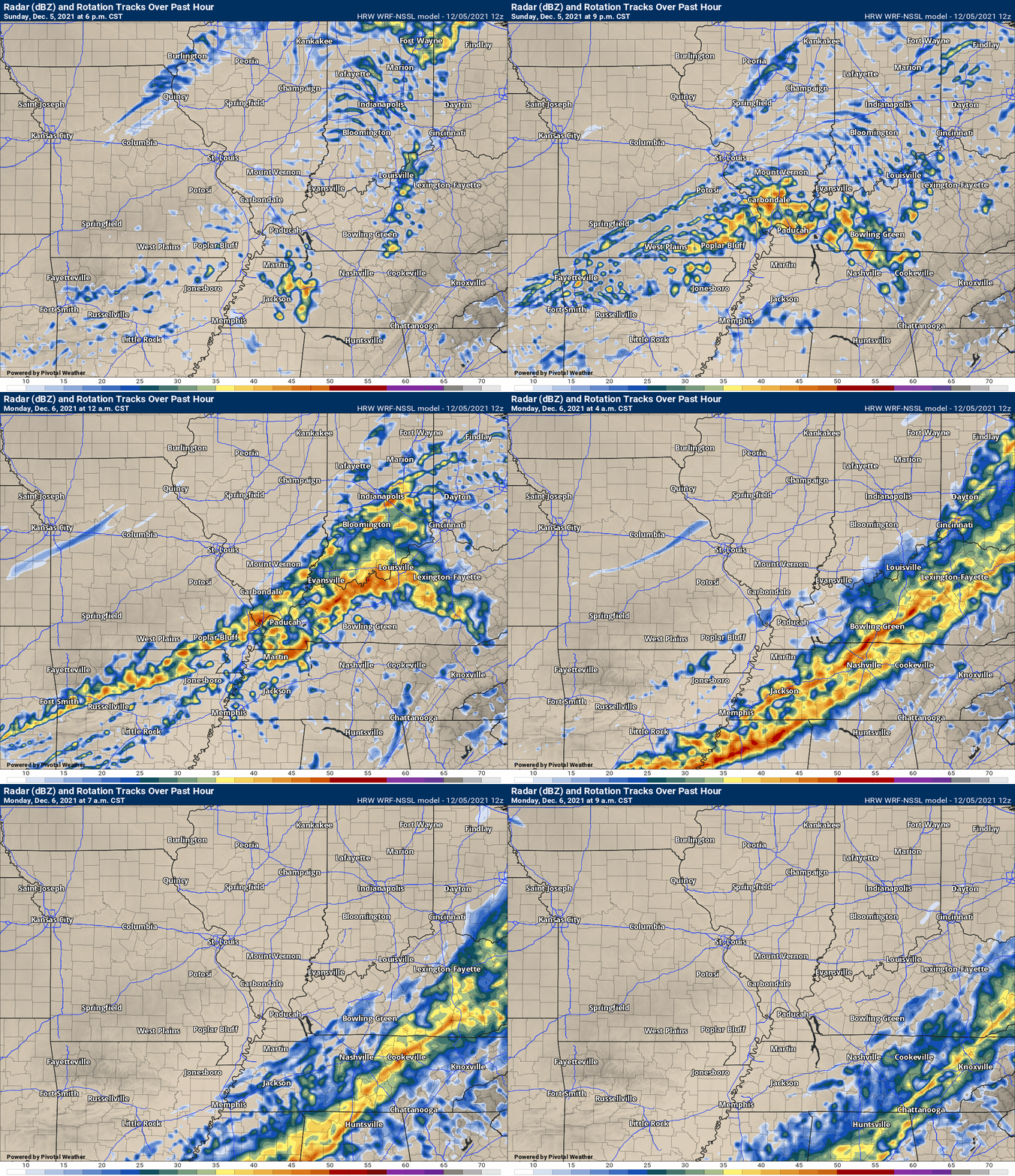
Here is the latest future-cast radar. You can see an active weather night ahead of us.
There is a primary line of thunderstorms and then there could be individual cells ahead of the line.
Some of these storms could be severe. Heavy rain is also a concern.
Be weather aware tonight. I will be here updating the page.
1:30 PM
No changes to the going forecast. I will post another update after 4 PM.
.
12 PM Sunday
A strong cold front is approaching the area. This front will push into southeast Missouri and southern Illinois this evening.
A band of thunderstorms will form along the front and then push east/southeast.
The atmosphere will be unstable tonight. Dew points will rise into the upper 50s and lower 60s. PWAT values will be near the top of the charts.
Dew point and PWAT values are used to measure how much moisture is in the atmosphere.
Wind fields tonight will increase ahead of the front. There will be speed and directional shear.
Speed shear is when winds increase with height. Directional shear is when the winds turn with height. This causes spin.
I can’t rule out some short-lived tornadoes from this event.
Overnight tornadoes can be especially dangerous. People are sleeping. Storms move at a fast pace. You can’t see what is coming.
Be prepared to seek shelter tonight if a tornado warning is issued.
Remember, a watch means to monitor updates, but no action required. A WARNING means severe weather is imminent. Seek shelter. A warning is more serious than a watch.
I will keep this page updated as the event unfolds.
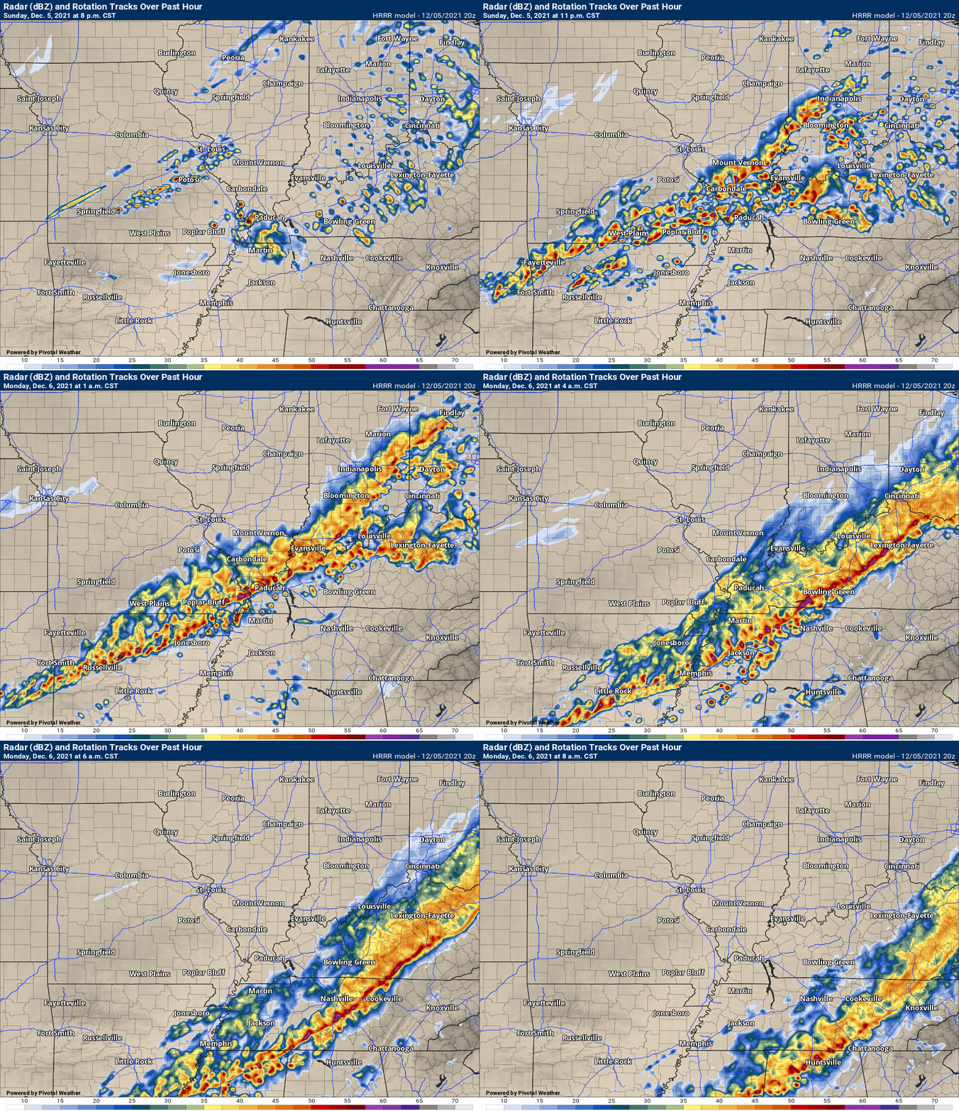
Here is the Hrrr model future-cast radar for tonight. You can see where it forms the squall line (line of thunderstorms).
Here is the SPC WRF model. You can see the similarities.
![]()
Today’s severe weather outlook from the Storm Prediction Center (below).
Light green is where thunderstorms may occur but should be below severe levels.
Dark green is a level one risk. Yellow is a level two risk. Orange is a level three (enhanced) risk. Red is a level four (moderate) risk. Pink is a level five (high) risk.
One is the lowest risk. Five is the highest risk.
A severe storm is one that produces 58 mph wind or higher, quarter size hail, and/or a tornado.
The tan states are simply a region that SPC outlined on this particular map. Just ignore that.

The black outline is our local area.

.
Tomorrow’s severe weather outlook.

![]()
![]()
Some safety graphics.
.![]()
.
.

Radar Link: Interactive local city-view radars & regional radars.
You will find clickable warning and advisory buttons on the local city-view radars.
If the radar is not updating then try another one. If a radar does not appear to be refreshing then hit Ctrl F5. You may also try restarting your browser.
Not working? Email me at beaudodson@usawx.com
Backup radar site in case the above one is not working.
https://weathertalk.com/morani
New ZOOM radar (with storm chasers)
https://wtalk.co/AVWG7GM7
Regional Radar
https://imagery.weathertalk.com/prx/RadarLoop.mp4
Lightning Data (zoom in and out of your local area)
https://wtalk.co/WJ3SN5UZ
Satellite Data
Computers and tablets. These two satellite links may not work well on cell phones.
Visible Satellite. This one is to be used during daylight only. Be sure and hit refresh once you are on the satellite page. Otherwise, the data will be old.
https://col.st/a5A0e
IR Satellite. This one shows cloud temperatures. Bright colors represent cold cloud tops. That could mean thunderstorms. Be sure and hit refresh once you are on the satellite page. Otherwise, the data will be old.
https://col.st/R2fw1
Water Vapor Satellite. This one shows mid-level moisture in the atmosphere. Be sure and hit refresh once you are on the satellite page. Otherwise, the data will be old.
https://col.st/xFVwx
.

Live lightning data: Click here.
Not receiving app/text messages?
Log in and out of your app.
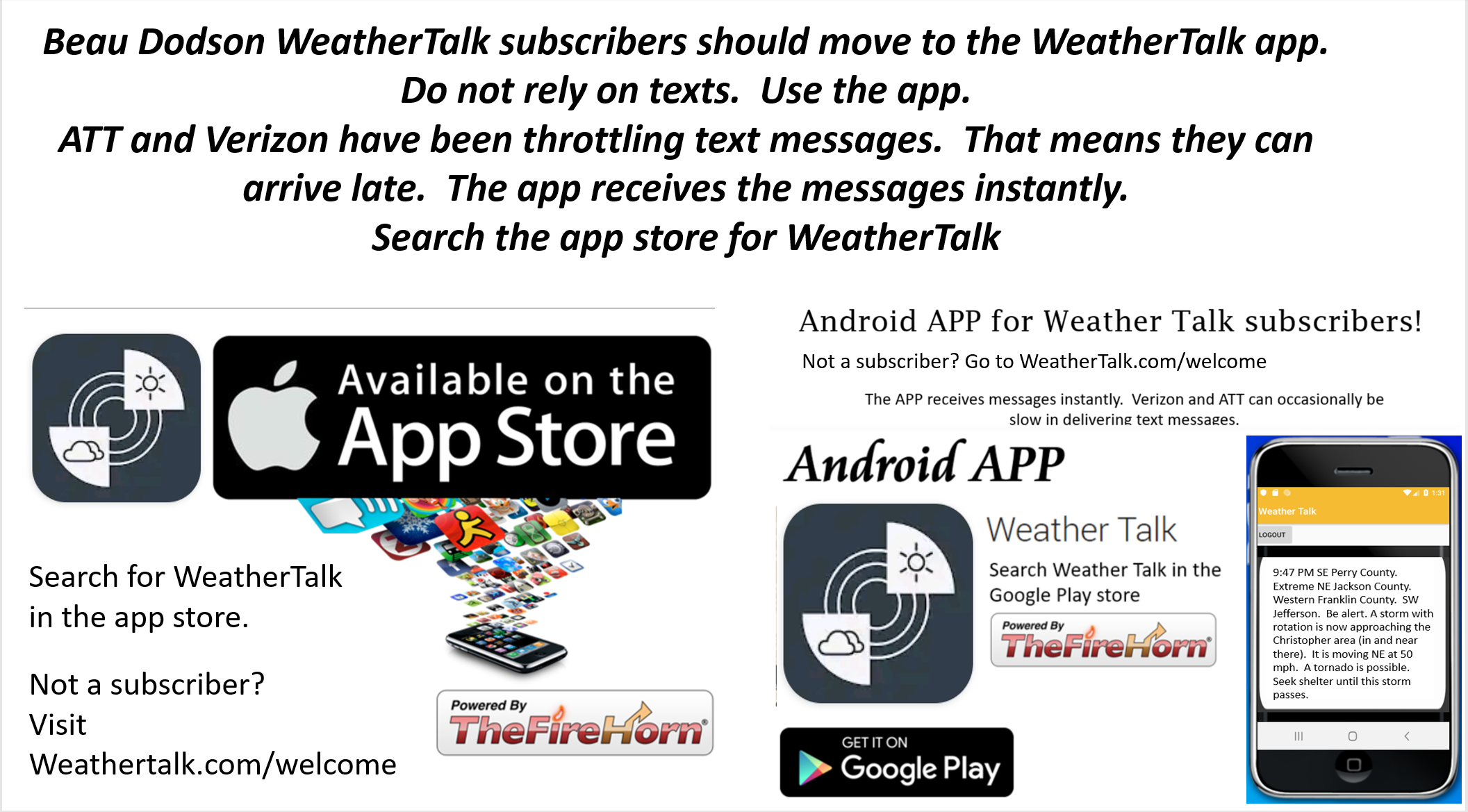
USE THE APP. ATT and Verizon are slowing or stopping the text messages. Move to the app (not texts).
Make sure you have the correct app/text options turned on. Find those under the personal notification settings tab at www.weathertalk.com. Red is off. Green is on.
Subscribers, PLEASE USE THE APP. ATT and Verizon are not reliable during severe weather. They are delaying text messages.
The app is under WeatherTalk in the app store.
Apple users click here
Android users click here
.


