Click on the words below to subscribe
Storm Tracking Links
Interactive local city-view radars. Clickable watches and warnings.
https://wtalk.co/B3XHASFZ
Backup radar site in case the above one is not working.
https://weathertalk.com/morani
Regional Radar
https://imagery.weathertalk.com/prx/RadarLoop.mp4
*NEW* Zoom interactive radar (with storm chaser streams)
https://wtalk.co/AVWG7GM7
Real time lightning tracker system two.
https://map.blitzortung.org/#5.02/37.95/-86.99
Lightning Data (zoom in and out of your local area)
https://wtalk.co/WJ3SN5UZ
Apple users click here. Android users click here.
What you need to know
Key Points
- Thunderstorms are likely Monday. A few of the storms could produce damaging wind gusts and hail.
- There is a low-end risk of a tornado.
- Locally heavy rain will be possible with thunderstorms.
- Have your Beau Dodson Weather app on. Check it. Make sure you have not logged out of the app.
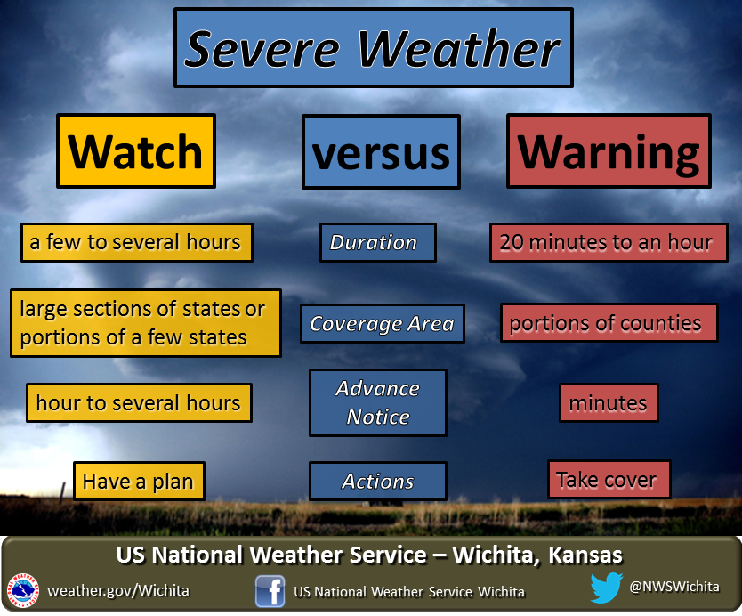
- Remember, a watch means to monitor updates. A warning means to seek shelter. A warning is a higher threat.
.

The latest update will be posted here at the top of Beau’s severe weather blog.
5 PM
Severe weather threat has ended.
4 PM
SPECIAL WEATHER STATEMENT
NATIONAL WEATHER SERVICE PADUCAH KY
354 PM CDT MON OCT 11 2021

ILZ078-INZ081-082-085>087-KYZ010-014-015-018-020-112200-
WABASH IL-POSEY IN-WARRICK IN-VANDERBURGH IN-GIBSON IN-PIKE IN-
HENDERSON KY-CRITTENDEN KY-WEBSTER KY-UNION KY-MCLEAN KY-
354 PM CDT MON OCT 11 2021

...STRONG THUNDERSTORMS WILL IMPACT PORTIONS OF EASTERN WABASH,
WARRICK, GIBSON, VANDERBURGH, POSEY, PIKE, HENDERSON, CRITTENDEN,
WESTERN MCLEAN, UNION AND WEBSTER COUNTIES THROUGH 500 PM CDT...

AT 353 PM CDT, DOPPLER RADAR WAS TRACKING STRONG THUNDERSTORMS ALONG
A LINE EXTENDING FROM 6 MILES EAST OF LANCASTER TO NEAR MOUNT VERNON
IN TO NEAR MARION KY. MOVEMENT WAS NORTHEAST AT 55 MPH.

HAZARD...WINDS IN EXCESS OF 40 MPH AND PEA SIZE HAIL.

SOURCE...RADAR INDICATED.

IMPACT...GUSTY WINDS COULD KNOCK DOWN TREE LIMBS AND BLOW AROUND
         UNSECURED OBJECTS. MINOR DAMAGE TO OUTDOOR OBJECTS IS
         POSSIBLE.

STRONG THUNDERSTORMS WILL BE NEAR...
  KASSON AND BLAIRSVILLE AROUND 405 PM CDT.
  MELODY HILL AND DARMSTADT AROUND 410 PM CDT.

OTHER LOCATIONS IN THE PATH OF THESE STORMS INCLUDE HAUBSTADT, DIXON,
FORT BRANCH, CORYDON, LYNNVILLE, ROBARDS, OAKLAND CITY, HENDERSON AND
WINSLOW.

THIS INCLUDES THE FOLLOWING HIGHWAYS...
 INTERSTATE 69 IN KENTUCKY BETWEEN MILE MARKERS 128 AND 148.
 INTERSTATE 69 IN INDIANA BETWEEN MILE MARKERS 1 AND 52.
 INTERSTATE 64 IN INDIANA BETWEEN MILE MARKERS 6 AND 42.
 AUDUBON PARKWAY BETWEEN MILE MARKERS 1 AND 11.

PRECAUTIONARY/PREPAREDNESS ACTIONS...

IF OUTDOORS, CONSIDER SEEKING SHELTER INSIDE A BUILDING.

TORRENTIAL RAINFALL IS ALSO OCCURRING WITH THESE STORMS AND MAY LEAD
TO LOCALIZED FLOODING. DO NOT DRIVE YOUR VEHICLE THROUGH FLOODED
ROADWAYS.

THESE STORMS MAY INTENSIFY, SO BE CERTAIN TO MONITOR LOCAL RADIO
STATIONS AND AVAILABLE TELEVISION STATIONS FOR ADDITIONAL INFORMATION
AND POSSIBLE WARNINGS FROM THE NATIONAL WEATHER SERVICE.
3:00 PM
SPECIAL WEATHER STATEMENT
NATIONAL WEATHER SERVICE PADUCAH KY
304 PM CDT MON OCT 11 2021

ILZ090-094-KYZ001>003-005>011-112045-
MASSAC IL-POPE IL-CARLISLE KY-MARSHALL KY-CALLOWAY KY-MCCRACKEN KY-
GRAVES KY-CRITTENDEN KY-FULTON KY-HICKMAN KY-LYON KY-LIVINGSTON KY-
304 PM CDT MON OCT 11 2021

...STRONG THUNDERSTORMS WILL IMPACT PORTIONS OF EASTERN MASSAC,
POPE, SOUTHEASTERN FULTON, WESTERN CALLOWAY, LIVINGSTON, CRITTENDEN,
MARSHALL, EASTERN HICKMAN, SOUTHEASTERN CARLISLE, MCCRACKEN, GRAVES
AND NORTHWESTERN LYON COUNTIES THROUGH 345 PM CDT...

AT 303 PM CDT, DOPPLER RADAR WAS TRACKING STRONG THUNDERSTORMS ALONG
A LINE EXTENDING FROM NEAR GOLCONDA TO 7 MILES SOUTH OF LONE OAK TO
NEAR CAYCE. MOVEMENT WAS NORTHEAST AT 60 MPH.

HAZARD...WINDS IN EXCESS OF 40 MPH.

SOURCE...RADAR INDICATED.

IMPACT...GUSTY WINDS COULD KNOCK DOWN TREE LIMBS AND BLOW AROUND
         UNSECURED OBJECTS.

STRONG THUNDERSTORMS WILL BE NEAR...
  PADUCAH, GOLCONDA AND JOY AROUND 310 PM CDT.
  BROOKPORT AROUND 315 PM CDT.

OTHER LOCATIONS IN THE PATH OF THESE STORMS INCLUDE BURNA, SALEM,
REIDLAND, CALVERT CITY AND LEDBETTER.

THIS INCLUDES THE FOLLOWING HIGHWAYS...
 INTERSTATE 24 IN KENTUCKY BETWEEN MILE MARKERS 1 AND 38.
 INTERSTATE 24 IN ILLINOIS BETWEEN MILE MARKERS 35 AND 38.
 INTERSTATE 69 IN KENTUCKY BETWEEN MILE MARKERS 1 AND 51.

PRECAUTIONARY/PREPAREDNESS ACTIONS...

IF OUTDOORS, CONSIDER SEEKING SHELTER INSIDE A BUILDING.

TORRENTIAL RAINFALL IS ALSO OCCURRING WITH THESE STORMS AND MAY LEAD
TO LOCALIZED FLOODING. DO NOT DRIVE YOUR VEHICLE THROUGH FLOODED
ROADWAYS.


AND
SPECIAL WEATHER STATEMENT
NATIONAL WEATHER SERVICE PADUCAH KY
300 PM CDT MON OCT 11 2021

ILZ076>078-082-083-086-087-090-091-INZ081-085-KYZ014-018-112100-
WHITE IL-GALLATIN IL-POPE IL-HARDIN IL-WAYNE IL-SALINE IL-EDWARDS IL-
HAMILTON IL-WABASH IL-POSEY IN-GIBSON IN-UNION KY-HENDERSON KY-
300 PM CDT MON OCT 11 2021

...STRONG THUNDERSTORMS WILL IMPACT PORTIONS OF SOUTHEASTERN WAYNE,
WABASH, POPE, EASTERN SALINE, WHITE, HARDIN, EDWARDS, SOUTHEASTERN
HAMILTON, GALLATIN, WESTERN GIBSON, POSEY, WESTERN HENDERSON AND
UNION COUNTIES THROUGH 400 PM CDT...

AT 259 PM CDT, DOPPLER RADAR WAS TRACKING STRONG THUNDERSTORMS ALONG
A LINE EXTENDING FROM NEAR WEST SALEM TO NEAR ENFIELD TO 10 MILES
NORTHWEST OF ROSICLARE. MOVEMENT WAS NORTHEAST AT 50 MPH.

HAZARD...WINDS IN EXCESS OF 40 MPH.

SOURCE...RADAR INDICATED.

IMPACT...GUSTY WINDS COULD KNOCK DOWN TREE LIMBS AND BLOW AROUND
         UNSECURED OBJECTS.

STRONG THUNDERSTORMS WILL BE NEAR...
  WEST SALEM AROUND 305 PM CDT.
  CARMI AROUND 310 PM CDT.
  CROSSVILLE AND EQUALITY AROUND 315 PM CDT.

OTHER LOCATIONS IN THE PATH OF THESE STORMS INCLUDE SHAWNEETOWN,
GRAYVILLE, RIDGWAY, ALBION, MOUNT CARMEL, MOUNT VERNON AND LANCASTER.

THIS INCLUDES THE FOLLOWING HIGHWAYS...
 INTERSTATE 64 IN INDIANA BETWEEN MILE MARKERS 1 AND 17.
 INTERSTATE 64 IN ILLINOIS BETWEEN MILE MARKERS 115 AND 130.

PRECAUTIONARY/PREPAREDNESS ACTIONS...

IF OUTDOORS, CONSIDER SEEKING SHELTER INSIDE A BUILDING.

TORRENTIAL RAINFALL IS ALSO OCCURRING WITH THESE STORMS AND MAY LEAD
TO LOCALIZED FLOODING. DO NOT DRIVE YOUR VEHICLE THROUGH FLOODED
ROADWAYS.
2:10 PM
SPECIAL WEATHER STATEMENT
NATIONAL WEATHER SERVICE PADUCAH KY
201 PM CDT MON OCT 11 2021

ILZ076>078-082-083-085>087-089>091-INZ081-KYZ007-112000-
WHITE IL-GALLATIN IL-POPE IL-JOHNSON IL-HARDIN IL-WAYNE IL-SALINE IL-
EDWARDS IL-HAMILTON IL-WILLIAMSON IL-WABASH IL-GIBSON IN-
LIVINGSTON KY-
201 PM CDT MON OCT 11 2021

...STRONG THUNDERSTORMS WILL IMPACT PORTIONS OF SOUTHEASTERN WAYNE,
WABASH, POPE, JOHNSON, SALINE, WHITE, HARDIN, EASTERN WILLIAMSON,
EDWARDS, HAMILTON, GALLATIN, WESTERN GIBSON AND LIVINGSTON COUNTIES
THROUGH 300 PM CDT...

AT 200 PM CDT, DOPPLER RADAR WAS TRACKING STRONG THUNDERSTORMS ALONG
A LINE EXTENDING FROM 9 MILES NORTHEAST OF MCLEANSBORO TO NEAR
CARRIER MILLS TO NEAR VIENNA. MOVEMENT WAS NORTHEAST AT 55 MPH.

HAZARD...WINDS IN EXCESS OF 40 MPH.

SOURCE...RADAR INDICATED.

IMPACT...GUSTY WINDS COULD KNOCK DOWN TREE LIMBS AND BLOW AROUND
         UNSECURED OBJECTS.

STRONG THUNDERSTORMS WILL BE NEAR...
  GALATIA AND DIXON SPRINGS AROUND 210 PM CDT.
  FAIRFIELD AROUND 215 PM CDT.

OTHER LOCATIONS IN THE PATH OF THESE STORMS INCLUDE NORRIS CITY, WEST
SALEM, ENFIELD, CARMI, ELDORADO, EQUALITY, RIDGWAY, CROSSVILLE,
ALBION AND GRAYVILLE.

THIS INCLUDES THE FOLLOWING HIGHWAYS...
 INTERSTATE 24 IN ILLINOIS BETWEEN MILE MARKERS 9 AND 23.
 INTERSTATE 64 IN ILLINOIS BETWEEN MILE MARKERS 100 AND 130.

PRECAUTIONARY/PREPAREDNESS ACTIONS...

IF OUTDOORS, CONSIDER SEEKING SHELTER INSIDE A BUILDING.
2:00 PM
SPECIAL WEATHER STATEMENT
NATIONAL WEATHER SERVICE PADUCAH KY
158 PM CDT MON OCT 11 2021

ILZ089-090-092>094-KYZ001>007-MOZ112-114-112000-
MASSAC IL-POPE IL-JOHNSON IL-ALEXANDER IL-PULASKI IL-CARLISLE KY-
MCCRACKEN KY-BALLARD KY-GRAVES KY-FULTON KY-HICKMAN KY-LIVINGSTON KY-
MISSISSIPPI MO-NEW MADRID MO-
158 PM CDT MON OCT 11 2021

STRONG THUNDERSTORMS WILL IMPACT PORTIONS OF PULASKI, POPE,
JOHNSON, SOUTHEASTERN ALEXANDER, MASSAC, MCCRACKEN, BALLARD, FULTON,
LIVINGSTON, HICKMAN, CARLISLE, GRAVES, EASTERN MISSISSIPPI AND
SOUTHEASTERN NEW MADRID COUNTIES THROUGH 300 PM CDT...

AT 157 PM CDT, DOPPLER RADAR WAS TRACKING STRONG THUNDERSTORMS ALONG
A LINE EXTENDING FROM BARLOW TO TOWOSAHGY STATE HISTORIC SITE TO NEAR
REELFOOT LAKE STATE PARK. MOVEMENT WAS NORTHEAST AT 65 MPH.

HAZARD...WINDS IN EXCESS OF 40 MPH.

SOURCE...RADAR INDICATED.

IMPACT...GUSTY WINDS COULD KNOCK DOWN TREE LIMBS AND BLOW AROUND
         UNSECURED OBJECTS.

STRONG THUNDERSTORMS WILL BE NEAR...
  LA CENTER AND BARLOW AROUND 200 PM CDT.
  BARDWELL AROUND 210 PM CDT.
  HICKMAN, WICKLIFFE, NEW COLUMBIA AND DORENA AROUND 215 PM CDT.

OTHER LOCATIONS IN THE PATH OF THESE STORMS INCLUDE LOVELACEVILLE,
CAYCE, CLINTON, BARKLEY REGIONAL AIRPORT, METROPOLIS, WEST PADUCAH,
BROOKPORT, PADUCAH, LONE OAK, GOLCONDA AND JOY.

THIS INCLUDES THE FOLLOWING HIGHWAYS...
 INTERSTATE 24 IN KENTUCKY BETWEEN MILE MARKERS 1 AND 14.
 INTERSTATE 24 IN ILLINOIS BETWEEN MILE MARKERS 23 AND 38.
 INTERSTATE 69 IN KENTUCKY BETWEEN MILE MARKERS 1 AND 24.

PRECAUTIONARY/PREPAREDNESS ACTIONS...

IF OUTDOORS, CONSIDER SEEKING SHELTER INSIDE A BUILDING.
1:25 PM
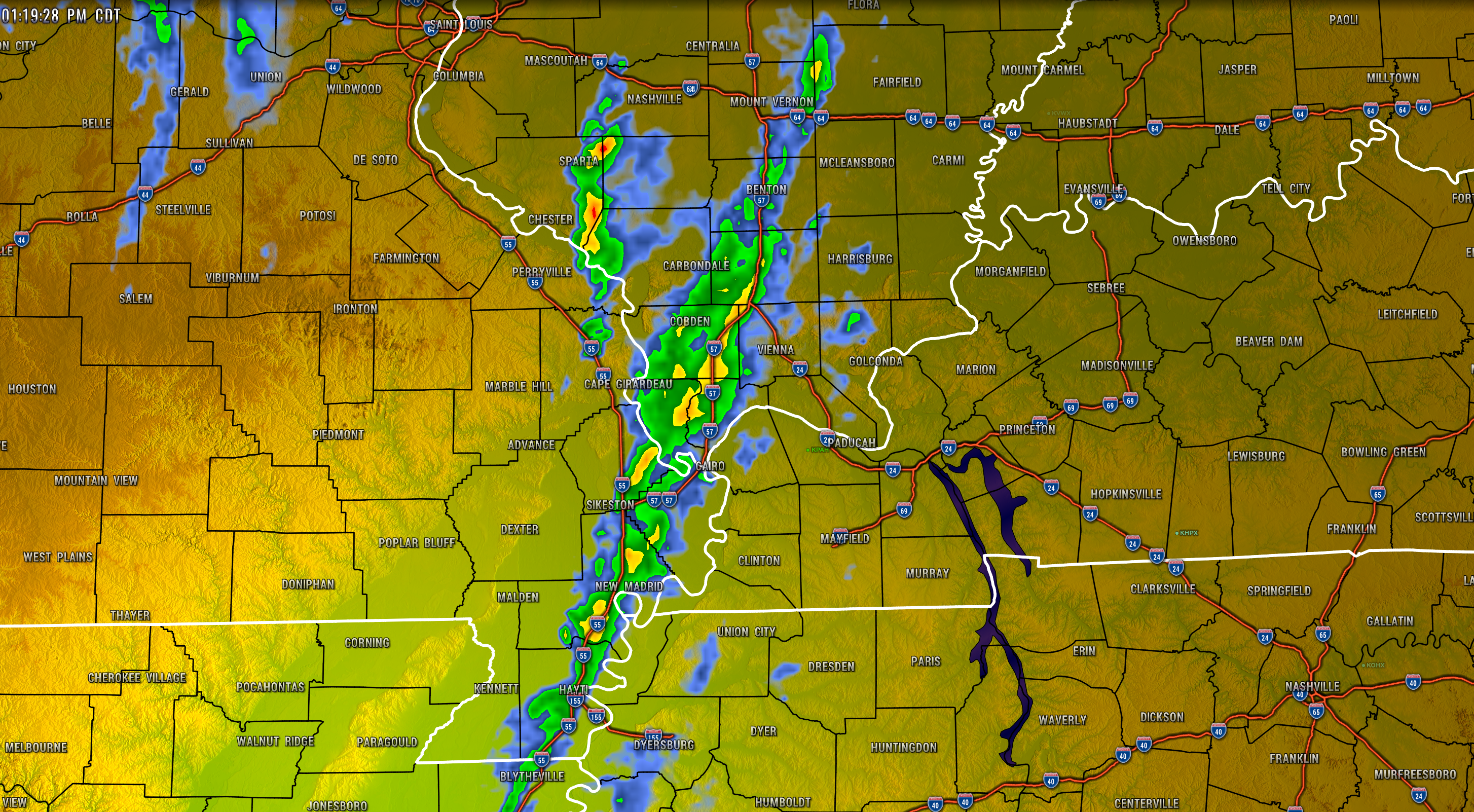
A line of gusty storms is moving through the area. No severe weather watches or warnings, at this time.
Monitor updates and the radars.
.
9:15 AM Update
8:20 AM Monday Update
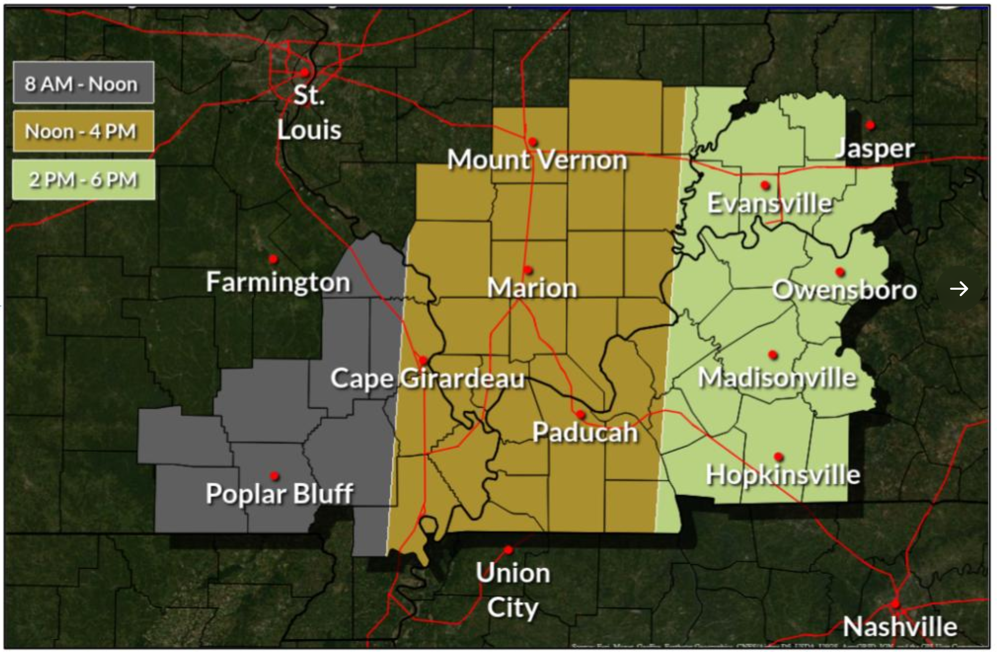
Primary time-line from the Paducah, KY, NWS. May vary a bit in each transition area.
There continues to be a low-end risk of a few thunderstorms becoming severe today with damaging wind, quarter size hail, and even a short-lived tornado.
There is some spin in the atmosphere, but generally winds aloft are more unidirectional. That means straight line winds with any line segments or bowing lines of storms.
Overall, the risk of severe weather at any given location is low, but not zero. Monitor your Beau Dodson Weather app for updates.
I will keep the severe weather blog active, as well.
The future-cast radars have been updated.

Click here if you would like to return to the top of the page.
Again, as a reminder, these are models. They are never 100% accurate. Take the general idea from them.
What should I take from these?
- The general idea and not specifics. Models usually do well with the generalities.
- The time-stamp is located in the upper left corner.
- The EC European weather model is in Zulu time.
.
What am I looking at?
You are looking at different models. Meteorologists use many different models to forecast the weather. All models are wrong. Some are more wrong than others. Meteorologists have to make a forecast based on the guidance/models.
I show you these so you can see what the different models are showing as far as precipitation. If most of the models agree, then the confidence in the final weather forecast increases.
You can see my final forecast at the top of the page.
.
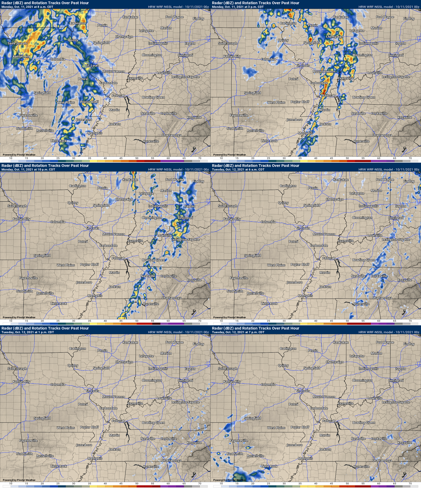
This animation is the Storm Prediction Center WRF model.
This animation shows you what radar might look like as the next system pulls through the region. It is a future-cast radar.
Time-stamp upper left. Click the animation to enlarge it.
.
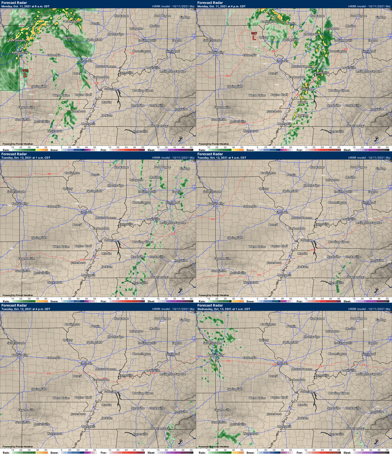
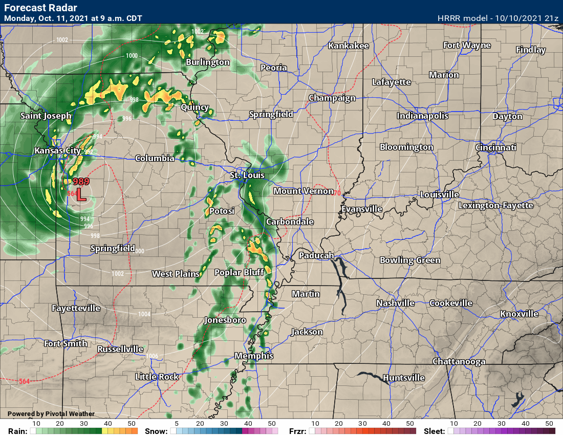
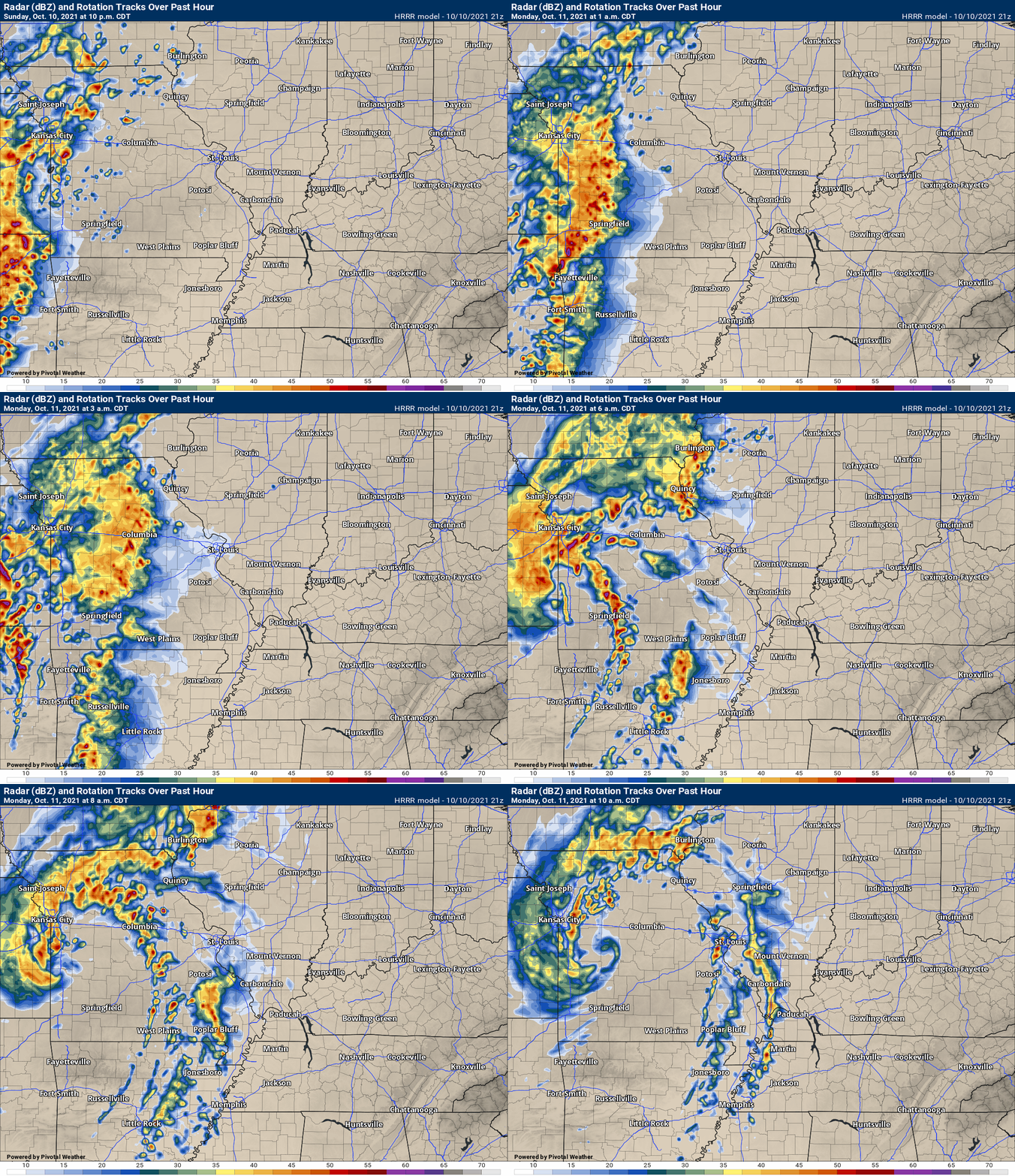
This animation is the Hrrr short-range model.
This animation shows you what radar might look like as the next system pulls through the region. It is a future-cast radar.
Time-stamp upper left. Click the animation to enlarge it.
.
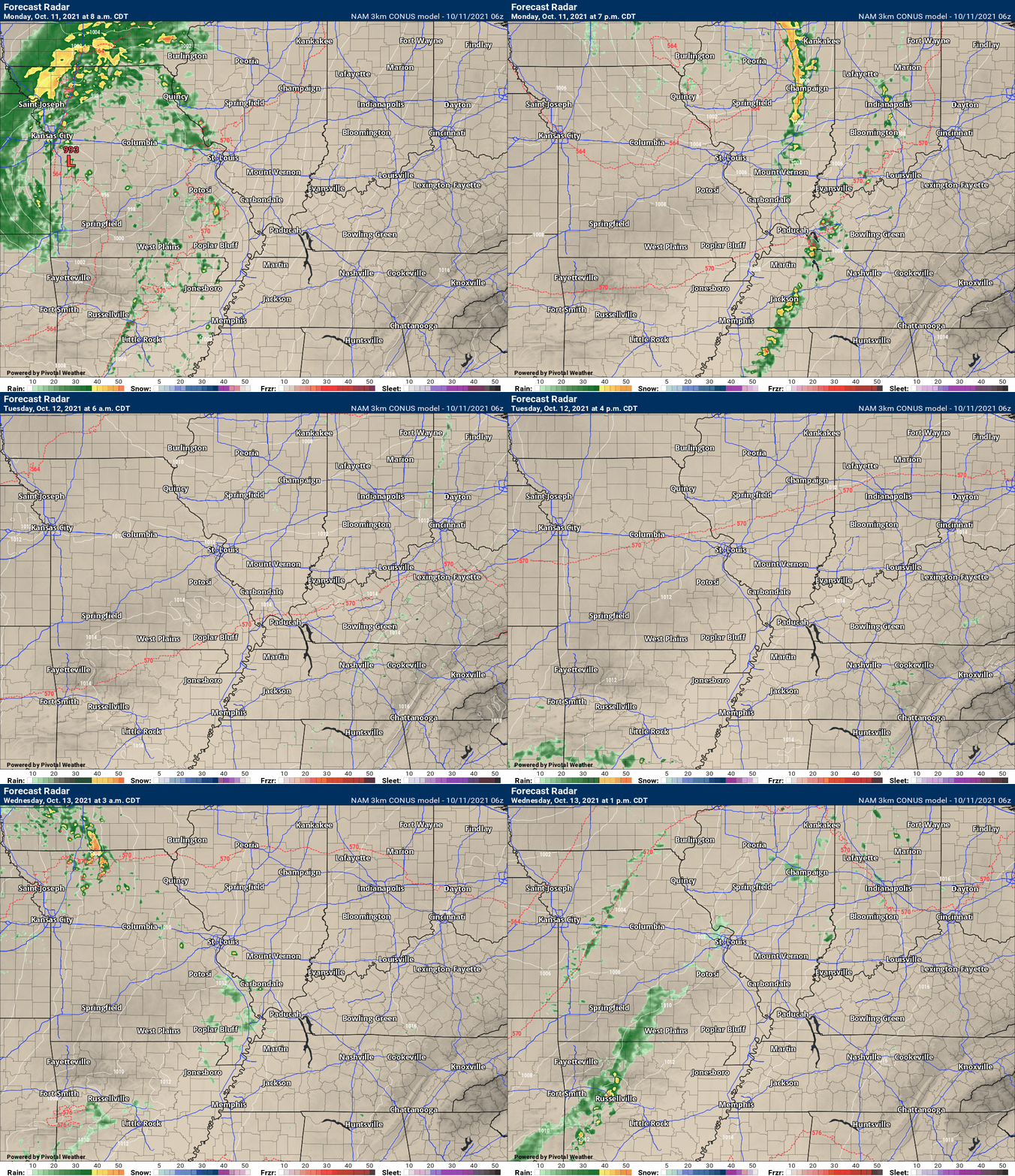
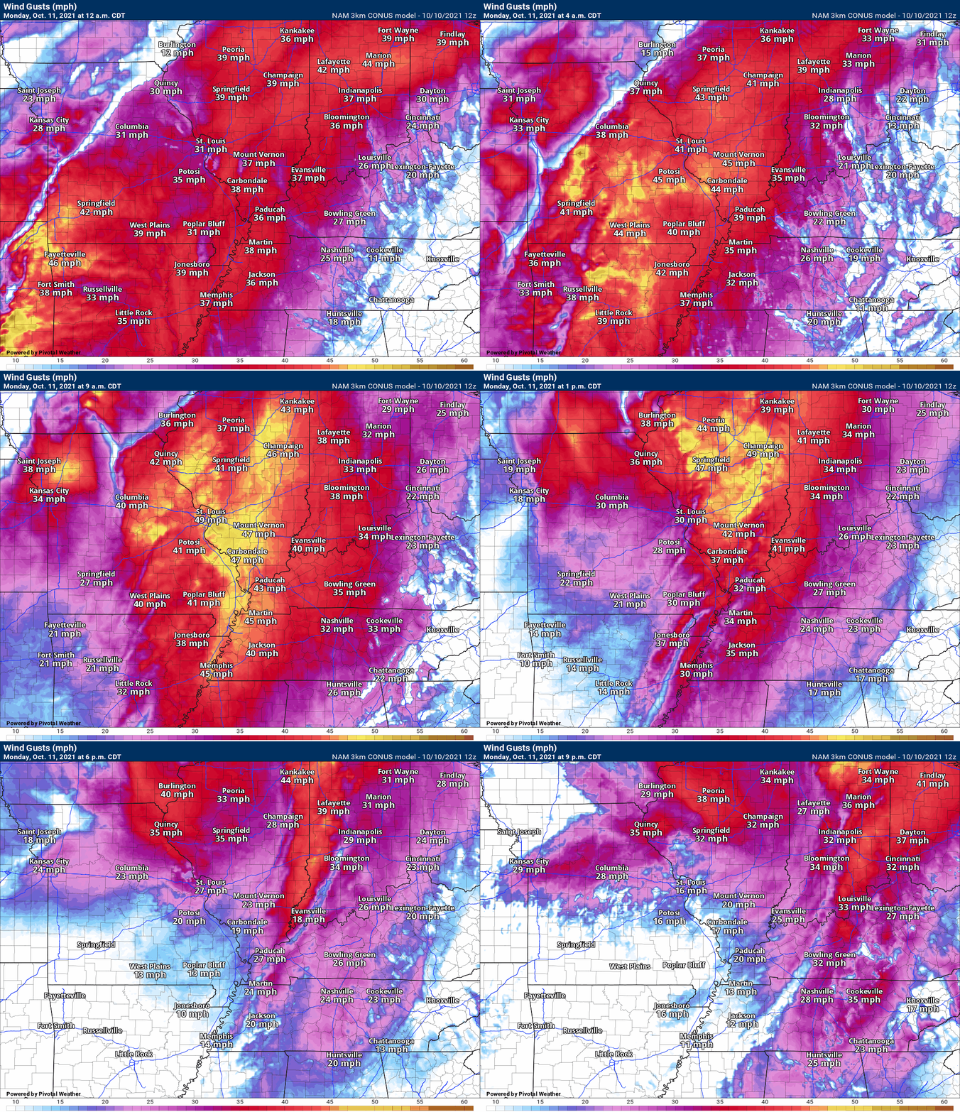
.This animation is the higher-resolution 3K NAM American Model.
This animation shows you what radar might look like as the next system pulls through the region. It is a future-cast radar.
Time-stamp upper left. Click the animation to enlarge it.
.
This next animation is the lower-resolution NAM American Model.
This animation shows you what radar might look like as the system pulls through the region. It is a future-cast radar.
Time-stamp upper left. Click the animation to enlarge it.
.
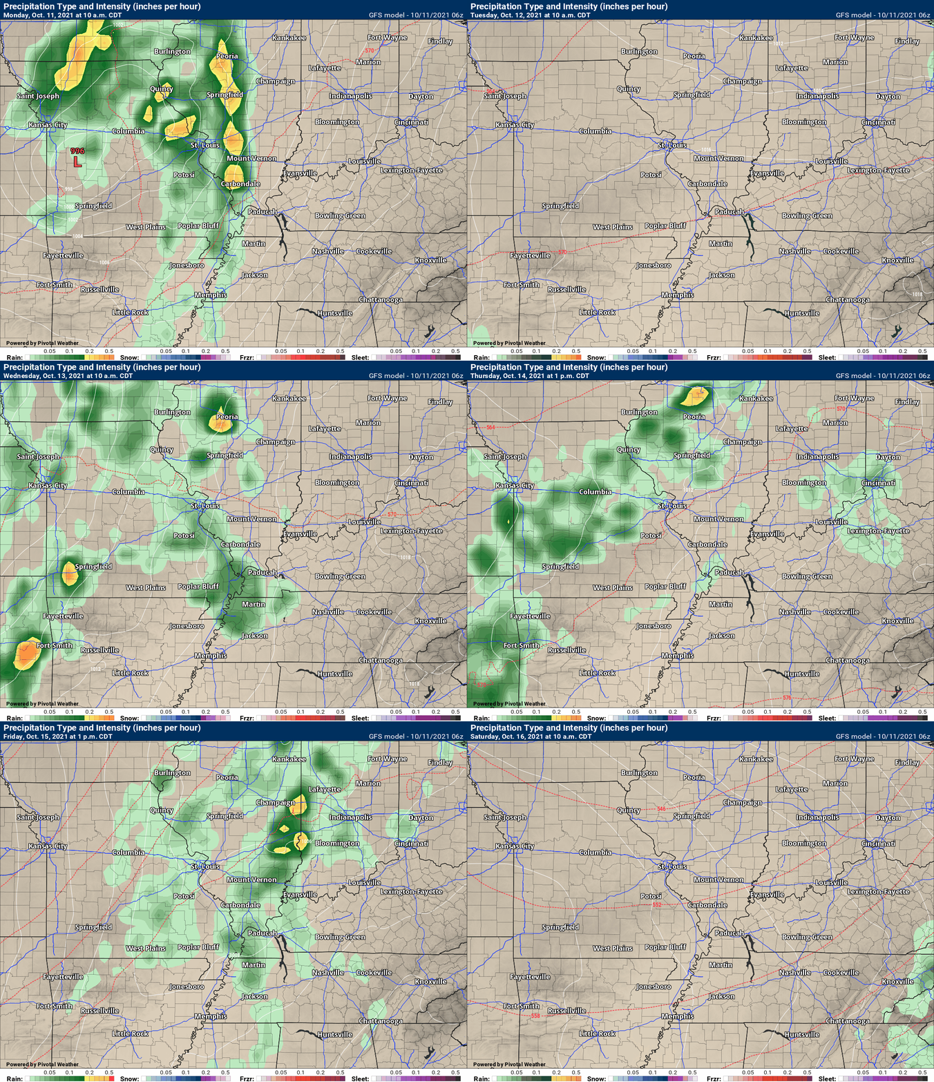
This next animation is the GFS American Model.
This animation shows you what radar might look like as the system pulls through the region. It is a future-cast radar.
Time-stamp upper left. Click the animation to enlarge it.
Longer range GFS
6 PM Update
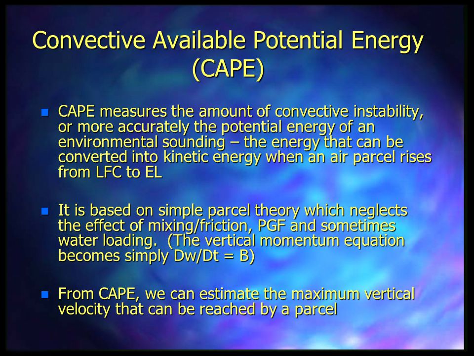
The latest Hrrr mode future-cast radar. This model believes the first line of storms will be in our area fairly early. This could keep CAPE numbers down. CAPE is energy that thunderstorms tap into.
The earlier the line passes through the region the lower the severe risk if new storms don’t form behind it. Something to consider.
The Hrrr shows the line in southeast Missouri as early as 7 to 9 am. Note the 989 mb low. That is deep low pressure and the wind gradient tomorrow will likely produce some non-thunderstorm winds gusting above 35 mph.
Animation
Weather Discussion
A rather unsettled weather pattern is developing.
A cold front will sweep across the region Monday and Monday night. This front will be responsible for damaging winds and tornadoes today across Kansas and Oklahoma. That activity will spread eastward Sunday night.
Gusty winds will accompany this system. Expect wind gusts Monday to top 30 mph from the south. These will be gradient winds (low pressure to our west will move northeast). Gradient winds are caused by the pressure difference between high and low pressure.
The NAM model even shows gusts over 40 mph. The NAM is sometimes a bit too strong with gusts. You can get the general idea though from this wind animation.
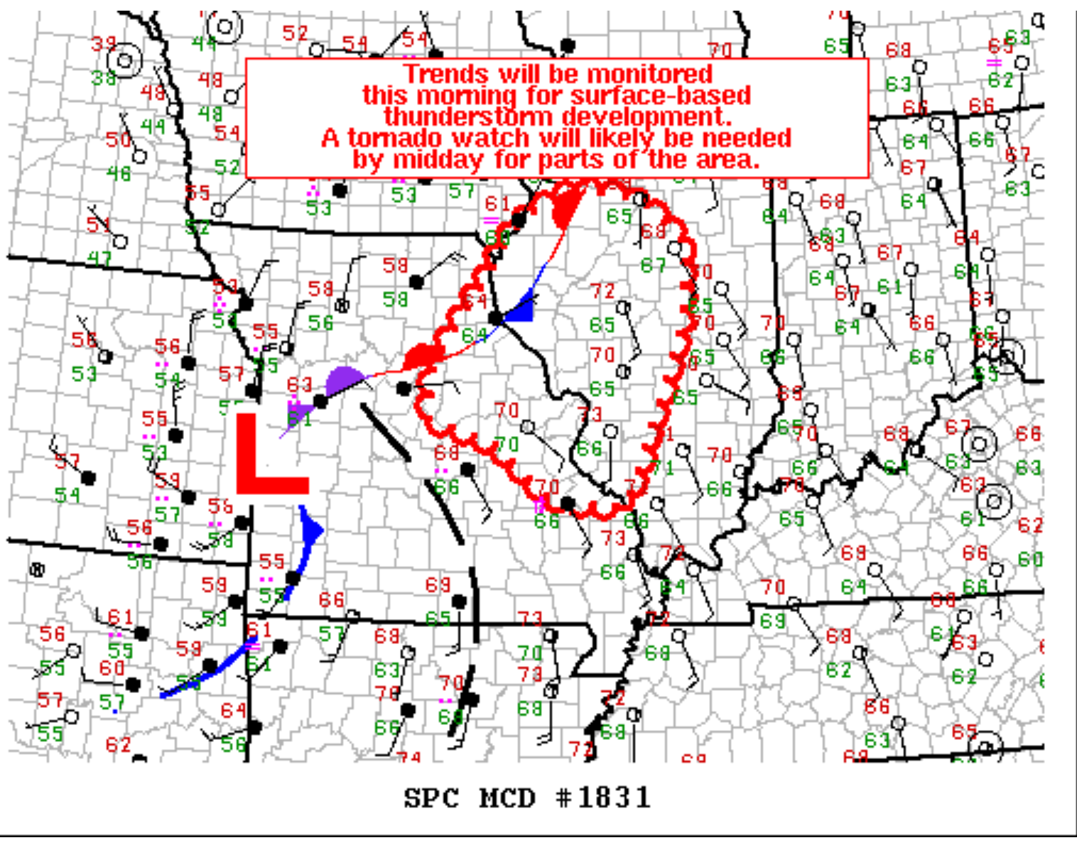
A line of thunderstorms will be moving into southeast Missouri early Monday morning. This line will then push eastward across our entire area.
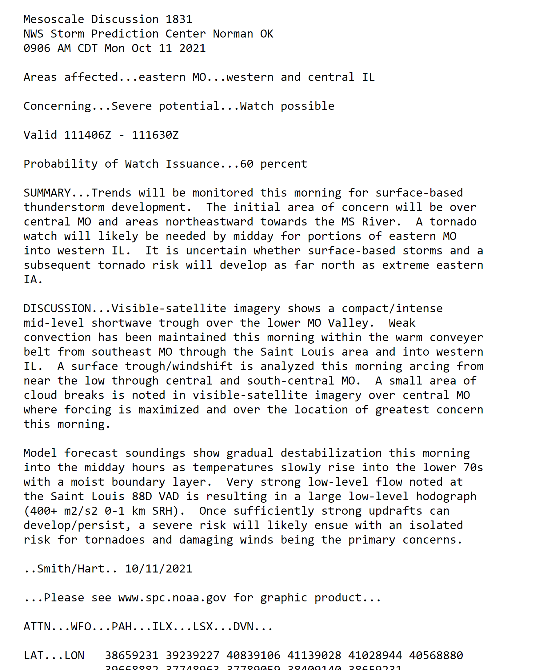
Some of these thunderstorms could be severe. There is a conditional risk of severe thunderstorms Monday. Conditional means that there will need to be some CAPE (energy) build ahead of the line of thunderstorms. Cloud cover could prevent this from happening.
If CAPE does not develop then the risk of severe weather will be lower. Less likely. Models show some CAPE but not a lot.
.
There will be a lot of wind shear to work with. Wind shear means that winds will increase with height. Stronger winds aloft help produce severe thunderstorms.
Typically, during the autumn months, we have strong wind shear but not much CAPE. The strong wind shear can sometimes offset the lack of CAPE.
The bottom line is that some severe thunderstorms are likely to develop Monday in our local area. The extent of the severe weather appears to be rather limited.
Damaging wind is the primary concern and then perhaps some reports of quarter size hail. There is enough turning of the winds with height (direction wind shear) that a tornado could develop. Again, this is a conditional risk and there is the possibility that there won’t be much in the way of severe weather. It will come down to the develop of CAPE.
The band of storms will push west to east through the day. Precipitation should end Monday evening west to east.
Tuesday should be dry.
I am monitoring a couple of systems Wednesday through Friday. These systems will produce at least scattered showers and thunderstorms as early as Wednesday into Thursday.
Peak shower and thunderstorm chances will arrive Thursday night into Friday night. A strong cold front will sweep across the region during this time period. Temperatures will only be in the 60s for highs this coming weekend and then lows will drop into the 40s.
There could be a few remaining showers early Saturday morning, but for the most part the system will be departing.
![]()
Today’s severe weather outlook from the Storm Prediction Center (below).
Light green is where thunderstorms may occur but should be below severe levels.
Dark green is a level one risk. Yellow is a level two risk. Orange is a level three (enhanced) risk. Red is a level four (moderate) risk. Pink is a level five (high) risk.
One is the lowest risk. Five is the highest risk.
A severe storm is one that produces 58 mph wind or higher, quarter size hail, and/or a tornado.
The tan states are simply a region that SPC outlined on this particular map. Just ignore that.

The black outline is our local area.

.
Tomorrow’s severe weather outlook.

![]()
![]()
Some safety graphics.
.![]()
.
.

Radar Link: Interactive local city-view radars & regional radars.
You will find clickable warning and advisory buttons on the local city-view radars.
If the radar is not updating then try another one. If a radar does not appear to be refreshing then hit Ctrl F5. You may also try restarting your browser.
Not working? Email me at beaudodson@usawx.com
Backup radar site in case the above one is not working.
https://weathertalk.com/morani
New ZOOM radar (with storm chasers)
https://wtalk.co/AVWG7GM7
Regional Radar
https://imagery.weathertalk.com/prx/RadarLoop.mp4
Lightning Data (zoom in and out of your local area)
https://wtalk.co/WJ3SN5UZ
Satellite Data
Computers and tablets. These two satellite links may not work well on cell phones.
Visible Satellite. This one is to be used during daylight only. Be sure and hit refresh once you are on the satellite page. Otherwise, the data will be old.
https://col.st/a5A0e
IR Satellite. This one shows cloud temperatures. Bright colors represent cold cloud tops. That could mean thunderstorms. Be sure and hit refresh once you are on the satellite page. Otherwise, the data will be old.
https://col.st/R2fw1
Water Vapor Satellite. This one shows mid-level moisture in the atmosphere. Be sure and hit refresh once you are on the satellite page. Otherwise, the data will be old.
https://col.st/xFVwx
.

Live lightning data: Click here.
Not receiving app/text messages?
Log in and out of your app.
USE THE APP. ATT and Verizon are slowing or stopping the text messages. Move to the app (not texts).
Make sure you have the correct app/text options turned on. Find those under the personal notification settings tab at www.weathertalk.com. Red is off. Green is on.
Subscribers, PLEASE USE THE APP. ATT and Verizon are not reliable during severe weather. They are delaying text messages.
The app is under WeatherTalk in the app store.
Apple users click here
Android users click here
.


