August 28, 2021
Double click on the image to enlarge it.
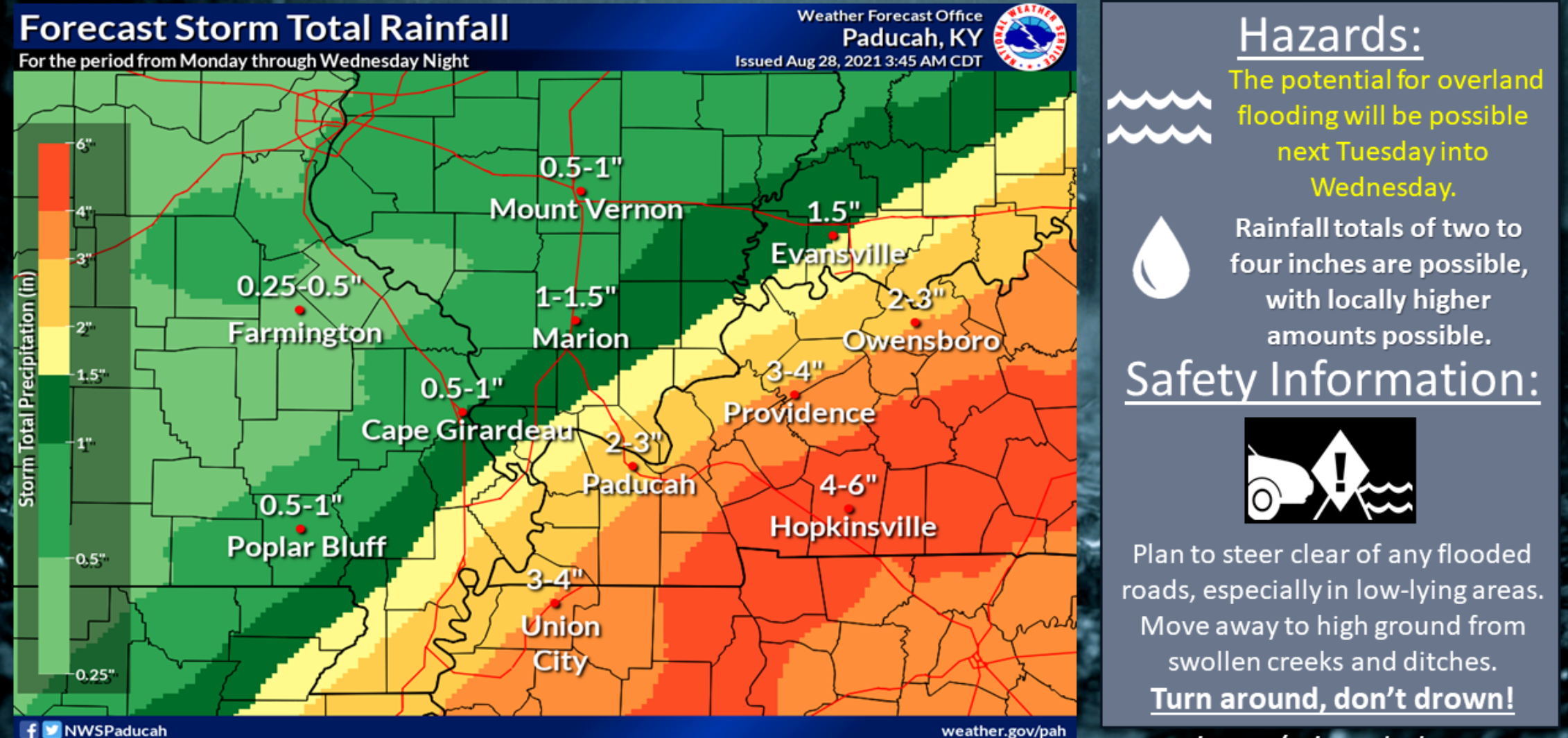
Locally heavy rain will be possible as the remnants of Hurricane Ida moves across the Mississippi and Tennessee Valleys.
The most likely zone for heavy rain will be across our southern and southeastern counties. From the Missouri Bootheel east/northeast along the Kentucky/Tennessee state line.
.
Rain totals will decrease as you move further north and northwest.
.
There will likely be adjustments to this graphic. This is the current forecast.
.
Monitor updates as we continue to track Hurricane Ida.
.
The time-frame of concern will be Monday through Tuesday night. We will need to monitor Wednesday.
.
Initially, on Monday, the rain chances will be higher across southeast Missouri and southern Illinois as a cold front nudges into the region. That won’t be directly connected to Ida (but some moisture may be enhanced by it).
.
At this time, we are expecting wind gusts of 15 to 30 mph. This is not another Hurricane Ike.
.
For now, the tornado threat appears to be greater to our south and east. This will be highly dependent on the exact track of Ida’s center.
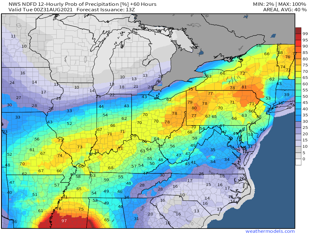
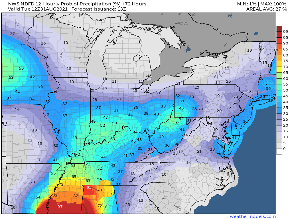
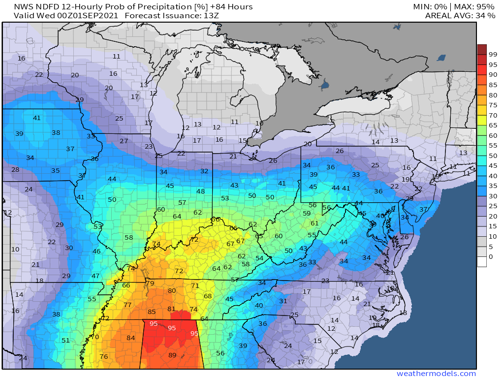
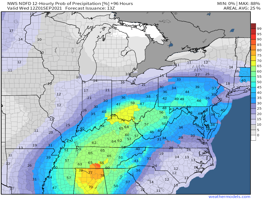
Current rain probabilities
Monday 7 AM to Monday 7 PM
Double click on the graphics to enlarge them.
Monday 7 PM to Tuesday 7 AM
Tuesday 7 AM to Tuesday 7 PM
Tuesday 7 PM to Wednesday 8 AM


