Click on the words below to subscribe
Storm Tracking Links
Interactive local city-view radars. Clickable watches and warnings.
https://wtalk.co/B3XHASFZ
Backup radar site in case the above one is not working.
https://weathertalk.com/morani
Regional Radar
https://imagery.weathertalk.com/prx/RadarLoop.mp4
*NEW* Zoom interactive radar (with storm chaser streams)
https://wtalk.co/AVWG7GM7
Real time lightning tracker system two.
https://map.blitzortung.org/#5.02/37.95/-86.99
Lightning Data (zoom in and out of your local area)
https://wtalk.co/WJ3SN5UZ
Apple users click here. Android users click here .
.
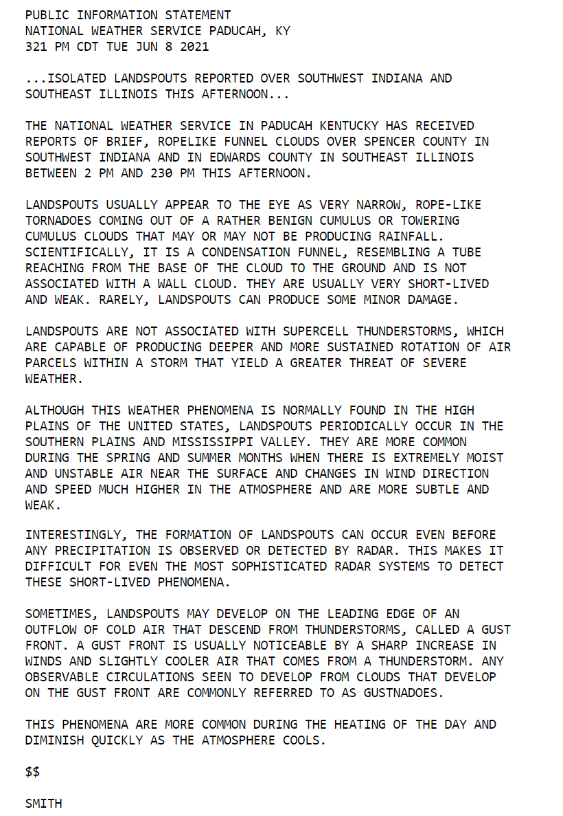
The latest update will be posted here at the top of Beau’s severe weather blog. I may delete old posts if it helps speed up the page.
What you need to know.
Key Points
- Thunderstorms are likely today. A few of the storms could produce high winds. There is a low-end tornado risk, as well.
- Locally heavy rain is likely with thunderstorms. The heaviest storms can drop one to two inches of rain in less than thirty minutes.
- The atmosphere will be loaded with moisture today. Avoid flooded roadways if flash flooding develops.
- Have your Beau Dodson Weather app on. Check it. Make sure you have not logged out of the app.
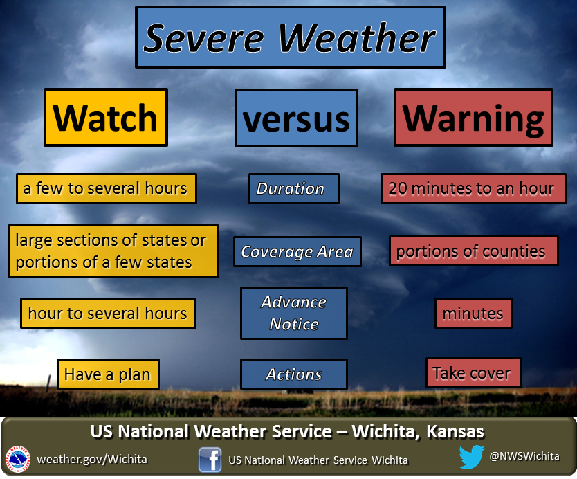
- Remember, a watch means to monitor updates. A warning means to seek shelter. A warning is a higher threat.
.

June 8, 2021
9 PM
End.
We had a couple of tornadoes today. One main rain band trained over portions of southeast Missouri and southern Illinois. It produced anywehre from 0.25″ to over 2.00″ of rain.
3:30 PM
.
1:00 PM
Historic event underway down south of us. A non-tropical event? Just insane rain totals and not moving. The Memphis, Tennessee, NWS says 4 to 8 more inches for some. The flood videos are showing terrible flooding in many areas.
This is why we preached about the extremely high PWAT values over the last few days. Someone was going to get nailed with large rain totals.
We are watching that play out just to our south.
No change in the going forecast here. Showers and thunderstorms are forming. They are training over the same areas. We will have to monitor to see if we have enough instability for a few severe thunderstorms.
.
10:00 AM
No change in the morning data.
This is a low confidence forecast for severe thunderstorms. We have a lot of clouds in the region and some ongoing rain. This will help keep instability levels down.
I am more concerned about locally heavy rain today. Any training thunderstorms could produce several inches of rain in a short amount of time.
Monitor updates.
.
7:00 AM
Weather advice:
Monitor updates concerning locally heavy rain this week.
Monitor updates in case a few thunderstorms become severe. The primary concern will be wind damage and torrential rain. A low-end tornado risk today and this evening, as well.
.
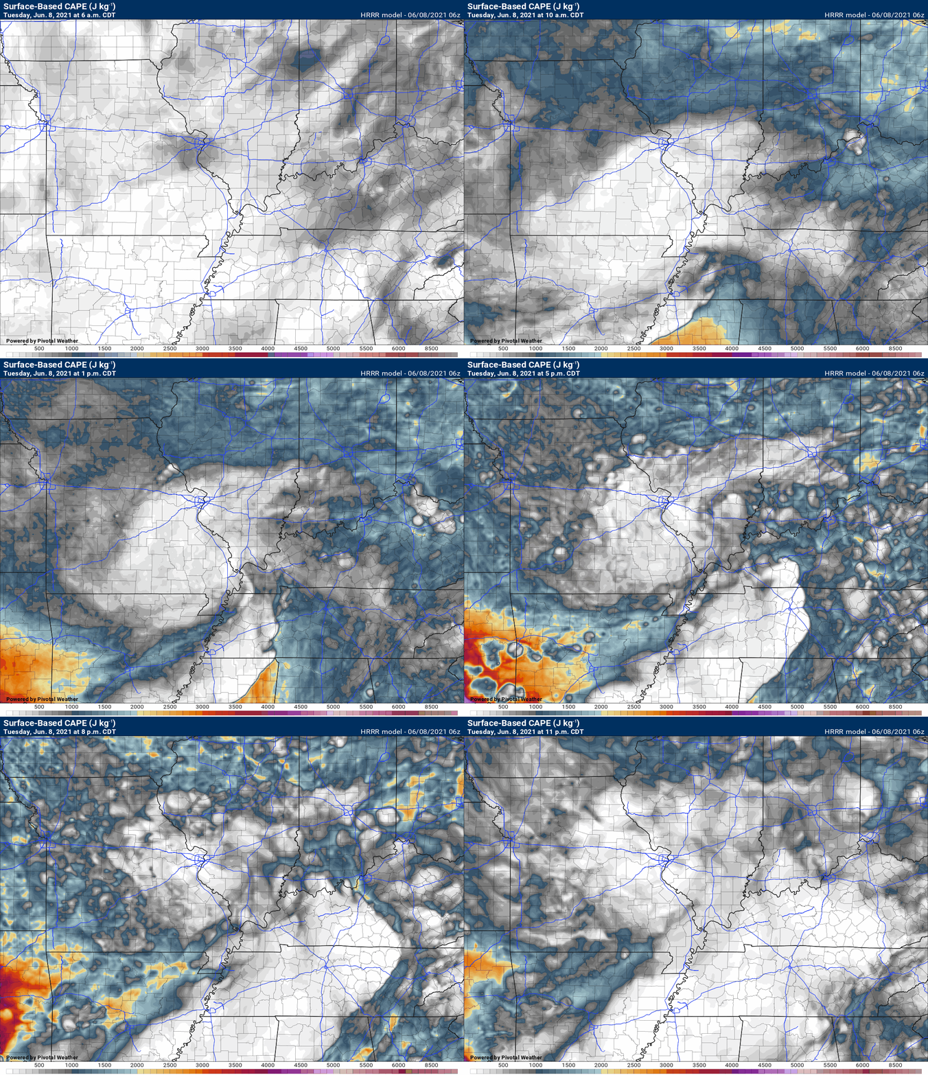
The big question today will be whether we have enough CAPE for thunderstorms to tap into to become severe. Models are not showing much CAPE. Some of the models show more than others, of course.
The high resolution Hrrr model is showing very little. This would lower the severe weather threat.
If we have sunshine today, then the risk of severe weather would increase. We will need to monitor satellite trends.
CAPE (energy) values will be high. Storms tap into CAPE. CAPE is one parameter that I look at when considering severe thunderstorms.
.
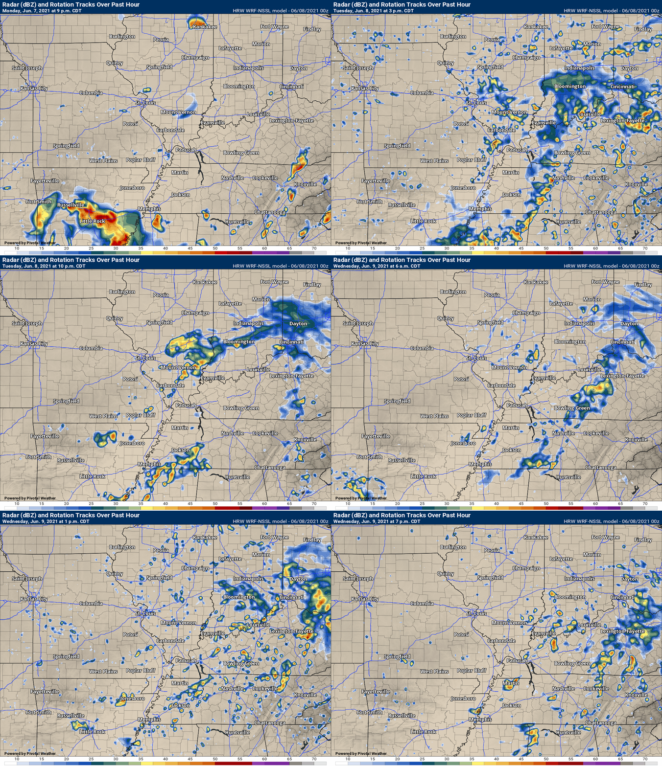
High resolution models show thunderstorms forming today. That is a certain. Locally heavy rain is the primary concern. A secondary concern would be the low-end severe weather risk.
.
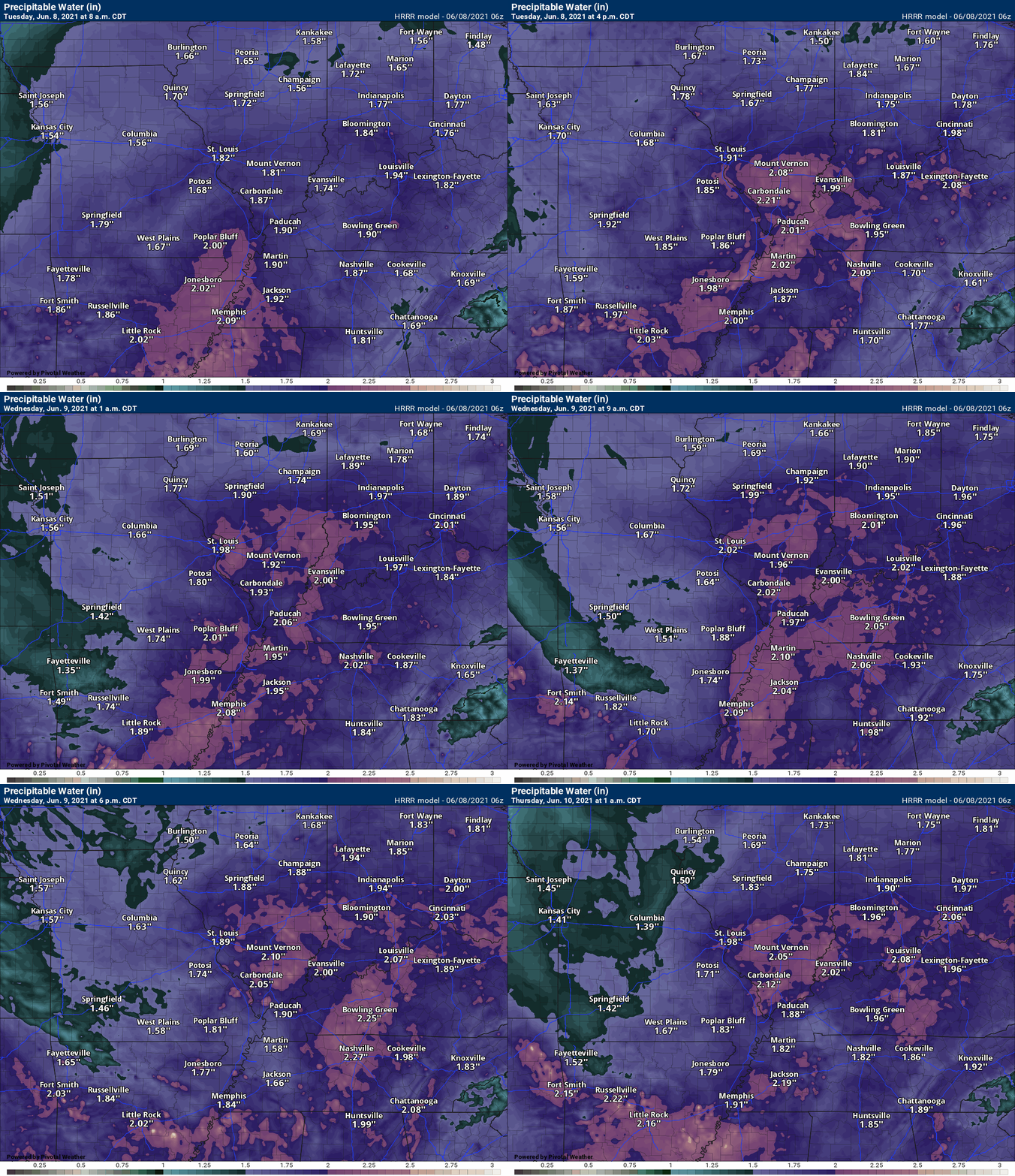
PWAT values will be very high today. This is a measure of moisture in the atmosphere. Any thunderstorms that form could produce torrential rain in a short period of time. A few flash flood warnings can’t be ruled out.
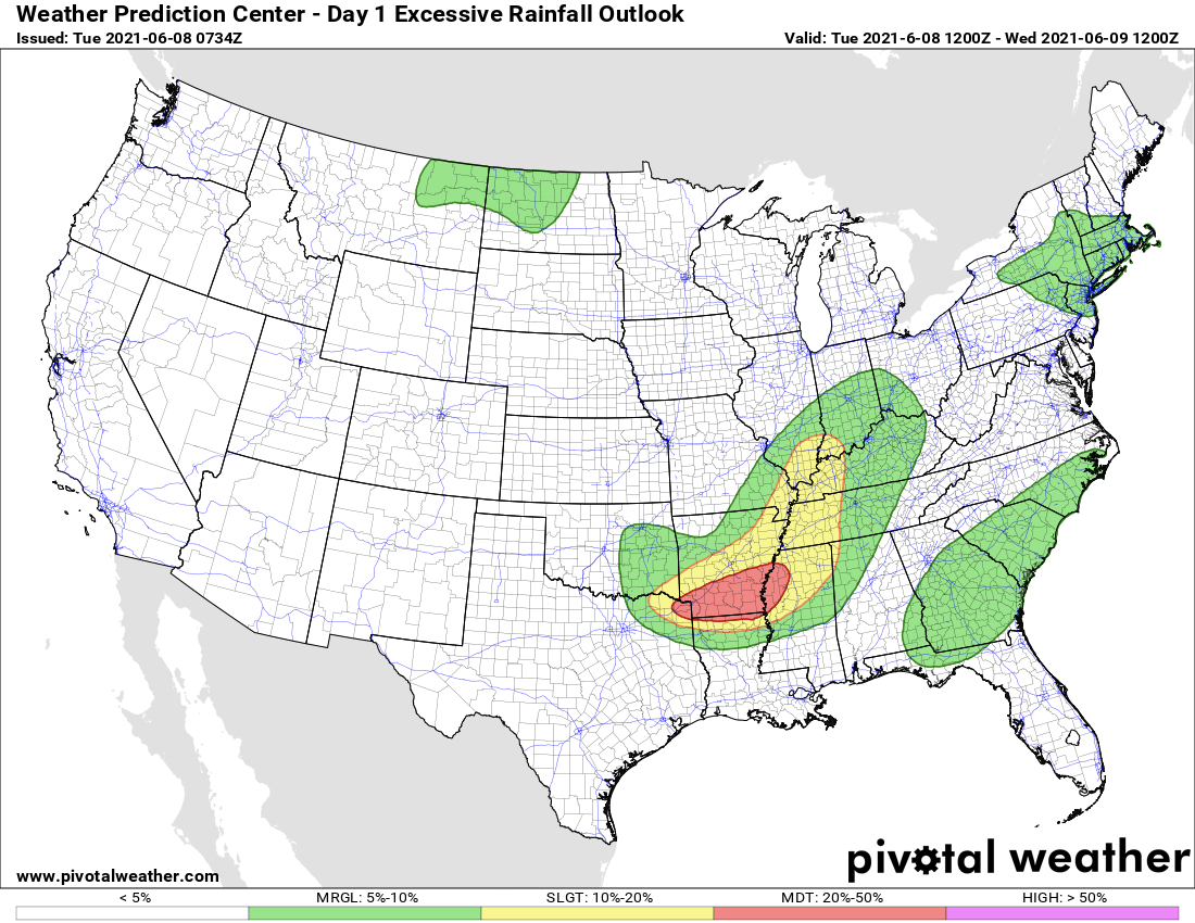
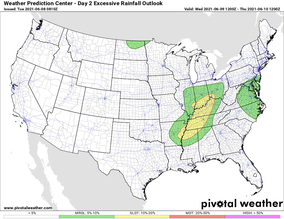
Day one excessive rainfall (flash flood outlook). This scale goes one to four. One being a slight risk. Four being a high risk.
You can see our region is in a risk of flash flooding today, tomorrow, and Wednesday.
Today
Tuesday

Click here if you would like to return to the top of the page.
Again, as a reminder, these are models. They are never 100% accurate. Take the general idea from them.
What should I take from these?
- The general idea and not specifics. Models usually do well with the generalities.
- The time-stamp is located in the upper left corner.
- The EC European weather model is in Zulu time.
.
What am I looking at?
You are looking at different models. Meteorologists use many different models to forecast the weather. All models are wrong. Some are more wrong than others. Meteorologists have to make a forecast based on the guidance/models.
I show you these so you can see what the different models are showing as far as precipitation. If most of the models agree, then the confidence in the final weather forecast increases.
You can see my final forecast at the top of the page.
.
This animation is the Storm Prediction Center WRF model.
This animation shows you what radar might look like as the next system pulls through the region. It is a future-cast radar.
Time-stamp upper left. Click the animation to enlarge it.
.
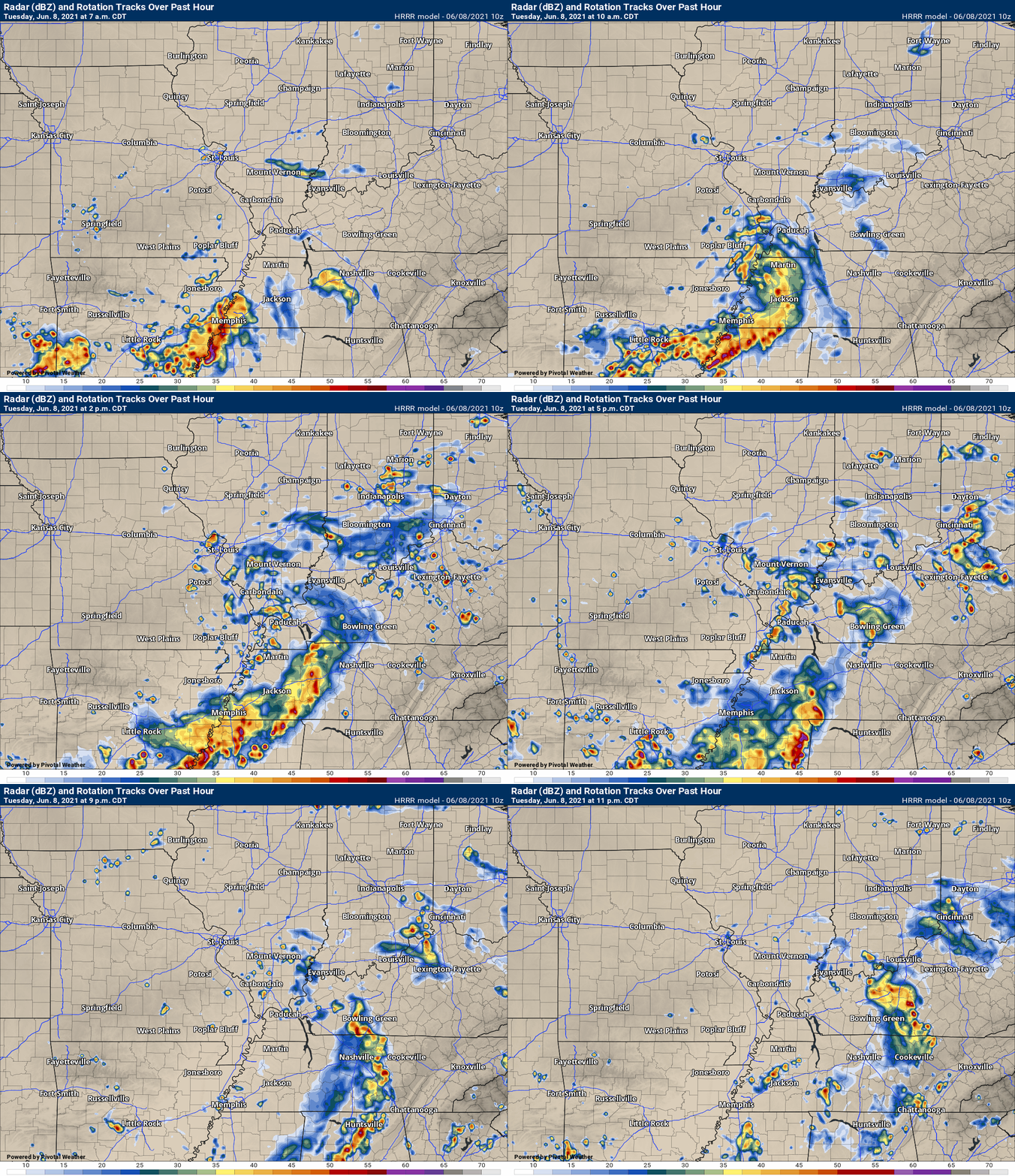
This animation is the Hrrr short-range model.
This animation shows you what radar might look like as the next system pulls through the region. It is a future-cast radar.
Time-stamp upper left. Click the animation to enlarge it.
.
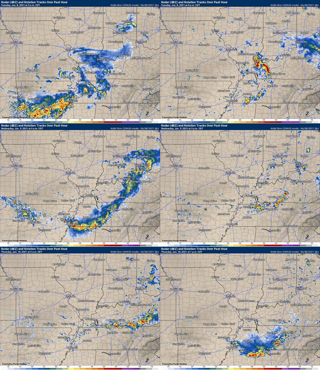
.This animation is the higher-resolution 3K NAM American Model.
.
![]()
Today’s severe weather outlook from the Storm Prediction Center (below).
Light green is where thunderstorms may occur but should be below severe levels.
Dark green is a level one risk. Yellow is a level two risk. Orange is a level three (enhanced) risk. Red is a level four (moderate) risk. Pink is a level five (high) risk.
One is the lowest risk. Five is the highest risk.
A severe storm is one that produces 58 mph wind or higher, quarter size hail, and/or a tornado.
The tan states are simply a region that SPC outlined on this particular map. Just ignore that.

The black outline is our local area.

.
Tomorrow’s severe weather outlook.

![]()
![]()
Some safety graphics.
.![]()
.
.

Radar Link: Interactive local city-view radars & regional radars.
You will find clickable warning and advisory buttons on the local city-view radars.
If the radar is not updating then try another one. If a radar does not appear to be refreshing then hit Ctrl F5. You may also try restarting your browser.
Not working? Email me at beaudodson@usawx.com
Backup radar site in case the above one is not working.
https://weathertalk.com/morani
New ZOOM radar (with storm chasers)
https://wtalk.co/AVWG7GM7
Regional Radar
https://imagery.weathertalk.com/prx/RadarLoop.mp4
Lightning Data (zoom in and out of your local area)
https://wtalk.co/WJ3SN5UZ
Satellite Data
Computers and tablets. These two satellite links may not work well on cell phones.
Visible Satellite. This one is to be used during daylight only. Be sure and hit refresh once you are on the satellite page. Otherwise, the data will be old.
https://col.st/a5A0e
IR Satellite. This one shows cloud temperatures. Bright colors represent cold cloud tops. That could mean thunderstorms. Be sure and hit refresh once you are on the satellite page. Otherwise, the data will be old.
https://col.st/R2fw1
Water Vapor Satellite. This one shows mid-level moisture in the atmosphere. Be sure and hit refresh once you are on the satellite page. Otherwise, the data will be old.
https://col.st/xFVwx
.

Live lightning data: Click here.
Not receiving app/text messages?
Log in and out of your app.
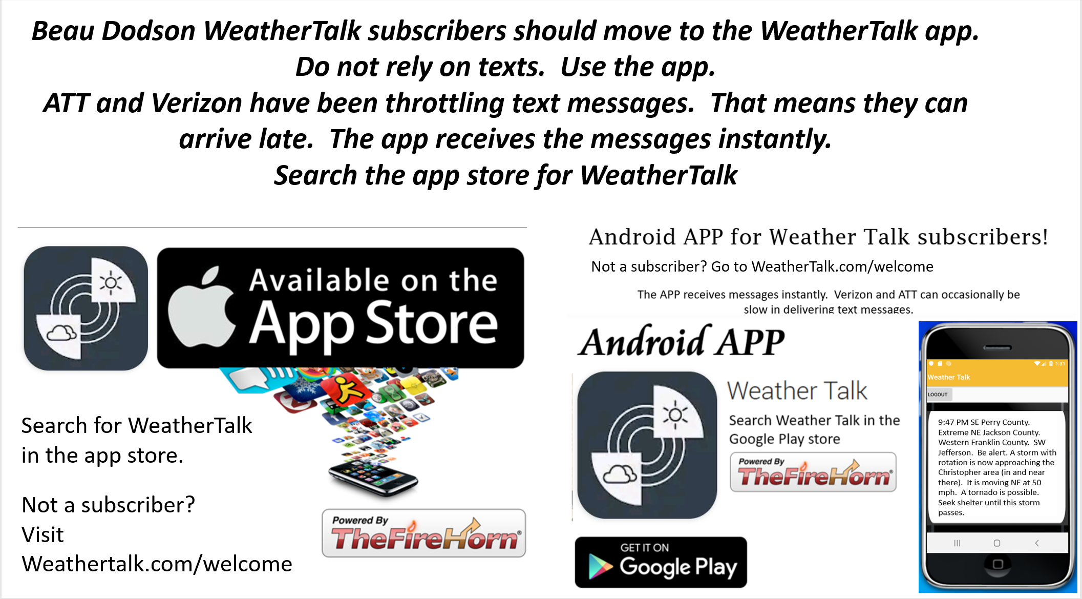
USE THE APP. ATT and Verizon are slowing or stopping the text messages. Move to the app (not texts).
Make sure you have the correct app/text options turned on. Find those under the personal notification settings tab at www.weathertalk.com. Red is off. Green is on.
Subscribers, PLEASE USE THE APP. ATT and Verizon are not reliable during severe weather. They are delaying text messages.
The app is under WeatherTalk in the app store.
Apple users click here
Android users click here
.


