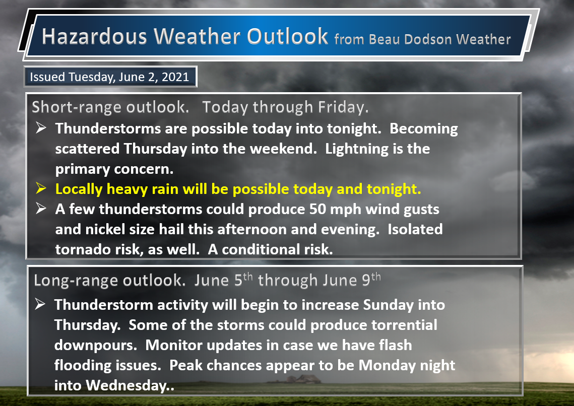
Click on the words below to subscribe
Storm Tracking Links
Interactive local city-view radars. Clickable watches and warnings.
https://wtalk.co/B3XHASFZ
Backup radar site in case the above one is not working.
https://weathertalk.com/morani
Regional Radar
https://imagery.weathertalk.com/prx/RadarLoop.mp4
*NEW* Zoom interactive radar (with storm chaser streams)
https://wtalk.co/AVWG7GM7
Real time lightning tracker system two.
https://map.blitzortung.org/#5.02/37.95/-86.99
Lightning Data (zoom in and out of your local area)
https://wtalk.co/WJ3SN5UZ
Apple users click here. Android users click here .
.
The latest update will be posted here at the top of Beau’s severe weather blog. I may delete old posts if it helps speed up the page.
What you need to know.
Key Points
- There is a conditional risk of severe thunderstorms this afternoon and evening from the Missouri Bootheel into extreme southern Illinois, southeast Illinois, western Kentucky, and western Tennessee.
- The risk is highly dependent on CAPE building. CAPE is energy for storms to tap into. This would occur if the clouds clear and the surface heats up. Monitor updates.
- Have your Beau Dodson Weather app on. Check it. Make sure you have not logged out of the app.
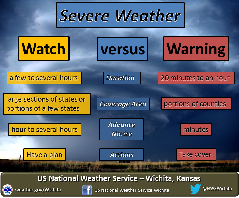
- Remember, a watch means to monitor updates. A warning means to seek shelter. A warning is a higher threat.
.

June 2, 2021
6:30 PM
Storms are sub-severe, at this time. It is likely the severe concerns are ending.
I will keep an eye on the radar.
.
4:55 PM
PRELIMINARY LOCAL STORM REPORT
NATIONAL WEATHER SERVICE PADUCAH KY
451 PM CDT WED JUN 2 2021

..TIME...   ...EVENT...      ...CITY LOCATION...     ...LAT.LON...
..DATE...   ....MAG....      ..COUNTY LOCATION..ST.. ...SOURCE....
            ..REMARKS..

0420 PM     FLASH FLOOD      2 SSE DEXTER            36.72N 88.29W
06/02/2021                   CALLOWAY           KY   LAW ENFORCEMENT

            NUMEROUS RURAL COUNTY ROADS ARE EITHER
            FLOODED OR COMPLETELY WASHED OUT FROM NEAR
            ALMO TO DEXTER AND SURROUNDING AREAS.
4:15 PM
The storm has left Henry County, TN. No further concern in that county.
.
4:00 PM
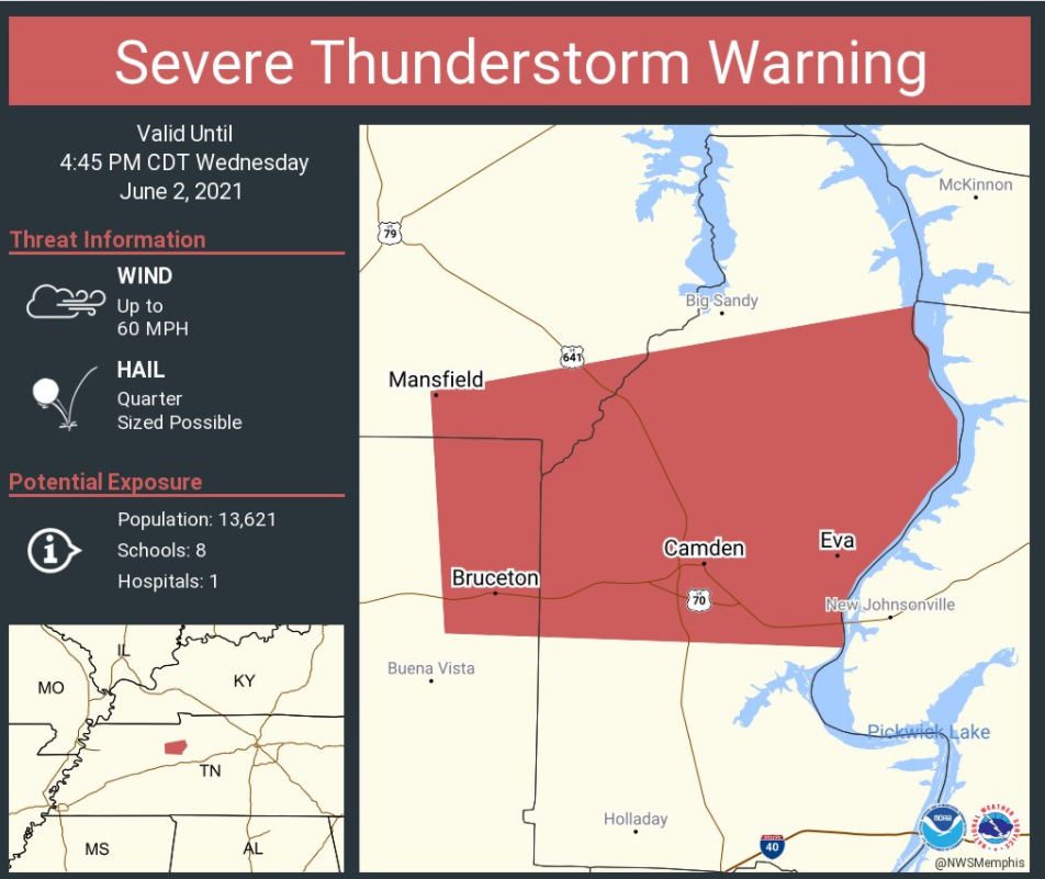
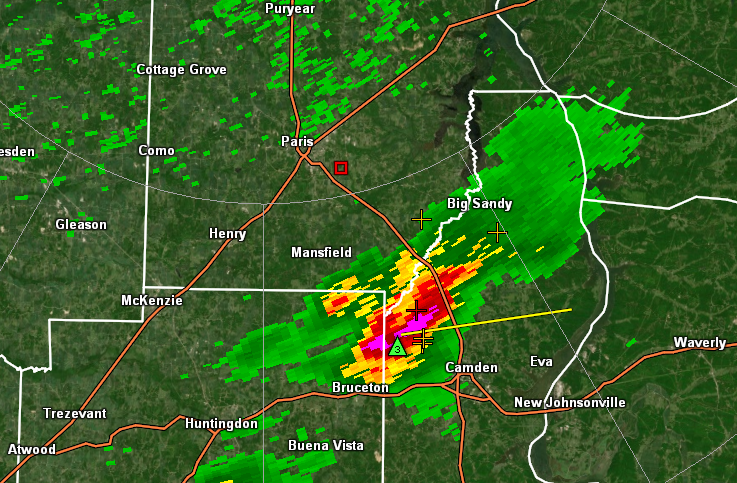
A severe thunderstorm will clip extreme southeast Henry County. The bulk of this storm will be just off to the east/southeast.
The extreme southeast portion of the county could have hail and high wind. This storm won’t last long since the bulk of it is out of the county.
You can see that it will barely clip the county.
3:50 PM
BULLETIN - EAS ACTIVATION REQUESTED
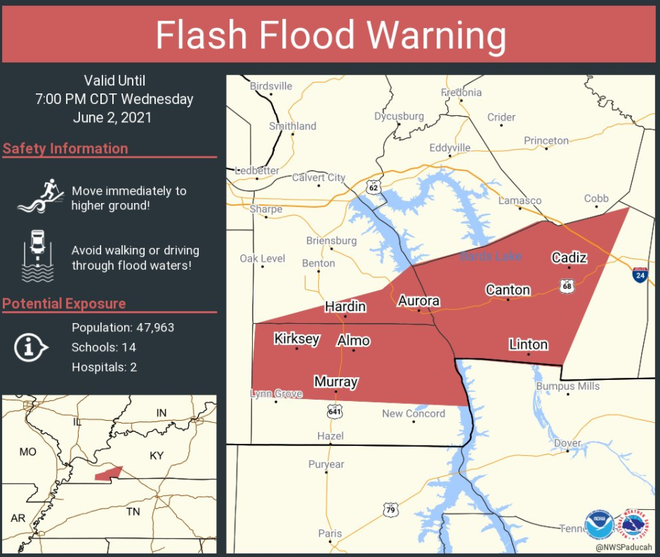
FLASH FLOOD WARNING
NATIONAL WEATHER SERVICE PADUCAH KY
400 PM CDT WED JUN 2 2021
THE NATIONAL WEATHER SERVICE IN PADUCAH HAS ISSUED A
* FLASH FLOOD WARNING FOR...
CALLOWAY COUNTY IN WESTERN KENTUCKY...
SOUTHEASTERN MARSHALL COUNTY IN WESTERN KENTUCKY...
TRIGG COUNTY IN WESTERN KENTUCKY...
* UNTIL 700 PM CDT.
* AT 359 PM CDT, DOPPLER RADAR INDICATED THUNDERSTORMS PRODUCING
HEAVY RAIN ACROSS THE WARNED AREA. UP TO TWO INCHES OF RAIN HAVE
ALREADY FALLEN. FLASH FLOODING IS ONGOING OR EXPECTED TO BEGIN
SHORTLY.
HAZARD...FLASH FLOODING CAUSED BY THUNDERSTORMS.
SOURCE...RADAR INDICATED.
IMPACT...FLOODING OF SMALL CREEKS AND STREAMS, URBAN AREAS,
HIGHWAYS, STREETS AND UNDERPASSES AS WELL AS OTHER
DRAINAGE AND LOW LYING AREAS.
* SOME LOCATIONS THAT WILL EXPERIENCE FLOODING INCLUDE...
MURRAY, CADIZ, LAND BETWEEN THE LAKES AREA, CANTON, ROCKCASTLE,
HARDIN, AURORA, LINTON AND KIRKSEY.
ADDITIONAL RAINFALL AMOUNTS OF 1 TO 2 INCHES ARE POSSIBLE IN THE
WARNED AREA.
 .
.
3:40 PM
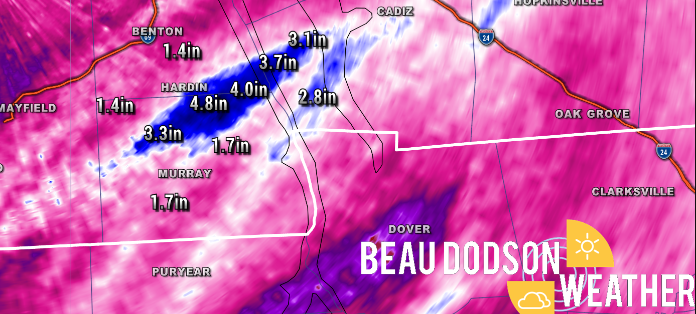
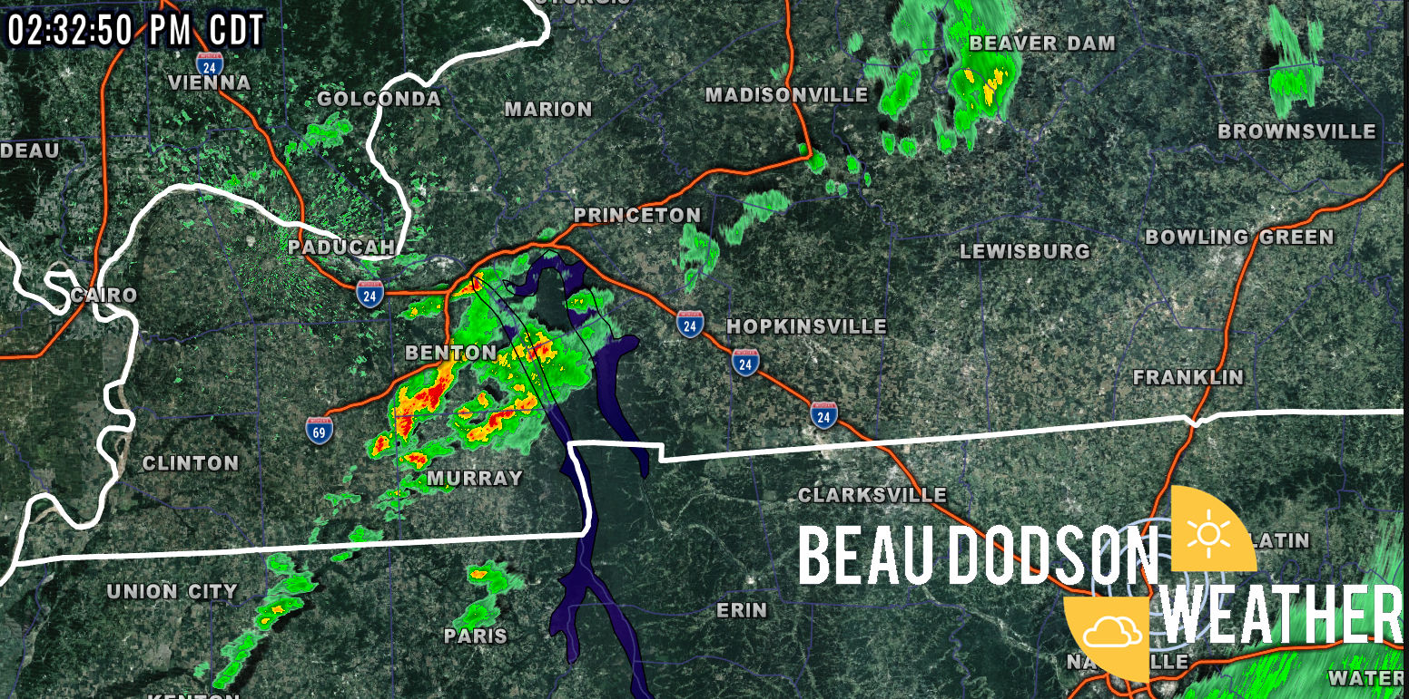
Locally heavy rain has fallen north of Murray, Kentucky. Some areas are now over 4″ over the past 24 hours.
Avoid flooded roadways. This is a small area of very heavy rain.
Thunderstorms are training over the same area.
The main concern will be to the east/southeast of the white line. A few storms could produce high wind and nickel size hail.
.
2:30 PM
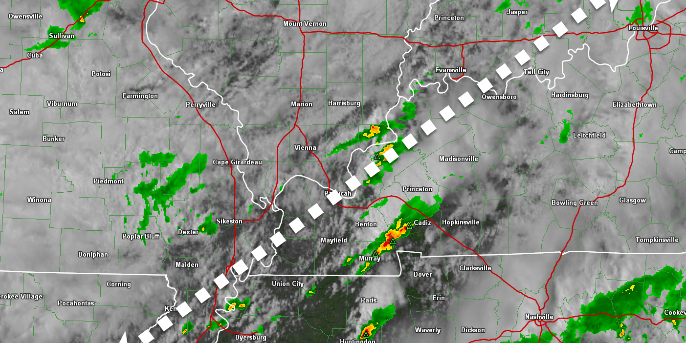
A few storms have formed over western Tennessee and western Kentucky. They are moving NE at 30 mph.
Gusty wind will be possible with these thunderstorms.
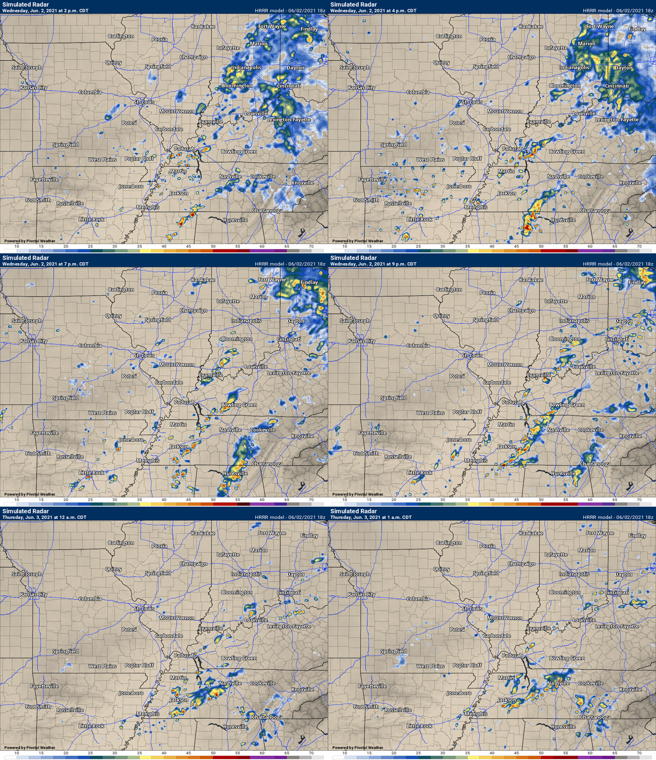
The afternoon Hrrr model seems to line up with what is happening.
Overall, the severe weather risk remains low.
.
1:20 PM
A few thunderstorms are forming over western Tennessee and western Kentucky.
Thus far, the storms have remained below severe levels. We are seeing more development of these scattered showers and thunderstorms.
We will have to see if a few of the storms can intensify. Wind shear remains quite weak. We do have CAPE values of 500 to 1500 in the region.
With wind shear being so weak, it may be difficult for thunderstorm updrafts to survive and become severe.
I am closely monitoring trends. I can’t rule out a few severe thunderstorms as we move through the coming hours.
.
11 AM
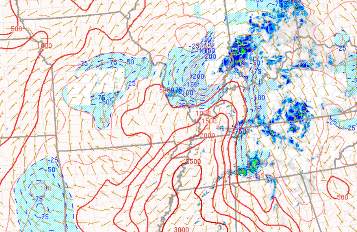
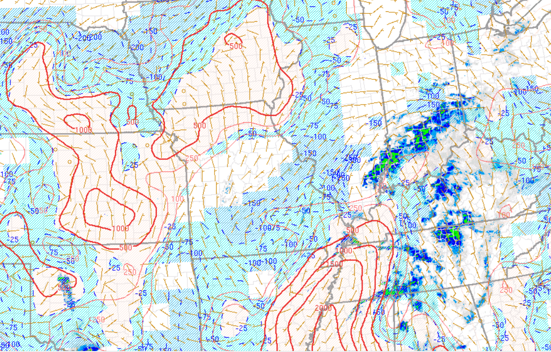
There has been clearing over the region. Enough that CAPE is building. Remember, CAPE is energy that storms tap into.
Thus, there is a risk of severe weather if thunderstorms develop later today (which they likely will). Continue to monitor updates.
10:00 AM
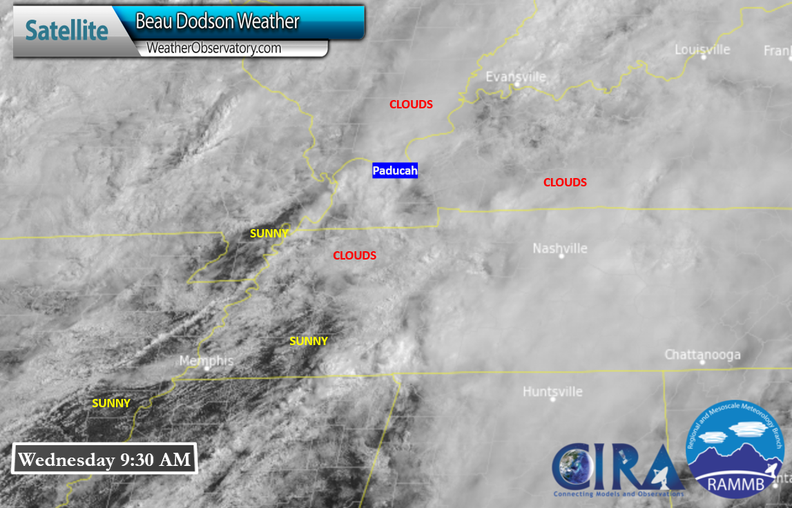
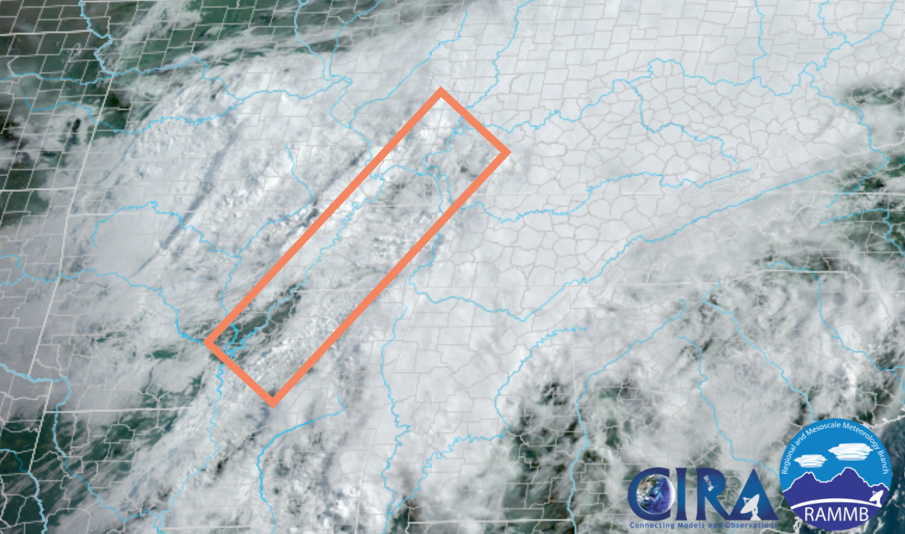
We do have some clearing across portions of Arkansas, Missouri, and Tennessee. We will have to watch this over the coming hours.
Sunshine would help build CAPE.
The SPC website also shows CAPE building over portions of the area (the red lines).
.
8:00 AM Update
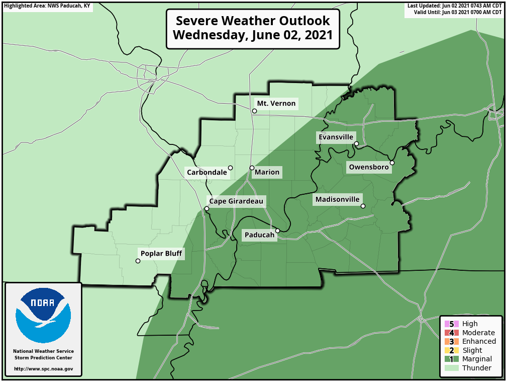
No significant adjustments in the Storm Prediction Center severe weather outlook (issued at 7 AM)
.
7:00 AM Update
I am watching this zone for clearing today. If we have clearing then severe storms are likely. No clearing and severe storms are less likely.
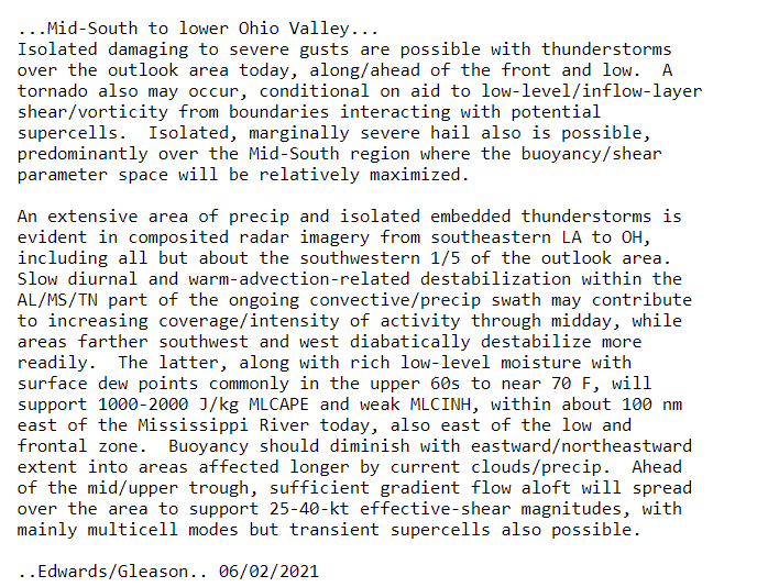
Here are the comments from the Storm Prediction Center.
Mid South into the OH Valley...
   A broad area of rain with embedded thunderstorms will be ongoing
   this morning from portions of the Mid South to the OH Valley, in
   conjunction with moisture transport associated with a southerly
   low-level jet. While the primary low-level jet will become focused
   further north with time over the OH Valley, convection will likely
   persist within a moist low-level environment across portions of
   TN/MS and northern AL. Diurnal heating will result in moderate
   destabilization along the southern and western fringe of ongoing
   convection by afternoon, while midlevel 30-40 kt southwesterlies
   will support sufficient effective shear for some updraft
   organization.

   Ongoing storms may intensify by afternoon, with additional
   development possible to the west of earlier convection along the
   weak surface boundary from northern MS into western TN/KY. Organized
   multicells and perhaps a supercell or two will be possible from
   afternoon into early evening. Damaging wind will likely be the
   primary hazard, though buoyancy may be sufficient to support some
   hail despite weak midlevel lapse rates, and a tornado cannot be
   ruled out with any sustained supercell.
END of their comments.
My thoughts.
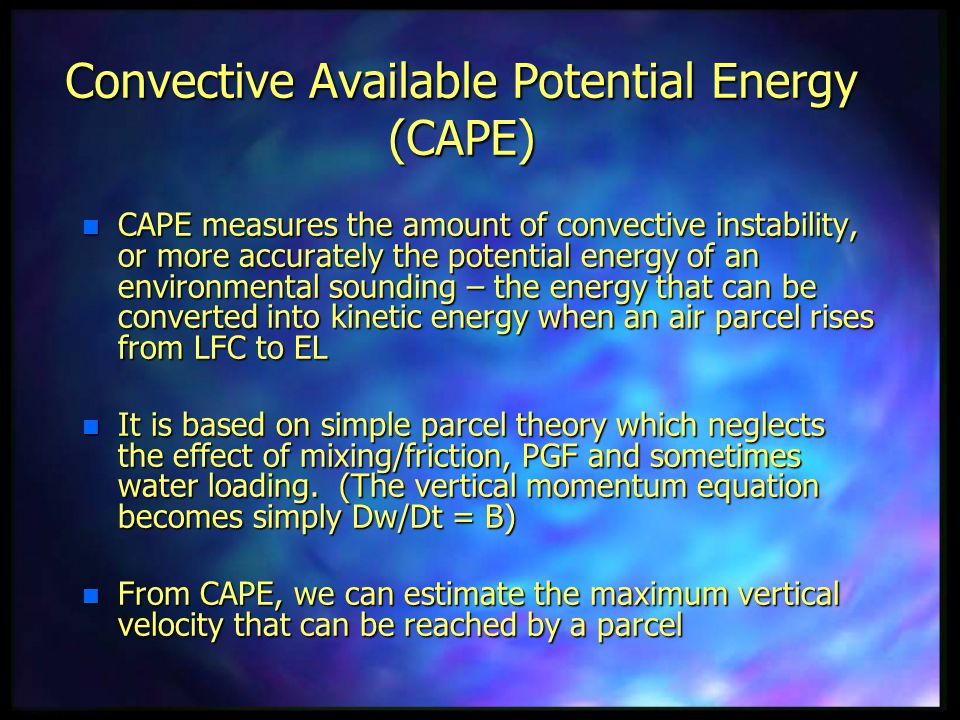
We are mainly going to be watching CAPE levels. CAPE is energy that thunderstorms tap into. The sun helps build energy at the surface. That in turn raises the CAPE numbers.
This is considered a conditional risk of severe weather.
If we don’t have higher CAPE numbers, then we likely will not have to deal with severe thunderstorms. At this point, it is a wait and watch situation. I will be monitoring both satellite and radar today into this evening.
The primary concern will be 2 PM through 8 PM.
This risk is mostly from the Missouri Bootheel into extreme southern Illinois and then southeast Illinois. Along that line and then east of that line. That would include all of western Kentucky and western Tennessee.
Again, keep in mind, this is a conditional risk and confidence is low.
If severe thunderstorms do form, then the concern would be 50+ mph wind gusts, nickel to quarter size hail, and even an isolated tornado.
Wind shear is not overly impressive. There is directional shear. Directional shear is when wind at the surface is from the southeast and then it becomes more westerly with height. This causes the air to turn. That is one parameter that I look for when forecasting severe thunderstorms.
If wind speed shear was higher, then the concern would be greater.
Let’s monitor updates later today in case a few severe thunderstorms form.
I will keep the page you are on updated throughout the day.

Click here if you would like to return to the top of the page.
Again, as a reminder, these are models. They are never 100% accurate. Take the general idea from them.
What should I take from these?
- The general idea and not specifics. Models usually do well with the generalities.
- The time-stamp is located in the upper left corner.
- The EC European weather model is in Zulu time.
.
What am I looking at?
You are looking at different models. Meteorologists use many different models to forecast the weather. All models are wrong. Some are more wrong than others. Meteorologists have to make a forecast based on the guidance/models.
I show you these so you can see what the different models are showing as far as precipitation. If most of the models agree, then the confidence in the final weather forecast increases.
You can see my final forecast at the top of the page.
.
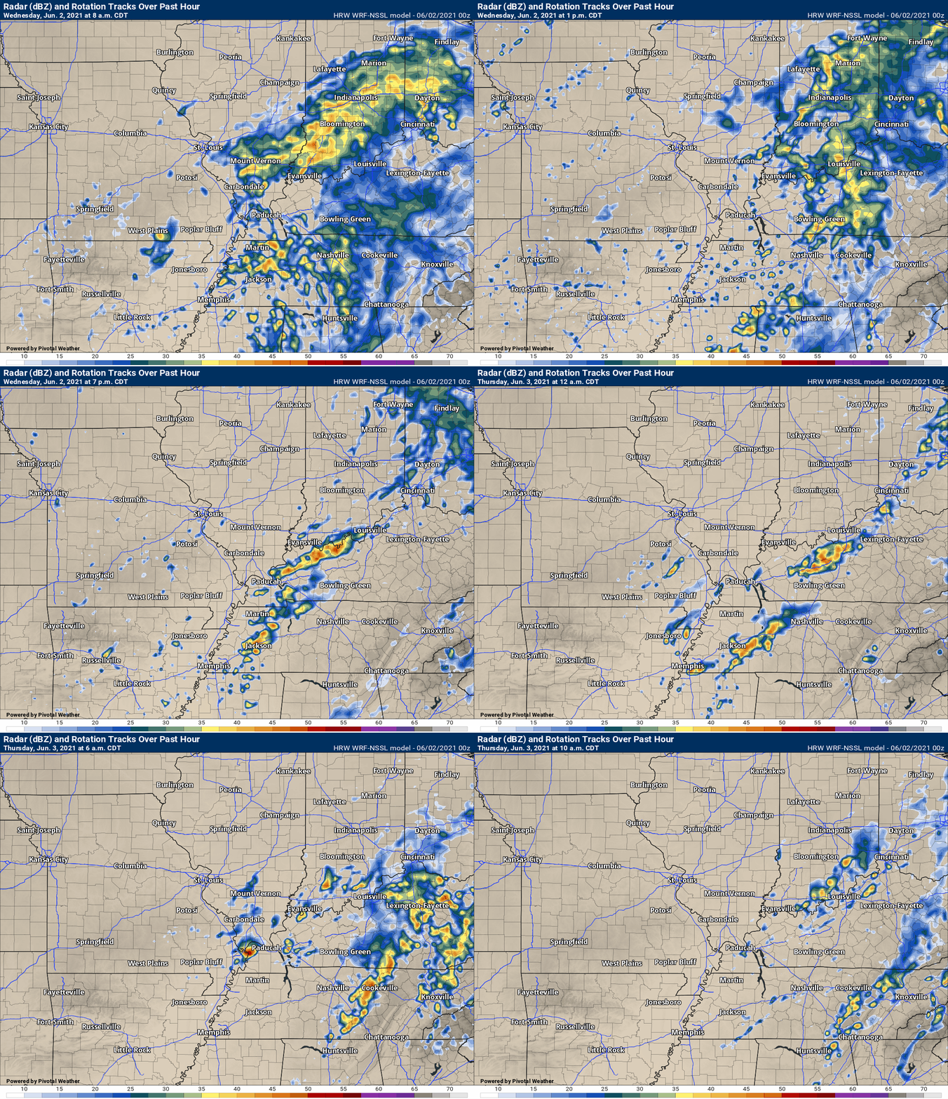
This animation is the Storm Prediction Center WRF model.
This animation shows you what radar might look like as the next system pulls through the region. It is a future-cast radar.
Time-stamp upper left. Click the animation to enlarge it.
.
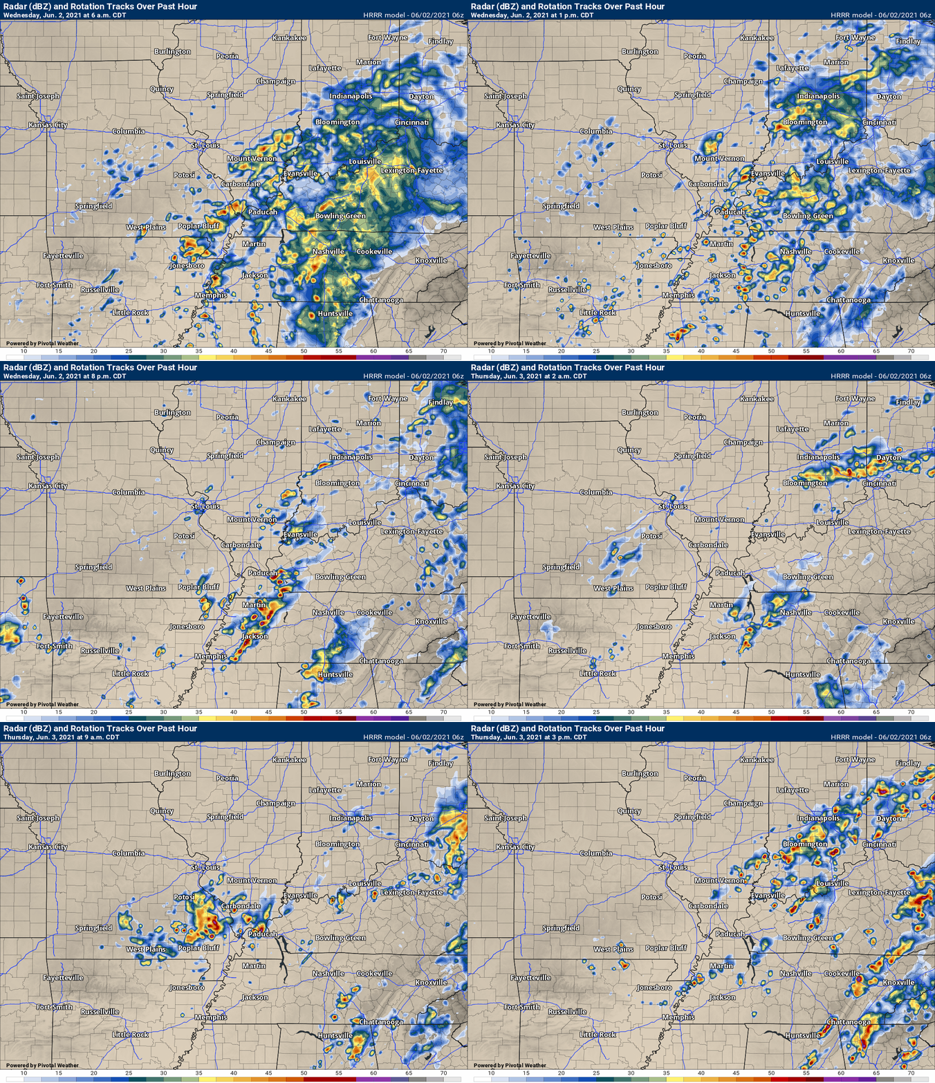
This animation is the Hrrr short-range model.
This animation shows you what radar might look like as the next system pulls through the region. It is a future-cast radar.
Time-stamp upper left. Click the animation to enlarge it.
.
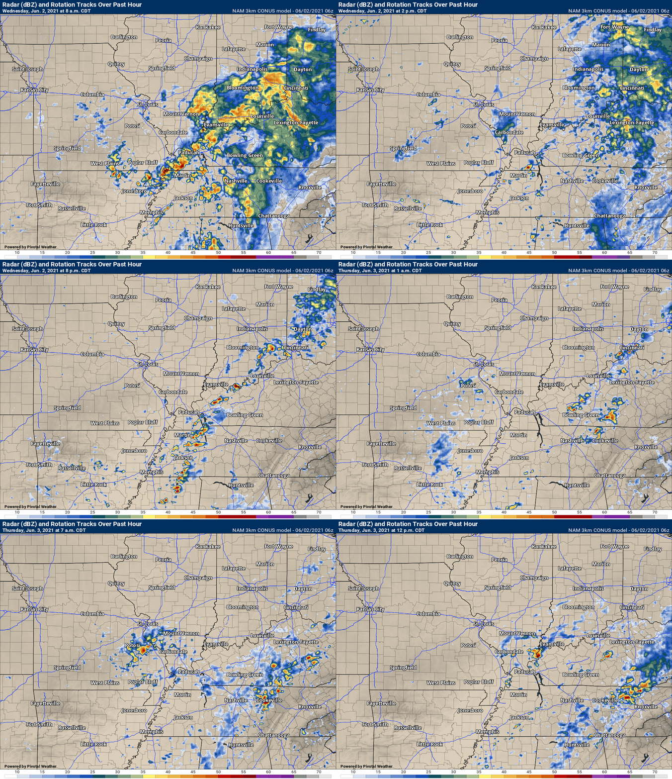
.This animation is the higher-resolution 3K NAM American Model.
This animation shows you what radar might look like as the next system pulls through the region. It is a future-cast radar.
Time-stamp upper left. Click the animation to enlarge it.
.
![]()
Today’s severe weather outlook from the Storm Prediction Center (below).
Light green is where thunderstorms may occur but should be below severe levels.
Dark green is a level one risk. Yellow is a level two risk. Orange is a level three (enhanced) risk. Red is a level four (moderate) risk. Pink is a level five (high) risk.
One is the lowest risk. Five is the highest risk.
A severe storm is one that produces 58 mph wind or higher, quarter size hail, and/or a tornado.
The tan states are simply a region that SPC outlined on this particular map. Just ignore that.

The black outline is our local area.

.
Tomorrow’s severe weather outlook.

![]()
![]()
Some safety graphics.
.![]()
.
.
What you need to know.
Key Points (monitor the top of the page for updates)
- A low-end risk of severe weather Wednesday afternoon and night.
- A few of the storms could produce hail and wind damage. A low tornado risk.
- Locally heavy rain and lightning.
- Have your Beau Dodson Weather app on. Check it. Make sure you have not logged out of the app.
- Remember, a watch means to monitor updates. A warning means to seek shelter. A warning is a higher threat.
.
Call to action.
Monitor updated weather forecasts.
Have a safety plan.
Make sure you are using the Beau Dodson Weather Talk app. Download it from the app store. It is under Weather Talk.
The app is for subscribers (please log into your account and make sure your payment has been updated. We have a large number of declined cards and PayPal payments.
Subscribe at www.weathertalk.com/welcome then go to your app store and search for WeatherTalk. Apple users click here. Android users click here .
.

Radar Link: Interactive local city-view radars & regional radars.
You will find clickable warning and advisory buttons on the local city-view radars.
If the radar is not updating then try another one. If a radar does not appear to be refreshing then hit Ctrl F5. You may also try restarting your browser.
Not working? Email me at beaudodson@usawx.com
Backup radar site in case the above one is not working.
https://weathertalk.com/morani
New ZOOM radar (with storm chasers)
https://wtalk.co/AVWG7GM7
Regional Radar
https://imagery.weathertalk.com/prx/RadarLoop.mp4
Lightning Data (zoom in and out of your local area)
https://wtalk.co/WJ3SN5UZ
Satellite Data
Computers and tablets. These two satellite links may not work well on cell phones.
Visible Satellite. This one is to be used during daylight only. Be sure and hit refresh once you are on the satellite page. Otherwise, the data will be old.
https://col.st/a5A0e
IR Satellite. This one shows cloud temperatures. Bright colors represent cold cloud tops. That could mean thunderstorms. Be sure and hit refresh once you are on the satellite page. Otherwise, the data will be old.
https://col.st/R2fw1
Water Vapor Satellite. This one shows mid-level moisture in the atmosphere. Be sure and hit refresh once you are on the satellite page. Otherwise, the data will be old.
https://col.st/xFVwx
.

Live lightning data: Click here.
Not receiving app/text messages?
Log in and out of your app.
USE THE APP. ATT and Verizon are slowing or stopping the text messages. Move to the app (not texts).
Make sure you have the correct app/text options turned on. Find those under the personal notification settings tab at www.weathertalk.com. Red is off. Green is on.
Subscribers, PLEASE USE THE APP. ATT and Verizon are not reliable during severe weather. They are delaying text messages.
The app is under WeatherTalk in the app store.
Apple users click here
Android users click here
.


