Click on the words below to subscribe
Storm Tracking Links
Interactive local city-view radars. Clickable watches and warnings.
https://wtalk.co/B3XHASFZ
Backup radar site in case the above one is not working.
https://weathertalk.com/morani
Regional Radar
https://imagery.weathertalk.com/prx/RadarLoop.mp4
*NEW* Zoom interactive radar (with storm chaser streams)
https://wtalk.co/AVWG7GM7
Real time lightning tracker system two.
https://map.blitzortung.org/#5.02/37.95/-86.99
Lightning Data (zoom in and out of your local area)
https://wtalk.co/WJ3SN5UZ
Apple users click here. Android users click here .
.
The latest update will be posted here at the top of Beau’s severe weather blog. I may delete old posts if it helps speed up the page.
What you need to know.
Key Points
- A few storms could be severe Thursday late afternoon and into tonight. Overall, the risk does not appear to be all that high across KY/TN. Better chances over MO/IL.
- A few of the storms could produce hail and wind damage. A low tornado risk.
- Locally heavy rain and lightning.
- Have your Beau Dodson Weather app on. Check it. Make sure you have not logged out of the app.
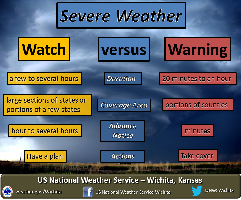
- Remember, a watch means to monitor updates. A warning means to seek shelter. A warning is a higher threat.
.

May 27, 2021
8:09 PM
Eastern Graves, Marshall, and Calloway County.
Radar shows an intense thunderstorm near or just a bit east/southeast of Mayfield. Over the past ten minutes there has been some rotation with it and winds are likely gusting above 50 mph, at times.
This storm is moving east at 40 mph. I can’t rule out some isolated wind damage with this storm. It is a bit stronger than other storms within the line.
Radars
Interactive local city-view radars. Clickable watches and warnings.
https://wtalk.co/B3XHASFZ
7:15 PM
6:16 PM
General thunderstorm update.
At 6:15 PM radar showed a line of thunderstorms extending from southwest Indiana into northeast Arkansas.
The line is moving east at 30 mph. A few of the storms could still produce gusty wind and dime size hail. Heavy rain and lightning, as well.
Generally, the risk of actual severe weather is low. We will lose instability as we lose the heating of the day.
If a severe thunderstorm does develop then I will send out additional messages. Otherwise, plan on the line continuing to push eastward over the coming hours.
.
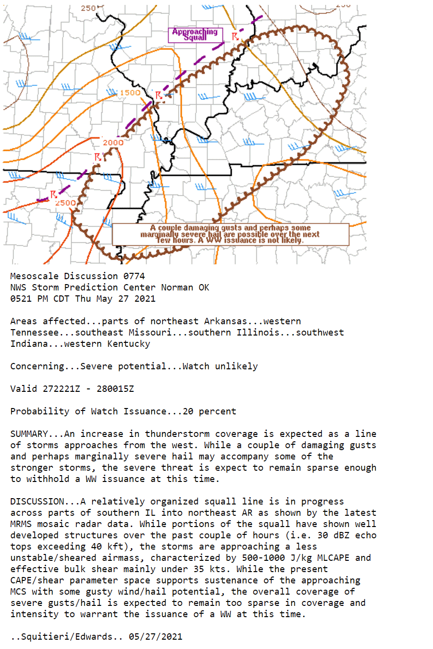
Additional watches are unlikely. SPC update.
5:30 PM
Storms are currently below severe levels.
The is a gust front with a long shelf cloud ahead of the storms. These clouds can look dramatic but are usually not an indication one way or another as to the severity of the storm.
Gusty winds with storms this evening.
The severe threat is highest across southeast Missouri. Lower elsewhere not that there is a gust front ahead of the southeast Illinois storms.
.
4:44 PM
Northern Massac and southern Johnson County
The thunderstorm has moved into southeast Johnson County. The lowering is no longer there. The storm may produce dime size hail and gusty wind. I will continue to monitor it.
The storm did produce a funnel cloud as it moved into Johnson County earlier.
4:32 PM
Perry, Jefferson, Franklin, Jackson, Williamson, Hamilton, and White Counties
Radar continues to show a line of thunderstorms moving through southern Illinois. There are pockets of high wind embedded in the storms along with some hail. Heavy rain and lightning, as well.
See the live radar links below.
Seek shelter as the storms approach and move through your area. It will take some time for them to completely cross all the counties mentioned above.
Concerns:
Wind: 60 mph wind gusts possible.
Hail: Nickle size hail possible.
Tornado threat: Low-risk.
.
4:22 PM
Northern Massac and southern Johnson County
I am watching a storm with some rotation over far northwest Massac County. It is moving E NE at 40 mph.
For now, just be weather aware as this storm tracks through the area.
.
3 PM radar loop
See the live radars for the most up to date data.
.
3 PM
Perry and Jefferson Counties in southern Illinois.
Radar Link: Interactive local city-view radars & regional radars.
Backup radar site in case the above one is not working.
https://weathertalk.com/morani
New ZOOM radar (with storm chasers)
https://wtalk.co/AVWG7GM7
Regional Radar
https://imagery.weathertalk.com/prx/RadarLoop.mp4
Lightning Data (zoom in and out of your local area)
https://wtalk.co/WJ3SN5UZ
Concern:
Wind gusts to 60 mph.
Hail up to the size of nickels.
Tornado threat: Currently low.
A line of thunderstorms is approaching from the west/northwest. These storms could produce high wind, pockets of hail, heavy rain, and lightning.
At 3 PM the storms were located from Marion County west/southwest into Monroe County. Movement varied but was mainly off to the east at 45 mph.
The brunt of the storms are still at least 20 minutes away.
.
2:47 PM
BULLETIN – IMMEDIATE BROADCAST REQUESTED
Severe Thunderstorm Warning
National Weather Service St Louis MO
246 PM CDT Thu May 27 2021
The National Weather Service in St Louis has issued a
* Severe Thunderstorm Warning for…
Monroe County in southwestern Illinois…
Northwestern Randolph County in southwestern Illinois…
Southeastern Jefferson County in east central Missouri…
Northeastern Ste. Genevieve County in southeastern Missouri…
* Until 315 PM CDT.
* At 246 PM CDT, a severe thunderstorm was located over Festus,
moving east at 45 mph.
HAZARD…60 mph wind gusts and quarter size hail.
SOURCE…Radar indicated.
.
2:35 PM
.
2:35 PM
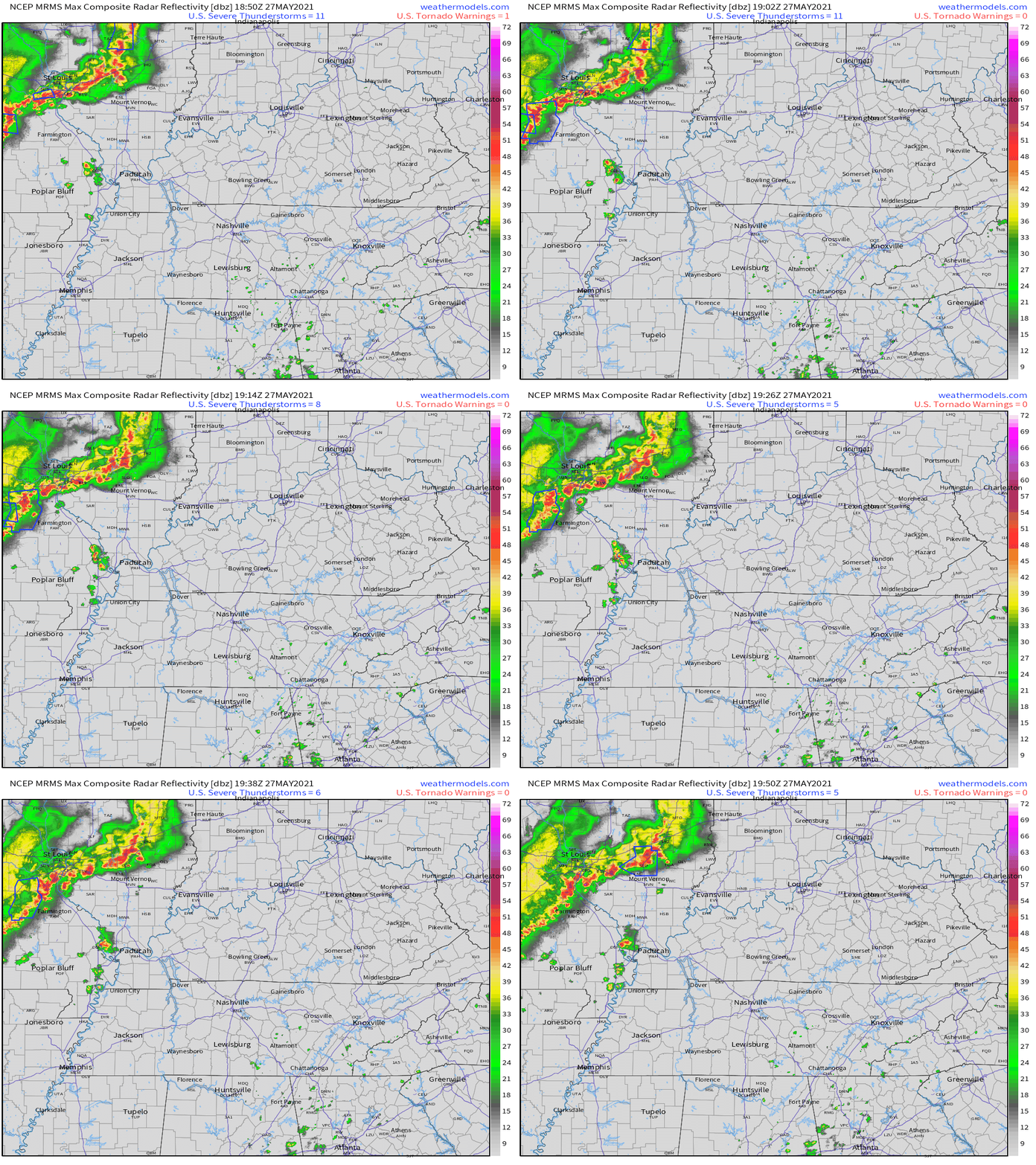
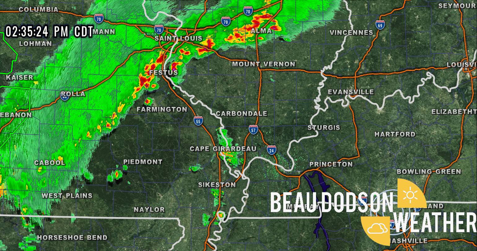
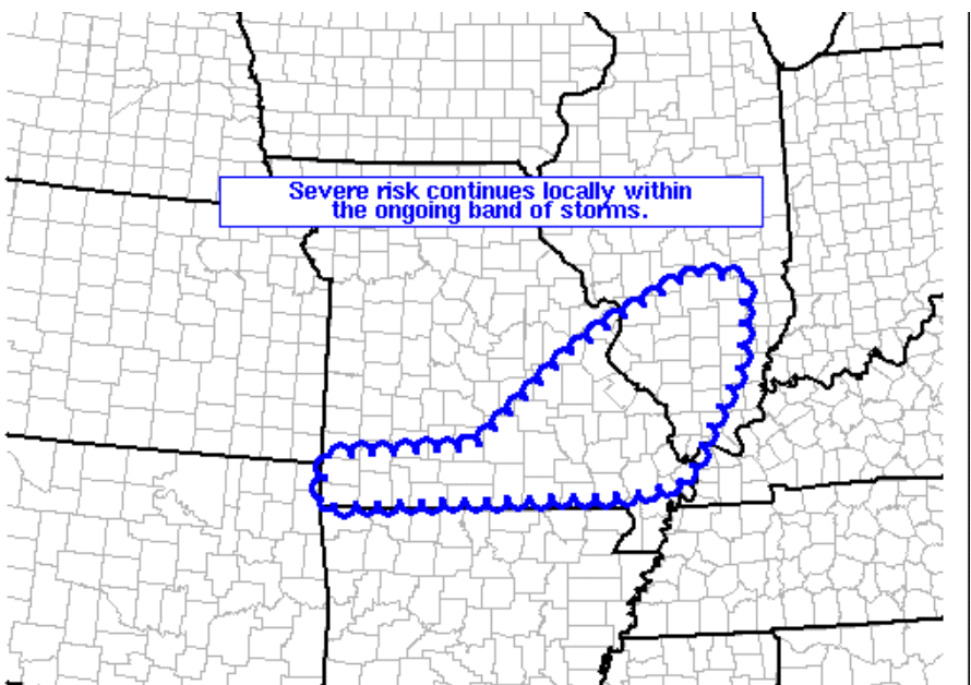
These storms are moving northeast and have produced high wind.
These storms are moving east
.
2:28 PM
Ste Genevieve and Perry Counties in southeast Missouri. Randolph County in southern Illinois.
Thunderstorms are approaching the northern portions of southeast Missouri from the west. Some of these storms could produce wind gusts above 50 mph and nickel size hail. See radars.
.
2:28 PM
Alexander, Pulaski, Jackson, Union, Johnson, and Williamson Counties in southern Illinois.
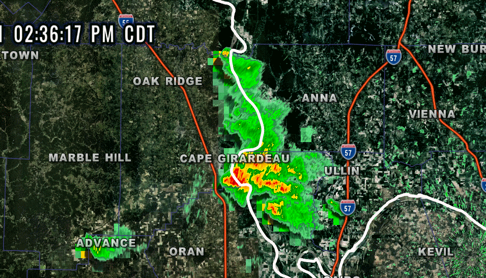
Southern Illinois: A line of thunderstorms was forming along the Mississippi River and is moving east/northeast at 30 mph. These storms have a history of producing 40 to 50 mph wind gusts. If they continue to strengthen, then they could produce some pockets of wind damage. See radars.
Radar Link: Interactive local city-view radars & regional radars.
Backup radar site in case the above one is not working.
https://weathertalk.com/morani
New ZOOM radar (with storm chasers)
https://wtalk.co/AVWG7GM7
Regional Radar
https://imagery.weathertalk.com/prx/RadarLoop.mp4
Lightning Data (zoom in and out of your local area)
https://wtalk.co/WJ3SN5UZ
.
May 27, 2021
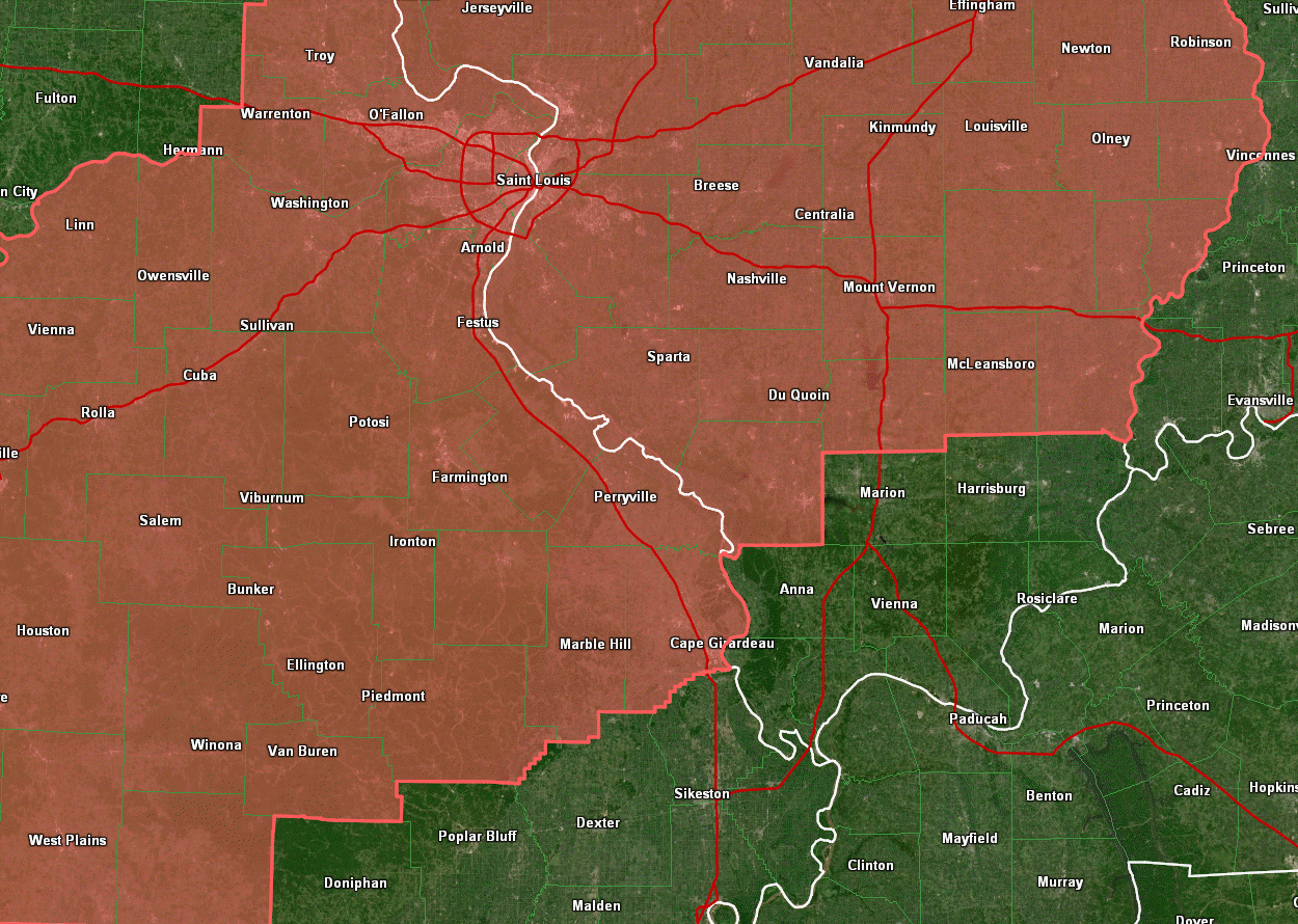
A severe thunderstorm watch has been issued for Ste Genevieve, Perry, Cape Girardeau, and Bollinger Counties in southeast Missouri and Randolph, Perry, Jackson, Jefferson, Franklin, Hamilton, and White Counties in southern Illinois.
The watch will be in effect through the afternoon.
The main concern is an area of thunderstorms near St Louis (although that may only clip our northern counties) and a line of storms forming in central and western Missouri.
The line will move east and further develop.
Some of the storms could produce strong and damaging wind, quarter size hail, heavy rain and lightning. There is a low-end tornado risk.
Monitor updates.
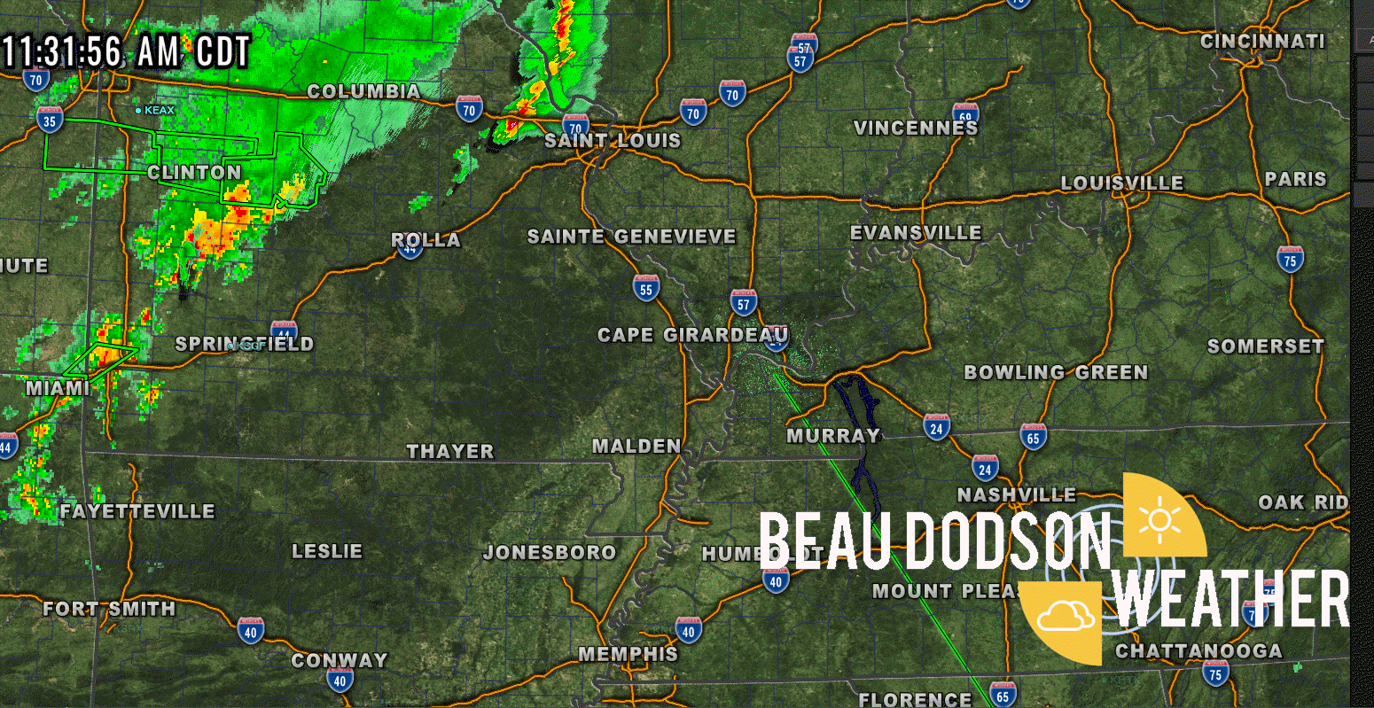
11:40 AM
A severe thunderstorm watch will run into this afternoon
I am watching the storms near St Louis and the ones in western Missouri
.
.
11:30 AM update
A severe thunderstorm watch will be issued shortly for portions of MO/IL.
.
8:30 AM update
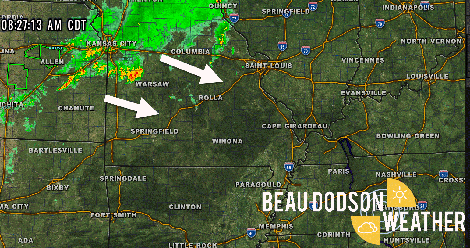
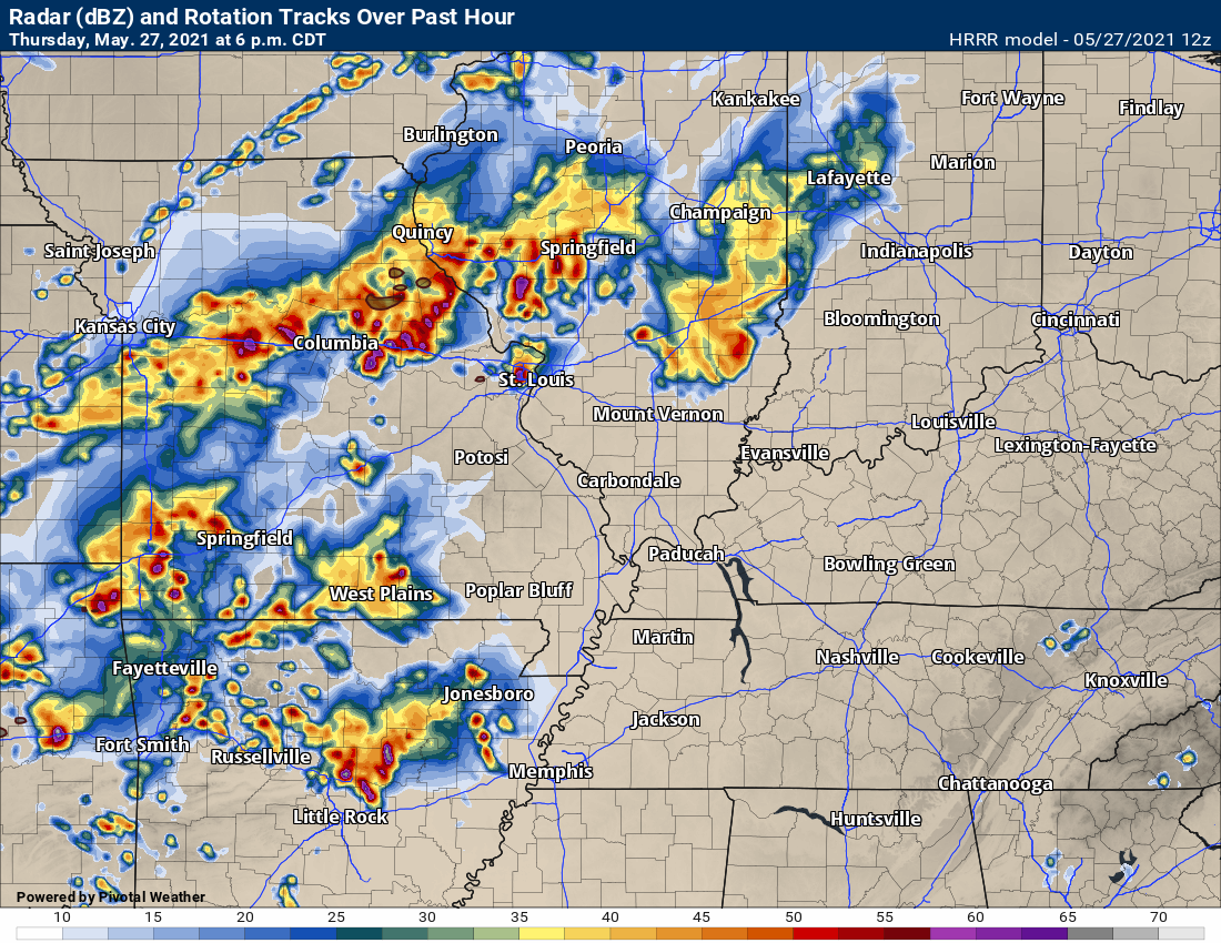
This is the complex of storms to watch for late this afternoon into tonight.
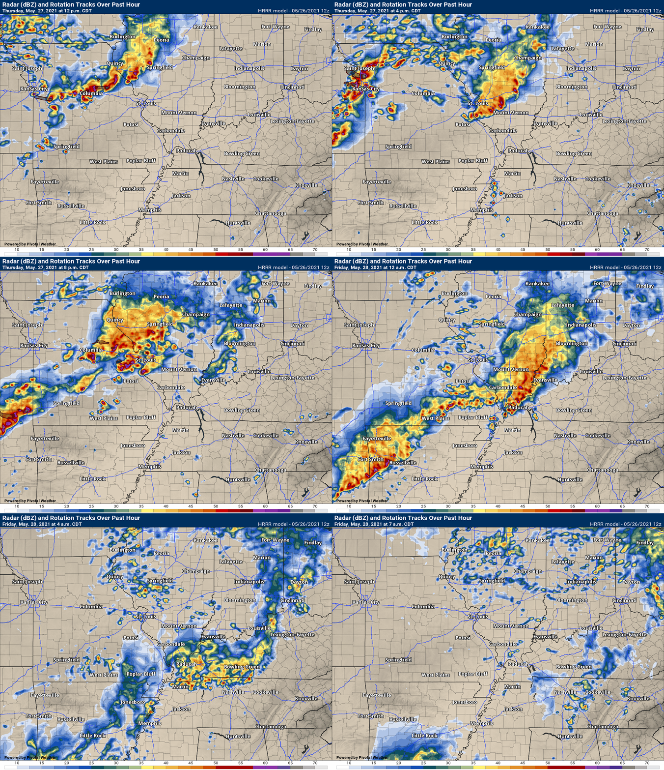
The Hrrr model keeps us dry most of today. A few storms could form.
6 PM future-cast radar.
.
7:15 AM Update
The primary weather concern in the short-term forecast will be thunderstorm chances today.
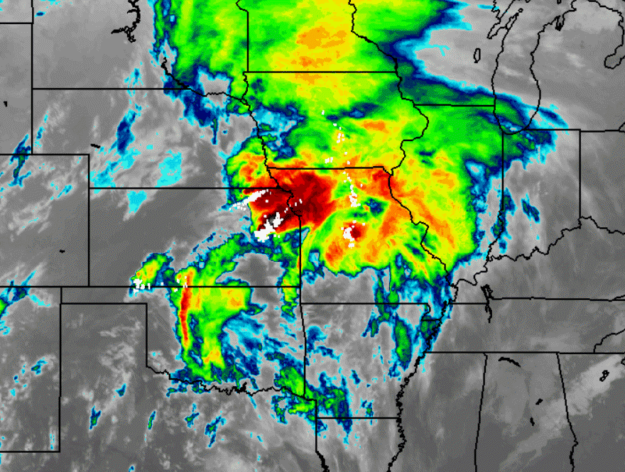
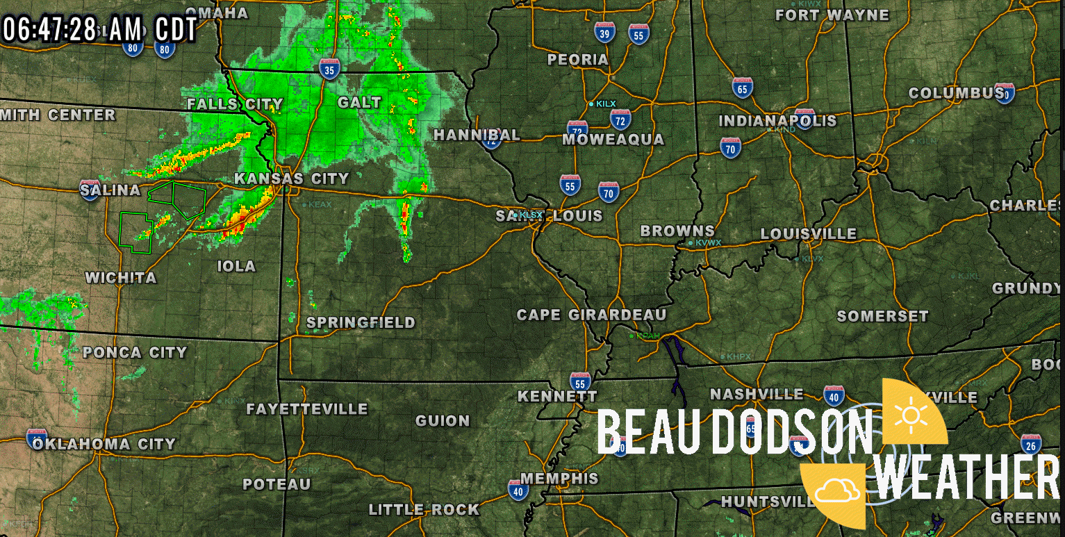
We have several complexes of thunderstorms over Iowa, Missouri, and Kansas as of this writing (7 AM).
These clusters of storms can be seen on both satellite and radar.
The satellite view showers the cold cloud tops (bright colors). Those are thunderstorms. Remember, these are clouds.
See the live satellite and radar links at the bottom of the page for the latest images.
And radar shows the rain and thunderstorms. Again, this is the 7 AM radar. See the live radar links for the updated images.
.
All of this will push into our region later this afternoon and into tonight.
There remain questions about whether we will experience much in the way of severe thunderstorms.
Dew points will struggle later today over Illinois, Kentucky, and Tennessee. Higher dew points over southeast Missouri. Dew points measure moisture in the atmosphere. Higher dew points equal higher severe weather chances.
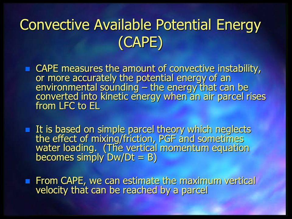
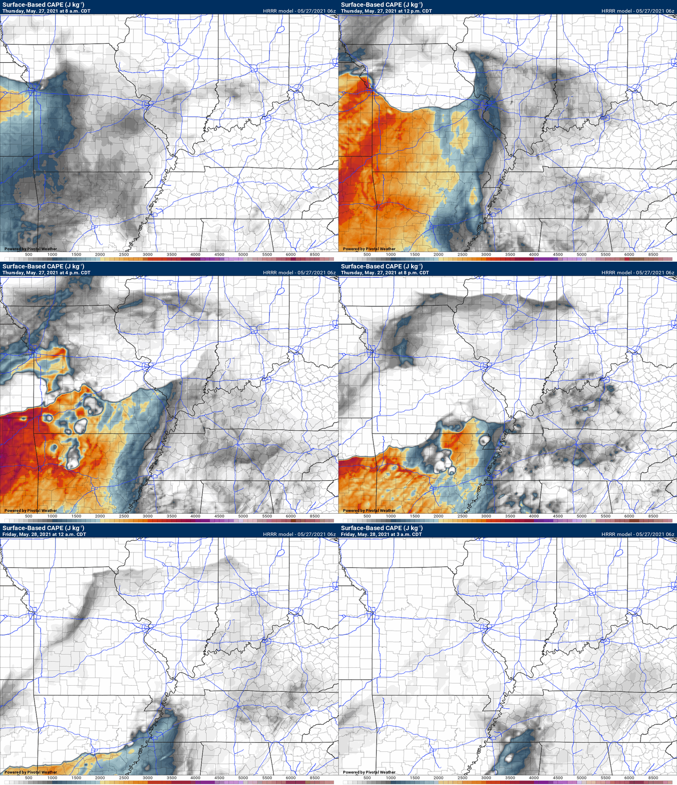
CAPE also struggles. CAPE is a measure of energy.
I am forecasting the highest risk of severe weather to be placed over southeast Missouri and southwest Illinois. Decreasing chances as you move further south and east. That does not mean Kentucky and Tennessee won’t experience a severe weather risk. It just means the risk appears smaller.
A few thunderstorms could form ahead of the main squall line. If that happens then those could produce damaging wind and hail, as well.
Some of the models hint as this happening between 11 AM and 2 PM.
The main line will approach southeast Missouri and southern Illinois between 12 PM and 3 PM. We will have to see how much of it remains intact.
Additional lines of thunderstorms may form over southern Missouri and northern Arkansas this afternoon. Those would move east/southeast, as well.
The bulk of the thunderstorm activity will occur between 2 PM and 10 PM.
Monitor the Beau Dodson Weather Talk app for the most up to date information.
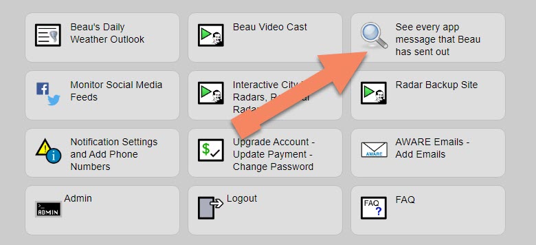
Did you know that we have a SEE ALL tab on the www.weathertalk.com website? You can view every message for every county.
.
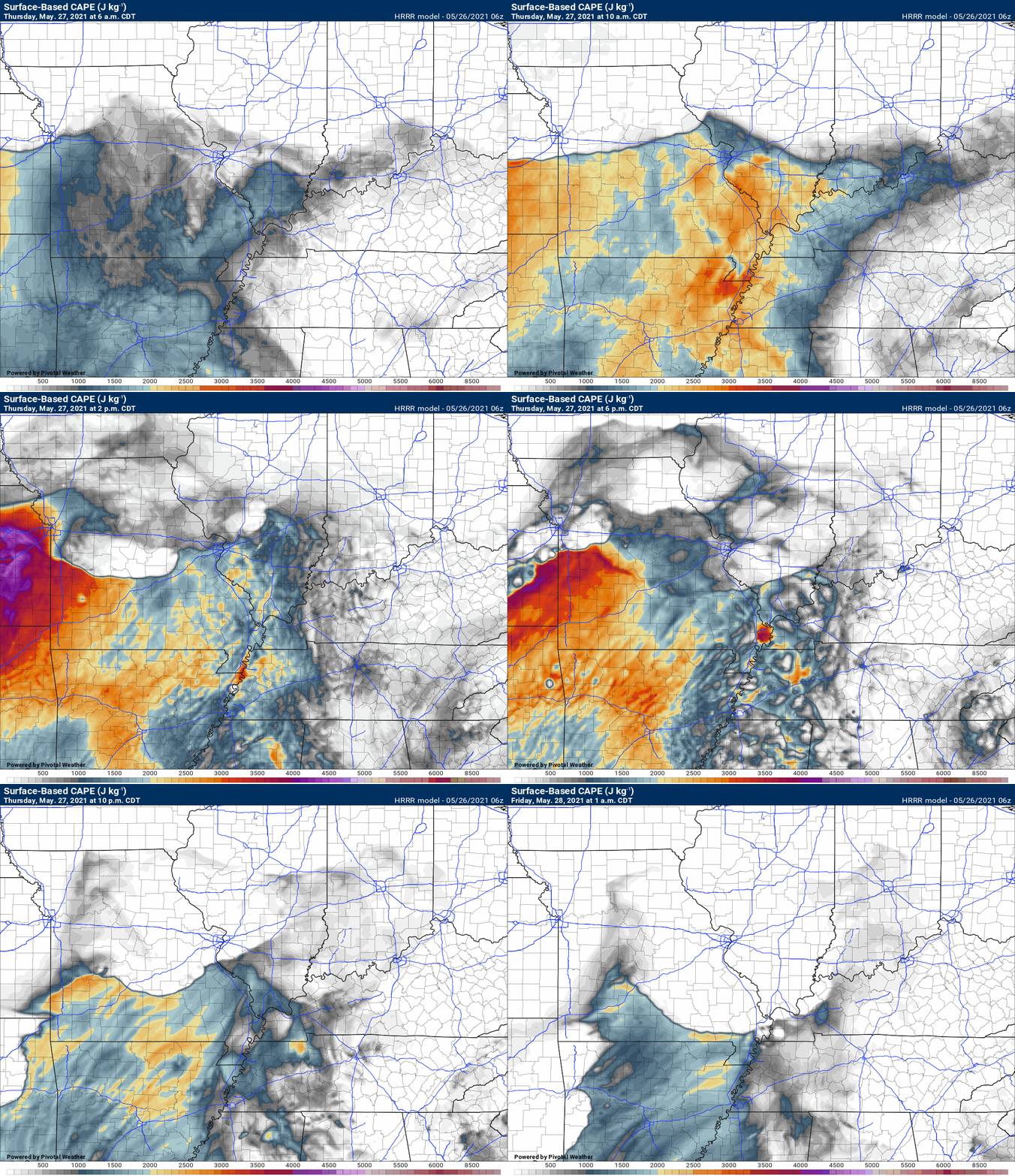
Notice how the CAPE is a bit muddled. It attempts to pump up tomorrow and then is knocked back down. That is because of the morning showers and thunderstorms.
If that morning line messes with the CAPE then it may be difficult for the CAPE to recover. If the CAPE does not recover then the risk of severe weather is lower.
.
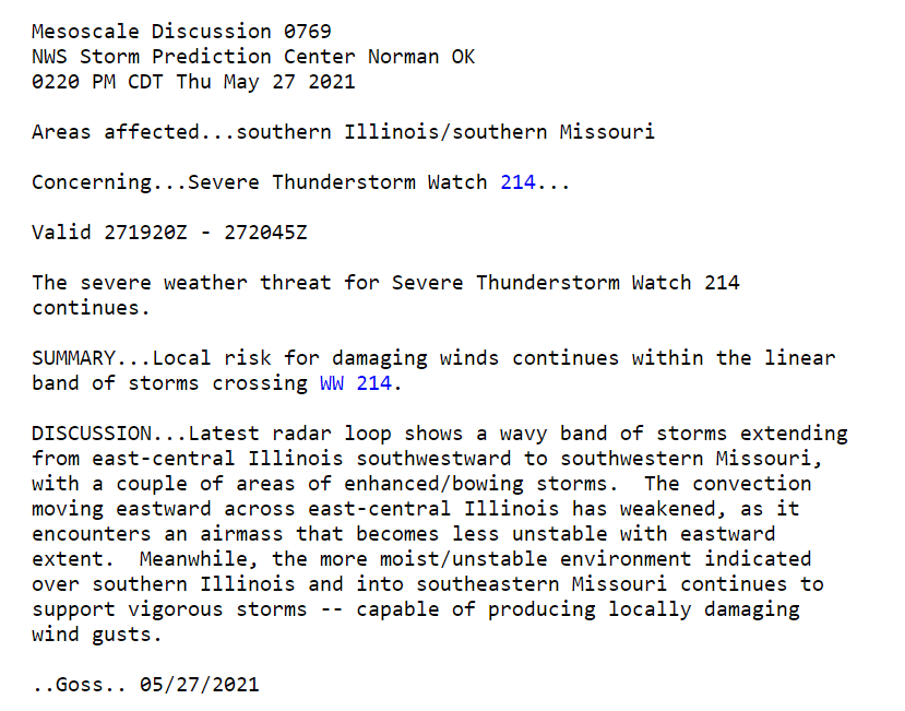
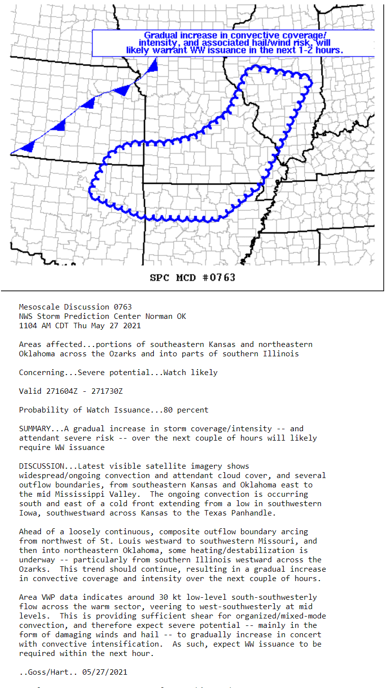
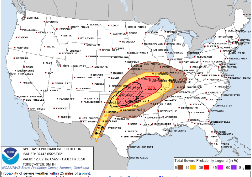
The SPC (Storm Prediction Center) has outlined the risk of severe thunderstorms for our entire area. As a matter of fact they have a level one, two, and three risk outlined.
Five is their highest risk.
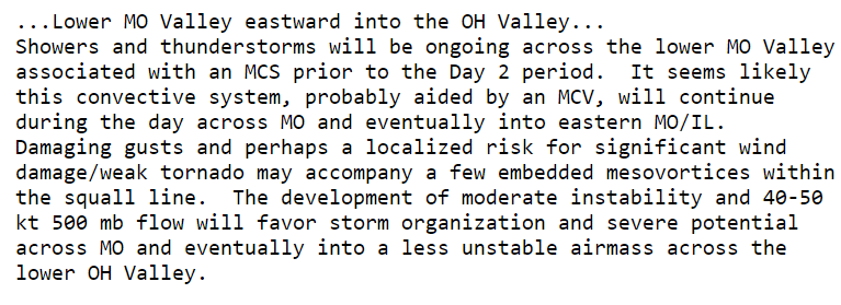
Here is the discussion from the Storm Prediction Center. The graphic shows you their primary concern zone. You can see the risk is a bit higher as you travel west/southwest.
Monitor updated forecasts. Adjustments are possible.

.
.

Again, as a reminder, these are models. They are never 100% accurate. Take the general idea from them.
What should I take from these?
- The general idea and not specifics. Models usually do well with the generalities.
- The time-stamp is located in the upper left corner.
- The EC European weather model is in Zulu time.
.
What am I looking at?
You are looking at different models. Meteorologists use many different models to forecast the weather. All models are wrong. Some are more wrong than others. Meteorologists have to make a forecast based on the guidance/models.
I show you these so you can see what the different models are showing as far as precipitation. If most of the models agree, then the confidence in the final weather forecast increases.
You can see my final forecast at the top of the page.
.
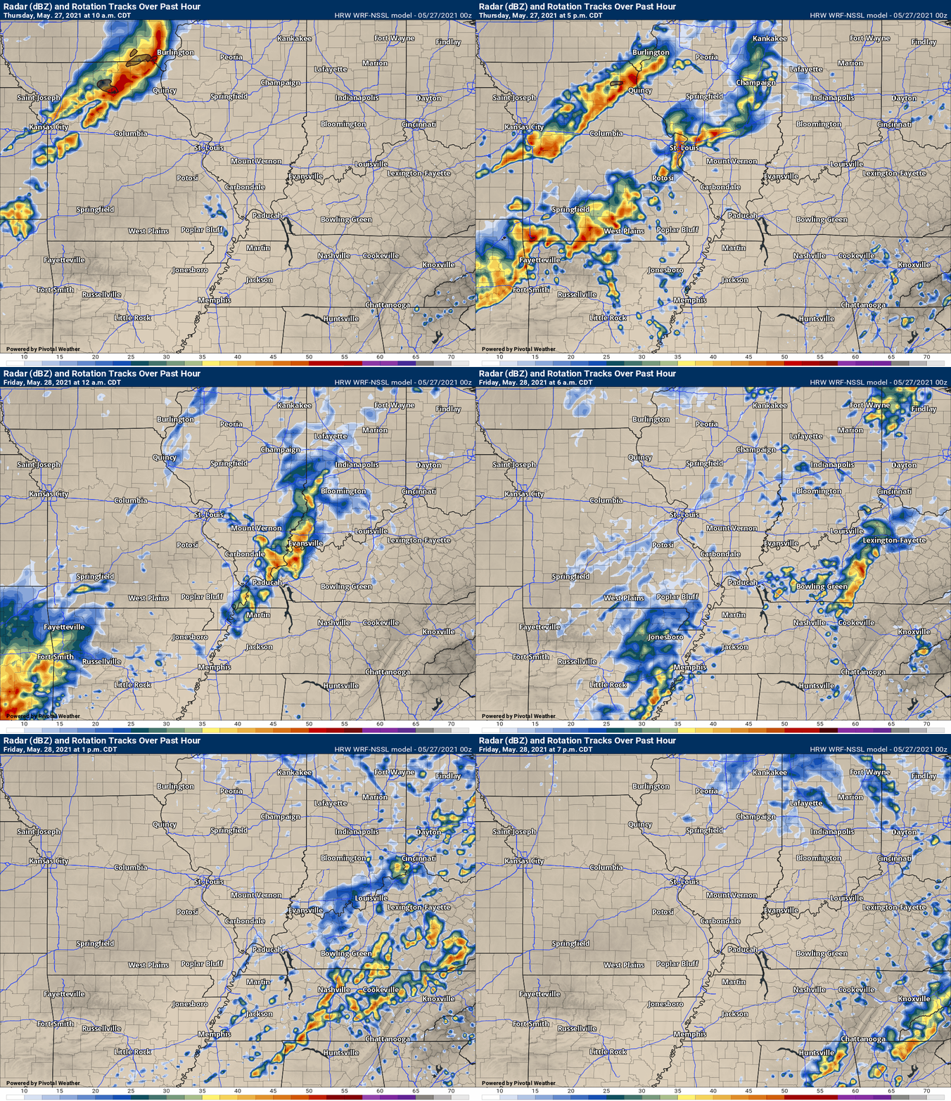
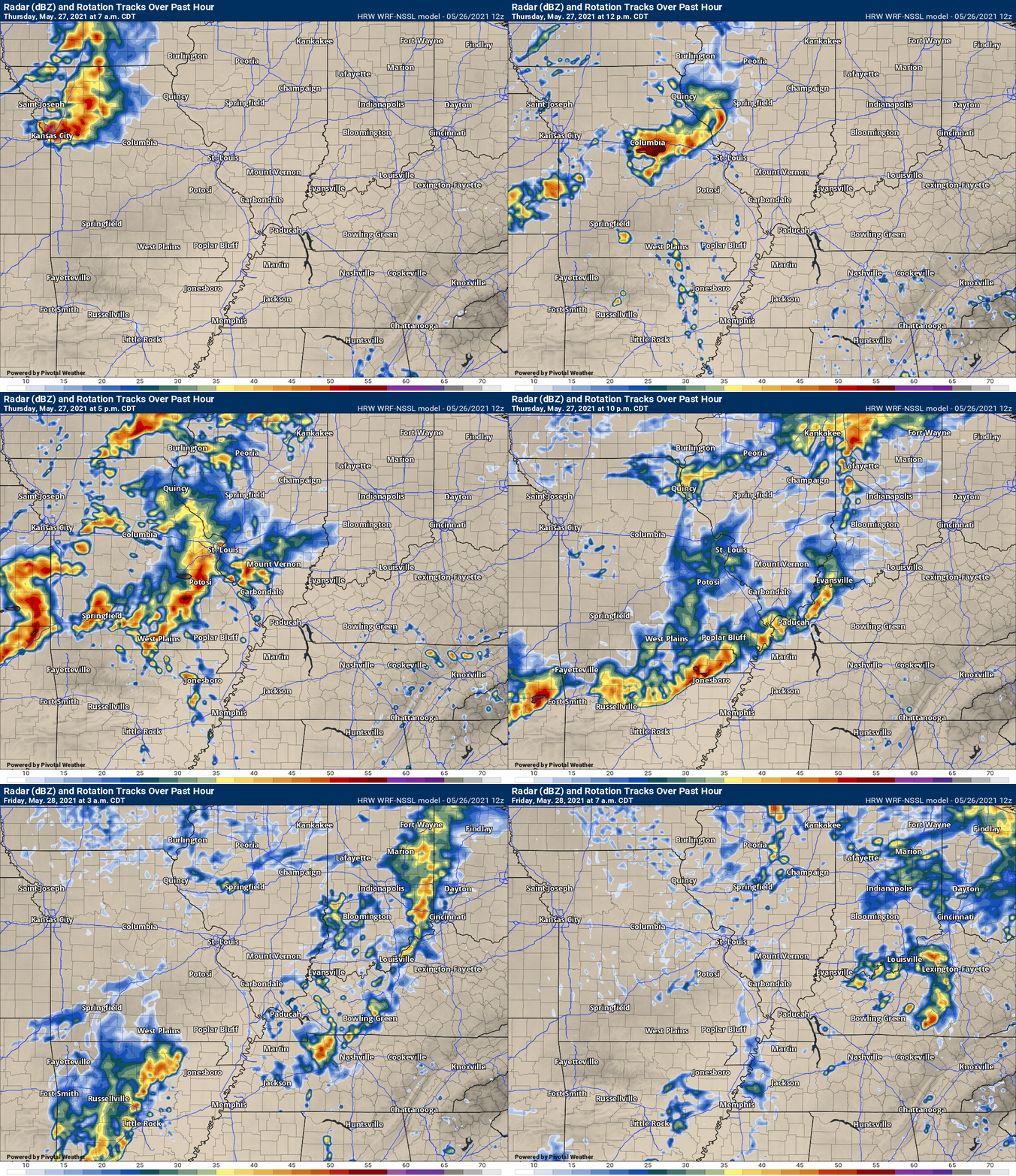
This animation is the Storm Prediction Center WRF model.
This animation shows you what radar might look like as the next system pulls through the region. It is a future-cast radar.
Time-stamp upper left. Click the animation to enlarge it.
.
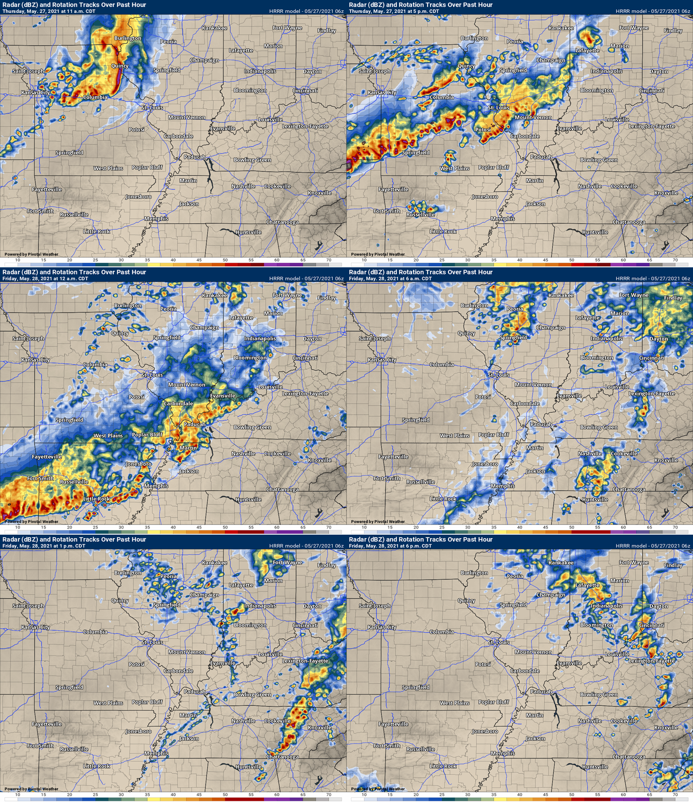
This animation is the Hrrr short-range model.
.
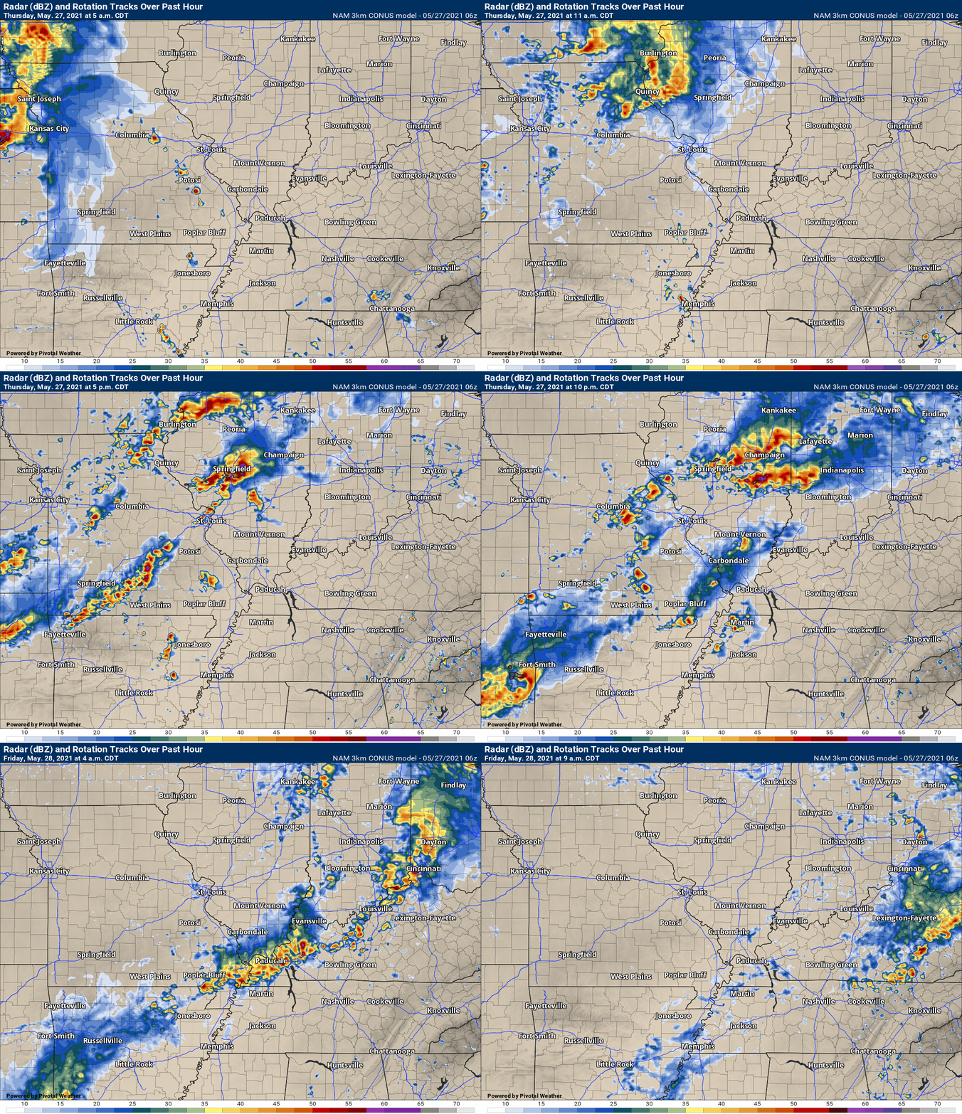
.This animation is the 3K NAM American Model.
This animation shows you what radar might look like as the next system pulls through the region. It is a future-cast radar.
Time-stamp upper left. Click the animation to enlarge it.
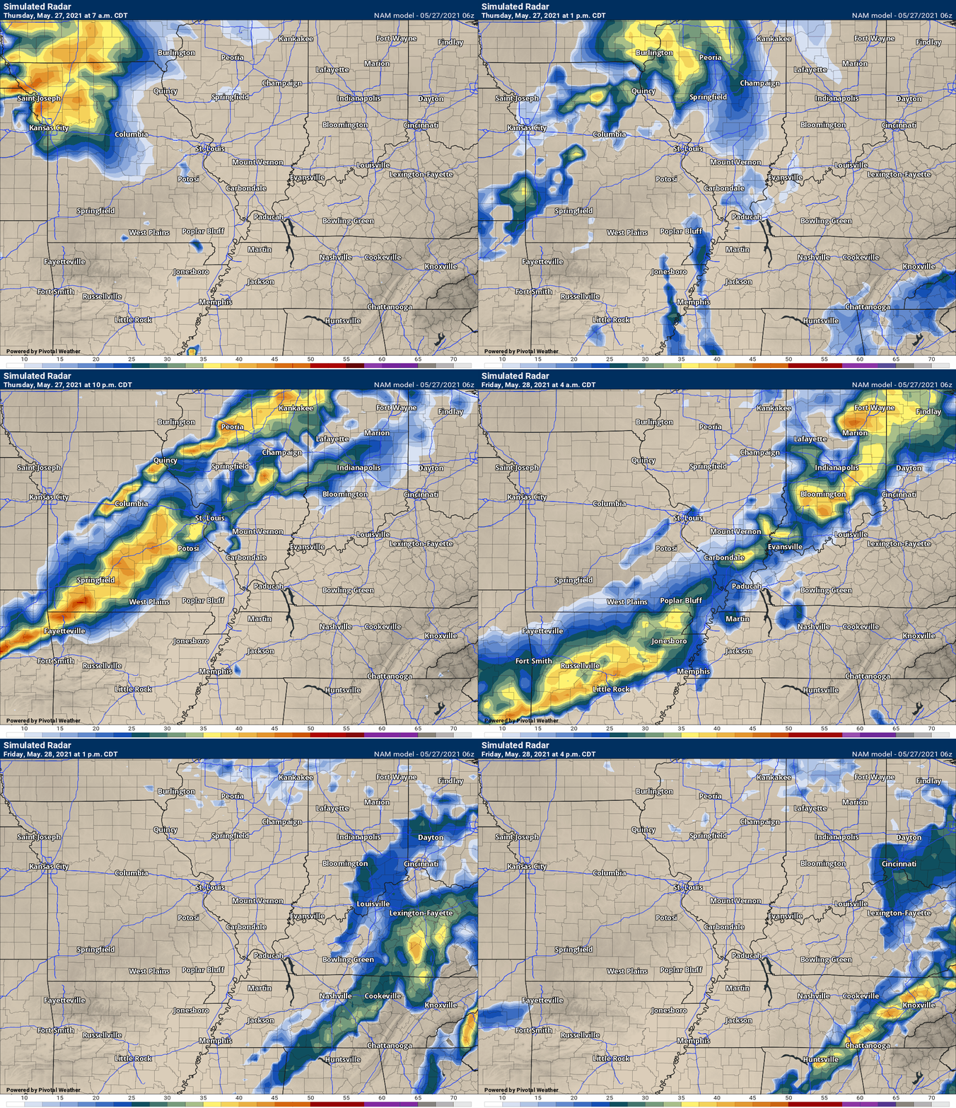
This next animation is the lower-resolution NAM American Model.
This animation shows you what radar might look like as the system pulls through the region. It is a future-cast radar.
Time-stamp upper left. Click the animation to enlarge it.
.
May 26, 2021
7 PM
No adjustments, yet.
There was an intense storm in Jackson County, IL. A tiny severe thunderstorm warning was issued for a small area of wind.
The main concern will be Thursday afternoon and night.
At least one or two areas of thunderstorms will impact the area. The severe weather risk is higher over MO/IL vs KY/TN.
I will know a lot more tomorrow morning.
Stay abreast of updated weather information tomorrow.
.
May 26, 2021 Update
11:15 AM updated two future-cast radars.
This is how these two models see tomorrow playing out. The NAM 3K model is a bit more scattered with storms.
I continue to monitor model trends on how the lines form and track.
.
11 AM
The primary forecast concern over the coming days continues to be showers and thunderstorms.
We are waking up to scattered showers and perhaps a few embedded thunderstorms. Nothing of the severe nature. Just some wet roadways and lightning to deal with for your morning commute.
These showers and thunderstorms will be with us into this afternoon and a few perhaps into the evening hours.
A couple of thunderstorms this afternoon could produce brief gusty wind and small hail. The severe weather risk appears to be small this afternoon and evening. Low-end risk of a severe thunderstorm warning. I will send out app messages if need be.
We have a relative lull tonight before a stronger system approaches tomorrow.
This strong system will help usher in much cooler air by Friday, Saturday, Sunday, and Monday. Then, another rain maker towards the middle of next week.
The atmosphere will become unstable Thursday late morning into Thursday night.
A high amount of moisture will be pushing into the region below a northward moving warm-front.
This northward moving warm-front will be key to what happens later in the day. How far north it travels will be important to our sensible weather.
There are a couple of ideas on the weather table for tomorrow and tomorrow night.
One is that a line of thunderstorms pushes across Illinois and Missouri tomorrow morning. Reaching our region after 11 AM. This line of storm may be weakening. It could then intensify over our local counties. That would occur as it bumps into an unstable air-mass.
If that line weakens and then does not intensify, then we would have to wait on the second round of storms Thursday night to produce any risk of severe weather.
For now, it appears that the morning line may move into our north/northwest counties of southeast Missouri and southern Illinois after 11 AM and then move across the rest of the area. It may be weakening.
A second line of storms would then move into the region after 9 PM Thursday night. This line would peak over Missouri and perhaps portions of Illinois. It would then be in a weakening stage as it moves into Kentucky and Tennessee.
Either round of thunderstorms could produce some severe weather. The main concern appears to be damaging wind. Straight line winds are possible in some counties. Any bowing echoes could produce short-lived tornadoes, as well.
Tomorrow is a conditional severe weather risk.
What does conditional mean? It means that there is lower than normal confidence in how the forecast unfolds because a few of the ingredients may not materialize. If they don’t materialize then the severe weather risk will be lower.
My advice is to be prepared for severe weather Thursday and then monitor the severe weather blog throughout the day and night. I will, of course, be sending out app messages.
Let’s take a look at the CAPE maps. CAPE is basically energy for thunderstorms to tap into.
Notice how the CAPE is a bit muddled. It attempts to pump up tomorrow and then is knocked back down. That is because of the morning showers and thunderstorms.
If that morning line messes with the CAPE then it may be difficult for the CAPE to recover. If the CAPE does not recover then the risk of severe weather is lower.
.
The SPC (Storm Prediction Center) has outlined the risk of severe thunderstorms for our entire area. As a matter of fact they have a level one, two, and three risk outlined.
Five is their highest risk.
Here is the discussion from the Storm Prediction Center. The graphic shows you their primary concern zone. You can see the risk is a bit higher as you travel west/southwest.
Since this is their day three outlook, it is likely to change between now and when the event occurs. They could add or remove counties from the risk zone.
Thus, monitor updated forecasts. Adjustments are likely.

.
.
May 25, 2021
4 PM
No major adjustments to the morning update.
Wednesday appears to be a low-end risk day. I am more concerned about Thursday afternoon and night. It appears storms will approach from the W NW after 1 PM in the afternoon.
Some models show the storms waiting until late at night. This needs to be ironed out.
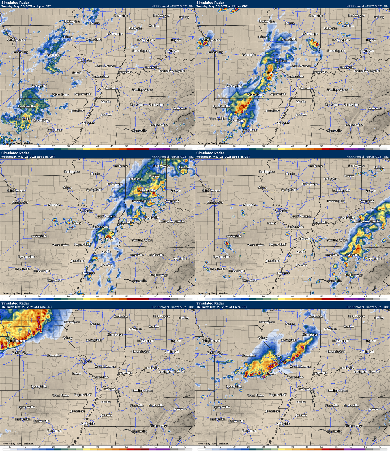
Here is the Hrrr model future-cast radar.
Time-stamp upper left.
The animation ends before the line gets here. The model will update again late tonight/tomorrow.
So, for now, no adjustments to the forecast further down in the blog. Scroll down.
May 25, 2021
7 AM Update
Severe thunderstorms are possible Wednesday afternoon/night and again Thursday afternoon/night (the risk is higher Thursday).
The primary forecast concern over the coming days will be showers and thunderstorms.
A few scattered showers and thunderstorms will be possible as early as today. The coverage will, however, be limited.
Rain chances will begin to increase tonight into tomorrow. Into the likely category.
It won’t rain all of the time, but there will be rain on radar pretty much through most of tonight and tomorrow.
A few of the thunderstorms could be intense Wednesday afternoon and evening. There will be some energy in the atmosphere. The wind shear, however, is going to be fairly weak.
That means that the risk of severe thunderstorms will be limited. I don’t expect an outbreak of severe weather Wednesday. A few storms could produce strong and gusty wind and perhaps nickel size hail.
I can’t rule out a severe thunderstorm watch, but this appears to be a low-end severe weather risk.
I will monitor today’s data and update accordingly.
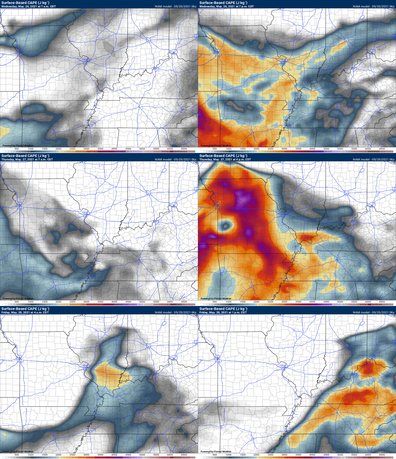
Let’s take a look at the CAPE maps. CAPE is basically energy for thunderstorms to tap into.
You can see limited CAPE Wednesday but higher CAPE Thursday afternoon and night.
.
Thursday will deliver higher severe weather chances.
The SPC (Storm Prediction Center) has outlined the risk of severe thunderstorms for our entire area. As a matter of fact they have a level one, two, and three risk outlined.
Five is their highest risk.
The thinking is that a dying line of thunderstorms will push across Missouri and Illinois Thursday morning and then redevelop Thursday afternoon into Thursday night.
It is this line that they are concerned about producing high wind, hail, and even some tornadoes.
The risk is conditional. There are questions about whether the line will reignite. This will need to be monitored. I will start the severe weather blog in case the event verifies.
The primary concern will be afternoon into the overnight hours. Showers and thunderstorms would then taper off Friday afternoon and evening.
Here is the discussion from the Storm Prediction Center. The graphic shows you their primary concern zone. You can see the risk is a bit higher as you travel west/southwest.
Since this is their day three outlook, it is likely to change between now and when the event occurs. They could add or remove counties from the risk zone.
Thus, monitor updated forecasts. Adjustments are likely.
.
.
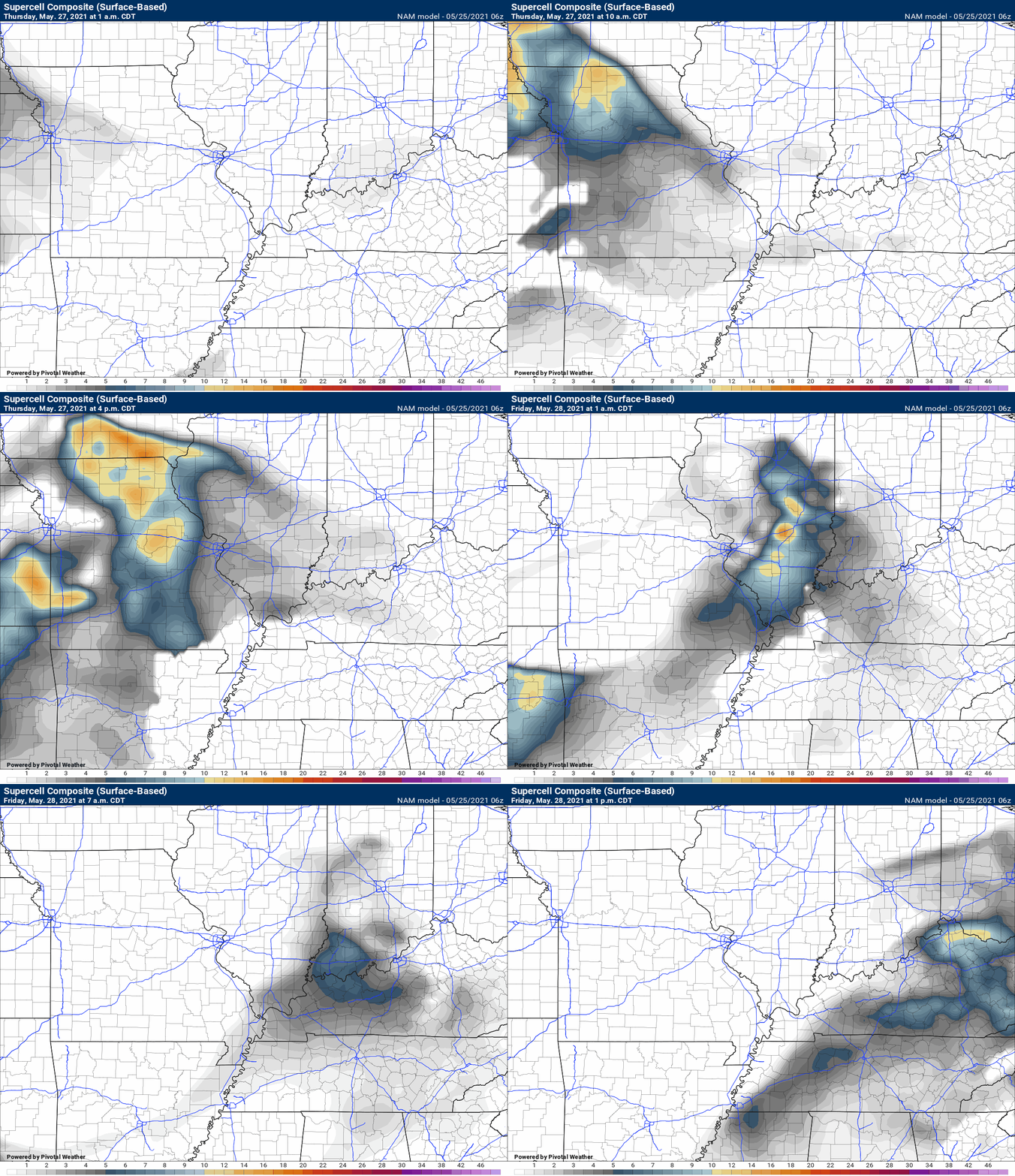
The supercell thunderstorm composite shows peak numbers Thursday PM and then waning Thursday night.
The supercell composite is one indicator of severe thunderstorms.
.
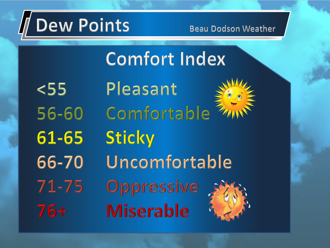
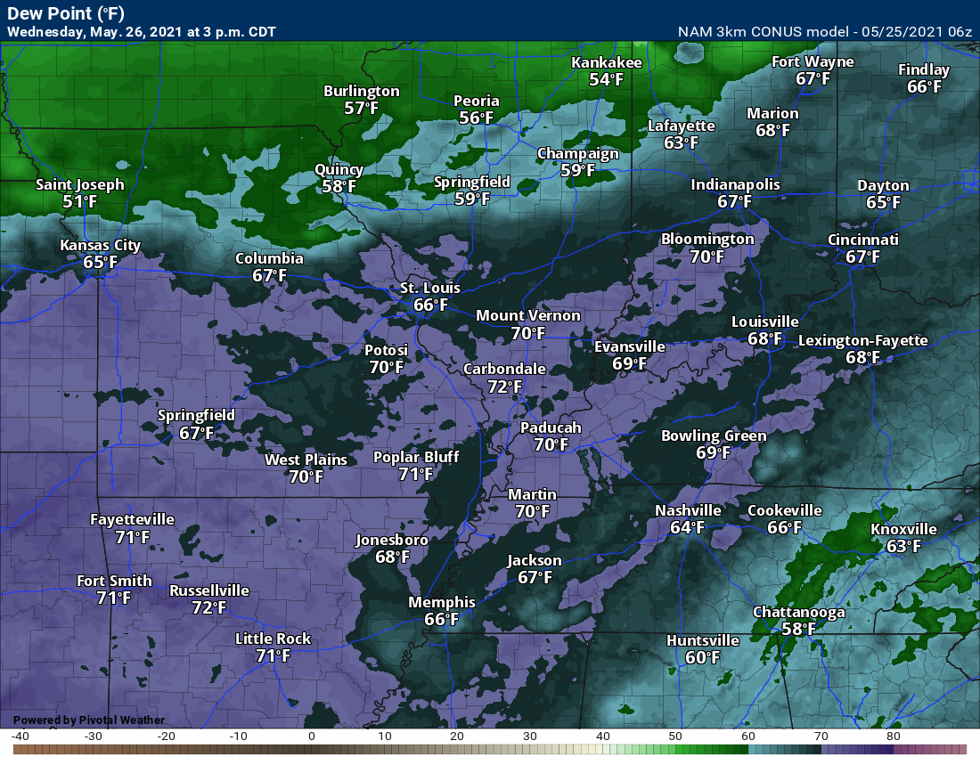
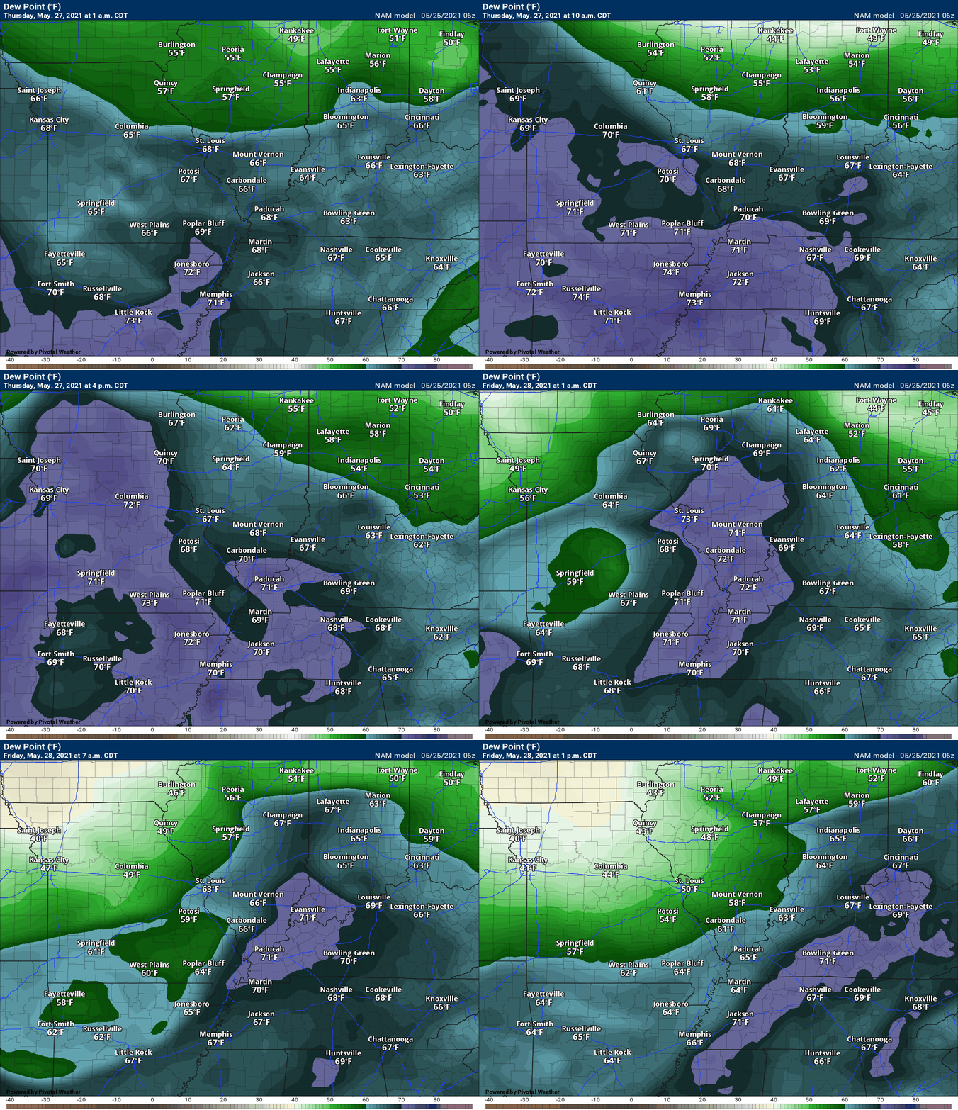
Let’s look at dew points. When considering severe weather I generally look for 60 degrees and above.
Dew point is an indicator of moisture in the atmosphere. It also controls how muggy it feels outside.
.
Dew points Wednesday afternoon will reach into the upper 60s to around 70. That is muggy air. That is enough moisture to help produce some downpours with any thunderstorms that develop.
.
We take a look at the dew point animation for Thursday, as well. You can see the moisture streaming northward ahead of our storm system. Pumping moisture into our region.
.
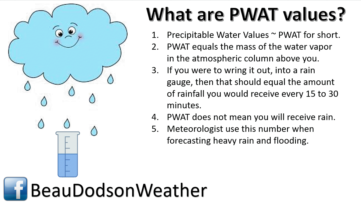
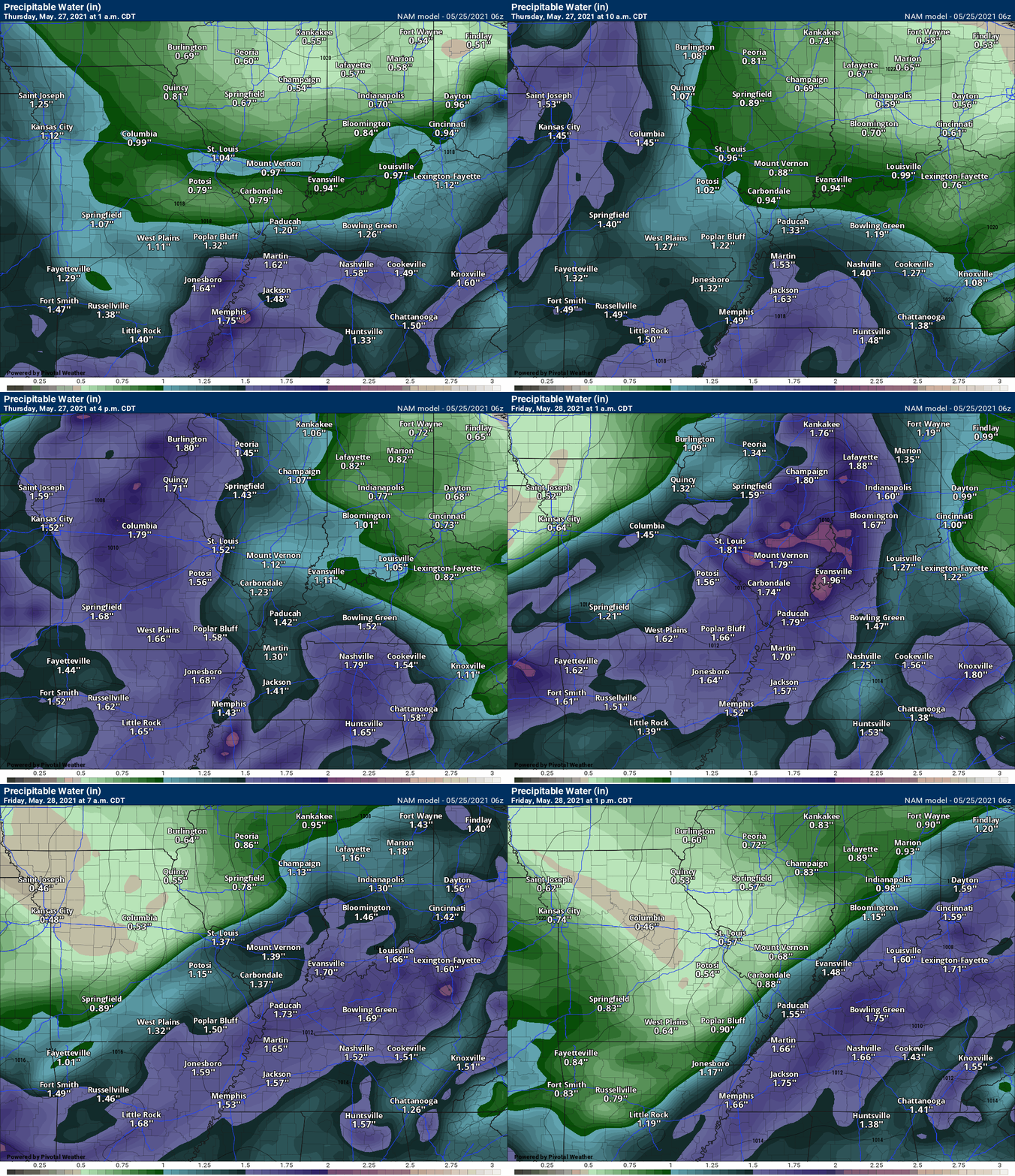
Let’s look at another moisture indicator. PWAT values. PWAT is something I look at when considering heavy rain or heavy downpours from showers/thunderstorms.
We will have quite a bit of moisture in the region. Not extreme, but enough to help produce some locally heavy downpours.
Rain totals between now and Friday will vary greatly. If you end up with a couple of thunderstorms then an inch of rain will be possible.
Generally, rain totals of 0.20″ to 0.50″ is anticipated. Again, storms will cause heavier totals.
It is not out of the question that some areas receive very little in the way of rain. Typical for this time of the year.
![]()
.Weather advice:
Monitor the live-blog, my Beau Dodson Weather Facebook page, and your app.
.
Weather Discussion
-
- A few rounds of thunderstorms will be possible today through Friday morning.
- A few storms could be intense Wednesday afternoon and night. Low-end severe risk.
- Thunderstorms could be severe Thursday afternoon and night. All modes of severe weather will be possible. This is a conditional risk. There remain some questions about whether a line of storms will form in Missouri and Illinois and then move east/southeast.
Don’t forget our website has a “see all” tab. You can see every warning that I send out (and other information).
Click here for the see all tab. You can monitor other counties. You can make sure you didn’t miss anything. LINK https://weathertalk.com/app/messages
.
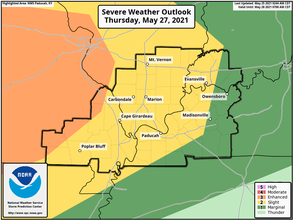
Today’s severe weather outlook from the Storm Prediction Center (below).
Light green is where thunderstorms may occur but should be below severe levels.
Dark green is a level one risk. Yellow is a level two risk. Orange is a level three (enhanced) risk. Red is a level four (moderate) risk. Pink is a level five (high) risk.
One is the lowest risk. Five is the highest risk.
A severe storm is one that produces 58 mph wind or higher, quarter size hail, and/or a tornado.
The tan states are simply a region that SPC outlined on this particular map. Just ignore that.

The black outline is our local area.

.
Tomorrow’s severe weather outlook.

![]()
![]()
Some safety graphics.
.![]()
.
.
What you need to know.
Key Points (monitor the top of the page for updates)
- A low-end risk of severe weather Wednesday afternoon and night.
- A greater risk Thursday afternoon and night.
- A few of the storms could produce hail and wind damage. A low tornado risk.
- Locally heavy rain and lightning.
- Have your Beau Dodson Weather app on. Check it. Make sure you have not logged out of the app.
- Remember, a watch means to monitor updates. A warning means to seek shelter. A warning is a higher threat.
.
Call to action.
Monitor updated weather forecasts.
Have a safety plan.
Make sure you are using the Beau Dodson Weather Talk app. Download it from the app store. It is under Weather Talk.
The app is for subscribers (please log into your account and make sure your payment has been updated. We have a large number of declined cards and PayPal payments.
Subscribe at www.weathertalk.com/welcome then go to your app store and search for WeatherTalk. Apple users click here. Android users click here .
.

Radar Link: Interactive local city-view radars & regional radars.
You will find clickable warning and advisory buttons on the local city-view radars.
If the radar is not updating then try another one. If a radar does not appear to be refreshing then hit Ctrl F5. You may also try restarting your browser.
Not working? Email me at beaudodson@usawx.com
Backup radar site in case the above one is not working.
https://weathertalk.com/morani
New ZOOM radar (with storm chasers)
https://wtalk.co/AVWG7GM7
Regional Radar
https://imagery.weathertalk.com/prx/RadarLoop.mp4
Lightning Data (zoom in and out of your local area)
https://wtalk.co/WJ3SN5UZ
Satellite Data
Computers and tablets. These two satellite links may not work well on cell phones.
Visible Satellite. This one is to be used during daylight only. Be sure and hit refresh once you are on the satellite page. Otherwise, the data will be old.
https://col.st/a5A0e
IR Satellite. This one shows cloud temperatures. Bright colors represent cold cloud tops. That could mean thunderstorms. Be sure and hit refresh once you are on the satellite page. Otherwise, the data will be old.
https://col.st/R2fw1
Water Vapor Satellite. This one shows mid-level moisture in the atmosphere. Be sure and hit refresh once you are on the satellite page. Otherwise, the data will be old.
https://col.st/xFVwx
.

Live lightning data: Click here.
Not receiving app/text messages?
Log in and out of your app.
USE THE APP. ATT and Verizon are slowing or stopping the text messages. Move to the app (not texts).
Make sure you have the correct app/text options turned on. Find those under the personal notification settings tab at www.weathertalk.com. Red is off. Green is on.
Subscribers, PLEASE USE THE APP. ATT and Verizon are not reliable during severe weather. They are delaying text messages.
The app is under WeatherTalk in the app store.
Apple users click here
Android users click here
.


