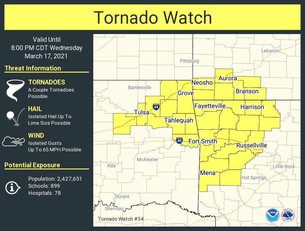
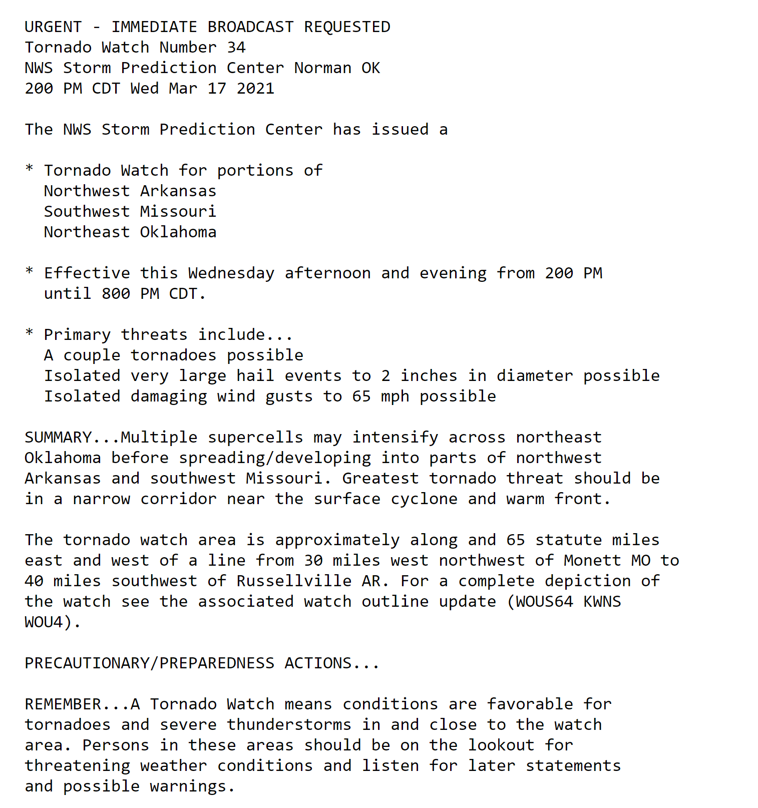
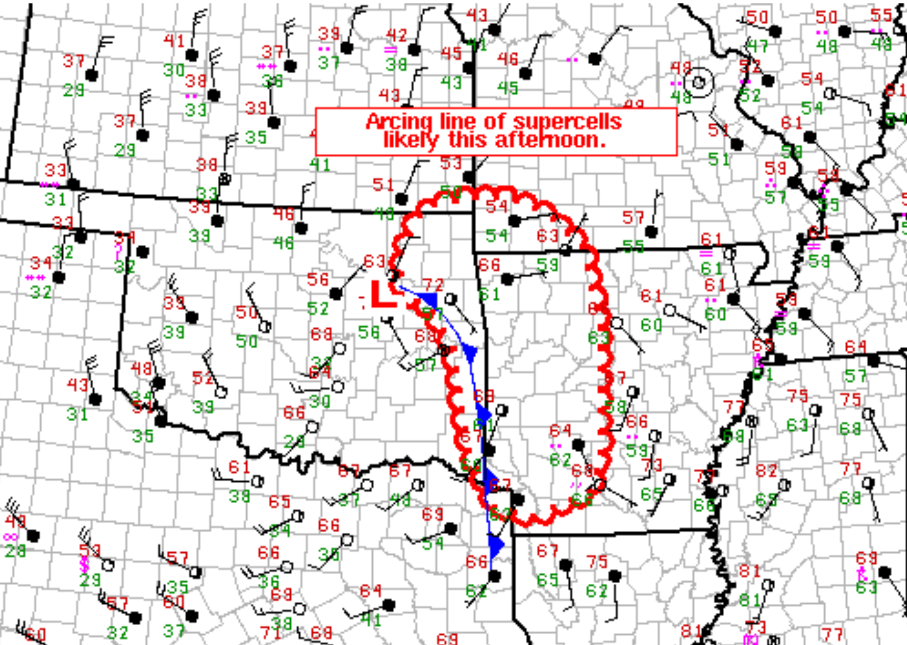
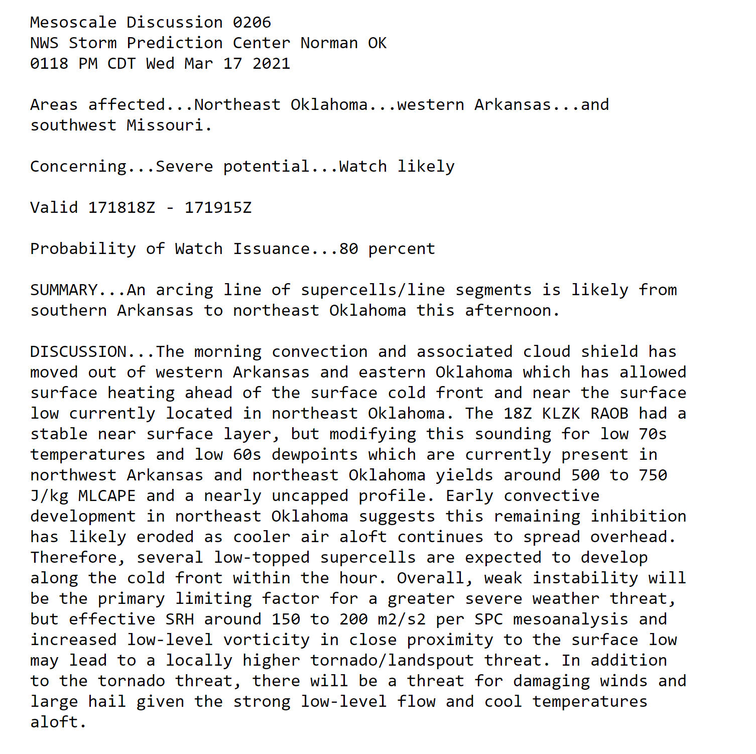
What you need to know.
A severe weather event is possible late tonight into Wednesday night.
.
Key Points
- Severe thunderstorms will be possible today and tonight. Peak time of concern will be Wednesday afternoon into Wednesday night.
- This is a conditional severe weather risk. Meaning, all the ingredients will need to come together in order for the forecast to verify. If they don’t then severe storms won’t form. If rain and clouds linger then the risk is lower.
- A flood watch covers portions of the region. Heavy rain is likely. Some flash flooding may occur.
- There remain questions about clouds and rain keeping instability lower. That would lower our severe weather risk.
- Have your Beau Dodson Weather app on. Check it. Make sure you have not logged out of the ap
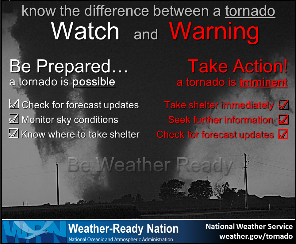
- Remember, a watch means to monitor updates. A warning means to seek shelter. A warning is a higher threat.
- Small hail and cold air funnels are possible Thursday. Cold air funnels are harmless.
.
Call to action.
Monitor updated weather forecasts.
Make sure you are using the Beau Dodson Weather Talk app. Download it from the app store. It is under Weather Talk.
TURN ON YOUR BEAU DODSON WEATHER TALK APP. Make sure it is on. Make sure you have not accidentally logged out of the app.
The app is for subscribers (please log into your account and make sure your payment has been updated. We have a large number of declined cards and PayPal payments.
Subscribe at www.weathertalk.com/welcome then go to your app store and search for WeatherTalk. Apple users click here. Android users click here
.
.
March 17, 2021
8:50 PM
Evening update. Before everyone turns in for the night.
Clouds and rain have kept the atmosphere semi-stable today and this evening.
The main cold front will push through the region late tonight.
The severe weather risk, the rest of tonight, is fairly low. That is because of the semi-stable atmosphere.
Showers and thunderstorms will continue into the early morning hours. Some of the storms will produce frequent lightning and very heavy rain.
The ground is saturated. Flash flooding can’t be ruled out. Avoid flooded roadways tonight and tomorrow.
If a severe thunderstorm were to form tonight, the primary concern would be damaging wind and nickel size hail. Overall, however, the risk is low.
This will be the last message unless something exceptional forms. Have a good night.
.
8:40 PM
Heavy rain is the main concern and lightning.
.
6:15 PM
Thunderstorms will increase over the coming hours as the main cold front approaches from the west.
Some of these storms will be intense. I can’t rule out severe thunderstorms.
The area of concern will mainly be southeast Missouri and western Tennessee. Perhaps into western Kentucky. The threat is lower as you move north and east.
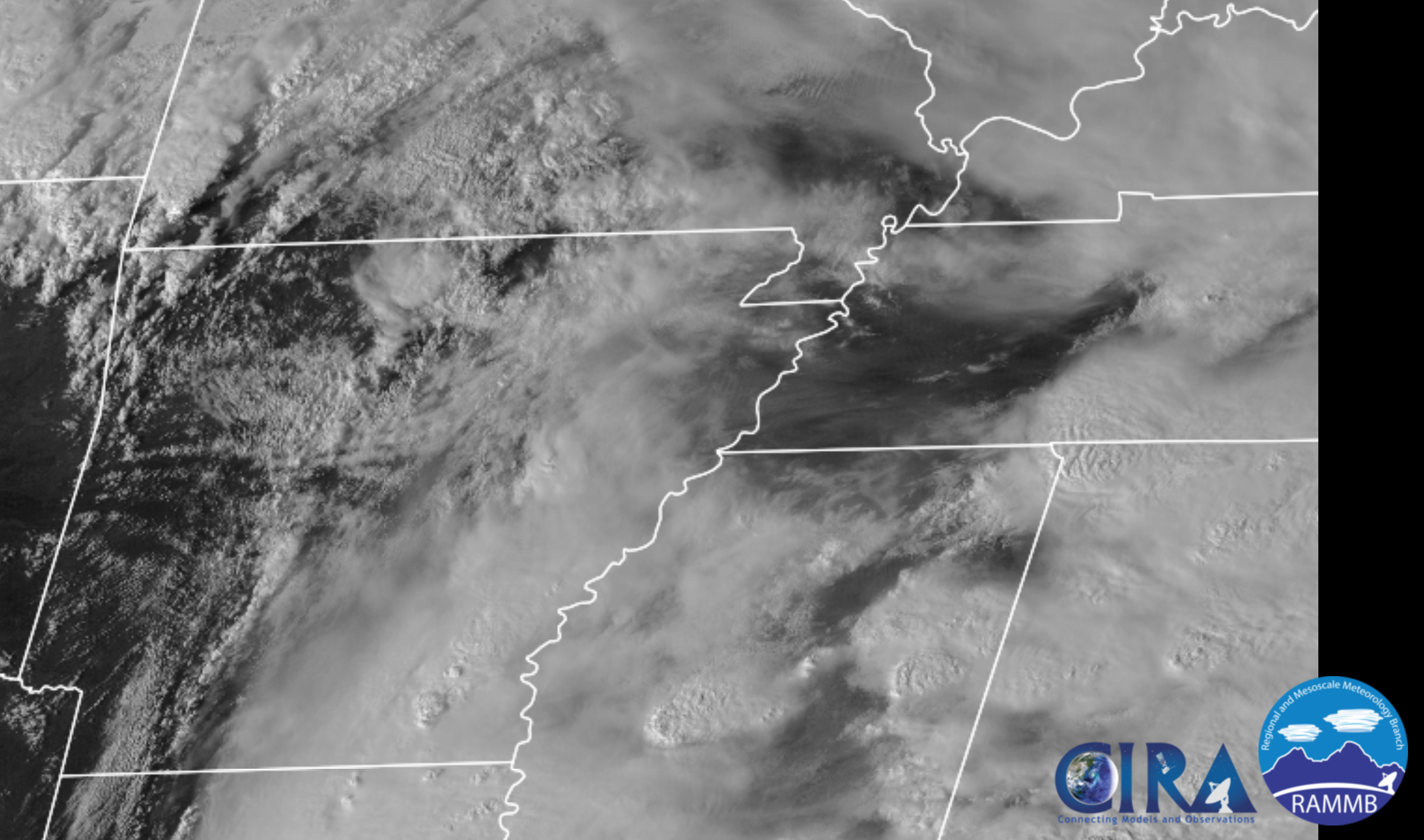
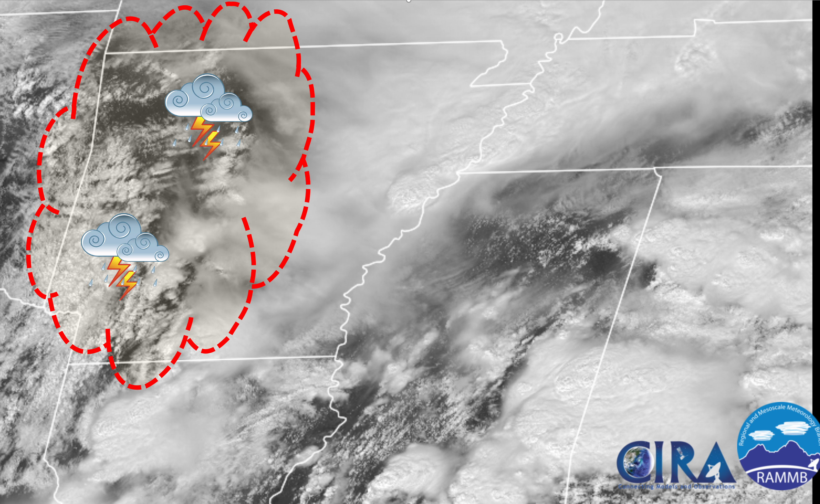
Satellite showers quite a bit of clearing over the past few hours. This is helping to make the atmosphere a bit more unstable over parts of MO and AR.
.
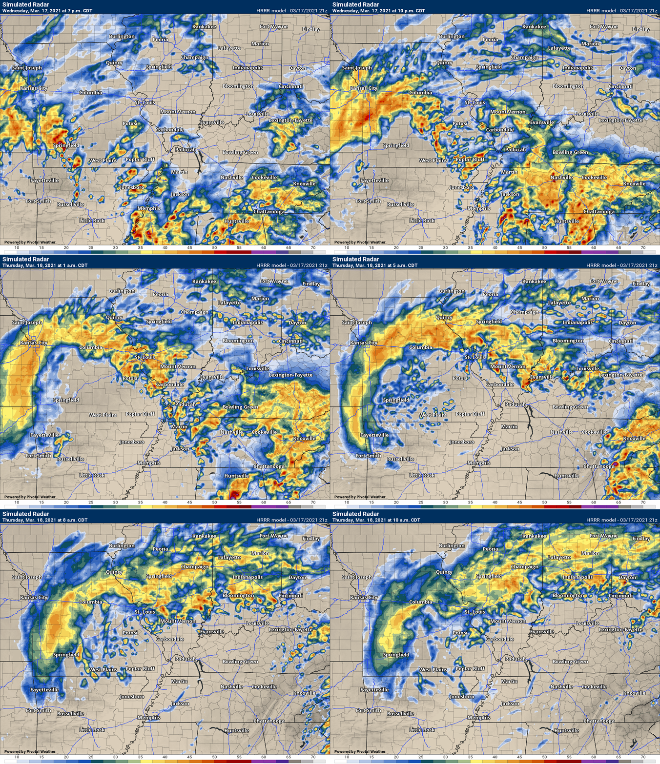
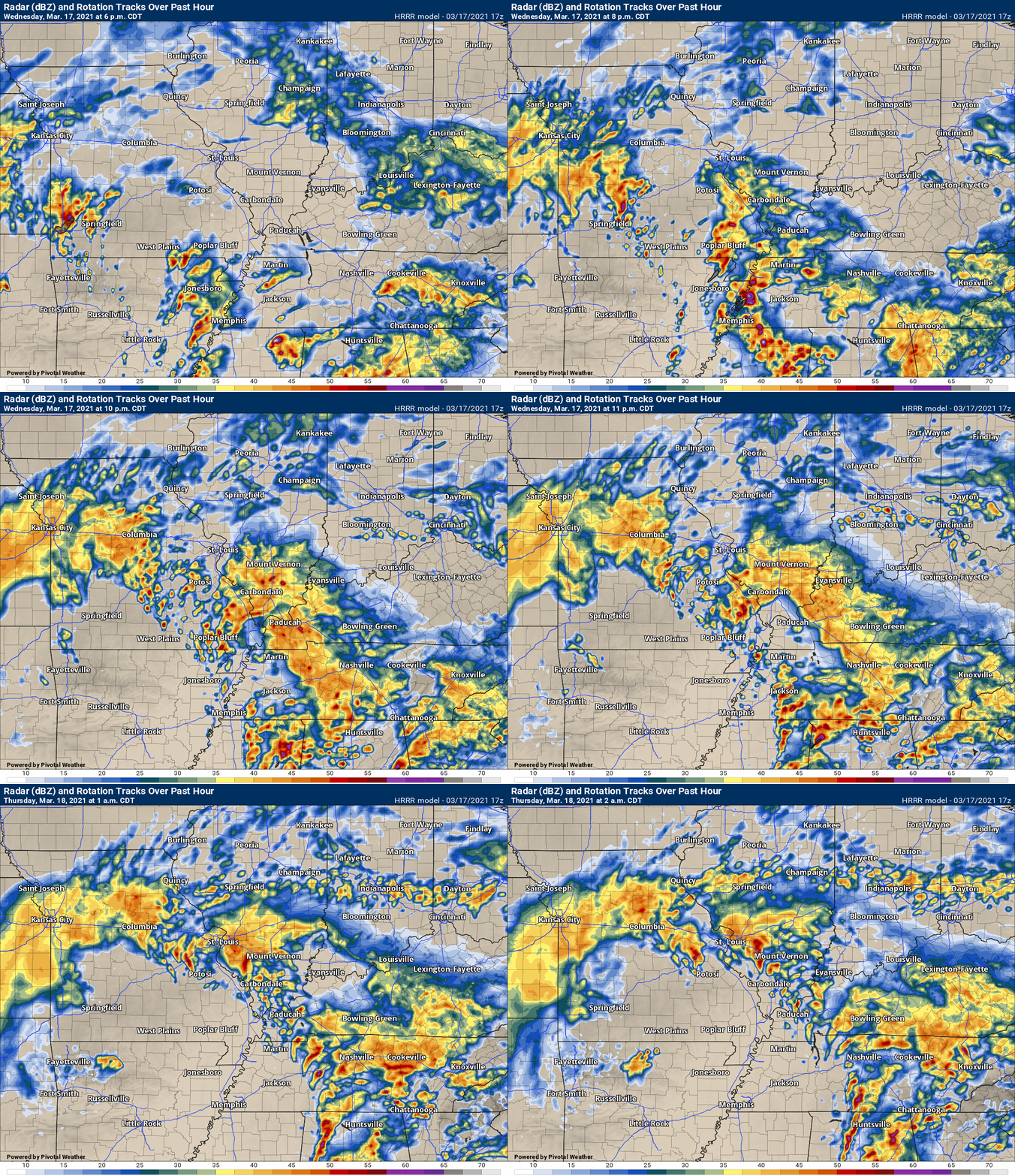
Future-cast radar shows you what to expect.
.
March 17, 2021
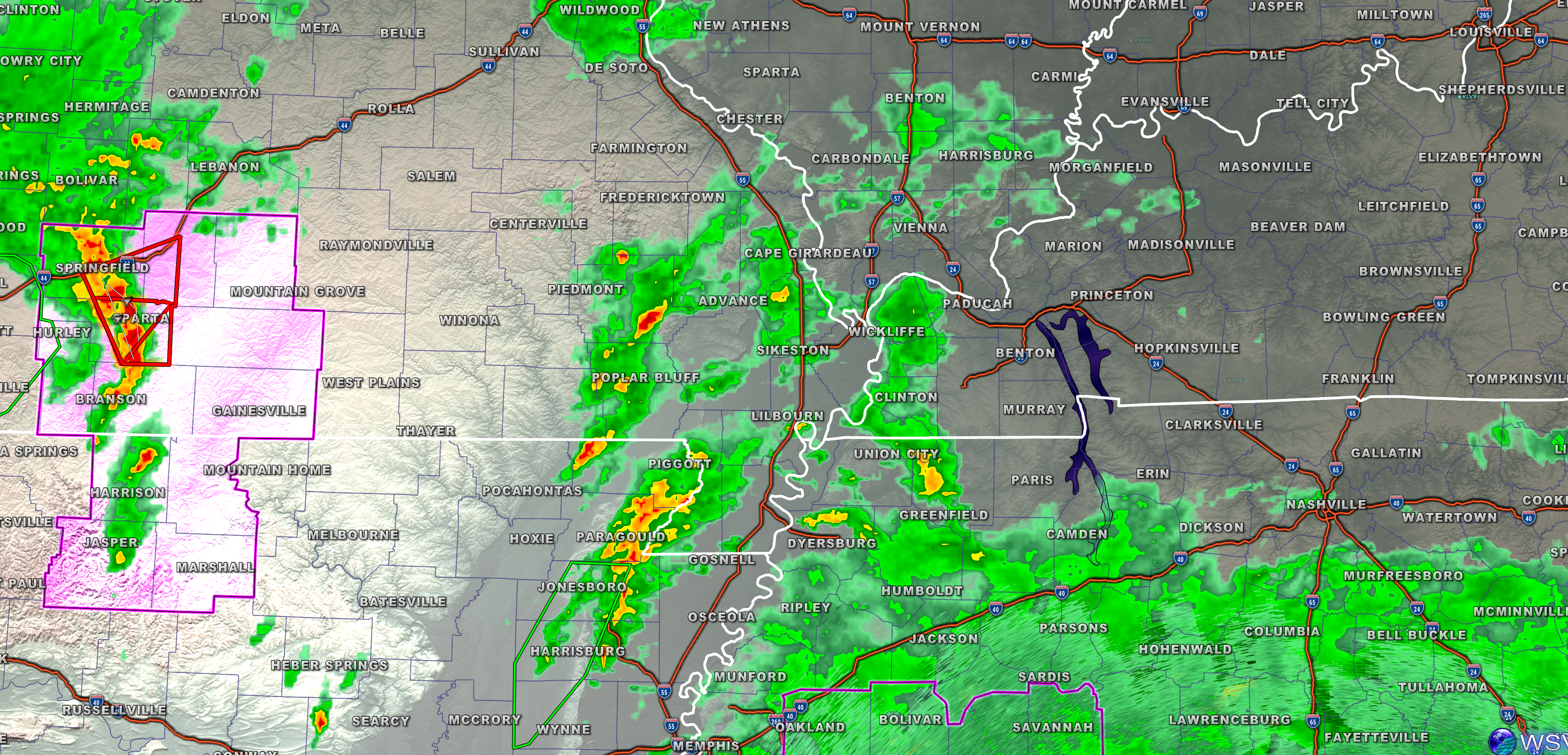
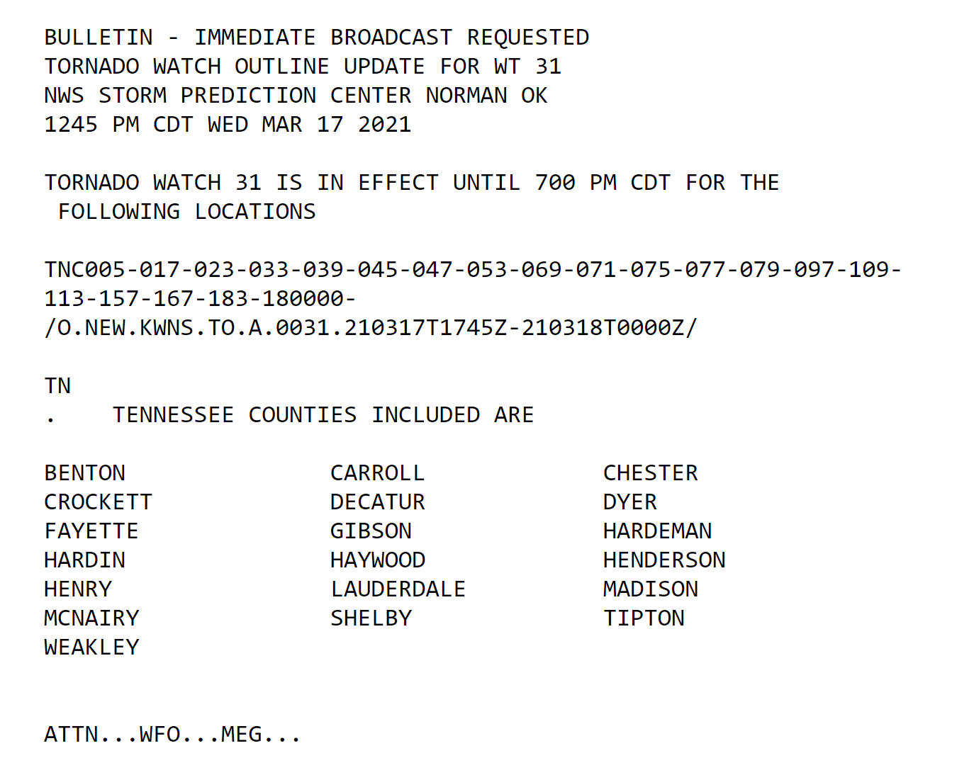
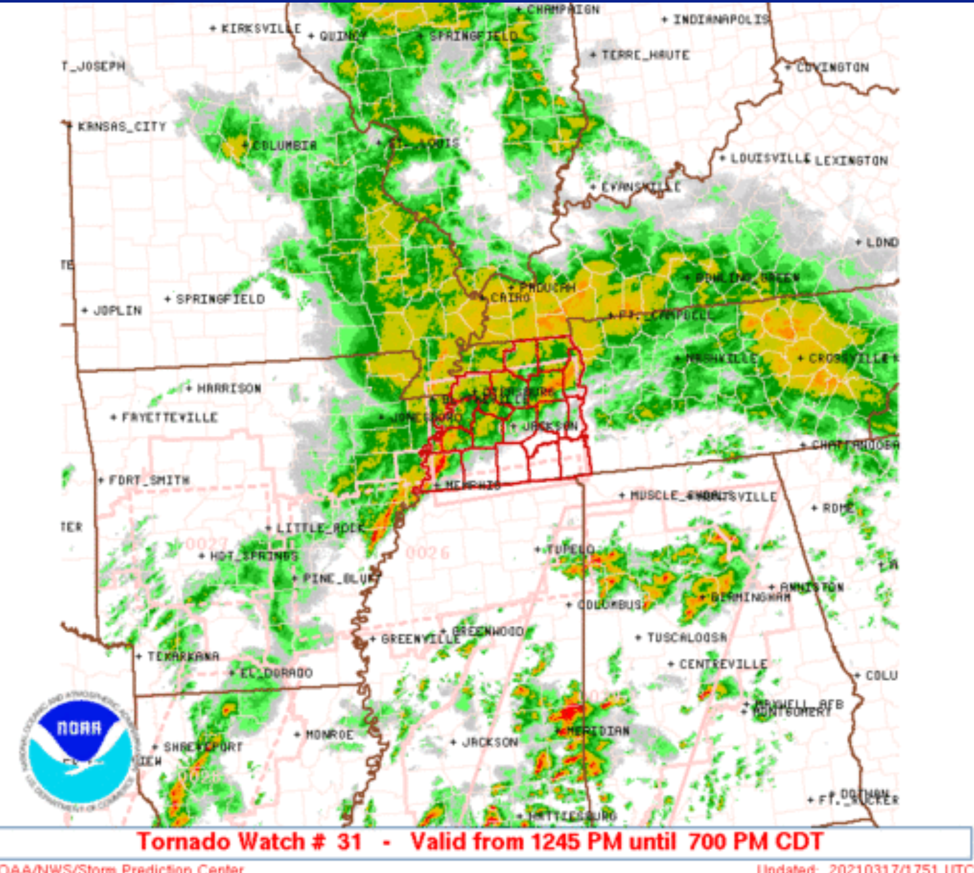
.There is a tornado watch for portions of western TN.
Areal flood advisory: Mississippi, New Madrid, Scott, Stoddard, Alexander, and Pulaski Counties until 4:30 PM.
Avoid flooded roadways.
.
March 17, 2021
.
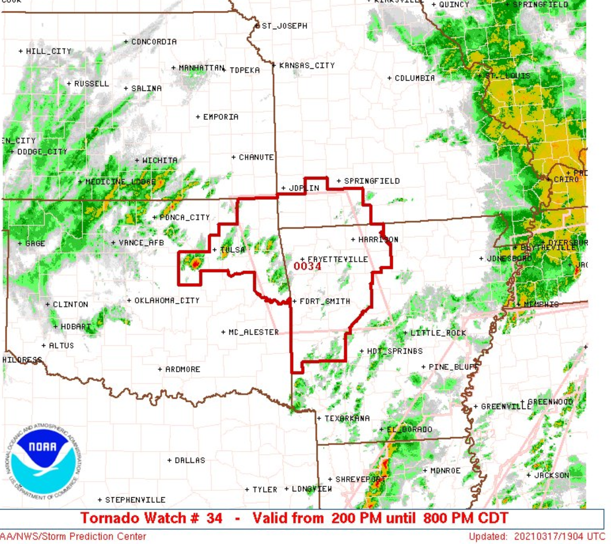
Several boundaries out west we need to watch. The surface low is over NE OK. One boundary extends northeast from the low to about SGF, then turns southeastward toward the bootheel. Another boundary extends from the low along the MO/AR border to about UNO, then dives to south of MEM into southern AL. The boundary farther south may be important over the next few hours. We will continue to monitor. PAH NWS
.
March 17, 2021
These SPC graphics will be updated within the next hour. I will post new graphics shortly.
March 17, 2021
2:15 PM
.
March 17, 2021
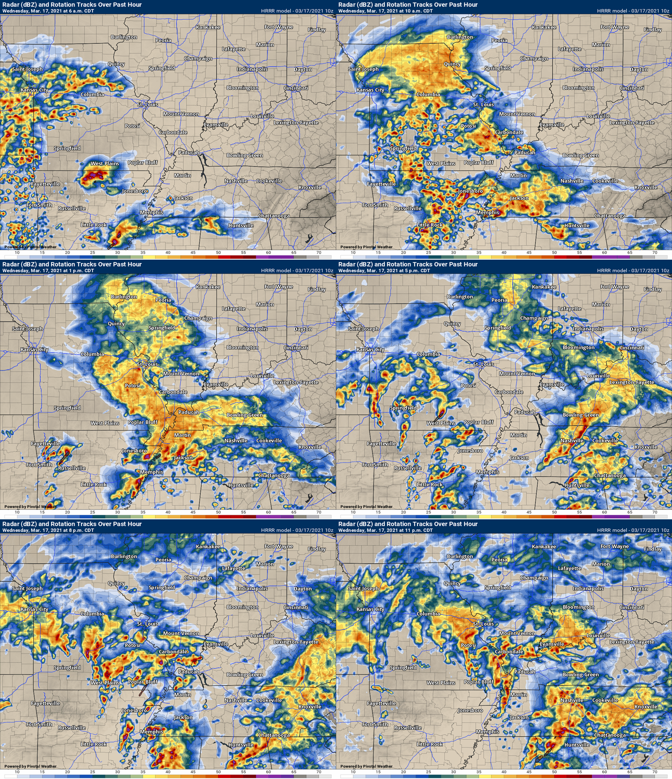
Here is the latest Hrrr future-cast radar.
I am monitoring western Arkansas and southern Missouri for thunderstorm development.
.
Future-cast radar
.
March 17, 2021
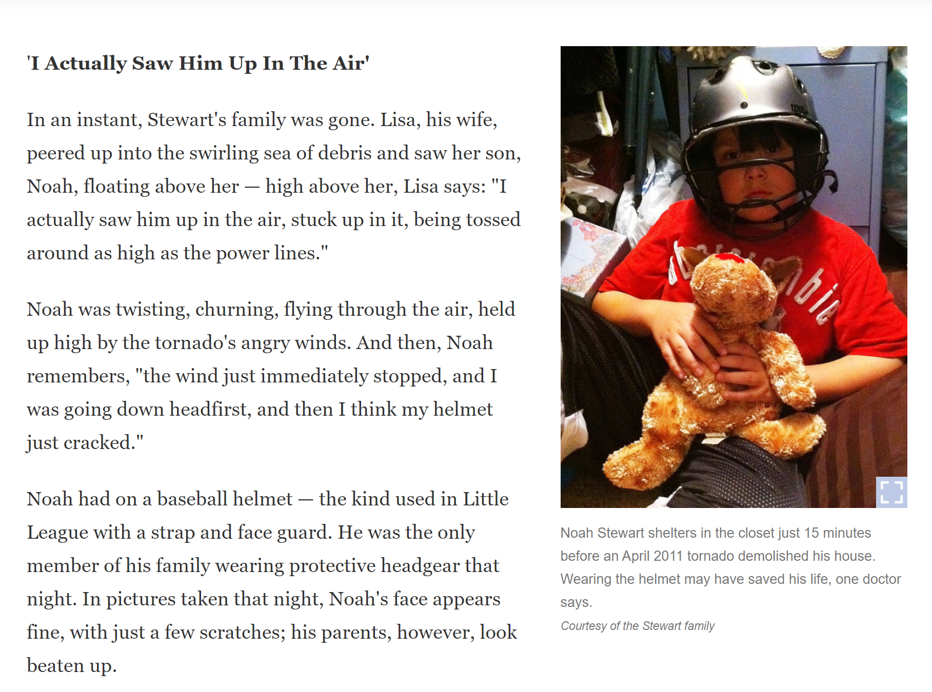
We do encourage people to wear helmets during tornado warnings. Place them in your tornado shelter. Then, you have then when needed.
Adults and children.
.
I am watching this area. Severe storms may form later this afternoon.
..
March 17, 2021
March 17, 2021
Radars and Lightning Data
Interactive-city-view radars. Clickable watches and warnings.
https://wtalk.co/B3XHASFZ
Backup radar site in case the above one is not working.
https://weathertalk.com/morani
Regional Radar
https://imagery.weathertalk.com/prx/RadarLoop.mp4
Lightning Data (zoom in and out of your local area)
https://wtalk.co/WJ3SN5UZ
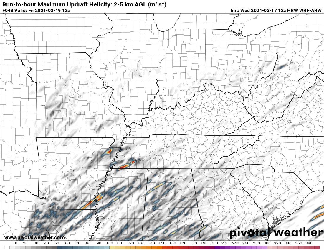
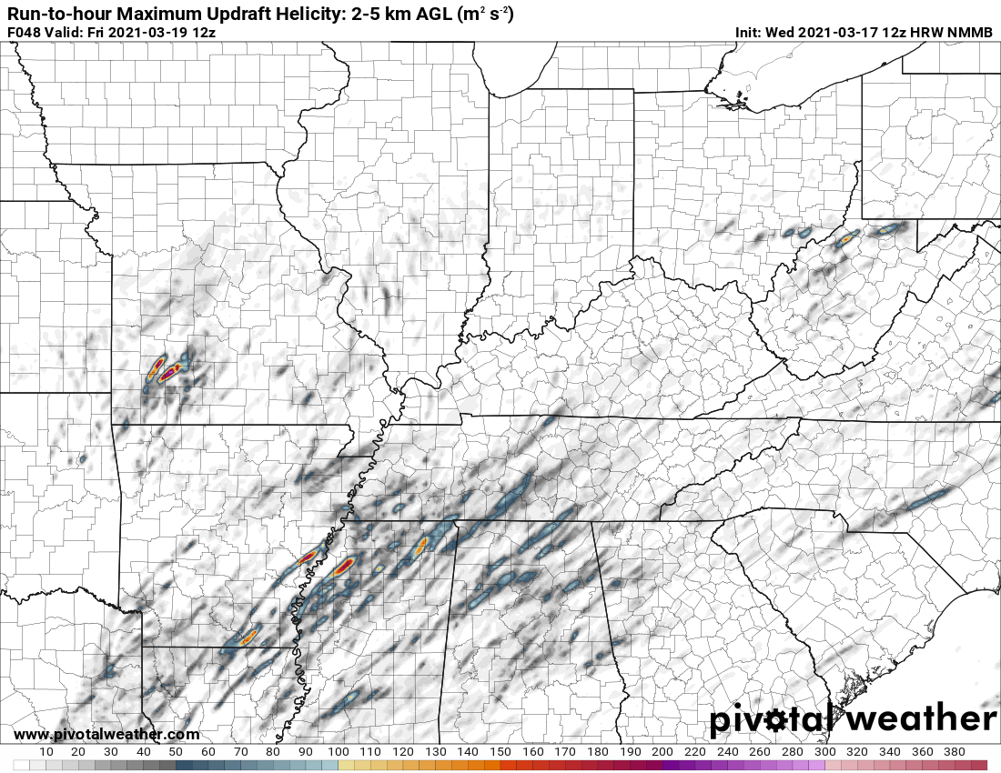
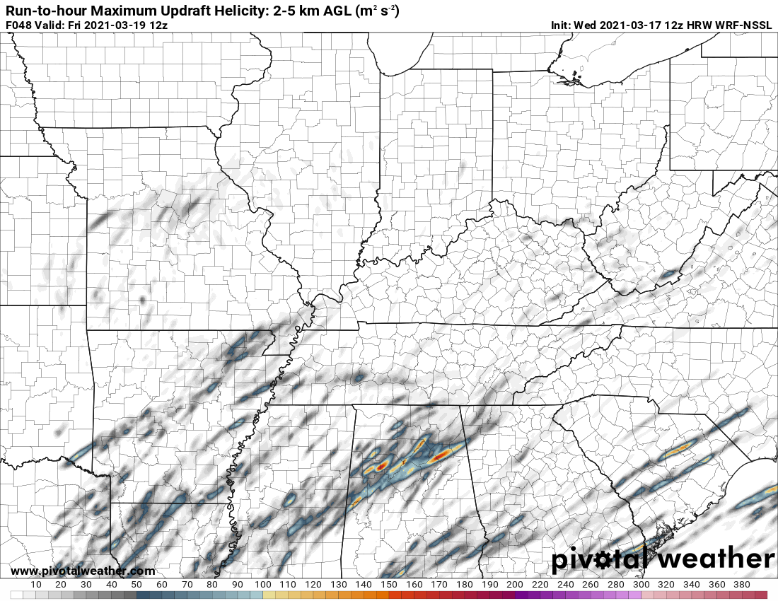
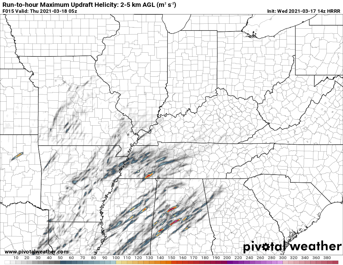
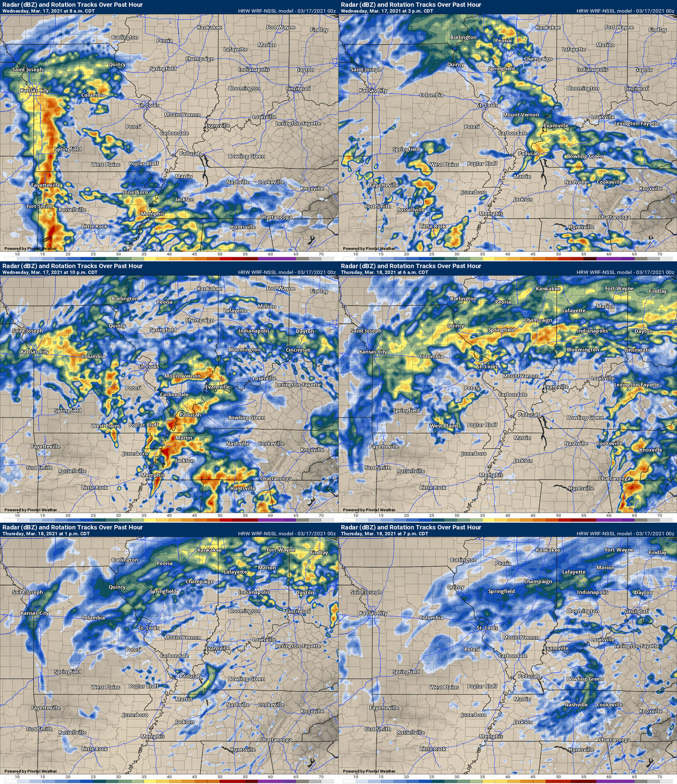
These tracks are where supercells “may” occur.
Notice how many are south of us in the greater severe weather risk zone.
Double click images to enlarge them.
.
March 17, 2021
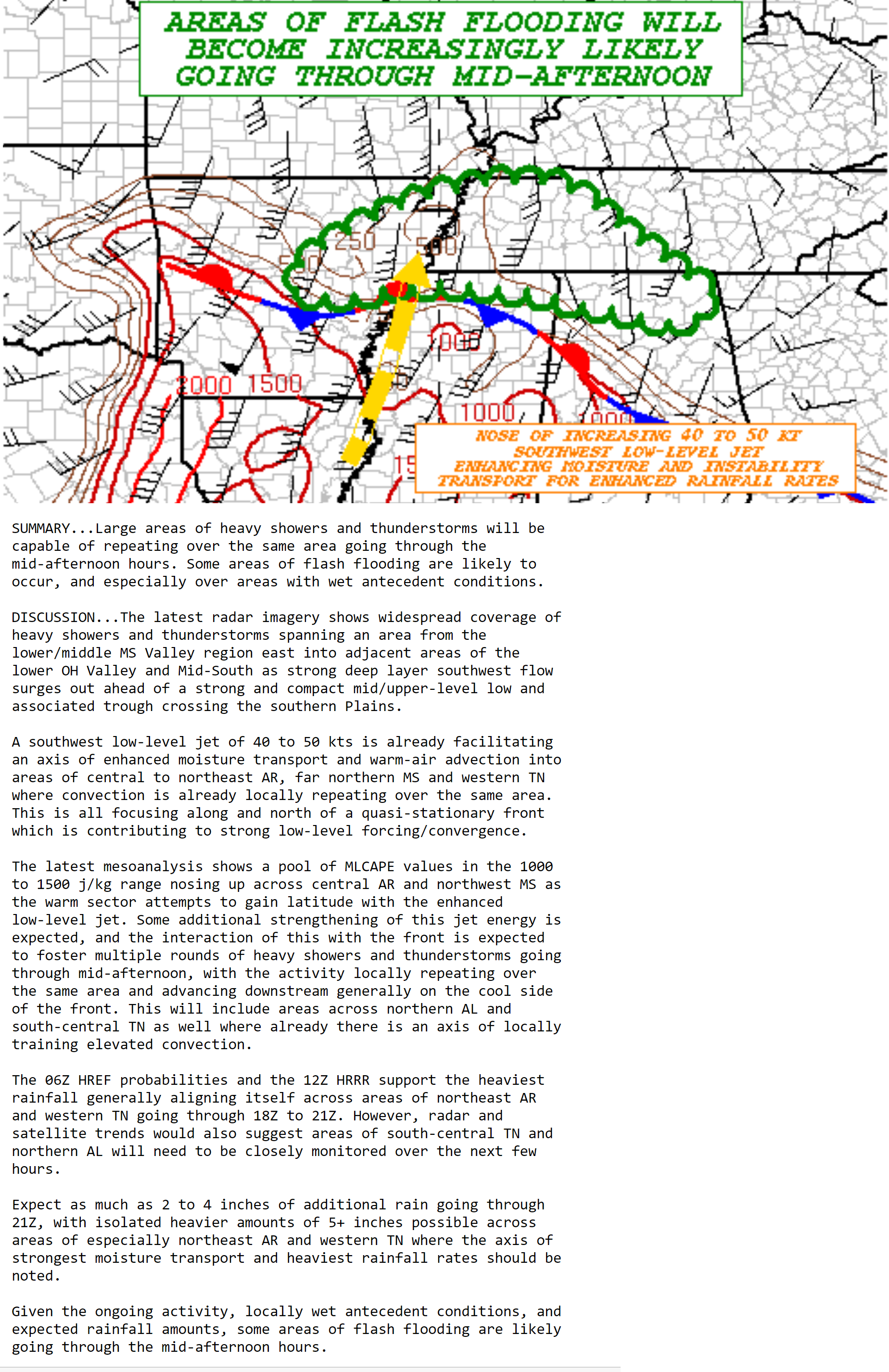
Flash flood statement from the WPC/NOAA
Double click image to enlarge.
March 17, 2021
Radars and Lightning Data
Interactive-city-view radars. Clickable watches and warnings.
https://wtalk.co/B3XHASFZ
Backup radar site in case the above one is not working.
https://weathertalk.com/morani
Regional Radar
https://imagery.weathertalk.com/prx/RadarLoop.mp4
Lightning Data (zoom in and out of your local area)
https://wtalk.co/WJ3SN5UZ
9:45 AM
Live lightning data: Click here.
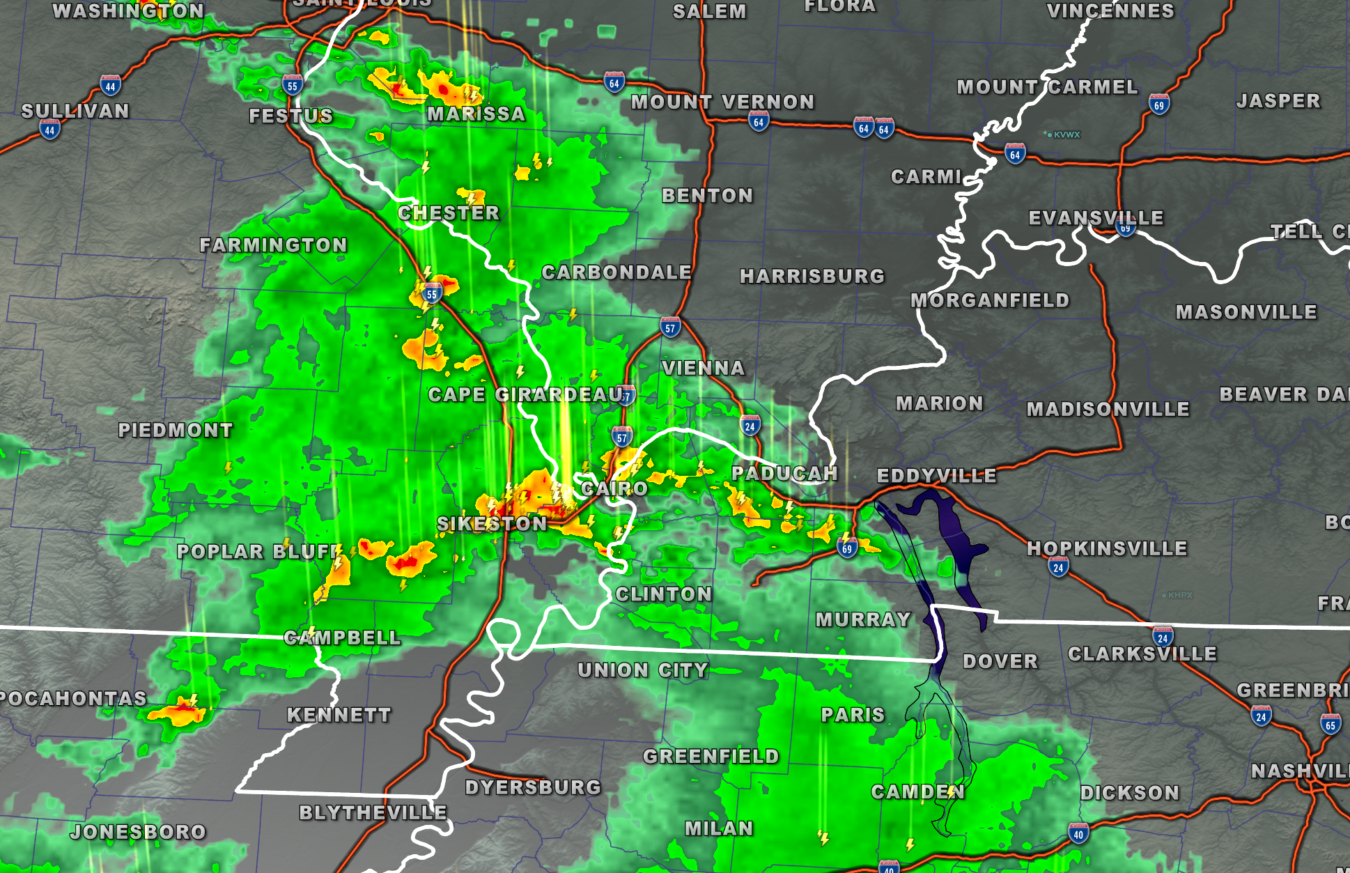
Showers and thunderstorms are moving northward. Not severe, at this time. Locally heavy rain, lightning, and dime size hail will be possible with the heavier storms.
March 17, 2021
7 AM Update
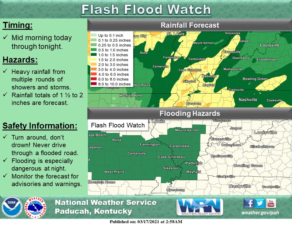
First, a flood watch is in effect today. Portions of the region. Mainly in the green zone (bottom of this graphic).
.
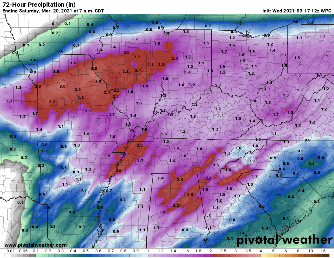
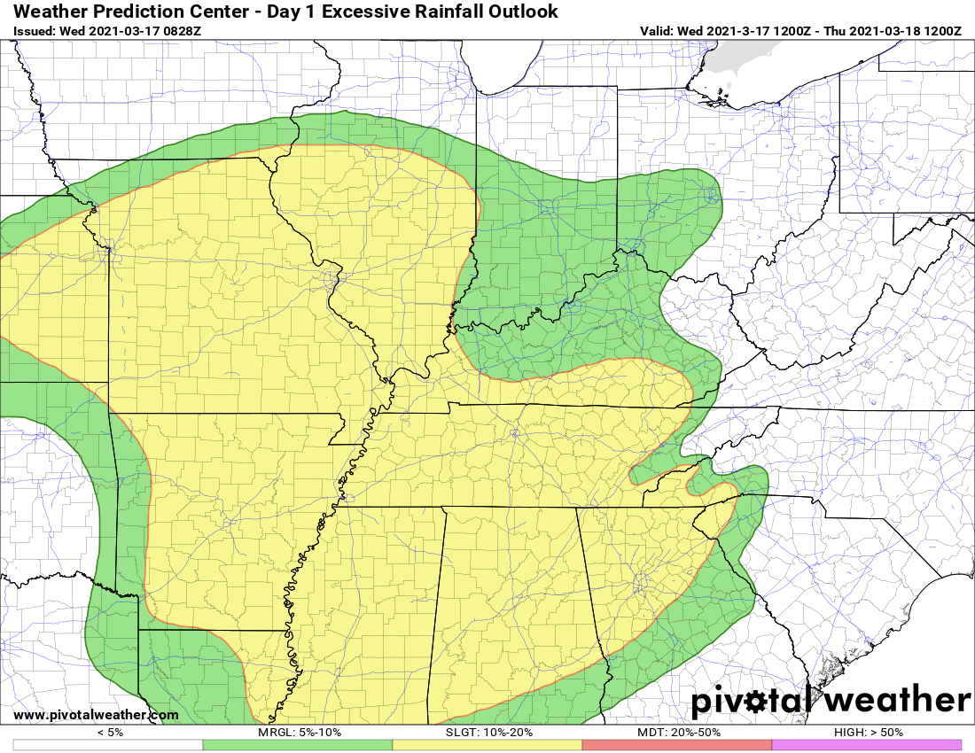
The NOAA/WPC rainfall forecast.
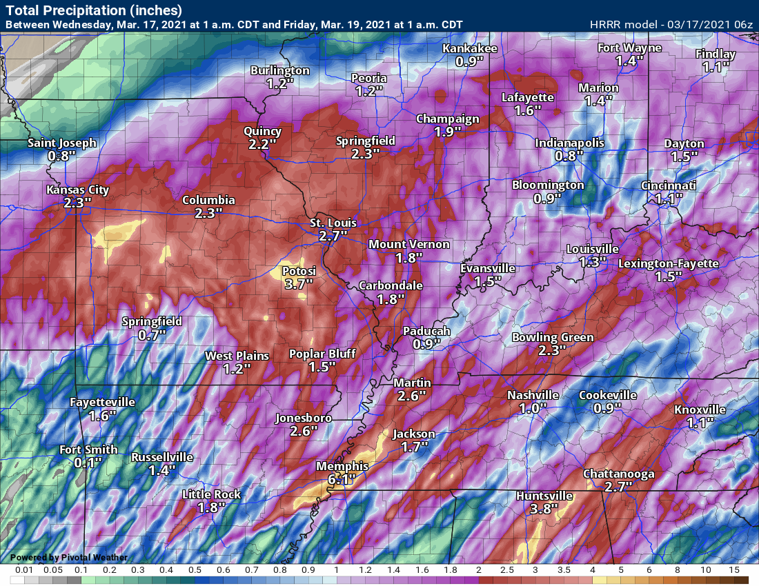
The Hrrr model rainfall forecast
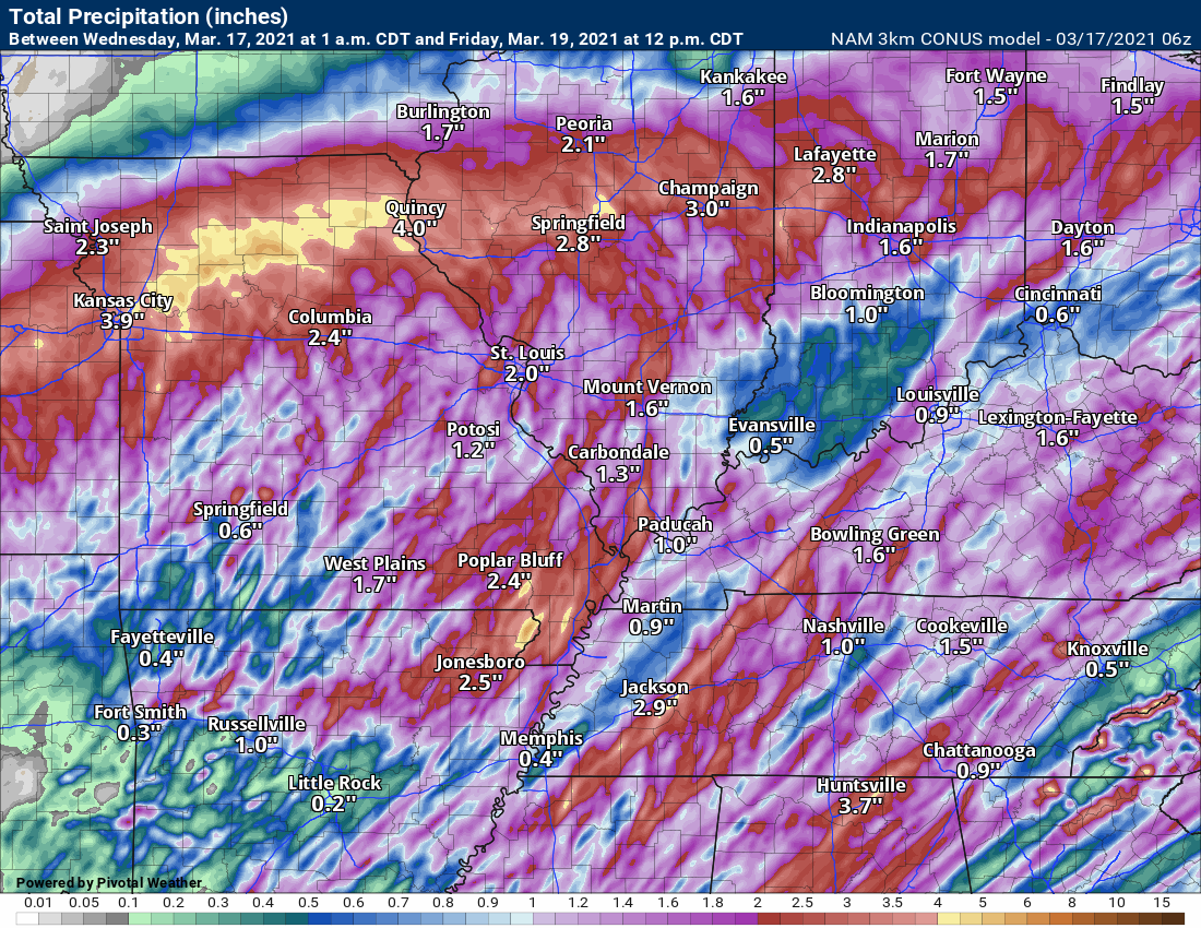
The NAM model rainfall forecast
.
You get the general idea. Locally heavy rain today and tonight.
I have started a severe weather blog post. This blog post will cover tomorrow’s event. Details at this link. CLICK HERE FOR THE SEVERE WEATHER BLOG UPDATE
An active weather pattern continues across the region.
We just finished a series of rain events and we have another one on the way.
Some severe thunderstorms are possible today. A significant outbreak of severe weather is likely to our south.
As always, most severe weather events are conditional. What does conditional mean? Conditional means that everything has to come together just right in order for the forecast to verify.
We are going to have a lot of clouds in the region today. Perhaps mostly cloudy the entire day. Also, widespread showers and thunderstorms are already moving in from the south and west.
These showers and thunderstorms will help keep instability lower. That is good news. The bad news is that wind fields will rapidly increase today. That will couple with increasing dew points/moisture. The end result will be some torrential downpours, gusty wind, lightning, and hail.
There may be enough instability for damaging wind and even a tornado. Let’s pay attention to any warnings today. Storms will move fast. There may not be much in the way of warning.
I will be sending out warning bulletins via the Beau Dodson Weather Talk app. Log into your app. Make sure it is on and working. Do that now.
A warm front will push northward from the Gulf of Mexico today.
There will be some showers and thunderstorms well north of the warm front. See the radars.
A widespread 0.80″ to 1.60″ of rain is anticipated with pockets of 2″ to 4″ possible. Training thunderstorms, storms that move over the same area, can produce very heavy rain totals. Keep that in mind.
See the future-cast radars further down in the blog.
The bigger concern will arrive Wednesday afternoon into Wednesday night. It is possible this severe weather event continues well into the night.
As always, you should be prepared to deal with severe weather.
The app is for subscribers. Subscribe at www.weathertalk.com/welcome then go to your app store and search for WeatherTalk
Subscribers, PLEASE USE THE APP. ATT and Verizon are not reliable during severe weather. They are delaying text messages.
The app is under WeatherTalk in the app store.
Apple users click here
Android users click here
Remember, a watch means to monitor updates. A WARNING means seek shelter. A WARNING is worse. A warning means that severe weather is occurring or about to occur at your location. See shelter.
.
Let me show you a series of maps. I will explain all of them.
When considering a severe weather forecast, we look at many factors. These factors have to come together in order to produce severe thunderstorms. Just one of them is not enough.
One item forecasters look for are high dew points.
Dew point is a measure of moisture. Once we reach the 58 degree mark, we start to think about severe thunderstorms.
Dew point is what makes it feel muggy outside.
Dew points in the 60s represent more than enough moisture for severe thunderstorms. Of course, there are other ingredients, as well.
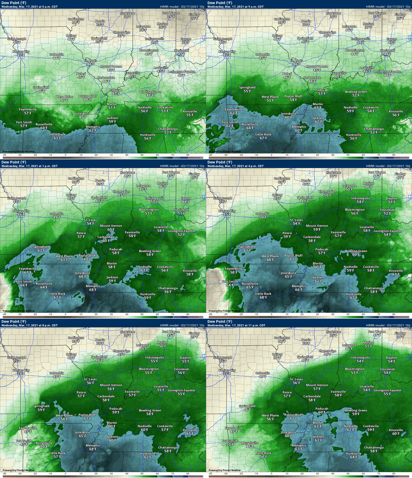
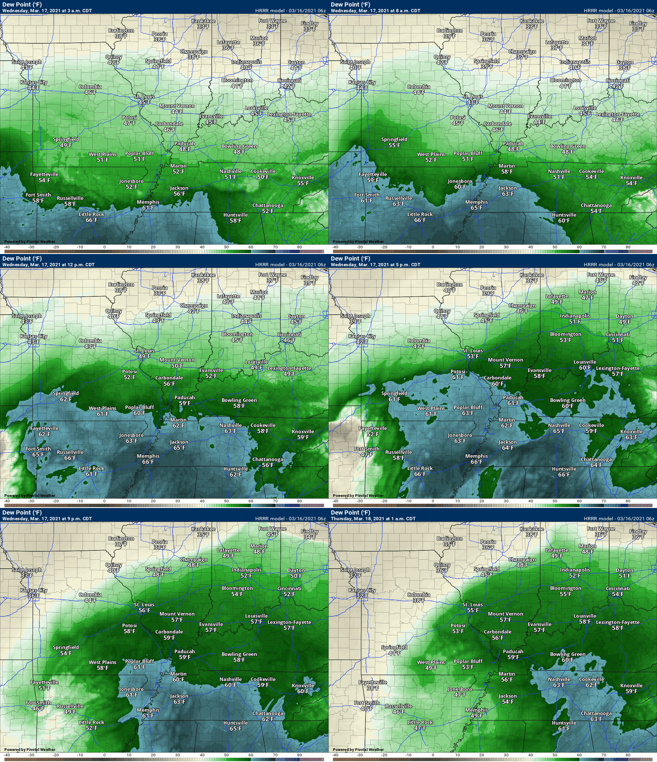
Let me show you the high-resolution Hrrr model guidance. Dew point forecast animation. This shows you Tuesday into Wednesday night.
You can see the tongue of 60+ dew points attempting to nudge into our region. You can see the blues area mostly to our south.
Those blue colors are the higher dew points.
For widespread severe weather, you would want to see those blues further north. Thus, I continue to monitor this. There are uncertainties on how far north to push the higher severe weather probabilities.
See how the 60+ degree dew points (blue colors) attempt to push northward into our region? With time, they diminish.
This is sufficient for severe weather concerns. Notice the 60s are widespread to our south. That is where the higher risk is located.
The risk will diminish as you travel north in our region. Keep that in mind.
The risk is higher over far southeast Missouri, the Missouri Bootheel, northwest Tennessee, and far western Kentucky.
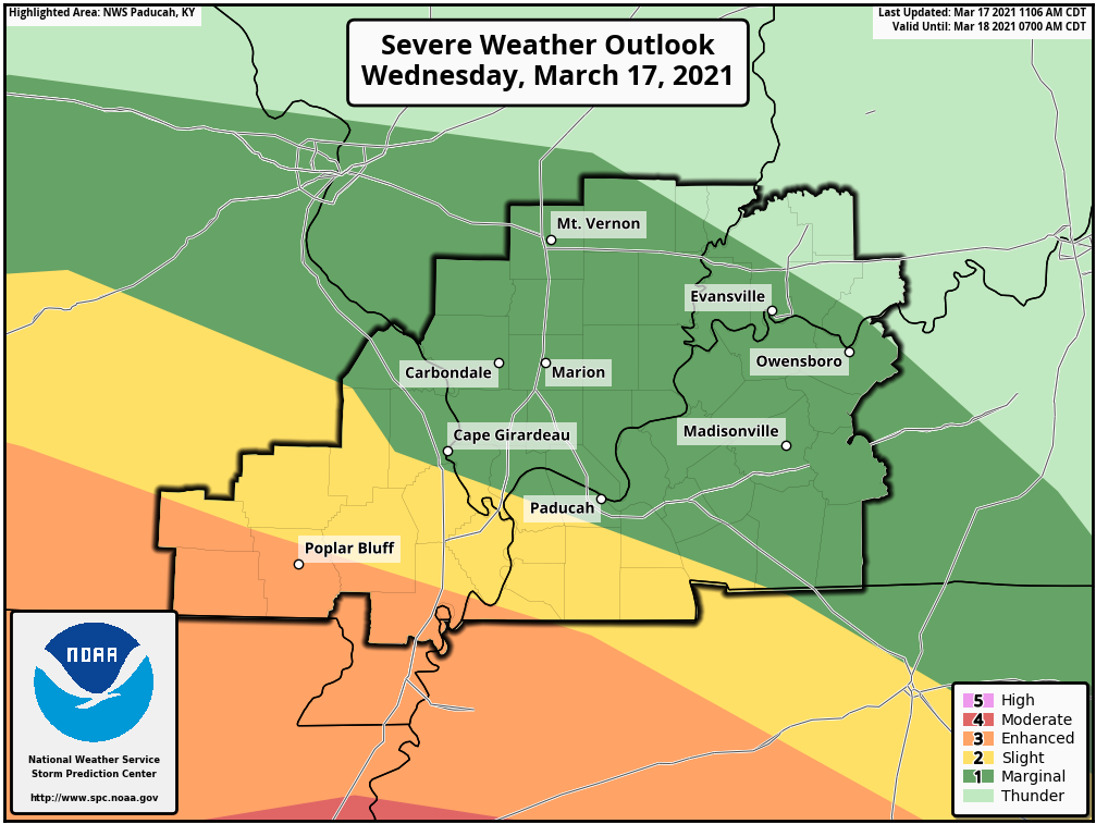
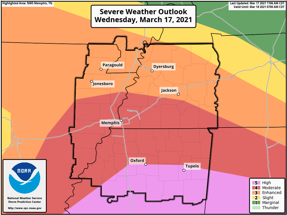
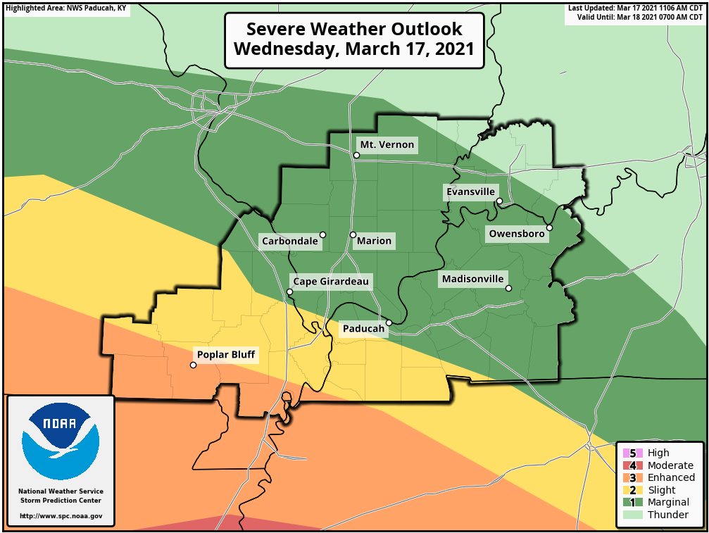
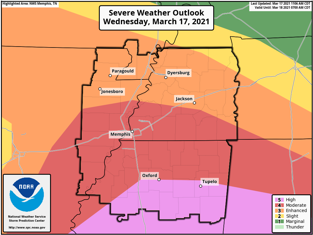
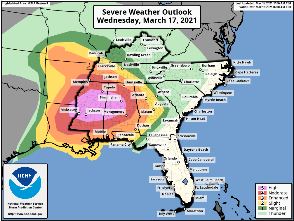
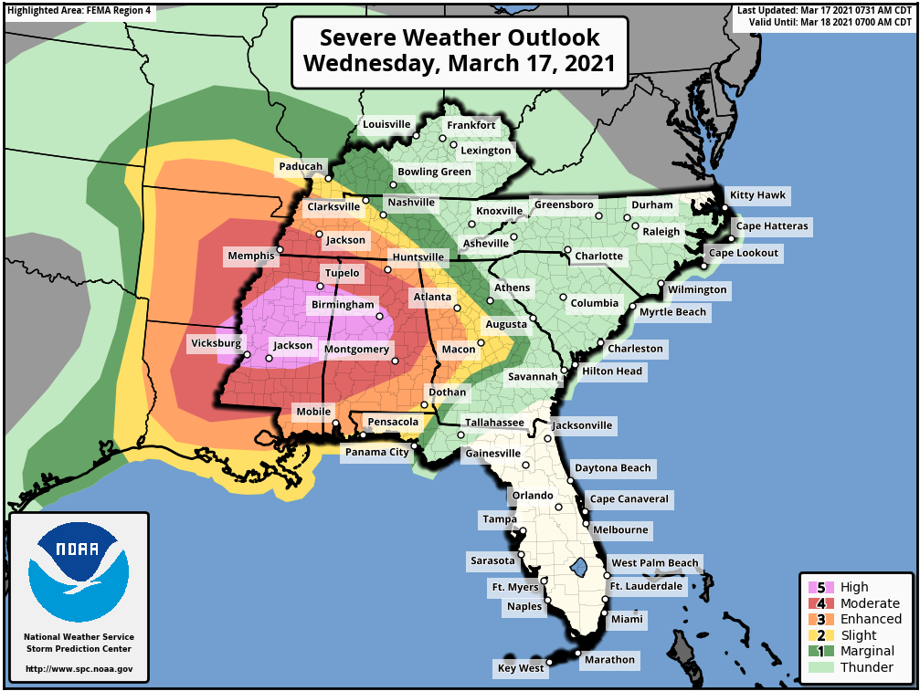
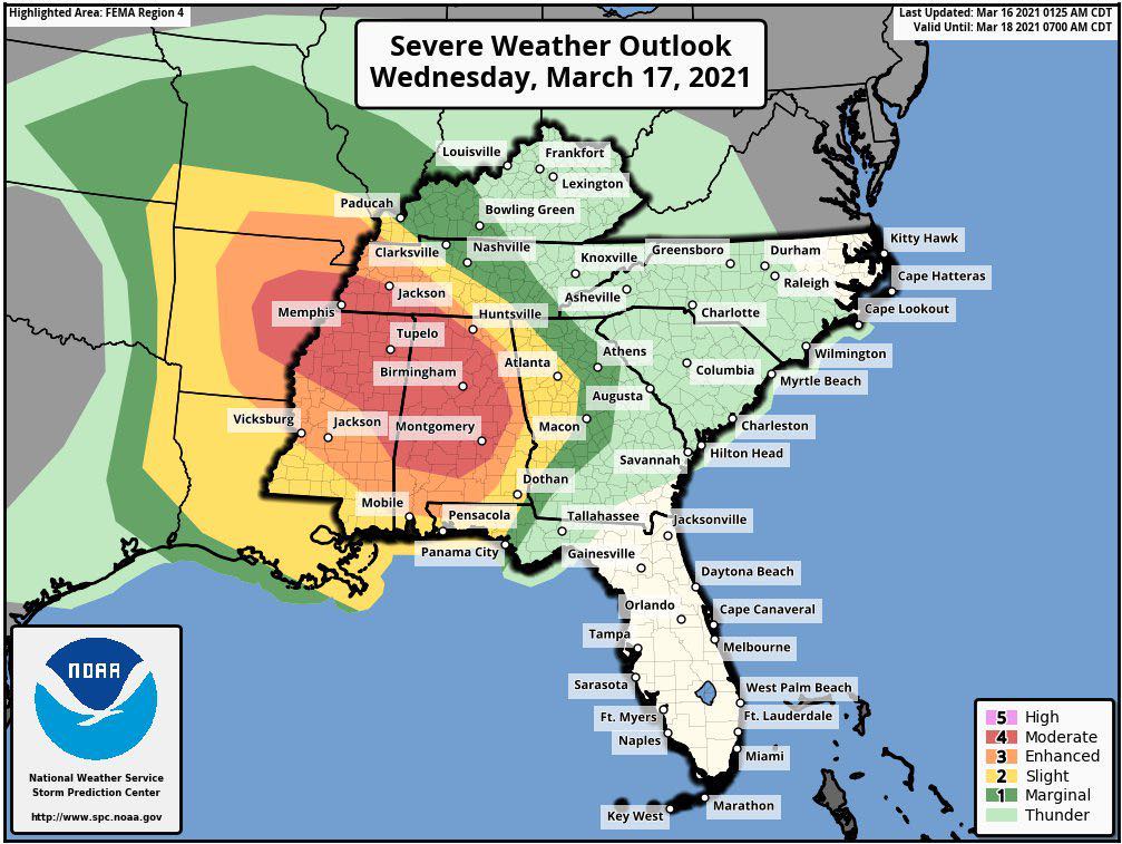
The Storm Prediction Center has outlined the region for a risk of severe weather Wednesday/Wednesday night.
Again, the risk is higher to our south, but we are still included in the risk zone. Higher probabilities across eastern Arkansas into Mississippi and Alabama.
There is a high risk over portions of the Gulf of Mexico.
You can see that here. The light green zone is where sub-severe storms are possible. The dark green is a level one risk. The yellow is a level two risk. The orange is a level three risk. The red is the level four risk zone. The pink is the level five risk zone.
Five is the highest risk that the Storm Prediction Zone has.
REMEMBER: Don’t focus too much on the colors or their exact placement. The Harrisburg, Illinois, tornado was in a slight risk and killed eight people. It only takes one tornado to cause problems. The SPC colors are for guidance only. Meaning, we use them to see where severe weather might be widespread vs scattered.
Again, it only takes one tornado to cause problems. The weather does not always follow our colors.
The pink zone is the high risk. The red zone is the moderate risk. The SPC believes that a significant outbreak of severe thunderstorms will be possible (IF all the ingredients do come together).
You can see that our entire region is included in the severe weather risk zone. Southern counties have the highest risk.
The SPC will update this more than once over the coming 24 hours. Monitor updates. Let’s see if they shift it around a bit.
Either way, the forecast will remain the same. There will be a chance of severe thunderstorms Wednesday/Wednesday night.
.
Zoomed in. This will update several times today.
This is for Wednesday/Wednesday night (a zoomed in view of the above SPC severe weather outlook graphic)
.

.
Let me break down the maps.
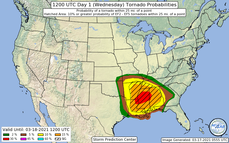
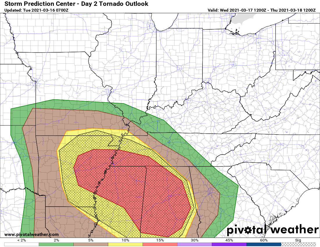
Here is the tornado risk zone.
The orange and red zone represent the highest risk. The hatched zone is where significant tornadoes will be possible.
.
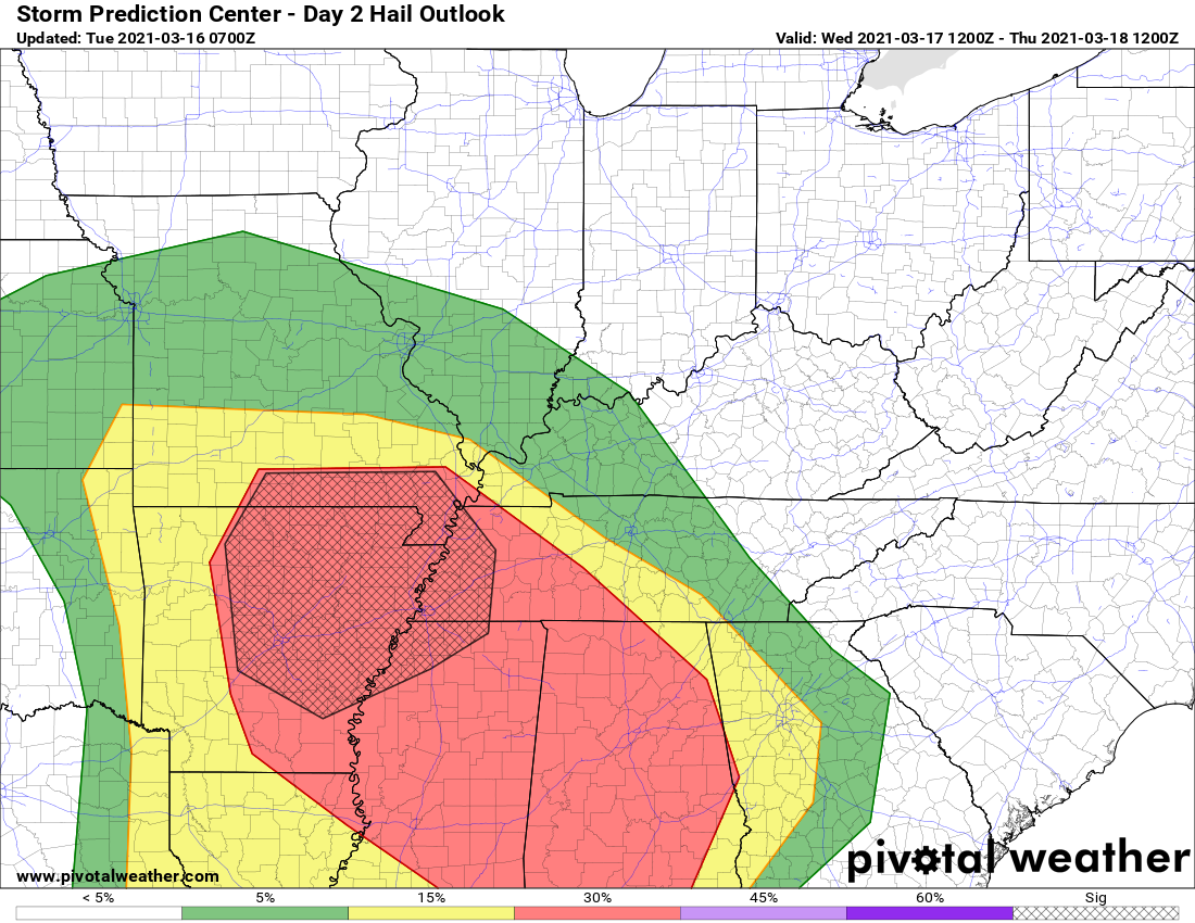
Let me break down the maps.
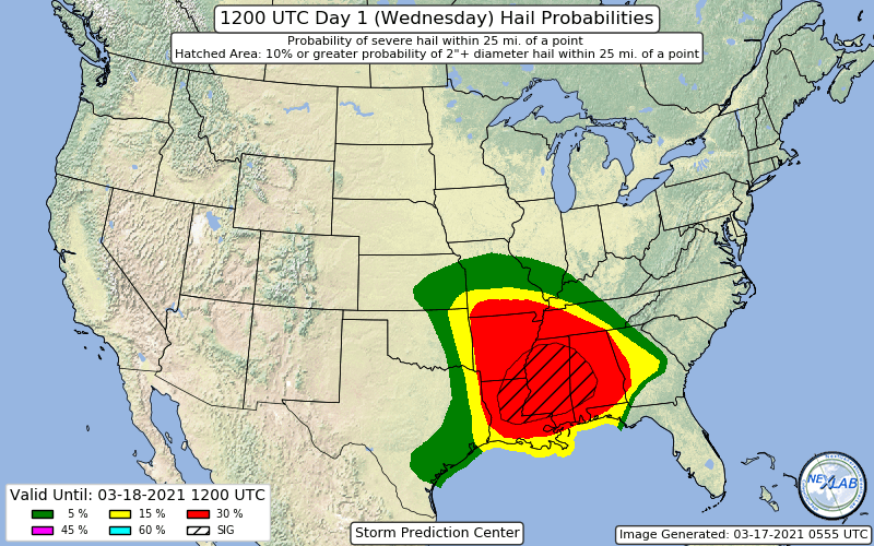
Here is the hail risk zone.
The yellow and red zone is the higher risk area. The hatched zone is where significant hail will be possible.
.
.
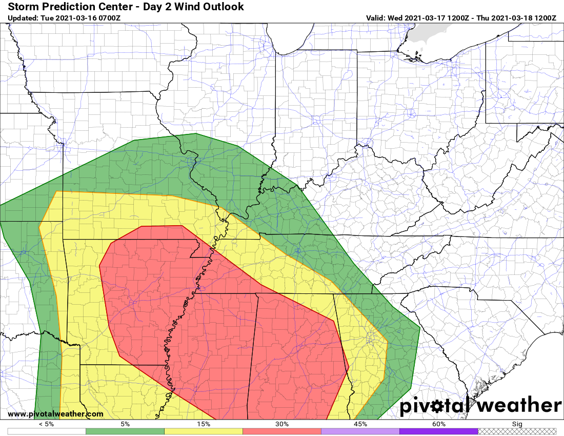
Let me break down the maps.
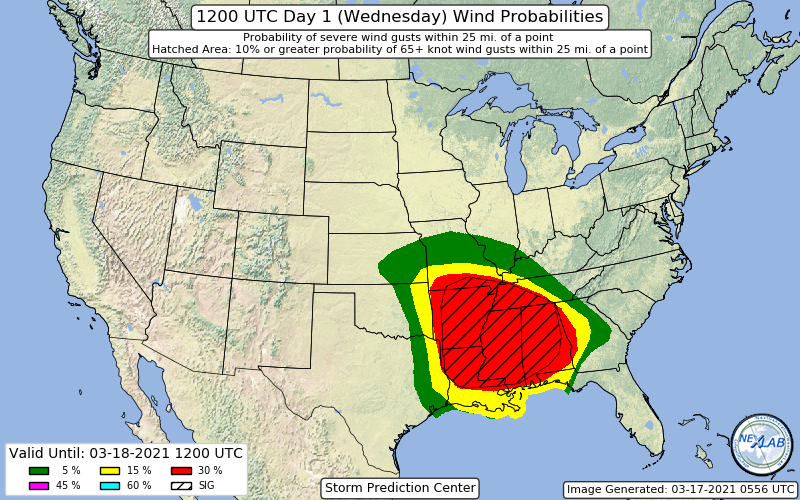
Here is the damaging wind risk zone.
The yellow and red zone is the higher risk area. The hatched zone is where significant wind damage will be possible. That would be 70 MPH or greater.
.
.
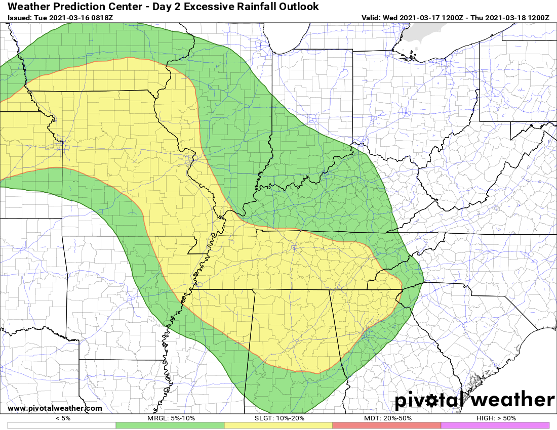
In addition to the above, we do have a risk of flash flooding. The WPC/NOAA has outlined our region in a marginal and slight risk of excessive rainfall. That simply means that locally heavy rain could flood some roadways, fields, and streams. Rivers remain high, as well.
Avoid flooded roadways.
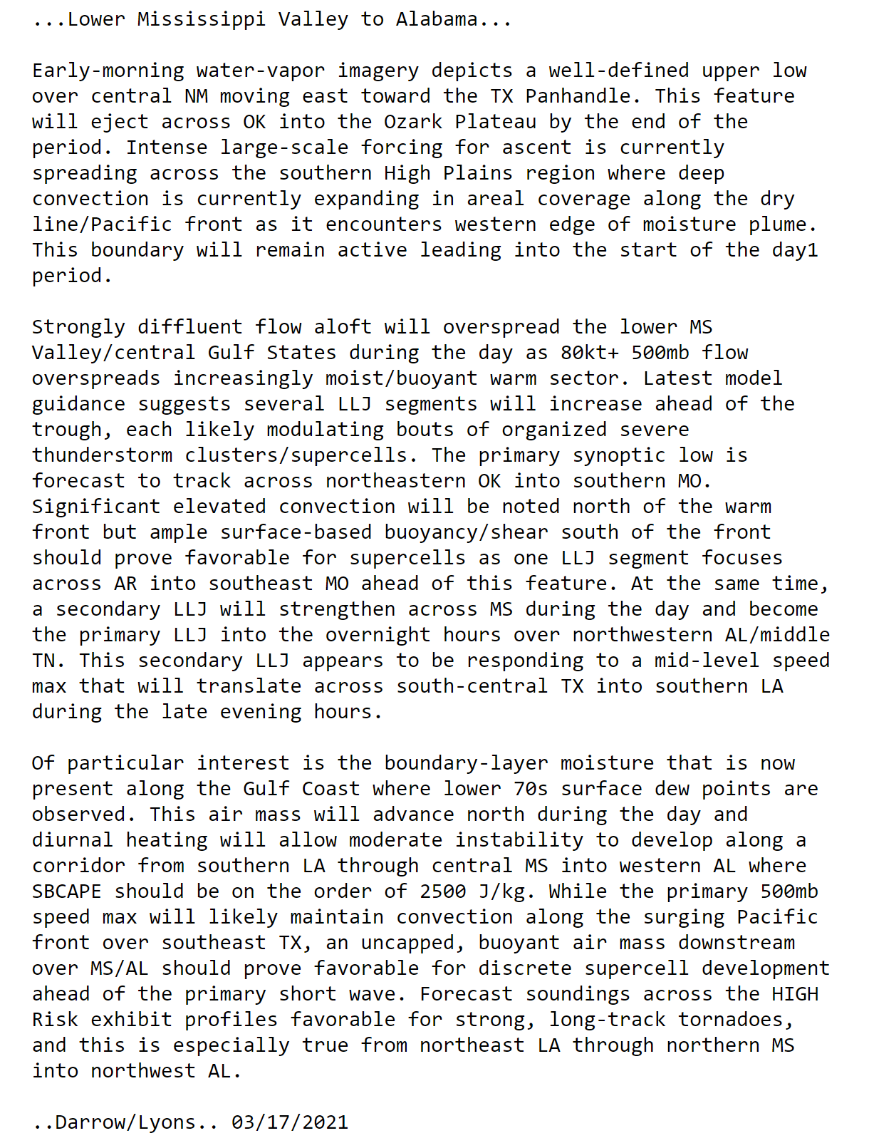
Here are some comments from the Storm Prediction Center and local National Weather Service Offices.
Double click on the text to enlarge it.
SPC comments
.
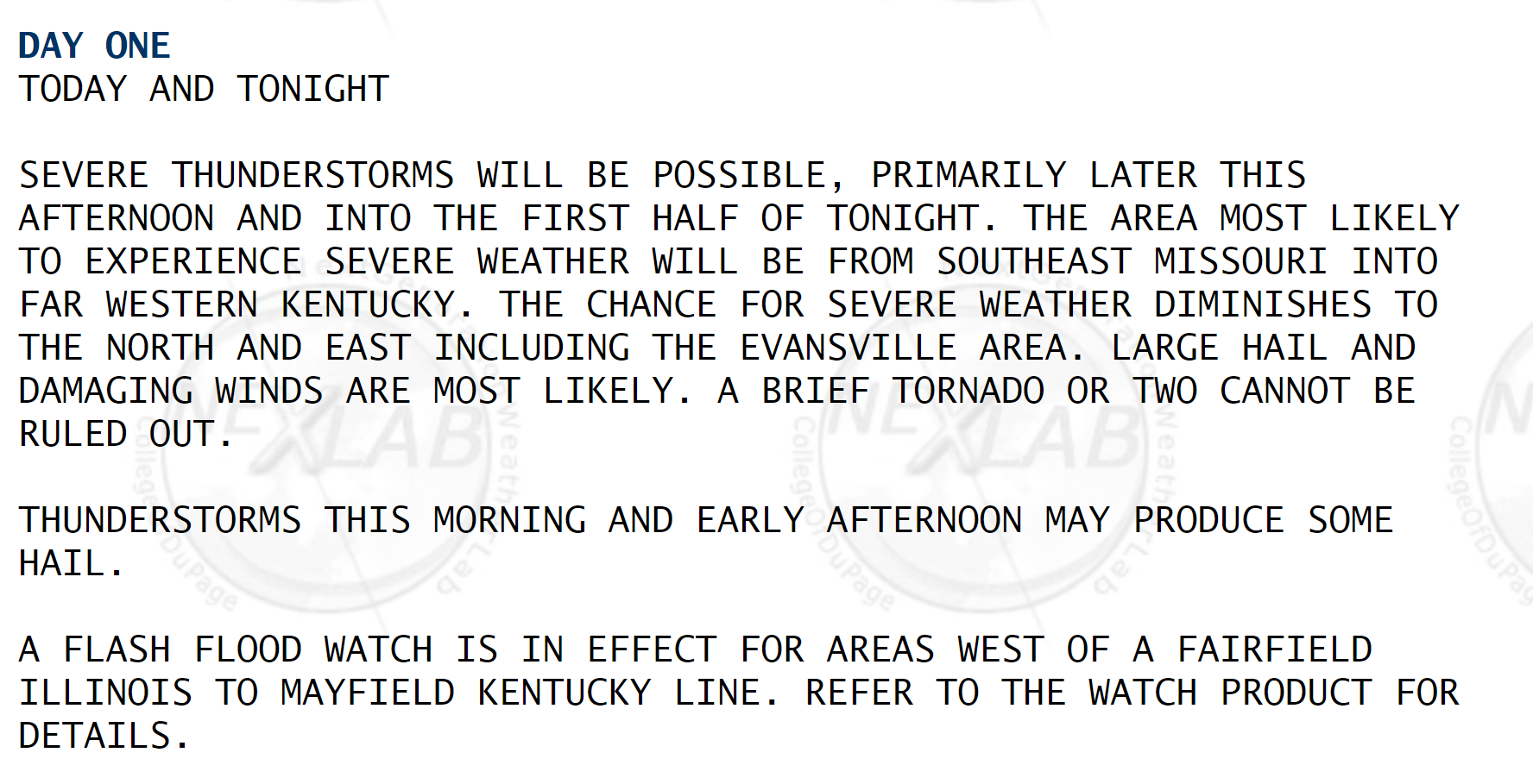
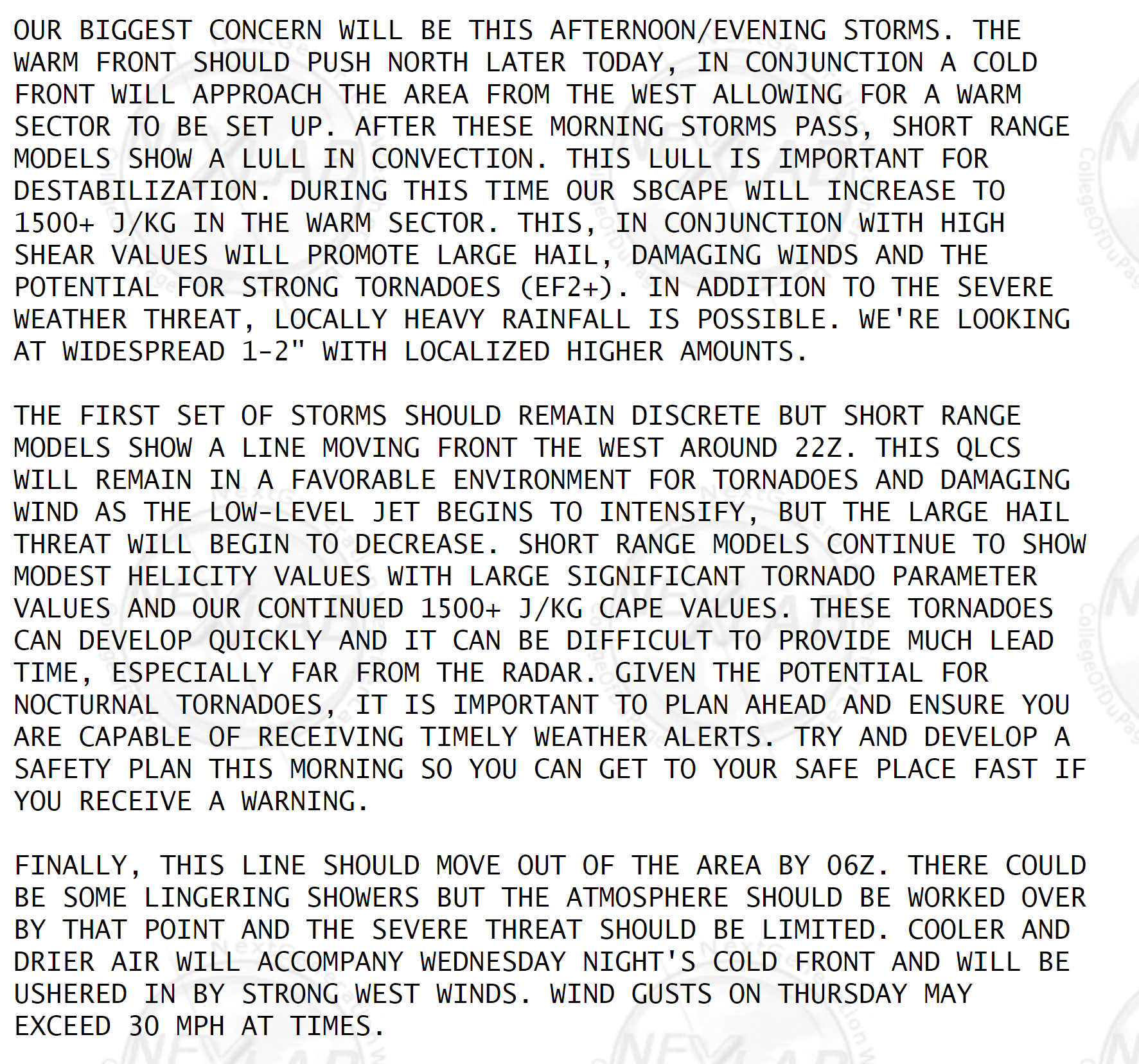
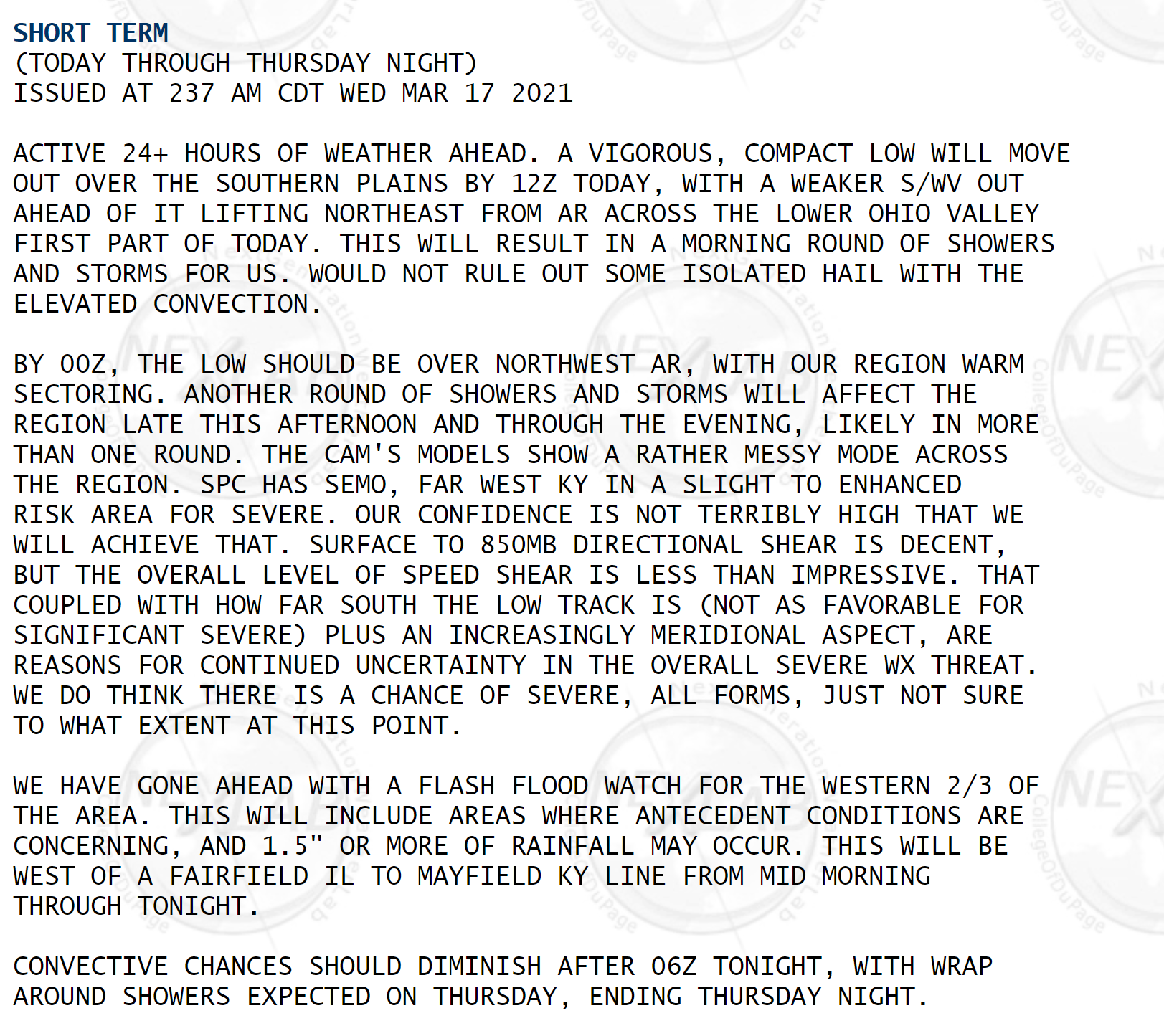
NWS Paducah comments.
.
NWS Memphis comments.
.
NWS Paducah comments from their area forecast discussion.
![]()
.

Again, as a reminder, these are models. They are never 100% accurate. Take the general idea from them.
What should I take from these?
- The general idea and not specifics. Models usually do well with the generalities.
- The time-stamp is located in the upper left corner.
- The EC European weather model is in Zulu time.
.
What am I looking at?
You are looking at different models. Meteorologists use many different models to forecast the weather. All models are wrong. Some are more wrong than others. Meteorologists have to make a forecast based on the guidance/models.
I show you these so you can see what the different models are showing as far as precipitation. If most of the models agree, then the confidence in the final weather forecast increases.
You can see my final forecast at the top of the page.
.
This animation is the Storm Prediction Center WRF model.
This animation shows you what radar might look like as the next system pulls through the region. It is a future-cast radar.
Time-stamp upper left. Click the animation to enlarge it.
No rain in the forecast
.
.
.
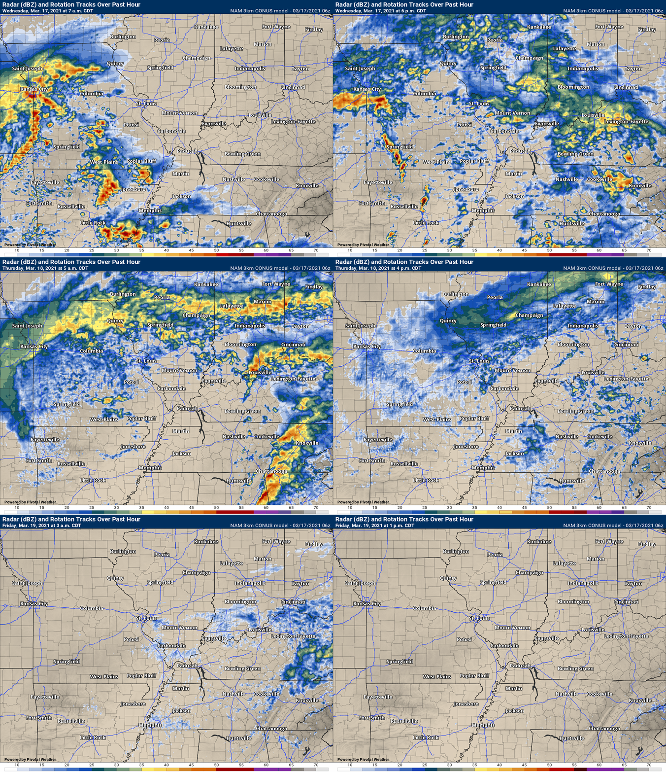
This animation is the 3K NAM American Model.
This animation shows you what radar might look like as the next system pulls through the region. It is a future-cast radar.
Time-stamp upper left. Click the animation to enlarge it.
.
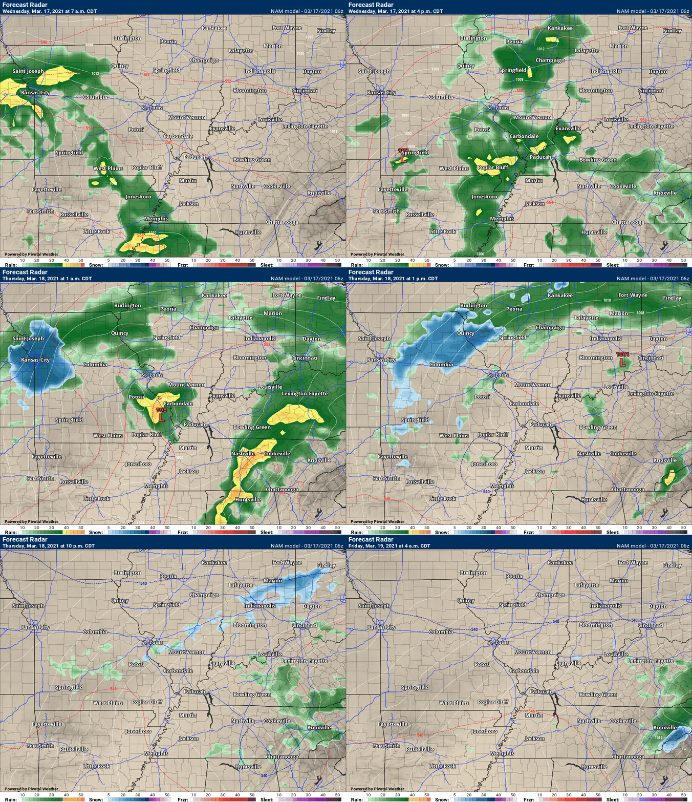
This next animation is the lower-resolution NAM American Model.
This animation shows you what radar might look like as the system pulls through the region. It is a future-cast radar.
Time-stamp upper left. Click the animation to enlarge it.
.
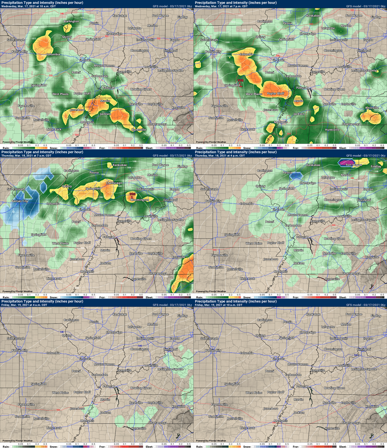
This next animation is the GFS American Model.
This animation shows you what radar might look like as the system pulls through the region. It is a future-cast radar.
Time-stamp upper left. Click the animation to enlarge it.
March 16, 2021
Remember, weather does not follow colors.
The SPC graphics are important, but they are not the entire story.
SPC colors = limited use.
Half my county is in yellow and the other half in orange. The risk is not as great at my house. I’m not worried. Wrong! Wx doesn’t follow colors.
I’m only in slight. Won’t be bad. Wrong! Harrisburg tornado was in a slight. 8 died.
.
4 PM
No changes to everything below.
The primary concern will be Wednesday afternoon and night.
Bands of showers and thunderstorms will arrive as early as Wednesday morning. The severe weather risk, however, will be greater during the afternoon hours into Wednesday night.
All modes of severe weather are possible. Damaging wind, hail, and tornadoes.
The threat is higher across the Missouri Bootheel, western Kentucky, and northwest Tennessee.
Locally very heavy rain is possible with this event. Some of the models shows two to four inches of rain in isolated locations.
Generally, rain totals will be 0.75″ to 2.00″. Flash flooding is possible where thunderstorms train over the same area.
Small hail and cold air funnels are possible Thursday. Cold air funnels are harmless.
March 16, 2021
Weather Discussion
An active weather pattern continues across the region.
We just finished a series of rain events and we have another one on the way.
Unfortunately, this one is likely going to produce severe thunderstorms. As always, most severe weather events are conditional. What does conditional mean? Conditional means that everything has to come together just right in order for the forecast to verify.
If we have more clouds and rain then that will keep instability down. If instability is lower then the severe weather risk is lower. This is not unusual. This is part of the forecast that will need to be monitored.
We definitely have a risk of severe weather. Keep in mind, however, that all the ingredients need to come together to actually produce severe thunderstorms.
Concerns are rising for a severe weather risk late tonight into Wednesday night.
A warm front will push northward from the Gulf of Mexico late tonight into Wednesday.
There will be some showers and thunderstorms well north of the warm front. This will occur tonight into early Wednesday morning.
Some of these thunderstorms could produce frequent lightning, gusty wind, and hail.
See the future-cast radars further down in the blog. You can see how the storms move out of Arkansas and Tennessee and eventually spread into the rest of our region.
The bulk of tonight’s activity will be after midnight. Some rumblers may wake you tomorrow morning.
The bigger concern will arrive Wednesday afternoon into Wednesday night. It is possible this severe weather event continues well into the night.
As always, you should be prepared to deal with severe weather. Make sure your Beau Dodson Weather app is on. Check it today. Make sure you have not logged out on accident.
The app is for subscribers. Subscribe at www.weathertalk.com/welcome then go to your app store and search for WeatherTalk
Subscribers, PLEASE USE THE APP. ATT and Verizon are not reliable during severe weather. They are delaying text messages.
The app is under WeatherTalk in the app store.
Apple users click here
Android users click here
I will be sending out messages today and tomorrow. I plan on starting a severe weather blog later today. I will send that out via the app, as well.
Remember, a watch means to monitor updates. A WARNING means seek shelter. A WARNING is worse. A warning means that severe weather is occurring or about to occur at your location. See shelter.
.
Let me show you a series of maps. I will explain all of them.
When considering a severe weather forecast, we look at many factors. These factors have to come together in order to produce severe thunderstorms. Just one of them is not enough.
One item forecasters look for are high dew points.
Dew point is a measure of moisture. Once we reach the 58 degree mark, we start to think about severe thunderstorms.
Dew point is what makes it feel muggy outside.
Dew points in the 60s represent more than enough moisture for severe thunderstorms. Of course, there are other ingredients, as well.
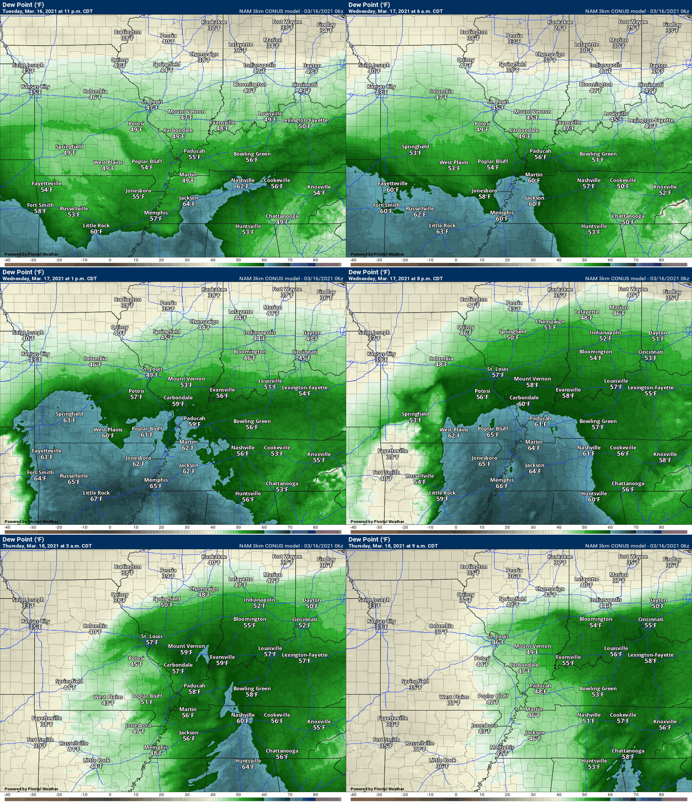
NAM model guidance. Dew point forecast animation. This shows you Tuesday into Wednesday night.
You can see the tongue of 60+ dew points attempting to nudge into our region. You can see the blues area mostly to our south.
Those blue colors are the higher dew points.
For widespread severe weather, you would want to see those blues further north. Thus, I continue to monitor this. There are uncertainties on how far north to push the higher severe weather probabilities.
Here is the NAM 3K model forecast for dew points. See how the 60+ degree dew points (blue colors) attempt to push northward into our region? With time, they diminish.
This is sufficient for severe weather concerns (esp early on in the event).
Here is the Hrrr model guidance. Another high-resolution model. It also pushes higher dew points into our region.
Notice how the higher dew points are mainly across far southeast Missouri, far western Kentucky, and northwest Tennessee.
With that said, the Hrrr model pushes those 60+ dew points a tad further north than some other models. This is something I will be closely monitoring over the next 24 to 36 hours.
The further those higher dew points (blue color) push northward, the greater the risk of severe thunderstorms.
.
The Storm Prediction Center has already outlined the region for a risk of severe weather Wednesday/Wednesday night.
The risk is higher to our south, but we are still included in the risk zone. Higher probabilities across eastern Arkansas into Mississippi and Alabama.
You can see that here. The light green zone is where sub-severe storms are possible. The dark green is a level one risk. The yellow is a level two risk. The orange is a level three risk. The red is the highest risk zone. That is a level four out of five. Five is the highest risk that the Storm Prediction Zone has.
The red zone is the moderate risk. The SPC believes that a significant outbreak of severe thunderstorms will be possible (IF all the ingredients do come together). There is a chance that ongoing showers and thunderstorms, during the day on Wednesday, keeps instability somewhat lower. If that happens, then the risk will be a tad lower.
You can see that our entire region is included in the severe weather risk zone. Southern counties have the highest risk.
The SPC will update this more than once over the coming 24 hours. Monitor updates. Let’s see if they shift it around a bit.
Either way, the forecast will remain the same. There will be a chance of severe thunderstorms Wednesday/Wednesday night.
.
Zoomed in. Let’s see how this changes over the coming days. They will update this once today and then a couple of times Tuesday.
This is for Wednesday/Wednesday night (a zoomed in view of the above SPC severe weather outlook graphic)
.

.
Let me break down the maps.
Here is the tornado risk zone.
The yellow and red zone is the higher risk area. The hatched zone is where significant tornadoes will be possible.
.
Let me break down the maps.
Here is the hail risk zone.
The yellow and red zone is the higher risk area. The hatched zone is where significant hail will be possible.
.
.
Let me break down the maps.
Here is the damaging wind risk zone.
The yellow and red zone is the higher risk area. The hatched zone is where significant wind damage will be possible. That would be 70 MPH or greater.
.
.
In addition to the above, we do have a risk of flash flooding. The WPC/NOAA has outlined our region in a marginal and slight risk of excessive rainfall. That simply means that locally heavy rain could flood some roadways, fields, and streams. Rivers remain high, as well.
Avoid flooded roadways.
.
Let me show you some more technical maps.
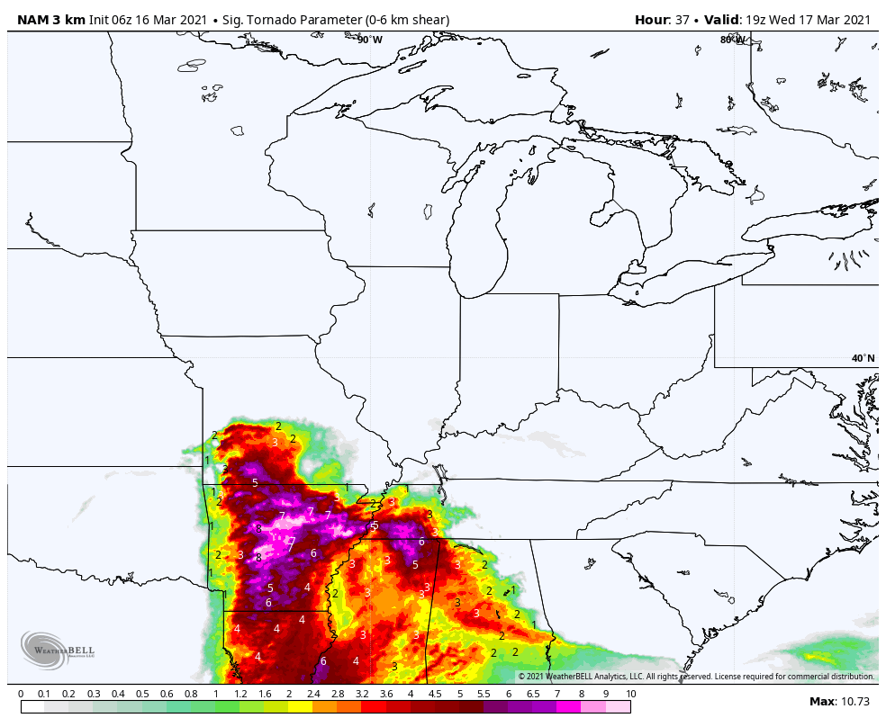
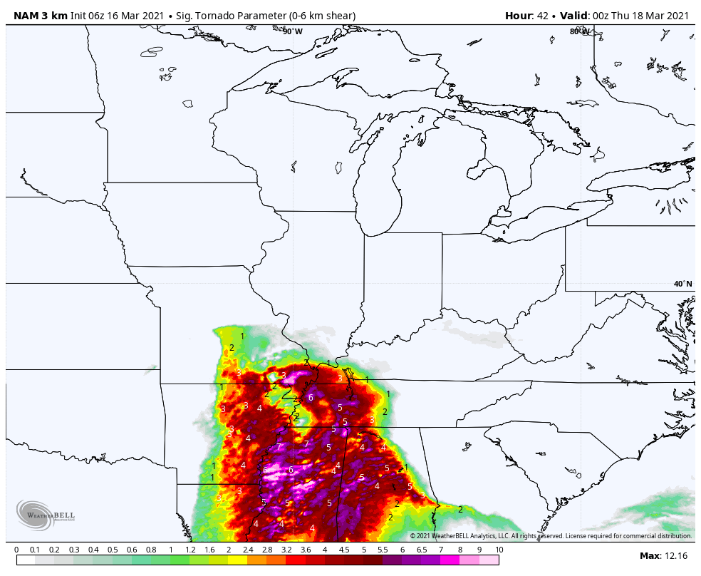
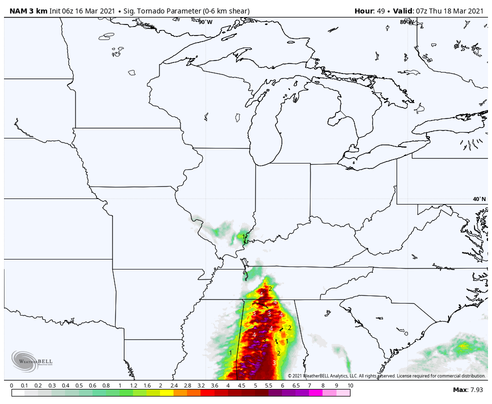
This is a significant tornado risk zone graphic.
Basically, these are some high numbers. Those pink and red colors are concerning. Will this verify? It depends on whether some of that area can clear out on Wednesday.
Remember, clearing equals sunshine. Sunshine equals energy. If clouds clear, in the higher risk zone, then concerns increase. I will be closely monitoring this.
2 PM
.
7 PM
.
11 PM
.
1 AM
.
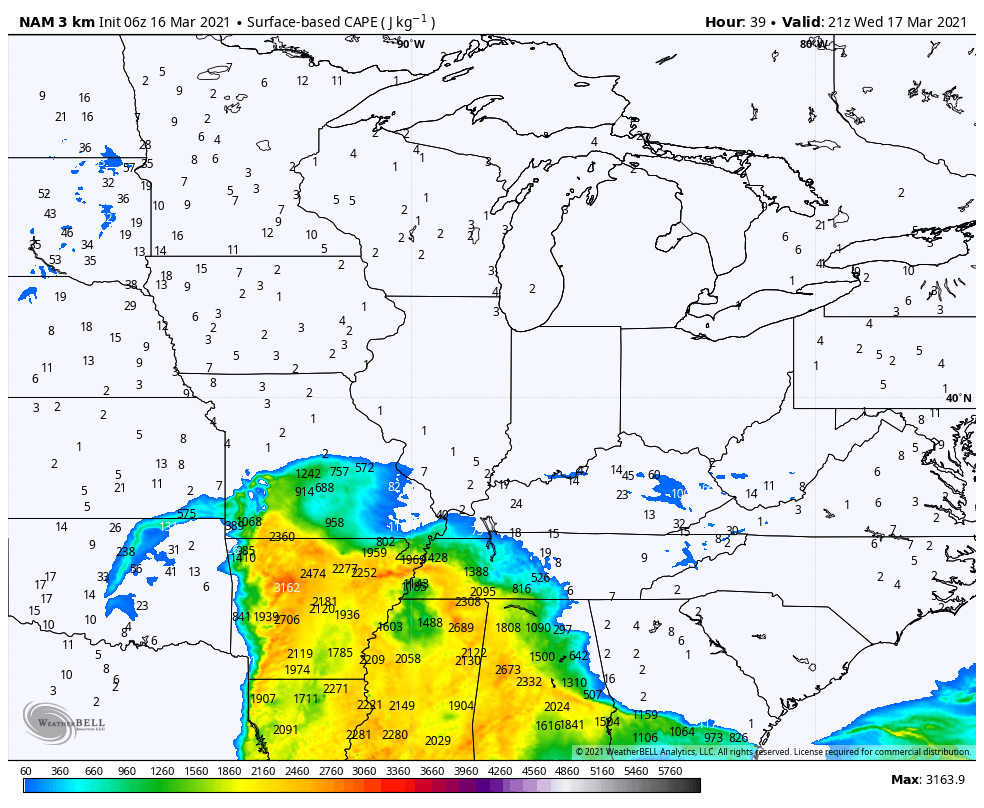
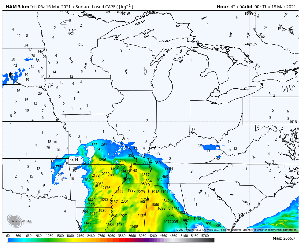
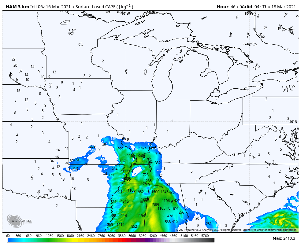
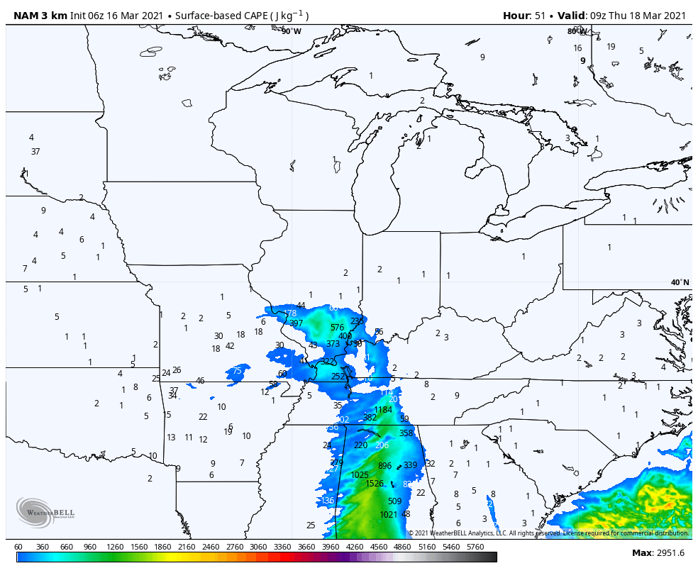
You will hear me talk about CAPE. CAPE is energy for thunderstorms to tap into. There are several different kinds of CAPE.
Surface based CAPE is typically associated with higher end severe weather.
These maps are showing you surface based CAPE.
Mid-afternoon Wednesday CAPE.
.
Early Wednesday evening CAPE.
.
11 PM Wednesday CAPE
.
3 AM Thursday
.
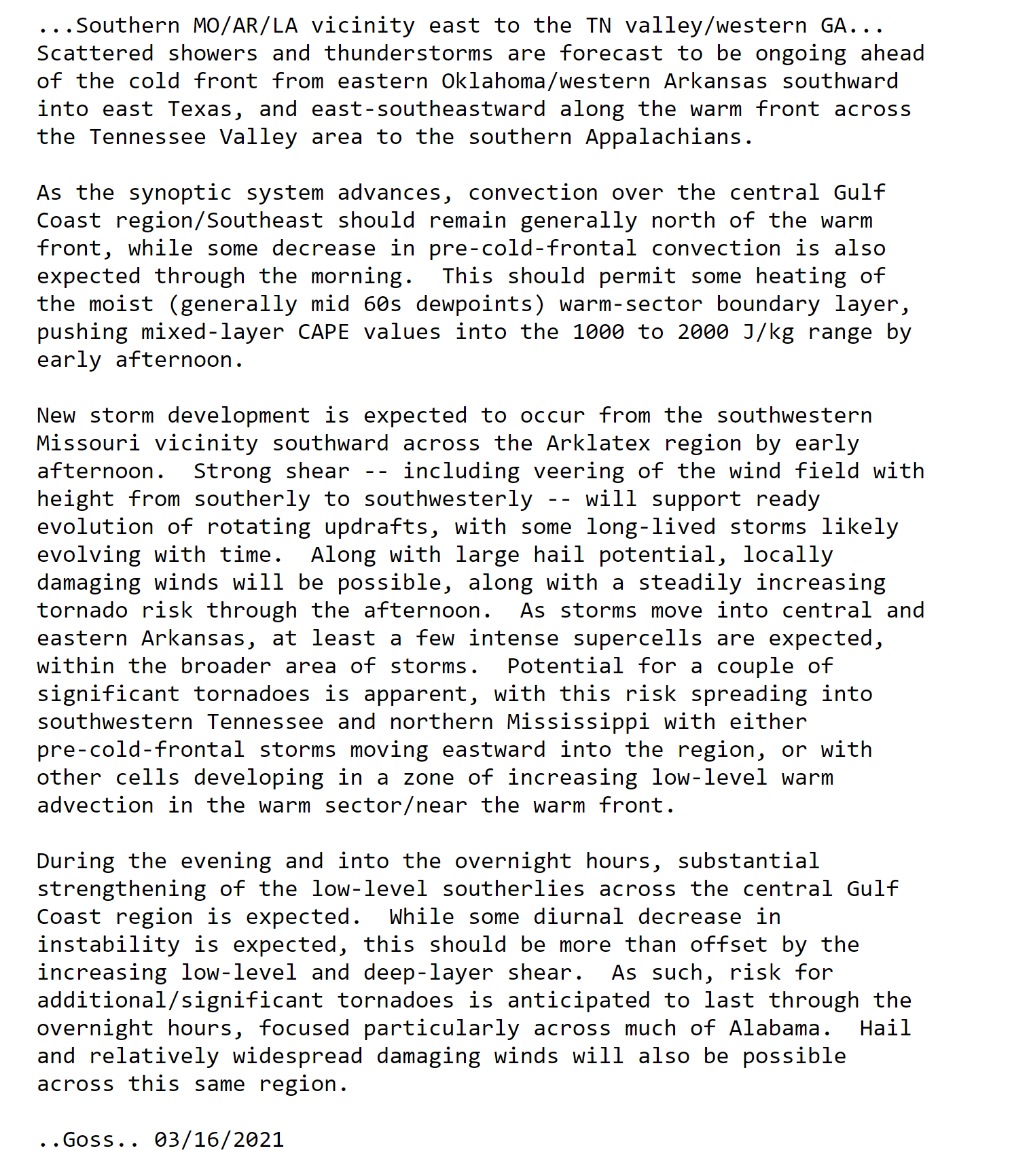
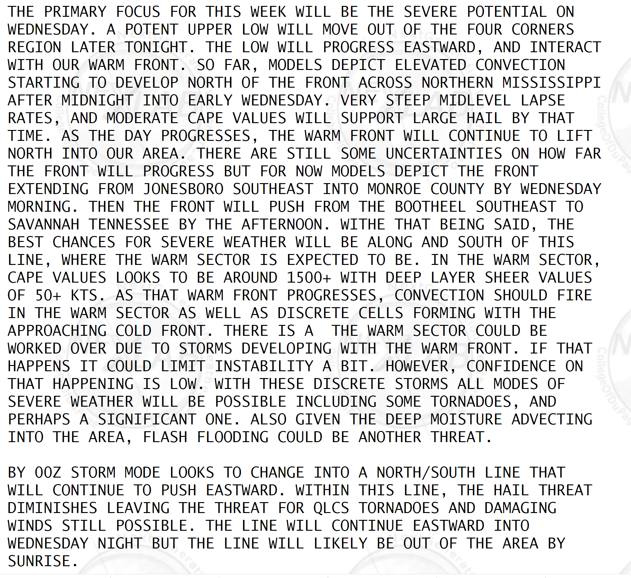
Here are some comments from the Storm Prediction Center and local National Weather Service Offices.
Double click on the text to enlarge it.
SPC comments
.
NWS Paducah comments.
.
NWS Memphis comments.
.
NWS Paducah comments from their area forecast discussion.
.
Not receiving app/text messages?
USE THE APP. ATT and Verizon are slowing or stopping the text messages.
Make sure you have the correct app/text options turned on. Find those under the personal notification settings tab at www.weathertalk.com. Red is off. Green is on.
Subscribers, PLEASE USE THE APP. ATT and Verizon are not reliable during severe weather. They are delaying text messages.
The app is under WeatherTalk in the app store.
Apple users click here
Android users click here
.

Live lightning data: Click here.


