September 12, 2017
The main weather story today will be the remnants of Irma. They continue to move into our region from the southeast.
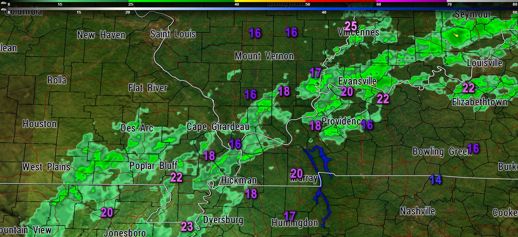
8 AM static radar image
The numbers are wind gusts. We have seen some 30 mph wind gusts over the last few hours. Most areas are experiencing 15 to 25 mph winds. Not too bad considering Irma’s remnants are moving through the region.
Rain showers will be with us through today and tonight. A few scattered showers possible on Wednesday, as well.
Rainfall totals won’t be extreme. Sort of surprising to see such a large hurricane produce so little rain (in our region).
Rainfall totals of 0.25″ to 0.50″ will be common. Some locations will receive 0.50″ to 1.00″ of rain. Isolated higher totals are possible, but most areas will remain below one inch. We could use the rain (most of us).
Temperatures will be below normal today. Clouds and precipitation will keep temperatures in the upper 60’s to middle 70’s. Cool! Normal high temperatures are around 84 to 85 degrees.
Gusty winds will be with us into this afternoon. Most gusts will be in the 10 to 20 mph range, with some gusts above 30 mph.
Want to track the precipitation?
Live radar link
Long range graphics
The main weather story is the rain in our region this morning.
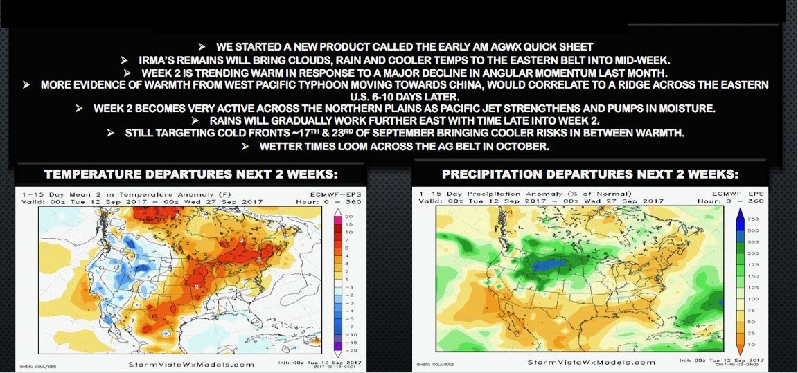
The long range guidance is starting to look a bit more active with several cold fronts between now and the end of September/first part of October.
Some of the guidance has a spring like look to it. Guidance is showing a period of above normal temperatures ahead of the fronts.
A spring like pattern could mean thunderstorms, but those details are not known yet.
Typically, we have severe weather towards the middle/end of October into part of November. That is when the jet stream begins to shift southward as winter arrives.
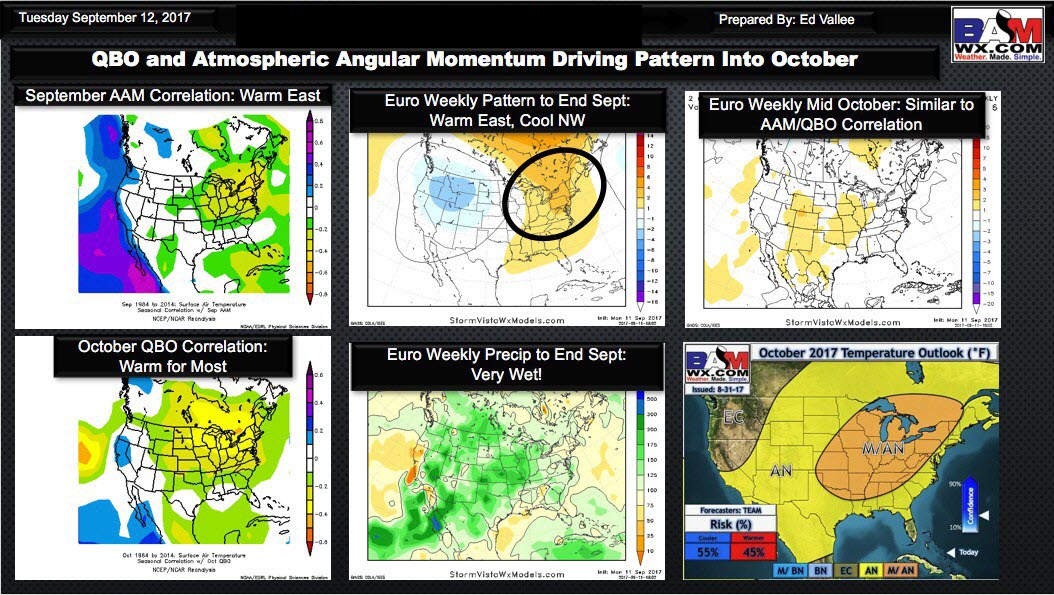
October data is leaning warmer than normal and perhaps wetter than normal. I think the warmer than normal forecast has a decent chance of verifying. Lower than normal confidence in the wetter than normal forecast.
Click images to enlarge.
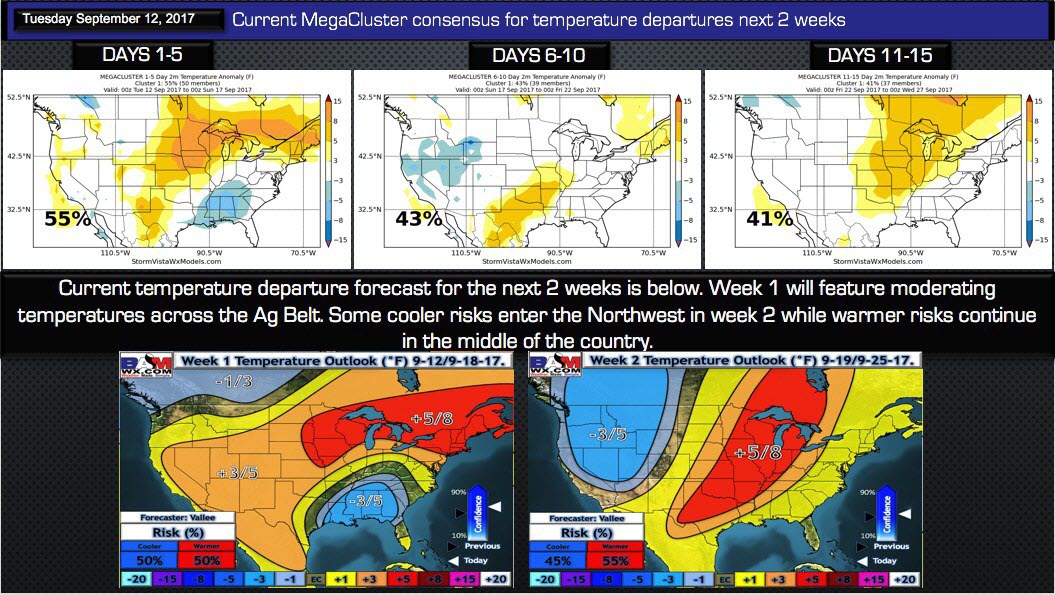
Megacluster guidance (models blended together) show a tendency to move more and more towards normal to above normal temperatures.
The top three images, on the graphic below, show days one through five as below normal (because of Irma). After that time, however, we start to see more yellows on the map. That indicates a trend towards warmer conditions.
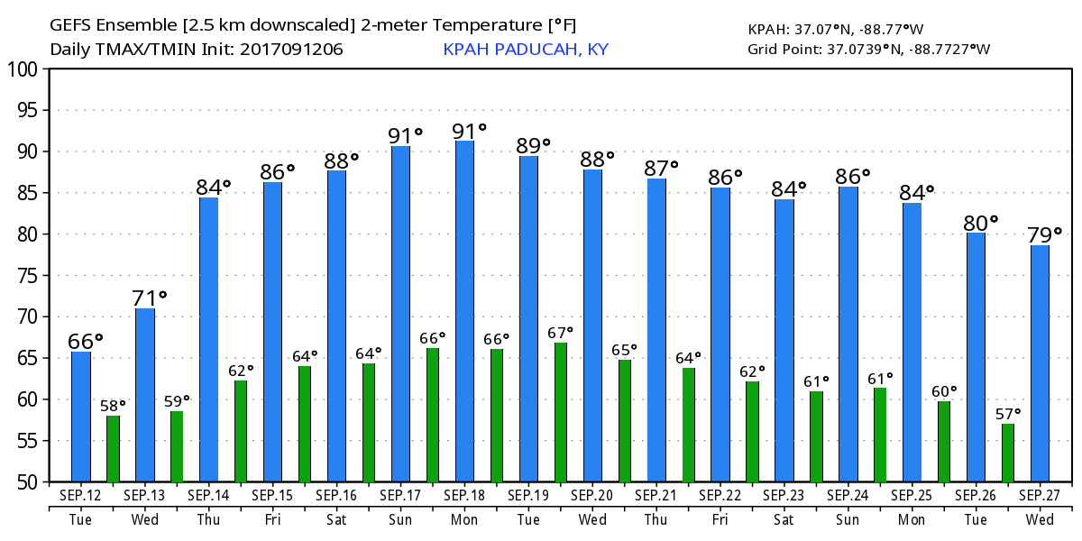
It appears we will have quite a few days in the 80’s as we move into the late week period into next week.
Here is the GFS model guidance. It even shows a few 90’s. Not sure I buy the 90’s, but certainly warmer than normal.
Our official forecast is shown on the bottom two graphics. The red indicates high probability for above normal temperatures as we move into the late week period and then into the following week.
Precipitation
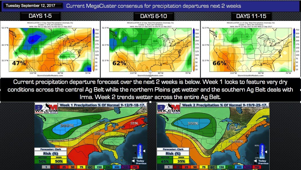
Megacluster data reflects above normal precipitation (in the green). Again, this is because of Irma.
The models show normal precipitation for days six through fifteen.
Our official forecast will begin wet today into Wednesday and then dry Thursday through at least Sunday. It is possible we remain mostly dry for several days after that, as well.
After that time, we will monitor several cold fronts. Whether we move into a normal to above normal precipitation pattern will need to be monitored.
The model trends are wetter, but we aren’t quite seeing a full push to above normal precipitation into our region. Trends are wetter. That means we should continue to monitor moving forward.
It might take some time to break the overall dry pattern.
Click images to enlarge
This next graphic is the October temperature forecast.
Odds are favoring above normal precipitation.
Video
<iframe width=”560″ height=”315″ src=”https://www.youtube.com/embed/DArShaa5-d4″ frameborder=”0″ allowfullscreen></iframe>


